
Emily Provincial Park is a cute little recreational park and campground in the heart of the Kawarthas. Here's everything you need to know!
Originally Published on June 16, 2024, Updated on 3/15/2026.

We’d started out along Lake Erie, then along Lake Huron and Georgian Bay, before going through the Kawartha Lakes region before heading home.
Gotta say, staying at this park had us a bit nervous, going into it.
Along with a few of the final stops along this trip, Emily PP holds the distinction of being held in a really negative light in the campground groups we’re in, on Facebook.
Located along the east shore of Pigeon River, most of the complaints we’ve seen have been swimming related - so not really a deal breaker for us.
Given that Emily holds a recreational park classification, I can see why people camping there would have an expectation of swimming. Or, you know... hiking. (Another area that gets the park panned).
If you’re into fishing or canoeing, though, you’d probably love it!
Personally, we enjoyed our stay - the park does have its share of natural beauty.
And hey, beauty is in the eye of the beholder, right?
Anyway, let’s tell you all about the park, and our experiences with it... both in 2024, and our second visit in 2025.

The Basics:
Campground Name: Emily Provincial Park
Address: 797 Emily Park Rd., P.O. Box 340 Omemee, ON K0L 2W0
Website: Emily Provincial Park
Price: Ontario Provincial Parks uses a pricing matrix across all their parks. See 2026 Camping Fees for more details.
Reservations: Ontario Parks Reservations
Park Classification: Recreational
Season: May 8, 2026 to October 13, 2026

Logistics
Some basic information to help make decisions and plan your trip:
Registration and Check In
We booked our stay online, 5 months ahead of time. No issues - the odds were ever in our favour, and we did get a camp site that seemed to suit our needs.
Check in at the park office was quick, easy, friendly and efficient, as usual.

Maps & Signage
Some basic info to help you find your way around Emily Provincial Park:
Park Map
The Emily Provincial Park map is the same 11 x 17, full colour, 2 sided format that we’ve been seeing at a lot of the parks in the area.
One side has the whole park overview, while the other has some basic information about the park. Because the park is so small, the overview really is all they need - they even have the campsite numbers displayed!
The map doesn’t seem to be super up to date with some of the things in the park. The “Boat Dock” in Cedars Campground doesn’t exist, the road that’s shown to be the path to a picnic shelter and group camping area is “authorized personnel only” in reality.
Also, the “picnic shelter” near the day use area doesn’t actually exist - there’s just a cement pad there.
Would have liked to see scale indicated -always a good thing when trying to suss out a new (to us!) park.

2025 Map Updates
In the year or so since between our first and second visits, they completely overhauled the map... and I'm not sure what I think of that.
On one hand, it's now more accurate, removing some of the things that obviously weren't up to date on our first visit. The picnic shelter and group campsite that was shown near the gatehouse is the BIG thing that I noticed first.
It also simplified a lot of the information. Water taps are now dots instead of symbols, which cleans up a lot of visual clutter... but the trails aren't named on the map anymore.

While I wouldn't call it a parking lot anymore - it seems to be more of a turn around loop than a lot. The rustic canoe launching point through the reeds seems to be exactly the same as we remember it, though. Plenty of room to paddle through to the main waterway.
2. The stuff about the third group campsite and picnic shelter - it's now gone from the map entirely.
3. The picnic shelter hasn't been replaced, and is no longer listed on the map or website ... so I'm assuming that's gone for good.
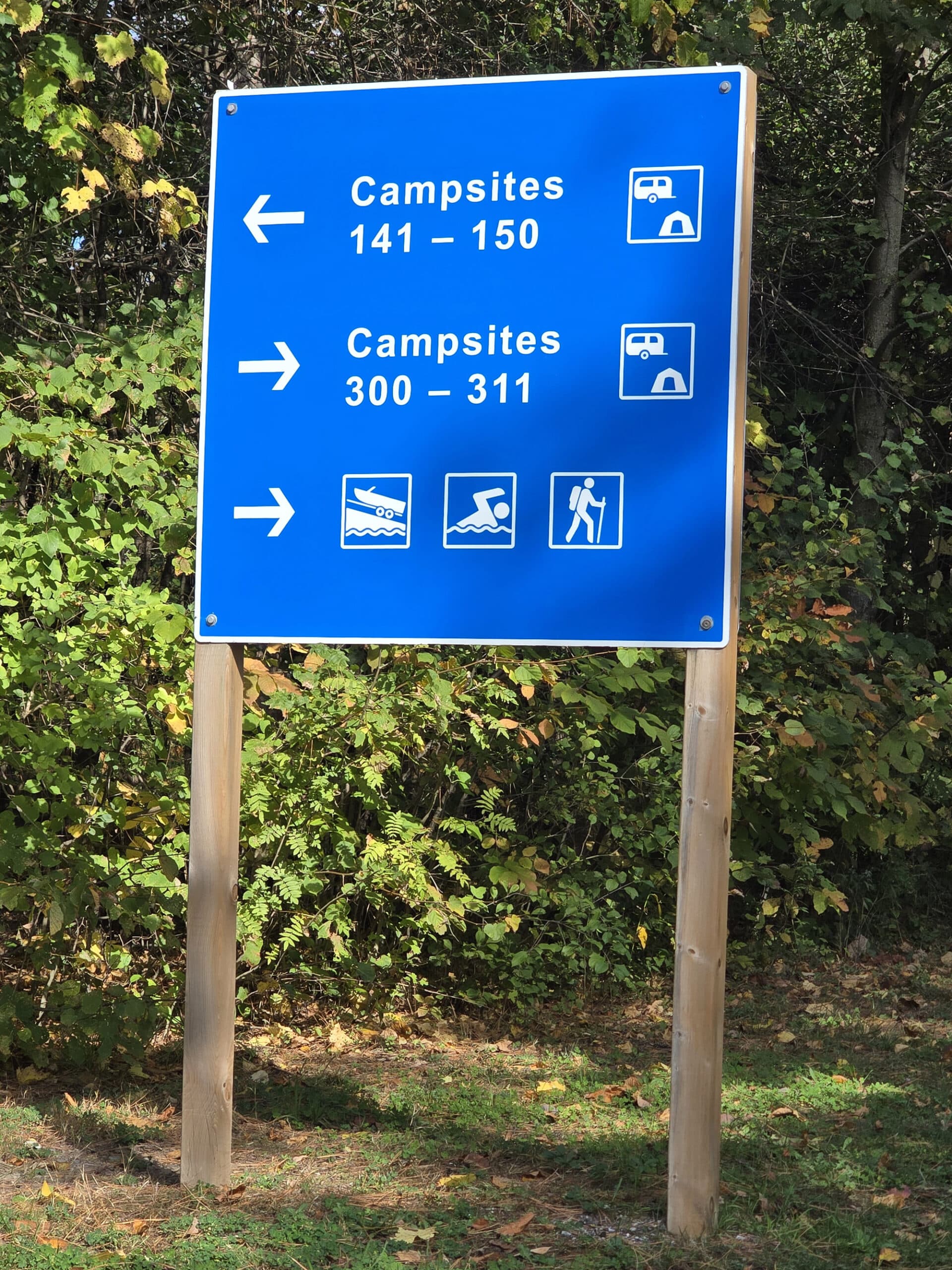
Signage
Anyway, the signage is more or less good through the park - especially with regards to the one way roads.
It does get a little confusing / annoying getting around the area between the front gate and the day use boat dock area. Signage pointing to that dock is only visible from one lane.
Also, if you miss taking that (unlabelled) road, you’ll be stuck driving up the day use area and around again, from the front gatehouse area.

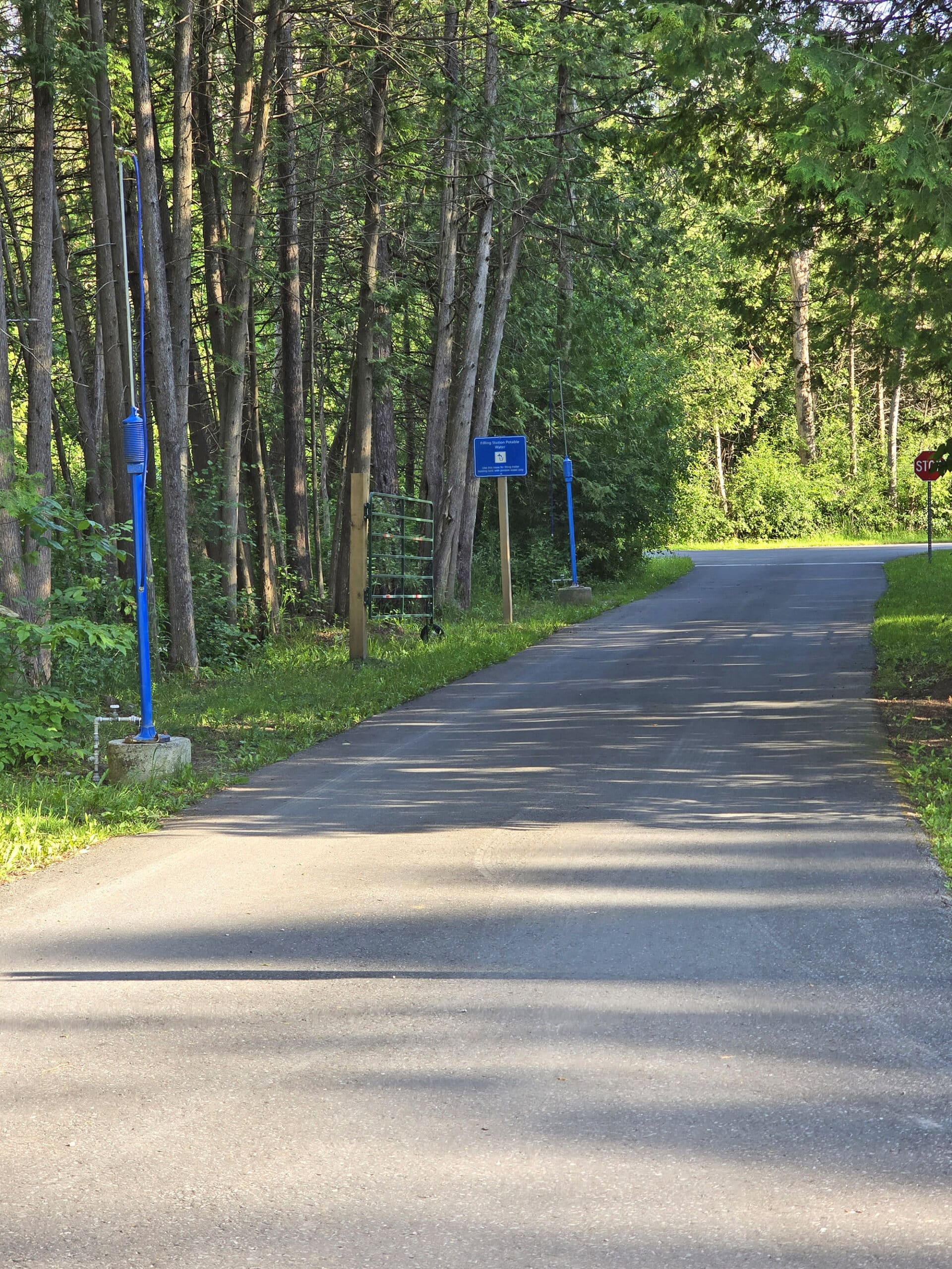
Waste & Water Services
There’s kind of a weird set up for the trailer sanitation stations at Emily Provincial Park.
As you come into the park, there’s a road off to the right with the 2 dump platforms. You continue around to the fill station, which has 3 taps - one on either side, and one in the middle.
Then you have to cut through all of the day use parking to get to the campgrounds.
When you’re leaving, you have to blow past the exit road / gatehouse to dump, then - again - cut through the day use to get back to the exit.

It would be really awkward to reach this one on the way *in* to the campground.
Anyway, that one has 2 fill taps, both on the left side.
Connectivity
We had decent to good wireless connectivity pretty much everywhere in Emily Provincial Park, both trips.
Weirdly, we LOST connection just outside of the park - but that was about it.
We had good upload and download speeds at the campsite itself, and we were even able to stream the first couple episodes of The Boys on a violently stormy night!
Accessibility
Overall, Emily Provincial Park is not great for wheelchair accessibility, but is pretty good when it comes to non-wheelchair mobility issues.
On one hand, pretty much none of the recreational activities are wheelchair accessible - and that includes the two short trails. They ARE, however, super accessible for anyone with other mobility issues.
Only one of the two comfort stations are barrier free. It DOES have a much nicer setup with ramps and such than we’ve seen at other “barrier free” comfort stations, though.
Also, it’s accessible from both roads that lead past it. One side has two ramps, the other has a parking lot right at the level of the comfort station
There's a single accessible shower it's actually accessible (you’d be surprised how many aren’t!), and there's a single accessible toilet stall in the main washroom area.

Right next to the comfort station are the two barrier-free campsites in Emily - #701 and #702.

This was probably the lumpiest, sloppiest installation of a Mobimat I’ve ever seen. It looked like they didn’t grade the sand at ALL before putting the mat down.
There were deep ... tractor tracks?... running underneath it, too. The photos don’t do justice to how lumpy and unsupported the mat was!
My tendons were actually hurting after trying to navigate all the bumps and dips, walking the length of it. I definitely wouldn’t recommend taking a wheelchair over that mess.
I appreciate the attempt but they really need to fix that up.
Anyway, there are three accessible parking spots at the beach now and they have ample space between them.

Pets
Pets are allowed at Emily Provincial Park, but are supposed to be leashed at all times - there are no off-leash areas.
There is a leashed dog play on what appears to have formerly been a day use beach - with signs posted about how high bacteria counts render the water there unsafe.
So, you may want to keep them out of the water.
That said, the area is nicely groomed and well maintained.

Parking
The campsites all seem MORE than big enough to accommodate an extra vehicle or two, and - for the size of the park - there definitely seems to be an adequate amount of parking in general.
There aren’t a bunch of “feature” areas - the boat launches, etc - but each seems to have a decent amount of parking.
Miscellaneous
The boat launches at the park all face almost directly west, so it’s a great place for sunsets.
There’s a little bridge over the river - just north of the park - where you CAN get a north facing view.
There are a bunch of cottages along the river north of the bridge, though, so lighting could be an issue if you’re aurora hunting.

Campground Amenities & Info
Here’s some basic information on the amenities at Emily Provincial Park:
Creature Comforts
There are two comfort stations in the park, which have to service the 4 (well, 3.5 ...) Campgrounds.
Circle Campground has its own comfort station, and it’s the lesser of the two - not accessible, looks to be older, and doesn’t have laundry facilities. It has showers, flush toilets, and a water tap.

The laundry room has four laundry machines - 2 washers and 2 dryers. They're $4 each to use, and take loonies and quarters.

There are also a few vault toilets scattered around the campgrounds and day use areas.

Park Store
The Emily Provincial Park store is a standalone building in the day use area.
It’s got a cute selection of souvenirs and gifts, a decent selection of snacks, some grocery items, firewood, ice, and all the basics.
It also has a bit of an ice cream bar, with a decent selection of ice cream you can buy in bowls or a choice of cone styles.
The “Algonquin Canoe” ice cream was particularly fantastic. We hadn’t seen it before, so obviously had to try it.
It’s described as being “French vanilla ice cream with a hint of maple, chocolate ripple and chocolate maple canoes”.
That was not a hint of maple, though. It was VERY maple - flavoured more like those maple sandwich cookies, than actual syrup. Very rich, super satisfying!
The staff was really nice, each time we went in.

Visitor Centre
There is no Visitor Center at Emily Provincial Park.
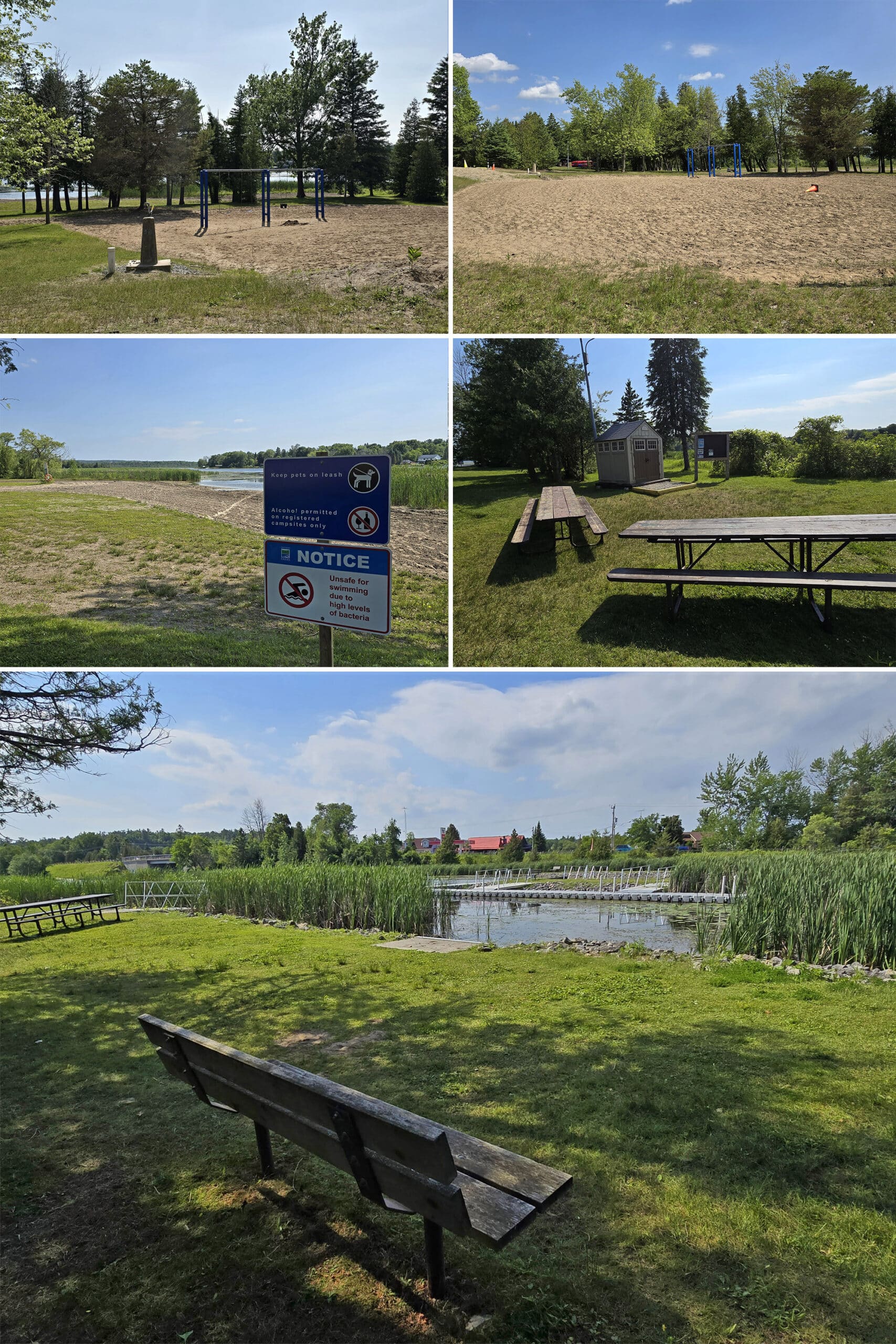
Day Use Area
The day use area was ... a bit underwhelming.
From what I read online, a couple years ago the decision was made to let the day use beach go back to a more natural state.
It hasn’t been suitable as a swimming beach for two years now, as a result of the changes that came with that decision. It now serves as a home to various aquatic species... and has a high level of bacteria.
So, there’s no swimming in the day use area - the beach is now a leashed play area for dogs.

There is a concrete platform there, though - so either there was an old one is getting replaced, or they’re behind schedule on a new one? Not sure.
2025 Update: this was removed from the map, so I’m guessing it’s not getting re-built.

It’s well maintained, but there are a LOT of geese - and the evidence they leave behind - so that’s really not a great idea, these days.
All that said, the area by the day use boat launch is gorgeous. There are picnicking areas, and these long, wraparound docks with great views of the lake, and the marshy areas near the shore.
It was very peaceful - I could definitely see hanging out in that area, it was beautiful!
Rentals
Emily Provincial Park has a pretty robust equipment rentals program during the summer months, as well as some options for borrowing.
Canoes and Kayaks - complete with safety equipment - are available for rent. There’s a separate rental shack for this, next to the park store.
Personal Flotation Devices (PFDs) are available to borrow - with a refundable deposit. ($35).
Finally, the park belongs to the Ontario Federation of Anglers and Hunters Tackleshare Program, allowing people to - ahem - test the waters when it comes to taking up fishing.
You can borrow fishing rods, reels and tackle, to give fishing a try!

Campsite Details
As with most (all?) Provincial Park campsites, the campsites in Emily all come with a picnic table and fire pit.
On average, they’re generally pretty large sites, too - and there are a LOT of great sites in Emily Provincial Park.
... Especially in Cedars Campground, but I’m getting a bit ahead of myself.
Anyway, there are 4 named campground areas in Emily, plus the group camping area(s?).
They are:
Cedars Campground
Non-electric sites, and radio free.
I THINK the campground is entirely tent-only - that’s what it implies on one part of the official site - but then another spot specifies “Campsites 1 and 2 are for TENTS ONLY”... which is oddly specific and emphatic.
Anyway.
Half of this campground (the east half) was gated off during our stay, but the open campground area was SUPER cute.
Not a ton of privacy, but we loved the vibe with the sites being surrounded by the tall cedar trees, the way the light filtered in - gorgeous!
The site has one of the 3 boat launch areas noted on the map, but no actual launch (More on this is a bit!).
There were also cute pathways between this campground, and other areas:

We thought they may have been evacuated, but I couldn’t find any mention of it on the Emily PP social media accounts or anything. Something to keep in mind, I guess?
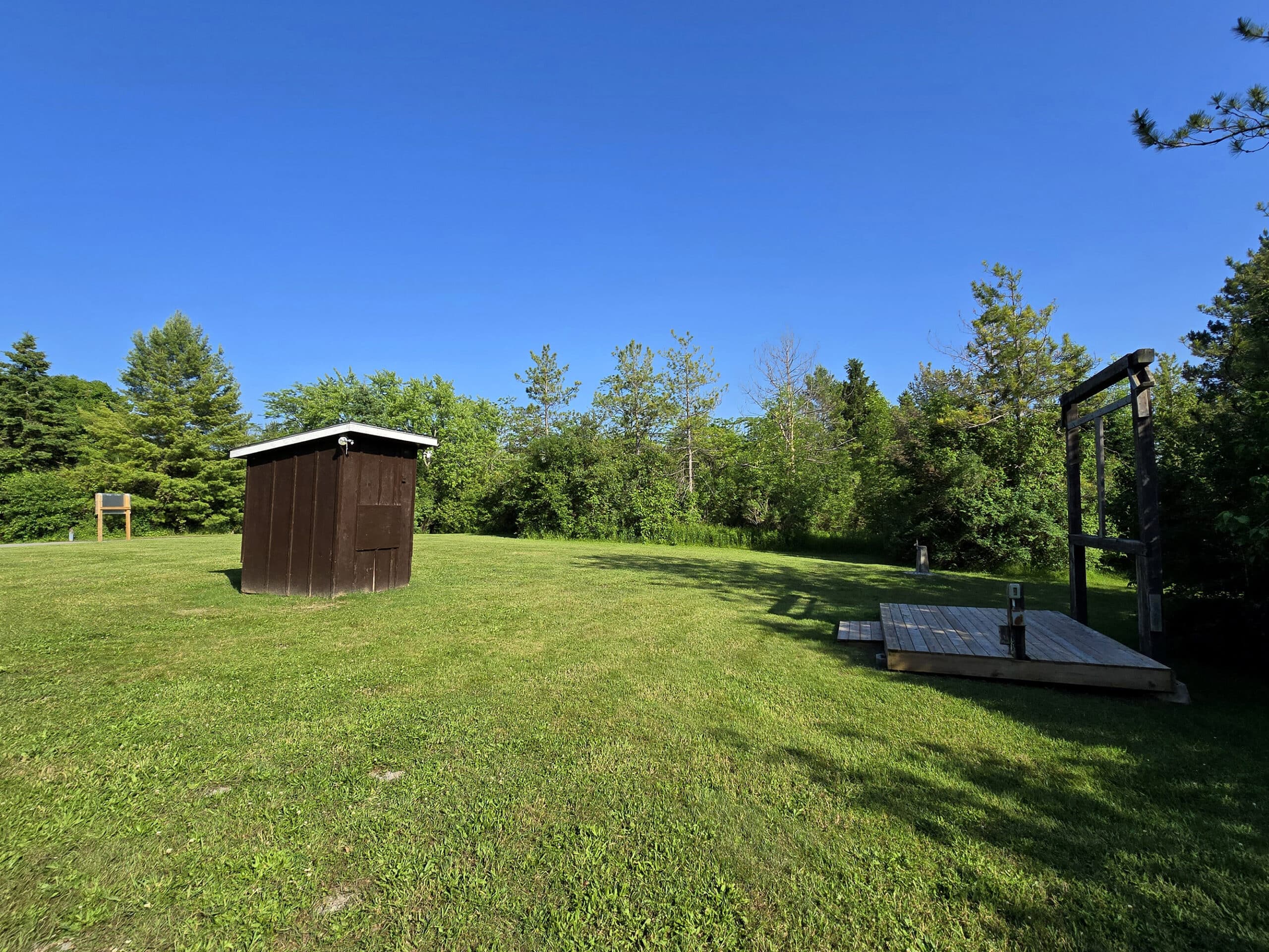
Circle Campground
They should have called this one the Pie Campground, or Trivial Pursuit Campground.
It’s a circular campground, with a bunch of pie shaped campground loops inside it. It honestly looks like a Trivial Pursuit playing piece.
The inner pie piece campsites are all electrical sites, while all of the sites around the perimeter are non-electric.
Anyway, this campground area has a lot of really cute sites, most of which are HUGE (especially around the outside ring).
As a note: The east side of this campground gets pretty loud from the County Rd 10 traffic, right behind it. Sites #238 and #277 seem to be the most affected.
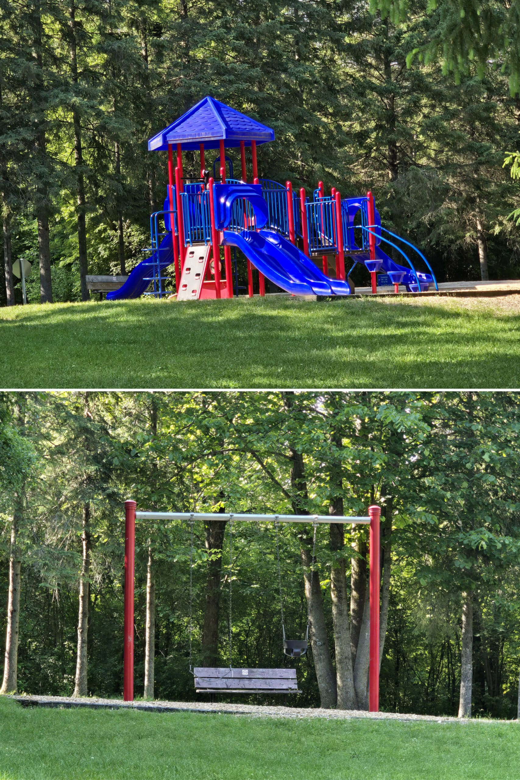
Also: The entrance to the Circle Campground is where the campers playground is - much nicer, newer, and in better shape than the day use playground:
Hill Campground
Hill Campground is sort of in between Cedars and Circle campgrounds, further away from the traffic noise, and with a couple access trails to the Camper’s Beach.
About half the sites are electrical and half are non-electric camping, and most of the sites were saw were huge.
This campground has the most amenities - the best comfort station (centrally located), beach access, the amphitheatre, etc - but the sites were not as cute as the ones in the Cedars or Circle campgrounds.

Hilltop Campground
Hilltop Campground is where we stayed. This is just a handful of campsites on the south side of the amphitheatre loop, and down the road to the camper’s beach / boat launch area.
Not as cute as Cedars or Hilltop, but conveniently located for what we wanted to do - mostly the marsh trail and hanging out near the boat launch/beach for sunsets and birding.
Just be forewarned, you may need to get a bit creative with situating your RV. They’re huge sites, but there’s some pretty wild sloping.

The two sites TOGETHER have good privacy, just not from each other. So, it would be a good option for those camping with another family.
Group Camping
You’re going to have to take this section with a grain of salt - there is some conflicting information out there, so we may or may not have seen all of the group camping area.
Per the website, there are two group camping areas, each 20-50 people.
The group camping area we saw was a loop off the main road, near the garbage and recycling depot - and those are the photos shown below, sites #501 and #502.
Both are radio free and have their own vault toilet building.
The park map also lists a site #403, on an offshoot road near the trailer dump station. This is also where Picnic Shelter #1 is supposed to be located.
... but that road is marked with “Authorized Personnel Only” signage, so... no idea.
2025 Update: The third group campground and picnic shelter were removed from the map, so I guess that area got repurposed!

Share the Love!If you’ve made one of our recipes, be sure to take some pics of your handiwork! If you post it to Bluesky, be sure to tag us - @2NerdsInATruck, or you can tag us on TikTok, if you’re posting video. We're also on Pinterest, so you can save all your favourite recipes and park reviews to your own boards! Also, be sure to subscribe to our free email newsletter, so you never miss out on any of our nonsense. Well, the published nonsense, anyway! |
Entertainment and Activity
Here’s some information on the recreational activities you can partake in, at Emily Provincial Park:
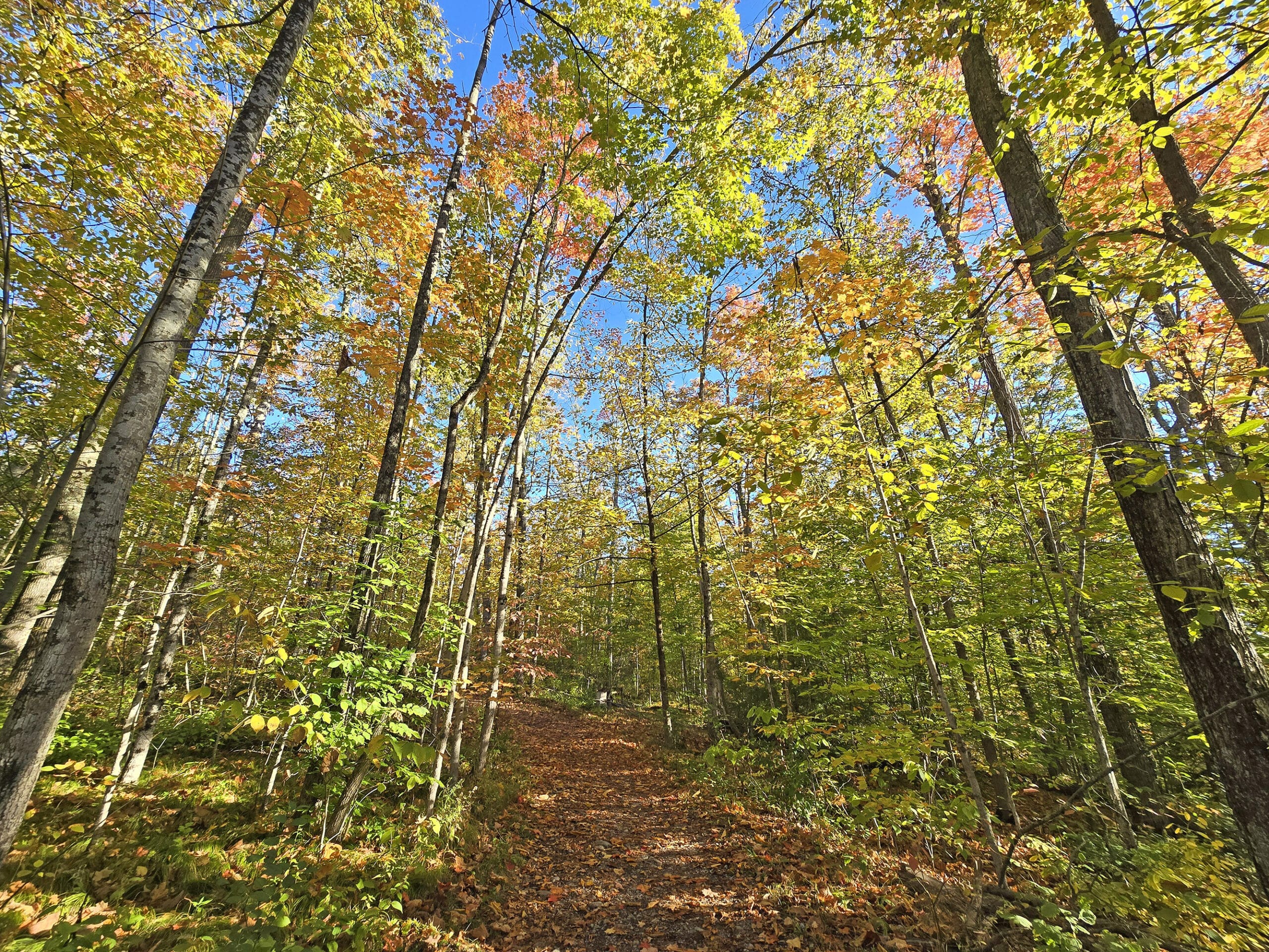
Hiking
So the “hiking” in the park isn’t really hiking, so much as a couple of nice walking trails.
Neither of the trails are wheelchair accessible - on account of roots, etc - but they’re generally really easy. Short, mostly flat, wide trails, etc.
There’s no information about either on the website, and the map doesn’t have scale shown, so we mapped them out:

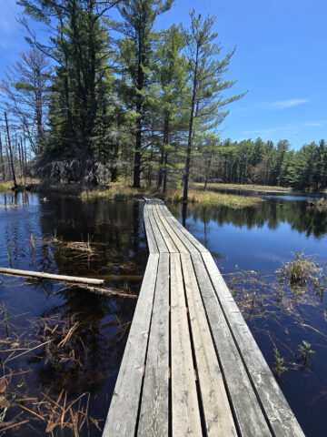
Marsh Trail
Marsh Trail is a bit weird to map, as there are a few access points, offshoots, etc.
We mapped this from the parking lot, taking the right side of the trail at the fork.
We continued on to the boardwalk, walked to the end of the boardwalk and back, crossed the path and went left, taking the other half of the loop. (What would have been the left side of the fork).
All told, that was 0.7 km - a very quick and easy walk!
The first half of the loop was flat, wide, and easy. The second half was more narrow and a bit more rough/small hills/roots/etc.
Super easy to go back the way you came, though - the two half run almost parallel to each other.

2025 Update
Porter walked the trail on our latest trip, and it had undergone some CHANGES. Here’s what he had to say:
“Immediately you can tell they've had some major storm damage, downed trees to the side, large branches on the forest floor, and large equipment track marks on the ground.
The path to the left has an orange blockade across it, I presume it still has downed trees on the path. Since that branch is no longer on the map, they may be permanently closing that branch.
Proceeding onto the main trail, there are sections where you can see they've cleared out some fallen trees, and there are sections that appear unscathed. It's still a lovely walk through the woods, even in the damaged sections.
At the boardwalk, it's clear they're in the process of extending the trail since the last time we were here.
Freshly cleared vegetation from the sides of the boardwalk and new boardwalk extending very close to the little island in the marsh. The path stops short of the island but it's obvious they're still building it. I would imagine it will extend to the island in 2026.
Across from the boardwalk the trail appears to continue, a wide, worn path not on the map.
The trail ends abruptly at a downed tree. Peering ahead, it looks like additional large branches block the trail further ahead so I turned back.”

Fern Trail
As with Marsh Trail, fern also had a few access points.
It’s short enough, though, that it’s not going to make a huge difference which you enter/exit from.
We entered from the parking lot, walked to the day use area, back to the last intersection, out the branch that exits near the store, and back - and it was 0.5 km.
Super short!
It was cute, though - tall trees everywhere, wide, flat paths lined with branches, it was enchanting and cute.

Biking
The park says you can go biking on the campground roads, but they’re pretty meh - and short.
If you’re looking for a nice long, scenic bike ride, we recommend cycling on the Kawartha Trans Canada Trail.
It’s a 3 metre wide, hard packed limestone trail that’s fantastic for biking!
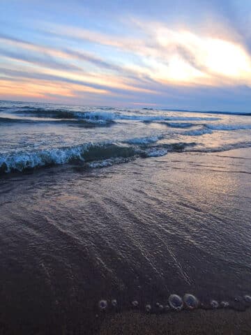
Swimming
Emily Provincial Park has two sandy beaches, but only one is an actual beach area, with swimming allowed.
It’s... a beach.
Definitely well kept when we arrived - it had been freshly raked, was clean, etc - but the water isn’t super enticing.
There’s marsh all up and down the shore of Pigeon River, and - while the roped off swimming area is clear by comparison - it’s not really our bag.
If you’re looking to do a lot of swimming, this probably shouldn’t be your first choice of park, to be honest.

Birding, Wildlife, and Nature
Within minutes of doing our first drive through of the park, we encountered our first few animals - and they were FUN ones.
First off, when walking down by the day use boat launch, we heard weird noises coming from the rocks. Merlin told us that the ugly - but cute! - baby bird we were looking at was a grackle.
His parents sounded less than impressed by our presence, so we took a few pics and left him alone.
Nearby, we saw a couple of turtle nests:

Then, within the scope of about 7 minutes, we saw 3 groundhogs along the main campground road.

In terms of birds - across the two trips - we’ve seen and/or heard:
American Crow, American Goldfinch, American Redstart, American Robin, Black-Capped Chickadee, Black-throated Green Warbler, Blue Jay, Canada Goose, Chipping Sparrow, Common Grackle, Common Starling, Common Yellowthroat, Downy Woodpecker, Eastern Phoebe, Eastern Wood-Pewee, Golden-crowned Kinglet, Great Crested Flycatcher, Hairy Woodpecker, Hermit Thrush, Least Flycatcher, Marsh Wren, Mourning Dove, Northern Cardinal, Northern Flicker, Pine Warbler, Red-Breasted Nuthatch, Red-eyed Vireo, Red-winged Blackbird, Ring-Bulled Gull, Rose-breasted Grosbeak, Song Sparrow, Swamp Sparrow, Yellow-Rumped Warbler, Yellow Warbler.
There are also a couple of Osprey nests right outside of the park.

Boating
Boating is a big thing at Emily Provincial Park, probably because Pigeon River connects up with the Trent Severn Waterway, which gives you all kinds of possibilities.
The waterway goes from Georgian Bay to Lake Ontario, with tons of branches to other rivers and lakes along the was. Endless possibilities for exploring!
Anyway, there are two main boat launches in Emily- one on either end of the park, with some seeming to be for day users, and the other for campers. Both have a decent amount of parking for trailers.
The day use boat launch has an interesting wraparound set of boat launches, plus a few surrounding park benches to take in the scene.

The other boat launch - next to the camper’s beach - has several basic floating docks. These seemed to be a popular spot for fishing, during our stay.

In reality, there was no dock ... but I’m guessing it’s used to launch canoes and kayaks onto the river.
2025 Update: The canoe launch and parking areas off Cedars Campground is not on the map anymore.
I wouldn't call it a parking lot anymore - it seems to be more of a turn around loop than a lot. The rustic canoe launching point through the reeds seems to be exactly the same as we remember it, though. Plenty of room to paddle through to the main waterway.

Fishing
We saw a lot of fishing happening during our stay, starting with what looked to be a school field trip on the first day of our stay. (The park runs a learn to fish program).
There were plenty of people fishing out on the river, and we often saw people fishing for panfish right off the docks in both boat launch areas.
The river is known to have Large and Small Mouth Bass, Muskie, and Walleye.

Discovery Program
Emily Provincial Park runs a Discovery Program in the summer - July and August only.
They’ll post a weekly calendar of events when it’s time - it was not time, though, during our visit!
They have a moderately sized amphitheatre area though. Given the way it’s featured in the park and on the map, we figure it probably sees a fair amount of programming use during the summer months.
Niantic Games
While there’s decent cellular connectivity to get your daily Niantic on, there’s not a TON of opportunity to do so.
There are only 5 portals / pokestops / gyms in the park: One at the entry, two in day use, one at the camper’s playground, and one at the camper’s boat launch.
Winter Activities
All of the park facilities close down after the fall season, but the park remains some degree of “open” during the winter months.
Visitors are welcome to use the park - day use only - for cross-country skiing, snowshoeing or winter hiking... with the caveat that the parking for doing so is limited.

Nearby Attractions
We made a couple of little side trips during our stay at Emily Provincial Park.
First, we had to go to Peterborough to pick up a grocery order, so I surprised Porter - a mechanical engineer - with a stop at the Peterborough Lift Lock, on the Trent-Severn Waterway.
Our timing was SUPER lucky - we got there just in time to see one of the Liftlock Cruises sail up, and then UP!
On our way out of the Lift Lock area, we happened across the Canadian Pacific Railway Swing Bridge.
As a “train autistic”, you can imagine how that went over with Porter!
Even as someone who’s not so into trains, I found it pretty cool.

It was a really nice, easy walk on a wide path lined with a TON of wildflowers.

Finally, Mark S Burnham Provincial Park is only 5-10 minutes away from the Peterborough Lift Lock, and worth a visit if you’re in the area!
Final Thoughts
Honestly, in NO WAY did this park live up to expectations - and, in this case, that’s a good thing!
We really braced ourselves for this one, based on what we’d read online. Aside from the beach situation - which, again, didn’t really affect us - I’m honestly not sure why this park gets panned.
Everything seemed really well maintained, the sites were HUGE, the park staff was friendly, and the area was actually really pretty.
We ended our stay with Friday and Saturday overnights, and it was peaceful - we’d been worried it would get loud and rowdy, but we didn’t hear a peep from outside.
It probably won’t be our FIRST choice of park - just due to the location and lack of hiking, but that’s not to say we wouldn’t return if we were in the area!
If swimming or hiking aren’t your top priorities, this is a cute little getaway - and not that far from the Greater Toronto Area!

More Southwest & Central Ontario Provincial Parks & Places to See
Want to read some more about the parks we've camped and at places we've seen in Southwestern & Central Ontario? Here are some more posts!
Southwest/Central Ontario Campground Reviews:
Awenda Provincial Park
Balsam Lake Provincial Park
Bass Lake Provincial Park
Bronte Creek Provincial Park
Bruce Peninsula National Park
Conestogo Lake Conservation Area
Craigleith Provincial Park
Darlington Provincial Park
Earl Rowe Provincial Park
Elora Gorge Conservation Area
Falls Reserve Conservation Area
Fifty Point Conservation Area
Inverhuron Provincial Park
Long Point Provincial Park
MacGregor Point Provincial Park
Mara Provincial Park
McRae Point Provincial Park
Meaford Memorial Park
Pinery Provincial Park
Point Farms Provincial Park
Port Burwell Provincial Park
Rock Point Provincial Park
Rondeau Provincial Park
Sauble Falls Provincial Park
Selkirk Provincial Park
Sibbald Point Provincial Park
Turkey Point Provincial Park
Valens Lake Conservation Area
Warsaw Caves Conservation Area
Wheatley Provincial Park
Southwest/Central Ontario Places to See:
Big Bay, Ontario
Canada's Dinosaur Park
Cheltenham Badlands
Devil's Monument
Doubes Trestle Bridge
Eugenia Falls Conservation Area
Flowerpot Island
Hogg's Falls
Inglis Falls Conservation Area
Indian Falls Conservation Area
Jones Falls
Keith McLean Conservation Lands
Lion's Head Lookout Trail
Mark S. Burnham Provincial Park
Menesetung Bridge
Mono Cliffs Provincial Park
Peterborough Lift Lock
Petroglyphs Provincial Park
Point Pelee National Park
Rattlesnake Point Conservation Area
Scenic Caves Nature Adventures
Spirit Rock Conservation Area
Springwater Provincial Park
Wasaga Beach Provincial Park
Want to explore beyond Southwest and Central Ontario? Check out our full list of Campground Reviews, Ontario Waterfalls, and other Places to See.
We also have a ton of Camping Recipes to cook up, while on your adventures!

Thanks for Reading!If you loved this post - or have any questions about it - please leave a comment below! We'd also love it if you would consider sharing the link on social media! |


Leave a Reply