
The Lion's Head Lookout Trail on Bruce Peninsula is one of the most popular hiking trails in Ontario. Here's everything you need to know!
This is something that’s been on our bucket list for a while, we’d just never had the time / a nice stretch of weather to do so.
This is an attraction that’s known to get really busy at certain points in the year, but - as luck would have it - our visit was timed to be JUST after the busy part of the fall season.
We arrived just after 8:00 a.m. on a Thursday morning in October. I ended up having to navigate tendon issues that morning, so made the last minute decision to hang back in the car, so Porter could “audition” the trail for me, for a future visit.
By 9:00 a.m. there were several other cars and groups. Not sure if this was just a run on the first free parking day or if this is something to expect every weekday.
Anyway, he had a great time out on the trail, and - spoilers - he rates it one of his top 5 hiking trails ever.
Lots to talk about, so let’s get to it!
The Basics:
Location Name: Lion’s Head Lookout Trail
Address: McCurdy Drive Parkette, Bruce Trail, Lion's Head, ON N0H 1W0 (Click for Google Map location)
Website: N/A
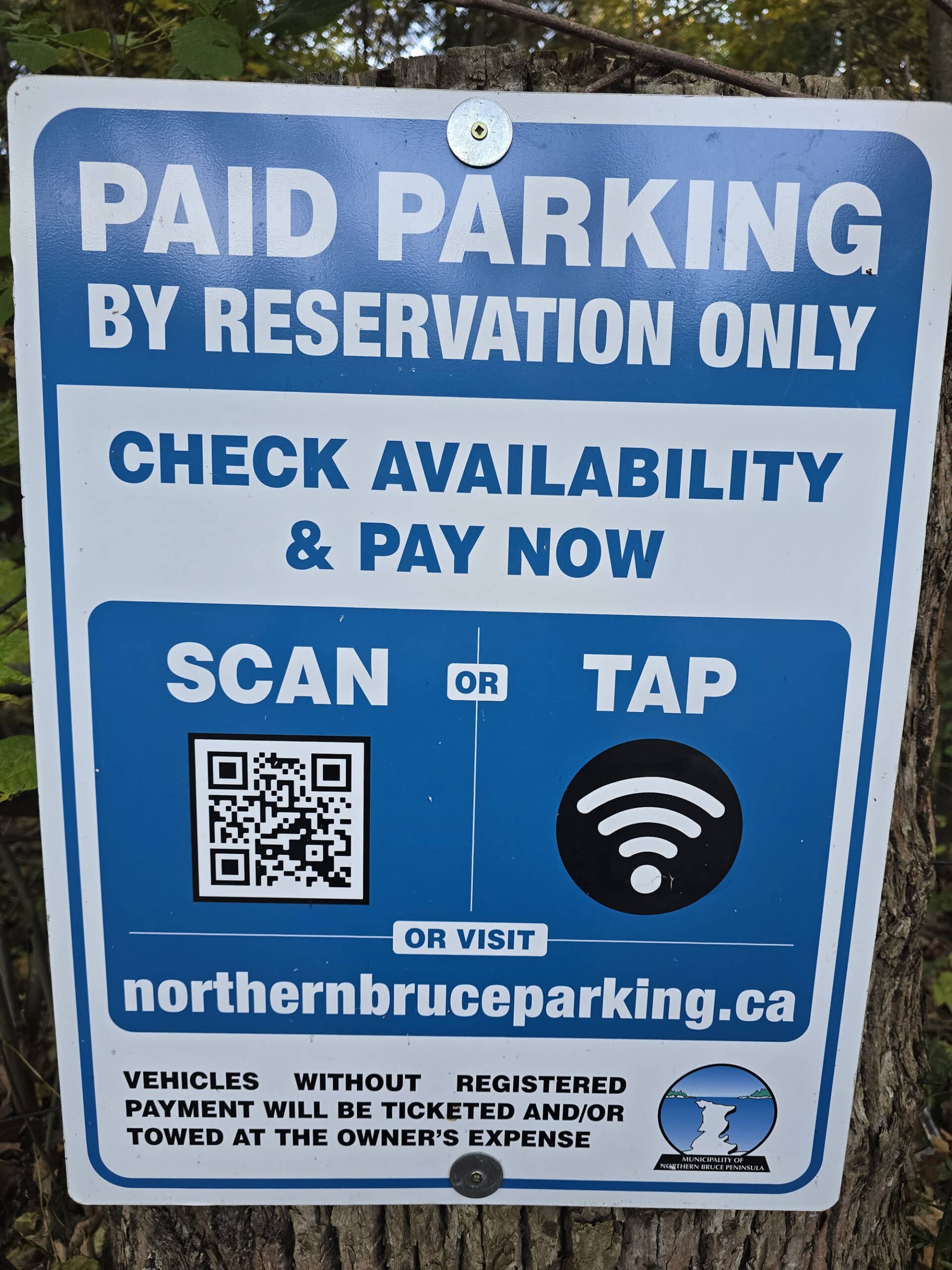
Price Entrance is free, but parking is paid - sort of. See the “Parking” section - below - for details.
Reservations: Northern Bruce Parking
Logistics
Some basic information to help you plan your visit to Lion’s Head Lookout Trail
Registration and Check In
Figuring out reservations was WAY more complicated and confusing than it needed to be.
TL;DR
From May 15 - October 15, you need to both reserve your parking AND pay. It’s $20 for a 4 hour block, or $30 for a full day - and it can be booked up to 2 weeks in advance.
If you’re visiting outside of season, the messaging is... confusing. Everything you see online mentions reservations being required, and paid parking - with NO mention of season.
In the end, we learned that outside of May 15-October 15, you don’t have the option to reserve OR pay - and parking is free.
There were no employees on site at the time of our visit.
That said, we did arrive after October 15th - I'm not sure if it was staffed during the busy season, but there was no kiosk or anything for that to be the case.
So as long as you have your parking reserved ahead of your stay - if applicable - just show up and you're good to go.
The Expanded Story:
We had started making plans on October 14, for the next day. At that point, I looked into booking on the 15th - and it would let me - but we decided not to, in case plans change.
Plans changed, so we put it off to the 16th.
On the 16th, we went to book parking... and it wouldn’t let us. It said no parking available, closed. It ALSO said that for all of the other parking locations listed, including Little Cove Beach.
Future dates were all greyed out.
We remembered back to an earlier visit to Little Cove, when we came upon confusing signage, booked a parking space on the spot, and ended up getting a surprise refund of that parking fee a few days later.
I Googled the situation at Lion’s Head, but couldn’t find any mention of seasonality, free parking off season, or anything of the sort.
So we decided to go, and assumed that we’d probably just have to pay for parking on the spot.
The signage at the parking lot said “Paid parking by reservation only, check availability and pay now” - with no mention about season.
So, we thought we had to pay anyway - but using that url to pay just brought me to the same greyed out options that wouldn’t allow it. The parking lot was not gated or closed in any way, and there was no indication that you could not *park* after October 15th.
After a bit of hand wringing, we decided that if we were supposed to pay, they wouldn’t have made it impossible to do so.
I was far from alone in that - several families that passed through fussed over the signs or asked me (and other people) what the deal was.
The municipality DEFINITELY needs to be more clear about their messaging. A line or two of info on the reservations page would save SO much hassle!
I ended up calling the municipality to find out what the deal was, which is when I learned that parking is, in fact, free after October 15.
Parking
The McCurdy Parking Lot is at the main trail entry point, and is the default parking lot for the trail.
It’s small - probably good for 25-30 cars - and oversized vehicles aren’t allow (or able, really) to park there.

The arena parking is about 1.5 km away from the trailhead - they do run a shuttle during the regular season.
While the McCurdy Parking lot is paid parking with reservations required during the main season, it looks like the arena is free parking.

Washrooms
There were four porta-potties in the parking lot at McCurdy trailhead - they looked fairly new and were really well maintained. All were well-stocked with toilet paper and hand sanitizer.
Unlike most porta potties we tend to see at unstaffed attractions, they were generally not offensive.
There were also two porta potties at the arena parking, we saw them on the way in, but did not use them.

Maps and Signage
Some basic information to help you get around Lion’s Head Lookout Trail:
Park Map
There is a single trail map in the parking lot, right at the trail head. It's large and clear and easy to read, showing not only the general area of the trail but a little bit about the city layout also.
Weirdly, there's a 1.5 km section of trail - the Moore Street Side Trail - that is covered with a piece of tape. I'm assuming it's out of commission, but there was no information - just tape.
In the writeup on that same map, it suggests that for a shorter trail you can take that Moore street side trail "marked in blue" and follow it back - but that trail section is red on the map.
Either way, I guess that whole option is not even available... but it's odd that it specifies the wrong colour.

There are distances provided on many or all of the side trails, just not on the main trail that takes you right out to Lion's head lookout - and I think this is the most commonly used trail here.
As an example, the aforementioned suggestion of a shorter trail gives a distance, but I didn't see anything on the sign that gave any kind of a final distance from the parking lot to the Lion's Head lookout itself.

Signage
As is usually the case on the Bruce Trail - at least on the sections we’ve hiked - the signage is fantastic.
In addition to the map at the beginning of the trail, there’s also a sign explaining how the trail blazes on Bruce Trail work, and the colour coding used. (Main trail vs side trails).
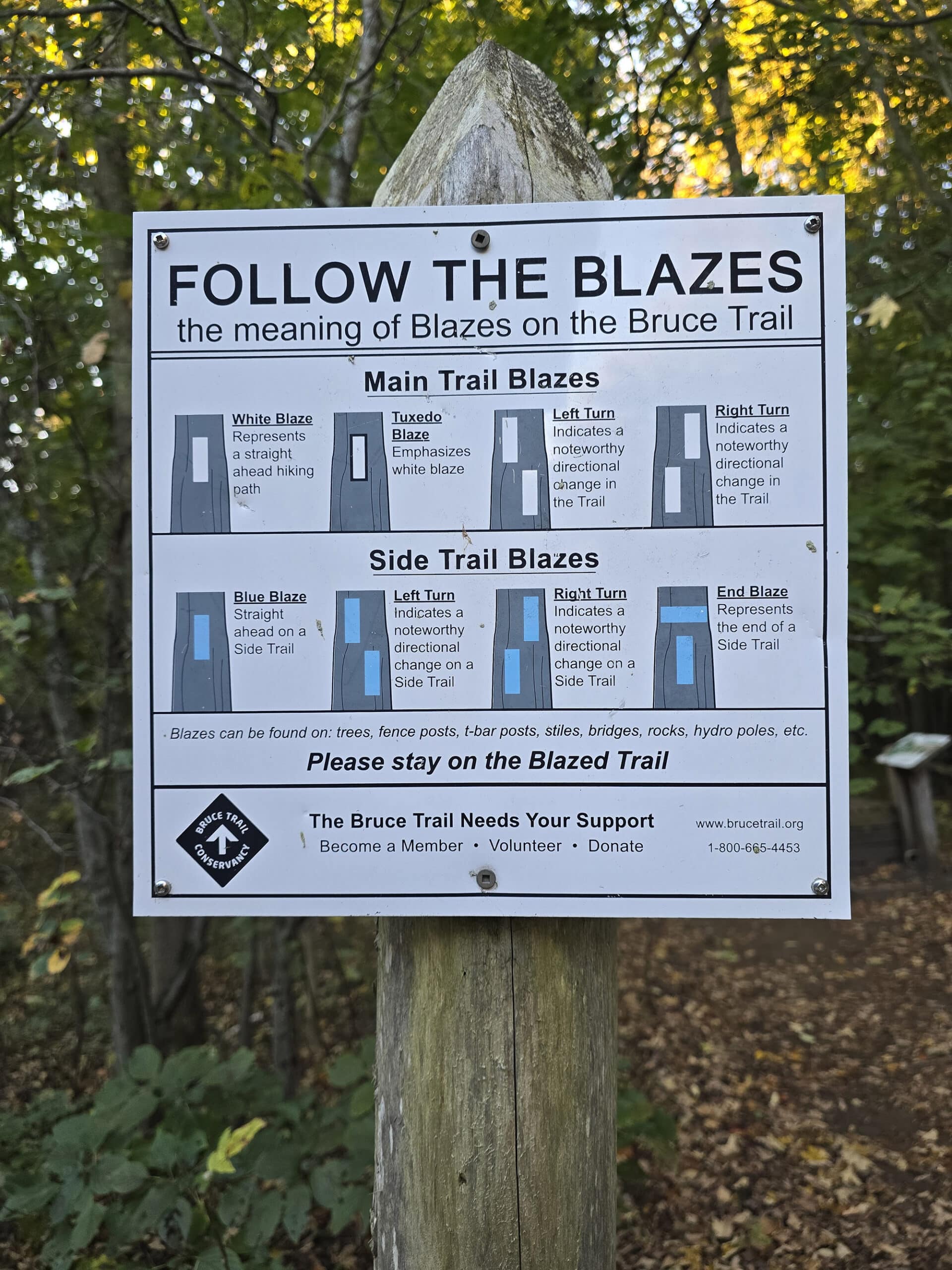
In the case of the two short offshoots to potholes (Lion’s Head Pothole Side Trail & Giant’s Cauldron Side Trail), these Bruce Trail signs also mentioned the ages of the potholes - 12000 and 10,000 years, respectively.
In terms of the blazes, the trails were well blazed, with the trail blazes frequent, vivid/high contrast, well-placed, and easy to see.

Accessibility
In NO way is Lion’s Head Lookout an accessible trail.
A very short section near the front is wheelchair accessible, but that’s about it. Not too far in, the trail becomes such that no one with any kind of mobility issues - or using any kind of mobility aid - is going to be able to do it.
I’ve done some wild things when booted or using a cane, but Porter says there’s no way I’d have been able to do this trail.
He’s in great shape with NO physical issues at all, and he said that his knees were “definitely feeling it” by the time he got back. I’ve literally never heard him mention his knees over hiking before.
Anyway, not that it matters all that much at this point, but there are no designated accessible parking spots, and the porta-potties aren’t the barrier-free style.
Pets
So far as we could tell, dogs were allowed on the trail... but I’m not sure how recommended that would be.
The first couple of kilometers would be fine, and large dogs should be fine further along.
We don’t think it would be great for small dogs, and it would be difficult for someone to carry them over the areas that would require it.
In general, dogs are allowed on MOST of the Bruce Trail, but must be leashed at all times and picked up after. There were garbage cans in the parking lot, but not along the route.
Park Store
There is no park store at Lion’s Head Lookout Trail.
Visitor Centre
There is no visitor center at Lion’s Head Lookout Trail.
Day Use Area
There are no picnic tables, benches, or anything of the sort at the trail head parking lot, or anywhere along the trail - at least as far as Lion’s Head Lookout Point.
Connectivity
We’re on Rogers Wireless, and generally had good cell phone reception and internet connectivity at Lion’s Head Lookout Trail.
I stayed in the parking lot the whole time, and had no trouble streaming videos, etc.
While Porter was out doing the hike, we kept in contact periodically - with him telling me about the trail and sending photos. The photos he'd send would come pretty quickly after an interaction, so the upload speed out on the trail seemed pretty good.
This decent to good connectivity lasted at least out as far as Lion's Head Lookout itself. After that point he seemed to lose connectivity, but he did regain it before reaching Lion’s Head Point.
Miscellaneous
A few random things to note:
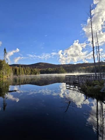
1. The lighting wasn’t great when we went first thing in the morning. The sun was up and the skies clear, but the sun was far enough behind that the cliffs and water on that side of that little peninsula were in shadow all morning.
For the best views, you’re going to want to go when the skies are clear and sun is over Lion’s Head Harbour, illuminating the cliffs and water. In October, this would probably mean an early afternoon start at the trail.
2. That said, it’s a really popular trail, even on the off season. We started around 8, and by the time he was back at the car - before 11 am - the parking lot was really starting to fill up.
4. This is not going to be a great trail to bring young kids on. If you do, be sure to have them harnessed or something - there are no barriers at the cliffs, so it can be VERY dangerous if they wander at all!
5. We noticed a few walking sticks left near the front of the trail, and have seen a few recommendations that hikers bring one to help with balance.
6. There’s an online Bruce Trail Conservancy Guestbook that hikers can sign, via a QR code on the trail. (Or through the link in the previous sentence!)
Share the Love!If you’ve made one of our recipes, be sure to take some pics of your handiwork! If you post it to Bluesky, be sure to tag us - @2NerdsInATruck, or you can tag us on TikTok, if you’re posting video. We're also on Pinterest, so you can save all your favourite recipes and park reviews to your own boards! Also, be sure to subscribe to our free email newsletter, so you never miss out on any of our nonsense. Well, the published nonsense, anyway! |
Entertainment and Activity
Hiking is definitely the main reason to visit Lion’s Head Provincial Park / Lion’s Head Nature Reserve / Lion’s Head Trail... but here’s the basic info we usually cover, anyway!
Hiking
Porter did this trail himself, as NOTHING I’ve seen about it gave me any confidence that I’d be able to complete the trail with my mobility issues.
As a quick TL;DR on the distances, from the McCurdy Drive Parkette, here’s what it took him to get to the main attractions:
Lion’s Head Pothole Side Trail: 40 minutes / 2.85 km.
Look Out Point (Per Google): Just over 3 km in.
The first view of Lion's Head Lookout itself came about three and a half kilometers in, and after an hour of hiking.
It took 4.6 km and an hour and a half to get to Lion's Head Point.
Overall it took him about 9 km and 2.5 hours to go as far as Lion’s Head Point and back. Also, MapMyRun clocks it as 87 meters of elevation gain.

Porter’s Experience
Here’s what he had to say about the trail:
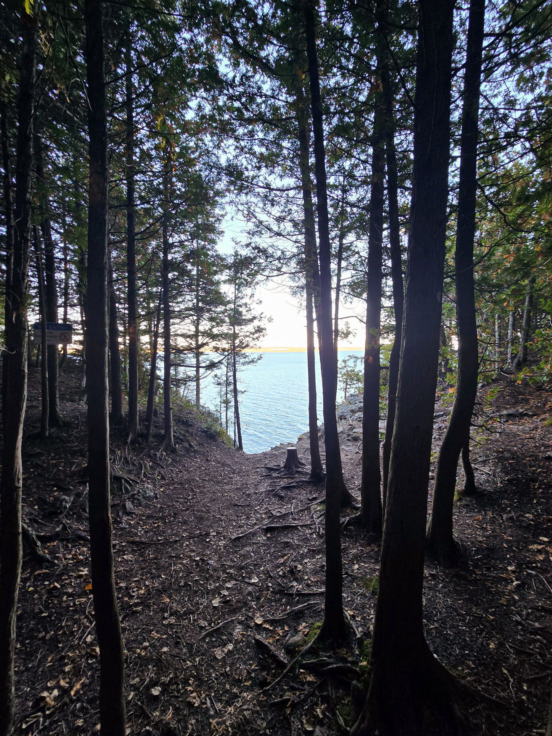
“Overall, the path is nice and wide, and well marked the entire way. It gets a bit more narrow on some of the steeper parts, but you don’t need to shimmy around anything or whatnot.
The first kilometer and a half is pretty rough, but not very hilly. After that, it meets up to a flat, straight gravel/dirt path for about a kilometer. I didn’t measure, but that’s a rough guesstimate.

In places, I had to hold on to a tree to steady myself.
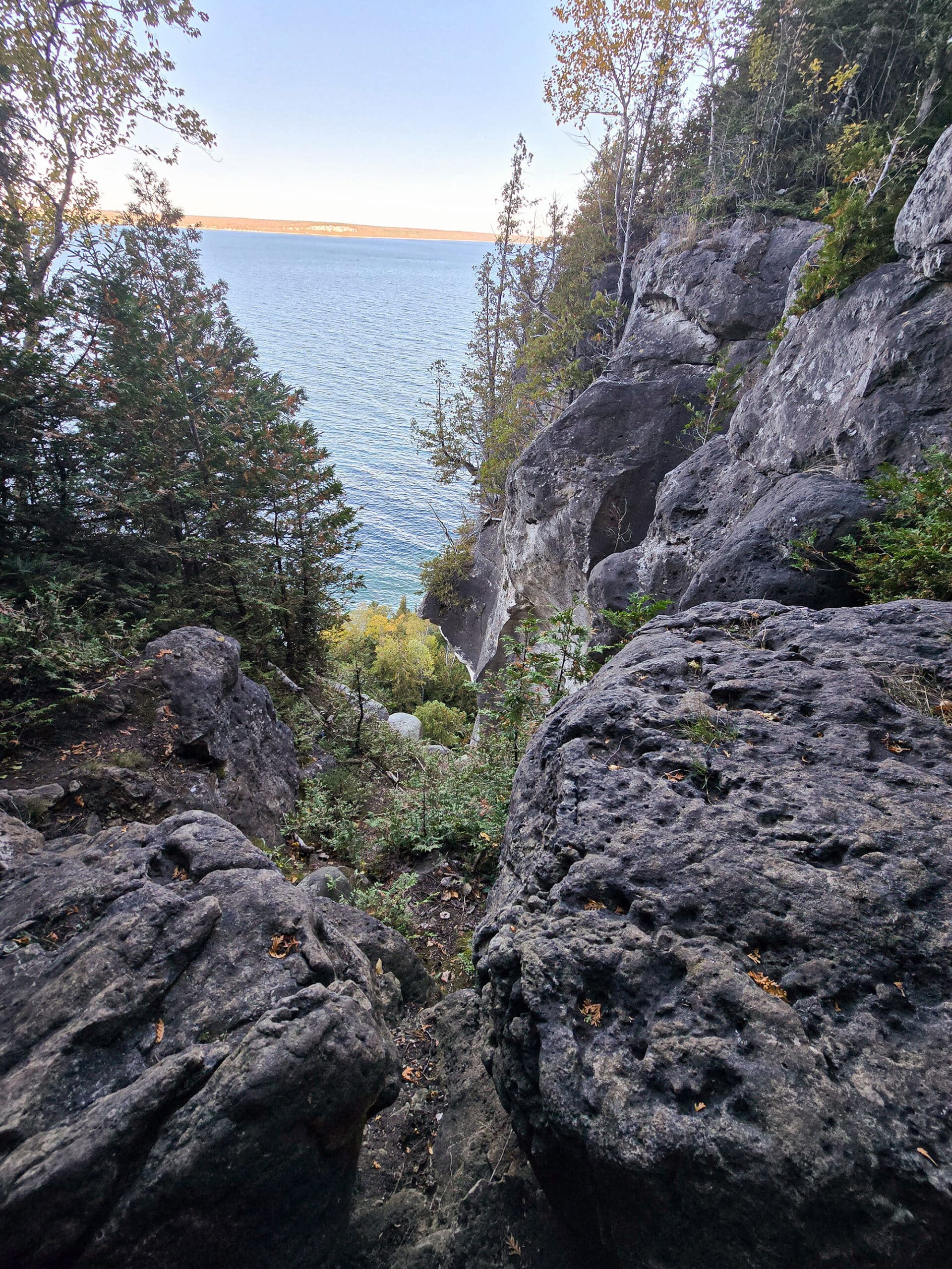
Anyway, even though the trail was pretty difficult, there was amazing scenery the entire way. The overlooks are obviously beautiful, but even the forest and moss covered boulders everywhere ... was just an amazing sight. ”

Giant’s Cauldron Side Trail
“This is a 15m long side trail. It’s a narrow, difficult trail up to the “cauldron”, and it was kind of... Tolkieny, if that make sense. It was rocky, but lush.
I really liked this section of trail.
The Giant’s Cauldron itself looked like a large campfire ring, as you might see in a group campsite. It’s just kind of a shallow pit - the photos don’t even really show it well.
There are a few rocks around it that sort of show where it is, but it wasn’t much of an attraction.”

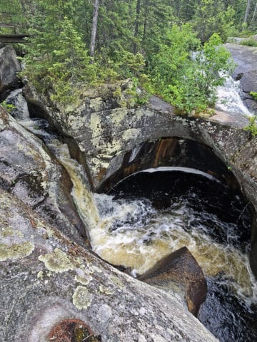
Lion’s Head Pothole Side Trail
“This was a 5 metre long side trail.
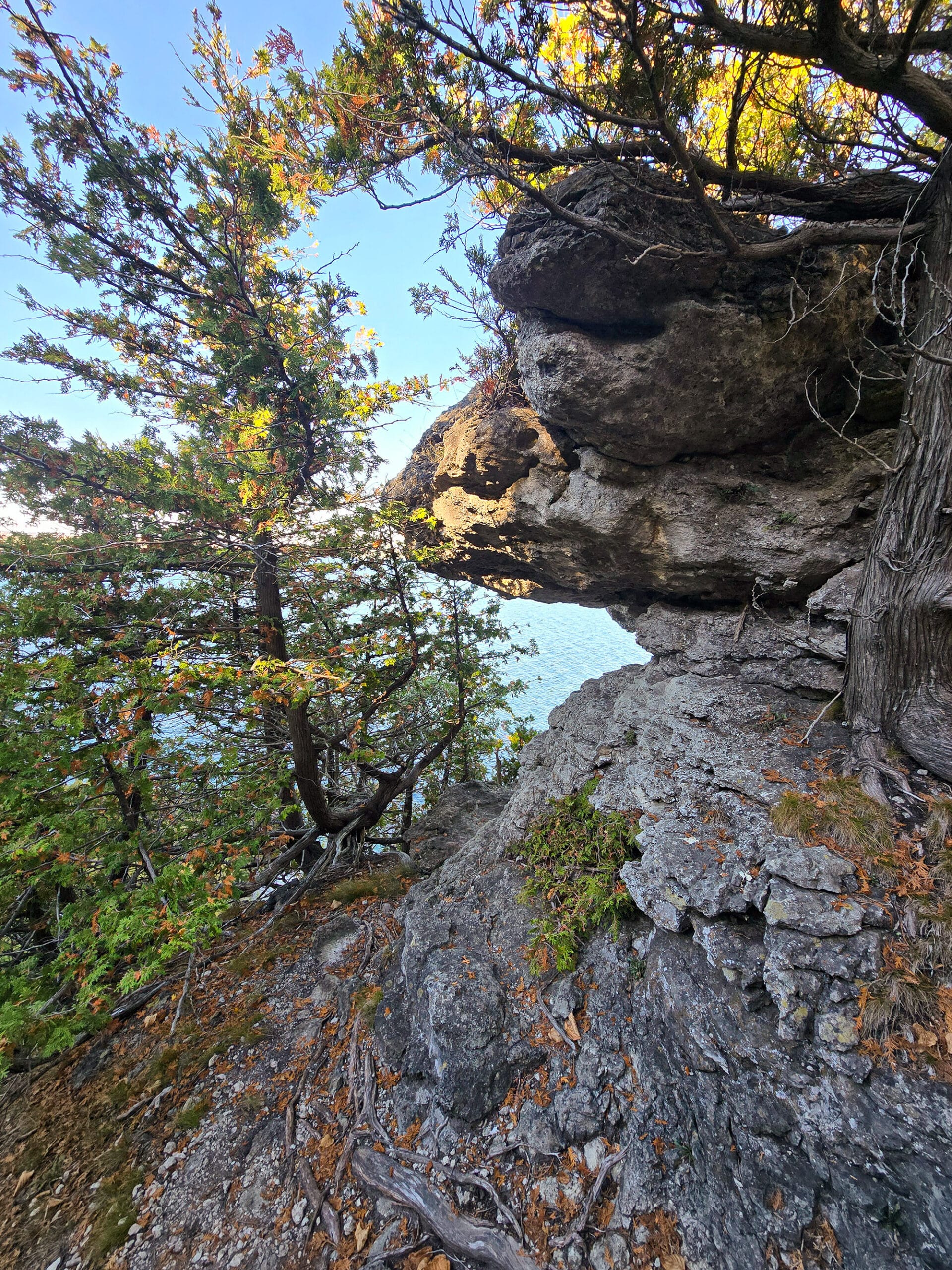
As I was walking towards it, the first thing I saw was a face in the rock - I had to pause and send a photo to Marie. I just thought it was really cool.
Just to the right of that, there was a little cave - that was the pothole. You can crawl into it to explore - it’s maybe a metre and a half wide.
I really liked this section of the trail, but I COULD NOT get photos that would do it justice.
It’s just really wild to know that water was able to carve that formation into the rock in the first place.”

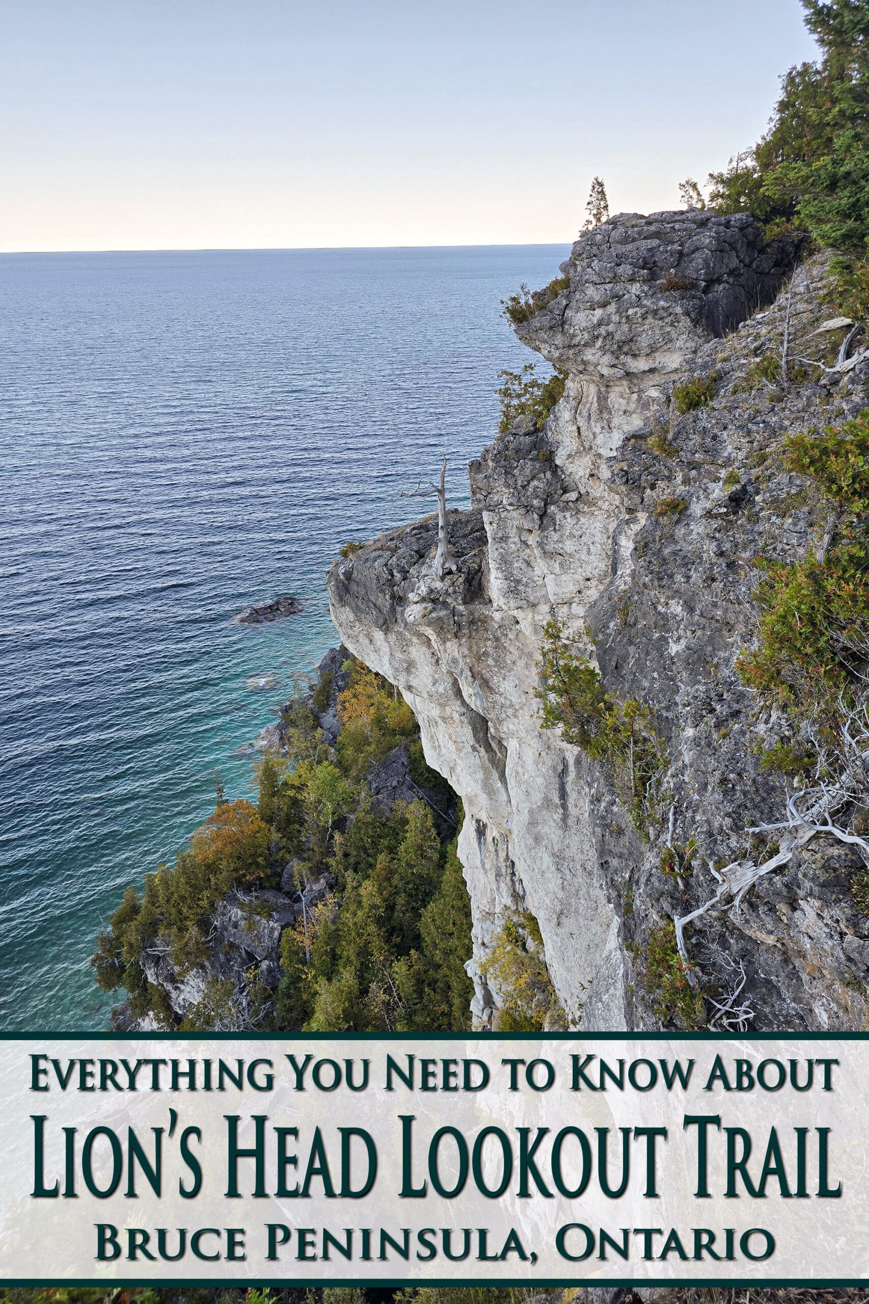
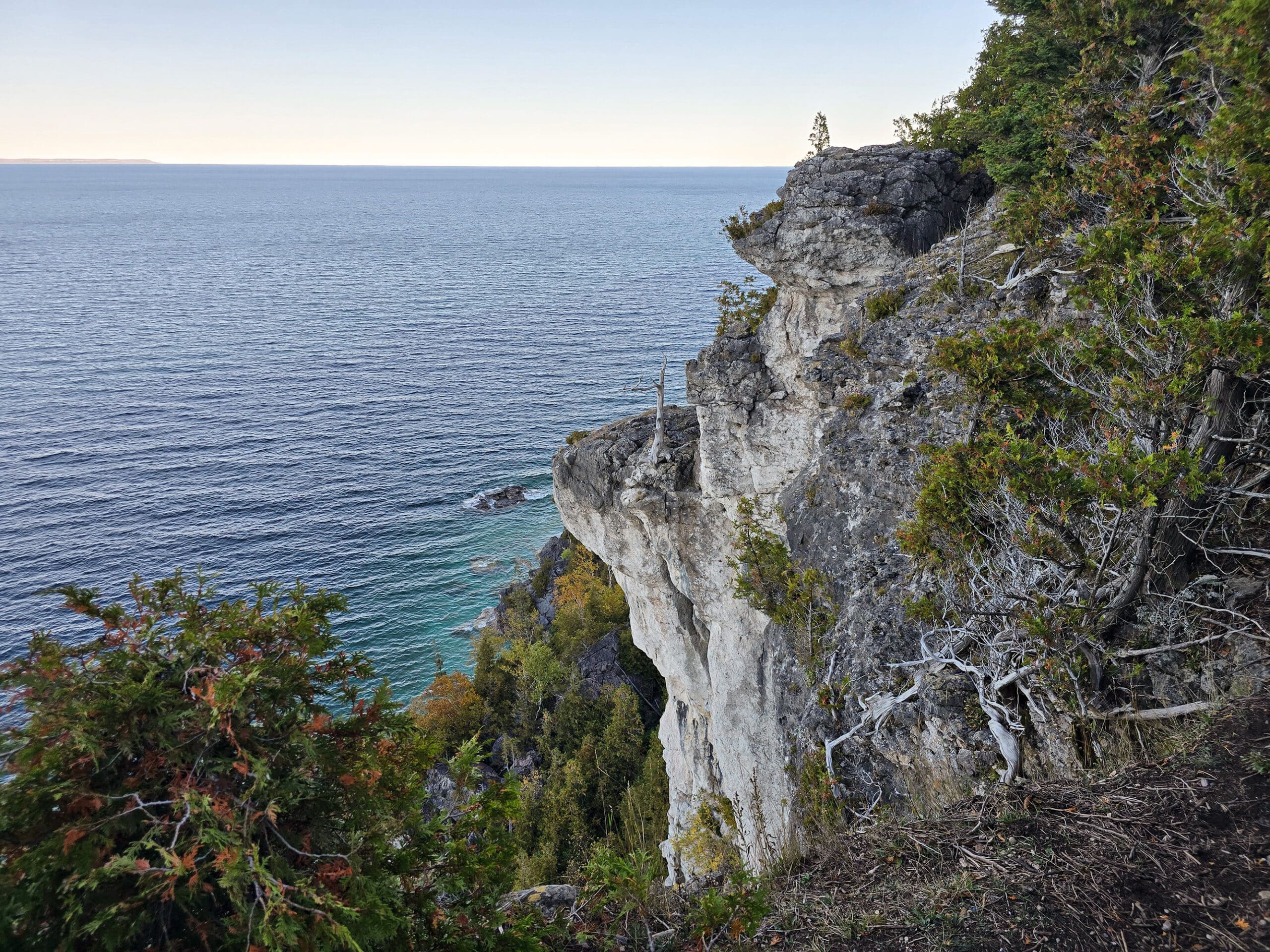
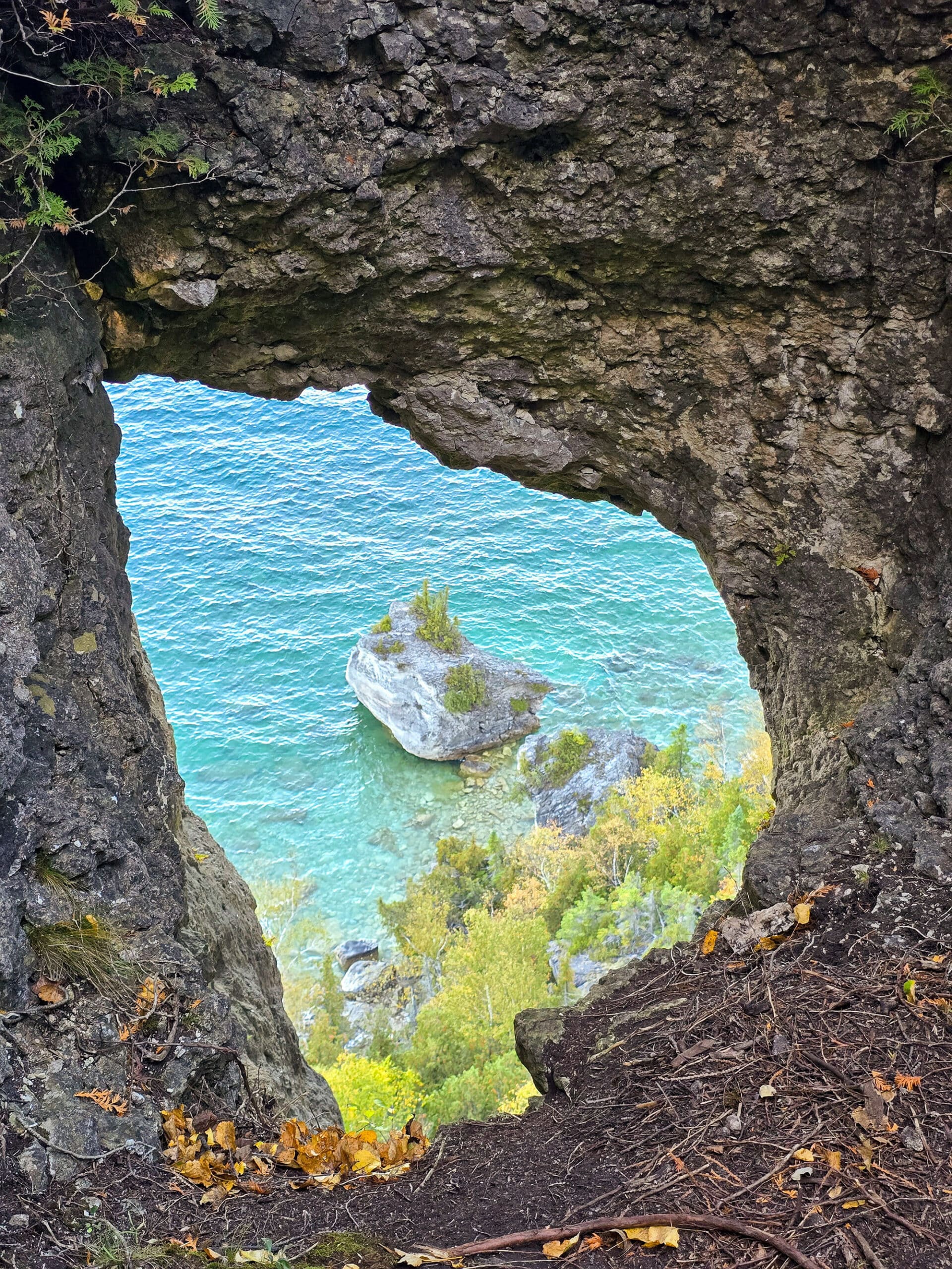
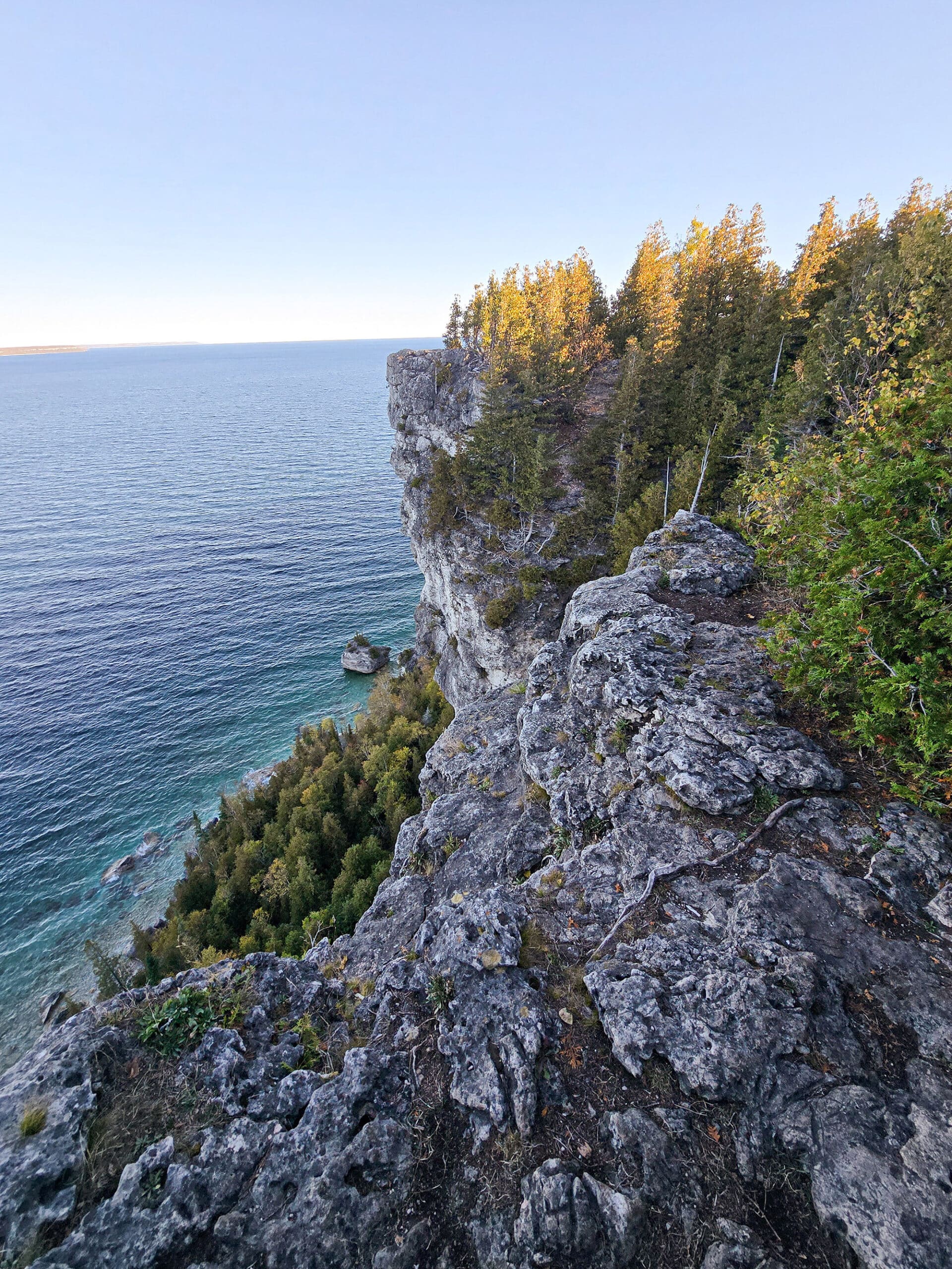
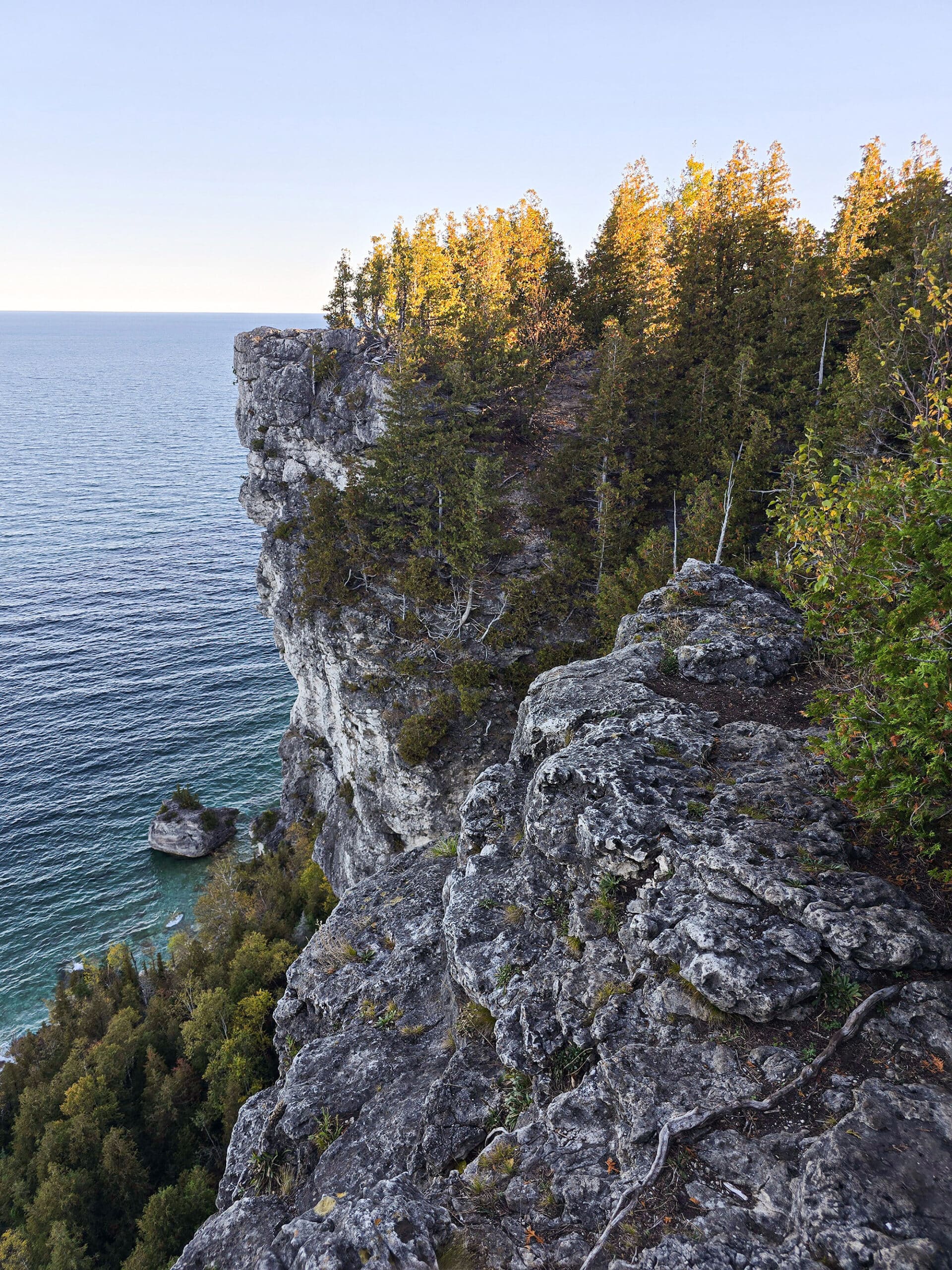
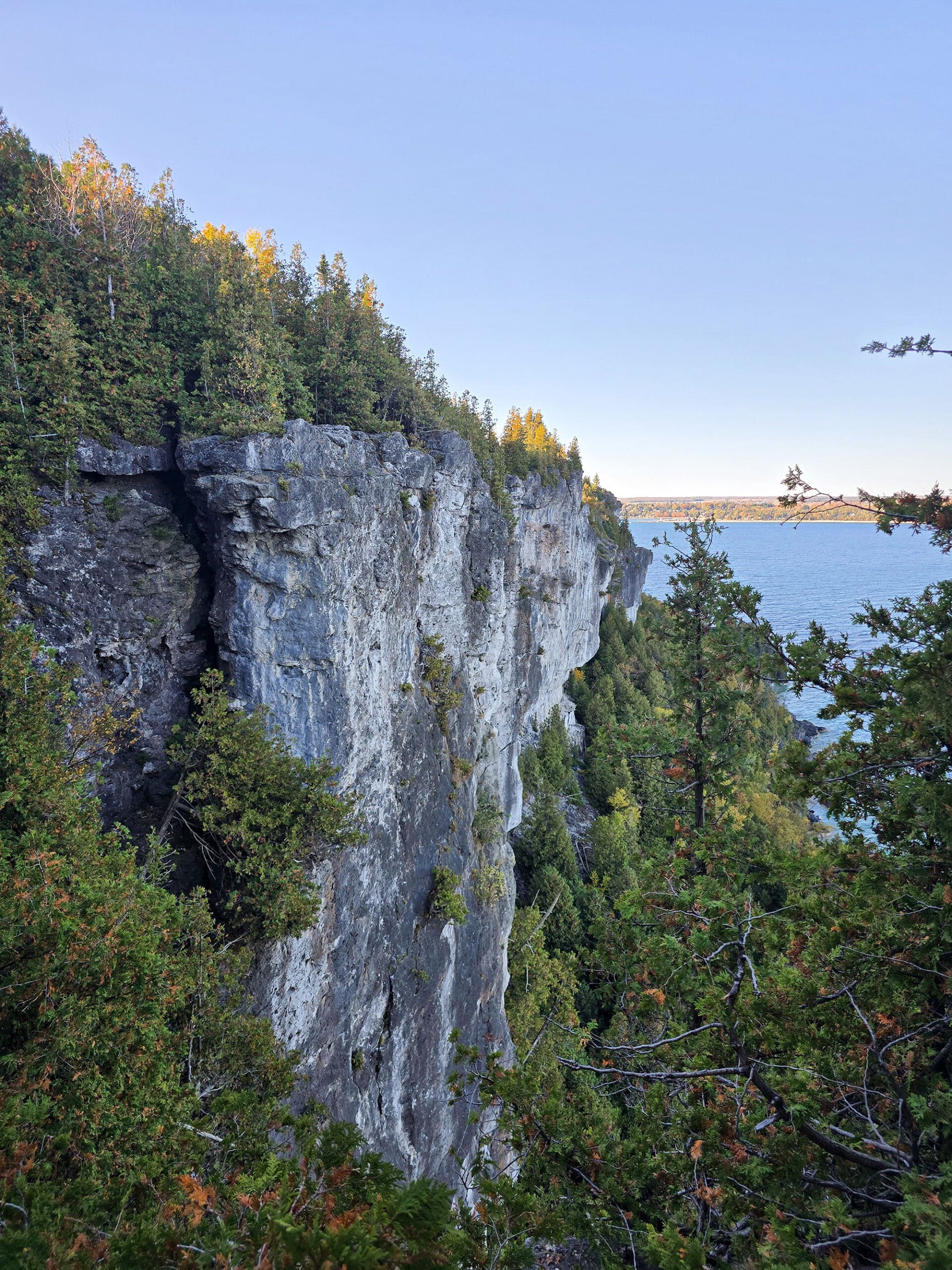
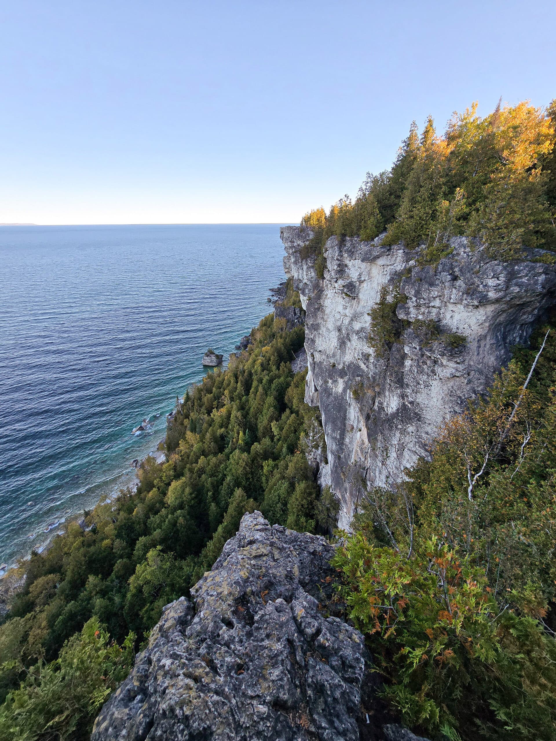
Lion’s Head Lookout
“This was just a few metres off the main trail.
I actually walked right past this lookout, the first time - I knew I was in the general area, but somehow missed the sign.
You have to take a narrow path between two trees, and it looked like an off-trail thing, like somewhere I wasn’t supposed to be.
On the way back, I saw the sign. It opened up my eyes and I was happy now, looking out over the cliffs and Georgian Bay.

Anyway, after you go between the trees you come to a small open space where you go to the left or right. Left gives you a lovely view of the cliffs and water, while going right allows you to go around and up to what I assume is the main lookout point.
This has the amazing panoramic view of the water and cliff faces.
This was a FANTASTIC view, but the photos really don’t do it justice. I definitely recommend doing this hike on a sunny day, to really get those views of the turquoise waters below.”

Stinger Gully
“This was a point on Google Maps, but was not shown on the main map at the front, and there was no signage on the trail to indicate it.
It was a really cool area that seemed more bouldery than other areas along the trail.
When we got back and Googled, we learned that this used to be a popular rock climbing route - but it was taken out in 2020.
... that might explain the emergency access roads in that area.”

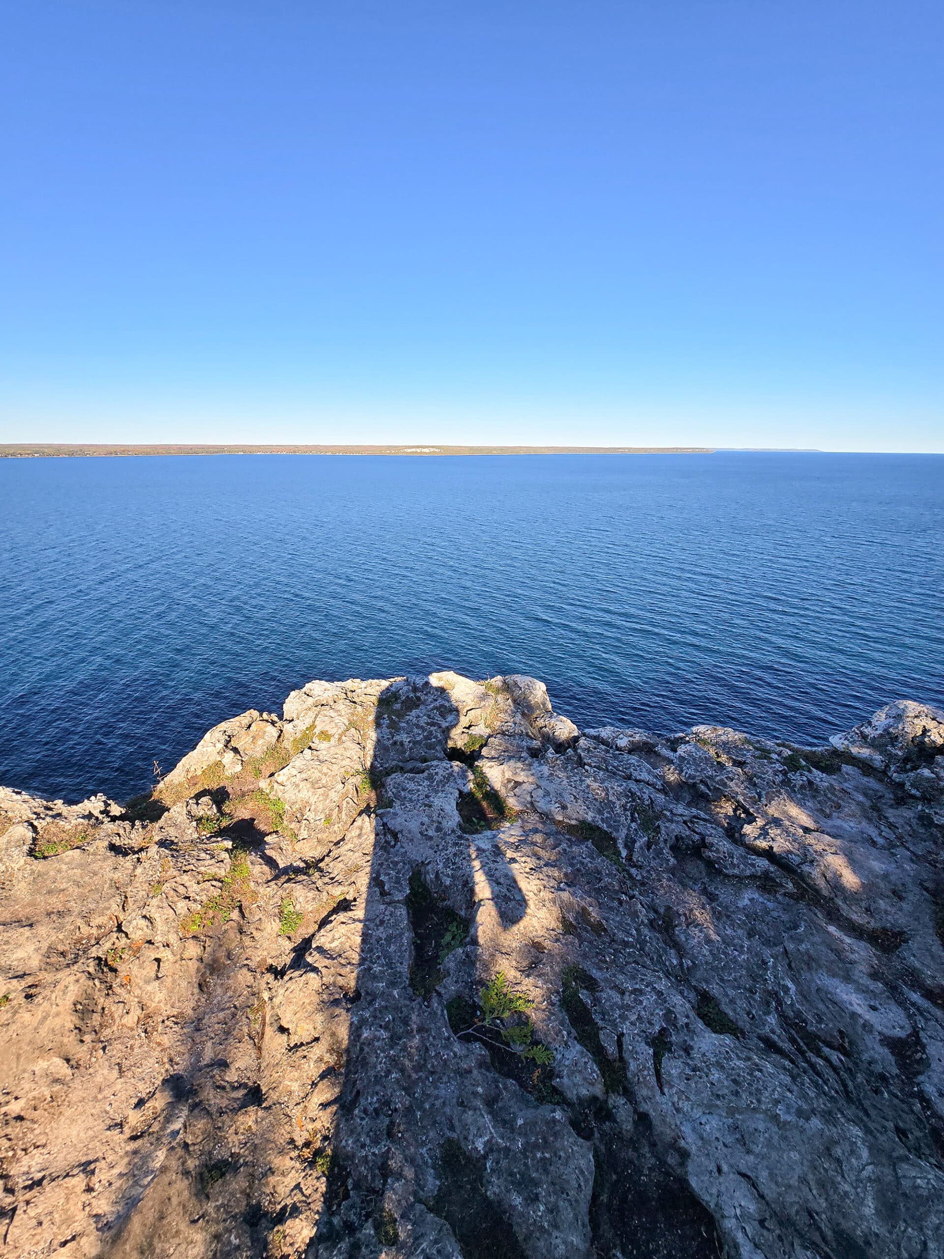
Lion’s Head Point
“We hadn’t intended for me to go any further than Lion’s Head Lookout itself, but saw Lion’s Head Point on the parking lot map. It looked to be only about ½ km further than the lookout, so I decided to add it to the plan.
It FELT like longer - and I forgot to check MapMyRun - but really... almost EVERY trail section on the Bruce Trail feels like it’s longer than it is!
This was the only point where the lighting was GOOD during my hike, so I really enjoyed seeing that blue-green water.
Other than the lighting / water colour, the other lookouts up to this point were much better. Before this point, you could see cliff faces, etc - at Lion’s Head Point, you mostly just see the water below.
It was nice enough, but I’m not sure I’d bother going all the way out to the point on future visits.”

Birding, Wildlife, and Nature
As soon as we pulled up in the parking lot, a large greyish bird flew across the trail in front of us. I’m pretty sure it was some kind of owl, but we couldn’t find it when we actually got onto the trail.
Aside from that, all Porter heard or saw during his hike were: American Crow, Black-Capped Chickadee, Blue Jay, Golden-Crowned Kinglet, Northern Flicker, and Winter Wren.
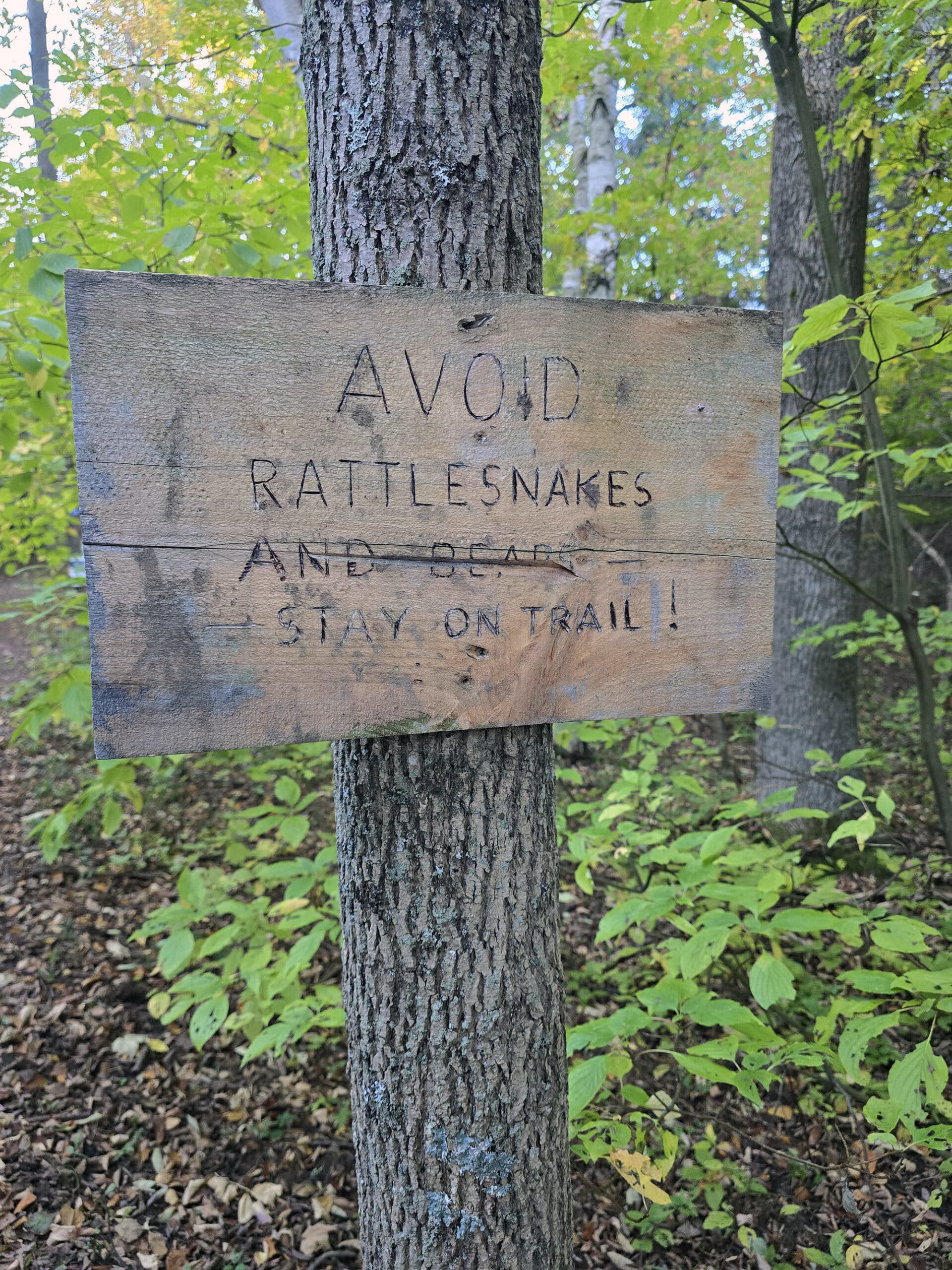
As a note, there are a couple signs near the beginning of the trail, warning about rattlesnakes and bears.
So, I suppose Black Bears are a possibility.
That said, we’ve still yet to see even a single one, over several years of visits to the Bruce Peninsula.
Educational & Cultural Opportunities
There’s are some pretty basic signs up front about bear safety and staying away from the cliff’s edge - and a sign at the Pothole about how long ago it was formed - but that’s about it in terms of educational opportunities here.
Niantic Games
There is a single Niantic Game Stop in the parking lot, and a few more along the hiking trail.
We had good enough internet to access the one in the parking lot, and Porter was able to load the game along the trail in several spots, as well.

Nearby Attractions
The trailhead for Lion’s Head Lookout is just a few minutes away from Lion’s Head Beach. It’s a cute little sandy beach, with nice views of the cliffs under Lion’s Head Trail, the Lion’s Head Harbour, and Georgian Bay.
Other than that, it’s about 30 minutes away from Devil's Monument ... if your legs can handle more hiking after the Lion’s Head Trail, anyway!

Final Thoughts
Here’s what Porter had to say about the overall experience:
“It's a long drive to get here, but it's an amazing hike with a lot of different kinds of views - it really keeps you interested.
The overlooks alone make the drive and effort worthwhile, but the entire journey is just beautiful.
I’ll be back again, and will try to time is such to get better lighting on that side of the cliffs, especially at the Lion’s Head Lookout itself!”

More Southwest & Central Ontario Provincial Parks & Places to See
Want to read some more about the parks we've camped and at places we've seen in Southwestern & Central Ontario? Here are some more posts!
Southwest/Central Ontario Campground Reviews:
Awenda Provincial Park
Balsam Lake Provincial Park
Bass Lake Provincial Park
Bronte Creek Provincial Park
Bruce Peninsula National Park
Conestogo Lake Conservation Area
Craigleith Provincial Park
Darlington Provincial Park
Earl Rowe Provincial Park
Elora Gorge Conservation Area
Emily Provincial Park
Falls Reserve Conservation Area
Fifty Point Conservation Area
Inverhuron Provincial Park
Long Point Provincial Park
MacGregor Point Provincial Park
Mara Provincial Park
McRae Point Provincial Park
Meaford Memorial Park
Pinery Provincial Park
Point Farms Provincial Park
Port Burwell Provincial Park
Rock Point Provincial Park
Rondeau Provincial Park
Sauble Falls Provincial Park
Selkirk Provincial Park
Sibbald Point Provincial Park
Turkey Point Provincial Park
Valens Lake Conservation Area
Warsaw Caves Conservation Area
Wheatley Provincial Park
Southwest/Central Ontario Places to See:
Big Bay, Ontario
Canada's Dinosaur Park
Cheltenham Badlands
Devil's Monument
Doubes Trestle Bridge
Eugenia Falls Conservation Area
Flowerpot Island
Hogg's Falls
Inglis Falls Conservation Area
Indian Falls Conservation Area
Jones Falls
Keith McLean Conservation Lands
Mark S. Burnham Provincial Park
Menesetung Bridge
Mono Cliffs Provincial Park
Peterborough Lift Lock
Petroglyphs Provincial Park
Point Pelee National Park
Rattlesnake Point Conservation Area
Scenic Caves Nature Adventures
Spirit Rock Conservation Area
Springwater Provincial Park
Wasaga Beach Provincial Park
Want to explore beyond Southwest and Central Ontario? Check out our full list of Campground Reviews, Ontario Waterfalls, and other Places to See.
We also have a ton of Camping Recipes to cook up, while on your adventures!
Thanks for Reading!If you loved this post - or have any questions about it - please leave a comment below! We'd also love it if you would consider sharing the link on social media! |

Leave a Reply