
Spirit Rock Conservation Area is a small park at the base of the Bruce Peninsula. Known for its epic spiral staircase- here's what you need to know!

After hitting up Big Bay, Ontario - and a quick stop in Wiarton - we finally got to check out Spirit Rock Conservation Area.
This is a relatively small park just outside of Wiarton, known for a few things:
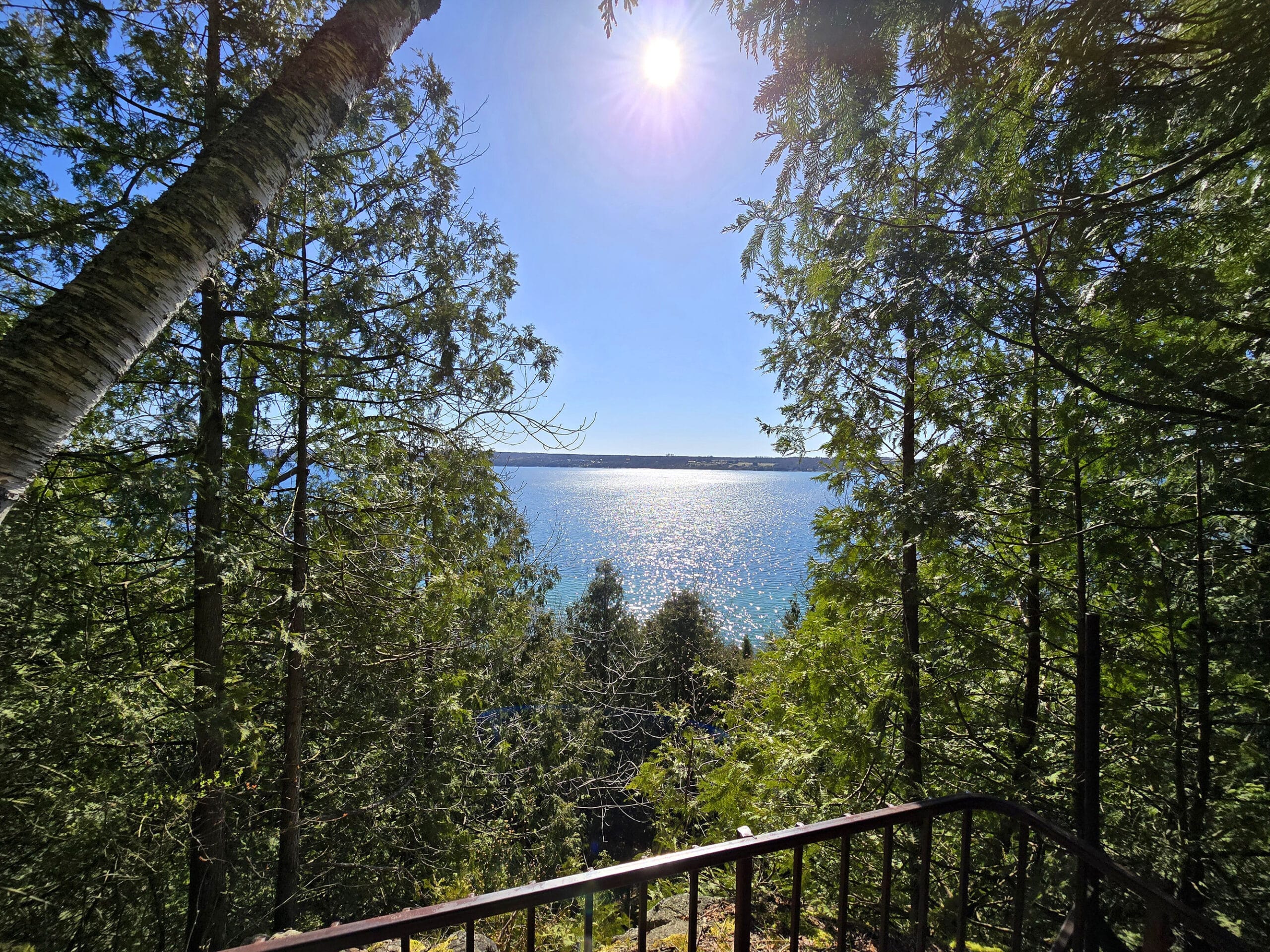
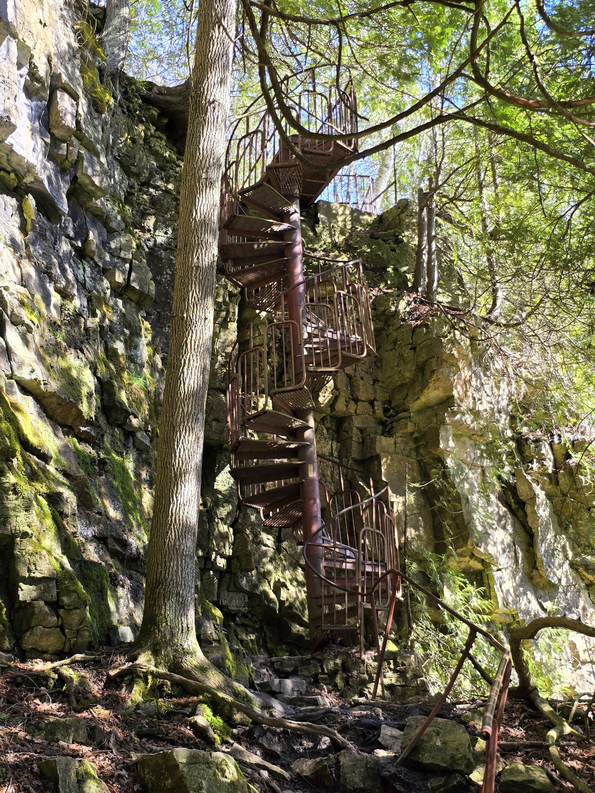
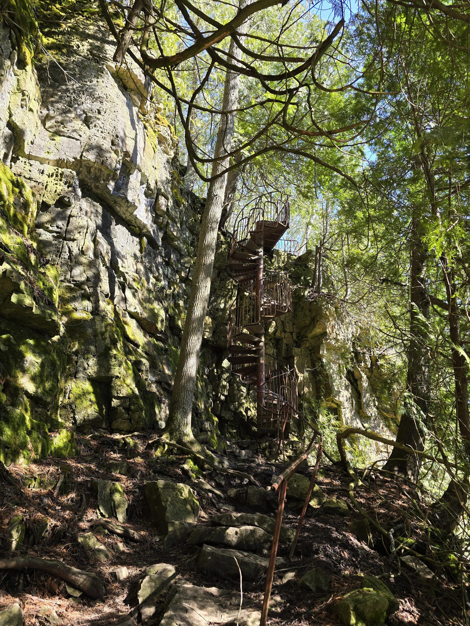
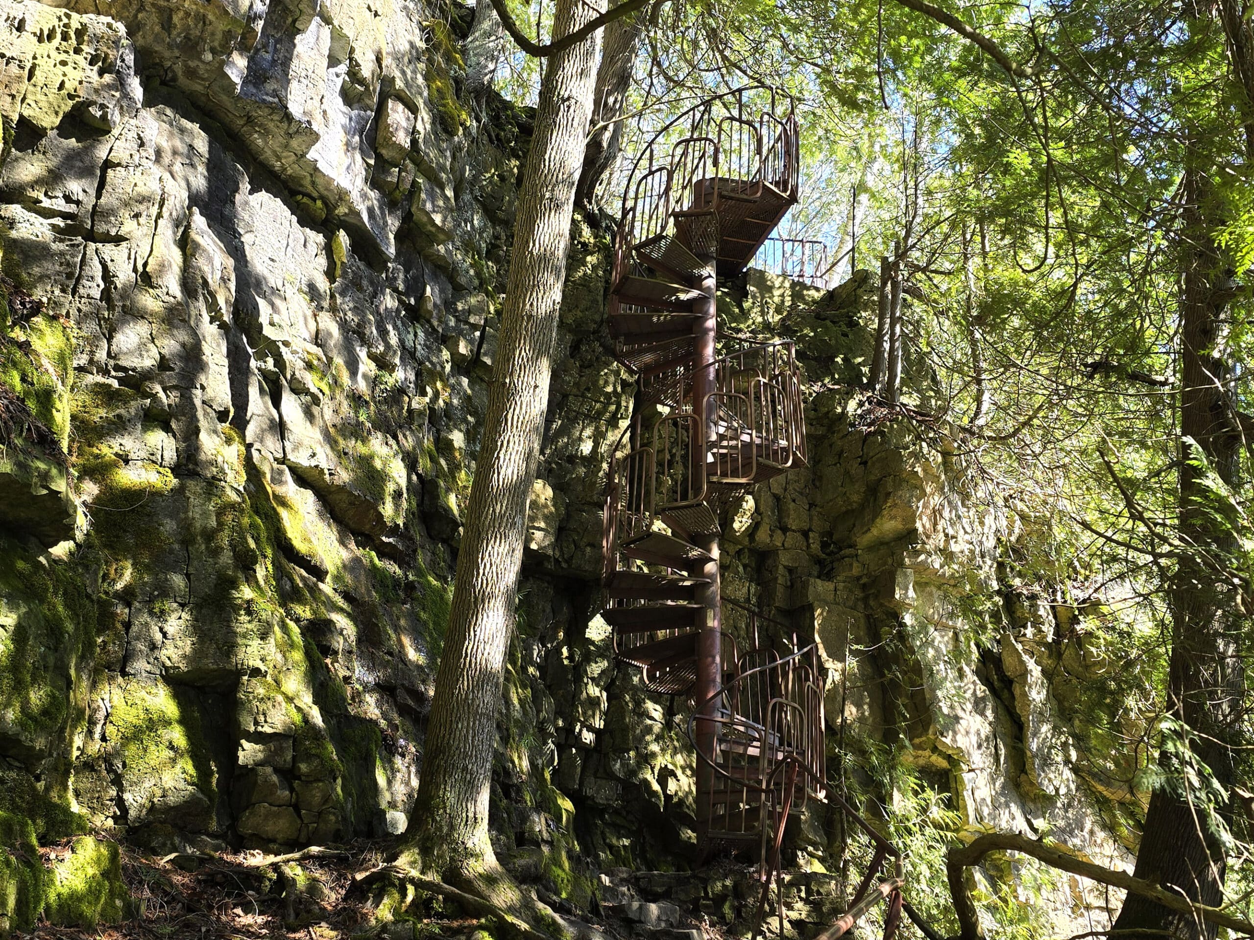
1. A spiral staircase descending off the top of the Niagara Escarpment , with a spectacular view over Colpoy’s Bay.
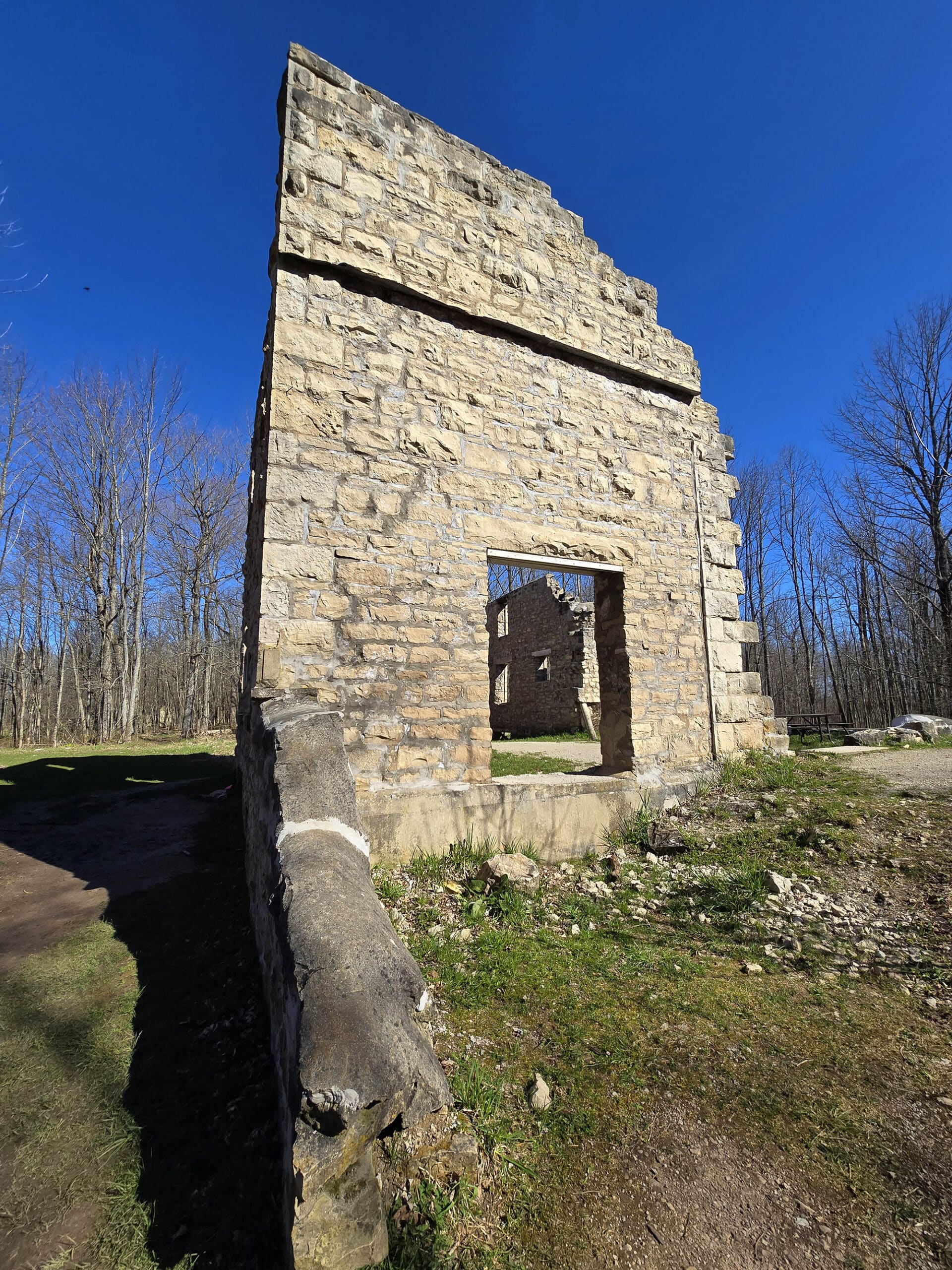
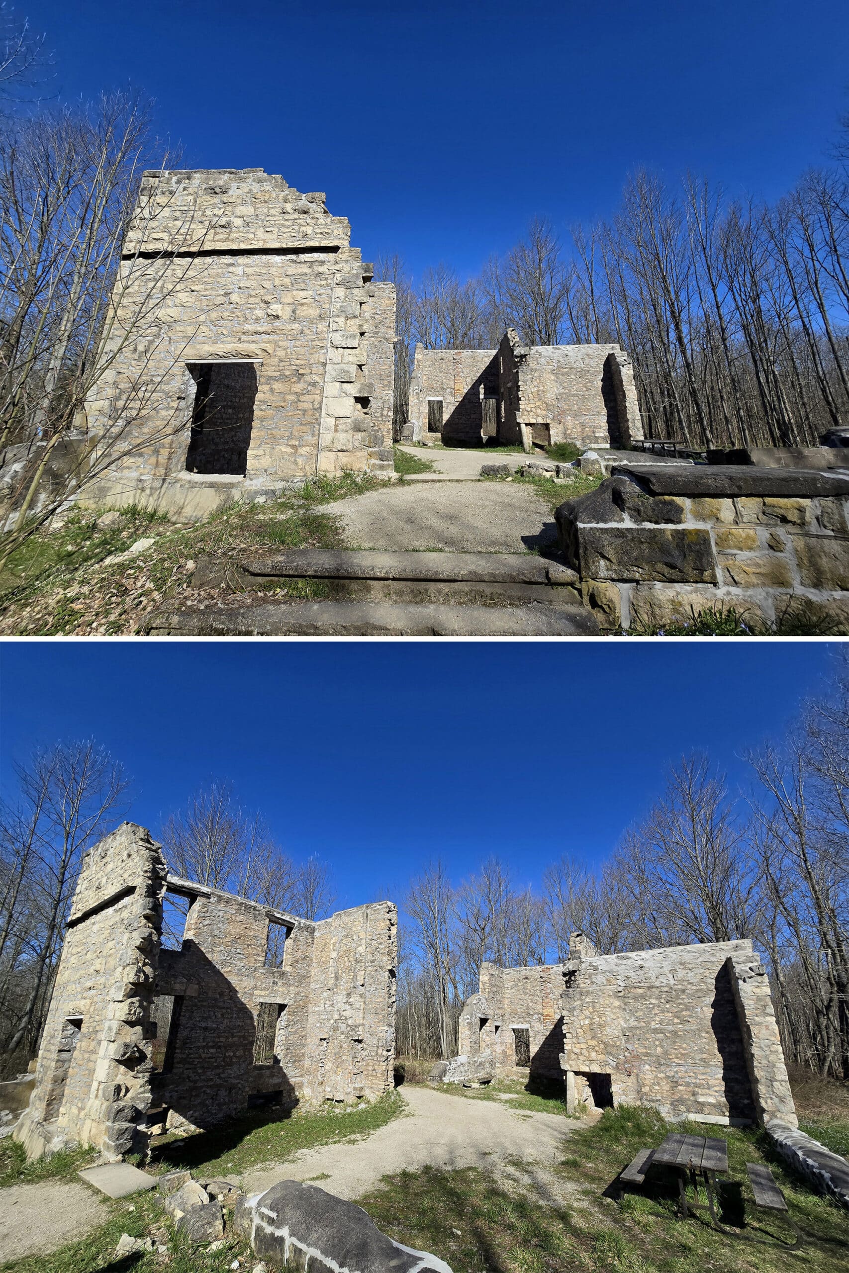
2. The ruins of the McNeill Estate, and the long series of unfortunate events that led to its eventual destruction.
3. Hiking!
Our stay there was short but sweet - we had a great time, saw some gorgeous sights, and took in some nice fresh air.
Let us tell you all about it!
The Basics:
Location Name: Spirit Rock Conservation Area
Address: 92 Highway 6 Wiarton, ON
Website: Grey Sauble Conservation Authority
Price At the time of publication, parking is $10/day.
Reservations: Grey Sauble Square Site - Pay for Parking
Logistics
We had a weird go of our visit, mostly because the website is NOT great for information.
The Website and Maps Situation
For one, we had no idea that the entrance to the park would be closed - along with access to the parking area.
We pulled up to the address that Google, to a gate with no information about seasons - it just told visitors to walk in.
Secondly, the map on their site is not clear at all, for someone who doesn’t know the area. For all we could tell, this was a permanent gate - but we could see a designated parking lot on their map.
There was what appeared to be another road into the map on the north end of the park, but when we drove there... it just didn’t exist. We figure it was part of the Bruce Trail, rather than a road.
So, I ended up calling the Grey Sauble Conservation Authority office to try and figure out what we were doing wrong.
The main entrance was not shown on the map, and you had to zoom WAY in to see any of the road from the main entrance to the parking at all - as it’s covered by trees.
The Parking Situation
Finally, there’s the parking fee situation.
Again, no mention of seasonality, so I had no idea if we were supposed to pay for parking for the two or 3 parking spots outside of the gate, or if we were essentially visiting a closed park.
As it turns out, if the gate is closed, you don’t pay parking. Good to know!
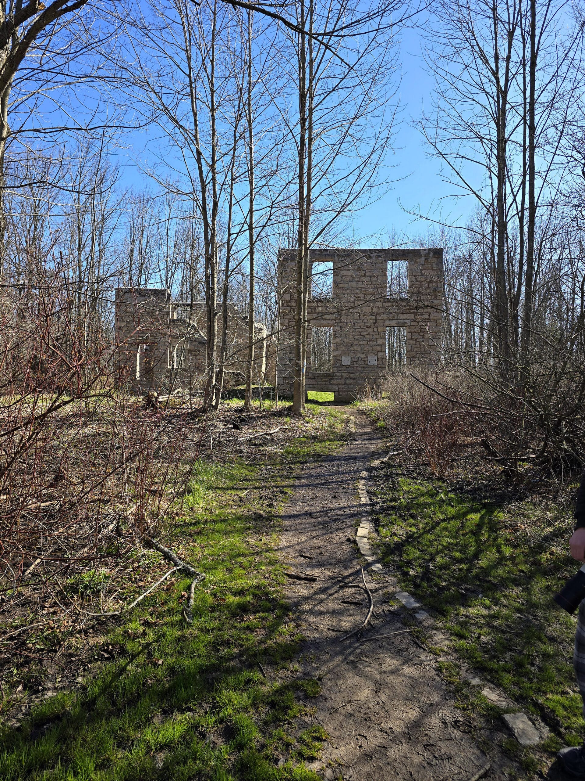
Once we knew what was up, we went back to the front gate, parked in the very small off season parking area, and walked in.
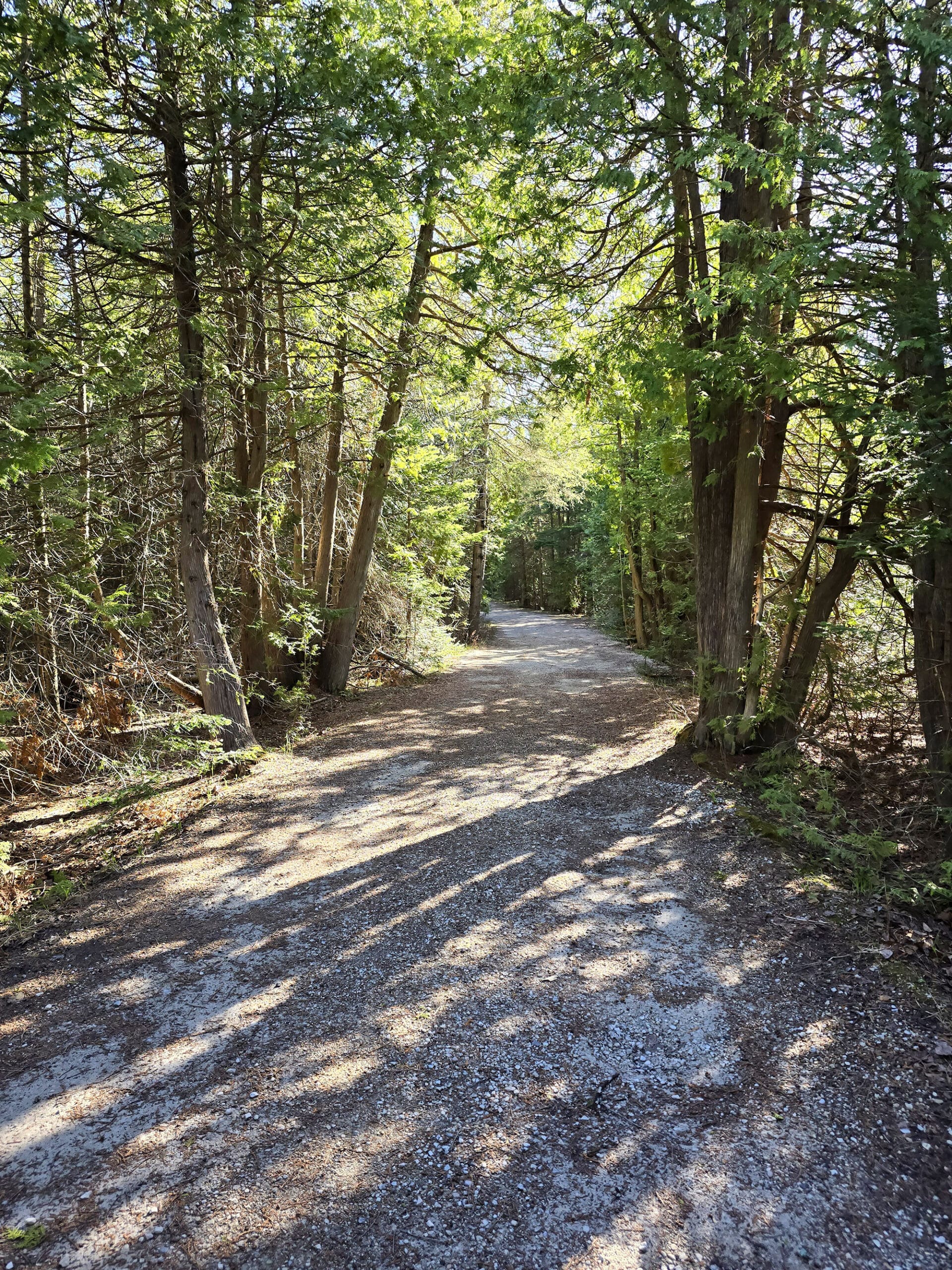
The walk from the front gate is about ⅔ of a km to get to the parking area.
Accessibility
As it was when we visited, it was in NO way an accessible park.
The front gate completely blocked the road, the only way in was either OVER it, or down a short and steep hill to get around it. Had I been having a bad tendon day, I would have been done before we started.
Then you walk the better part of a km before you even get to the real entrance (parking area) of the park. The road is... not great. Probably wheelchair accessible, but I likely would have noped out if I was in a boot or using a cane that day.
The walk from the parking lot to the ruins is relatively flat, but rough, narrow, and was incredibly muddy when we were there. Not wheelchair accessible, definitely glad I wasn’t in a boot for it.
The trail - so far as we could see, we didn’t do the whole thing - was easy enough to do. Not wheelchair accessible, but should have been fine with braces / walking boot / cane.
... up to the point you get to the stairs, anyway.
Once you’re at the base of the stairs... you’re really not going anywhere if you’re using any kind of mobility aid. Big - sometimes loose - rocks, a very wonky rail that bare helps, etc etc.
You’ll want to be pretty decently able bodied for this section of the trail.
Pets
Apparently dogs are OK as long as they’re on a leash.
I’m not sure how well most of them would do on the area by the stairs - and beyond - so you might want to skip that part of the trail, if you have any concerns.
Parking
There’s a small parking lot towards the middle of the park - right by the ruins.
You can reserve and pay for your parking online by visiting Grey Sauble Conservation Authority, and there was also a small building that looked to be some sort of ticket booth - it was closed during our visit.
As mentioned earlier, you only pay for parking if you’re parking IN the park, on season.
If the front gate is closed, there’s a very - VERY - small parking area between the main road and the gate, maybe 2-3 cars worth.
Park Amenities
The map says that there are washrooms between the parking and the McNeill Estate ruins, but we managed to miss them during our stay.
There was a big open area between the parking and the ruins that screamed “picnic area” to me, and I’m like 90% sure I saw picnic tables - but don’t quote me on that!
There’s no park store or visitor centre type deal at this park, but there are signs at the ruins telling you what you’re looking at.
Share the Love!If you’ve made one of our recipes, be sure to take some pics of your handiwork! If you post it to Bluesky, be sure to tag us - @2NerdsInATruck, or you can tag us on TikTok, if you’re posting video. We're also on Pinterest, so you can save all your favourite recipes and park reviews to your own boards! Also, be sure to subscribe to our free email newsletter, so you never miss out on any of our nonsense. Well, the published nonsense, anyway! |
Entertainment and Activity
Hiking
The Spirit Rock Trail - overall - is a big loop about 4 km long, with a few entry points. It’s rated easy - though that absolutely doesn’t apply in the area near and beyond the stairs.
There appears to be an access point at the south west corner of the park, and the trail is also accessible via the parking lot, and from the area of the ruins.
The parking lot is the perfect place to start if you want to “cheat” a bit and just get directly to the stairs. The walk from the parking lot to the stairs is quite short - probably about ¼ km or so.
For reference, we walked from the front gate to the parking area, on to the ruins, down the stairs to the water's edge, and back again, and the whole thing was only 2.07 km. Over half of that was just getting to the parking area from the front.
Anyway, let’s talk about the section of trail we actually did:
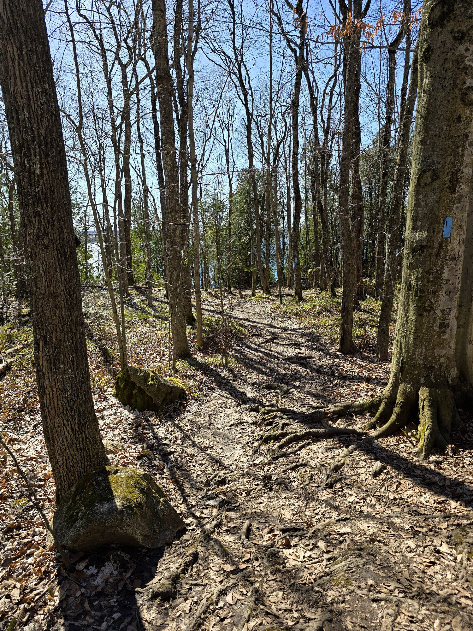
Getting to the Stairs
The sections of trails from the parking lot to the ruins, the ruins to the stairs, and the parking lot to the stairs are all unpaved, but relatively flat.
There’s a lot of mud and poison ivy, so govern yourself accordingly.
Aside from the stop at the ruins, not a lot to see. A nice enough walk through the woods, but nothing to write home about.
Via this trail, you can access the Bruce Trail, or the main loop of the Spirit Rock Trail.
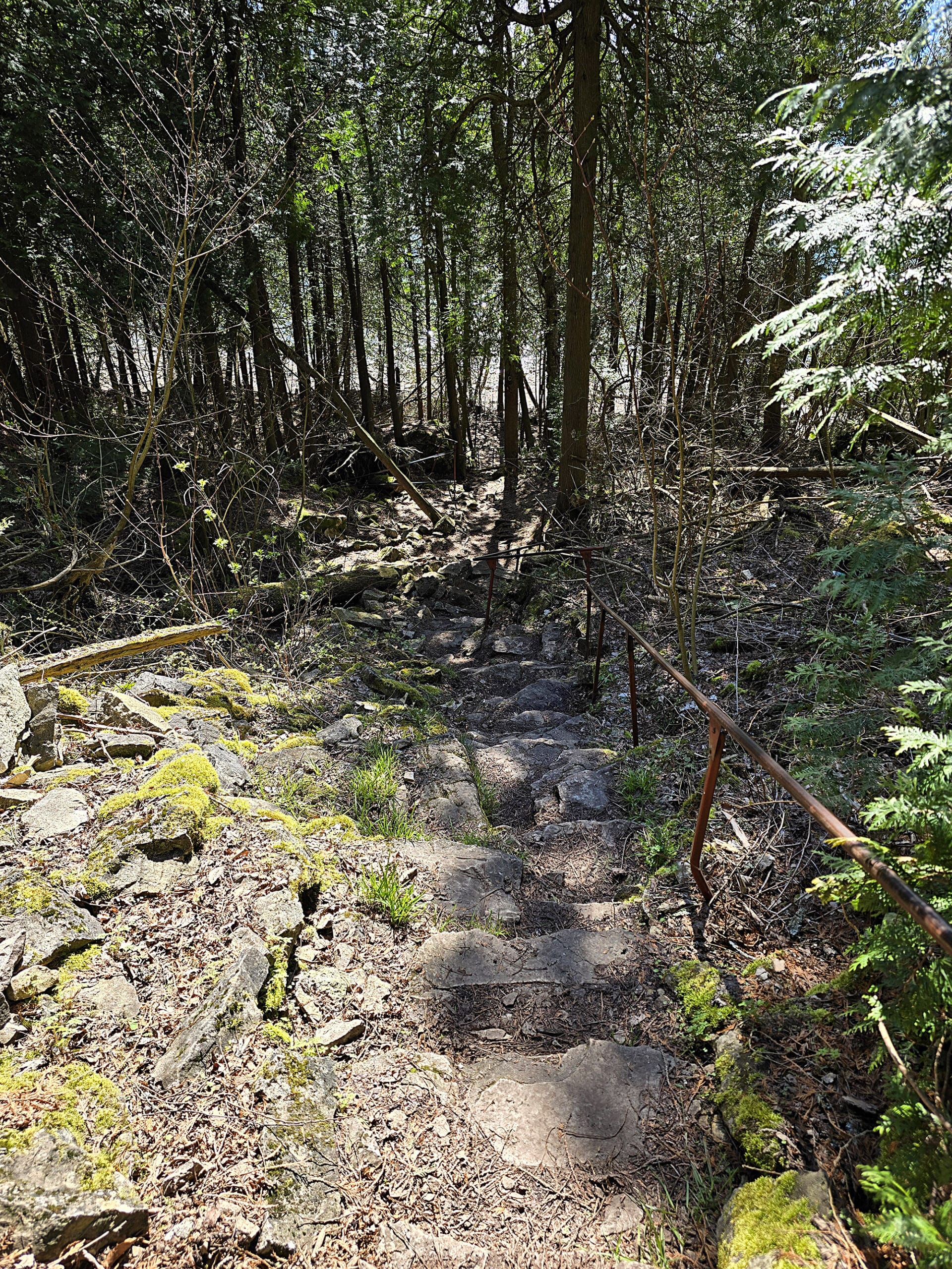
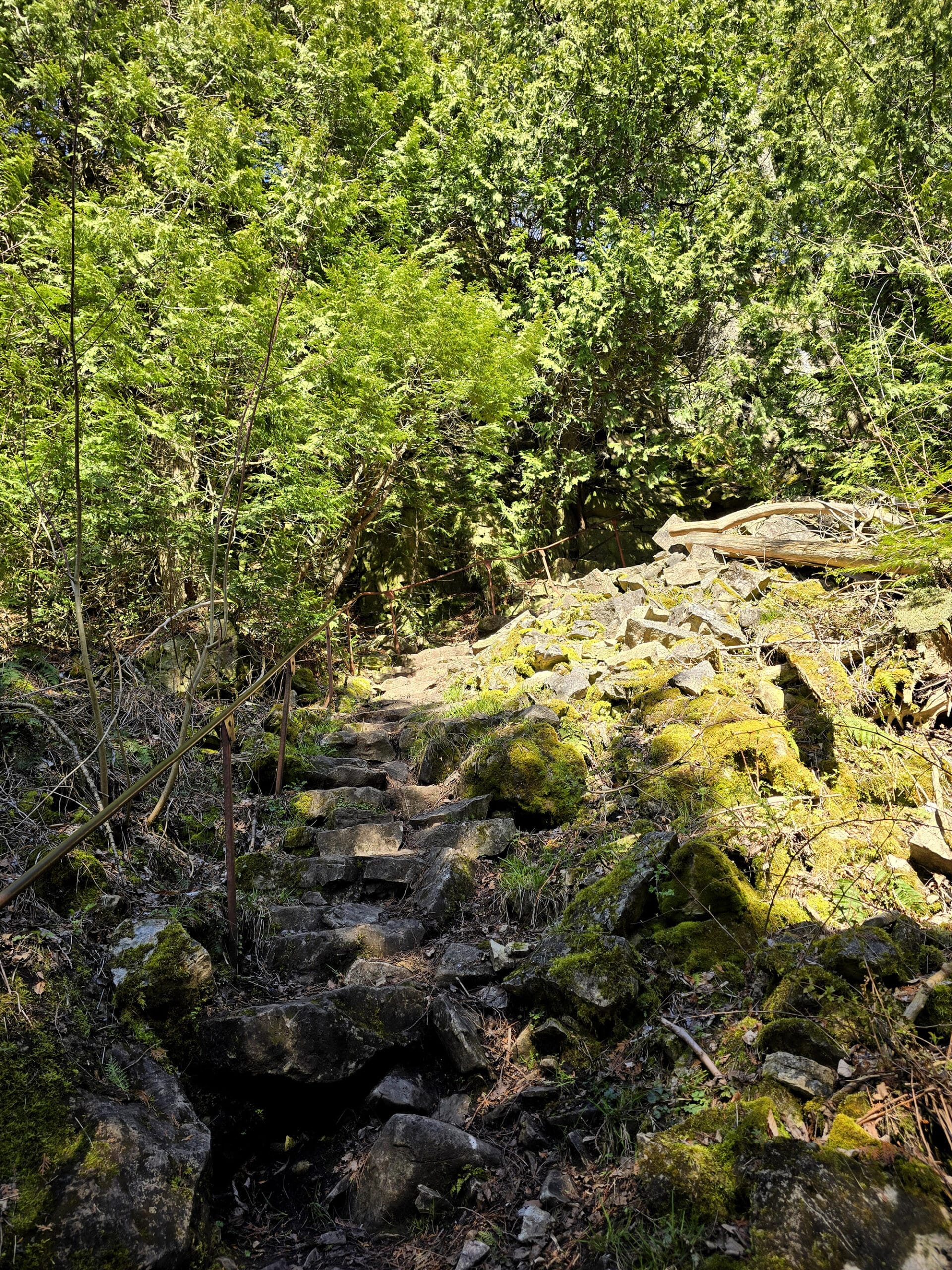
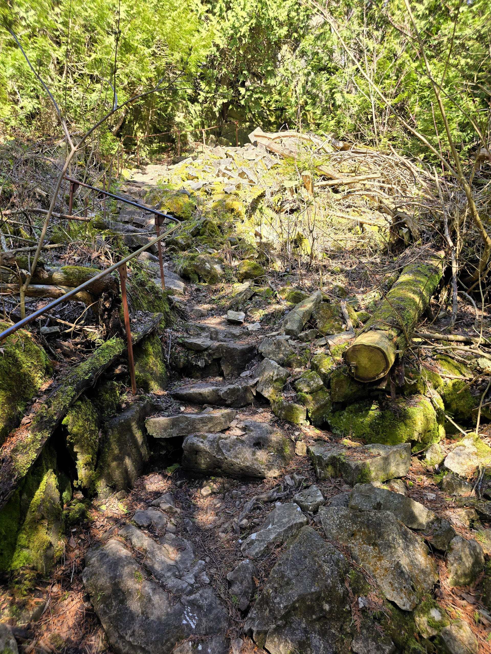
As you approach the stairs, you’ll go downhill, and the terrain gets very uneven and rocky.
This is just a warmup to what you’ll be experiencing at the bottom of the stairs, so if you’re having too much difficulty here, I would NOT recommend proceeding.
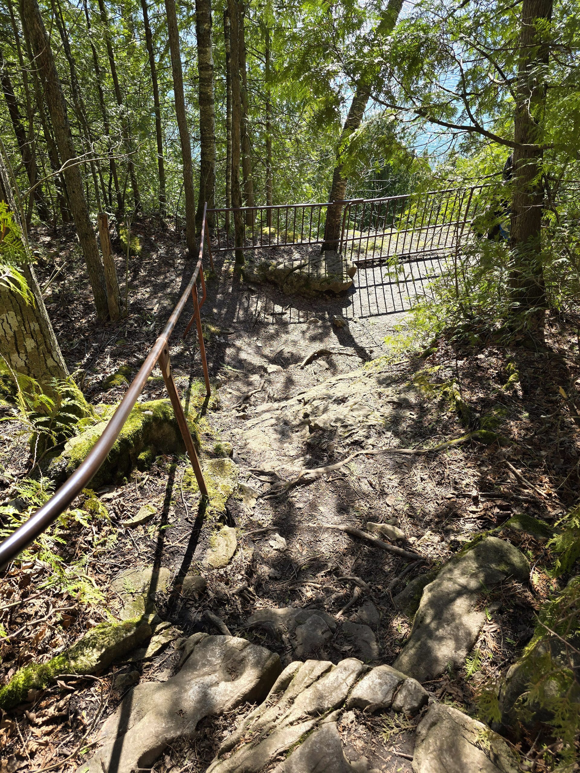
Anyway, once you get down over that short section of rocky area, you’ll come to a bit of a natural platform with a railing. It has an impressive view of Colpoy’s Bay, and down over the hike you’re about to experience:
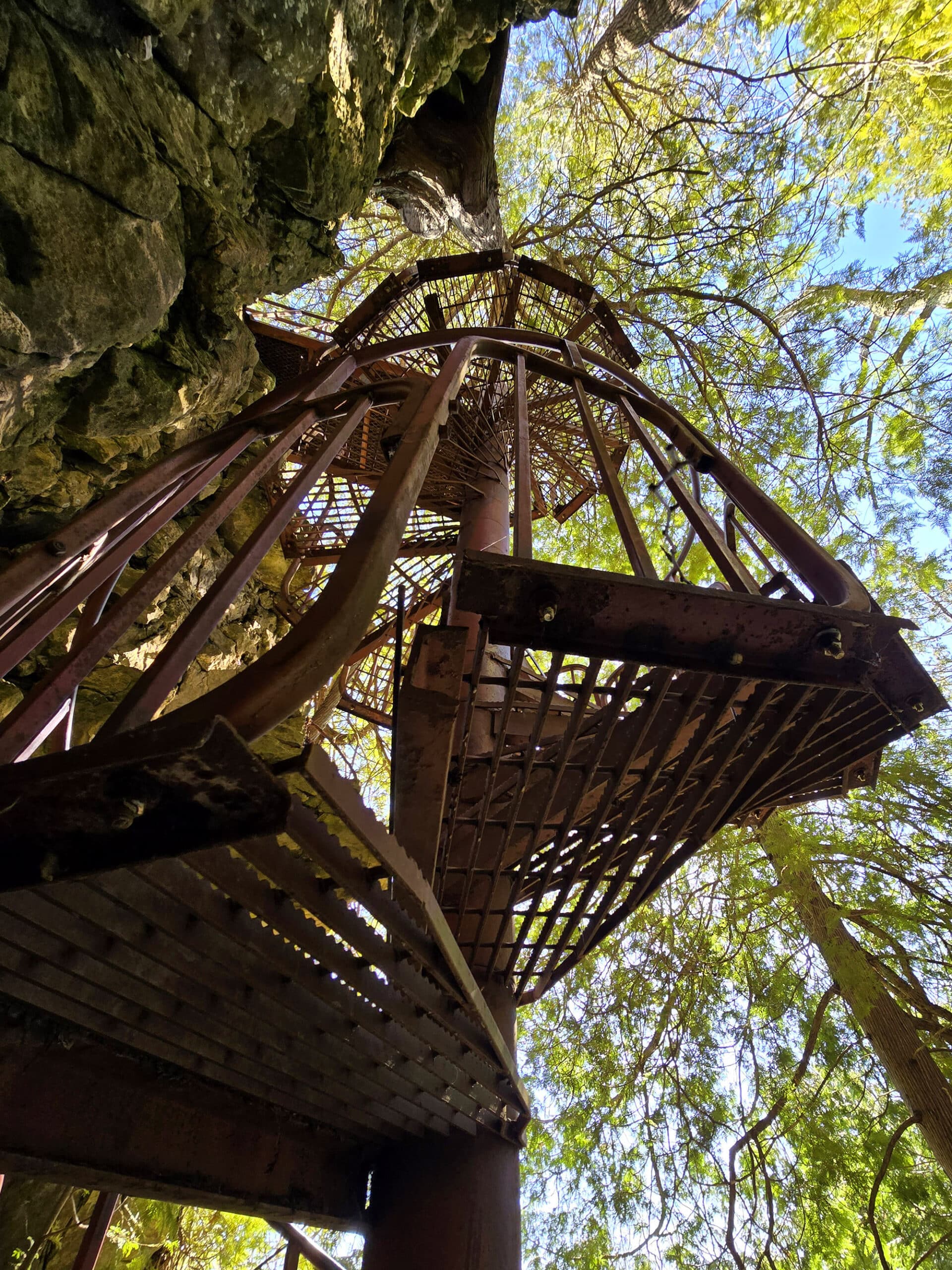
The STAIRS
That platform angles down slightly towards the stairs, at the edge of a steep cliff.
Let’s be real here, in NO WAY do any photos - mine or anything else’s that we saw beforehand - do any justice to this thing.
It was terrifying.
I have SOME degree of issue with heights, but I didn’t even consider that, looking at photos ahead of time. My husband has NO issue with heights, and he found it scary.
Like he didn’t even get onto them before he came back towards me, obviously a little rattled - to say something about how I probably wouldn’t want to do it.
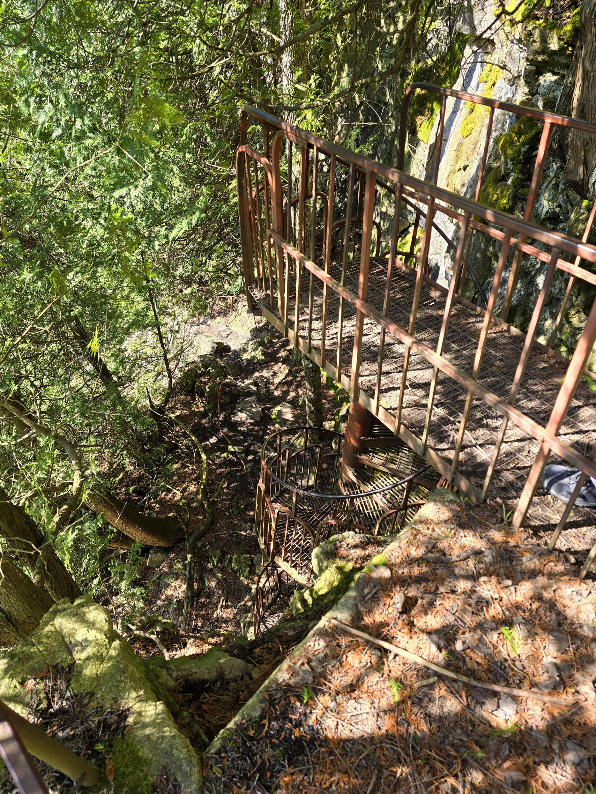
The spiral staircase circles down off the top of the escarpment - it doesn’t look particularly tall, it wasn’t rickety, etc. If it was in a building I don’t think I’d bat an eye.
The spiral is a really tight one - definitely only room for single file - and the fact that you can see down through the steps was a bit disconcerting.
Logically, there was no real reason to be terrified. I can’t explain it. Anyway...
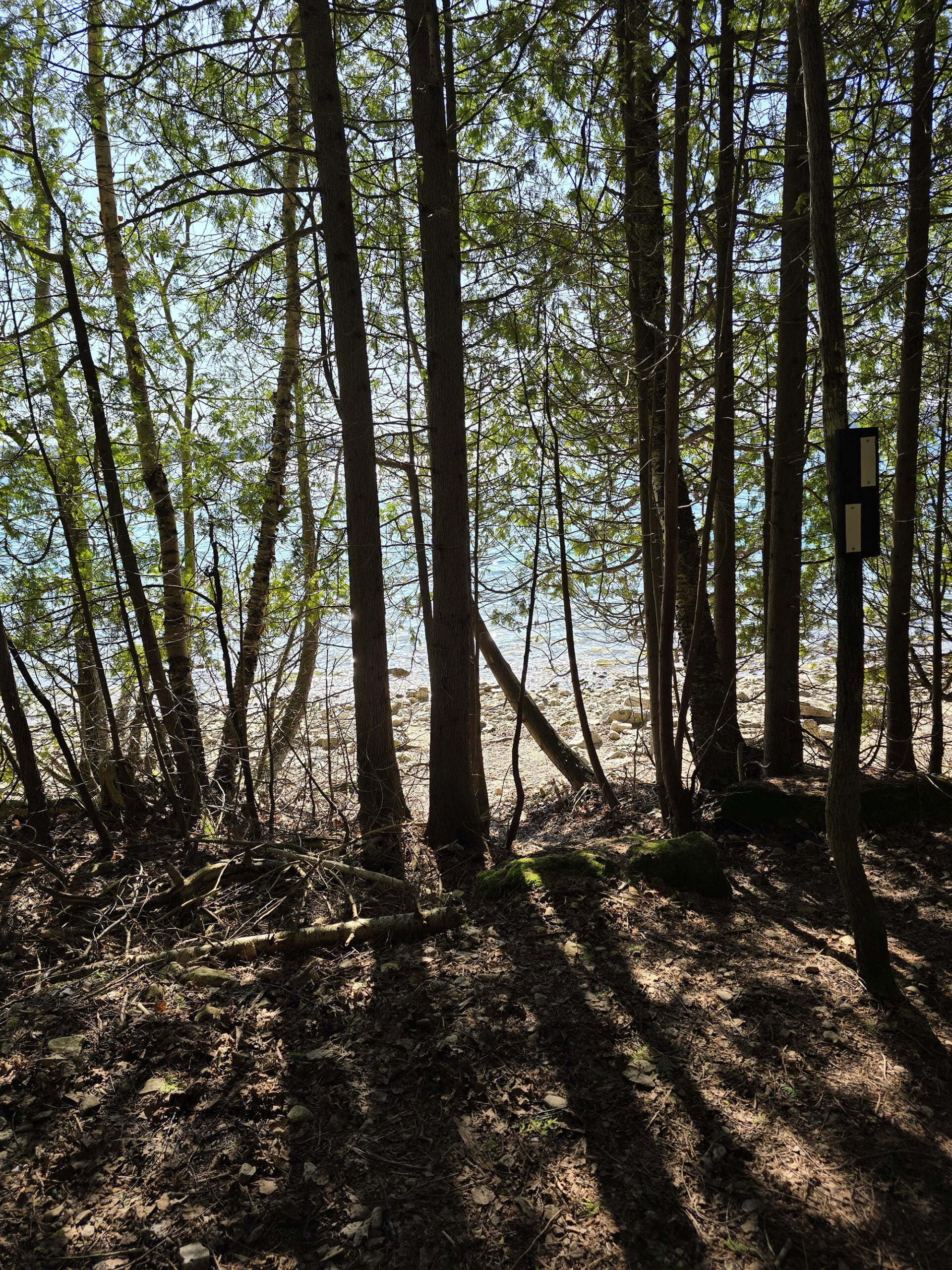
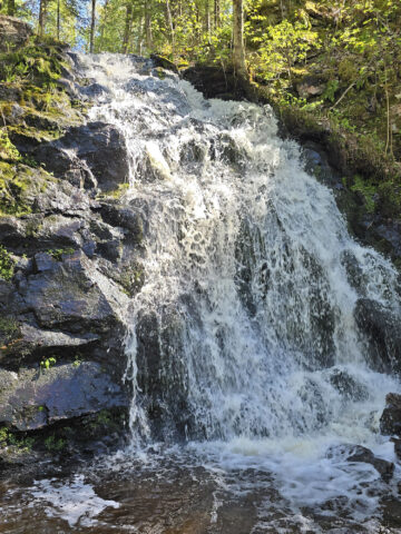
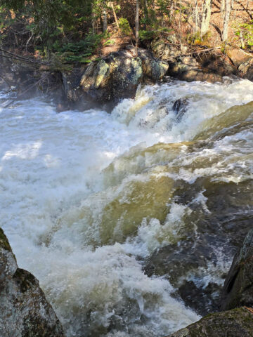
The Path to the Beach
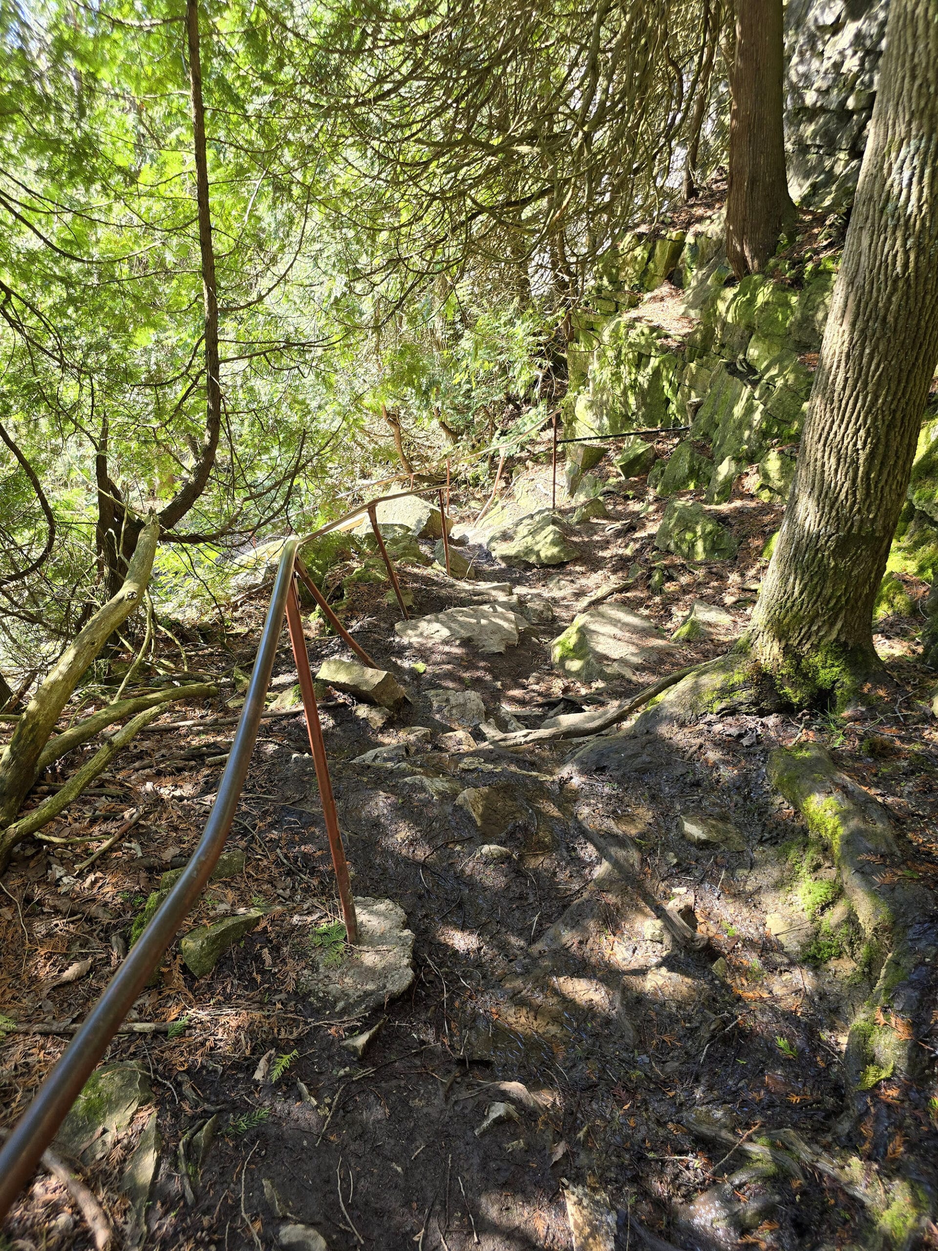
Almost as soon as you hit land at the bottom of the stairs, the path become very steep and rocky - big rocks, some are unstable.
There’s a really wonky hand rail in some places - it’s definitely seen better times. In some places, it’s bent so far off the trail that you can’t even reach it, without going off the main trail.
It’s definitely a workout! Take your time and be really careful where you step!
I’ll talk more about the beach a bit further down in this post.
Anyway, we hung out at the beach for a bit, before heading back the way we came.
If you’re on the short end, or at all out of shape... your quads are going to HATE you for the hike back up to the stairs. Stretch before and after, and maybe don’t make any strenuous plans for the next day!
Spirit Rock Lookout
On the way back to the car, we passed a sign pointing towards Spirit Rock Lookout, and I think it said it was just over 1 km off the trail. (Road? Maybe this was on the road back to the car.)
My quads were already throwing tantrums over the aforementioned walk back to the stairs, so we skipped it on this trip.
Looking forward to it, next time we go - it’s known to have a remarkable view of Colpoy Bay, and legend attached to it.
As the story goes, an Indian maiden fell for the chief of an enemy tribe.
Her family wasn’t thrilled with this, there was drama, so she jumped over the cliff.
A sad story - I’m glad things went better for my great great grandmother! She was the daughter of the chief, fell in love with an American man, and got kicked off the rez.
Thankfully, the two of them just went to live in the woods together, rather than do anything so drastic as to inspire legends 🙂
Anyway, apparently you can sometimes see the maiden’s face in the cliffs, hence the name “Spirit Rock”.
The Ruins
The historical ruins in Spirit Rock Conservation Area involve another sad story.
So, Alexander McNeill was a federal Member of Parliament for the North Bruce riding, back in the late 1800s.
McNeill built a 17-room mansion on this site complete with book-lined walls. Seriously, I want a home with book lined walls.
Anyway, he also collected and displayed ancient weapons and tapestries in this mansion, which he named “The Corran”.
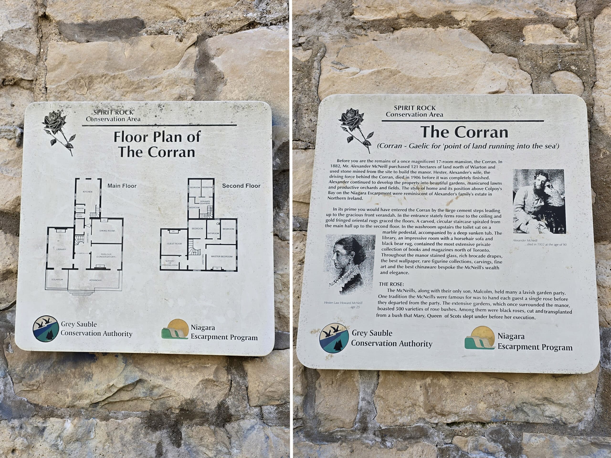
The sad story started before the mansion was even completed, with the death of McNeill’s young wife.
McNeill’s own death led to the downfall of the mansion, with his son partying away his family fortune rather than taking care of the place.
Then he died, willed the estate to a housekeeper, and she sold it to a Toronto resident in 1960 - leading to its eventual demise.
In 1976, they sold the property to the conservation authority.
... it soon burned to the ground, leaving only the stone shell that we see today.
Birding, Wildlife, and Nature
Our visit was shockingly devoid of any sort of wildlife. We saw a single robin, that was it. Not even squirrels!
Not sure if it was a weird time of year? We’ll definitely update this section after our next visit.
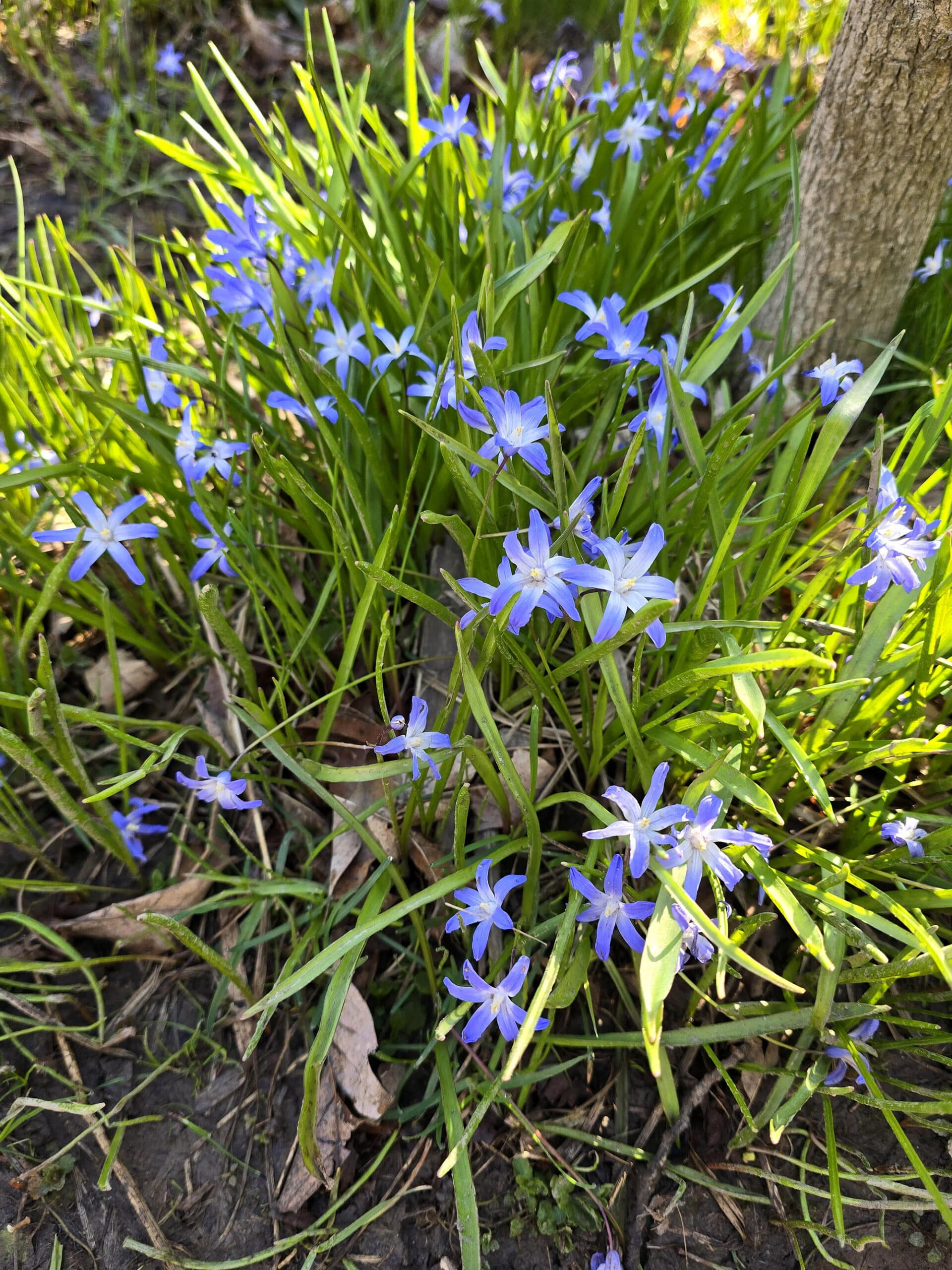
Anyway, what we DID see was flowers - a fair amount of them.
There were a few sections of daffodils out in the woods - seemed random, but I always love a surprise bit of colour while out on a hike!
Also, we saw a type of flower that we had to Google after the fact, as we’d never seen it before: Glory of the Snow (Chionodoxa luciliae).
Boating
While there is ALL kinds of boating in the area, this park is not going to be somewhere for it.
You’re not going to be able to carry any kind of boat down over the stairs or that trail. I suppose you could chuck a small kayak over the edge and hope for the best, but really... might wanna keep things to hiking, here!
There are plenty of boat launches along the shore of Georgian Bay in general, though.
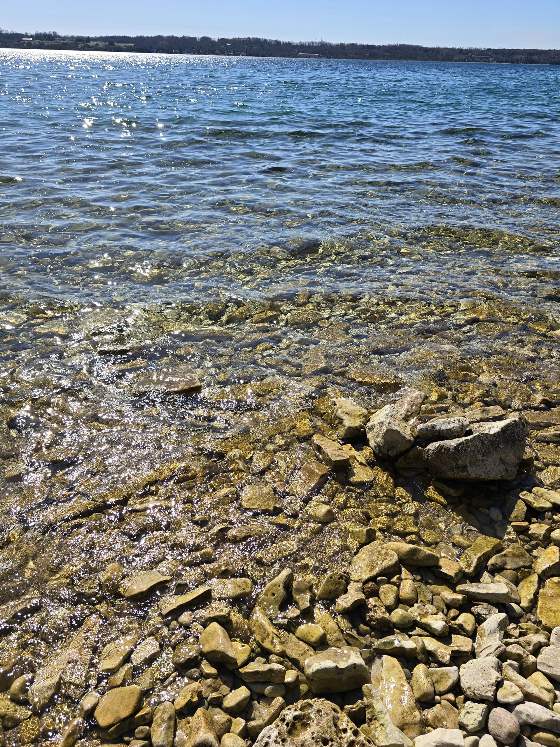
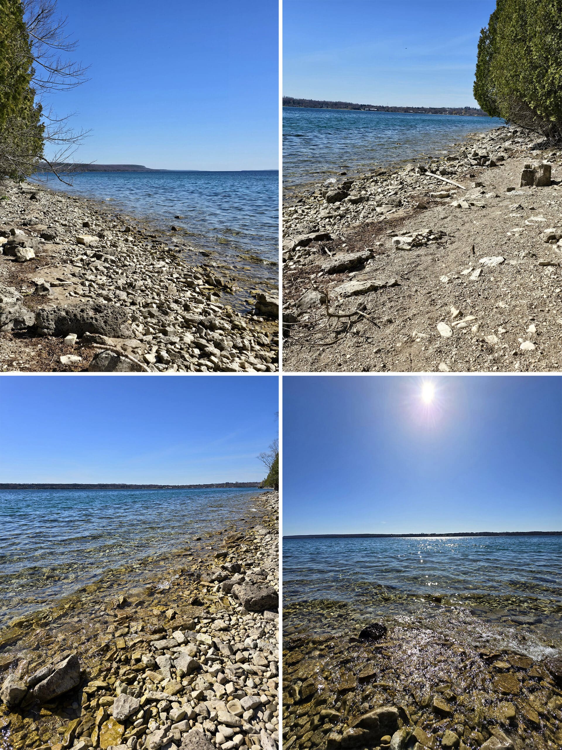
Swimming
We didn’t think to bring water shoes, towels, or anything else, but Colpoy’s Bay looks like a fantastic place to swim.
I kind of doubt it gets very busy on the hidden beach, just given what a hassle it is to get down there.
Next time, we’ll be packing a picnic lunch to enjoy on the water’s edge, as well as the stuff we’d need to go swimming.
Maybe my quads would have been a little bit less pissed off at me, had I dunked them in the water for a while!
Misc
Spirit Rock Conservation area is known for great snowshoeing and cross country skiing, in the winter.
I can totally see that being the case on the main trail - I bet it’s gorgeous in winter!
Also, as a side note: We didn't learn about Bruce's Caves Conservation Area until after we'd left the area.
That's another place that looks really cool to visit, kind of in between Spirit Rock and Big Bay, Ontario. We're definitely planning on checking it out on a future visit!
Final Thoughts
The ruins were interesting to walk through and learn about, the staircase was terrifying, but worth it, and the trail was a fun little adventure.
We definitely feel like we didn’t do the park justice, with our time there. Had we known then, what we know now ... we would have done things a bit different.
Planned to spend more time there, bring stuff (picnic, water shoes, etc) to enjoy the beach, and do the lookout walk first.
Well, basically do anything we want to do, first, because the walk to and from the beach definitely did me in for the day!
Overall, we’re really glad we made the trip, and will definitely be back!
More Places to See
Looking for some nice sights to see and great places to visit while you're out on your camping adventures? Here are a few of our favourite day use parks, attractions, etc.
Batchawana Bay
Big Bay, Ontario
Bruce Peninsula National Park
Cheltenham Badlands
Devil's Monument, Bruce Peninsula
Keith McLean Conservation Lands
Point Pelee National Park
Temagami Fire Tower
Thanks for Reading!If you loved this post - or have any questions about it - please leave a comment below! We'd also love it if you would consider sharing the link on social media! |


Leave a Reply