
Charleston Lake Provincial Park is a fantastic campground in Southeastern Ontario, with a LOT to offer. Here's everything you need to know!

We’d been to a few of the southeastern Ontario Provincial Parks - Bon Echo Provincial Park, Bonnechere Provincial Park, Ferris Provincial Park, Presqu'ile Provincial Park, Sandbanks Provincial Park, and Silent Lake Provincial Park.
... but aside from a less than amazing stay at Rideau River Provincial Park, we hadn’t really been EAST in Ontario.
Charleston Lake Provincial Park was the first stop on our little tour of new-to-us Provincial Parks.
The whole area is in an extension of the Canadian Shield, which made for some great hiking trails though varying types of forest landscape.
The birding opportunities were great, and we even had some downtime to shoot a few camping recipes for this blog, as the weather was generally nice.
We had a fantastic time at the park, so why don’t we go ahead and tell you all about it!
The Basics:
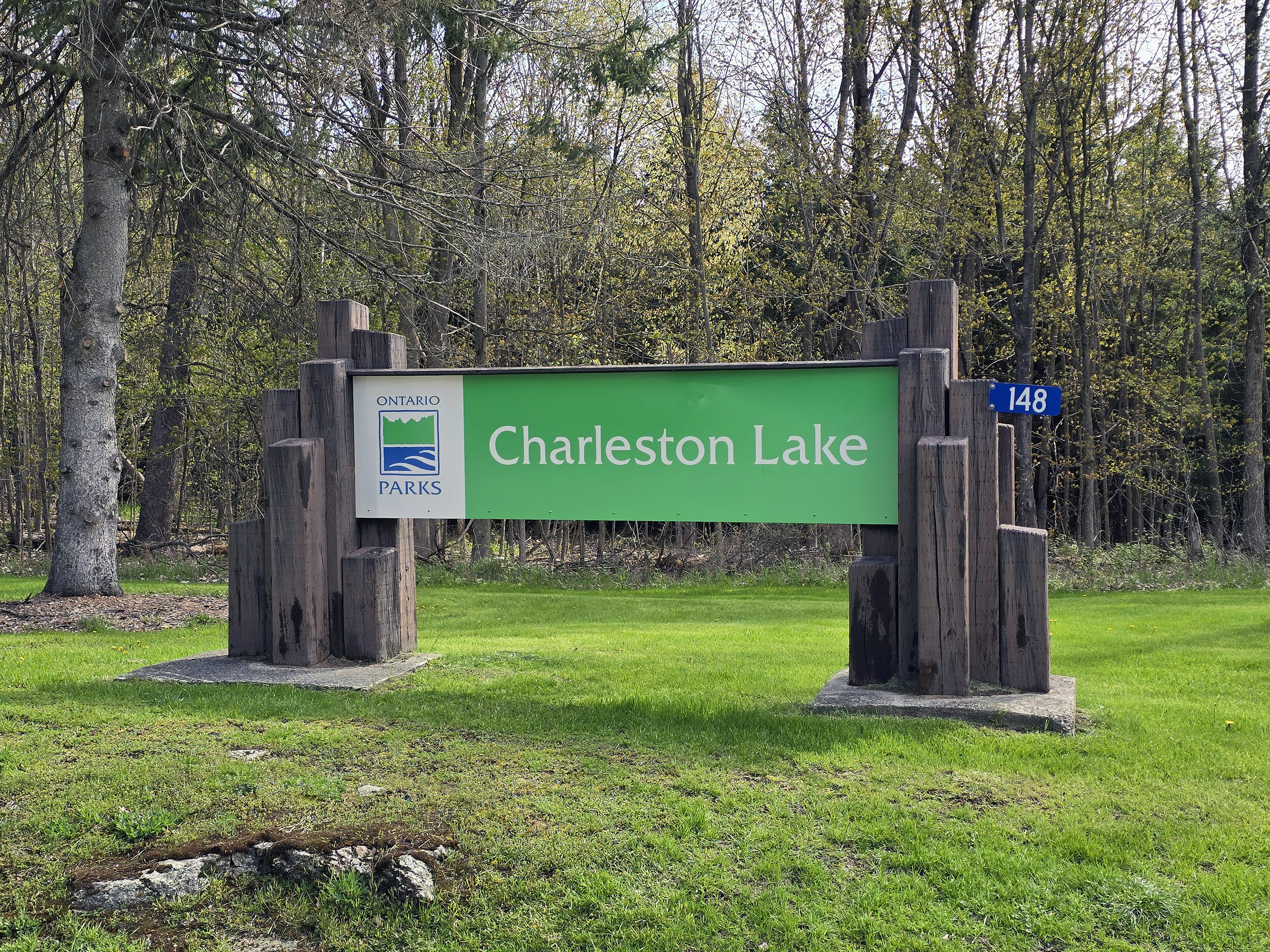
Campground Name: Charleston Lake Provincial Park
Address: 148 Woodvale Rd. Lansdowne, ON K0E 1L0
Website: https://www.ontarioparks.ca/park/charlestonlake
Price: Ontario Provincial Parks uses a pricing matrix across all their parks. See 2026 Camping Fees for more details.
Reservations: Ontario Parks Reservations
Park Classification: Natural Environment
Operating Season: May 8, 2026 to October 18, 2026
Park Warden Phone Number: 613 484 8352
Logistics
Some basic information to help you plan your stay at Charleston Lake Provincial Park:
Registration and Check In
We showed up just before 2:00 on opening day of the 2026 camping season, having done the online check in earlier that morning.
The in-person check-in happens via a small gatehouse building, and service was quick and easy as usual
Interestingly, there's a sign out front that says only two people allowed in at a time. It's been a few years since we've seen that, so it stuck out to us.
Nice to see, though!

Maps and Signage
Some information to help you get around Charleston Lake Provincial Park.
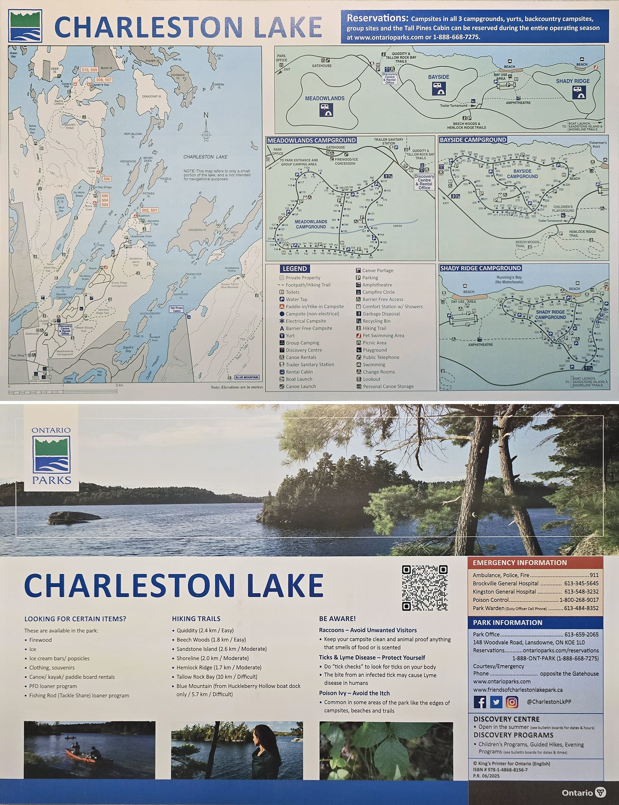
Park Map
Overall, the map is pretty good - full colour, 11 x 17" handout with one full side of the sheet dedicated to campground and park overview maps.
There’s a ton of information there, neatly laid out, with a lot of colour / shape coding on the various types of campsite.
Charleston Lake gets a bonus point for actually having accessibility information right on the map - sad to say it’s not the norm!
Anyway, the park’s website has a couple of online maps - Charleston Lake Provincial Park Map and Charleston Lake Provincial Park Trails Map
Signage
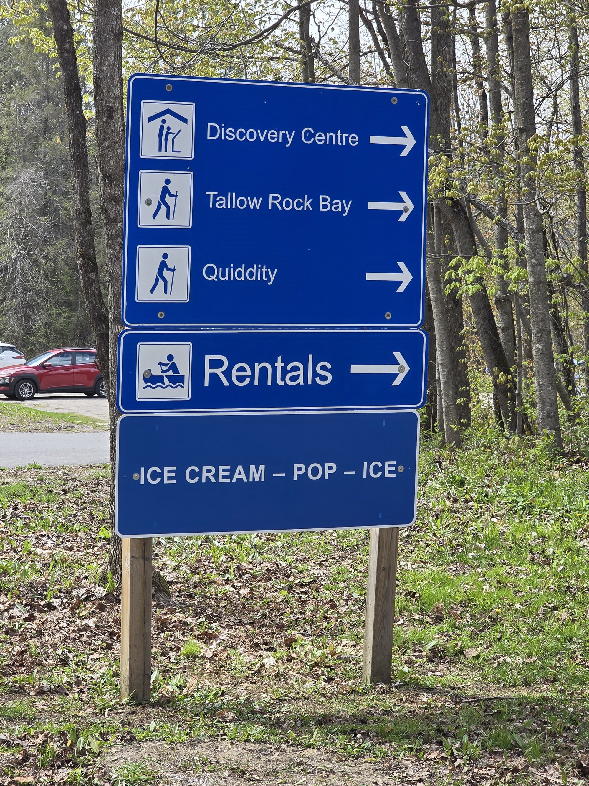
Overall, the signage in the park is good. Large, well-placed directional signage on the roads, that are high contrast and easy to read!
The trails are generally well-blazed, and there’s a lot of great information posted in key areas, like trailheads and comfort stations.
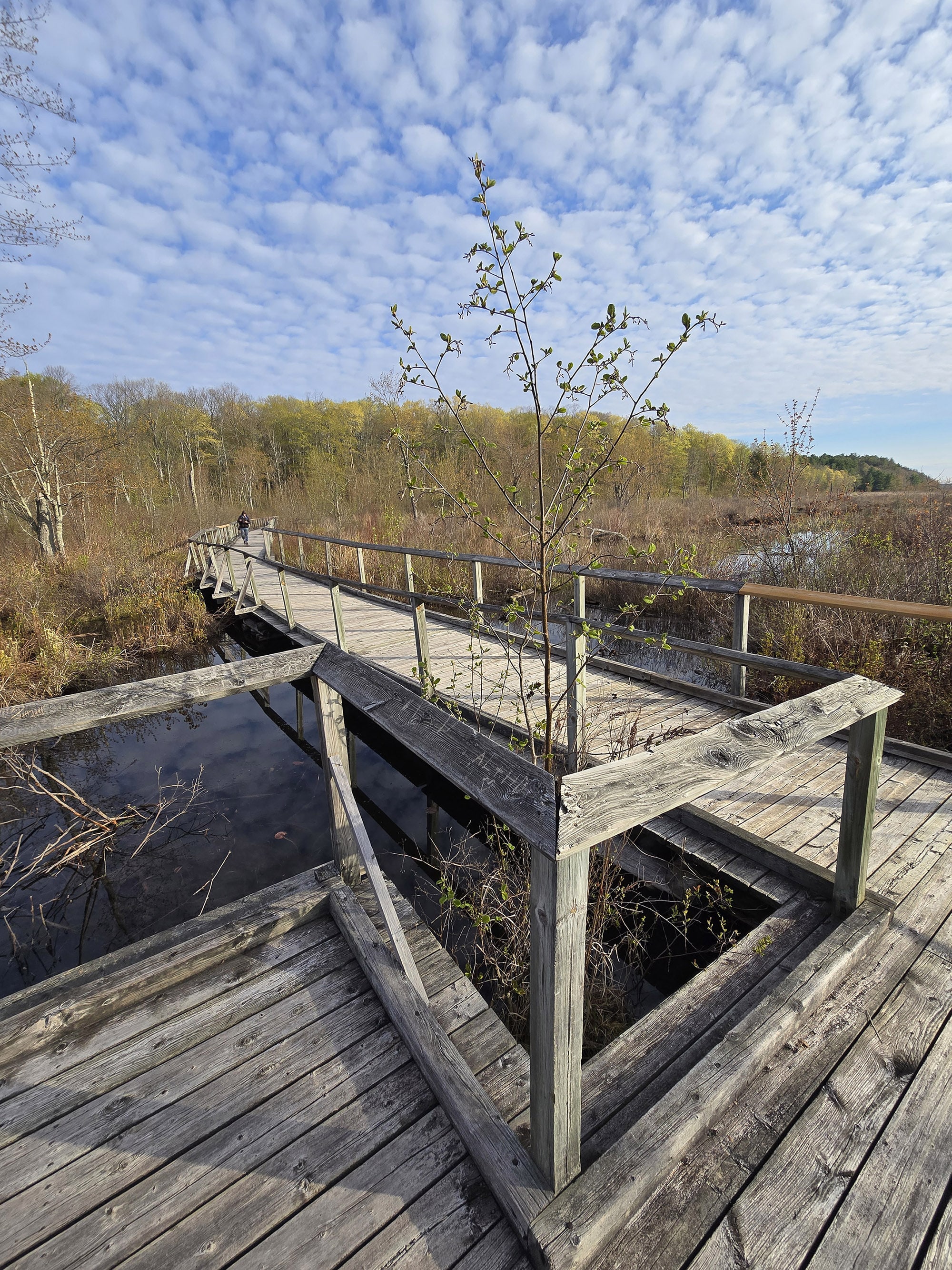
For example, signage at the Quiddity Trail parking lot let hikers know about the trail conditions - that they were in good condition, had some wet and muddy areas, and could be slippery when frosty, and that the bridge on Tallow Rock Trail was out. Love to see it!
Per the map, the trail splits immediately after the boardwalk, with Quiddity off to the right, and Tallow Rock to the left.
When we got to that split, there was NO signage, but a single trail blaze on a tree to the left. We consulted Pokemon Go (a wildly accurate trail map!), and it looked like the actual split was further along the trail.
So we went to the right - the one without the trail blaze! - and soon came upon the actual trail split, with directional signage.
There was also another side trail - a portage - in there nearby. Neither that - nor the blazed trail to the left at the end of the boardwalk - were even on the map.
Also - on the back side of that directional signage - an arrow seemed to indicate that the (fairly overgrown) portage was the way back to the parking lot, rather than the wide, well packed, obviously well traveled path we’d just walked up.

Water & Waste Services
The trailer sanitation station is on the left, very soon after you pass the gatehouse. It definitely seems to be geared for those leaving the park - including a “goodbye!” type sign - but it can be accessed from either direction.
It’s a 2 lane set up - no bypass lane for either one. You start off with 3 water fill platforms (one on either side of the two lanes, and one in between them).
Each of the water hoses has a splitter, with both a threaded connection, and an unthreaded connection.
This style of hose is more likely to rest against the post, so maybe aren’t quite as sanitary as the regular kinds - you might want to plan to clean off the hose end you’ll use.
Anyway, after the fill platforms, there are 2 dump platforms, both on the driver’s side.

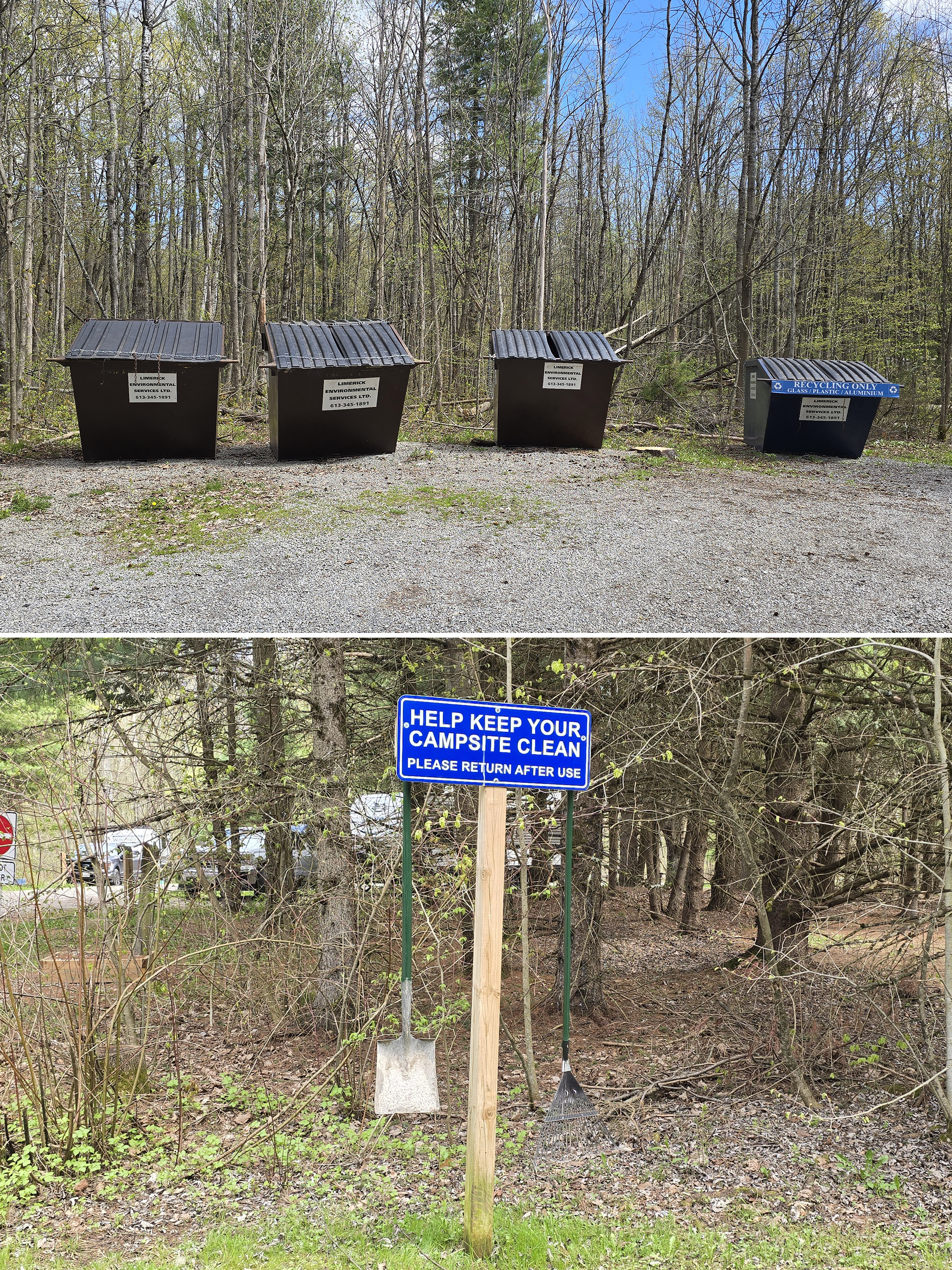
In terms of garbage and recycling, each campground has a nice big garbage and recycling depot at the entrance. Nice and convenient - unlike Presqu'ile Provincial Park!
Speaking of convenient, each of the campgrounds has a little campsite cleaning equipment station, each with a rake and a shovel for campers to borrow.
Connectivity
We'd heard that there was absolutely no internet in Charleston Lake Provincial Park... but that was not the case for us.
We’re on Rogers Wireless, and had decent-to-good cell phone reception throughout most of the campgrounds and on the trails. We were even able to stream TV.
We did not venture out to any of the further reaches of the park - like the far end of the Tallow Rock Trail, or any of the canoe-in sites - so your mileage may vary in those areas.
Accessibility
Charleston Lake Provincial Park is one of those parks that’s a weird mix of really accessible, and really... not.
Loads to talk about, so let’s look at it in sections:
Accessibility Basics
First, let’s talk accessibility information!
The website does not have a lot of information about the accessibility of the park, and really undersells itself on that front. All it mentions is that the comfort stations, yurts, and beginning of Tallow Rock Bay trail are barrier free, and that there’s a wheelchair available to borrow.
... that leaves out a TON of information, as you’ll soon see! I wish that Ontario Parks would realize that information is an accessibility issue, and lack of info is a barrier.
Anyway, on that note ... the park map actually does have accessible facilities marked on it.
Beyond that, one big thing to note is that while facilities themselves are accessible, the routes to them may not always be.
The thing is, the campground roads are narrow and in really, really bad shape - they might technically be passable on a wheelchair, but they’re definitely not wheelchair FRIENDLY, and probably not all that safe.
Some of the barrier free campsites are located a fair distance from the comfort stations, and require travel on those roads. More on that in a bit, though!

Accessible Facilities
The gatehouse is quite small, but the path to it is wheelchair accessible, and there’s enough room to turn around in there.
The Discovery Centre was not open at the time of our visit, but there was a ramp up to it on the outside. The amphitheatre, though, requires traveling along trails a bit of a distance to get there, and at least one path involves stairs.

Row 2: Standard Accessible Shower & Washroom Stall
Row 3: The Barrier-Free Outhouse in Bayside Campground
In addition to the comfort stations, Bayside Campground has (what I believe to be) the only barrier-free outhouse in the park. It’s the only one we saw, and the only one designated as such on the map.
The washrooms in there have actual flush toilets, rather than vault toilets.

Row 2: Site 357 in Shady Ridge
Row 3: Site 371 in Shady Ridge
Barrier-Free Camping
Two of the three campgrounds have barrier-free campsites available - Bayside and Shady Ridge, with 2 campsites in each.
Each of the barrier-free campsites has the wheelchair-accommodating style of picnic table, but a regular fire pit - not the elevated kind that some barrier-free campsites have.
They also each have their own water tap, right in the site. I mean IN the site - near the back - so it’s not something that should be inviting people to trespass to use it. I’ve never seen this at any Provincial Park campground, I like it!
Anyway, of the two campgrounds, I would say that the barrier-free sites in Shady Ridge are more wheelchair friendly. They’re MUCH closer to the comfort station - more or less adjacent to it. There is a bit of a hill to get up, but it’s a short trail in decent shape.
The situation at the Bayside Campground is just... weird. The two barrier-free campsites are on the outer loop of campground road.
To get to the comfort station, you have to up a short way up that road, turn onto the cut-through road, pass ANOTHER campsite (not barrier-free), then go up a 50 m long hill to get there... with the roads in bad shape.

Accessible Activities
The path from Bayside campground to the main beach is wide, well packed, and wheelchair accessible.
There’s also a path down from the day use parking area above - the trail there is also wide, well packed, etc... and has a nice ramp and the bottom, to get you down to the actual beach area.
As a note there's actually two paths from the day use parking area. The path to the left as you're leaving the parking lot is the accessible one, the path to the right takes you to a viewing platform that has stairs going down.
The beach itself does not have any accessibility features - there are no wheelchair accessible picnic tables, and there was no MobiMat - at least at the time of our visit.
As previously mentioned, though, the park has a beach wheelchair available to borrow (with a refundable deposit).

The fish cleaning hut is up a steep flight of stairs, and neither the boat launch nor the canoe launch have those barrier-free launch facilities that we’ve seen at some parks.
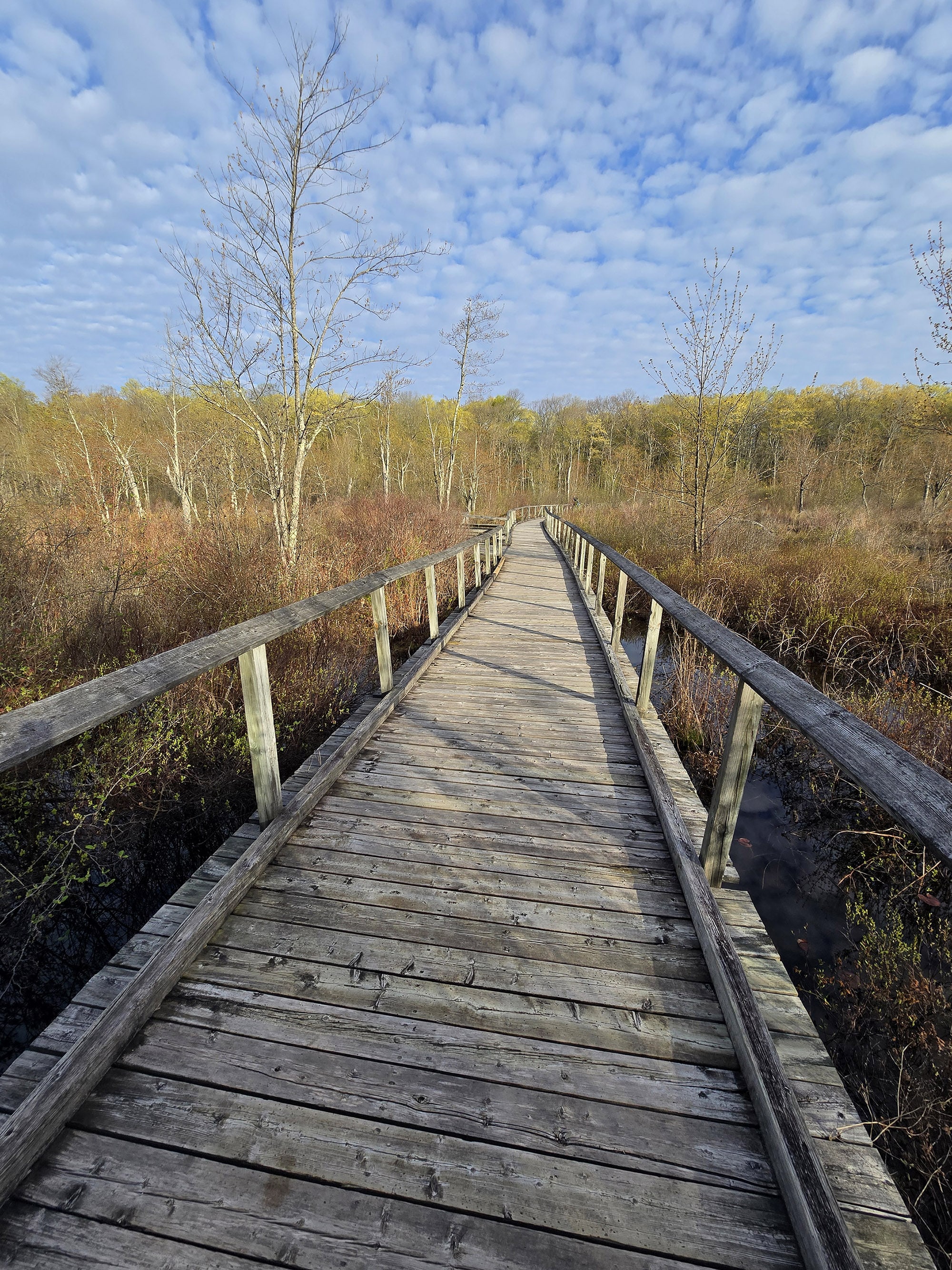
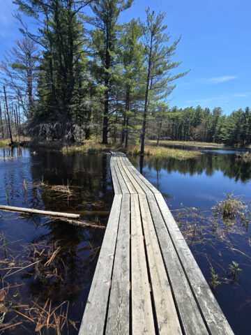
There is a single wheelchair accessible trail in the park - the beginning section of the Tallow Rock Bay Trail / Quiddity Trail.
It starts out as a wide, flat, well packed and level trail, and soon comes to the first of a couple boardwalk sections. The trail itself and the boardwalk are actually in great shape, definitely wheelchair friendly.
Some of the park information says it’s the first 300 metres of that trail - it’s actually further than that, about 500 meters to the end of the second boardwalk.
As far as the difficulty / accessibility of other trails, we’ll cover that in the hiking section, in a bit!
Pets
Dogs are allowed in the park - and there were a ton of them during our stay - with all of the standard rules applying.
They have to be leashed at all times, picked up after, and their droppings need to be properly disposed of. They aren’t allowed to be left alone on sites, or allowed to harass other campers or animals.
Dogs are not allowed on either the main beach or the Shady Ridge Campground Beach. That said, there’s a small dog beach off to the right of the Shady Ridge beach, as you’re approaching from the road.
A cute little path takes you to a more secluded beach, with picnic tables. There are two water access points in the area - the first has some large stone steps down, and might be difficult for smaller dogs.
Just beyond that, the second area has a nice shallow approach that would be great for any size dog.
It’s a really cute area, with a great view of the surrounding water and islands.
Also: While there’s a dog poop baggie dispenser at the trailhead for Quiddity Trail, weirdly doesn’t seem to be one by the dog beach. There’s a garbage bin, though.
Finally, Yurt 315C allows dogs.

Parking
For the most part, there seems to be plenty of parking at the main visitor areas in Charleston Lake Provincial Park.
One thing to keep in mind, though, is that the trailhead parking can be pretty limited - and it got pretty busy at the time of our visit.
Also, the trail head for the Sandstone Island Trail shares parking with the boat launch - there’s trailer parking up there. It’s off a half loop from the main road - one lane, in and out.
Unfortunately, it’s not marked as one way. Getting up to/from there from the boat launch involve going around a corner without sight the whole way, so it could get awkward if trailers are trying to get in and out at the same time!
Miscellaneous
Just a few random notes here:
1. Charleston Lake is in an area with VERY little light pollution, so it’s generally a good place to do some stargazing. The best place to view would be if you have one of the walk-in sites #501 or #502. The picnic area on the Shoreline Trail - nearby - would be good in theory, but the trail is a bit much to take on in the dark.
So, we’d probably see what we could see from the main boat launch.
2. On that note, the campgrounds themselves are heavily treed. If you’re looking to be able to utilize solar power, you’re definitely going to want to pay attention to the campsite notes on the reservations portal - very few sites have much in the way of direct sunlight.
3. The roads through the campgrounds are in generally poor shape.
High centering, chunks washed away, sections of exposed underlayment, etc. In places, both sides of the road appears to have broken off/washed away, about ½ of the actual width!
You’re not going to lose a tire or anything, but something to keep in mind!

Campground Amenities & Info
Here’s some basic information about the amenities at Charleston Lake Provincial Park:
Creature Comforts
Each campground has at least one comfort station, with Meadowlands having two.
The comfort stations are all pretty modern - according to the park’s website, they were replaced about 15 years ago.
They more or less look the same - we didn’t take a super close look, but I wouldn’t be surprised if they’re all the exact same design.
Each has washrooms, showers - including a barrier-free shower, and laundry facilities.
In the laundry room we checked out, it’s $3.50 per load, and the machine will only take 3 loonies and 2 quarters. I wouldn’t doubt that to be the same across all the comfort stations.

There are also change rooms at both beaches.

Row 2: Bayside Comfort Station, Bayside Accessible Outhouse
Row 3: Shady Ridge Comfort Station, More Outhouses
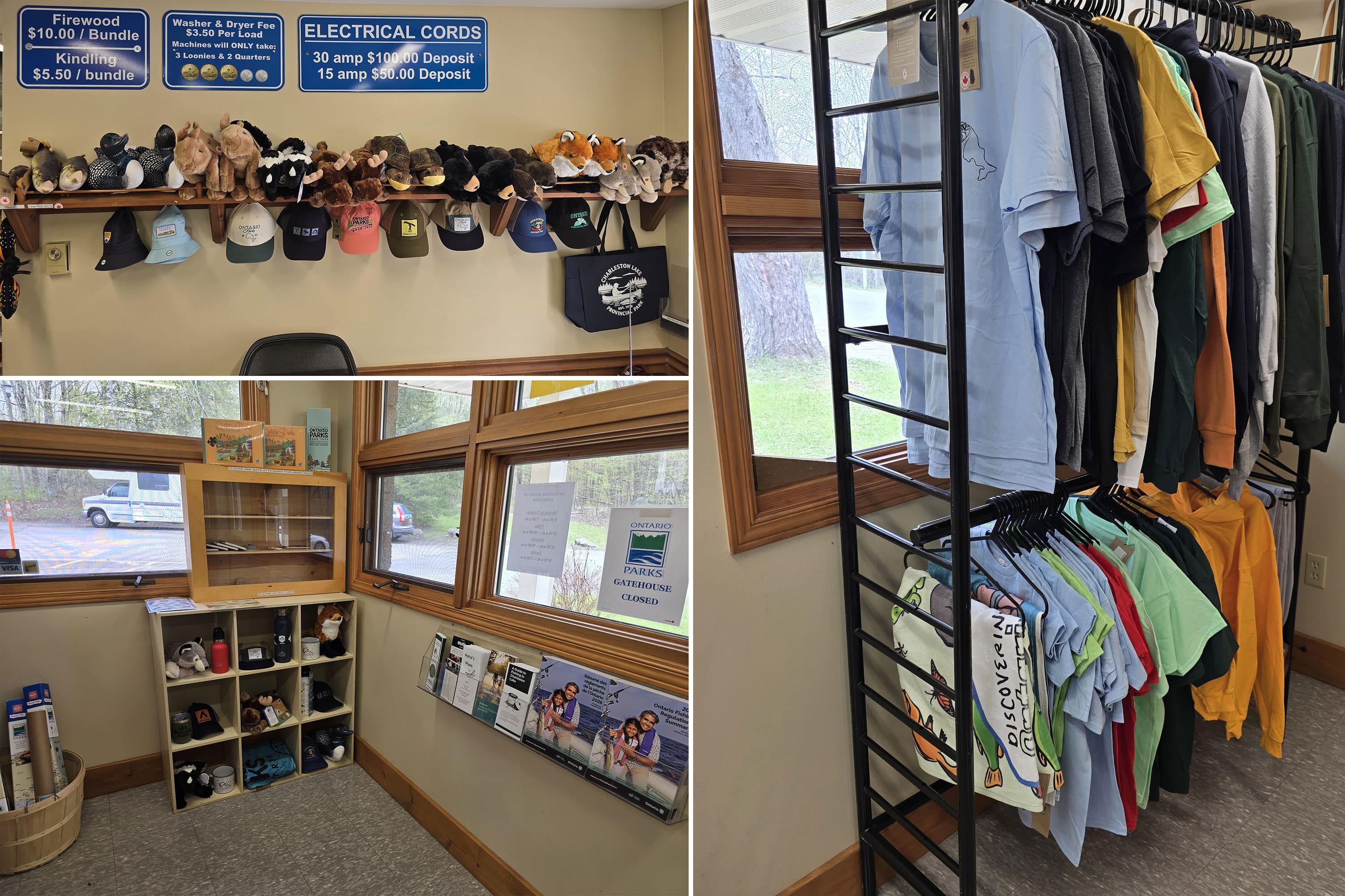
Park Store
There’s a small park store setup inside the gatehouse.
It wasn't so much an organized store like we see in some gate houses, but more like a few racks and shelves in a gate house, if that makes sense.
Just a few clothing items, firewood, souvenirs, stuffed animals, etc. We didn’t see anything in terms of snacks or drinks there.
There was also a sign pointing towards the rental office that said “ice cream, pop, ice”, so I guess that’s where you can go for some refreshments.
Visitor Centre
The Charleston Lake visitor center is called the “Discovery Centre”, located next to the trailer sanitation station / Quiddity Trail head.
The Discovery Center didn’t seem to be operational at the time of our stay - they rarely are, this early in the season!
The park’s website mentioned that this nature centre is host to their Natural Heritage Education program and other events, and features displays.
They even have a Black Rat snake that you can see - during peak season only, though!

Day Use Area
There are a few picnic areas scattered throughout the park.
The main day use area seems to be at the main beach, which also has a playground nearby. There are a few picnic tables, that’s about it. Same with the Shady Ridge campground beach.
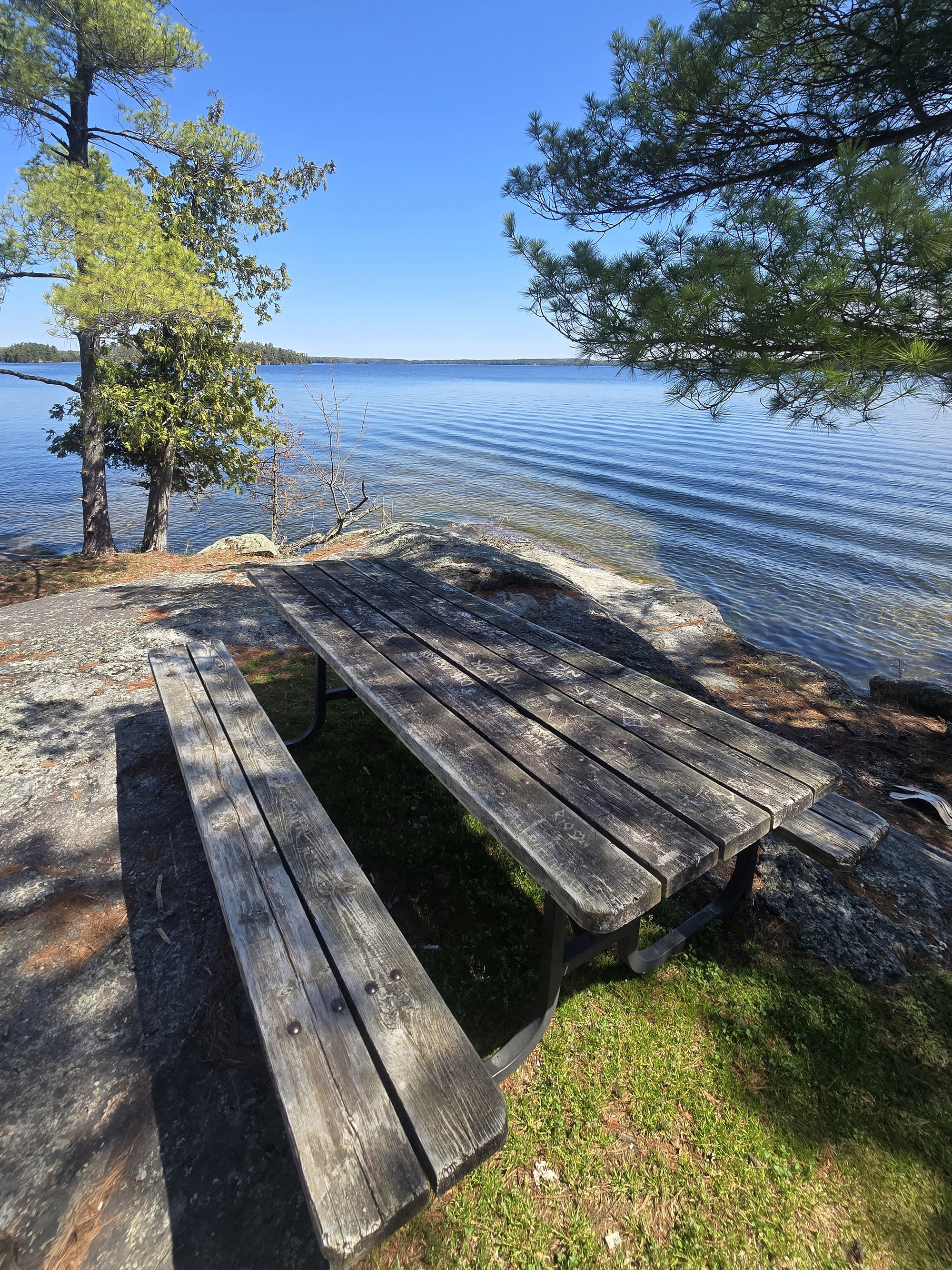
A MUCH more gorgeous and inviting picnic area is at the boat launch. There are several picnic tables - and a couple of hibachi grills - along the water there, with amazing views.
This is 100% where we’d choose to picnic.
Anyway, beyond that, there are also some picnic tables on a grassy area along the parking lot between the Tallow Rock Bay Trail / Quiddity Trail head and the Discovery Centre.
There’s also a sign there saying that it’s the future site of a picnic shelter. Donations towards that effort can be made at https://friendsofcharlestonlakepark.org/.

Rentals
Charleston Lake Provincial Park has canoes and kayaks available for rent. Where you go for them depends on the time of year you’re visiting:
There’s a rentals office behind the Discovery Centre that operates from mid-June until Labour Day (8am-8pm).
If you’re camping during the shoulder seasons - spring or fall - you can arrange your rentals at the gatehouse or main campground office.
The nice thing is that there are multiple rental racks in the campground, so you have some choice of where you pick up - and put in.
We saw them at the main day use beach, the Shady Ridge Campground beach, and at the main boat launch.
There was a sign at the day use beach rentals area with all of the pricing info, and a mention that the park is also park of the OFAH Tackleshare Program, which loans out fishing equipment, free of charge.

Campsite Details
You have a few different options when it comes to camping styles at Charleston Lake Provincial Park: Car Camping, Backcountry Camping, Yurt Rental, Group Camping, as well as a single cabin available to rent.
Here’s some more specific info:
Car Camping
We stayed in the Bayside Campground, one of three campgrounds in Charleston Lake Provincial Park. The other two are the Shady Ridge Campground and the Meadowlands Campground.
Each campground had a mix of electrical sites and non-electrical sites, and - as always - each site had a picnic table and fire pit.
Overall, they all mostly had the same vibe - Meadowlands had a younger forest and some sites were more open and sunny, Bayside had a handful of sites with waterfront views, but that’s really it for differences.
Overall, each campground was pretty well-treed, with a fair amount of sites backing on to some cool boulders or rock faces.
There wasn’t a ton of actual privacy, but there seemed to be enough distance / tree separation to not notice that.

Backcountry Camping
Charleston Lake Provincial Park has several backcountry campsites, requiring wildly different degrees of effort to get to!
First of all, there are a couple of walk-in sites along the Shoreline Trail. These are definitely the easiest access, with less than 1 km of a walk to get to them.
For those who want an ADVENTURE to get to their backcountry site, there are more along the Tallow Rock Bay Trail - the easiest to get to are 3km out, with others being 5+ km to get to - one way.
Each backcountry campsite seems to be accessible by water, as well - and the sites we saw were all super cute!
The ones we saw all had 2 or 3 wooden deck tent platforms, a fire pit, a picnic table, and its own - enclosed - privy.

Group Camping
There are 3 group campsites at Charleston Lake Provincial Park. They’re located in a cluster, down a short road just outside of the main park. It’s not a long drive, though.
The road through the campground area is in really good shape, which tends to be an anomaly in the group campgrounds we tend to see!
The first campground - 401 - is wide open, sunny, and has its own parking lot.
Sites 402 and 403 are located just beyond that - visually separated from the 401 site, but not each other. These two share a parking lot, with a campground located on either end of it.
I could see this being a great option if you had more than the 40 people that each single group campsite can accommodate.
Anyway, the #402 site MIGHT have some kind of water access - I could see water behind it, but didn’t want to walk through the site to investigate.
It’s the only one that had a visible body of water there, though.
Each of the sites has a covered picnic shelter and a fire pit, with a potable water tap and vault toilets adjacent to it. They’re all non-electric sites.

Roofed Accommodations
There are two kinds of roofed accommodations available at Charleston Lake Provincial Park: Soft sided shelters (yurts), and a rustic cabin.
Yurts
There are 4 yurts at the park, located in a cluster in the Shady Ridge Campground - close to the Shady Ridge Beach.
Each can accommodate up to 6 people, via 2 Futon bunk beds. They also have a table and chairs, a propane BBQ, picnic table, and fire pit.
There’s a shared potable water tap for the yurts, and a vault toilet adjacent to that area. The comfort station is a short walk from there.
Campers booking the yurts have to bring their own bedding, cookware, dishes, etc, and there are minimum stays in place. (2 nights usually, 3 on long weekends).
Dogs aren’t allowed in the yurts - aside from Yurt 315C, cooking and smoking in yurts are also prohibited.

Rustic Cabin
There is a single cabin available for rent - it actually looks like it’s just outside of the park, per the overview map.
We weren’t able to see this one, so can’t really tell you much - beyond what’s actually on the park’s website.
See, this cabin - the Tall Pines Cabin - is only accessible by water! It’s about 2 km from the boat launch, so a bit of a haul - there’s a dock at the cabin.
It’s about 640 sq ft and non-electrical, though it has solar powered lighting.
The cabin sleeps 6, across a double/Queen bunk bed in the single bedroom, and a Futon in the living room. There is also a dining room with a table and chairs.
Outside, there are two decks with a fire pit, Muskoka chairs, a picnic table, and a propane BBQ. No washroom or shower, but there’s a composting outhouse.
Guests have to arrange their own travel to the cabin, and bring absolutely everything they need, including all utensils, pots, pans, etc, linens, pillows, etc.
They also have to bring basics like potable drinking water and firewood - a requirement we don’t usually see at Provincial Park cabins!
I was surprised to see a mention of “no excessive noise at any time”, given how far out it is... but apparently there is private land - and private residences - nearby.
Also, during the main camping season there’s not only a minimum stay requirement, there’s an EXACT stay requirement - you can only reserve for 6 nights, and it’s Saturday to Friday. Wild - but understandable.
Outside of the main camping season (late June to Labour Day), it’s just a 3 night minimum.
Share the Love!If you’ve made one of our recipes, be sure to take some pics of your handiwork! If you post it to Bluesky, be sure to tag us - @2NerdsInATruck, or you can tag us on TikTok, if you’re posting video. We're also on Pinterest, so you can save all your favourite recipes and park reviews to your own boards! Also, be sure to subscribe to our free email newsletter, so you never miss out on any of our nonsense. Well, the published nonsense, anyway! |
Entertainment and Activity
Charleston Lake has a LOT to offer on the recreational activities front - here are your main options:
Hiking
There are seven named trails on the park’s website. In reality, one of those nature trails is outside of the park... and there’s another short, named trail inside the park.
Here are the details on all 8 of them, listed alphabetically.
Note: We’ve listed the park’s information on distances and difficulty in each header, but give more specifics in our trail descriptions).
Beech Woods Trail: 1.8 km Loop, Easy
This is not what I would consider an “ADD-Friendly Trail”.
Aside from a couple short stretches, it basically feels like a walk through the same kind of forest the whole way, without much in the way of changes or actual views.
It’s an interpretive trail, though, with a handful of educational signs along the way to break up the monotony a bit.
We spent most of the time looking for owls, as we’d read that this trail was a good place to see them - didn’t have any luck on that front, though.
Towards the end of the trail, the view changes up a bit - you pass along a bit of a ridge (same forest below), over some flat rock, and down a pretty steep hill.
The park’s trail description calls it an easy hike, I was having a bit of difficulty with it. There are inclines, declines, and uneven footing throughout the trail - definitely more than the sign at the trail head implies.
My (able-bodied!) husband says he found it “the easy end of moderate”, rather than an “easy” trail.
In terms of accessibility, it’s not wheelchair or walker friendly. If you’re in a boot and otherwise adventurous you COULD do it, but it would take a while.

Blue Mountain Trail: 5.7 km Linear, Difficult
This is the one trail we didn’t do during our stay at Charleston Lake Provincial Park, and it’s also the trail that looks to be entirely outside of the park.
The description mentions that it takes you up to the highest peak in the county, and that - on a clear day - you can see New York’s Adirondack Mountains from that vantage point.
Blue Mountain Trail is a bit of a weird one - the park has it as being accessible by water, via Huckleberry Hollow... and the trail cuts off on the map, with a bit of “Basin Lake Trail” also showing in the area.
That’s the only mention of Basin Lake Trail on the site or the map, so I’m not sure what the deal is there.
Another thing: Because the map doesn’t show the whole trail, I don’t know if the 5.7 km is one way, or return. Usually the parks show the distance on linear trails as one way... but another trail in the park has the return distance listed for the trail distance.
Anyway.
As it turns out, there is a land based trail head you can use to access the trail. It’s a 10 minute drive from the campground, at the corner of Warburton Rd and Blue Mountain Rd (click for the Google Maps location).

Fisherman’s Point Trail, Linear, Easy
This trail is a very short walk, right in the Bayside Campground. It’s not listed in the Hiking section of the park’s website, but it’s named and has a trail sign, so we’re including it here!
This trail comes in at 0.5 km, round trip from the nearby parking area on the side of the road in the Bayside Campground.
It starts out as a wide, flat, well-packed wood chip trail, and ends at a rocky outcrop on the shore of Running’s Bay.
Really nice views, for not a lot of effort.
In terms of accessibility, the first part is probably wheelchair accessible, but that ends before the actual views start.
The rock inclines are short and not that difficult, I didn’t have any problem doing it, even though I was NOT having a good mobility day.
You could do it in a cane or in a walking boot if your balance and strength are otherwise good.

Hemlock Ridge Trail: 1.7 km Loop, Moderate
Porter did this interpretive trail without me, here’s what he had to say about it:
“The first half of this trail is moderate difficulty, but not by much, it's on the easy side of moderate. There are some small hills and some mucky areas but it's really not that difficult.
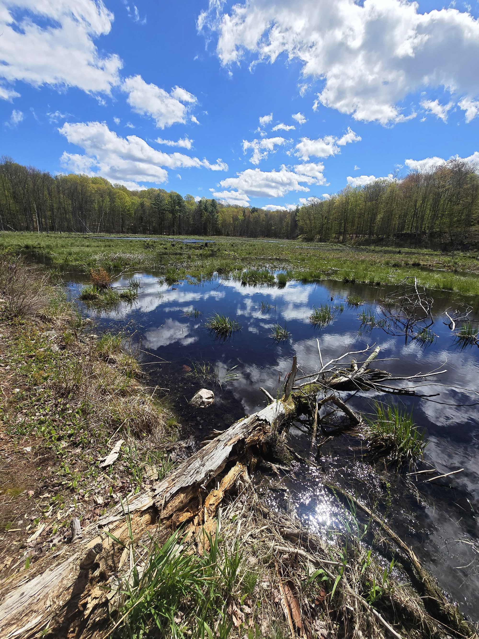
The views show water on both sides of the ridge you're walking, and as you approach the first tight curve you get a really good opportunity to see a large marshy pond area. I saw Wood Ducks and a Great Blue Heron on my walk, it looks like a great place for birding.
The forest areas you're walking through keep changing from pines to deciduous trees, so I found the walk interesting.
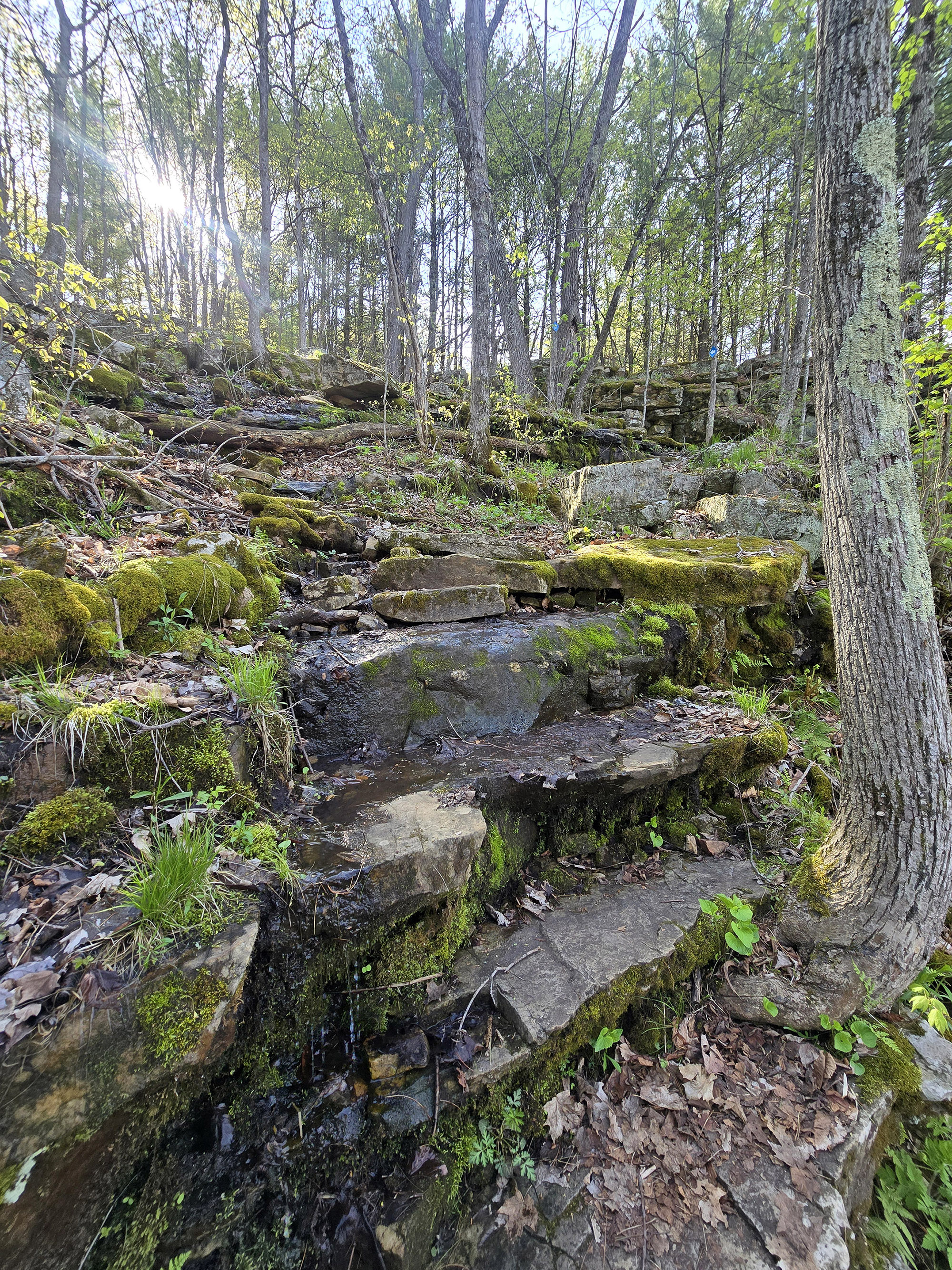
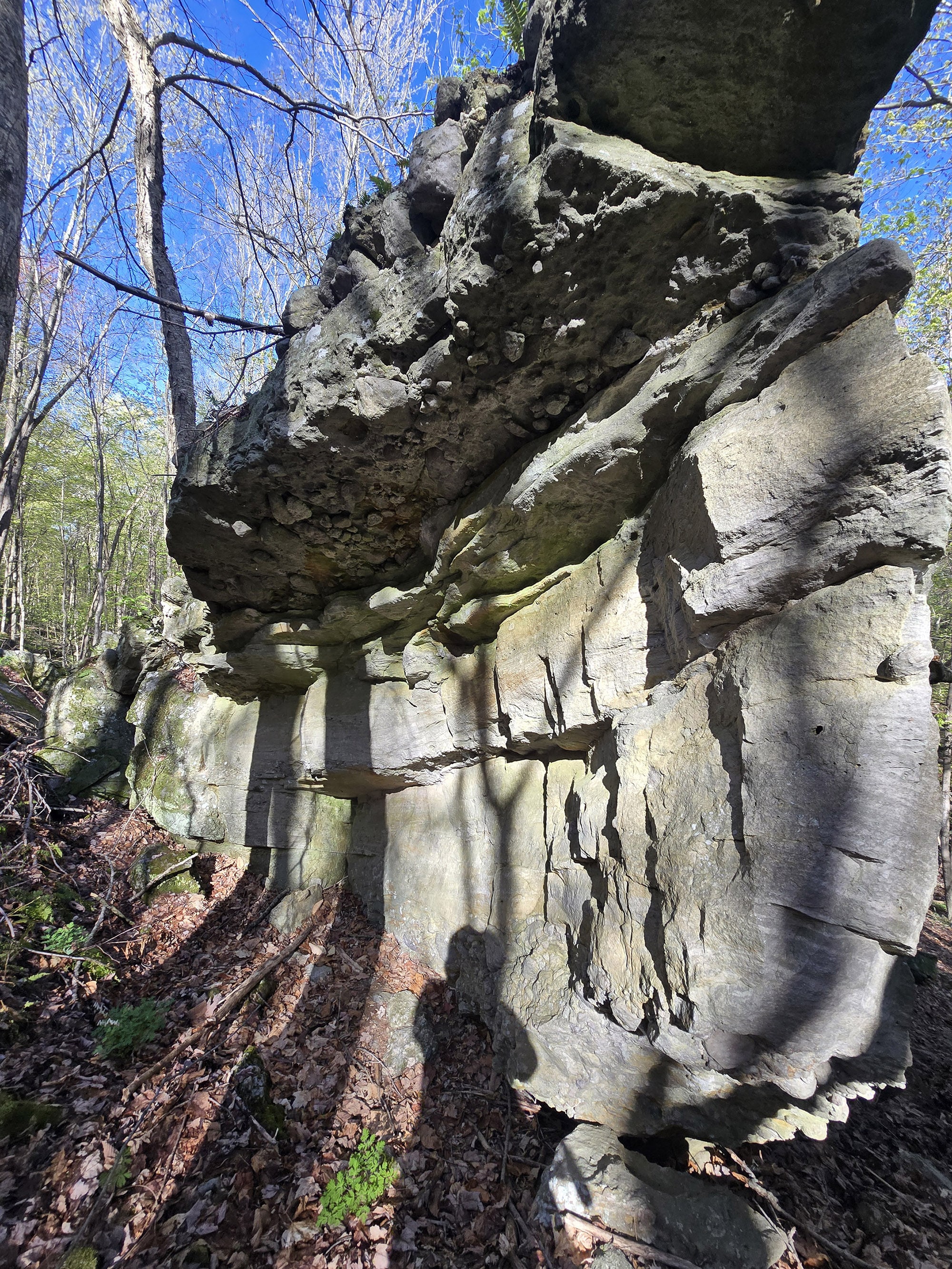
Moving on, you get to an awesome area with large moss covered boulders that you're climbing over and around.”

You actually walk through this crevice in the rocks as part of the path, it's definitely a really cool experience and I recommend it.
As you might suspect, this area is a bit more difficult, but I would still call it in the category of moderate difficulty.
The trail could use some more trail blazes. It’s clear that people wander around the rock area, so it's not obvious where the actual path continues in some spots.
The last third of the trail back to the parking lot is pretty easy, just a lovely walk through the forest. The views at the end of the first ⅓ - where you get the great water view - and the boulder area are really the stars of this trail.
There are signs with numbers all along the trail but there are no text descriptions on the trail to describe what they are. I didn’t notice the mail box for trail guides on the trail sign until later!
Anyway, I clocked the trail at 2.07 km from my car back to the car again.”

Quiddity Trail: 2.4 km Linear, Easy
The trail information regarding distances on this one ... is a bit weird.
They call the trail 2.4 km return - we clocked it at just under 3 km, from the parking lot.
The description also mentions that the first 300 m of the trail is wheelchair accessible - it’s actually longer than that, which I was happy to see! The boardwalk area was really nice, so I’m glad it wasn’t as short as described.
Anyway, the first bit of this trail is also the first bit of the Tallow Rock Bay Trail, they split off shortly after the boardwalk.
There was a bit of sign weirdness, as we mentioned earlier in this post. When you come to the end of the boardwalk, there’s a big, obvious trail split. No directional signage, but a single trail blaze on a tree to the left.
In actuality, you can go either way but most people hang right at that split - it’s NOT the actual trail split (just a little shortcut), which comes a little bit later, after turning right. You’ll keep to the right at the actual split, as well, to continue onto Quiddity - it’s marked there, though!

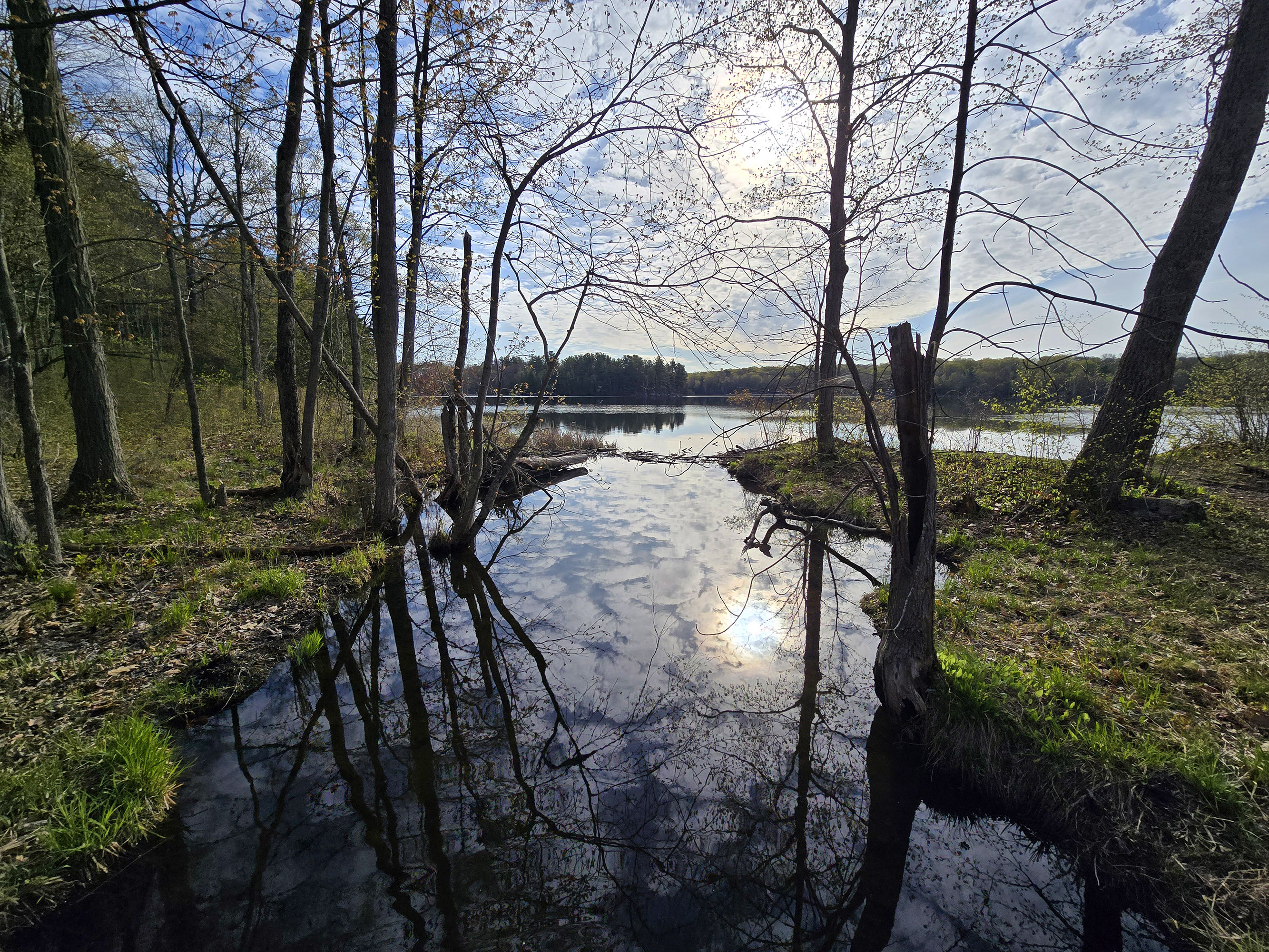
After the boardwalk, you walk through the woods, along some kind of marshy stream, and over a couple short foot bridges with pretty views out to the lake.
Soon after that, it’s a STEEP walk up to the lookout. It’s a nice enough view, but honestly the trail was enjoyable even before getting there. I definitely enjoyed this trail a lot more than the Beechwoods Trail.
In terms of accessibility, you could probably do the bulk of the trail if you're in a boot but otherwise pretty mobile/strong/have good balance. Not sure you’d want to go up that final incline, though.

Sandstone Island Trail: 2.6 km Loop, Moderate
This is another interpretive trail, with informative trail brochures available on the trail head sign.
Porter did the whole trail without me - on account of difficulty - but made me do the first bit of it the following day. He said I’d regret not doing it, and he was right - the section I did was GORGEOUS!
Anyway, here’s what he had to say about the entire trail:

The rocky overhang that served as a shelter for indigenous people is amazing, you actually walk *through* this feature, which is just really cool to look at. This feature is approximately a half kilometer into the trail from the parking lot.
After you pass that zone, that's where it turns into a moderate trail. There are boulders in the trail, and you're going around these massive walls of moss-covered boulders. It's a beautiful landscape next to the water, it's really amazing.”

That second half is a bit anticlimactic. It's a lovely walk through the forest, but it's nothing compared to that first half with those rocky shorelines.”

Shoreline Centennial Trail: 2 km Loop, Moderate
This trail is referred to as the “Shoreline Centennial Trail” on the park’s website, but just “Shoreline Trail” at the trail head signage and on the map.
It’s listed as being an interpretive trail, where people could “how the Charleston Lake area was a popular vacation destination for many wealthy citizens in the 1880s”... but Porter - who did it alone - didn’t notice any signage or numbered posts, and there were no trail guides at the trail head.
Anyway, he didn’t have a LOT to say about this trail, but had a ton of great photos... so for the most part, we’ll let the pics do the talking.
Here’s what he did have to say, though:

It's very ADD friendly due to the constantly shifting vibe. I would call this a moderate difficulty, you have to watch your step a little bit but it's pretty wide and fairly easy to walk on.
You can shortcut to the Buckhorn picnic site, but you'll pass it later on the loop if you continue to follow the trail in the indicated direction.”

There's a short but really large bouldery area which is beautiful to see, but you have to take larger steps with a bit more drastic elevation change, it's just a little bit more difficult.”

Tallow Rock Bay Trail: 10 km Loop, Difficult
This is another trail that Porter did without me, on account of the difficulty rating and distance.
Due to trail conditions - the Slim Bay Bridge being out - he didn’t do the entire trail. He took the east leg of the trail as far as the bridge, and back.
Here’s what he had to say about it:
“This is a very ADD friendly trail!
It's got areas of rocky terrain, ground with roots on it, an evergreen area where the ground is blanketed with old pine needles and stuff.
I was barely into it and before thinking it was a really cool trail. it's definitely into the moderate range because of some short areas of significant inclines and declines.
It's a clear path and it is blazed very well. It goes along a steep hill with a great view and then into deeper forest.
At one point you're walking on this ridge, where it's a steep hill down to the left down to the lake and then down to the right is a very steep hill to a dry ravine bed, with a moss-covered boulders everywhere.
Just a really cool view!

Bob's Cove to the walk-in campsites: the trail is a lot narrower and less defined, but there are still blazes and you can still find your way pretty well.
There are some really cool boulders and winding trail areas, and great views at the camp sites. It looks like an amazing place to stay!
The view at the bridge is great, it's a shame that the bridge is currently broken.
From the shoreline you can still get amazing views of the lake on both sides.
The camp sites on the other side are currently canoe-in or kayak-in only, I did see a couple of kayaks over there so it looks like they're being used already.
It is 2.2 km from the where the Tallow Trail splits into a loop, to the bridge, if you take the right hand (East) trail. It is 3.25 km from the parking lot to the bridge.

Biking
There aren’t any dedicated biking trails in the park, and - if memory serves - each trail head had signage specifically disallowing the use of bikes.
Campers are invited to go cycling on the campground roads, though. I’d definitely recommend wearing a helmet, given the conditions!
The main road through the park is in much better shape, wider, and just seems far more pleasant for biking, than the actual campground roads.
I remember there being a bike rack at the day-use beach for sure, but I’m pretty sure I saw at least one more in the park.

Swimming
There are a couple of beaches at Charleston Lake Provincial Park. (Neither with a life guard, though - same for most/all Ontario Parks!)
The day-use beach was pretty standard for an inland lake beach. It had clean sand - not a lot of evidence of Canadian Geese using it! - and the clearest water of the two beaches.
I’m not so into inland lake beaches, but it looked like an excellent swimming spot!
The day use beach area is easily accessible from the Bayside and Shady Ridge campgrounds, and also has a large parking lot, just off the main park road.

There's a small parking lot at the main beach entrance - maybe six cars worth - then a couple more, smaller parking spots and trails to get to it, just past that one.
The beach is not nearly as nice as the day use beach, but it's convenient if you happen to be staying at that end of the campground.

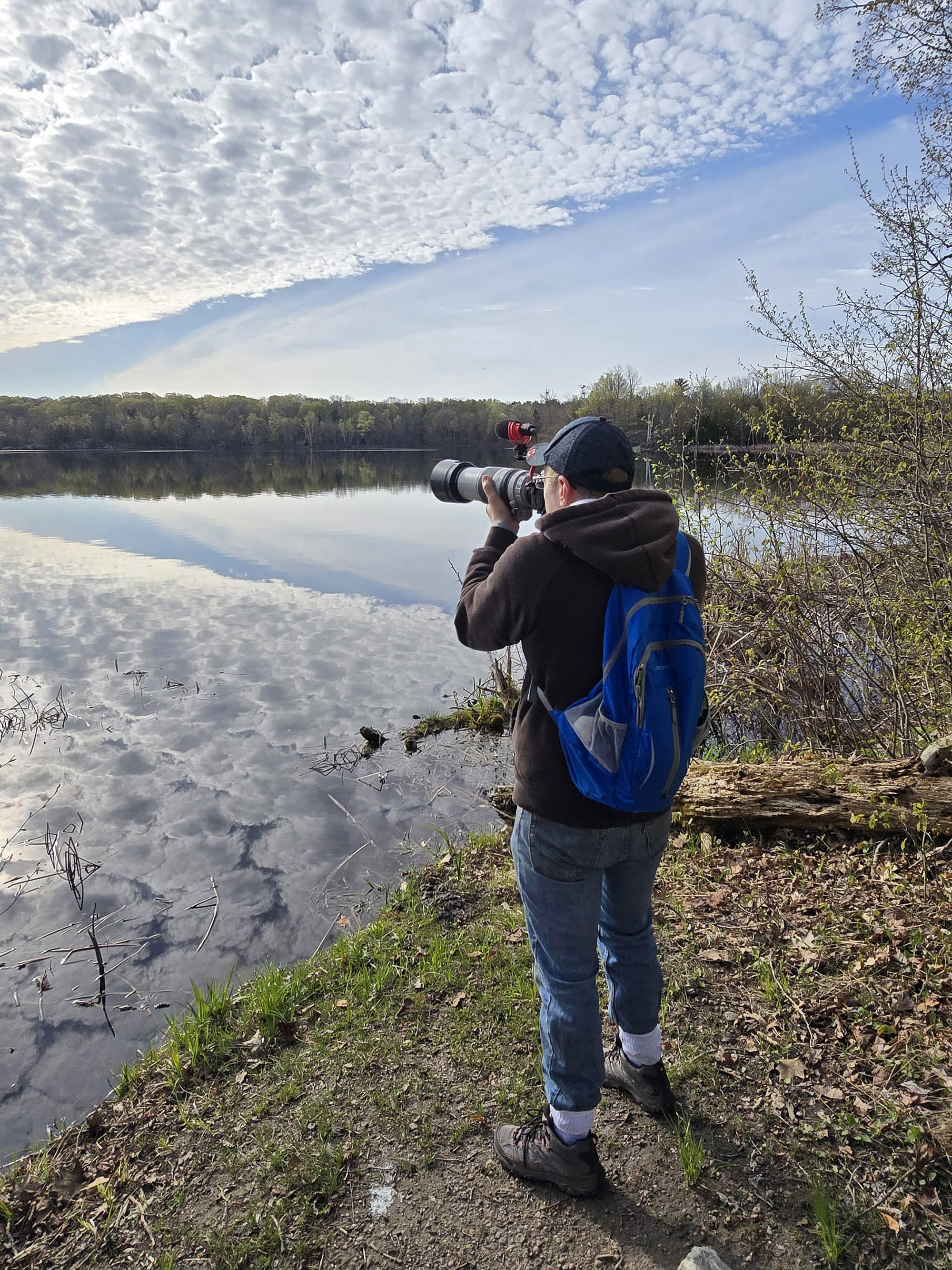
Birding, Wildlife, and Nature
The Charleston Lake Provincial Park website had us especially excited for wildlife viewing, listing off Bald Eagles, Black-Billed Cuckoos, Cerulean Warblers, Red-Shouldered Hawks, Yellow-Billed Cuckoos, and Yellow-Throated Vireos.
Aside from the Bald Eagles and Hawks, we’ve never seen ANY of those species before!
... and we still haven’t, LOL. We did hear the Yellow-Throated Vireo though.
That said, we still enjoyed a variety of excellent birding opportunities.
We had Baltimore Orioles, Woodpeckers, and others right in our campsite, and our hearts STOPPED when we heard a Great Horned Owl for the first time!
Unfortunately, we heard more than we saw, and we saw more than we were able to get photos of. The birds mostly stayed really high up in the trees, and it made photography very difficult.
Overall, we heard and/or saw: American Crow, American Goldfinch, American Redstart, American Robin, American Tree Sparrow, Baltimore Oriole, Barred Owl, Bay-Breasted Warbler, Black-and-White Warbler, Blackburnian Warbler, Black-Capped Chickadee, Black-Throated Green Warbler, Blue-Headed Vireo, Blue Jay, Blue-Winged Warbler, Broad-Winged Hawk, Brown Creeper, Bufflehead, Canada Goose, Chestnut-Sided Warbler, Chipping Sparrow, Common Grackle, Common Loon, Common Raven, Common Tern, Common Yellowthroat, Downy Woodpecker, Eastern Kingbird, Eastern Phoebe, Eastern Warbling Vireo, Great Blue Heron, Great Crested Flycatcher, Great Horned Owl, Hairy Woodpecker, Indigo Bunting, Mallard Duck, Merlin, Mourning Dove, Mute Swan, Northern Cardinal, Northern Waterthrush, Northern Yellow Warbler, Osprey, Ovenbird, Pileated Woodpecker, Pine Siskin, Pine Warbler, Red-Bellied Woodpecker, Red-Eyed Vireo, Red-Shouldered Hawk, Red-Winged Blackbird, Rose-Breasted Grosbeak, Ruby-Crowned Kinglet, Solitary Sandpiper, Song Sparrow, Swamp Sparrow, Tree Swallow, Tufted Titmouse, Turkey Vulture, White-Breasted Nuthatch, White-Throated Sparrow, Wild Turkey, Wood Duck, Yellow-Rumped Warbler, Yellow-Throated Vireo.

Row 2: Blue-Headed Vireo, Bufflehead, Canada Goose, Common Loon
Row 3: Common Tern, Downy Woodpecker, Eastern Phoebe, Great Blue Heron
Row 4: Great Crested Flycatcher, Mallard Duck, Mute Swan, Northern Yellow Warbler
Row 5: Osprey, Tree Swallow, Turkey Vulture, White-Breasted Nuthatch
Row 6: White-Throated Sparrow, Wild Turkey, Wood Duck, Yellow-Rumped Warbler
We also saw a TON of wild flowers during our visit.
There were Trillium in bloom throughout the campgrounds and along the main roads and trails, and I saw “Dutchman’s Breeches” for the first time!
(Those are the cute flowers below that look like upside-down white pants - hence the name!)

Boating
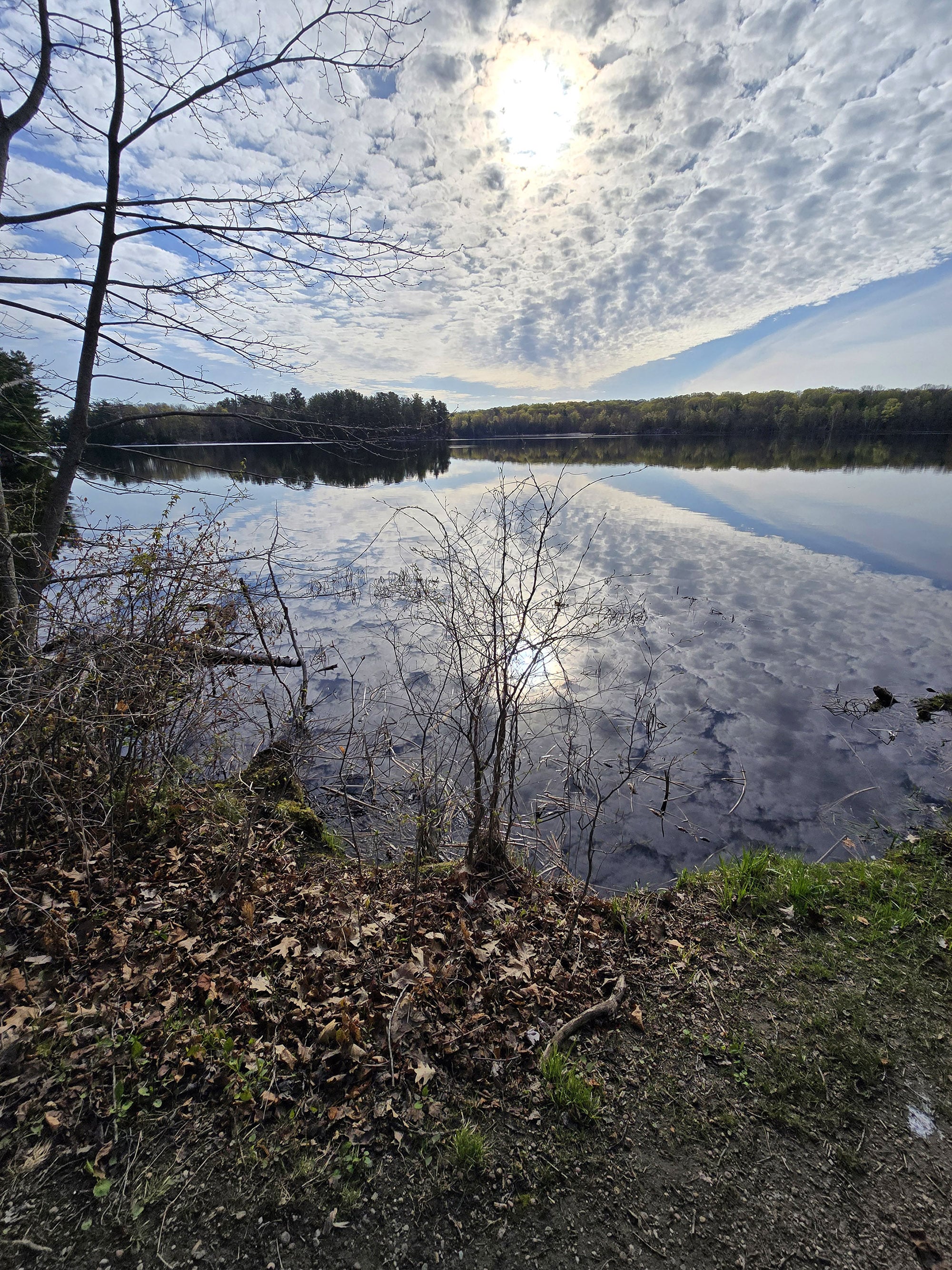
Given the size of Charleston Lake, it wasn’t surprising to hear that the park is popular for canoeing, water skiing, and other water activities.
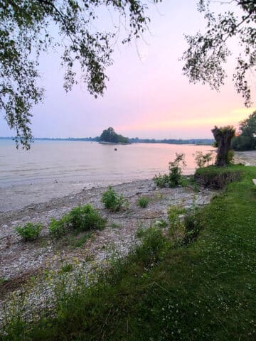
All of those little islands look to provide some excellent paddling destinations, and the area along the campground beaches - Running’s Bay - just looked so serene and beautiful.
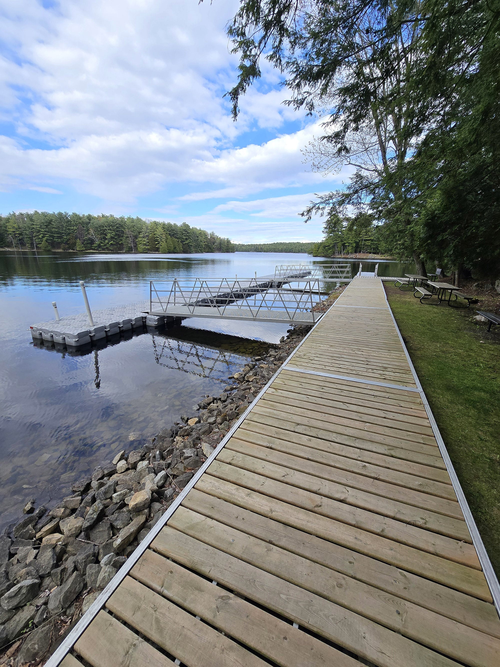
There are two watercraft launch sites in the park.
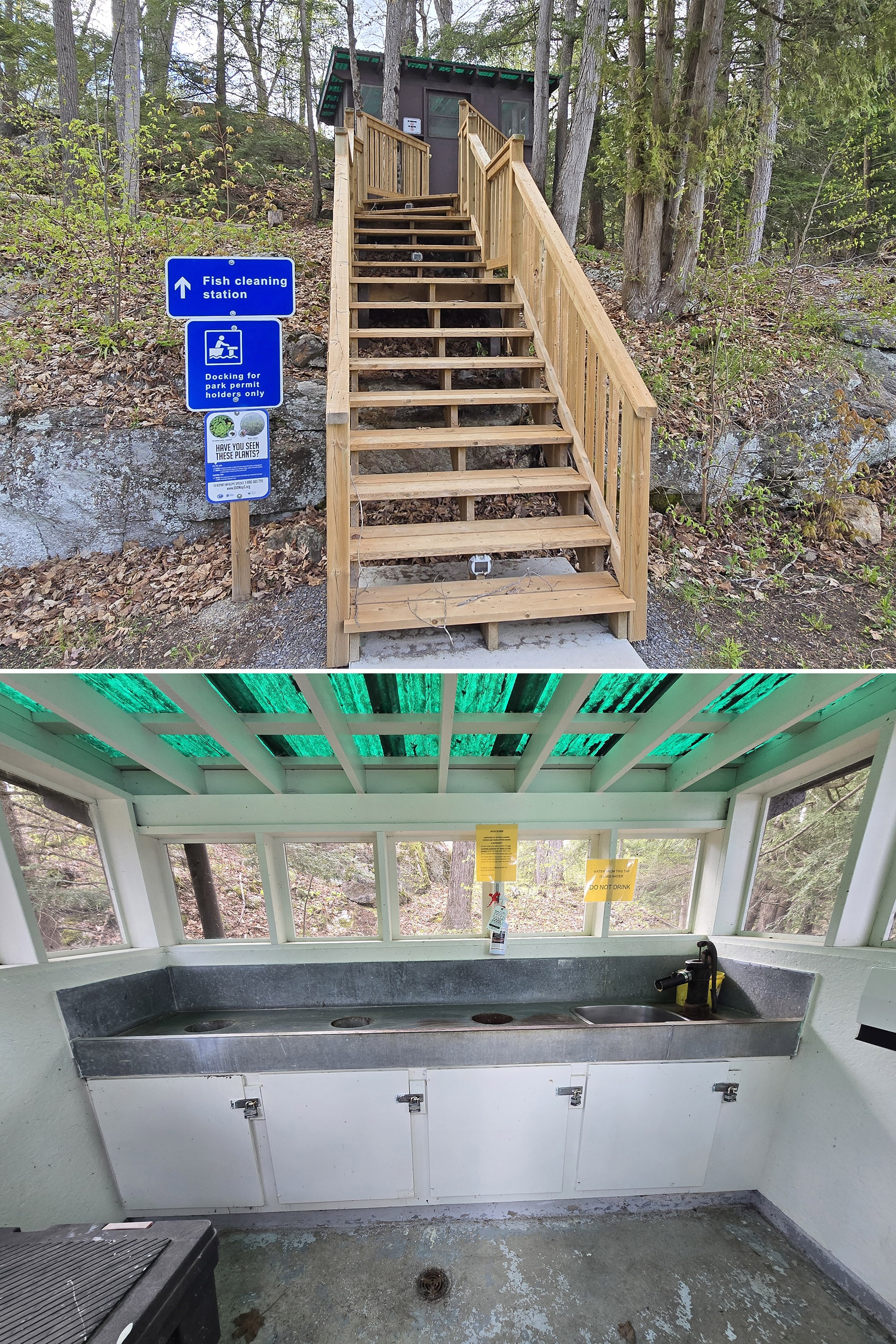
The main boat launch - at far end of the park - is really... involved. There’s a whole day use type area there, with picnic tables, grills, gorgeous views, a fish cleaning station, and more.
There’s also a boat launch and several floating docks - it’s free to use with your camping permit, and there is trailer parking nearby (in the Sandstone Island Trail parking).
Just note: Powerboats aren’t allowed in parts of Running’s Bay and Slim Bay, but you can explore the rest of Charleston Lake that way.

There’s more of a parking lot there than at the main launch, and it seems to serve as a main jump off point for the canoe in campsites.
The canoe launch itself is down a little hill from the parking lot.
Apparently Charleston Lake boasts a whopping 75 km of shoreline, surrounding numerous bays and little islands!

Fishing
Charleston Lake is huge, and seems to be a great spot for fishing - all kinds of islands and alcoves, different environments, etc.
The park’s website says that the park is an excellent fishing destination, and that Black Crappie, Lake Trout, Large Mouth Bass, Northern Pike, Small Mouth Bass, and Yellow Perch are available, along with other, unspecified species of fish.
There is a fish cleaning hut at the main boat launch - at the far end of the road and through the campground.
You do have to go up a fairly long set of stairs to get to it. It was in good shape, both the building and the stairs.
Finally - as mentioned previously - Charleston Lake provincial park is part of the tackle share program. Those looking to try fishing can borrow fishing gear for free!
Discovery Program
Discovery Programming happens during the summer only, with guided hikes, children’s programs, evening programs, and other special events run out of the Discovery Centre, as well as at the Amphitheatre.
For those of us visiting on the off season, there are some educational signs on at least one trail (Beech Woods Trail), with numbered signs at points of interest on other trails.
We found a trail guide at the trailhead for Sandstone Island Trail, but didn’t see any for the Hemlock Ridge Trail - which also had numbered posts.
I think next time we’re here, we’ll look closer - maybe ask at the gatehouse.
Niantic Games
While there was generally good enough cell reception in the park to load up Pokemon Go, there weren’t a TON of Niantic Game features (Pokestops, Pokegyms, Ingress Portals, etc) in the park - a few scattered here and there.
I wonder if cell reception is a fairly recent thing for the park?
We did end up staying during an event, though, and there were plenty of spawns, etc to play!
Final Thoughts
Charleston Lake Provincial Park was a surprise hit for us!
We generally prefer Northern Ontario Parks to everything else, and we really never hear about this park in online groups. We really had no idea what to expect, so we weren’t expecting much.
... and we ended up amazed!
Loads of beautiful views, each of the trails seemed nicer and more interesting than the last, everything (except the roads!) was in really great shape and well maintained... what’s not to love?
We’ll definitely be back!
More Southeast Ontario Provincial Parks & Places to See
Want to read some more about the parks we've camped and at places we've seen in Southeastern Ontario? Here are some more posts!
Southeastern Ontario Campground Reviews:
Bon Echo Provincial Park
Bonnechere Provincial Park
Ferris Provincial Park
Presqu'ile Provincial Park
Rideau River Provincial Park
Sandbanks Provincial Park
Silent Lake Provincial Park
Winter Camping at Silent Lake Provincial Park
Southeastern Ontario Places to See:
Gariepy Creek Falls
Lake on the Mountain Provincial Park
North Beach Provincial Park
Want to explore beyond Southeastern Ontario? Check out our full list of Campground Reviews, Ontario Waterfalls, and other Places to See.
We also have a ton of Camping Recipes to cook up, while on your adventures!
Thanks for Reading!If you loved this post - or have any questions about it - please leave a comment below! We'd also love it if you would consider sharing the link on social media! |


Jessica
Thanks for such a great review! Heading there for the first time this weekend! I especially appreciate your detailed trail reviews because I have limited mobility but my kids like a bit of an adventure. Commenting because I appreciated your dig about the change to the garbage disposal at Presqu'ile. I camp there 2 to 3 times a year and I am SO MAD about the change.
Marie & Michael Porter
Thank you!
Man, don't get me started on the garbage situation at Presqu'ile.
We're not even going back til next year, and I'm already dreading to see how that WILDLY RIDICULOUS change is going to play out. Ugh!!!
I'm so glad to hear the descriptions help others with limited mobility! I always feel like the odd person out, having terrible with the trails... So I never know how much my accessibility info actually helps.
I figure, at worst, it's there for me to refer to next time we go, lol.
- Marie