
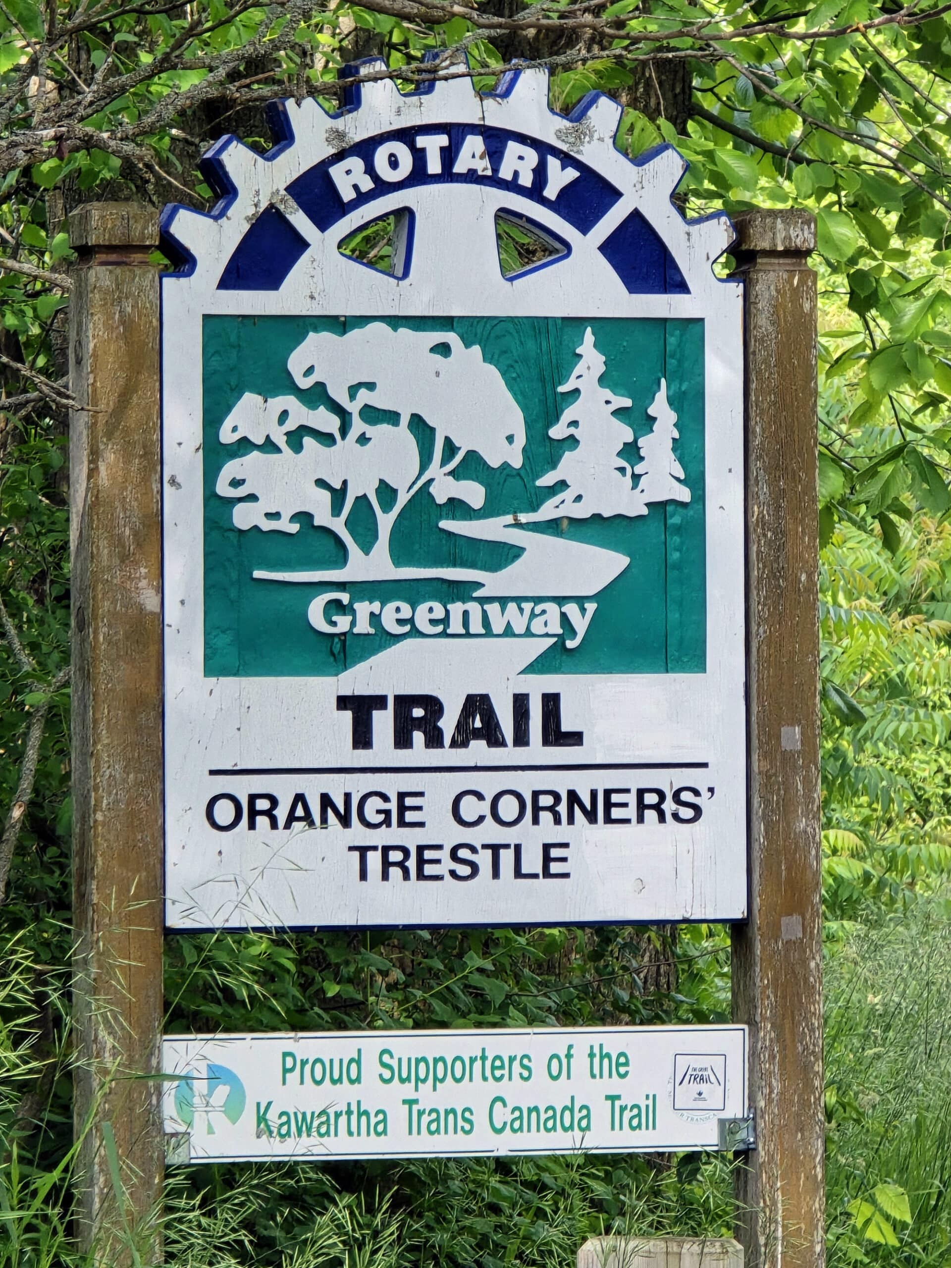
Doube's Trestle Bridge is a re-purposed historic rail bridge, on the Kawartha Trail. A great place for a walk, here's what you need to know!
Originally published July 3, 2024, Updated on 3/12/2026.

Part of the Trans-Canada Trail, it’s a former rail line bridge, spanning across Buttermilk Valley.
It’s located only about 10 minutes from Emily Provincial Park - and about an hour and a half from Toronto - it’s a great trail to spend some time on.
I’d thought we were just going for Doube's Trestle Bridge itself, but the trail was really nice - and left me wishing we’d booked more time to explore it!
Even aside from the panoramic views you’ll get from the bridge, there are all kinds of things to see along the trail - and a few ways to enjoy them!
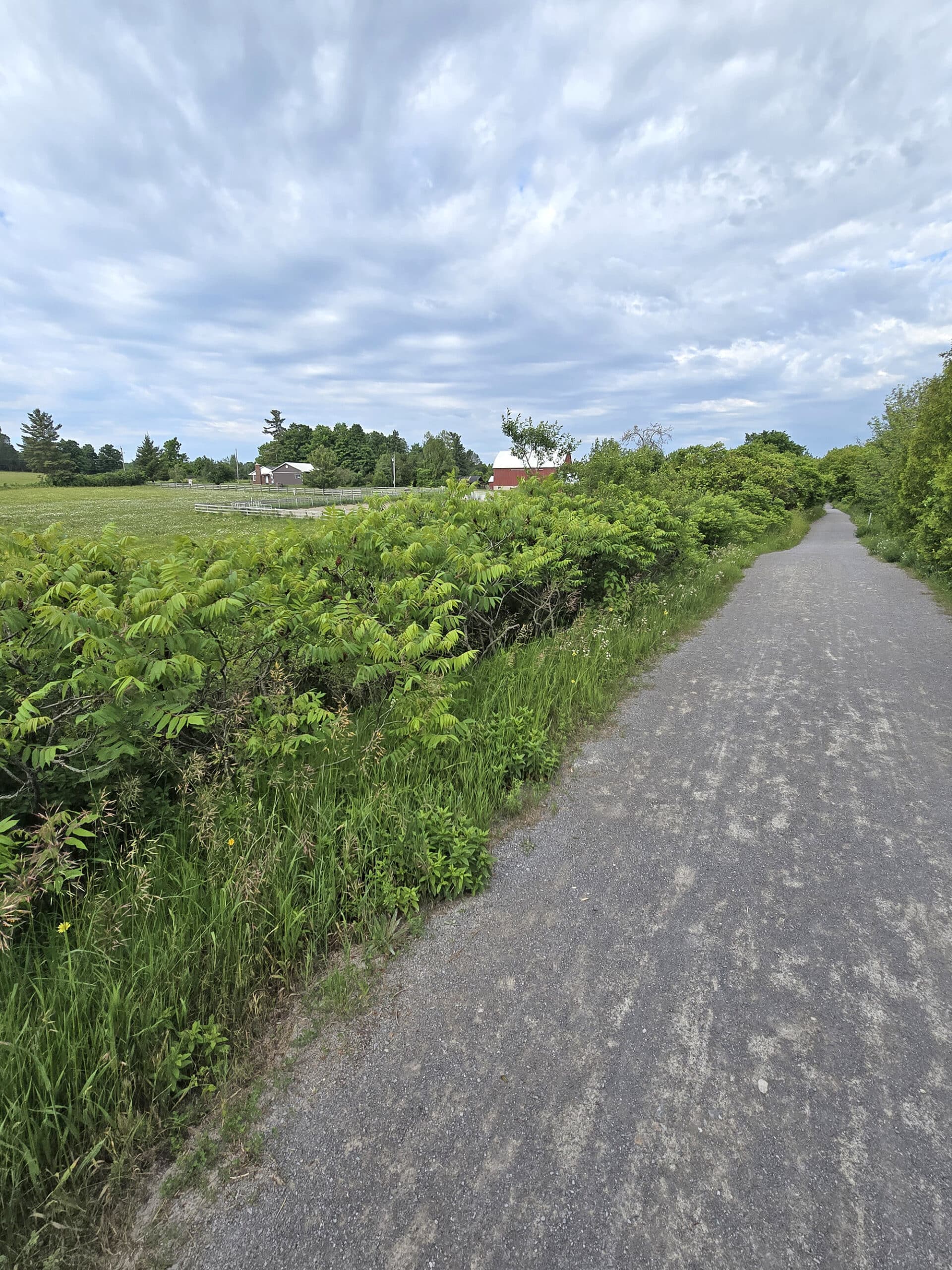
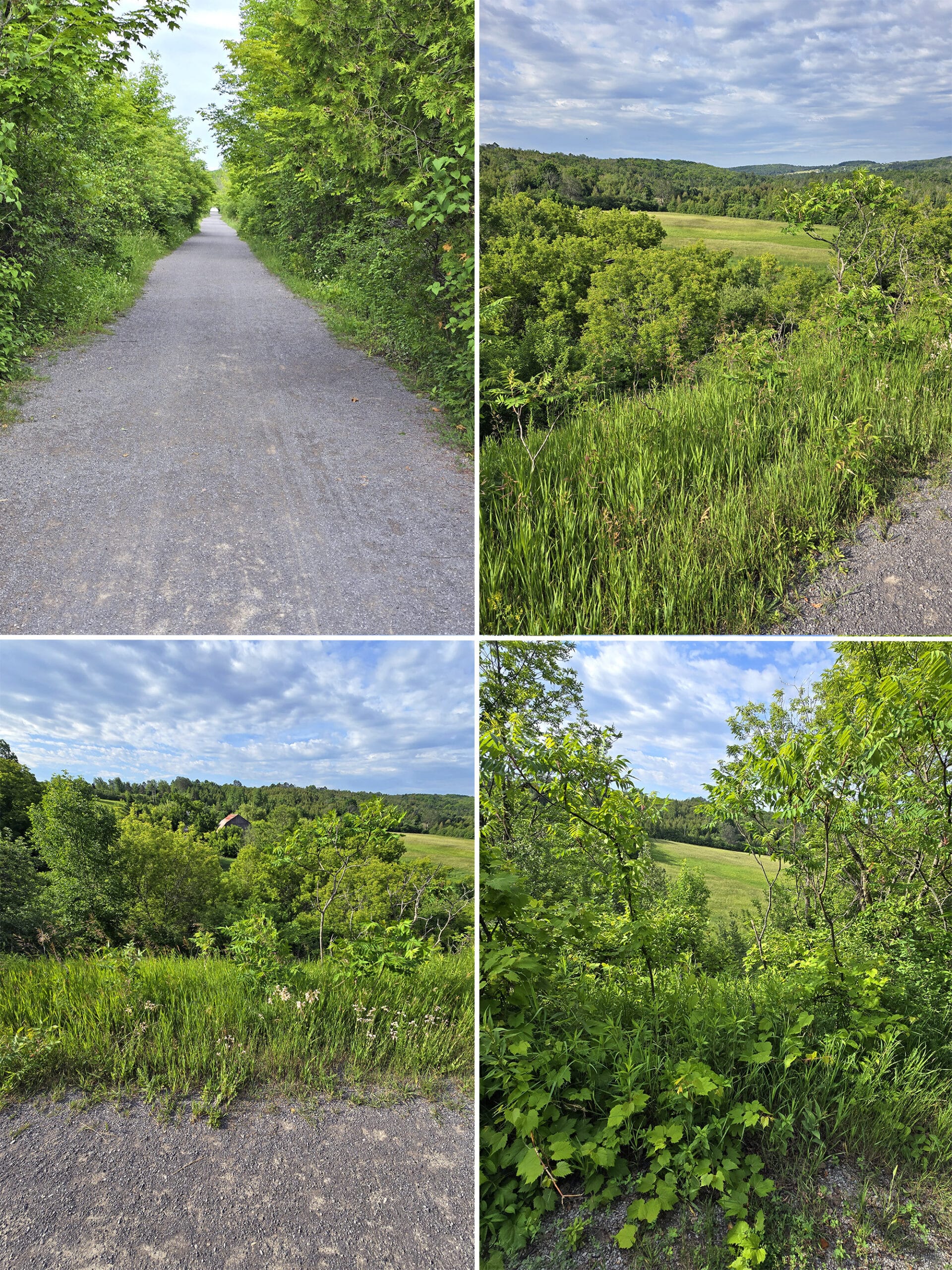
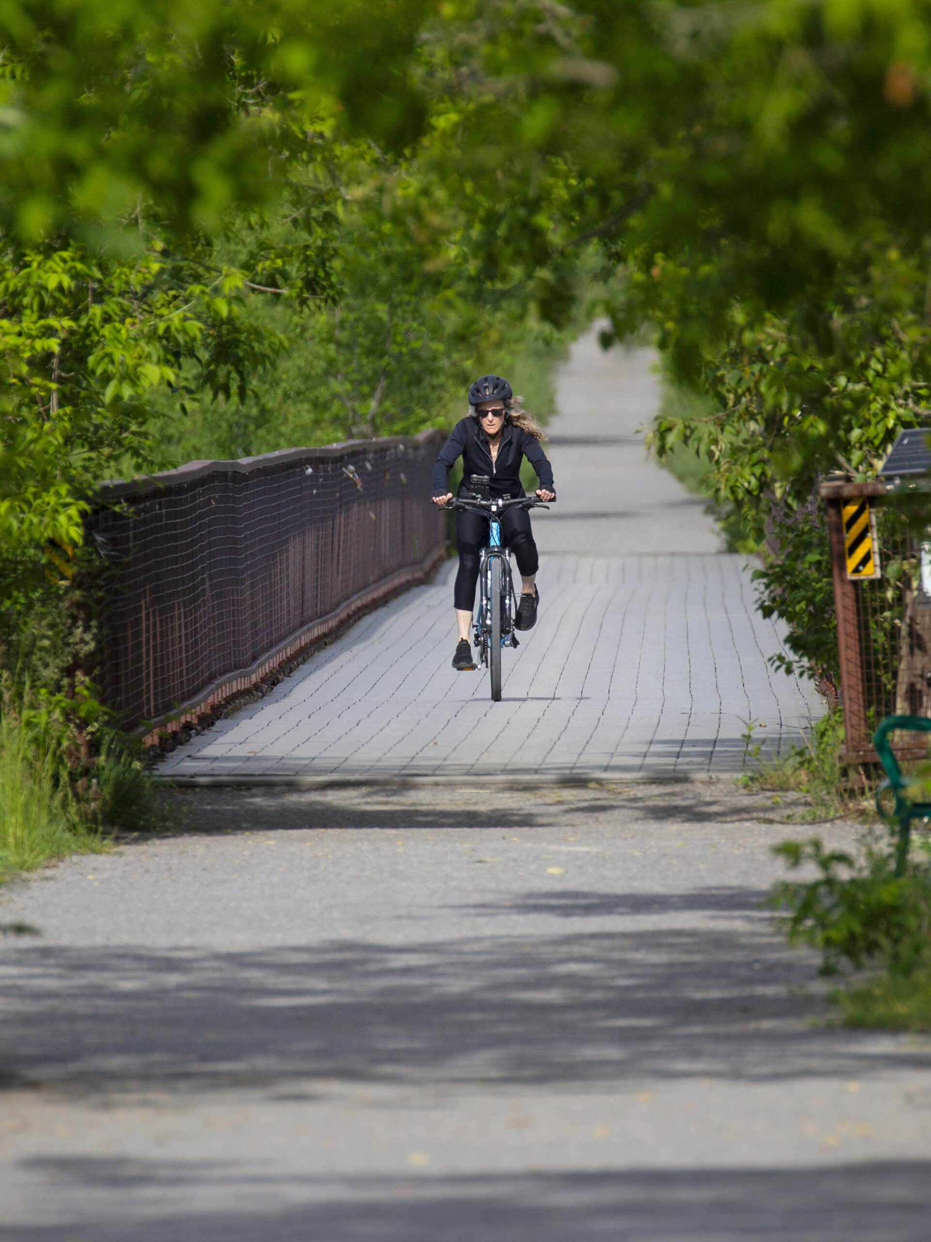
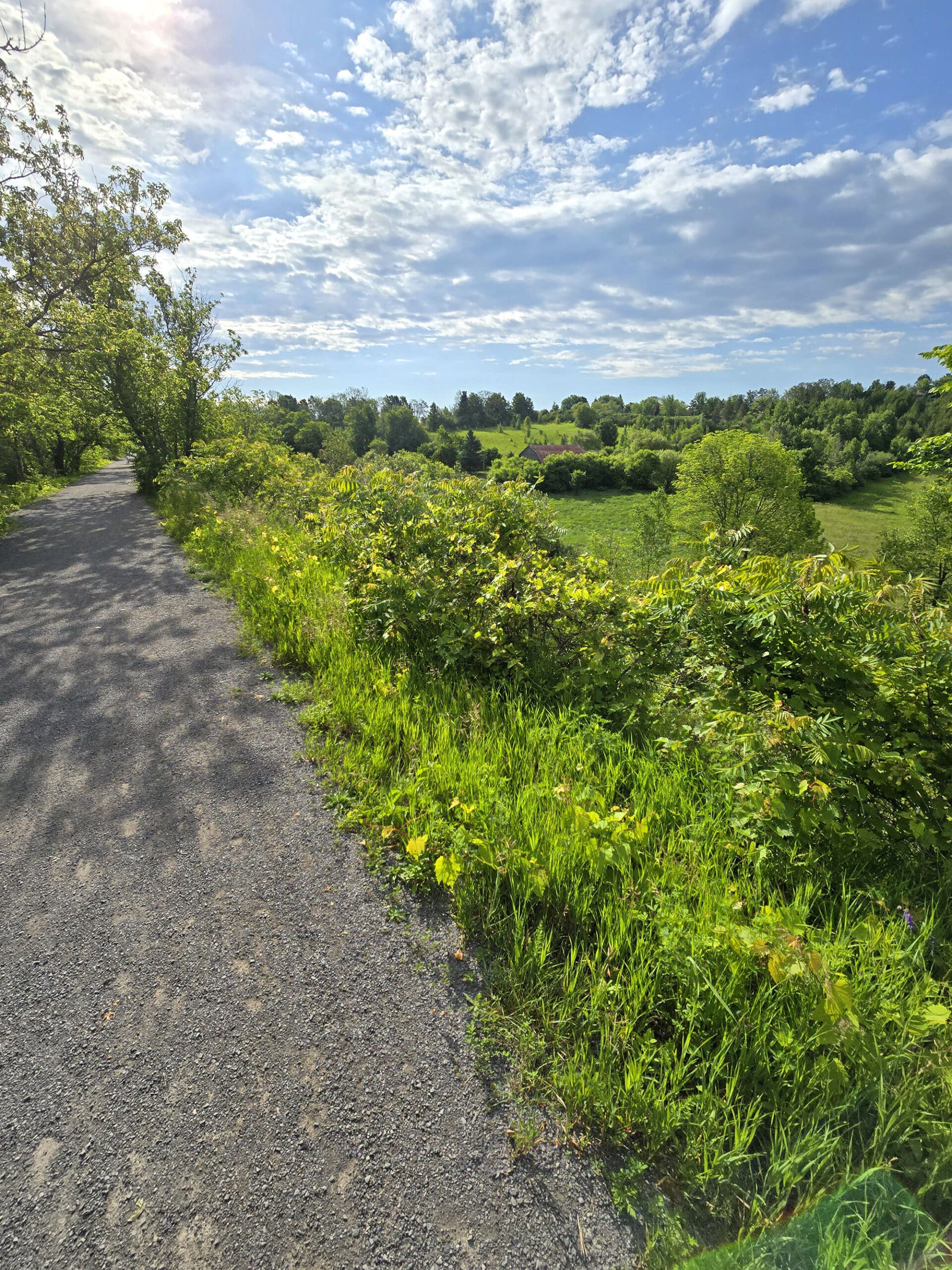
Trail users can walk, run or bike on this recreational trail. It’s in really good shape, and well maintained.
Anyway, lots to talk about - and photos to share! - so let’s get to it!
The Basics:
Location Name: Doube’s Trestle Bridge
Address:: Trans-Canada Trail, Kawartha Lakes, ON K0L 2W0 (Click for Google Maps location)
Website: Kawartha Trans Canada Trail Association
Price: Free!
Logistics
Some basic information to help you plan your visit to Doube’s Trestle Bridge:
Registration and Check In
There is no registration or check in to worry about, nor tickets, reservations, paid parking, or anything of the sort. Just show up, park, and go!
Parking
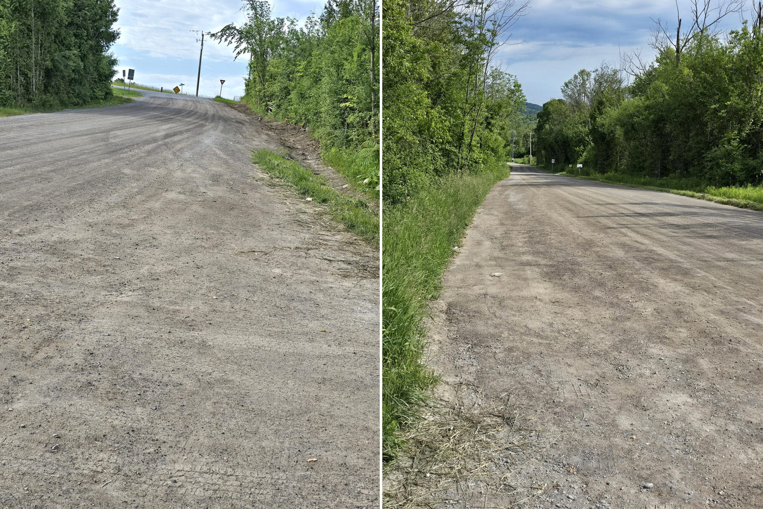
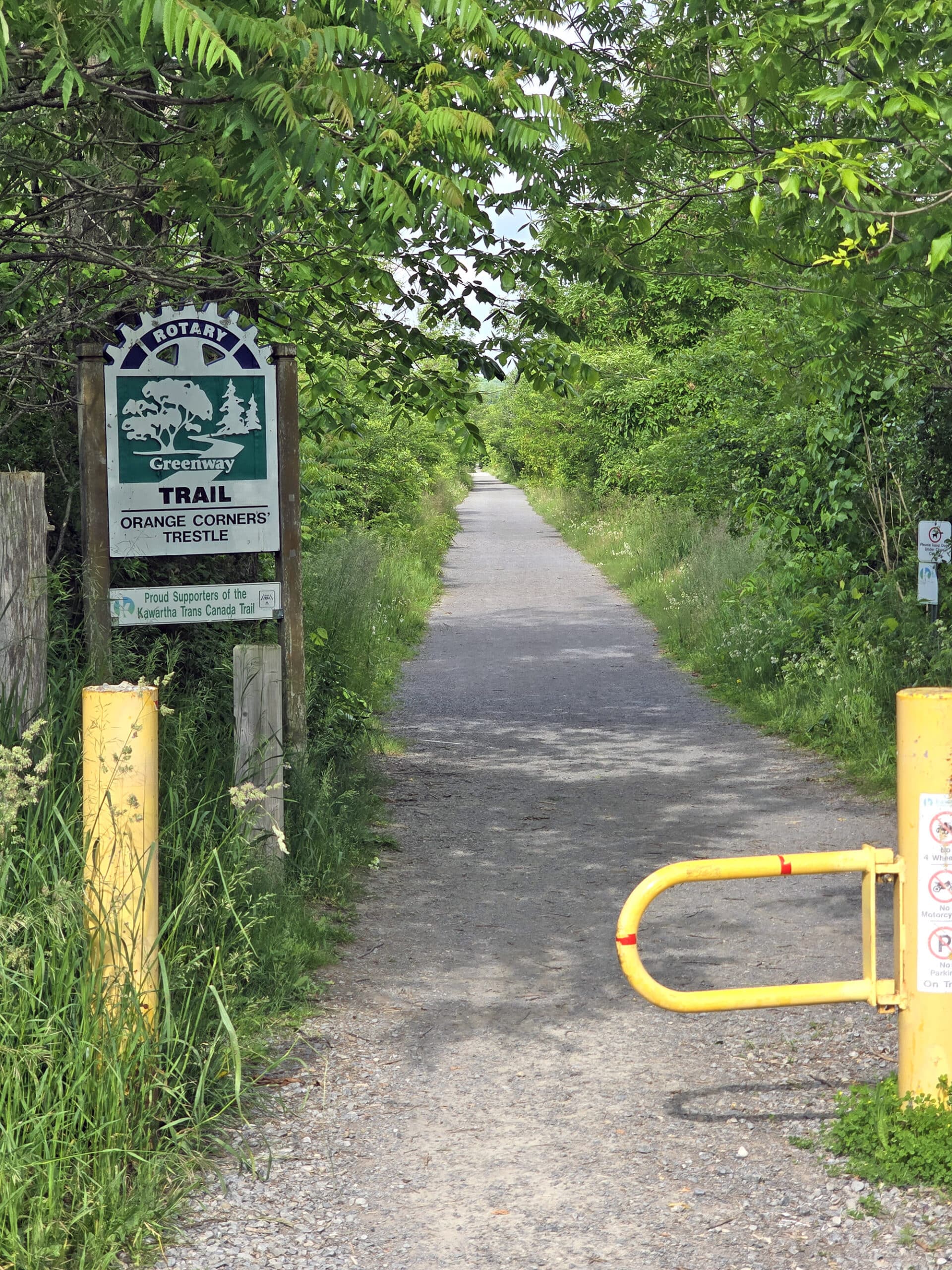
We parked at the trail entrance on Orange Corners rd.
While there’s not an actual parking lot there, there’s a widened section of road that’s clearly intended for parking - at least PART of the year.
Signage there indicated that parking was NOT permitted between November 1 and April 30.
There’s another trail entrance on Emily Park Rd, but we didn’t realize that til after we got home and looked at the map more closely.
So, no idea what the parking situation is on that end, but it’s probably worth checking out.
If you’re staying at Emily Provincial Park - like we were at the time - it’s a fair amount closer than the Orange Corrners Road access point.
Washrooms
There are no washrooms on site.
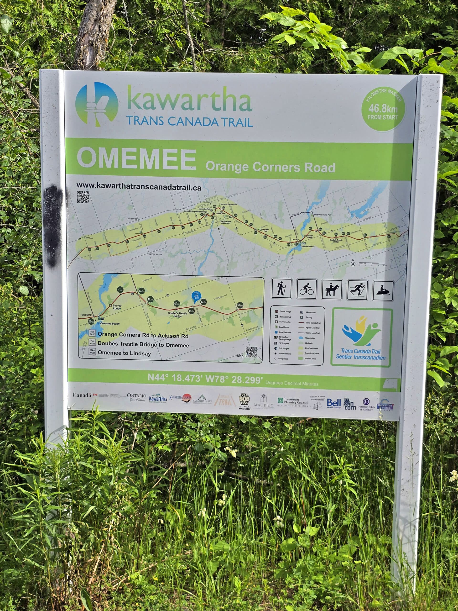
Maps and Signage
As a very straight-shot trail, this one really didn’t need much in the way of maps or signage, IMHO.
That said, there was a nice trail map at the Orange Corners access point where we parked, and there’s always the Kawartha Trails Trail Map, online.
It’s a nice feature - an interactive map, where you can filter for connecting trails, parking lots, parks, and other points of interest.
As an example, if we were to continue past the bridge for a bit, we would have come across a beaver lodge!
There was some educational signage on the bridge itself.
Accessibility
The trail is a well packed crushed limestone surface. It’s wide, flat, and - because it’s a former rail trail - there isn’t a lot in the way of elevation changes.
This section of the trail is wheelchair accessible, and definitely doable for any other kind of mobility aid. I was having a less-than-great tendon day, the day we went, and I had no problem with the trail.
The only possible concern is that there wasn’t any actual designated accessible parking, and you can’t book a spot or anything. So, you may find yourself out of luck, if that section of trail happens to be busy at the time of your visit.
There are parking lots further out from the bridge, and theoretically those could possibly have accessible parking... but the distance may pose its own issues.
Pets
The trail seemed popular for dog walking at the time of our walk, and dogs are welcomed to use the whole trail.
They’re supposed to be on a leash and under control at all times while using the trail.
Also, owners are expected to scoop the poop *and properly dispose of it*. I’ll never understand the people who bag it and then leave it, or hang it in a tree or whatnot.
Didn’t see any of that this time, just a random mini-rant!
Day Use Area
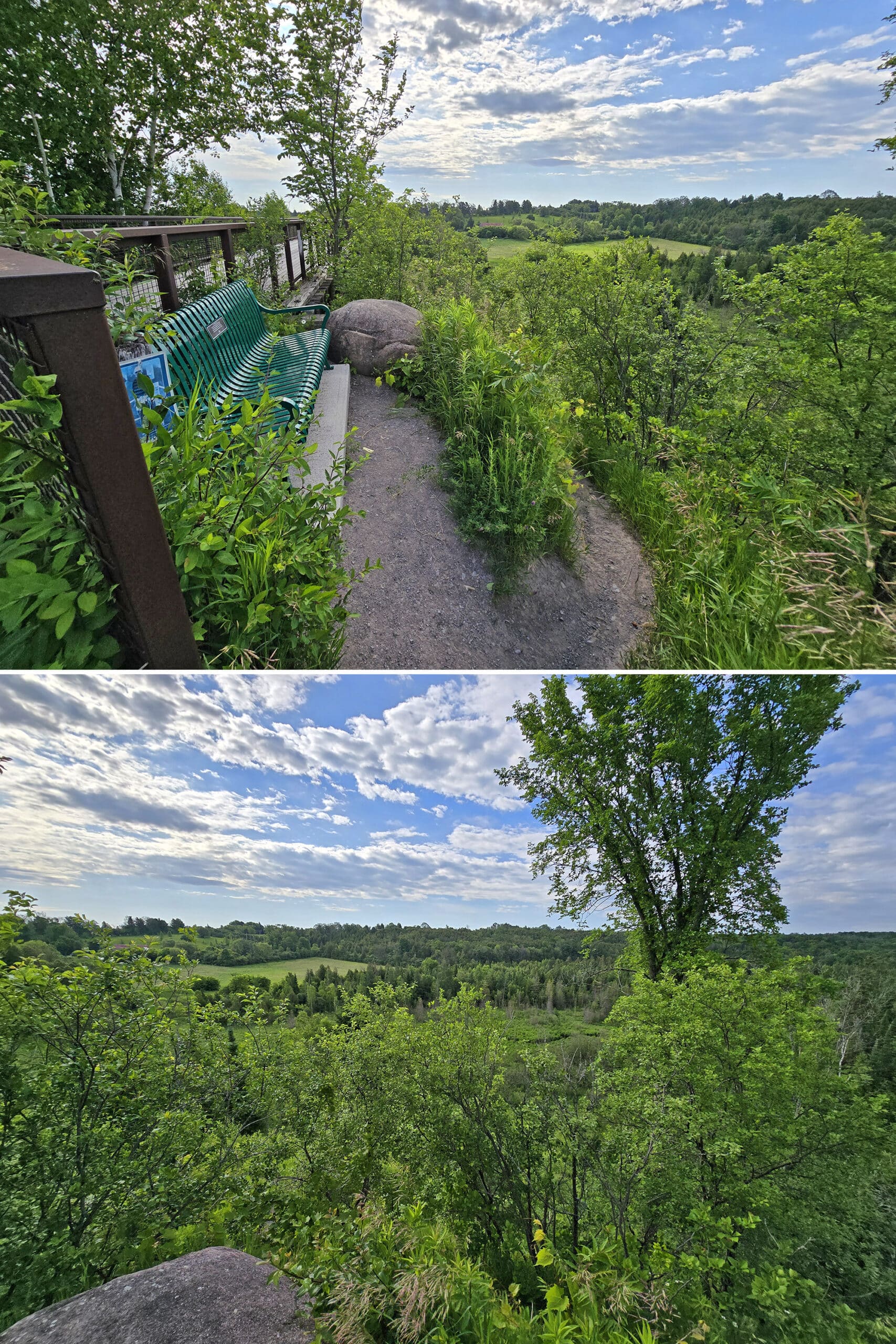
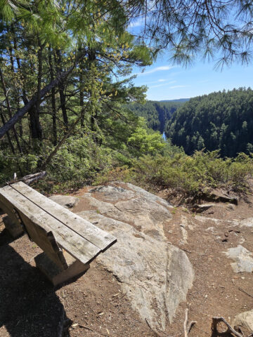
We haven’t seen any picnic tables on this section of the trail, but there are a couple benches on either side of the bridge.
Connectivity
We had decent connectivity any time we checked our phones along the trail - usually to google something we saw.
This was just a very short section of the overall trail, though - we can’t speak to connectivity along the rest of the Kawartha Trans Canada Trail.
Miscellaneous
While I mention walking and cycling, the trail is also used for horseback riding and - in the winter - cross-country skiing and snowmobiling!
Also, as a note: The trail provides some degree of “access” to private property in some places.
Just because you physically CAN access them, doesn’t mean you legally can - trail users are urged to stick to the trail itself.
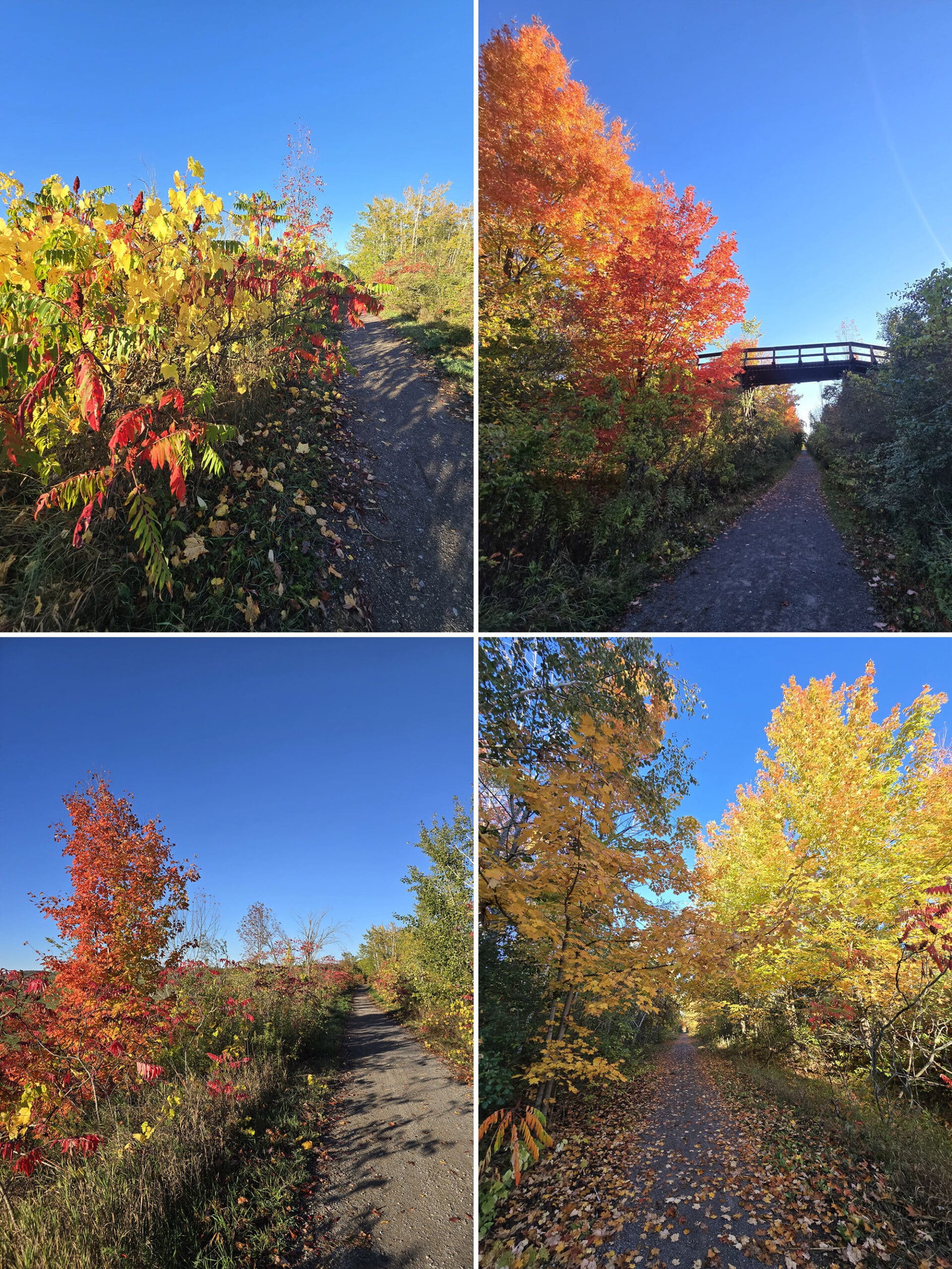
Also, pro-tip: The trail is GORGEOUS on a sunny fall day!
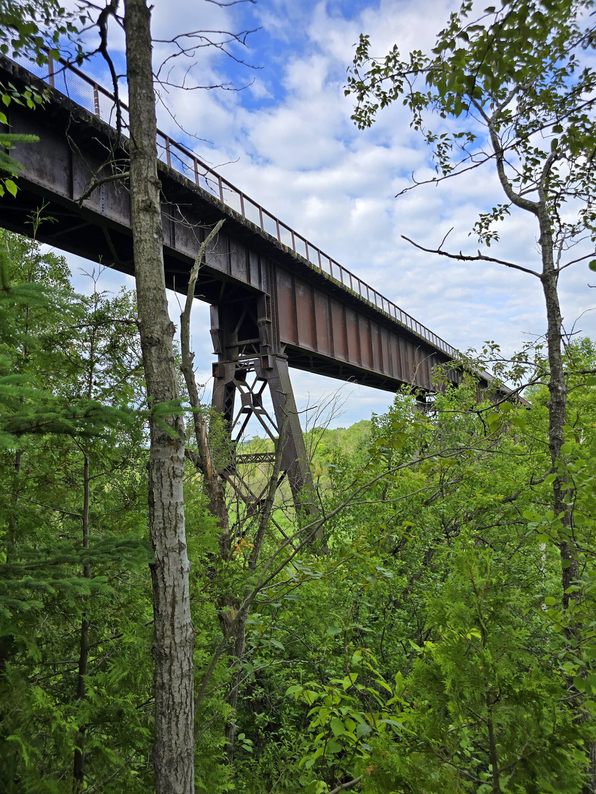
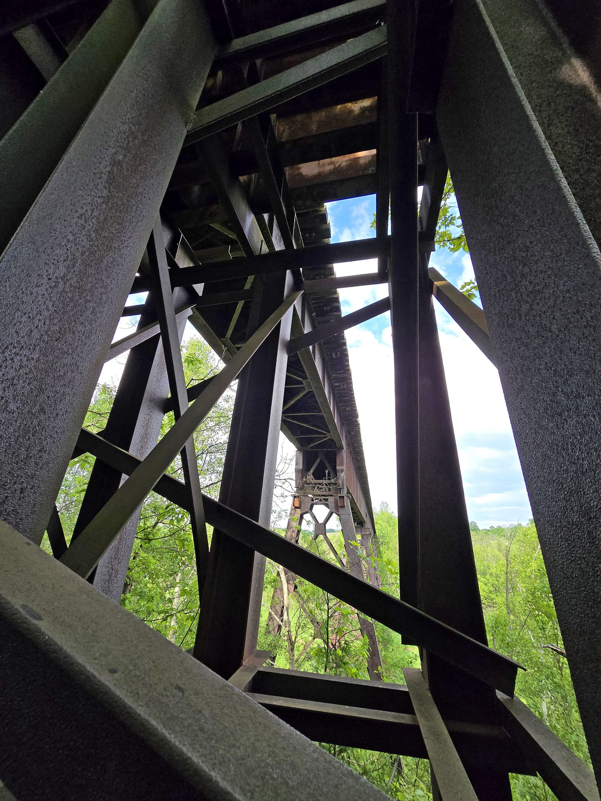
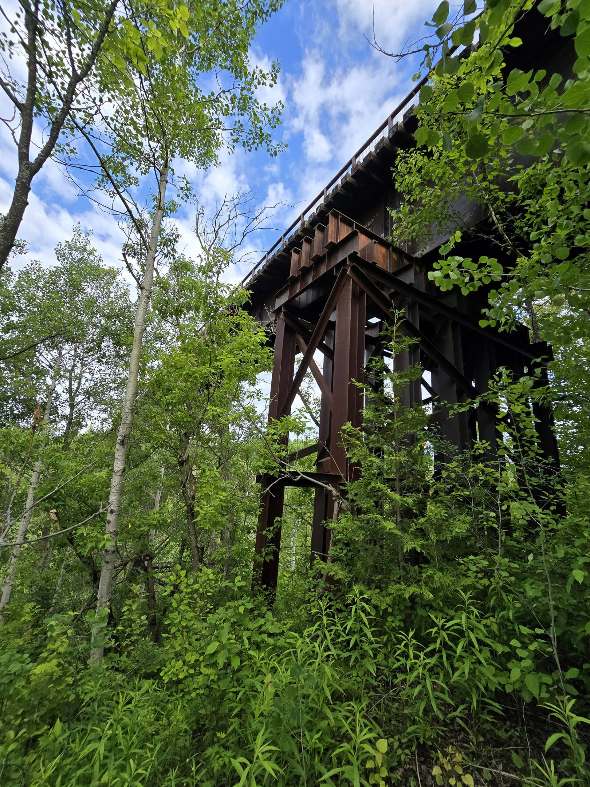
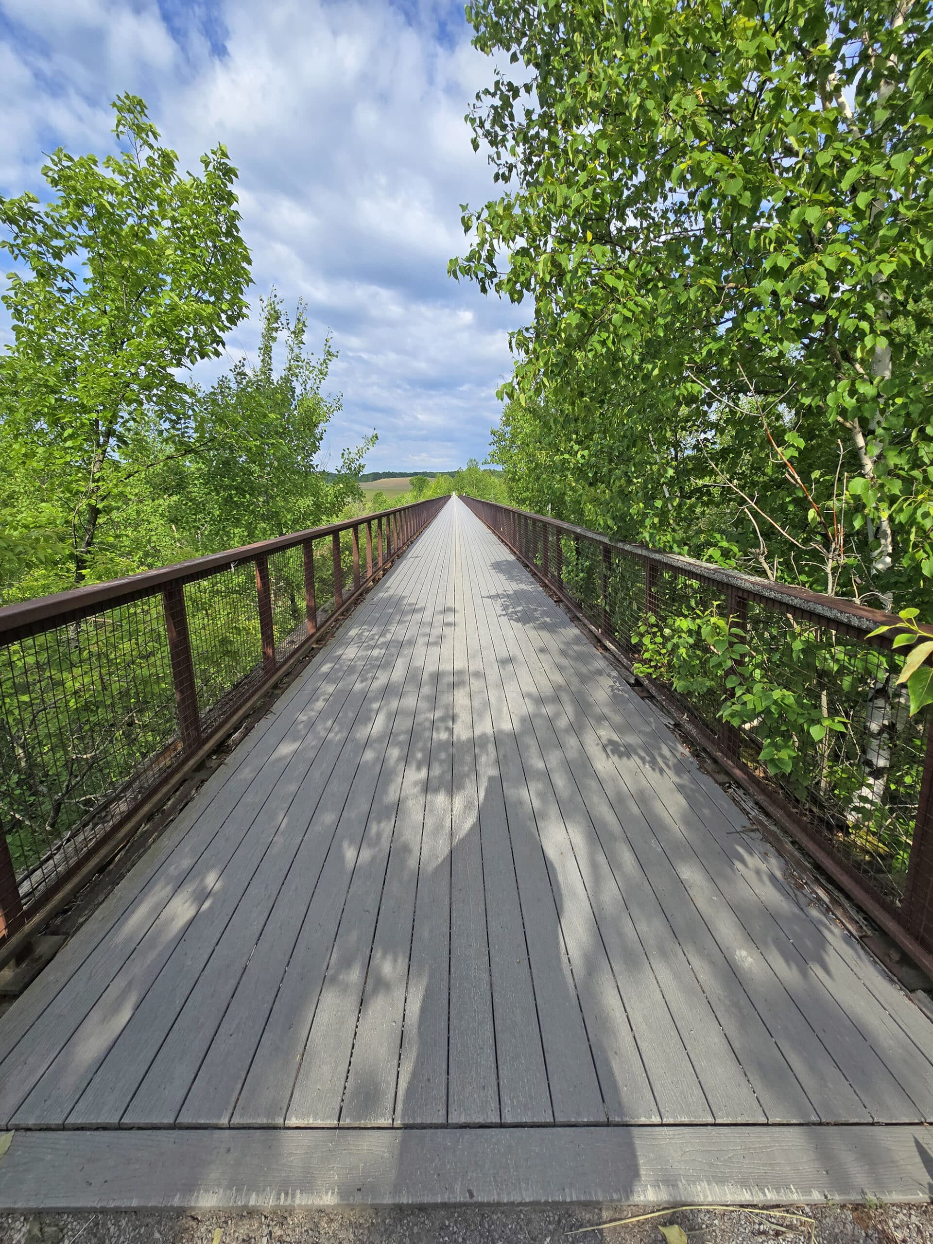
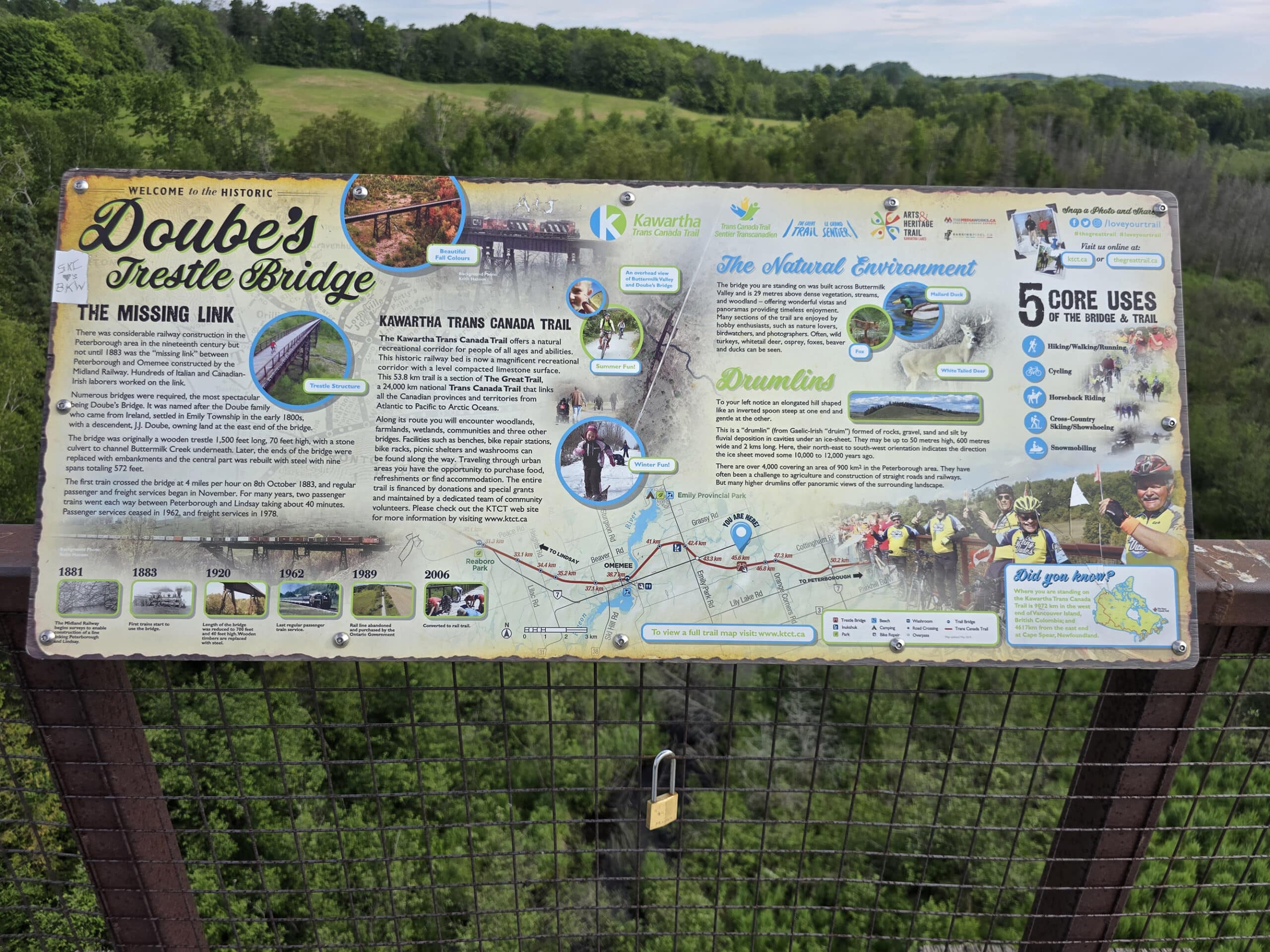
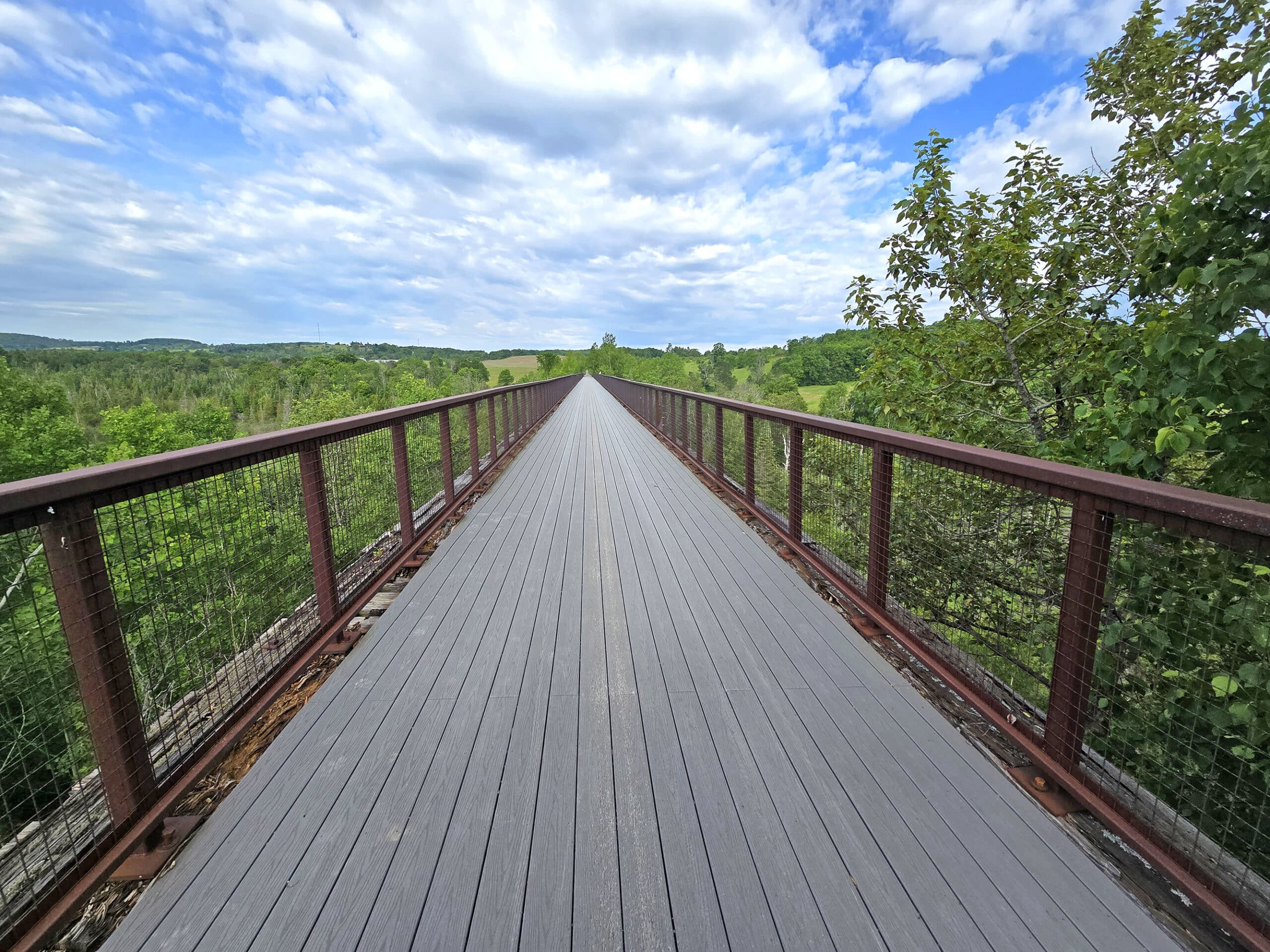
The Bridge
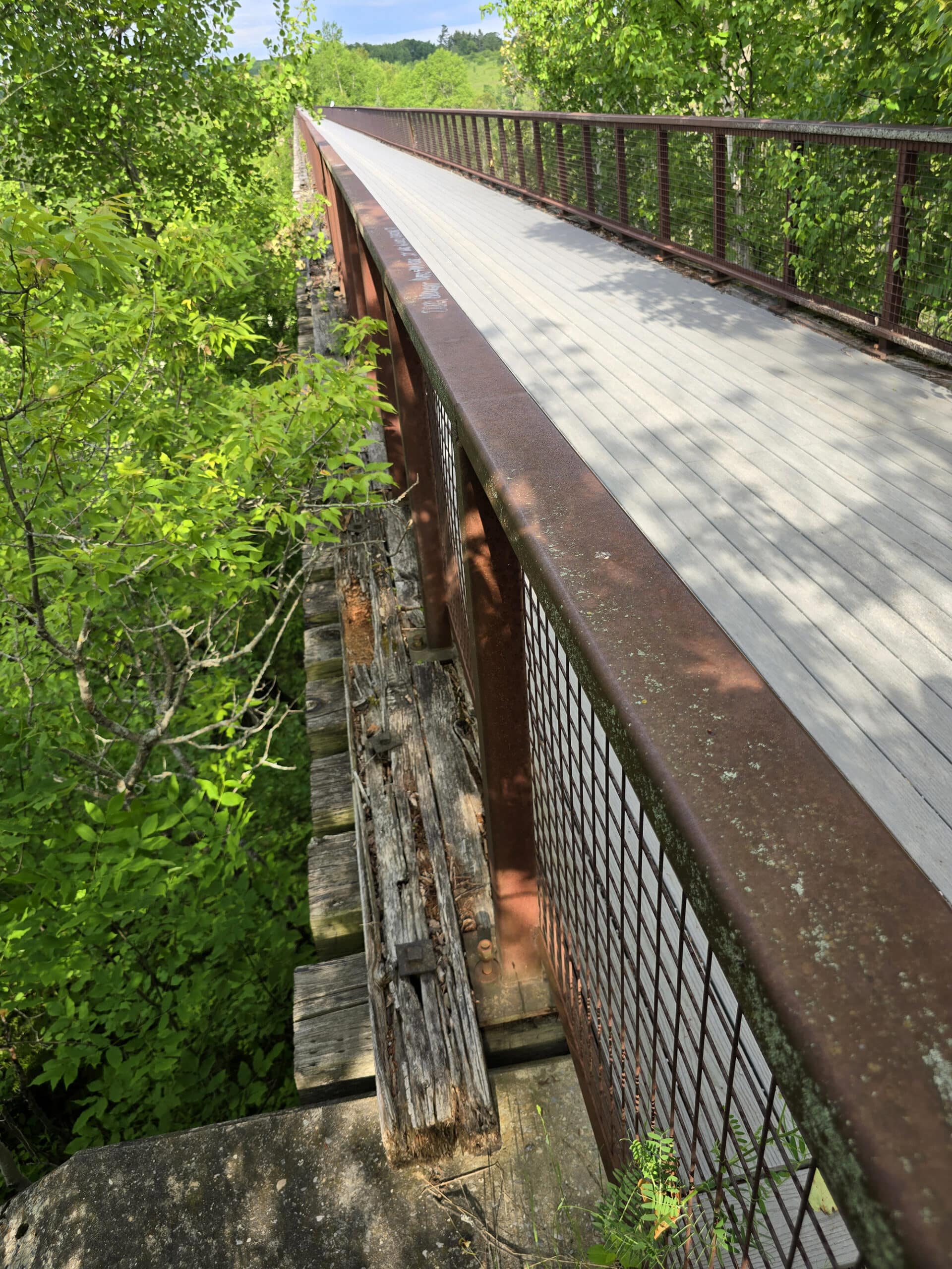
Doube’s Trestle Bridge was built in 1883, as part of what would become the Canadian National Railways’ Omemee-Peterborough line. It’s 200 metres long, and 30 metres tall.
The bridge was originally a wooden trestle bridge, with the central part of the trestle eventually upgraded into a steel bridge. This was done to help accommodate the heavier freight trains.
At that point, the bridge became property of the provincial government and the rails were pulled out.
Eventually, the whole thing - tail trail and bridge - became part of the Trans-Canada Trail, where it’s now a featured historic landmark along the Kawartha section of the trail.
2025 Update
2 months after we originally posted this review, the bridge sustained fire damage and was closed to the public. It reopened in time for our 2025 visit, and we had no idea what to expect.
We were actually shocked - we couldn't really tell what was different.
Porter walked the length of the bridge and eventually found a section - about 15 ft long - that looked like the boards had been replaced. The side barriers and everything appeared to be untouched.

Share the Love!If you’ve made one of our recipes, be sure to take some pics of your handiwork! If you post it to Bluesky, be sure to tag us - @2NerdsInATruck, or you can tag us on TikTok, if you’re posting video. We're also on Pinterest, so you can save all your favourite recipes and park reviews to your own boards! Also, be sure to subscribe to our free email newsletter, so you never miss out on any of our nonsense. Well, the published nonsense, anyway! |
Entertainment and Activity
Some basic information on the activities you can partake in, on the Doube’s Trestle Bridge trail.
Hiking
The Kawartha Rail Trail section of the Trans-Canada trail is 54 km long, and stretches from Manilla to Peterborough.
As mentioned, it’s a really nice wide, flat trail with a well packed surface.
I’m a fan of surfaces like this, as rainy days don’t negatively impact the experience! (I’m NOT a fan of trying to cross large muddy sections of trail!
Fairly early on, you come to another trestle bridge - at least we think it’s trestle.
Not sure if there’s a quantitative measure to define “short spans” of bridge, or if it’s more a matter of proportion to the overall bridge length... I digress.
It’s a nice little bridge to walk under, and almost serves as a visual.. Appetizer?... to the main event, further up the trail.
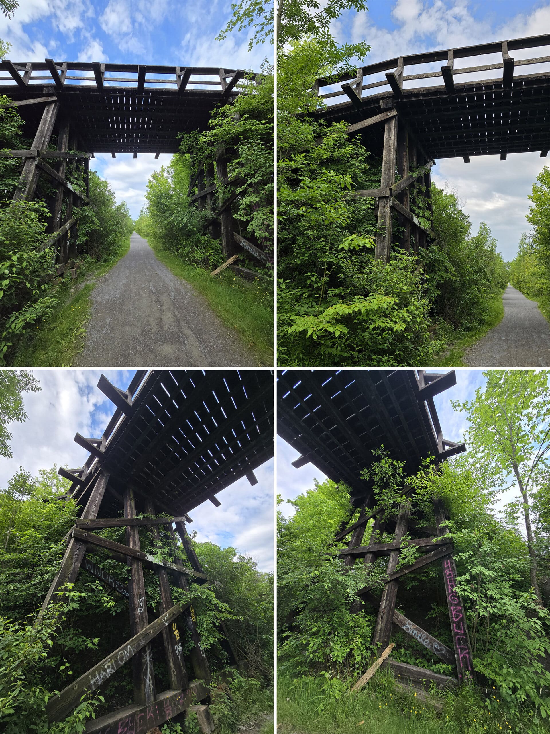
It just makes for a really nice vibe on the walk.
Around 1 km in, you come to Doube’s Trestle Bridge.
Many were missing, rusted through, or were kind of loosely sitting in sections of rotted wood. So, definitely safe to cross... but wouldn’t recommend leaning on the railing, as you take in the views of the area!
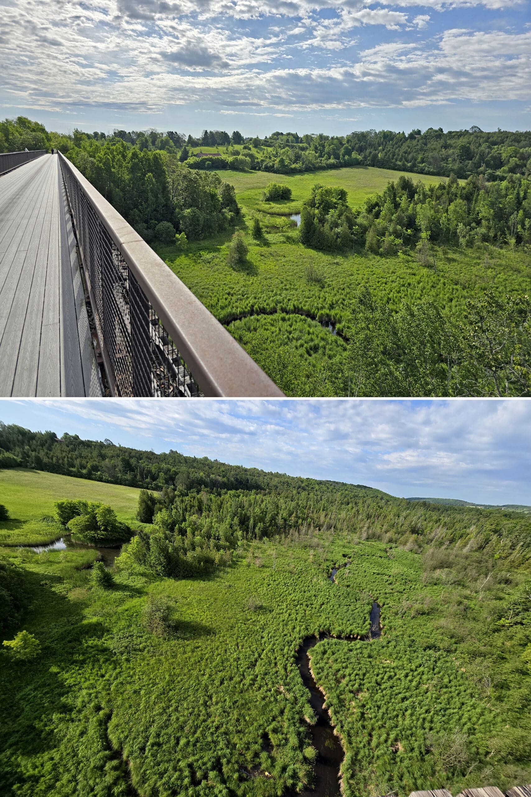
Pro tip: The bench on the far side has a much better view.
All in all, a nice little section of trail, and it really left us wanting to see more of the Trans Canada Trail in the future!
Biking
The Kawartha Trans Canada Trail looks like a FANTASTIC place to go cycling ... and I’m still kicking myself that we weren’t able to go back with our bikes.
The weather and timing just didn’t work out for it. 🙁
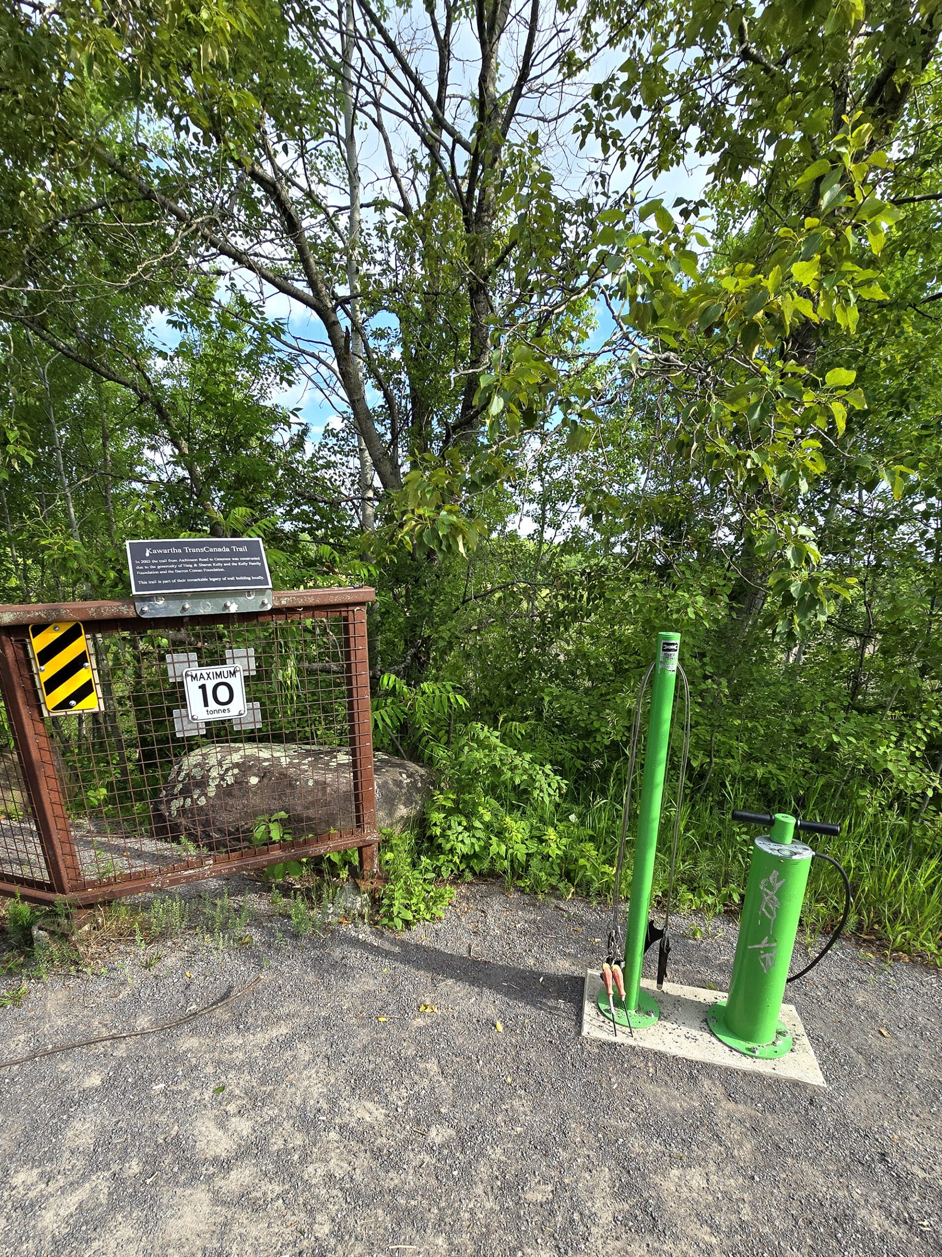
Not only was the trail perfect for it, the trail association really seems to welcome cycling.
I love when I see these little repair stations out on trails - it’s so thoughtful! This one was located right next to the bridge.
Birding, Wildlife, and Nature
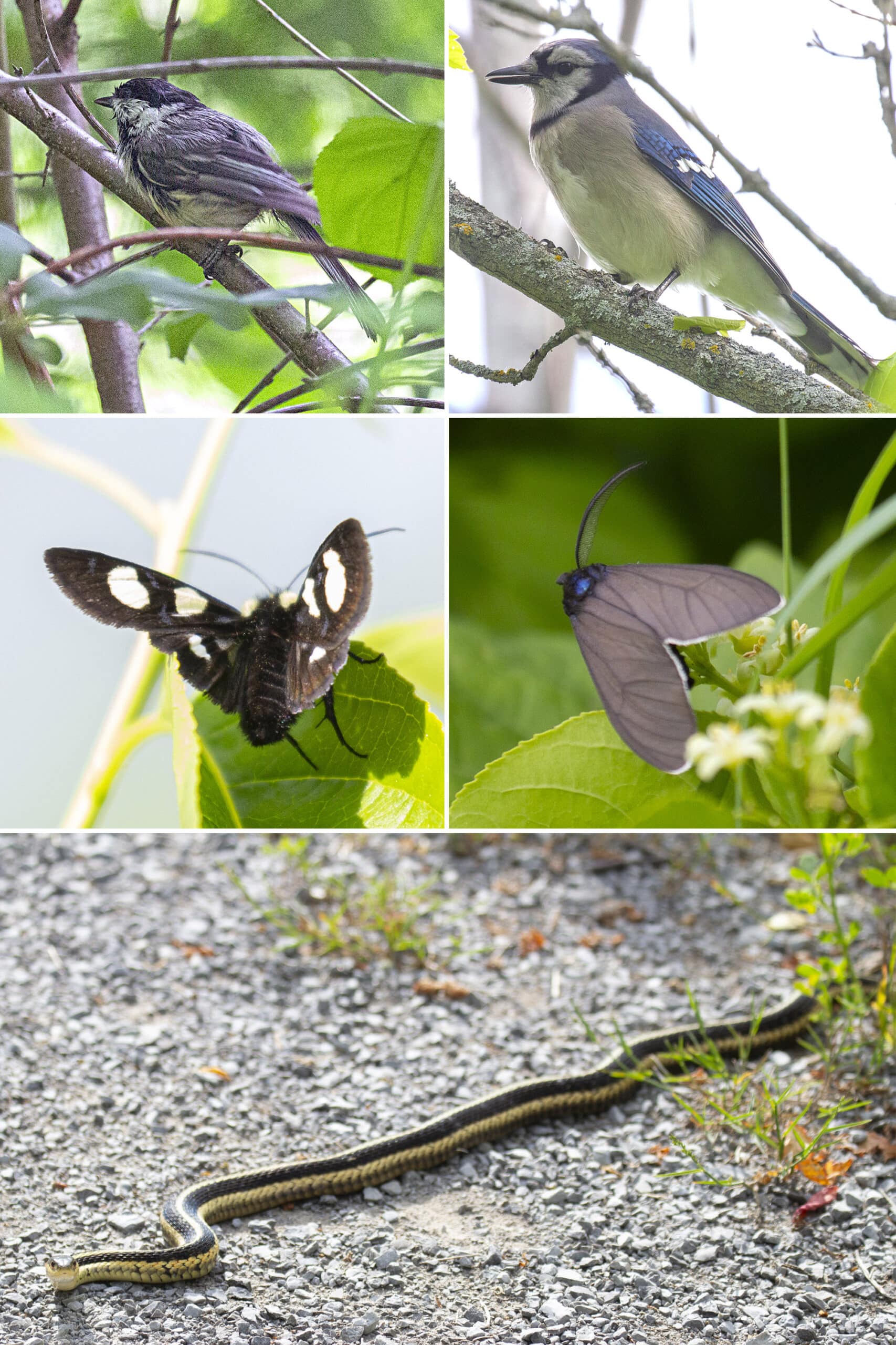
On the morning of our walk, the trail was fantastic for hearing - and sometimes seeing! - birds, but the lighting didn’t work out so well for actually photographing them.
Overall, we’ve seen or heard: American Crow, American Goldfinch, American Robin, Black-And-White Warbler, Black-Capped Chickadee, Blue Jay, Bobolink, Cedar Waxwing, Eastern Meadowlark, Golden-Crowned Kinglet, Hermit Thrush, House Wren, Pine Warbler, Red-Winged Blackbird, Savannah Sparrow, Song Sparrow, Swamp Sparrow, Yellow Warbler.
Beyond the birds, an Eastern Garter Snake crossed the trail right in front of us on the way back, on our first visit.
Porter ended up calling me “Indy”, and I realized that I’m kind of surprised it’s taken 18 years for him to make THAT comparison. I’m a nerd that’s VEHEMENTLY opposed to snakes *and* Nazis.
I’ve been called worse, LOL!
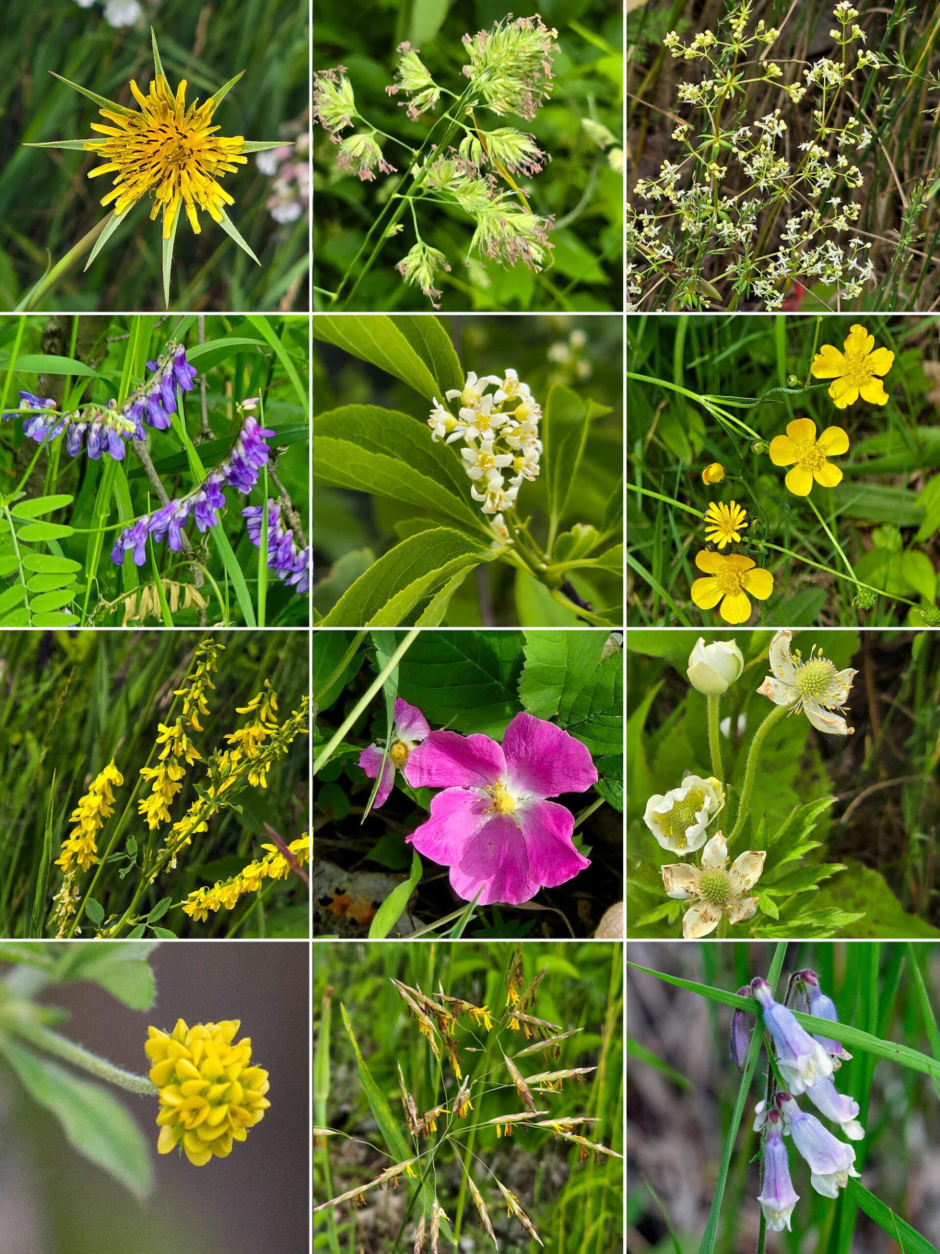
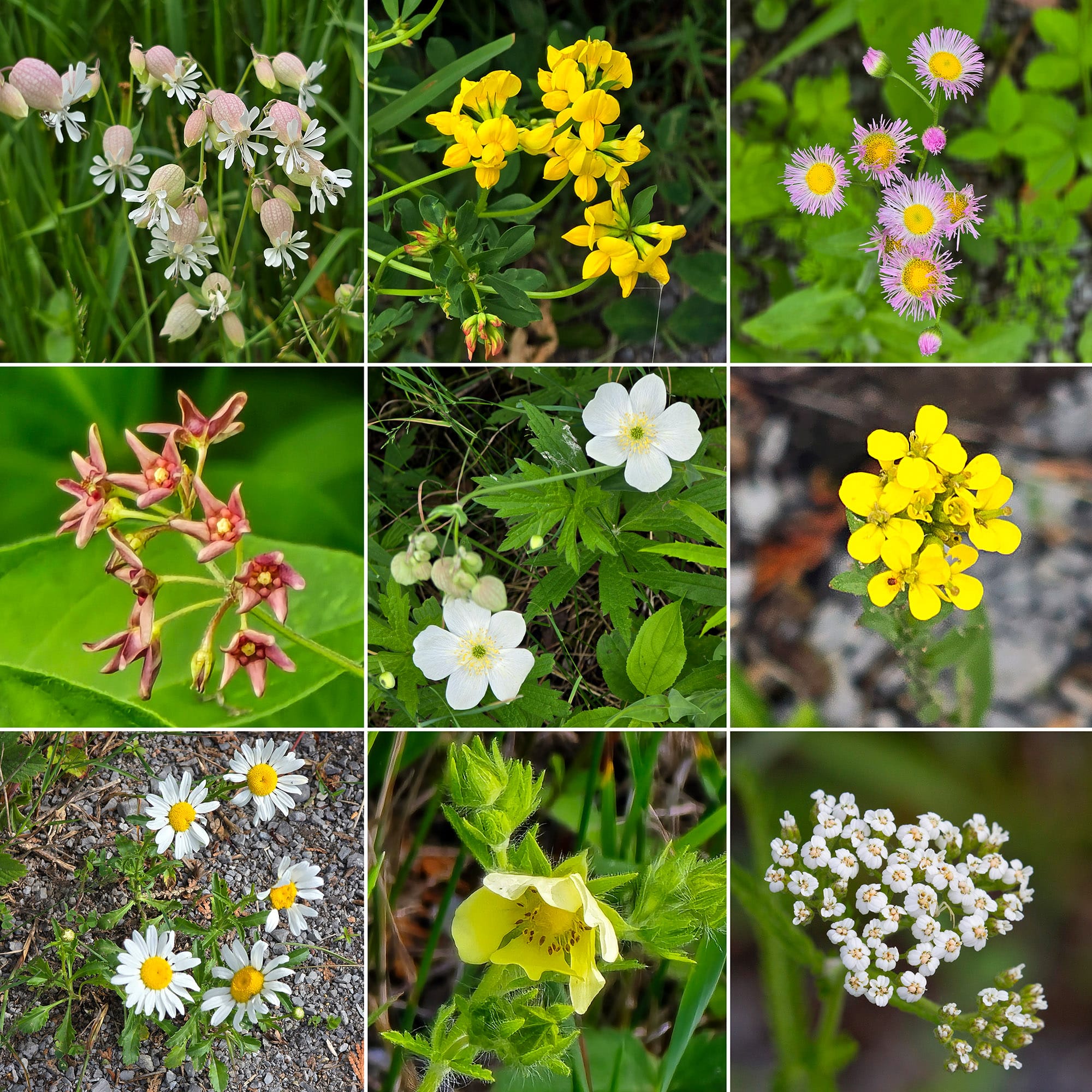
Anyway, there were also were a TON of different wild flowers along the trail, as well as some apple trees and raspberry bushes.
Niantic Games
There are two Portals / Pokestops / etc, right at the bridge. Nothing at the Orange Corner’s trail access point, though.
If you’re coming from the west, there’s another where the trail crosses Highway 7, and three more where it crosses Emily Park Rd.
We had plenty of internet connectivity at the bridge, but didn’t check at the other trail access points.
Educational & Cultural Opportunities
We saw a single educational sign, on the bridge itself. It discussed the history of the bridge.
Final Thoughts
Slightly mixed final thoughts here, between the two of us.
For me - not so into bridges, didn’t go more than a few metres out on the bridge itself - I loved it!
The trail was super easy to walk on, the views were great, and I loved how varied the flora and fauna were, even over such a short distance.
My only regret - and I’m still kicking myself about this, two weeks later! - is that we didn’t go back with our bikes. I would have loved to see more of the trail!
Just, you know, going in the other direction of the bridge. 🙂
Porter loved the trail itself, loved the concept of repurposing rail bridges as trails. As a mechanical engineer, though, he was deeply unsettled by some of what he saw out on it.
Said it’s absolutely safe for cyclists - and pedestrians walking along it - but he questions the safety of the railing attachment.
Definitely recommends the experience, but strongly urges everyone to NOT lean on that rail, and keep a close eye on any kids that may do so.
Rusty rail attachments or not, we’ll definitely be back, next time we’re in the area!
More Southwest & Central Ontario Provincial Parks & Places to See
Want to read some more about the parks we've camped and at places we've seen in Southwestern & Central Ontario? Here are some more posts!
Southwest/Central Ontario Campground Reviews:
Awenda Provincial Park
Balsam Lake Provincial Park
Bass Lake Provincial Park
Bronte Creek Provincial Park
Bruce Peninsula National Park
Conestogo Lake Conservation Area
Craigleith Provincial Park
Darlington Provincial Park
Earl Rowe Provincial Park
Elora Gorge Conservation Area
Emily Provincial Park
Falls Reserve Conservation Area
Fifty Point Conservation Area
Inverhuron Provincial Park
Long Point Provincial Park
MacGregor Point Provincial Park
Mara Provincial Park
McRae Point Provincial Park
Meaford Memorial Park
Pinery Provincial Park
Point Farms Provincial Park
Port Burwell Provincial Park
Rock Point Provincial Park
Rondeau Provincial Park
Sauble Falls Provincial Park
Selkirk Provincial Park
Sibbald Point Provincial Park
Turkey Point Provincial Park
Valens Lake Conservation Area
Warsaw Caves Conservation Area
Wheatley Provincial Park
Southwest/Central Ontario Places to See:
Big Bay, Ontario
Canada's Dinosaur Park
Cheltenham Badlands
Devil's Monument
Eugenia Falls Conservation Area
Flowerpot Island
Hogg's Falls
Inglis Falls Conservation Area
Indian Falls Conservation Area
Jones Falls
Keith McLean Conservation Lands
Lion's Head Lookout Trail
Mark S. Burnham Provincial Park
Menesetung Bridge
Mono Cliffs Provincial Park
Peterborough Lift Lock
Petroglyphs Provincial Park
Point Pelee National Park
Rattlesnake Point Conservation Area
Scenic Caves Nature Adventures
Spirit Rock Conservation Area
Springwater Provincial Park
Wasaga Beach Provincial Park
Want to explore beyond Southwest and Central Ontario? Check out our full list of Campground Reviews, Ontario Waterfalls, and other Places to See.
We also have a ton of Camping Recipes to cook up, while on your adventures!
Thanks for Reading!If you loved this post - or have any questions about it - please leave a comment below! We'd also love it if you would consider sharing the link on social media! |


Liz
Thanks.
I’m new to Peterborough and appreciate the information.
😊