
Located in Bracebridge, High Falls is one of the biggest and most popular waterfalls in the Muskoka region. Here's what you need to know!

It’s since become a must-see destination for us, whenever we’re in the Muskoka region. Beyond the main waterfall itself, it’s just a really great place to visit - ethereally lush trails through a forested area, two more waterfalls, a cute picnic area - it’s always a great time!
That said, a little blurb as a “things to see near Arrowhead Provincial Park” section in a campground review just doesn’t do justice to the High Falls Picnic Area, and everything you’ll find there!
So, after our most recent visit in Spring 2026 ... we decided to give it the full visitor’s guide treatment here on 2 Nerds in a Truck.
Now we can share more information about the picnic area, the two other falls on the property, and those GORGEOUS hiking trails.
So, let’s get to it!
The Basics:
Location Name: High Falls Picnic Area
Address: Bracebridge, ON (No proper address, click for Google Maps Location)
Website: N/A
Price Free!
Reservations: Not applicable
Season: Mid May to Mid October.
Park Hours: 5 am - 9 pm Daily.
Logistics
One thing to note: If you search “High Falls” in Google Maps, it’ll take you to a parking spot across the falls - if it takes you to the RIGHT “High Falls” at all. (There are many different waterfalls of the same name, even in Ontario. At least THREE are in Algonquin Provincial Park, alone!)
You’ll want to either search “High Falls Picnic Area”, or click the link we provided in the “basics” section, above.
Beyond that, here is some basic information to help you plan your visit to Muskoka’s High Falls:
Registration and Check In
This is basically a rest stop kind of park. While it’s gated in the off season, there’s no gatehouse or anything to check in at when it’s open.
There’s no need - or ability - to reserve parking or anything, you just show up, find your parking, and start exploring!
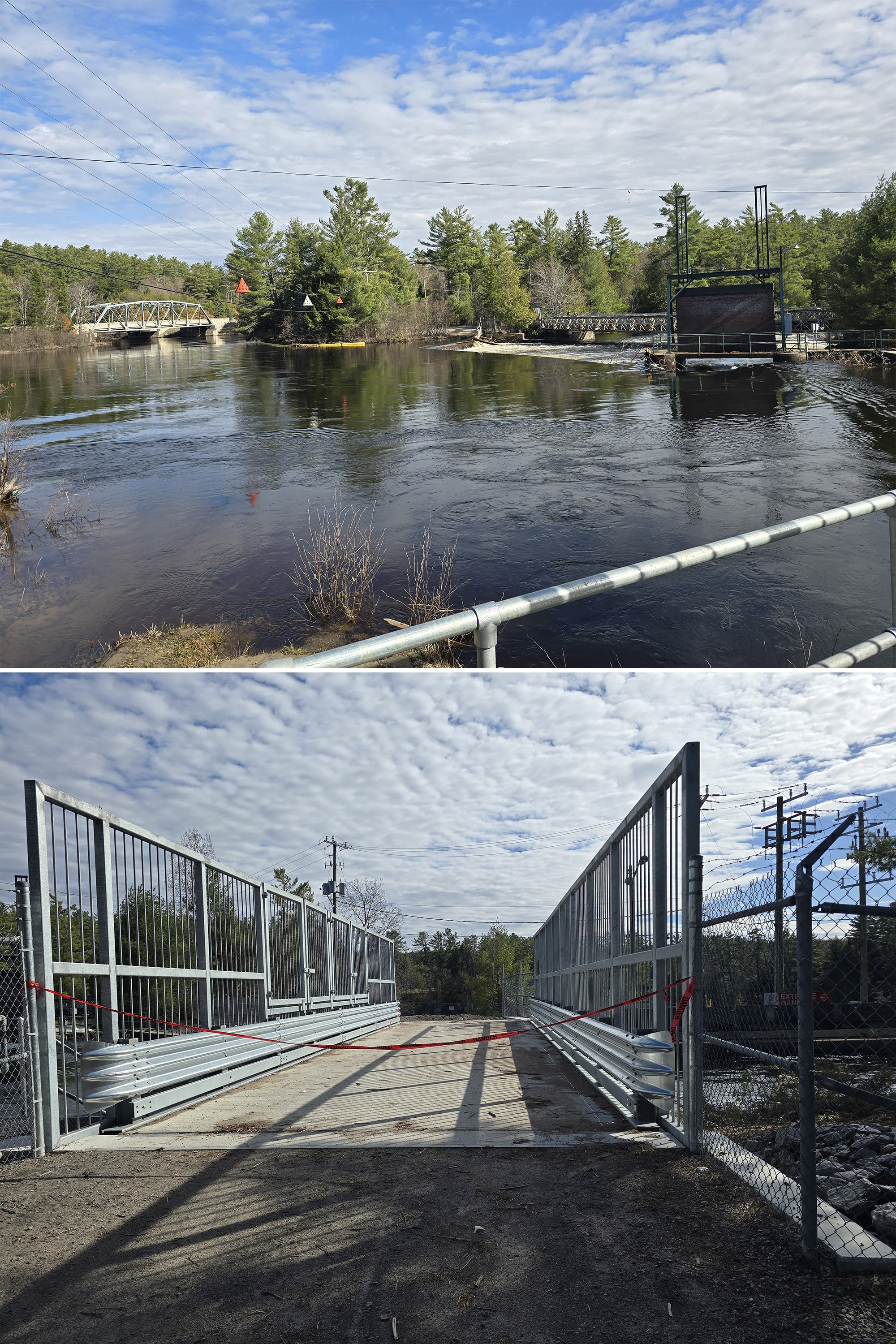
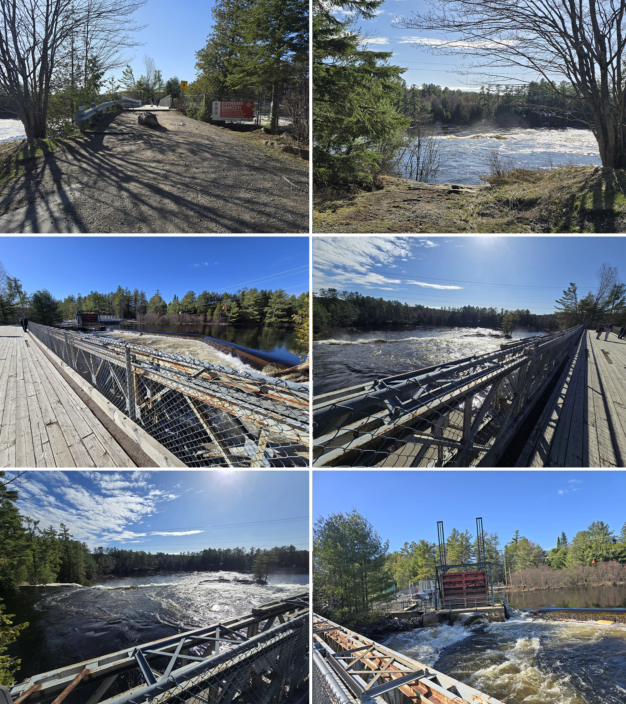
As a note: If you come in via Power Pt Rd - north of the falls - you may or may not be able to cross the bridge over the falls. Sometimes it’s blocked off - I’m guessing due to the high water levels?
Parking
There is VERY little in the way of parking at High Falls.
At the end of the park’s loop - right at the upper part of the falls - there are maybe 4-5 parking spots.
Aside from that, you can park at each of the handful of little picnic nooks... but that’s about it.

Washrooms
There is a small, seasonal washroom building to the right, as soon as you enter the main parking area.
If you’ve turned left / gone onto the loop to head towards the falls, you’ve passed it.

Maps and Signage
There is no park map - unfortunate, on account of the trails! - and very little in the way of signage.
If you’re just looking for easy access to the falls, it’s pretty easy to find it - just follow the road until the end of the loop, and you’ll see the bridge easily!
If you’re looking to hit the trails though, it’s more of an exploration thing.
The trails from the main road (on the back half of the loop / when you’re returning from the bridge area) aren’t marked, but they’re pretty obvious when you see them.
The one closest to the falls is fairly difficult to get down (slippery rocks!), but is the closest to the best viewing areas.
If you go a bit further down the road - closer to the entrance of the park - you’ll find a few more trails into that forest area. The last main one is a flat and easy one, that will take you to the bridge over Potts Falls.

Accessibility
The accessibility of High Falls Picnic Area really depends on what you’re looking to do.
In terms of just visiting, checking out the falls from the top, picnicking, etc - fairly accessible. There’s a barrier-free washroom stall, and parking at each of the picnic outlets.
While there are no designated disability parking spots on site - as far as we saw - if you CAN snag a spot at the falls, you should be able to get a view.
The bridge over the falls has a step up to get to it, but - as you’re looking from the parking towards the falls - if you go to the left down the road, there’s a natural path down to a viewing area, on your right.
This is the best view of the falls for those with mobility impairments.
Note: If you come to the wooden steps, you’ve gone too far.

Getting down to the better views of the falls means getting down steep areas, stepping down boulders - slippery in a lot of areas - and, depending on where you go, climbing over a large fallen tree.
I’ve done some wild stuff while in a walking boot, and I would ABSOLUTELY not recommend doing so here.
If I were using any kind of mobility aid at all, I would stick to the viewing area at the top side of the falls.
That said, one of the paths in from the main road - the one marked with a portage sign - is a fairly easy, flat path that will take you to a bridge on top of Potts Falls, with a really nice view of the area from there.
It may or may not actually be wheelchair accessible, but any other mobility aid should be fine.
Pets
We’ve seen several dogs walking the trails. They were all larger, though - smaller dogs may need help getting up some of the larger rocks and such.
There are garbage cans in the picnic area, but no poop baggie dispensers - so plan accordingly and PLEASE pick up after your pet!
Park Store
There is no park store of any kind at High Falls Picnic Area.
Visitor Centre
There is no Visitor Center at the High Falls Picnic Area.
Picnic Area
There are a handful of picnic areas along the loop of road that goes through the park. Probably 5 of them?
They’re individual little nooks, with a single picnic table and space for a car or two to park right at the site.
As a note, the one on the right - just before the bridge - by FAR has the nicest view. It’s right on the water ... at least in the spring!

Connectivity
We always seem to have decent to good internet reception at High Falls Picnic Area, on Rogers Wireless.
I can never resist uploading waterfall videos to a friend or two, while on site!
High Falls Picnic Area Waterfalls
While it’s named after the largest and most impressive waterfall in the area, there are actually 3 waterfalls in this park, just a short walk from each other.
2 of them are easy to get at least some kind of view of, the third will require a short hike to access.
These are:
High Falls
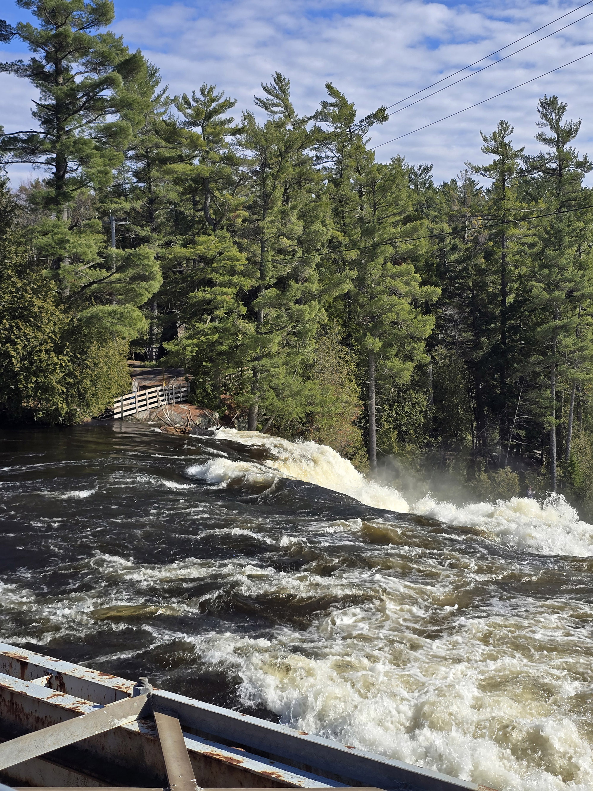
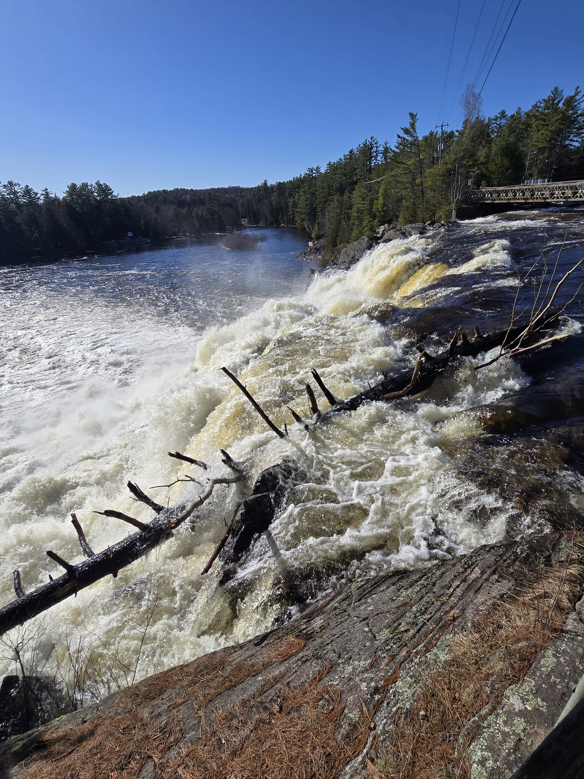
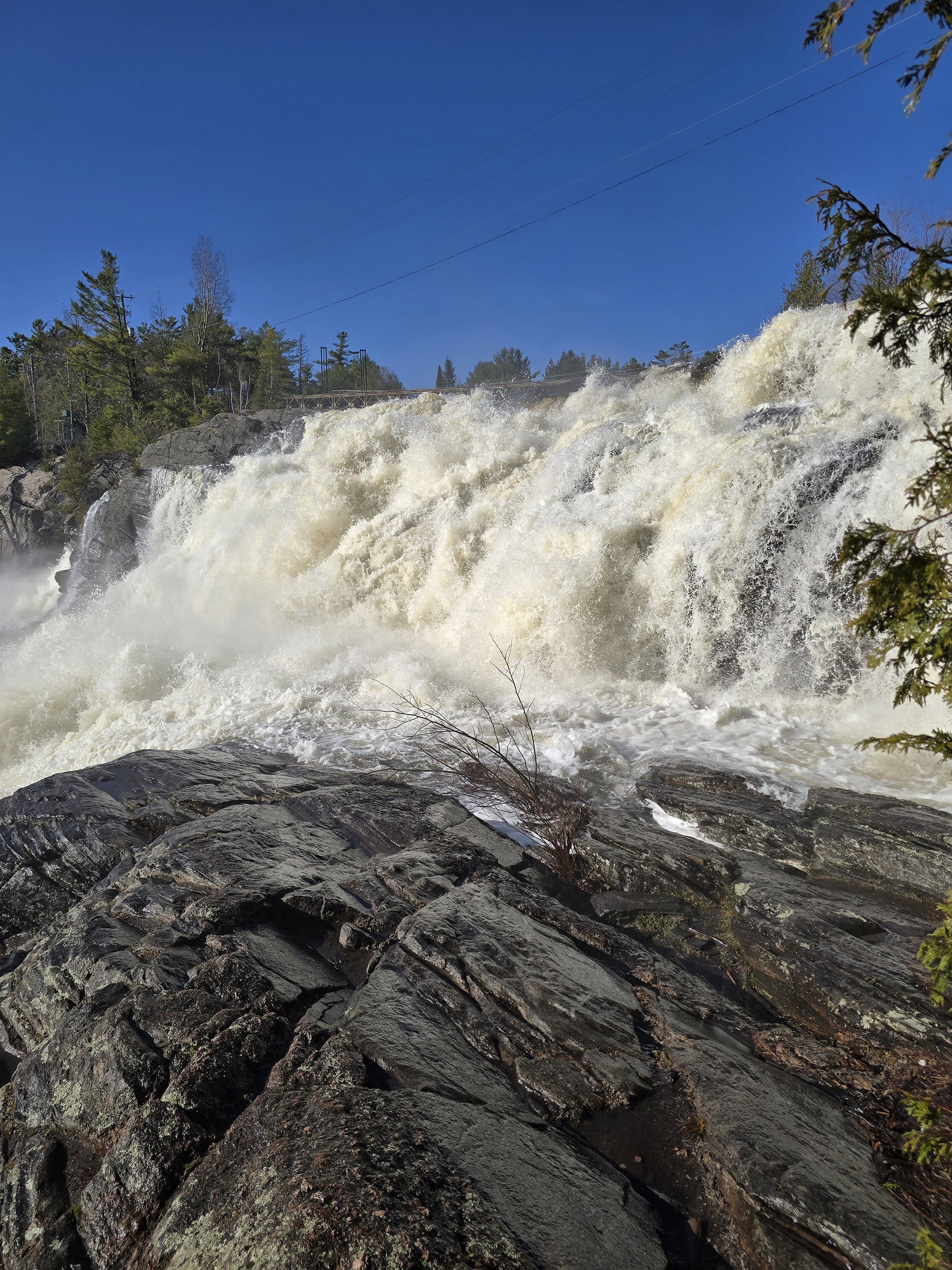
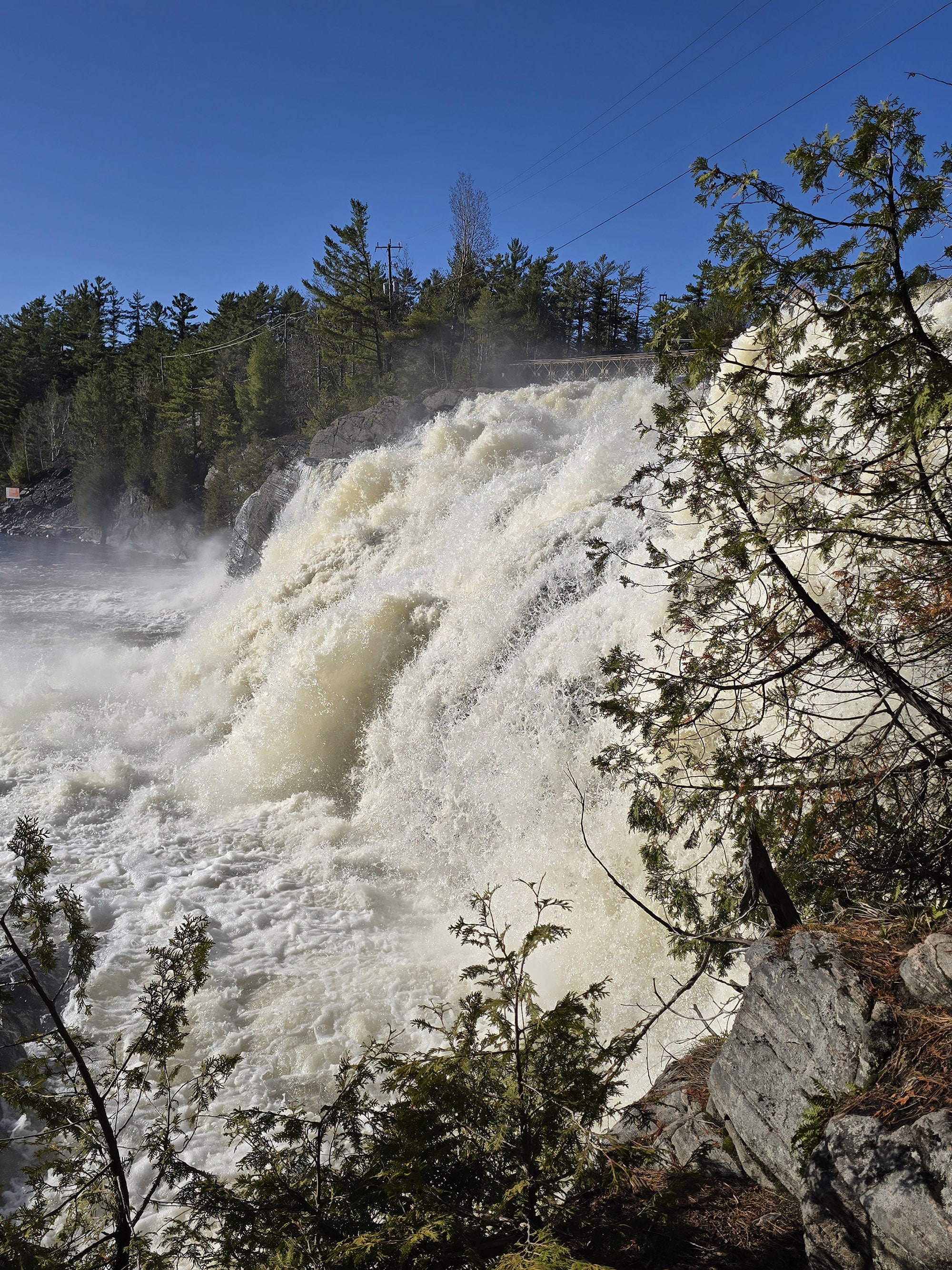
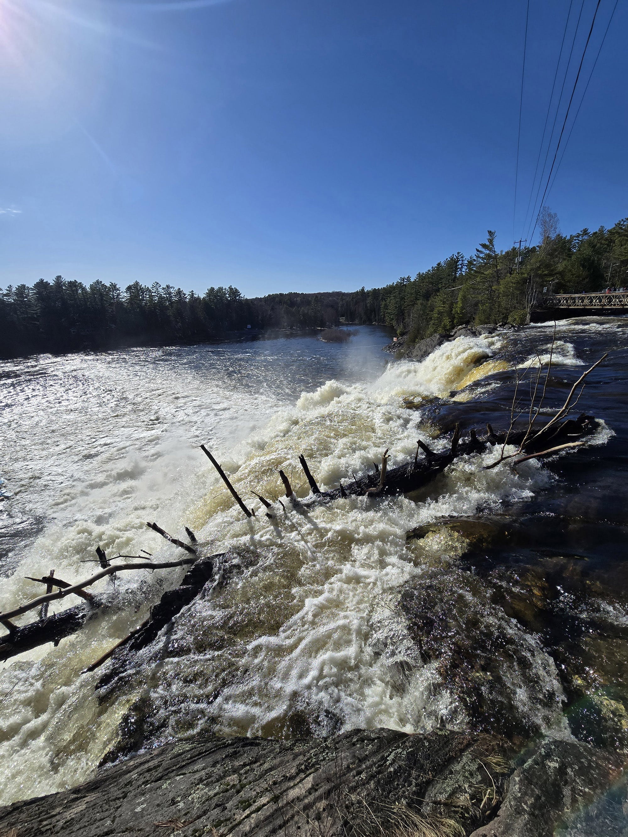
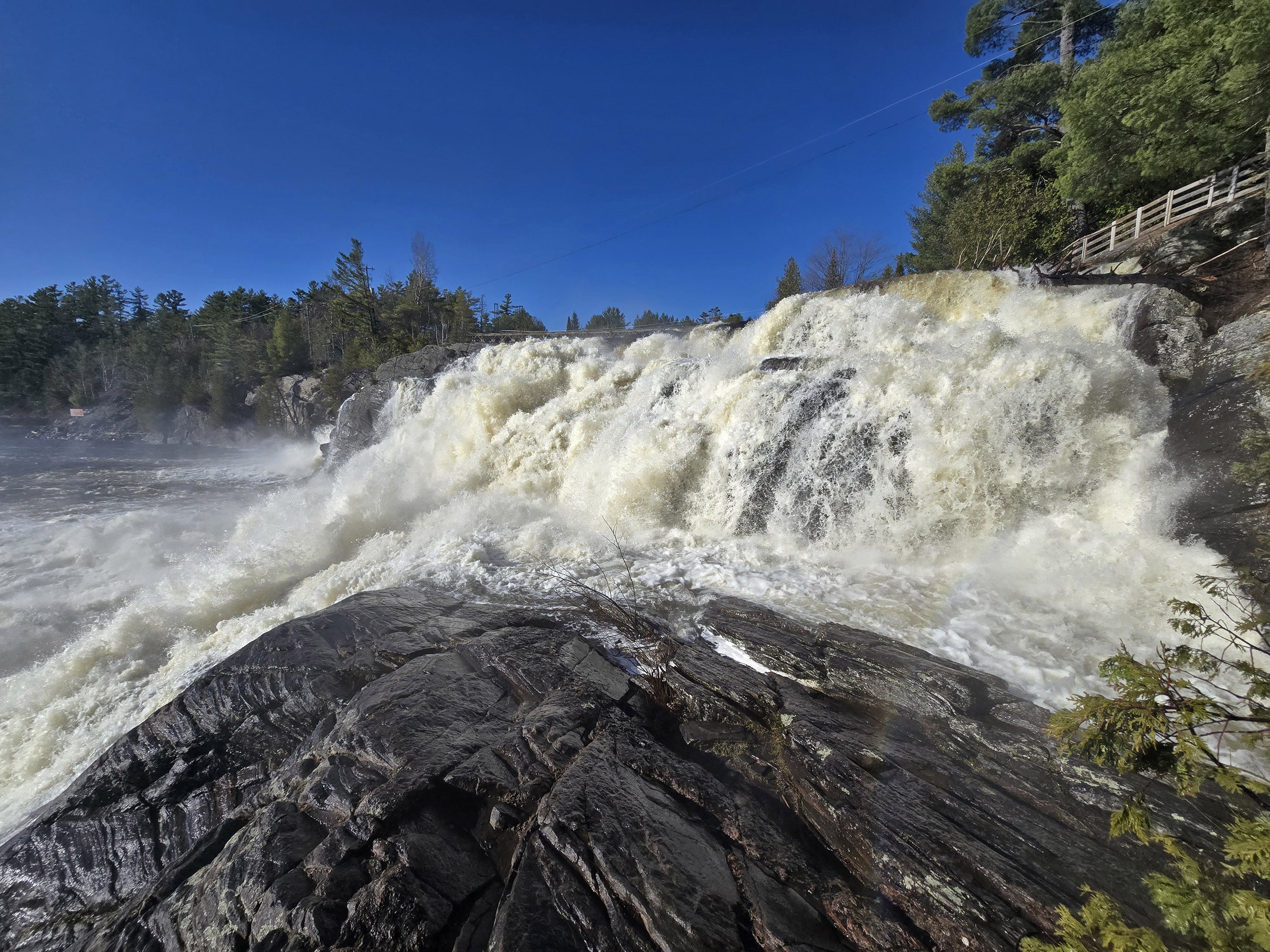
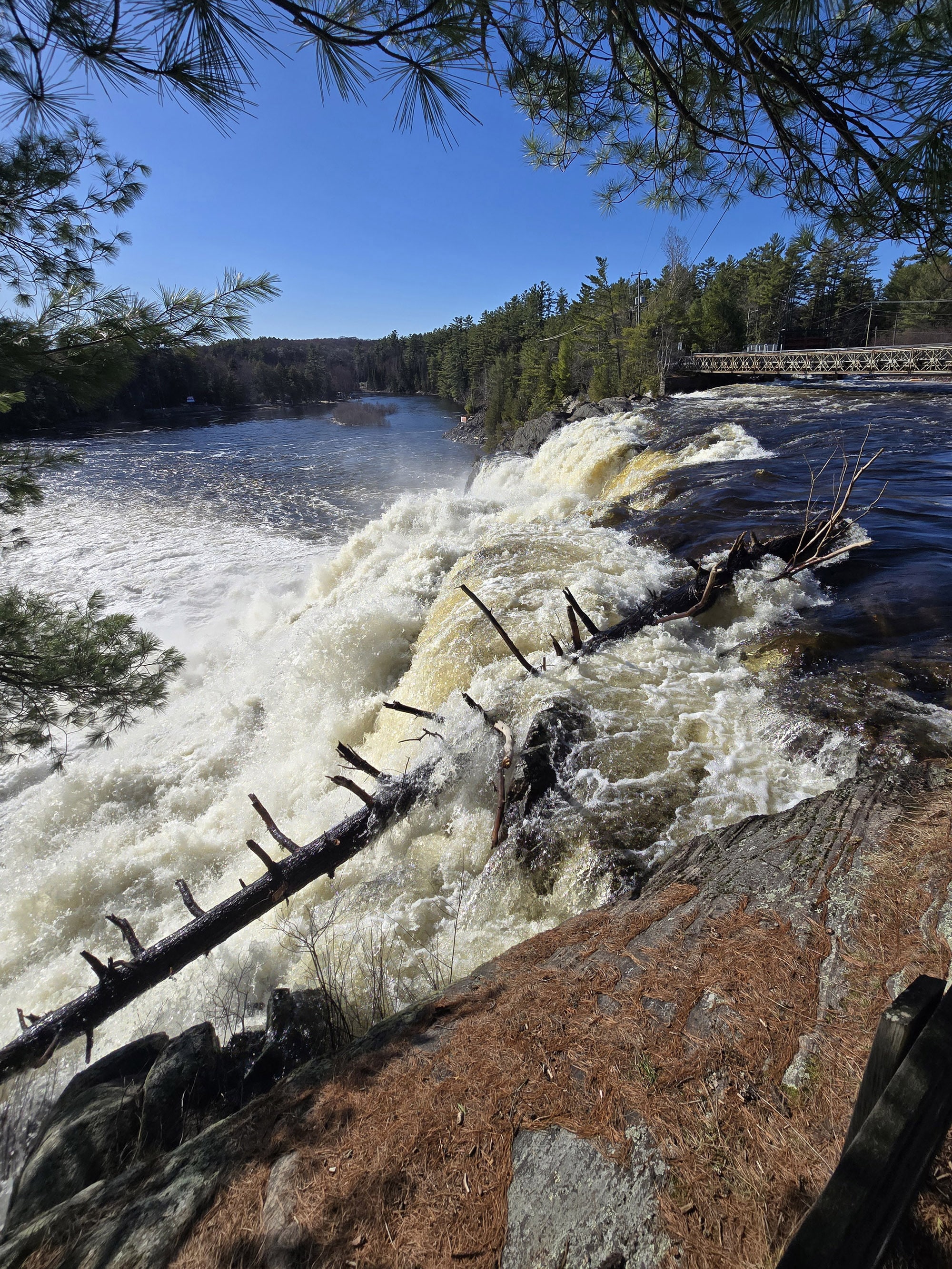
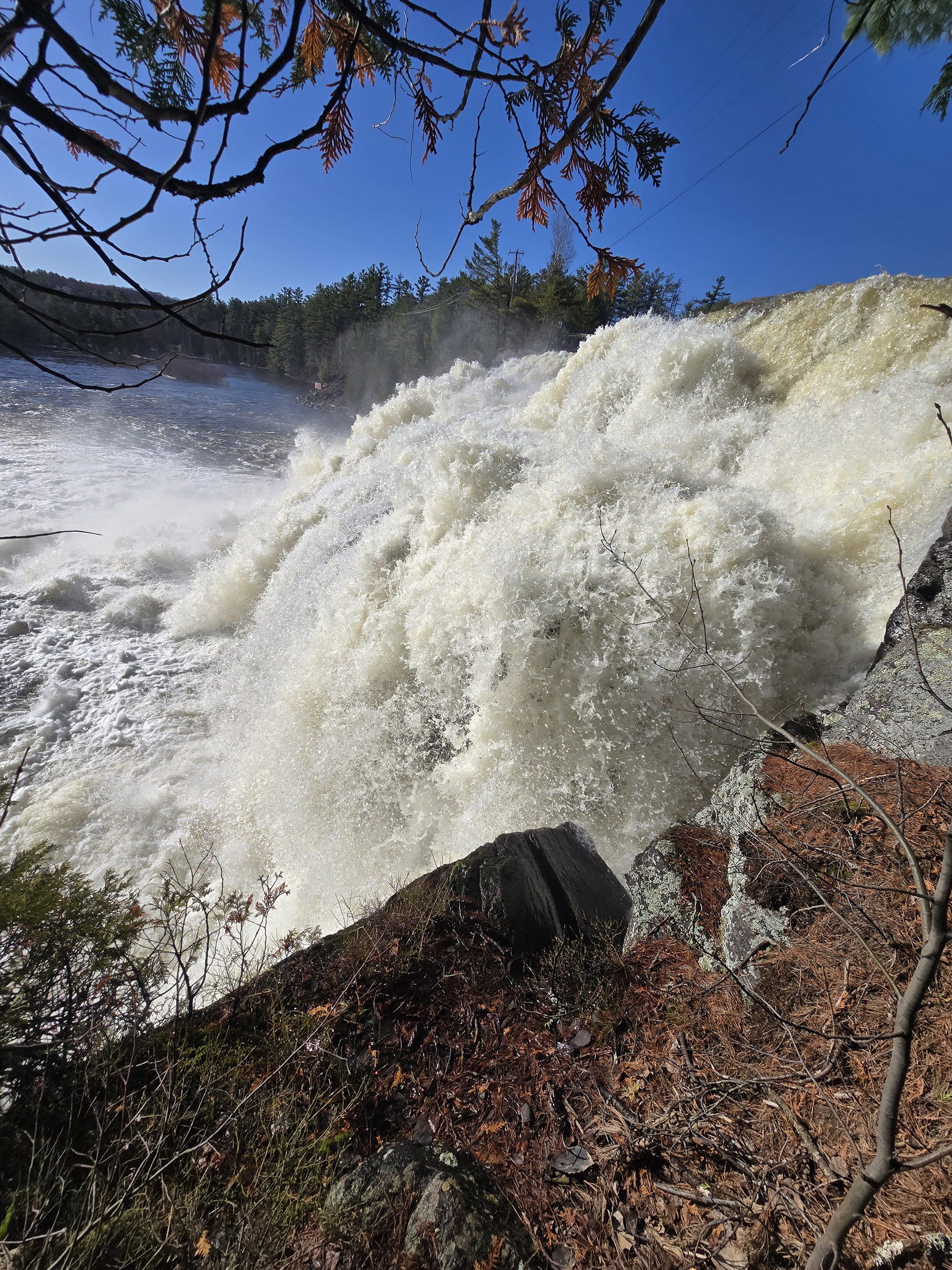
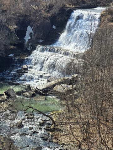
At about 16 metres tall and 30 metres across, High Falls is one of the biggest waterfalls in the Muskoka area. It’s a cascade style waterfall, and the watercourse is the north branch of the Muskoka River.
Sometimes it’s referred to as “Niagara of the North”. I mean, it’s a nice waterfall, but I definitely reserve that nickname for Kakabeka Falls!
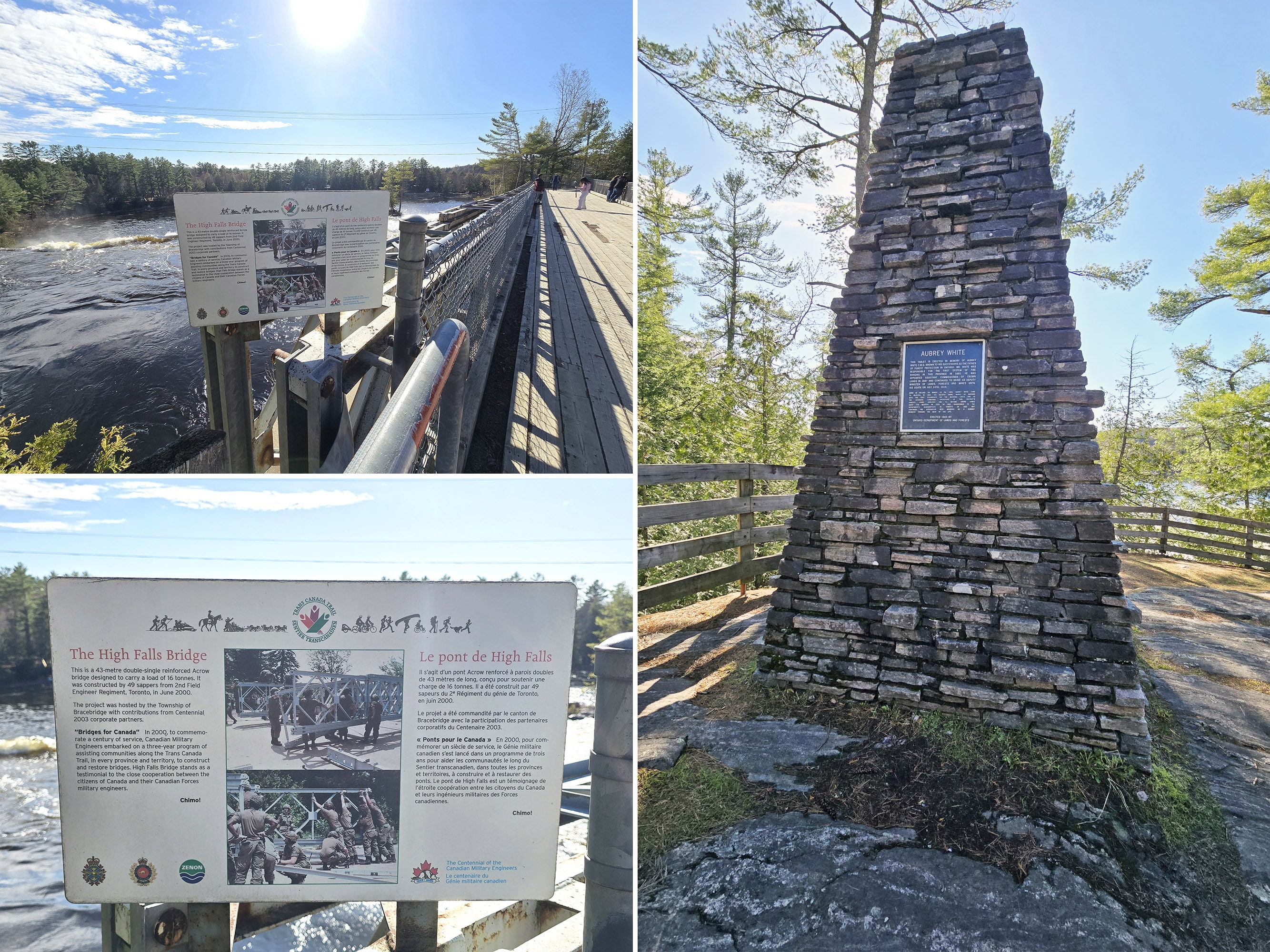
Anyway - like many waterfalls - High Falls is part of a hydroelectric generating setup, with the power generating equipment just above the falls. Unlike many of those waterfalls, though, you can easily get great views - and photos - of High Falls WITHOUT that infrastructure visible.
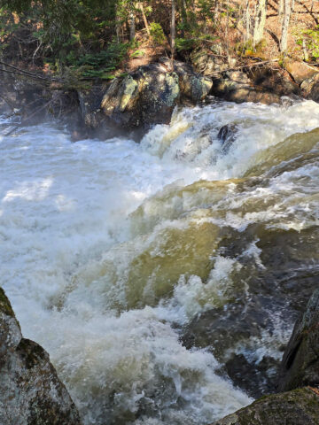
1. From the bridge that runs overtop. This is the easiest to access, right from the road/parking area. You can see the top of the falls - and the water below - but that’s about it.
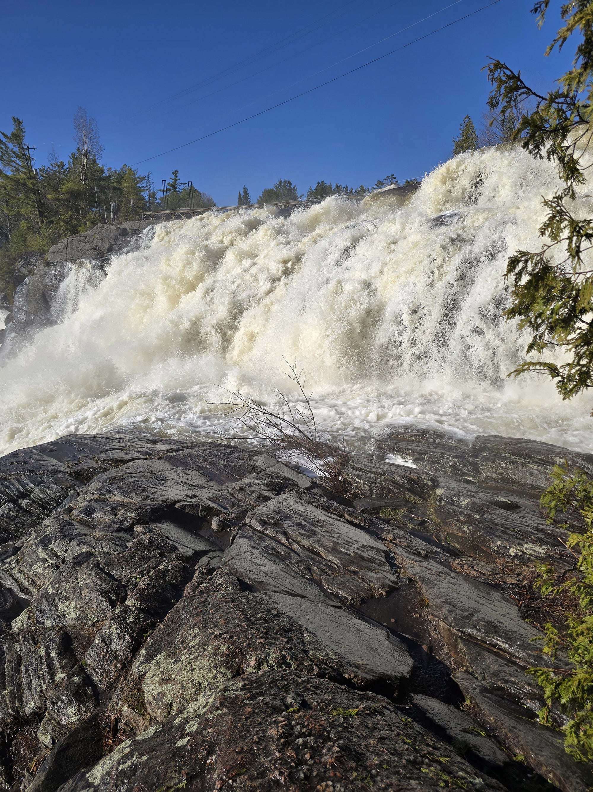
2. From a viewing area to the left of the bridge (when looking at it from the parking area).
If you walk a few metres further along the road, there’s an open area with a tall rock monument in it. There’s a sloped path and set of set-in wooden steps leading down to an area that overlooks the side of the waterfall.
This is the easiest view of the waterfall itself, and it’s RIGHT next to it.

When the water is low, you can easily get out on some rocks that jut out in front of it, but this is far too dangerous when there’s a strong flow on the go.

5. From the High Falls Bay Camping & Waterpark , below. This is really the only place to get a straight-on view of the falls, but it’s from a distance and requires a reservation!
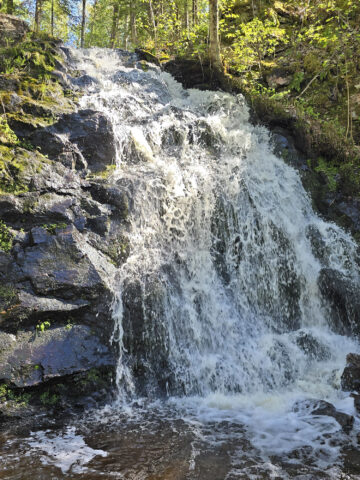
Little High Falls
Little High Falls is a ... well, little... cascade waterfall that’s kind of off to the side of High Falls.
Like Pott’s Falls - more on that in a minute - its watercourse is Potts Creek, which flows along the picnic area, down in the lower, forested area.
Short of booking a reservation at High Falls Bay, the only way to see this one is to hike down along Pott’s Creek.
There’s a pretty good view of the falls on the picnic area side of the creek - it’s very close to the lower viewing area (#3 above) for High Falls. Just head away from the falls, along the water - you’ll come to it in about 1 minute.
Alternately, you could cross Potts Creek over Potts Falls and walk down to the edge of the Muskoka River on that side, for a better view of the Little High Falls from below.

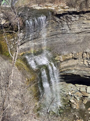
Potts Falls
Like Little High Falls, Potts Falls is located on Pott’s Creek... just a little further away from the Muskoka River.
You can hike along either side of the stream to get there - with access to the base of the falls from either side - or take the trail with the Portage sign straight to a bridge over it.
From the bridge, you can hike to the base on either side, if you like.

About the Names...
There are some WILD inconsistencies when it comes to the names of Little High Falls and Potts Falls. I’ve seen both falls referred to with each of the names, and ALSO both falls named as “Potts Falls”, with one being “Upper Potts Falls” and the one next to High Falls being referred to as Lower Potts Falls.
Google Maps has each one noted, and it refers to them as I have - with the upper falls being Potts, and the lower falls being Little High Falls.
This makes the most sense to me, partially because it seems weird to have the upper one called “Little High Falls”, rather than the smaller waterfall that’s right next to High Falls.
So, apologies if it’s wrong, but I’m choosing to see the Google Maps naming convention as the correct one.

Share the Love!If you’ve made one of our recipes, be sure to take some pics of your handiwork! If you post it to Bluesky, be sure to tag us - @2NerdsInATruck, or you can tag us on TikTok, if you’re posting video. We're also on Pinterest, so you can save all your favourite recipes and park reviews to your own boards! Also, be sure to subscribe to our free email newsletter, so you never miss out on any of our nonsense. Well, the published nonsense, anyway! |
Entertainment and Activity
Some basic information on the things you can see and do while visiting High Falls in Bracebridge:
Hiking
Aside from the Trans Canada Trail cutting through the picnic area (across the bridge over High Falls, along the picnic area road, and down the trail over Pott’s Falls), the trails at High Falls aren’t named or mapped.
It’s basically a case of... you take a path off the side of that main road, find your way down to the forest floor below, and wander around.

Certain times of year, this path gets pretty dangerous - wet moss, wet fallen leaves, etc make that descent SLIPPERY!

It’s a longer trail that takes you a little further away from High Falls, but it’s easier (and safer!) when the conditions are slick.
You’ll still need to navigate over some rocks, roots, and trees to get down there, though.
Once you get down to the bottom, you can turn left to go see the bottom of Pott’s Falls:

... or continue to the right, to head toward High Falls.

When you get to the area next to High Falls, you can (sometimes) walk out onto a flat rock for a good view - not advisable when the flow is high! - or continue up a bit of an embankment for a different view:

This is the where the Trans Canada Trail continues - you’ll connect up with the third (?) Trail from the main road, which is the one marked with the portage and Great Trail signs.
From here, you can cross the bridge and either hike down to the other side of Pott’s Fall’s, or continue along the Trans Canada Trail from there.

Biking
Aside from the little main loop of road, there really isn’t anywhere to go biking here.
Swimming
While there’s swimming at the resort nearby, there isn’t really any safe or desirable access to swimming from within High Falls Park.
Birding, Wildlife, and Nature
Weirdly, the most wildlife we’ve seen during our visits has been the odd squirrel. It’s usually pretty quiet for birding - or maybe we just can’t hear birds over the roar of the multiple waterfalls!
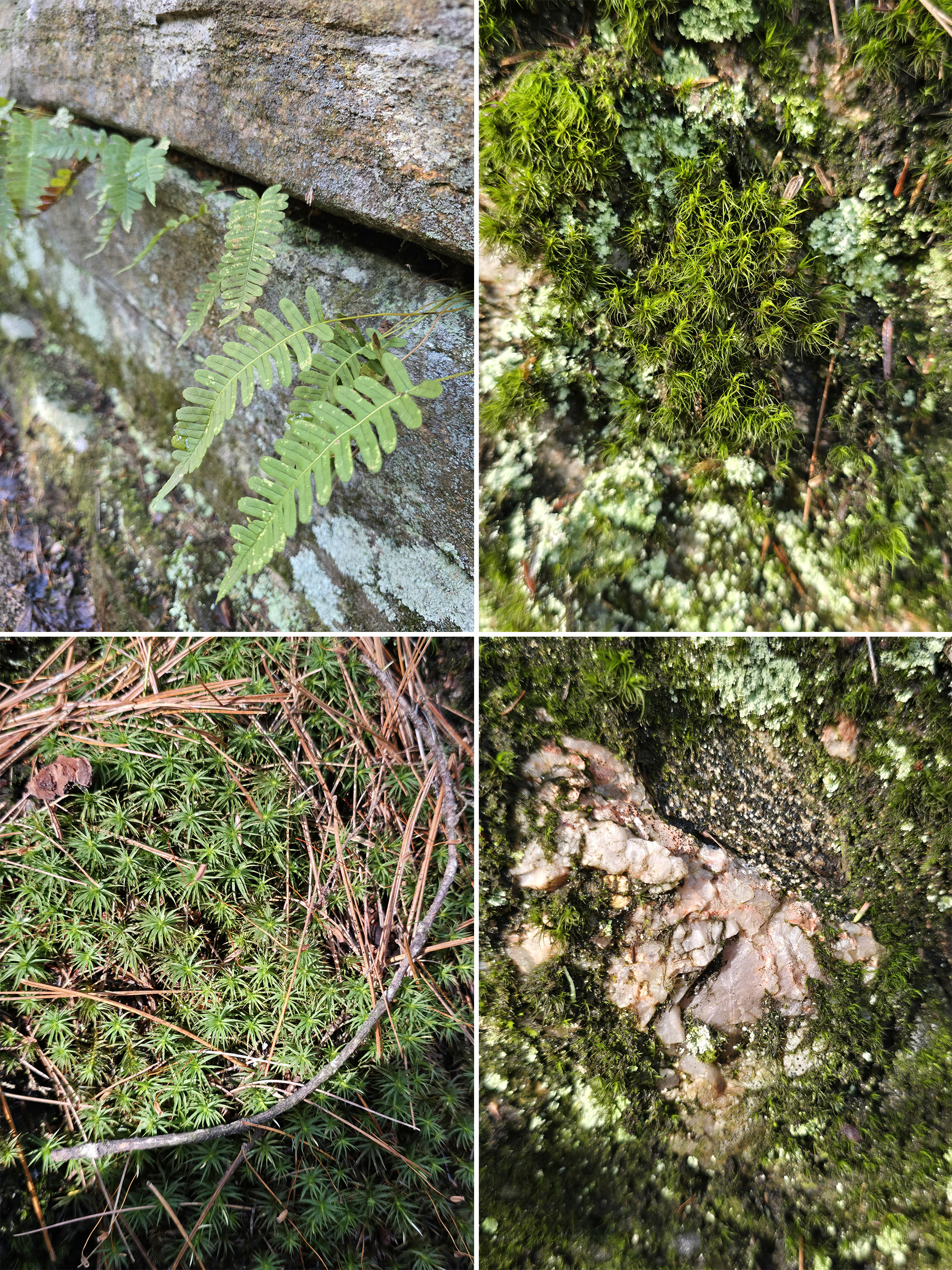
While it hasn’t really been a great birding destination for us, the vegetation is REALLY cool.
The hiking area is incredibly lush, and we love looking at all the different mosses and such that thrive on all the boulders down there!
Boating
There is no access for boating from within High Falls Picnic Area / Park.
Fishing
I’ve seen people with fishing rods heading into the park, but accessing fishing areas from that picnic area seems like a bit of a hassle. It’s Muskoka, so there are great fishing locations EVERYWHERE!
Educational & Cultural Opportunities
The only educational signage we saw at High Falls was one on the bridge, giving some history and details about the bridge over High Falls.
There’s also a memorial cairn for Aubrey White, with some information about the work he did as “The Father of Forest Protection” in Ontario. He was also Assistant Minister of Crown Lands, and eventually the Deputy Minister of Lands, Forests, and Mines.
If you have time, Google him - he seems far more interesting than we really have time or space for, in this post about waterfalls!
Niantic Games
There are a handful of Niantic Game features (Pokestops, Poke Gyms, Ingress Portals, etc) in the High Falls picnic area.
They’re mostly clustered right around High Falls itself, and there is generally really good cell phone reception in the area.
Final Thoughts
Obviously, we love High Falls - we make a point of stopping there every time we camp at Arrowhead Provincial Park!
It’s a great place to stop over and have a little picnic while on a road trip, but we really recommend spending a bit more time here, and exploring the trails a bit.
We love the mossy rocks and really the whole feel of the forested area below the main road. It’s so lush and gorgeous, with very ADD friendly trails. You can see and experience a lot of great views and get a bit of a workout, in a fairly small area!
The falls have been impressive every time we’ve been there, and don’t seem quite as dependant on spring thaw / rainfall as a lot of other falls we’ve seen.
That said, they’re definitely EXTRA impressive in the spring, during flooding season.
Whatever time of year you go, though, expect a gorgeous visit!
More Ontario Waterfall Posts
Looking to waterfalling in Ontario? Here are more Ontario Waterfalls to check out:
Albion Falls
Aguasabon Falls
Bridal Veil Falls, Manitoulin Island
Buttermilk Falls
Chippewa Falls
Devil's Punchbowl
Eugenia Falls
Falls Reserve Conservation Area
Felker's Falls
Gariepy Creek Falls
Healey Falls
Hogg's Falls
Indian Falls Conservation Area
Inglis Falls
Jones Falls
Kakabeka Falls
Kap-Kig-Iwan Provincial Park
Little Davis Falls
Little Falls Scenic Lookout, Atikokan
Mink Creek Falls
Onaping Falls
Oxtongue River-Ragged Falls Provincial Park
Provoking Falls
Rainbow Falls
Roy Wilson Suspension Bridge
Sand River Falls
Sauble Falls
Scenic High Falls
Sherman Falls
Smokey Hollow Falls
Tew Falls
Tiffany Falls
Walter's Falls
Webster Falls & Spencer Gorge Conservation Area
Webwood Falls
Beyond the beautiful waterfalls, be sure to check out our Places to See category, to find more interesting Ontario places to explore!
We also have a long list of Campground Reviews, and a ton of Camping Recipes to cook up, while on your adventures!
Thanks for Reading!If you loved this post - or have any questions about it - please leave a comment below! We'd also love it if you would consider sharing the link on social media! |

Leave a Reply