
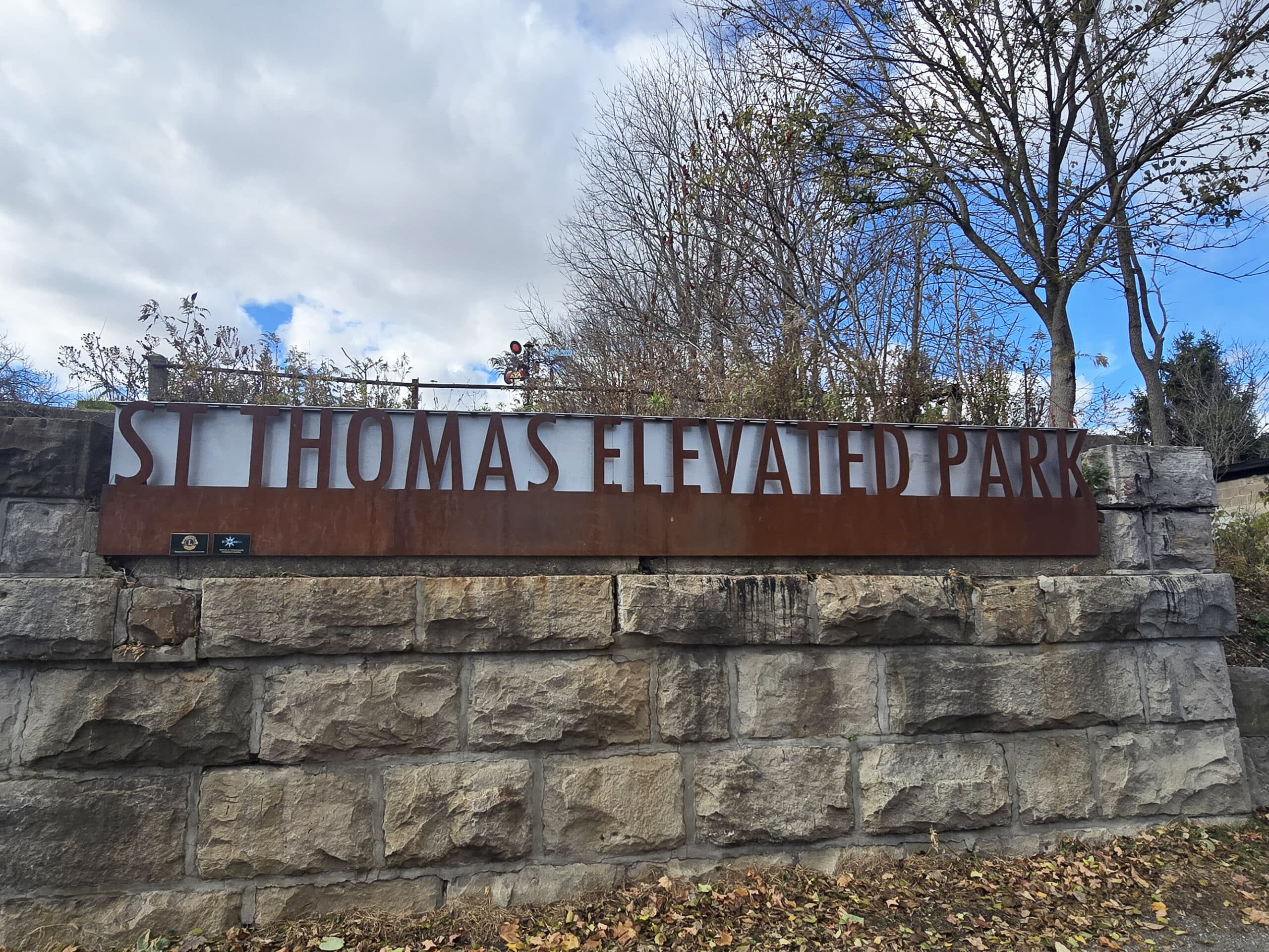
St Thomas Elevated Park is a cool attraction in Southern Ontario: An art park built on an abandoned rail bridge! Here's what you need to know!

Built on an old abandoned rail bridge - the Michigan Central Railroad Kettle Creek Bridge, specifically - it’s a fairly massive space, with public art installations, flower beds, and great views over the Kettle Creek Valley.
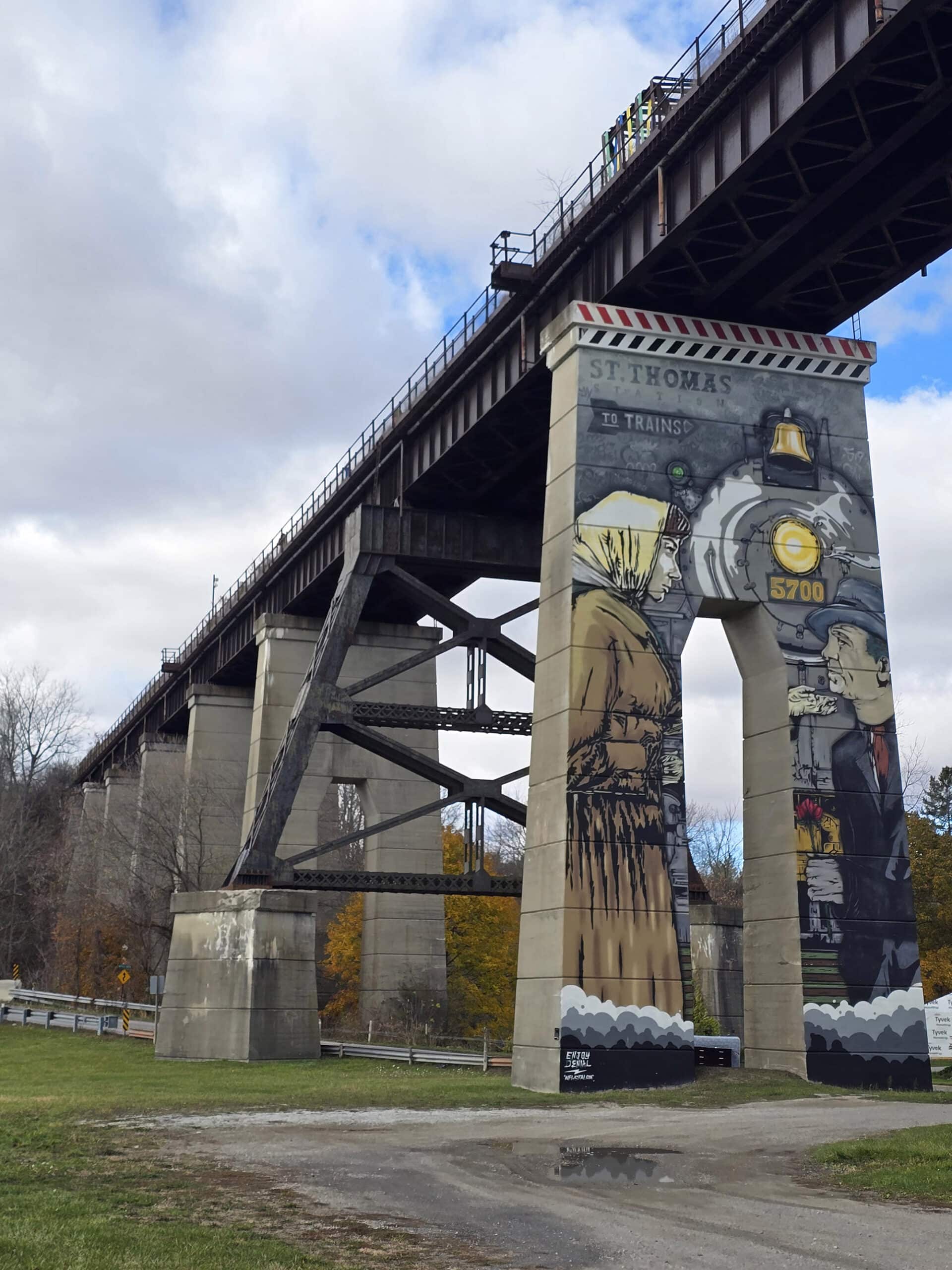
According to Railway City Tourism, the bridge was originally built in 1929, is 850 feet long, and 30 feet wide... 95 feet in the air.
The last train to cross it was back in 1996. It sat unused for years, before eventually being turned into a unique art park - Last I heard, it’s the only one of its kind in Canada!
Unfortunately, St Thomas Elevated Park is not really close to our home - probably an hour and a half drive from Hamilton.
It IS, however, kind of in bet - but it IS almost halfway between a couple of Provincial Parks that we enjoy visiting - Long Point Provincial Park and Rondeau Provincial Park.
So, this past fall, we finally got around to visiting - let us tell you all about it!

The Basics:
Location Name: St Thomas Elevated Park
Address: 1 Centre St, St Thomas, ON N5R 2Z5
Website: https://www.elevatedpark.ca/
Price Free!
Reservations: Not Applicable.
Logistics
Heads up: St Thomas Elevated Park isn’t a very RV-friendly place to visit, so if you’re on the road in an RV or with a trailer, there are some things to keep in mind.
First off, there’s the approach to the park.
If you’re coming from Highway 403, you’ll come to a roundabout, where the signage will tell you to go straight for the park, but Google might tell you to go right on to Sunset Drive - as it did for us.
You’re going to want to continue straight (Talbot St), then turn right at Stanley St, if you’re in an RV or have a trailer. MUCH better approach.
Once you get to Stanley, you’ll have two options for parking - more on that in a bit.
Beyond actually getting to the park, here’s some information to help you plan your visit to St. Thomas Elevated Park:

Registration and Check In
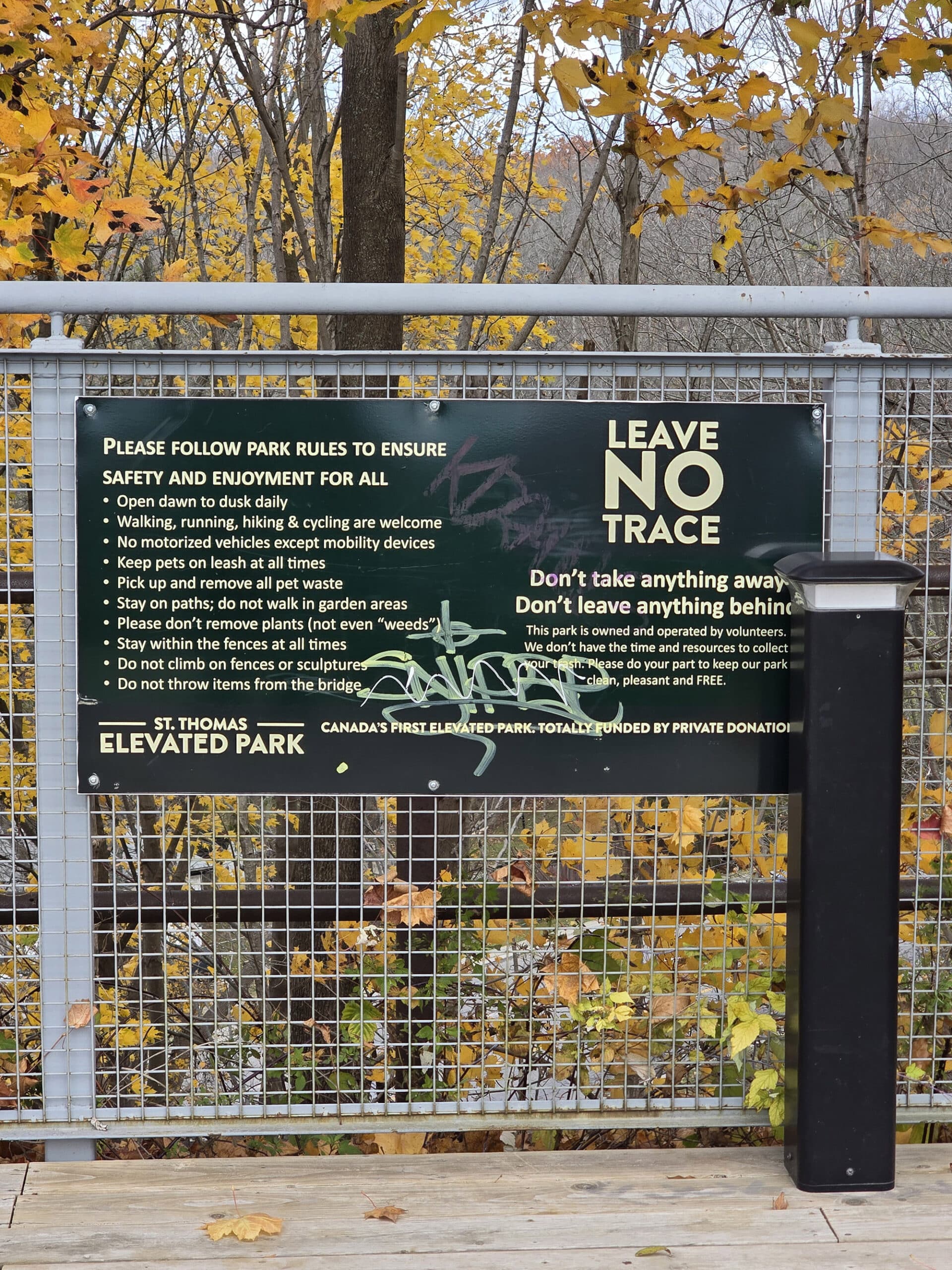
This is more of a “roadside park”, than a “gated and ticketed” kind of park to visit. You just show up and do your thing - no reservations or tickets needed (or available).
Parking
Ok, back to parking.
Once you continue along Talbot - through the roundabout - you’ll be turning right onto Stanley St. Where you go from there depends on what you’re driving.
Jumbo the Elephant Memorial Parking Lot
The most reasonable parking option if you have a larger vehicle or a trailer is to park at the Jumbo Memorial, 65 Talbot St, St Thomas, N5R 3C9.
Once you turn onto Stanley, if you basically U-Turn to the right (as soon as you turn right, turn right onto that st... also called Talbot St), you’ll come to a decent sized parking lot with a big elephant and a caboose in it.

Bottom: Jumbo The Elephant Memorial Parking
Elevated Park Parking Lot
Your second option - if you can park in a normal sized parking space - is to turn right onto Stanley St (as above), but then turn right onto Centre St, instead of Talbot.
This will take you to the main parking lot for the Elevated Park. This one is only big enough to hold 10 cars and it's perpendicular parking.
It was the only parking spot we knew about - we weren’t familiar with the area, and it’s where Google took us.
Luckily it was relatively empty the day we went and we were just doing a quick stop so we parked like jerks. It worked out for us, but I don't recommend that!
Had we known about the Jumbo Memorial lot, we definitely would have gone there instead - it’s only about a block or so away from the park.
Washrooms
We didn’t see any washroom facilities during our visit to the St Thomas Elevated Park. We covered the area from the main parking lot to just past the far end of the bridge.
The trail did continue on from there, though, so we could have missed something further out.
That said, Lions Club Dog Park (25 Talbot St, St Thomas, ON N5R 3C9) had a portapotty in the parking lot. This is only 350 meters from the main lot for the Elevated Park, or 220 meters from the Jumbo Memorial parking lot.
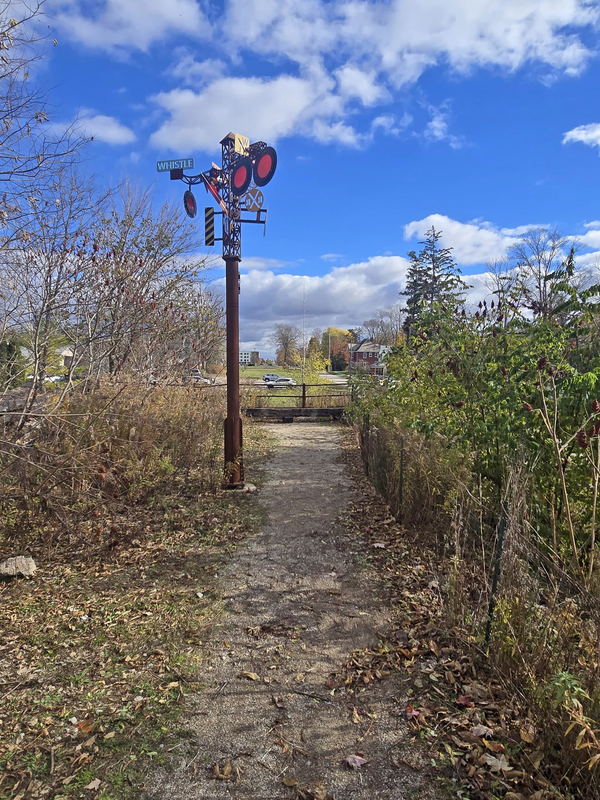
Maps and Signage
We didn't see any maps of the park ... but it really didn't need it.
If you’re parking in the main parking lot, the trail up to the park is right there and really obvious. Once you’re up that short path, it’s just a straight rail trail path - you’re not going to get lost!
That said, I would have liked to see a map, partially to see how much further the trail went, maybe other points of interest, etc.
Something I’d read said that the park was 850 meters long... but from the parking lot to the far end of the bridge (where the park seemed to end) was just under 600 meters.
I couldn’t SEE any more park along the trail, but it would have been nice to know if there were any other points of interest down that way. Or, you know, things like washrooms, additional parking lots, etc.
Accessibility
There were not any designated disability parking spots, and it’s a small lot - getting a spot could be an issue.
From there, the trail between the parking lot and the rail trail is a bit of an incline. Not super long, and it was well packed ground... just a bit steep.
I’m not 100% sure if that’s wheelchair accessible, but it’s something to keep in mind in general if inclines are a problem for you.
Once you’re at the top of that little hill, though, it’s wide, flat, well-packed trail.
You should be able to tell from the base if you’ll be able to handle it - the whole thing is visible. It’s the only real accessibility obstacle - the actual trail and park should be accessible for wheelchair users and anyone with mobility issues / devices.

Pets
Dogs are allowed at the St. Thomas Elevated Park, but must be leashed at all times and picked up after.
We didn’t see any poop bag dispensers, so come prepared!
Beyond that, there’s that nearby off-leash dog park I mentioned earlier - the St. Thomas Lions Club Dog Park, about 350 meters from the parking lot at the base of the trail to the Elevated Park.
It has its own parking lot - pretty big, but maybe not suitable for larger RVs or trailers to turn around in, especially if it’s busy.

Park Store
There is no park store at St. Thomas Elevated Park.
Visitor Centre
There is no Visitor Center at St. Thomas Elevated Park.
Day Use Area
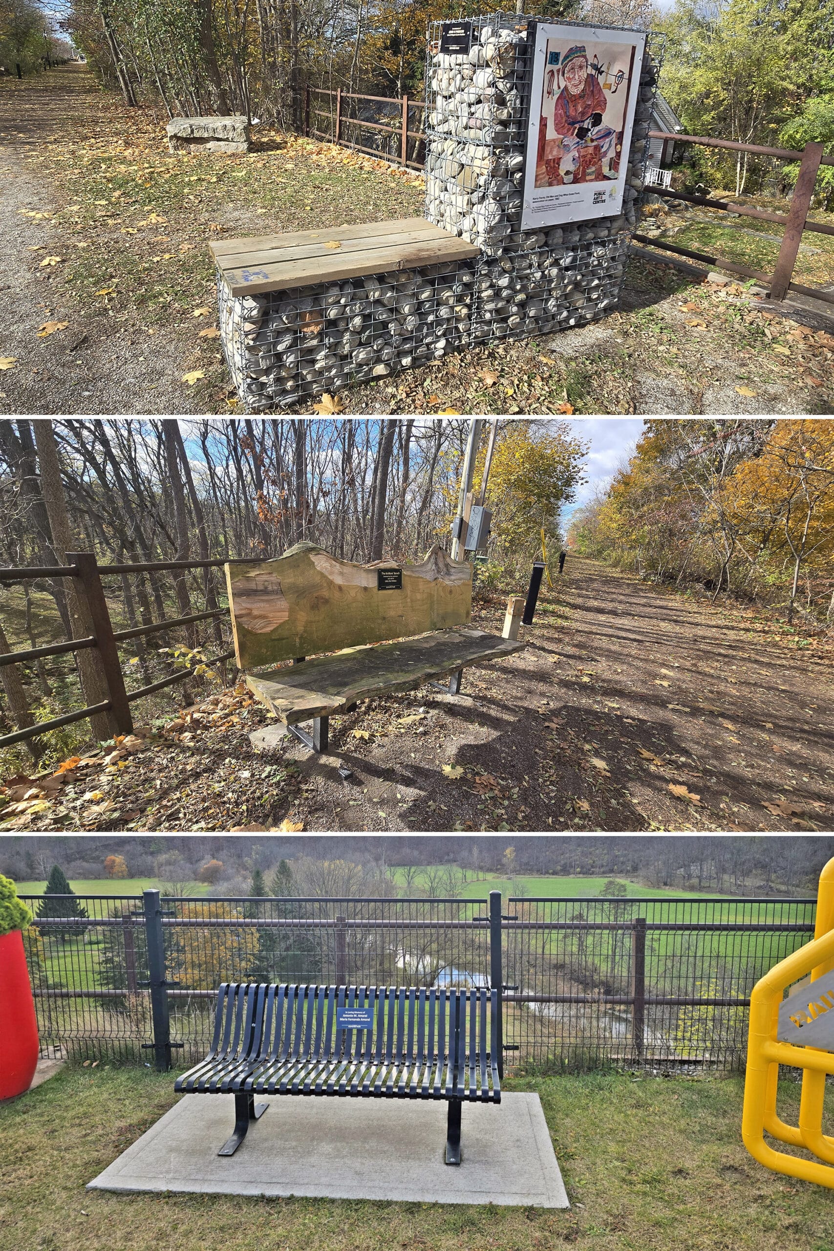
I was surprised to NOT see any picnic tables at or around the St. Thomas Elevated Park.
There were a few park benches along the route, but that was it.
Connectivity
We had pretty good internet connection, on Roger’s Wireless.
Miscellaneous
A couple things to note:
Bridge Clearance
If you are bringing an RV or trailer onto Centre St, you’ll likely encounter the underpass on Pleasant St, at the bottom of Centre St - it runs under the park.
The clearance LOOKS like it’s low - we were a bit worried when we were about to turn onto Pleasant - but there was actually plenty of height there. The clearance is 4 meters.

Fear of Heights
As you probably know from previous posts on the Doubes Trestle Bridge, Menesetung Bridge, and Roy Wilson Suspension Bridge ... I’m not a fan of bridges, and I ALWAYS chicken out when it comes to crossing them.
I don’t know whether it was because it was really wide, or because the ground didn’t LOOK like a bridge or what... but I didn't actually have a problem going out across the Elevated Park.
I mean, I didn't necessarily want to walk right out to the side and look over the end or anything, but it was definitely a lot more comfortable than other bridges. I was able to walk to the far end and back without an issue!
Share the Love!If you’ve made one of our recipes, be sure to take some pics of your handiwork! If you post it to Bluesky, be sure to tag us - @2NerdsInATruck, or you can tag us on TikTok, if you’re posting video. We're also on Pinterest, so you can save all your favourite recipes and park reviews to your own boards! Also, be sure to subscribe to our free email newsletter, so you never miss out on any of our nonsense. Well, the published nonsense, anyway! |
Entertainment and Activity
Here is some information about the activities you can enjoy while visiting the St. Thomas Elevated Park:
Hiking
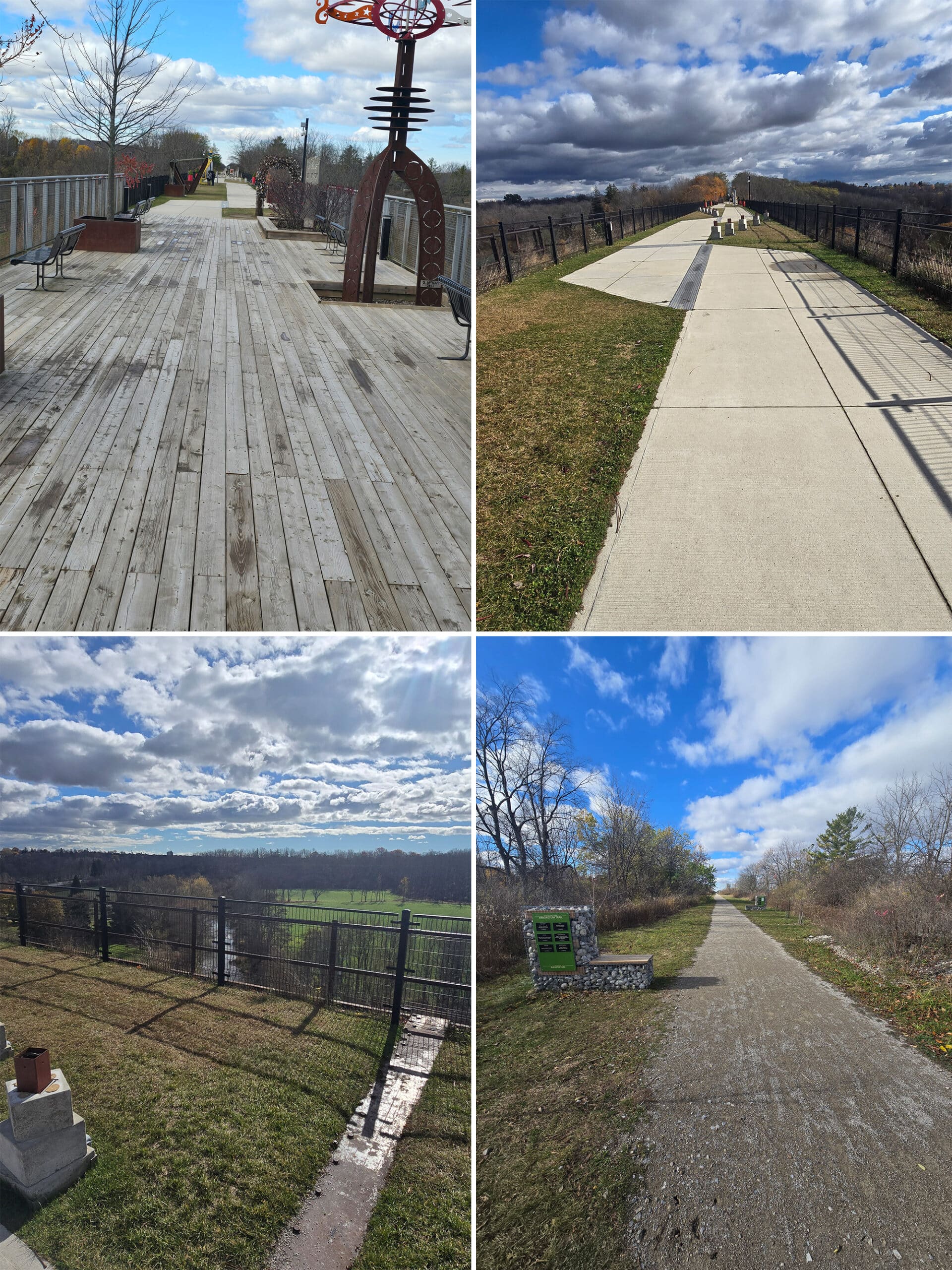
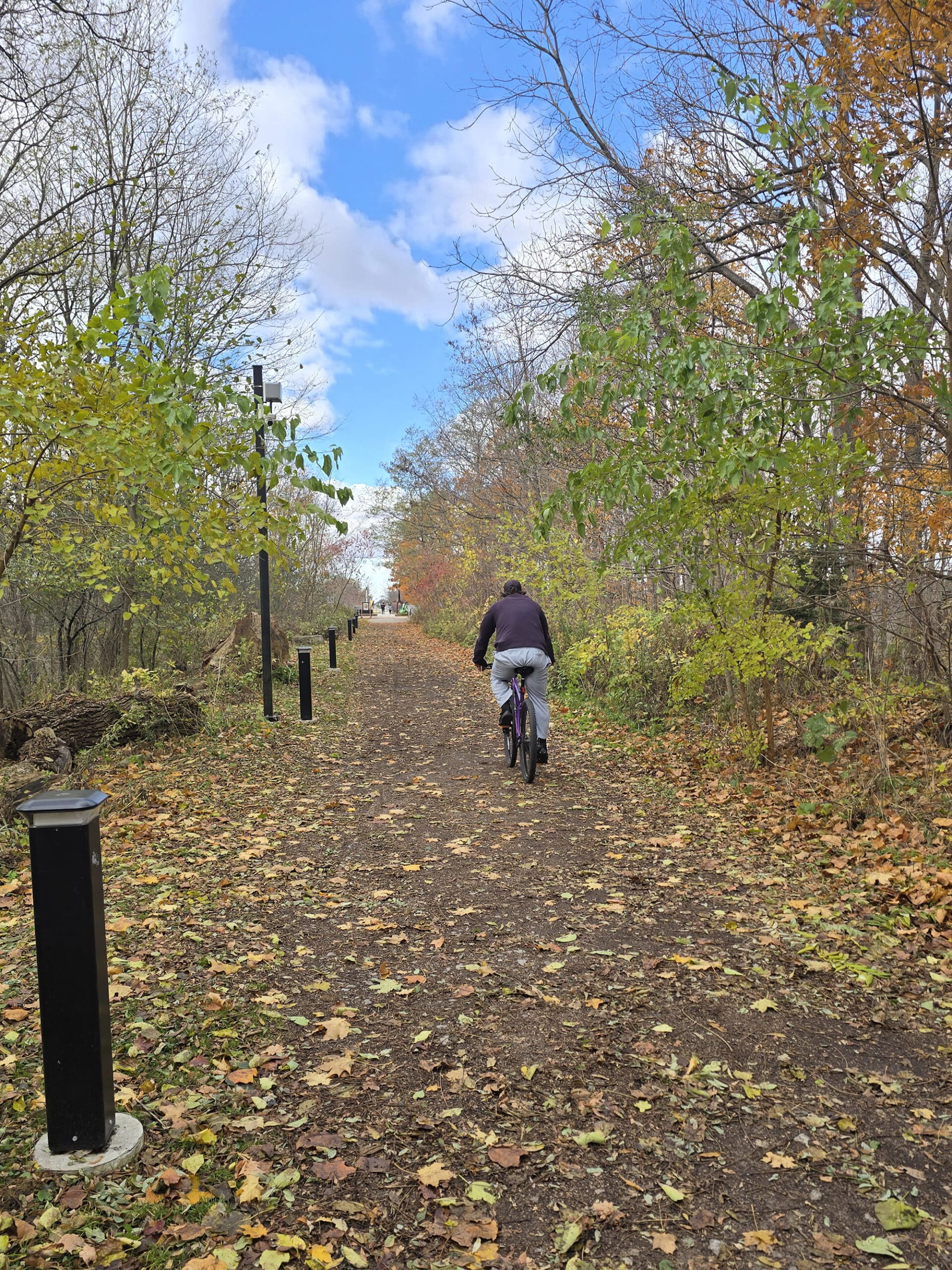
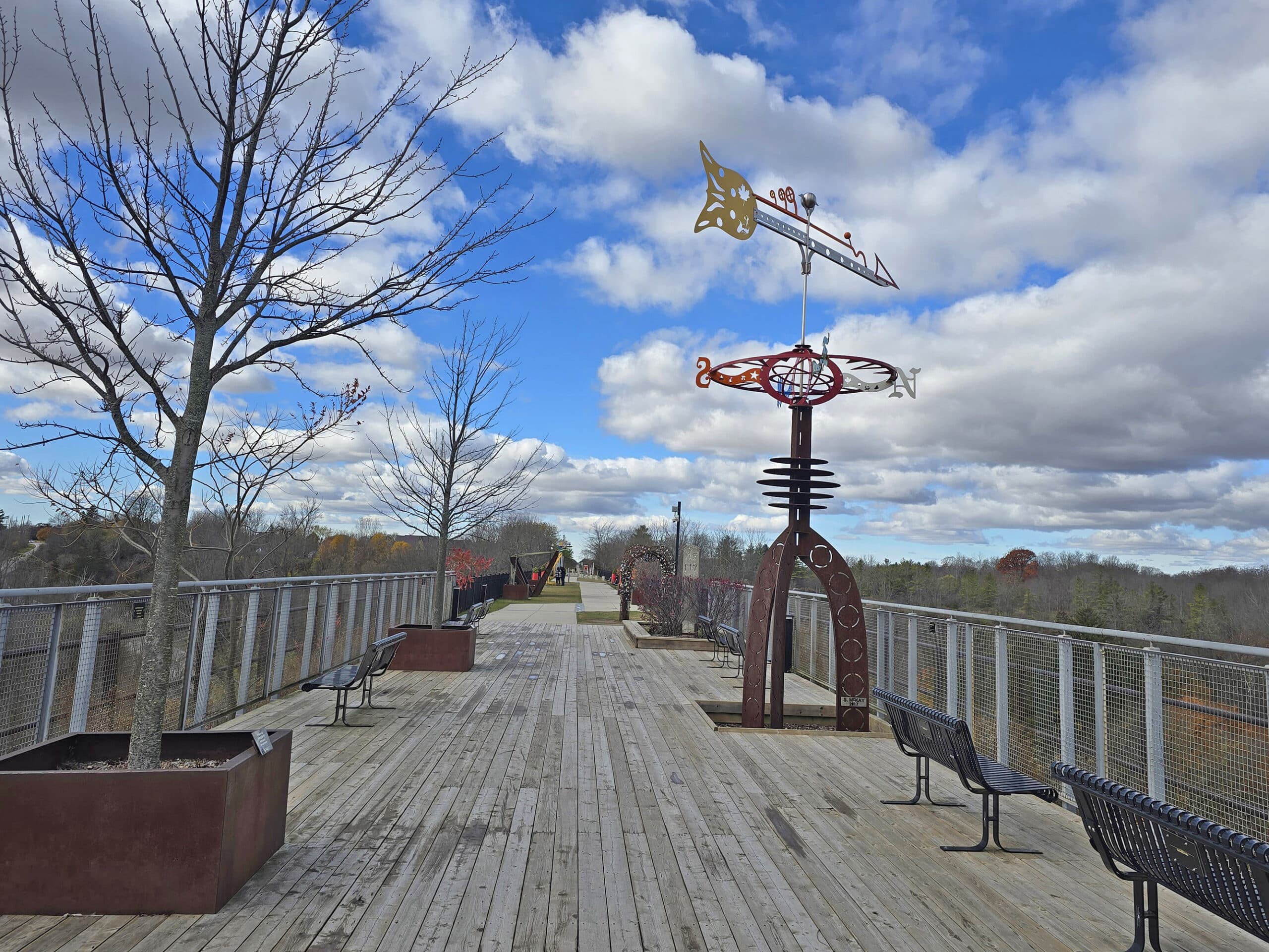
The park itself is built on the bridge of a rail trail, to it’s VERY flat, wide and level.
The base is either well packed ground, wooden decking, or pavement, depending on the section. The transitions are smooth, no curbs or steps up or down anywhere.
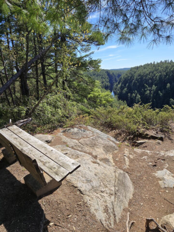
The safety railings feel nice and secure - unlike at Doubes Trestle Bridge - so you can take in the breathtaking views without much worry!
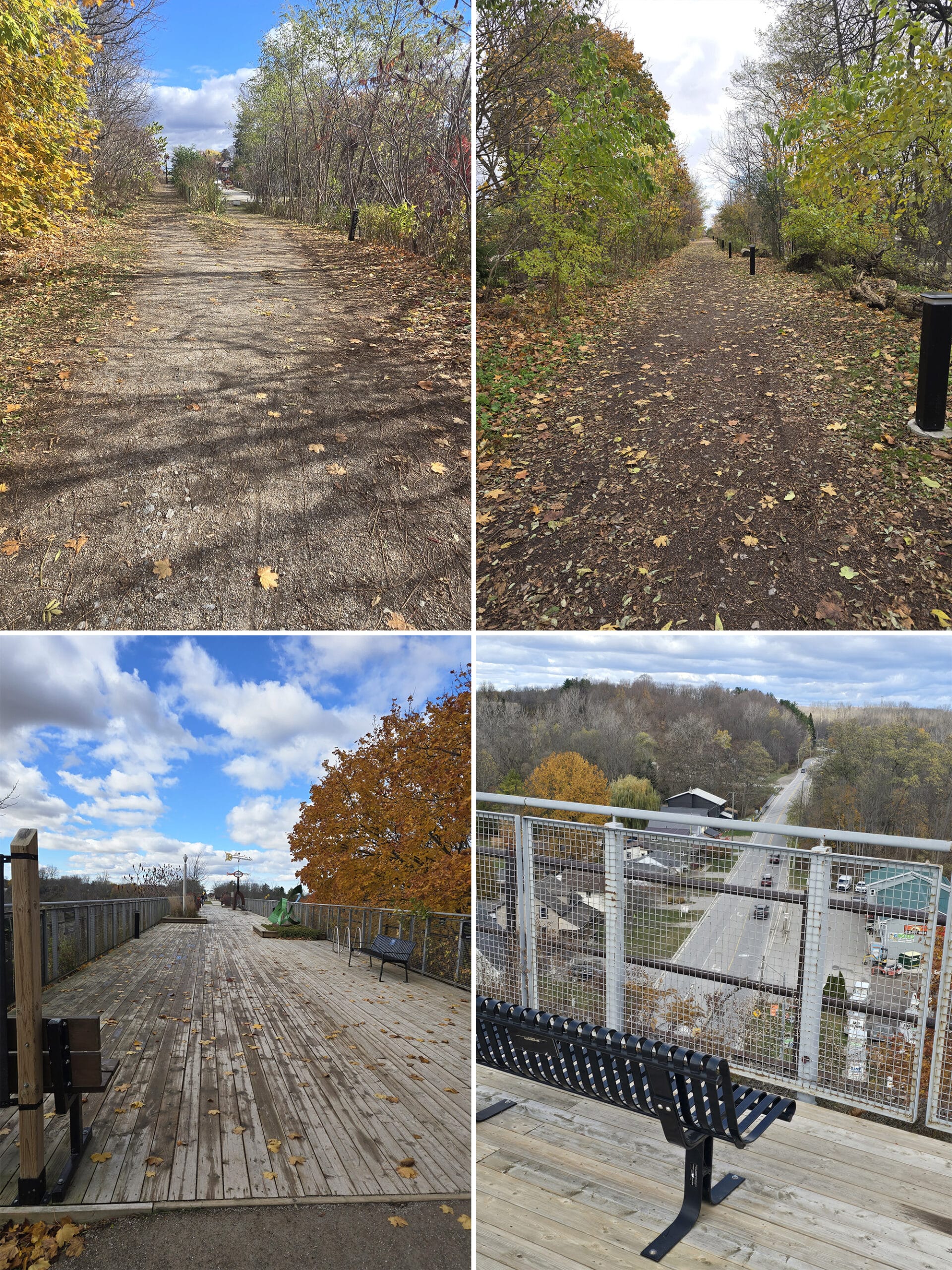
I guess “ending” is a bit loosely used here - it continues on as part of the Trans Canada Trail both on Lyle Rd and - at the parking lot end - down Centre St.
There’s a LOT of hiking in the area, though, as I learned when I Googled to look up a trail head we passed on the way in.
While I couldn’t find it on the map, I did learn a bit about the Elgin Hiking Trail (41 km long) and Whistlestop Trail which goes down to Port Stanley.
Also, the Waterfront Trail isn’t too far away.
So, a great variety of scenic trails to choose from!
Biking
The elevated park and trail is bike friendly, as is the greater Trans Canada Trail that it’s a section of.
If you need one, there’s a bike rack located pretty early on, on the bridge itself.
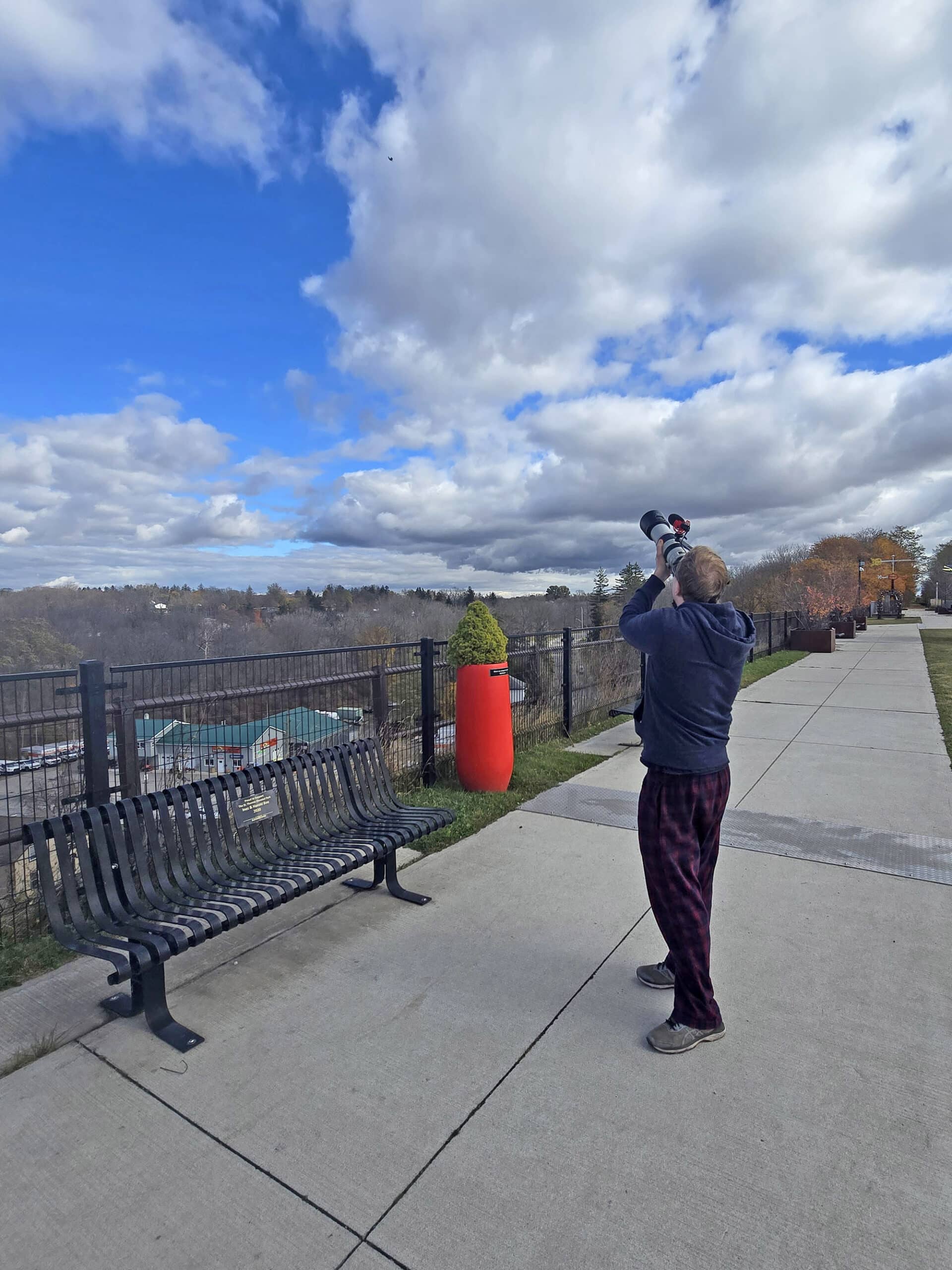
Birding, Wildlife, and Nature
The day of our visit was unseasonably cold, and really blustery. So... didn’t have a lot of luck in terms of birding.
We saw a pigeon camped out in a cute little nook of the railing, a Turkey Vulture and some Blue Jays overhead, and some sort of woodpecker flew by - we weren’t able to identify it though.
We didn’t go super far along the trail on account of the weather, but apparently it’s good for seeing a variety of wildlife. Birds, Raccoons, Deer, etc.
One interesting thing to note is that there’s apparently an “Arboretum Line” along the trail, with native Carolinian trees featured. You can see examples of
Hop Tree, Red Mulberry, Sassafras, Shagbark Hickory, Sweet Chestnut, and Tulip Tree... and we managed to miss this installation entirely, somehow!
I guess we were too distracted by the art and high winds, to notice the native plants on display!
Educational & Cultural Opportunities
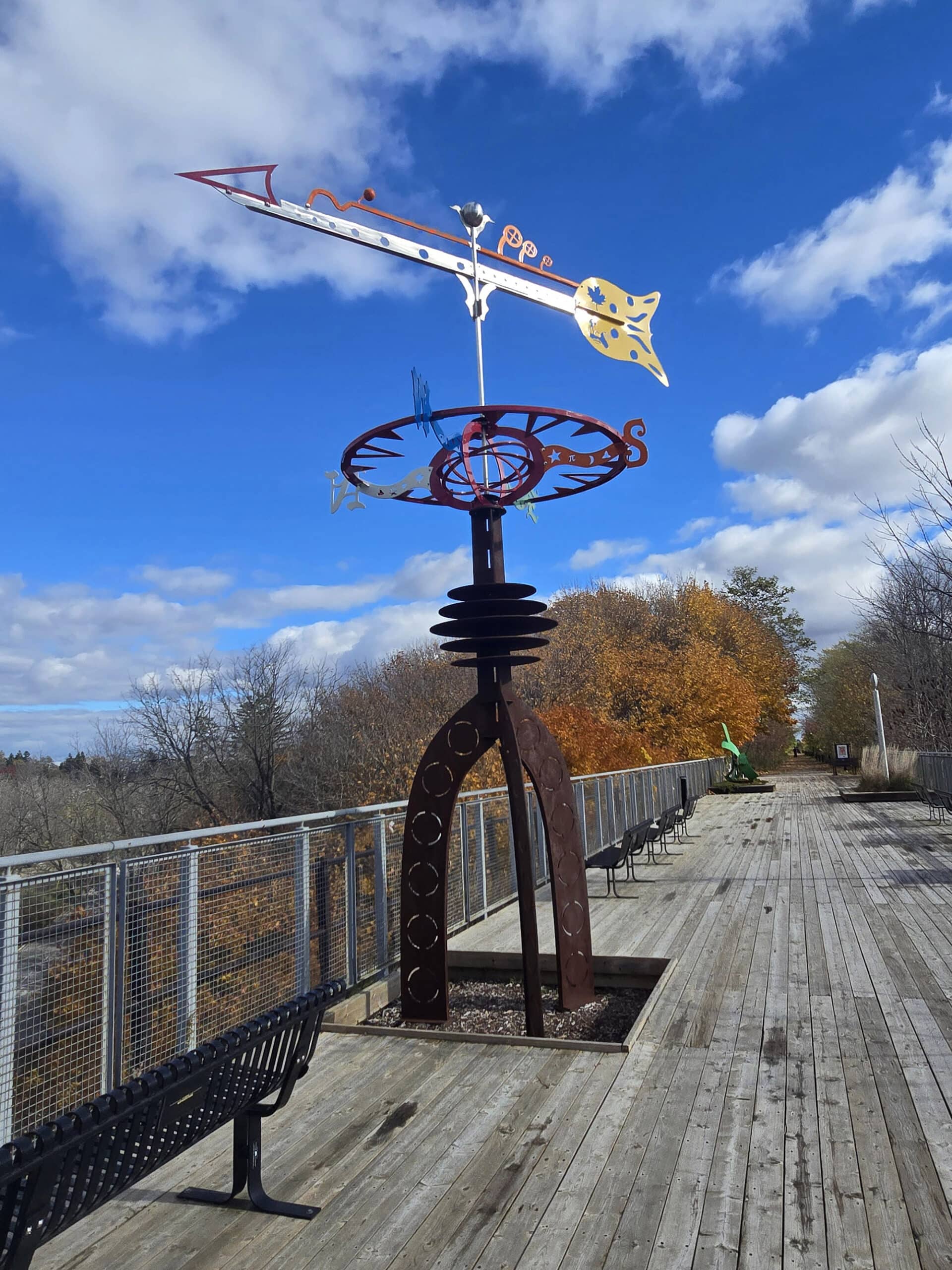
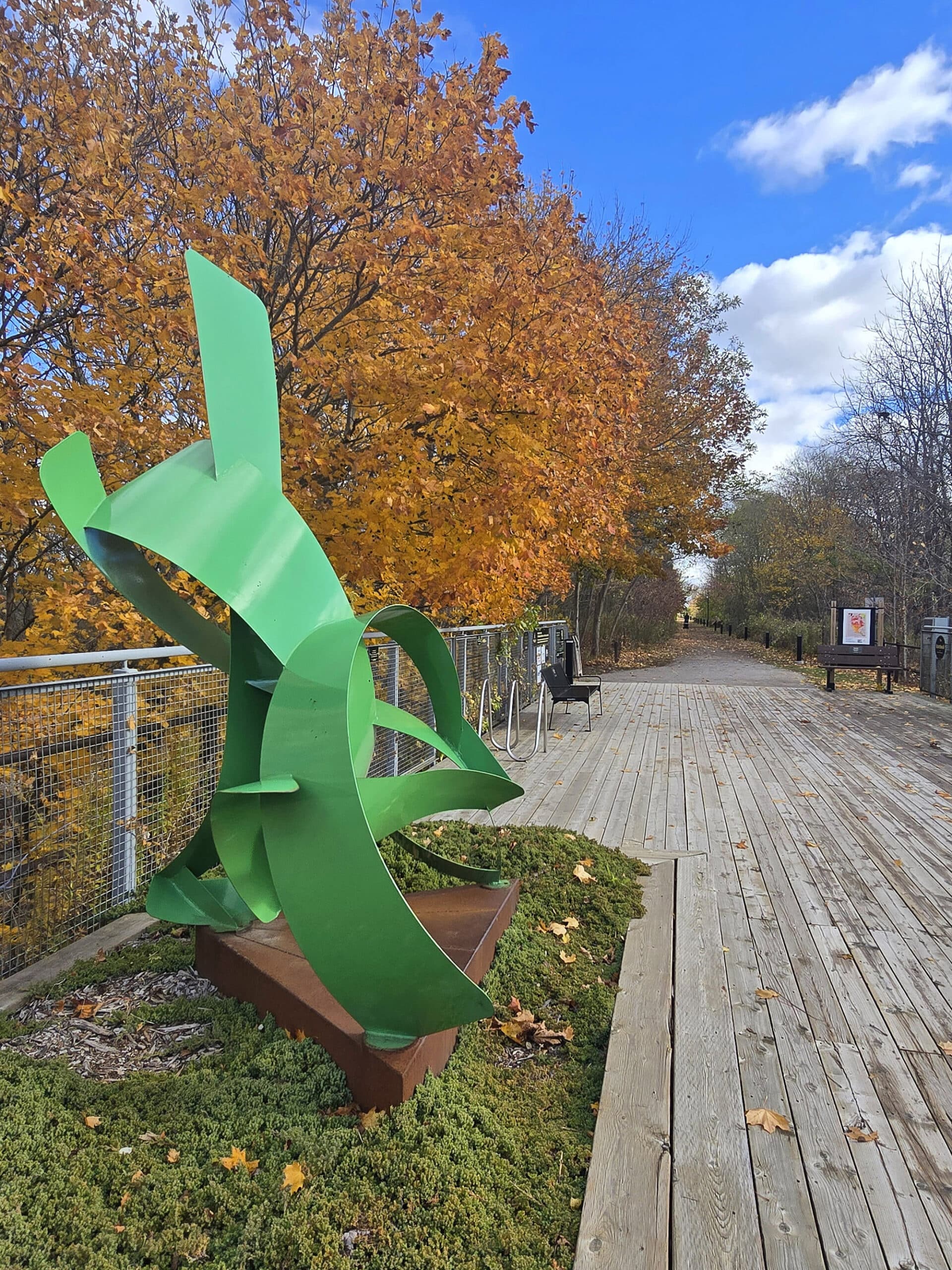
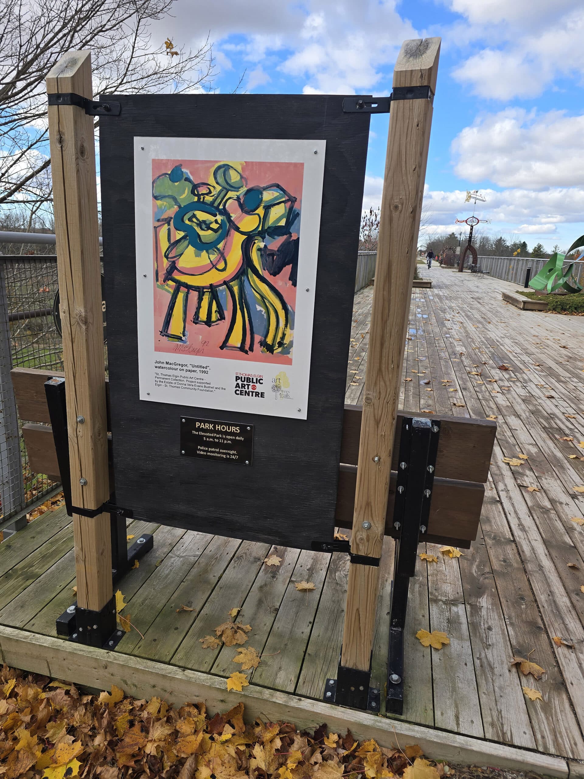
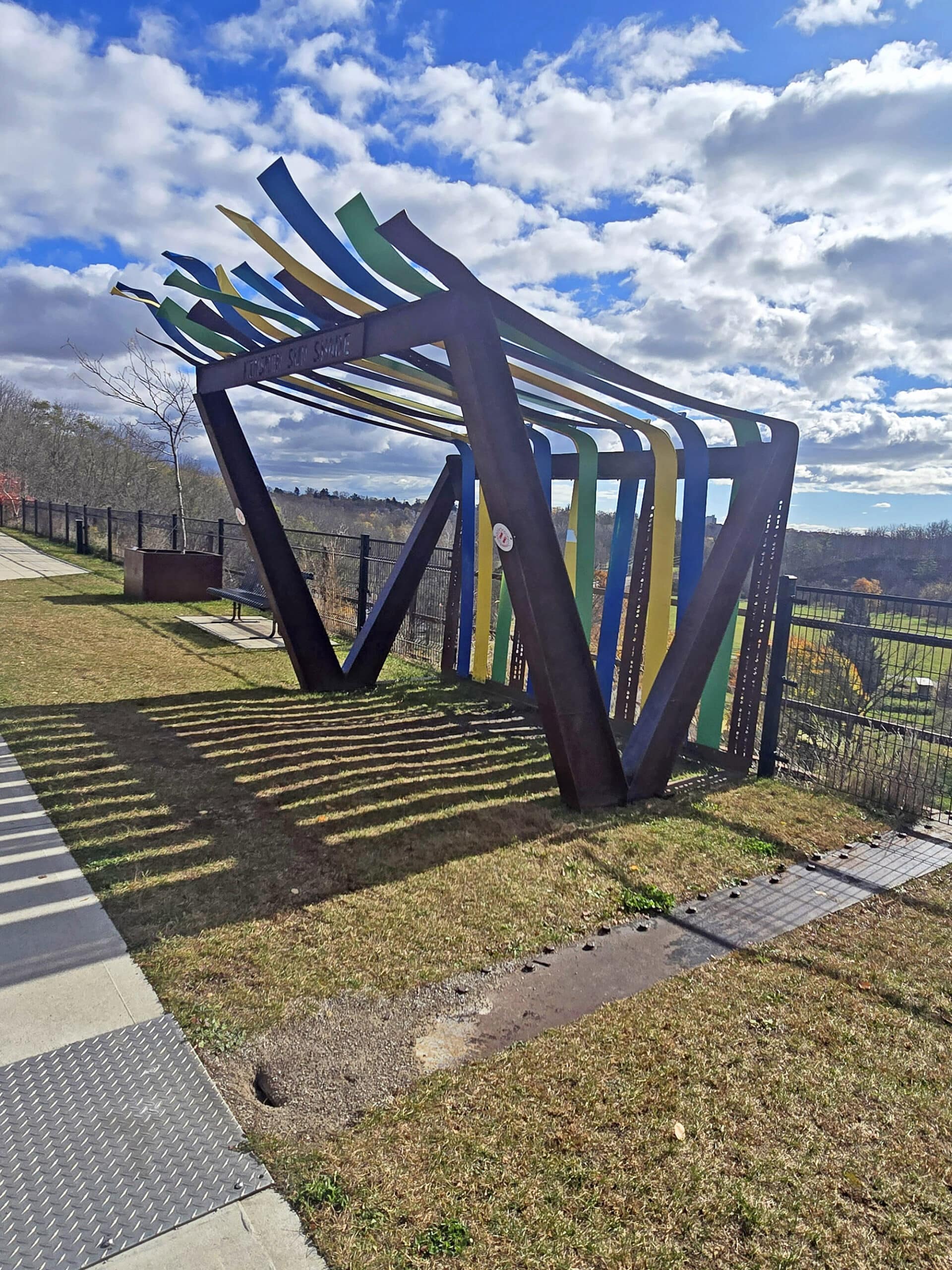
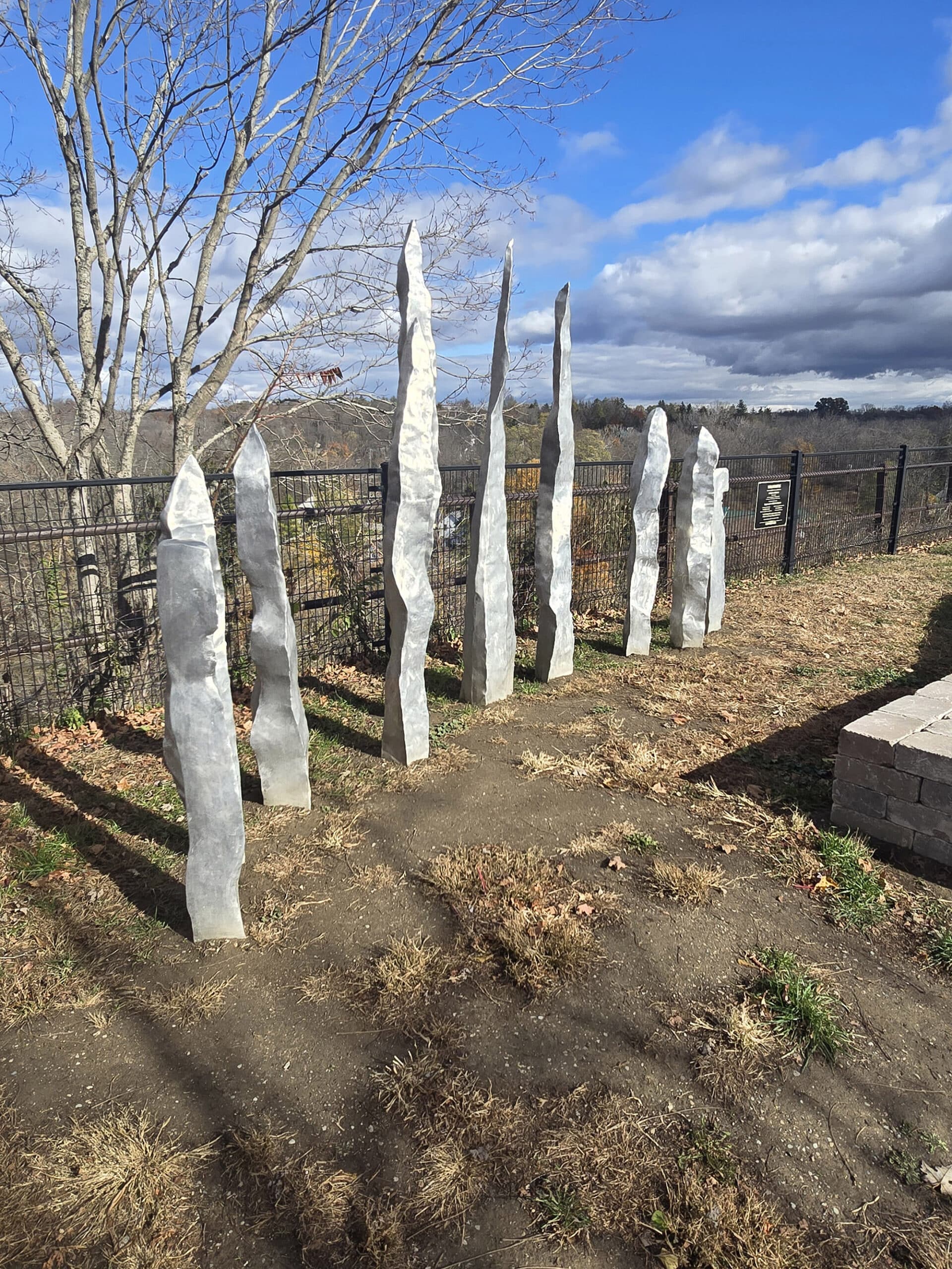
As you may have gathered by now, the entire length of the bridge is actually an art park!
There are a bunch of different art installations the whole way up the path, each - so far as we saw - had a little plaque giving the name of the artist, etc.
Even the pillars supporting the bridge are part of the show, with an 85 foot tall mural painted on one of them!
I wish then official page had a list of works, maybe with bios and links to the artists. We didn’t have enough time to really read up on everything, it would be nice to have some sort of a reference, online!

Niantic Games
There were a ton of Niantic game stops all the way from the parking lot, to the far end of the bridge.
Also - as previously noted - cell reception was great!
Final Thoughts
I’ve been wanting to see this park, ever since being pushed an article about it a couple years ago... and I’m glad we went!
It’s a super cute park, and a really nice place to take a stroll on a nice day.
That said, it’s not super convenient to visit if you’re in an RV, and the park is about an hour away from both of the Provincial Parks we stayed at on that trip.
If you have a regular vehicle or a smaller RV, you won’t have a problem parking there. I’m just not sure I would have wanted to drive an hour each way to see it - especially with how windy it ended up being!
If you’re in the area - or don't have the restriction of having a trailer and having to deal with the parking issues - I would definitely recommend stopping visiting St Thomas Elevated Park at least once.
It's really nicely done, has got some great views, and is just a really great place to take a walk.
I love rail trails in general and this one was WAY more ADHD friendly than most, LOL!
More Southwest & Central Ontario Provincial Parks & Places to See
Want to read some more about the parks we've camped and at places we've seen in Southwestern & Central Ontario? Here are some more posts!
Southwest/Central Ontario Campground Reviews:
Awenda Provincial Park
Balsam Lake Provincial Park
Bass Lake Provincial Park
Bronte Creek Provincial Park
Bruce Peninsula National Park
Conestogo Lake Conservation Area
Craigleith Provincial Park
Darlington Provincial Park
Earl Rowe Provincial Park
Elora Gorge Conservation Area
Emily Provincial Park
Falls Reserve Conservation Area
Fifty Point Conservation Area
Inverhuron Provincial Park
Long Point Provincial Park
MacGregor Point Provincial Park
Mara Provincial Park
McRae Point Provincial Park
Meaford Memorial Park
Pinery Provincial Park
Point Farms Provincial Park
Port Burwell Provincial Park
Rock Point Provincial Park
Rondeau Provincial Park
Sauble Falls Provincial Park
Selkirk Provincial Park
Sibbald Point Provincial Park
Turkey Point Provincial Park
Valens Lake Conservation Area
Warsaw Caves Conservation Area
Wheatley Provincial Park
Southwest/Central Ontario Places to See:
Big Bay, Ontario
Canada's Dinosaur Park
Cheltenham Badlands
Devil's Monument
Doubes Trestle Bridge
Eugenia Falls Conservation Area
Flowerpot Island
Hogg's Falls
Inglis Falls Conservation Area
Indian Falls Conservation Area
Jones Falls
Keith McLean Conservation Lands
Lion's Head Lookout Trail
Mark S. Burnham Provincial Park
Menesetung Bridge
Mono Cliffs Provincial Park
Niagara Falls White Water Walk
Niagara Glen Trail & Nature Centre
Peterborough Lift Lock
Petroglyphs Provincial Park
Point Pelee National Park
Rattlesnake Point Conservation Area
Scenic Caves Nature Adventures
Spirit Rock Conservation Area
Springwater Provincial Park
Wasaga Beach Provincial Park
Want to explore beyond Southwest and Central Ontario? Check out our full list of Campground Reviews, Ontario Waterfalls, and other Places to See.
We also have a ton of Camping Recipes to cook up, while on your adventures!
Thanks for Reading!If you loved this post - or have any questions about it - please leave a comment below! We'd also love it if you would consider sharing the link on social media! |

Leave a Reply