
Springwater Provincial Park is a day-use only park near Barrie, Ontario. Here's everything you need to know about visiting there...

It’s a day-use park - no camping at all - located in Simcoe County, right outside of Barrie and operated by the Beausoleil First Nation.
This review is going to end up all over the place. We (tried to!) visit twice - the first visit was frustrating, the second was outright anger inducing.
The park itself was great - I wish we could have seen more of it - but actually VISITING was incredibly frustrating. We had to abort our second attempt, and we’re still not even sure what even happened - more on that in a minute.
I'm probably going to use the word “unfriendly” more than once, and make reference to how often we felt like we weren’t supposed to be there.
I just want to be clear up front: I mean “unfriendly” - or “unwelcoming” in an a logistical sense, with regards to things like layout, signage, accessibility, etc.
The park staff we ran into on our first visit were really nice. I talked to one staff member on the phone before our first trip, and another one stopped to chat when I was exploring. He was funny, warm, and engaging.
“Unfriendly” and “unwelcoming” are just the best adjectives I can come up with, when addressing the logistical issues we had.
Anyway, you’re probably wondering what happened, so let’s just get to it...
The Basics:
Location Name: Springwater Provincial Park
Address: 1331 Route 26, Midhurst, ON L0L 1X0
Website: Springwater Provincial Park
Price Ontario Provincial Parks uses a pricing matrix across all their parks. See 2025 Day Use Fees for more details.
Reservations: Ontario Parks Reservations
Park Classification: Recreational
Season: January 1, 2026 to December 31, 2026

Logistics
Some basic information to help you plan your visit to Springwater Provincial Park:
Registration and Check In
The park hours are a bit weird: the Day Use hours are listed as being 8:00 a.m. to 10:00 p.m. with vehicle access being 9:00 a.m. to 4:00 p.m. When the gates closed, you have to park alongside the park entrance road, and walk in.
There were several cars parked along the road as we pulled up on a Friday afternoon, so I guess they probably arrived before 8:00 a.m.
Anyway, we had called the park before arriving, to ask about the parking situation (we were in the RV, with a towed car), and about how the park reciprocity thing worked when the park we were staying at (Emily) didn’t have printed permits.
We were told that we could just show our email receipt, and that parking wouldn’t be a problem.
When we showed up... there was no one at the main gate. The gatehouse was locked, and no one answered when we called.
We decided to just make our way to the parking lot, and show the email if we were stopped at any point.
Anyway, there was a QR code on the door of the gatehouse, so day users to book their parking if they hadn’t already / no one was there.

Not only did this put a kibosh on our plans, it also royally screwed us for getting out. Because our RV tows a car, we weren’t able to back out or turn around to get out of the park, and had to unhitch everything, turn both vehicles, and hook it all up again.
We called, no answer - repeatedly. There were no signs about it being closed, nor any alerts on the park page.
The signage there indicated the hours of vehicle access - and we were well within that time frame... so this was really, really annoying.

Parking
The parking situation was a bit weird at the time of our visit - P1, P2, and P4 parking areas were all gated off, and P3 was completely blocked off by a supply truck.
The road the - per the map - the led to P4 didn’t even have any signage pointing that way.
We later walked down there, and the whole section felt abandoned - not sure what was going on there.

There were only a couple of people parked at the time of our visit, so we were able to pull our RV over to the side and park.
In general - when the other lots are open - you shouldn’t have a hard time getting an RV and/or trailer through the park. Each of the lots (except P4) is a straightaway parking lot, with separate entrance/exit onto a main park road.
P4 is the only lot with only one access point, but - again - it was gated and closed off, so that’s probably not an issue.
If it HAD been open, it would be the only one where I wouldn’t recommend trying to bring an RV or trailer to, in case you got stuck and couldn’t turn around.

Middle Row: Parking Lots 3 & 4.
Bottom Row: Parking Lot 5.
Washrooms
The park’s website info - that there are 3 comfort stations - didn’t quite line up with what we saw during our visit.
First off - not mentioned - there’s an outhouse right by the front gate. It's kind of off in the woods but there's a short trail to get to it.
The only operating comfort station we saw was across from the Park Office, in the center of the day use area. It looked old but functional - flush toilets and sinks.
There was a sign outside warning about falling ice, so I would assume that this would be the one that’s heated and open year-round.
Aside from that, we happened across a second comfort station in the P4 area - it appeared (from a distance) to be boarded up, and the path to it was pretty overgrown.
The third comfort station on the map is located near the beginning of the driving loop, sort of between the front gate and the picnic shelter area.
We didn’t see this one, but easily could have missed it during the confusion of trying to figure out where we were going, with parking lots gated off!

Maps and Signage
Oh boy, this park is a bit of a logistical mess when it comes to maps and signage. Let’s see if I can organize my thoughts and observations on that whole issue in a coherent way....
Park Map
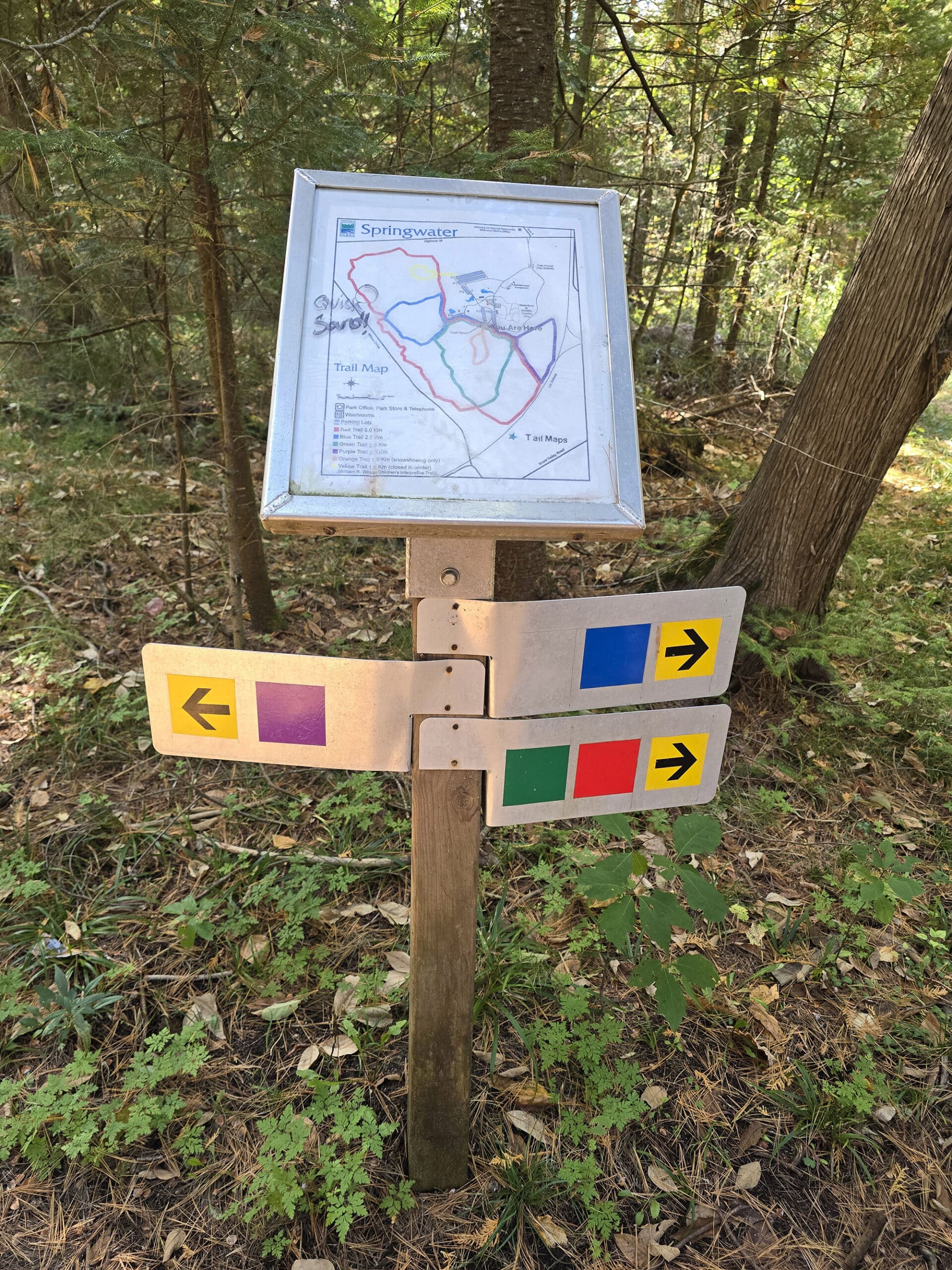
There is no pdf map for the park, but we were surprised to see that they had two printed maps posted at the front gate - an overview map, and a trail map.
We haven’t seen many day use only parks with printed maps - just map signage. Anyway, we’re not sure if they had handouts of the same, though, as we never did come across a gate employee.
As it turns out, there are two versions of those maps in play - the ones posted at the front were radically different from the ones we saw posted at the trailhead.

Some differences:
1. The Waterfowl and Wildlife Display Area on the trailhead map was blacked out on the overview map at the front, and just didn’t exist on the trail map at the front.
2. The map at the front had a big section of the red trail crossed off as being closed. The trailhead map just had “Quicksand!” written on one part of the trail that was crossed off on the other map.
3. The trail map at the front had two new sections of Blue Trail added to it... sort of. It didn’t seem to be an extension of the actual blue trail, and the new section was a slightly different colour of blue. The trail distance for the Blue Trail was the same as listed on the Trailhead map, and there wasn’t a separate entry for these new sections.
Beyond that, there were other issues between that front map (presumably the current one!), and reality.

One problem with the whole thing, is that it seems like the park has gone under some major changes sometime fairly recently... and it seems like there just hasn't been a consistency in the information presented, since that point.
Another annoying thing - IMHO - is that the trail map doesn't need to be separate from the overview park map.
The overview doesn’t have the trails shown, the trail map doesn’t have all the washrooms and stuff listed (just one comfort station).
It’s really unwieldy and inconvenient to be juggling two different maps - especially as photographs of maps from the front. This is a small, day-use only park - Not Algonquin!

Signage
The directional signage at Springwater Provincial Park is generally terrible and usually non-existent. Things in person don't necessarily line up with the map, either.
For instance - on the map - there's a section of road that looks to be one way, passing the main picnic shelter and continuing on to P4. (P4 is gated there, that's not marked on the map.)

You're definitely going to want either a map - or a photo of the map that's at the front - and a navigator, if it’s your first time visiting the park.

For instance, there’s an area behind P4 where a bunch of trails overlap, with one trail access point having a “Do not enter” sign. We thought the trails were closed!
We ended up on the same trail section when we walked it from the trailhead - with nothing telling us not to go on that section of the trail.
So, I think that sign was specifically meant for vehicular traffic - it just comes off as really unfriendly, when you’re walking the paths.
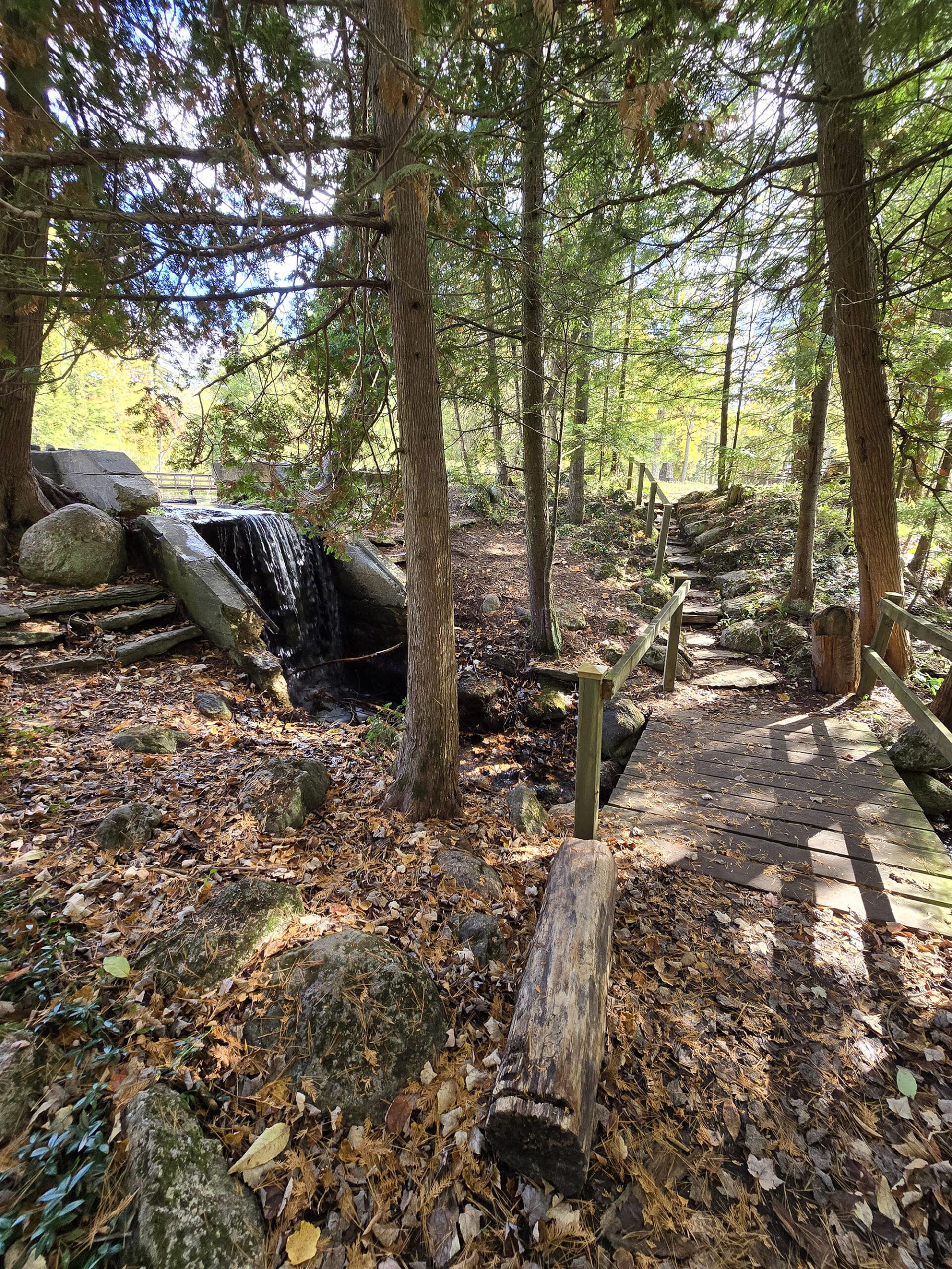
Trail signage is much better if you start from the actual trailhead - but there’s really only any directional signage at the spots where trails intersect - no blazes along the way.
Accessibility
This is one of those cases where the park could be so much more accessible, if someone would just put a few minutes of thought and effort into information.
First off, there’s no accessibility information on the park map, and the info provided on the website is incredibly vague:
“Springwater Provincial Park offers some barrier-free access. The park offers paved walkways that go through main park area. There are several barrier-free picnic shelters and a centrally located barrier-free washroom.”
So, let’s dive into things.
First off, the only designated accessible parking - again, not on the map - is located next to the large picnic shelter (Picnic Shelter E).
The thing is, it’s a small road, off the main road. There’s no signage at the main road indicating that there is accessible parking up this offshoot - which looks more like a maintenance road, than somewhere visitors are supposed to be.
Then, there’s the issue of that parking.
There are two separate signs on that road to indicate designated parking spots, but they’re just... there. As in, this single lane road has a parking spot right in the middle of it, somehow? If you park in the first spot, you cut off access to the rest of that little road, and the second parking spot.
It’s SO weird, and makes no sense at all.
Anyway, if you can deal with that kind of rough road and get up to the paved road that goes through the picnic area, things get a little better. Still not what I’d consider super wheelchair friendly, but you should be able to do it. That central road is paved for the most part, but there's some high centering and roughness.
Anyway, beyond the parking situation, the comfort station that's across from the park office has accessible stalls, and is more or less accessible from that road.
If you are not a wheelchair user but otherwise have mobility issues, this park should be mostly okay for you.
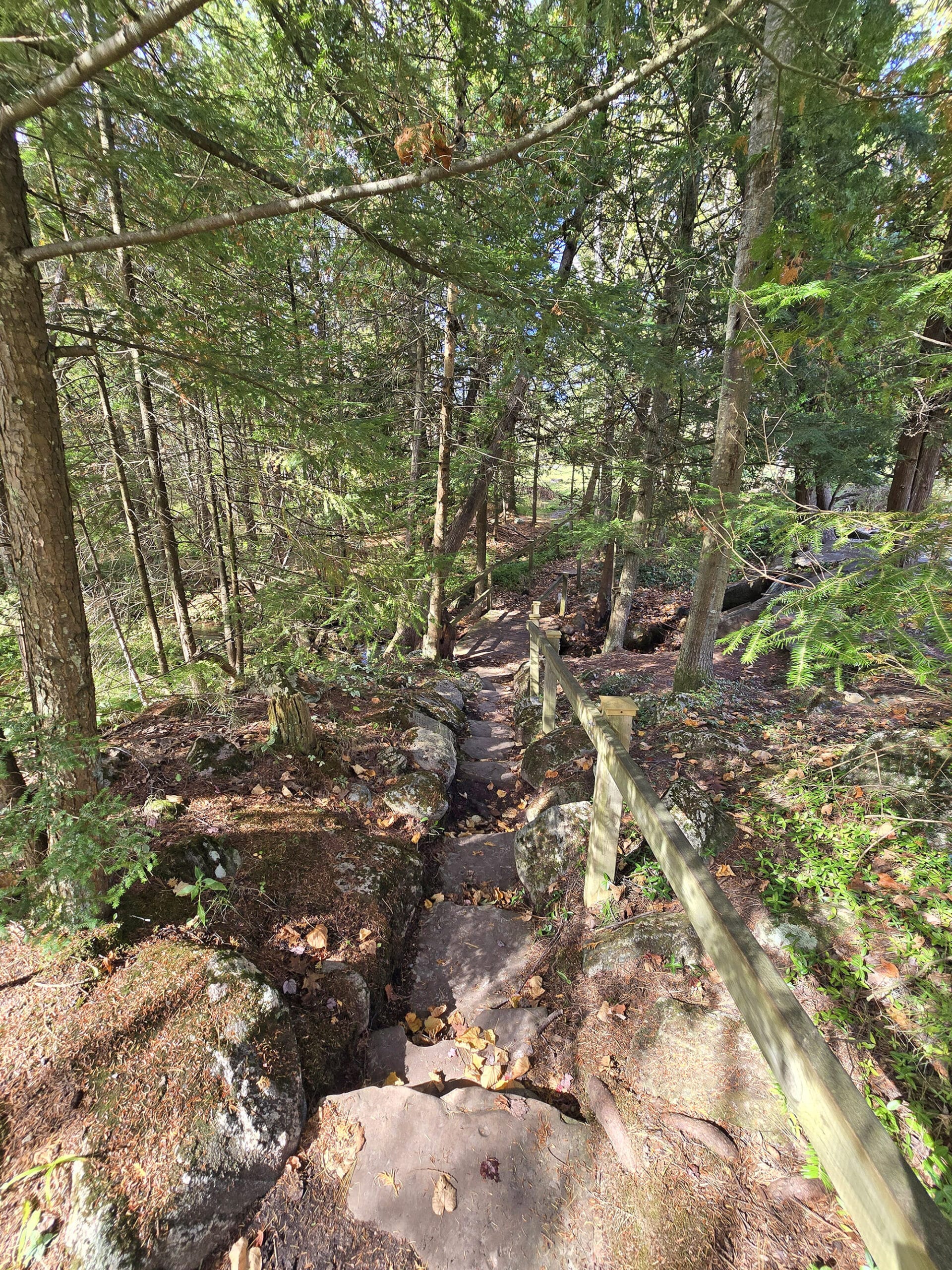
The walking trails we saw mostly looked pretty accessible: wide, flat, and well packed. They weren't anything that would bother me, even if I was wearing a boot or using a cane at the time.
Note: we didn't do all the trails, but every little piece of a trail that we saw seems to fit that description.

Pets
The park’s website has the icon for having a pet exercise area, but there was no information about that on the site or on the park map. We did not see one during our visit.
That said, dogs are allowed, but all the standard rules apply: keep them leashed at all times, pick up after them, and properly dispose of the droppings.
Park Store
There is no park store at Springwater Provincial Park.
Visitor Centre
There is no visitor center at springwater Provincial Park.
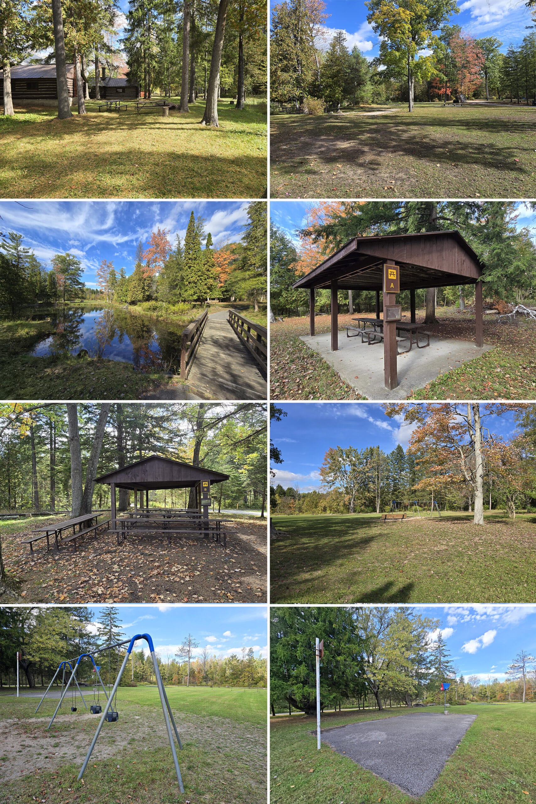
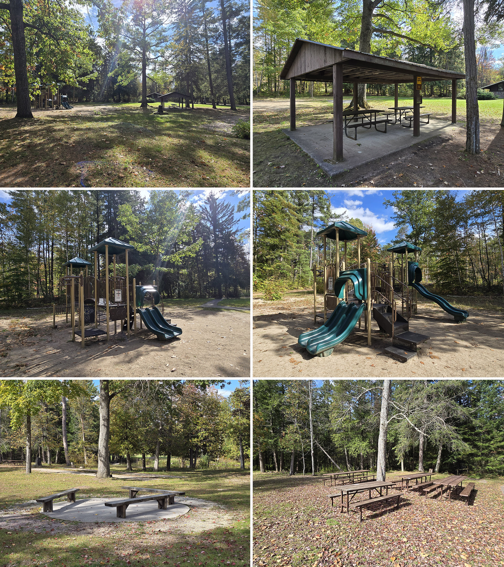
Day Use Area
The whole park is a day use facility, but we tend to use “day use” in the sense of picnic facilities and such.
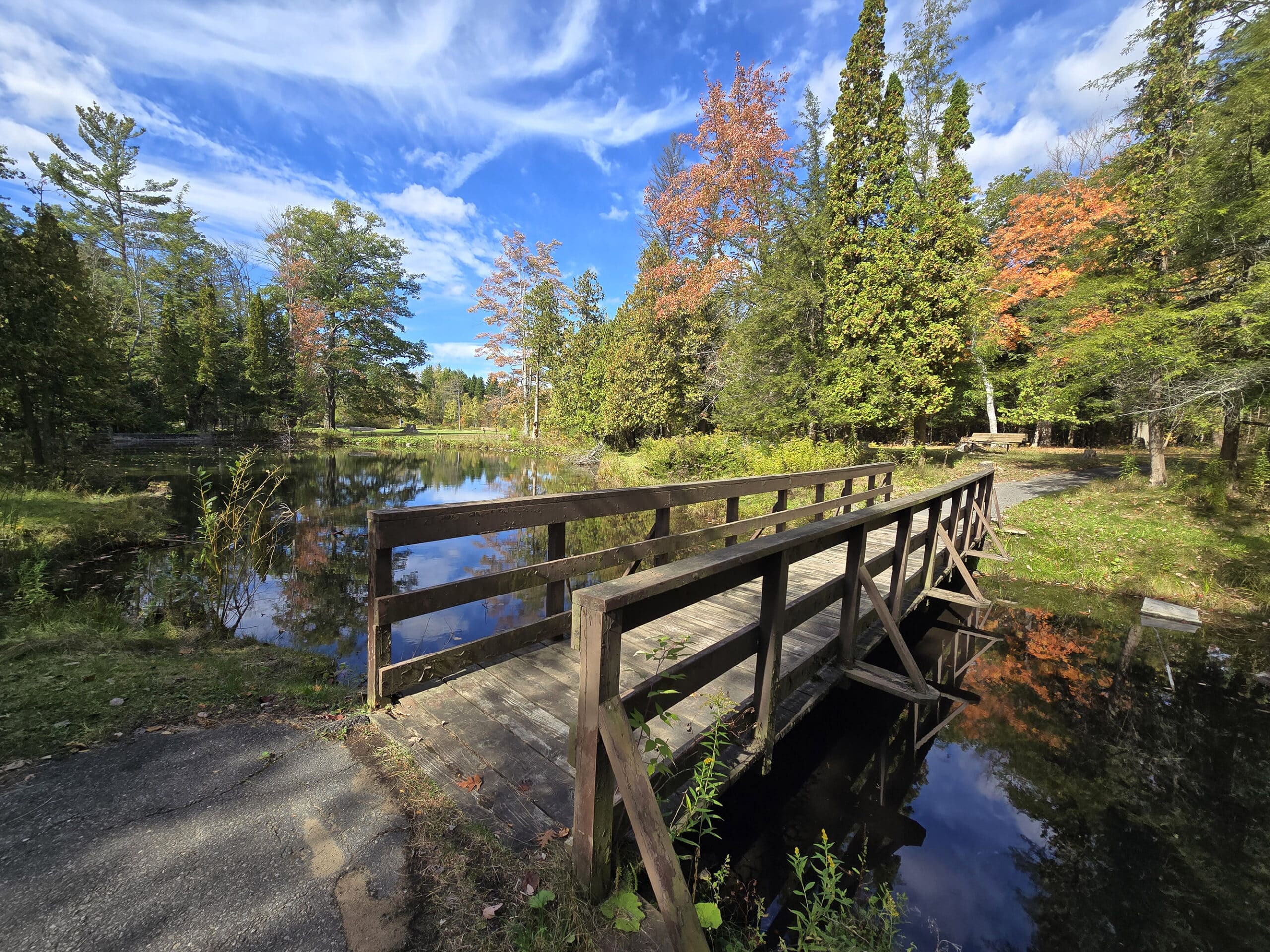
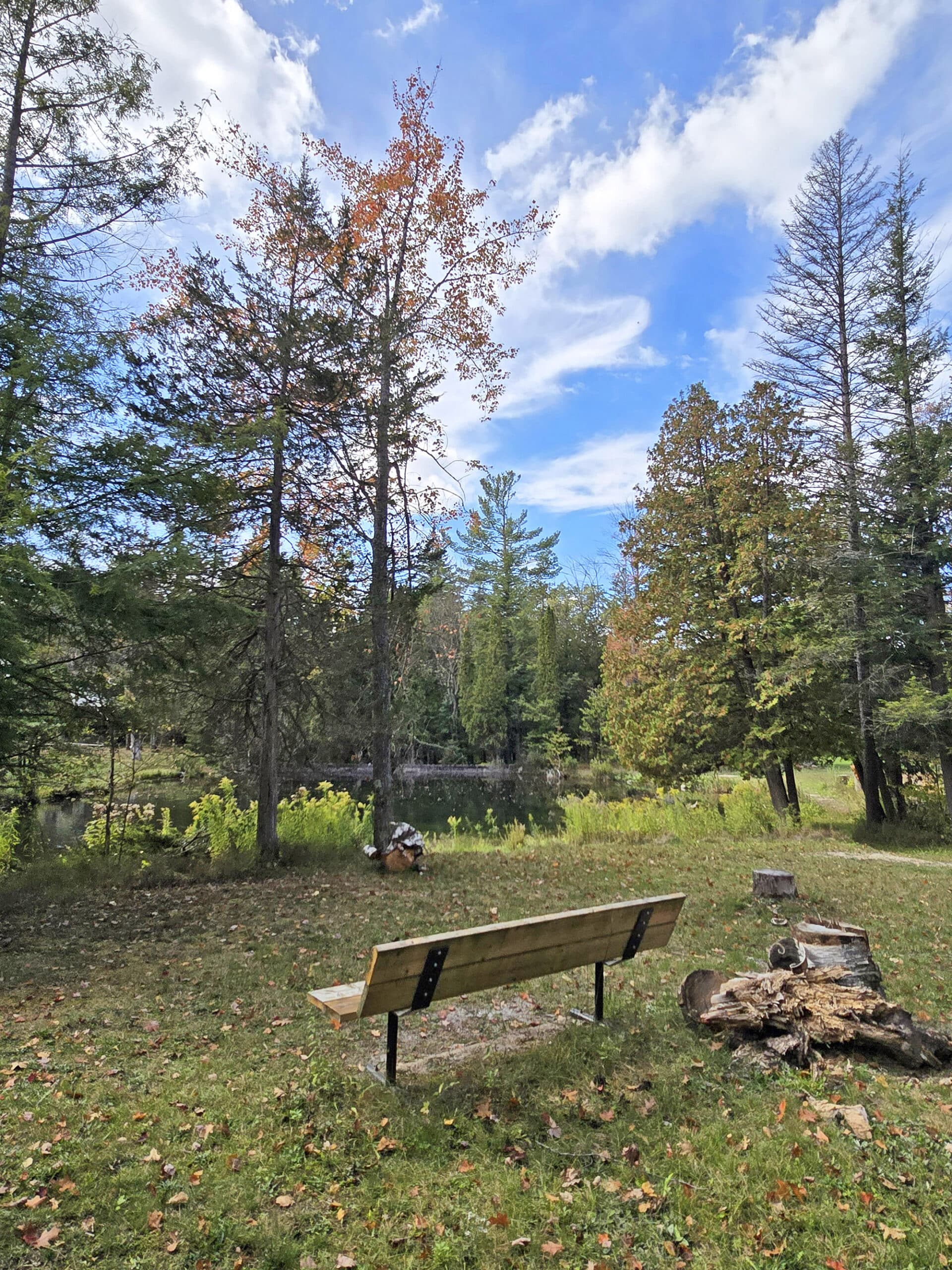
In the case of Springwater Provincial Park, the picnicking is really the big draw.
The main picnic area is located in the heart of Springwater Provincial Park, with easy access to the various parking lots and trails.
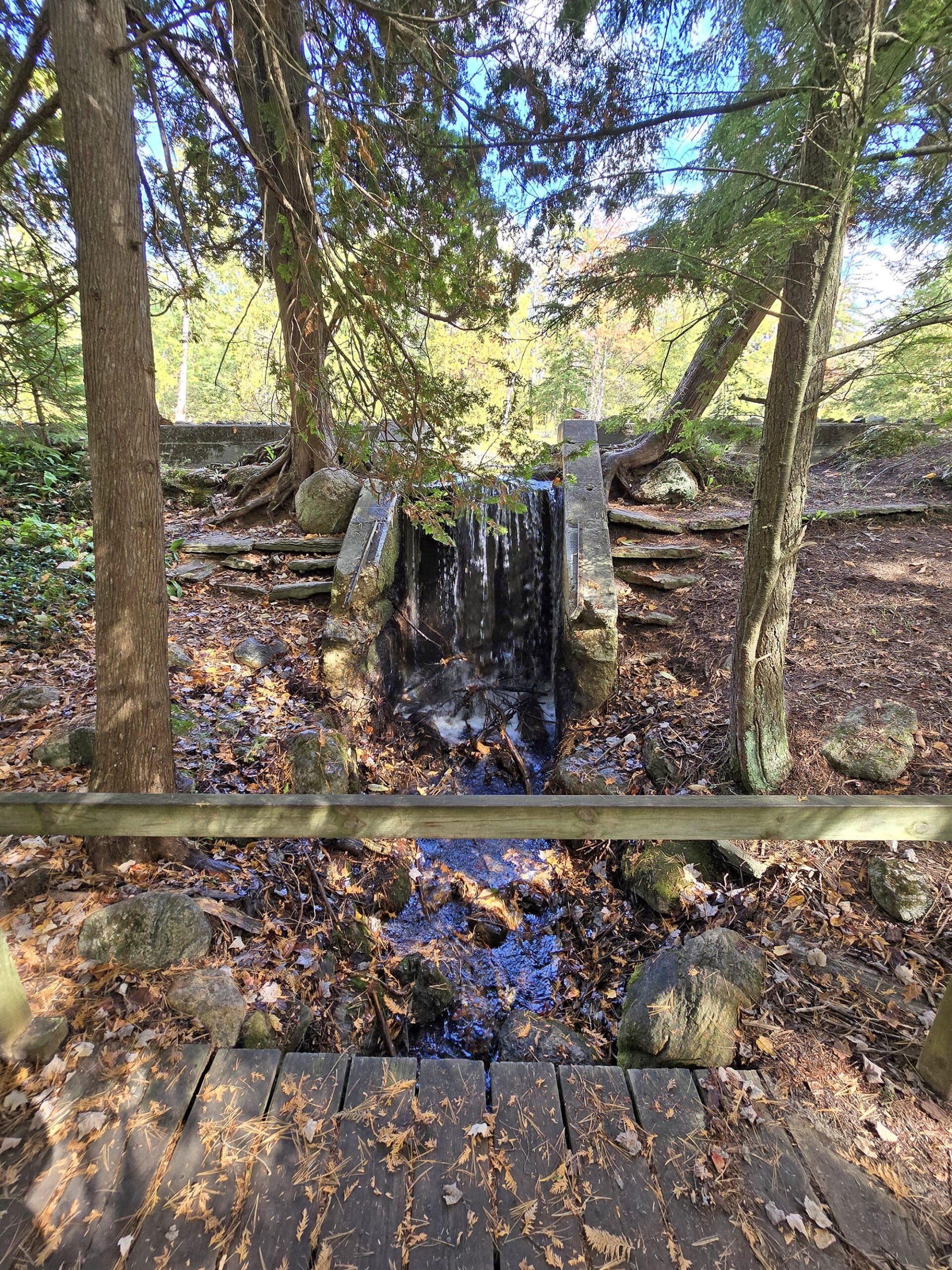
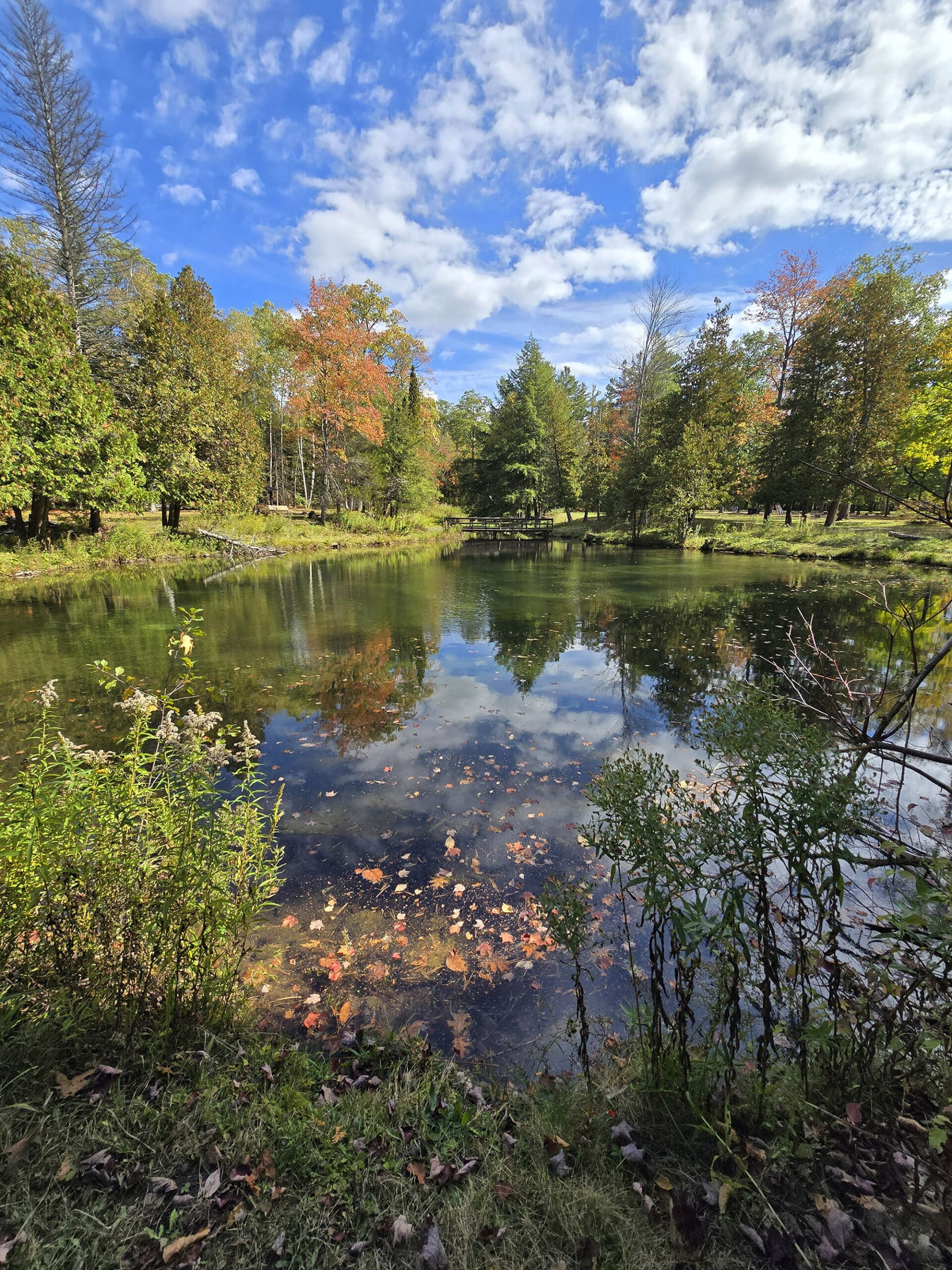
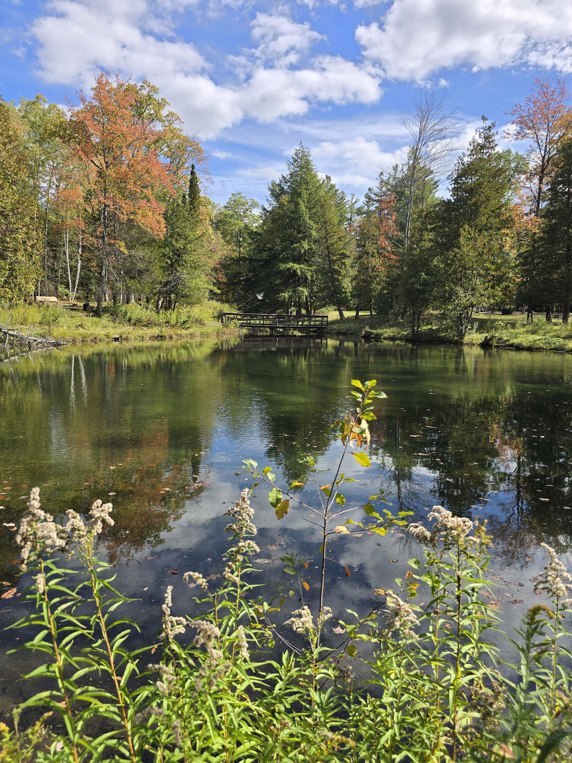
There are a variety of picnic shelters strewn about the green spaces, with a scenic pond and some recreational facilities to round it all out.
The first picnic shelter we came to was PSE, which was huge - like “host a wedding here” huge. Weirdly, it had two log cabins attached to it, but with no information (in person or on the website) about them.

Aside from the numerous picnic shelters - some tiny, some more moderately sized - there were picnic tables everywhere.
Near the comfort station, there's a playground... and next to the playground there is a water fountain and tap available.

Overall, a really cute area for outdoor get togethers!
Connectivity
We seem to have decent internet connection throughout the park. It's just minutes away from Barry so that makes sense, we're on Rogers wireless.
Miscellaneous
A couple things to note, here:
1. We visited in early October and there were a LOT of lights being set up at the time - it looked like they were setting up some kind of drive through or walk through Christmas lights display.
It was for Magic of Lights - but didn’t see anything on the park’s website to this effect, though!
Anyway, there were piles of displays, moving trucks, etc - it was odd and gave the whole thing a vibe like we weren’t supposed to be there.
As Porter put it, it felt like being at a fairgrounds, before or after the event.

3. There are train lines that run next to the park, and it is VERY loud at times!
4. There’s a WWI Cenotaph, and the park hosts a Remembrance Day ceremony annually:

Share the Love!If you’ve made one of our recipes, be sure to take some pics of your handiwork! If you post it to Bluesky, be sure to tag us - @2NerdsInATruck, or you can tag us on TikTok, if you’re posting video. We're also on Pinterest, so you can save all your favourite recipes and park reviews to your own boards! Also, be sure to subscribe to our free email newsletter, so you never miss out on any of our nonsense. Well, the published nonsense, anyway! |
Entertainment and Activity
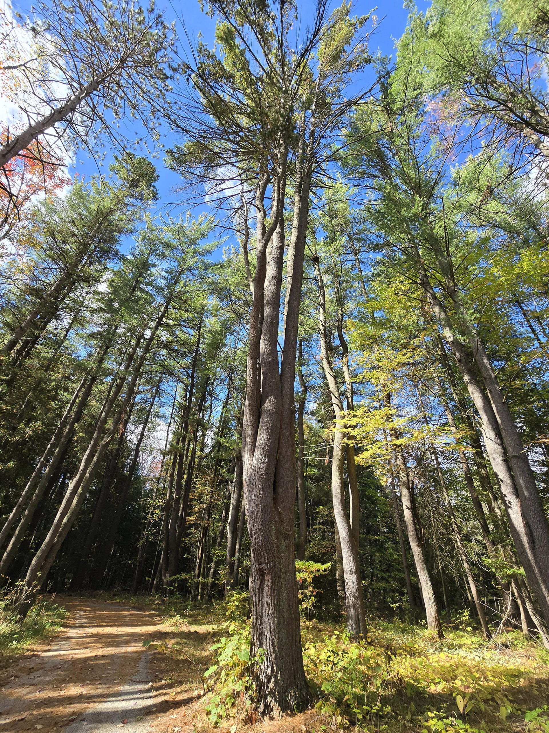
While Springwater Provincial Park is definitely more of a picnic destination than anything else, there are other ways that outdoor enthusiasts can enjoy their time in this natural setting.
Here’s some info about your options:
Hiking
There are five hiking trails in the park, ranging from 1.5 km to 5 km in length, with many sections of the various trails overlapping in places:
Red Trail - 5 km
Green Trail - 2.5 km
Blue Trail - 2.5 km
Purple Trail - 2 km
Yellow Trail (Children’s Interpretive Trail) - 1.5 km.

There’s a map and arrows just inside the trail when you enter from the parking lot, but - as far as we saw - the trails are blazed at intersections only.
So, if you hop on a trail at any other point, you may or may not be on an official trail - and you’re not likely to know, until you come to an intersection point with another trail.
We only did a few km of trails during our first stay. It all seemed to be easy trail - wide, well-packed forest floor, with not much in terms of obstructions, obstacles, or hills.
One thing to note: The Children’s Interpretive Trail - right off P1 / P2 - was closed at the time of our visit.

Biking
There aren't any specific biking trails in the park but the park roads seem perfectly fine for cycling on there's a lot of them.
The park’s site mentions that cycling is allowed on all of the park’s trails aside from the children’s interpretive trail - which wasn’t open at all, during our visit.
Swimming
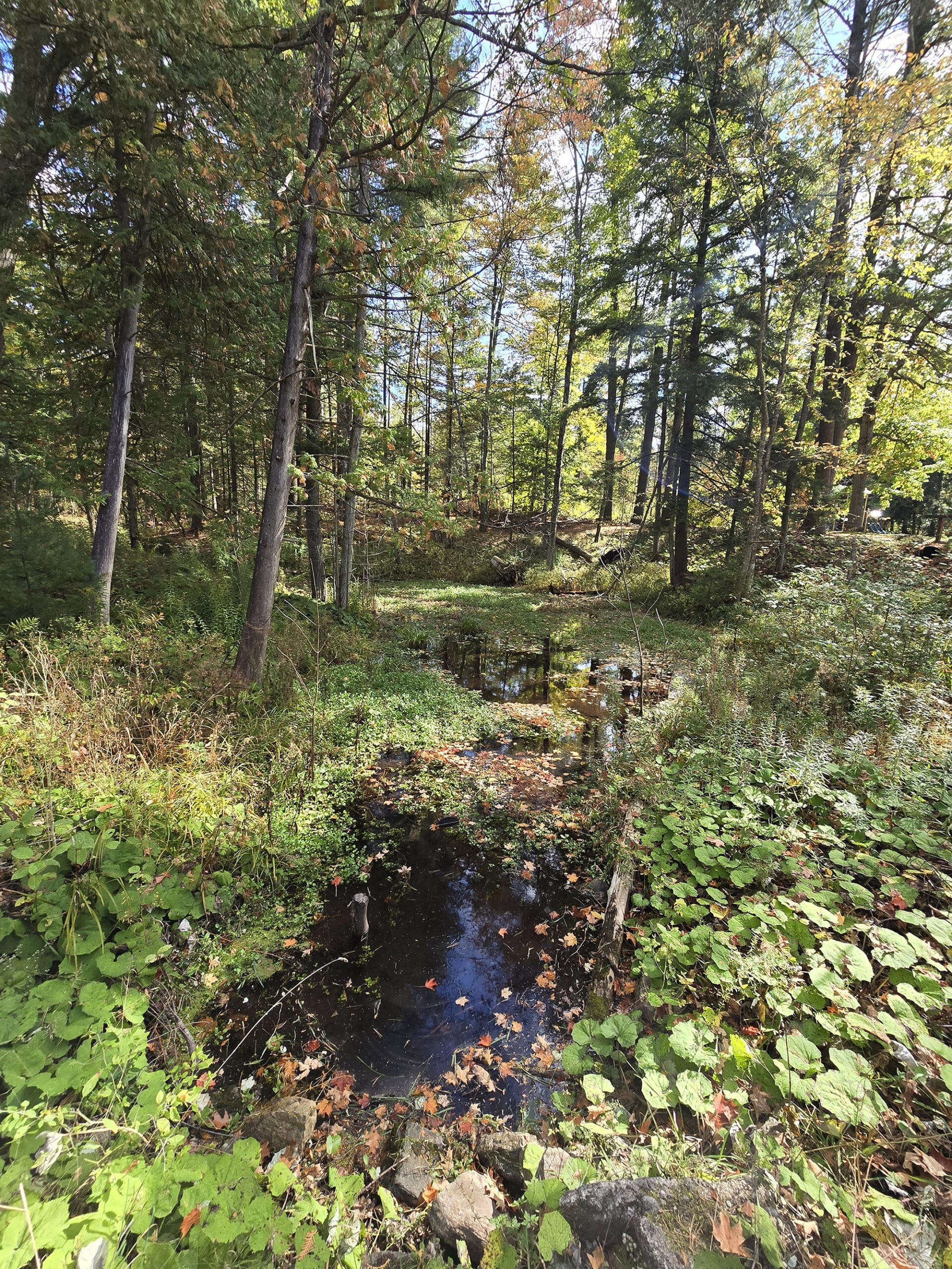
While there are a couple small water bodies in this park none, of the ones we saw appeared to be fit for swimming in - they’re definitely ornamental.
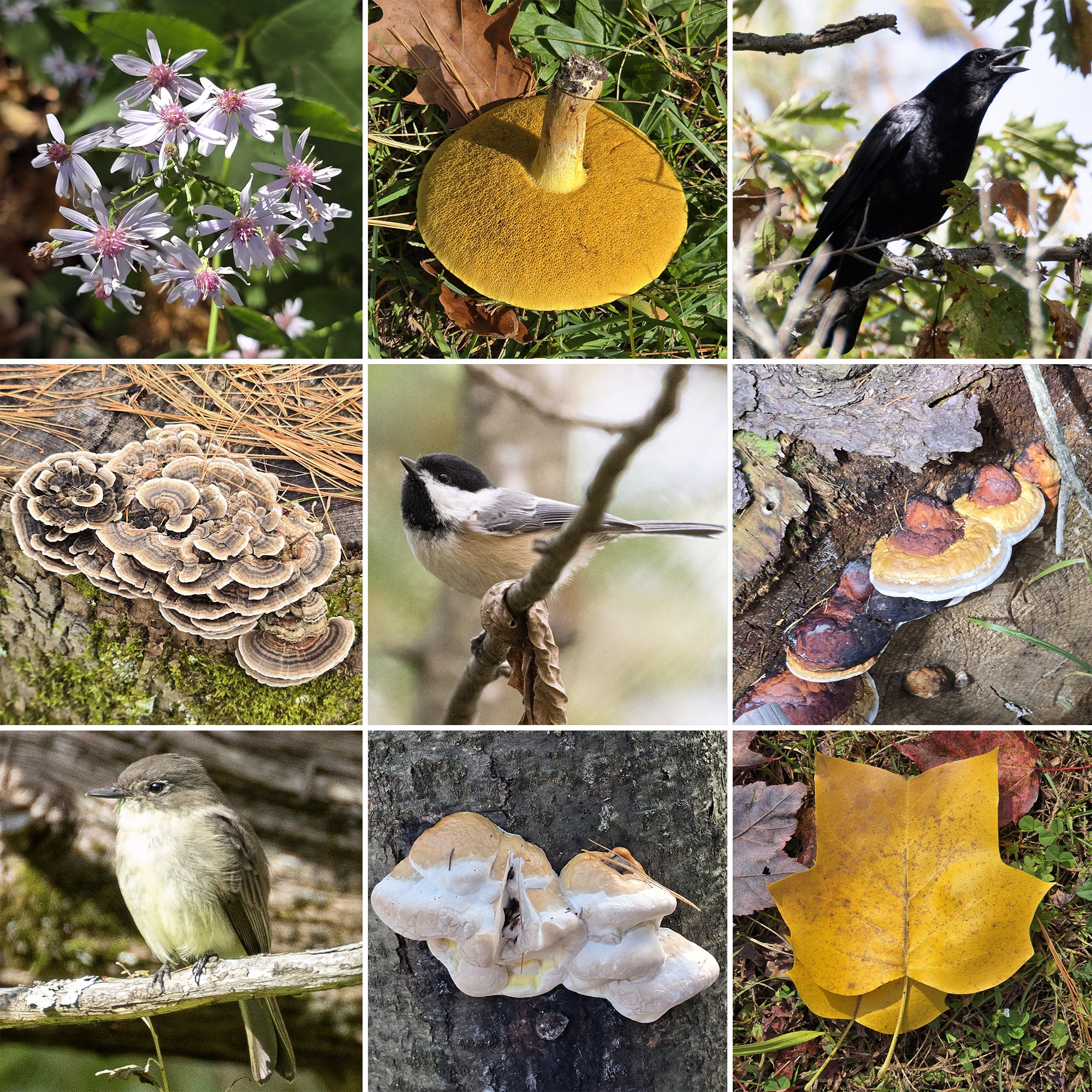
Birding, Wildlife, and Nature
We didn’t have a ton of time for wildlife viewing, and had been hoping to spend more time at Springwater Provincial Park on our ill-fated second attempt.
That didn’t happen, so all we’ve seen or heard there were:
American Crow, Black-Capped Chickadee, Black-Throated Blue Warbler, Blue Jay, Eastern Phoebe, Golden Crowned Kinglet, Pileated Woodpecker, and Red-Breasted Nuthatch.
Misc
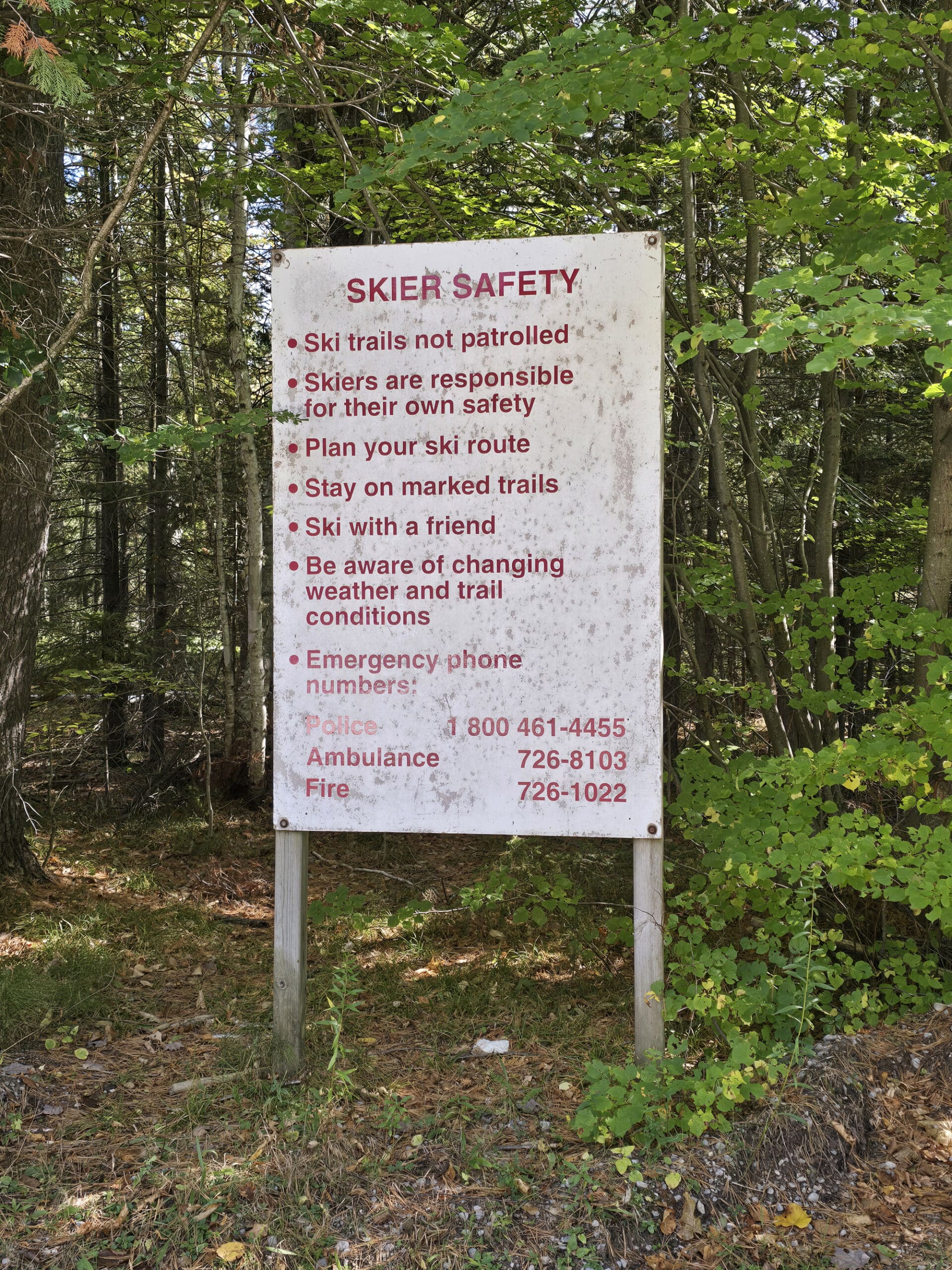
There are 10 km of winter trails available for snowshoeing and nordic skiing in the park, with at least one being a snowshoe trail exclusively and not open during the summer.
Parking Lot #5 also serves as a cross-country ski trail head during the winter, and had a sign with information about cross-country skiing.
Discovery Program
There does not appear to be any kind of Discovery Programming offered at Springwater Provincial Park.
There is a “Children’s Interpretive Trail” - no information about what that entails - but it was closed at the time of our visit.
An older sign at the trailhead DID make mention of the existence of a “Waterfowl and Wildlife Display Area” elsewhere in the park, but it was blacked out on the main map at the front, and we didn’t see anything like that during our visit.

Niantic Games
There is not an single Niantic Stop in the entire park.
WEIRD ... I don’t think we’ve ever seen that to be the case before - even the parks with no cell reception at all!
Final Thoughts
This park was a logistical nightmare, and just did NOT leave us with a good impression. Like other parks that we end up rating poorly, the park ITSELF was really nice... it was all logistical issues that could so easily have been avoided, given a little effort and planning.
With so many parking lots and trail sections closed - and things not lining up between the map (well, 2 different maps!) and reality, it was frustrating.
The vibe with all the Christmas stuff in piles everywhere was just weird. It felt like we were visiting a like a fairgrounds after the event or something, and like we shouldn’t be there.
The whole thing with the gates being closed during operating hours, no one answering the phone, nothing posted as park alerts, etc? Ugh.
Having to disconnect our towed car and cross our fingers that we would even be able to turn the RV around on the 2 lane road was super stressful.
We WANTED to like the park. It was super cute, is probably even nicer in the summer, and I bet it’s a really great place to have summer get togethers.
I honestly have no idea how it’s rated so well - did our visits happen during a bad time? Are there unspoken rules among locals, who may know when and when not to visit?
I wonder how much of it is a local vs outsider thing. The maps and direction stuff wouldn’t be a bother to people who live locally and just know the park, after all.
Anyway, we’d been looking forward to giving the park a second chance, after having figured out the basics on the first go. Given how that went, we’re not going to be back.
It’s just not worth it to risk having to turn the RV around like that... but your mileage may vary!
More Southwest & Central Ontario Provincial Parks & Places to See
Want to read some more about the parks we've camped and at places we've seen in Southwestern & Central Ontario? Here are some more posts!
Southwest/Central Ontario Campground Reviews:
Awenda Provincial Park
Balsam Lake Provincial Park
Bass Lake Provincial Park
Bronte Creek Provincial Park
Bruce Peninsula National Park
Conestogo Lake Conservation Area
Craigleith Provincial Park
Darlington Provincial Park
Earl Rowe Provincial Park
Elora Gorge Conservation Area
Emily Provincial Park
Falls Reserve Conservation Area
Fifty Point Conservation Area
Inverhuron Provincial Park
Long Point Provincial Park
MacGregor Point Provincial Park
Mara Provincial Park
McRae Point Provincial Park
Meaford Memorial Park
Pinery Provincial Park
Point Farms Provincial Park
Port Burwell Provincial Park
Rock Point Provincial Park
Rondeau Provincial Park
Sauble Falls Provincial Park
Selkirk Provincial Park
Sibbald Point Provincial Park
Turkey Point Provincial Park
Valens Lake Conservation Area
Warsaw Caves Conservation Area
Wheatley Provincial Park
Southwest/Central Ontario Places to See:
Big Bay, Ontario
Canada's Dinosaur Park
Cheltenham Badlands
Devil's Monument
Doubes Trestle Bridge
Eugenia Falls Conservation Area
Flowerpot Island
Hogg's Falls
Inglis Falls Conservation Area
Indian Falls Conservation Area
Jones Falls
Keith McLean Conservation Lands
Mark S. Burnham Provincial Park
Menesetung Bridge
Mono Cliffs Provincial Park
Peterborough Lift Lock
Petroglyphs Provincial Park
Point Pelee National Park
Rattlesnake Point Conservation Area
Scenic Caves Nature Adventures
Spirit Rock Conservation Area
Wasaga Beach Provincial Park
Want to explore beyond Southwest and Central Ontario? Check out our full list of Campground Reviews, Ontario Waterfalls, and other Places to See.
We also have a ton of Camping Recipes to cook up, while on your adventures!
Thanks for Reading!If you loved this post - or have any questions about it - please leave a comment below! We'd also love it if you would consider sharing the link on social media! |


Leave a Reply