
Ojibway Provincial Park is a tiny park and campground, located about an hour outside of Dryden. Here's our review & full camping guide!

For those who happened across this post randomly, a bit of context:
We blew out two tires at Caliper Lake Provincial Park, were able to get up to Rushing River Provincial Park on a spare and a replacement, but ended up stranded there for a week and a half, waiting for Canadian Tire to get the other replacement tire in.
I had meticulously planned the road trip for months, and suddenly our peaceful retreat was completely up in the air, with constant rescheduling.
Then the wildfires became a big issue.
As we were losing days to this, we had to rethink our plans. We had to cancel several of the reservations we had, and visit those parks on a day use basis, instead.
Ojibway Provincial Park was one of the 3 night planned stays that ended up sacrificed ... sort of. We decided to nix it, in favour of visiting on a day pass while staying at Aaron Provincial Park, nearby. Based on what we saw, we rebooked our stay... but for 4 nights, instead of the original 3!
Anyway... Ojibway Park is located in the town of Sioux Lookout, about 45 minutes away from Aaron. Of that, about 15 minutes is on the Trans Canada Highway, then you head north for another half hour or so.
As a tiny, very remote park, it’s known for its serene surroundings, and ample opportunities for outdoor exploration - both on land and water.
It sounded like a great summer destination, so I’d been looking forward to it for months!
Anyway, let’s tell you all about it...
The Basics:
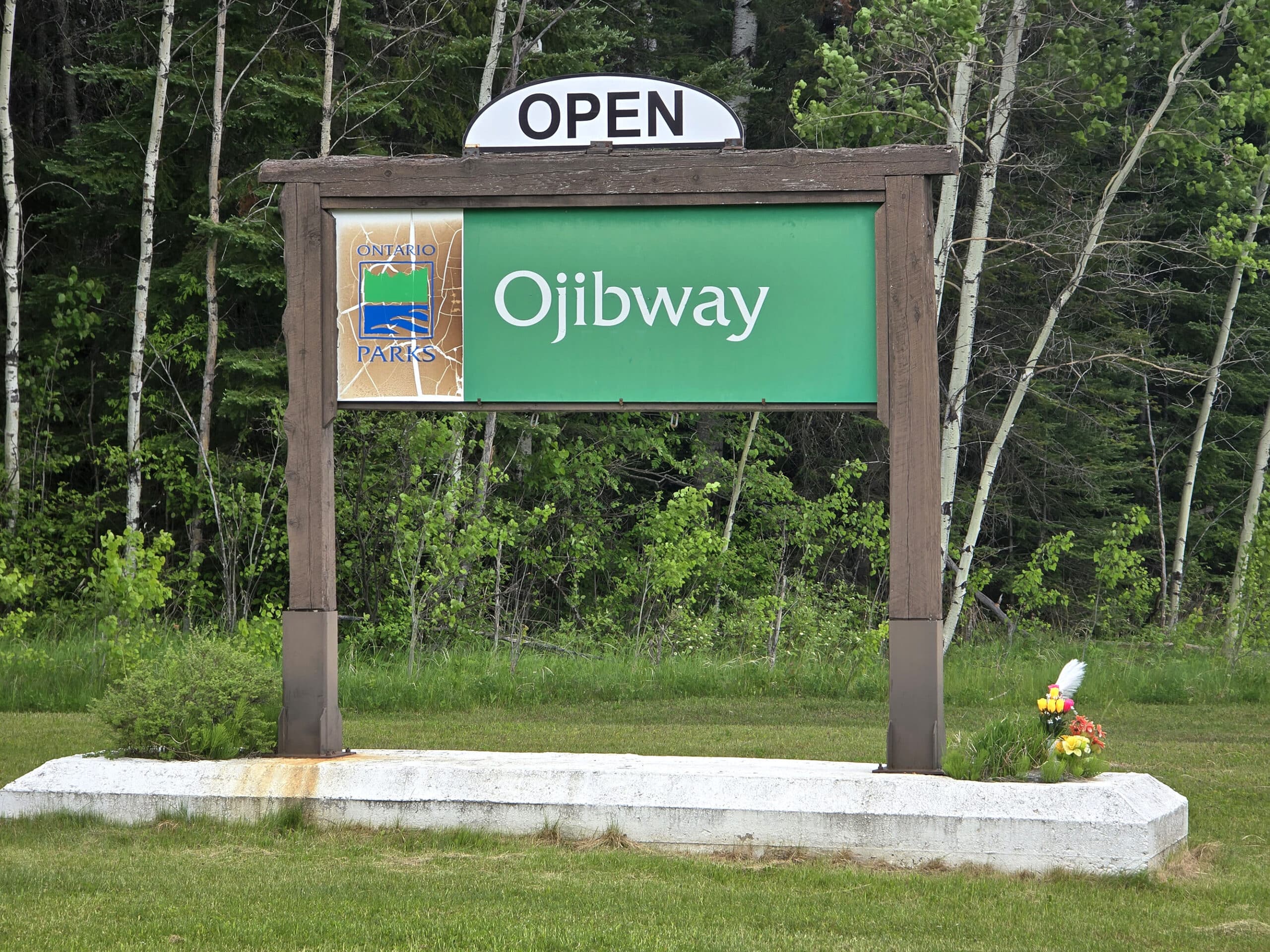
Campground Name: Ojibway Provincial Park
Address: Indian Trail, Sioux Lookout ON. Click here to see the Google Maps location.
Website: https://www.ontarioparks.ca/park/ojibway/
Price: Ontario Provincial Parks uses a pricing matrix across all their parks. See 2025 Camping Fees for more details.
Reservations: Ontario Parks Reservations
Park Classification: Natural Environment
Season: May 15, 2026 to September 13, 2026
Logistics
Some basic information to help you plan your visit to Ojibway Provincial Park:
Registration and Check In
As I mentioned, our campsite reservations for this camping trip didn’t quite pan out as planned.
I had booked 5 months ahead of time, no problems. I had to re-book the stay a few days ahead of time, before ultimately cancelling it and visiting on a day pass... then re-booking it.
No problems at all along the way, it was just annoying that things panned out that way. Also, Ontario Parks made a TON of money off the change fees and cancellation penalties from this trip, LOL.
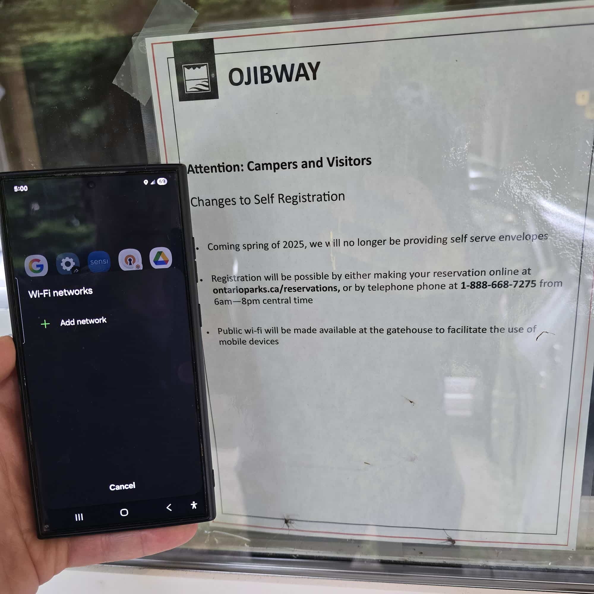
As far as actual registration goes - much like Pakwash Provincial Park - the gate was unstaffed at the time of our visit.
This looked to be a long term thing, as there was a BIG sign declaring it to be a self-serve gatehouse, and instructing people to register and pay before proceeding into the park.
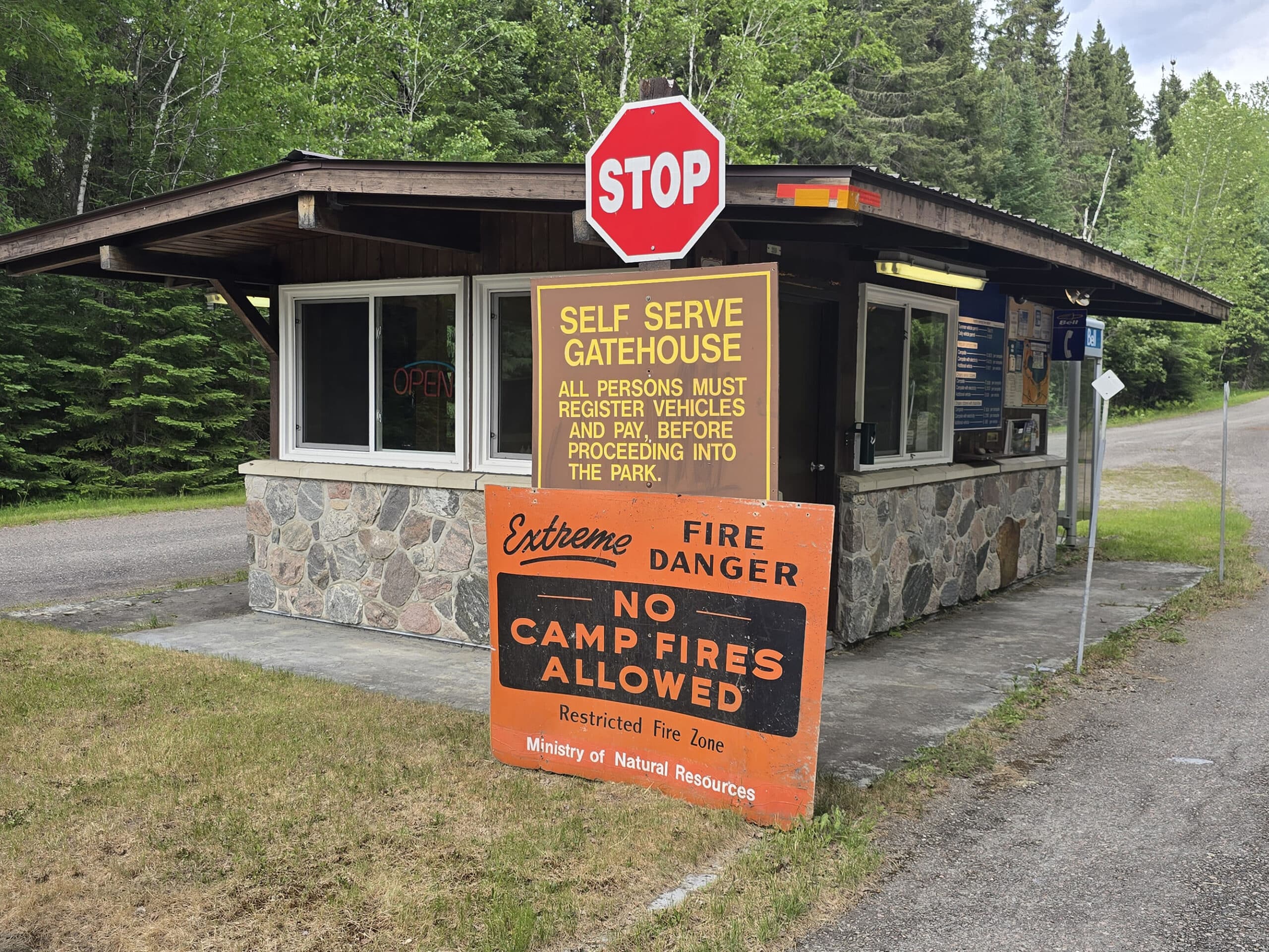
It also said that public wifi would be available at the gatehouse to help facilitate that, which would have been nice, but there was definitely no wifi there.
Maps and Signage
Unlike Pakwash, Ojibway Provincial Park had paper maps available at the front, as well as a large, colour-coded map sign.
There was definitely some weirdness with the maps:
The main map was decent - an 11x17 colour map, folded - but there were some omissions.
Directionality at a one-way road (near the dump station), making it appear that some amenities were accessible from other areas (the playground and beach are not accessible directly from the boat launch), etc.
It also shows a single trail starting out from the road to the group camping area - there are actually 3 there.
We took the first one we saw (parking area) assuming it was the one on the map - it was NOT. It was only after walking further up the road that we realized there were others.
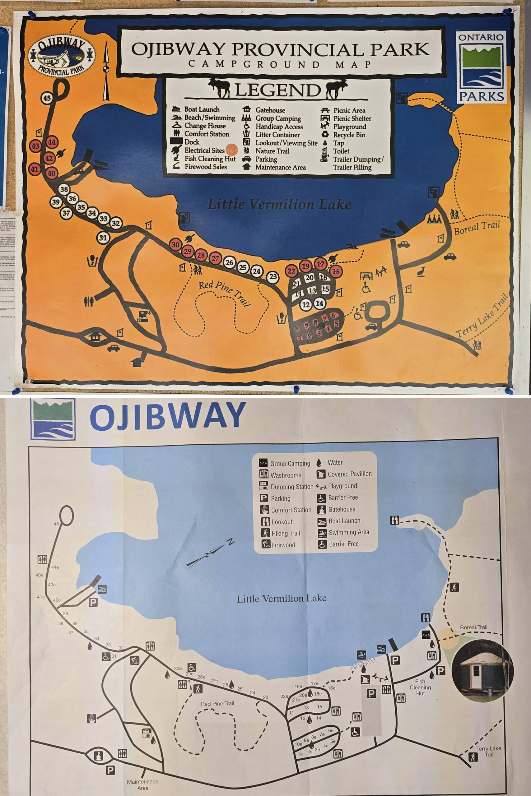
And I mean literally just the trails. No trail names, no parking indicated, etc.
There’s a bit of information at the bottom - naming the trails based on colour (ugh!!) with distance and difficulty info. Not only was that useless for the map as presented, it was also cut off at the bottom!
Beyond that, apparently the trails on the map are listed in a different colour than the blazes they’re telling you to follow, which is weird. That doesn’t even really matter, as the actual trail markers don’t always line up with either of them!
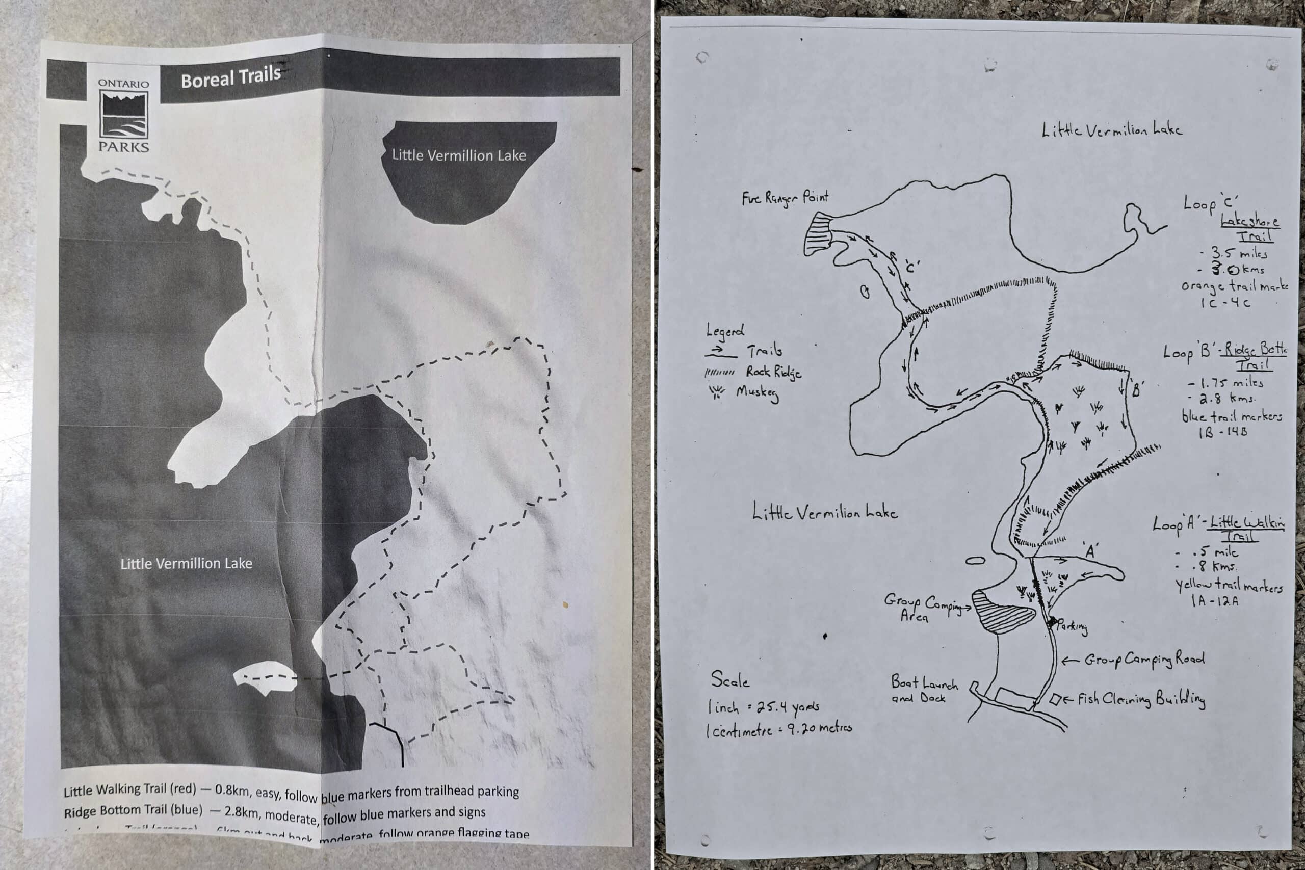
There were also hand drawn paper maps and signs at the Boreal trails.. That didn’t seem to line up with the park’s map OR trail descriptions.
Definitely makes exploring the great outdoors a bit more chaotic, especially when one of us has to budget mobility and can’t do moderate trails at the moment!
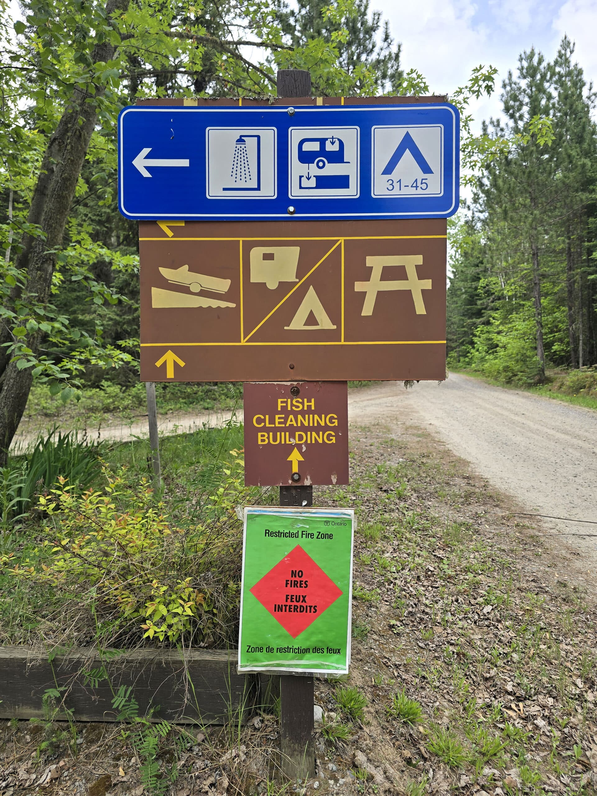
LOTS of signage, very visual, mostly high-contrast, usually well placed.
The only problem is that the signs that indicate the campsite numbers (As in, the ones that say which lot of sites is where) has the numbers incredibly small - you pretty much have to be stopped right at the sign to see what numbers are listed.
That said, it’s a very, VERY small campground, so I’m not sure how that matters. Also, the symbols are clear, just not the listed sites below them. Knowing you’re staying in the “First loop on the right”, etc will definitely work.
Waste and Water Services
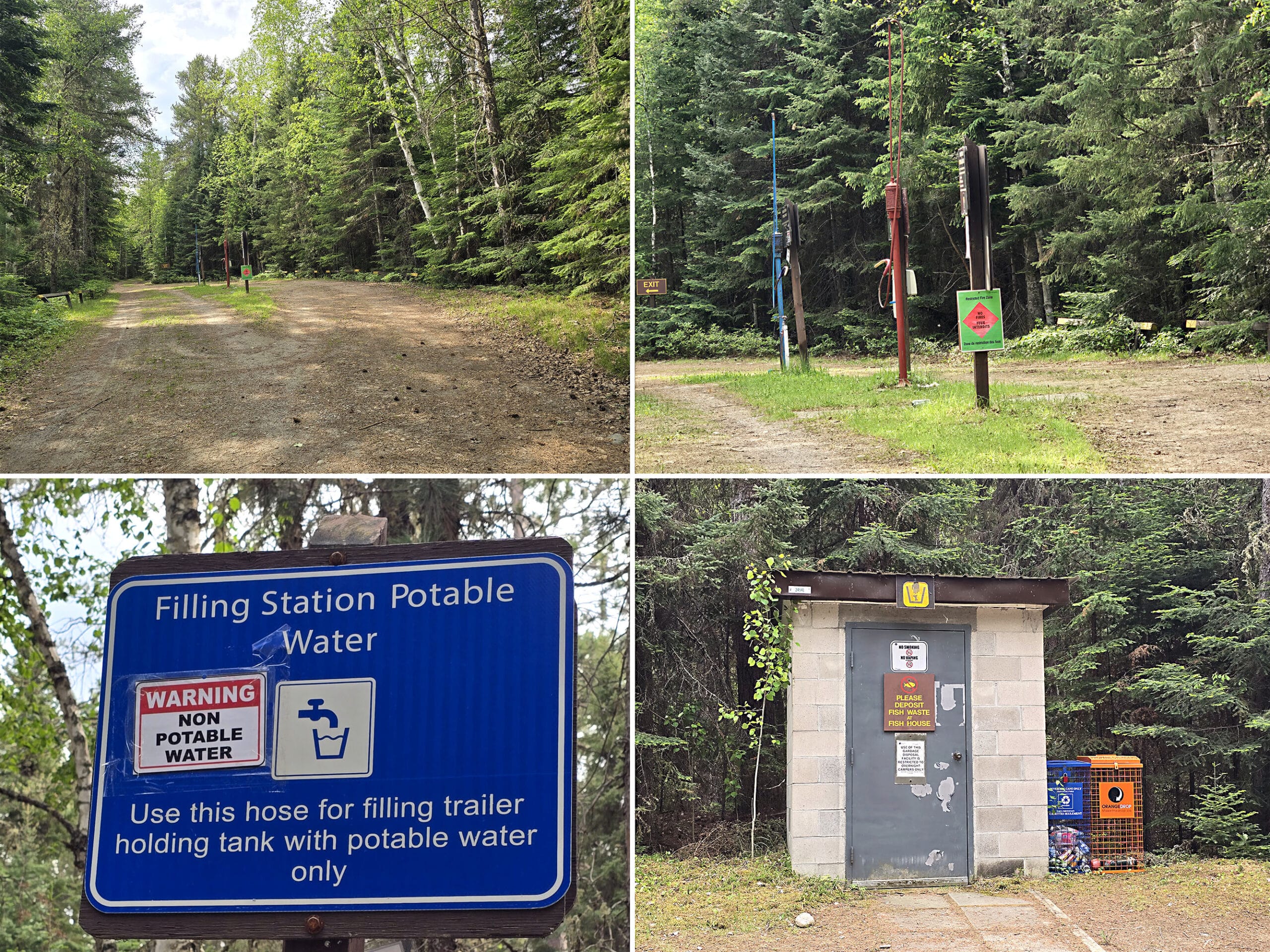
Garbage and recycling isn’t indicated on the map, but there are a few locations. One was on the road between the campsites and the comfort station, and there was another near the 2 loops of campsites, near the day use area.
The trailer sanitation station is a half loop off the side of a road, near the comfort station. There’s basically an island in between 2 lanes - neither has a bypass lane, but I suppose both of them act as a bypass lane for the other.
Anyway, it’s a one way road, but - with this setup - you can dump and fill from either side of your rig.
The dump platform is first, followed by a non-threaded water fill tower.
It had a warning that it’s not potable water, though - and it looked to be a relatively long term thing, as a sticker and tape, rather than a hung, temporary warning.
Connectivity
On Rogers Wireless, the cellular reception at Ojibway Provincial Park was a bit... weird.
We had decent to really good connection in most of the park, but then some of the areas we THOUGHT should have good reception (the beach/day use area, boat launch) had none.
Accessibility
Overall, not a very accessible park.
The barrier free sites are a disappointment. Both are smaller than the sites surrounding them, and 29e is the only site along that stretch that DOESN’T have a water view.
Not cool to have the accessible ones being crappy little side of the road sites, no privacy or interest at all, surrounded by really nice sites!
Oh, and neither is directly adjacent to accessible washroom facilities or the comfort station.
The park’s site says there’s a wheelchair ramp in the day use area - I didn’t see one.
There is an accessible washroom facility shown on the map, between the day use parking and the first loop of campgrounds adjacent to it. I did not see the washroom from the parking lot, so we went looking for it.
There’s a trail down to it from that campground, but the trail is ABSOLUTELY not barrier free. Also, the washroom does not exist - accessible or not.
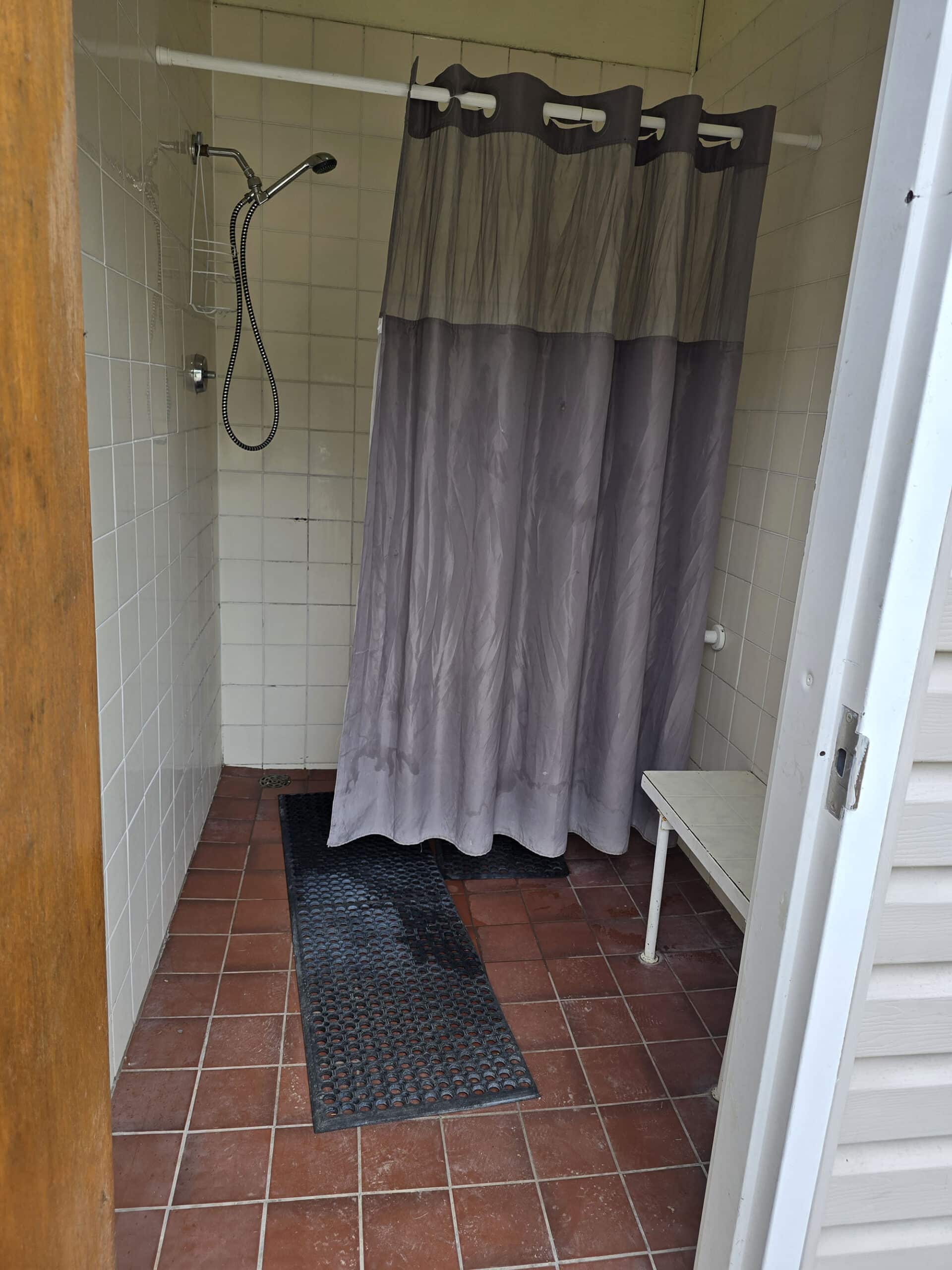
The “barrier-free” shower has a bench - and what looked to be a single railing in the shower - but the shower head and handle were regular height - not wheelchair accessible. The door to this shower stall is also VERY narrow, and there’s much less room in there, than other accessible showers I’ve seen.
Pets
There is no mention of pets on the park’s website or on the map.
So, expect that the basic rules are in play - dogs are to be leashed and attended to at all times, and not allowed to make excessive noise or harass other campers or wildlife.
They’re also to be picked up after, and droppings properly disposed of.
We can tell you that dogs were not allowed on the beach, per signage in that area.
Weirdly, there was a sign next to the washroom in the day use area. It said “washrooms” with an arrow pointing to the left ... on top of a picture of a person with a dog.
I can’t imagine that the washroom itself was supposed to be dog friendly - it looked to be a pretty standard outhouse - but just beyond that, there was an opening in the trees, leading to a bit of a field
This is between the day use parking and the boat launch, and it’s not labeled at all on the map - just dead space.
I’m thinking it’s supposed to be a dog exercise area? There weren’t any employees on hand, and no other signage to clarify. Really just kind of weird!
Anyway, that field was accessed at/near the day use parking, as it connects to the day use area.

Parking
While a lot of the campsites seemed pretty small- and some people were definitely parked partly into the campground roads - there were a few parking lots in the park that could have served as overflow parking. They weren’t marked as such, though.
Anyway, as a few specifics:
1. The north side boat launch (near the group camping) had plenty of parking for vehicles with trailers.
2. The south side boat launch had little to no parking - several big piles of rocks took up the area that could have been parking.
3. There’s a small parking lot near the group camping area that is supposed to serve as parking for both the group camping area, and the multiple hiking trails that originate there.
4. The day use parking is quite big, probably more than that day use area would ever require.
Miscellaneous
1. The highway between the Trans-Canada Highway and the park was VERY rough in spots, with construction causing big ruts, bumps, and delays along the way. The road into the park was also pretty rough for the first bit - and it’s about 3 km from the highway to the gatehouse.
2. There were SWARMS of dragonflies at the park! I’ve never seen so many of them in my life, it was really cool. As a related note, we saw only a handful of mosquitos the entire time we were there. I’ve definitely never been to a campground that had enough dragonflies to completely obliterate the mosquito population!
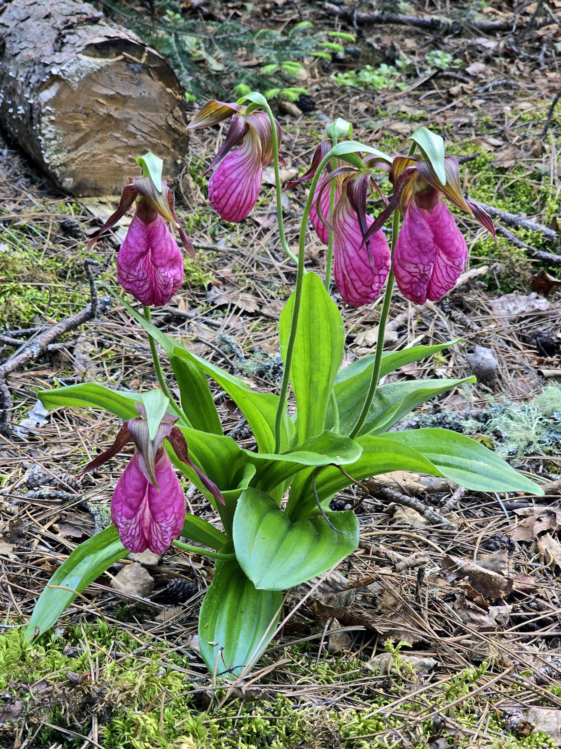
3. We loved seeing all the Boreal forest elements at the park. The forest floor that flanked the roads were covered all kinds of mosses and tiny plants - as well as a few wild orchids! - and it was just really visually interesting.
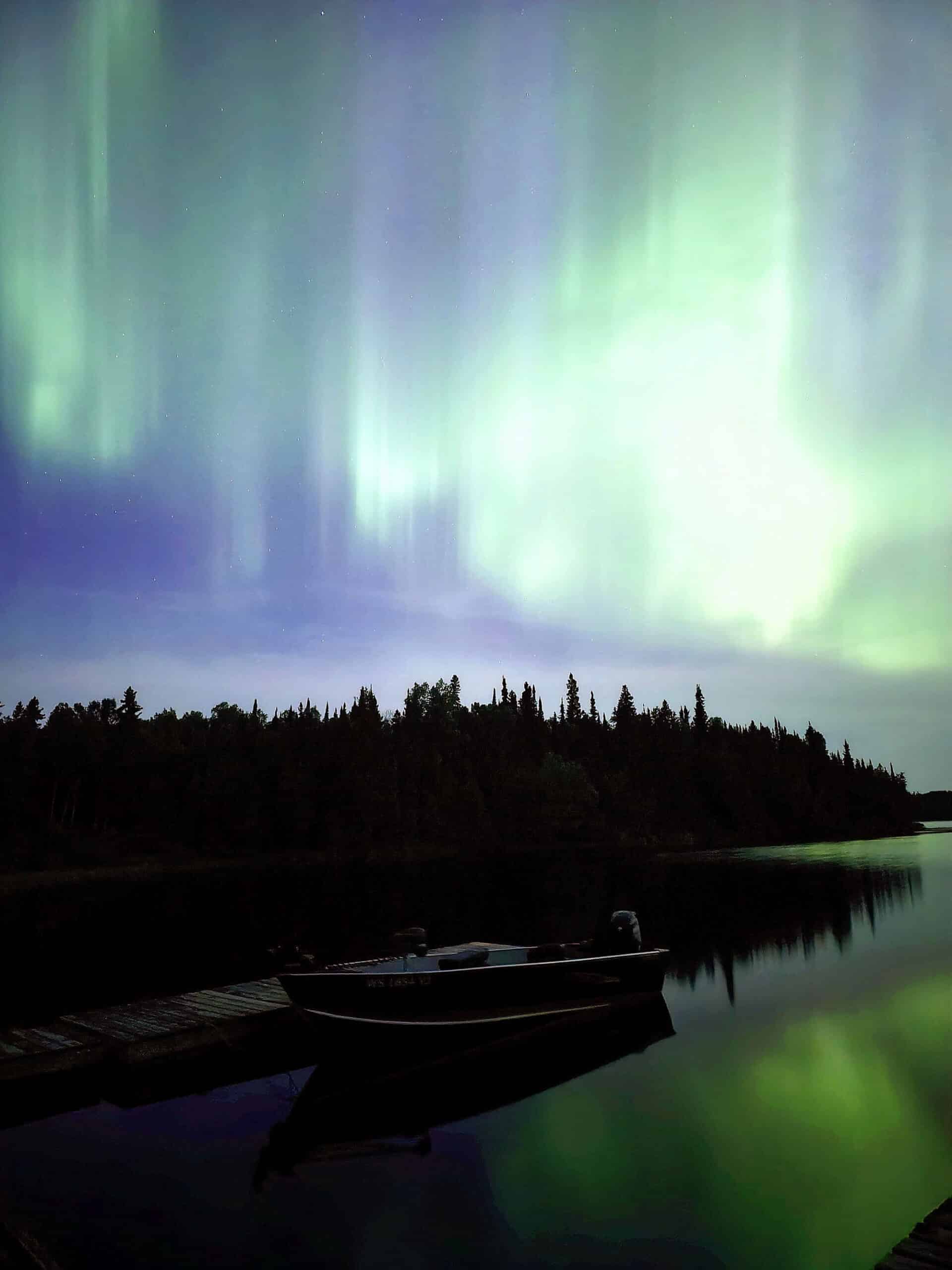
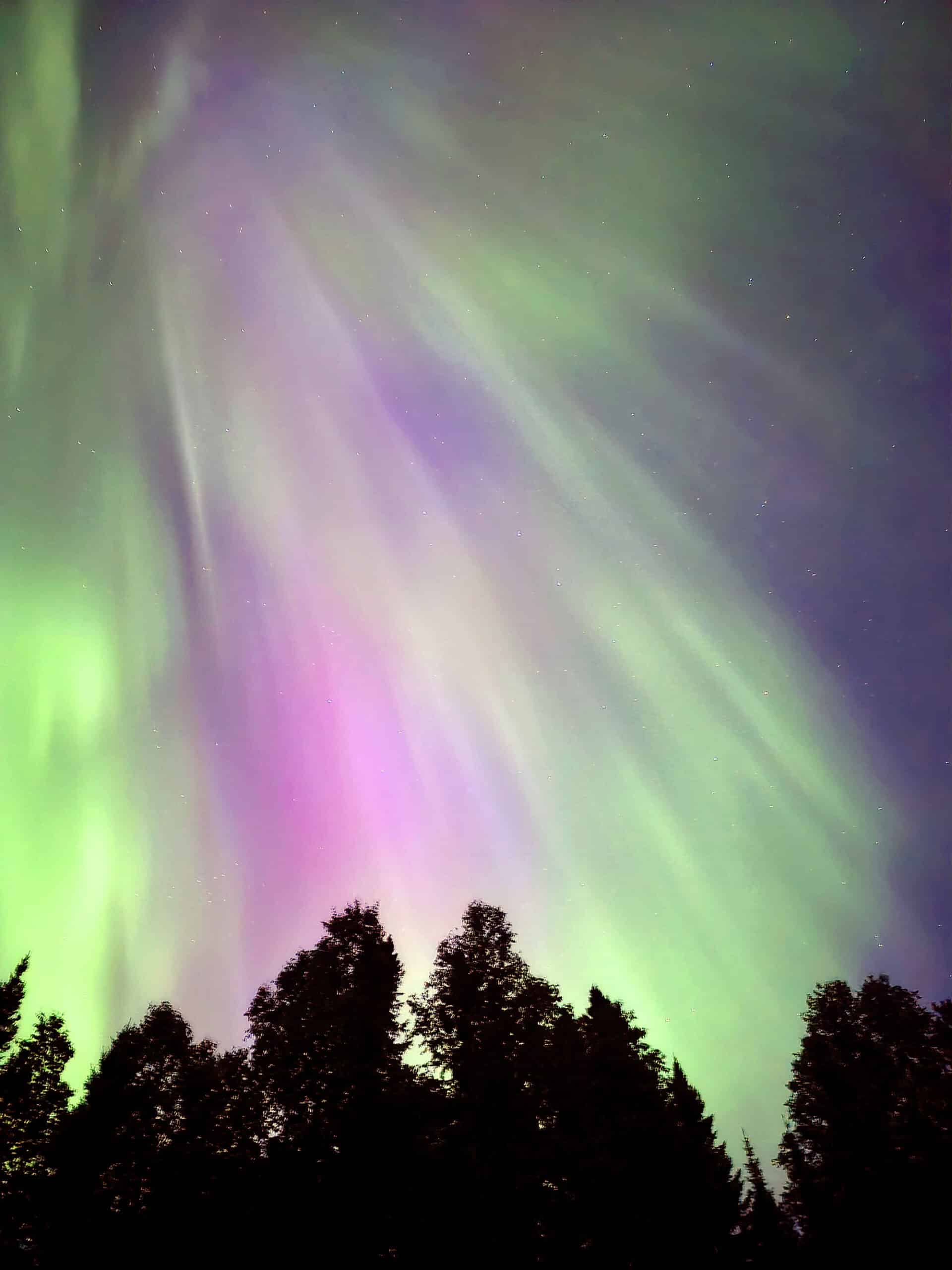
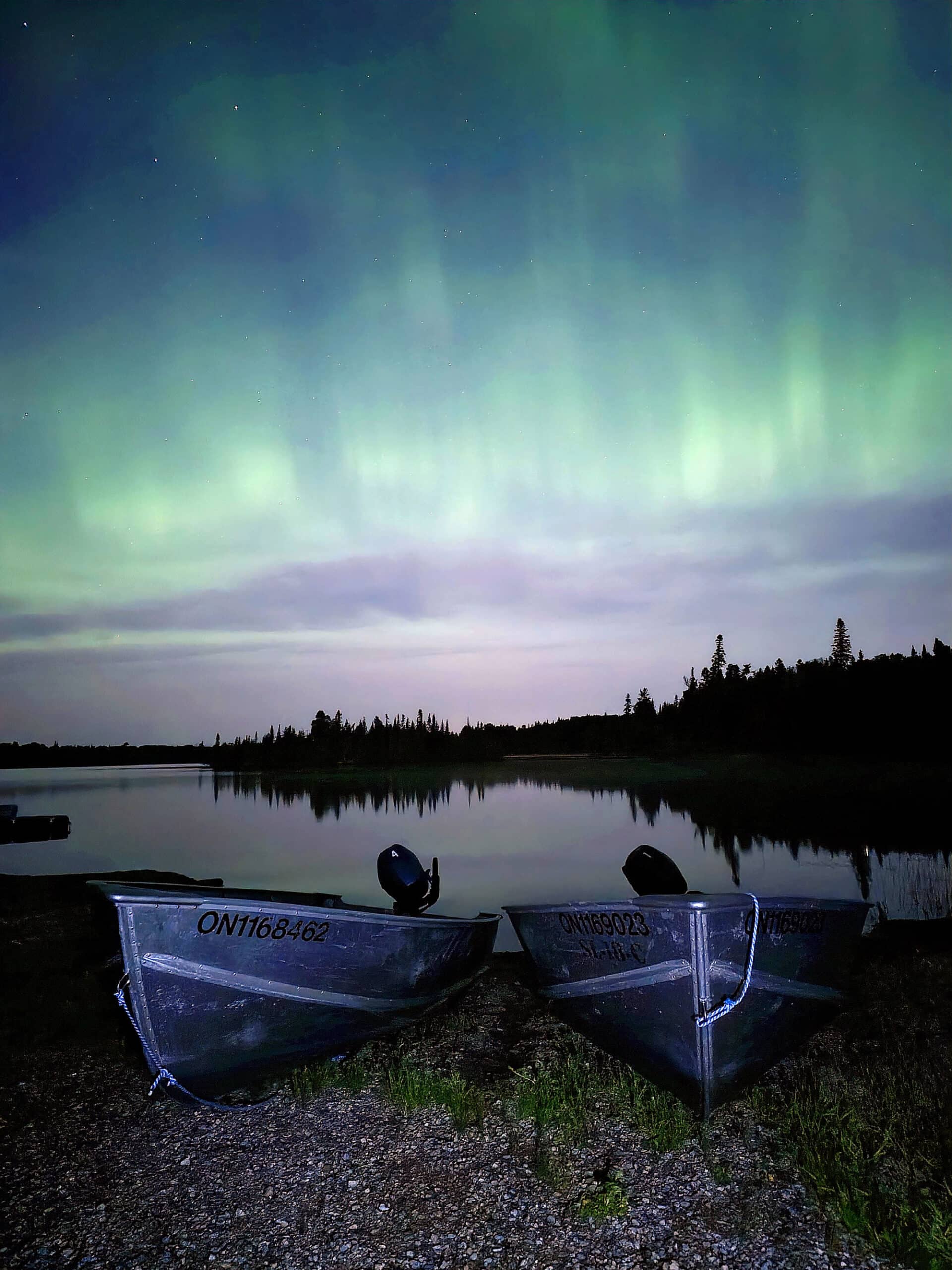
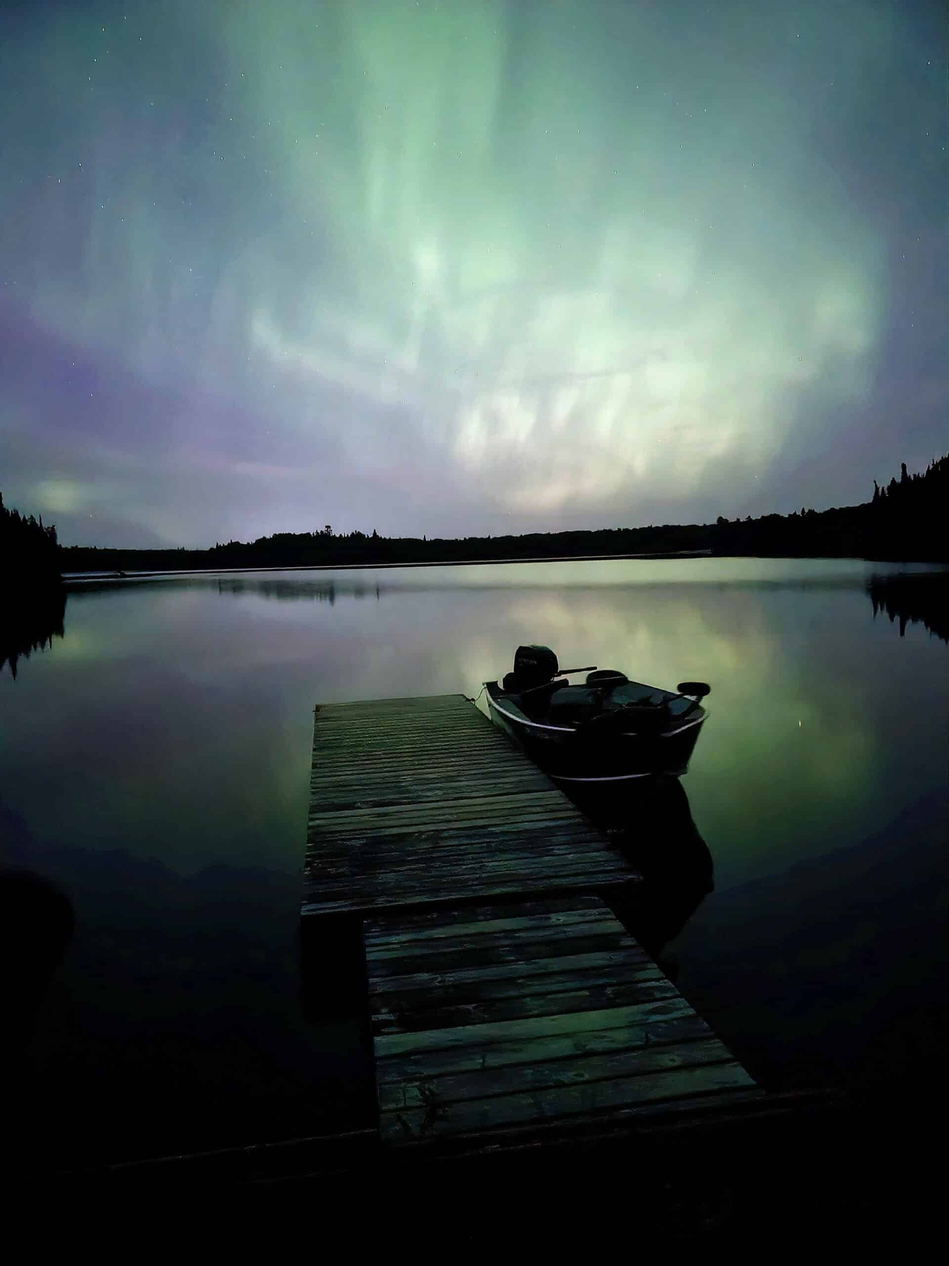
4. Some of the shoreline is directly north facing. The park is quite far north, in an area of VERY low light pollution... so it would be the idea place to view the Northern Lights. It’s part of why I was really looking forward to our stay!
We ended up confirming that suspicion on our second night at the park, with a beautiful aurora display. We viewed it from the south side boat launch (ie: not the one next to the group site).
If you’re interested in possibly seeing the northern lights, check out our posts: Aurora Hunting, How to Photograph the Northern Lights, Can I See the Northern Lights Tonight?, and Where to See Northern Lights in Ontario.
Campground Amenities & Info
Here’s some basic information on the park facilities at Ojibway Provincial Park:
Creature Comforts
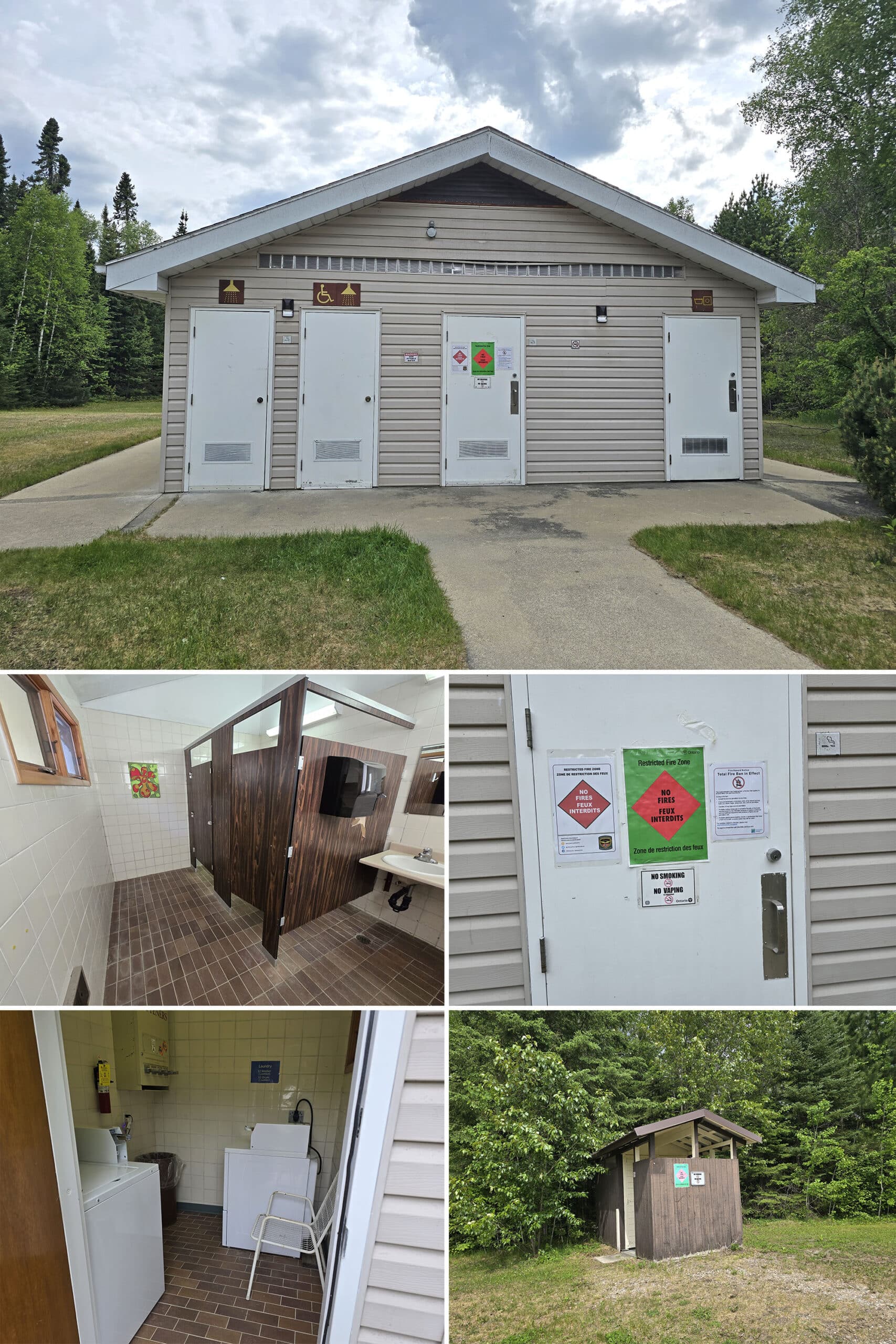
There’s a single comfort station, with flush toilets, laundry facilities, and showers.
The sinks - and outside of the building - all had warnings that the water was non-potable. Again, taped right onto the building, so probably a long-standing issue.
As previously mentioned, the barrier-free shower was *not*. In addition to that, the laundry machines were ancient. We were surprised at how large the washer was, and what great shape they were in - they may have been ancient, but they did a great job!
That seemed to be a theme of the comfort station, as the washrooms were uniquely bizarre. They looked straight out of the 80s!
I’m not talking “it looks like they haven’t been changed out since the 80s, and have been in use for 40 years”, either. No, I mean that they looked like a washroom *in* the 80s, as if I was right there, at that time, using a new-at-the-time washroom.
The paneling was gleaming and did NOT look old, it was well kept, it was just... 80s. Kind of a weird feeling, but amusing!
The site does say that there are flush toilets in various locations throughout the campground... everything we saw looked like vault toilets.
And I mean like the older vault toilets that I wasn’t eager to go check out. I had to go, and DEFINITELY held out for the comfort station! Every last one of the outhouses looked scary, IMHO.
Park Store
There is no mention of a park store at all on the site, and the gatehouse isn’t staffed.
Visitor Centre
There is no visitor centre at Ojibway Provincial Park.
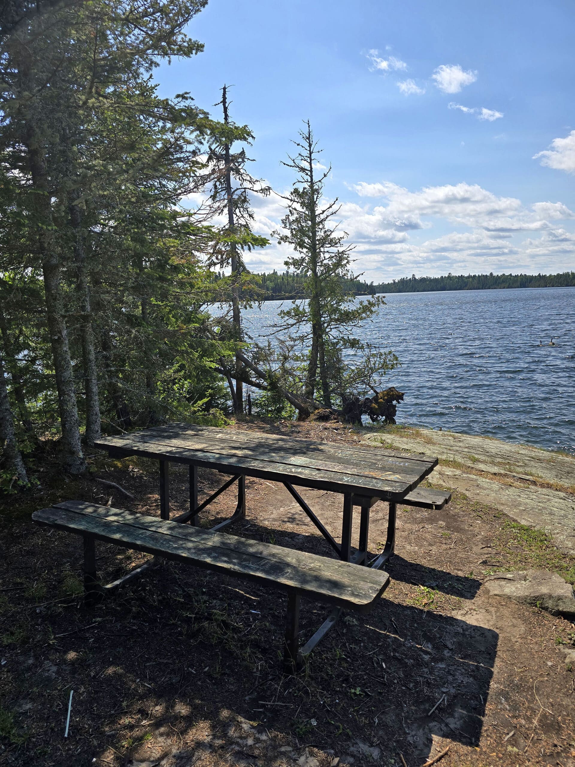
Day Use Area
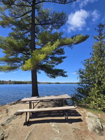
The day use area is actually pretty cute. There’s a little boardwalk / footbridge from the parking lot to the picnic shelter, which has maybe a half dozen or so picnic tables in it.
Watch your head as you step into the picnic shelter - the diagonal support beams come in narrow and LOW!
From there, there are a few steps down to the field and beach area, with a bit of a playground. There’s also a volleyball net - not noted on the map or website.
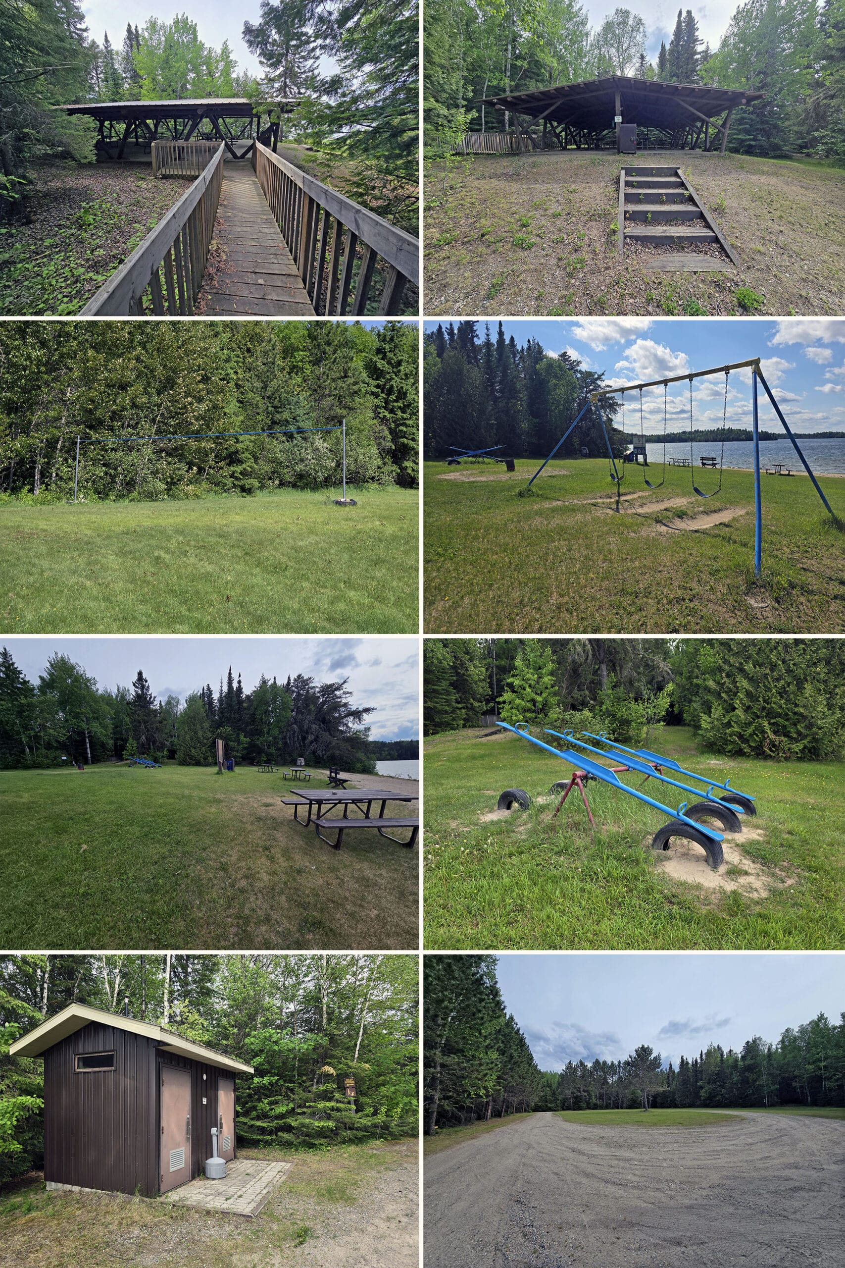
This is an easy trail - flat, wide, well packed ground, just a bit awkward, how it goes between the two sites with no visual barrier or anything. You feel like you’re walking in someone’s yard.
Campsite Details
There are two main ways to camp at Ojibway Provincial Park: As an individual/family, and as a group.
Car Camping
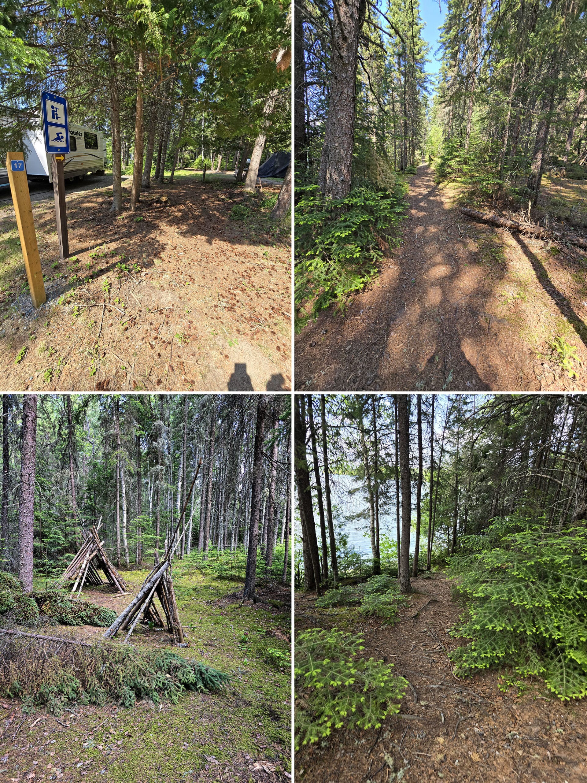
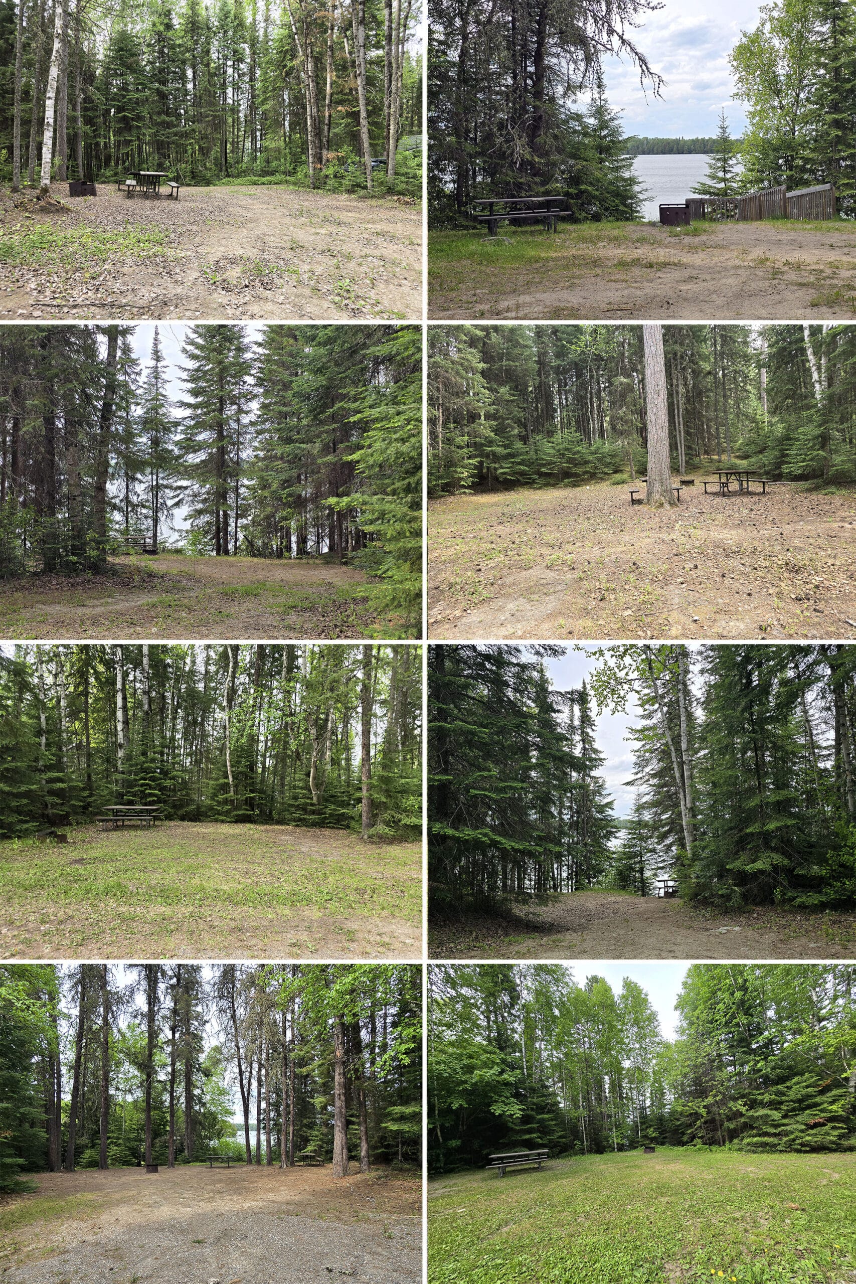
The campsites at Ojibway Provincial Park are fairly typical Ontario Provincial Park campsites, each with a fire pit and at least one picnic table (many had two!).
There are 45 campsites, and - by my count - about 26 of the are electrical sites.
About half of the overall sites - a mixture of electrical and non-electrical sites - are situated in two small loops, adjacent to the day use area. These ones seemed pretty tightly packed.
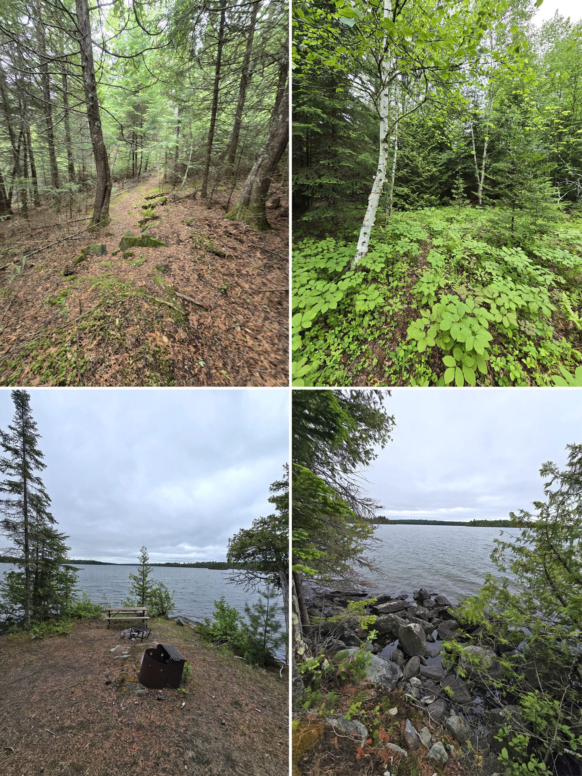
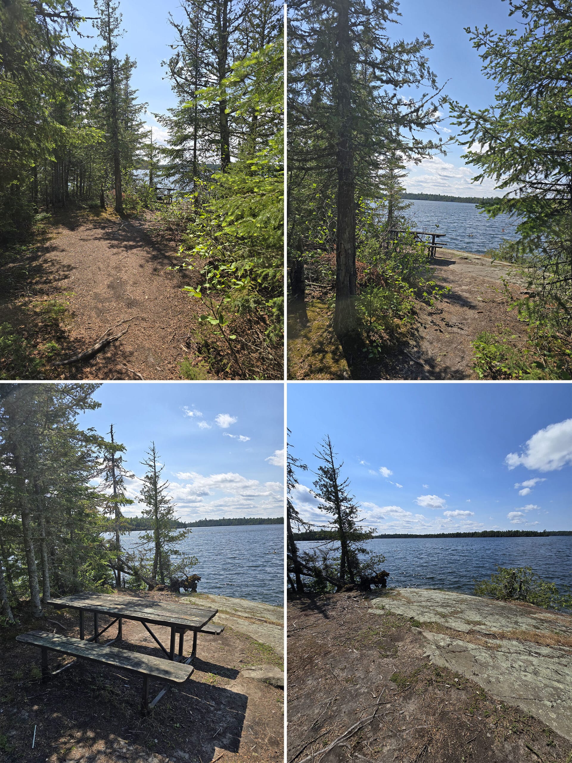
The rest of the sites are situated along a stretch of road running along the shoreline, with many of them having either a view of the water, or full on access to the water.
A few of them were walk-in sites (parking on the road, walking down to the actual campsite), but this is not mentioned on the website. REALLY cute sites!
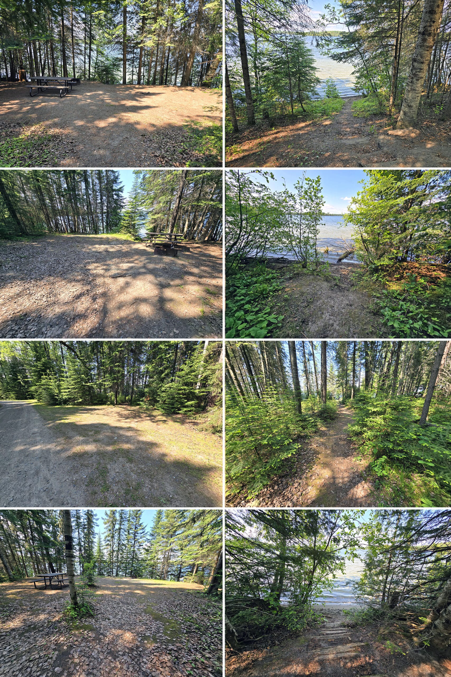
We stayed in two different sites over the course of our stay, loved em both (#42 and #19)
1. Some of the sites at the south end of the park have north facing views over the water, and would make a suitable spot for northern lights viewing.
2. Sites 17e and 19e are probably the nicest sites in the park, and each have a wooden walkway down to the water.
3. As mentioned, there’s a walking trail between 16e and 17e to take campers to the beach... and the sign placement is a bit weird. I would bet money that 17e gets people accidentally wandering into their site, often.
4. The vault toilet across from 4e and 5e has a motion-triggered light on it, and it went off as we passed - in broad daylight. Probably a good thing to keep in mind if you’re booking one of those (or adjacent) sites. You’re likely to end up flooded with light off and on through the night.
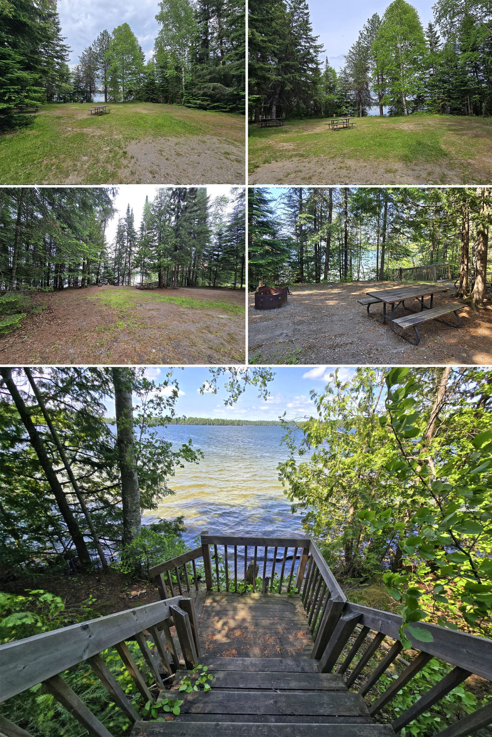
Group Camping
The group campsite is a bit odd. There’s parking off the road leading up to it, but beyond that, there’s a sign that says that it’s closed to vehicular traffic.
It’s a short hill to walk up to get to the site, which is a decent size - it’s for 15-50 people - and nice. They’ve got a couple vault toilets, water taps (non-potable), a bit of a lookout over the water, and direct trail access.
Inexplicably, there’s also a yurt, right in the group campsite.
Now, there is NO mention of a yurt in the group camping section of the Ontario Parks site, nor is any roofed accommodation listed as being available at Ojibway Provincial Park.
There’s no signage at all about it... but there’s a big photo of it on the main park map. Again, with no info.
CURIOUS!
Share the Love!If you’ve made one of our recipes, be sure to take some pics of your handiwork! If you post it to Bluesky, be sure to tag us - @2NerdsInATruck, or you can tag us on TikTok, if you’re posting video. We're also on Pinterest, so you can save all your favourite recipes and park reviews to your own boards! Also, be sure to subscribe to our free email newsletter, so you never miss out on any of our nonsense. Well, the published nonsense, anyway! |
Entertainment and Activity
For such a small park, Ojibway Provincial Park offers an impressive amount of possibilities, when it comes to outdoor activities.
Here’s some info on your outdoor recreation options:
Hiking
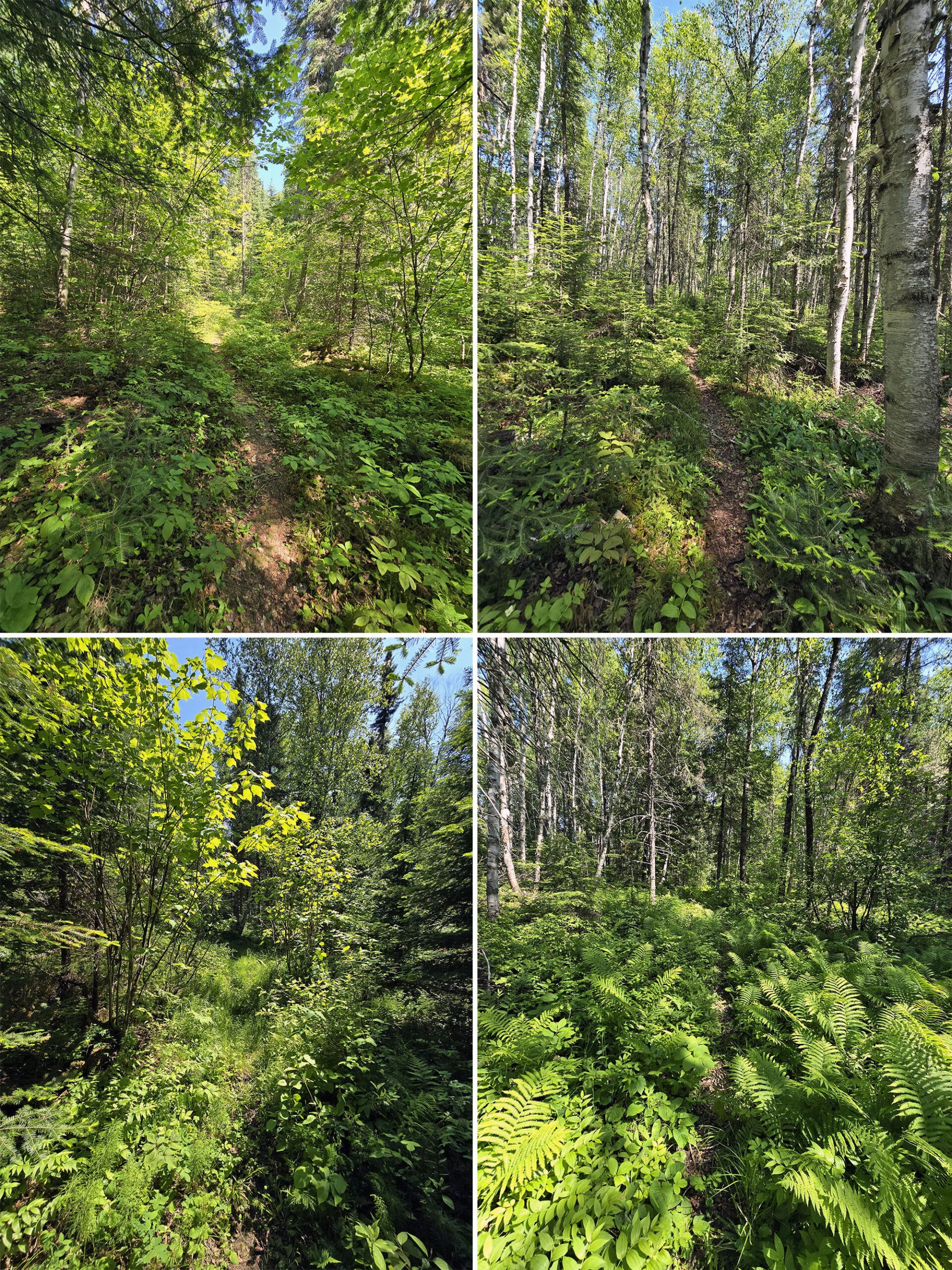
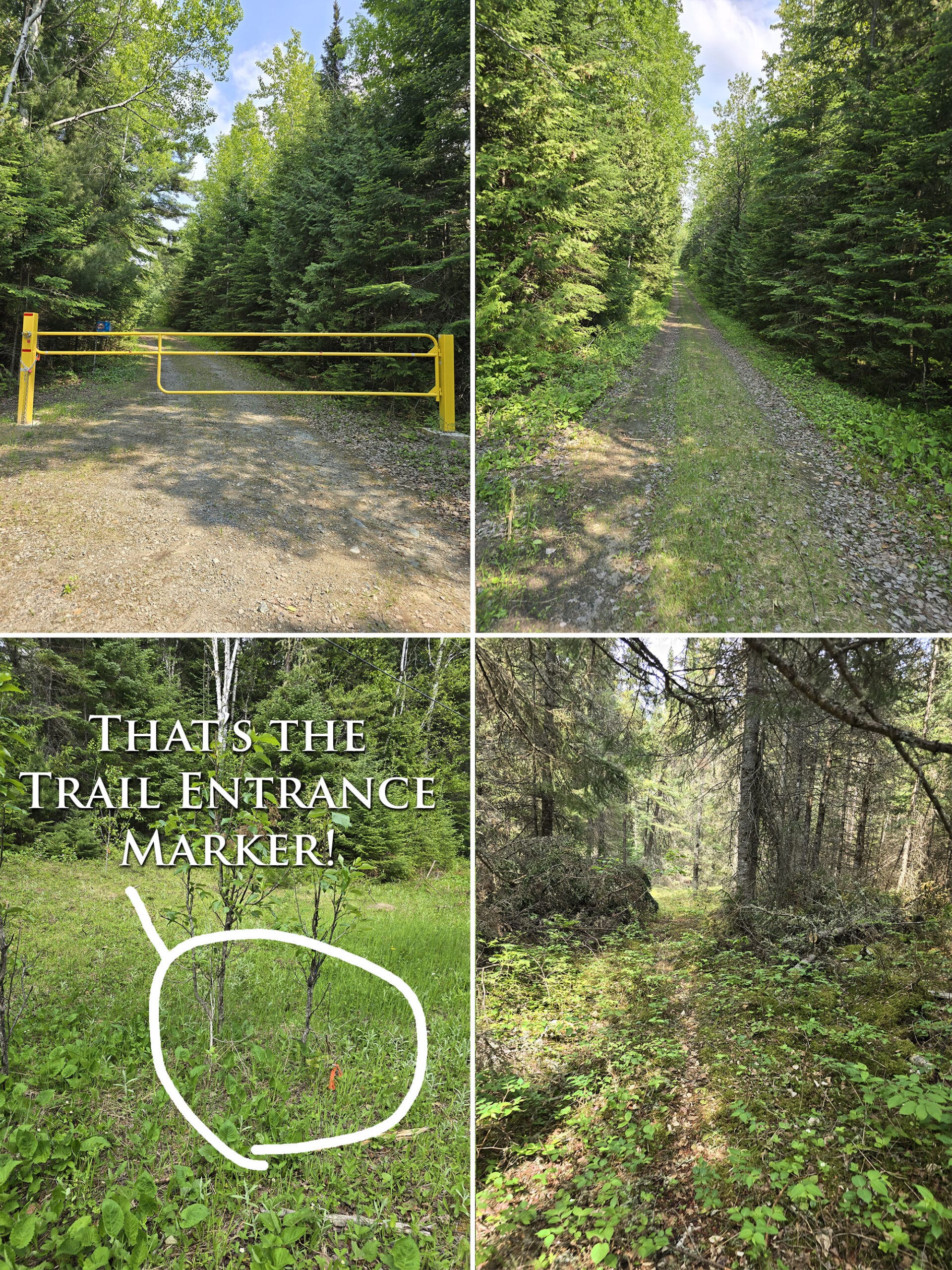
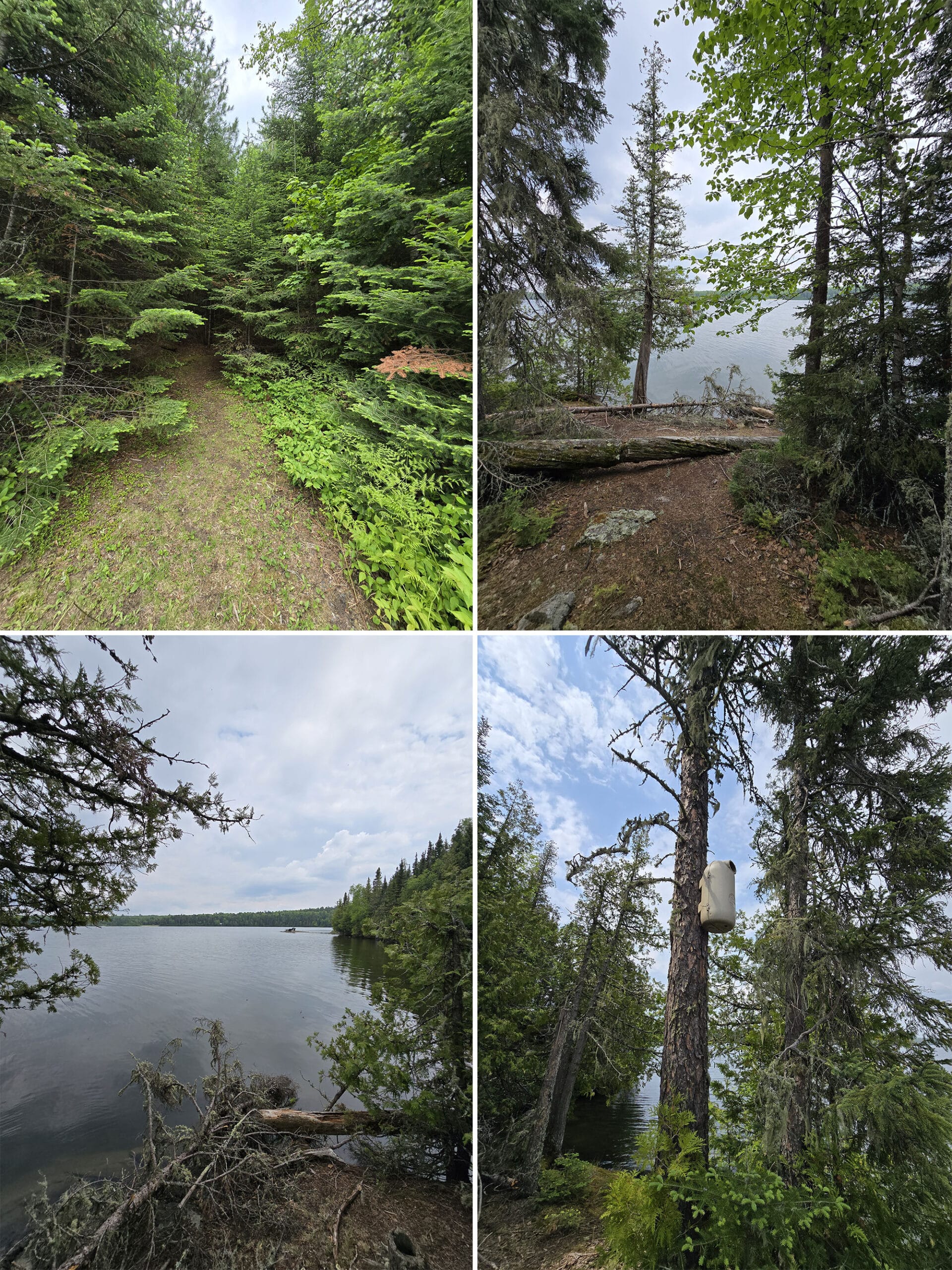
Due to the map issues I mentioned earlier, the hiking situation here seemed a bit confusing.
Most of the trails seem to be clustered over near the group camping area, with another trail halfway though the campground area.
The trail heads near the group camping area had little boxes with hand drawn maps in them. They were cute, but there wasn’t a lot of context. As first time visitors to the area, we found it a little...overwhelming.
It’s kind of a mess of inter looping trails in that area.
Over the course of our stay, we did most/all of the trails - well, Porter did most, as I was still recovering from my knee blowout - but we’re not 100% sure whether or not we actually covered them all, given the mapping and signage weirdness.
Anyway, overall there are 6 different named hiking trails at Ojibway Provincial Park, and two more than aren’t mentioned on the park site.
Most are short and relatively easy, but you’ve got a couple longer / more moderate options.
Note: The headers have the information provided by the park's website. See our trail descriptions for much more accurate info.
Boreal Walking Trail: 1.5 km, Easy
This is part of the cluster of trails near the group camping area, and starts from the trail head that’s near the start of the group camping area - not the one right in the parking lot.
The trail description just mentions that it’s a Boreal forest (shocker, given the name AND the fact that the entire campground is Boreal forest!), listing the variety of trees you’ll see along the way: Black Spruce, Jack Pine, Larch Pine, White Birch, and White Spruce.
We’re ... not sure if we walked this one or not.
Lakeshore Trail: 6 km, Moderate
The trail description for this one says that there are 4 interpretive stops along it, teaching about the vegetation and ecology of the lake shore.
It’s not on any of the park’s official maps, so far as we can see (maybe its designation was cut off the bottom of the black and white trail map?), and it’s only vaguely mentioned on the hand drawn maps.
Porter went down there and figured it out during our longer stay, though. Here’s what he had to say about it:
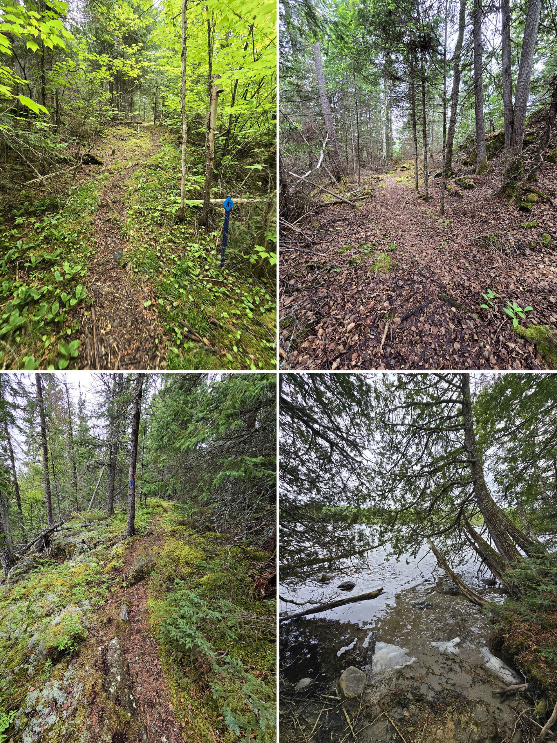
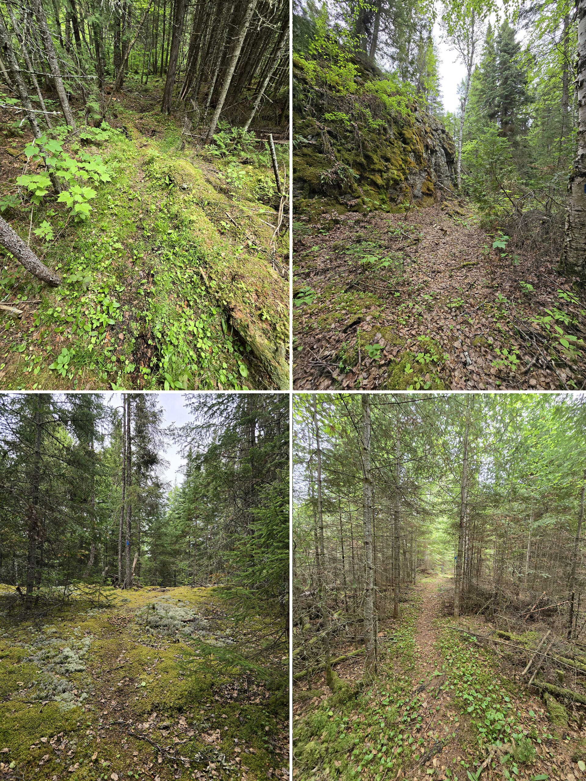
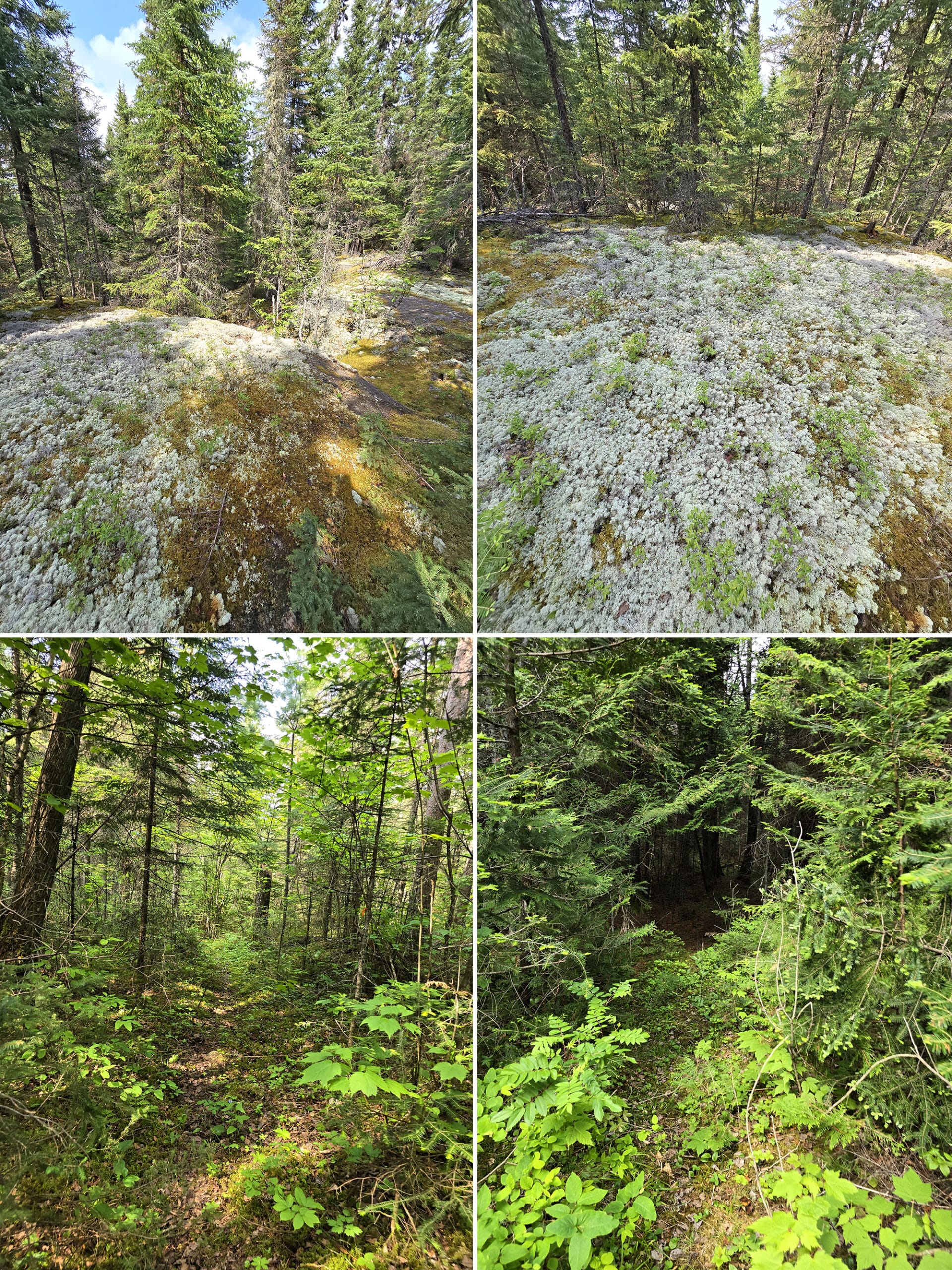
The trail is narrow in some areas, but well-traveled so it's easy to see where you're headed. There were only a couple of spots where I had to look around to see which direction the path continued.
Trail markers are a complete mess. The trail head sign says to follow the yellow, blue, or orange markers depending on which loop you're following. You'll see ribbons in those colors, and you'll also see blue-and-white striped ribbon, yellow paint, red paint, blue paint on trees, and a sign that just says "2C" on it.
When two trails follow the same path for a bit, they don't always have the trail markers together, so you might pass an orange, another orange, then a blue. Make sure to have something tracking your route, such as MapMyRun (which has a free option), so you can confirm you're on the right path.
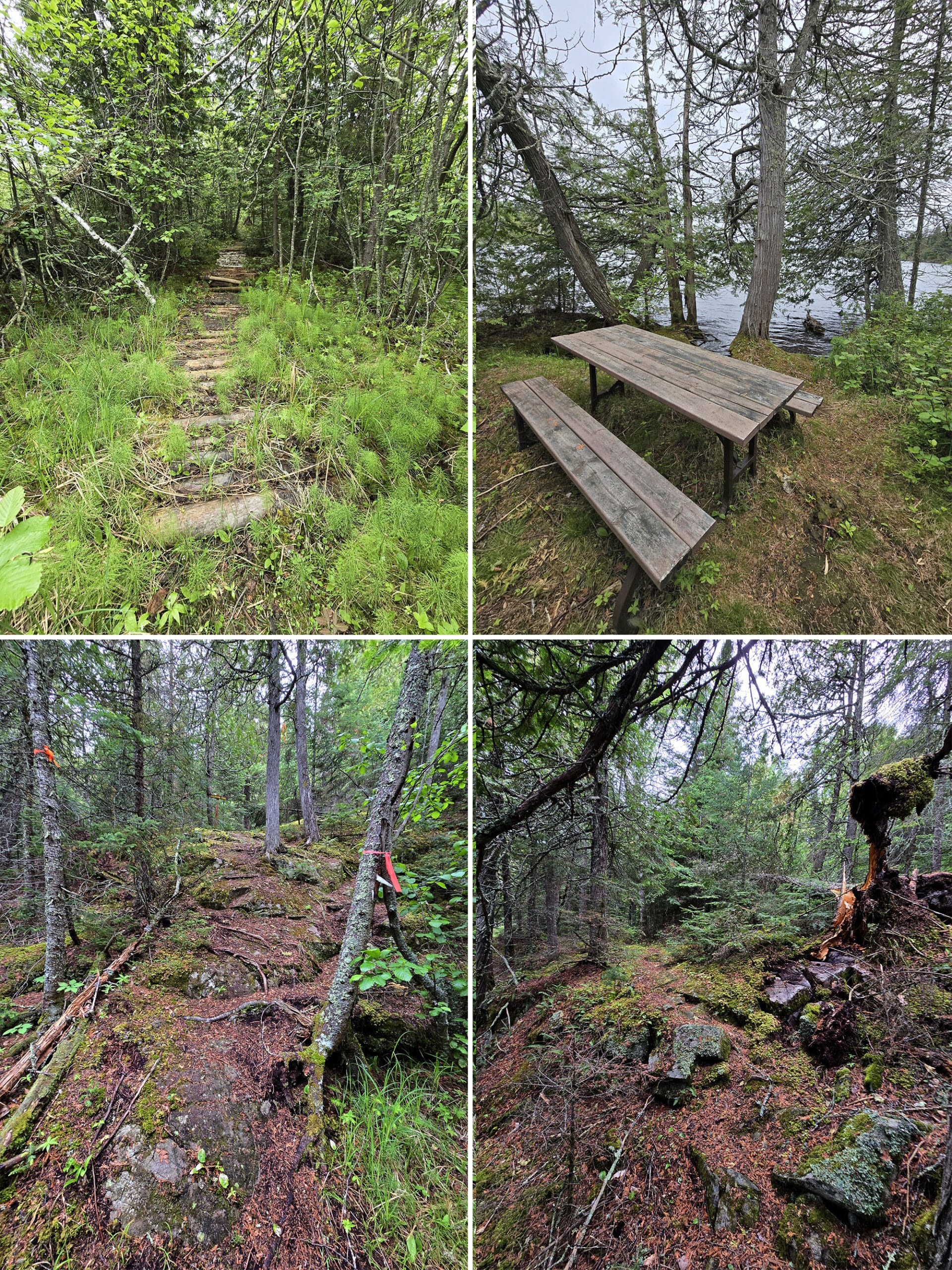
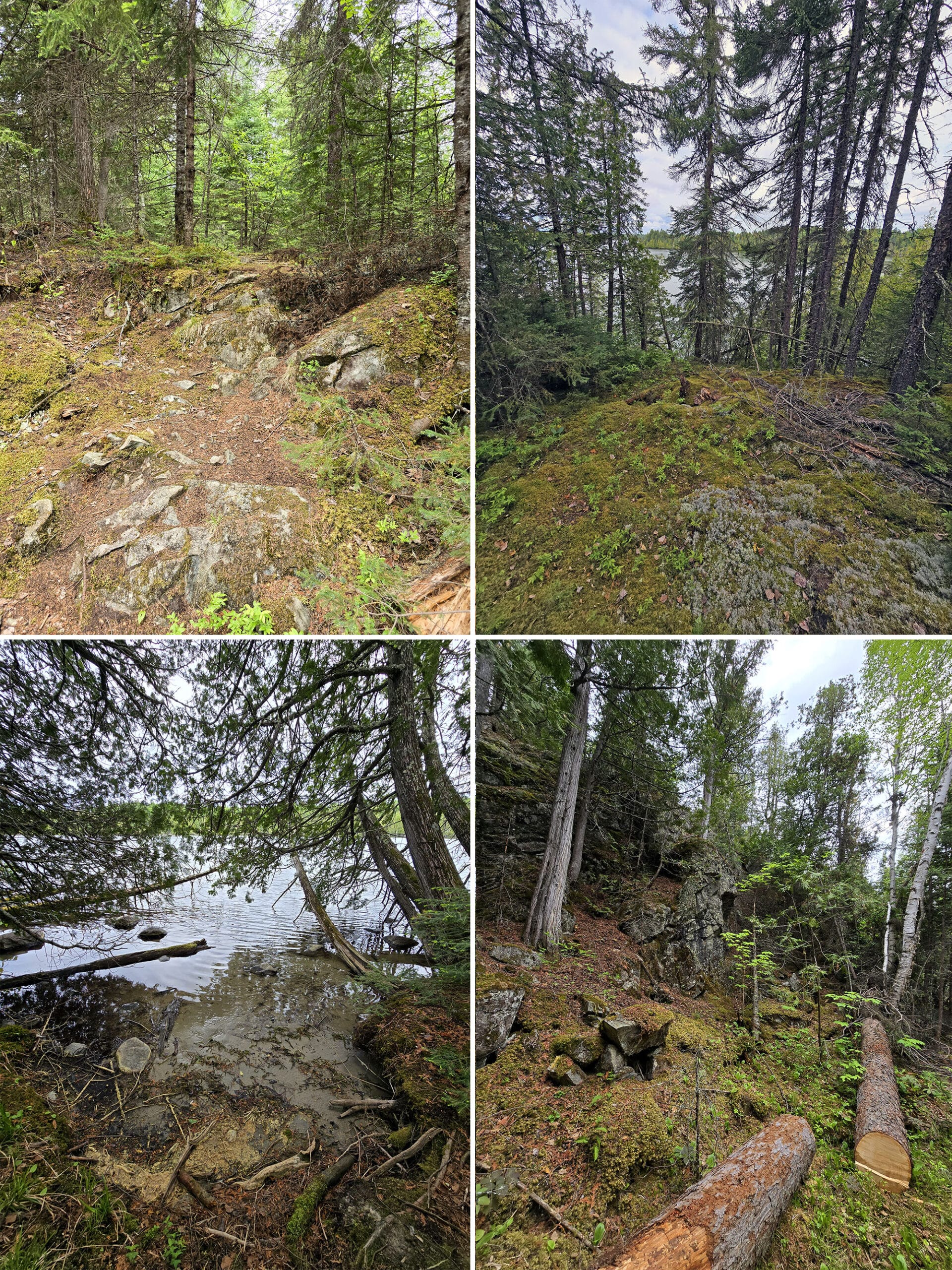
The walk brings you through different forest views, which keeps it interesting. It follows close to the water, but the water view is obscured by trees until the very end. The end brings you to an opening in the trees on lovely rocky peninsula with great views of Little Vermilion Lake.
There are two picnic tables along the route, one around halfway and one at the very end. A great way to have a snack with a great view!”
Little Walking Trail: 0.8 km, Easy
The trail description mentions having 12 interpretive stops along it - talking about the plants and wildlife you’ll see in Boreal Forest - but we didn’t see any. Do you see a running theme developing here?
Anyway, this is one of two trails that we did together during our stay.
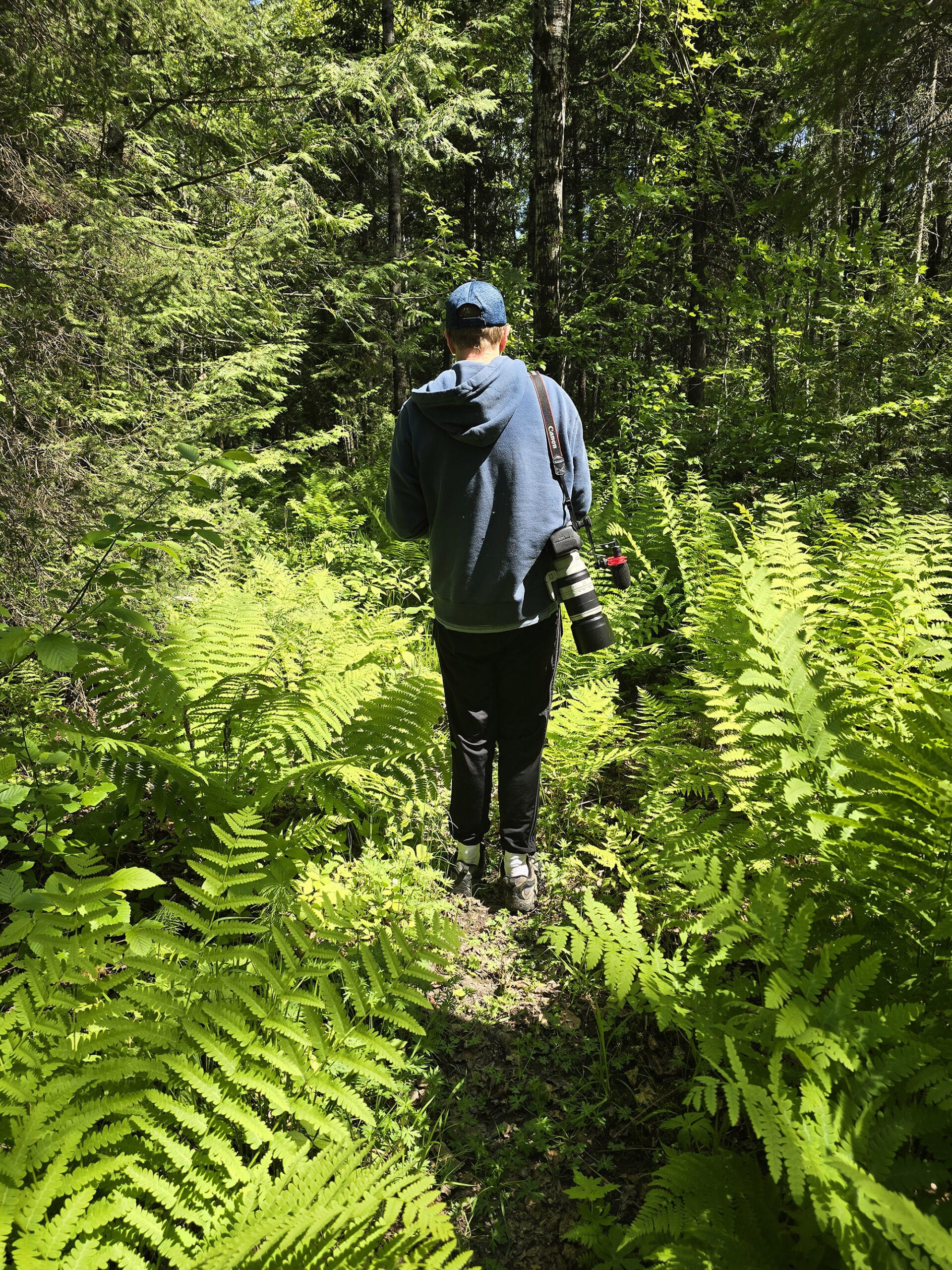
Walking along the shared path starting near the group campsite, the Little Walking Trail goes off to the right after a short distance. The narrow path goes through various terrain, including grassy sections and a crazy tall field of ferns.
The first section, before the split, is moderate difficulty. After it branches off, it's pretty even and relatively flat, but you still need to watch your step, so I can't quite call it an easy trail at that section either.
The last half of this trail gets a bit monotonous, we sort of felt done with the trail halfway through the loop after the branch off part.
The trail ends at the parking lot - mystery solved, we had been wondering where that path led.
If you're looking at doing multiple parts of this trail system, we recommend doing this one backwards, leading to the branch point where you can head to the island, or turn right to the Ridge Bottom and Lakeshore Trails.
Red Pine Walking Trail: 0.5 km, Easy
This is a little half loop trail along the main road through the campground, starting across from site #29e, and ending across from site 23. It loops through the woods - and was pretty overgrown at the time of our visit.
Apparently there are 9 interpretive signs along the way, teaching about forest succession. Maybe they’re just invisible, but Porter didn’t see any of them. Overall, though, here’s what he thought of the Red Pine Trail:
“Starting in the middle of the campground, this one is pretty short. It's fairly steep in several sections, with rough footing due to roots. This gives it a moderate difficulty in my opinion.
This is a great payoff for the distance and effort. You get to wind through pine trees in some sections, as you might have expected, but you'll also see mossy boulders, a blanket of ferns, and just different lovely views all along the way.
Trail markers are good, you won't get lost on this trail. At the end, you are brought back to the road along side one of the vault toilets.”
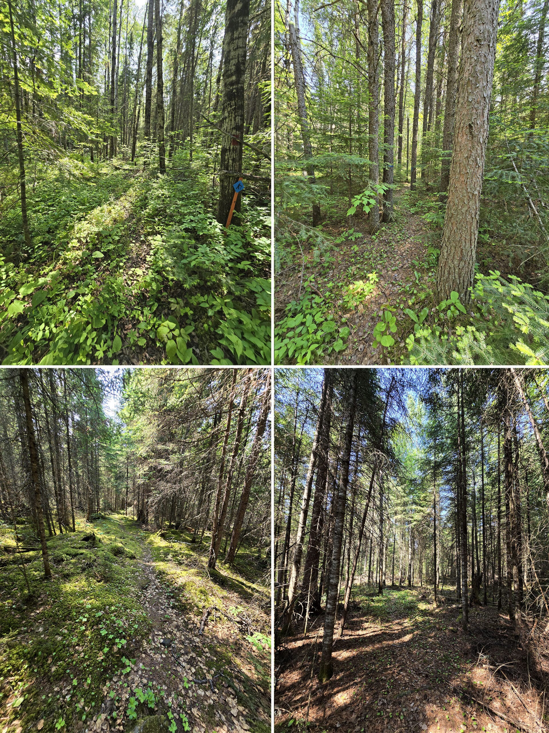
Ridge Bottom Trail: 2.8 km, Moderate
While not named on the main park map, we could see that this was one of the trails in that area off the group camping road.
Due to the lack of colour on that colour coded map, I couldn’t tell you which it was, but it might have been the one Porter mistakenly set out on when we visited on a day pass.
It’s noted as having 14 interpretive stops along the trail, as well as lichens and fungi. That’s... not exactly the case. There are NO interpretive stops on this trail.
Anyway, Porter went back during our longer stay and did the actual trail. Here’s what he had to say:
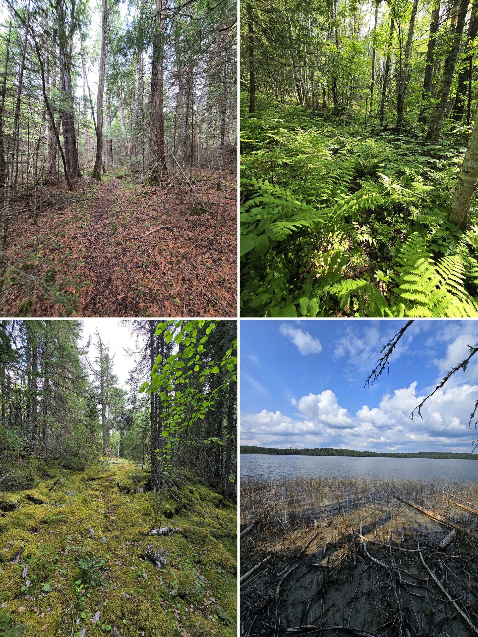
When you take a right-hand turn to the Ridge Bottom Trail, the landscape changes. It's almost marshy, the ground is very uneven with large sunken spots. I didn't want to step in the center of the sunken spots because it looked like it was really soft and muddy.
It follows along walls of moss-covered boulders for some portions, light forest, and dense forest. There are some rough spots and steep portions, so I rate this as moderate, but a bit more difficult than the Lakeshore Trail.
This is a really crappy trail. As in dung, feces, poop. Specifically, moose scat. So, so much moose droppings. In some areas it seemed like it was every 10 meters.
I didn't count, but I'd guess I saw at least two dozen areas of moose droppings just on the outer part of the loop after it breaks away from the Lakeshore Trail, perhaps a 1.5km stretch.
I kept scanning the sides, hoping to see a moose, but there were none. I'm definitely going to head back to this trail in the morning, hoping to catch a moose adding more landmines to the trail.”
Terry Lake Trail: 1.5 km, Easy
This is the trail I had REALLY been hoping to do, as it’s a trail out to Terry Lake.. Which is apparently great for wildlife viewing - the park’s description specifically mentions moose!
It also says you can fish for walleye out there.
Anyway, for this trail you’ll want to park at the day use area, then walk down a short, gated-off road across from that parking lot, to get to the trailhead.
Porter did the trail alone one morning, to suss it out and see if I’d be able to manage it. Here’s what he had to say about it:
I missed it.
Turning back, I finally found it, a couple of small orange plastic ribbons tied to some trees off to the side. For your reference, this is 0.65km from the gate, per my mapping software.
It turns into the dense forest at this point, and the trail immediately becomes very difficult. Steep sections, moss-covered boulders, tree roots, you name it, you will encounter it.
The trail is extremely narrow, and you can lose the trail very easily. Keep looking for the orange ribbons, though there aren't nearly as many as I would have liked to see. I highly recommend some mapping software using GPS, I use MapMyRun.”
After about a kilometer of this trail, you reach Terry Lake. A cute little outlook with a small mucky beach gives you a view of the entire lake.
One really cool thing about this trail is the exclusivity. It's obvious that very, very few people have ever used this trail.
You're one of the few people that not only found the trail, but followed it all the way to Terry Lake, which doesn't have any road access at all. How cool is that?”
Unnamed Trails
As for the two unnamed trails, one - we’re calling it the Island Trail - exists on the main park map, it just isn’t named. The other does not, but it’s obviously well-used trail - we’re calling it the West Loop Peninsula Trail.
Island Trail
Porter originally happened upon this trail while trying to do the Little Walking Trail. He turned a corner, and - as he came to the end - he saw what he assumed to be a little lookout deck, but turned out to be a bridge over to a tiny island!
You can explore the whole island, with multiple little offshoots to the water. At this point, the trail is more moderate and rocky.
There’s a picnic table right at the end, with probably the best view!
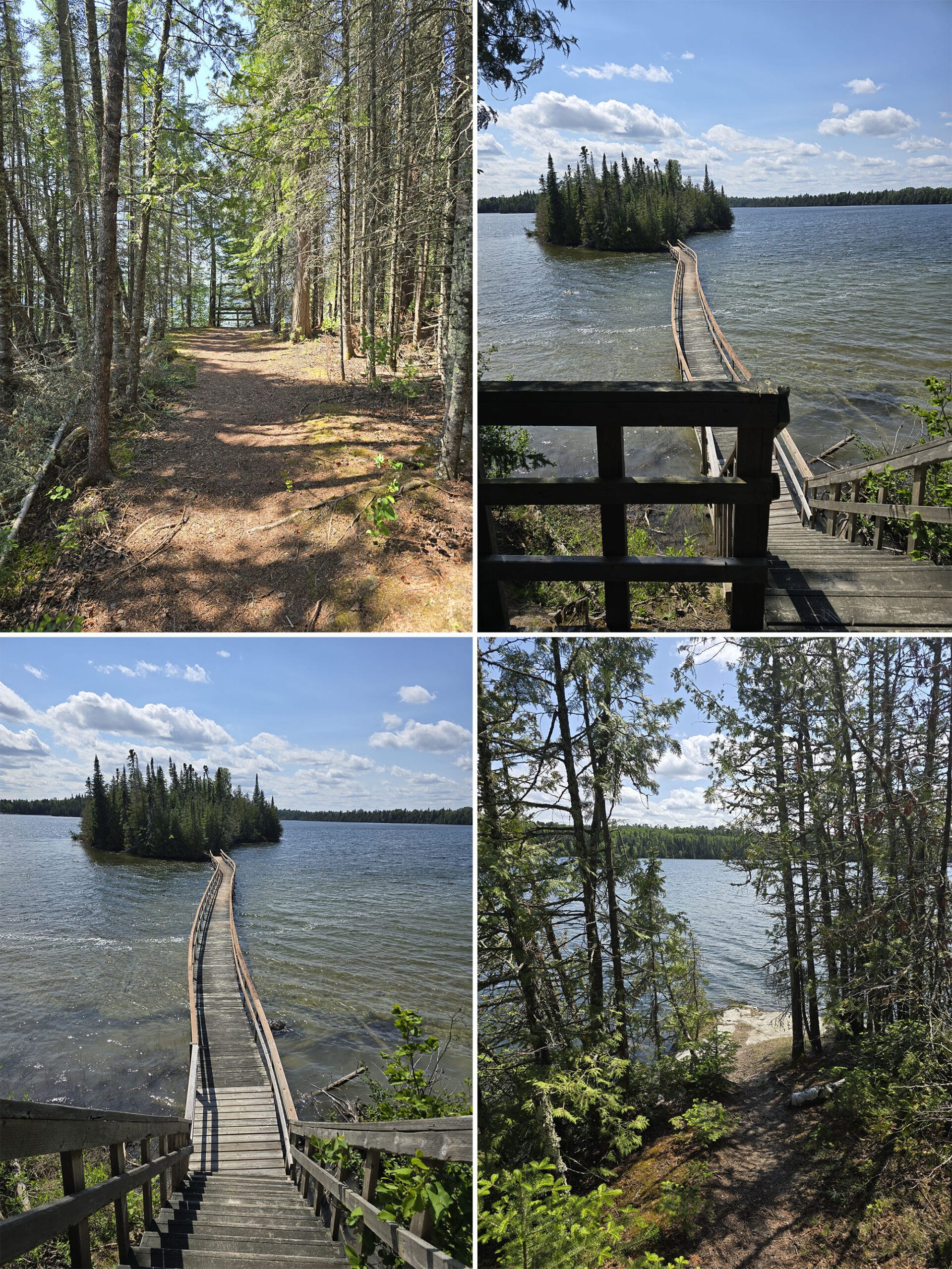
This way is a flatter, wider, and easier trail than the one that starts out halfway between the parking lot and the group site, but both are only about 0.4 km to the far tip of the island.
Super cute walk, great scenic payoff for very little effort!
West Loop Peninsula Trail
This one starts out at the end of the south campground loop, just beyond site #45. Porter did this one himself, here’s what he says:
“It's a very short ¼ km trail through dense forest. I'd rate is as a moderate trail due to a significant incline and rough path.
It leads to an opening on the end of the peninsula on the west side of the park. It has a lovely water view, a great payoff for such a short trail.
There's a plastic contraption strapped to a tree a few meters up, google lens tells me it's an artificial wood duck house. I didn't see or hear any activity near it, but I'm hoping to see some wood ducks in the area now!”
Biking
There aren’t any dedicated bike trails at the park - and the trails we saw weren’t suitable for biking - but the park invites campers to bike on the park roads.
The roads - aside from the stretch between the highway and the park office, anyway - were actually in really great shape. We’re so used to seeing campgrounds in need of re-grading and whatnot, this was a pleasant change!
Swimming
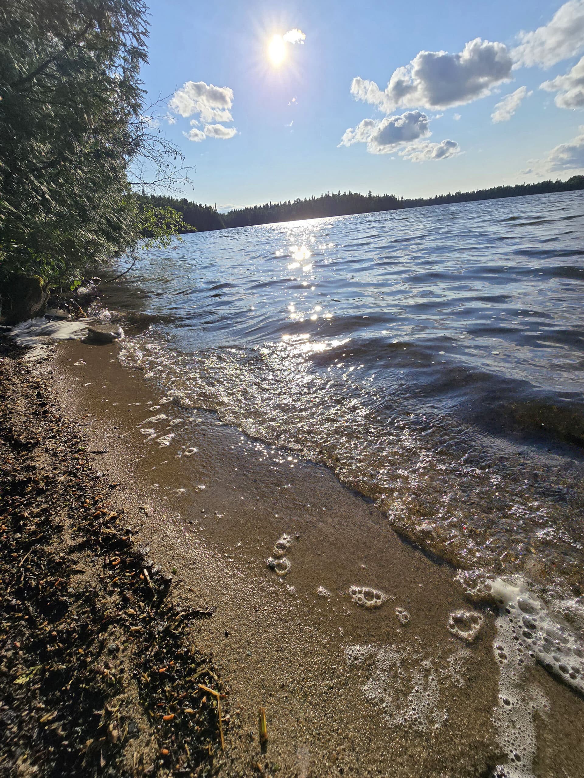
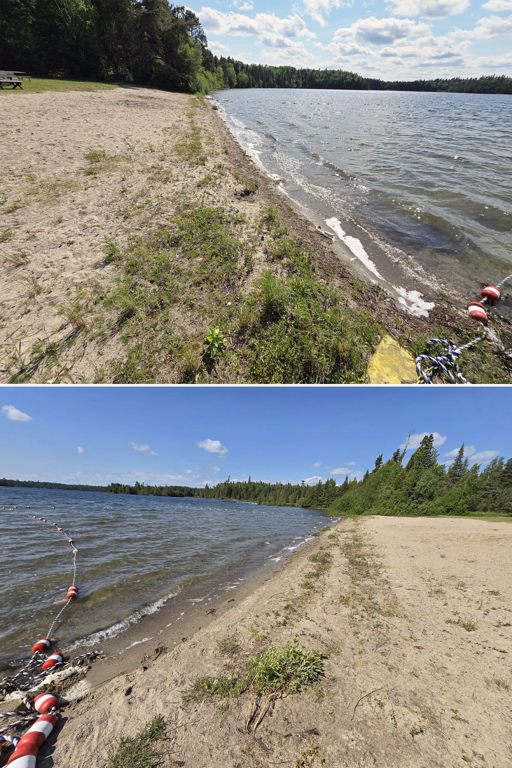
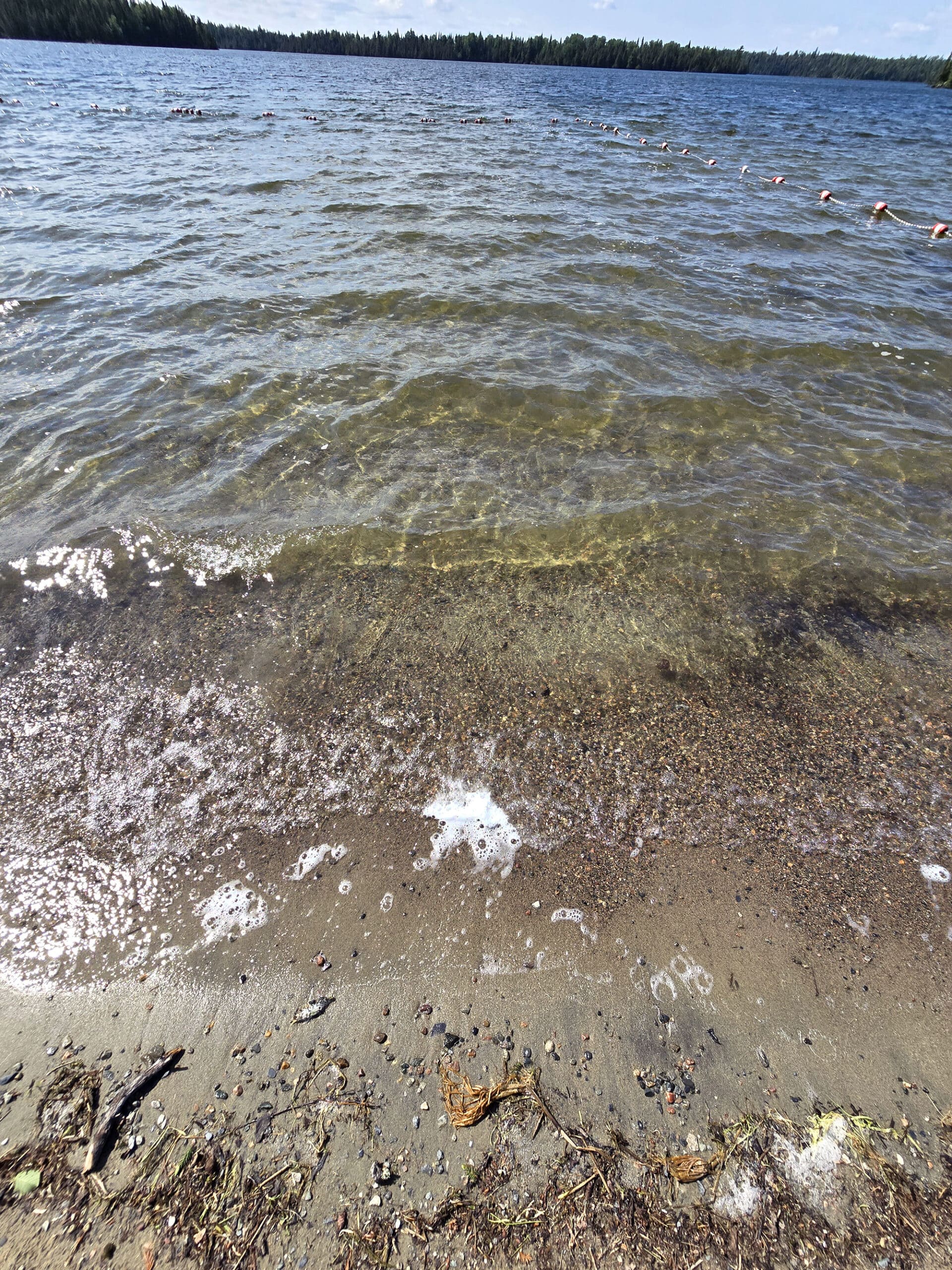
The beach is not exactly what I would consider a good swimming beach, but your mileage may vary.
Rather than a nice sandy beach, it’s a mix of coarse sand and gravel. The water is clean and clear, but has the floating bits of vegetation that generally make me nope out of smaller lake swimming.
It’s a really nice view, though, so I could see putting out a beach blanket and hanging out there.
If you do go swimming, the swimming area is marked out with buoyed rope.
Birding, Wildlife, and Nature
The wildlife wasn't cooperating as much as we would like during our stay. Birds were staying high in the trees or deep in the forest away from the trails. Moose left us their ... clues on the trails, but weren't out during our hikes.
All told, we heard and/or saw :
American Crow, American Redstart, American Robin, Bay-Breasted Warbler, Black-and-White Warbler, Blackburnian Warbler, Black-Capped Chickadee, Black-Throated Green Warbler, Blue Jay, Broad-Winged Hawk, Canada Warbler, Cape May Warbler, Chipping Sparrow, Common Loon, Common Raven, Dark-Eyed Junco, Magnolia Warbler, Merlin, Nashville Warbler, Northern Waterthrush, Ovenbird, Pileated Woodpecker, Red-Eyed Vireo, Red-Tailed Hawk, Ring-Billed Gull, Ruby-Crowned Kinglet, Ruffed Grouse, Song Sparrow, Swainson’s Thrush, Swamp Sparrow, White-Throated Sparrow, Yellow-Rumped Warbler, Yellow Warbler.
We also saw an Eastern Painted Turtle that seemed to be nesting, so that was cool. Didn’t see any moose or Black Bears, though!
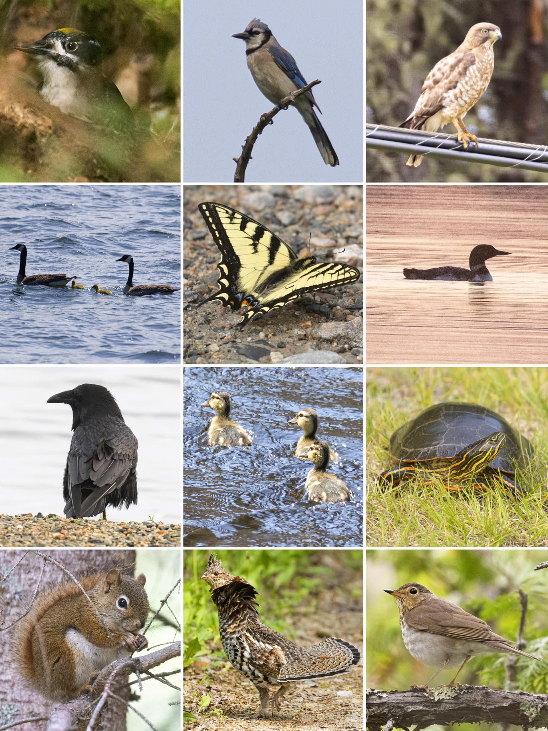
Row 2: Canada Goose, Canada Tiger Swallowtail, Common Loon
Row 3: Common Raven, Mallard Babies, Eastern Painted Turtle
Row 4: Red Squirrel, Ruffed Grouse, Swainson's Thrush
Boating
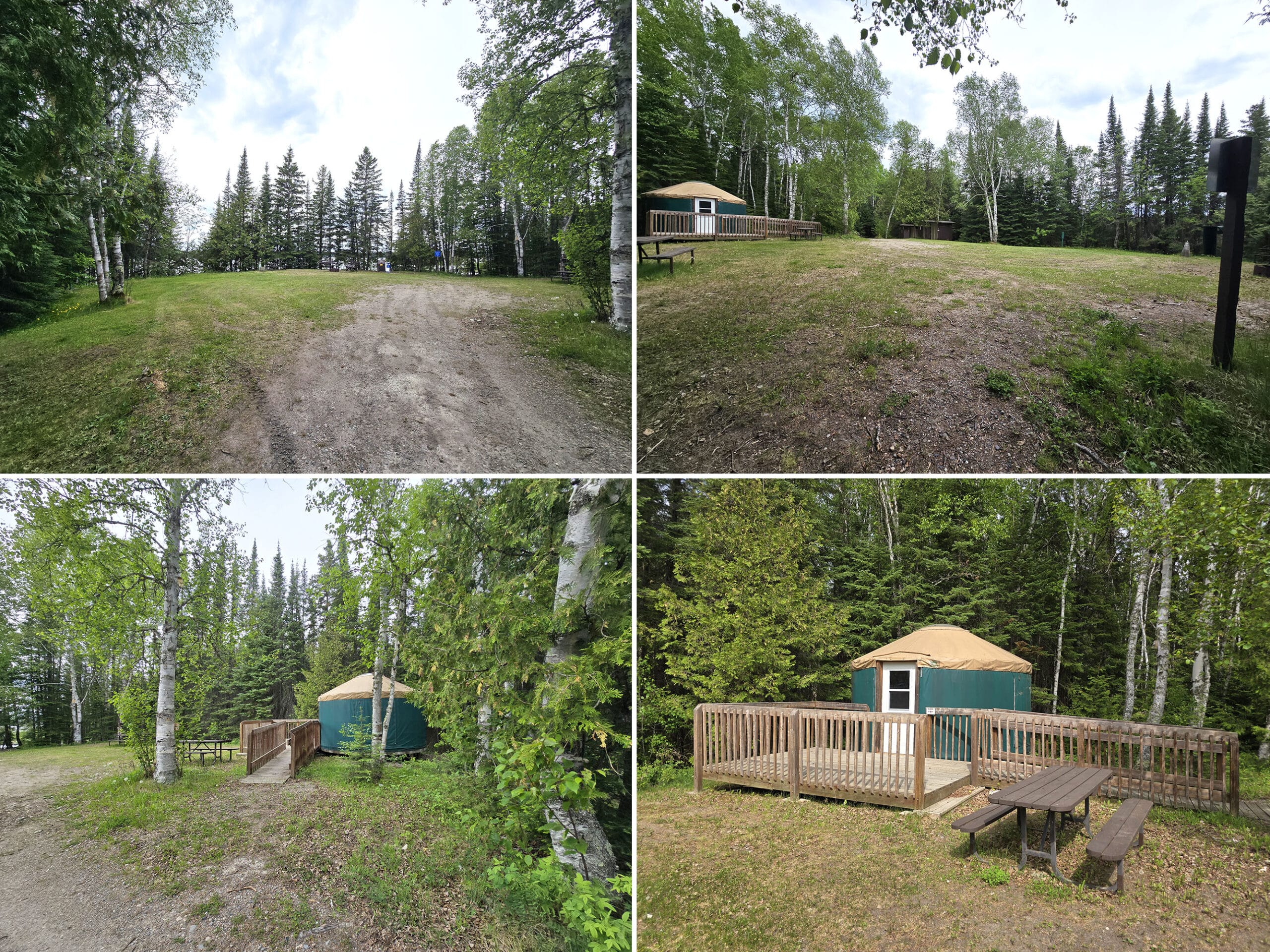
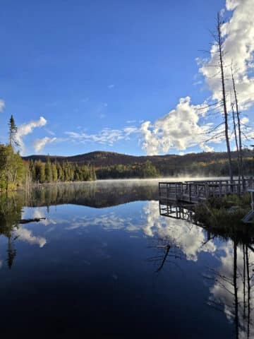
Ojibway Provincial Park stretches along the shores of Little Vermillion Lake, and boating definitely seems to be a draw!
There are two boat launches in the park:
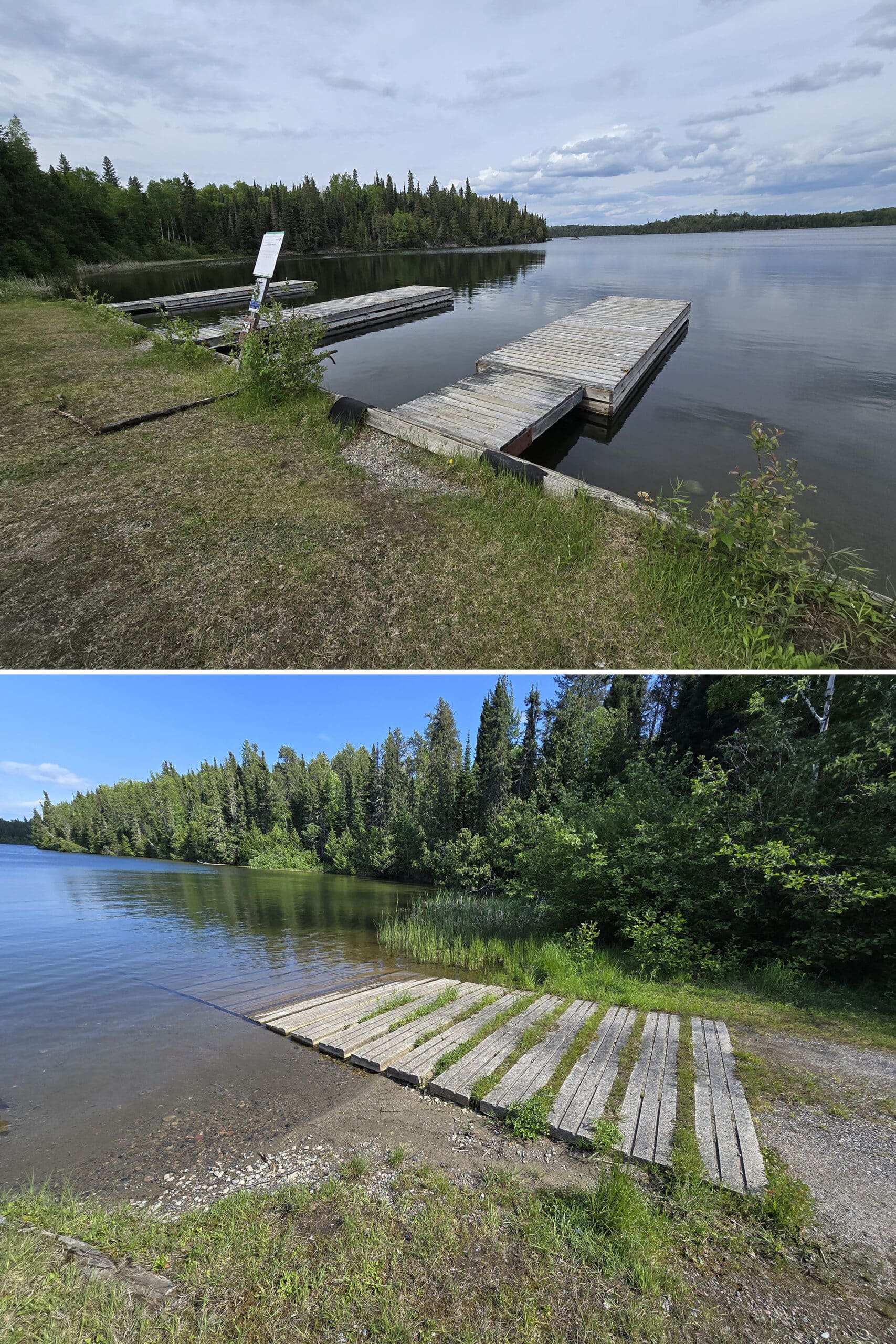
The north boat launch (right side of the park, if looking towards the water) is the nicer of the two boat launches, with deeper water and a single wooden dock that extends into one of those modular floating docks.
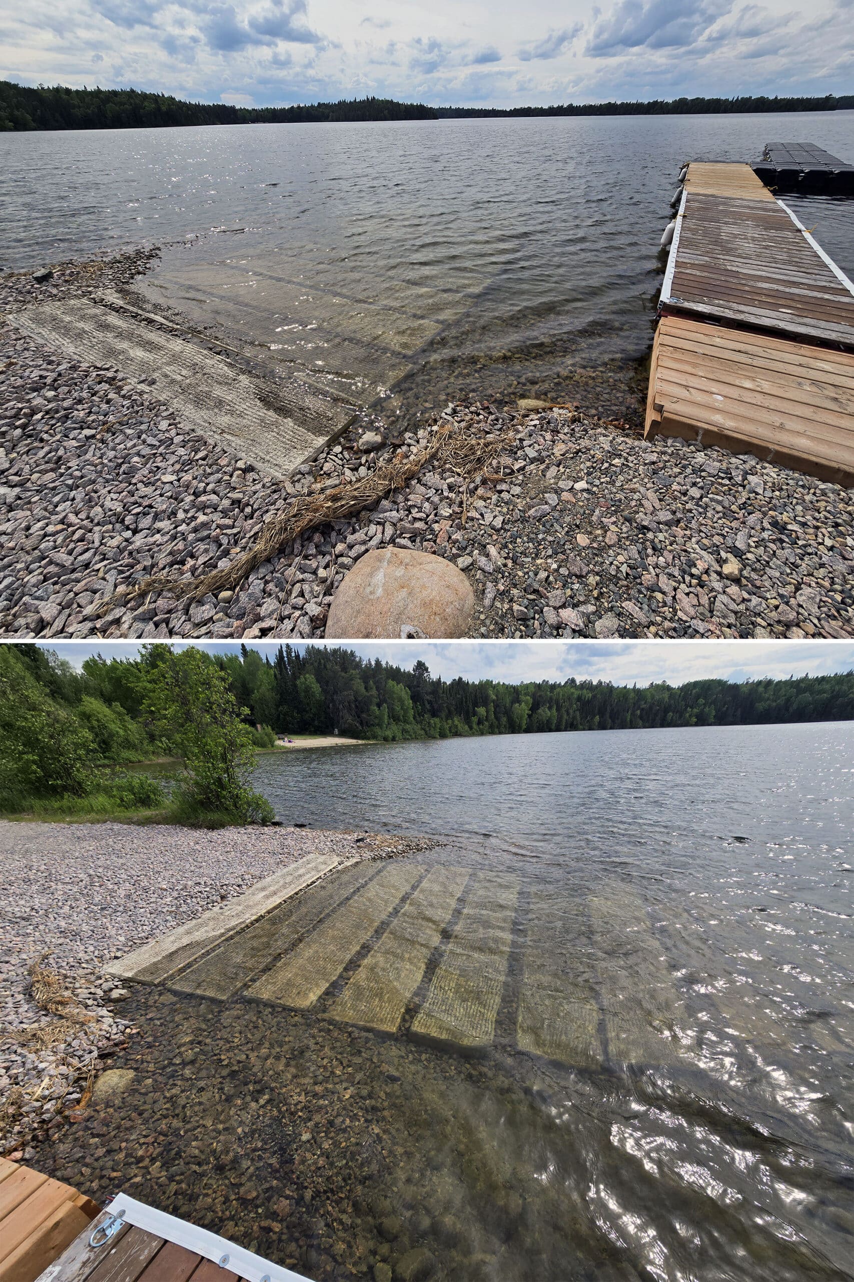
Also, there were 3 docks at the south boat launch, just not directly adjacent to the launch.
On that note, that boat launch also has a fair amount of grass growing between the beams, so I’m guessing it’s not as used as the north launch.
The south launch would be really good for canoes, etc, though. The lake also seemed a bit more calm and sheltered in that area, it was a little cove.
Fishing
There must be some pretty fantastic fishing at Ojibway, the park’s site mentions that you can catch “Huge” Smallmouth Bass right from the dock.
Beyond that... at this point, I’m thinking the same person wrote the site descriptions for Pakwash, Aaron, and Ojibway Parks.
I don’t think I’ve ever seen the word “teem” used to describe fishing in any of the Provincial Parks... usually more talk about the luck needed, and how overfished the areas are!
I guess the small size and remote location of Ojibway - and the others - work to the advantage of those looking to go fishing there!
Anyway, the site says that the lakes in and around the park have abundant stocks of Lake Trout, Northern Pike, and Smallmouth Bass.
Interestingly, there are signs at both launches saying that Little Vermillion and Cedarbough Lakes are closed to angling for Lake Trout YEAR ROUND. (Capitalization is theirs!).
When we were approached by some Conservation officers when we were on the way out of the park - the Lake Trout fishery has been closed for at least a couple of decades, and they had no idea that the park’s website mentioned fishing for it.
Whoops.
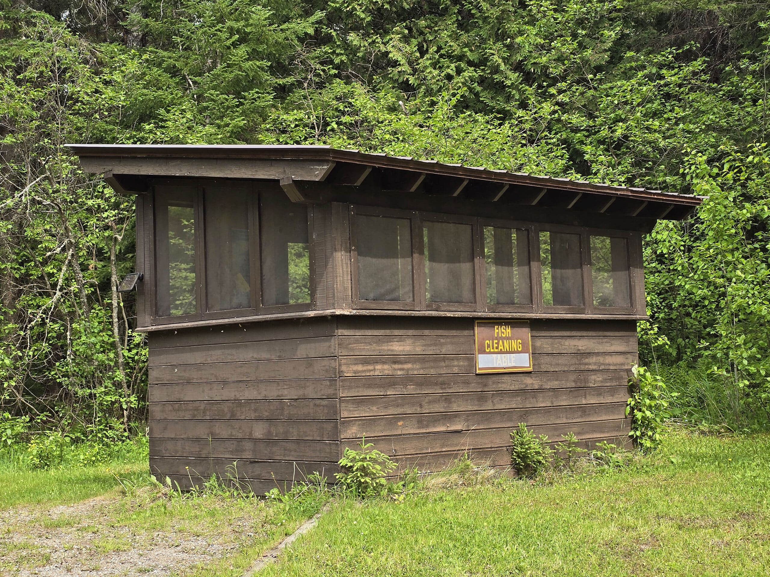
Anyway, there’s a little fish cleaning station near the boat launch - with cutting tables and running water.
Discovery Program
There’s no mention of Discovery programming on the Ojibway Provincial Park website, which probably make sense - it’s a teeny tiny park!
Niantic Games
There is a single Ingress game point (Pokestop/ Gym / Ingress Portal/etc) in the park. It’s located at the park’s highway sign - nowhere near any of the campground or day use areas.
Final Thoughts
We’re still shocked at the fact that the park’s website makes no mention at all of the little island, even in the trail section. It was definitely a highlight of the park for us!
Overall, we really enjoyed our stay - I’m definitely glad that we gave it a second chance! I’d been a little “meh” after the day visit, but the mysteries of that trail system really just got under my skin, you know?
I HAD to know what was what!
Honestly, even after 4 days... neither one of us are really clear what the deal is with the trails. Huge discrepancies between real life, the website, the park map, and the hand drawn maps.
Trails “colour coded” - on a black and white photocopy of a map that doesn’t seem to exist in person or online - in one colour, while telling you to follow a different colour... Then there being a completely different colour of blaze on the trail... several trails mentioning interpretive stops that don’t exist...
And who made those hand drawn maps, anyway? Very cool, just ... odd.
We split our stay between two gorgeous waterfront sites, saw and heard VERY few humans during our stay, and got to enjoy the northern lights. I suppose we can overlook a bit of logistical chaos for that!
We’ll probably be back!
More Northern Ontario Provincial Parks & Places to See
Want to read some more about the parks we've camped and at places we've seen in Northern Ontario? Here are some more posts!
Northern Ontario Campground Reviews:
Aaron Provincial Park
Agawa Bay Campground, Lake Superior Provincial Park
Blue Lake Provincial Park
Caliper Lake Provincial Park
Kakabeka Falls Provincial Park
Lake Superior Provincial Park
MacLeod Provincial Park
Neys Provincial Park
Pakwash Provincial Park
Pancake Bay Provincial Park
Pukaskwa National Park
Quetico Provincial Park
Rabbit Blanket Lake, Lake Superior Provincial Park
Rainbow Falls Provincial Park
Rushing River Provincial Park
Sandbar Lake Provincial Park
Sioux Narrows Provincial Park
Sleeping Giant Provincial Park
White Lake Provincial Park
Northern Ontario Places to See:
Aguasabon Falls & Gorge
Amethyst Mine Panorama
Batchawana Bay
Chippewa Falls
Kakabeka Falls
Mink Creek Falls
Old Woman Bay
Ouimet Canyon Provincial Park
Potholes Provincial Park
Roy Wilson Suspension Bridge
Sand River Falls
Scenic High Falls
Temagami Fire Tower
Terrace Bay Beach
Want to explore beyond Northern Ontario? Check out our full list of Campground Reviews, Ontario Waterfalls, and other Places to See.
We also have a ton of Camping Recipes to cook up, while on your adventures!
Thanks for Reading!If you loved this post - or have any questions about it - please leave a comment below! We'd also love it if you would consider sharing the link on social media! |


Leave a Reply