
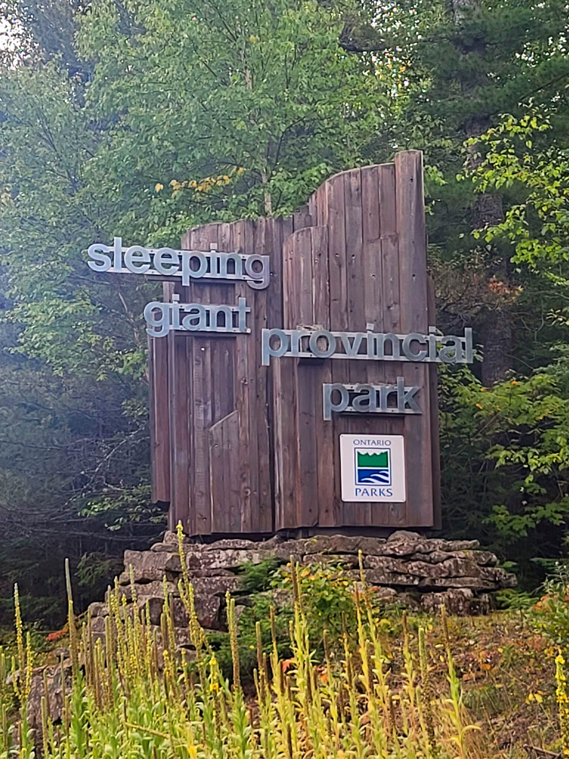
Sleeping Giant Provincial Park is a large natural area, just 86 km east of Thunder Bay. We stayed in the campground there twice - here’s our review!
Originally Posted Sep 24, 2023, Updated 7/9/2025

A large Peninsula of land jutting out into Lake Superior, it looks just as the name implies it does: Like a big man laying on his back.
It’s been the subject of Ojibway legend for ages... and I had no idea - until recently - that it’s one of the best places to camp in Northern Ontario!
Formerly known as Sibley Provincial Park, it has something for everyone: a campground, a couple dozen backcountry sites, 100 km of trails for hiking, 50 or so for cross country skiing, lakes, spectacular geological features, boreal forest, and is just a really great place to enjoy nature in whatever way you like.
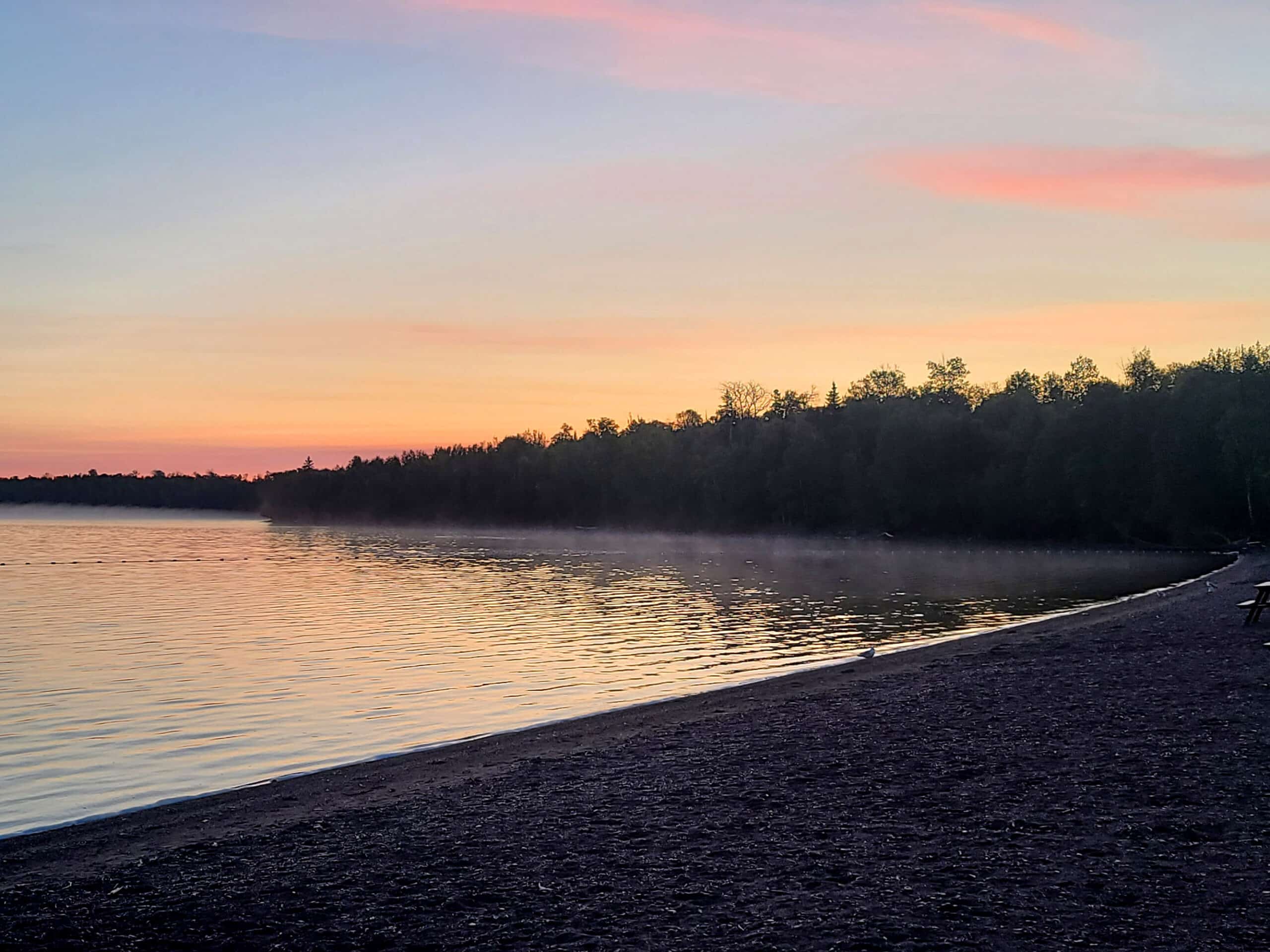
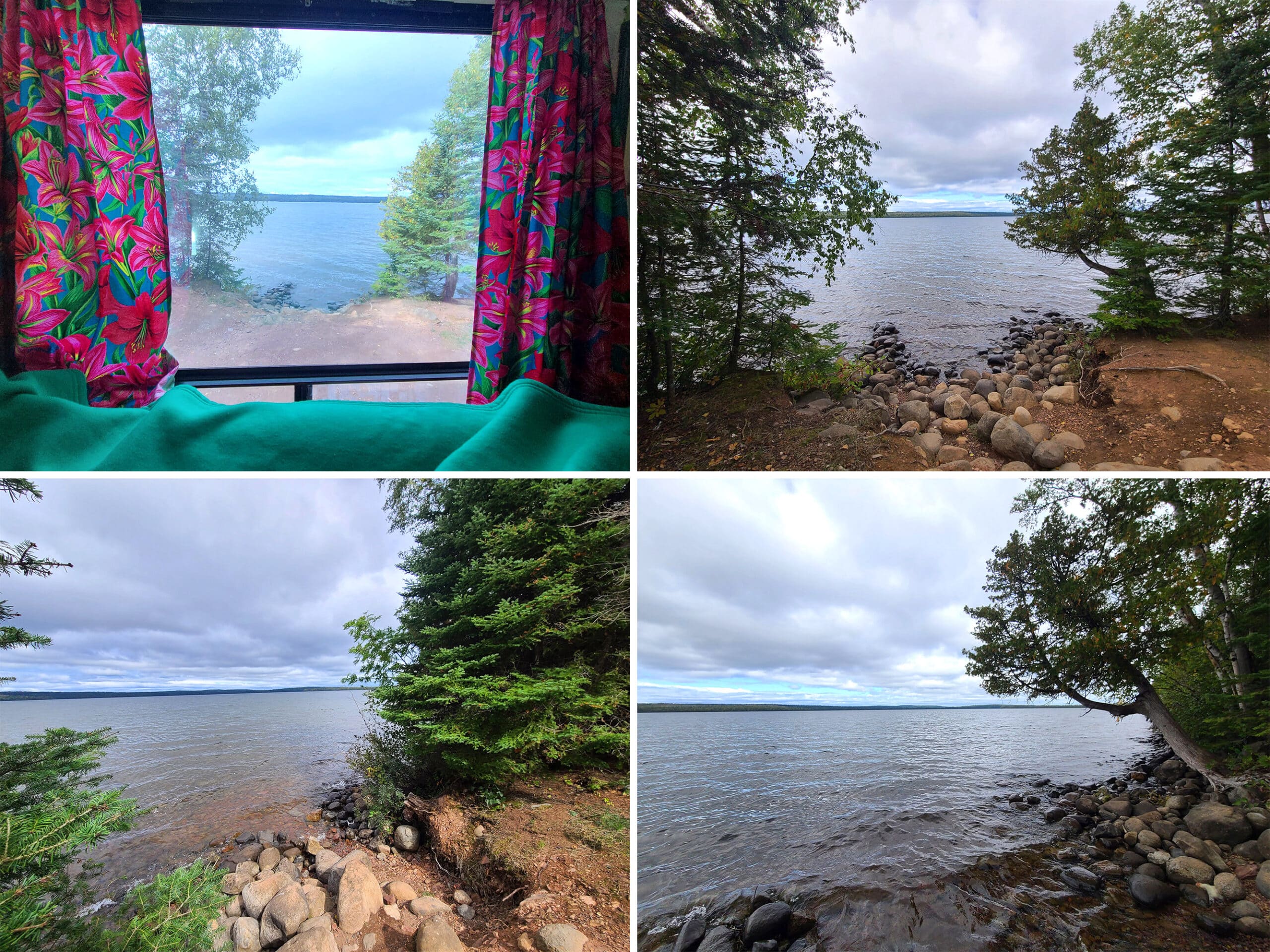
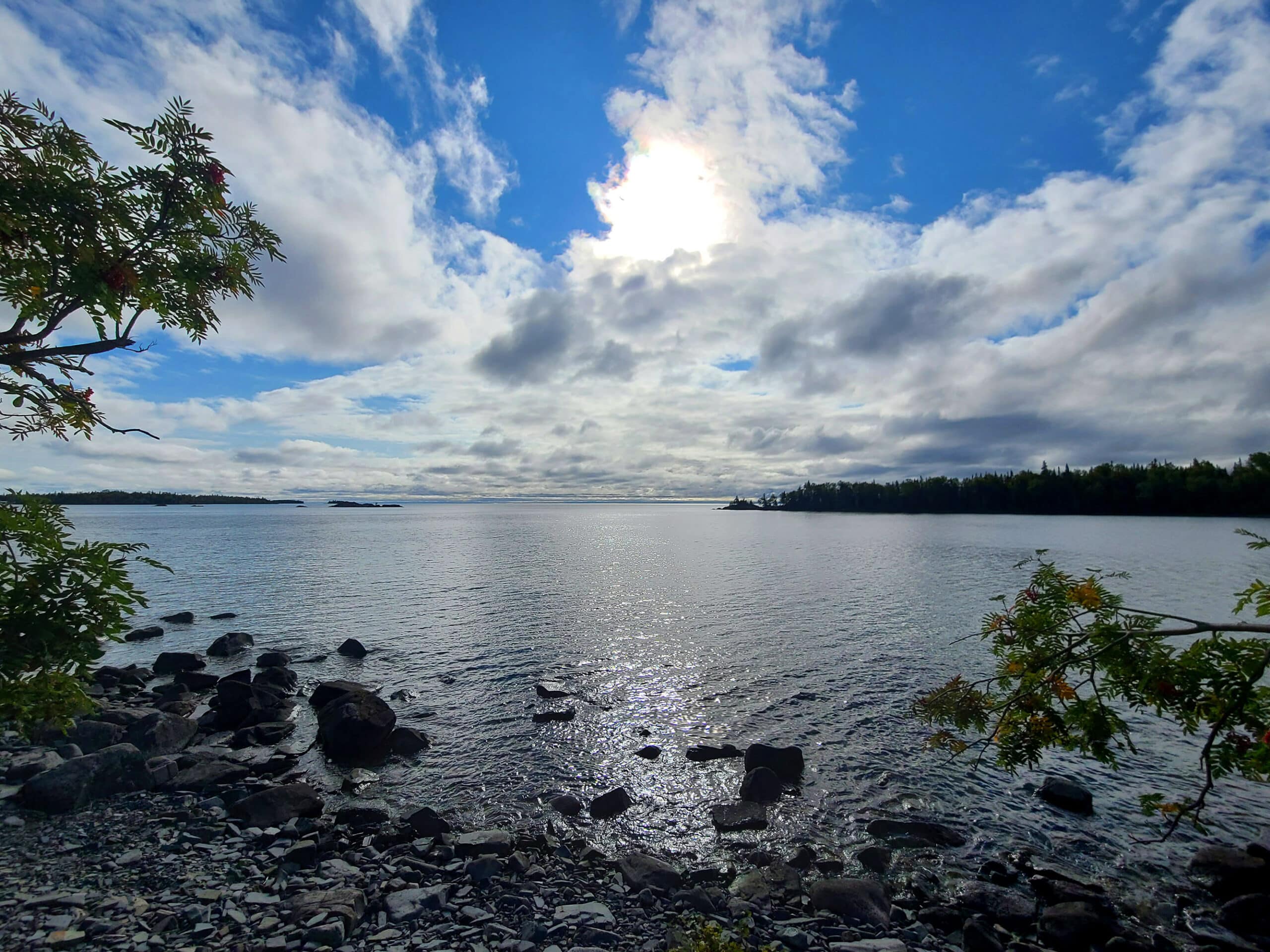
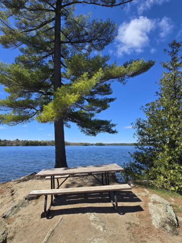
Two of our 3 camp sites had a GREAT view over Marie Louise Lake, where we enjoyed gorgeous sunsets and sun rises.
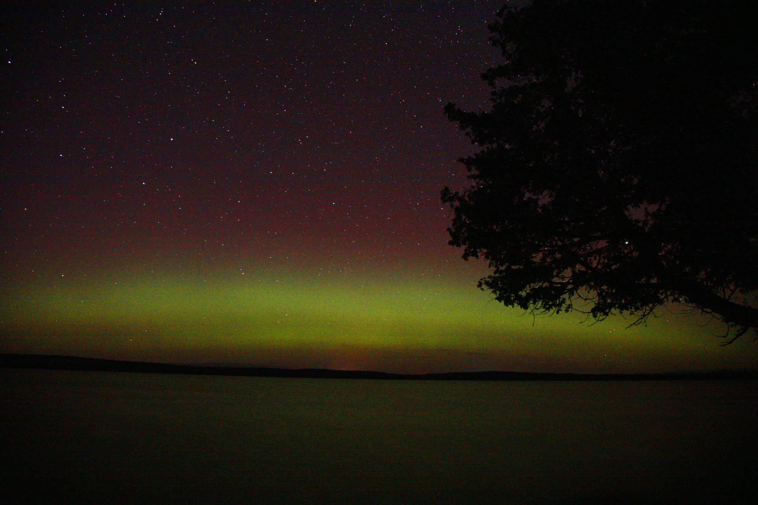
On one occasion - the second night of our first stay - the Aurora Borealis even made an appearance! We were able to enjoy the show from just behind our camper!
Anyway, LOADS to talk about, so let’s get to it!

The Basics:
Campground Name: Sleeping Giant Provincial Park - Marie Louise Lake Campground
Address: R.R. #1 Pass Lake, ON P0T 2M0
Website: https://www.ontarioparks.com/park/sleepinggiant
Price Ontario Provincial Parks uses a pricing matrix across all their parks. See 2025 Camping Fees for more details.
Reservations: Ontario Parks Reservations
Park Classification: Natural Environment
Season: May 15, 2026 to October 20, 2026

Logistics
Sleeping Giant is WAY bigger than I ever expected, having looked across it to a kid. It’s more than 30 km across, takes like half an hour to drive. The campground itself is about an hour drive from the city of Thunder Bay
Highway 587 has a speed limit of 80 in most places, but we didn’t feel comfortable going over 60. The highway is narrow, very twisty, and in some places steep.
Beyond that bit of info, here’s some basic info to help you plan your stay at Sleeping Giant Provincial Park:
Registration and Check In
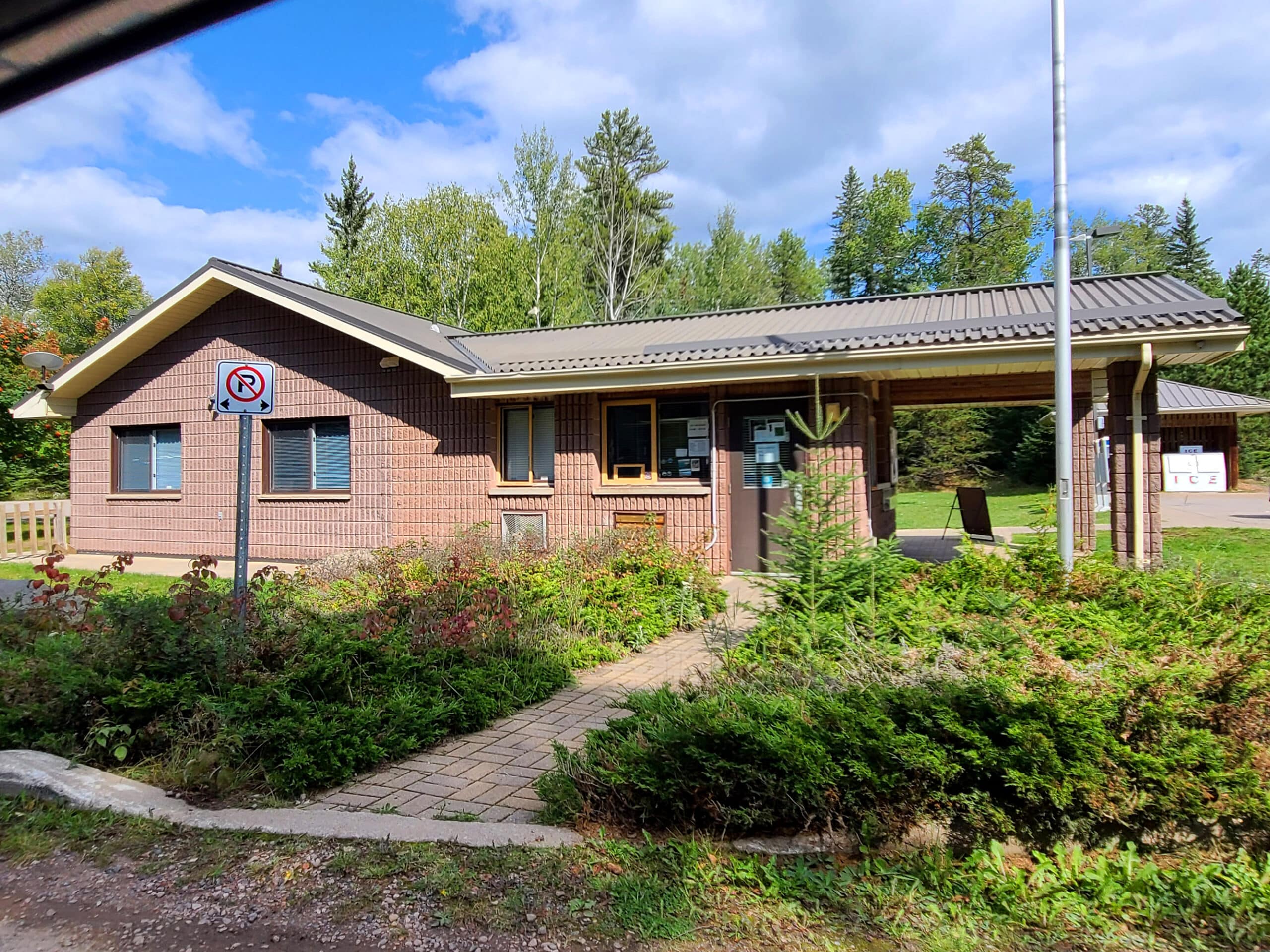
As always, reserving our site online was quick and easy, through the Ontario Parks website. There was a big line for check in on our first visit but it went fast - and was super friendly, as usual.
Check in at the park office was via a window outside - the building had an awning they could open it if it was raining / too sunny though. (It was open on our second trip - sunny!)
The park still uses paper permits for your vehicle and campsite post, as of June 2025.
Maps and Signage
Finding your way around Sleeping Giant Provincial Park is a weird mix of “really great”, and “really frustrating”:
Park Map
As of our 2025 visit, the park map booklet is a bit frustrating.
The campground maps are clear and easy to follow, but there are 5 of them across two pages - one overview of MOST of the campground (which doesn’t have things like water taps and vault toilets on it), then 4 more on the back of that page, detailing different sections.
It’s much nicer than the online version, though: Sleeping Giant Provincial Park Campground Map.

At the VERY least, this should have been a centerfold - It’s way too big of an area to cover on a single page, and all of the type is so small, you really need a magnifying glass.
And I’m saying this as someone with great eyesight! Trying to find a certain trail and read any of the text on that thing made me feel like I was 80 years old. Wild.
I recommend downloading the park’s Sleeping Giant Provincial Park Trails Map BEFORE reaching the park (no internet!), as you can zoom in pretty well on that one.

On that note, not all the trail descriptions tell you where to go for them, so trying to search them out on the map is frustrating.
I wish Sleeping Giant Provincial Park would adopt the system that Algonquin Provincial Park has - label the main highway with km markers, then reference those km points in every trail / destination description.

Signage
The road signage in the park is spectacular. Seriously, this might be the best of the Ontario Provincial Parks, when it comes to directional signage.
Everything on the highway is marked well. Within the campground, all the signs are large, clear high-contrast, detailed, and well placed. The signs indicating campsite numbers down a row are BI-DIRECTIONAL (!!!!), which is something we pretty much never see.
All around, fantastic!
Water & Waste Services
As with most of the Ontario Provincial parks, this one does not include water or sewer to the campsites.
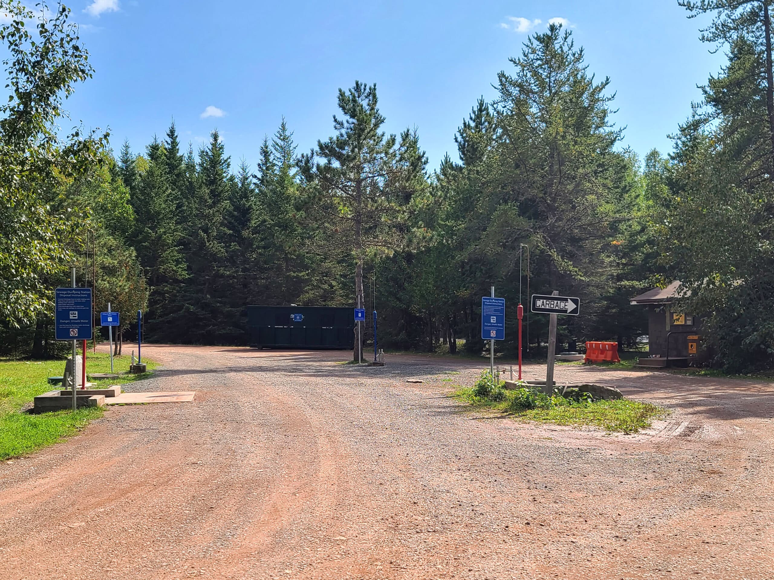
There’s a dump station / fill station (or, as we’ve taken to referring to it - the “poop loop”!), near the front of the campground.
It’s got 2 dump platforms, and 2 fill. These are set up in 2 lanes - dump first, then fill for each - with threaded hoses on the fill towers..
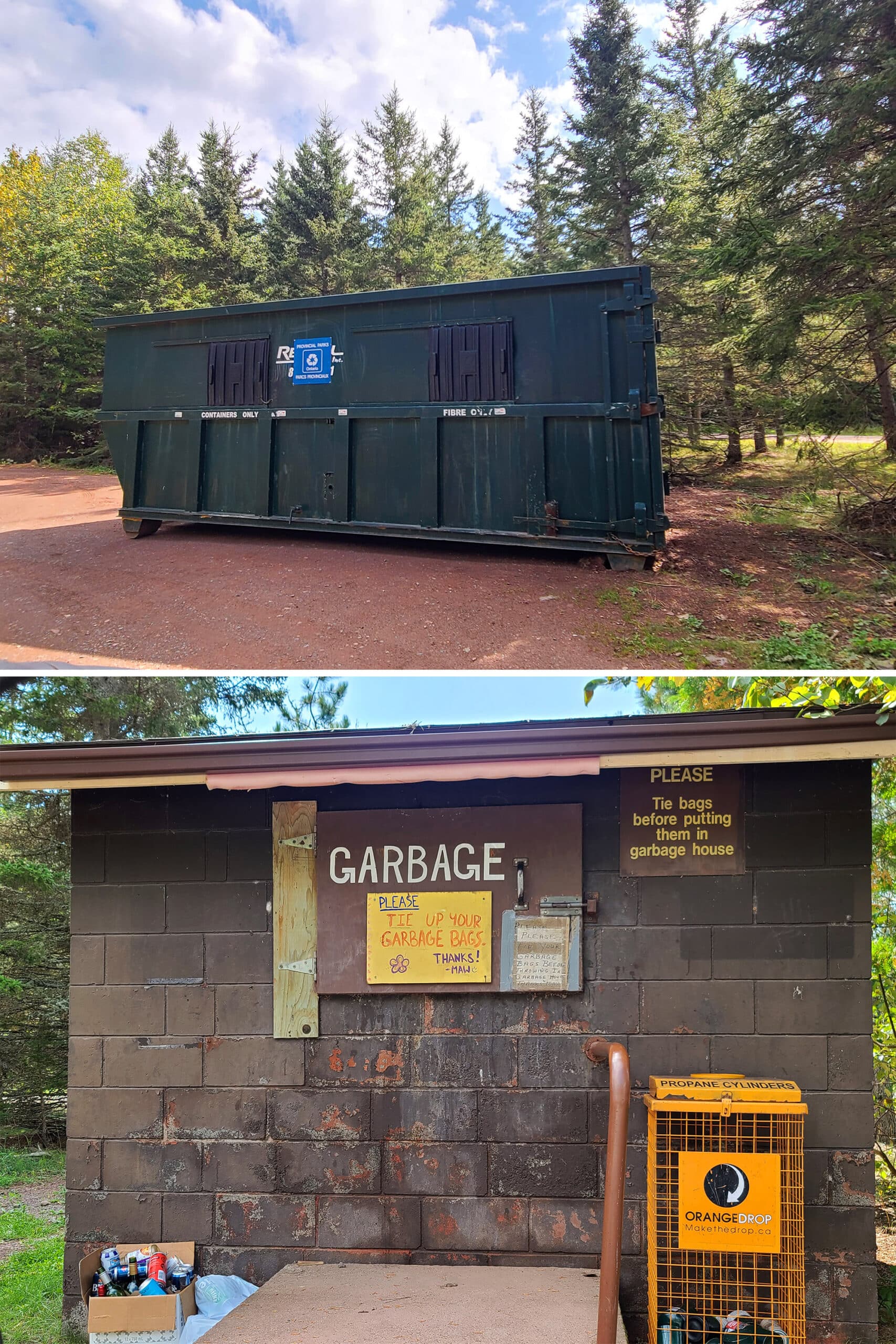
As a note: The staff seems desperate for visitors to tie off the garbage bags.
Tie your damn garbage, people! They have to manually unload your trash. Don’t make it any grosser for them than it has to be, good lord.

Connectivity
Cell reception has been next to non-existent pretty much everywhere in the campground - and Sleeping Giant park in general - across all 3 of our stays there.
We tend to have a little coverage in Pass Lake, and at the Thunder Bay lookout, that was about it the first couple of trips. Sometimes we’d get notifications randomly at our campsite, but not be able to check them.
That was the case on our third trip as well, but now we can add some additional info:
1. There’s what looks to be a cell reception booster (?) at the QR code sign next to the campground office. It did not seem to be functioning at the time of our June 2025 trip. Maybe it’s only for winter?
2. The Joeboy Lake parking lot has a pay station that also has some sort of signal booster on it, and we were able to get connection there - but only right next to that sign.
3. The South Kabeyun Trail Head has some kind of satellite internet setup with public wifi available. We had a good connection there, but needed to be fairly close to that setup.

Accessibility
The campground has barrier free access to the comfort stations, the gate house, and the visitor centre - sort of.
The visitor center was NOT accessible for those with sensory issues.
High pitched noises were incorporated into their nature displays and went off CONSTANTLY - we could only handle about 4 minutes in the building.
As for the comfort stations, both have a barrier free shower - and ACTUALLY have the handheld showerhead / lower-placed controls. They also have a barrier-free stall in the washrooms, but those aren’t marked on the outside of the building.
The comfort stations themselves are exactly the same, but the one next to the barrier-free campsites is a little more wheelchair friendly, just on account of the path from the parking lot/road to the actual comfort station being a bit smoother.
Also, the Plaintain Lane Nature Trail is designated as barrier-free. See our hiking section - further down in this post - for photos and details.
Anyway, beyond all of that, the campground also offers 2 barrier free camp sites.

Pets
Dogs are welcome in the park, but must be leashed at all times.
I didn’t see any off leash dog areas in the campground itself - whether in person or on the map.
That said, one of the trails is designated as being an off-leash dog trail - Sifting Lake Trail. They’re allowed on the other trails as well, but must be kept on a 2 metre long leash.
Parking
Each camp site seems big enough for at least one vehicle, beyond your camping equipment. There’s also parking available at the comfort stations, the visitor center, the beach, etc.
I don’t think you’ll have an issue finding a parking spot in the campground!
That said, some of the trail heads have really small parking lots. I could see those getting a bit crowded on nice weekends in peak season - summer, maybe fall when the leaves change colour.

Miscellaneous
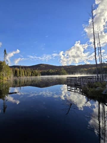
While it’s not quite “dark sky park” status, it was plenty dark in all three of our camp sites to see the stars clearly, and - on one night - the Northern Lights over the lake.
If you’re staying in the waterfront electric sites, you’ll need to look to your right.
Otherwise, the beach area faces north, and would be a great place for aurora borealis viewing.
If you’re interested in possibly seeing the northern lights, check out our posts: Aurora Hunting, How to Photograph the Northern Lights, Can I See the Northern Lights Tonight?, and Where to See Northern Lights in Ontario.
Campground Amenities & Info
For being so remote, this park is remarkably well appointed! Also, everything was very clean and well maintained during our stay.
Here’s some more specific information about the basic amenities offered at Sleeping Giant Provincial Park:
Creature Comforts
There are 2 comfort stations in the campground, pretty close together. Both of them have flush toilets, laundry facilities and showers.
The laundry facilities are the “closet” type - just a door from the outside, rather than a whole room.
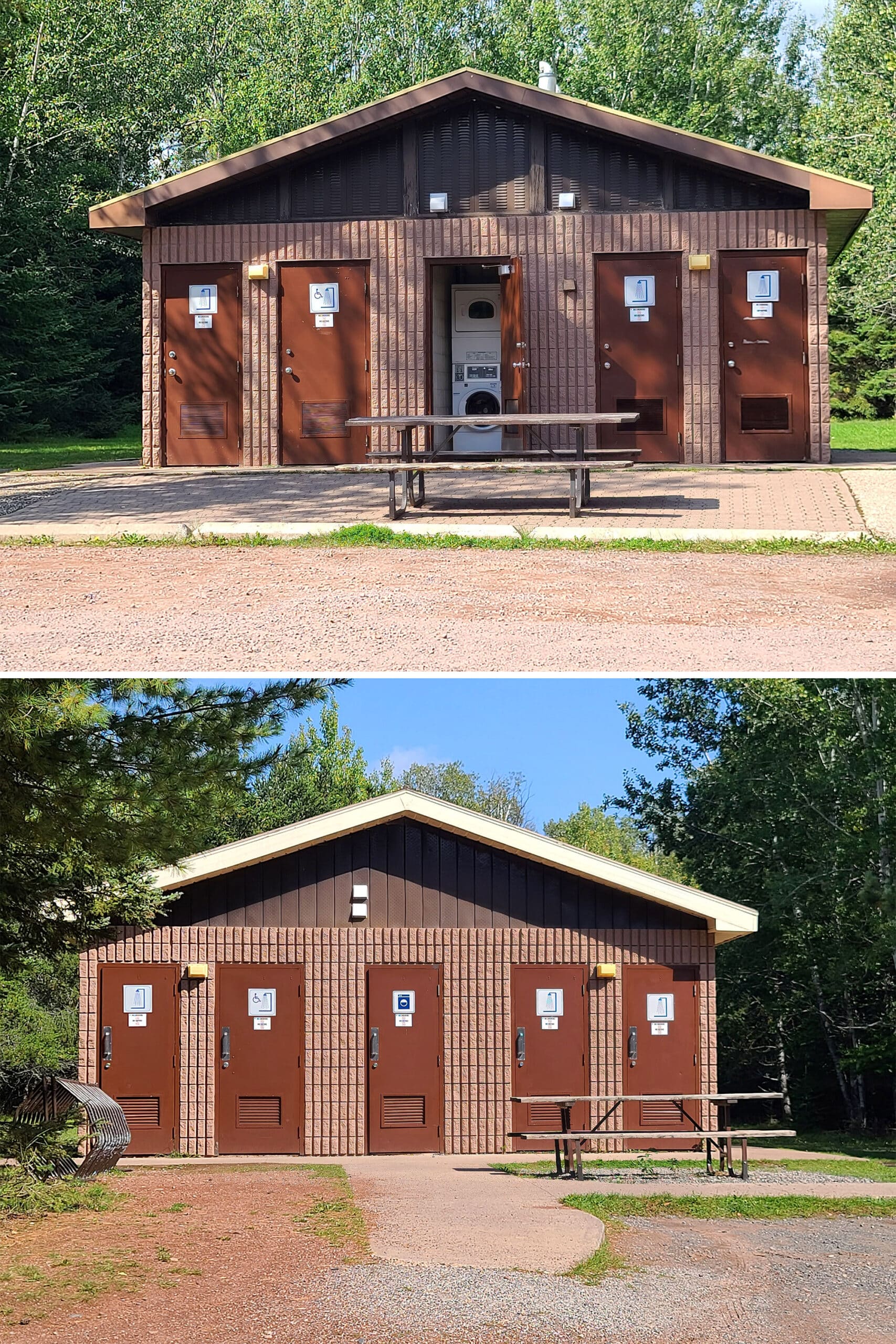
There are also flush toilets at the visitor centre, and vault toilets located throughout the campground.

Park Store
There’s a park store in the visitor center - unfortunately, it was closed for the season during our first two visits.
When it IS open, it offers the usual - souvenirs, books, camping supplies, etc. It also does canoe and kayak rentals, and loans of fishing rods and tackle.
The park office building appeared to be selling firewood, ice, and some of the smaller items in the meantime, though - they had examples of what you could buy posted on the window, labeled with pricing.
We did get to visit the park store in 2025, though:

Visitor Centre
There’s a large visitor center near the center of the campground, with displays and interactive exhibits about the nature and cultural history of the Sibley Peninsula and surrounding area.
There’s also a model of the silver islet mine, and a little cave you can walk through.

There was also a cute little reading area, books about Nanabosho legends, and a posted invitation to read them to your kids.
Note: the hours are VERY short for the Visitor Centre in the off season. 10 am - 1pm only, and I think that was only on weekends, at that!
During our 2025 visit, it was open at 10 am every day, closing at 5pm on Wednesday and Thursday, and 6pm the rest of the week.

Day Use Area
Aside from a few picnic areas throughout the Sleeping Giant Provincial Park in general (Lizard Lake, Poundsford Lake, and Rita Lake), there is a large and REALLY nice day use area in the campground.
The beach is fairly big and way more appointed than the map or website lets on.

There are 2 playgrounds, a (somewhat janky) basketball court, a volleyball net, and more.

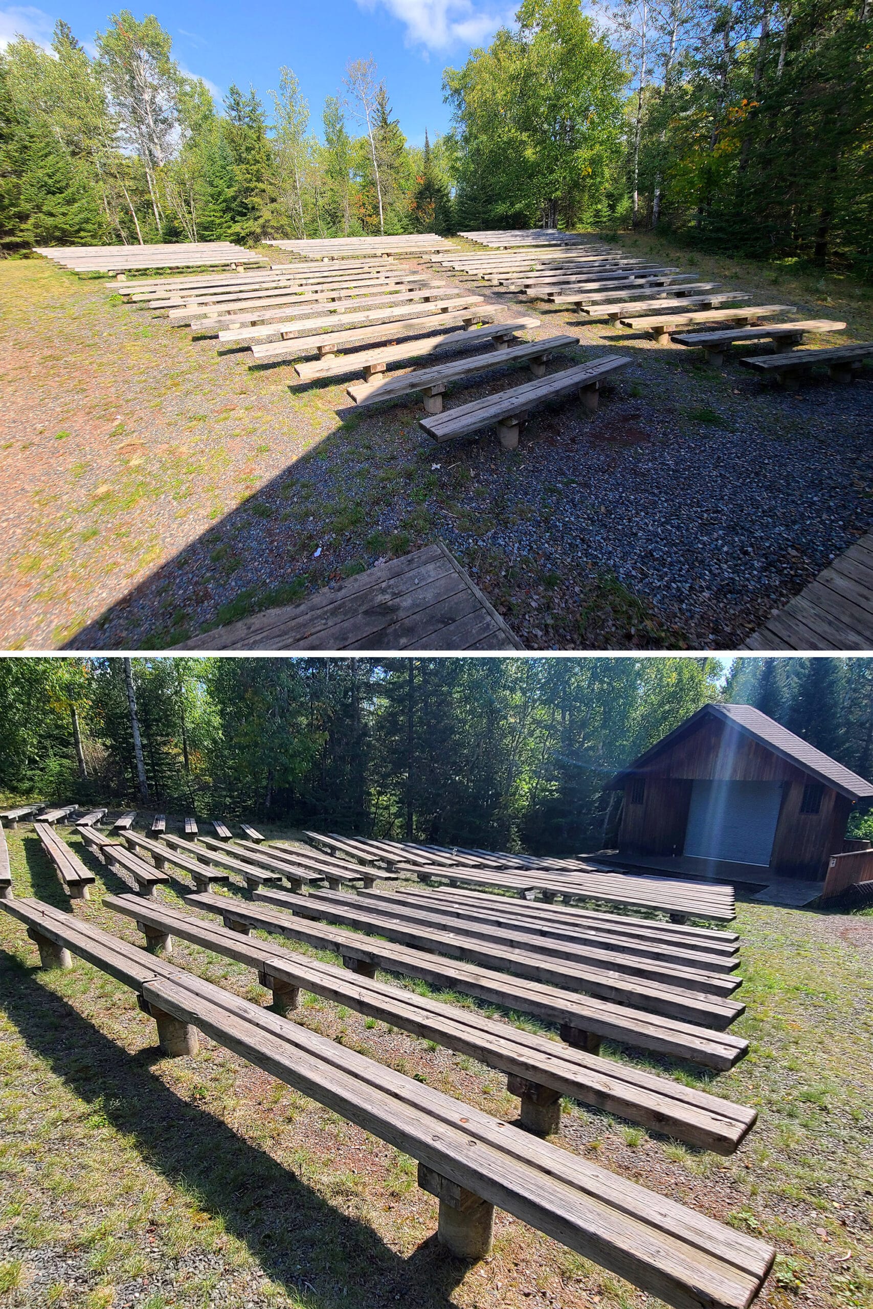
There’s also a public firepit with seating, called the “campsite theater” - it had a small platform with a bench, I guess as a stage.

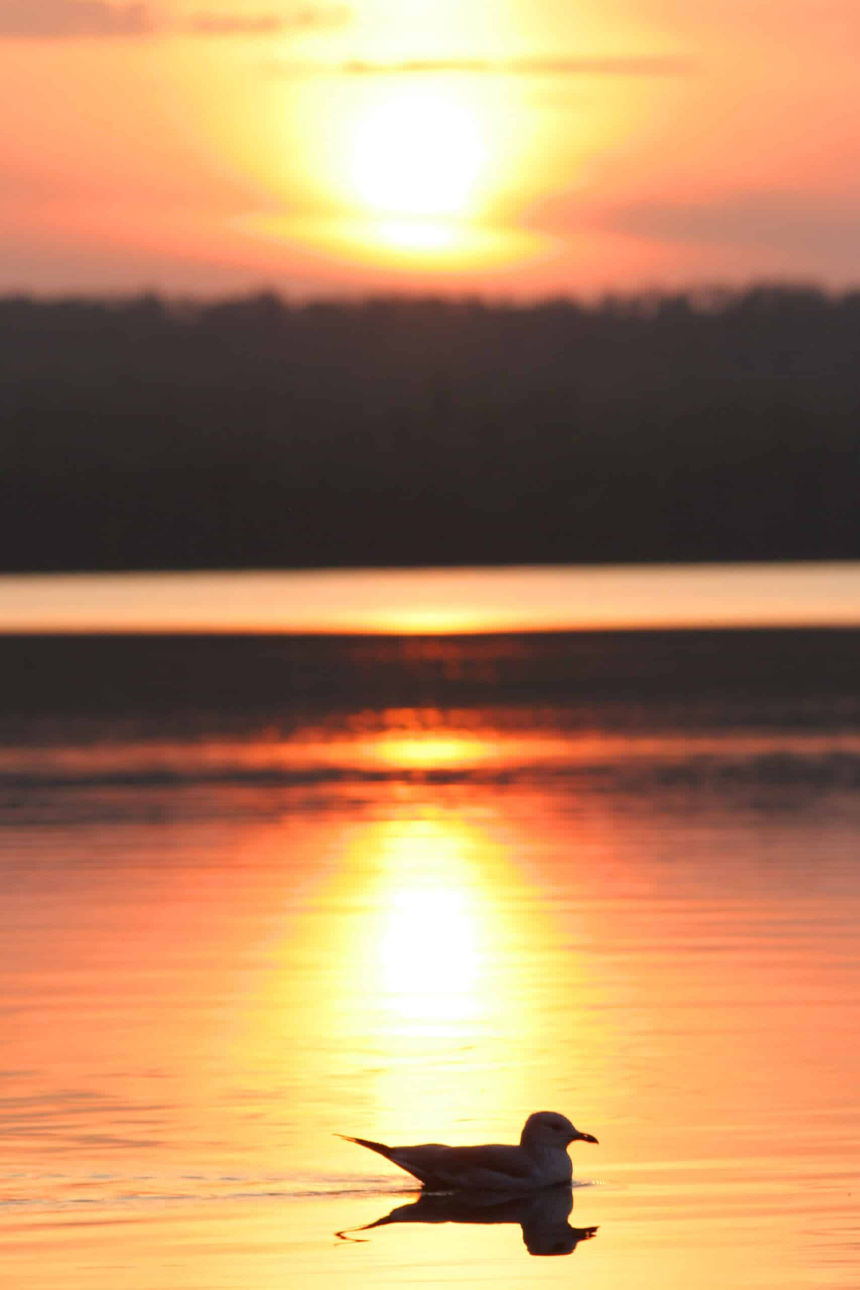
Pro tip: The beach is a great place to watch the sun rise over Marie Louise Lake!
We have to wonder if each of them is more about being a canoe access point, than an actual picnic destination?
Here’s what we can tell you:
Lizard Lake Picnic Area
To reach this day use area, you’ll need to drive about a third of the way up the road to Thunder Bay Lookout, then turn off that road and go a short distance on a side road.
There are only two picnic tables at this picnic area - one’s randomly on the side of the road across from the vault toilet, and the other has a nice view of the lake.
Marie Louise Lake Lookout & Picnic Area
This is located off the side of the main highway, across the lake from the campground.
There’s a single picnic table next to the water, where you have a good view of the head & shoulders of the Sleeping Giant.
Poundsford Lake Picnic Area
This one is also located on the road to the Thunder Bay Lookout. It’s about half way up, then another ~km or so off the road.
We were surprised to see how small this picnic area was! It was a single picnic table on the side of the lake, with a second picnic table in the grass and bushes - pretty overgrown.
A nice enough view from the one picnic table, and definitely secluded!
There’s a washroom off on another side road, just be careful getting there - it’s so overgrown, it’s easy to miss the small boulder in the middle of the road, that nearly took out the bottom of our car.
Rita Lake Picnic Area
This was actually the first Day Use Area we checked out, and it was kind of a weird one.
The parking lot is huge, but we had to really hunt to find the trail to the day use area. It’s pretty well hidden, but it’s on the right side of the road, just before it opens up into the actual parking area.
Maybe 100m in on this narrow walking path (we didn’t measure), you’ll come to the picnic area. It’s just a single picnic table! Really weird, for the size of that parking lot.
Maybe it’s a popular spot for canoeing?

Row 2: Marie Louse Lake Lookout Day Use Area
Row 3: Pounsford Lake Day Use Area
Row 4: Rita Lake Day Use Area
Rentals
Rentals are handled out of the Sleeping Giant Provincial Park store - when it’s open. They offer canoes and stand-up paddleboards for rent, as well as personal flotation devices.
The park is also part of the Federation of Anglers and Hunters Tackleshare Program, so you can borrow fishing rods and tackle from the store as well.

Campsite Details
The Marie Louise Campground has about 200 sites. The sites are a mix of electrical and non-electrical - about 50/50. They’re also a mix of car camping and tent camping sites.
Ten of the sites are located on the west shore of the lake, a fairly long drive from the front - we went to take a look, eventually gave up before getting all the way to the campsites!
Anyway, there are fire pits in every site, along with at least one picnic table.
The sites all look really well maintained, and we saw a big mix of camper sizes, along with pop ups, tents, vans, and more.
Every site in the main campground is just a short walk from a set of vault toilets, which are generously scattered throughout the campground. The water taps are similarly abundant.
The south facing sites on the arm of the campground that has the boat launch are SUPER cute, by the way.
The ones next to the water (141-167, odd numbers) had some kind of stairs or path down to the water. 142 - 168, even numbers - were elevated from the road, with a short set of steps to reach each campsite.

Our Sites
We were actually in 4 different sites over the course of our 3 visits to the campground.
Our first was 203 - it was huge, fairly private, had a bit of a slope, and was surrounded by trees. Our 4th site - 219 - was similar to this one.

The ground leveled out when we pulled in parallel to the water, so not much slope to deal with on that one.
When we returned on the way back through the area, we had 216 - also waterfront, and a more secluded site than the other two. BIG SLOPE, no room to pull in sideways.
Group Camping
There are two group campsites at Sleeping Giant Provincial Park, right next to the beach, and basically across the road from each other.
The smaller one fits up to 25 people and is a waterfront site, and the larger one fits twice as many and is not on the water.
Both have water taps and at least one fire pit, and the larger site has its own vault toilet. (It’s right beside the road, though, so I wouldn’t be surprised if random people use it!)
Also good to know: Both seem to have electrical hookups in them!

Bottom 4: Large Group Campsite
Rustic Cabins
There are 5 cabins available for rent, 3 of which are on the waterfront. They have cute names - Dragon's Mouth, Rose Pogonia, Fairy Slipper, Pink Moccasin Flower, Coral Root.
We didn’t get too close a look at them during our drive through, but the details appear to be the same as we’ve seen in other parks:
Each sleeps 6, comes with pots, pans, cutlery, etc. You need to bring your own linens, food, toiletries, etc. These ones actually have full washrooms, too!
Only one of the cabins allow any pets at all - just dogs, and it’s $20.00 / night to do so.
There’s also the Ranger Lodge, which is a much larger cabin. In the off season, the park rents this one out for group retreats and such.

Backcountry Camping
TOTALLY not our thing, but the park does have 27 backcountry campsites throughout the park.
Apparently they can be hard to come by during the busy season, so they recommend people book their vehicle permit & backcountry camping permits ahead of time, and arrive early.
They sound pretty well-appointed, also - most of the ones in the more popular zones (Tee Harbour, Lehtinen’s Bay, and Sawyer Bay) have firepits, access to privies, and shared bear proof food lockers.
Other campsites in different zones have varying degrees of amenities.
Share the Love!If you’ve made one of our recipes, be sure to take some pics of your handiwork! If you post it to Bluesky, be sure to tag us - @2NerdsInATruck, or you can tag us on TikTok, if you’re posting video. We're also on Pinterest, so you can save all your favourite recipes and park reviews to your own boards! Also, be sure to subscribe to our free email newsletter, so you never miss out on any of our nonsense. Well, the published nonsense, anyway! |
Entertainment and Activity
There are a LOT of outdoor activities to do in Sleeping Giant Provincial Park, whether you stick mostly to the campgrounds, or venture off into the rest of the park:
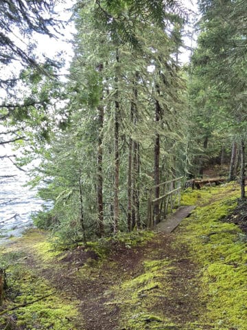
Hiking
There are over 100 kilometres of trails in the park. Unfortunately, after blowing out my knee during our stay at Lake Superior Provincial Park, all of our hiking plans for our first two stays at Sleeping Giant were right out the window.
Somehow I managed to repeat history, blowing a knee out at Oastler Lake Provincial Park on the way out to our Northern Ontario adventure in 2025.
By the time we reached Sleeping Giant Provincial Park, I was a bit more ambulatory than the previous trips, so we actually managed to get some hiking in.
Here’s the info we’d assembled for our hikes, along with our thoughts on the trails we’ve done so far!
You’ll look for a short and easy trail, get excited to see one that’s marked as being 0.4 km and easy... but then you see that the trail requires walking 12 km from the parking lot - on a main trail marked difficult - to even get to.
Per the park’s website:
The difficulty ratings are based on the trail’s tread-base/surface type, elevation-profile, width, steepness, and, to a lesser extent, length.
... so it seems wild to mark anything that requires a 12 km, difficult hike to even get to as “easy”.
Anyway.
In order of total length, with both the designated difficulty and the realistic difficulty (as we do each), here are the trails:

Kabeyun Trail - Difficult
LMFAO at “difficult”, this one is next-level nonsense, for those into multiple day hikes.
It’s 37 km end to end, or a 74 km trail - SEVENTY FOUR KILOMETERS - return.
The description for this one straight up sounds like the park trying to talk you out of doing it, basically giving every reason in the world not to.
For me, the 37 km thing did it just fine... though I bet you get some breathtaking views of Lake Superior along the way!
Anyway, this one requires a ton of planning, endurance, strength, etc. Camping and terrain can be a huge issue throughout the trail, so ... I mean, YOLO, I guess?
Pickerel Lake Trail - Moderate
This one is 11.7 km / 23.4 km round trip, and takes you through a bunch of white pine forest. Popular with cross country skiers.
Thunder Cape Trail - Moderate (Difficult)
This trail is listed as being 2.4 km round trip... but 23.2 km round trip - with most of it on a difficult trail - if you count actually getting there and back.
This one is for the birds - literally. It takes you to the Thunder Cape Bird Observatory. The observatory is not a part of the park - and it’s outside the park boundary.

Bay’s End Lookout Trail - Moderate
An 11.6 km / 23.2 km round trip trail, this one was formerly a gravel road - it’s mostly level, as a result. Sounds like it would be marked easy, if not for the distance.
Part of the Trans-Canada Trail, this one takes you to both the Bay’s End Lookout and the Caribou Island Lookout.
Burma Trail - Moderate
An 11.4 km / 22.8 km round trip trail that is generally more for cross country skiiing, than hiking - it’s too wet in the summer.
Top of the Giant Trail - Difficult
This trail is 6.6 km round trip itself, but 21.8 km round trip from the parking lot.
It involves hiking up to the top of the tallest cliffs in Ontario - and the highest point in the park - with the top of the cliff being known to provide some pretty spectacular views of both sides of the Sibley Peninsula.

Talus Lake Trail - Difficult
This one is either 12 km round trip, or 18.6 km round trip, depending on which part of the description you’re reading.
I’m going to assume 18.6, because it would really suck to get 12 km into a difficult hike, thinking you’re done ... only to realize you’re not even ⅔ of the way in yet!
This one sounds really interesting, though - it connects a few trails, goes past a few lakes, a meadow, cliffs, creeks, talus slopes, a beaver dam, a field of boulders, and more.
Nanabosho Lookout Trail - Difficult
This one is 1.6 km round trip for the trail itself, but 17 km round trip from the South Kabeyun trailhead parking lot.
The hike takes you up the “chest” of the sleeping giant, with views of the campground, several bays, Silver Islet, and Porphyry Island.
Head Trail - Difficult
This trail is 2.8 km round trip, but 16.2km round trip, when you count the walk to get there.
As you may guess by the name, this one takes you to the top of the sleeping giant. It’s the steepest trail in the park.
Tee Harbour Trail - Easy (Difficult)
Another one of the sneaky ones. 0.4 km / 0.8 km round trip, marked easy... but is a 12.4 km round trip from the parking lot, with the bulk of that on a trail graded “difficult”.
This one takes you to a large rocky outcrop that juts out into Lake Superior.
Sawyer Bay Trail - Moderate (Difficult?)
This one is 5.7 km / 11.4 km round trip for itself, but also involves almost a km on a trail designated as “Difficult” in order to get there - 12.2 km total, round trip. The trail takes you through rolling hills, to Sawyer Bay.
Middlebrun Bay Trail - Moderate
4.9 km / 9.8 km round trip trail takes you up to Finlay Bay and a single backcountry site there. On the way - 2.3 km from the trailhead - there’s a secluded, sandy beach. (Middlebrun Bay).

Ferns Lake Trail - Moderate
This is a 9.7 km loop that has one of the funniest trail descriptions ever. Starts out nice, goes a bit off the rails:
“This trail has many access points and crosses highway 587 twice before looping back to the Marie Louise Lake Campground. Highlights of this trail include two beaver dams and a small pond.
A portion of this trail overlaps with a maintenance road as well as Wildlife Habitat Nature Trail and this poorly-marked loop is not often the first choice for recommended hikes in this remarkable park.” - Park Guide
Twinpine Lake Trail - Moderate
4.4 km / 8.8 km round trip trail. Passes by a lake, involves a lot of climbing, including through swampy sections.
Gardner Lake Trail - Easy
This one’s a 2.6 km / 5.2 km round trip trail that takes you along an old logging road, through some cedar groves, to the shore of Gardner Lake.

Sifting Lake Trail - Easy
A 2.1 km / 4.2 km round trip trail that takes you through red and white pine forests, to Sifting Lake.
This one’s an off-leash dog trail, the only one in the park.
Porter did it in 2025, here’s what he had to say about it:
“This trail is mostly flat, narrow in some places, with a few areas that are a bit muddy. A couple of those spots have some logs in the path to help out. This makes it on the border between an easy trail and a moderate trail, in my opinion.
It winds through several types of forest, from tall canopy trees to young forest with small trees and bushes encroaching onto the trail. This keeps it interesting, but after around 1.5 km I sort of felt like I had seen enough of the forest views and grew a bit impatient.
I'm glad I stuck it out, because at the end you arrive at a small opening at the shore of Sifting Lake. The lake is beautiful, but what really caught my eye were the dozens of American White Pelicans swimming and flying all around me!
Having only first seen these at Caliper Lake Provincial Park a couple of weeks ago, this was definitely the highlight of the trail for me.”
Sawbill Lake Trail - Moderate
A 4.0 km round trip hike that goes up a steep hill to get a bit of a look at Thunder Mountain.
Piney Wood Hills Nature Trail - Moderate
Self contained trail, 1.4 km long, or 2.8 km round trip. Takes you to a spot overlooking Joeboy Lake.
While we haven’t done this trail yet, we CAN report on finding it! The trailhead is almost impossible to see from the road on the way up to Thunder Bay Lookout, as the sign is missing, and the sign post is concealed by trees.
You can see it a bit easier on the way down, but mostly because it’s got a couple parking spots on the side of the road - you definitely have to be looking for it.
So, for reference - the parking lot is 1.4 km up from the highway, on the right.

Sibley Creek Nature Trail - Easy
A 2.3 km loop themed around swamp ecology and the historical forestry practices in the area.
Taking you to a bridge over Sibley creek, this one offers a bunch of educational opportunities - pamphets at the trailhead, and informative posts along the way.
Wildlife Habitat Nature Trail - Easy
A 2.1 km loop that takes you to a pond.

Ravine Lake Nature Trail - Moderate
A 1.9 km loop trail, this trail takes you up to a spot that overlooks Grassy Lake, Lake Superior, and the south end of Sibley Peninsula, before taking you down to Ravine Lake and through a grove of cedar trees.
Porter did this trail in 2025, here’s what he said about it:
“The Ravine Lake Trail is a moderate trail, with some short difficult sections such as a steep area with a short switchback to help you climb the hill, and some areas with boulders.
The trail blazes are very good, the path is well-worn and there are blazes where you need them.
There's a lake outlook at one point where the trail dead-ends, but when you turn around you see blazes directing you back a bit. The blazes then point to the side, where you see the trail is in a tight Y shape and you continue on the loop toward the left.
At the higher parts it's a beautiful boreal forest, which I always love to see on a trail.
There's a boulder outlook with a great elevated view of the surrounding area. Overall this is a great hike through interesting forest with a couple of really nice scenic outlooks.”

Sea Lion Trail - Moderate
This trail is listed as 0.8 km round trip - and moderate - itself, but requires 0.8 km on a difficult trail (So 1.2 km total one way, or 2.4 km return) to access it.
This one is said to be the most popular trail at Sleeping Giant Provincial Park, and the description says that it takes you over rocky outcrops, past a pebble beach, with the end of the trail taking you to a diabase rock arch on Lake Superior.
There are information panels detailing the geology of those rock formations, for those interested.
We were able to do the trail in 2025, and downgraded our assumed difficulty from “difficult” (based on the trail rating to get there), to “moderate”.
In reality, the 0.8 km section of trail leading up to the start of the sealion trail is easy. Wide, well packed, some relatively steep inclines, but no real obstacles.
The trail splits off from the main trail just before a bridge, going up some stairs before entering steep forest trail.
After navigating past the rocky beach - there are side paths to go out there - and up a lot of steep, root covered areas, you’ll eventually come to a clearing with a railing.
The railing is to keep visitors back from the sheer cliffs in that area, and there are signs telling you that climbing on the Sealion rock formation is prohibited.
Anyway, that makeshift viewing platform gives you some great views of the shores of Lake Superior that you passed on the way in, and a clear view of the Sealion Arch.
The best view of the arch was just past the railing, though, where a small path leads you a little ways down the cliff for more of a straight-on view.

Cemetery Trail - Easy
0.8 km / 1.6 km round trip, this short trail is near the southern tip of the park, about a 10 minute drive from the campground. Takes you to Silver Islet Cemetery, a historical site.
Joe Creek Nature Trail - Easy
This is one of the first trails you run across after entering the park, and is just 0.7 km / 1.4 km round trip.
Described as a “tranquil trail”, this one takes you past a series of waterfalls to the Lake Superior shore on the east side of the peninsula.
Personally, I’d consider this more moderate, than easy. It was definitely a bit of a workout, with inclines, roots, rocks, etc to get up and down over.
From the description, I was assuming there’d be more of a view of the waterfalls. In reality, there’s one really good area - where you can walk down to the rocks right beside it - and then a few glimpses of the rapids through the trees and bushes.
The “waterfalls” were more just a casual cascade of rapids with really small drops, but it was still nice.

Pass Lake Overlook Trail - Moderate
This is a 0.5 km / 1 km round trip trail that is actually self contained. It takes you to the top of a sandstone cliff, overlooking Pass Lake and - in the distance - Thunder Bay.
While Pass Lake - both the lake and the town - are indicated on the trail map, the trail itself is not. So, we don’t really have any information on how to get to this one!
Thunder Bay Bogs Nature Trail - Easy
This one’s a 0.7 km loop, accessed via the most WILD drive ever - see the section on the Thunder Bay Lookout for full details.
If you brave the drive to take this trail, the park says you’ll be treated to pitcher plants and Labrador Tea growing on the shore of a small lake.
We finally did this trail in 2025. The park’s description is a bit inaccurate - it’s more of a moderate trail than easy (steep areas, large rocks, roots, jumping over swampy areas, etc), and is just over 1 km long.
It’s a nice little trail. We didn’t see the aforementioned pitcher plants, but we saw a TON of wild orchids amongst all of the usual boreal vegetation.

Plantain Lane Nature Trail - Easy
The shortest trail in the park, this one is just 0.3 km / 0.6 km round trip, and located just outside the entry to the Marie Louise Lake campground. (Turn right onto the highway, it’ll be on your left and is well marked at that point)
The parking situation is a bit weird. It’s supposed to be a wheelchair accessible / barrier free trail, but there aren’t any barrier-free parking spots. There’s barely any parking at all really - the trail head is a single lane loop on the side of the highway, with a little bulb at one side for maybe 2-3 cars to park.
Anyway, this is a wide, well-packed forest trail. About 150 metres in, you come to a bridge over Sibley Creek, with some rapids on either side. Lovely view, first thing in the morning.
Beyond that spot, the trail is a bit anti-climactic and a bit less accessible - it goes up a slight hill, there are more tree roots and such, and it eventually just ends on the side of the highway.

Thunder Bay Lookout
About ⅓ of the way between the park entrance and the campground, there’s a side road off to the right that will take you out to Thunder Bay Lookout, as well as a couple of trail heads.
The lookout is terrifying and amazing - a single, fairly narrow walkway that’s vaulted high above the trees below, looking out over the lake.
There are some spectacular views of Lake Superior for those who venture out on the platform to any degree. I went out a couple of meters, looked down, got dizzy, and noped out.

Apparently the very end of the platform is just a metal grate, not covered by the wood planks that the rest of the walk is covered by.
He says it was “designed really well to be able to look out over that height, and still be safe.”
K. I’ll take his word for it - from a distance!

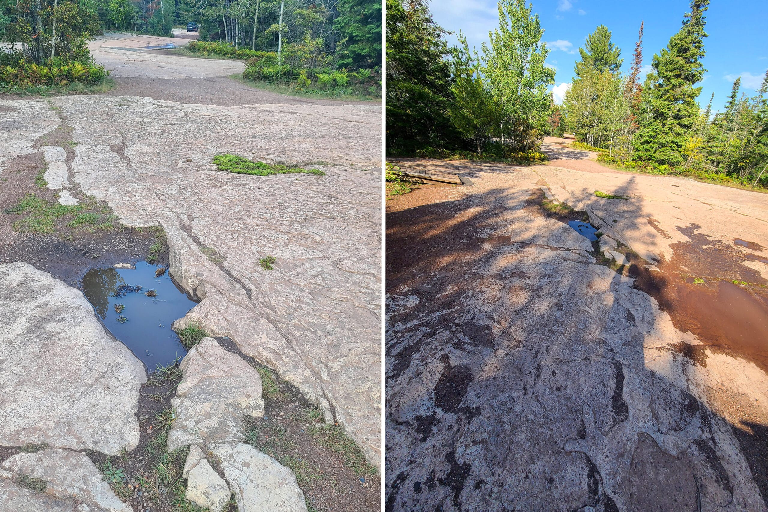
The ROAD.
Now, let’s talk about the road to get there - a 9.2 km road that runs between the highway and the lookout area. It takes us just under 20 minutes to get up there from the highway.
That road is is WILD - I would not recommend taking a camper down there!
There’s a sign early on that warns of steep sections, in no way does that do justice to what you’re going to encounter. Frankly, the steep areas didn’t feel that steep, and were the least of the driving concerns!
The majority of the road is just a dirt road, some ruts, a bit steep, no big deal - that’s the first 7 km or so.
Driving on raw rock face, giant craters, having to drive almost into the trees in order to not ruin your wheels.
Nowhere to turn around, either, so you’re like 7+ km in when you hit the NOPE - and there’s nowhere suitable to just back out at that point.
Words and photos will never do justice to how rough that road was. If you’ve got a nicer car, you may want to avoid that side trip.
Biking
If you bring your mountain bikes with you, you’ll be able to use them on some of the trails in the park.
Burma Trail, Pickerel Lake Trail, Sawbill Lake Trail, and Sawyer Bay Trail all allow cycling, as well as the South Kabeyun Trail - but just as far as the junction with Talus Lake Trail.
They also recommend 2 of the roads within the park - Marie Louise Drive (12 km), and Thunder Bay Lookout Road (9 km).
If you do the Thunder Bay Lookout, be sure to watch where you’re going - you’ll be dodging some of the wildest potholes and road conditions ever, as well as the cars that are ALSO dodging the same.

Swimming
As mentioned above, the Marie Louise Lake has a large, beautiful public beach. The swimming area is marked off with buoys, and it’s just a wonderful area to spend a warm afternoon.
There’s also inland swimming on Pounsford Lake, and swimming in Lake Superior via Middlebrun Bay’s sandy beach.
Feeling more adventurous? There are a ton of natural bays and inlets along the coast, many of which can be accessed by the Kabeyun Hiking Trail.
As a note, there are no lifeguards on duty at any of the swimming areas in Sleeping PP, or along the shore of Lake Superior.

Birding, Wildlife, and Nature
Sleeping Giant Provincial Park is known for its excellent wildlife viewing opportunities.
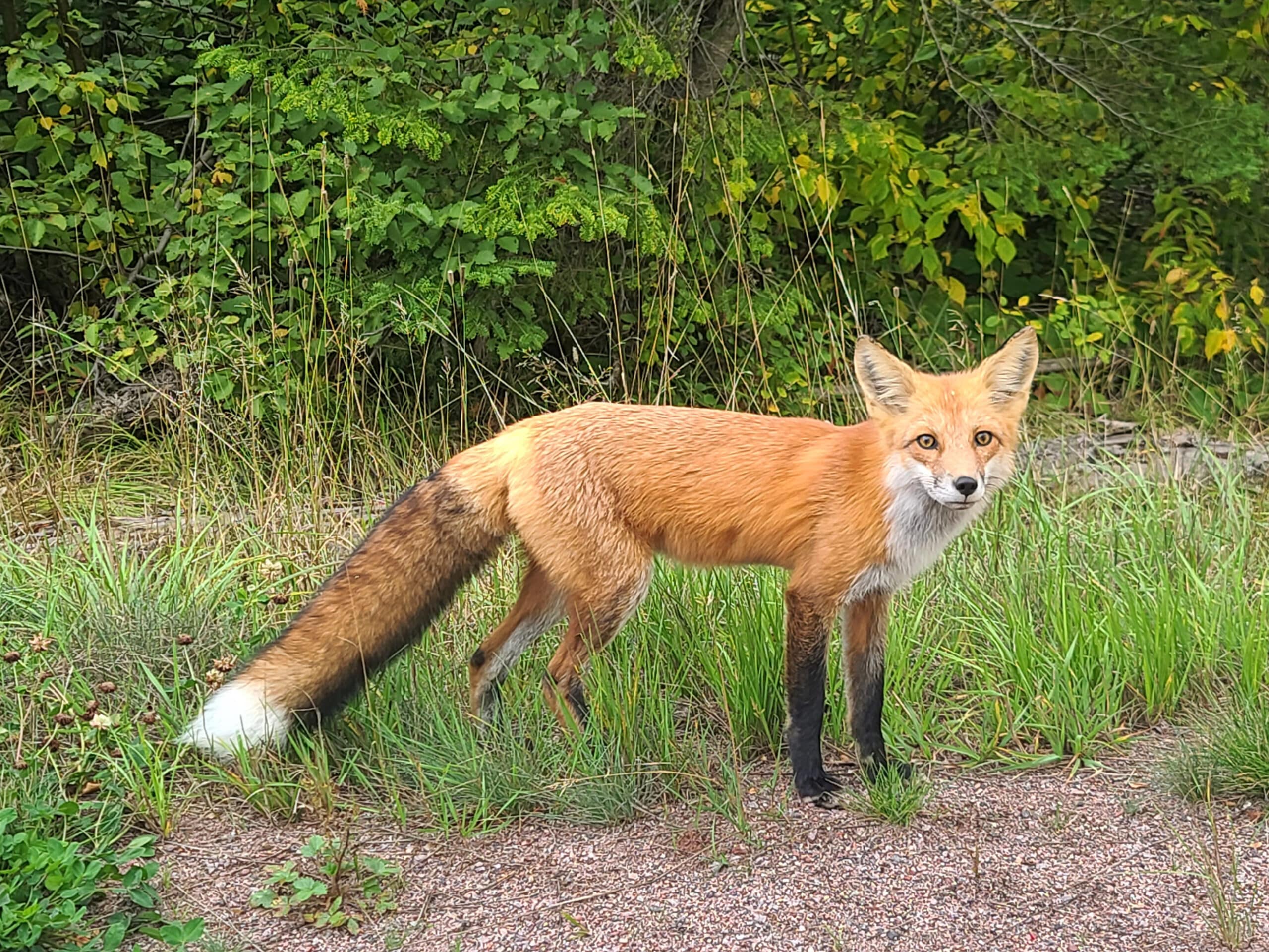
People have been known to see deer, fox, lynx, and wolf in the park.
We didn’t see any deer, lynx, or wolf on our first trip ... but our first night at the park, we saw a fox sitting on the side of the highway, so we pulled over to look at him from a distance.
He walked right up to the car - gorgeous little guy!
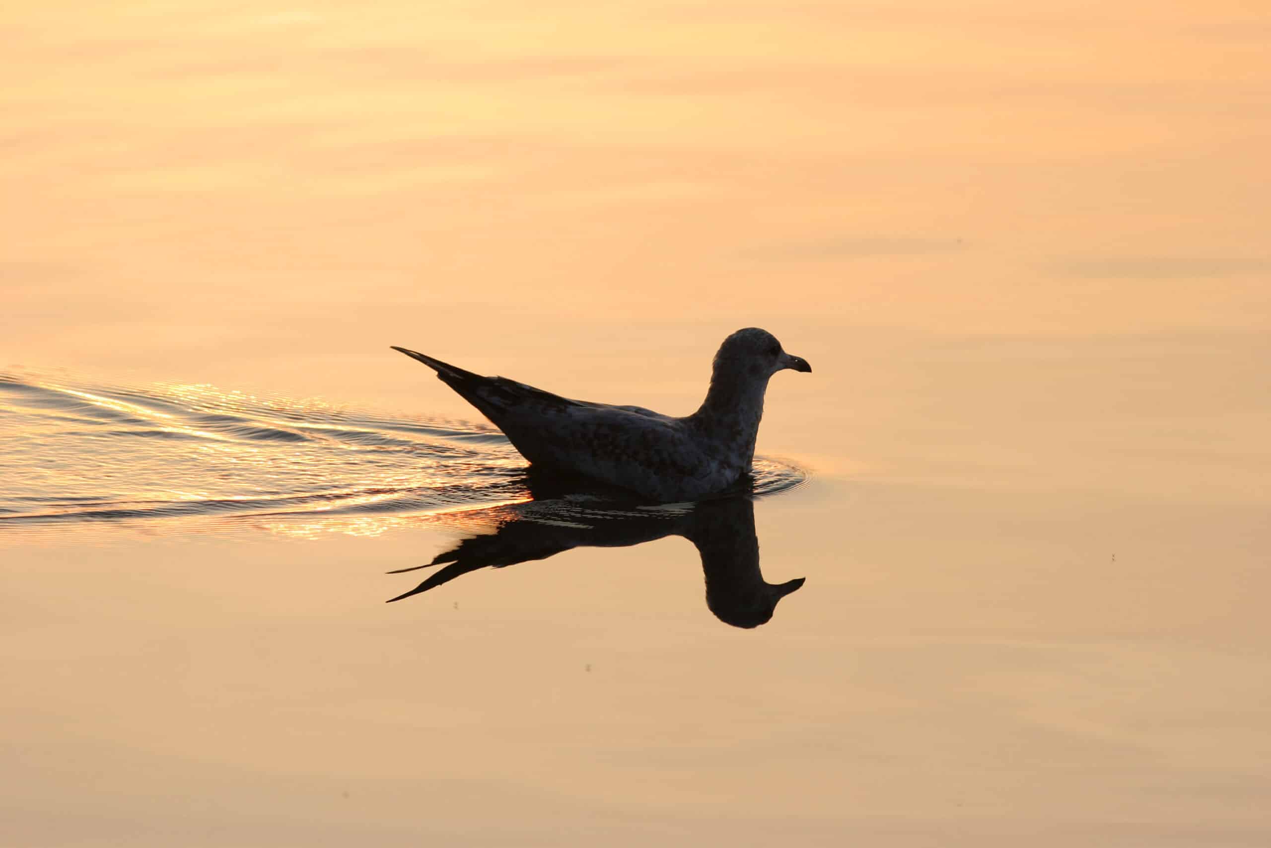
Aside from land animals, the park is home to many species of birds - at least 75 different ones nest in the park, and over 200 species have been recorded seen in the area.
While we’ve yet to see any of the peregrine falcons mentioned on the signage at the Thunder Bay lookout, here’s the list of bird species we heard and/or saw during our 2025 visit to Sleeping Giant Provincial Park:
American Goldfinch, American Redstart, American Robin, American White Pelican, Bay-Breasted Warbler, Black-and-White Warbler, Blackburnian Warbler, Black-Capped Chickadee, Black-Throated Green Warbler, Blue-Headed Vireo, Canada Goose, Canada Warbler, Cape May Warbler, Cedar Waxwing, Chipping Sparrow, Common Loon, Common Raven, Common Yellowthroat, Golden-Crowned Kinglet, Hairy Woodpecker, Hermit Thrush, Horned Lark, Least Flycatcher, Long-Eared Owl, Magnolia Warbler, Nashville Warbler, Northern Cardinal, Northern Flicker, Northern Parula, Northern Waterthrush, Ovenbird, Pileated Woodpecker, Pine Siskin, Pine Warbler, Red-Breasted Nuthatch, Red Crossbill, Red-Eyed Vireo, Ring-Billed Gull, Song Sparrow, Swainson’s Thrush, Tennessee Warbler, Trumpeter Swan, White-Throated Sparrow, Winter Wren, Yellow-Bellied Flycatcher, Yellow-Rumped Warbler, Yellow Warbler.

Row 2: Cape May Warbler, Common Goldeneye, Common Loon
Row 3: Hairy Woodpecker, Northern Flicker, Red Fox
Row 4: Red-Eyed Vireo, Ruffed Grouse, White-Tailed Deer
We also saw a TON of wildflowers during our June 2025 visit!

Boating
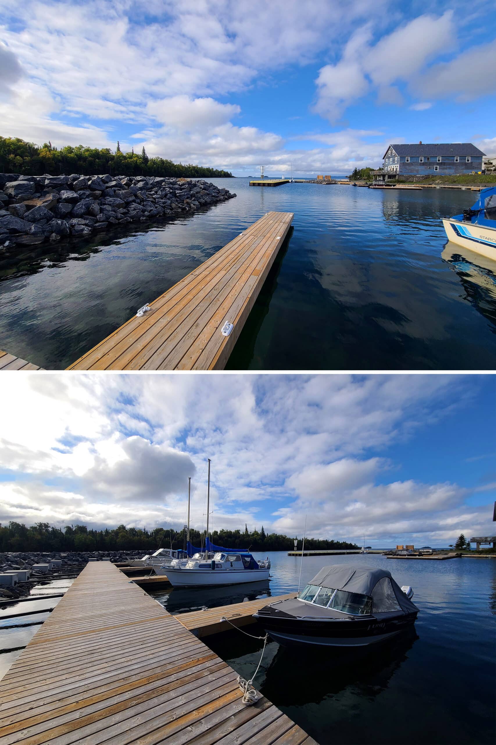
There’s a boat launch and small dock located in the Marie Louise Lake campground, where people can canoe, kayak, or use motor boats.
Marie Louise Lake - one of the larger lakes in the park - is the only lake in the park where power boats are permitted, btw - and they’re limited to 10 HP or less.
The campground has canoes, kayaks, and stand up paddleboards available for rent in the camp store - not sure how they handle that after the store is closed for the season, though - maybe through the front gate?
In addition to Marie Louise Lake, canoeing opportunities are available at other lakes throughout the park.
Anyway, be sure to keep a close eye on the weather forecast. We’ve noticed that it tends to be pretty volatile in this area, and can change wildly with very little notice.
Also, accuracy can be an issue. One afternoon, it was ten degrees cooler than it was STILL predicting that and the following hour to be!

Fishing
While you can’t use - or even possess - baitfish within the park waters, you CAN go fishing in the lakes.
The smaller lakes are known to have Northern Pike and Yellow Perch, and you can find Smallmouth Bass and Walleye in the larger lakes.
Just be sure to note the power boat restrictions we mentioned earlier!
Discovery Program
As with all of the other Ontario Parks we’ve been to, Sleeping Giant PP runs a Discovery Program during the summer months.
A variety of programming about the geology, forestry, wildlife, and cultural history of the park, Silver Islet - especially Silver Islet Mine - and more are available, through the Visitor Centre.
During our June 2025 visit, there were a few programs available over the weekend - one on rock hunting, one about bears, “Sleeping Giant Jeopardy”, a guided hike on the Sea Lion Trail, and a birding program for kids.

Winter Activities
Unlike many parks we’ve stayed in - that close and gate up over the winter months - Sleeping Giant seems like a winter wonderland for people that love to play in the snow.
They’re known to play host to some of the best cross-country skiing, with cross-country skiers coming from all over to enjoy the 50 km of groomed trails.
There’s also a big ski festival hosted there - the Sleeping Giant Loppet - in March.
In addition to the cross-country ski trails, there’s also a SKATING TRAIL - 300 metres long - in the campground!
Snowshoeing on the hiking trails and ice fishing on the frozen lake are other options.
Niantic Games
There was so little cellphone reception in the park, we wouldn’t recommend planning on getting even just your daily tasks in.
If you’re staying here, expect to break whatever streaks you had on the go! That said, if you go to the beach in the campground, there are 2 Niantic stops (Pokestops, Ingress Portals, etc) there. We could usually get reception at the first one, not usually near the second.
Nearby Amenities & Attractions
Feel the need to get out of the park for a bit? Here’s some info on the nearby offerings, amenities, and attractions:
Silver Islet
Silver Islet is a really short drive down the Sibley Peninsula from the campground - 5 km or so.
This is a small community located right at the tip of the peninsula.
There’s a gorgeous harbour, beautiful views, and a small general store, stocked with souvenirs and some foods - both basic, and touristy.
LCBO & Store
In the opposite direction - I think it was about 20 minutes from the campground? - there’s a store with an LCBO and Canada Post in it.
It’s located in Pass Lake, just before as you get to the entry of the park itself, when coming from the Trans Canada Highway.
It had a surprisingly decent selection of booze, as well as some basic foodstuffs.
Gas Station
Across the highway from the entrance to the Sleeping Giant Peninsula - where Highway 587 joins with the Trans-Canada Highway - there’s a large gas station centre.
It’s very RV friendly - it’s a truck stop, with diesel and regular gas, a lot of semis, tons of room.
There’s a large-ish, fairly well appointed store there, that sells every manner of junk food (Including Masala Munch! Weird to see it so far out here!), as well as auto maintenance accessories and supplies.
Amethyst Country Rock & Gift Shop
This is a little amethyst shop on Highway 587, located just before you get to the main park entrance / boundary, when coming from the Trans Canada Hwy.
The employee we dealt with was super friendly and knowledgeable about her wares, which varied from cute to gorgeous.
We ended up spending way more than we’d planned to, but were happy to do so.
Amethyst Mine Panorama
This attraction is one that’s near and dear to my heart - I went there as a kid!
There’s a big, well appointed gift shop with rough and finished amethysts, as well as jewelry and souvenirs made from them.
There’s something in basically every price range - it was a WILDLY different experience, going there as an adult with credits cards, vs going as a kid!
The mine offers tours - we didn’t do it - at $10 per person.
What’s REALLY cool though, is that you can walk through areas that have piles of amethysts, and pick what you want.
Once you have a bucket of treasure going, you take it to a washing station and see what you’ve got. $5 / lb to take it all home!
We’re going to have to do a full write up eventually - LOVE this place!
Update: See our full Amethyst Mine Panorama Review!

Final Thoughts
After 3 trips to Sleeping Giant Provincial Park, we find we’re loving the park more and more with every visit.
It helps that we were actually able to get to check out some of the trails in 2025!
We love that it always feels like there’s more to explore at Sleeping Giant. As much as we HAVE seen, there are tons of trails that we’ve yet to see... and even more that we’re not likely to, just based on logistics.
It’s got a nice little campground, with a TON of options for activities.
We loved our campsites, especially the two waterfront ones - 202 and 216.
Not only is it always nice to have a waterfront site, these two gave so many great views - the sunset, the sun rise, the northern lights, AND the head / chest of the Sleeping Giant itself!
I also think that this campground would be especially good for families - the whole beach area of the Marie Louise Lake campground would have been AMAZING, as a kid. A beach, 2 playgrounds, a basketball court, volley ball, and just a ton of space to run wild!
Obviously, we’ll be back again... and again... and again!

More Northern Ontario Provincial Parks & Places to See
Want to read some more about the parks we've camped and at places we've seen in Northern Ontario? Here are some more posts!
Northern Ontario Campground Reviews:
Aaron Provincial Park
Agawa Bay Campground, Lake Superior Provincial Park
Blue Lake Provincial Park
Caliper Lake Provincial Park
Kakabeka Falls Provincial Park
Lake Superior Provincial Park
MacLeod Provincial Park
Neys Provincial Park
Ojibway Provincial Park
Pakwash Provincial Park
Pancake Bay Provincial Park
Pukaskwa National Park
Quetico Provincial Park
Rabbit Blanket Lake, Lake Superior Provincial Park
Rainbow Falls Provincial Park
Rushing River Provincial Park
Sandbar Lake Provincial Park
Sioux Narrows Provincial Park
White Lake Provincial Park
Northern Ontario Places to See:
Aguasabon Falls & Gorge
Amethyst Mine Panorama
Batchawana Bay
Chippewa Falls
Kakabeka Falls
Mink Creek Falls
Old Woman Bay
Ouimet Canyon Provincial Park
Potholes Provincial Park
Roy Wilson Suspension Bridge
Sand River Falls
Scenic High Falls
Temagami Fire Tower
Terrace Bay Beach
Want to explore beyond Northern Ontario? Check out our full list of Campground Reviews, Ontario Waterfalls, and other Places to See.
We also have a ton of Camping Recipes to cook up, while on your adventures!
Thanks for Reading!If you loved this post - or have any questions about it - please leave a comment below! We'd also love it if you would consider sharing the link on social media! |


Leave a Reply