
Voyageur Provincial Park is a large campground in Eastern Ontario, located between Ottawa and Montreal. Here's everything you need to know about camping there!

We’d enjoyed several parks in southeastern Ontario over the past couple of years - Bon Echo Provincial Park, Bonnechere Provincial Park, Ferris Provincial Park, Presqu'ile Provincial Park, Sandbanks Provincial Park, and Silent Lake Provincial Park - but this was the first time we spent any real time in EAST Ontario.
Well, aside from a less-than-awesome stay at Rideau River Provincial Park a few years ago, anyway!
Voyageur Provincial Park was the third new-to-us campground we stayed in, after starting the trip with stops at Charleston Lake Provincial Park and Murphys Point Provincial Park. (We’d also checked out Sharbot Lake Provincial Park and Silver Lake Provincial Park while staying at Murphys Point PP.).
It was originally called Carillon Provincial Park, named after the Carillon Dam. The Carillon Hydroelectric Dam and Power Generating Station is still operational - just a few minutes outside of the park - but the name was changed in 1994.
I guess there are other parks that are similarly named in the area, and they wanted to avoid confusion!
Growing up in Winnipeg, we learned a lot about the Voyageurs & the fur trade in school, so I was interested to see if that whole theme would play out in the park.
Anyway, we spent a few days there, let us tell you all about it!
The Basics:
Campground Name: Voyageur Provincial Park
Address: 1313 Front Road, Chute-à-Blondeau, ON K0B 1B0
Website: https://www.ontarioparks.ca/park/voyageur
Price Ontario Provincial Parks uses a pricing matrix across all their parks. See 2026 Camping Fees for more details.
Reservations: Ontario Parks Reservations
Park Classification: Recreational
Season: May 8, 2026 to October 13, 2026 for camping, December 12, 2026 to March 14, 2027 for winter day use.
Park Warden: 613 678-0434
Logistics
Some basic information to help you plan your stay at Voyageur Provincial Park:
Registration and Check In
As usual, we booked our trip 5 months ahead of time, at 7am. This has just become a matter of habit for us: either we’re booking a campground we know and love (and usually have a favourite site to aim for), or we’re booking a park completely unknown to us, with no idea how busy it might be.
Our trip was scheduled to start on a Saturday, and I was surprised at how few sites were available. As it turns out, there was a very good reason for this: The May Long Weekend actually hit a week earlier than I thought it was.
... So I guess we really lucked out by getting anything at all! The park was SUPER full, upon arrival.
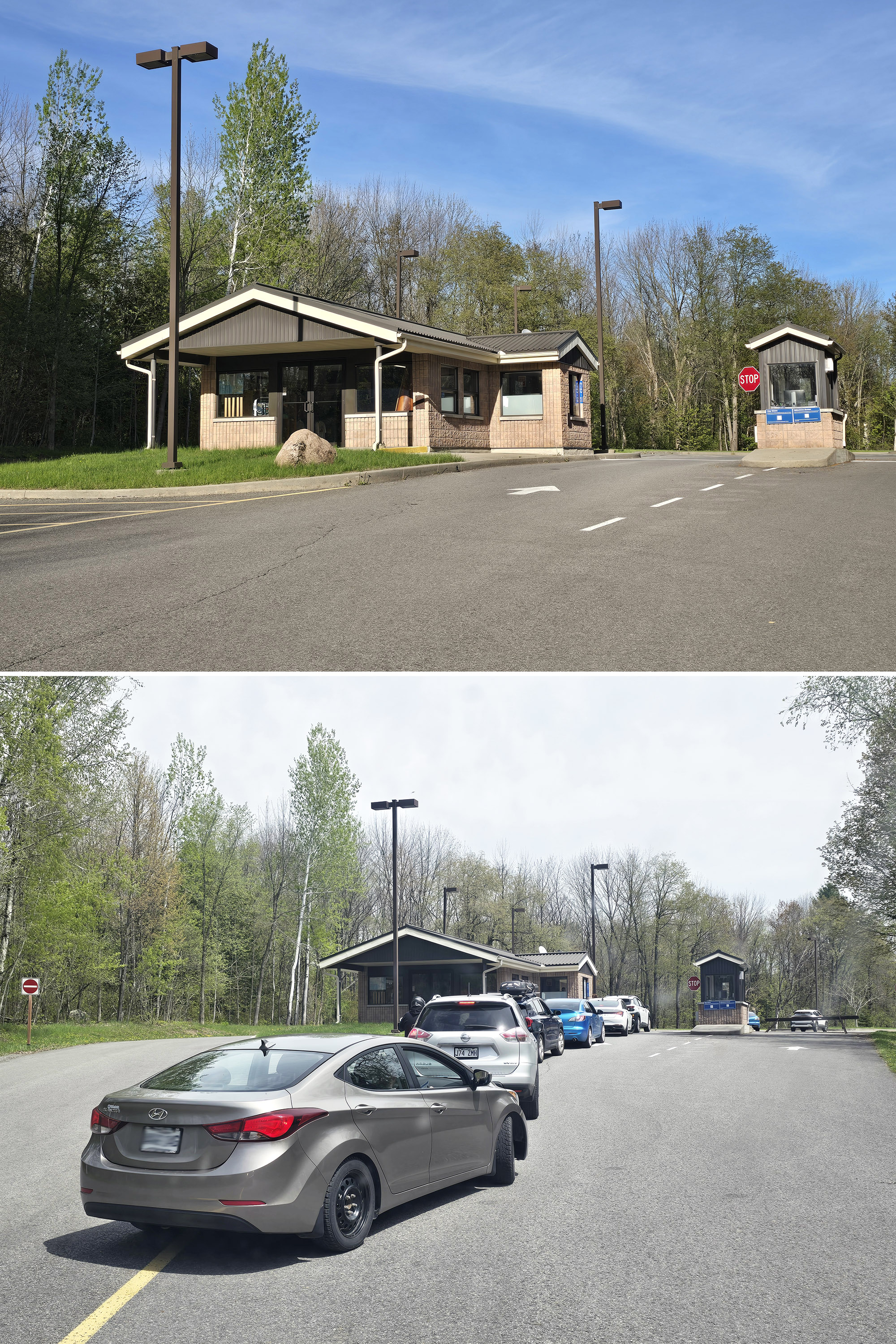
There was actually a long line at the gatehouse, and it was NOT moving. We watched as the line behind us grew and grew, with no movement at all.
Eventually they sent a warden out to ask people who’d pre-registered to drive through on the right - there was an unstaffed kiosk there.
We ended up having to go through the check in window anyway - it’s window service - as we needed maps.
Not sure why they didn’t have a staff member with maps in hand doing exactly what the warden was doing, earlier on - it would have fixed that mess, quickly!
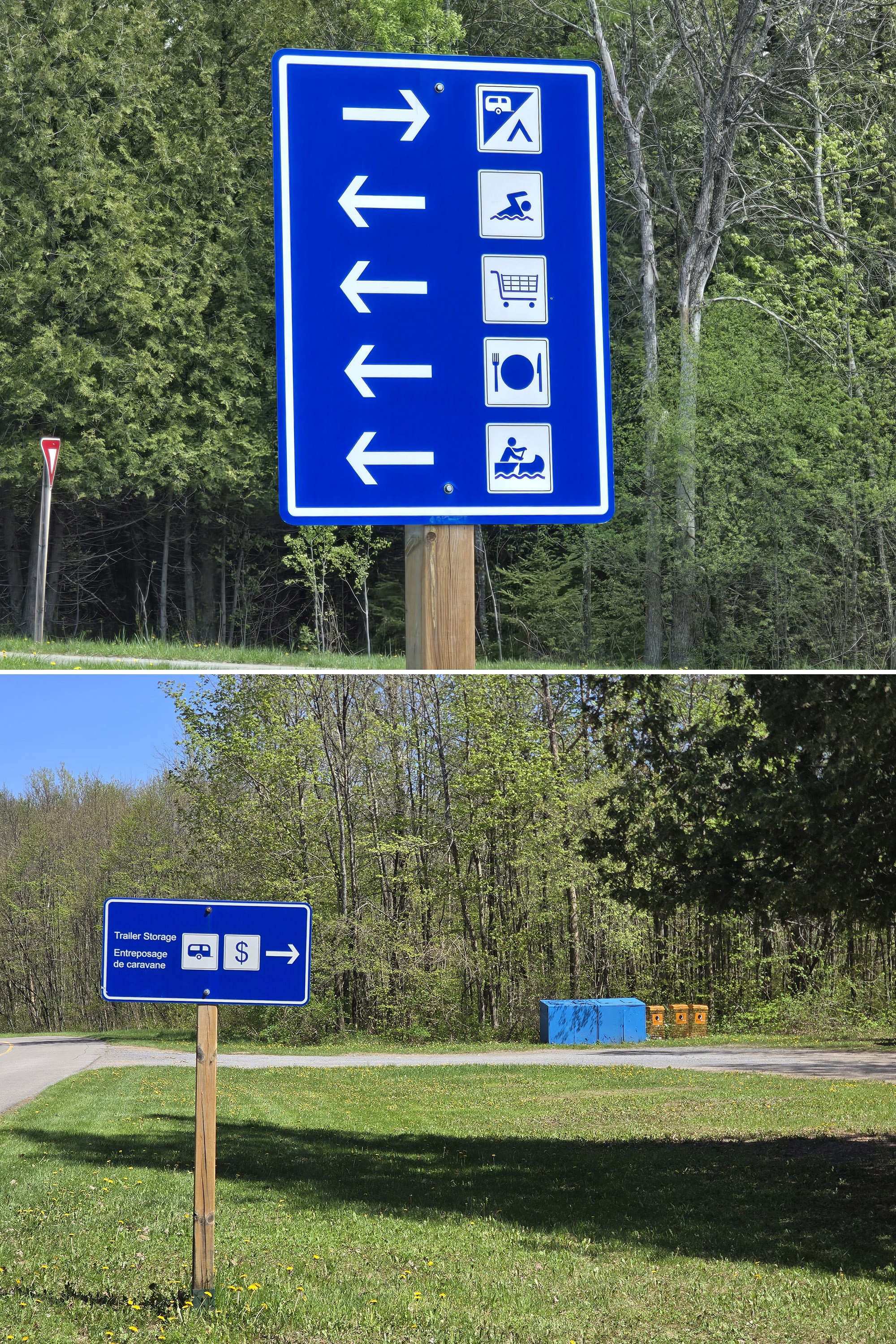
Maps and Signage
Between map issues and signage issues, Voyageur Provincial Park can be incredibly frustrating to find your way around in, before you get the lay of the land.
I could rant for days on this, but I’ll try to condense it down to a bit of an overview:
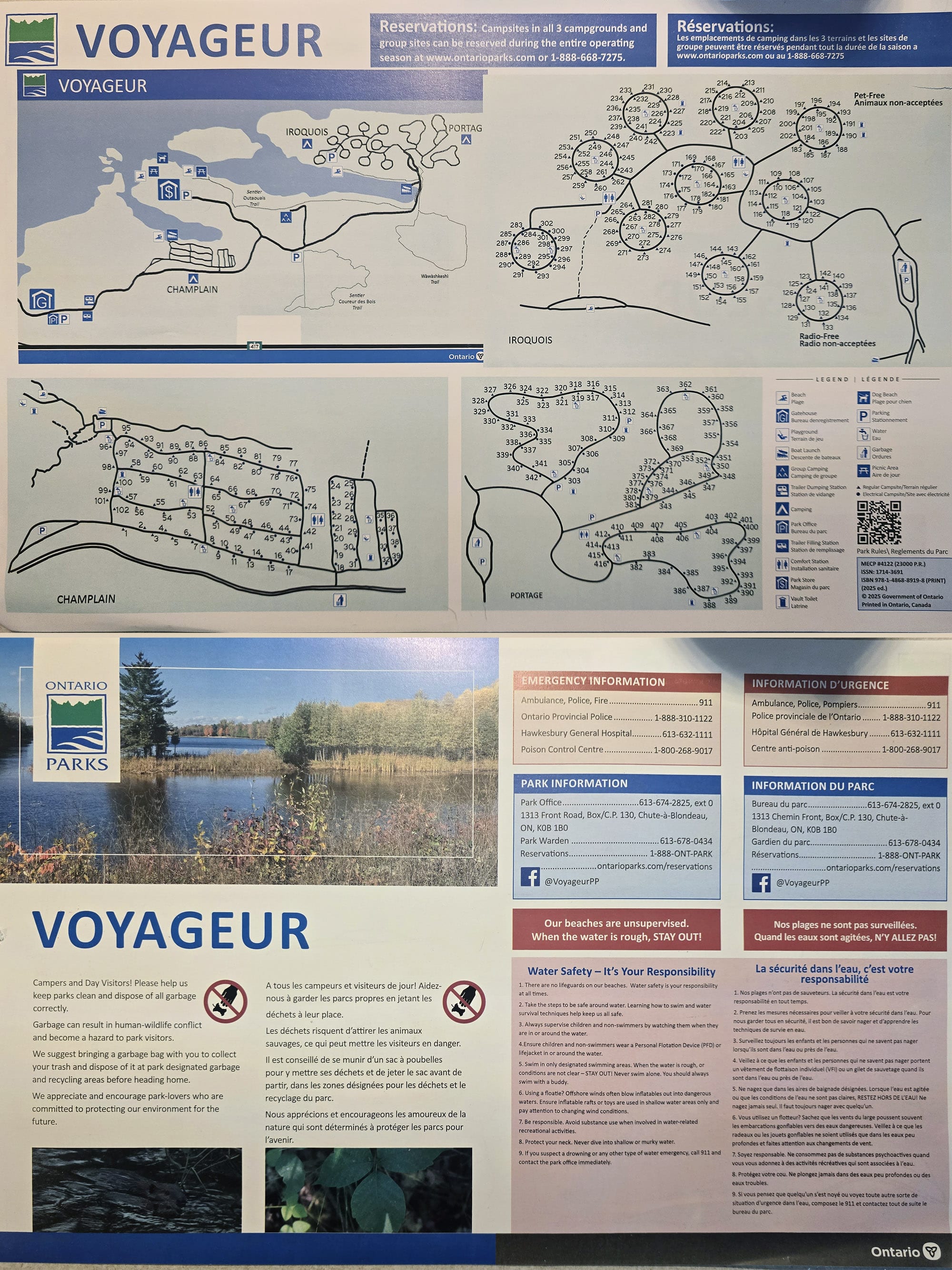
Park Map
The park map was the 11 x 17, full colour glossy handout that a lot of parks utilize. One side has some information - including emergency contact phone numbers - while the other side is dedicated to the maps.
At first glance, the map was OK enough - there was a lot of information represented, with a single overview of the whole park, then 3 smaller maps to highlight the campground areas.
There was no scale on any of the maps, no colour coding at all (it’s a full colour map!), and accessible information was not on the map at all.
I suspect the scale might have been a bit weird anyway - the 1.5 km loop trail was drawn about the same size as the 3.6 km loop trail.
Colour coding is especially nice for the few trails in the park, and not having the barrier-free facilities listed on the map usually ends up being a bad sign for the park. Information is an accessibility issue!
Once we had explored the park, it was obvious that the map was old and desperately in need of updating. A few things we noticed:
1. There’s a trail right before the actual camping section of Champlain Campground, as you’re coming from the front. That appears to be the only way to the Champlain campground beach, but it’s not represented on the map.
2. The trail to that beach that IS represented on the map (near the boat launch) is gated and blocked off - it looks like there was a bridge there at some point that washed out or something. This does not look to be a particularly new or temporary situation.
3. There are multiple roads that aren’t shown on the map, AND have no signage at all. We made a couple wrong turns on account of things like “take the next turn on the right”.
4. The playground shown as being in the far end of Champlain campground does not exist in reality.
5. There’s a whole section of the park - very popular during our stay - that wasn’t even on the map. It looks like kind of an abandoned rail trail section near the far boat launch, overlooking a section of water that’s secluded from the river itself. It was a popular fishing spot, but yeah - not on the map!
6. The Outaouais Trail - heading from the boat launch towards the day use area - is wildly misrepresented on the map. I’ll get to this a bit in signage, and more in the hiking section.
7. The comfort stations are shown on the map using the same symbol that’s generally used for outhouses at most parks - without symbols for shower/laundry/etc.
There aren’t a lot in the way of outhouses at Voyageur - and they have a different symbol - but it made looking for the comfort stations on the map a little ... odd. I actually missed the fact that there was a second comfort station in Iroquois, until we literally drove past it.
Signage
Much like with maps - and usually as an interconnected issue - the directional signage at Voyageur Provincial Park is definitely lacking.
Again - something with enough instances for its own post, but I’ll try to condense it down to the highlights.
1. The basic signage isn’t great. Exits from the main road are generally only signed in one direction. If you’re coming from the front of the park, that’s more or less fine... if you’re heading forward from one of the back two campgrounds, not so much.
2. What main road - and campground - signage does exist, is usually really small. It’s still the high contrast, blue/white type, but small signs with small type. Some of them, you have to be right on top of it to read... and that’s coming from someone with fantastic eye sight!
3. That presumed rail trail section I mentioned under maps had NO signage from the road.
Best we can tell, the actual trail doesn’t go down the main road at all (As depicted), but follows the water, from the rail trail section itself. Not so much as a trail blaze to set you on the right path!
5. There’s a garbage and recycling depot across from the Champlain Campground, where the only signage from the road that points to it says “Trailer Storage Area”. (A feature that’s not on the map, btw). That sign only faces the front, too.
6. This is more of an accessibility issue - and we’ll get into that more in a bit - than a directionality issue: Most of the accessible showers/washroom stalls were not labeled as such on the doors.
Really, the longer we were at the park, the more annoying the signage situation was.
Waste & Water Services
The Trailer Sanitation Station is located near the beginning of the park, before any of the campground entrances.
On the way into the park, the fill station is located right on the side of the road, on a little pull-off lane. The fill pedestal is located on the driver’s side.
The hose had a weird splitter that goes to a threaded connection and then also splits off to another food grade hose that was not threaded. It looks really janky but see seems to prevents the hose ends from touching the stand - so that's good!
Anyway, the dump station is located on the opposite side of the road - so it’s a pull off to the right, when you’re headed OUT of the campground.
You can access it when coming into the park as well, but it’s a fairly tight u-turn to the left to do so.
It’s a single dump platform on the driver's side.

Tow 2: Fill Station
One was in front of the entry to the Iroquois and Portage campgrounds, the other was across from the Champlain campground - but on the main road.

Connectivity
We had pretty good cell reception throughout the park.
At our campground it was good enough to be able to stream TV, no problem.
At one point the cell signal seemed to get a little bit wonky - further out in the Iroquois campground - but that might have been an app issue rather than connectivity issue, as it didn’t happen again.
Accessibility
Woof. Where to start with this one? I guess let’s break it down in sections:
Barrier-Free Information
First of all - as previously mentioned - the park’s map doesn’t have any accessibility information denoted on it at all.
The park’s website mentions the comfort stations and registration office as being barrier-free, and that there are two barrier-free campsites in the Champlain Campground. That’s it.
As mentioned earlier, almost none of the accessible facilities are marked as being so, on the actual facility. I’ll get more into the specifics of each comfort station and such in a minute, but for the most part? You’ll be opening different shower doors to find the accessible one.
If they can mark the door as being a shower in the first place - and go to the effort of installing the barrier-free accoutrements - why not slap a disability symbol on the door?
It’s an especially crappy omission, what with there being no accessibility symbols on the map, to start with!
Barrier-Free Facilities
Each of the comfort stations has a single designated disability parking spot. While they may not be labeled from the door, each one has barrier-free facilities:
The larger Champlain comfort station has a wheelchair accessible shower with a toilet in it. There is also a wheelchair accessible stall in the multi-stall washroom there.
The smaller, second Champlain comfort station has one of the two showers (on the side with the women’s washroom) as being accessible. There’s a single stall wheelchair accessible washroom on the other side of the building - the multi-stall washroom does not have a wheelchair accessible stall.
The Portage campground comfort station has one wheelchair accessible shower, not marked - it’s the middle one. There’s also a single wheelchair accessible stall in the washroom, also not marked - it’s the one closest to the sinks.
The first Iroquois campground comfort station - when going into that campground - has a single wheelchair accessible shower. Again, not marked on the door - it’s the middle one. There’s also a single wheelchair accessible stall in the multi-stall washroom, unmarked - the one closest to the sinks.
The second Iroquois campground comfort station - near the beach - has an unmarked accessible stall in the main washroom (closest to the sinks), and a separate, single-stall wheelchair accessible washroom with its own door from the outside. The 3 showers were not marked as being accessible, the accessible one is the one next to the (marked) barrier-free washroom.
As a note: Aside from the larger comfort station in Champlain, none of the barrier-free showers had handheld showerheads/hoses.

Row 2: Smaller Champlain Comfort Station
Row 3: First Iroquois Comfort Station, Portage Comfort Station
Row 4: Second Iroquois Comfort Station
The larger washroom building is next to the Park Store, it has a single wheelchair accessible stall at the far end of the toilet stalls.
Beyond all of that... none of the outhouses appeared to be barrier-free. We didn’t see all of them, though - this is why marking them on the map is important!

Row 2: Park Store
Row 3: Electric Barrier-Free Site, Non-Electric Barrier-Free Site
Barrier-Free Camping
I had to look at the reservations page and start a mock reservation to find out which the barrier-free sites are: They are site #50 (Electric) and #53 (Non-Electric).
Both sites had a regular fire pit - not the vaulted or tall kinds that a lot of barrier-free sites tend to have - and a regular picnic table.
Weirdly, the picnic table top was painted blue on site #53, but not site #50. There was a blue top one in the site next to it though, so I guess someone swapped them for some reason.
The blue top - or benches, in some cases - usually marks the picnic table as being the wheelchair accessible type, with the table top extending off one side. These... weren’t that style.
Anyway, then non-electric site is right across from the main comfort station in the Champlain Campground, while the electric site is across a road and two sites down from it.
Barrier-Free Activities
None of the trails were wheelchair accessible. For those with other mobility issues:
Coureur Des Bois: Has some steep areas, probably not great for those with mobility issues.
Outaouais Trail is probably ok to do in a boot, as long as the ground is dry at the time.
Wawashkeshi Trail would be really easy, if not for a big hill at the beginning. If you can make it past that, you’re all good.
... we’ll get into more specifics in the hiking section, though.
As far as the beaches go, none of them had MobiMats at the time if our visit. Given the setups of each - and the way the park is almost aggressively awful about accessibility - I doubt that’s a seasonality thing.
The Iroquois campground beach is probably wheelchair accessible, but doesn’t have designated parking for disabled people. The short trail to get to the beach (about 100m) is flat with well-packed gravel most of way. It ends at a lawn that’s not super well-kept, but should be traversable. The sand there was the hard pack, easy to walk on type.
The two day use beach areas have some designated parking. Some of those parking spots - in the lot to the right, as you approach the area - are completely grown over with tall grass. Both beaches are located across unkept lawn and down a bit of a hill.
The dog beach - if it exists - is definitely not wheelchair accessible. More on that whole thing, next.
Finally, the Champlain campground beach is only accessed via a 350 m long trail. It’s wide and flat, should be wheelchair accessible. It also ends at unkept grass, which gradually transitions to the actual beach.
The Park Store has a ramp up to it, so getting some ice cream is a barrier-free activity!
Pets
As always, the usual Ontario Parks rules apply - dogs are welcome, but need to be leashed and under control at all times. They can’t be left unattended or allowed to harass other campers - or wildlife - and must be picked up after.
They’re not allowed on any of the swimming beaches, but there’s a dog beach... in theory.
It exists on the map, but there is absolutely no signage anywhere, so far as we could tell.
After unsuccessfully hunting for it, we asked a park employee... who seemed surprised to hear that there was a dog beach and had to consult the same map we were working from.
As pictured, it’s located between the two day use beaches. There is a spot with a little, locked building that has a dog symbol on it... but it’s adjacent to one of the main beaches... that has signage saying no dogs.
On the other side, there’s something that COULD be a dog beach, but there was no access to it.
A little way past that - headed towards the second beach - there was a clearing with a large cement pad. Heading to the water in that area brought us to the spot that we figure must be the dog beach.
Signage would be nice!

Parking
The day use area had a ton of parking. One whole section of it looked to not get much use - or attention - at all, and was pretty overgrown with grass and weeds.
Maybe it’s different in the summer, but it didn’t get too busy on the May Long weekend, even when it got hot (20+) and sunny.
None of the trailheads - aside from where Outaouais hits the day use parking - had much in the way of parking.
We actually had a rough time getting out of the Coureur des Bois parking lot after Porter’s hike - too many cars!
The campsites, in theory, should have had plenty of room for parking. For some reason, it seemed like most of the campground was parked partially out in the road.

Miscellaneous
A couple random bits of info:
1. Voyageur Provincial Park is in an area with a high amount of overall light pollution. It’s situated between Ottawa and Montreal, and very solidly in the yellow zone for Montreal’s light pollution.
There’s also some red right north of the park, so it’s just not going to be a great place for night sky viewing, or seeing the aurora borealis. (Unless it’s a WILD show, like some we got in 2024 and 2025!.
2. The main road through the campground is not in great shape - there are some pretty significant bumps and dips along the way, especially toward the front of the park.
Bad enough that THEY were marked with bumpy road signage - and in this park, that’s saying something!

Bottom: Second Iroquois Comfort Station Playground
Campground Amenities & Info
Some basic information on the amenities at Voyageur Provincial Park:
Creature Comforts
There are 5 comfort stations among the 3 campgrounds - two each in Champlain and Iroquois, and one in Portage. Weirdly, there are different laundry prices across them!
There are also washroom buildings (1 large, 1 smaller) at the day use area, and a few outhouses sprinkled around the park.
Here is everything you could possibly want to know about the washroom and shower situation at Voyageur Provincial Park:
Champlain Comfort Station #1
This is the main comfort station for that campground, in the middle of the larger area of campsites.
It has 5 showers (1 is barrier-free), 2 multi-stall gendered washrooms, and a laundry room.
Weirdly, the light did not come on in the laundry room while I was there - and I couldn’t find a switch. Sorry for the photos - I don’t usually have to use flash!
Anyway, the laundry room had 2 washers and two dryers: $2.25 wash, $3.50 dry.
Champlain Comfort Station #2
This is a smaller comfort station, between that main block of campsites, and the smaller loops off to the side.
It has 2 showers on one side of the building, along with a small, multi-stall women’s washroom. One of the two showers is barrier-free. On the other side of the building is another shower and the men’s washroom.
The laundry room in this comfort station is really small - like a closet. It’s $3.50 wash , $3.50 dry.

Row 3 & 4: Smaller Comfort Station
Iroquois Comfort Station #1
The first Iroquois comfort station - as in, the first you come to, when headed into that campground is REALLY old looking.
The 5 showers (1 accessible - it’s the middle one) aren't as nice as in the other ones. The washrooms are both the multi-stall gendered washrooms, and there is no laundry room in this one.
There’s an unmarked door with a dishwashing station, and a playground outside.
Iroquois Comfort Station #2
This comfort station is located just before the campground beach.
It has the two gendered, multi-stalled washrooms, as well as a separate, single-stall accessible washroom. There are 3 showers - one accessible - as well as a small laundry room. ($3.50 wash, $3.50 dry)
There’s also a playground behind this comfort station.

Row 3 & 4: Second Comfort Station
Portage Comfort Station
This one is in an older building, but the facilities were in good condition.
The 2 gendered, multi-stall washrooms run along either length of the building, with doors at both ends.
On one side of the building is a set of 5 showers (middle one is accessible), and the other side has the laundry room.
This one is the biggest, nicest laundry room in the park, with a decent size folding table and a dishwashing station. The laundry machines there were $3.50 wash, $3.00 dry

Day Use Area Washrooms - Large Building
This one is located next to the Park Store. I figured it was a change room building, what with all the beaches nearby, but it was just a couple of the gendered, multi-stall washrooms.
Day Use Area Washrooms - Small Building
This one is located in that first parking lot as you’re heading into the day use area. It’s a small, 6 stall building, each with its own door.
Two of the stalls are wheelchair accessible, though not marked as such - one on each side of the building, the stalls closest to the parking lot.

Row 2: Smaller Day Use Washroom Building
Row 3: Outhouses
Visitor Centre
There is no Visitor Center at Voyageur Provincial Park. There’s what appears to be an abandoned amphithreatre, but you have to kind of happen upon it - it’s not on the map.
Park Store
The Park Store was a high point for us, during our stay.
Unlike a lot of the other facilities and general grounds, the park store was clean, well-maintained, and really well stocked.
A decent selection of grocery items, big bags of charcoal - always nice to see - beach stuff like flip flops and beach toys, general camping supplies, beverages, and a fair amount of snack foods.
They also had a small coffee bar, a freezer of various ice cream treats, a full scooped ice cream bar (with sprinkles, even!), and slushie machines.
We ordered some scooped ice cream, and the super friendly employee was adorable with the up-sell. We’d ordered the small, and she mentioned that it’s $5 for one scoop, or $6 for 2.
We also grabbed a bag of cheese curds at the checkout - when near Quebec, you kinda have to. They were nicely squeeky, too!
Note: While they used to have a selection of hot foods (burgers, hot dogs, fries, sandwiches, etc) being served out of there, they discontinued that for 2026.

Day Use Area
There’s a large day-use area, more or less in the center of the park.
There are two distinct sections, each with its own parking lot, washroom building, picnic area, and beach - but you can walk from one to the other.
Kind of in between the two sections is a separate small section out of the side, with a large cement pad - we figure it must have been a picnic shelter, at some point.
Anyway, in that little area, there’s a really BIG grill.

Rentals
The park’s website - and signage in the day use area - mentions a rental facility... but we did not see it.
Apparently that’s where you can rent canoes and kayaks out of. I wonder if they have a temporary set up - maybe a tent or something - in the main camping season?
Anyway, aside from the watercraft rentals, there’s a “large group barbeque” available to rent as well - probably the one I mentioned in the last section, though it definitely seemed like an abandoned, forgotten relic more than anything.

Campsite Details
There are two ways to camp at Voyageur Provincial Park: Car Camping, and group camping.
Car Camping
There are 3 campgrounds at Voyageur Provincial Park, with very different vibes and layouts. These are:
Champlain Campground
This one is located closest to the front of the park, and seems to be the most RV-Friendly campground. It’s VERY packed - with very little privacy at all.
The main section is pretty heavily treed, but the set of loops at the far end of it are a bit more open - kind of have a trailer park vibe. I wonder if that’s where their seasonal sites are?
Anyway, the sites we saw in this section seemed to be relatively flat - certainly nothing like Murphys Point Provincial Park - but you’ll probably want to have some levelers / stabilizers on hand anyway.
Of note: There are some cute waterfront sites here!
Iroquois Campground has in interesting set up - it’s a set of 10 campground loops, each on its own spoke from the main campground road.
Each one is basically a circle, with about 20 campsites located along both the inner and outer sides of the road.
We didn’t visit all of the loops, but the ones we did check out seemed to be quite cramped, with very little privacy. Also, this section of the campground was the WORST for people encroaching on the road.
Some are entirely electrical sites, others are entirely non-electrical, some are a mix. One campground is designated as radio-free camping, another is for dog-free camping.
Portage Campground
The Portage campground is a set of several big loops, these sites seem to have better privacy than those at the other two campgrounds.
Like the Champlain Campground, this one is better suited for larger RV rigs, than Iroquois is.
Some of these sites are cute waterfront sites, and there are several sets of double sites, as well.

Group Camping
The group campground area is at the end of its own road, off the main road. 5 sites are sprawled across an open are, with 4 of them being good for up to 100 people each, and the fifth being for groups of less than 50 people.
Each site has outhouses and water taps nearby.
One thing to note: It’s not obvious where each site starts and ends, and there isn’t any privacy between them, either.
Possibly a good thing if you’re looking to book for several hundred people, but I doubt many people are looking to do that!

Share the Love!If you’ve made one of our recipes, be sure to take some pics of your handiwork! If you post it to Bluesky, be sure to tag us - @2NerdsInATruck, or you can tag us on TikTok, if you’re posting video. We're also on Pinterest, so you can save all your favourite recipes and park reviews to your own boards! Also, be sure to subscribe to our free email newsletter, so you never miss out on any of our nonsense. Well, the published nonsense, anyway! |
Entertainment and Activity
Here is some information on the recreational activities you can engage in at Voyageur Provincial Park:
Hiking
I was happy to see that 2 of the 3 trails in the park were marked as being relatively easy hiking trails! As it turns out, I hit a flare the day we arrived - and Porter ended up doing all of the trails himself.
Here’s what he had to say about them:
Coureur des Bois Trail: 1.5km Loop, Easy - Moderate
“The trail starts out fairly narrow and flat, and it winds a bit through the forest a little ways.
It gets a little bit more moderate as you proceed, with some rough footing due to rocks and roots. There are also a few small hills here and there.”

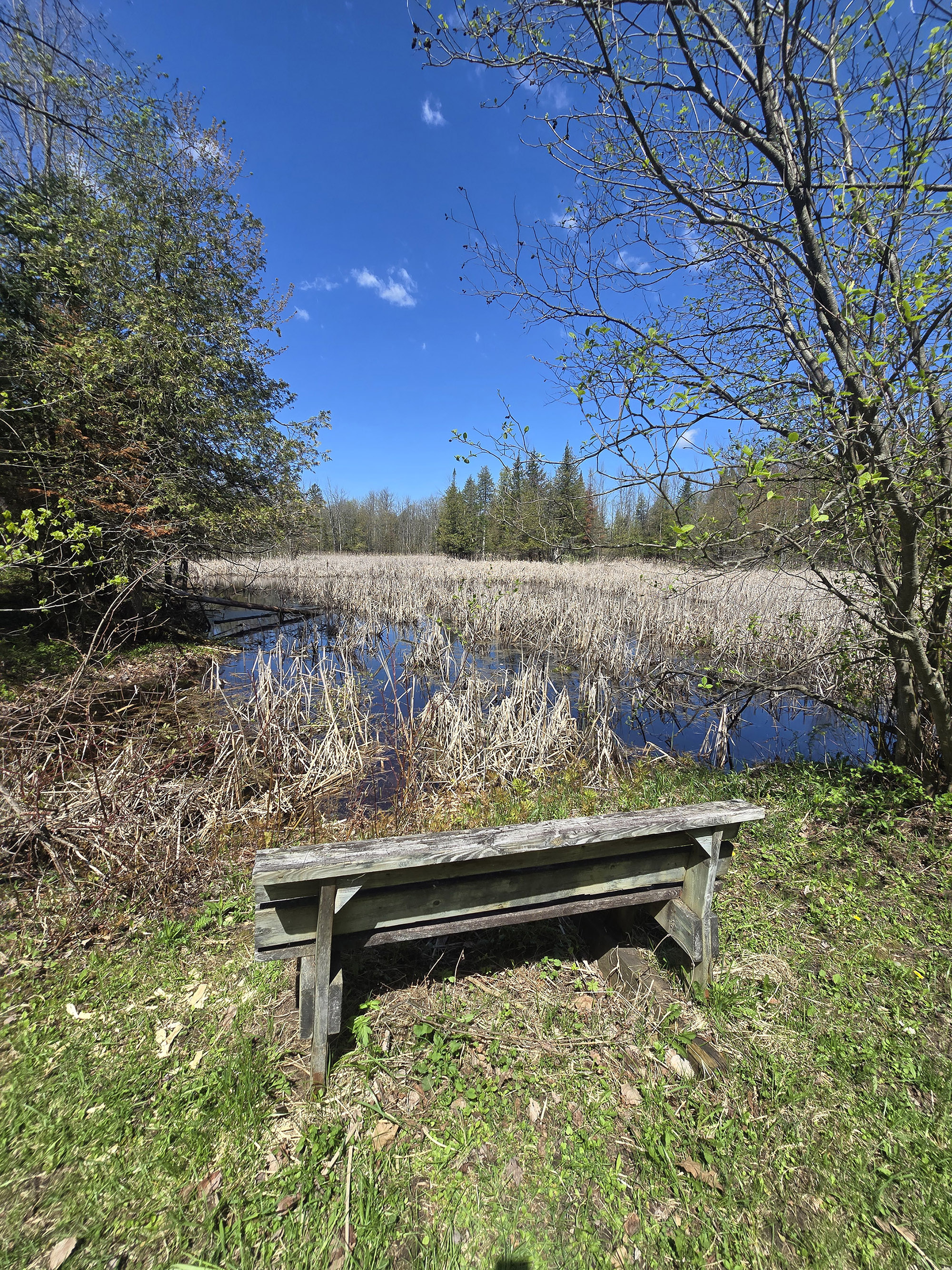
The trail follows along a grassy path underneath some power lines. Some areas of there are pretty flooded out, muddy and gross.
The section of trail under the power lines is perfectly straight, so the path isn't very interesting. There are, however, some really nice views of a marshy area off to the side.
I started my map a bit late and clocked it at 1.8 km, so the map is pretty accurate for this one.”

Outaouais Trail: 2.7 km Linear, Easy
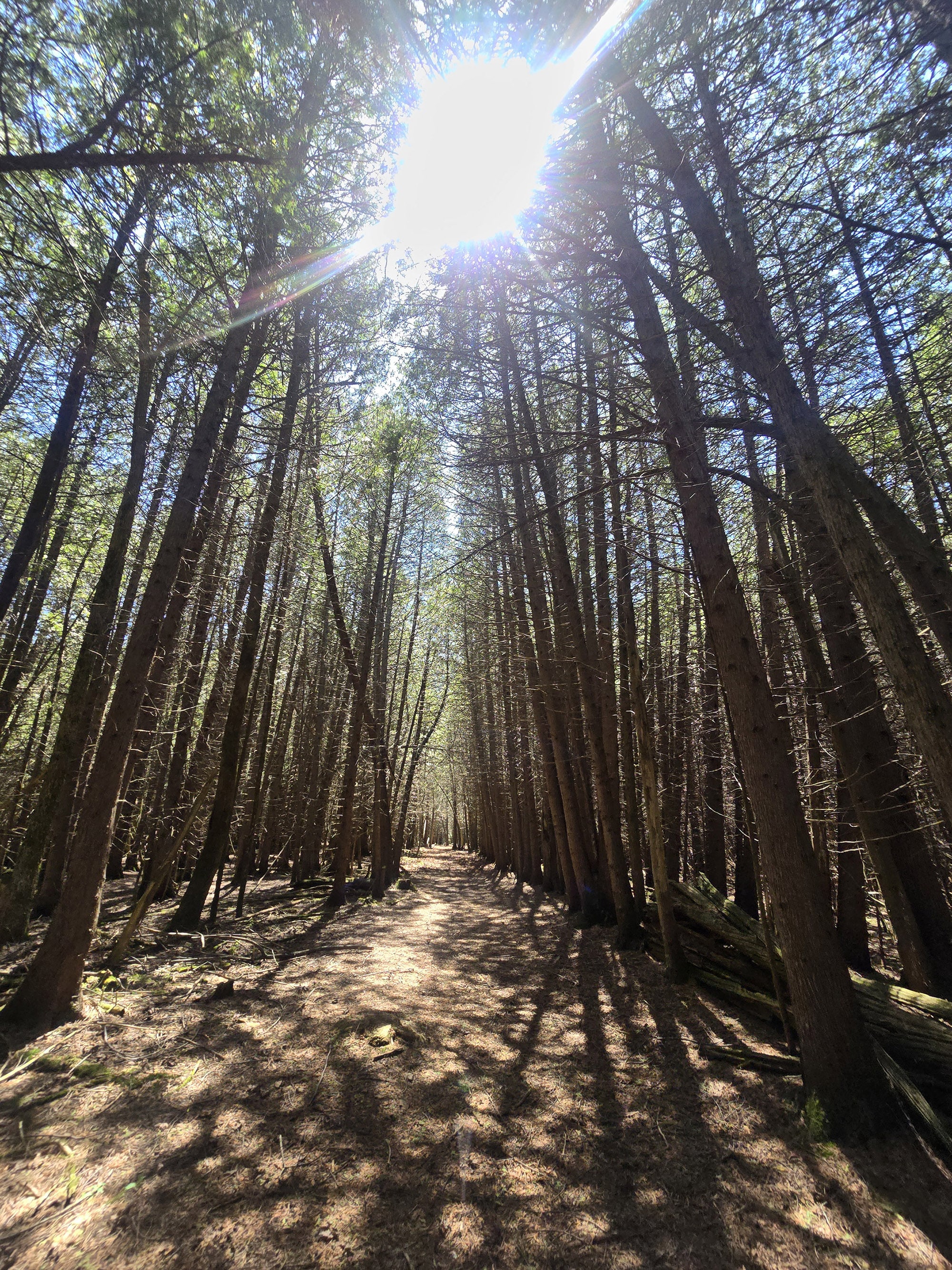
“I started this one at the beach at the Iroquois campground. It's a narrow winding path winding through cedar forest, very close to the shore line.
There is a strip of trees between you and the shore, and you're a bit elevated, so you don't get an amazing view of the water but it's still nice. You pass pretty close to campsites on your left as you proceed. The path is moderate difficulty due to rocks and roots.
One section has steep hills going up to your left, and down and right. You have to be a bit careful but overall it's still on the easier end of moderate.
It's about a half kilometer from the beach to the boat launch area. From there I didn't see a sign indicating where to continue. Looking at the map I followed on to this rocky berm that almost looks like it might have been a railroad many years ago.
Then I proceeded on to follow the main campground road until I saw a trail going into the right. It had a gate that was open and seemed to be the trail, but shortly into the trail it looked like it was abandoned and not maintained at all.”

I figured this was clearly the actual trail. It seems like I missed an entrance to the trail, but it seemed like I was on the right path now.
At that point the trail is very wide and flat, there are a lot of branches on the path but they're pretty easy to navigate.
It was pretty clear it hadn't been mowed in quite a while and it got worse and worse as I proceeded.
I came upon an old amphitheater, which looked abandoned many years ago.
At that point I had no idea where I was. Looking at the map, there's only a small area between the main road and the water, so as long as I kept going in the same direction I knew I had to end up where I wanted to be.
Eventually I met up to a small road and took a right to get closer to the water.
That road met up with the group campsite area - success! I knew the actual trail went past the group campsites.
I did see a trailblaze for the real trail off to the right, so it looks like I was on a completely different - but parallel - trail system.
At this point I continued down to the correct trail. From that point, this trail is also easy to navigate, very wide and flat.”

The trail follows the road for a very short section on a very well-mulched path - nice, wide and dry - next to the marshland.
Alongside the mulch section you can see where the trail used to cross what is now a flooded area of marshland, they've obviously reformed the path on a dry area a bit closer to the road. It's nice to see that they have maintained the trail as needed.
You pass through an almost open field, with a lot of small bushes to the sides of the trail. I'll bet this is a really good spot to see butterflies or warblers in the right time of year.
It was mid-May when we visited and the bushes were just starting to grow leaves. Immediately after that you reach the day use area.
I ended up going 3.3 km on my little adventure walk.
Update
Later on, we found where the trail was actually supposed to pick up.
On that strip of fishing area / looks like rail trail, there’s a downhill trail that does have a trail blaze on it. It was difficult to see from the direction I was coming.
This absolutely does not line up with the map, which shows the trail continuing along the main road for a while before turning into the woods.”

Wàwàshkeshì Trail: 3.6 km Loop, Moderate
“The trail is wide and well packed, very flat side to side. This would make it an easy trail but there are some areas of pretty steep elevation change - one steep hill in particular - which makes this a moderate difficulty trail.
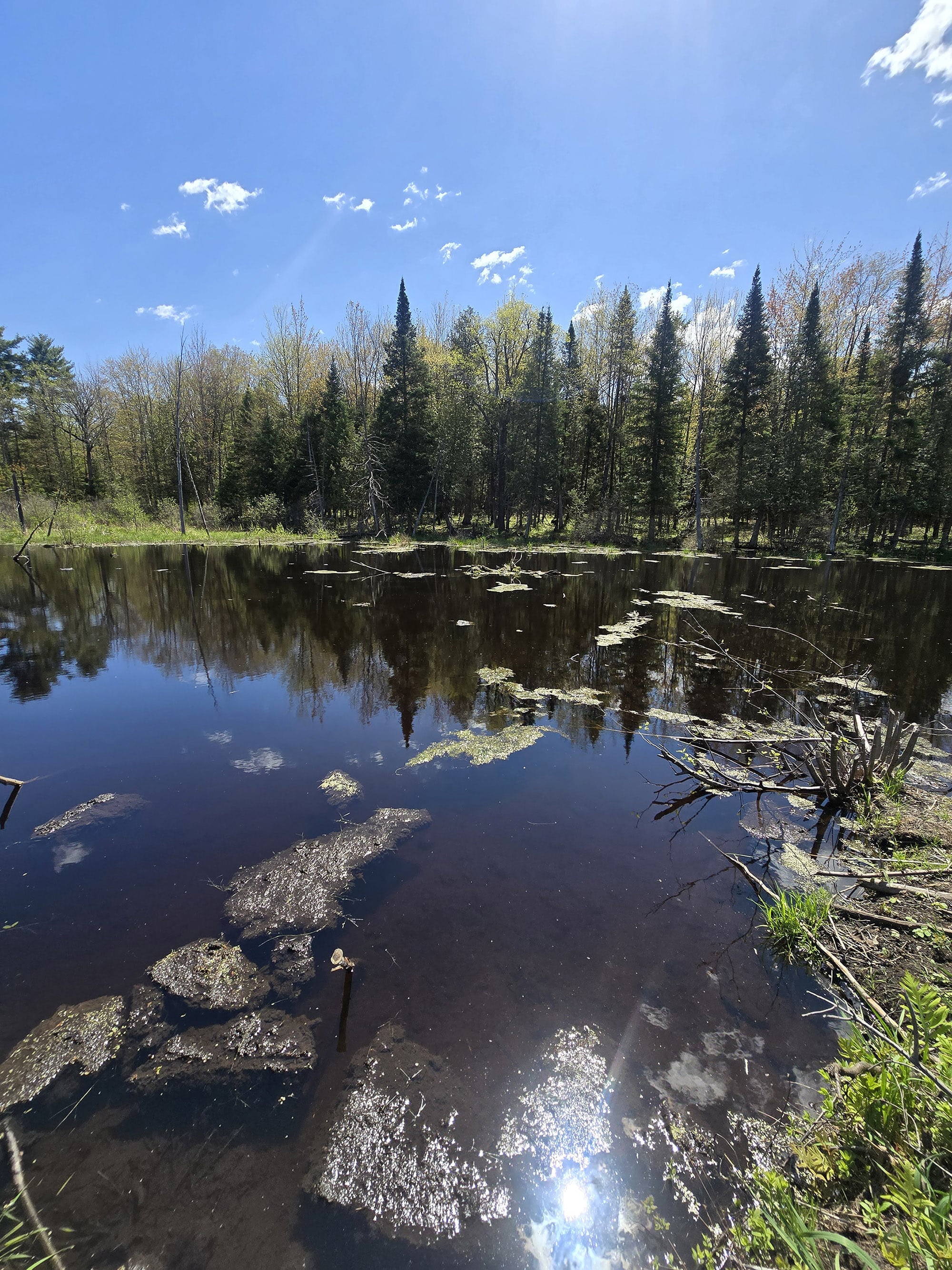
It's very visually interesting, with a dense evergreen forest that you travel through, and next to the marshy areas, then deciduous forest.
There are trail blazes on the trail guiding you. There seem to be some old trails that are not in use anymore, the main trail is well blazed to direct you in the correct direction.
Some of the trail walks along a short stone fence, and wood fence in a couple of sections. It feels like we might be on the border of the Provincial Park.
Further in, I figured this must have once been farmland because there are large portions that are very flat with very young trees. Perhaps those old stone walls were previous owners' marking of their land.”

It easily could be a cross country ski trail, but I didn't see any markings to indicate this. There are only a few somewhat short sections that are pretty steep. If you can deal with those, it's an easy trail.
Near the end of the trail you're walking along a barbed wire fence and there's a sign that says it is the wastewater lagoon.
The barbed wire fence feels very unfriendly, unwelcoming. It's kind of unfortunate that the trail loop ends at this scene.
I clocked the trail at 3.6 km”

Biking
There are no dedicated biking trails at Voyageur Provincial Park, but campers are welcome to go cycling on the campground and park roads.
The campground roads are probably best for kids, the long main road through the park was popular for adults.
It’s a pretty long road, from the front office to the Iroquois Beach - about 5 km.

Swimming
There are 4 beaches at Voyageur Provincial Park: One in the Champlain Campground, one at the end of the Iroquois Campground, and 2 more at the day use area.
They’re all... beaches. Generally sandy, opening out onto still water. Not amazing, not outwardly offensive, nothing to really write home about, TBH.
The water was fairly murky during our stay, and some of the beaches had a fair amount of debris on shore. Just not a super attractive option for swimming, IMHO.
The day use beaches are both much closer to their parking areas, just across a bit of lawn - no paved or trail access to either.

The Iroquois campground is about 100 m down a trail from the parking lot.
It’s a decent sized sandy beach, after crossing some grassy area. Not much gravel, though it might have some degree of clay content, from the texture we experienced.

Birding, Wildlife, and Nature
The birding was actually the highlight of our stay at Voyageur Provincial Park.
While there were some varied habitats, most of our action was either in our campground (our campsite itself was LIT) or along that little “rail trail” type fishing area.
For the most part, this was another case of us hearing a lot more than we actually saw - they mostly stayed far up in the tree canopy - and seeing more than we could actually get decent photos of.

Row 2: Blue Jay, Broad-Winged Hawk, Canada Goose
Row 3: Chestnut-Sided Warbler, Chipping Sparrow, Common Grackle
Row 4: Common Tern, Double-Crested Cormorant, Eastern Kingbird
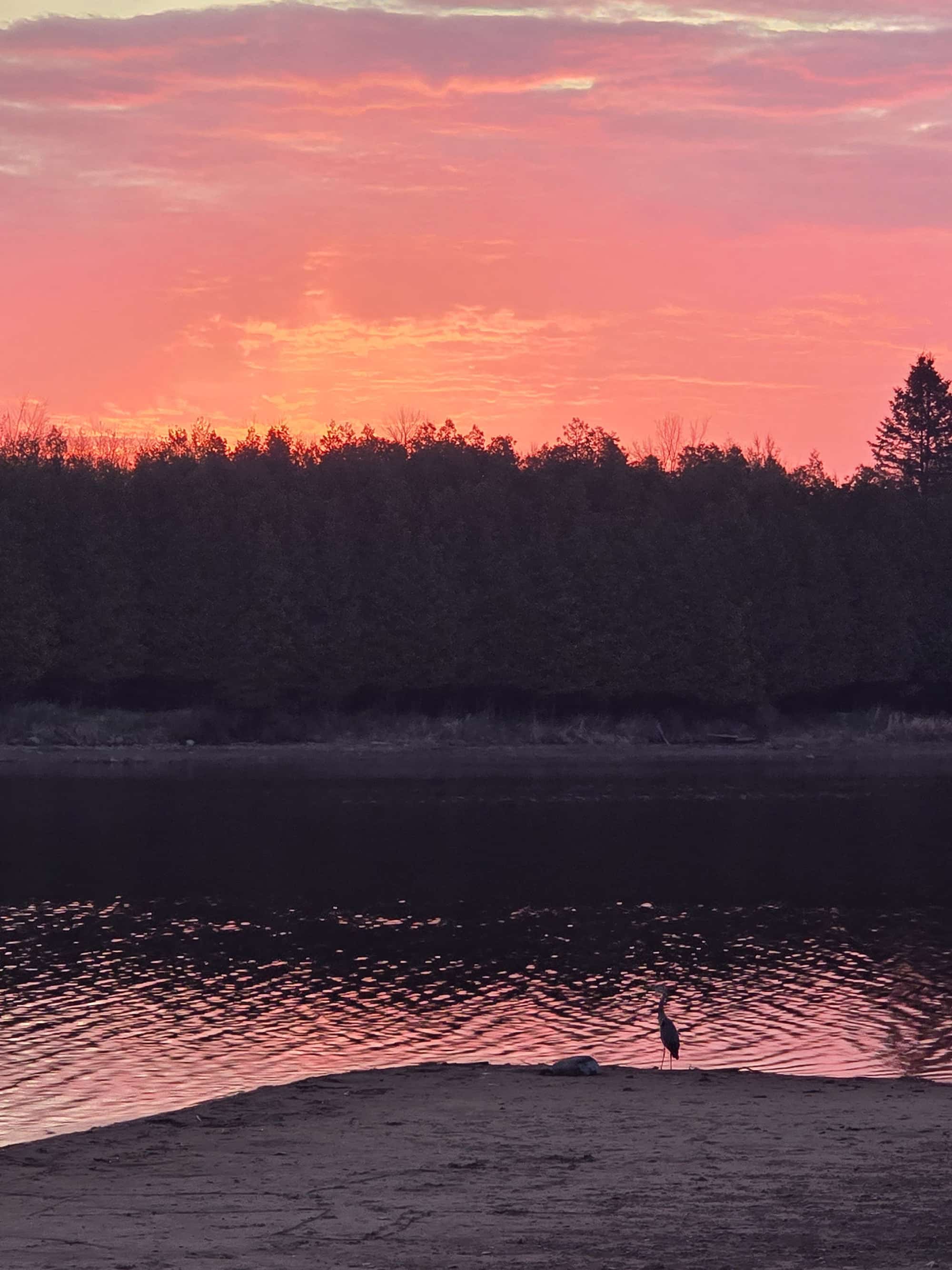
Row 5: Eastern Phoebe, Eastern Warbling Vireo, Great Blue Heron
Row 6: Great Crested Flycatcher, Greater Yellowlegs, Killdeer
American Crow, American Goldfinch, American Pipit, American Redstart, American Robin, Baltimore Oriole, Bay-Breasted Warbler, Blackburnian Warbler, Black-and-White Warbler, Black-Capped Chickadee, Black-Throated Green Warbler, Blue-Headed Vireo, Blue Jay, Bobolink, Bonaparte’s Gull, Broad-Winged Hawk, Brown-Headed Cowbird, Canada Goose, Canada Warbler, Cedar Waxwing, Chestnut-Sided Warbler, Chimney Swift, Chipping Sparrow, Common Grackle, Common Tern, Common Yellowthroat, Downy Woodpecker, Dunlin, Eastern Bluebird, Eastern Kingbird, Eastern Phoebe, Eastern Warbling Vireo, Eastern Wood-Peweee, Great Blue Heron, Great Crested Flycatcher, Greater Yellowlegs, Great Horned Owl, Hairy Woodpecker, Hermit Thrush, House Finch, House Sparrow, Indigo Bunting, Killdeer, Least Flycatcher, Least Sandpiper, Magnolia Warbler, Marsh Wren, Mourning Dove, Nashville Warbler, Northern Cardinal, Northern Flicker, Northern House Wren, Northern Parula, Northern Waterthrush, Northern Yellow Warbler, Osprey, Ovenbird, Pine Warbler, Red-Breasted Nuthatch, Red-Eyed Vireo, Red-Winged Blackbird, Ring-Billed Gull, Rose-Breasted Grosbeak, Savannah Sparrow, Solitary Sandpiper, Song Sparrow, Spotted Sandpiper, Swamp Sparrow, Tennessee Warbler, Tree Swallow, Turkey Vulture, Veery, White-Crowned Sparrow, White-Throated Sparrow, Wild Turkey, Wood Thrush, Yellow-Rumped Warbler.
The park’s website mentioned Bald Eagles commonly being sighted at Voyageur PP, we didn’t see any. 🙁 Apparently they get Snow Geese in the spring and fall - super cute, but were probably long gone by the time we rolled up!

Row 2: Red-Winged Blackbird (m), Red-Winged Blackbird (f), Ring-Billed Gull
Row 3: Rose-Breasted Grosbeak (f), Rose-Breasted Grosbeak (m), Song Sparrow
Row 4: Spotted Sandpiper, Tree Swallow, Turkey Vulture
Row 5: Unknown Thrush, Veery, White-Breasted Nuthatch
Row 6: White-Crowned Sparrow, White-Throated Sparrow, Yellow-Bellied Sapsucker
Aside from birds, we also saw a few snakes, a Groundhog, A Painted Turtle, a Snapping Turtle, Chipmunks, and some White-Tailed Deer.

Row 2: Eastern Chipmunk, Garter Snake
Row 3: Northern Pike, Painted Turtle
Row 4: Spring Azure Butterfly, White-Tailed Deer
Boating
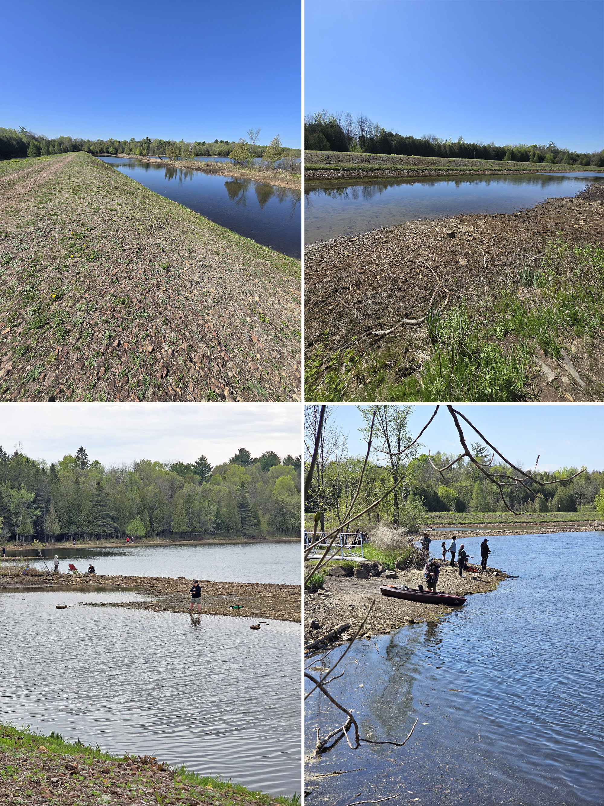
First up, a caveat: I think the water levels may have been low at the time of our stay. We haven’t been to the park before, but some of the views along the shore made us wonder.
If that’s the case, it may have affected what we saw, as far as boating.
Anyway, there are two boat launches in the park - one in the Champlain Campground, and the other just before the Portage and Iroquois Campground areas. Neither one had the docks set up at the time of our visit, they were just laying on shore.
The park’s website says that the Champlain one is better for small boats, and that the other one can handle bigger boats - I would definitely question that second statement.
Champlain Campground Boat Launch
This one has a very narrow approach and a really tight little loop of road to get there. There’s also no trailer parking... anywhere, as far as we could see. Maybe that little parking loop just before the campground, when coming from the main road?
Anyway, it’s an unpaved, very uneven gravel launch down to the river... which seemed awfully shallow.
So much so, that Porter thought it might have been a canoe launch, rather than an actual boat launch.
Iroquois / Portage Boat Launch
This boat launch... was kind of a mess.
It’s accessed via a single lane, downhill road from the main campground road. There’s no trailer parking nearby, so people were parked *everywhere*, including alongside the road.
We went down with our little SUV, and we had a hard time getting around. I can’t imagine trying to navigate a trailer with the “larger watercraft” that this boat launch is supposed to handle!
At one point, the main road was partially blocked by a truck and boat trailer, because they had to get out and walk down the road to see if there was any way they were even getting past the mess of vehicles between them and the boat launch.
Anyway, this one also isn’t paved, and just wasn’t really in great condition either.

Row 2: Champlain Campground Boat Launch
Fishing
The park’s website mentions fishing for Catfish and Barbotte/Bullhead in the spring, with Bass, Perch, Pike, and Walleye being the main fish being targeted in the summer.
People also fish from shore for panfish. I actually had to Google that, thinking that there’s no way that’s a legit name.
I was right - apparently that’s just a catch-all reference to random fish - like Catfish, Crappie, Herring, Sunfish, Yellow Perch - that aren’t any bigger than a pan.
Not sure which of those may be in the area, though!
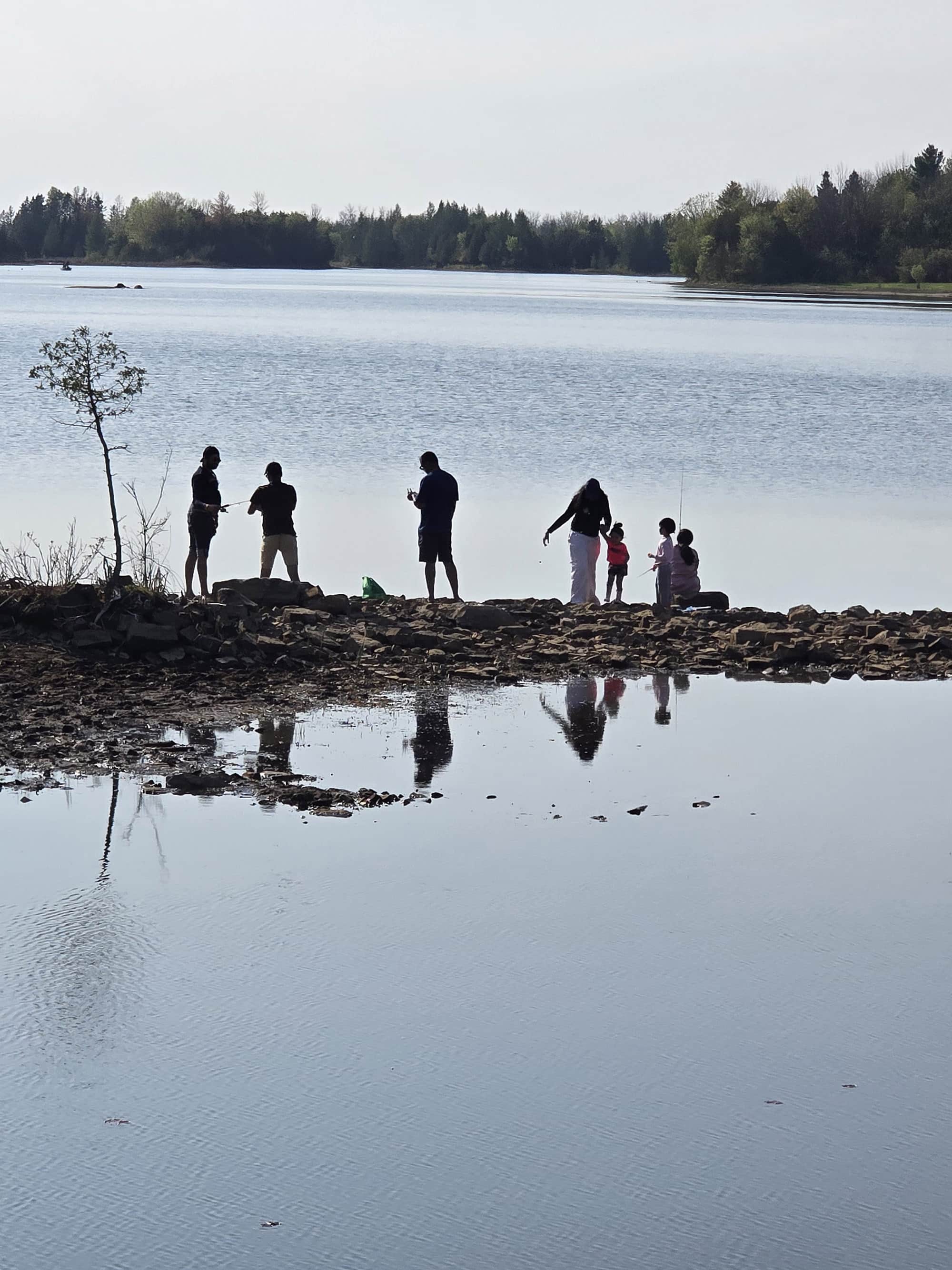
Anyway, while we saw some people out on Ottawa River, fishing from boats... the shore fishing seemed WAY more popular.
As mentioned previously, there’s a stretch of what looks to be an abandoned rail trail, kind of adjacent to the Iroquois boat launch, and running parallel to that stretch of campground road. (You access it to the left of the road down to the boat launch.)
Early on, there’s a trail that goes down and across to the other side of the channel of water below, and people were fishing from both the suspected rail trail, and the kind of sandbar like section across from that bit of water.
There were also people along the actual shore - there’s a trail near the end of the rail trail section, that goes along the water for a ways.
This whole area was really, REALLY popular for fishing, at the time of our stay.
Aside from that area, some of the waterfront sites look to have access to the shores of the Ottawa River, which could be another possibility.
Note: We didn’t see any kind of fish cleaning hut or station in the park, so plan accordingly!
Also good to know: The Park Store sells fishing tackle and worms during the summer fishing months.
Discovery Program
The park runs some sort of Discovery Programming in July and August, but the information on the site is very vague. They also welcome campers to pick up a Discovery Activity Book for individual exploration - throughout the camping season.
I’ve gotta say - the park definitely seems to be sleeping on some historical / thematic activity here.
With a park named “Voyageur” - and at least one of the trails (Coureur des Bois) being named in reference to the historical fur trade... I guess I would have expected something more on that front, you know?
We didn’t see anything like artifacts, displays, or even educational signage. Even the trail named in reference to voyageurs... didn’t mention what the name was about, on the trailhead sign.
Seriously, the most “Voyageur” we saw, was the pot of French Canadian Pea Soup we made, to shoot the recipe for this blog!

Niantic Games
While there is plenty of cell reception to play the games, there aren’t many Niantic Game features located within Voyageur Provincial Park.
There are a couple here and there throughout the park, 3 or so in the day use area... with the bulk of them in the Iroquois Campground area.
Weird to see a campground with more stops than the day use area!
Winter Activities
While the camping season is limited, the park opens up again from mid-December to mid-March for winter day-use activities.
We didn’t see a winter trail map anywhere, but the park’s website says that it has a 10 km set of groomed, track-set cross-country ski trails.
These are set up as a series of 3 km, 7 km and 10 km loops, that are suitable for beginner and intermediate skiiers.
You can also use snowshoes throughout the park - anywhere EXCEPT on the ski trails - but they recommend avoiding going on the ice.
Final Thoughts
This ... was not the park for us.
We started off annoyed over map and signage issues, and that just seemed to snowball, the more we saw of the park.
So much of this park seemed to be neglected, abandoned, and/or just run down or poorly maintained.
It had been open for a week by the time of our visit, and we were visiting over a long weekend - you’d think they could have mowed the main areas in that time, you know?
The connectors on the trailer sanitation stations looking cobbled together, the docks at the boat launches just sort of looking tossed on the shore... it just really ended up being an overall vibe.
Between the weird vibe and there not being a ton for us to do - beyond the birding - it’s not going to end up one of our favourite parks.
Where it’s so out-of-the-way from the parks we DO want to visit again, I doubt we’ll be back.
More Southeast Ontario Provincial Parks & Places to See
Want to read some more about the parks we've camped and at places we've seen in Southeastern Ontario? Here are some more posts!
Southeastern Ontario Campground Reviews:
Bon Echo Provincial Park
Bonnechere Provincial Park
Charleston Lake Provincial Park
Ferris Provincial Park
Murphys Point Provincial Park
Presqu'ile Provincial Park
Rideau River Provincial Park
Sandbanks Provincial Park
Sharbot Lake Provincial Park
Silent Lake Provincial Park
Silver Lake Provincial Park
Winter Camping at Silent Lake Provincial Park
Southeastern Ontario Places to See:
Gariepy Creek Falls
Lake on the Mountain Provincial Park
North Beach Provincial Park
Want to explore beyond Southeastern Ontario? Check out our full list of Campground Reviews, Ontario Waterfalls, and other Places to See.
We also have a ton of Camping Recipes to cook up, while on your adventures!
Thanks for Reading!If you loved this post - or have any questions about it - please leave a comment below! We'd also love it if you would consider sharing the link on social media! |

Leave a Reply