
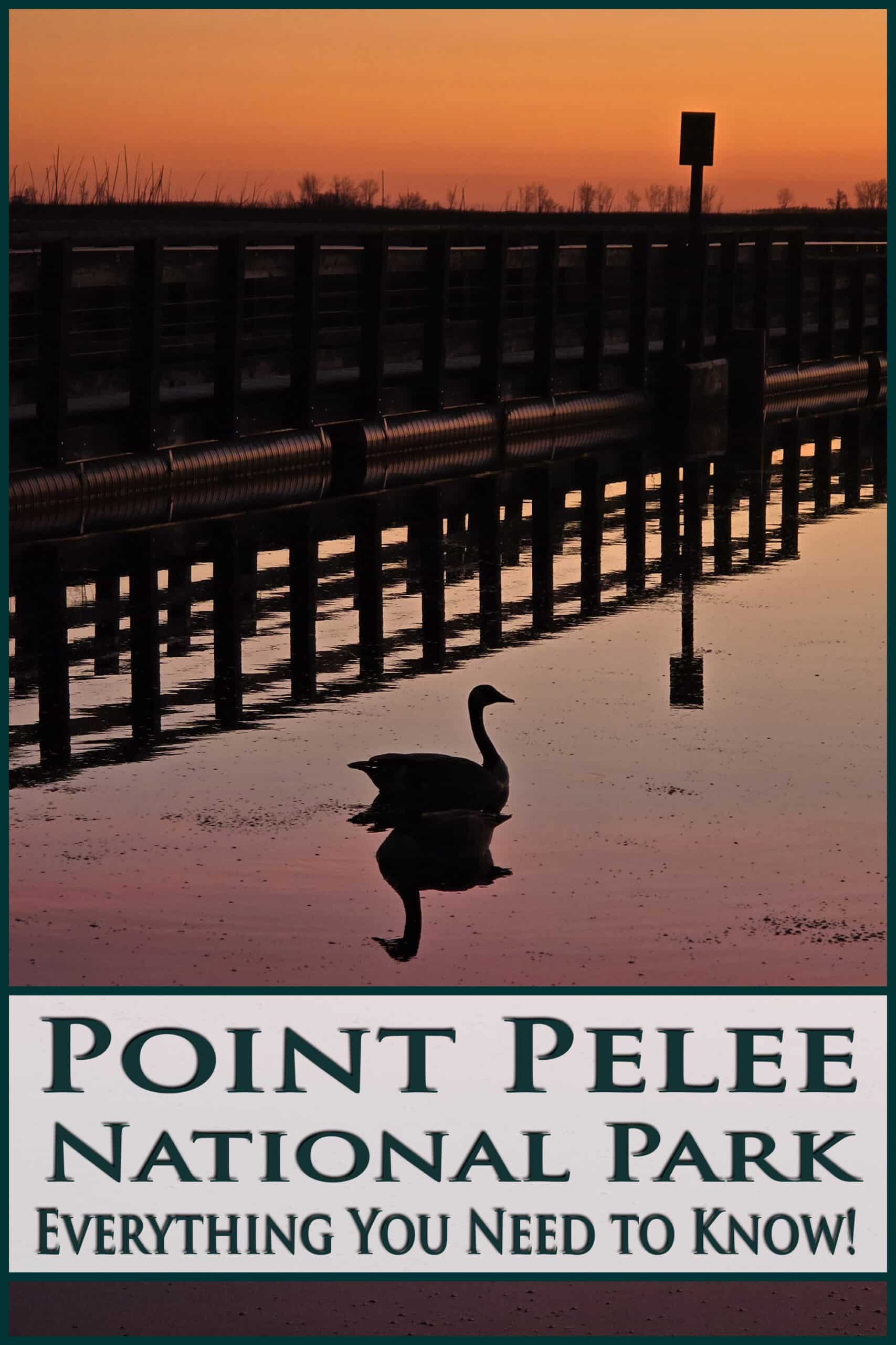
Point Pelee National Park is a gorgeous natural area, home to the southernmost point in mainland Canada, and a mecca for birders. Here’s our ULTIMATE guide to Point Pelee Park!
Originally posted on April 26, 2024. Updated on 4/20/2025.
It’s not often that we find ourselves in that part of Southwestern Ontario, and this particular Canadian National Park is a 3 hour drive from home. It’s also mostly a day use park, with camping limited to cabin rentals.
Not the most convenient - especially with cats to feed - so we jumped at the chance to finally cross it off the bucket list.
Point Pelee often comes up when celestial events happen, as it’s known for being a fantastic location for dark sky viewing. That’s actually how we first heard of it, long before we took up RVing.
It’s among Canada’s smallest national parks - the second smallest, at only about 15 square kilometres. It’s also known to be Canada’s most ecologically diverse National Park.
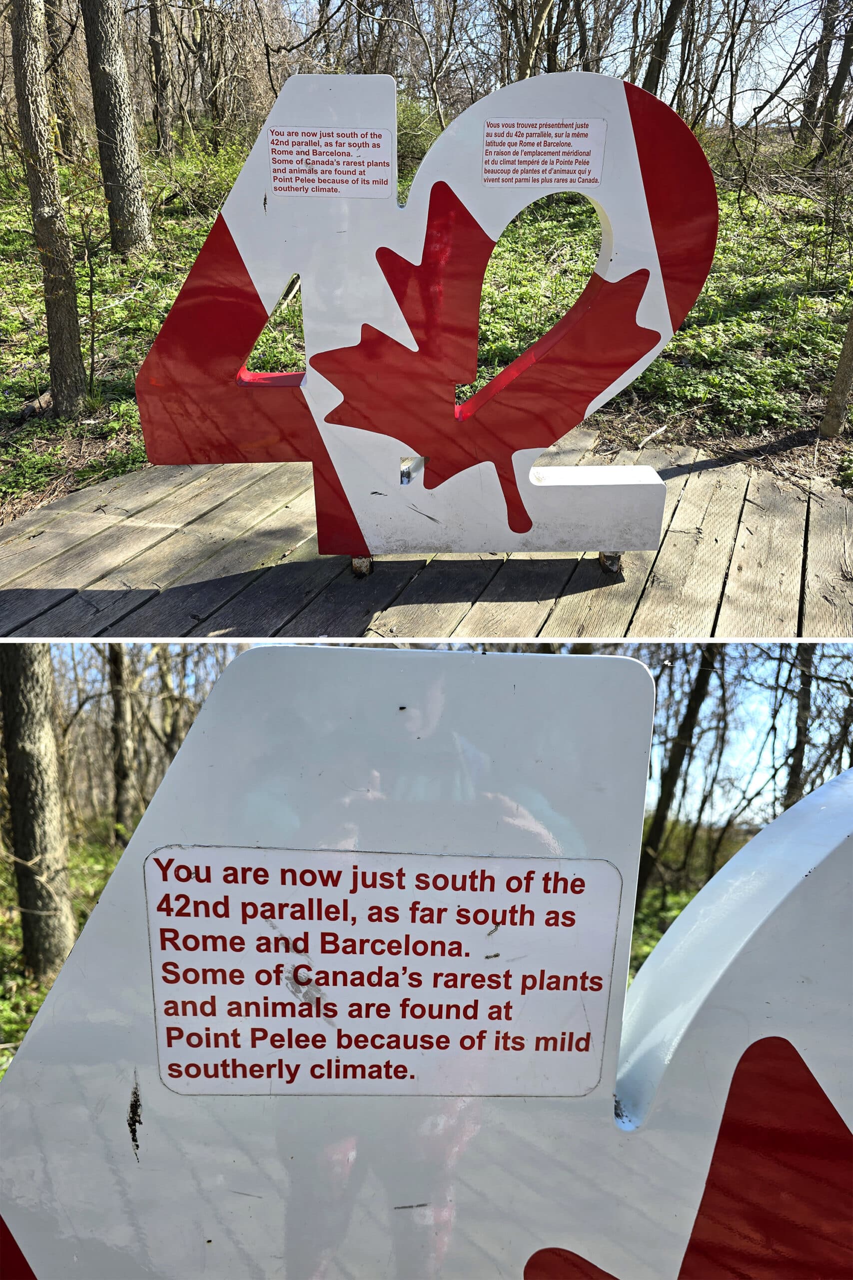
Oh, and the sharp point at the bottom of the park? That’s just the southernmost point of mainland Canada.
Yep, you can be standing in Ontario and be at the same latitude as Barcelona, Northern California, and Rome!
We had such a great time at Point Pelee, that we made a repeat trip in April 2025!
Anyway, tons to talk about, so let’s get to it!
The Basics:
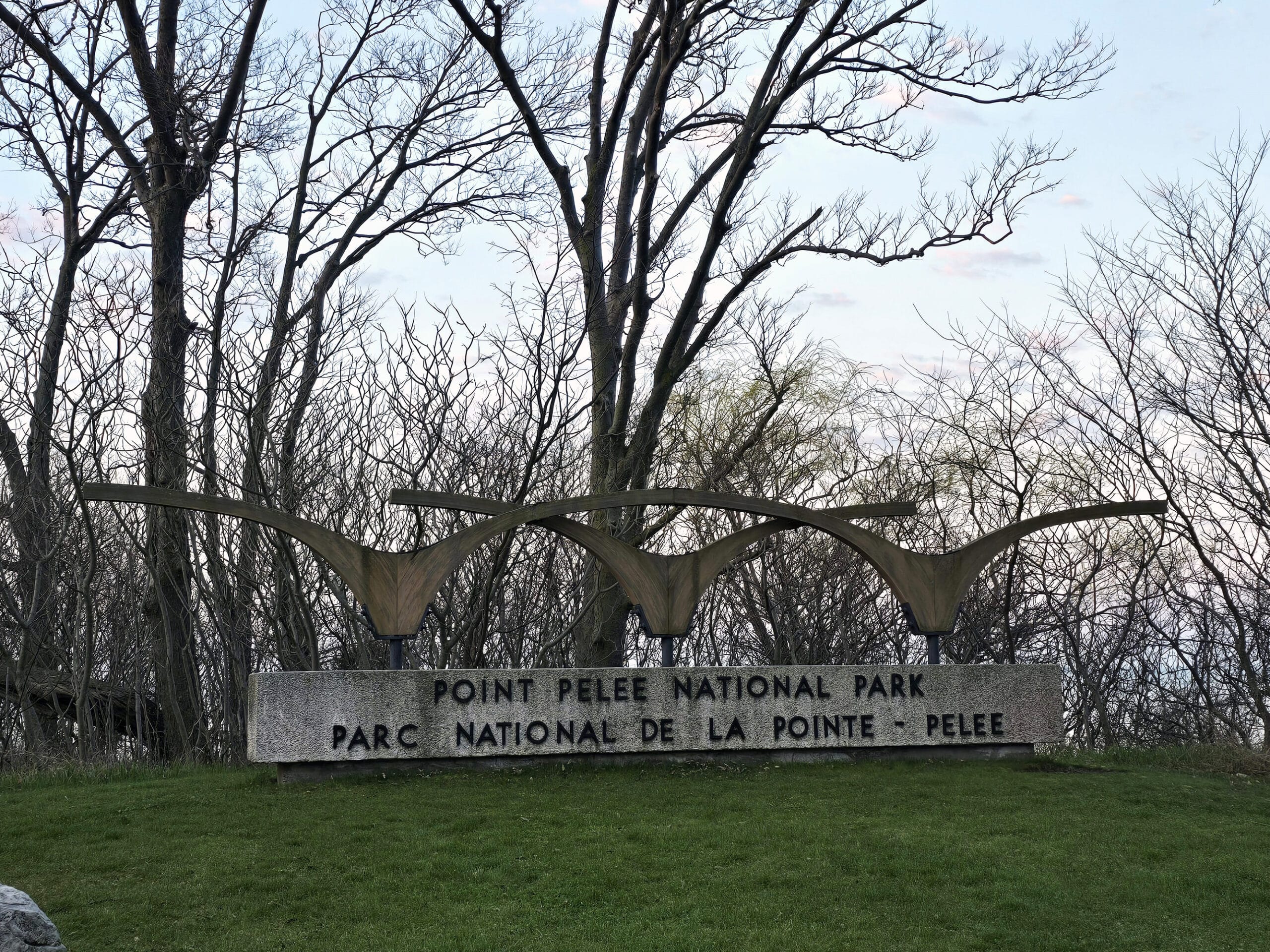
Park Name: Point Pelee National Park
Address: 1118 Point Pelee Drive, Leamington ON N8H 3V4
Website: Point Pelee National Park
Price: Varies, see Fees Schedule for more details on admission fees*
Hours: Park, Visitor Centre, and shuttle hours vary throughout the year. See Hours of Operation on the official park site.
* Porter used his Canoo app for free entry to National Parks last year, and I decided to buy a Discovery Pass when we visited Point Pelee, as we had couple trips planned to Bruce Peninsula National Park later that year.
We’ve since purchased a Discovery Pass for the both of us, after his Canoo benefits ran out.
Logistics
Some basic information to help you plan your visit to Point Pelee National Park:
Registration and Check In
During our first trip, we weren’t sure if the park hours were just for people with passes, or if the gate was actually STAFFED from 6am.
We called, and a friendly employee answered all of my dumb questions. As it turns out, yes, the front gate is staffed at 6am when the park opens, and yes, we would be able to buy a Discovery Pass then and there.
When we arrived the first day, check in and purchasing was friendly, and relatively quick. Signing in with the Canoo app is a slick idea, but can be a little clunky.
ON the second day, we ran into a bit of an issue - Porter had dropped his phone in the park the day before, and couldn’t access the Canoo app. We tried putting it on my phone, but he’d have to click a link from his. Ugh.
Anyway, our mess was handled quickly and with friendly service, even though it was 100% our fault we couldn’t access the app.
During our 2025 visit, we purchased a Discovery Pass at the gate. After some initial confusion - you can buy a Point Pelee specific pass, OR a federal Parks pass - we were on our way!
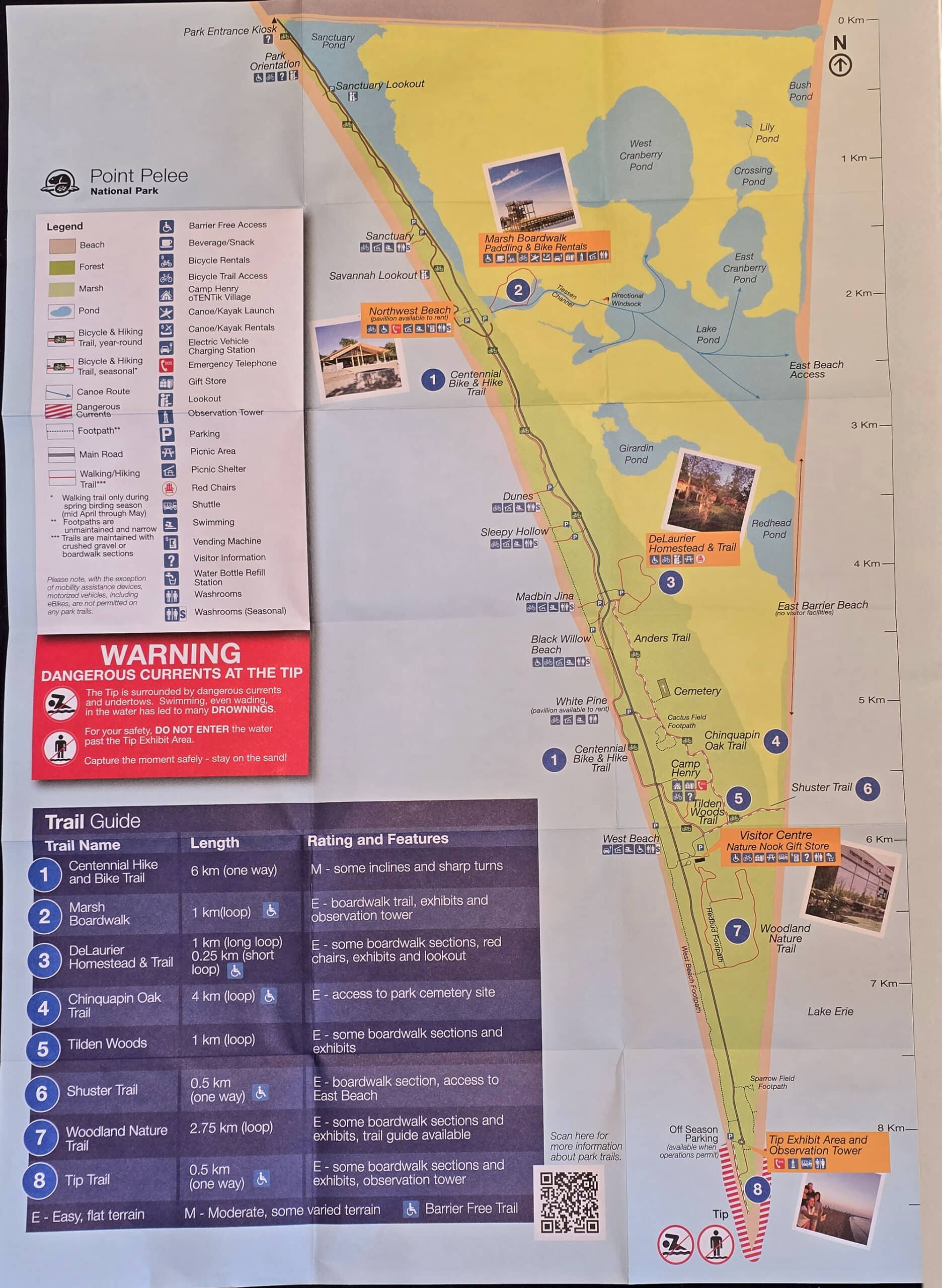
Park Map & Signage
The park map was a single large sheet of paper, folded down to a pocket size.
It was pretty much perfect - tons of information, easy enough to access. No complaints at all!
On that note... the website is kind of terrible. The information is good, but the page hierarchy / layout is awful. Most pages are only accessible from certain other pages - the interlinking is not at all intuitive or comprehensive.
The park signage was good. Big and visible, clear communication, easy to see where you are and where you’re going.
Parking
We found there to be plenty of parking all throughout the park... with the caveat that we visited on a Monday morning, then a few more times - all weekdays. Even our 2025 trip was across the span of weekdays - we’ve never been at Point Pelee on a weekend.
According to the park’s site, though, it can handle over 700 vehicles at a time. Sounds kinda hellish, but hey - we visit places like this on weekday mornings for a reason!
Now, one key thing to note is that there is not only NO parking at the tip, but no vehicles are allowed on the road between the Visitor Centre and the tip (unless it’s between November and March, anyway!)
Other than that, you’ll need an overnight camping permit if you’re looking to park at Camp Henry, and that’s it.
Parking is included in the park admission fee, and you don’t need to display any kind of permit - except at Camp Henry, as noted.
Accessibility
According to the park’s site, there is wheelchair access available at Camp Henry, the DeLaurier building exhibits and parking, and the Visitor Centre. The Visitor Center also offers closed-captioned theatre programs, which is always great to see.
There are both accessible washrooms and inclusive (Non-gendered) washrooms at Northwest Beach, The Tip, and the Visitor Centre.
In terms of accessible hiking, the Marsh BoardwalkTrail and Tilden Woods Trail are wheelchair accessible, and the Delaurier Homestead walk *appears* to be wheelchair accessible.
The Shuster Trail is wheelchair accessible til just before the end of it, as is the Tip Trail - Both end at a beach.
There are also all terrain wheelchairs available to borrow from the Visitor Centre.
As far as day use facilities go, both the Marsh Boardwalk and Northwest Beach areas have accessible parking, picnic tables, washrooms and barbecues.
Finally, the shuttle to the tip is also wheelchair accessible.
Pets
Point Pelee National Park is VERY dog-friendly.
There are a few rules you have to abide by, as well as some cautions.
You have to keep your dog on a leash at all times. You can’t leave them alone in vehicles, and you can’t leave them unsupervised. Also, you can’t let them bother other people or the wildlife (including barking).
Obviously, you have to pick up after your dog as well.
They also recommend that you stay on all trails, as there’s a lot of poison ivy and ticks in the area.
That said, you can do pretty much anything with a dog, that you can as a human. They’re welcome on all trails, the shuttle, AND in the visitor centre!
Connectivity
Cell service was great in several areas of the park, but disappeared a bit from the Visitor Centre down to the tip of Point Pelee Peninsula.
In general, it seems to be better the further north you go in the park.
Park Amenities
As a national park, Point Pelee is generally in really great condition, and well maintained. During our 2025 trip, we even saw a crew of 4-5 people washing road signs and swing gates.
I’ve always noticed that national parks signs are in great condition - Bruce Peninsula National Park and Pukaskwa National Park are also really on the ball in that department.
Just another reason you’ll never hear me complain about paying Canadian taxes - I enjoy having access to nice things, and I love that our public spaces are well cared for!
Creature Comforts
There are washrooms *everywhere* in the park.
Picnic and beach areas dot the road the whole way from the entrance to the tip of the peninsula.
The visitors centre, tip area, and northwest beach have the nicest washrooms, the ones we saw at the picnic/beach areas were all a bit older.
Cool to see that they had solar water heating set up (at least at the one we actually used, anyway!), but the water was pretty cold. Not overly so, I didn’t even really notice until Porter mentioned it.
Wheelchair Accessible: The Tip and the Visitor Centre.
Year-Round: The Marsh Boardwalk, White Pine, the Tip, and the Visitor Centre.
Seasonal Only: Northwest Beach, Dunes, Sleepy Hollow, Madbin Jina, Black Willow Beach and West Beach.
Inclusive / Non-Gendered: Camp Henry, Northwest Beach, the Visitor Centre and the Tip.
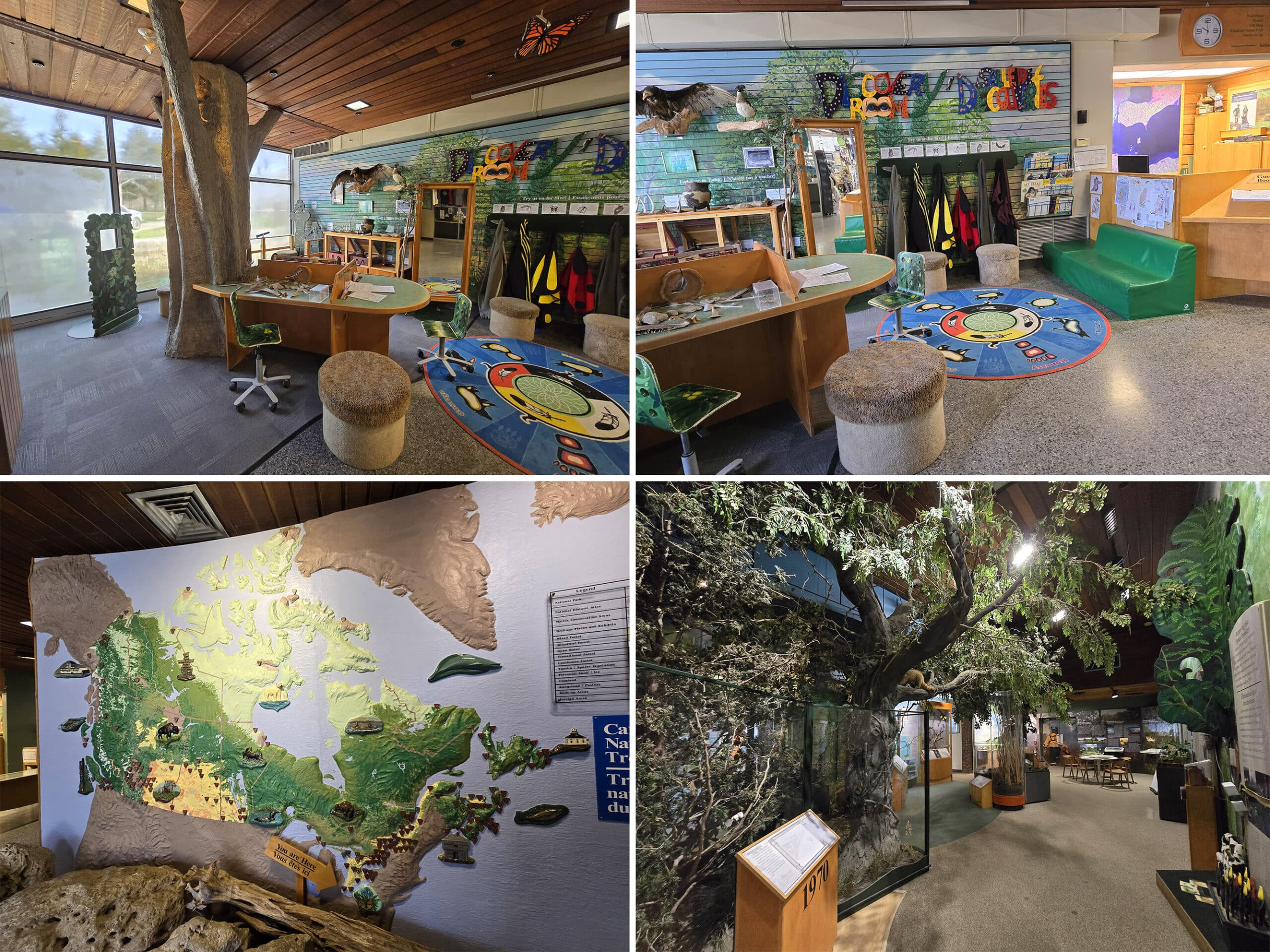
Visitor Centre & Park Store
Point Pelee Visitor Centre is a small but cozy building with a few areas of exhibits, and a theatre. It was nice, but a little underwhelming in size.
To be fair, we had been blown away by the Visitor Centre in Bruce Peninsula National Park, and I guess we kind of assumed it would be on the same sort of scale. This IS a much smaller park, though.
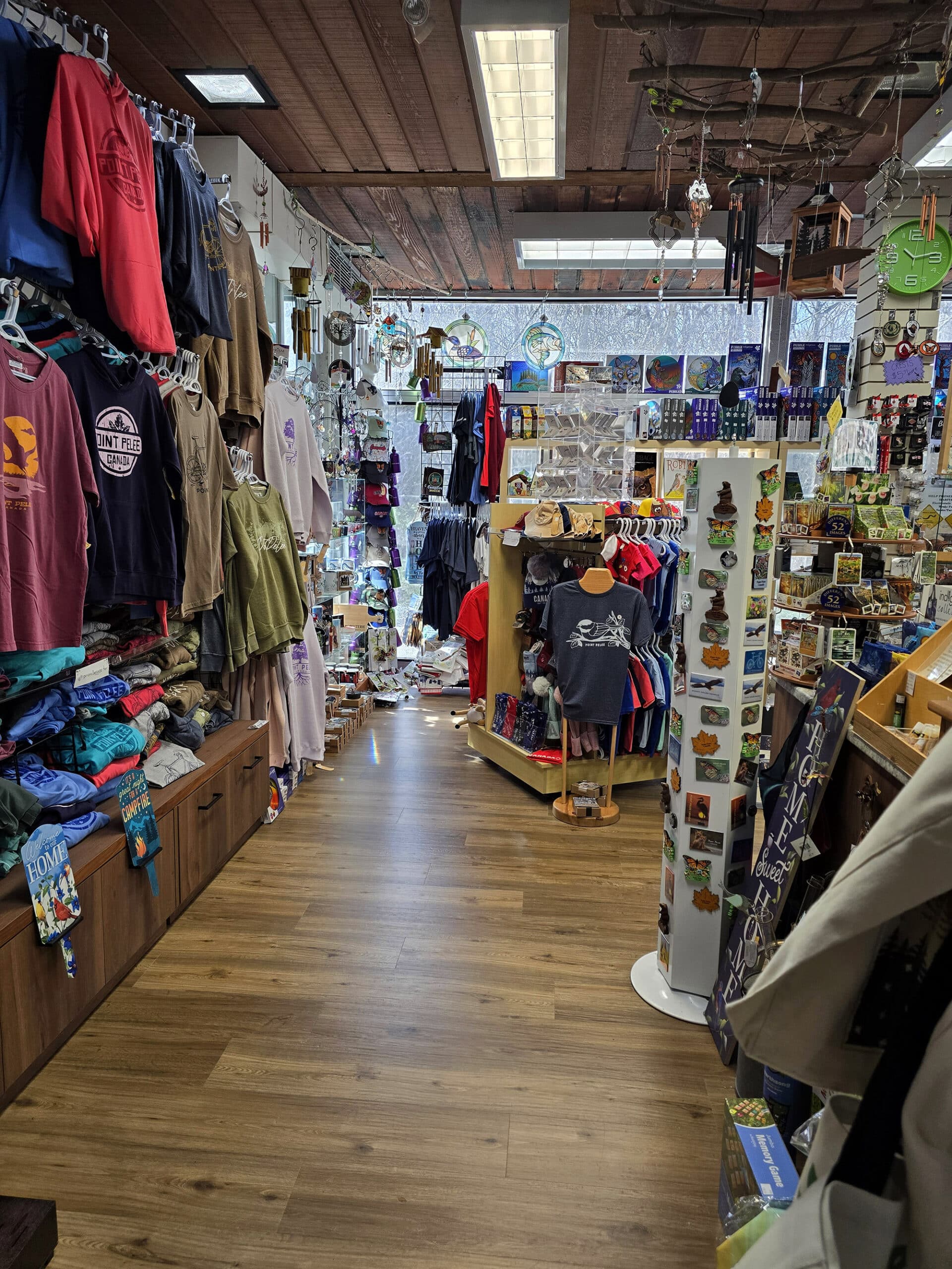
Anyway, there is also a cute gift shop that’s packed with cool souvenirs and birding resources.
We picked up a Red Winged Blackbird stuffie (that screeches!), and a couple of the Sibley’s waterproof bird identification brochures.
There are also gift shops in the Camp Henry Campground Office (the only year-round option), and at the Marsh Boardwalk
Day Use Areas
There is NO shortage of places to hang out, picnic, or even cook food over a charcoal grill, all throughout the park!
Here are our thoughts on each, in the order you’ll encounter them as you drive through the park.
Park Orientation
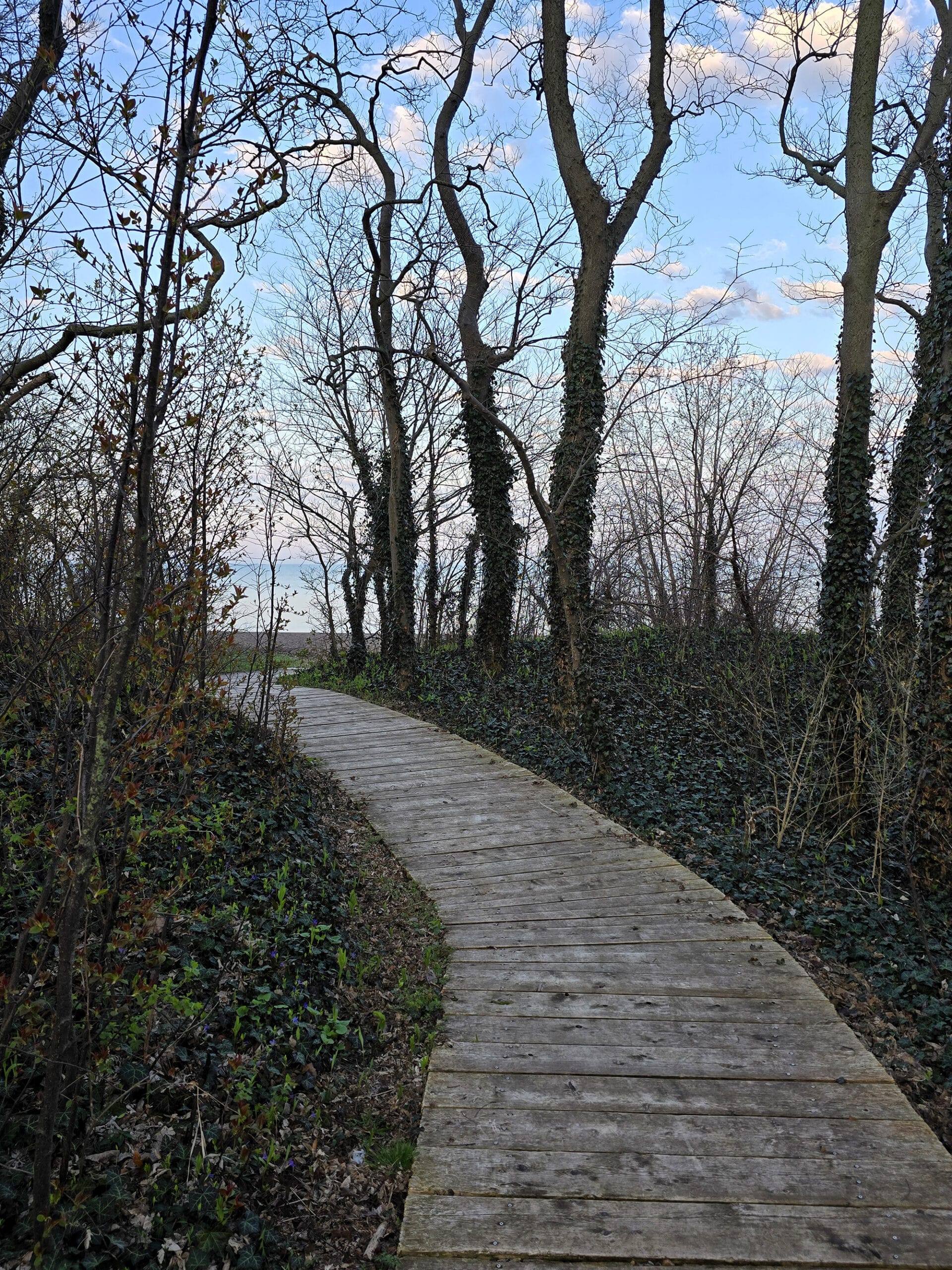
This one isn’t really a picnic area - as far as we could see - but it was a neat little stop as soon as you pass the front gates.
It has a cool sculpture by a First Nations artist - Teresa Altiman - as well as a large map and some general information on the park.
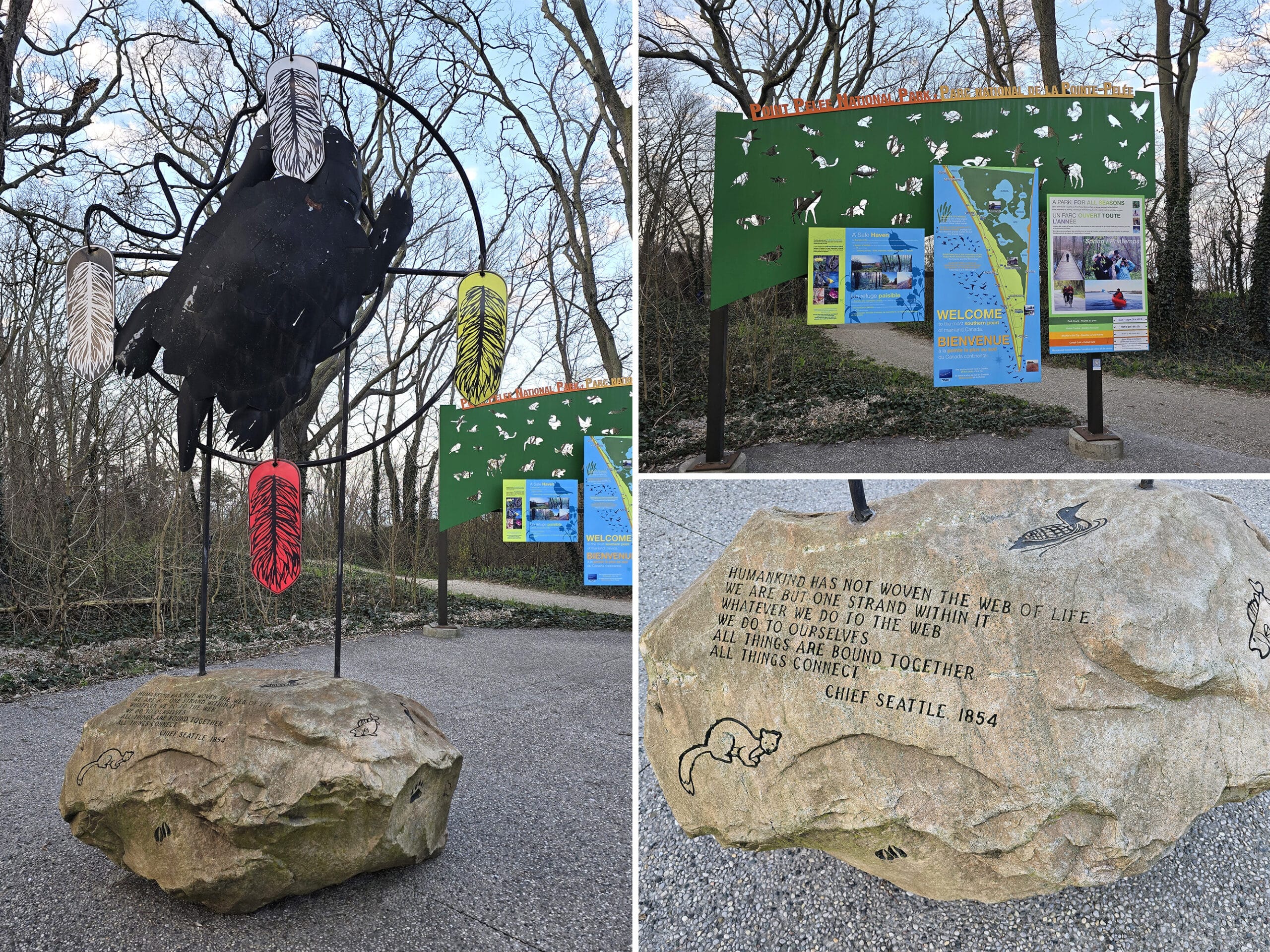
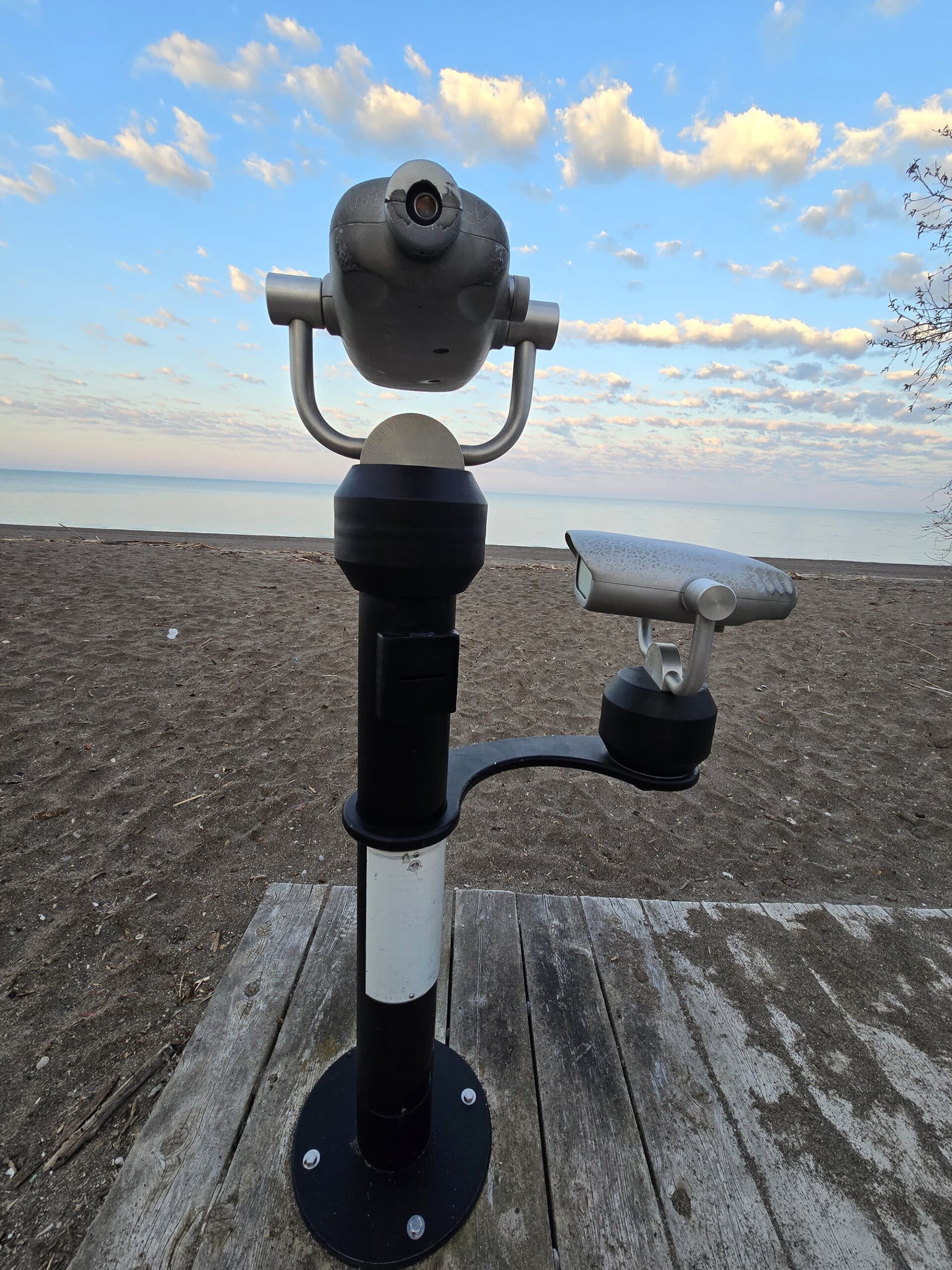
There are washroom facilities, and a short boardwalk to a lookout over Lake Erie.
As Porter put it, “It’s like in any movie where they’re in a jungle. I always thought they exaggerated the noise, but... maybe not!”.
Anyway, the area made for a really cool “welcome” to the park.
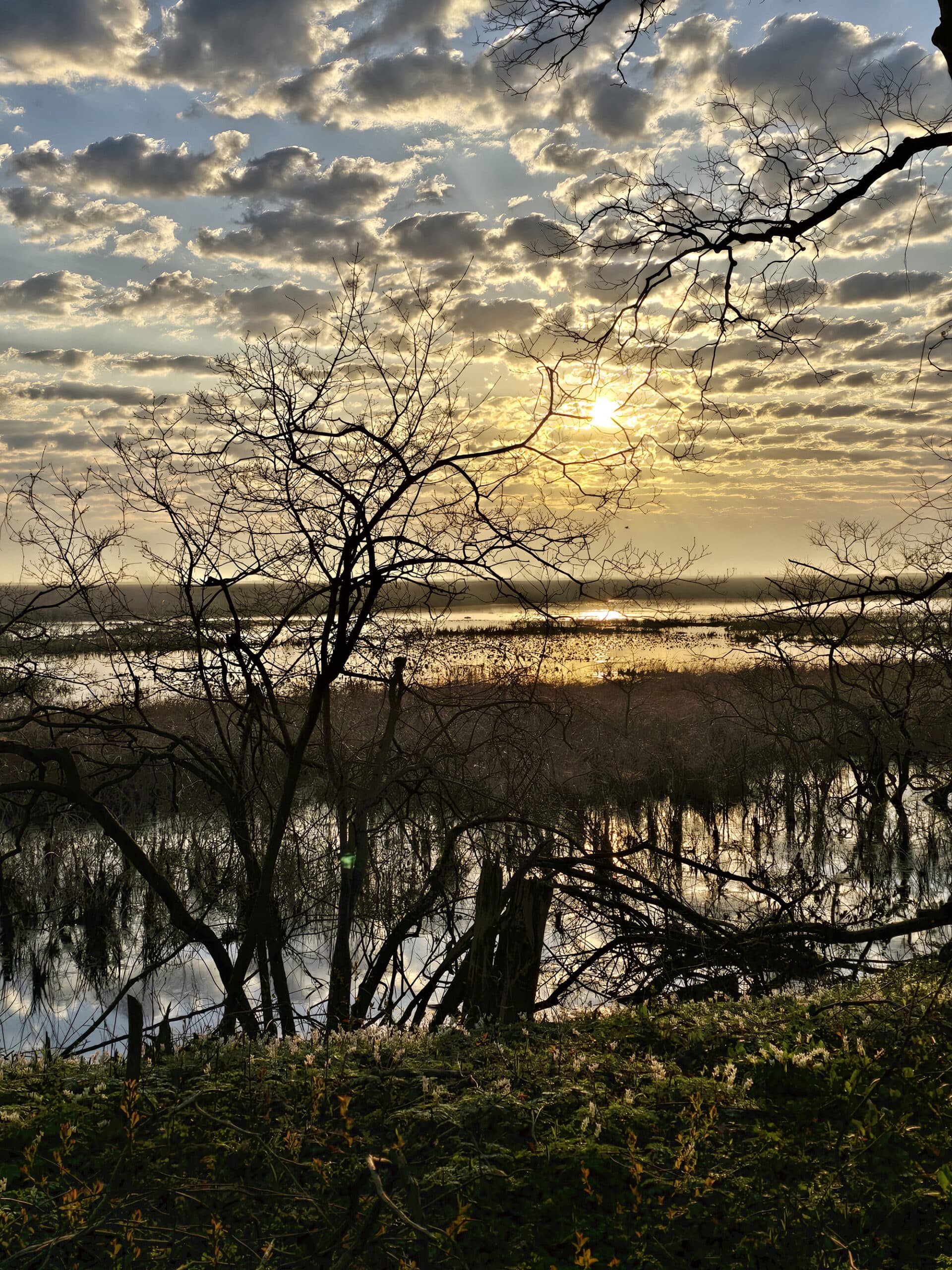
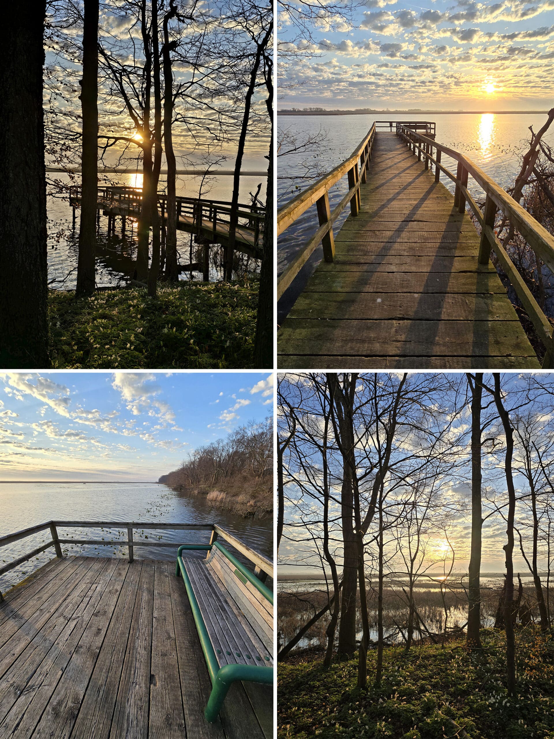
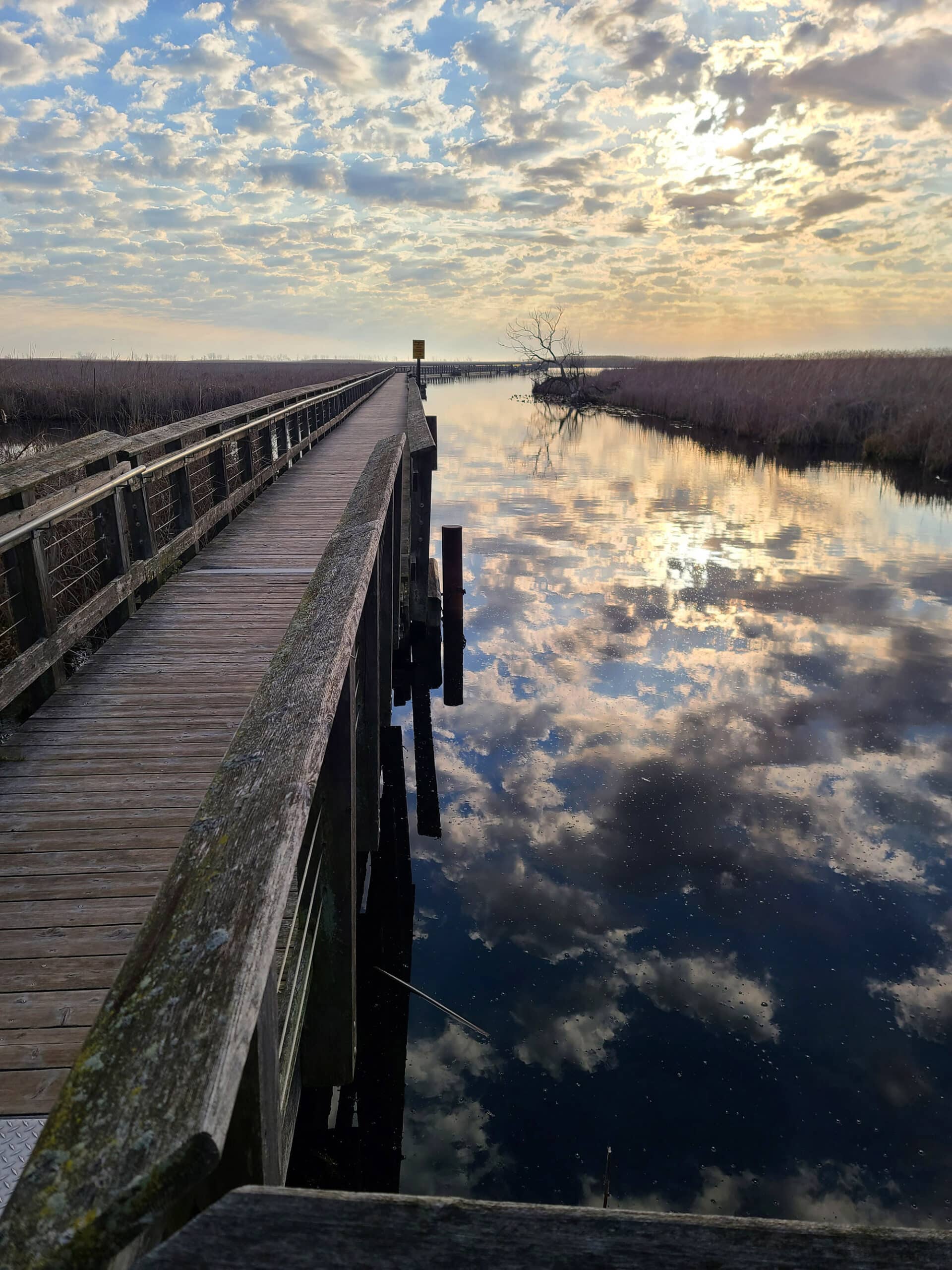
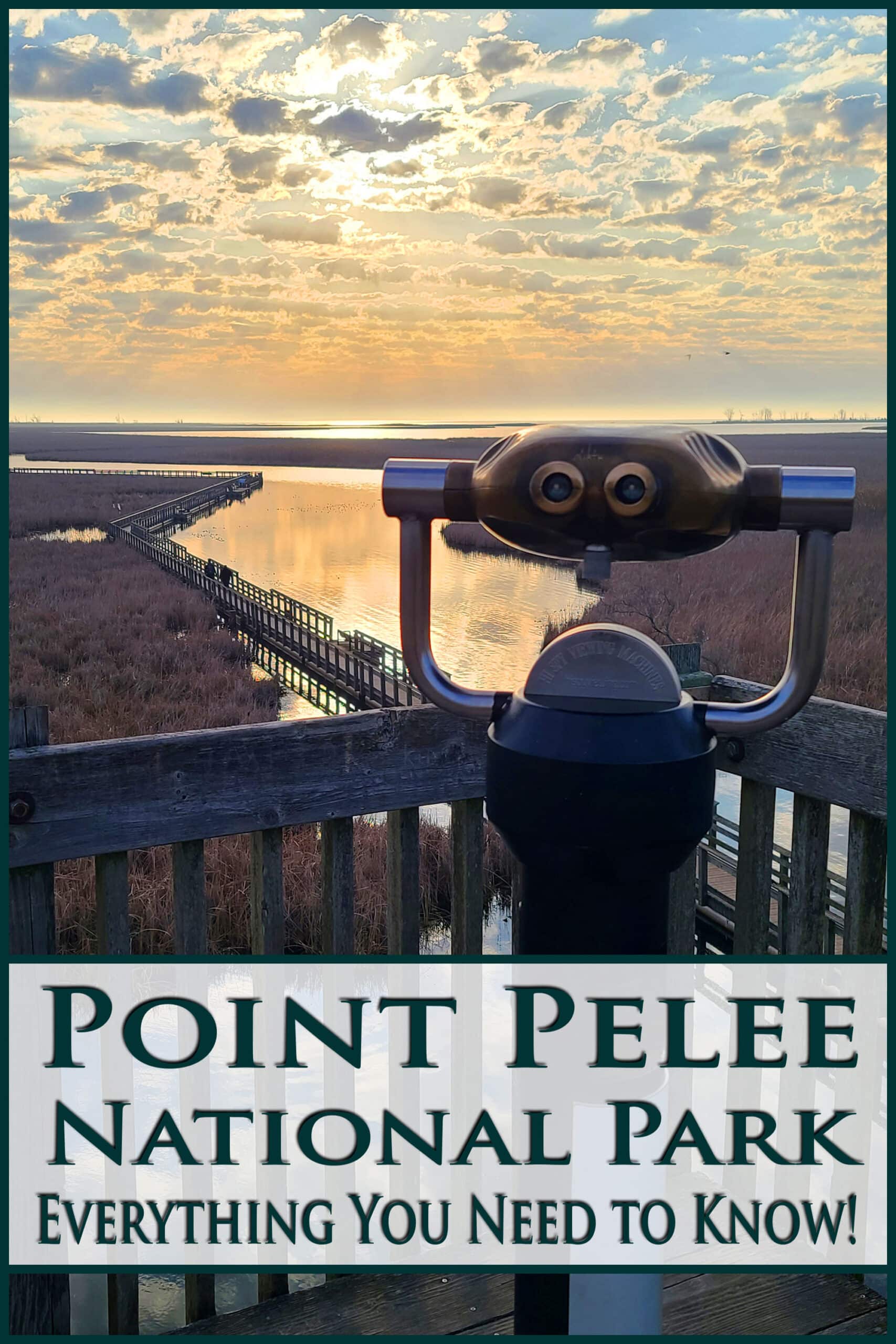
Sanctuary Lookout
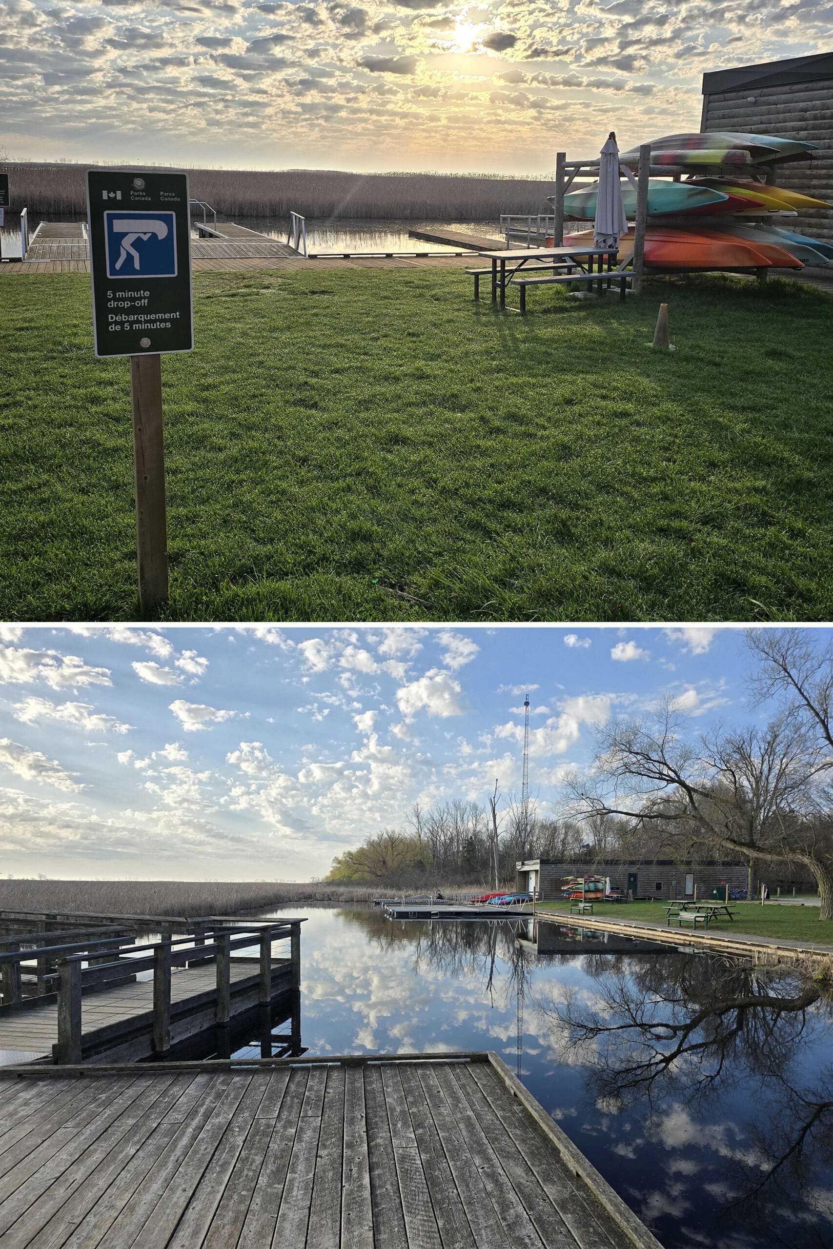
This is a small wooden pier out over Sanctuary Pond. Absolutely gorgeous at or just after sunrise - not a ton of parking, though.
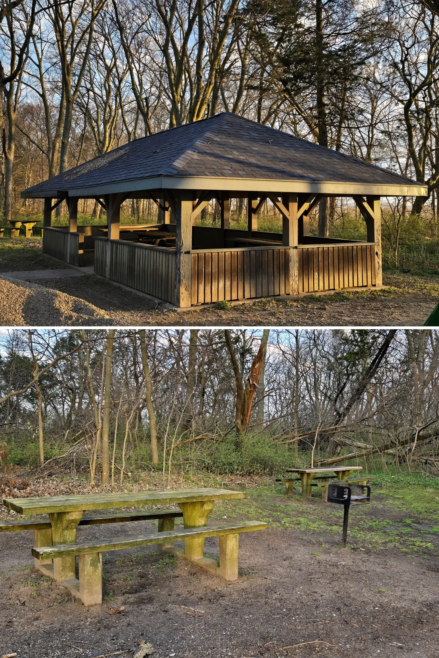
Sanctuary Picnic Area
Just beyond the lookout, you’ll come to the Sanctuary Picnic Area.
This is a super basic picnic nook, and seemed to be under some sort of construction or repair while we were there. (A tractor with gravel piled up).
You’ll find a little picnic shelter pavilion, a seasonal washroom building, picnic tables (really mossy though!), and grills. You can access both the bike trail and the beach from this picnic area.
Northwest Beach
Northwest Beach is a really nice “beach-beach” with picnic tables and charcoal pits all over the place.
It’s a much larger area than most of the other picnic table / day use areas, and much more well-appointed.
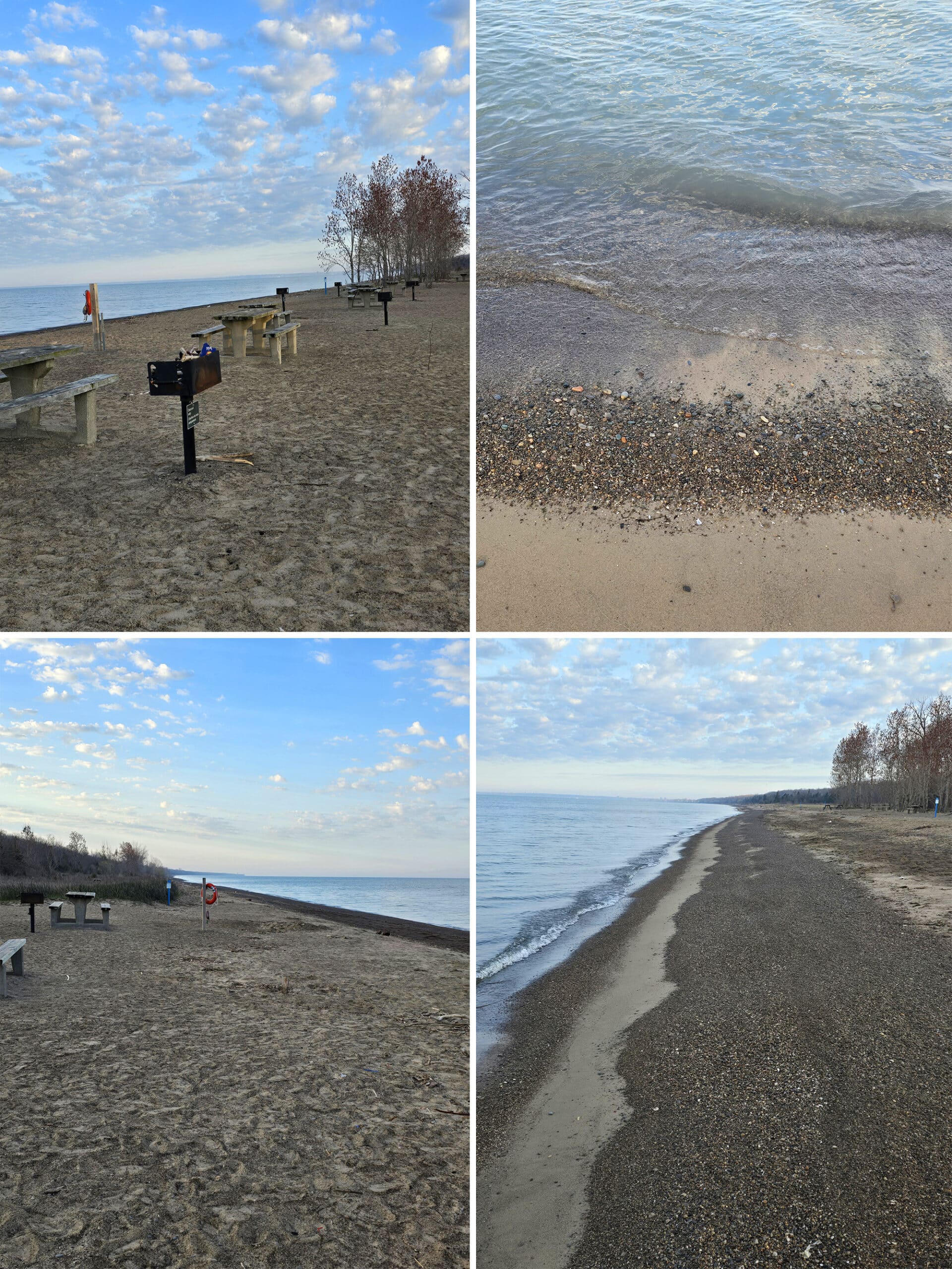
...I was legitimately jealous of kids today, LOL!
Anyway, there was a big, nice picnic pavilion that’s available for reservation, as well as a separate building with washrooms.
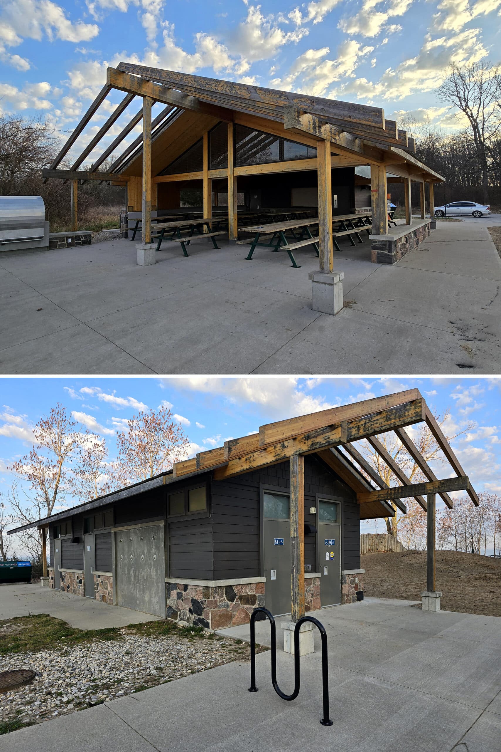
The washrooms were in good condition when we visited, and there was a bike repair stand right outside of it.

We could totally see it being a fun family area, where people could bring a couple kids and a dog and just hang out on a nice summer day.
Marsh Boardwalk Picnic Area
We’ll get to the actual boardwalk a bit later in this post, but we should address the picnic situation of the area here!
There was a pavilion, washrooms facility, and picnic tables with grills.
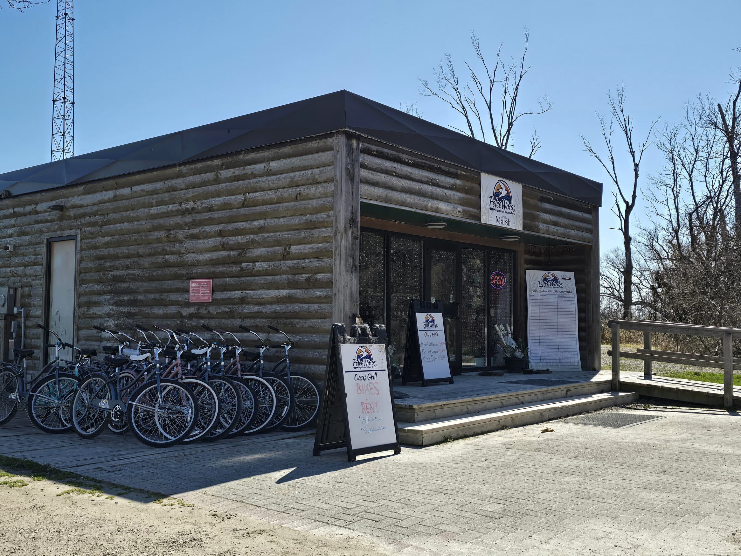
There was also a small building that has a concession stand and an outfitter company housed there - looks like the rent canoes and such.
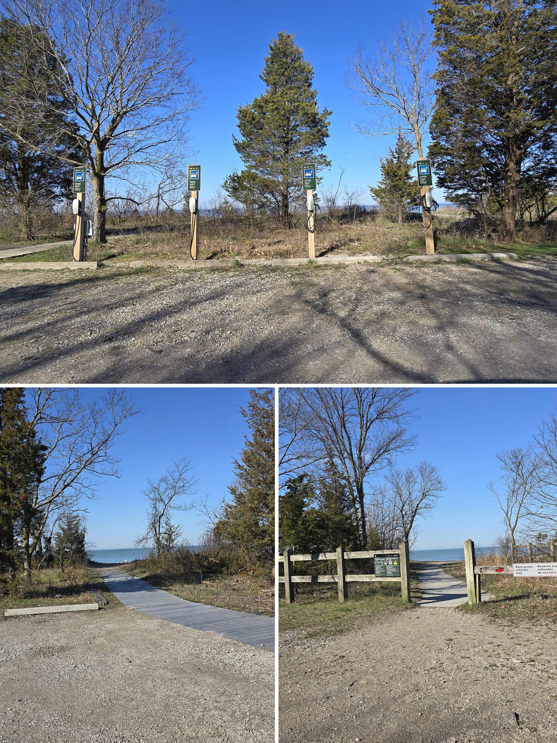
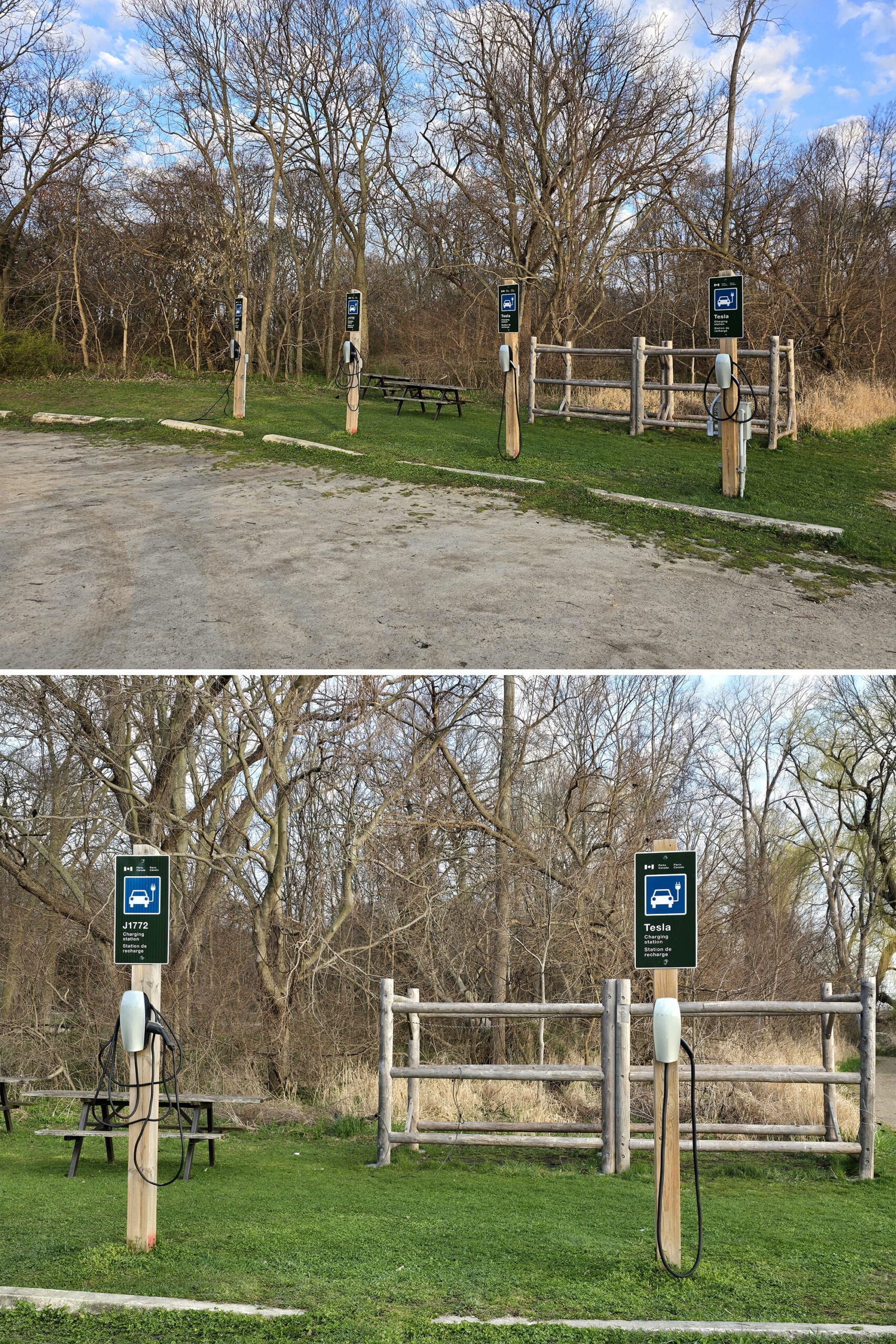
Another interesting thing to note was that there were a few electric vehicle charging stations - both Tesla and J1772.
Dunes Picnic Area
This is another one of the smaller, more basic picnic areas along the main Point Pelee park road.
It had a small picnic pavilion, seasonal washrooms, outdoor picnic tables and grills. There was access to both the beach, and the bike trail.
Sleepy Hollow Picnic Area
Very similar to Dunes. A pavilion, seasonal washrooms, picnic tables, grills, and access to both the beach and the bike trail. Nothing really to write home about.
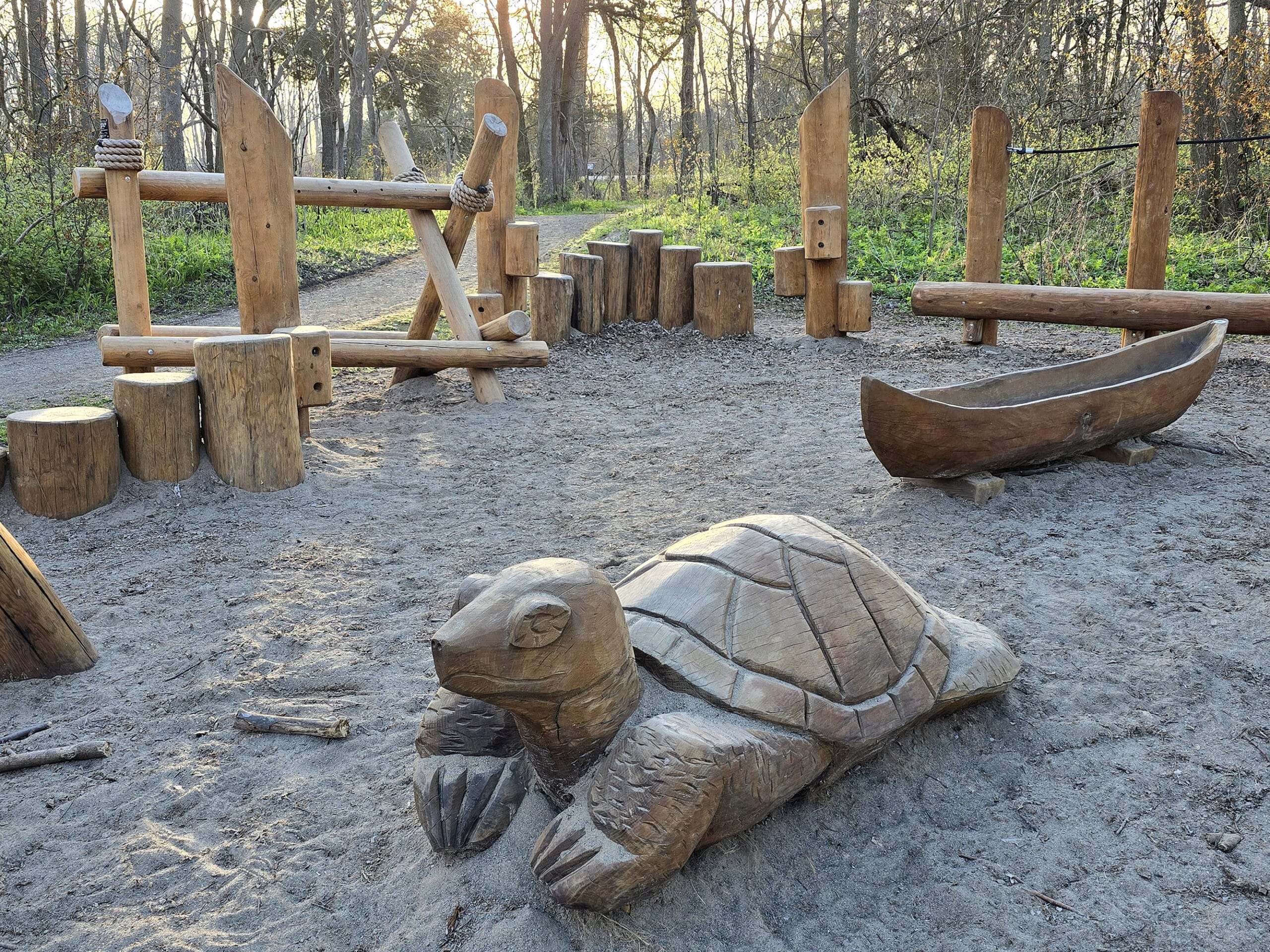
Madbin Jina Picnic Area
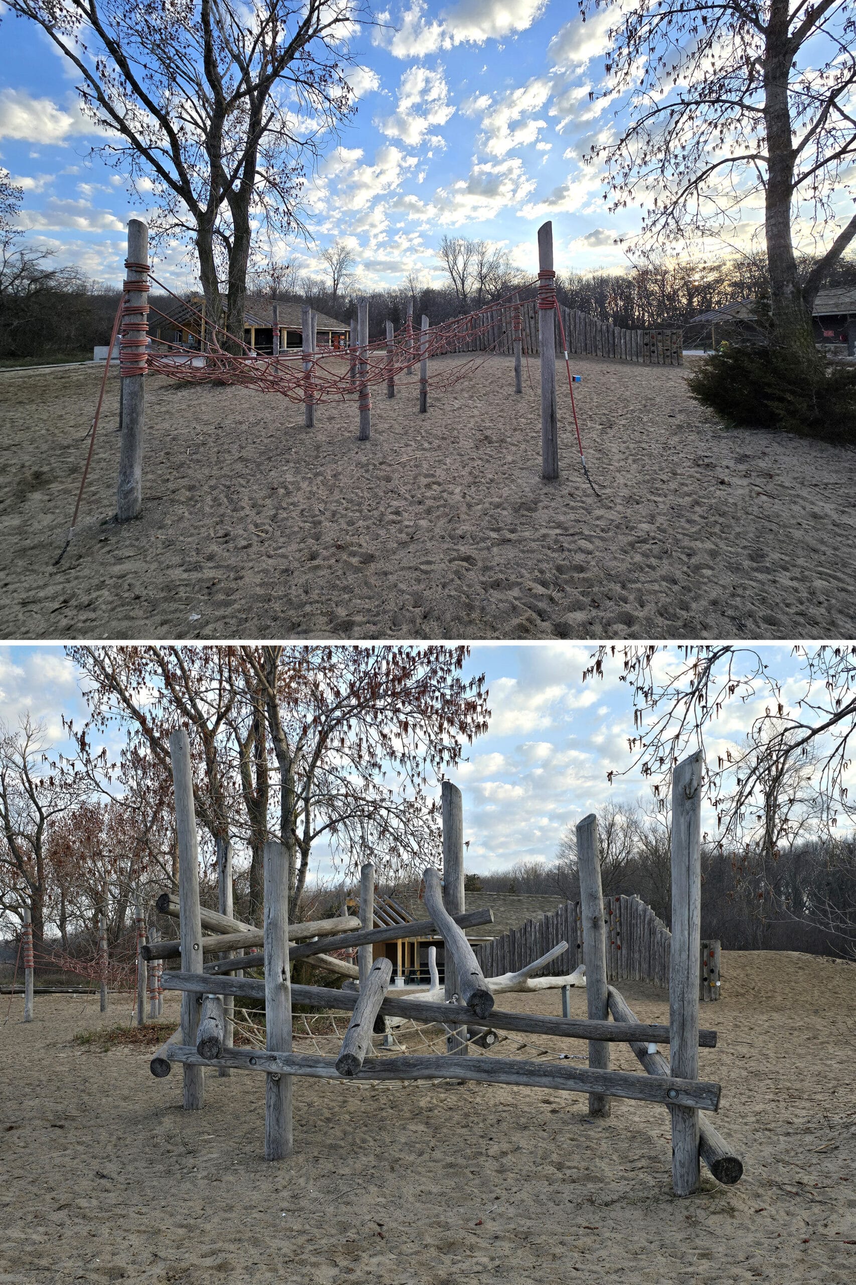
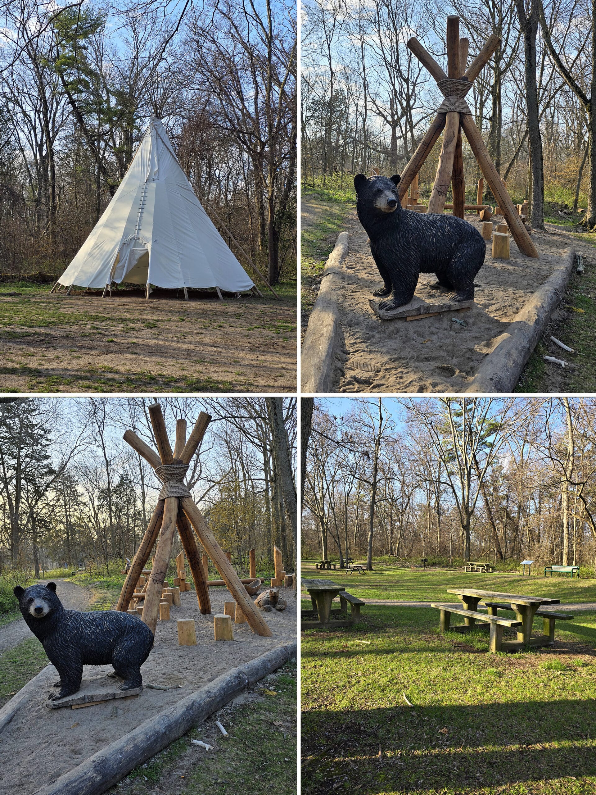
This one was formerly called the Pioneer Picnic Area. It looked fairly new - I’m guessing there was a makeover involved with the name change.
This one was a lot more interesting than the previous couple of picnic areas. It had the same basics - a pavilion, seasonal washrooms, picnic tables, grills, and access to both the beach and the bike trail.
... but there was also a teepee, and cute bear, turtle and canoe sculptures!
This picnic area is touted as being their first First Nation-themed picnic area, and the design elements pay homage to the Caldwell First Nation. The name translates to “Sit Awhile”.
We Googled to find out more, and it turns out that the bear and canoe sculptures had a rope climbing element involved, but we didn’t see it - or didn’t recognize it, I guess.
We also found references to additional animal carvings representing the 7 teachings, but didn’t notice them during our stay. I wonder if they were carved into the sides of the wood log structures?
This was our favourite picnic area in the park - unfortunately, it was gated during our 2025 visits, and looked to be under construction.
DeLaurier Homestead and Trail
Located right across the road from Madbin Jina, apparently this also counts as a picnic area.
They had picnic tables, but no washrooms or grills.
Black Willow Beach
This picnic area was longer and more “open” feeling than the last few.
In addition to the pavilion, seasonal washrooms, picnic tables/grills, and access to the beach and bike trail, there’s a cute little boardwalk going up the length of it, with a bunch of little offshoot boardwalks going to the beach area.
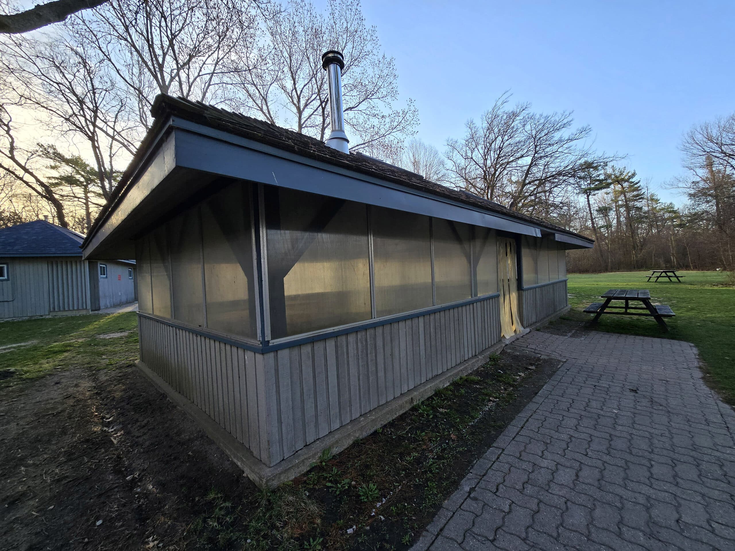
White Pine Picnic Area
Another really basic, small picnic area. It has seasonal washrooms, beach and trail access, and a wood burning stove - probably in the pavilion.
The pavilion is available for rent, which was a bit confusing - it’s not the really nice, new kind like the other (Northwest Beach) pavilion that’s noted as being for rent.
It’s basically one of the normal little ones, with weird plastic siding? It looked like it belonged on Dexter, to be honest. Maybe the plastic was temporary?
It wasn’t very inviting, that’s for sure.
West Beach
This area was a bit bigger than the other picnic areas. Loads of parking, a bunch of boardwalks to the beach.
It had picnic shelters, tables, and grills, as well as another set of vehicle chargers. (Again, both Tesla and J1772.)
Shuttle to the Tip
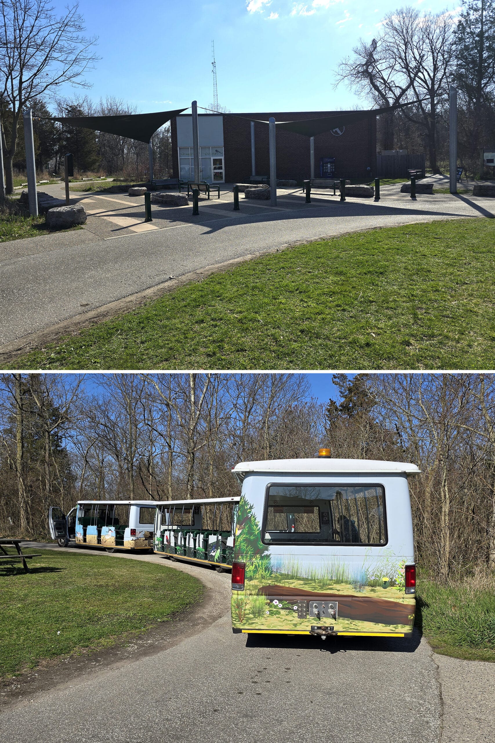
The park provides a free shuttle service from near the Visitor Centre parking lot, down to the Tip Tower area.
You’ll have to walk a short distance from that point - it’s about half a km from the drop off spot, to the southernmost tip of mainland Canada.
The shuttle is super cute. The seats were the molded kind, but were more or less comfortable even with my hefty butt.
It felt a little “Jurassic Park” - on account of all the screeching! - but in a fun way!
Anyway, the covered shuttle ride takes about 7 minutes to go the 2 km, and the shuttles run every 20 minutes or so from either end.
See the park’s Hours of Operation page for shuttle hours - they vary by season.
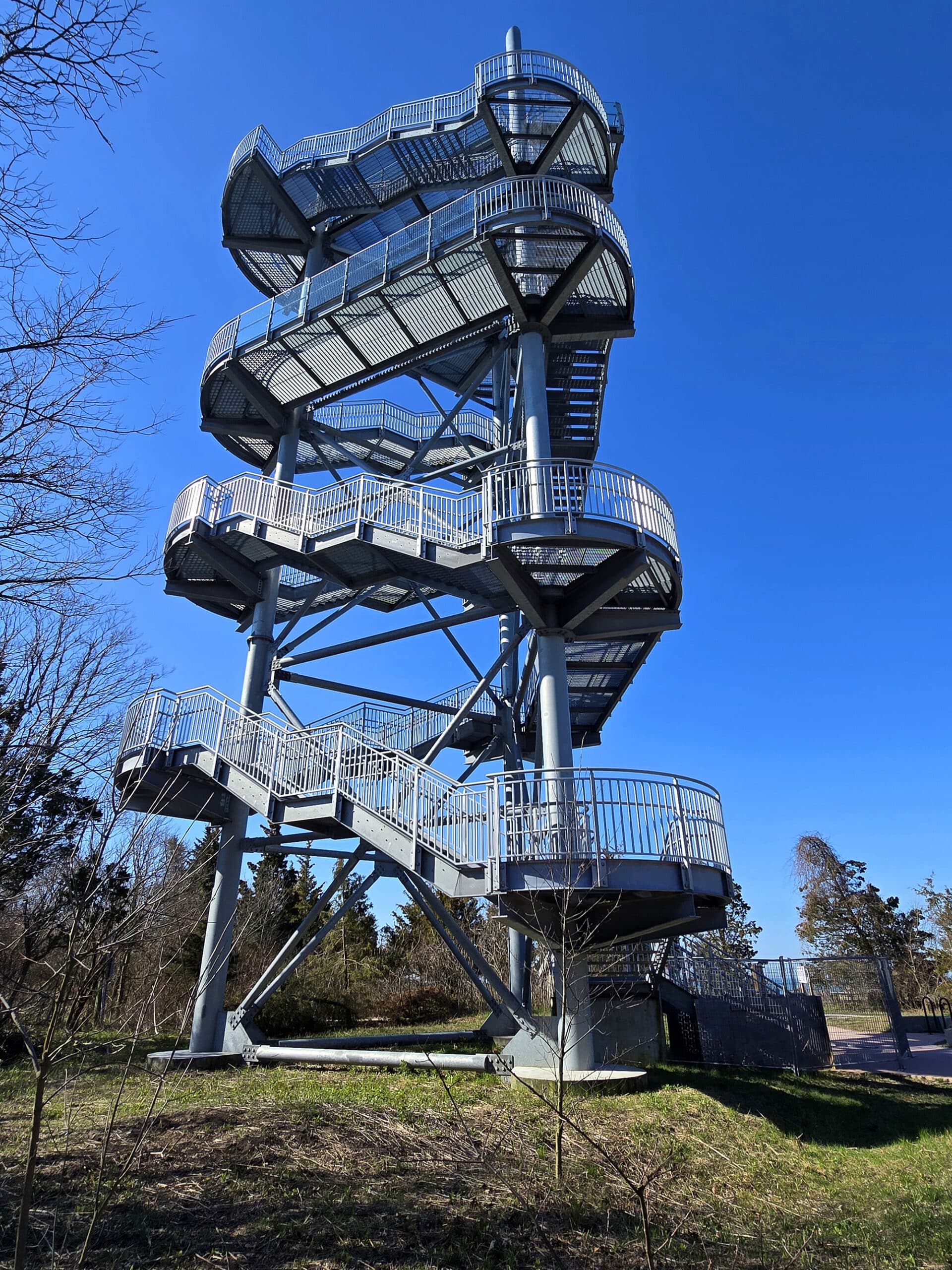
The Tip Tower
The Tip Tower is a 24 metre tall attraction at Point Pelee National Park. As you can probably guess, it’s located near the southern tip of the park - and country.
It’s about half a km from the actual tip, pretty close to the spot where the shuttle does drop off/pick up.
After being closed during our 2024 visits, we were happy to see that the Tip Tower was open for visitors during our April 2025 visits.

My own fears seemed to be confirmed a few minutes after Porter started up the 144 steps to the top. (“A *GROSS* set of steps” - Porter. LOL!)
A guy came down, looked at me, and loudly declared “I’m NEVER doing that again”!
Porter also confirmed that I wouldn’t have been into the experience. The steps are the open metal grate style, so you can see all the way to the ground, the Whole. Way. Up.
Yes, including the entirety of the top platform!
He’s not as much of a wuss about heights as I am, but he said he was a bit unnerved by it - it was incredibly windy, which was “a bit scary”.
He says the view was worth it, though!
EV Charging Stations
As mentioned, there are charging stations for both Tesla and J1772. These are located at the Marsh Boardwalk and West Beach parking lots.
Share the Love!If you’ve made one of our recipes, be sure to take some pics of your handiwork! If you post it to Bluesky, be sure to tag us - @2NerdsInATruck, or you can tag us on TikTok, if you’re posting video. We're also on Pinterest, so you can save all your favourite recipes and park reviews to your own boards! Also, be sure to subscribe to our free email newsletter, so you never miss out on any of our nonsense. Well, the published nonsense, anyway! |
Entertainment and Activity
For such a small park, there is a LOT to see and do!
Here are some details on the main attractions - and our thoughts on the ones we experienced during our time at Point Pelee.
Hiking
We made a point of doing as many of the walking trails as possible - there are a few short ones, and all but one trail in the park are listed as being “easy”. The site states that park’s trails are “1.5 m wide, surfaced with crushed gravel and boardwalks, suitable for strollers and wheelchairs.”
In order from the front of the park:
Centennial Bike & Hike Trail
This is a long trail that goes almost the full length of the park - from the Park Orientation Area all the way down to the Visitor Centre.
6 km long (12 km return), it’s shared with cyclists and is listed as being “moderate”.
From what we could see, the moderate designation is more than likely just on account of the length - every section we could see was wide and flat, definitely nothing I’d consider “moderate”.
The site does refer to it as “topsy turvy”, so maybe it gets more wild between stops?
The neat thing about this trail is that - because it runs up the west side of the park - it has access to all of the beaches and picnic areas along that side - so, most of them!
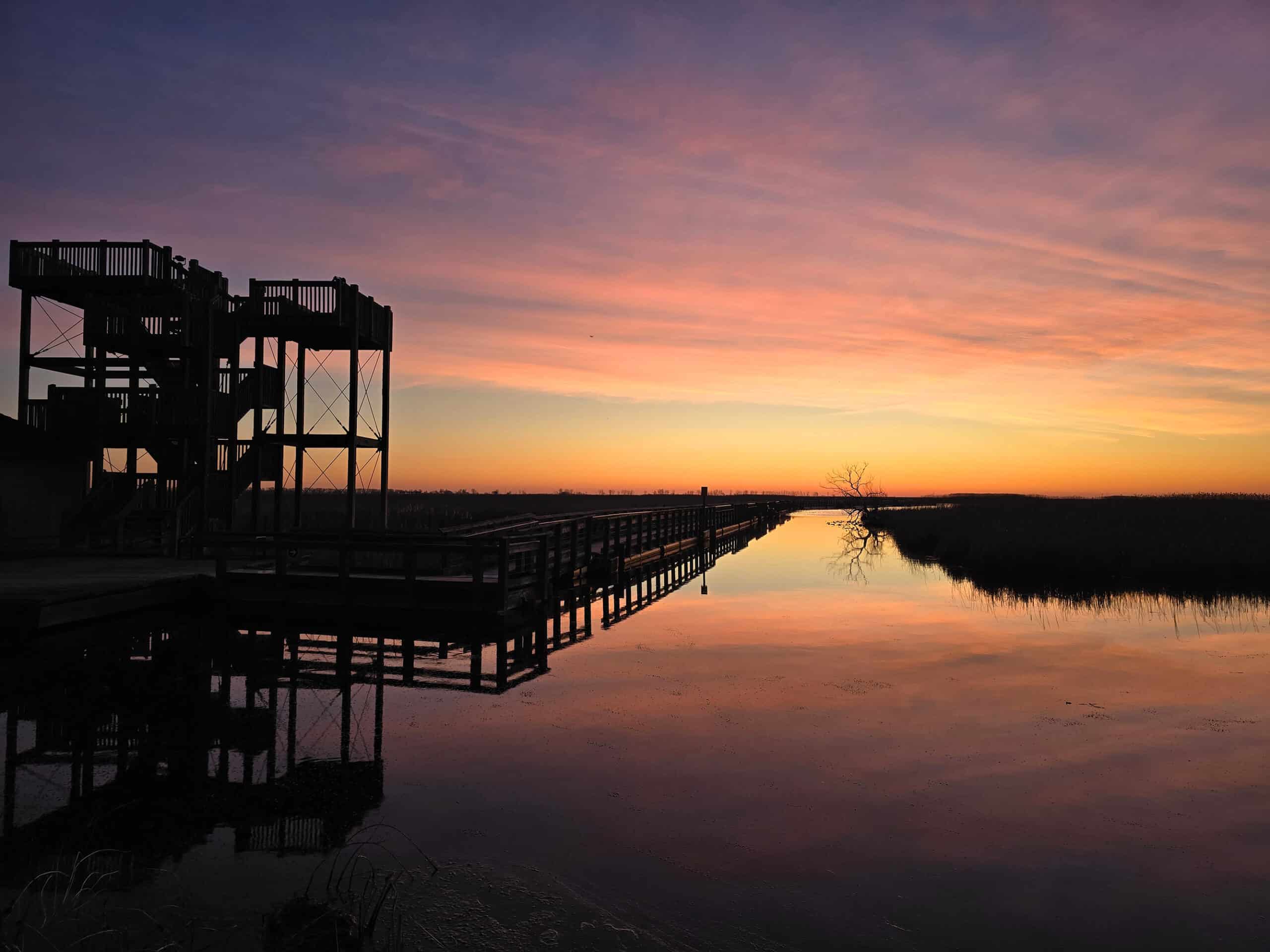
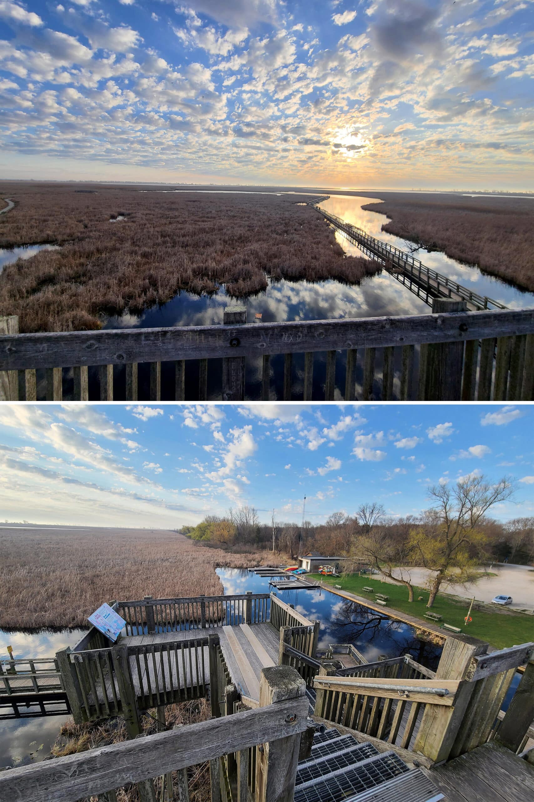
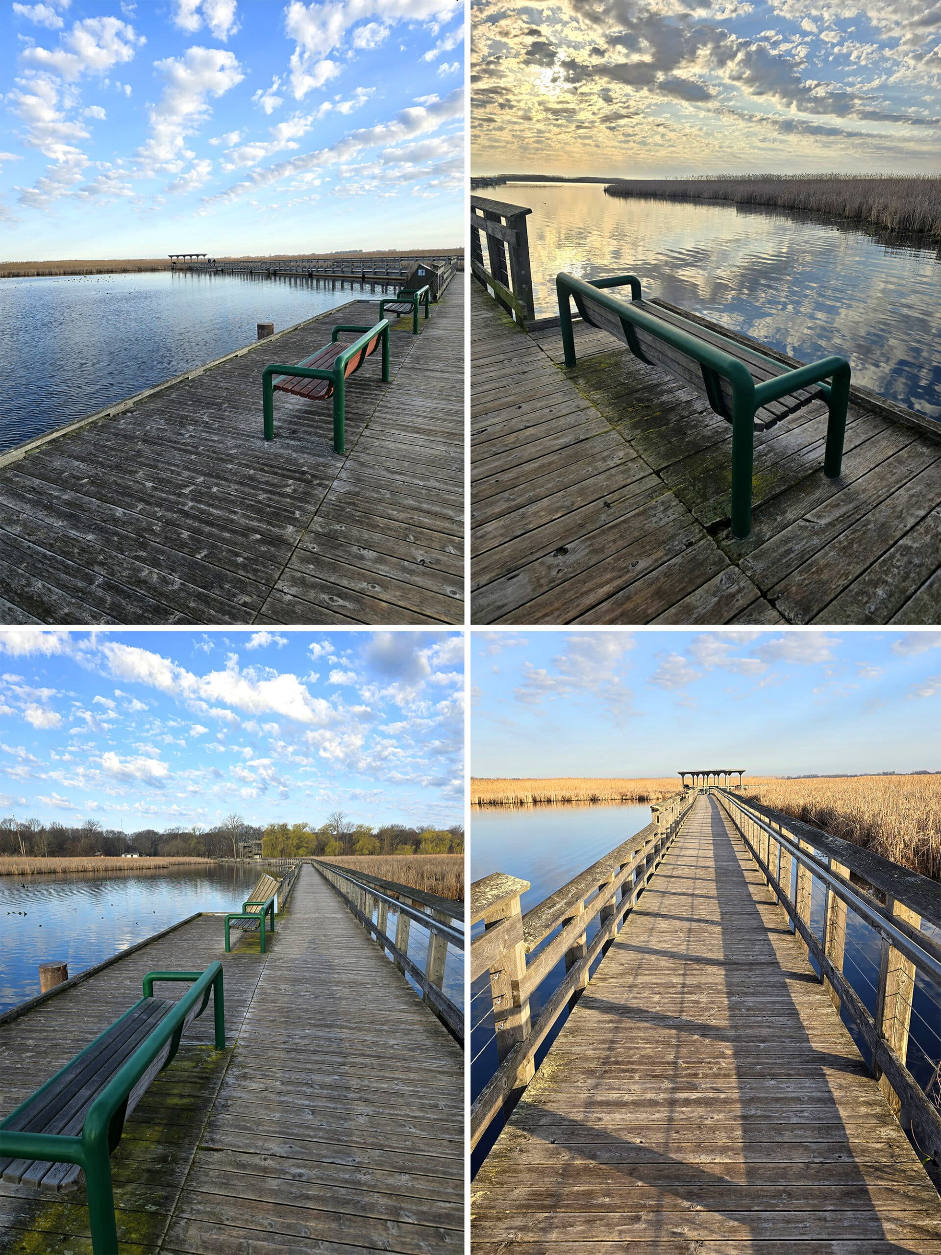
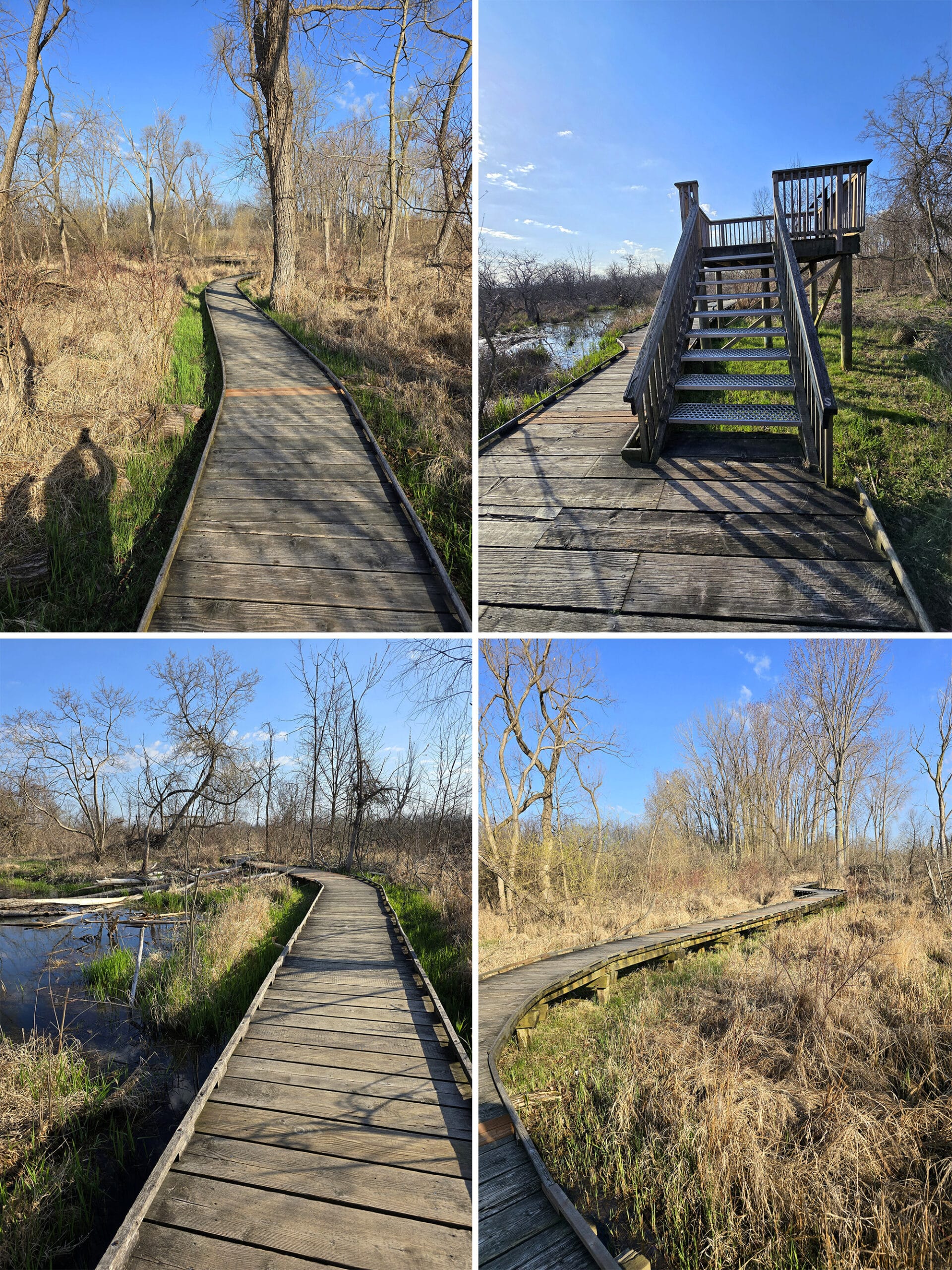
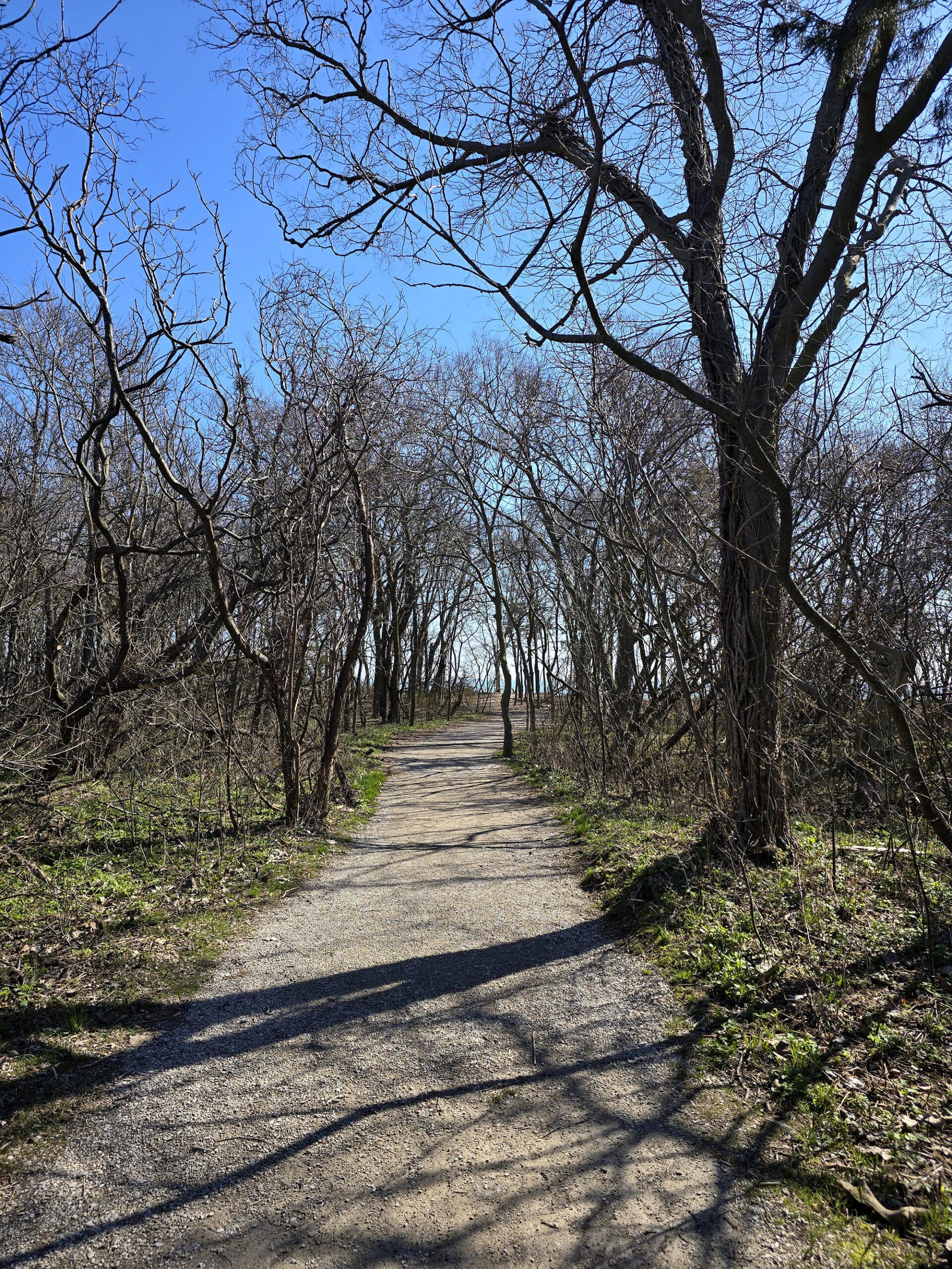
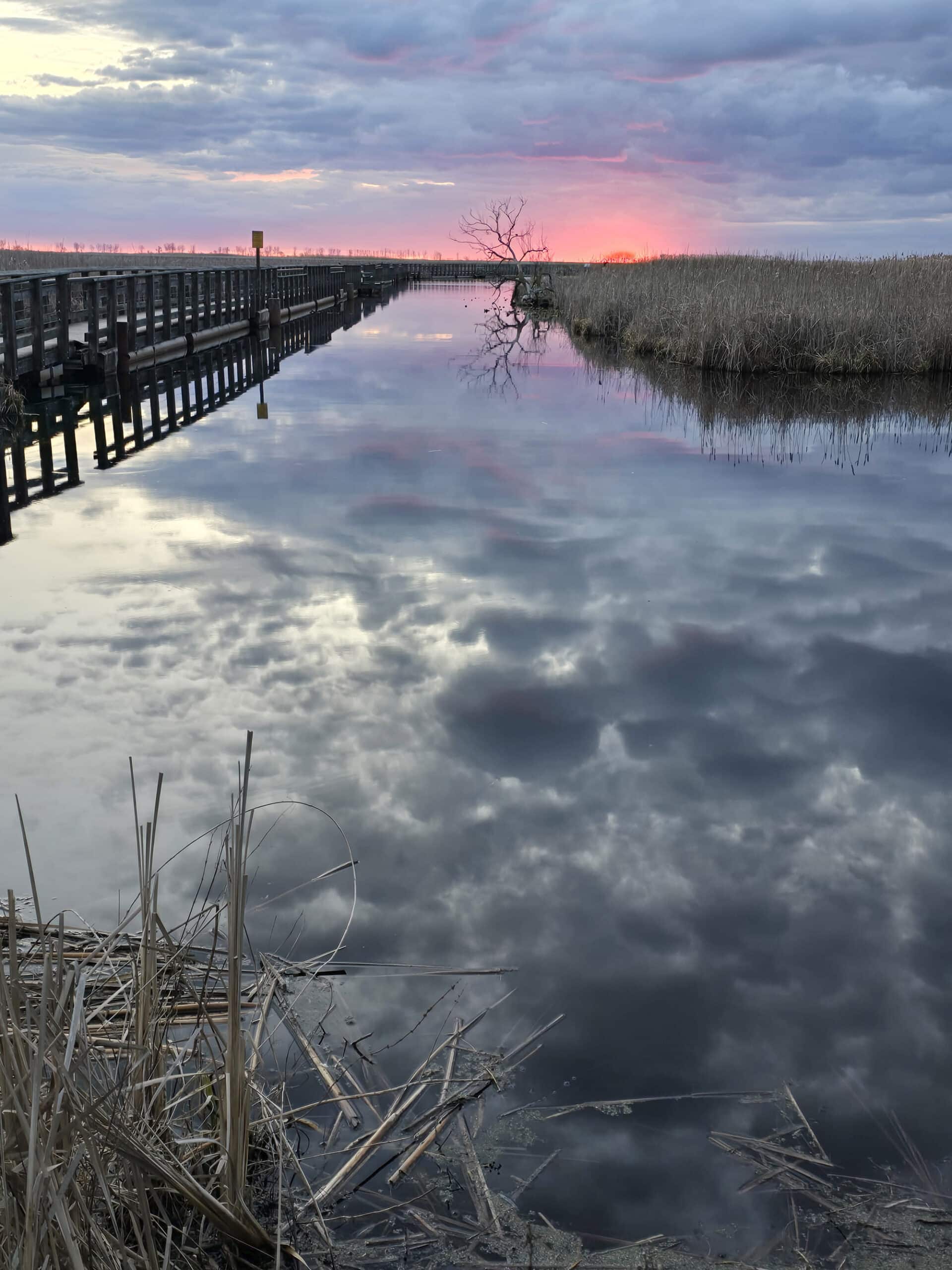
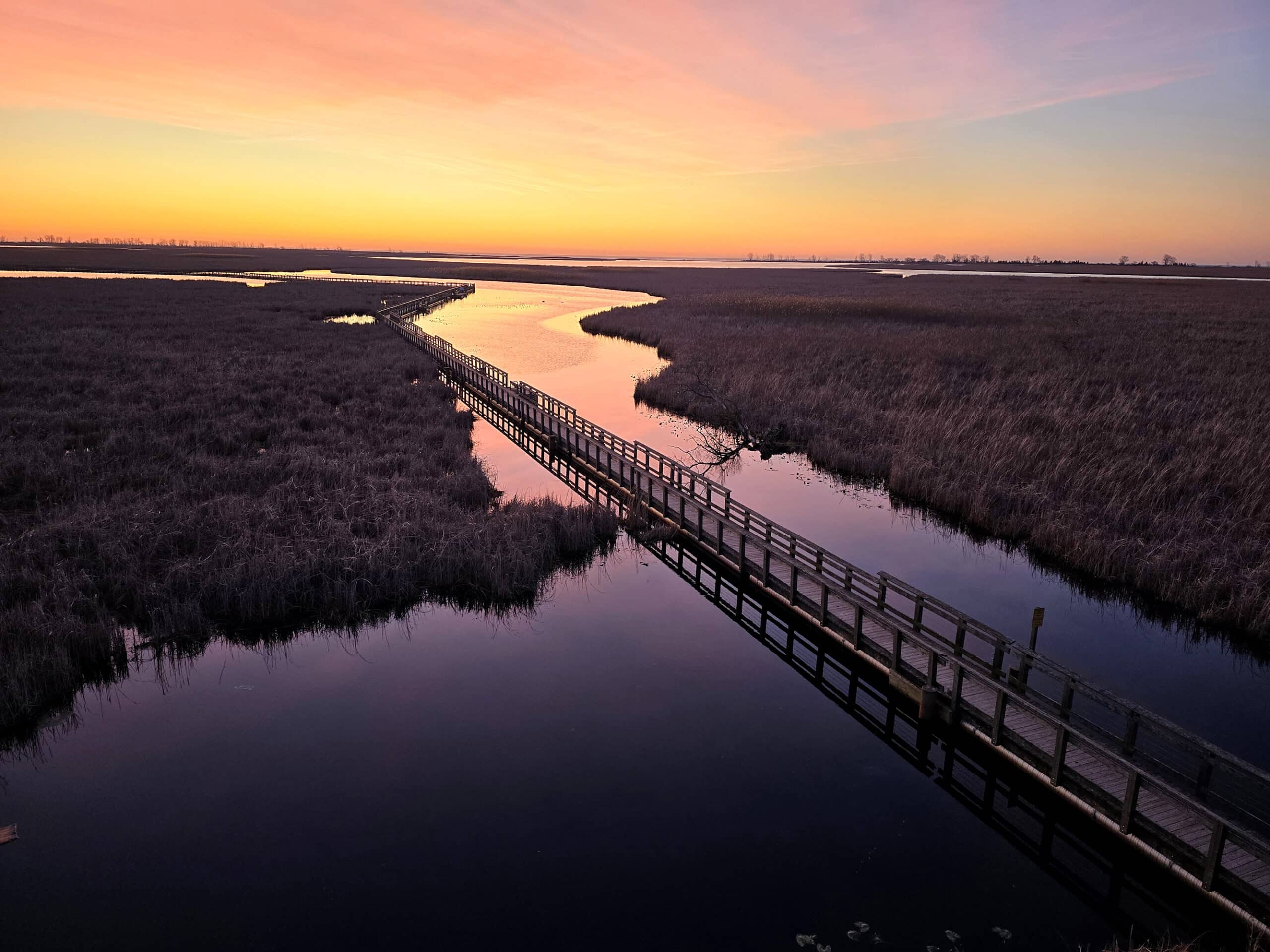
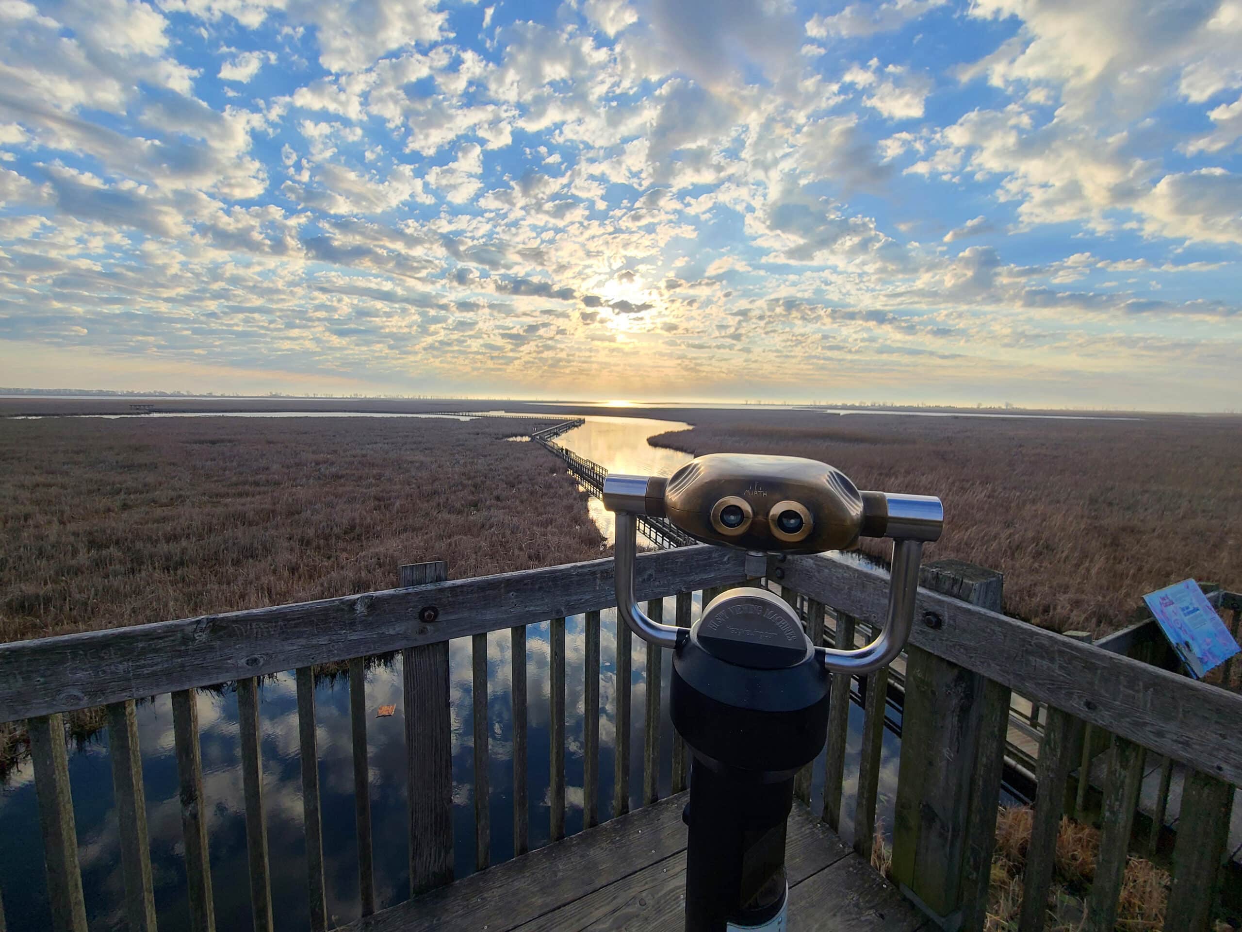
Marsh Boardwalk
This trail is listed as being a 1km loop of easy difficulty, with a suggested completion time of 45 minutes.
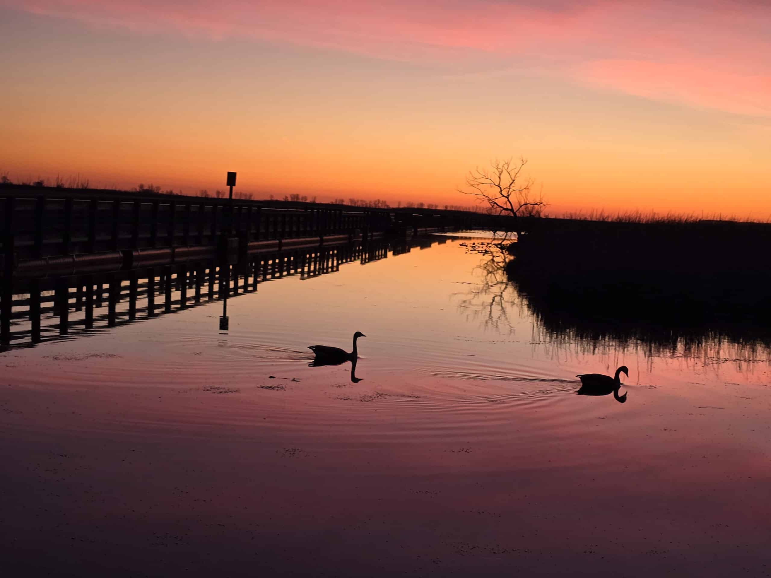
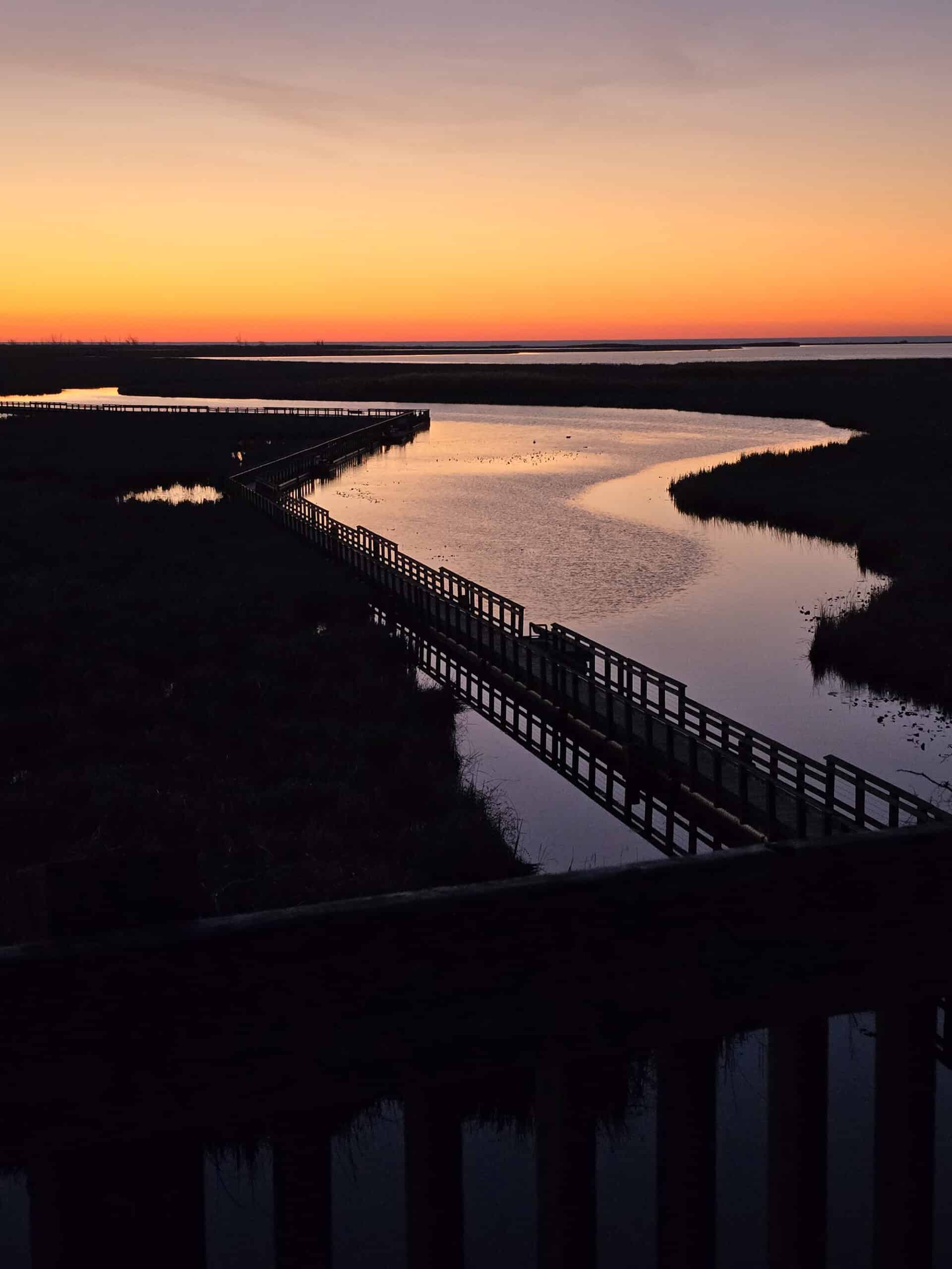
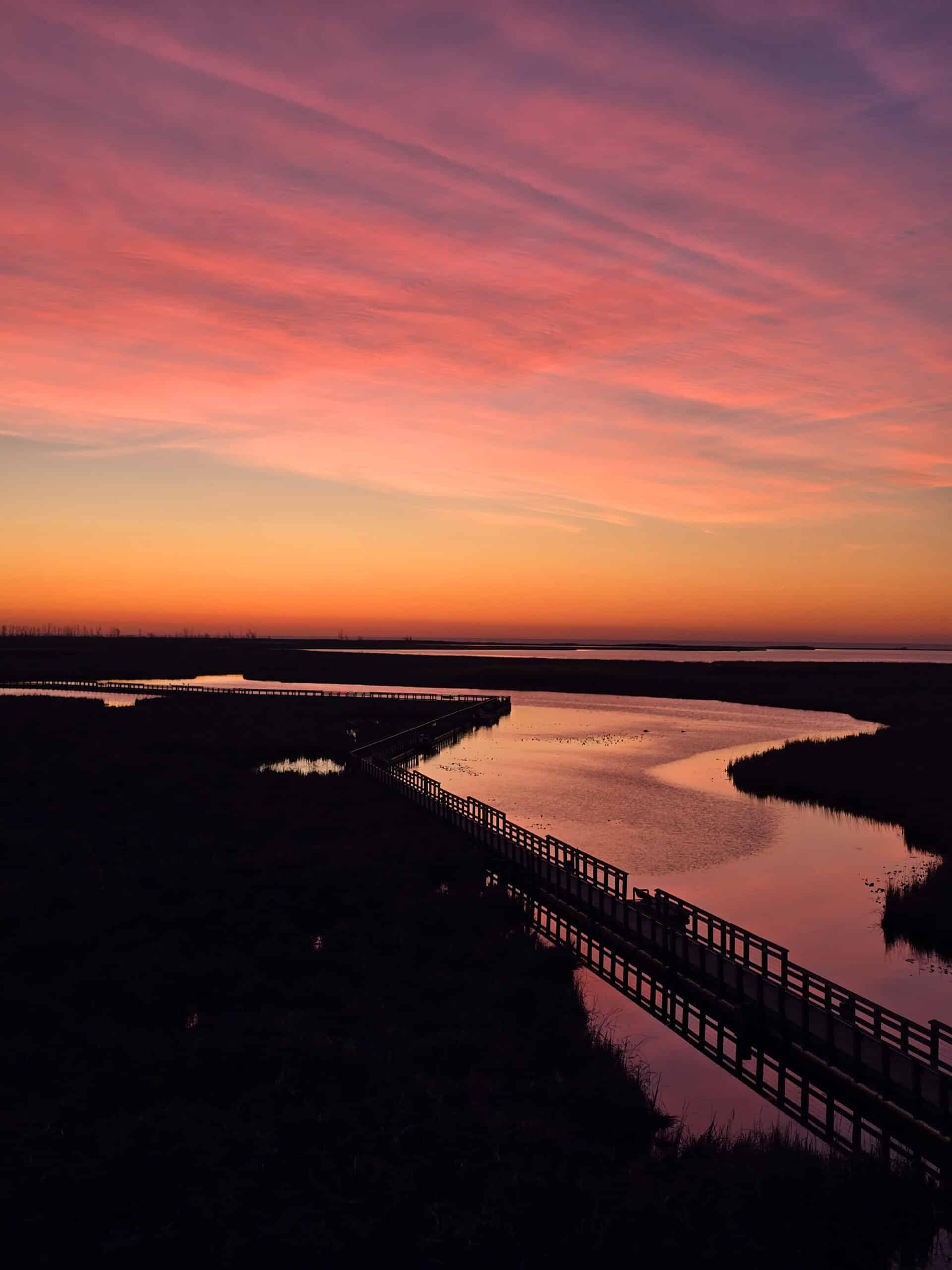
The entire trail is a floating boardwalk, and it was a GREAT way to spend a beautiful spring morning!
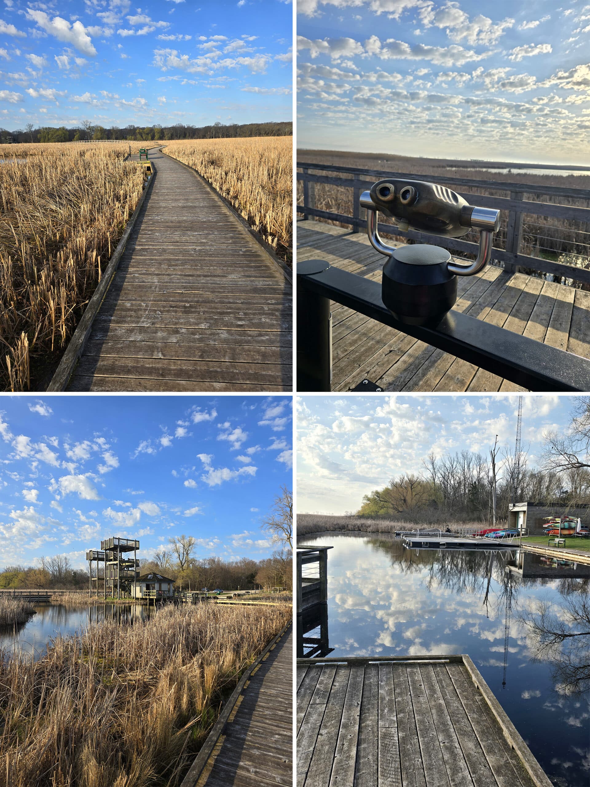
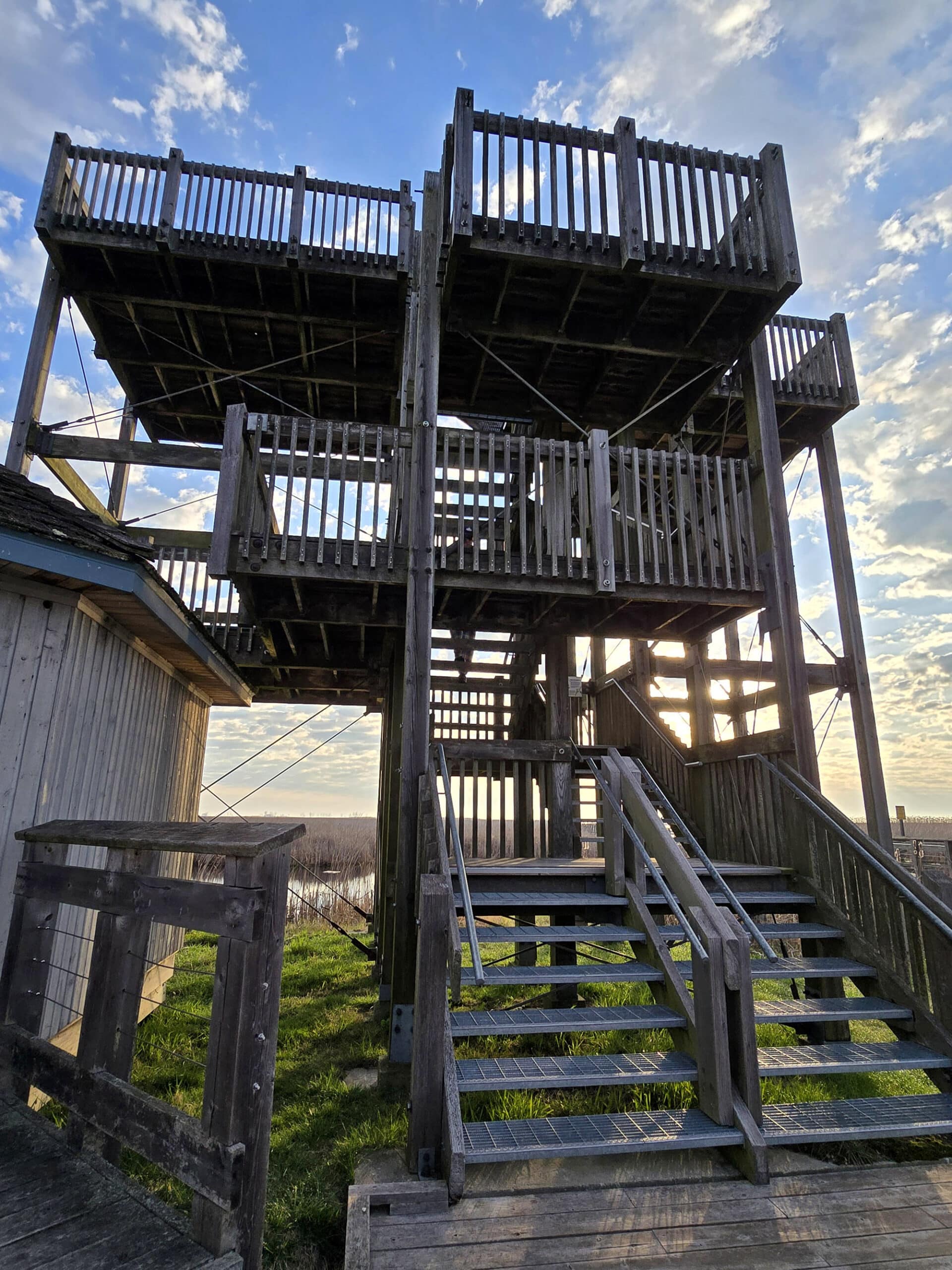
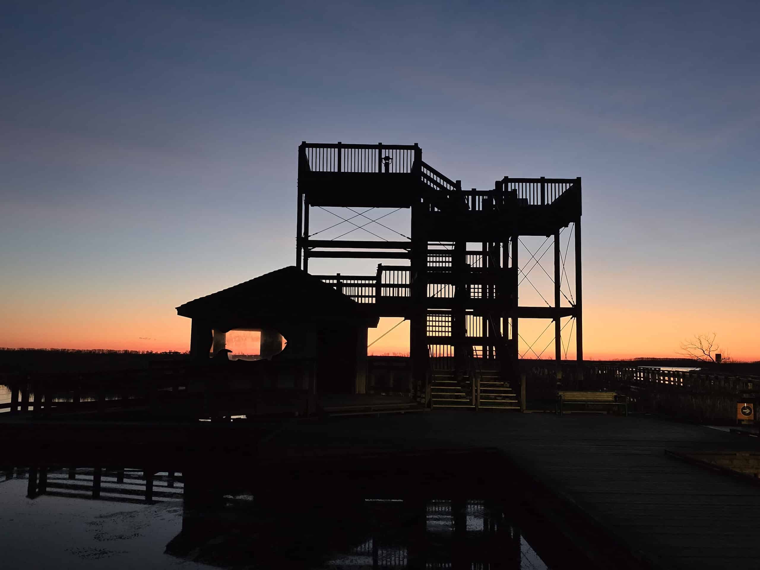
The short trail starts and ends at a big wooden observation tower, where we learned about the wildlife in the area (on the bottom level), and saw a fantastic view of the area from up top.
This was all as we were listening in on a bunch of geese making their drama EVERYONE’S business, btw.
Ambiance!
I was SO excited!
We didn’t see any of the wood ducks that apparently hang out in the area, but we did see a turkey (in the picnic area, NOT the marsh itself!), a few giant swans, and a bunch of birds we couldn’t identify.
We both LOVED this walk. It was so gorgeous and serene first thing in the morning - we decided that we should go back the next morning!
The next time, we’ll take more time to sit and take in the surroundings at the multiple benches along the way.
Note: While the trail itself is wheelchair accessible, the observation tower is not.
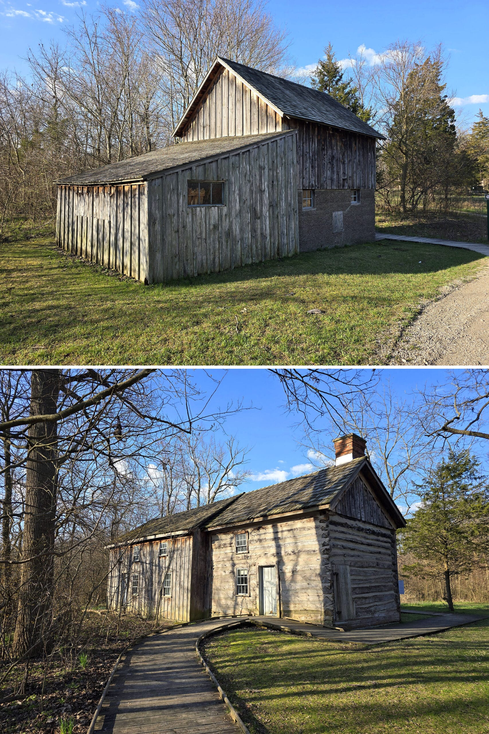
DeLaurier Homestead & Trail
This short walk has two parts to it - The outer loop is about 1 km long (“Long Loop”), and there’s a shorter inner loop (“Short Loop”) that is only 0.25 km.
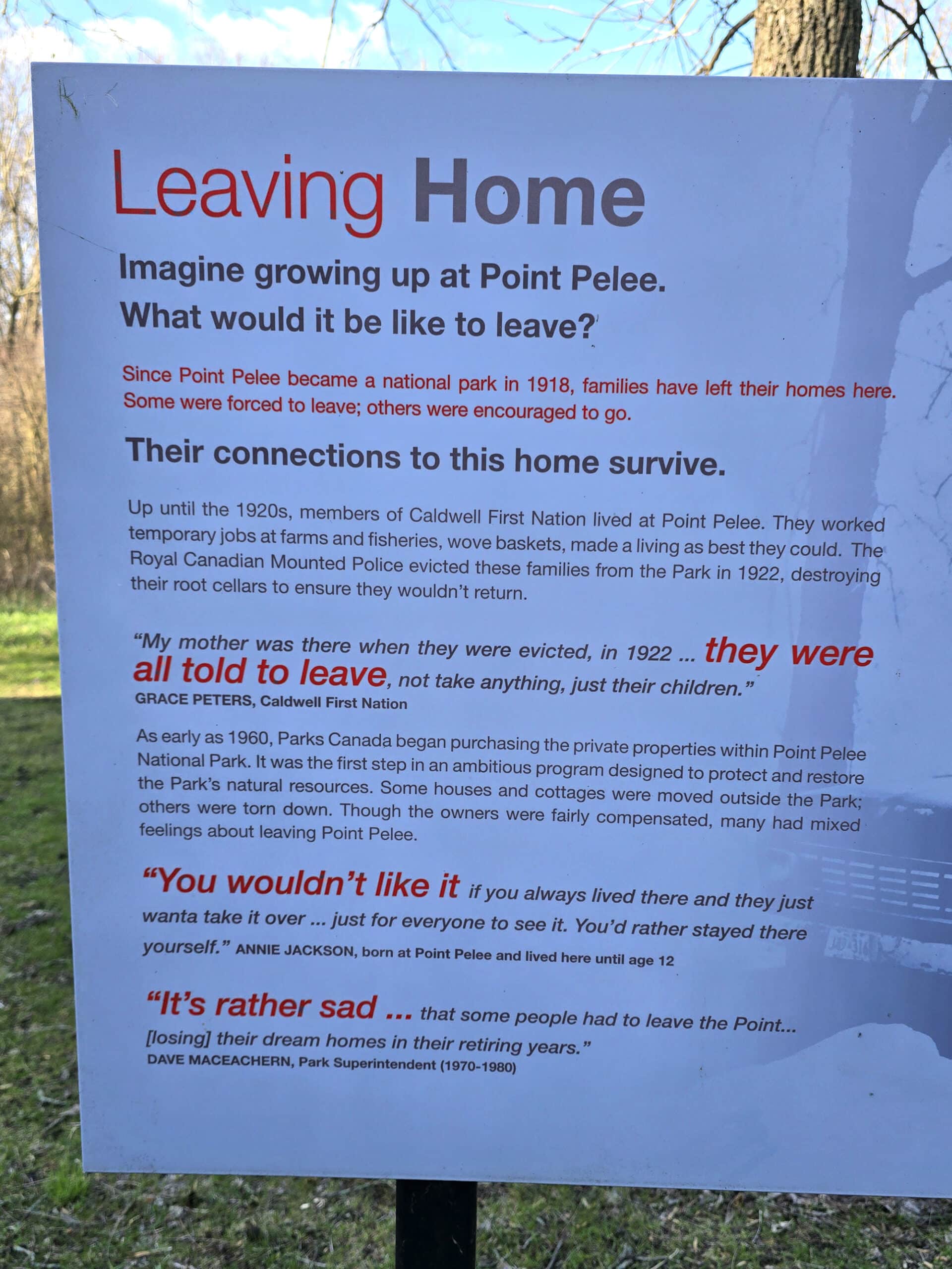
We walked the outer loop, and started the walk off by reading signage that really drove home what absolute tools the federal government has been (let’s be real, continues to be) to First Nations people.
In this case, it was more colonization - kicking people off the land so that they could develop it, eventually turning it into the park we visited that day.
Made me feel a little gross about visiting it, TBH.
There were spider webs everywhere. I’m not just talking about on exhibits or in trees off to the side, I mean crossing the trail.
Constantly, everywhere, multiple at once, the whole time.
As a former arachnophobe, I was busily trying to convince myself that I was feeling my own (French braided!) hair against my face that often. Meanwhile, Porter was walking ahead with long lengths of spider web trailing off him like it was a freaking cape.
Oooof.
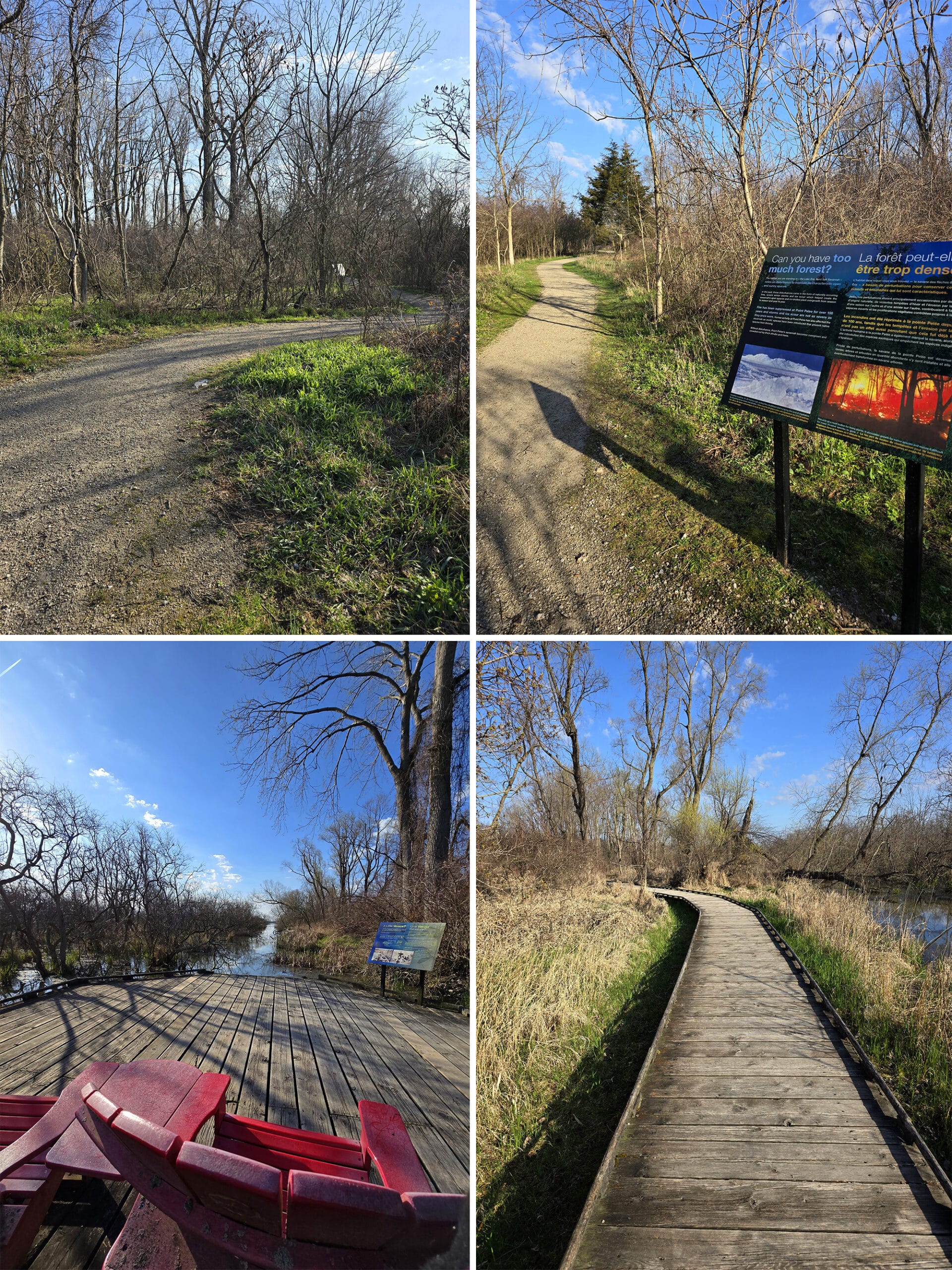
At one point, there were a couple of the Red Chairs off on a section of boardwalk. They had a cool view down a channel of open water through a marsh.
Nearby, there was a small outlook or bird stand thing. Not a lot to see at the time we were there, though.
Chinquapin Oak Trail
This is a 4 km loop trail, and it suggests a time of 2 hours to complete it.
This one has a couple of access points, across from the Visitor Centre parking lot, and across the street from the White Pine Picnic area.
The literature says that it takes you through a mixed dry forest that involves the namesake Chinquapin Oak.
... but we haven’t done this one yet, though!
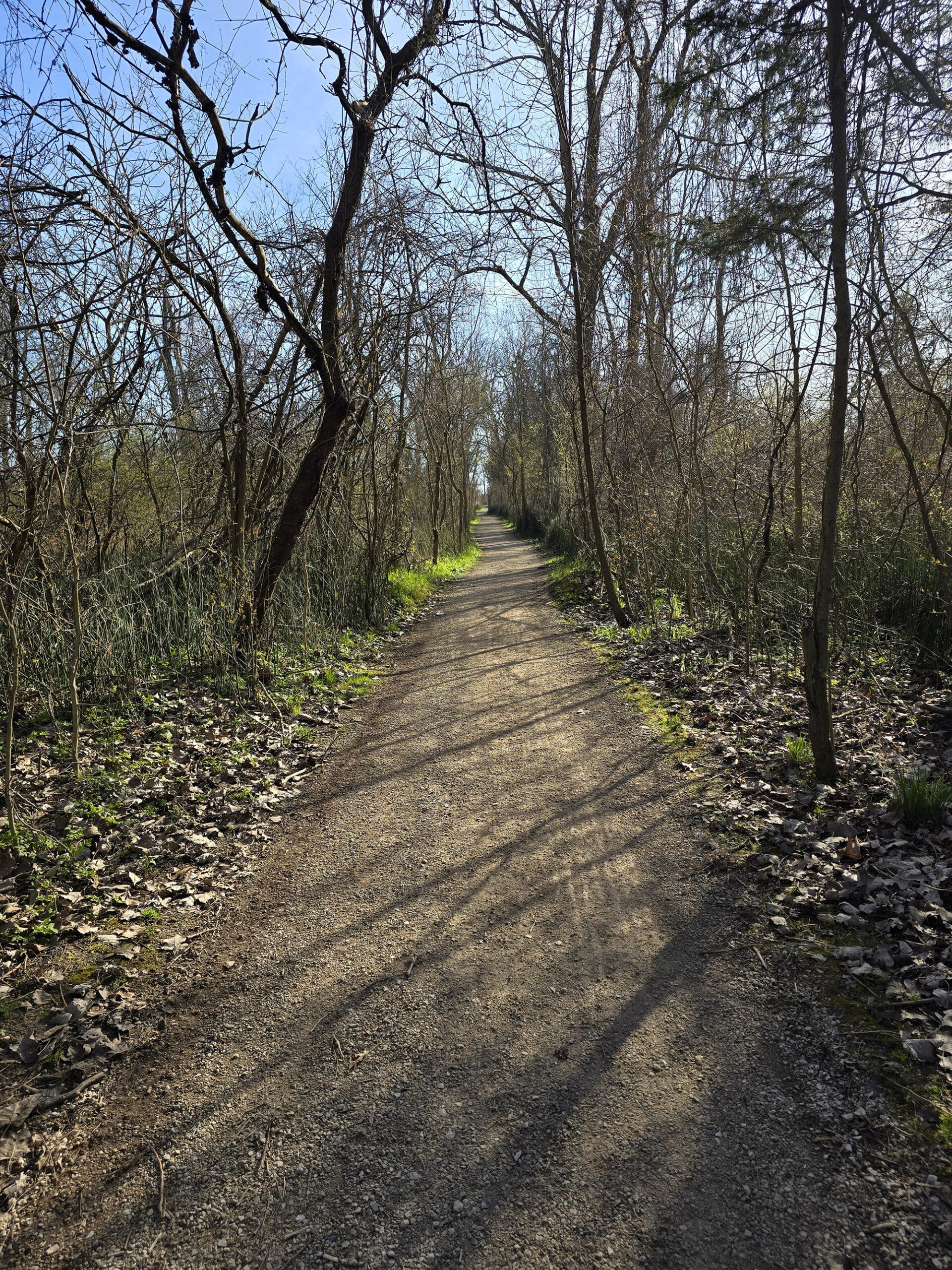
Shuster Trail
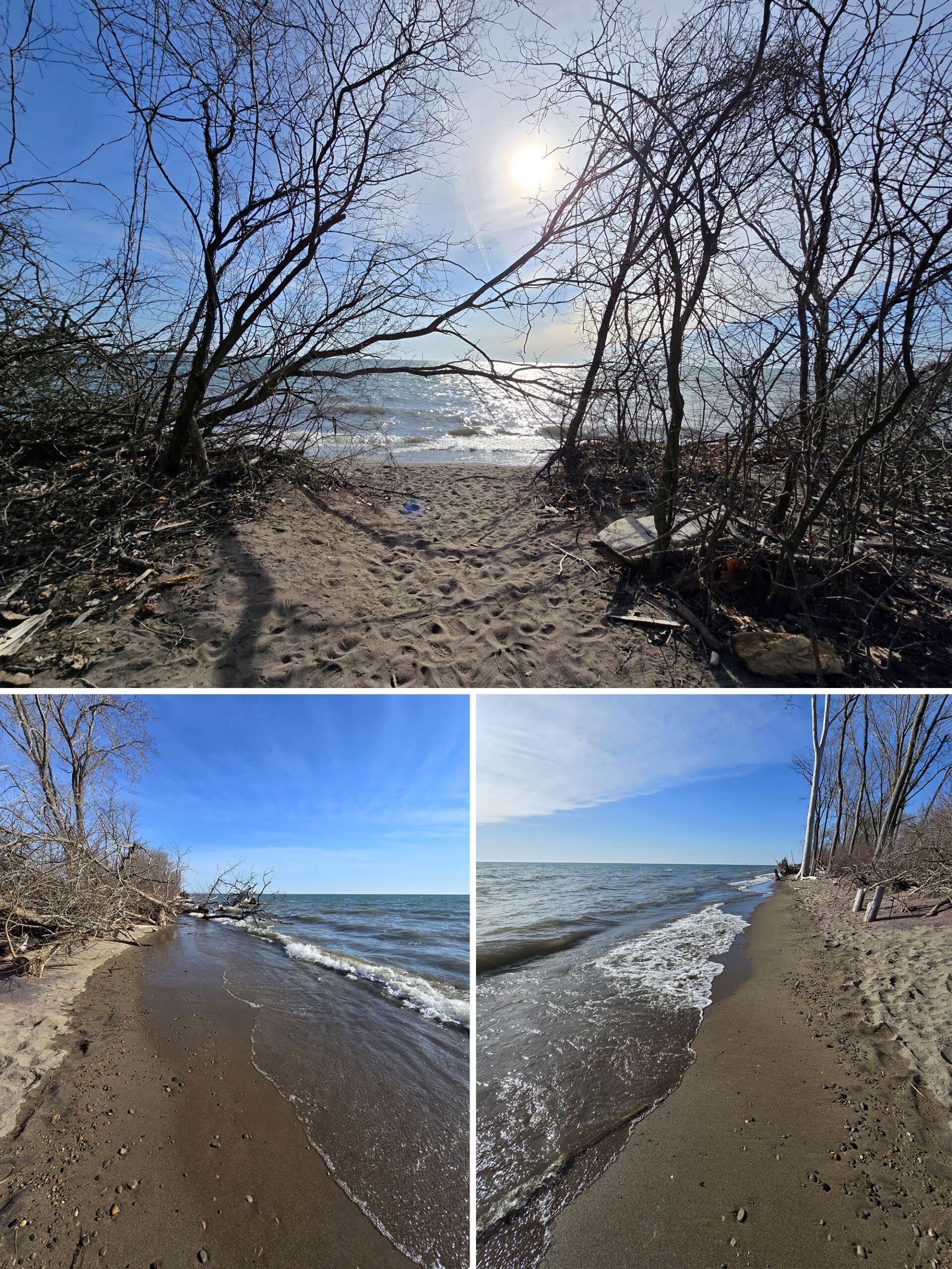
This trail is 0.5 km long, and basically just a short, straight walk out to the beach. (ie: 1 km return).
It’s a very flat and well groomed trail, with lots of birds around.
It's a fairly fully enclosed trail - big trees and such line both sides - right till the last few meters. At that point, there's basically a "tunnel" or gate effect from the trees, then BOOM you're on the beach.
When it opens out onto the beach, you’re all of a sudden just a few feet from the water! It's fairly dark leading up to that point, so it was a striking effect.
Aside from the tip, this seems to be the only place in the park to access the eastern shore / beach on foot.
Woodland Nature Trail
This is a 2.75 km loop, with a suggested completion time of an hour.
We didn’t get around to this one during our first visits, but I was curious about that timing. Tilden Woods is flat, easy, and 45 minutes to do 1 km, I wonder why they’re saying it’s only 15 minutes longer to do a trail almost 3 times as long?
Weird.
Anyway, this one is noted as being the oldest forest in the park, and has it’s own guide book - available at the Visitor Centre.
Porter did this trail during our 2025 visits - it’s another flat, wide, well-packed gravel trail. Super easy, and - according to Porter - “Very ADD friendly”.
He said it was “twisty-turny”, with a variety of different environment types. Always something new to look at!
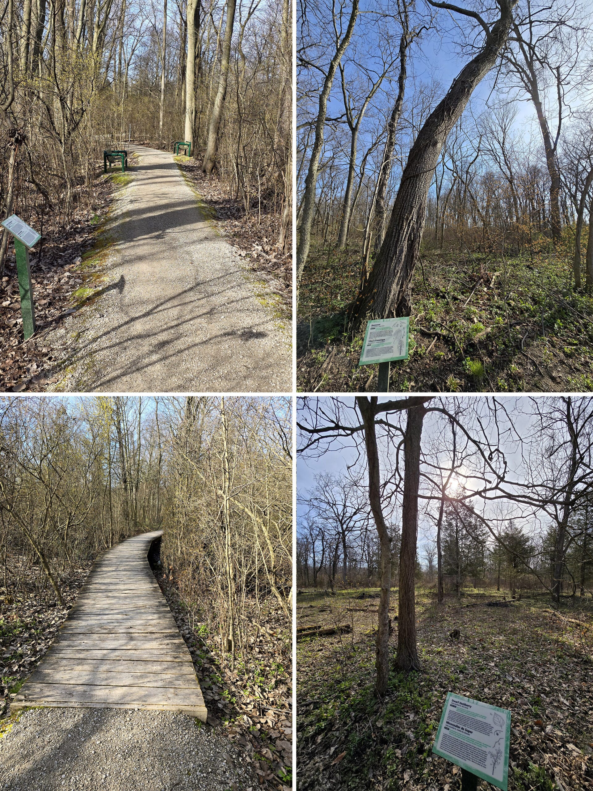
Tilden Woods Trail
This is a 1 km loop that extends off from both the parking lot and the Shuster trail, and is 1 km in length.
It has a similar path style to Shuster - wide, flat, level - just with the addition of some boardwalk and several benches along the way.
The benches were more of a rest thing, than a “situated on account of the view” thing.
It was cool that there were several plaques among the way, telling you what kind of tree you're looking at.
As with the Shuster Trail, we saw a ton of birds here, on all of our visits. At one point, Porter was photographing a Turkey Vulture flying above, and got spooked by a *Turkey* that snuck up behind him and let out a loud gobble!
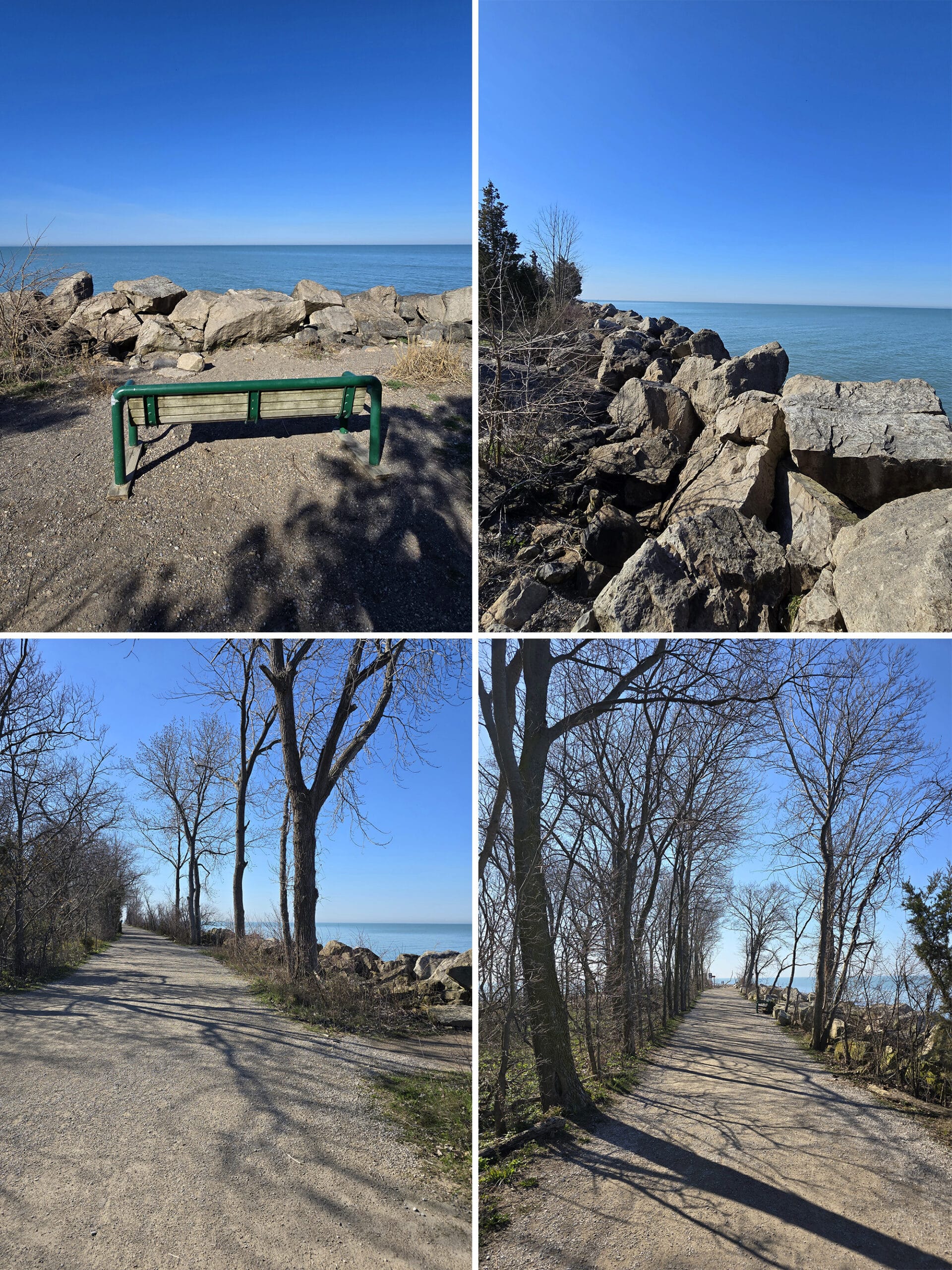
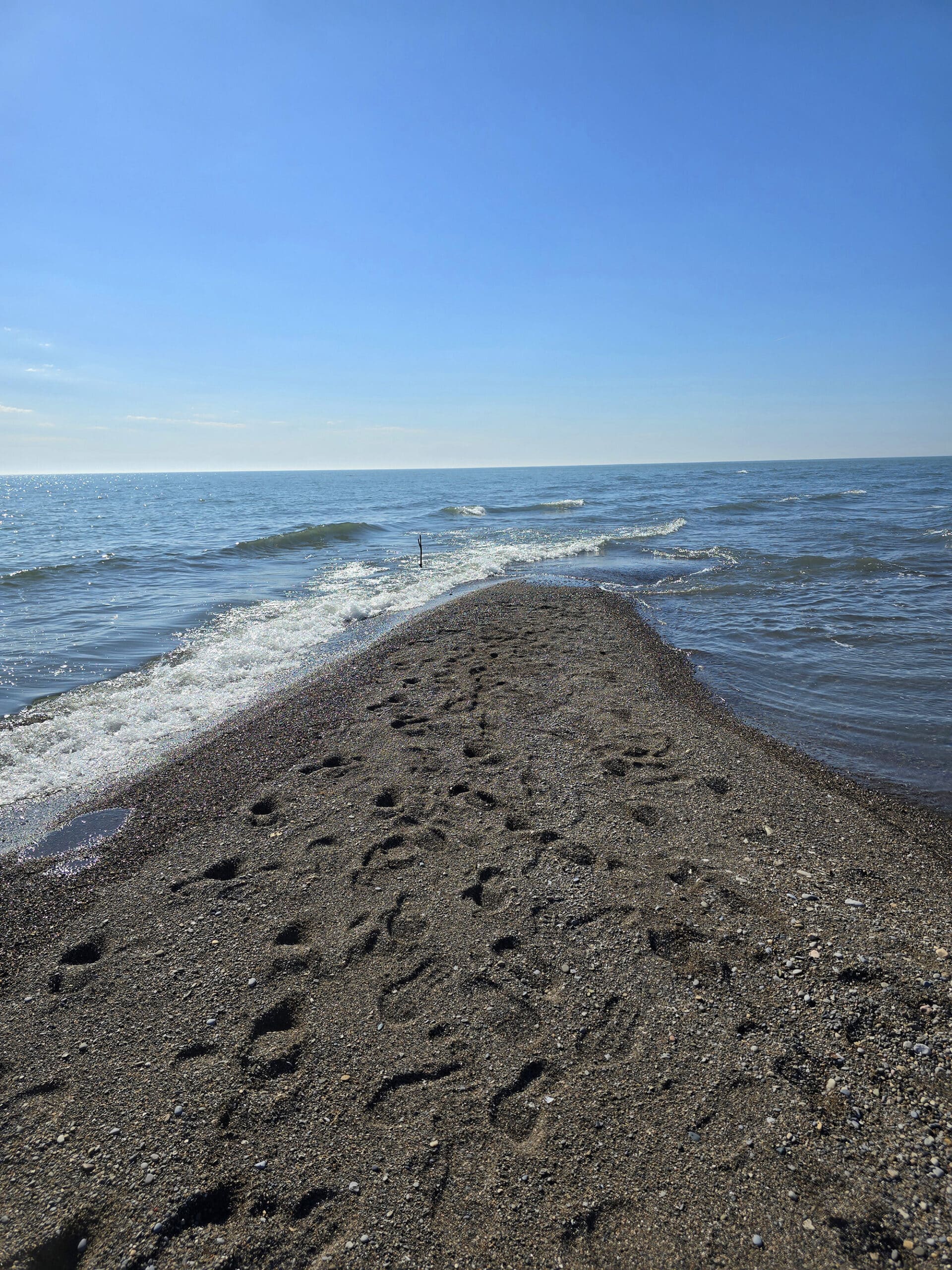
Tip Trail
The start of the tip trail is right about where the shuttle drops you off - near the Tip Exhibits.
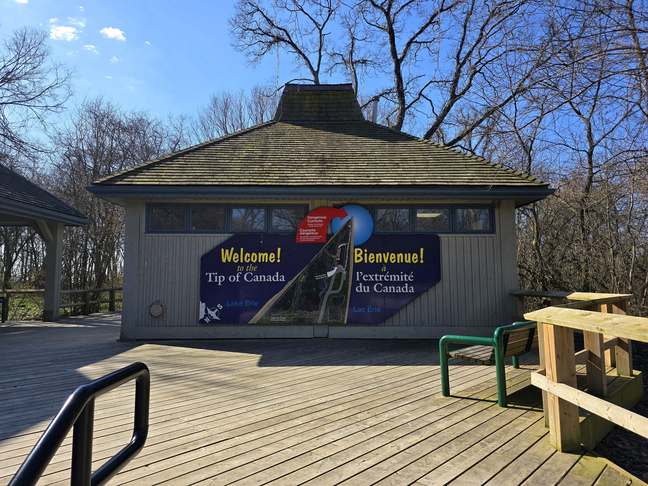
At the beginning of the trail is Tip Tower, as we previously mentioned.
The sand was pretty difficult for me to walk on, none of it was that nice packed kind that I do better on.
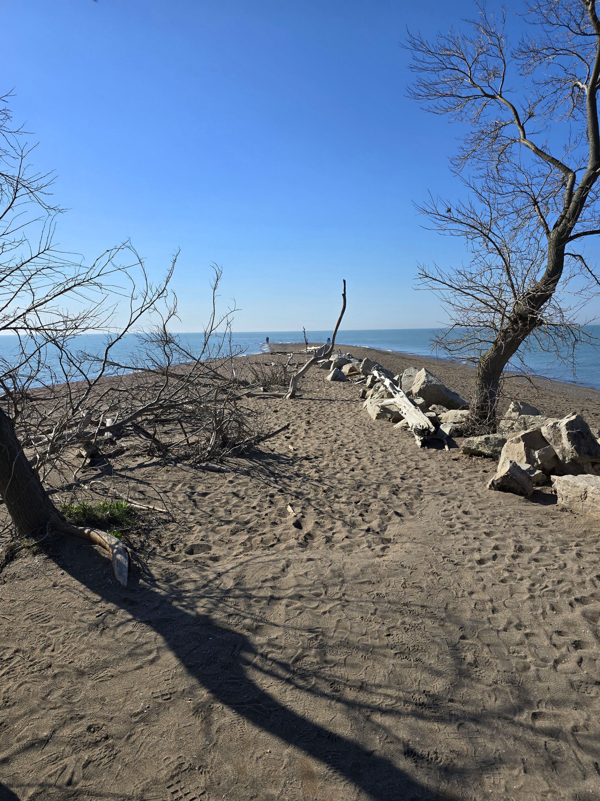
Watching the waves come in from both directions was cool, they’d form little squares as the met up at the tip.
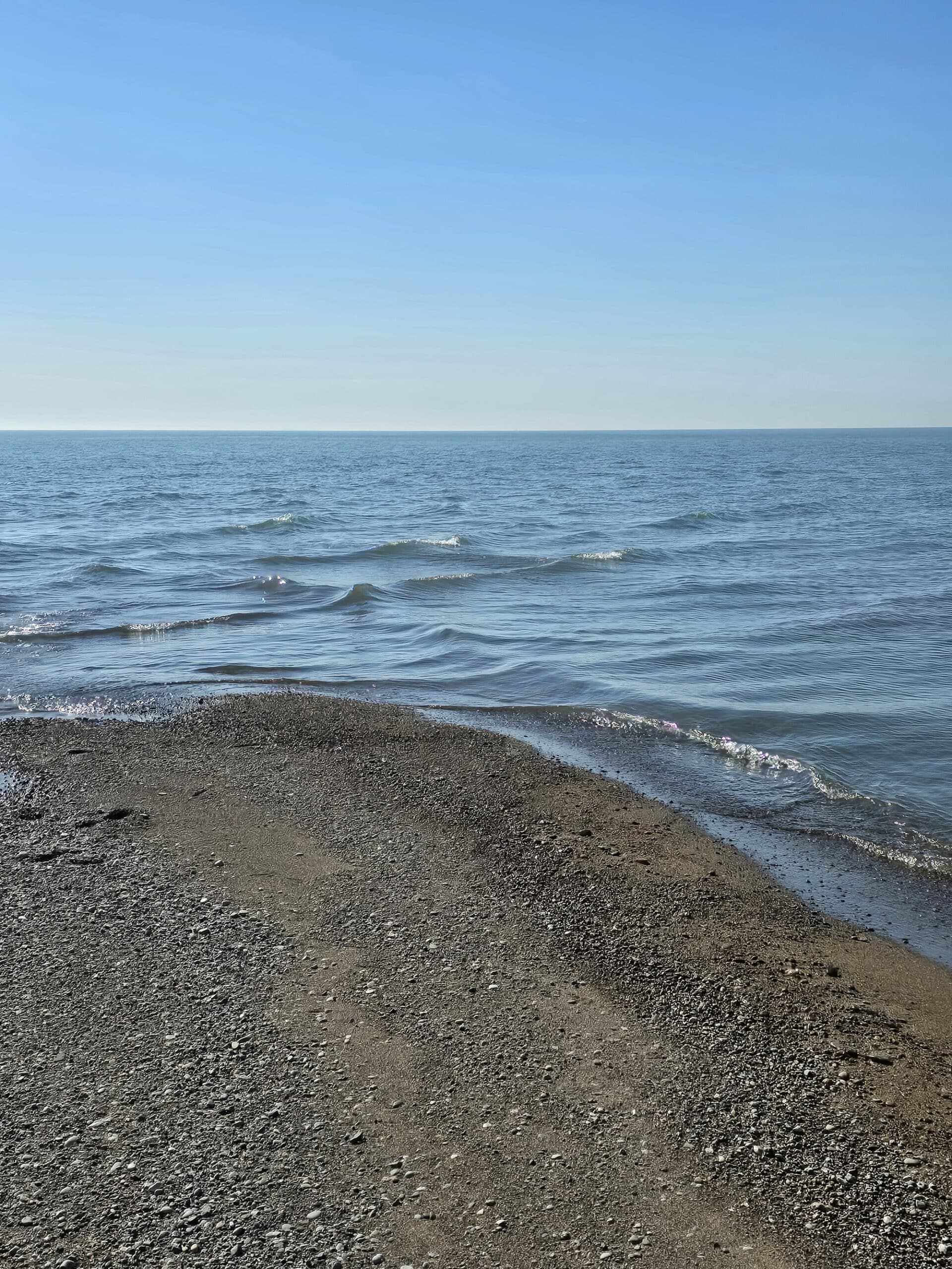
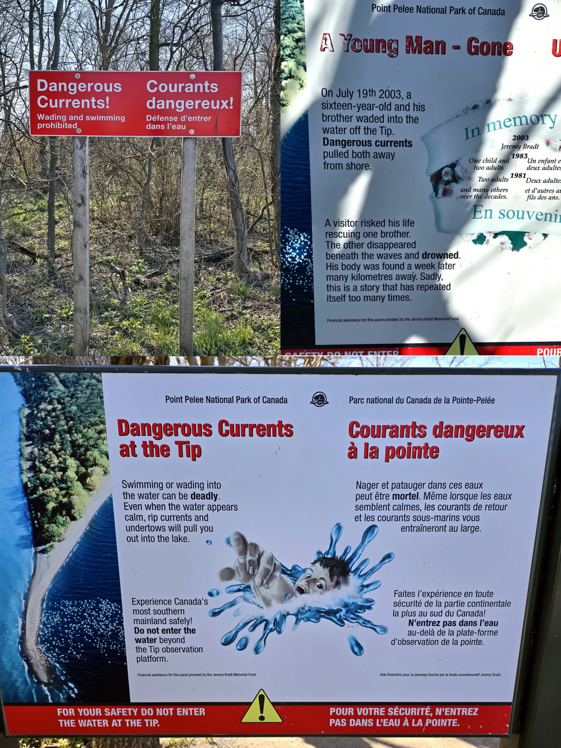
(As a note, wading anywhere south of the shuttle dropoff is prohibited, and can end you up either dead, or facing up to $10,000 in fines.)
Does visiting two of the extremes basically obligate one to complete the set? I kind of think it does!
Various Footpaths
Point Pelee National Park offers a series of “footpaths” that are apparently more narrow, with uneven surfaces and wet sections.
Because I’d already done a lot of walking in the days leading up - and we were already planning to visit again the next day - we decided not to bother with footpaths.
Anyway, the footpaths are:
Cactus Field Footpath (Off the Chinquapin Oak Trail)
Redbud Footpath (In the middle of the Woodland Nature trail)
Sparrow Field Footpath (Just north of the Tip Exhibition Area / Tip Tower, on the east side of the park)
West Beach Footpath (A long footpath going from West Beach, down to the Tip observation tower area).
Biking
We’ve seen a LOT of people biking during our various trips to Point Pelee park - even though they’ve all been on weekdays, during the off season!
The park boasts 12 km of well groomed bike trails - in addition to 9 km of roads - to bike on. Seasonal trails are open from June to October, but biking can be done in the park all year long.
I wish we’d realized that we could have rented bikes from the outfitter at the Marsh Boardwalk - Pelee Wings. What a fun way to explore the park!
Anyway, in addition to Centennial Hike and Bike Trail and Chinquapin Oak Trail - mentioned in the hiking section - you can also bike on Tip Road.
This is the road from the Visitor Centre down to the tip exhibit area - about 2 km, 1 way. We saw a TON of people biking that road when we went out on the shuttle. I guess that would be a great way to beat the crowds that wait for the shuttle to start running in the morning!
Anyway, this part of the road is restricted to all vehicular traffic - outside of the shuttle - for most of the year.
Once you reach the exhibit area, it’s walking only from there to the tip - but they have bike racks available.
Swimming
While we were looking forward to our visit on account of birds - and the Tip - Point Pelee National Park seems to be a great place for swimming.
You know, just not in early April!
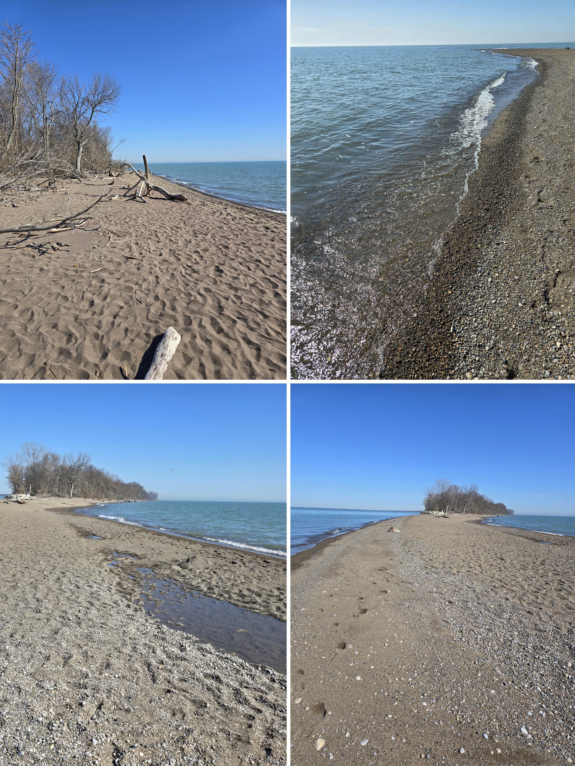
They have the longest continuous natural beach in Essex County, with sandy beaches going almost the full perimeter of the park!
20 km of beach!
Northwest Beach is by far the nicest beach area, and West Beach is the other most popular beach area in the park.
Of course, not all of the shoreline is actually usable as a full beach. Strong currents at the southern end of the park mean that entering the water anywhere south of the Tip exhibition area is banned.
You can still hang out in the sand, though.
Also, most of the East Beach seems to only be accessible by water. There’s a canoe access that starts out from the Marsh Boardwalk, and you can walk in via Shuster Trail or the Tip, but that’s about it.
There are no visitor facilities on the East Beach, though.
Birding, Wildlife, and Nature
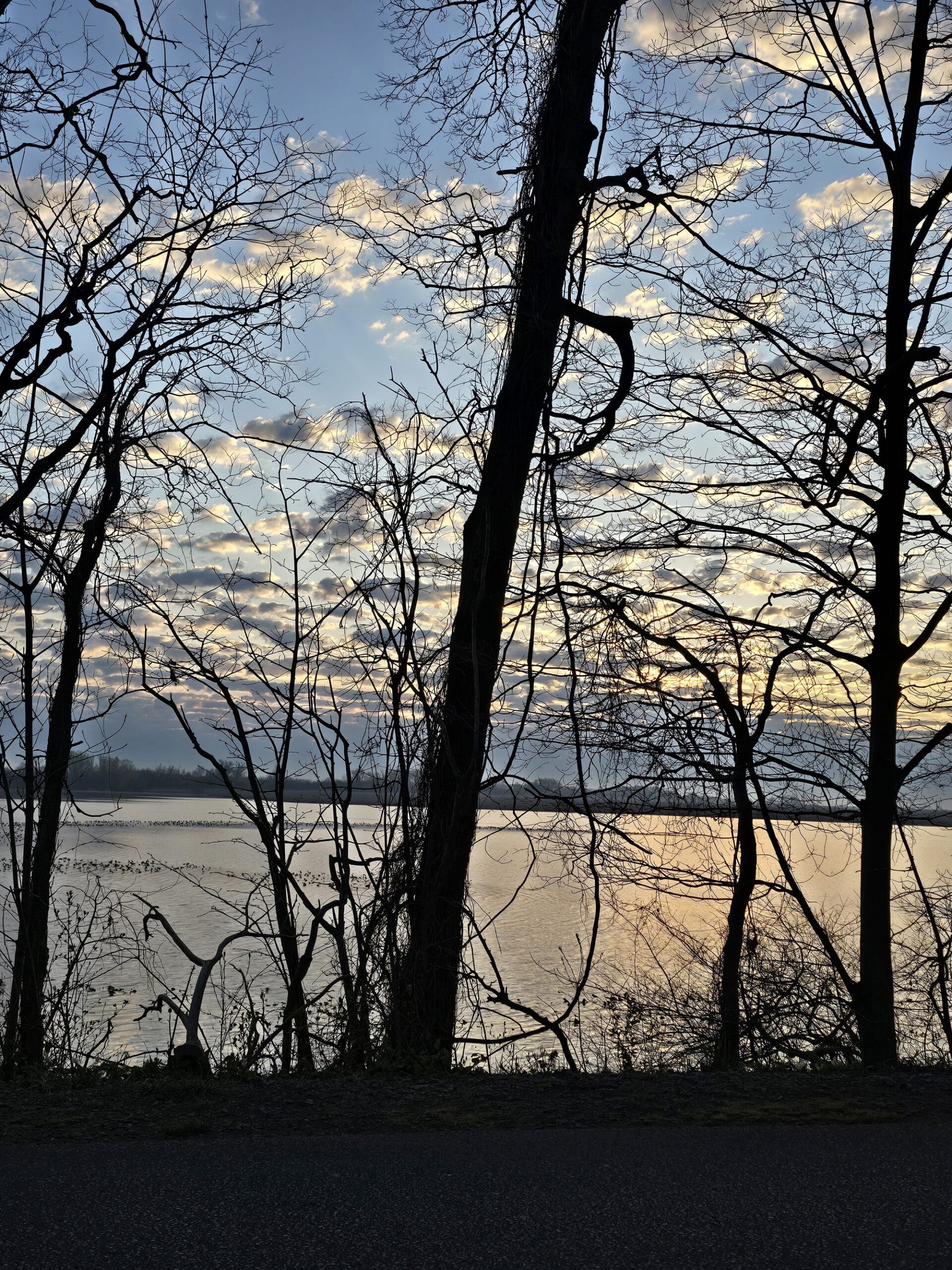
Point Pelee is known for having one of the largest freshwater marshes in Southern Ontario - it’s actually designated as a Ramsar Wetland of International Significance.
Between being a Ramsar site , being a warmer climate due to the moderating effects of Lake Erie, and being along major migratory flyways, its no wonder that it’s a popular spot for bird watching.
It’s basically the perfect place to see a bunch of migratory birds in the spring and fall - over 390 species of birds have been recorded in the park.
I think our visit must have timed with the beginning of the spring bird migration, as it seemed VERY active - though peak time isn’t until May.
At that point, they host Festival of Birds . It sounds like the park gets pretty busy from all the people coming to see the different migratory species passing through!
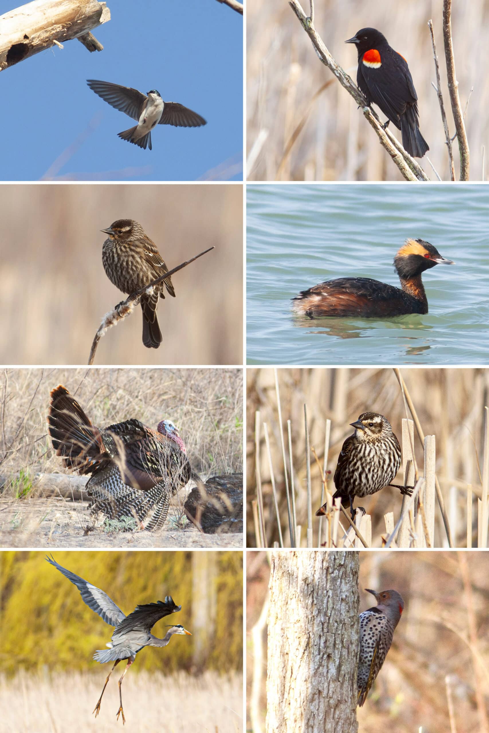
We saw a Horned Grebe - didn’t even know that existed, til we image-searched the “weird duck” we saw at The Tip.
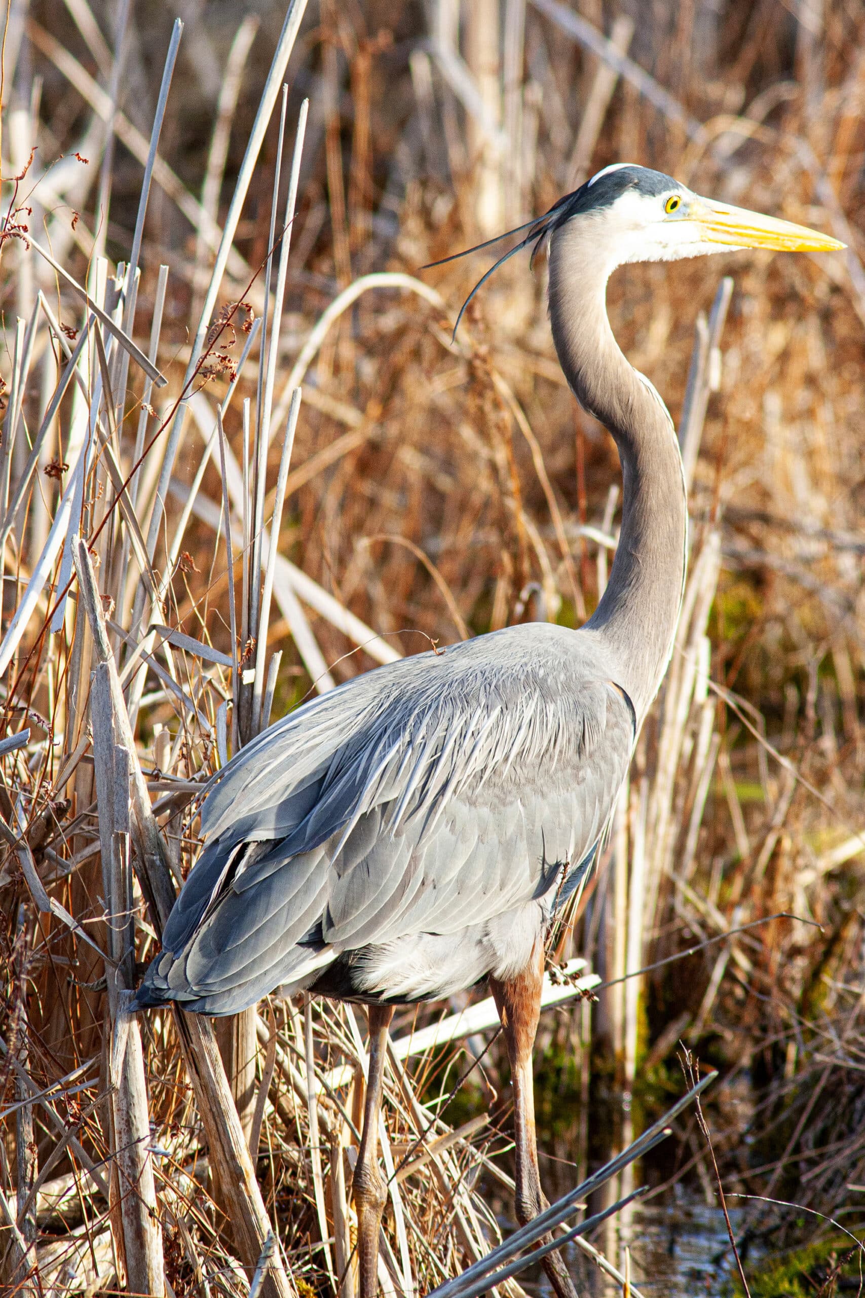
I finally got to see a Kingfisher, which was exciting, and Porter was thrilled to see a Great Blue Heron up close.
There were wild turkeys everywhere, as well as Turkey Vultures overhead.
Bunch of stuff we heard and couldn’t see, or saw ... but couldn’t identify, too!

Row 2: Bonaparte's Gull, Brown Creeper, Brown-Headed Cowbird, Carolina Wren
Row 3: Common Grackle, Great Blue Heron, Hermit Thrush, Horned Grebe
Row 4: House Sparrow, Northern Flicker, Red Winged Blackbird (F), Ring-Necked Duck
Row 5: Ruby-Crowned Kinglet (F), Song Sparrow, ??? Sparrow, ??? Sparrow
Row 6: Tree Swallow, White-Throated Sparrow, Wild Turkey, Yellow-Rumped Warbler
We found the best areas for birding to be at the Marsh Boardwalk area, and the Tilden Woods Trail - we spent a lot of time birding at each location, and each time we saw something new and interesting.
Overall, we heard and/or saw: American Goldfinch, American Kestrel, American Robin, Bald Eagle, Belted Kingfisher, Blue Jay, Brown Creeper, Brown-Headed Cowbird, Canada Goose, Carolina Wren, Common Grackle, Downy Woodpecker, Eastern Phoebe, Eastern Towhee, European Starling, Golden-Crowned Kinglet, Great Blue Heron, Horned Grebe, Louisiana Waterthrush, Mourning Dove, Northern Cardinal, Northern Flicker, Northern Mockingbird, Osprey, Red-Bellied Woodpecker, Red-Winged Blackbird, Ruby-Crowned Kinglet, Song Sparrow, Swamp Sparrow, Tree Swallow, Tufted Titmouse, Turkey Vulture, White-Breasted Nuthatch, White-Throated Sparrow, Wild Turkey.
Boating
Aside from Bon Echo, Point Pelee is probably one of the best places we’ve seen for canoeing.
Well, in theory. We don’t know a ton about it, but this triggered the second strongest “We NEED to get into canoeing!” urges, so I’ll go with that.
They have canoe and kayak rentals in the Marsh area, which looks to be an absolutely amazing area to paddle.
The Marsh is also kind of a gateway to other large ponds throughout the park, linking up with West Cranberry Pond, East Cranberry Pond, Crossing Pond, Lily Pond, and Lake Pond.
Lake Pond is also an East Beach access point, so you could paddle your way out to a secluded beach. No washroom facilities, but it sounds amazing anyway!
Fishing
Fishing has been prohibited within Point Pelee National Park since 2022.
This restriction also applies to catch-and-release fishing, and covers all waters in the park.
Photography
Point Pelee National Park is a great spot for photography, as there are SO many points of interest.
Obviously wildlife photography is popular at Point Pelee, between the birds in the sky, ducks and turtles in the water, and wild turkeys, deer, and other animals on the ground. So much opportunity.
Landscape photography is also a big thing there, with so many varied environments and gorgeous views. Our favourite was the Marsh Boardwalk, which was particularly amazing for sunrise photography.
Photographers are asked to not trample plants or harass animals. You can’t surround, crowd, follow, stalk, or pose with a wild animals in the park, and feeling them is illegal. You’re also not supposed to use animal calls to attract them.
Finally, professional photography requires a special license from the park.
Dark Sky Nights
The Windsor Centre of the Royal Astronomical Society of Canada (RASC) designated Point Pelee National Park as a dark sky preserve almost 2 decades ago.
That means it’s an excellent place to view the night sky, whether you’re looking to see the stars, moon, planets... or any astrological events.
You know, when the park is open for it, anyway. It generally closes before dark.
Point Pelee DOES host Dark Sky Nights from time to time, though. These are nights - usually about once a month, with some exceptions - where the park is open until midnight.
There is one 2 night event in August where the park is just open for almost 3 days, continuously.
Unfortunately, our trip JUST missed the April one!
Niantic Games
There are a ton of Ingress Portals, Pokestops, and Poke Gyms in Point Pelee National Park, with the biggest concentrations of them being at the Marsh Boardwalk Area, DeLaurier Homestead Trail.
There are also high concentrations near the Visitor Centre and the Tip... there just isn’t much in the way of cellular reception in those areas, so I wouldn’t expect to get much game play there.
At least, that’s on Rogers Wireless - your mileage may vary.
Camping
Point Pelee has a small amount of camping available - no tent or RV camping though.
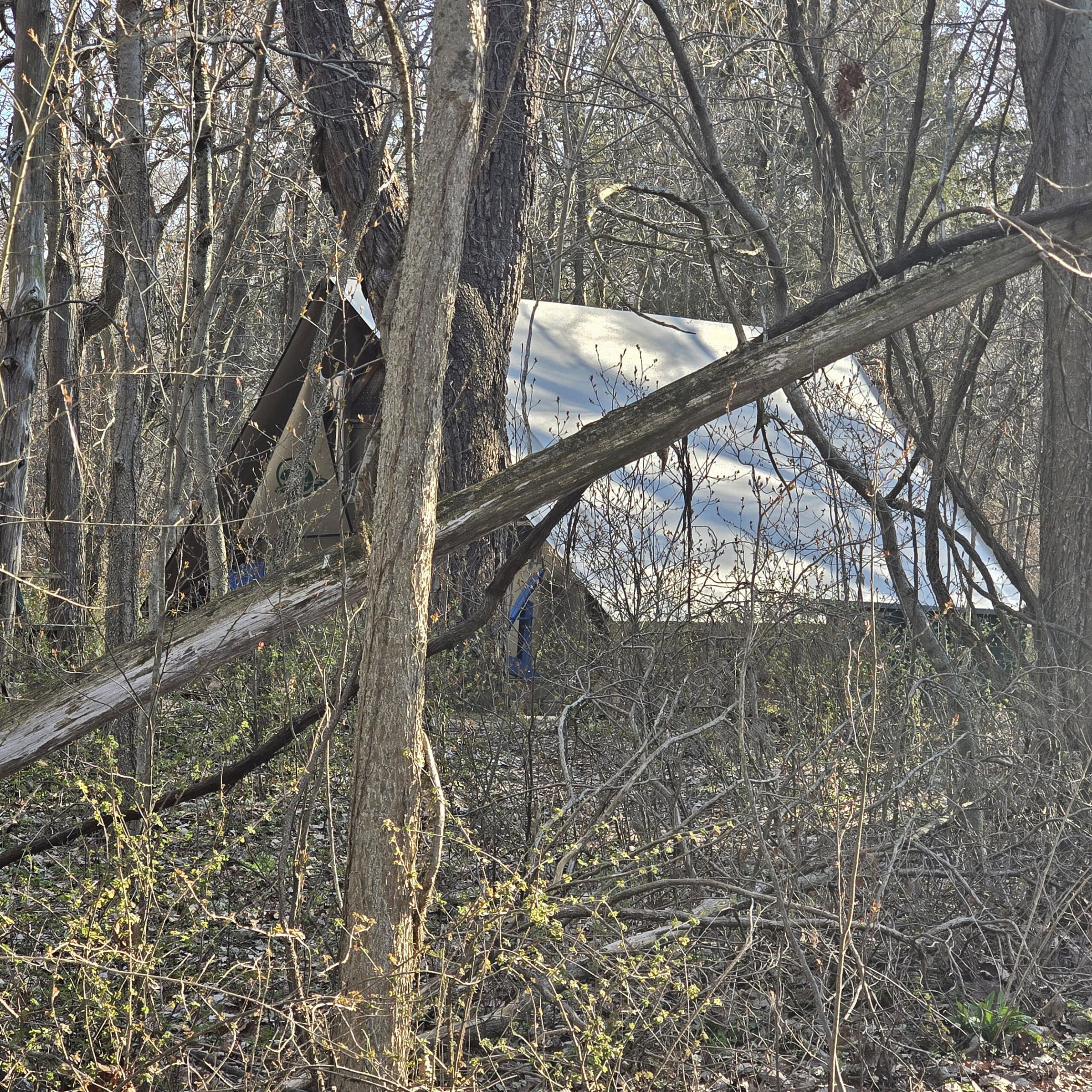
Camp Henry is the location of a 24 oTENTik ... cabins? I guess that’s the closest term for what they are, anyway!
Parks Canada bills them as being a cross between an A frame cabin and a prospector tent, an accommodation offering that’s unique to our National Parks.
Unfortunately, oTENTik camping is out for us, what with the cats and all... but it looks like a pretty cute option in general, from what we could see.
During our first visit, a huge group of kids were staying there, playing sports in the field area near the Camp Henry Store building. Our second visit, there were park maintenance crews working, so we didn’t want to get in their way to get a closer look.
I imagine it would be a great base for school groups exploring the park, but I absolutely could not imagine being stuck with a bunch of teenagers in a campground with no wifi or cell coverage!
Anyway, camping is available year-round, and each oTENTik structure sleeps 6 people. They also have heating, lighting, a bit of electricity - only 15 amp power - a table and chairs, and a gas BBQ outside.
No running water, though - they provide a water jug, which you can take to the nearby comfort station to get potable water.
They also provide a little dishes / utensils kit, which you’re expected to wash before your departure. Pretty much everything else, you need to bring - toiletries, linens, etc.
Another interesting thing to note is the parking situation - the oTENTik sites are all walk-in. Each reservation allows for a single parking space in the nearby parking lot, and they provide little wagons to cart your stuff to the camp site.
Four sites are accessible (#8, #11, #17, # 18), and two are pet friendly ( #8, #9). Check in is 3pm, and check out is 11 am - probably the widest spread I’ve seen for any kind of camping options.
You can rent for a single night from Monday to Thursday, but there’s a 2-night minimum on weekends, and a 3-night minimum for certain holidays.
For full details on booking an oTENTik site at Point Pelee National Park, see their Camping & Overnight Accommodation page.
Nearby Attractions
While we didn’t have time to check out nearby attractions during our first visit, here are the two points of interest we’re considering for future trips:
Point Pelee Island
Point Pelee Island is accessible via a ferry service located in Leamington, maybe 10 minutes from the park.
It’s definitely a time commitment - only a few crossings per day, and 1.5 hours crossing time!
It sounds like a beautiful place to visit - they market it like a tropical getaway almost - so I could see it being a fun day trip.
Middle Island
Part of Point Pelee National Park, Middle Island is a small - less than 19 hectares - island that is the ACTUAL southernmost part of Canada.
Visiting there is HIGHLY regulated, as it’s considered a “Zone I - Special Preservation” area. You can’t visit at all between March 1 and September 1.
Beyond that, it’s not the easiest place to access - there are no tours to the island, and no docks there. September through March means harsh water conditions, AND there are no visitor facilities out there (washrooms, shelters, etc).
So... not sure how - or if - we’ll ever be able to swing it, but I bet it would be amazing to visit!
Final Thoughts
If you’re anywhere near the area, visit Point Pelee!
There’s so much to see and do, it’s such a beautiful park... and there’s a cool factor involved with visiting the southernmost point of Canada.
I enjoyed messaging a friend in Detroit to say that we were just south of her!
Anyway, we’ve basically decided that we’re going to make trips to Wheatley Provincial Park and Point Pelee National Park a somewhat regular thing, going forward.
More Places to See
Looking for some nice sights to see and great places to visit while you're out on your camping adventures? Here are a few of our favourite day use parks, attractions, etc.
Aguasabon Falls & Gorge
Amethyst Mine Panorama
Batchawana Bay
Big Bay, Ontario
Big Chute Marine Railway
Bruce Peninsula National Park
Canada's Dinosaur Park
Cheltenham Badlands
Devil's Monument, Bruce Peninsula
Falls Reserve Conservation Area
Fielding Bird Sanctuary
Flowerpot Island
French River Provincial Park
Hardy Lake Provincial Park
Menesetung Bridge
Old Woman Bay
Ouimet Canyon Provincial Park
Petroglyphs Provincial Park
Rattlesnake Point Conservation Area
Sand River Falls
Scenic Caves Nature Adventures
Screaming Heads
Spirit Rock Conservation Area
Temagami Fire Tower
Terrace Bay Beach
... we also have an entire section of Ontario Waterfalls you can check out!
Thanks for Reading!If you loved this post - or have any questions about it - please leave a comment below! We'd also love it if you would consider sharing the link on social media! |

Proma Datta
Can we drive in May in Pint Pelee after the Visitor Center? Like are there driving roads?
Marie & Michael Porter
There is a driving road past the visitor center, but it's gated off by May.