
Lake Superior Provincial Park is one of our all-time favourite places in Ontario. Here's your ultimate guide to visiting & camping there!

Located right off the Trans-Canada Highway, it was a convenient pit stop on that first tour of Northern Ontario. It’s just a couple hours north of Sault Ste. Marie, and a short drive from Pancake Bay Provincial Park.
Located on the north shore of Lake Superior, it’s a natural environment class park that has a bit of everything!
Being on the largest freshwater lake in North America makes for great boating and fishing, and being in the Canadian Shield makes it a great place for hiking, wildlife viewing, and more.
We’ve covered a few specifics of the park in standalone posts - Agawa Bay Campground, Rabbit Blanket Lake Campground, Old Woman Bay, and Sand River Falls.
Much like with our Algonquin Provincial Park megapost... we figured it’s about time to for a big, all-encompassing post to talk about ALL the park has to offer!
So, let’s get to it!

The Basics:
Campground Name: Lake Superior Provincial Park
Address: N/A
Website: N/A
Price Ontario Provincial Parks uses a pricing matrix across all their parks. See 2025 Camping Fees for more details.
Reservations: Ontario Parks Reservations
Park Classification: Natural Environment
Season: May 16, 2025 to October 14, 2025 (Agawa Bay Campground), May 2, 2025 to October 19, 2025 (Day Use & Backcountry Camping), May 16, 2025 to October 26, 2025 (Rabbit Blanket Lake Campground).

Logistics
Some basic information to help you plan your stay at Lake Superior Provincial Park:
Registration and Check In
As always, we recommend booking your sites online, via the Ontario Parks reservations portal.
The park can be VERY popular during the summer, so if you can book 5 months ahead of time, that’s the best idea. Being logged in and ready to book at 7am, 5 months to the day before you book is definitely a good idea if you want to score one of the gorgeous waterfront sites, for sure!
Over the past few years there have been some changes to the check in process - and it can vary based on what time of year you’re camping.
Pre-registering is always a great idea, and now there’s a system where you can check in on the day of your trip, as well.
The park does still use paper permits for driving vehicles, though - so you do still have to check in with park staff, to get your permit.
During the main camping season, you can do this via the gatehouse at either campground. During the shoulder season, Agawa Bay campers can check in at the Visitor Centre, while Rabbit Blanket Lake campers can check in at the Park Office just south of the campground.

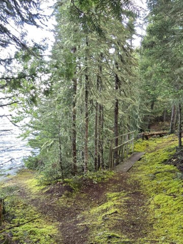
Bottom: Rabbit Blanket Lake Campground Office
Maps and Signage
Some information to help you find your way around Lake Superior Provincial Park:
Park Map
As a GIGANTIC park, there are a bunch of different maps you can be dealing with - we’ve linked the canoe route maps in the activities section, further down in this post.
Anyway, both campgrounds and are fairly small and the park roads pretty straightforward, so the provided maps are really easy to follow.
The handout at check in has both campgrounds on the same page, and there are PDF versions of each campground map online: Agawa Campground Map, and Rabbit Blanket Campground Map.

Both could stand to be higher contrast (less intense background colours), though.

Signage
In terms of campground signage, it's decent. Besides, once you’ve driven the campground once, you really don’t even need the signs- it’s pretty easy to get around.
The highway signage, though, is great.
The signs are placed in a way to give you a little notice for each destination, and each turn off is marked with symbols denoting what you'll find at that turnoff - hiking, washrooms, day use, etc.

Waste & Water Services
As with most of the Ontario Provincial Parks, the campsites in Lake Superior Provincial Park don’t have any water or sewer hookups.
There are two trailer sanitation stations in the park - one at each campground - each with at least one dump and one fill platform... but with very different setups.
Agawa Bay Trailer Sanitation Station
Agawa Bay campground has the best setup. It’s a loop off the main campground road. The main loop is a single lane that splits off to two lanes at the first post - the dump platform - so that you can access it via either side of your RV or trailer.
On the other side of the loop, there’s a single, threaded fill post.
While this set up is WILDLY better - and more convenient - than the one in Rabbit Blanket Lake... it always seems to be under a boil water advisory at the time of our visits.
I’d guess probably 80% of the time, that’s the case. Each time it’s been the case, Rabbit Blanket Lake wasn’t under a boil water advisory, so we’d just go there.
I guess that’s the benefit of the campgrounds being so far apart - they’re definitely not on the same water system!

Rabbit Blanket Lake Trailer Sanitation Station
The trailer sanitation station setup at Rabbit Blanket Lake... uh, doesn’t seem like it was designed by someone who’s ever driven an RV.
It’s set up to be accessed on the way out, but backwards - the platforms are located on the passenger side. If you need it on the way in, you have to either go in the wrong way for driver's side service, or do a U turn around the gatehouse.
Assuming you’re coming at it from the direction of the campground, it’s just a pull-off section on the side of the campground road, rather than a separate loop.
The two platforms - a dump platform, then the fill station - are just on the side of the road - so on the passenger side of your vehicle.
We asked a staff member about it on our last trip - they had no idea why the layout was that way, and were fine with people just going in, the “out” way to access it on the driver’s side.

Connectivity
In general... don’t expect much in the way of cellular reception in Lake Superior Provincial Park.
The two campgrounds tend to have at least some degree of cell reception - we’re on Rogers Wireless - but that coverage tends to cut off immediately as you leave the campground.
We don’t tend to have any cell coverage at all in any of the day use areas, along the highway, or out on the trails at all.
Accessibility
Overall, Lake Superior Provincial Park isn’t super accessible for those with mobility issues.
On the upside: each campground has a barrier-free campsite, and the park offices and Visitor Centre are barrier-free. The Visitor Centre also has an all-terrain wheelchair available to borrow.
Each of the comfort stations are designated as barrier-free, and actually have appropriately-positioned shower controls. (Not always the case in “barrier free” stalls!) Also, Agawa Bay Campground has new vault toilets, most/all of which are also barrier free.
The down sides:
1. While the comfort stations are designated barrier-free - at least across our stays - the barrier-free facilities are often out of order. Also, they’re not always in great condition when they ARE open.
2. The only beach that has any kind of wheelchair access (A Mobi-Mat) is Old Woman Bay... and that one is only a very partial one, that doesn't go ANYWHERE near the water - it just sort of overlooks the beach area.
3. None of the trails are wheelchair accessible, and very few of the trails are suitable for anyone with other mobility impairments. There's the paths between Awaga Bay Campground and the Visitor Center, and the main section of Crescent Lake Trail... but that's about it.
So, you won’t have necessarily have any trouble *camping* at Lake Superior Provincial Park if you’re mobility impaired... but there’s not a lot for you to do, outside of your campsite.
Overall, Agawa Bay Campground is more disability friendly - the comfort stations are generally in better condition, and you have 2 chances of getting an in-service barrier-free stall.
The Visitor Centre is right there, and the easier trails are much closer to that campground. The only downside is that Old Woman Bay is clear across the park.

Middle Row: One of the Agawa Vault Toilets
Bottom: Old Woman Bay
Pets
There are two dog beaches at Lake Superior Provincial Park:
For those at Agawa Bay Campground, you can access the off-leash dog beach via a trail from the Visitor Centre, or from the gated-off road that you see when leaving the campground, headed toward the Trailer Sanitation Station.
The dog beach is located sort of halfway between the campground and the Visitor Centre.
Rabbit Blanket Lake Campground doesn’t have a dog beach - and specifically bans dogs from the beach there - but there IS a dog beach just up the road, at Old Woman Bay.
When you pass the entrance loop, turn right and go to the end of that parking area / road. You’ll see signage at the beach that points to the right for the dog area.
Aside from those two beaches, dogs aren’t allowed in the swimming areas or on the Agawa Pictograph trail. (They’re allowed on all of the other trails, though!)
Beyond that, all of the Ontario Parks standard rules apply - They’re supposed to leashed at all times, and never left unattended. Don’t let them harass other people or animals, and pick up after them.

Parking
Most of the campsites are big enough for an extra vehicle, and both campgrounds have overflow parking for those who need it.
In terms of trailheads and day use areas, MOST seem to be adequately sized for the number of people that visit the park.
The big exceptions to this - in our experience, anyway - have been the Old Woman Bay parking area, and the parking lot at Sand River Falls. Depending on the weather and time of year, those can get pretty busy!
We’ve also seen Katherine Cove’s parking get PRETTY full, but not quite to the same extent / consistency as the other two.

Miscellaneous
Some random info:
Gargantua Rd
Garguantua Road is located kind of in the middle of the park. It’s an important route, taking you out to Gargantua Harbour, multiple backcountry sites, and access points for canoe routes.
It also takes you to the main access point for the Coastal Trail.
If you’ve never driven the road before, there are some things you need to know.
It’s about 14 km long from the highway to the harbour, and it’s a ROUGH 14 km - and prone to washouts. I HIGHLY recommend having a truck, or at least a vehicle with a lot of ground clearance.
Even then, plan on that 14 km taking you a good 45 minutes to drive. It’s narrow, has two small bridges, and not much in the way of clearance for passing an oncoming car.
There are very few places wide enough for even a small vehicle to turn around, should you choose to nope out.
The road can be in even worse condition after heavy rain, so - when in doubt - ask the staff at the Agawa Bay campground about the current status of Gargantua Rd.

Northern Lights, etc
Lake Superior Provincial Park is in an area of very low light pollution, so it can be a fantastic place for star gazing.
It’s also pretty far north, so it can be a fantastic place for viewing the northern lights... you just might want to scout things out ahead of time.
We’ve seen them from the beach at Agawa Bay, but you have to look to the right (as you’re looking at the water) for a north view. Not *ideal*, as you’ll get some traffic lights in there at times.
Katherine Cove has good potential, though - great north facing views from both the south side of the beach on the right, and from the rock formation that divides the two beach areas.
In terms of Rabbit Blanket Lake, you’ve got a bit more light pollution, as you’re much closer to Wawa. Also, there’s not really any great north facing views in that campground.
The south side of Old Woman Bay could provide some decent views, though - we just haven’t been in that end of the park during auroral activity.
As a note: night time viewing is limited to those with camping permits, as day use permits expire at 10pm... and aren’t valid until 8am,
If you’re interested in possibly seeing the northern lights, check out our posts: Aurora Hunting, How to Photograph the Northern Lights, Can I See the Northern Lights Tonight?, and Where to See Northern Lights in Ontario.

Campground Amenities & Info
Some basic information about the amenities at Lake Superior Provincial Park:
Creature Comforts
All of the actual comfort stations in the park are located in the two campgrounds - two at Agawa Bay, one at Rabbit Blanket Lake.
Each of these have flush toilets, laundry facilities, and showers.
Both campgrounds also have vault toilets throughout. These are easily seen and accessed in the Agawa Bay Campground, but are set back from the road on trails in the Rabbit Blanket Lake campground.
As a word of advice, be sure you know where you’re going when you get out of the outhouse, at Rabbit Blanket. Each has multiple little trails, and some go directly into campsites!
Also, most of the day use areas and trail heads also have vault toilets - these are usually indicated on the road signs pointing to each area, as well.

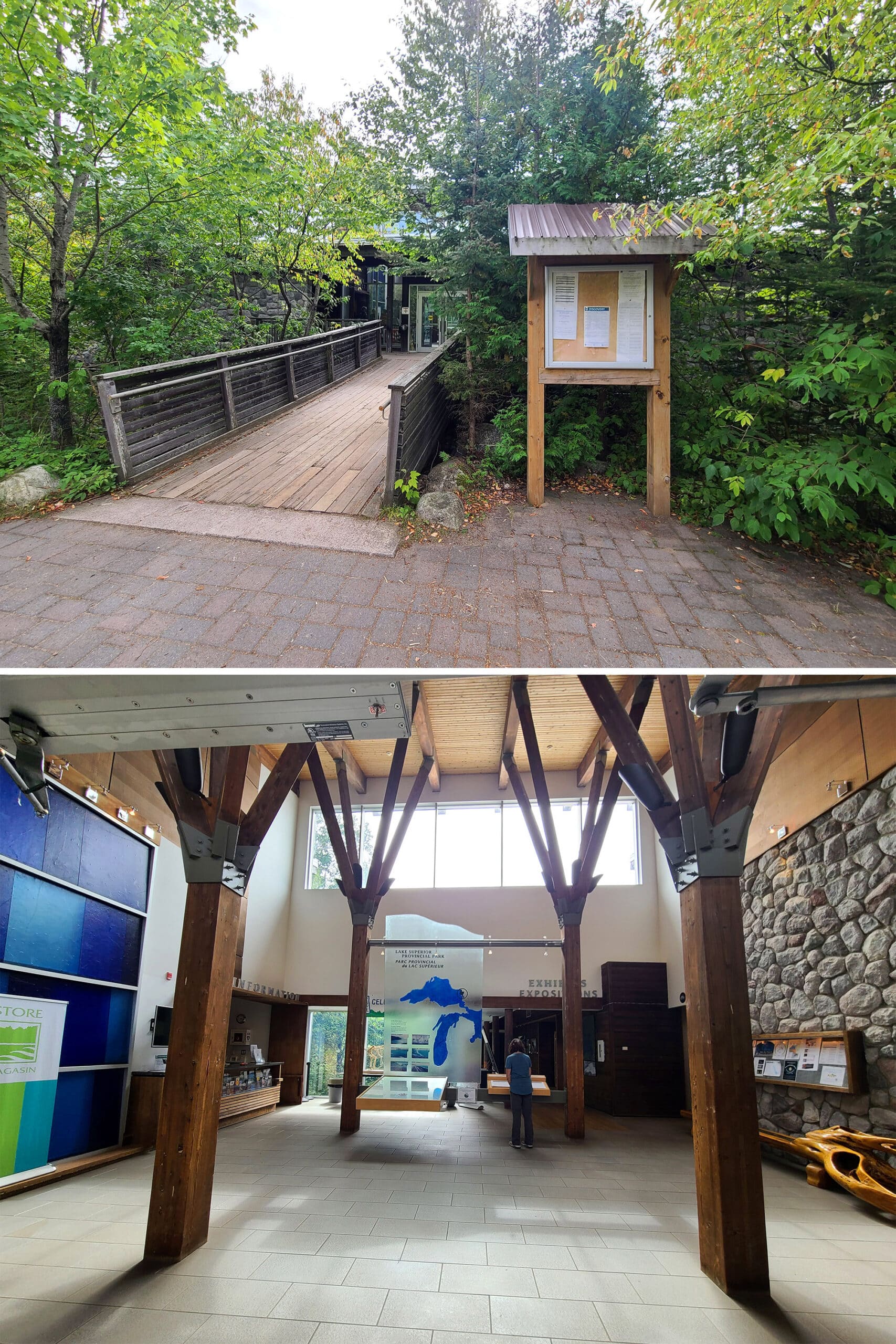
Park Store
During peak camping season - when the campground gate houses are open - you can get park maps and some really basic souvenirs - stickers, badges, sometimes some stuffed animals.
You can also buy maps, souvenirs, etc at the Park Office at Red Rock Lake.
The main campground store is located in the Visitor Center, where you can buy clothing items, books, artwork, snacks, grilling tools, souvenirs, firewood, etc.
It’s nice - a bit more upscale than some of the other campground stores we’ve seen.

Visitor Centre
In addition to housing the gift shop - and acting as the registration office in the shoulder season - the visitor center has displays highlighting the area’s geography, nature, and cultural history.
There’s also an activity room, theatre, and tourism information on site.
Day Use Area
Aside from the long beach at the Agawa Bay campground, neither of the campgrounds has much of a traditional day-use area... but there are a few day use areas in other parts of the park.
If you’re one to picnic, Agawa Bay is your best bet - 3 of the 4 main day use areas at Lake Superior Provincial Park are within a 15 minute drive of that campground!
Anyway, here are the details:
Katherine Cove Day Use Area
Katherine Cove is a set of two beaches, about 15 minutes north of Agawa Bay.
It’s a popular spot for swimming, but I don’t remember seeing much in the way of picnic tables there during any of our trips.
There IS a “Moments of Algoma” interpretive installation there, though.
This is an easel display talking about the Group Of Seven's history in the Algoma region.

Old Woman Bay Day Use Area
By far the biggest and most popular day use area in the park, this one is located just a few minutes north of Rabbit Blanket Lake campground.
There are a few picnic tables as soon as you pull off the highway, but skip those - there are MUCH nicer picnic spots as you get to the beach.
There are picnic tables all up the beach, as well as little “nooks” above the beach, with varying degrees of privacy. Some look like mini campsites, and many have great views of the beach and surrounding area.
For full details - and more photos - see our Old Woman Bay post.

Sand River Day Use Area
This one is also located about 15 minutes north of Agawa Bay, just slightly closer than Katherine Cove.
Quite possibly my favourite area in the whole park, the main attraction here is a series of waterfalls and the Pinguisibi Trail. (Possibly my favourite trail ever!).
In terms of picnicking, there’s not a TON of picnic space here - I think 3 or so picnic tables - but most of them are right next to the river, overlooking the falls.
Also, at least one of them has a pedestal style grill!

Sinclair Cove
While it’s not listed as a day-use area - it’s the boat launch - I consider Sinclair Cove as basically a mini day use area.
To access this one, you pull off the highway for the Agawa Pictographs trail, but turn right at the split (rather than left, for the trail).
There’s a small parking lot (WATCH THE DROP!), and the boat launch.
When you walk down the ramp, though... there’s a gorgeous beach area off to the right, and really beautiful views of the cove. Also, there’s rarely anyone there, any time we’ve visited - bonus!

Rentals
During the main camping season, you can rent canoes at Lake Superior Provincial Park.
Canoe rentals are handled out of the Agawa Bay and Rabbit Blanket Lake gatehouses, as well as at the Park Office for Mijinemungshing Lake.
Mijin is the largest lake in the park, so that’s convenient!

Campsite Details
There are several different ways you can go camping in Lake Superior Provincial Park: Car camping, roofed accommodation, and backcountry campsites.
Here’s some more specific information on your options:
Car Camping
There are two campgrounds in Lake Superior Provincial Park: Agawa Bay on the south side of the park, and Rabbit Blanket Lake on the north end of the park.
The two have entirely different vibes, and each have a mix of electrical and non-electrical sites. As with most parts, each camp site comes with a fire pit and a picnic table.
Personally, we prefer Agawa Bay - which seems to be the main campground in the park - but your mileage may vary.
Note: there used to be a third campground, south of Agawa Bay: Crescent Lake Campground. That campground closed a few years ago, and is gated off.
The hiking trail is still there, and now there are some walk-in sites.
Agawa Bay Campground
Agawa Bay is located right on the edge of Lake Superior, and probably a quarter or so of the sites have a waterfront view. Some have road between them and the water, while others have actual beachfront access.
All sites are just a quick walk from the sprawling beach area, though.
Most - if not all - of the camping area is under a tall forest cover. The sites tend to be quite large, but without much privacy, and the southernmost part of the campground - all of the sites in the 300s - are radio free.
Also of note: The campground is along the highway, so expect to hear highway noise. Even with the lack of privacy and the noise, though... one of our favourite campgrounds in the province.
It’s hard to find deal-breaking fault with big campsites that are just a few metres away from a Lake Superior beach, after all!
Anyway, for full details on the campground - including a lot more photos! - see our Agawa Bay Campground Review.

Rabbit Blanket Lake Campground
We tend to look at Rabbit Blanket Lake as more of a stopover campground, or a backup plan. It’s on a small lake, with only a few waterfront sites. (And our equipment doesn’t fit in those sites!)
The sites do have quite a bit more privacy than the Agawa Bay campground, though, and less in the way of highway noise.
It’s a good campground to pick if you plan to spend a lot of time at Old Woman Bay, or exploring the Wawa area. It’s also a better location when your next stop happens to be Pukaskwa National Park, just given the logistics of their whole registration thing.
Anyway, for full details on this campground - including plenty of photos - see our Rabbit Blanket Lake Campground Review.

Roofed Accommodation
Roofed accommodation is SUCH a new option at Lake Superior Provincial Park, the park’s website and maps haven’t been updated with info about it, as of the publication of this post!
We happened across the Rabbit’s Burrow Cabin during our spring trip in 2025, when we went to the swimming beach at Rabbit Blanket Lake.
Since our last visit, a cabin and deck had been constructed on that small beach!
We actually weren’t sure what the deal was - no information on site or on THE site - so we didn’t hang out at the beach. With the cabin there, it kind of felt like we were trespassing on a private site!
Anyway, while the park website has no mention of it, the reservations portal does - and it IS available for booking!
The single room cabin includes a single/queen bunk bed, as well as a double sized futon couch - and a camp cot is also available, by request.
Beyond that, there’s a table and benches, a mini fridge, a propane heater, and a gas BBQ, outside on the deck. No kitchen area, and no washroom though!
Weirdly, the reservation page includes information that you usually see for a regular campsite - that it’s got 15 amp electrical service, no shade/full sun, grass for ground cover, and a slight pad slope.
Anyway, pets aren’t allowed, and there’s a 2 night minimum for booking.

Backcountry Camping
For those a lot more rugged than we are, there are 163 backcountry sites throughout the interior of the park. Some are hike in, some are canoe-in, some require both.
After all, there are 150 km of canoe routes AND 130 km of hiking trails in Lake Superior Provincial Park.
Anyway, the backcountry sites are divided into 76 zones. Sites are designated, and have access to box privies.
Some campsites have fire pits, but not all. Some of the more popular areas include a picnic table on the backcountry sites, and some of the sites along the Coastal Hiking Trail have a food locker.
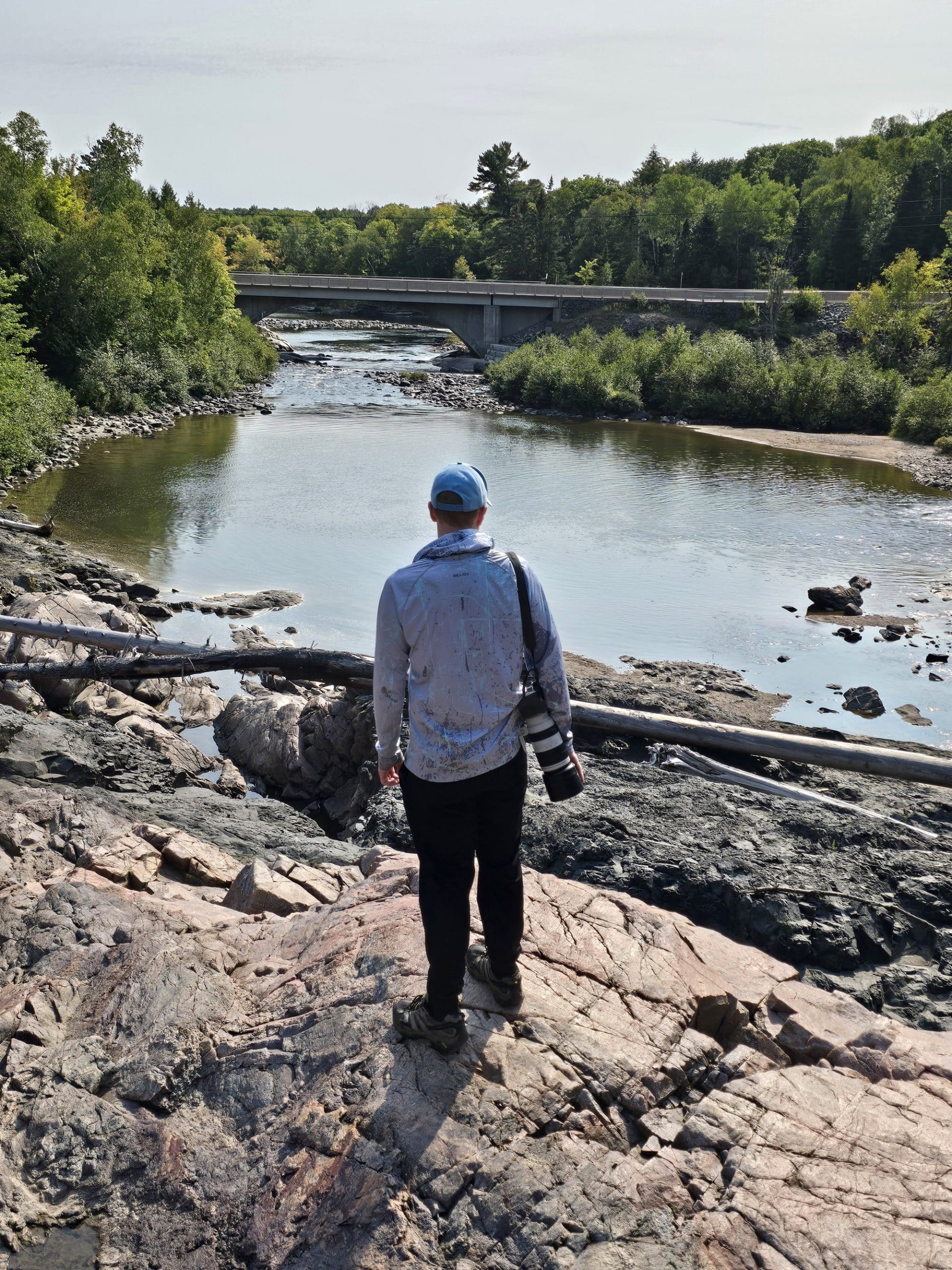
There are a bunch of different access points: Agawa Bay, Coldwater River, Gargantua Road, Katherine Cove, Michipicoten Bay/Michipicoten River, Old Woman Bay, Orphan Lake Hiking Trail, Sand River, and Sinclair Cove.
It’s a good idea to go over a map of the park and have a pretty good idea of where you want to go, before trying to book your backcountry site.
Maybe I’m just not used to it, but it seems like a really complicated system - you start by searching either by hiking or paddling, and your entry point.
There’s a drop down of available booking locations, which the system may or may not let you book, as some appear to be “too far from your access point”.
Anyway, as you may have guessed, backcountry is WAY outside what we do - so I’d recommend checking out the reservations page for more info on the sites, backcountry camping fees, etc.
I will say, though: The Crescent Lake sites seem to be among the easiest to get to. Also... just remember what I said earlier about Gargantua Rd, if you’re camping up that way!

Share the Love!If you’ve made one of our recipes, be sure to take some pics of your handiwork! If you post it to Bluesky, be sure to tag us - @2NerdsInATruck, or you can tag us on TikTok, if you’re posting video. We're also on Pinterest, so you can save all your favourite recipes and park reviews to your own boards! Also, be sure to subscribe to our free email newsletter, so you never miss out on any of our nonsense. Well, the published nonsense, anyway! |
Entertainment and Activity
Lake Superior Provincial Park is HUGE, and has a lot to offer in the way of outdoor recreation.
Here is some information on your options:
Hiking
Whether you’re looking for a relatively short hike, full day hikes, or long trips spanning multiple days, there are plenty of options when it comes to hiking trails - over 130 km of trail, across 11 main trails!
The park map we got when we registered was good about laying out the info for the various trails, the distance from the campground, and their ratings.
Trail Ratings
When it comes to ratings, that’s decided by both considering the terrain, and the length of time it takes you to walk the trail.
By their definitions:
Easy: “Level terrain; less than 3 hours”
Moderate: “Some steep inclines and uneven footing; less than 4 hours”
Demanding: “Some steep inclines and uneven footing; long distance trails, 4 - 6 hours”
Very Demanding: “Route not well marked at times; many steep, rugged areas and uneven footing; long distance, overnight trails.”
Assume the most extreme possible condition for that variable.
The trails we haven’t done yet, we’ll be showing the park’s difficulty rating. The ones that we have done, we show OUR assessment of the difficulty.
Whichever trail you do - even those marked as easy - you’ll definitely want to wear sturdy footwear, and pack suitable water / food / bug protection / weather gear / first aid supplies / etc.
Also note that a can and bottle ban is in effect for all backcountry areas. Keep this in mind when planning your food!
Agawa Campground Trail - Moderate
Access: km 1105.5, Awaga Bay Campground
This isn’t a named or described trail on the Lake Superior Provincial Park website or map, but it’s a cute little trail that’s worth a visit, if you’re in the area.
We’ll map it for distance next time we’re there, but until then...
The trail starts out near site 322, at the south end of the Awaga Bay Campground. It’s probably a couple hundred meters through a wooded area, before bringing you out to a rocky outlook on Lake Superior - Rocky Point.

Awaga Pictographs Trail - Difficult
This trail takes you to a sacred site on the side of Lake Superior. People are asked to treat the area with respect, and dogs are banned from this trail.
There’s some weird and conflicting information out there on this trail. For some reason, it’s not listed on the Lake Superior Provincial Park site.
Some places say it’s 0.5 km - or 0.5 miles - or 0.8 km, etc.
When we did it, we’d read 0.5 km, and didn’t think to start mapping our walk until we were at least that far in. We came out somewhere over 0.5 km by the time we got back to the car, so it was at least double that.
I’ve seen a description calling the extension trail 400 km long and “descending 30 metres”, (probably accurate!), and I’ve seen another one saying that the that the extension trail was only 30 metres long (absolutely NOT accurate!).
The big thing is that I’ve seen this trail referred to as easy - absolutely not the case. This is why it’s ridiculous to base difficulty rating heavily on distance!
Alltrails says you can do the trail in 15 minutes... maybe if you sprout wings and fly over it.
You’ll scramble down a steep set of rocks that form almost a staircase, and then up over a rocky ledge until you’re eventually looking down over the Pictographs site.
If the weather is good, you can descend down to the rock ledge along the pictographs, with a metal railing to help you get down there safely.
The ledge itself is steep - angling back to the lake - and very slippery when wet. You’ll want to wear grippy, sturdy boots AND avoid going down there if there are any waves.
People have died down there, getting swept into the lake, so you really want to be careful!
All in all, a gorgeous hike. It does get very busy in the summer, though, so keep that in mind!

Trapper’s Trail - Easy, 1.5 km Loop
Access: km 1074.3. Suggested Time: 45 min. – 1.5 hours
This trail starts out with a boardwalk, and continues to circle the rest of that lake, with multiple views over the lake.
While this is generally an easy trail, there are some rough sections, walking up over roots, etc. It can also get swampy in places, so plan your footwear accordingly!
We’ve found this to be one of the best trails for wildlife viewing, across multiple trips.
On our first trip, we had an AMAZING encounter with a couple of otters - who knew they’d respond to being “Pss-Pss!”ed at like cats? - and we’ve seen fresh moose tracks pretty much every time we’ve done the trail.
We’ve also seen Great Blue Herons, Loons (and baby loons!), and more.
IMHO, this one is best done first thing in the morning.

Crescent Lake Trail - Easy, 2 km Loop
Access: km 1113.8. Suggested Time: 30 min. - 1 hour
While it's listed as being 2 km, that's based on old information. It's located in a now-closed campground, and the main road into that campground is gated off. So, you'll have to walk .85 km from the parking lot to get to the start of the trail, adding 1.7 km (overall) to that distance.
When Porter did the trail in 2025, it came to a total of 5.5 km, which included the multiple short branches to get to the lake lookouts along the trail.
The main loop trail is basically a nice walk through the woods, with short offshoot trails to several the portage points at the four lakes in the area (Kenney, MacGregor, Mud, and Crescent).

South Old Woman River Trail - Moderate, 2.5 km Loop
Access: km 1049.6, Rabbit Blanket Lake Campground. Suggested Time: 1 - 2 hours
We haven’t done this trail yet, but plan to on our next stay at Rabbit Blanket Lake.
The description says most of the trail is easy with some sections of uneven footing, and some rock hopping involved to cross the river.
Given the location - and mention of the types of plants there - I’m assuming it’ll be a pretty Boreal forest... so we’re looking forward to it!
Nokomis Trail - Moderate, 5 km Loop
Access: km 1042.6. Suggested Time: 1.5 - 3 hours
This one is located across the highway from Old Woman Bay area, and takes you through boreal forest areas to visit scenic lookouts with views of Lake Superior.
It's also ranked one of the top 5 day hikes in Lonely Planet’s “Discover Canada” book.
Porter says it's the most diverse trail he's ever walked on, with cedar forests, smooth river rock routes, jagged boulder areas, and more. "It's almost as if it were constructed to keep you interested as you go along!"
He says that the views from the multiple rocky overlooks are amazing, covering a huge area of Old Woman Bay and the surrounding area.
He recommends wearing sturdy footwear, bringing plenty of snacks and water, and making sure to have PLENTY of room on your camera / battery life to capture all the photos you'll get!

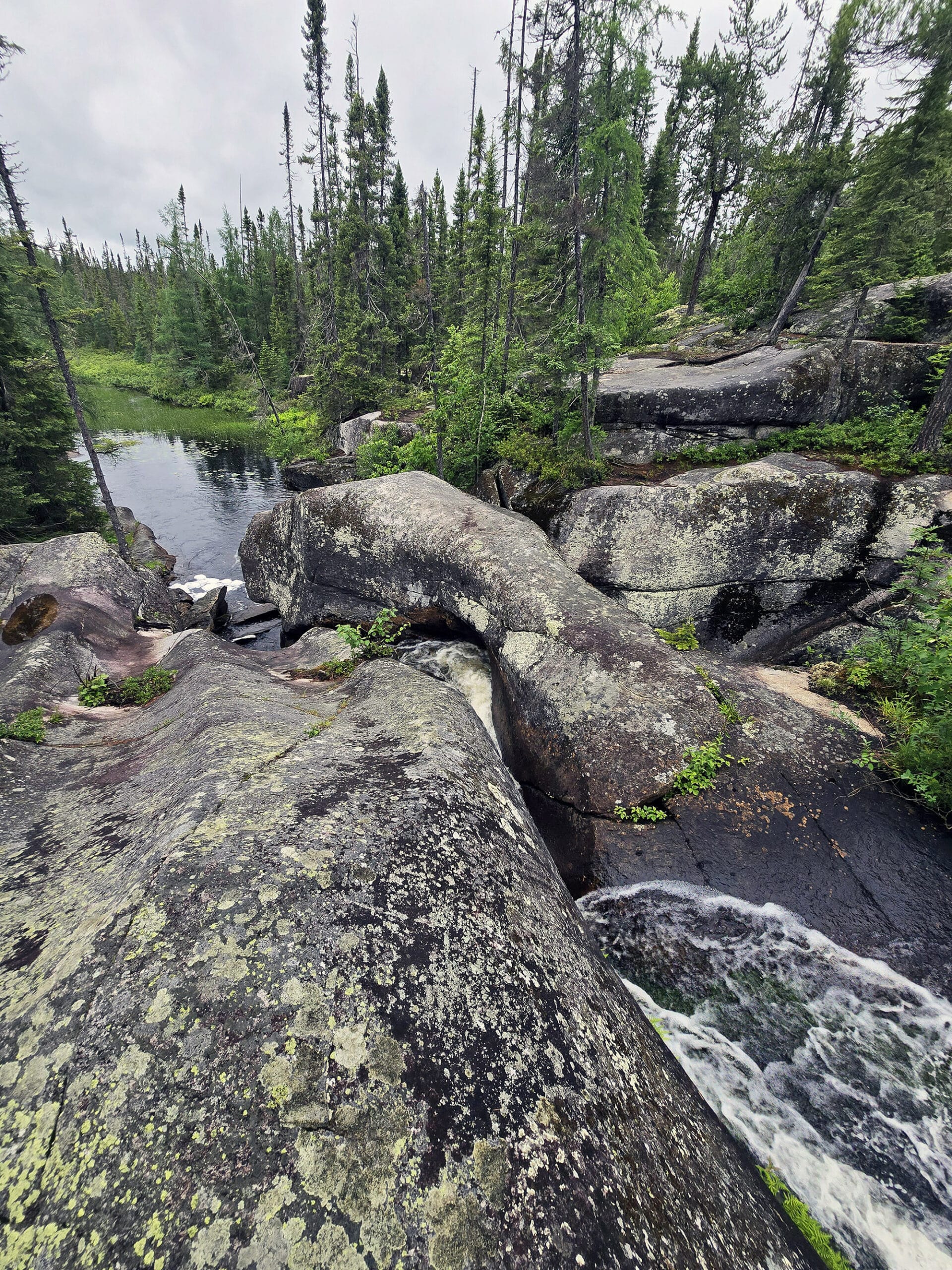
Pinguisibi Trail - Moderate, 6 km Return / 3 km Linear
Access: km 1090.6. Suggested Time: 1.5 - 3 hours
This trail is also known as Sand River Trail - Pinguisibi being the Ojibwe name for “river of fine white sand”, after all - and is probably my favourite hiking trail of all time.
The trail walks along Sand River, immediately starting out with a waterfall area, right next to the parking lot.
The scenic views just keep coming, with more rapids and falls every few minutes along the first km or so of trail.
Part of what makes it - IMHO - one of the best hikes ever is that you can walk right out onto the waterfalls in several areas, depending on the time of year.
In the fall, we were even able to get out onto the .. 3rd or 4th? ... waterfall area. Totally not accessible in the spring, though - the water flow gets MUCH stronger.
I always have the best time when playing out on the rocks near waterfalls, and this one just really scratches that itch, you know?
Anyway, we have an entire post about this trail, with tons of photos and details - Sand River Falls Trail.

Orphan Lake Trail - Moderate, 8 km Loop
Access: km 1080.8. Suggested Time: 2 - 4 hours
We haven’t yet done this trail, but it sounds like an interesting one.
The description mentions going though various types of forest, climbing up to lookout, a pebble beach, waterfalls, and more.
I bet there are gorgeous views on this one, so we’re looking forward to trying it sometime!
Awausee Trail - Demanding , 10 km Loop
Access: km 1101.4. Suggested Time: 4 - 6 hours
Another trail that we haven’t done ... yet!
This one’s description has it following an old logging road at the base of Agawa mountain, before taking you up hills, along a ravine, past lookouts, and through forest areas.
If you want a truncated version of this hike, though, you can just go to the first lookout and back - 45 minutes, round trip.

Peat Mountain Trail - Demanding , 11 km Loop
Access: km 1049.6, Rabbit Blanket Lake Campground. Suggested Time: 3 - 5 hours
This trail is starts out at the Rabbit Blanket Lake Campground, with access points near site #30 and #49. (No parking nearby, though?)
We haven’t done this trail yet, but the description has you going through forested areas and up to the top of Peat Mountain, for views over the whole area.
Apparently you can see all the way out to Michipicoten Island on a clear day - 55 km to the west, on Lake Superior!
Towab Trail - Very Demanding, 24 km Return / 12 km Linear
Access: km 1103.8. Suggested Time: 8 - 14 hours
While this one is longer than we’d ever be able to do (we camp with our cats, who need to be fed!), we’re hoping to do a bit of this trail at some point, at least.
To get to this trail head, you need to drive 3.5 km up Frater Rd. It can be in rough shape in areas, so having a vehicle with decent ground clearance is a good idea.
Anyway, this trail takes you out along a river to Agawa falls - one of the highest waterfalls in Lake Superior Provincial Park - and back, passing several back country campsites en route.

Coastal Trail - Very Demanding, 65 km Linear
Access: Multiple. Suggested Time: 5 - 7 days (entire trail)
This monster of a hiking trail more or less follows the Lake Superior shoreline up the edge of the park, and involves all kinds of steep climbs, rocky beaches, boulders, scenic vistas, and more.
Gargantua Rd - in the middle of the park - is apparently the main access point for this trail, but you can access it at Agawa Bay, Coldwater River, Katherine Cove, Orphan Lake Trail, and Sinclair Cove, as well.
Gargantua Rd also seems to be the difficulty dividing point of the trail. North of that point ranges from easy to moderate difficulty, while the trail south of the road is listed as being “extremely rugged” and very demanding.

Biking
We haven’t seen any information about biking in Lake Superior Provincial Park, and none of the trails seem to be marked as mixed use.
I’m guessing campground roads are about it, in terms of cycling.

Middle: Katherine Cove Beach
Bottom: Old Woman Bay Beach
Swimming
While the park is full of lakes and other swimming areas, there are three main swimming beaches at Lake Superior Provincial Park:
Agawa Bay Campground Beach
This is the rockiest of the beaches, but it’s a relatively small pebble type of rock, for the most part. An easy walk from anywhere in that campground, but not really a “Destination” type beach for those not camping there.
Katherine Cove Beach
This one is sort of two beaches - they’re both accessed via the parking lot.
Taking the trails to the left bring you to a big, wide open beach. Taking the trails to the right bring you to a more secluded feeling cove.
Both are beautiful!
Old Woman Bay Beach
This is the big DESTINATION beach in the park, and you can definitely spend a lot of time there if you want.
Great picnicking sites, clear, clean water, great views of the lake and the “Old Woman” rock formation, just a really cool place.
See our entire post dedicated to it, for ALL of the into - Old Woman Bay

Rabbit Blanket Beach is... dubious at this point. In NO WAY does it compare to the others, and - as of 2025 - there’s now a rental cabin on it.
I’m not sure it’ll be listed as a swimming beach after the park updates their map and website, to be honest.
Sinclair Cove, though... is a beautiful beach.

Row 2: Black-Throated Green Warbler, Broad-Winged Hawk, Canada Goose
Row 3: Chipping Sparrow, Common Loon, Common Loon BABIES (!!!!),
Row 4: Dark-Eyed Junco, Downy Woodpecker, Ruffed Grouse
Row 5: Swainson's Thrush, Tennessee Warbler, Yellow-Rumped Warbler
Birding, Wildlife, and Nature
Lake Superior Provincial Park is a fantastic place for bird watching, wildlife viewing, and just enjoying all kinds of flora and fauna in general.
There’s such a wide variety of different habitats within the park, and what you can expect to find varies between them.
Overall, though, over 120 different birds nest in the park, and more than 250 different species have been observed there. The spring and fall migration periods are particularly good times for bird watching.
Overall - across multiple stays, at different times of year - we’ve encountered:
American Crow, American Pipit, American Redstart, American Robin, American Woodcock, Bald Eagle, Baltimore Oriole, Black-and-White Warbler, Blackburnian Warbler, Black-Capped Chickadee, Black-Throated Blue Warbler, Black-Throated Green Warbler, Blue-Headed Vireo, Blue Jay, Broad-Winged Hawk, Brown Creeper, Cedar Waxwing, Chestnut-Sided Warbler, Chimney Swift, Chipping Sparrow, Common Loon, Common Raven, Common Yellowthroat, Dark-Eyed Junco, Downy Woodpecker, Eastern Phoebe, Golden-Crowned Kinglet, Golden Eagle, Great Blue Heron, Great Horned Owl, Greater Scaup, Hairy Woodpecker, Horned Lark, Least Flycatcher, Magnolia Warbler, Northern Flicker, Northern Parula, Ovenbird, Pileated Woodpecker, Pine Siskin, Pine Warbler, Purple Finch, Red-Breasted Nuthatch, Red Crossbill, Red-Eyed Vireo, Rose-Breasted Grosbeak, Ruby-Crowned Kinglet, Ruffed Grouse, Savannah Sparrow, Swainson's Thrush, Swamp Sparrow, Tennessee Warbler, Turkey Vulture, White-Crowned Sparrow, White-Throated Sparrow, White-Winged Crossbill, and Yellow-Rumped Warbler.
In terms of other wildlife, we’ve seen:
Moose, Black Bear, Otters, Frogs, Toads, Squirrels, Chipmunks, Canada Tiger Swallowtail Butterfly, Monarch Butterfly, Mourning Cloak Butterfly.
No Great Lynx yet, but here’s hoping we’ll see one next time!

During the late spring and early summer, there are wildflowers EVERYWHERE!

Boating
Given the number of inland lakes in the park - never mind all of the access to Lake Superior proper - there are a ton of different boating opportunities within the park.
In terms of power boating specifically, you’re a bit limited.
You’re allowed to boat on Lake Superior, with no motor size restrictions in place.
You’re also allowed to have motorboats on Sand Lake (as long as the motor size is 10 hp or less)... I just have no idea how one actually gets a motor boat TO Sand Lake.
We’re definitely going to have to look into that on a future trip - the map definitely doesn’t show any road access, though!
Anyway, there’s a boat launch at Sinclair Cove. It’s a relatively sheltered cove on Lake Superior, and a beautiful place to start your boating adventure!

Canoeing and Kayaking are popular throughout the park, and there are eight named canoe routes in the park.
They range from relatively short and easy day trips (like Crescent Lake), to a mega, 56 km long canoe route (Sand River).
The park has a pdf file for each route, with descrptions, maps, portage info, etc:
Belanger Lake Canoe Route
Crescent Lake Canoe Route
Fenton Treeby Canoe Route
Gamitagama Lake Canoe Route
Mijinemungshing Lake Canoe Route
Old Woman / Sand River Canoe Route
Rabbit Blanket Canoe Route
Sand River Canoe Route
Beyond that, we’ve seen people kayaking right on Lake Superior, and stand up paddle boards at Crescent Lake.

Fishing & Hunting
If you’ve got a big enough boat to deal with the power of Lake Superior, you can find Lake Trout, Rainbow Trout, and Salmon (Chinook Salmon, Coho Salmon, and Pink Salmon).
As far as inland fishing goes, there’s Brook Trout and Lake Trout.
Gargantua Road seemed like a good starting point for those looking to do inland fishing - a big map in a pull-off area had a fishing map and information that we hadn’t seen anywhere else in the park - or on the website.
It just covers part of the park - almost everything west of the highway.

Hunting - Grouse, Hare, and Moose - is also permitted in the park, just in a very specific area.

Discovery Program
Discovery Programming is based out of the Agawa Bay Campground, and mostly limited to the summer months.
The summer says July and August, but there was some weekend programming during our stay in June, as well.
We passed by a couple Exploration Stations - one at the Agawa Campground gatehouse, and one outside of the Visitor Centre. They also offer things like evening programs and guided hikes.
When in season, Discovery program schedules are posted at the gatehouse, comfort stations, and some other random areas around the park.

Winter Activities
There’s no camping in the park in the winter season, and pretty much everything (campgrounds, Gargantua Road, Mijinemungshing Road, etc) are gated off.
You’re even allowed to snowmobile on Frater Rd - as an access point to the Algoma Central Railway - but that’s the only place in the park that allows it.
Niantic Games
Agawa Bay campground has a handful of Ingress Portals / Pokestops / PokeGyms - a couple in the campground itself, 2 by the visitor center, one at the amphitheatre, and one at the gate house.
Rabbit Blanket Lake Campground has just 2 - one at the gatehouse, and one at the boat launch.
Both campgrounds have decent cell reception to play (on Rogers Wireless, at least!)... but I wouldn’t bother trying to load the games anywhere else in the park.
Per the Ingress Intel page, there are a couple more in Katherine Cove, but we don’t tend to have any connectivity there.

Nearby Attractions
Depending on where you’re coming from, where you’re proceeding on to, and how far you’re looking to explore... there are a few places in the general area of Lake Superior Provincial Park that we make a point of visiting when we’re out that way.
Let’s address these in the order we do - heading from the GTA towards northern Ontario.
First off, Chippewa Falls is a nice roadside stop, with a decent sized set of waterfalls RIGHT THERE.
A short trail takes you to the top of one set of falls, where you can walk right out onto them for a beautiful view up and down stream.
A few minutes past Chippewa Falls, you’ll come to Batchawana Bay Provincial Park - it’s a nice little day use park, a good place to stretch your legs, maybe get a swim in, etc.

They make the absolute best apple fritters anywhere, and they’re usually still warm when we buy them!
Be sure to pick up a few extra, so you can make my Apple Fritter Bread Pudding, and/or Apple Fritter French Toast!

Scenic High Falls is a gorgeous waterfall attraction, just before Wawa. It’s got a great picnic area, multiple viewing platforms, and is very accessible!

This tiny park has a short, relatively easy trail, with great views. Highly recommend going there at least once!
Final Thoughts
As you can probably tell by the sheer volume of information we have on Lake Superior Provincial Park - and the fact that it was collected over so many visits - we are BIG fans of this park.
The fact that it’s basically the gateway to Northern Ontario definitely contributes to the fact that we stay there so often, but really? It’s the kind of park that we’d drive well out of our way to visit.
Waterfront sites on Lake Superior, all kinds of little nooks to explore, the wildlife, and the fact that it’s host to my favourite hiking trail of all time... what’s not to love?
If you haven’t already been to Lake Superior Provincial Park, we definitely recommend giving it a go!

More Northern Ontario Provincial Parks & Places to See
Want to read some more about the parks we've camped and at places we've seen in Northern Ontario? Here are some more posts!
Northern Ontario Campground Reviews:
Aaron Provincial Park
Agawa Bay Campground, Lake Superior Provincial Park
Blue Lake Provincial Park
Caliper Lake Provincial Park
Kakabeka Falls Provincial Park
MacLeod Provincial Park
Neys Provincial Park
Ojibway Provincial Park
Pakwash Provincial Park
Pancake Bay Provincial Park
Pukaskwa National Park
Quetico Provincial Park
Rabbit Blanket Lake, Lake Superior Provincial Park
Rainbow Falls Provincial Park
Rushing River Provincial Park
Sandbar Lake Provincial Park
Sioux Narrows Provincial Park
Sleeping Giant Provincial Park
White Lake Provincial Park
Northern Ontario Places to See:
Aguasabon Falls & Gorge
Amethyst Mine Panorama, Thunder Bay
Batchawana Bay
Chippewa Falls
Kakabeka Falls
Mink Creek Falls
Old Woman Bay
Ouimet Canyon Provincial Park
Potholes Provincial Park
Roy Wilson Suspension Bridge
Sand River Falls
Scenic High Falls
Temagami Fire Tower
Terrace Bay Beach
Want to explore beyond Northern Ontario? Check out our full list of Campground Reviews, Ontario Waterfalls, and other Places to See.
We also have a ton of Camping Recipes to cook up, while on your adventures!

Thanks for Reading!If you loved this post - or have any questions about it - please leave a comment below! We'd also love it if you would consider sharing the link on social media! |


Leave a Reply