
Earl Rowe Provincial Park is a cute - but somewhat unpopular - campground & day use park in Alliston, Ontario. Here's our review of the time we spent camping there!

Named in honour of William Earl Rowe - the 20th Lieutenant Governor of Ontario - the park is located in Simcoe County, just an hour or so from the GTA.
This park was a weird one for us, in many ways.
First, going into it - we’d heard pretty much nothing but complaints about it. We tend to NOT camp during peak season, though, so most of the issues raised .. Just don’t even apply for us. So, we wanted to see for ourselves.
... There was a lot of *weird* during our stay.
What was the thought process behind the design of the poop loop in Riverside?
There were some real head-scratchers:
1. The whole west beach access / pool situation.
2. Having SUCH a gorgeous beach area, tricking it out with all kinds of amenities... when it’s apparently not usually safe to swim in. You'd think they'd build most of those amenities around the pool that's posed as an alternative... but even that's apparently never open.
3. Advertising the fish ladder as an attraction to see, but it's actually fully enclosed, and fenced off with barbed wire. There is literally nothing to see, there.
4. The way the trails not only weren't accurate to the info given about them, they were WILDLY inaccurate. Slight differences in distance is one thing. This was... wild. (More on that in a bit!)
5. Coming across the rear half of a baby deer on a trail. No gore, clean looking cut, absolutely no idea who or what left it there. Just bizarre.

Some were hilarious or otherwise delightful:
1. The time Porter tried to take photo of birdhouse, and bird flew out right at him and scared the HELL out of him. He’d later get dive bombed by them!
2. Randomly meeting a park employee with a full out Raccoon costume. Yes, I’m capitalizing “Raccoon”, because it wasn’t just ANY Raccoon costume, it was literally one based on The Raccoons.
I’m sure I looked like a crazy person when I shrieked with delight over it - neither the employee or her handler looked old enough to have any idea what I was getting on with, LOL!

4. Seeing a Pileated Woodpecker just metres away from us, on the ground, flinging dirt around.
5. Without so much as a mention about birding on the website, this park turning out to be the BEST birding experience we’ve had yet.
So, all kinds of weird, basically.
Anyway, we’re always down for camping adventure, and having a weird stay can be fun, with the right mindset.
Let us tell you all about it - this one is a RIDE.

The Basics:
Campground Name: Earl Rowe Provincial Park
Address: 4998 Concession rd #7 Tosorontio Township, ON L9R 1W1
Website: Earl Rowe Provincial Park
Price: Ontario Provincial Parks uses a pricing matrix across all their parks. See 2025 Camping Fees for more details.
Reservations: Ontario Parks Reservations
Park Classification: Recreational
Season: May 8, 2026 to October 13, 2026, Year Round (Day Use)
As a note: a fair amount of the park was closed off during our stay. This included 2 campgrounds and road access to the entire west side of the park (beach, pools, trails, etc).

Logistics
This park was a logistical nightmare. So much weirdness between the map, park website, and signage - I honestly can’t wrap my head around how some of it even could have happened.
You know when you see photos that are obviously AI, but just baffling?
Like the AI had enough information to get like 80% of the way there, but then makes nonsensical choices like adding 2 extra fingers to a hand?
I feel like if you had AI design a campground and spit out the maps, signage, and written information for it, Earl Rowe is what you would get.
I’m not even trying to be snarky about it, just... I’m baffled by some of the stuff we came across.
Registration and Check In
We booked our site online about 5 months before our trip, no issues at all.
Check in was done via an outdoor service window. A decent sized roof overhang probably does a good job of sheltering people signing in during sunny or inclement weather.
Friendly staff got us checked in quickly and easily, as usual.
In general, the park staff we dealt with were great - we had more interactions with them, than usual.
The morning of our arrival, I had to call ahead of time with some questions. Later that day - when doing our drive through - we asked if we could get a pass to see the Riverside campground (gated), and that was also handled quickly.
The Raccoons thing (more on that in a bit) was hilarious, and we had to call in to let them know about half a baby deer left on one of the trails.
Each time, super pleasant. (Well, as pleasant as talking about baby deer remains can get, anyway. 🙁 )
Maps and Signage
This park is what we refer to as a “Spaghetti Mess” of a park - it’s a bunch of random loops and offshoots, and it can be a bit difficult to figure out where you’re going.
Once you drive around a bit though, it’s a bit easier to get a feel for the layout.
Unfortunately, you have to take the maps and signage - as well as the information on their website, at times - with a big grain of salt. They’re ... not the most reliable.
Park Map
The park map is two sided, full colour and glossy, one with an overall map for the park, and one with a zoomed in view of the campgrounds.
The some of the things you’re looking for in the campgrounds (like comfort stations, playgrounds, etc) don’t show up on the main map, so you will find yourself flipping back and forth.
Given how weird the layout of the park is, I wish this one had a slightly bigger map.
Anyway, this is one of those parks where you’re probably going to want to have one person driving and the other navigating, if you’re trying to get anywhere other than directly to a campsite.
Those are minor issues we noticed up front, though - the real problems kept popping up throughout our stay.
The map does stuff like make it look like there are trail access points where there aren’t, like the laundry and defib are across the street from the comfort station they’re actually located in (Riverside), etc.
It shows only one of the two bridges over Earl Rowe Lake, doesn’t show the land mass between them as even existing (it’s significant, too! Definitely enough so to show on a map!), and is missing any info at all about one of the trails on the website (that also exists in reality).
Just a lot of little weird discrepancies - enough of them to make you have to question every bit of location info you get from the park.
We were never sure if something was going to be accurate, only slightly inaccurate, or WILDLY inaccurate - it became a bit of a game after a while. We’d make bets on how a trail or whatever was going to compare to the map and/or site info!
Also, a weird note: In the extra information section (emergency numbers) part of the map, someone had taken a marker to it.
Upon holding it up to the light, it said “Check out our new informational site www.earlroweprovincialpark.com for all of our latest information”. The site doesn’t exist.

Signage
We started out thinking the signage was actually pretty good, as we got to our site. Through the course of our visit, that opinion went pretty downhill.
The signage is the high contrast blue and white style that we like - easy to see throughout the camping season - but definitely on the small side.
In some cases, it’ll point you to the general area for something - like the amphitheatre - and basically dump you in a big open area with no idea as to where you’re actually supposed to go. (More on this in a minute.)
You take a right there, btw.
Then you come to a street on the right - there’s signage for the picnic table down that way, but again - no mention of the boat launch.
Once you go down that street, there’s also no signage pointing to the little exits that get you to the boat launch. If you have the map on hand, you can figure it out, but why bother with any signs at all, in that case?
Behind the Visitor Centre, there’s a sign with a swimmer icon, directing you to the right (as you face the lake).
Going to the right takes you all the way around to the far end of the beach, where you can hook up with a trail (Rainbow Run), and sort of flounder your way onto the beach eventually.
However, if you were to turn left instead of right, there’s a big, open, obvious beach access MUCH closer.
Just bizarre.

The Saga of the Amphitheatre
So. As part of our reviews, we like to explore that park, to see - and photograph - any areas of interest that are mentioned on the site or on the map.
When it came time to do the amphitheatre, we followed the road sign... and absolutely could not find any access to the amphitheatre - nor additional signage for it - at all.
It points you down a lane with several offshoot lanes of parking... and absolutely no signage anywhere.
A couple of the parking lanes end with really overgrown trails. One goes to the Rainbow Run trail, and another just joins two of the parking lots together.
The end of the main parking road extends into a picnicking area, but feels like you’re not really supposed to drive there.
Literally not a single sign in the parking lot or picnic area pointed out where the amphitheatre was. At that point, it became a MISSION to find this thing.

Brigadoon?
We started to doubt that it actually existed, at a few points.
We ended up ignoring the parking lot that was actually associated with the amphitheatre, and ended up accessing it via an (unlabeled) walking path from the Greenbush Picnic Shelter.
We walked a short distance - about 0.2 km - down a wide path lined with bird houses, getting dive bombed by Tree Swallows that did NOT want us to finish our quest, LOL.
We came to an opening - no signs - and eventually to a sort of firepit round. There wasn’t anything on the map about a firepit round, so we were kind of wondering if that was it.

So, we were able to confirm that it existed. It looked like it probably hadn’t seen use in a very long time, though.
Also, weird note: There’s a sign indicating the general direction of the amphitheatre parking lot down near the store, and another right before the amphitheatre parking lot, as you come from the campground.
... each uses a different symbol for it. Yay, consistency?

Waste & Water Services
There are two trailer sanitation stations in Earl Rowe Provincial Park - one in the West Campground, and one in the Riverside Campground.
Note: The Riverside Campground is gated, and requires a bar code scan to get in. Campers staying in that campground are given the barcode on a little cardstock ticket - so the dump station there is NOT accessible to those staying in the West Campground
Westside Trailer Dumping Station
The Westside Campground Trailer Dumping Station is situated on the east side of that campground section, between Boyne Meadow and Fletchers Field campgrounds.
It’s a single dump platform followed by a single fill platform, with no bypass lane.

Riverside Trailer Dumping Station
The Trailer Dumping Station in Riverside is probably the most bizarre setup we’ve seen to date.
It’s located to the right, as you enter that campground. You go down a short road, that ends in a big loop - you’re expected to go to the right, as directed by arrows on the ground.
There is a single dump platform followed by a single fill platform on that half of the loop - no bypass lane. These are both on the left side of the road.
Inexplicably, there’s a regular water tap on the other side of this lane, almost directly across from the actual fill platform.
Anyway, you can exit out of the loop to go towards the Salmon Run and Rabbit Loop Campgrounds, but those ones don’t seem to be trailer friendly sites.
You can also enter the loop coming from those areas - again, that seem to be tent sites - to the second half of the loop.
On that half of the loop, there are two FILL platforms - no dumping platforms - but this time, they’re on the right side of the road. Again, no bypass lane.
Just some really weird decisions, there.

Connectivity
We usually had fairly good cell reception in our camper and in most places throughout the park.
There were a few times we had slow internet in the camper, but we also had enough internet to rewatch the Doctor Who specials on Disney Plus streaming the first night.
Overall, no real complaints there.
One note: Near the front of the park is a cell tower, and the reception is bad in that area. There’s also not really anything to do in that area, so it’s not a huge issue.

Pets
The website has nothing about dogs, but the map has an off leash trail.
You can’t access it by road - and there’s a sign with an image of a dog, and “Oct-April” on the gate that has the area closed off. What?
Otherwise, the park seems pretty pet friendly - so long as they’re on a leash and picked up after.
Parking
The park seems to have plenty of parking for each of the main amenities, though the parking lot at the store was QUITE full on the Saturday afternoon of our stay.

Accessibility
Overall, Earl Rowe PP is a bit hit and miss on the accessibility.
It has a handful of barrier free campsites, and - the ones we saw, at least - were some of the nicer accessible campsites we’ve seen. I like that they have a path to the road.
There are accessible showers in the comfort station, but the paths to some of the comfort stations could use a bit of work. Probably technically wheelchair accessible, but requiring a bit more effort to get from the parking lot to the sidewalk than really necessary.
The boat launch is accessible, and has a short ramp to get you up the slight height difference to the viewing platform.
In general, none of the trails are really accessible. The parts of Rainbow Run that are *right* around the Park Store and bridges is wheelchair accessible, but everything beyond that area is really hit and miss.
In terms of other mobility aids, pretty much every trail (except the resource trail) had some sort of dealbreaker if I had been in a boot, or using a cane, etc.
At least one of the picnic shelters (Greenbush) had wheelchair accessible picnic tables.
So, you can picnic, use a shower, shop and sit out on a platform at the boat launch... but not really do much else.

Bottom Row: Riverside Comfort Stations
Campground Amenities
Some basic info on some of the amenities available in Earl Rowe Provincial Park:
Creature Comforts
There are a LOT of comfort stations in this campground.
Traditional comfort stations - with showers - are located in each of the four Westside campgrounds, as well as at the Heydon Way campground in Riverside.
There are also “comfort stations” - without showers - (I’m assuming just flush toilets) at both beaches, as well as at the group camping sites.
In addition to the comfort stations, there are vault toilets AND a few privies with flush toilets throughout the park.

Rather than being in a comfort station - as we’re used to seeing - it looks like they converted an old gatehouse into a laundry room.
The machines are a bit bigger than some we’ve seen at other Provincial Parks, and cheaper, too - $3 for a wash, $2 for the dryer. (OK they’re usually $3 for a wash, but this handled quite a bit more clothing, so.. Cheaper!)
We didn’t see the laundry facilities in Riverside, but they seem to be in or around the Heydon Way comfort station.

Park Store
The park store has limited hours, but is probably the nicest provincial park camp store we’ve seen yet.
It’s BIG, with high ceilings, wide aisles, and seems to have been designed with more of a sense of actual merchandising than most park stores.
It has all the Ontario Parks souvenir merchandise & sundry items you tend to see, and a LOT more.
One of the fridges offers locally produced beverages and even chili!
They also have a full out ice cream shop right up front!
This was a SUPER cute store - we ended up so enchanted, we spent WAY more money than we ever intended to!
Anyway, rental items - canoe and paddleboat rentals for the most part - are offered in the same building, just a door over.

Visitor Centre
This was another oddity.
The park map shows “Visitor Centre” - with its own symbol - occupying the same building as the store (which is labeled and symboled separately).
But... there doesn’t seem to BE a Visitor Center, at least not in any way we’ve ever seen at another park.
There is a “Visitor Centre” sign right by the entrance to the store, and the store - combined with the rental shop - seems to take up the whole building.
There is mention of a resource centre - from what we could tell, this was a little rack of pamphlets just inside the store.
I wonder if there used to be an actual visitor centre, and it got taken out in favour of the store? It’s just weird to see that dual labeling.

Day Use Area
There are SO MANY PLACES to picnic at Earl Rowe - it almost feels like this is a big Day-Use park, with some camping tacked onto it.
I can’t remember seeing more than 2 rentable picnic shelters in a park - most only have a single picnic shelter.
Earl Rowe has FOUR.
Access to the West Beach area was walk-in only at the time of our stay.
Each day use area has a large picnic area, with picnic tables all over the place. Even beyond the day use areas, there are picnic tables All. Over. The Place.
There are picnic tables in all kinds of scenic areas along the trails, and near the bridges.
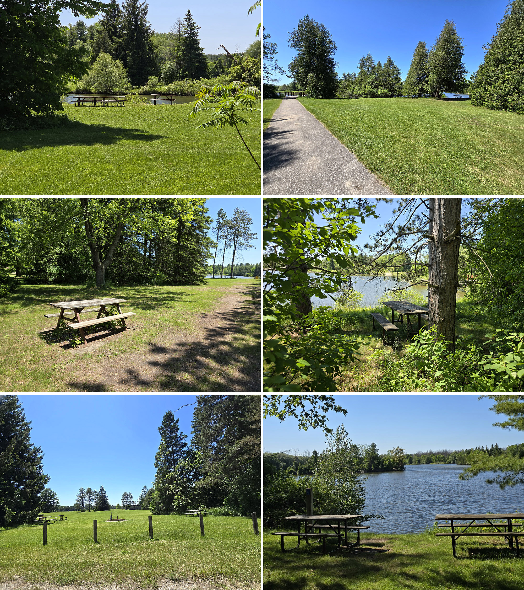
That’s how we’re choosing to look at the 3 (or more) tables we saw in the water - in various places - during our stay.
After first one, it became kind of a “Where’s Waldo?” kind of situation, with each new half submerged picnic table bringing out a weird sense of delight.
It reminded us of the “spot the caution tape” game we had going during our stay at Canisbay Lake, Algonquin Provincial Park.
Anyway, I had to chuckle at all the signs and warnings about ticks, contrasted with how many picnic tables were *in* bushes.
Not “a bit too close for comfort”, but literally IN the bush. We saw this in a few places in the day use, along the river, and even in some of the campgrounds.
Some were getting pretty overgrown, too - I think the plants have claimed them.

Playing Field
There’s also a large playing field near the park store, complete with a baseball diamond.

Campsite Details
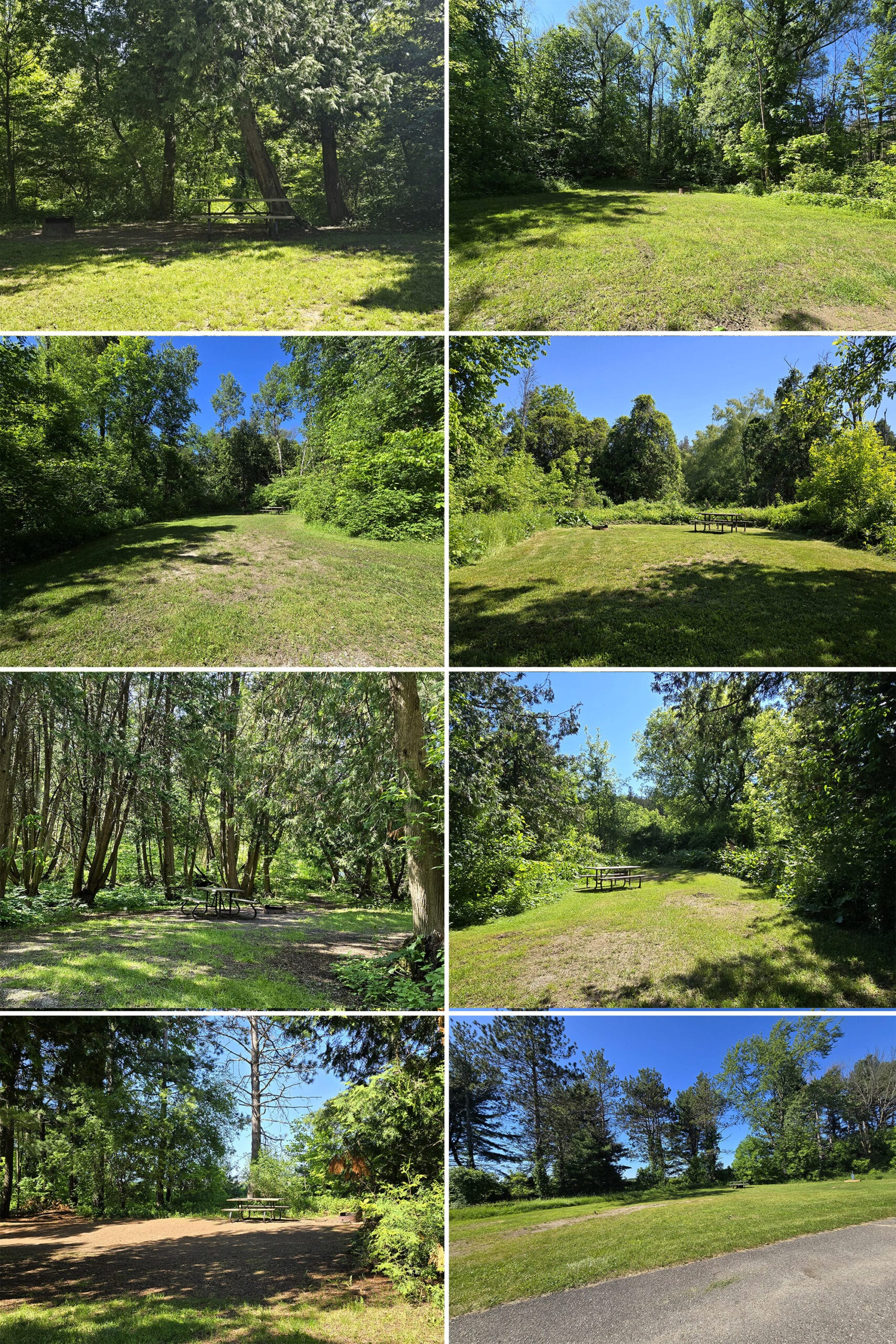
There are 2 main campgrounds in Earl Rowe Provincial Park:
Westside Campground
Westside Campground is the larger of the two, and is the side that has the day use area, lake, etc. It has four camping areas: Trillium Woods Campground, Boyne Meadow Campground, Meadowbrook Campground, and Fletchers Field Campground.
During our stay, Meadowbrook and Trillium Woods were gated off, though we did get to see some of the Meadowbrook campsites as part of the Resource Trail:

These were a little odd - they were much shorter than traditional pull through, so we had to disconnect the car and park it beside the trailer. It was plenty wide, though - and no privacy at all.

In fact, Boyne Meadow, Meadowbrook, and Trillium Woods are all entirely non-electrical campsites.

Riverside Campground
Riverside Campground is across the road from the rest of the park, and is gated. Campers staying there receive a little cardstock ticket with a bar code, in order to lift the gate.
Riverside also has four camping areas: Blue Heron Campground, Heydon Way Campground, Rabbit Loop Campground, and Salmon Run Campground.
Blue Heron (Radio Free), Rabbit Loop, and Salmon Run are all non-electric sites, while the campsites in Heydon Way - both sections - all have hydro. There are water taps located throughout, too.
As a note: Salmon Run also has the cutest campsite we saw in the park, and one of the cutest we’ve seen yet.
The photo doesn’t do it justice at all. It very much has a garden feel, and I think it might even have a view of the scenic river valley from the back end of it (we didn’t go into the site).

A Few Observations:
1. The cutest sites with the most privacy were in Salmon Run and Rabbit Loop, especially closest to the river. Riverside definitely had cuter sites than Westside.
2. In general - there were exceptions - we found that most campsites were fairly big sites with really uneven ground, and square.
3... Well, except when they weren’t. #18 is super tiny, and then #19 is just really Loooooong.
4. Rabbit Loop earned its name! The first rabbit we saw in the park was seconds after we got to Rabbit Loop, and we saw several in that very small area. Super cute!
5. The playground in Riverside is nicer than the one in Westside, if that matters to you.

Bottom: Fletchers Field Campground.
6. Interesting note: The campgrounds on the river side of Riverside have GIGANTIC ferns - some were hip or even waist high!
7. On the Saturday of our stay, a lot of people were using campsites in Heydon Way as *group* campsites. We haven’t seen that before, don’t know if it’s a common thing.
Just figured we’d give a bit of a heads up - there were people, cars, and equipment spilling out onto the roads, as these hug groups weren’t really fitting into the sites.
Group Camping
The group camping area of Earl Rowe Provincial Park was gated off during our stay.
Share the Love!If you’ve made one of our recipes, be sure to take some pics of your handiwork! If you post it to Bluesky, be sure to tag us - @2NerdsInATruck, or you can tag us on TikTok, if you’re posting video. We're also on Pinterest, so you can save all your favourite recipes and park reviews to your own boards! Also, be sure to subscribe to our free email newsletter, so you never miss out on any of our nonsense. Well, the published nonsense, anyway! |
Entertainment and Activity
Here’s a bunch of information on the activities offered at Earl Rowe Provincial Park:
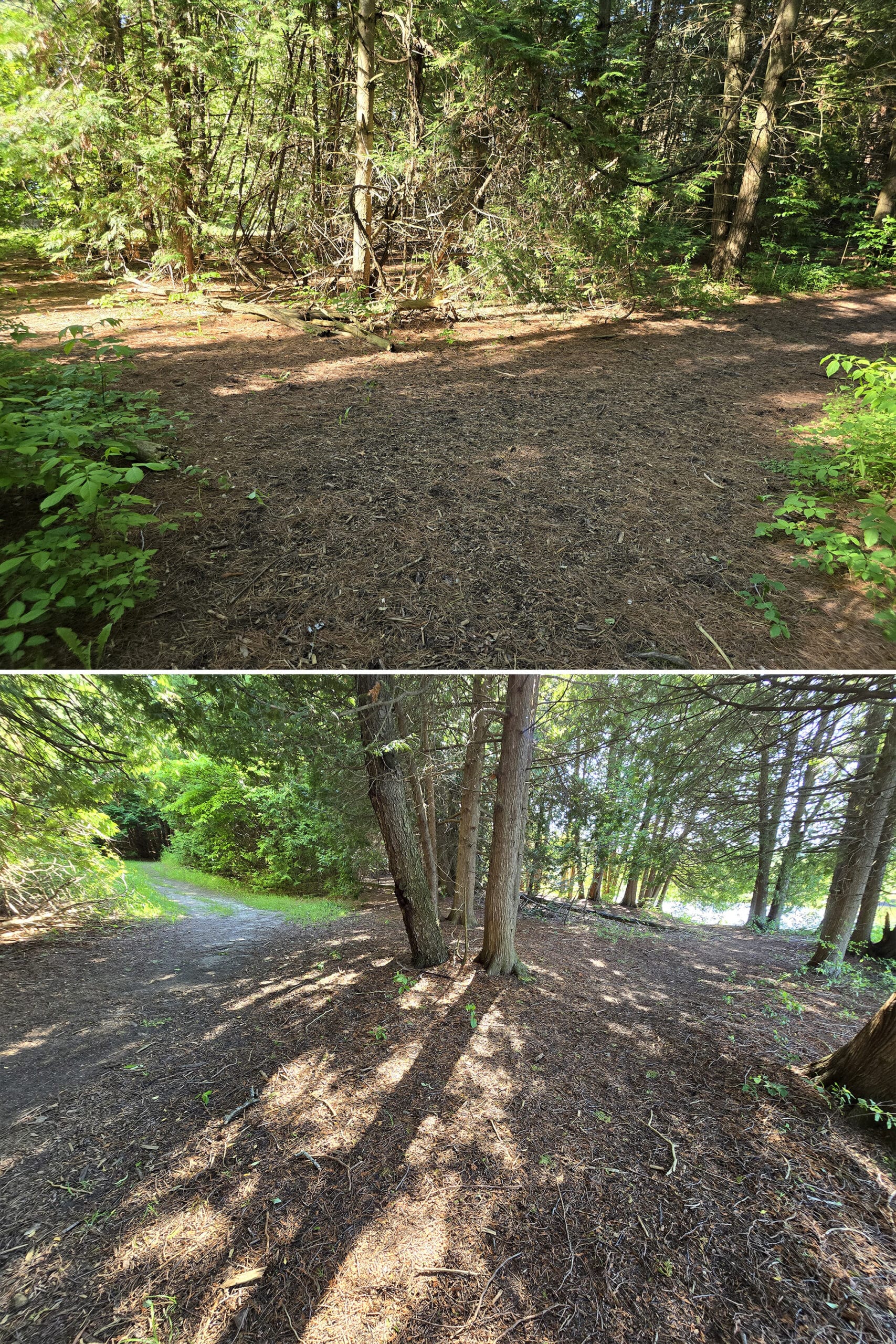
Hiking
Hiking at this park was a bit weird, starting out with huge discrepancies between the map, the website description, and reality.
One trail is noted as being more than twice as long as it actually is, one is mentioned on the site but not shown on the map, another is described as a 0.5 km linear, when it’s actually 1.5km and a loop... that kind of thing.
Anyway, some info on the Earl Rowe Park trails:
Fletcher’s Mill Pond Trail
This one is mentioned on the website, but is not shown on the map - at all. As in, there’s nothing marked that even matches the description of where this goes, vague as it may be.
At first we wondered if it overlapped the Little Trail, then continued on to the pool... but then we saw a single trail marker for it out by the bridges.
So... who knows?
Anyway, it’s described as being 1.5 km (linear), and connects the Earl Rowe Dam to the pool, going along the edge of the lake and passing by the store.

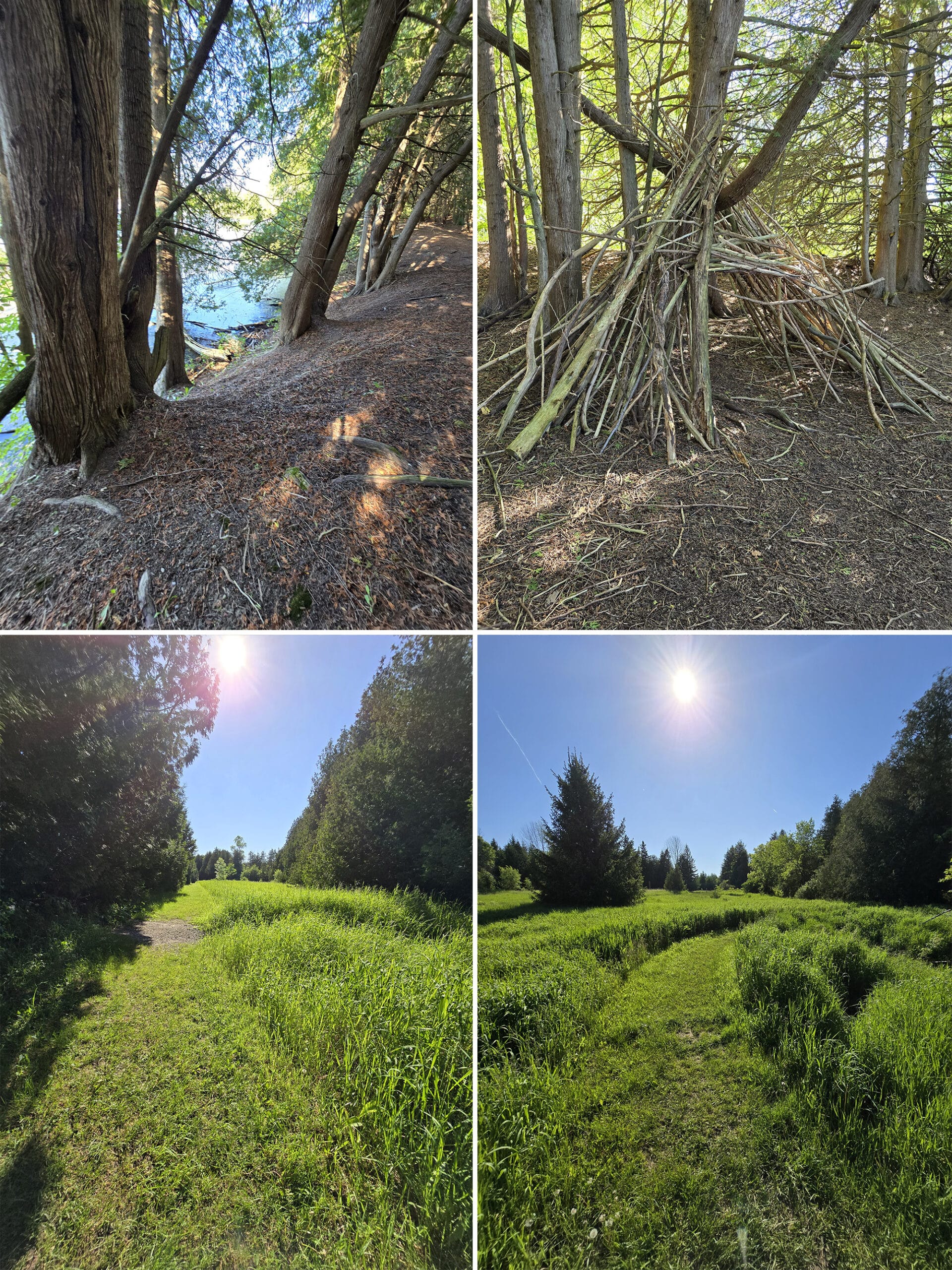
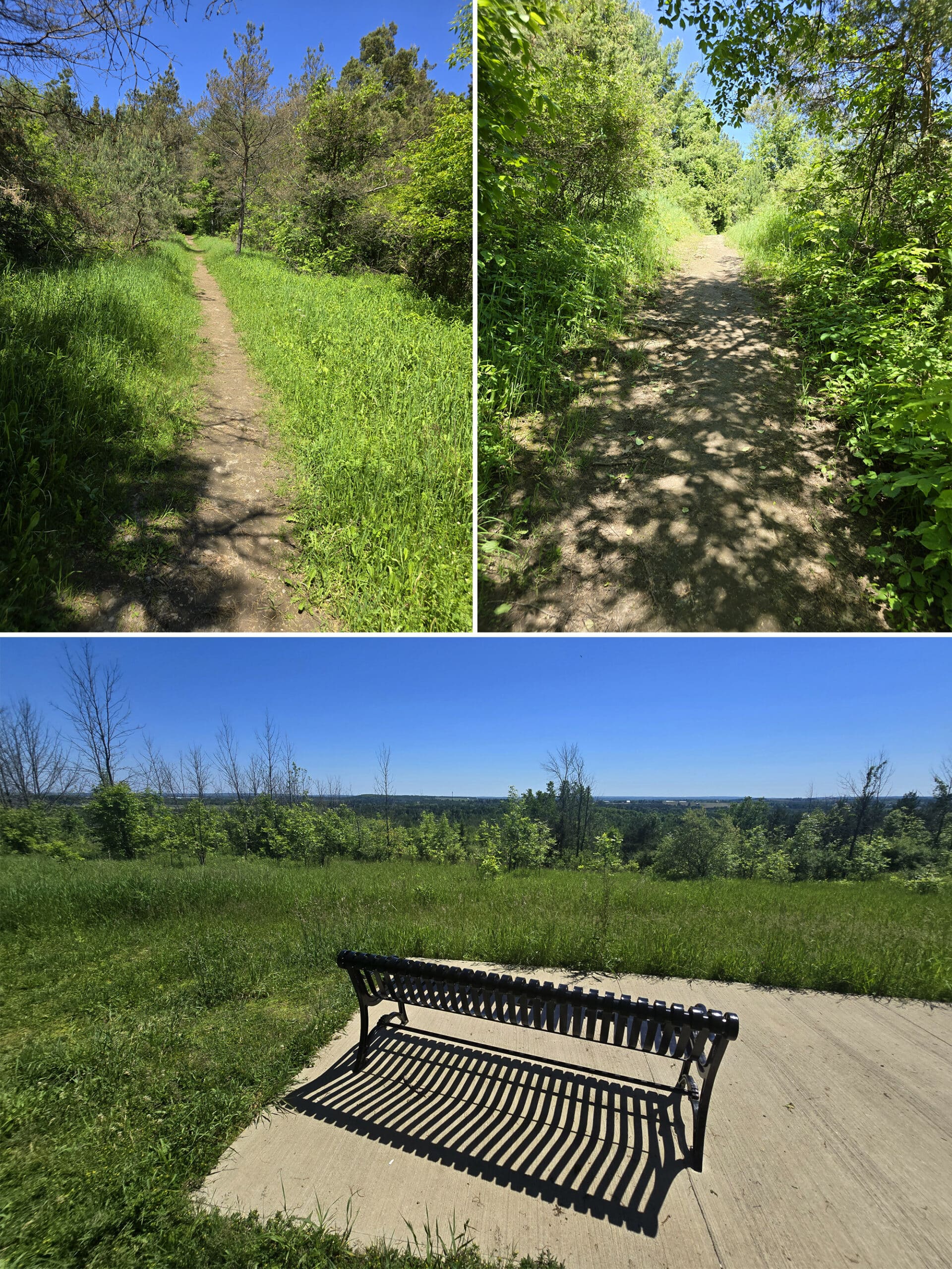
Little Trail
On the park website, this one is listed as being a 0.5 km linear trail. On the map - and in reality - a loop... and 1.5 km long.
It’s described as being a quick and easy walk through the woods, but it’s kind of a wild rollercoaster of a trail.
The photos I’m sharing are in order - yes, there were that many changes of scenery / vibe / trail type in just 1.5 km!
In another place, there was randomly a trail marker for Rainbow Run, even though the map showed the Rainbow Run trail being on the other side of the street for the whole length of this trail.
He said that the only thing that made him feel better about possibly being lost is that he knew the trail was contained to a narrow strip of land, pinned between a road and water.
So, unless he crossed either, he knew he was more or less going in the right direction.

Adding to his photo collection of half submerged picnic tables was his favourite part of the trail. To me, it was how WILDLY the trail changed over just 1.5 km.
It goes way beyond ADHD friendly, LOL.

Lookout Trail
This was a weird trail, in terms of the map.
You have to access it via the rainbow trail. The map makes it look like there’s an entry point near the Westside trailer sanitation station, but there weren’t any access points that we could see on that entire side of the campground.
So, walked around this section of Earl Rowe Park a bit to find it, joined up with the rainbow trail at the main road, and onto the Lookout trail.
The site says this is a 4km loop, but it’s more like a U shape on the map, with both ends meeting up on Rainbow Run Trail.
All told - from our site to the trailer sanitation station, back to the main road, joining up with the trails, doing both the Lookout portion and the joining section of Rainbow, and back to our site - it was 4.7km.
No idea where they came up with 4 km. The “U” itself is only 1.53 km! Including the section of rainbow trail to get back to it - making an actual loop - is 1.84 km in total.

That... probably wins for most inaccurate trail info we’ve seen yet
Then there’s the matter of “beautiful lookout platform overlooking Earl Rowe and surrounding area”, as advertised. It’s represented on the map as a little tower.
You’d think some sort of raised structure, right? Probably a really scenic view?
It’s a cement pad with a couple benches on it, and no real view of anything of note - certainly not one of the panoramic views we tend to end up with on similarly named trails in other parks!
Anyway, about the trail...
This was kind of a weird trail. There were sections that were gravel, and others that were muddy grass, and yet others that were sandy.
In some points the trail was really narrow and completely un-maintained, but then in others it was wide and well groomed.
This went beyond our usual “ADHD friendly” designation, and into “...what?”.

In general, it ended up being just kind of a disappointing walk through the woods, you know?
Some areas we liked, but the rest was pretty meh, and not very interesting. No birds, but lots of mosquitos, too.
Probably a good thing that it ended up being half the distance it said it was!

Rainbow Run Trail
This is the longest trail in the park, at about 11 km (as stated, anyway - who knows what it actually is!).
It loops around and through the entire park, overlapping with and intersecting with the other trails.
Unlike the other trails, this one actually has some spectacular views - but they’re mostly within a short distance of the beaches / park store.

The trail varies from wide pavement and bridges in good shape, to almost completely overgrown in other places.
As you journey out from the area between the park store and the pool, you get into more unmaintained area, with a LOT of mosquitoes at any time of day.
So, we didn’t explore beyond it.
As a note: There’s a section of this trail - beyond the pool, and to the right - that is labeled as being off-leash for dogs. It’s a bit of a hike to even get there.
Also note: The area around the store, beaches, and bridges are FANTASTIC for sunsets!

Resource Trail
Signage on the trail said this one was 2 km, but the website - which said 1.5 km - was accurate.
This trail is named for the educational signs along the route, teaching hikers about ... stuff. In theory, anyway.
Some of the signs had definitely seen better days, and varied from weathered, to illegible, to completely obliterated.

Porter walked the Resource Trail by himself, and said that it was “Nice - much nicer than Lookout Trail”, and more in line with what he’s used to at Ontario Provincial Parks.

One highlight to note: The giant “hip to waist high” ferns we noticed in Riverside campground grow even taller along this trail. He saw some that were chest height!

Given that that campground was gated off during our stay, it was fun to walk through it, deserted.

Riverside Campground Trail
This trail appears to be an old road (on the west side, anyway), and/or ATV trail (as it appears from the Riverside end). It’s blockaded off to prevent motorized vehicles from accessing it.
Not much to say here - it’s just a quick, straight-shot road connecting the Riverside Campground to the Westside area, ending partway between the dam and the day use parking.
You’ll have to walk on the road for a bit in order to join up with another trail, though.

Biking
Every trail in the park is considered open for biking, with the exception of the Lookout Trail. In addition, campers and day users are welcome to bike ride along any of the park roads.
As a note: We saw a bike rack at the Park Store, but that’s the only bike rack we noticed. There may be more - but if there are, they may be hard to find.

Swimming
The swimming situation at Earl Rowe is weird, and the source of most of the bad reviews we’ve seen about this park.
There are two main beach areas - West Beach and East Beach - as well as a swimming pool.
The road leading to the whole West Beach area (including the pool, rentable picnic shelter, etc) was gated off during our stay, which was weird.
After May long weekend, you’d think they’d have all the day use areas accessible?

The Beaches
The East Beach is the larger of the two beaches, and has a lot of amenities - canoe rentals, a long dock you can jump off, beach volleyball, picnicking, a playground, etc.

Probably the reason for the reputation of it “never” being safe to swim there - they’re known for excessive Fecal Coliform levels.

A nearby sign explains how the lake was made, and how man made lakes tend to have bacteria issues, offering up the pool as an alternative.

The Pool
The Earl Rowe pool closed something like 4 years ago, and hasn’t opened since.
Apparently it was in need of repairs that are supposed to be done to open in July this year ... but at the beginning of June, we couldn’t see any signs of work being done on it, at all.
It just looked big, empty, and abandoned.
So. No idea there.

Birding & Wildlife
Holy CRAP, we were not expecting this park to be such an amazing spot for birding - it doesn’t even mention birds on the website!
We saw many different species of birds during our stay, and heard even more.
Of particular note:
1 - A GIANT Pileated Woodpecker on the ground - just a few metres in front of us - flinging dirt in the air.

3. The trail from the Greenbush picnic shelter to the amphitheatre is lined with bird houses. The Tree Swallows that live in them are GORGEOUS.
Beyond that, we saw: American Crow, American Goldfinch, Bank Swallow, Black Capped Chickadee, Blue Jay, Brown Headed Cowbird, Canada Goose, Cedar Waxwing, Chipping Sparrow, Common Grackle, Cormorant, Eastern Bluebird, Eastern Phoebe, Eastern Wood Pewee, Flycatcher, House Wren, Mourning Dove, Northern Cardinal, Pine Warbler, Purple Finch, Red-Eyed Vireo, Red Winged Blackbird, Song Sparrow, Starling, Turkey Vulture, Yellow-Rumped Warbler, Yellow Warbler.

Second Row: Brown Headed Cowbird, Starling, Northern Cardinal
Third Row: Eastern Bluebird, Indigo Bunting, American Goldfinch
Fourth Row: Cedar Waxwing, Eastern Phoebe, Flycatcher
Seriously, there were times - near the bridges - where birding was actually getting difficult, because there were SO many different bird songs, in all directions.
You’d be tracking something, and 5+ others would be singing right over it!
We also saw a monarch butterfly, which is always cool.

Boating
There’s a boat launch in the park, right onto Earl Rowe Lake, and the park offers rentals to get people out on the water.

We saw what looked to be a learn to canoe class one morning during our stay, but didn’t see any information about that on the park website.

Fishing
Earl Rowe Provincial Park touts some interesting possibilities for fishing - or just watching fish!
In the early spring, they say you can watch rainbow trout leap up the fish ladder, bypassing the dam on their way to Boyne River. (In the fall, it’s the salmon’s turn to spawn.)
This... doesn’t seem to fit with what we saw.
The fish ladder is completely enclosed, and behind some VERY unfriendly looking barbed wire fencing. There’s also no trail or anything past it, you have to be right on the road to see it - or the dam/river - at all. Not even a shoulder!

There’s a Tackle Share program with loans of fishing equipment, and you can get a map of all the best fishing spots from the Gatehouse or Resource Center.
They even offer a Learn to Fish program! I was hoping to try this out, but the 2024 info had not been posted by the time of our visit - boo! 🙁

Discovery Program
As with most - maybe all? - of Ontario’s Provincial Parks, Earl Rowe offers a Discovery Program in the summer.
As we visited in early June, we didn’t see much about what would be offered. The website mentions the Discovery Activity Book - and nothing else - so it may be just basic programming.
Winter Activities
The park is open year round for day use.
In the winter, the hiking trails and campground roads are used for winter hiking and snowshoeing.
Niantic Games
There are a few portals / Pokestops scattered throughout the park, and enough connectivity to access them - usually.
Wouldn’t be a great place to be for an event, but adequate to just get your daily tasks in.
Nearby Attractions
The town of Alliston / New Tecumseth is only about 5 minutes from the park, so there’s pretty much anything you may need - or want - just a short drive away.
We noticed the park store was selling souvenirs for both Mono Cliffs Provincial Park and Forks of the Credit Provincial Park.
We haven’t been to Forks of the Credit yet, but Mono Cliffs was gorgeous - it’s part of the Bruce Trail system, so no surprise there.
Anyway, both of those parks are relatively near by, as are quite a few conservation areas:
Beattie Pinery Provincial Park Nature Reserve, Glencairn Conservation Area, Island Lake Conservation Area, Scanlon Creek Conservation Area, Tiffin Centre for Conservation, Tottenham Conservation Area, and Utopia Conservation Area ... among others.

Final Thoughts
Weird. Seriously, “Weird” was the running theme of this park, for our stay.
It makes it a bit (sorry) weird to actually sum up our thoughts on the park, or to give it any kind of overall rating.
As we do the vast majority of our camping in spring and fall, the swimming issues don’t really affect us. If we were looking to swim, specifically, we’d pass on coming back.
A lot of the weird was mostly just head scratching stuff, rather than REALLY offensive or inconvenient. Some of the weird was delightful!
Honestly, a lot of our issues with the park could be dealt with cheaply and easily.
If they were to get someone data oriented to look over the website, map, and the actual park itself... it just needs some work on the accuracy and consistency.
No idea what was going on with the picnic tables though
On the other hand, the birding was FANTASTIC, and the location is pretty convenient.
We’d definitely come back, with the caveat that it would be in the spring birding season, and it would be with the foreknowledge that we weren’t really going to be hiking.
And really, that’s fine - Not every park we visit has to be a hiking destination.
Overall, we did really enjoy our stay. I wouldn’t recommend the park to everyone - this one is going to be really, wildly dependant on what you like to do, when you’re camping.

More Provincial Park Campground Reviews
Want to read some more of what we have to say about the campgrounds we've stayed at? Here are some more reviews!
Awenda Provincial Park
Balsam Lake Provincial Park
Bass Lake Provincial Park
Bon Echo Provincial Park
Canisbay Lake, Algonquin Provincial Park
Chutes Provincial Park
Driftwood Provincial Park
Emily Provincial Park
Inverhuron Provincial Park
Killbear Provincial Park
Lake Superior Provincial Park
Long Point Provincial Park
MacGregor Point Provincial Park
MacLeod Provincial Park
Mara Provincial Park
McRae Point Provincial Park
Neys Provincial Park
Pinery Provincial Park
Point Farms Provincial Park
Port Burwell Provincial Park
Quetico Provincial Park
Rideau River Provincial Park
Rock Point Provincial Park
Rondeau Provincial Park
Sauble Falls Provincial Park
Selkirk Provincial Park
Sibbald Point Provincial Park
Sleeping Giant Provincial Park
Turkey Point Provincial Park
Wheatley Provincial Park

Thanks for Reading!If you loved this post - or have any questions about it - please leave a comment below! We'd also love it if you would consider sharing the link on social media! |

Leave a Reply