
Bronte Creek Provincial Park is an urban campground and day use area in Oakville. Packed with activities, here's everything you need to know!

Well, as a campground, anyway. We did go for a walk there 2 years ago, to check out their little “Gnome Road” attraction.
How wild that we managed to camp at Quetico Provincial Park, long before Bronte provincial park... which is such a short drive from home?
A 30 minute drive from us, Porter would literally pass it on his daily commute, when that was still a thing for him.
To be fair, we haven’t heard a lot of great things about it.
In theory, anyway. The huge outdoor pool has been closed for years, which definitely hasn’t worked in th park’s favour when it comes to discussions in Facebook groups.
There are a lot of other attractions to talk about, though: a picturesque ravine, a disc golf course, a ton of easy walking trails, a turn-of-the-century farmhouse AND a children’s farm - both with live animals! - and more.
It’s even open year-round, and offers cross-country skiing and a toboggan hill in the winter.
Spoilers: Aside from some negatives, we had a great time.
As my husband said during one of our hikes... "it's kind of wild that we're in Oakville".
Anyway, lots to talk about - and a TON of photos to share - so let’s get to it!
The Basics:
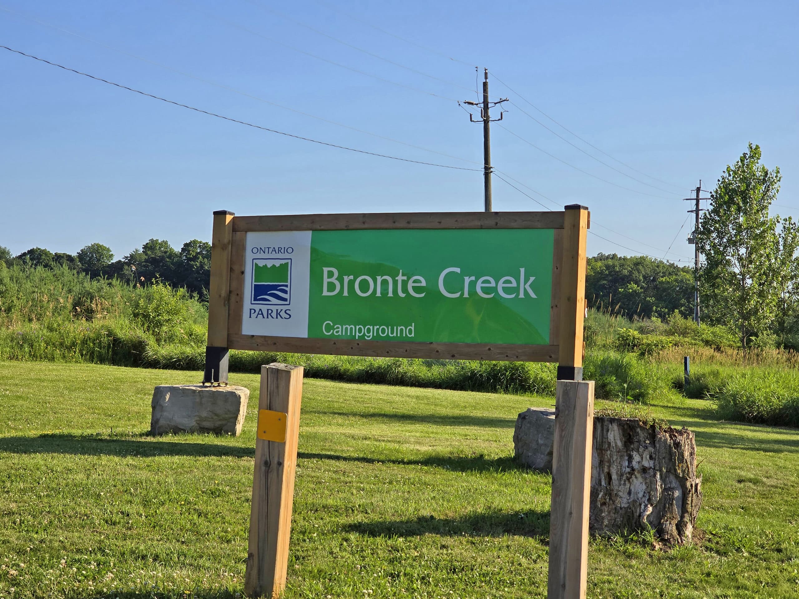
Campground Name: Bronte Creek Provincial Park
Campground Entrance: 3201 Upper Middle Road West, Oakville, ON 905-827-3228
Day-Use Address: 1219 Burloak Drive, Oakville, ON 905-827-6911
Website: https://www.ontarioparks.ca/park/brontecreek
Price: Ontario Provincial Parks uses a pricing matrix across all their parks. See 2025 Camping Fees for more details.
Reservations: Ontario Parks Reservations
Campground Season: May 8, 2026 to October 25, 2026
Day Use Season: Open year round
Logistics
The logistics are a bit weird at Bronte Creek park, as the day use area is completely separate from the camping area - 2 separate entrances and all!
Truthfully, it feels like we’re reviewing two entirely different parks. I’ll try to keep all the info as organized and straightforward as possible - there’s a LOT to go over!
Registration and Check In
As part of the Ontario Parks system, Bronte Creek uses the same online registration portal as the vast majority of parks we’ve camped at. This is true whether you’re booking a campsite, or just day-use parking.
Either way - and now we’ve booked both, a few years apart - it’s quick and easy to register.
We actually booked our trip about an hour ahead of time, as this was a spontaneous trip. Happily, there was plenty of availability. Kind of shocking, for a July weekend!
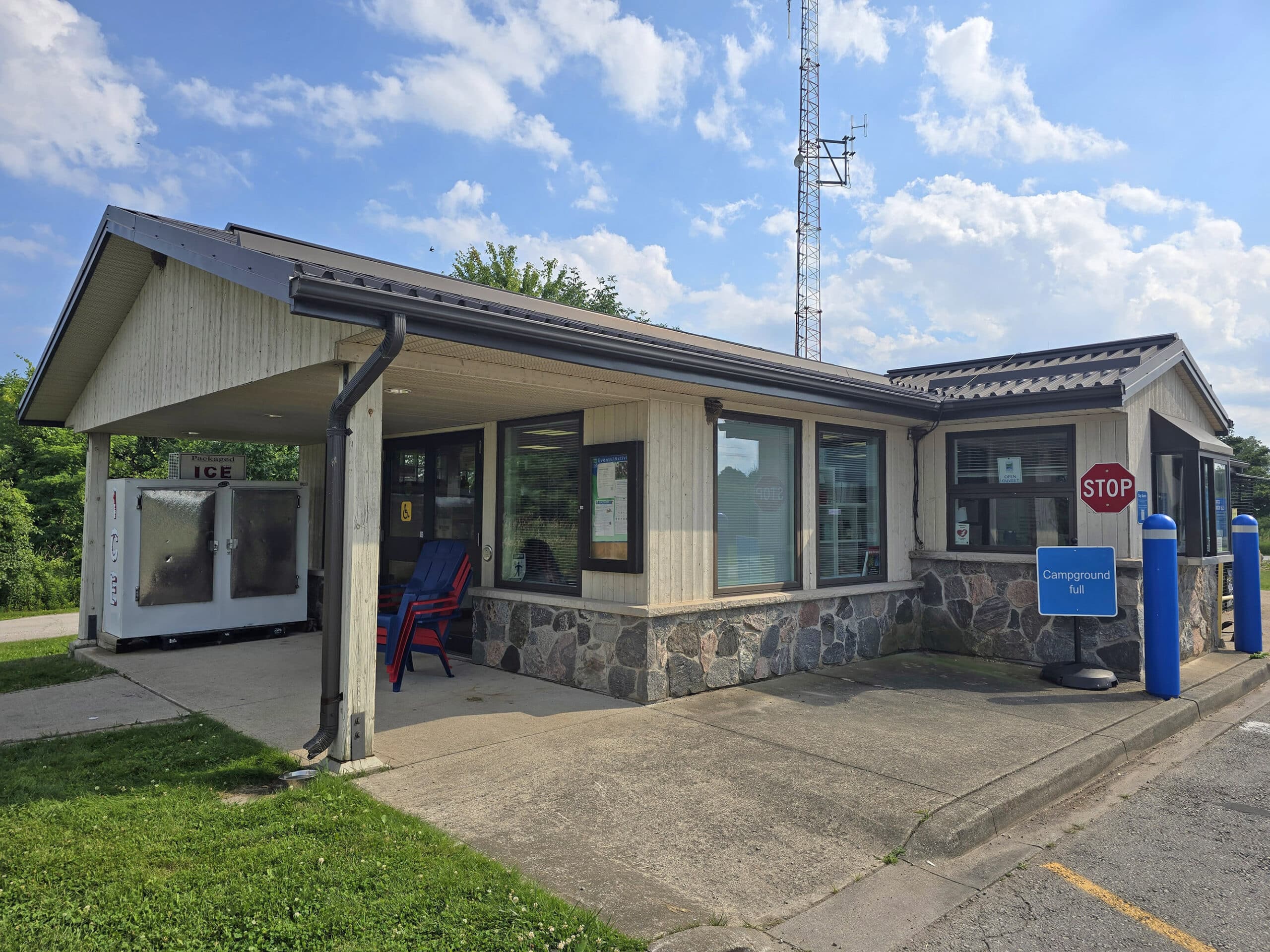
Anyway, we checked in at the campground office - just a short distance off Bronte Road. This was also quick and easy, done via a window at the front gate.
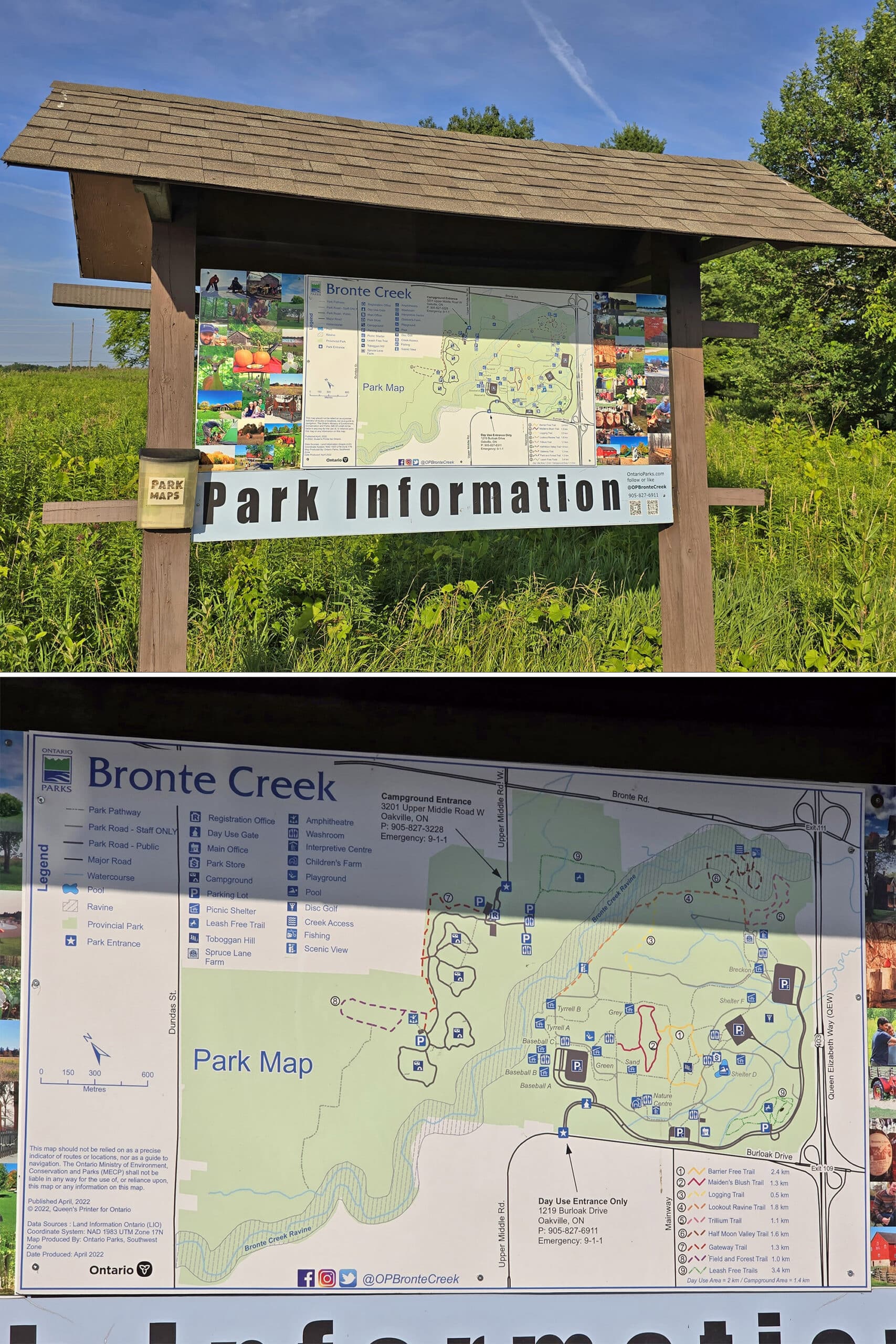
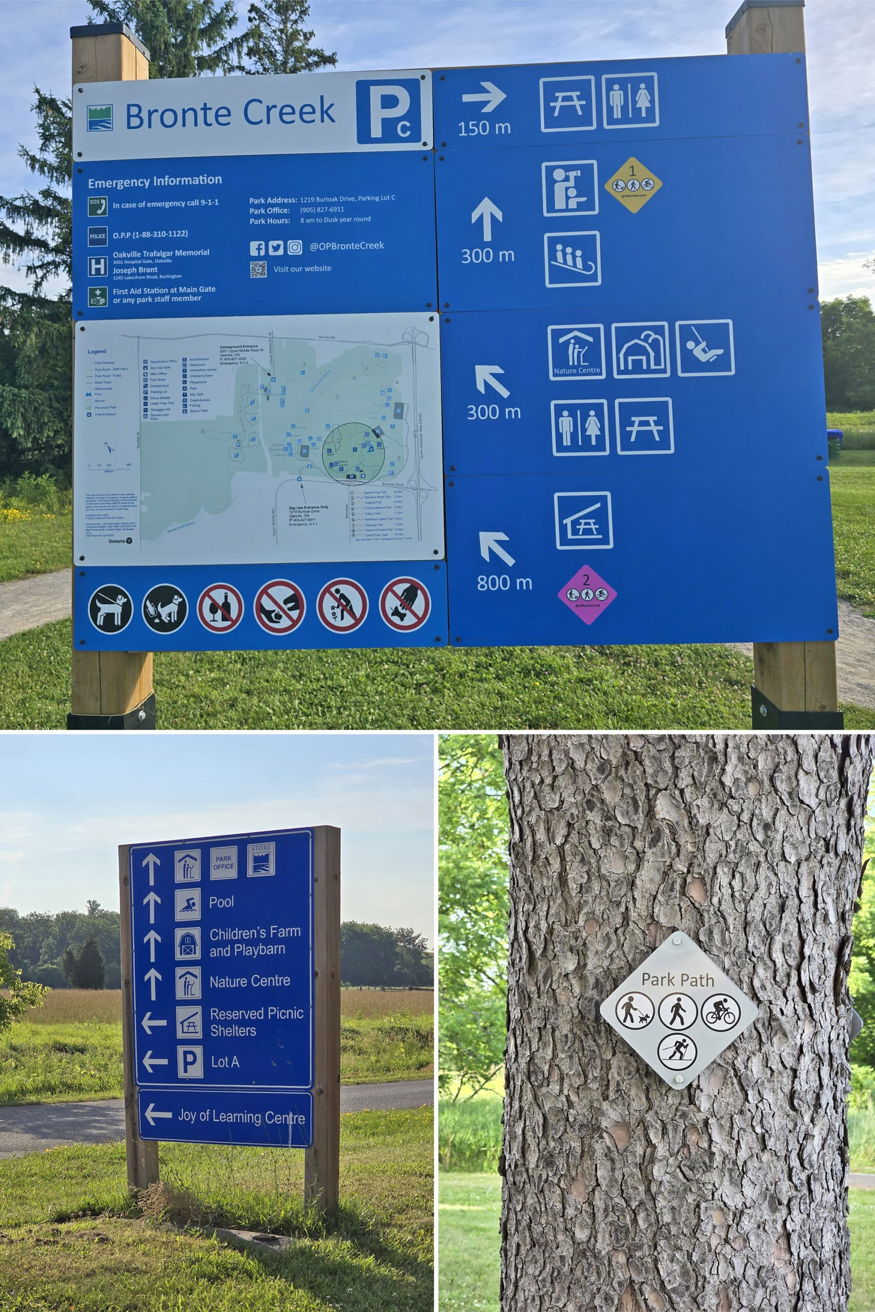
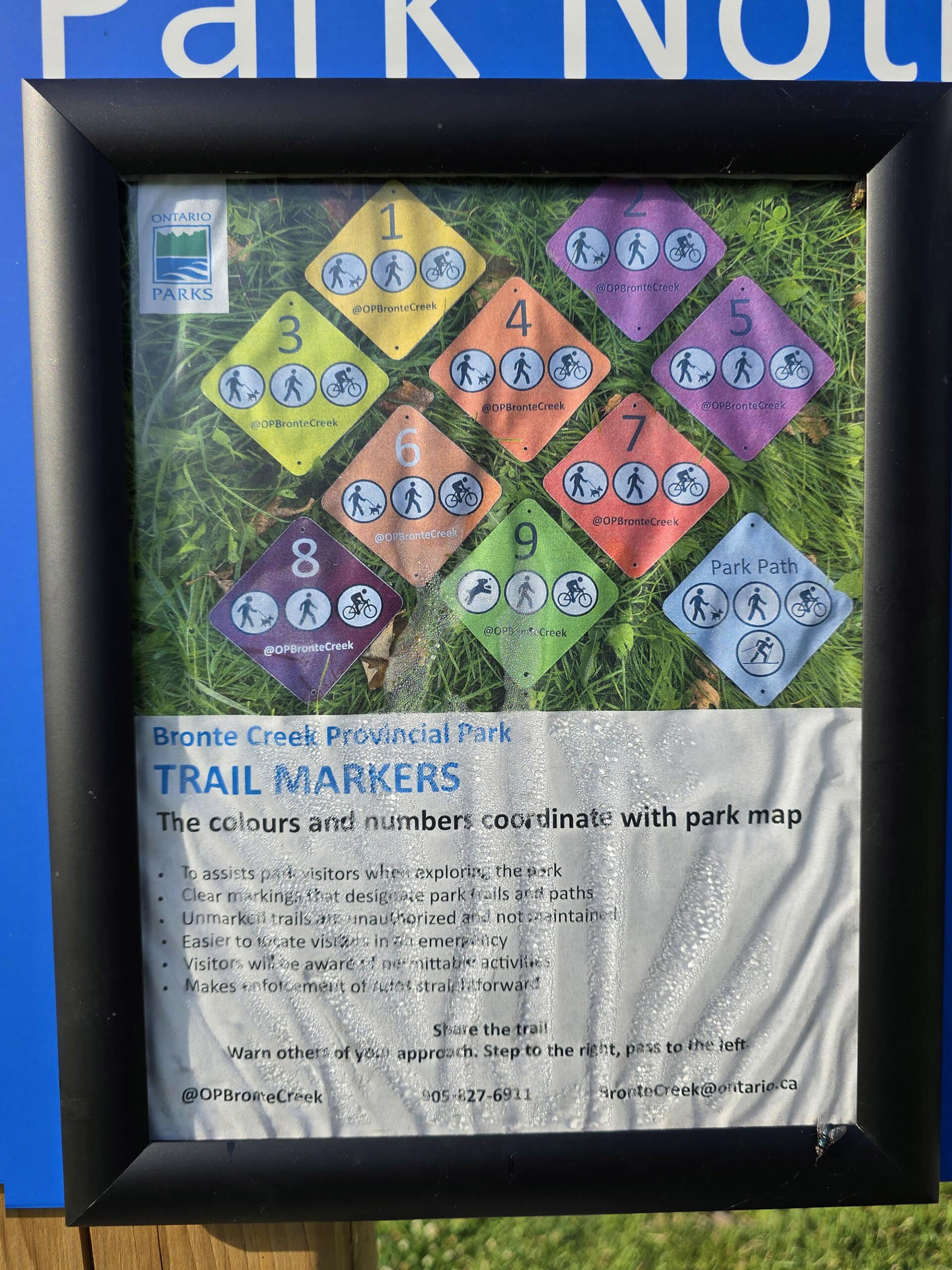
Maps, Signage, and Website
The main sources of location information in Bronte Creek Provincial Park are... a mixed bag.
There are definitely some discrepancies between the 3, especially with regards to trails. (Some trail distances, the actual existence of some of the trails/paths, etc.
Overall, minor issues, though.
Some more detailed observations:
Park Map
The park map you get when checking in to the campground is an 11 x 17" glossy, two sided map. The campground map takes up one full side, and the second side is an overview of the whole park.
Unlike some, it has a compass rose, a scale indicator, and a fantastic key.
The map has a TON of information - love it. Colour coded trails, distances provided, the whole shebang. I love that it doesn’t waste a ton of real estate on like.. Tick warnings and flowery campground overview info.
There’s a huge sign version of the map just inside the day use area, and - AND!! - there’s a container on the lower left that holds paper versions of the map!
LOVE.
That said, there are definitely some discrepancies. There are well-used paths in reality that aren’t shown on the map, the Signage for Field and Forest trail says it’s 2.2 km, while the map says 1 km, etc.
Overall, you can tell that a lot more care was put into producing this map, than some of the other park maps.
Signage
The signage in the campground was decent. High contrast, but sometimes a bit smaller than would be ideal.
It’s a small campground, though, so there wasn’t much needed in the way of signage. What was there, definitely got the job done.
The signage in the day use area is generally fantastic. High contrast, with directions and distance to the main attractions, etc.
Website
So, when it comes to the maps, one thing that is frustrating is that everything is *a walk* from the nearest parking lot, and it’s not always obvious where you’re supposed to access things from.
I love that the website MOSTLY tells you where to access things from. The trail descriptions only cover 5 of the 9 trails, though.
There are definitely discrepancies between distances listed on the site vs the maps vs the signage on site vs reality, though.
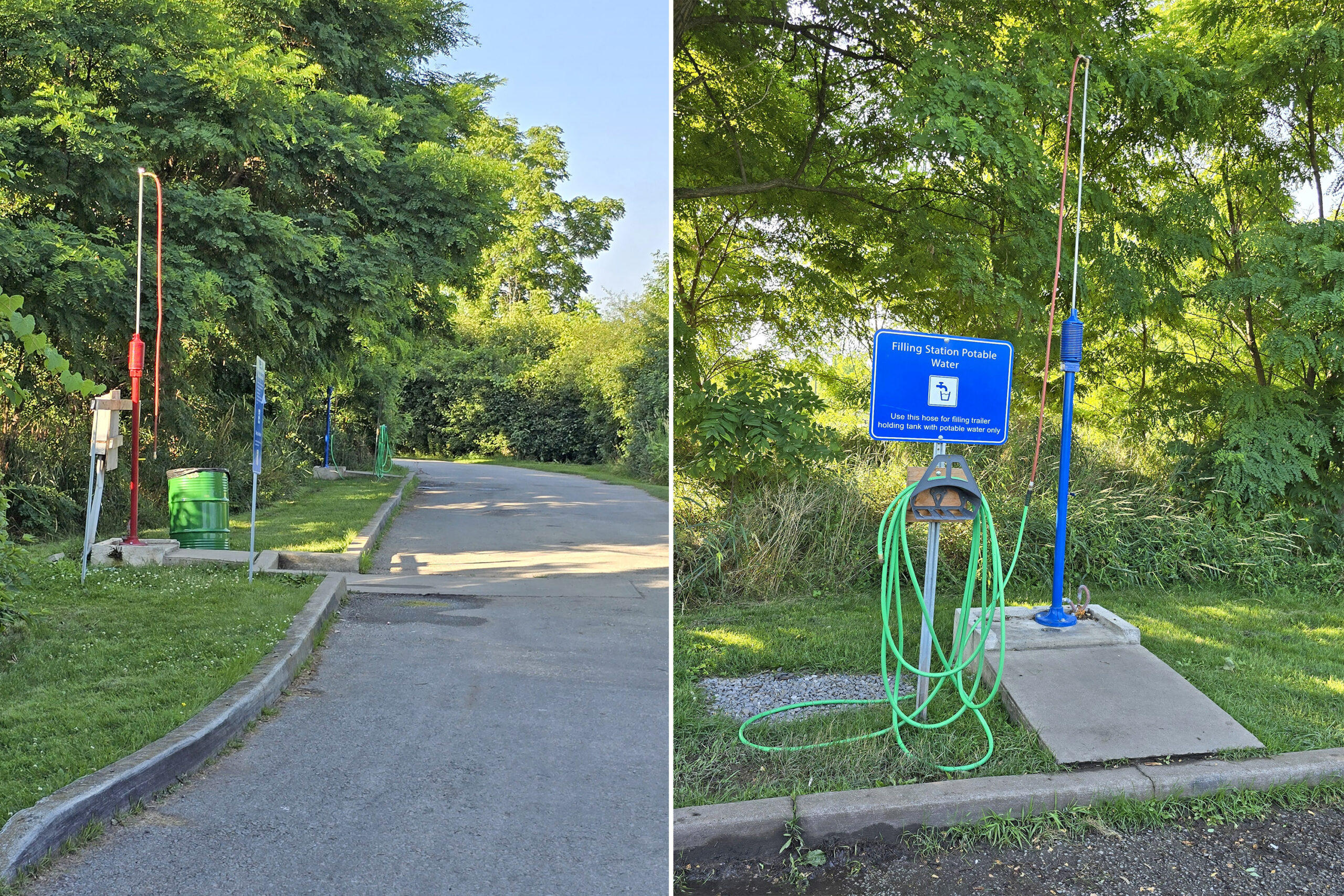
Waste & Water Services
The trailer sanitation station is a bit annoying.
It’s really only easily accessible on the way out of the park. If you need to dump or fill on the way in, you’ll have to basically U turn after the registration office, and go almost all the way back to the front gate.
Once finished, you’ll have to head back into the park - and through the registration lane again.
Anyway, there’s a single dump platform, then a single fill platform (threaded hose)... no bypass lane.
Connectivity
While there is no WiFi in the park, we did have really good cellular connection pretty much everywhere - including out on the trails.
I guess that’s one benefit for camping so close to the GTA!
Accessibility
While this park has a lot of things going for it, accessibility is NOT one of them.
If you’re a wheelchair user and planning to stick to the campground area itself, you should be more or less ok.
The campsites and roads are reasonably flat, there are two designated “barrier free” sites, and the comfort stations are barrier free.
The day use area, though, is absolutely not what I would consider accessible at all.
First, there’s the matter of location - you can’t access it directly from the campground, you have to drive 6.5 km to get there.
Parking lots are dotted around the outside of the day use, and literally anything you may want to go to is a bit of a hike from any of them.
What’s frustrating is that there ARE roads that go through the park, but they’re all staff only roads.
“Barrier Free Trail” is... not. It’s the most narrow trail, and the second roughest in the park!
Also, it’s not directly accessible from any of the parking lots, you’ll have to navigate other trails or park roads to get there.
All that said... with the exception of Half Moon Valley Trail, most of the roads, paths, and trails are wide, well-packed, and relatively flat.
Pets
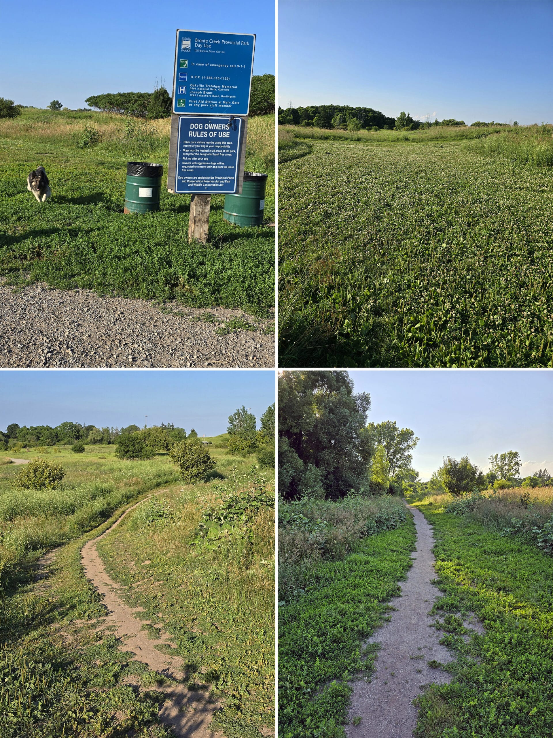
Bronte Creek Provincial Park has two large, leash-free areas - one in the day use area, and one in campground section.
The campground off leash area has a 1.4 km loop of off-leash trail, with a couple vault toilets near the entrance (one in each of the 2 parking lots).
At least one of the two vault toilet buildings has barrier-free stalls.
The day use section has 2 km of off-leash trails, in a mess of overlapping loops. This one doesn’t have a vault toilet right there, but the next parking lot over - in each direction - has them.
The day use area has LOTS of space for dogs to burn off energy, but it wasn’t mowed well - definitely check your dogs for ticks, after using it!
Parking
The campground section of the park has decent parking. I didn’t see any “overflow” type parking for the campsites, but the campsites are all pretty big.
The lots for any of the attractions - trail heads, off-leash dog park, amphitheatre, etc - have smallish lots, but ample enough for the size of the park, from what I could tell.
The day use area has TONS of parking, as several large lots along the outer edge of the park.
Park Amenities & Info
A few of the amenities were closed during our visit - despite it being on a weekend in the summer - but we did get to check out most of what the park has to offer.
Here’s some information on the park features:
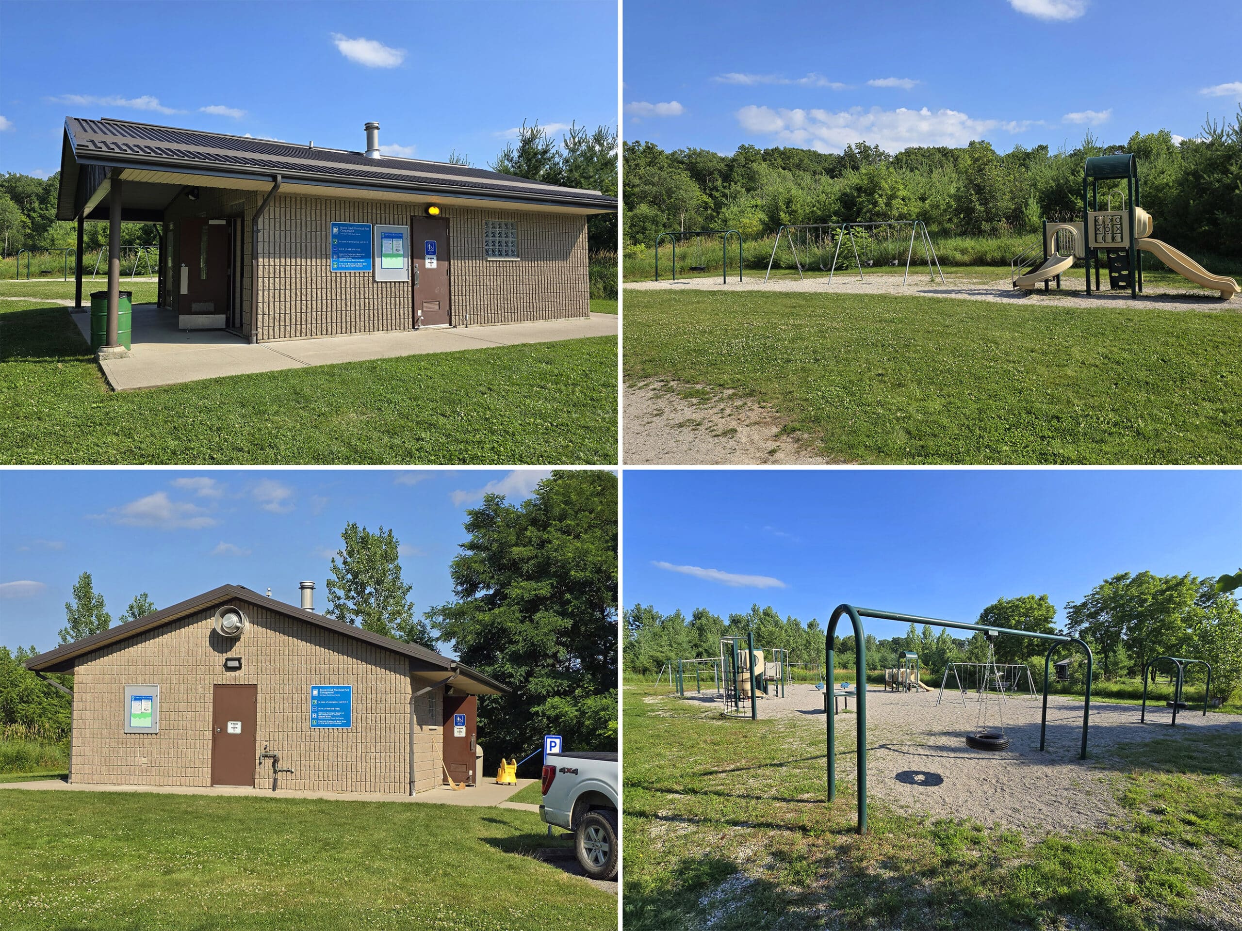
Creature Comforts
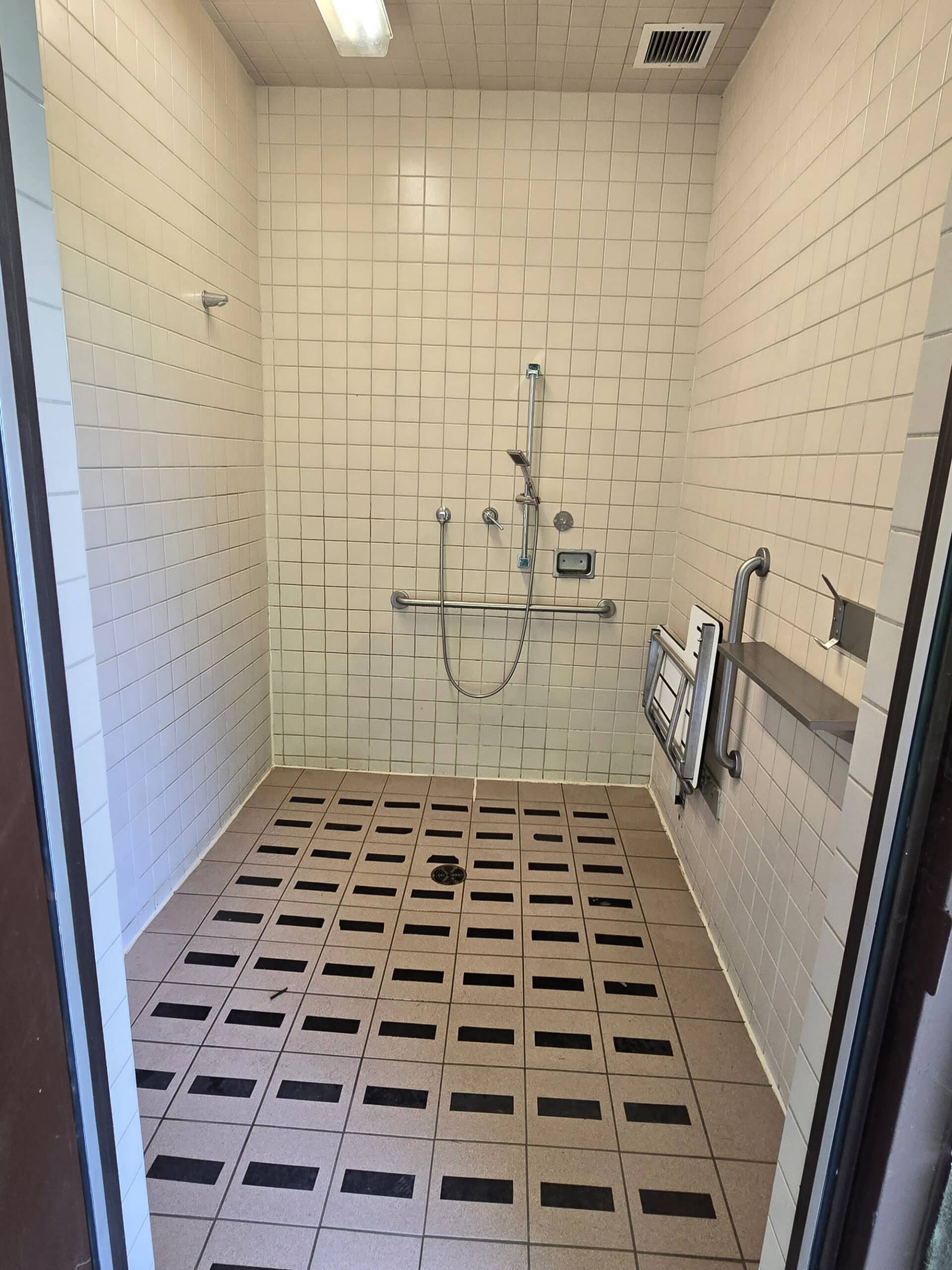
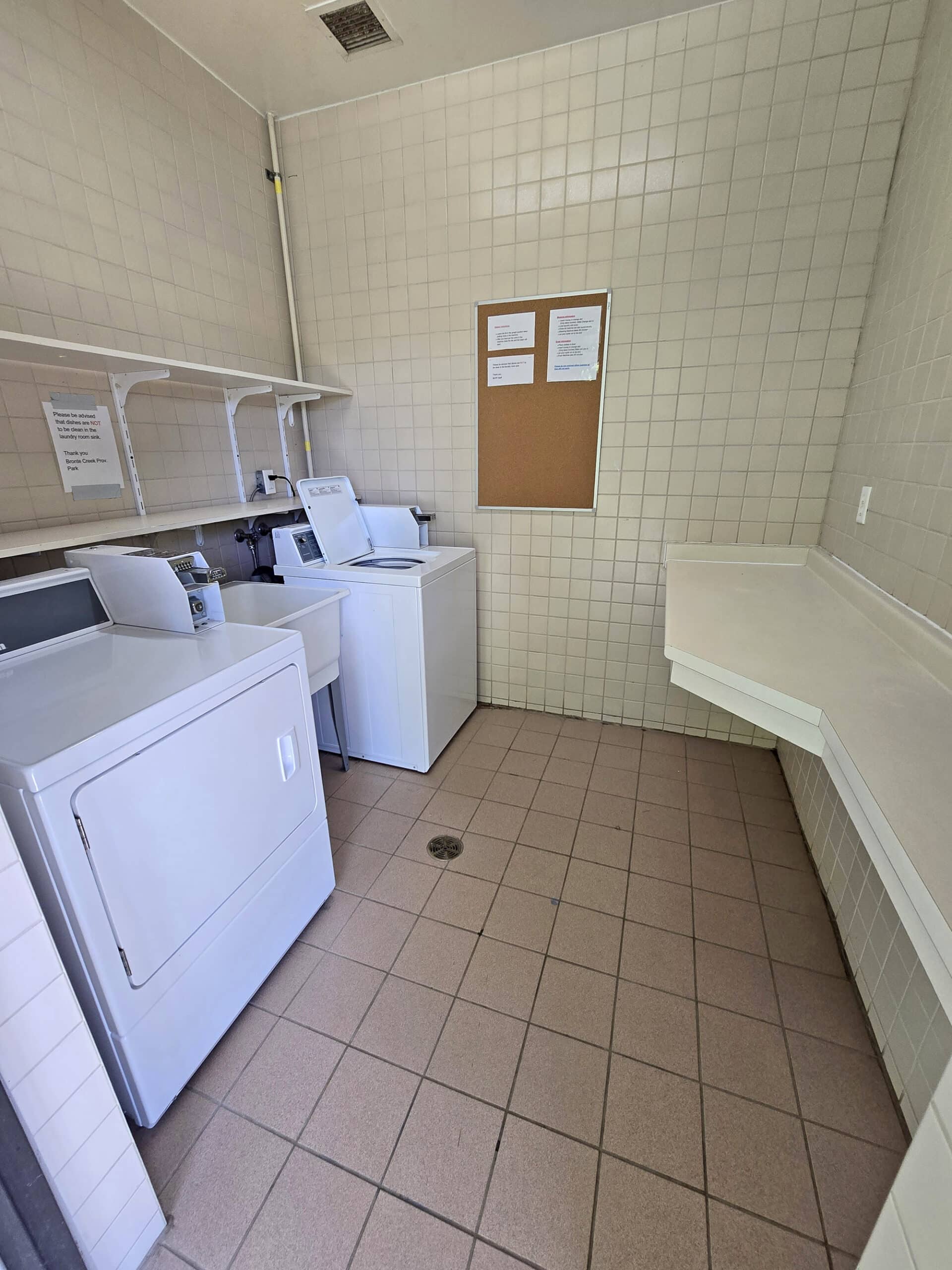
The campground has two comfort stations, each with flush toilets, laundry facilities, a playground, and barrier free showers.
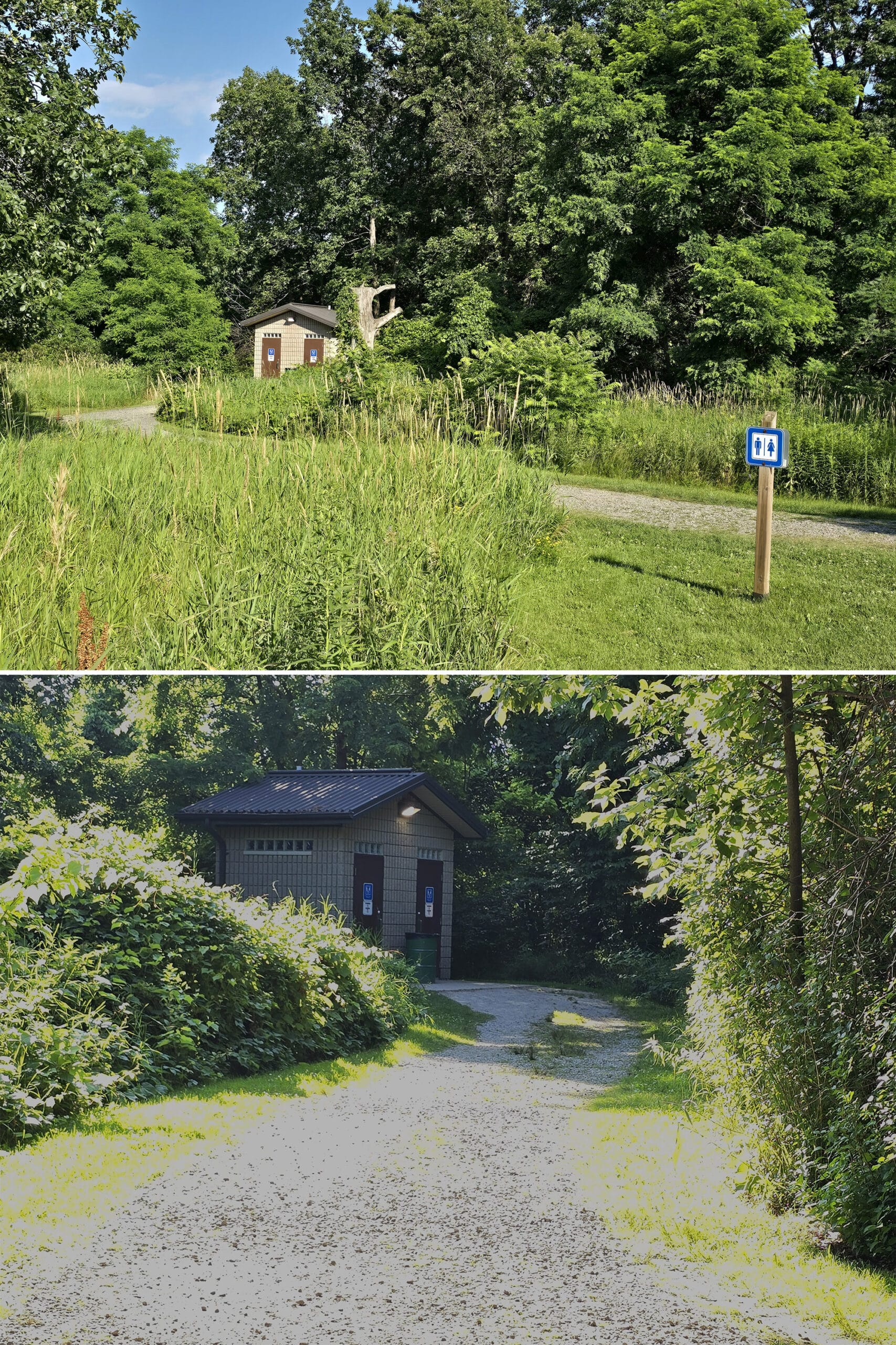
There are also 8 or 9 (depending on whether you’re reading the website or the map!) “comfort stations” throughout the day use area, each with flush toilets.
Whatever they are - I didn’t use any of them - they’re all located off the campground roads, up short-ish trails.
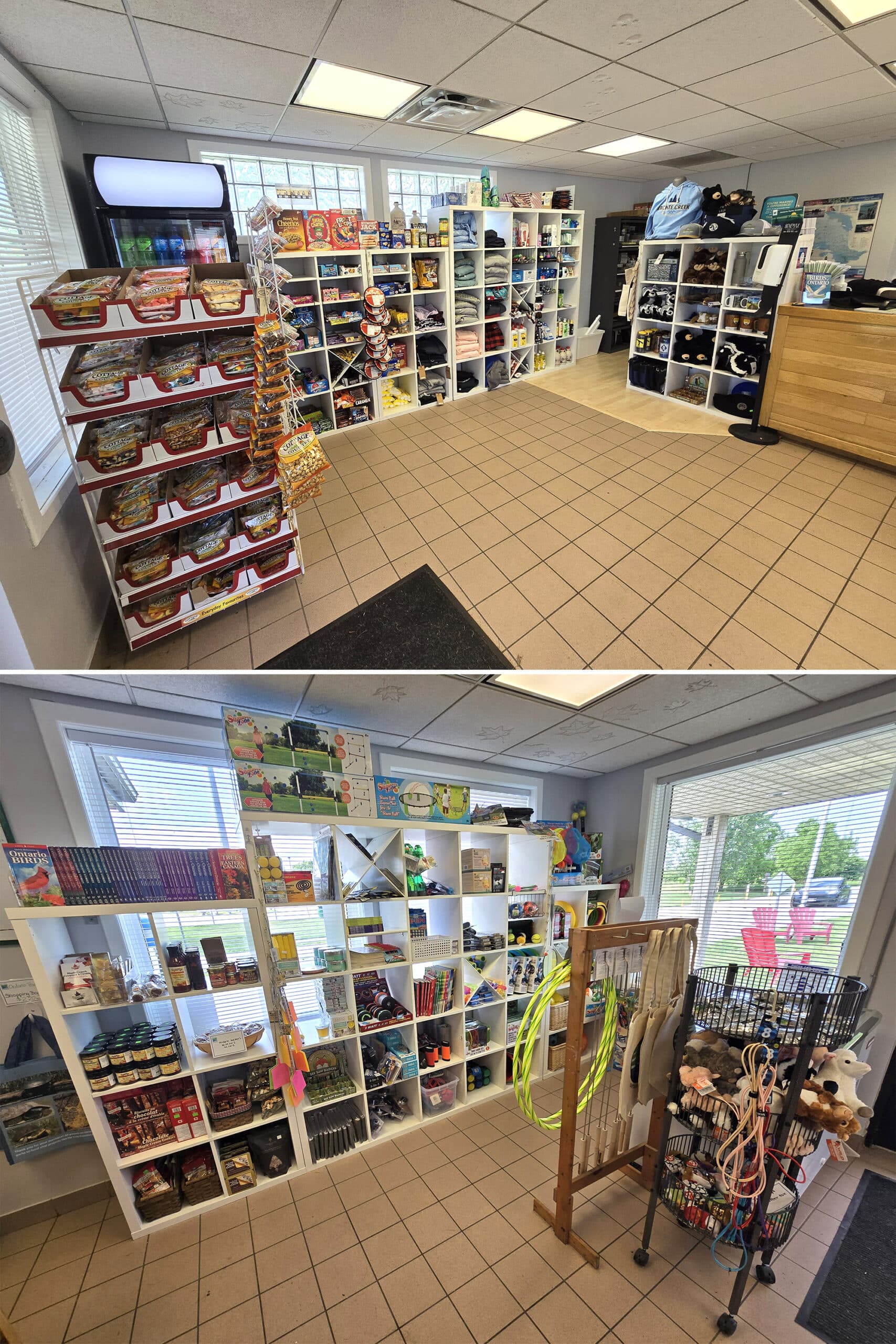
Park Store
The park map shows two park stores - one in day use and one in the campground - but the one in the day use doesn’t appear to be operational. (It looks to have been at the pool?)
Anyway, the park store is in campground main gate building.
It was kind of small, but had a cute selection. All the basics you’d expect - Ontario Parks merchandise, stuffed animal toys, snack foods. Really small selection though, don’t expect it to act as a mini grocery store, as some park stores do.
The interesting thing was that it also had some more bougie stuff that we don’t tend to see at park stores, like whisky casket wood chips and fancy maple syrup treats!
Visitor Centre
The “visitor center” situation at Bronte Creek Provincial Park is a bit different from most parks: There’s not really a traditional “Visitor centre”, but there are two other areas that both sort of meet the same purpose.
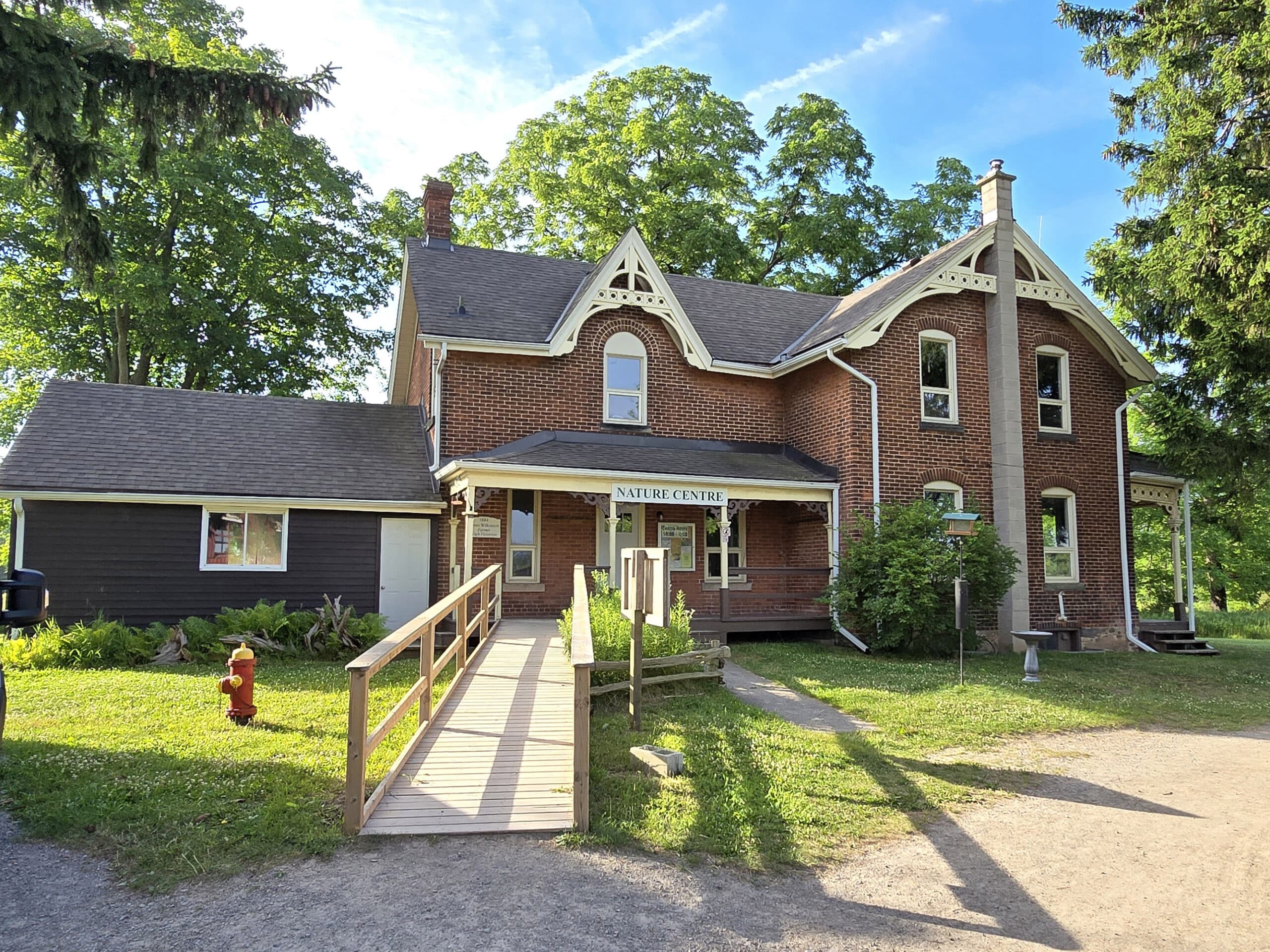
Nature Centre
The Nature Centre is a gorgeous old building - Victorian, maybe? (Damn it Jim, I’m a blogger, not an architect or historian!) - located near Parking Lot C.
We didn’t have time to visit this centre during our stay, but it’s a learning centre with information about the historical geography of the area, wildlife, etc.
It’s also the meeting point for some of the parks events and special outings.
Spruce Lane Farm House
The Spruce Lane Farmhouse is located at the far end of the day use area, near Parking Lot F.
We didn’t visit the main farmhouse during our stay. Apparently later in the day they have staff in period costumes, giving demonstrations.
We went early, as we wanted to get some hiking in before the hot weather hit - the farm is en route to the Half Moon Valley Trail.
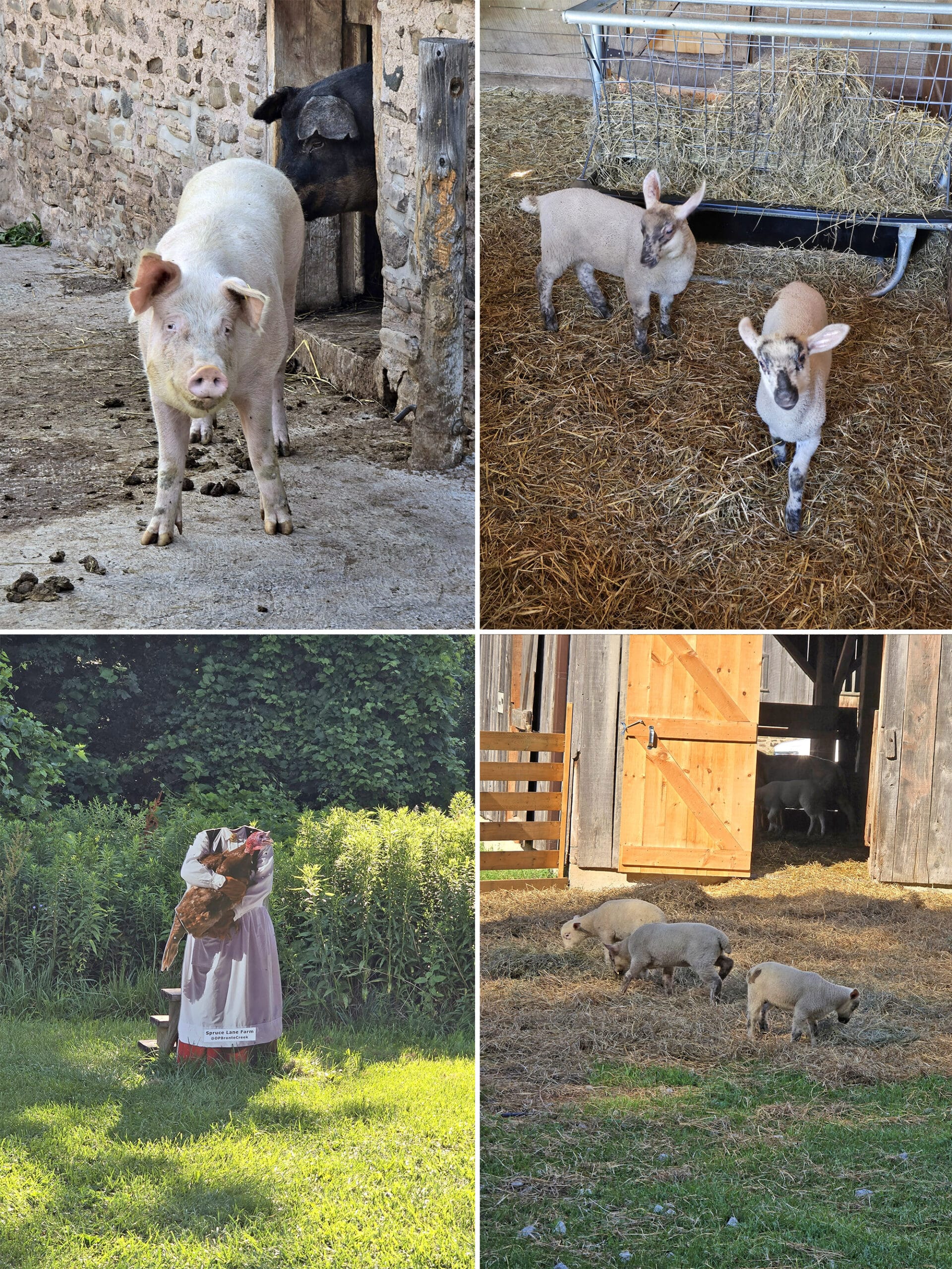
... that said, we definitely took some time to wander the farm area.
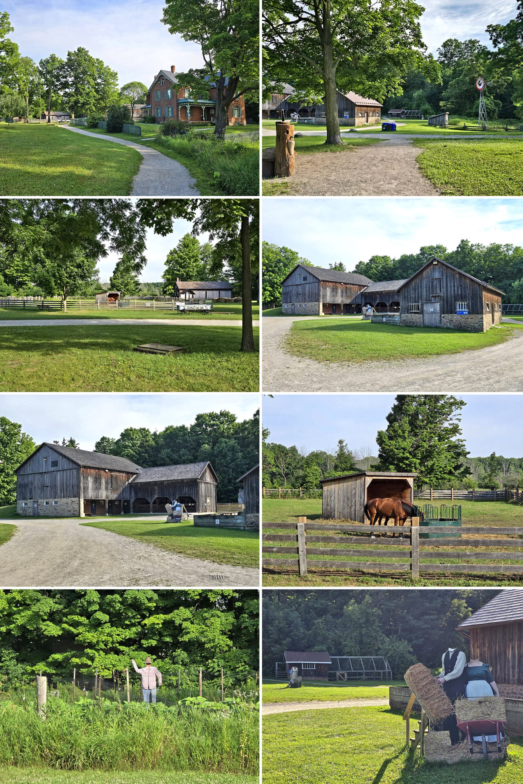
BABY GOATS. Baby goats with EARS! (They were so freaking cute, I couldn’t handle it!).
Also, lots of headless people. If you’re interested in posing with touristy headless standees... this is the part of the park for you!
Anyway, this is also the section of the part that hosts the Maple Syrup Festival in the spring, and the Victorian Christmas Program in the winter.
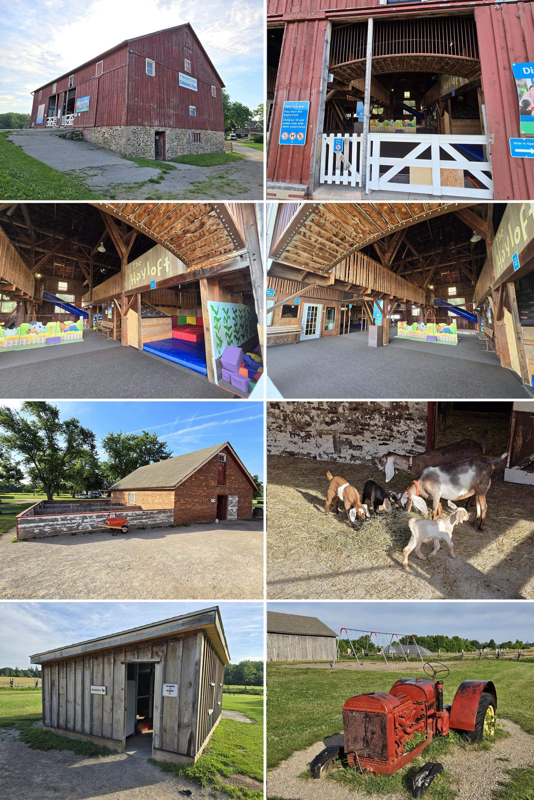
Children’s Playbarn
There’s a whole interactive area - near the Nature Centre, via Parking Lot C - done up as a children’s farm, complete with a play barn.
This looked like a super cute set-up, but we don’t really know much about it. Got a quick look, but it was definitely geared for children.
Day Use Area
Usually I use this section to talk about the day use area of a park... but this is a bit of a different situation, as the main day-use area is basically a whole park by itself.
So, let’s talk about the picnic areas and such, and leave the separate activity areas as their own sections.
First off, a couple caveats:
1. The whole day use area was SUPER busy on the weekend, AND on the Monday we were there - it wasn’t a holiday weekend. If you’re looking to book a picnic shelter, you may want to do it early.
2. You can definitely hear the highway drone from the 403 throughout a lot of the day use area.
So, keeping those tidbits in mind...
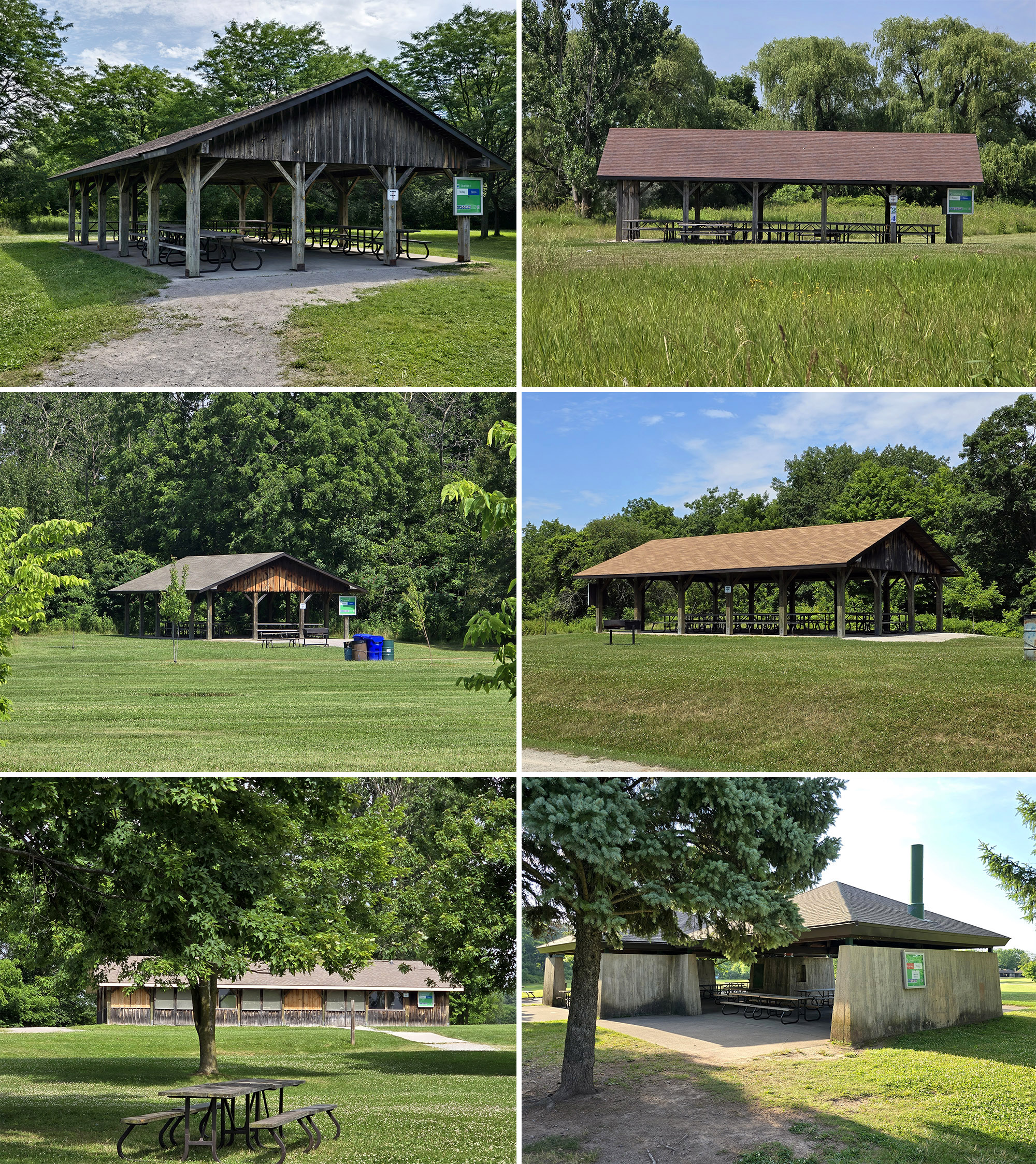
Picnic Shelters
There are 11 picnic shelters available to rent, each with large charcoal BBQ grills.
... but they are DEFINITELY not equal.
Some are the traditional style you see at most Provincial Parks, and some are more ...modern looking?.. concrete structures. (Green).
Then, at least one - Breckon - is boarded and looked abandoned.
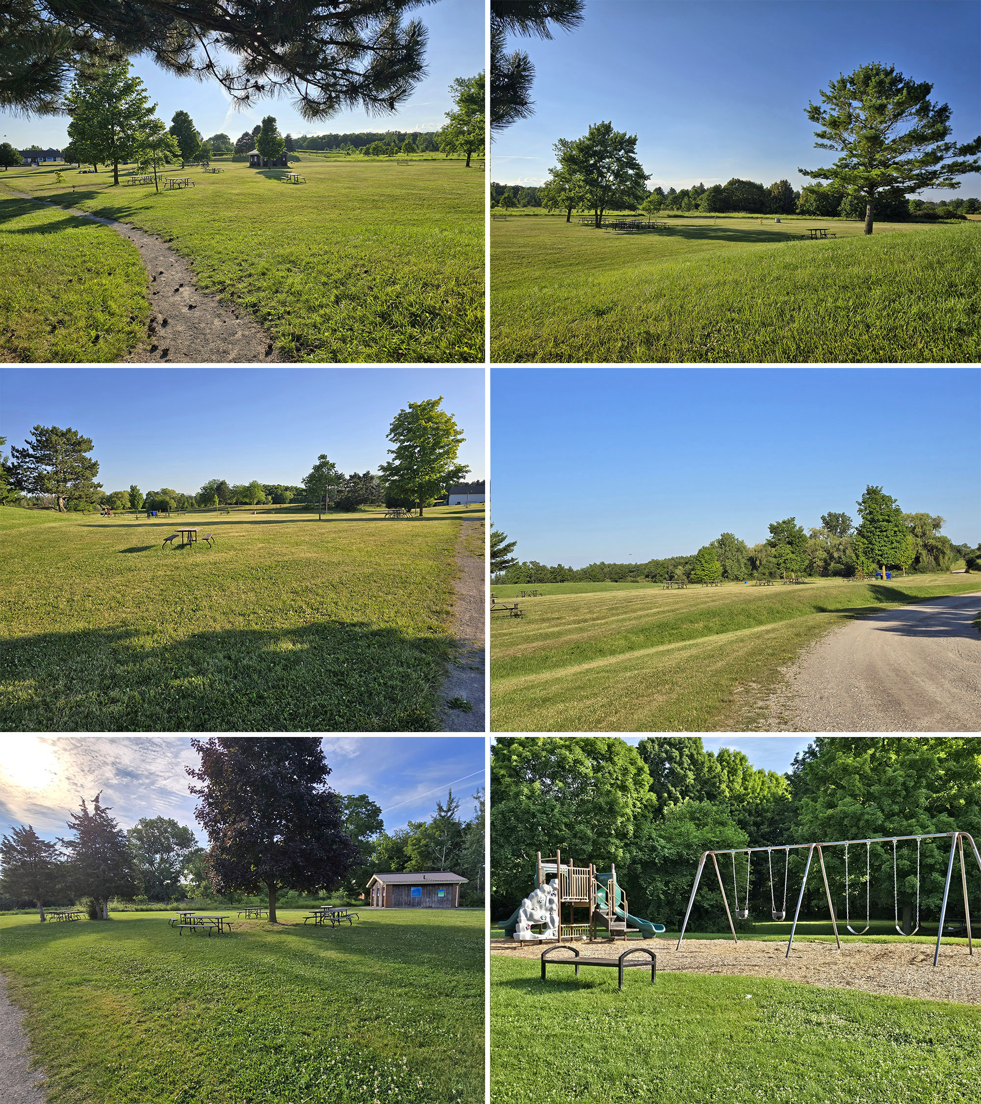
Picnic Areas
Aside from the reservable picnic shelters, there are also picnic areas throughout the day use area.
The big open areas around Parking Lot D seem to be the nicest picnicking areas.
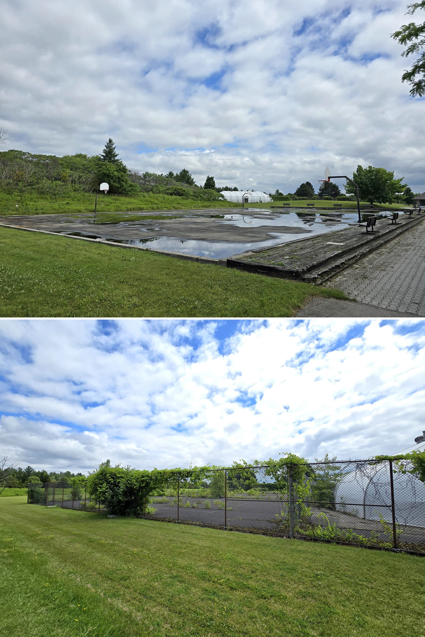
Bottom: The Tennis dome and courts.
Recreation Complex
A lot of people talk about the non-operational pool, but I was surprised to see that it was part of what appeared to be a bigger complex.
Right next to the pool is a LARGE set of basketball courts - it’s not on the map or mentioned on the site, though.
It’s hard to be 100% sure because it had recently rained, but the asphalt (concrete?) base seemed relatively flat and smooth - kind of made me wish I’d brought my rollerblades!
Anyway, 1 of the 4 basketball hoops was missing a net, but otherwise it seemed to be in good condition.
Near the basketball court, there’s a tennis complex. Like the basketball court, it’s not mentioned on the map. Unlike the basketball court... oof, it’s in bad shape.
I only knew what it was because there was a Pokestop on it, labeling it a tennis dome. Sure enough - on closer examination - there were outdoor tennis courts in the gated enclosure.
Completely overgrown. I wonder what the story is, there?
Share the Love!If you’ve made one of our recipes, be sure to take some pics of your handiwork! If you post it to Bluesky, be sure to tag us - @2NerdsInATruck, or you can tag us on TikTok, if you’re posting video. We're also on Pinterest, so you can save all your favourite recipes and park reviews to your own boards! Also, be sure to subscribe to our free email newsletter, so you never miss out on any of our nonsense. Well, the published nonsense, anyway! |
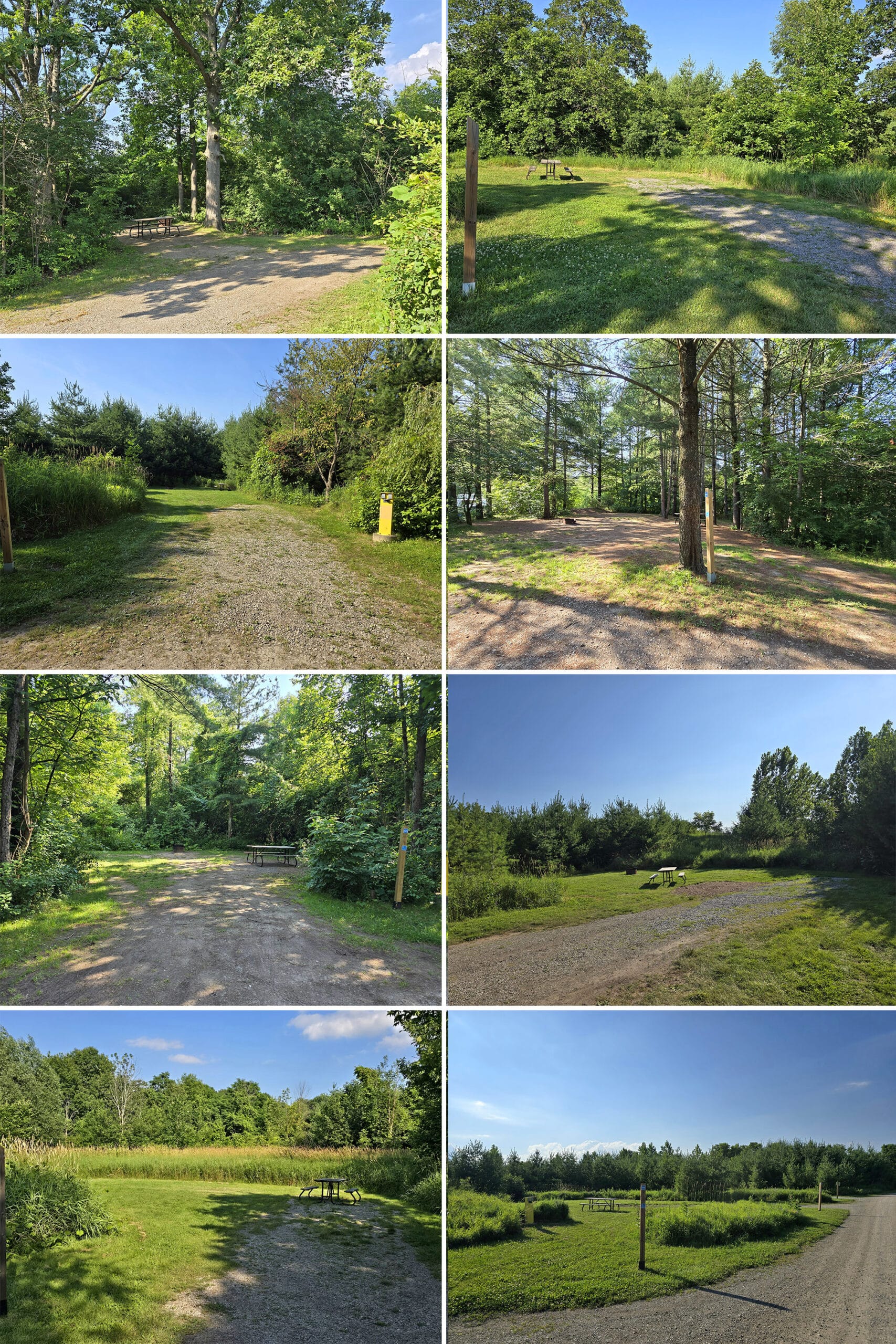
Campsite Details
Bronte Creek Provincial Park is unusual in that ALL of the campsites are electric hookup campsites. These are arranged in a series of 4 smallish camping loops.
In general, the sites are pretty big, have a gravel parking pad, are relatively flat, and don’t have a lot of privacy.
There are some exceptions to most of those points, though, so be sure to check the park’s photo of your site before booking.
Like most provincial park campgrounds, each one has a picnic table and fire pit, with water taps nearby.
Oh, and as a bonus point: We didn’t hear highway or city traffic at all in the camping area.
The Prairie Loop is the one that’s best suited for larger rigs, while The Savannah, Woodlands and Ravine Loops are a bit smaller, and better for trailers under 25 feet long - and tents, of course.
The Savannah Loop is radio free.
Group Camping
There's a sign that seemed to indicate the existence of a group campground, aiming towards dog trail.
... but we couldn’t find any evidence of it, beyond that sign. There’s no mention of group camping on the map or website description, and we didn't see it when we went to check out the off leash area.
Roofed Accommodation
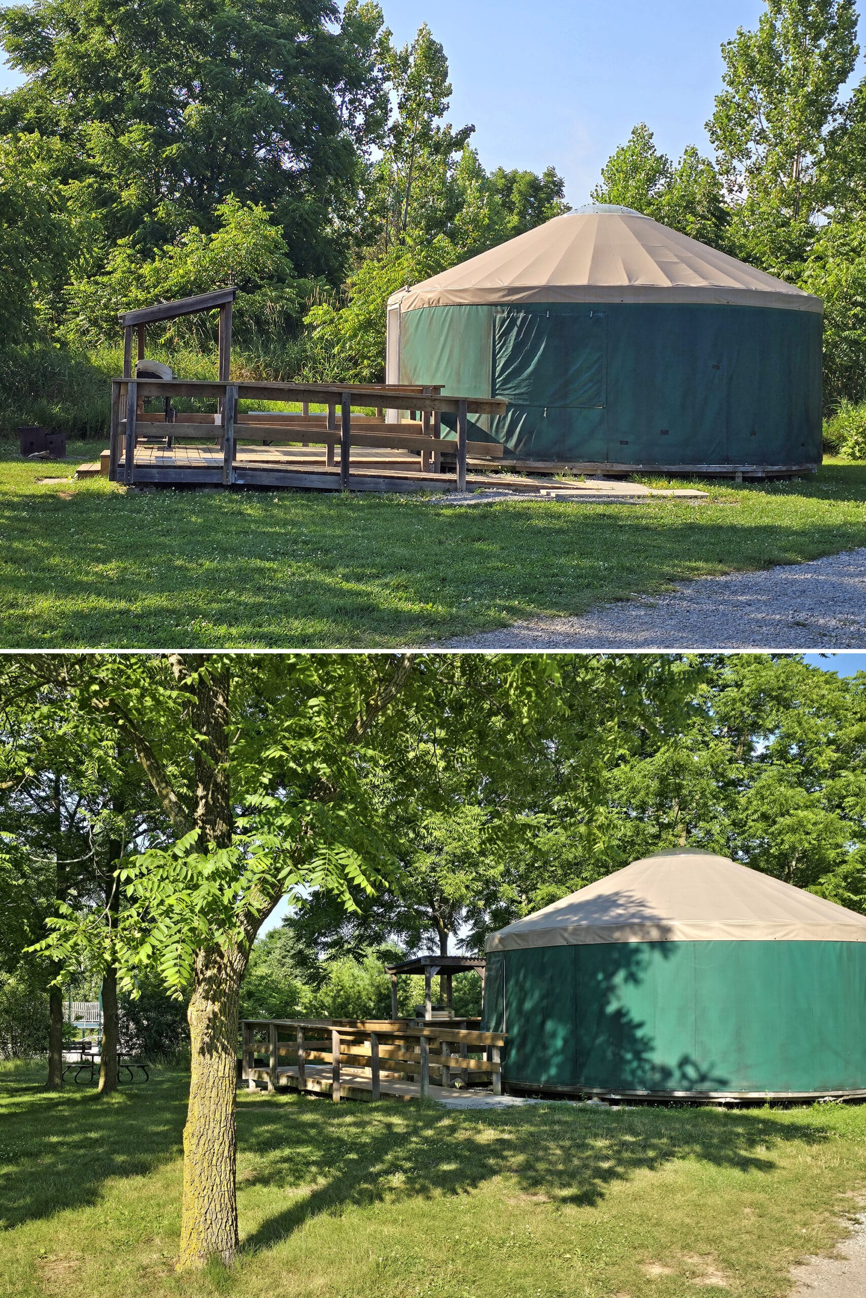
There are also 3 Soft Sided Shelters - yurts - available for rent at Bronte Creek Provincial Park.
They’re all located in the radio-free campground loop (Savannah), and have electricity, heating, and lights.
Each sleep 6, with two sets of bunk beds (You have to bring your own bedding and personal items), and have a deck, fire pit, picnic table, and propane BBQ outside.
Pets are banned, so yurts aren’t really an option for us. They look really cute, though!
Entertainment and Activity
We knew the park had at least several km of multi-purpose trails, but we were actually pleasantly surprised by the amount of space, and the diversity of activities offered at the park.
We spent a fair amount of time checking out those park trails - and other recreational amenities - and here’s what we think of it all:
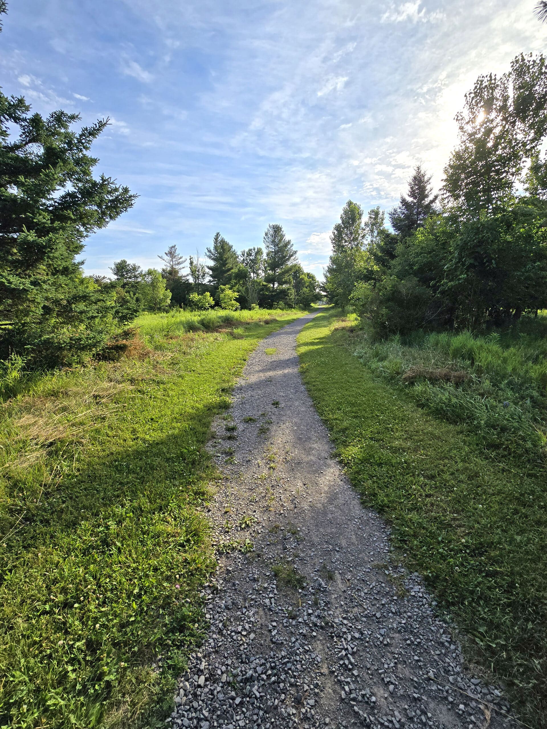
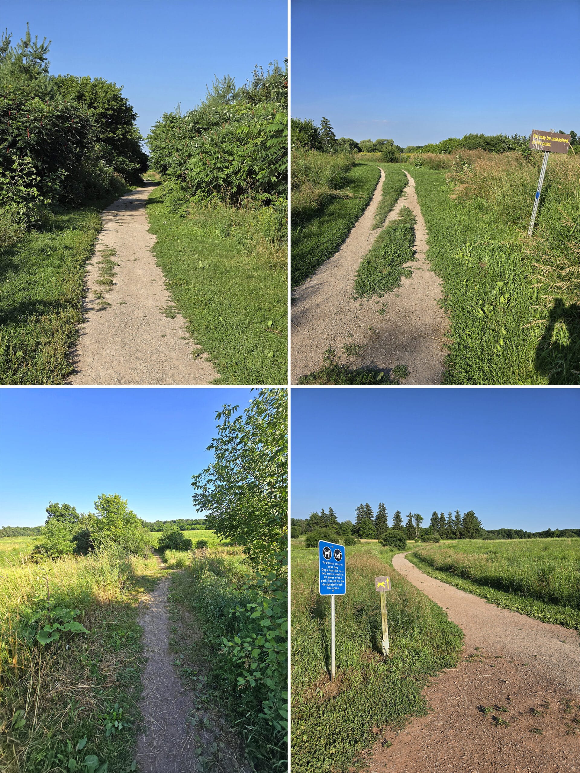
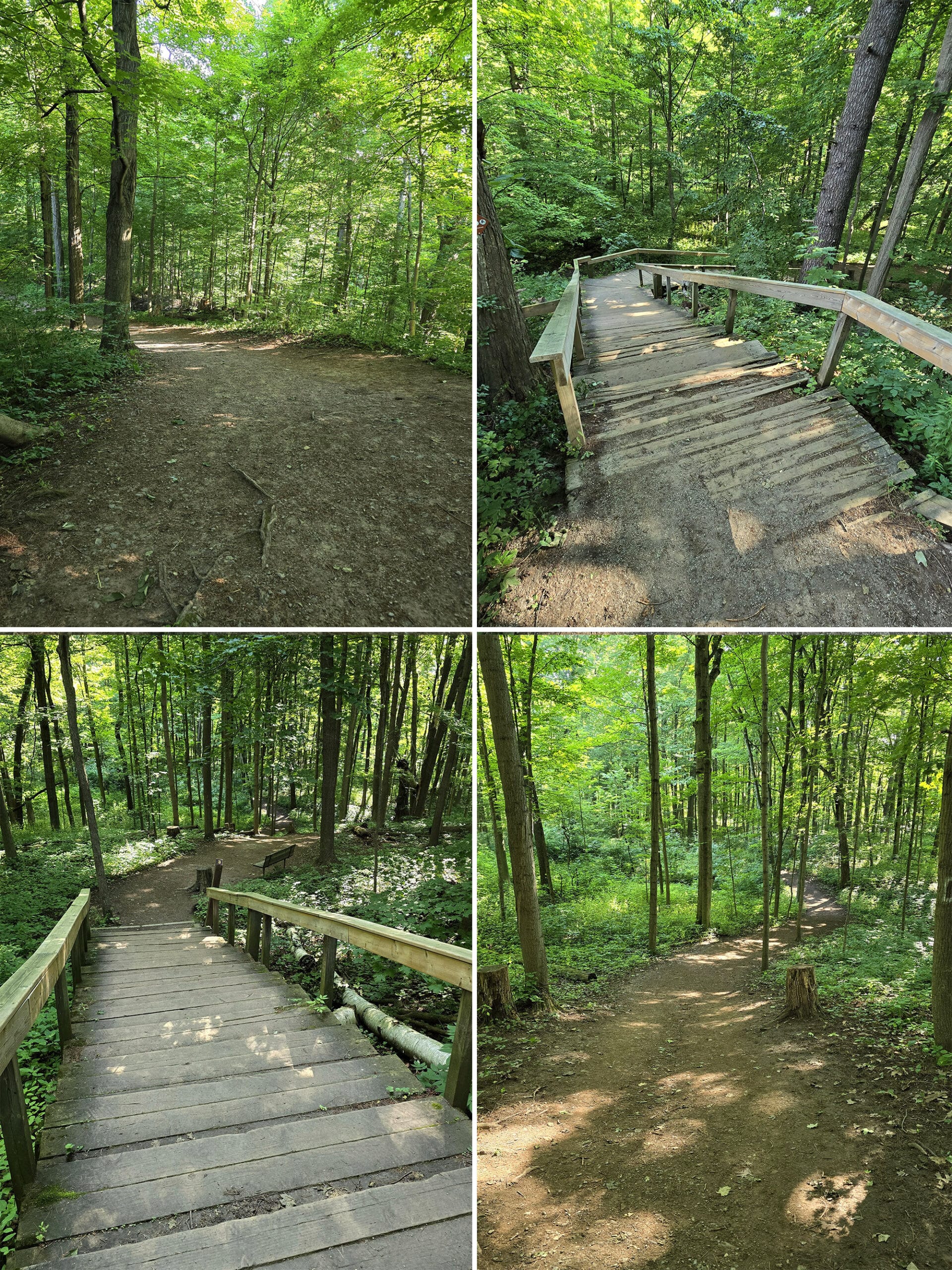
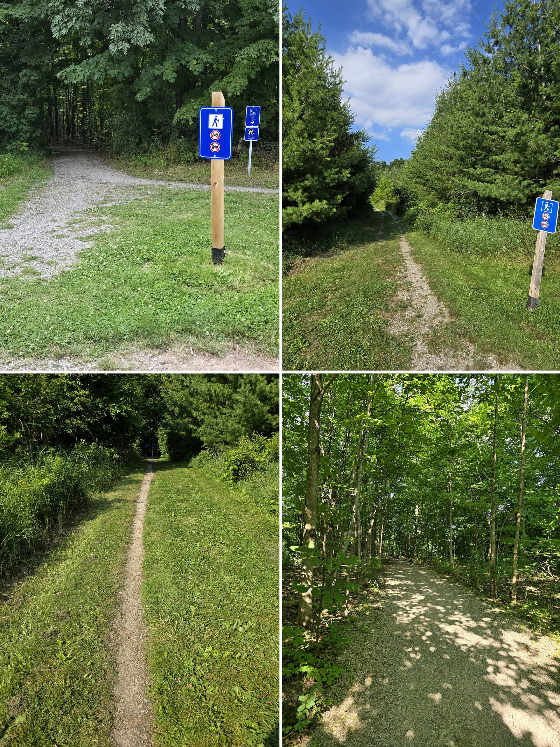
Hiking
According to the park’s website, there are 7.2 km of hiking trails in the park, while the park map has over 11 km worth - and that’s not even including the 3.4 km of the dog park trails.
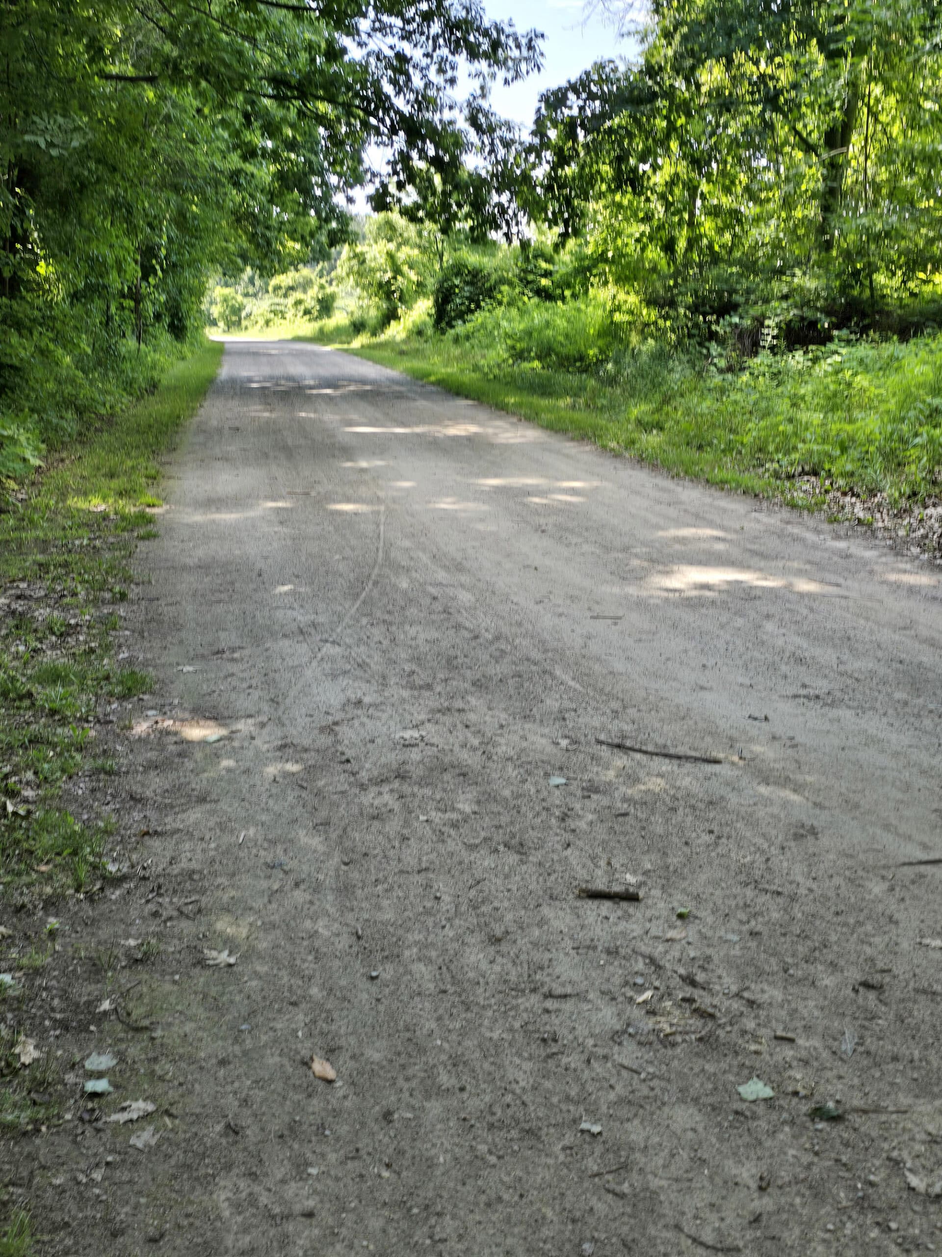
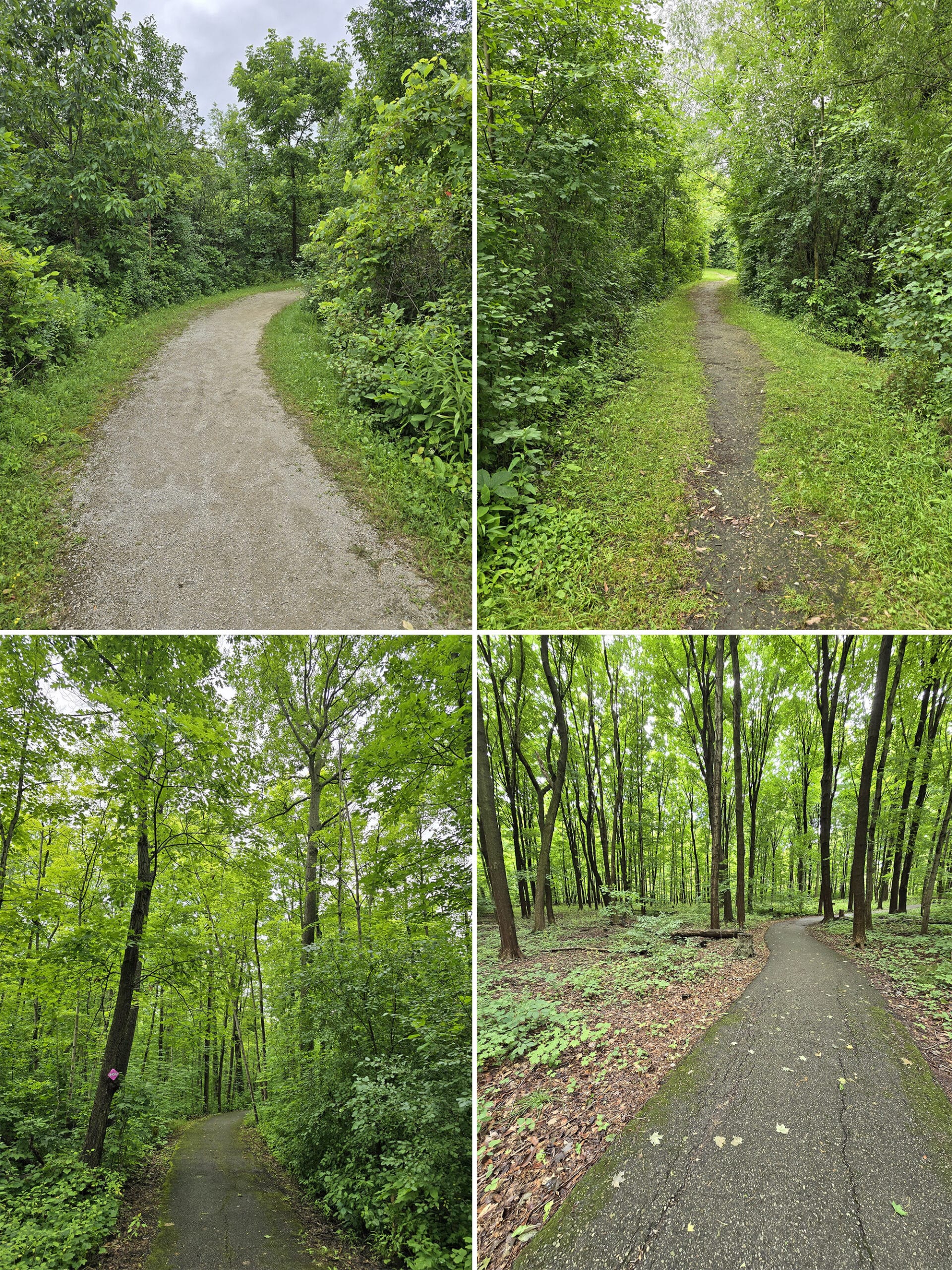
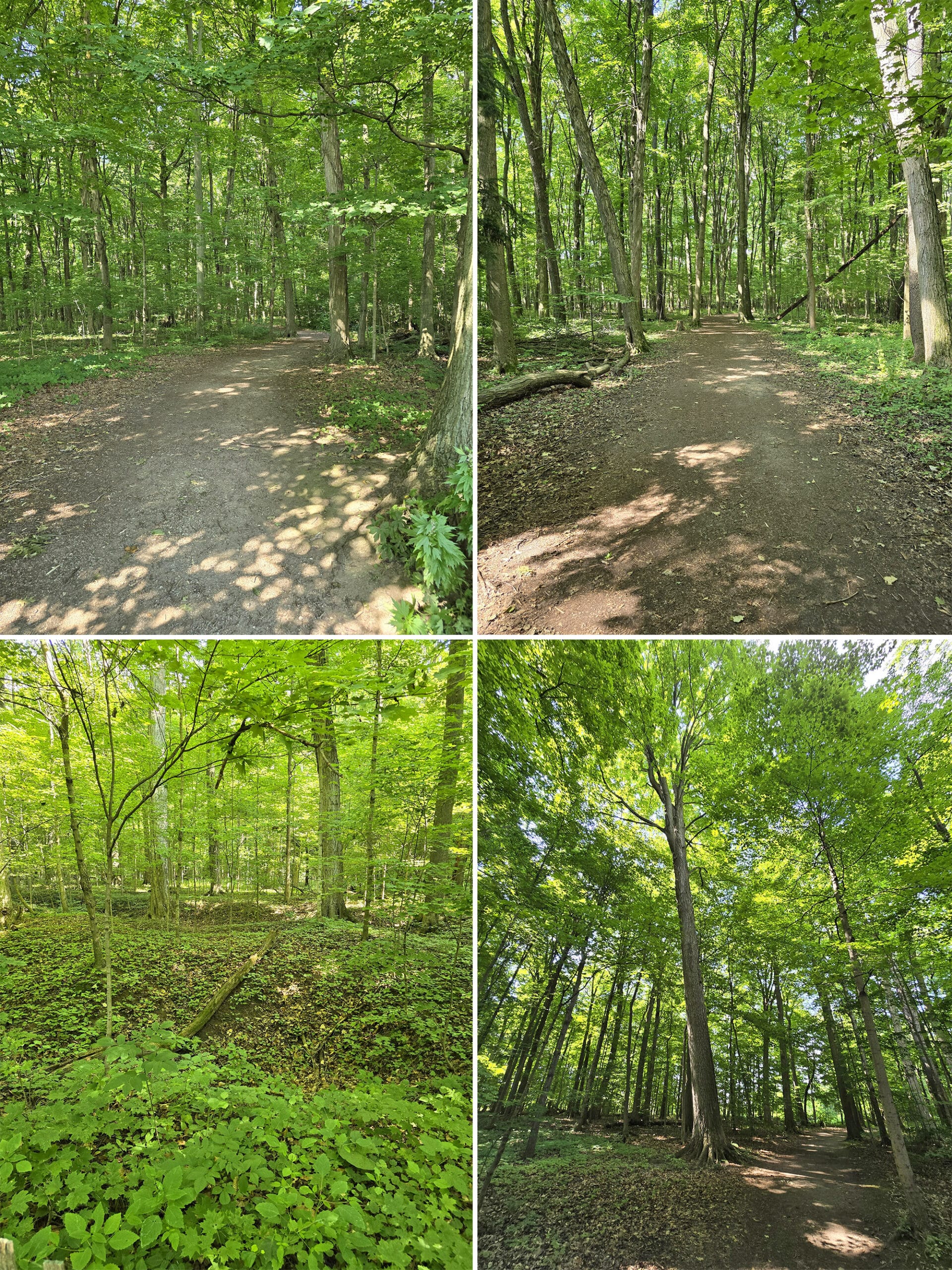
Most of the trails are generally wide, flat, and well packed... though some have sections of narrowing trail, or rougher spots.
Some had really nice, informative trail head signs, but most did not.
Weirdly, the site only mentions 5 trails, though there are 9 named nature trails in the park - 2 in the campground, and 7 in the day use.
We check them all out, here are the details:
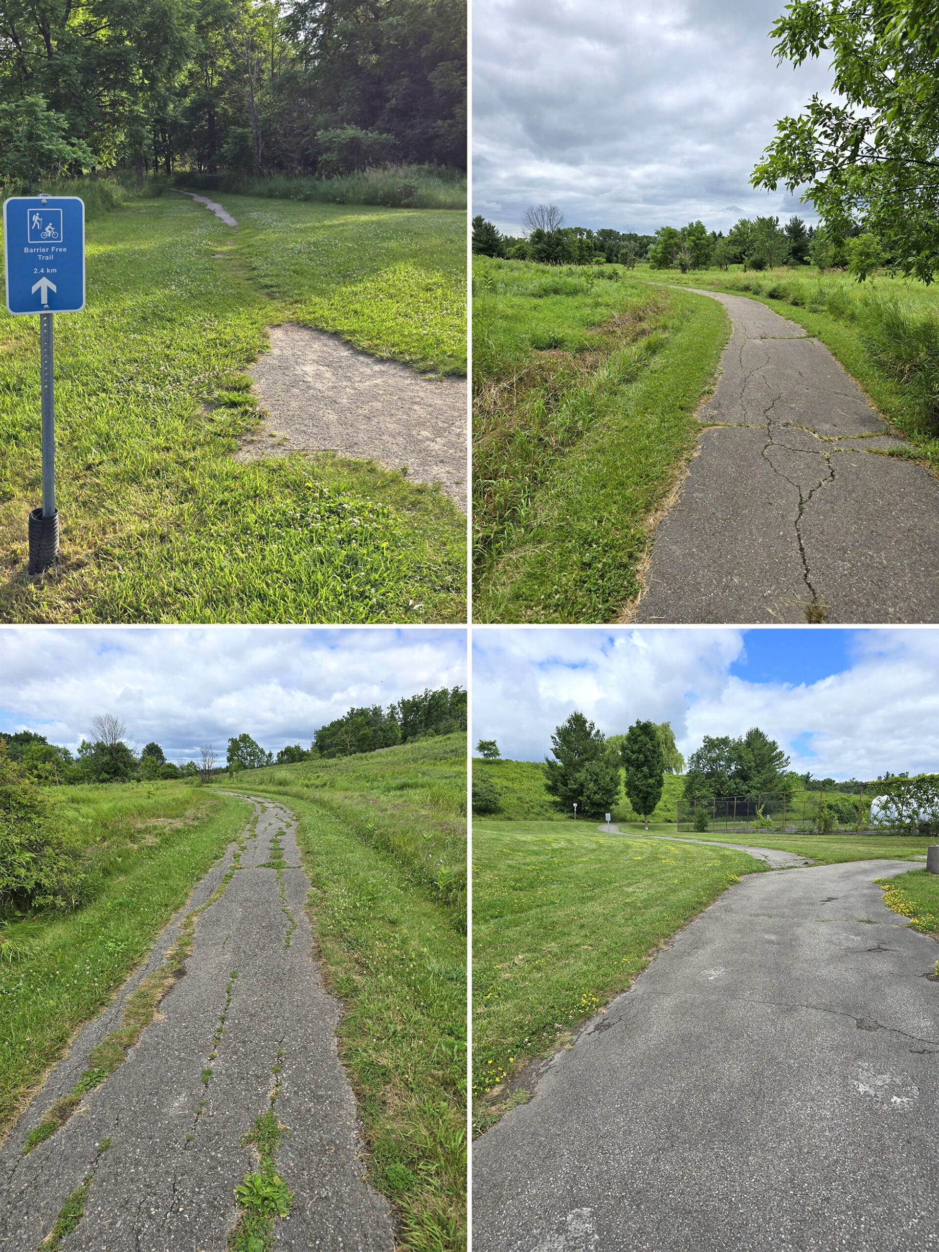
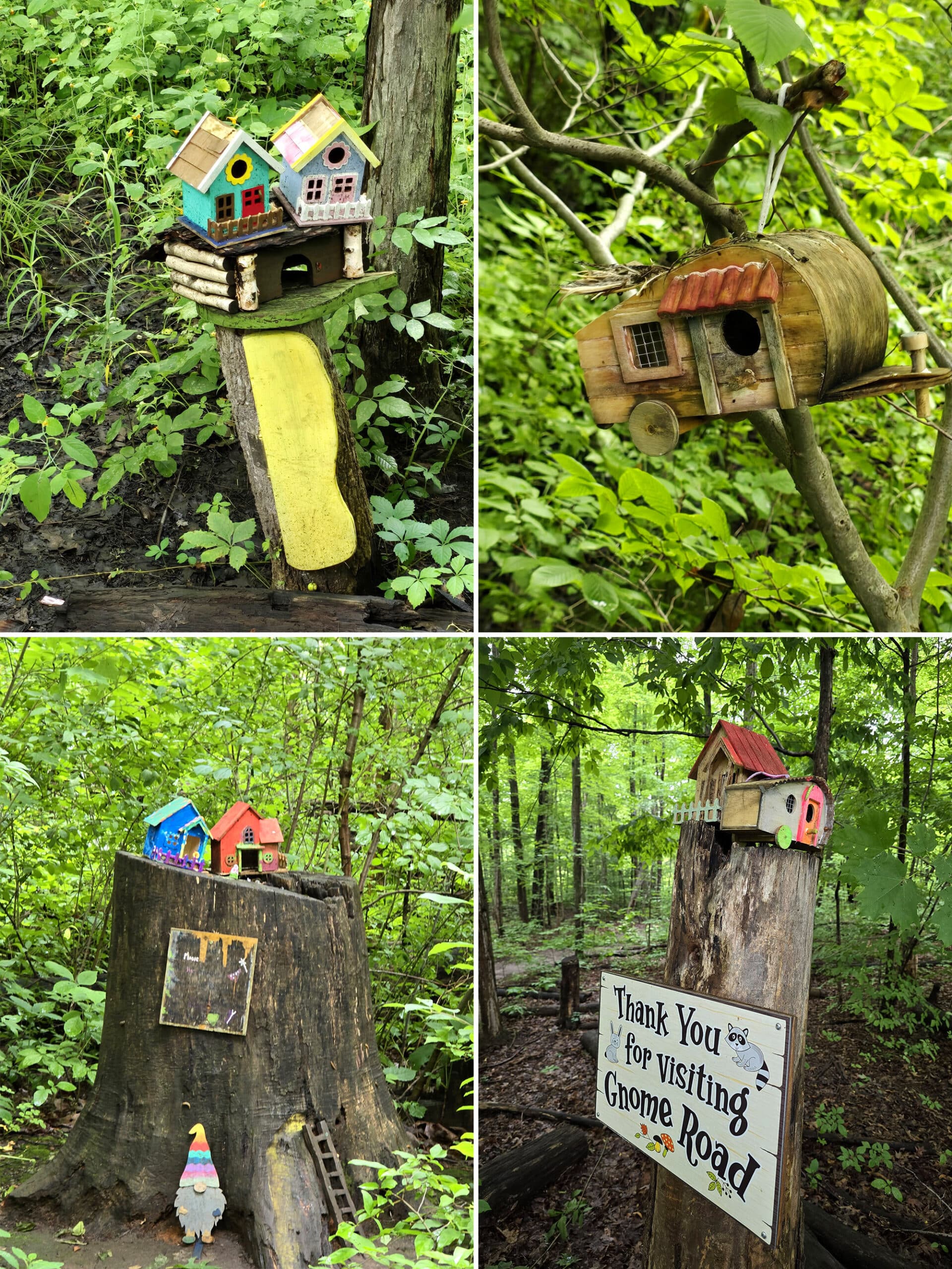
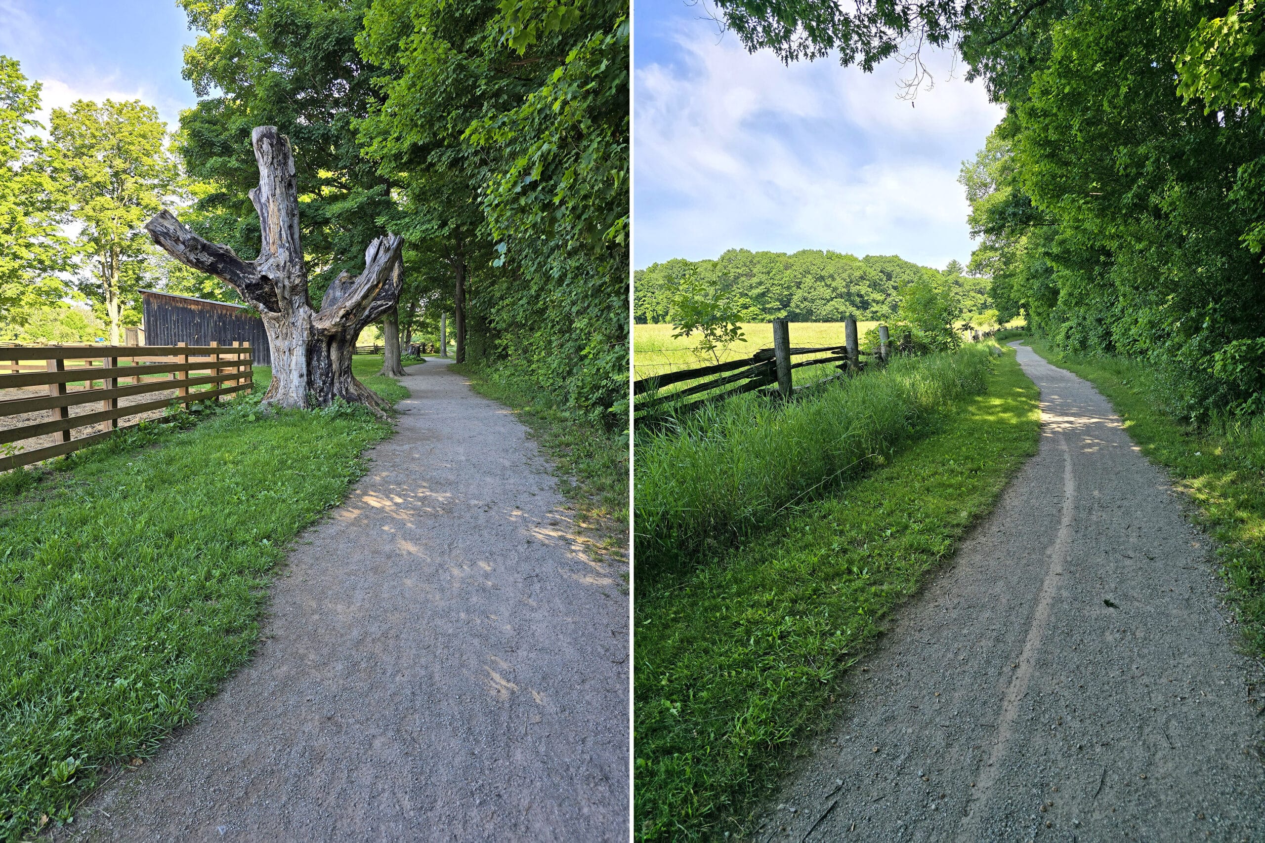
1. Barrier-Free Trail
The Barrier-Free Trail is one of the ones not mentioned on the site - it’s listed as being 2.4 km on the map, though.
This one is MOSTLY paved, but in really poor condition. Weirdly, it’s not as barrier-free as some of the trails that aren’t named as such!
Aside from the main connection - via the Maiden’s Blush Trail - there are a lot of access points where it connects up with some of the park pathways, and encircles the toboggan hill.
Some of it has tree cover, but most of the trail is wide out in the open, flanked by wild flowers. It was FABULOUS for birding, as well.
This is a super cute feature - a section of trail with a whole bunch of cute little gnome houses, situated in and at the bases of the trees.
When we visited a couple years ago, I remember seeing something about an event to make them, or maybe kits to purchase? It’s long enough ago that it’s just a vague recollection.
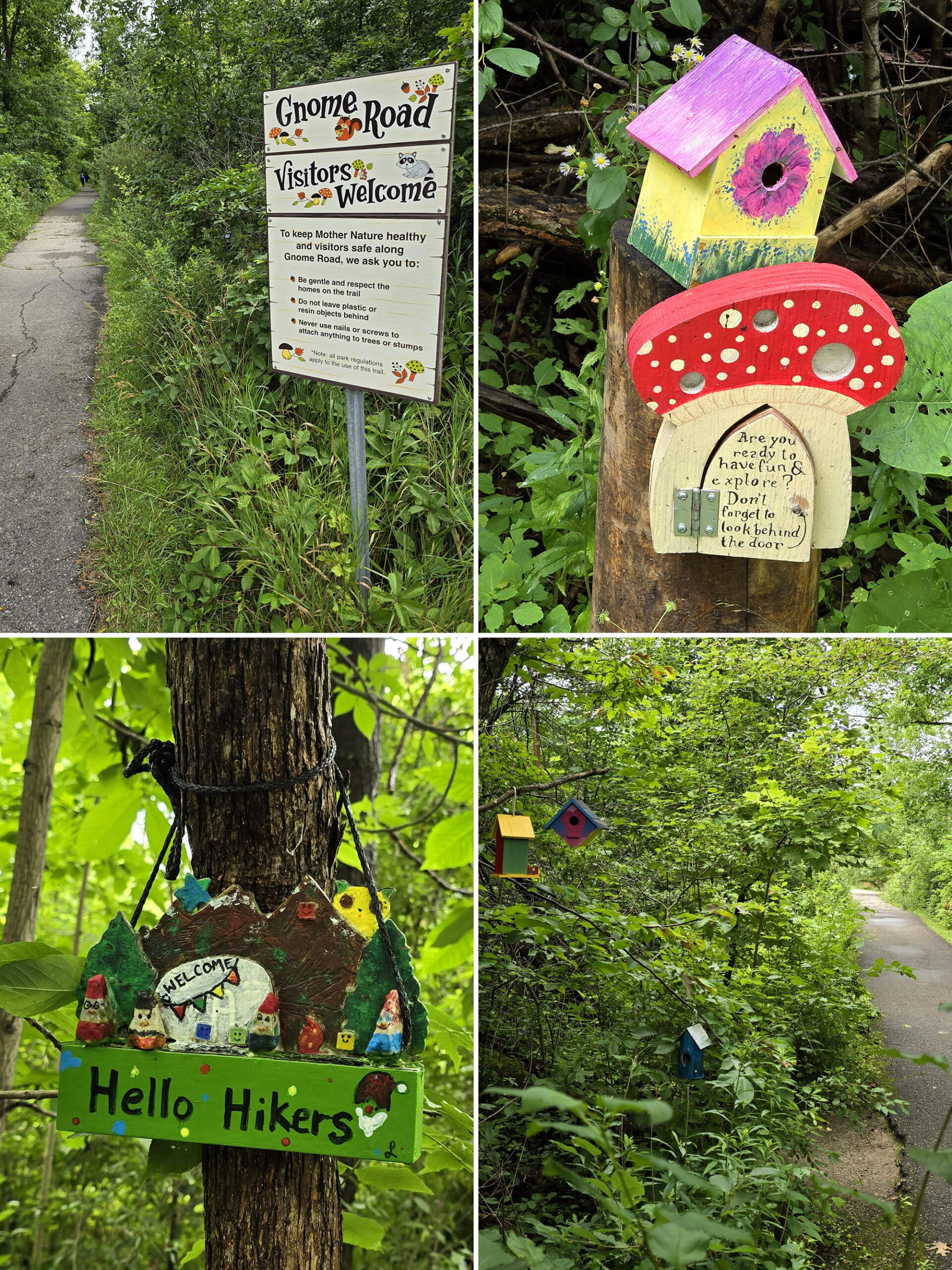
All our photo backups from that time, Google maps history, our Ontario Parks account (there’s a good chance we just paid when we got there, though), everything. It’s like it never happened.
My husband assures me that I didn’t hallucinate that visit, so I’m here wondering... GNOME houses? Or *fairy* houses? LOL!
2. Maiden’s Blush Trail
This one is listed as being either 1 km (website) or 1.3 km (map), and is located in the day use area, just north of the Children’s Playbarn and Nature Centre (Lot C). We actually accessed it via Lot A.
This is a mostly paved trail (the access trails are not), running through a mature forest and meeting up with the Barrier Free Trail.
This trail is actually far more accessible than the trail literally called “Barrier-Free Trail”, so that was a bit odd.
Overall, a nice easy walk. No real hills or anything, but also not really anything stand-out to comment on.
The park website says this one is suitable for roller blading, and I’d agree - to an extent. It could definitely use a re-paving.
If you’re looking to roller skate, the basketball court is probably a better option.
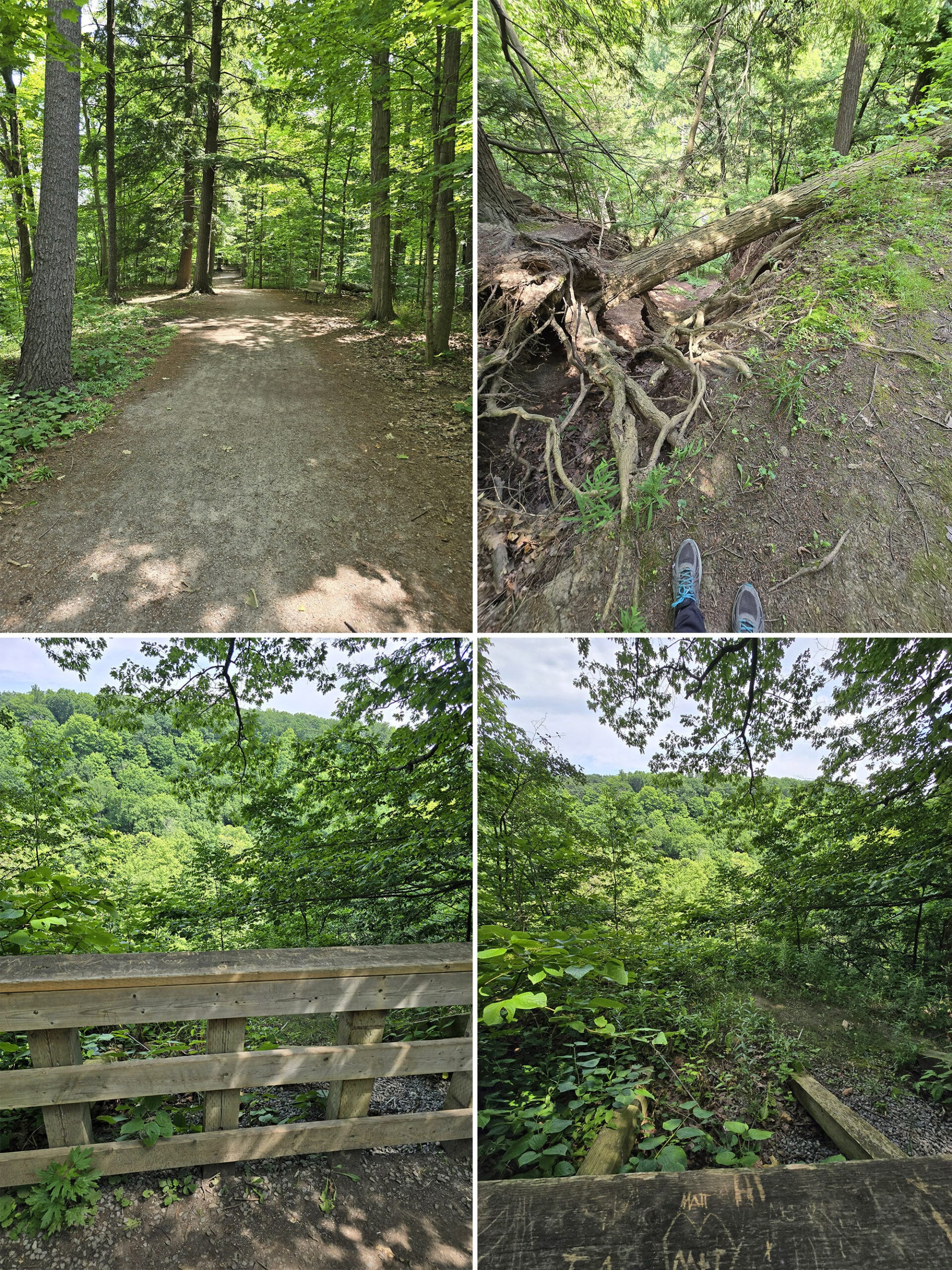
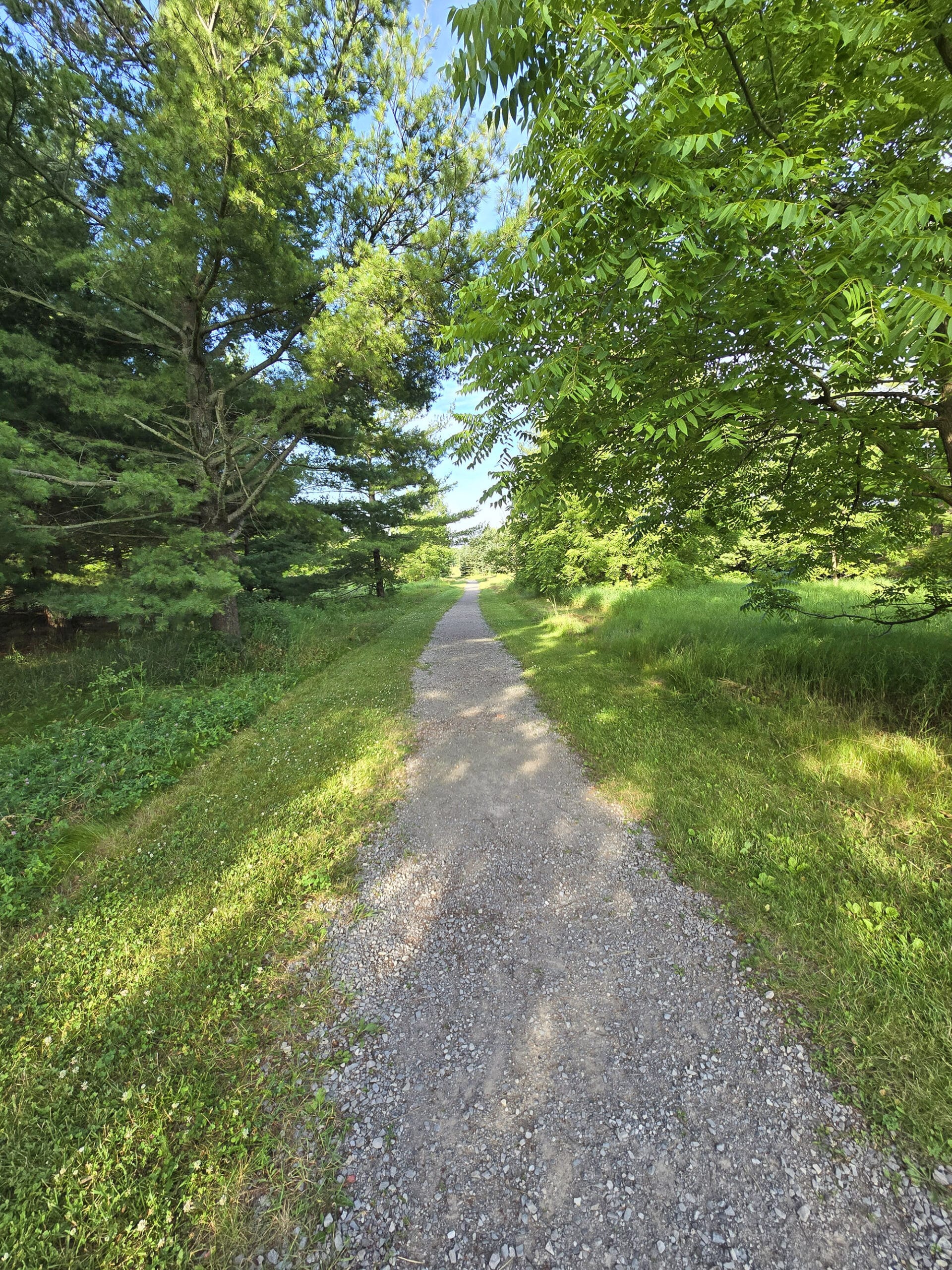
3. Logging Trail
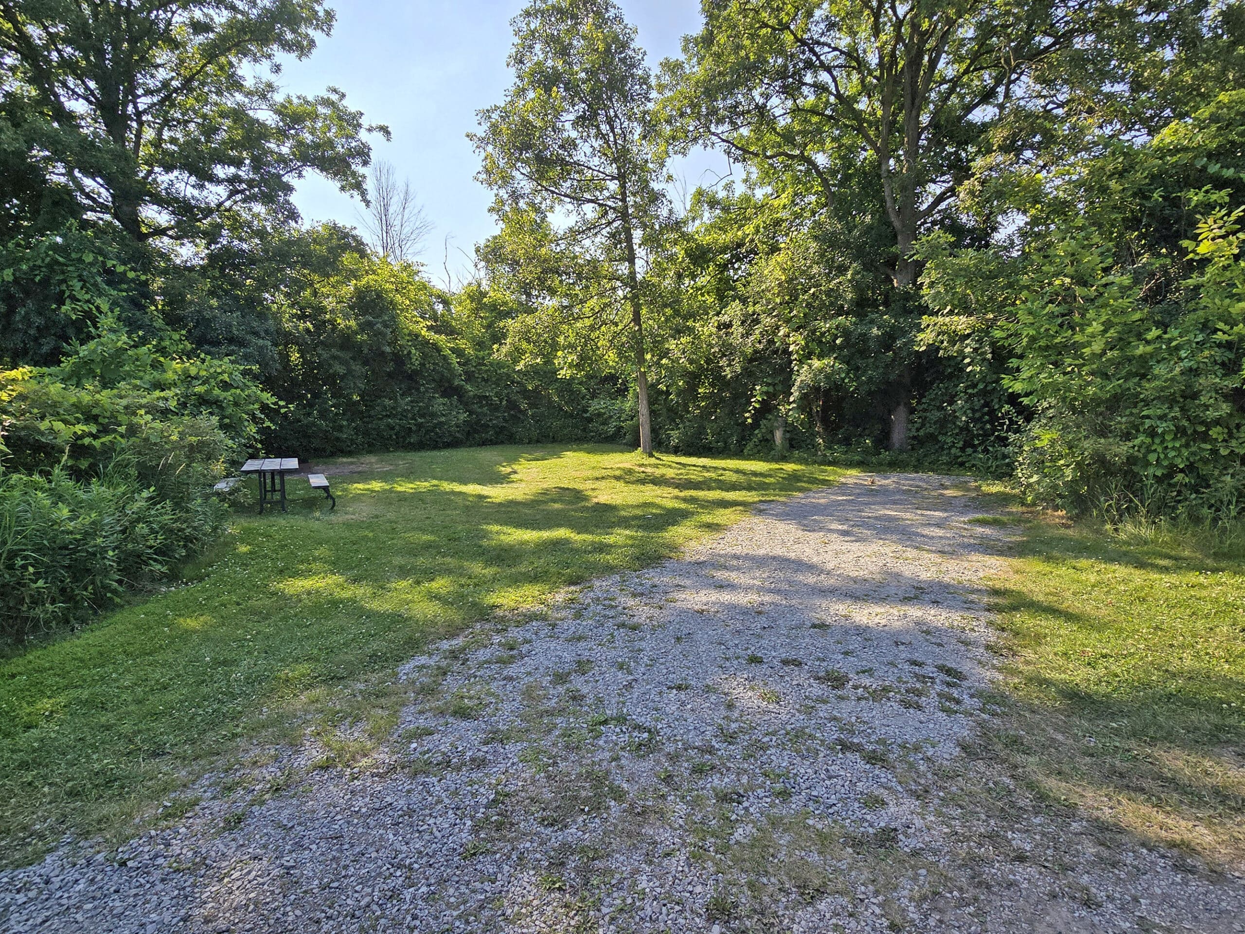
This is a short - 0.5 km - connecting trail running from the Lookout Ravine Trail to one of the park roads, headed towards the centre of the day use area.
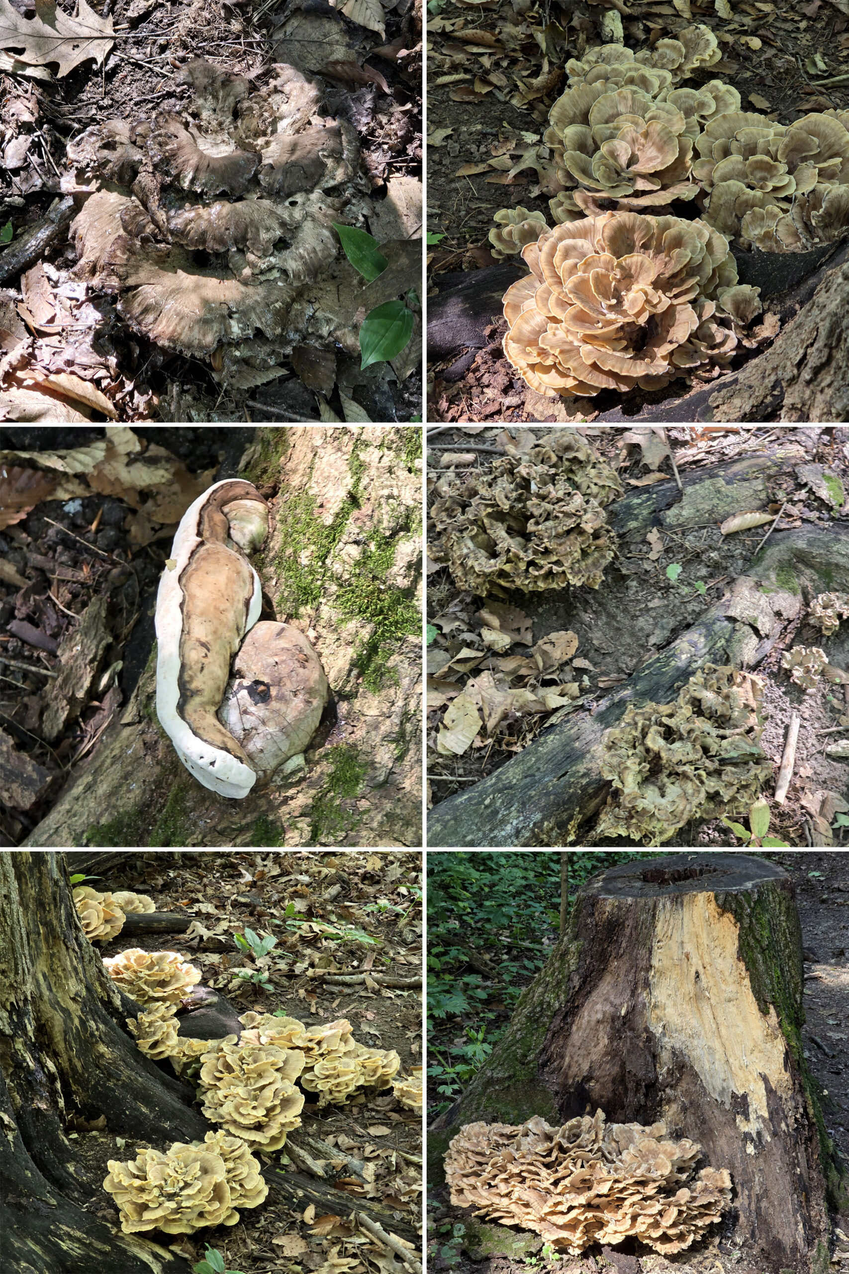
It’s wide, flat, well packed ground, going through a really pretty forest. Of particular note: Loads of cool fungi along this trail!
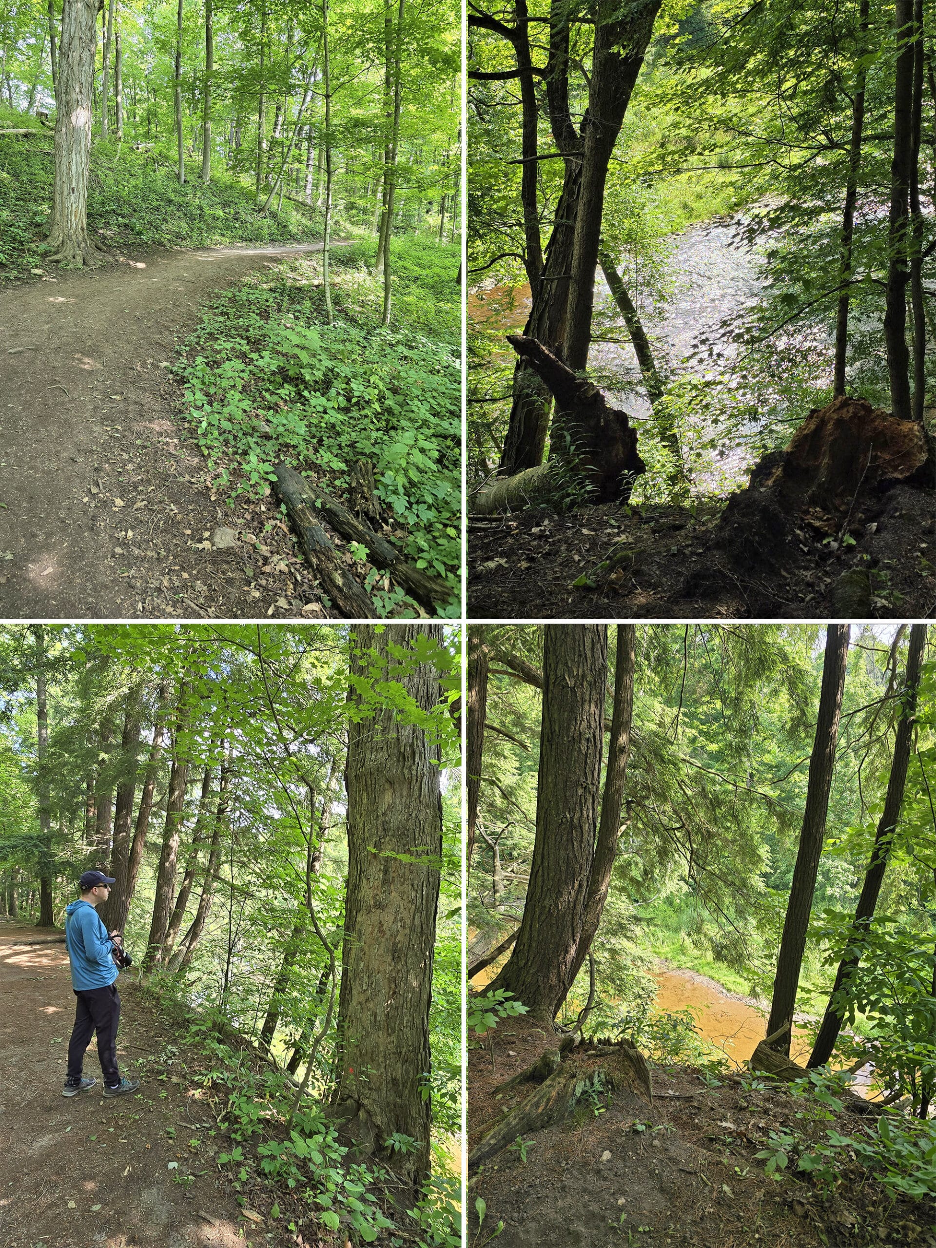
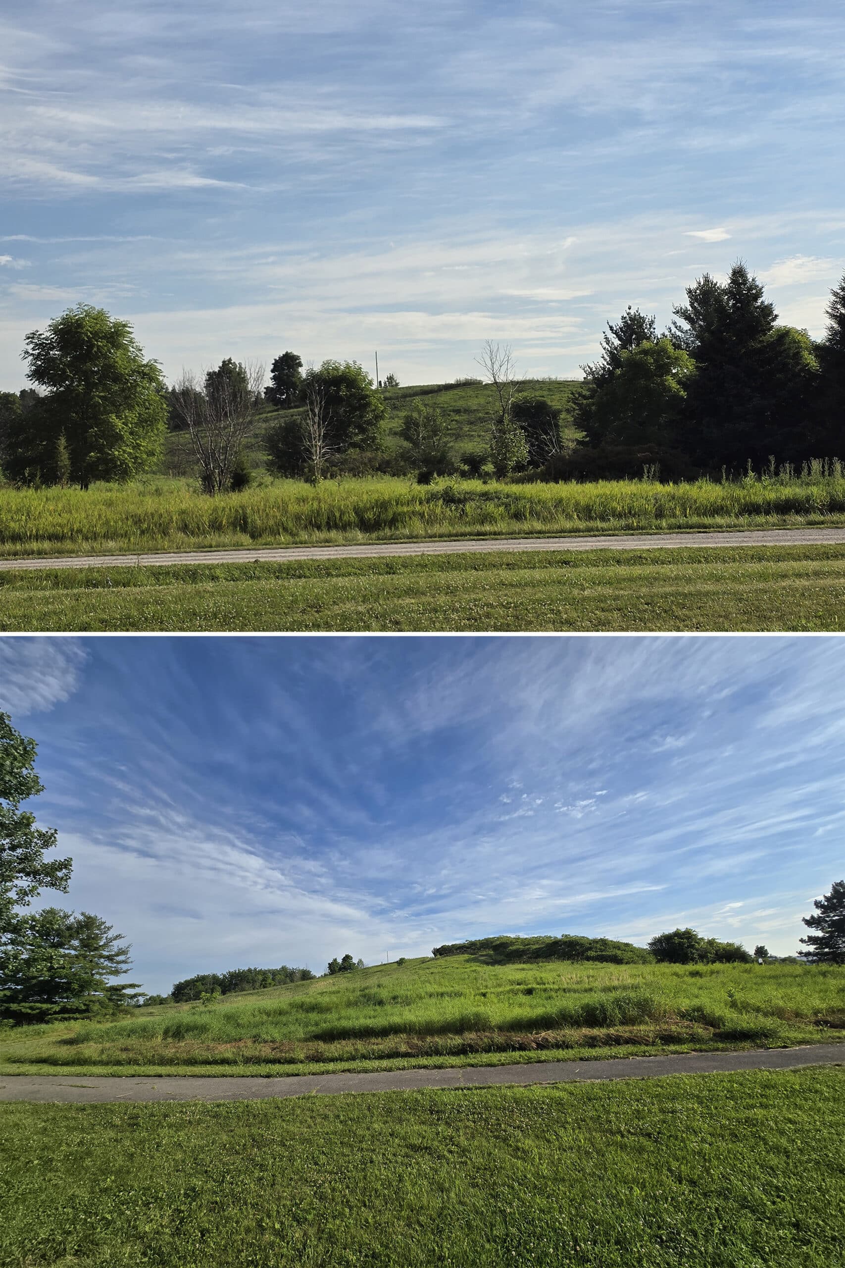
4. Lookout Ravine Trail
This is another one in the day use, and another one with some discrepancies in the info.
The website refers to it as “Ravine Trail”, and has it as 2.7 km, while the map has it as “Lookout Ravine Trail”, at 1.8 km.
Either way, about half the trail borders the Bronte Creek Ravine, and it’s accessed via Parking Lot A or Parking Lot F - about half a km away from either.
On the Lot F end of the trail (pictured above), you’re walking along a big wildflower field, and the path is lined with raspberry bushes for a stretch of it.
As you pass the field, the path narrows as it approaches the forest that lines the ravine:
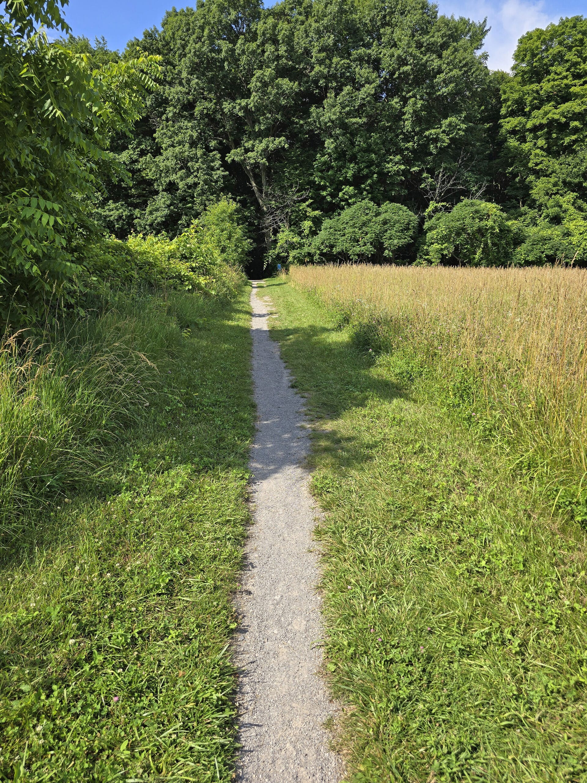
It was... kind of disappointing. We were expecting maybe a platform or an actual view of the ravine, but you really can’t see much from it. (See below).
This an OK trail, we’d expected it to be really scenic with that name... it wasn’t all that scenic.
I guess I’d expected something more along the lines of what the Half Moon Valley Trail ended up being (more on that in a bit).
This trail was a nice walk, though.. Just nothing to write home about.
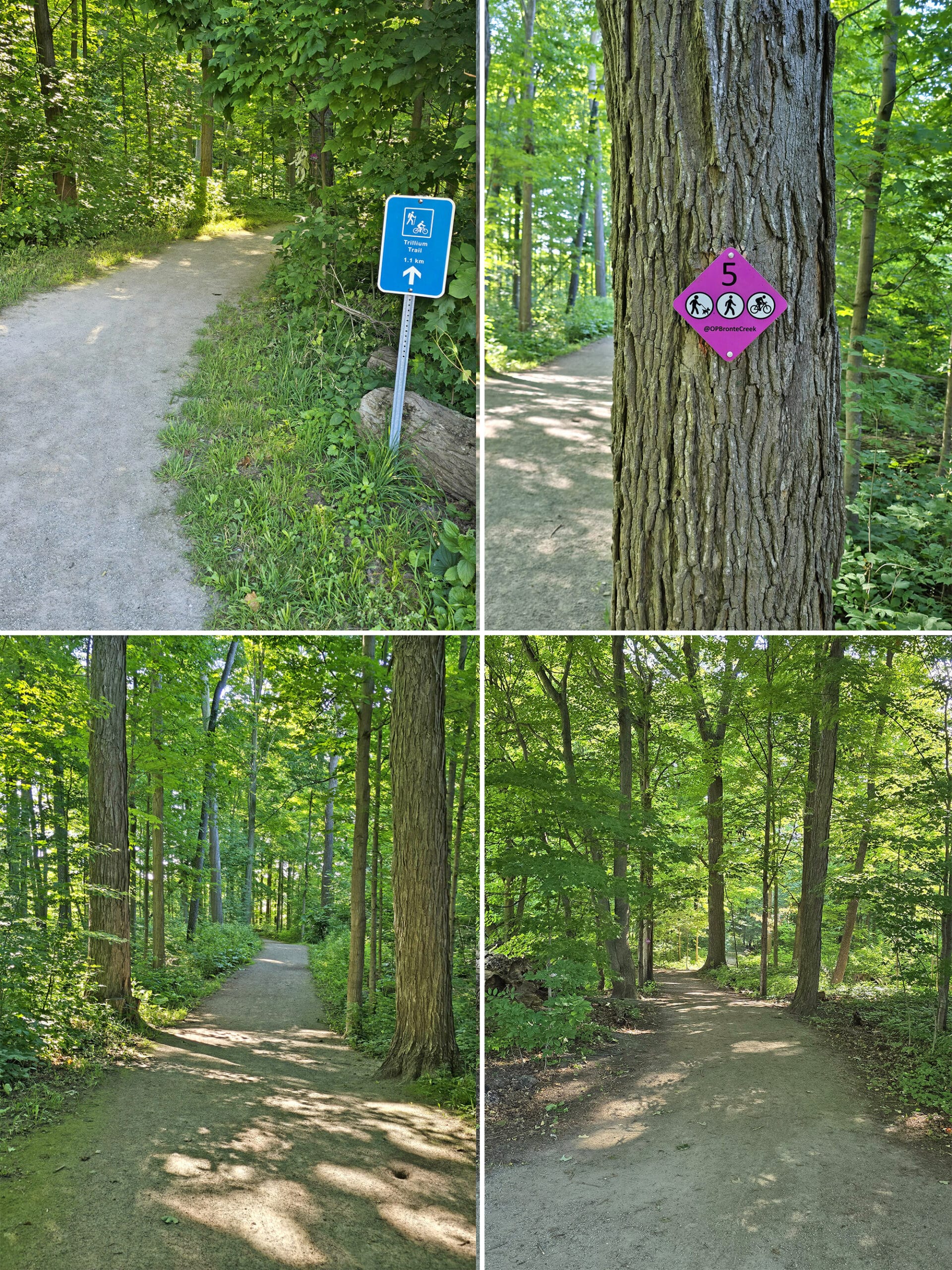
5. Trillium Trail
Listed as 1 km long on the site - and 1.1 km long, on the map - this was a wide, flat, easy trail.
It seems to be wheelchair accessible, and it’s either open for cycling, or... not.
Weirdly, the trail head sign says that bikes aren't allowed, while the little pink trail markers for it - including one ON the trailhead sign - have the cycling symbol on it, to say it IS allowed.
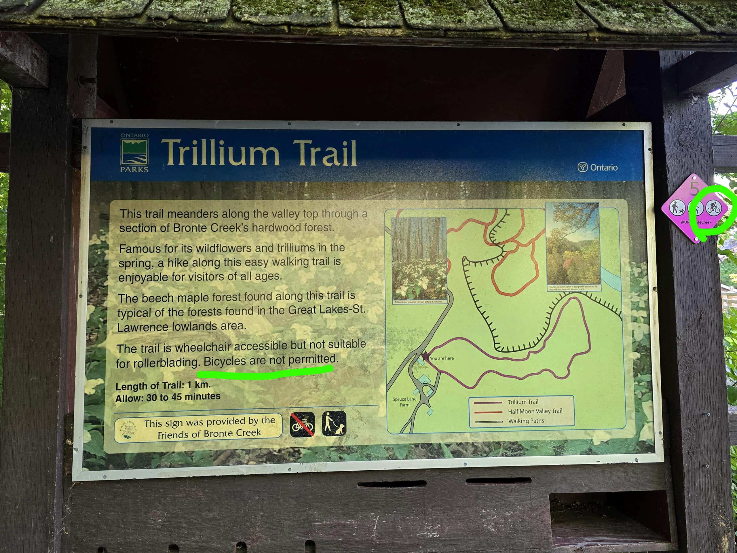
This trail is named for the Trillium flowers that bloom along the trail in the early spring, and it has a good view of the valley along the way.
Apparently you can view an eagle’s nest from above - a hiker on the Half Moon Valley Trail told us as much - but we weren’t able to find it.
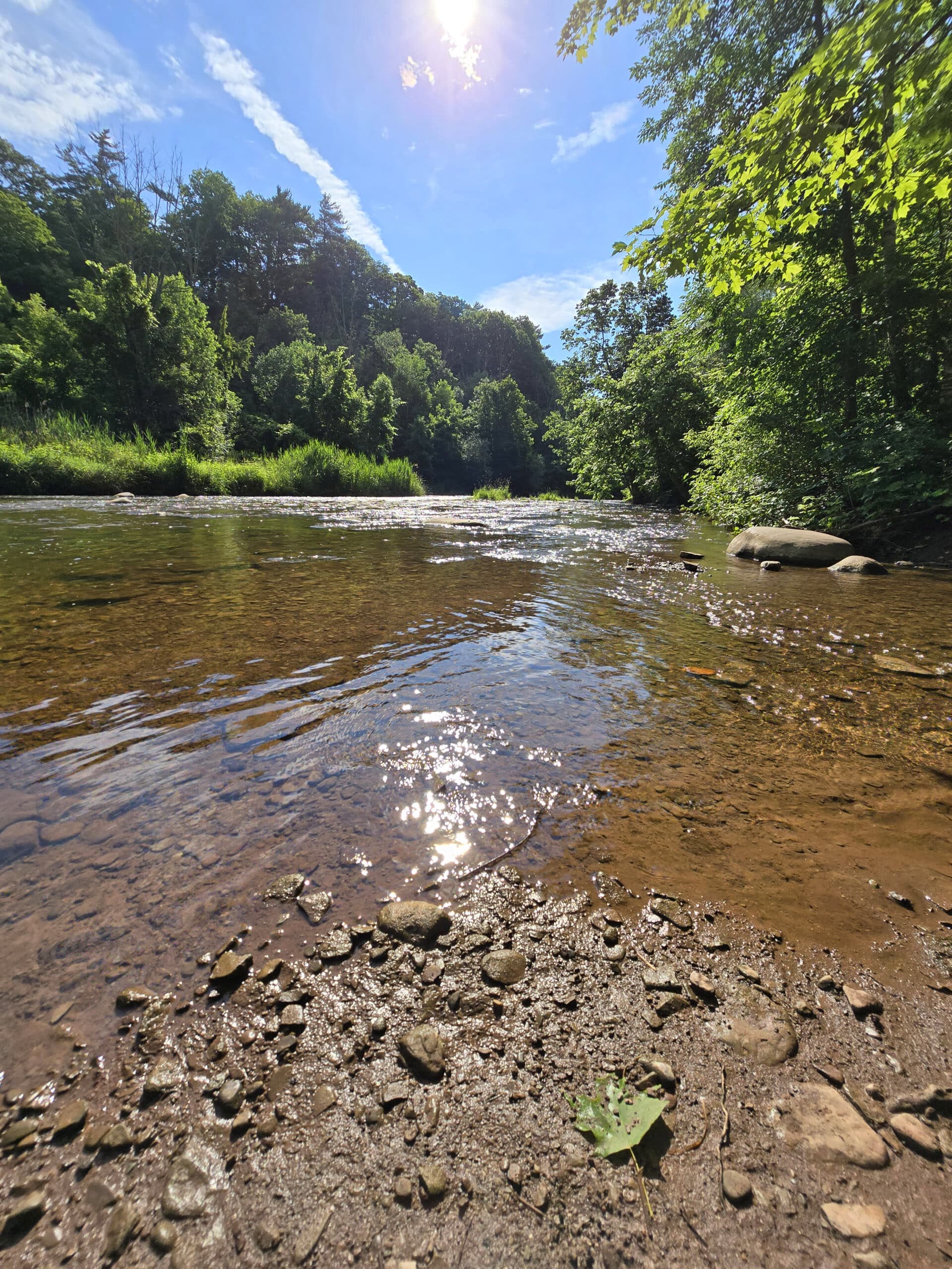
6. Half Moon Valley Trail
This one is the only trail in the park that’s at all challenging - the rest are all easy, this one is more of a moderate difficulty.
The site calls it “Halfmoon Valley Trail” and has it noted as being 2 km, the map says it’s 1.6 km.
Either way, you access it via Lot F - walk through the Spruce Lane Farm and onto the Ravine Trail. The entry is just past the Trillium Trail entrance.
Interestingly, this one has an Mp3 tour associated with it: Self Guided Tour of Half Moon Valley Trail, via the Friends of Bronte Creek website.
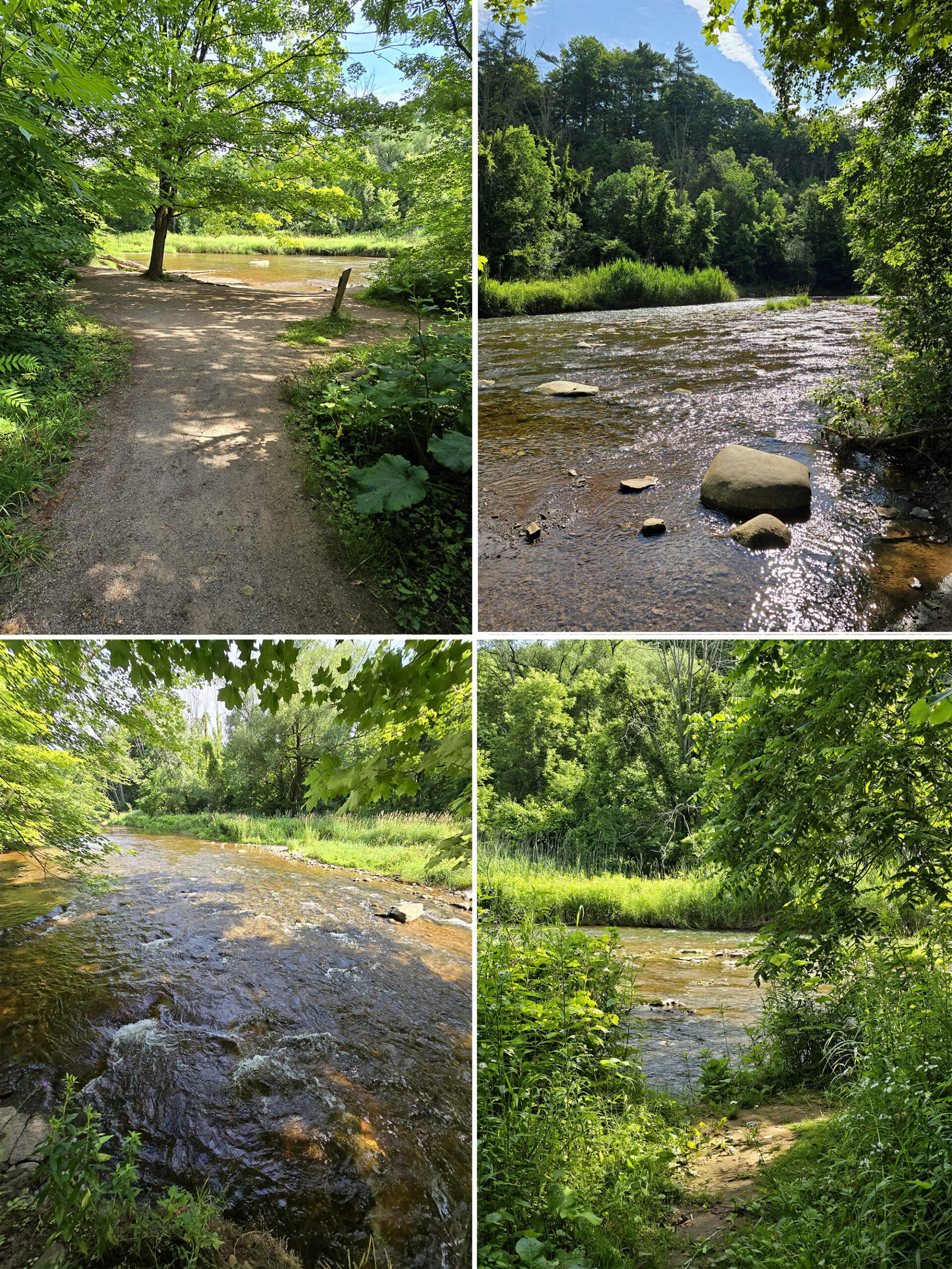
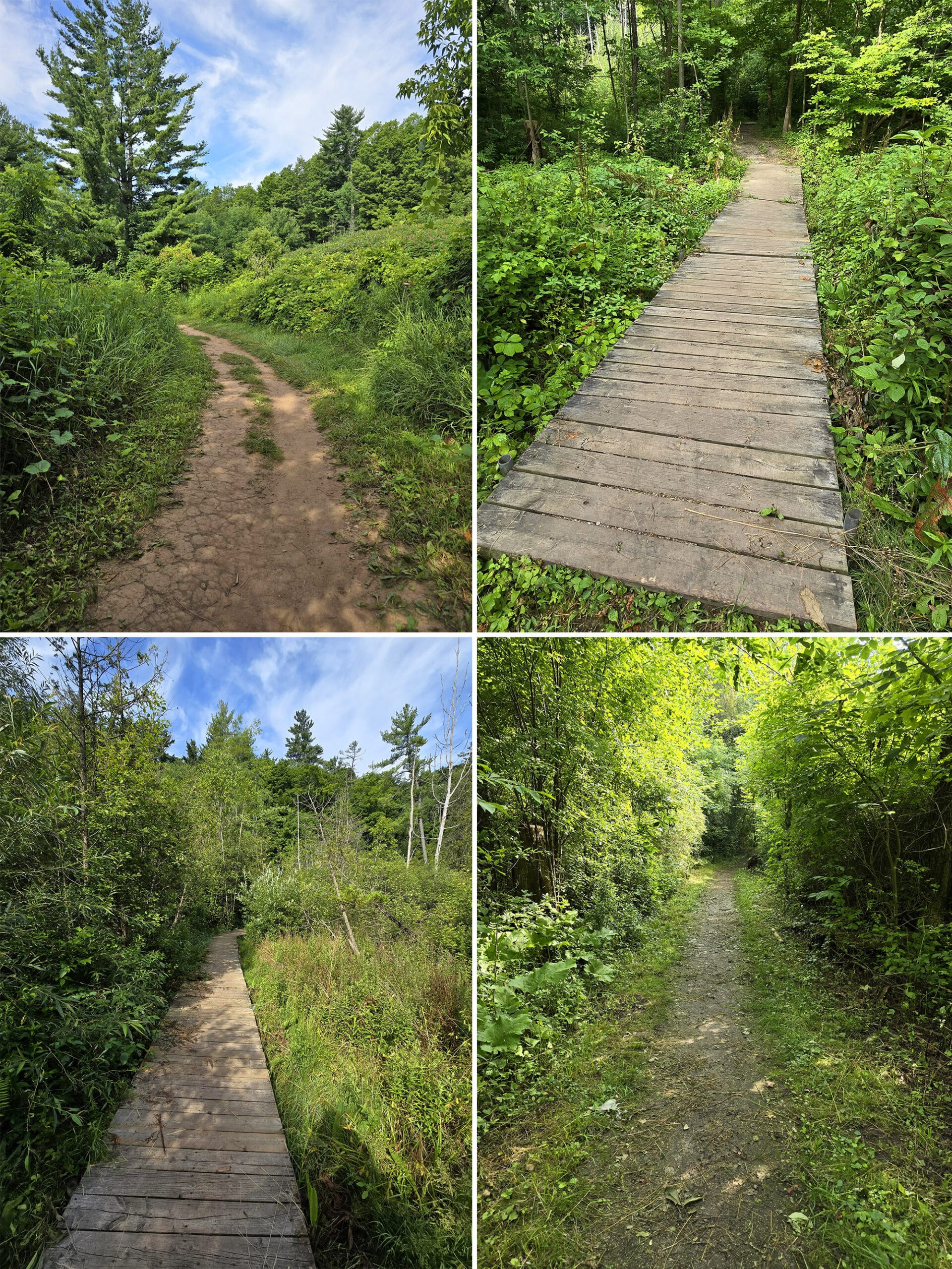
As you pass the creek, you come to some wetland area with boardwalks - LOADS of Forget Me Nots bordering those boardwalks!
SO MANY BLUEJAYS!
Also, woodpeckers acting weird. I’ll have to post a video we took of two of them... vibing out? I have no idea what was going on there, but it was hilarious.
We were only planning to go in and go directly to the water and back, to budget my mobility. We ended up doing all of the offshoot loops of this trail.
Love it, will definitely be back!
7. Gateway Trail
Listed as 1.5 km on the site - and 1.3 km on the map and on the trail signage - this is the first of two trails located in the campground section of the park.
Pretty basic trail going most of the length of the campground area, beside the road. Flat and easy, not much to see.
8. Field and Forest Trail
The second of two trails in the campground area, this one is listed as being 1 km long on the map, but 2.2 km on the trail signage.
Can’t tell you which, as the mosquitoes were WAY too thick for us to bother doing this whole trail. Oof. When did they get so immune to bug spray?
Anyway, as you’d imagine from the name, this one takes you through fields and forests. Pretty basic walk.
9. Leash Free Trails
I covered these in the beginning of this post, with the dog information. Wanted to have it numbered here, as I mentioned there being 9 trails. (Actually 10, I suppose, as these are very much separate areas!)
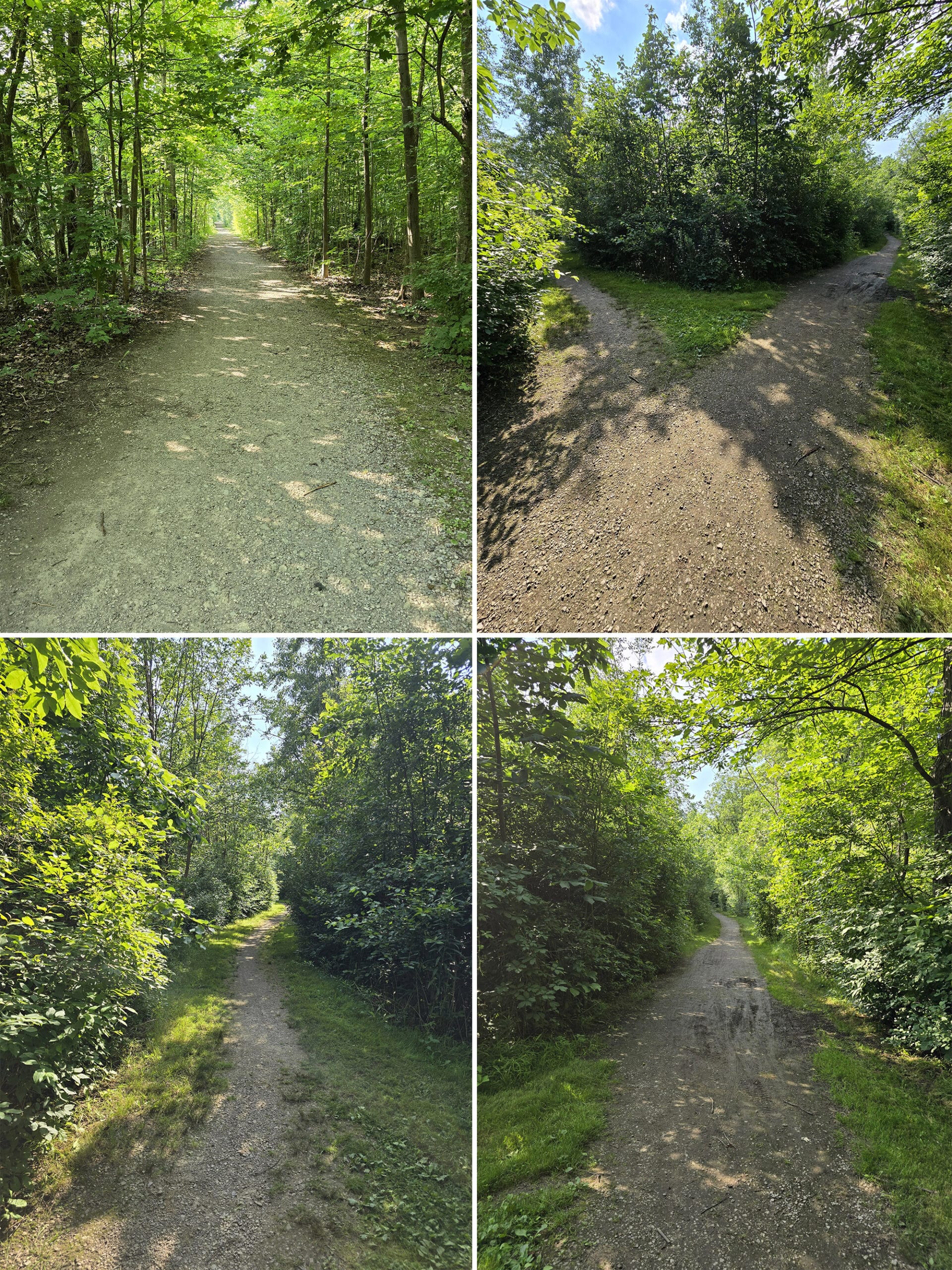
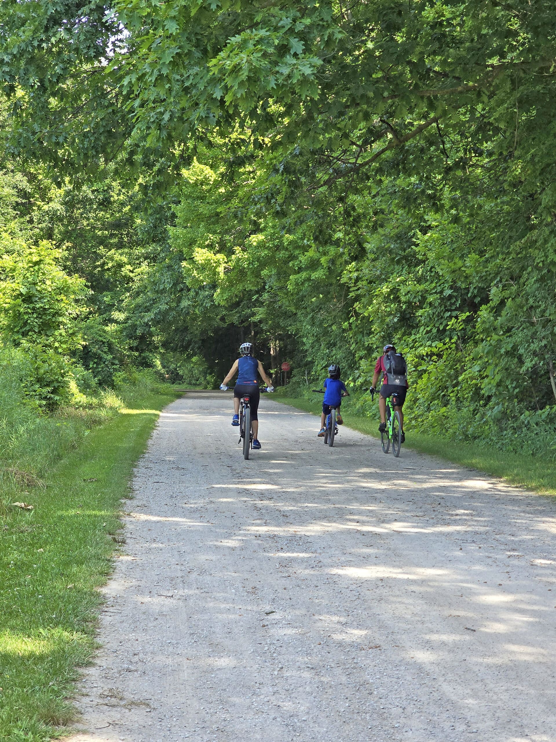
Biking
This is definitely a good park to go cycling in.
There were a lot of cyclists everywhere, and most trails seemed to be multi-use - both hiking and biking trails.
Not only are most of the trails wide, flat, and well packed, but there’s also a big network of staff-only roads that serve as trails - also perfect as biking trails.
Swimming
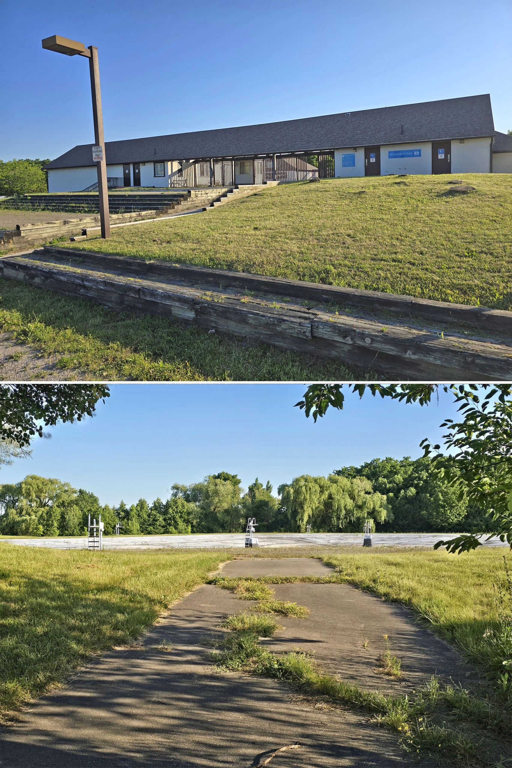
Bronte Creek may be home to a large outdoor swimming pool, but it’s been closed for 4 years at this point.
It’s in ROUGH condition and looks completely abandoned, though it sounds like they’re making arrangements to repair it in the future.
Can’t wait to see what it’s like in action - its size is measured in ACRES (1.8 acre pool)!
As it was, it starts a few centimeters deep around the border of the pool, and gets as deep as 6 feet - in the centre. Unlike most swimming at Provincial Parks, this one actually had lifeguards on duty.
Note: There was an additional fee to enter the pool area, I’m assuming that’ll be the case in the future as well.
Birding, Wildlife, and Nature
SO much wildlife to enjoy, which was unexpected this deep into the GTHA!
Birding
We were shocked at how great the birding was at this park! Sure, the site mentions 190 species of birds, but still.
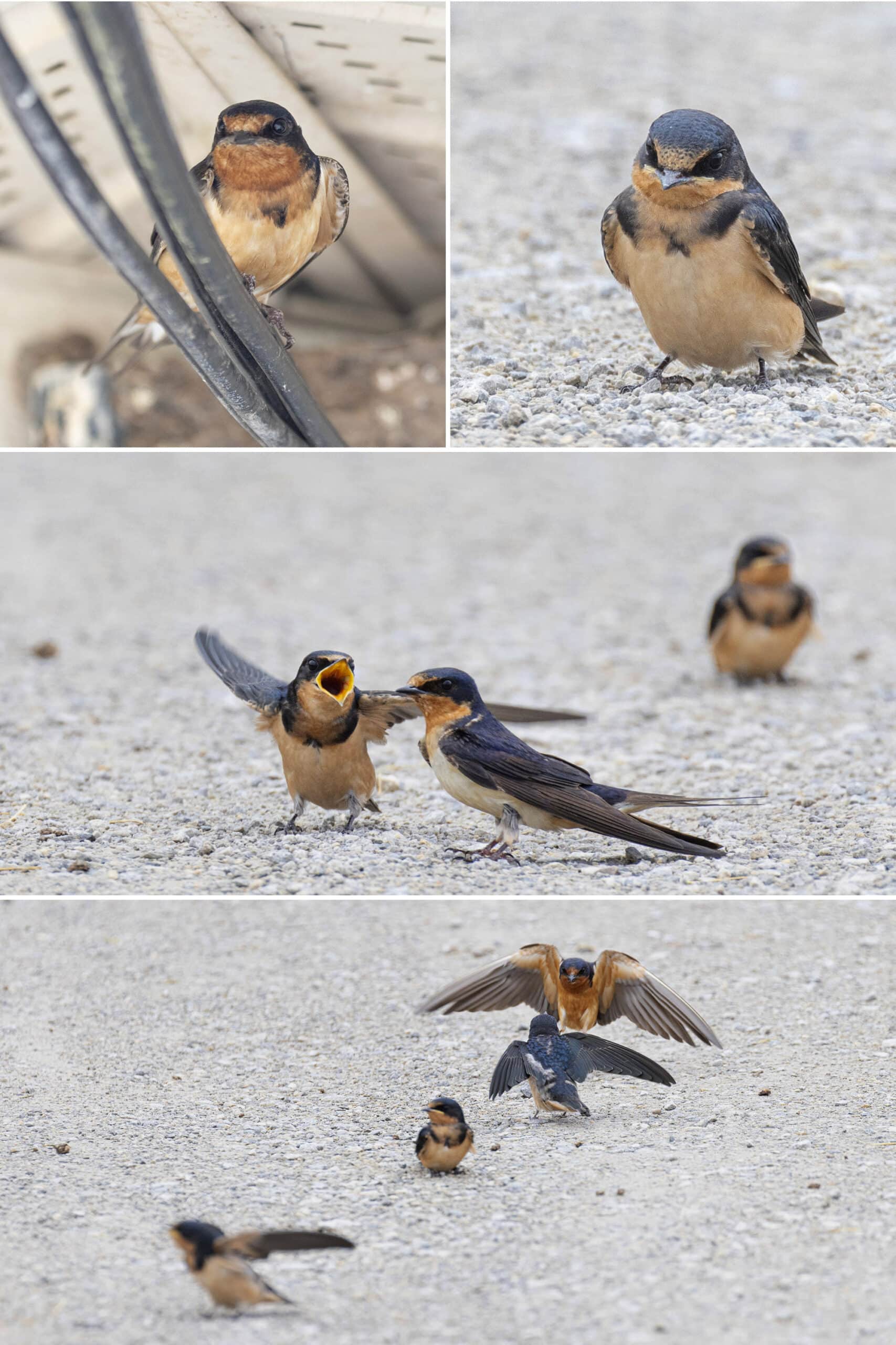
It all started out with barn swallows nesting on the registration building. Minutes after that, we saw a Green Heron fly up into a tree, as we visited the Field and Forest trail.
As we were driving to our campsite, we saw a big American Robin splooted out on a picnic table. No idea what it was doing - we got out of the car to make sure it was ok, it flew off.
There are several really good birding areas, especially down along the Half Moon Valley Trail, and Ravine trail near the farm / Half Moon Valley trail heads (Indigo Buntings) .
Overall, we saw: American Crow, American Goldfinch, American Robin, Baltimore Oriole, Barn Swallow, Black-Capped Chickadee, Blue Jay, Downy Woodpecker, Eastern Bluebird, Eastern Kingbird, Field Sparrow, Great Crested Flycatcher, Green Heron, Harry Woodpecker, House Sparrow, House Wren, Indigo Bunting, Mourning Cove, Northern Cardinal, Northern Flicker, Red Winged Blackbird, Song Sparrow, Turkey Vultures, White-Breasted Nuthatch.
... and we heard: Cedar Waxwing, Common Raven, Common Yellowthroat, Cooper’s Hawk, Eastern Meadowlark, Eastern Wood-Pewee, European Starling, Gray Catbird, Red-Tailed Hawk.
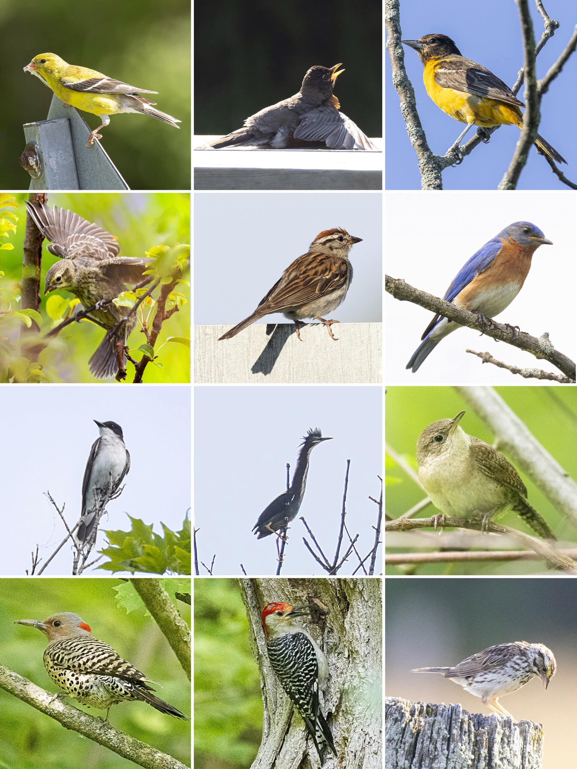
2nd Row: Brown-Headed Cowbird, Chipping Sparrow, Eastern Bluebird
3rd Row: Eastern Kingbird, Green Heron, House Wren
4th Row: Northern Flicker , Red-Bellied Woodpecker, Savannah Sparrow
At one point there were a bunch of them on the open park pathway leading from Parking Lot A to the trail entrance for Maiden’s Blush.
One or two would fly off, and fly a perfect circle around a man with two dogs on leashes. They stayed JUST outside of the range of the leash, as the dogs chased them.
Then, they’d fly back to the group, they’d all seem to.. Cheer?... then another one or two would fly off to do the same.
Still not sure if they were taunting that dog or playing, but they seemed to be having a great time doing it. It went on for maybe ten minutes, them taking turns having the dogs chase them!
Other Wildlife
We saw a tiny snake - maybe a baby? - on the trail leading up to the Spruce Trail Farm.
I’ve never seen a snake that small!
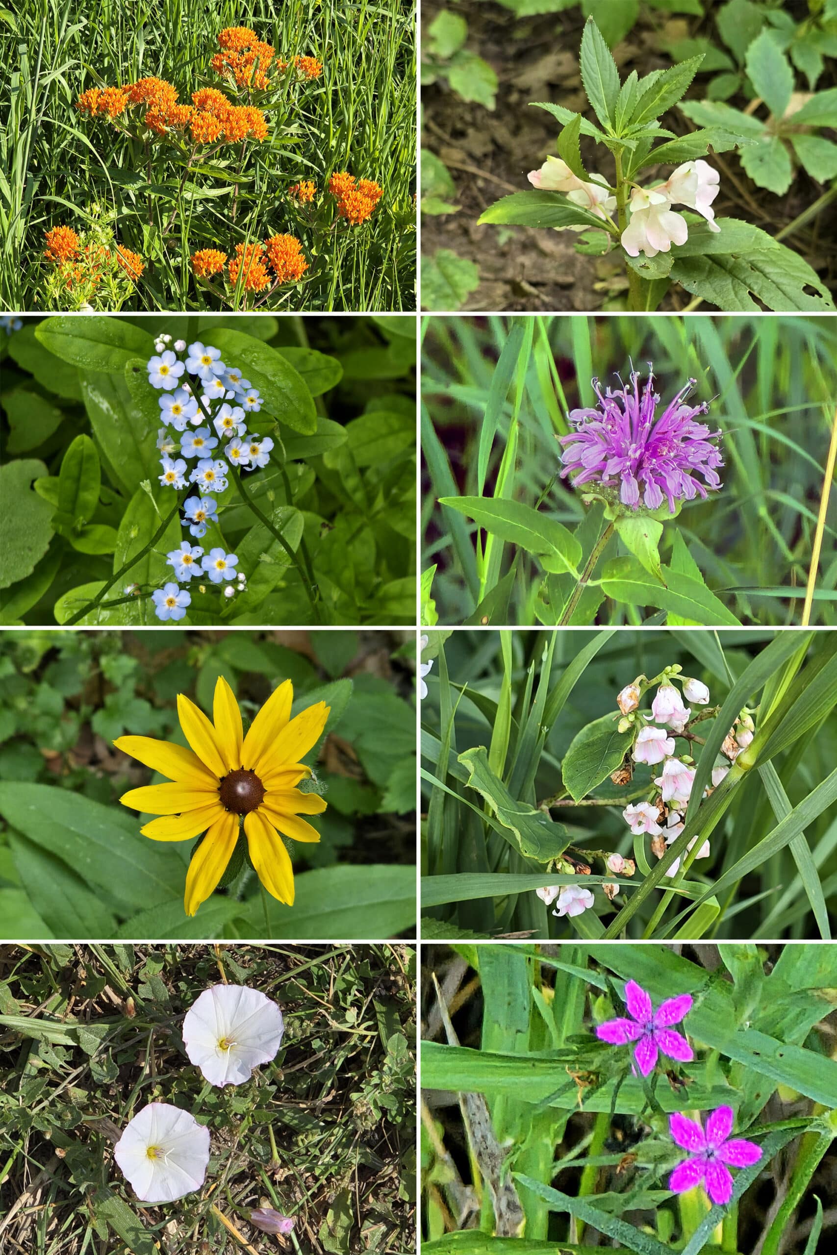
Also: Tons of butterflies! Several different types, including a couple of Monarch Butterflies.
Not really surprising, given the number of wild flowers in the area - including a ton of milkweed.
There was also a lot of interesting fungus, especially on the Logging Trail.
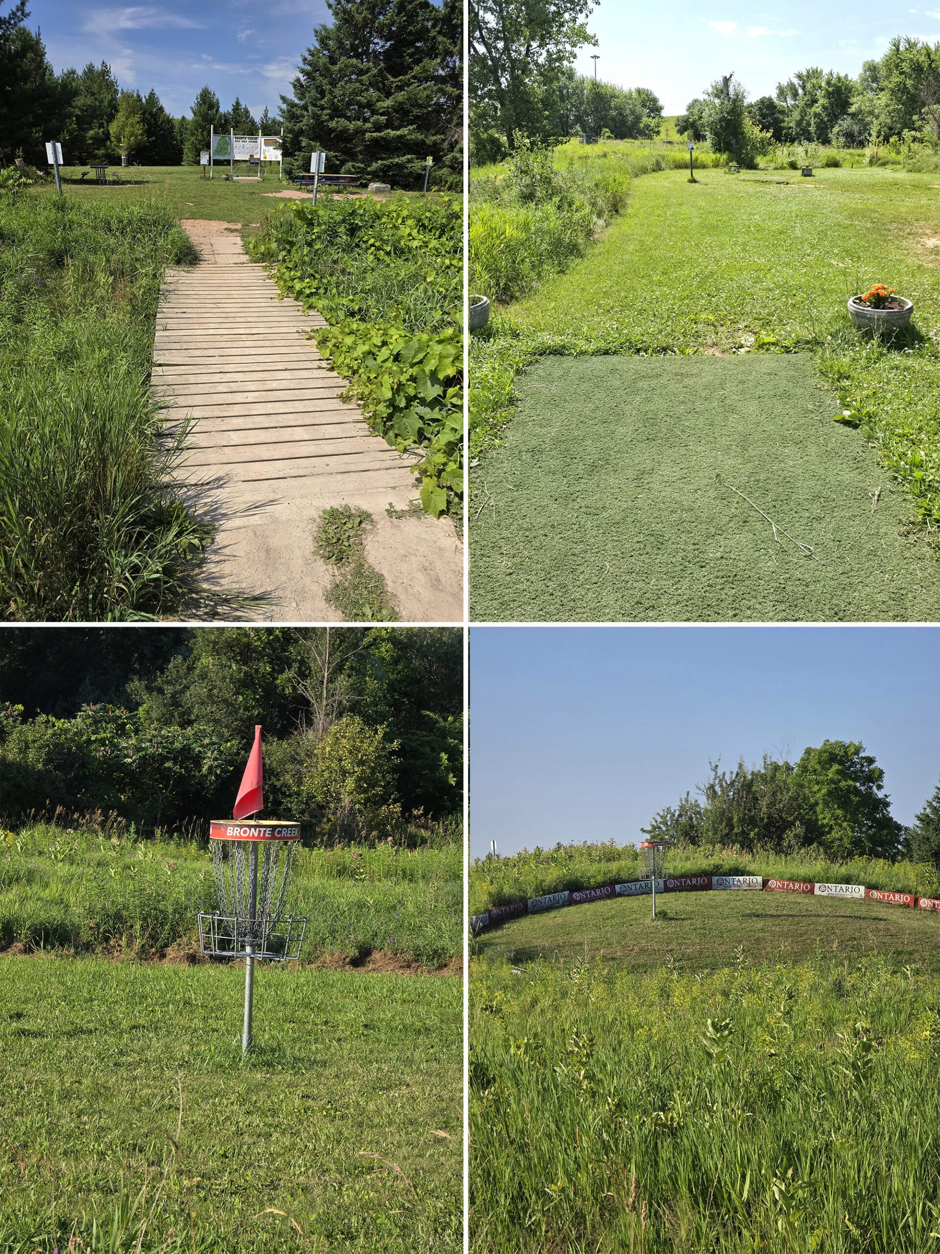
Disc Golf
This is the first park we’ve camped at, where Disc Golf is offered. We’d never actually seen one before, and it’s really interesting!
The course has a really cute setup, and seems to be high quality and well maintained. They DEFINITELY put some thought into this!
Well, aside from on the map, anyway. It’s not clear on the map, where you access the disc golf area from: the entrance is on the West side of Parking Lot F, though.
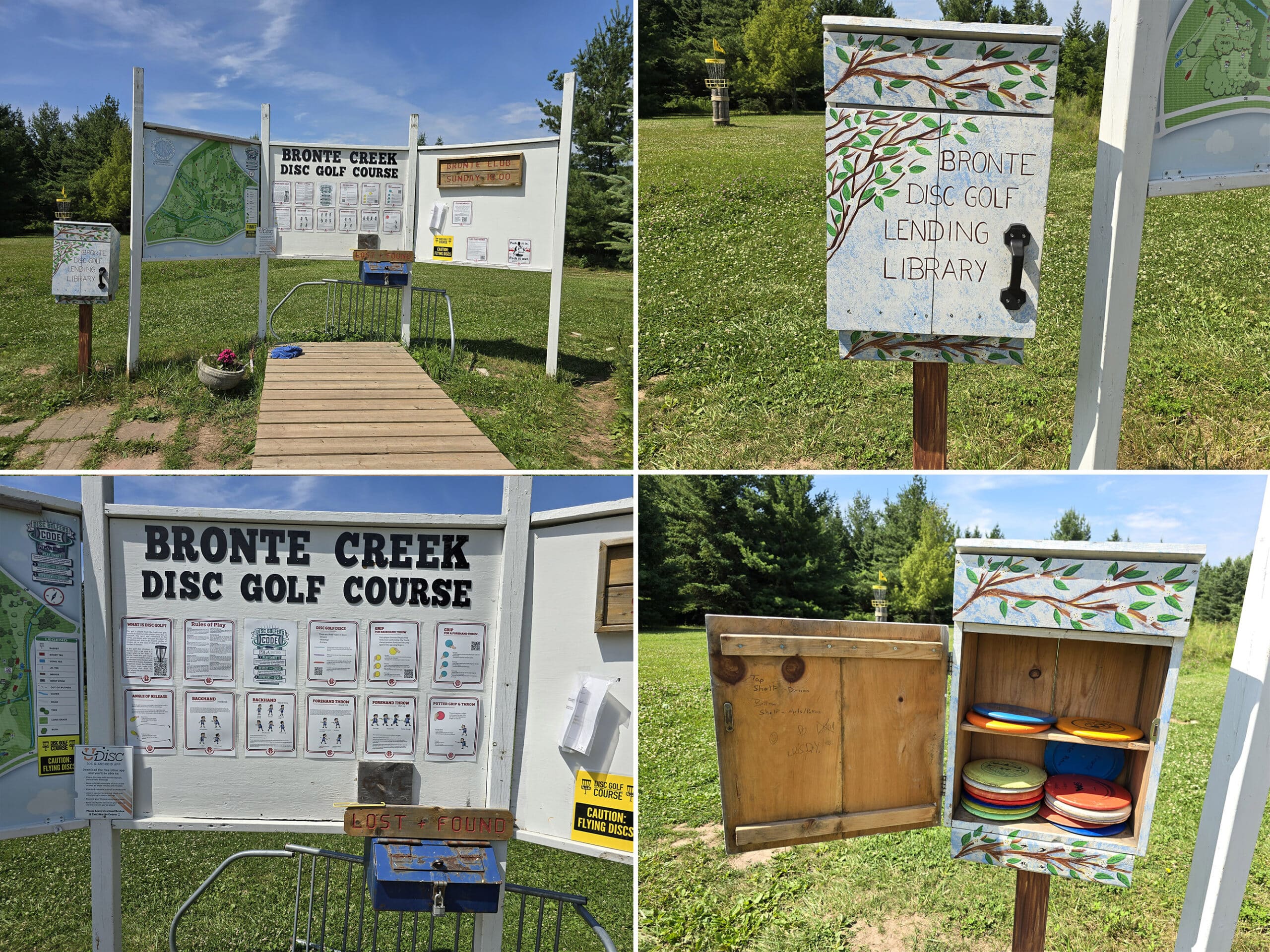
The signage has the rules for playing, diagrams for how to make different throws, etc.
There’s also a “little free library” type thing, but for lending frisbees!
There are different types of frisbees for different types of shot - kind of like golfing - they were laid out in order on the shelves.
Top shelf was “Drivers”, Bottom Shelf was mids / putters.
I had no idea it was so involved - we’re going to make a point of trying it out when the weather is cooler.
Apparently the course stays open all year round, though the park’s website says that parking lot is closed in the winter?
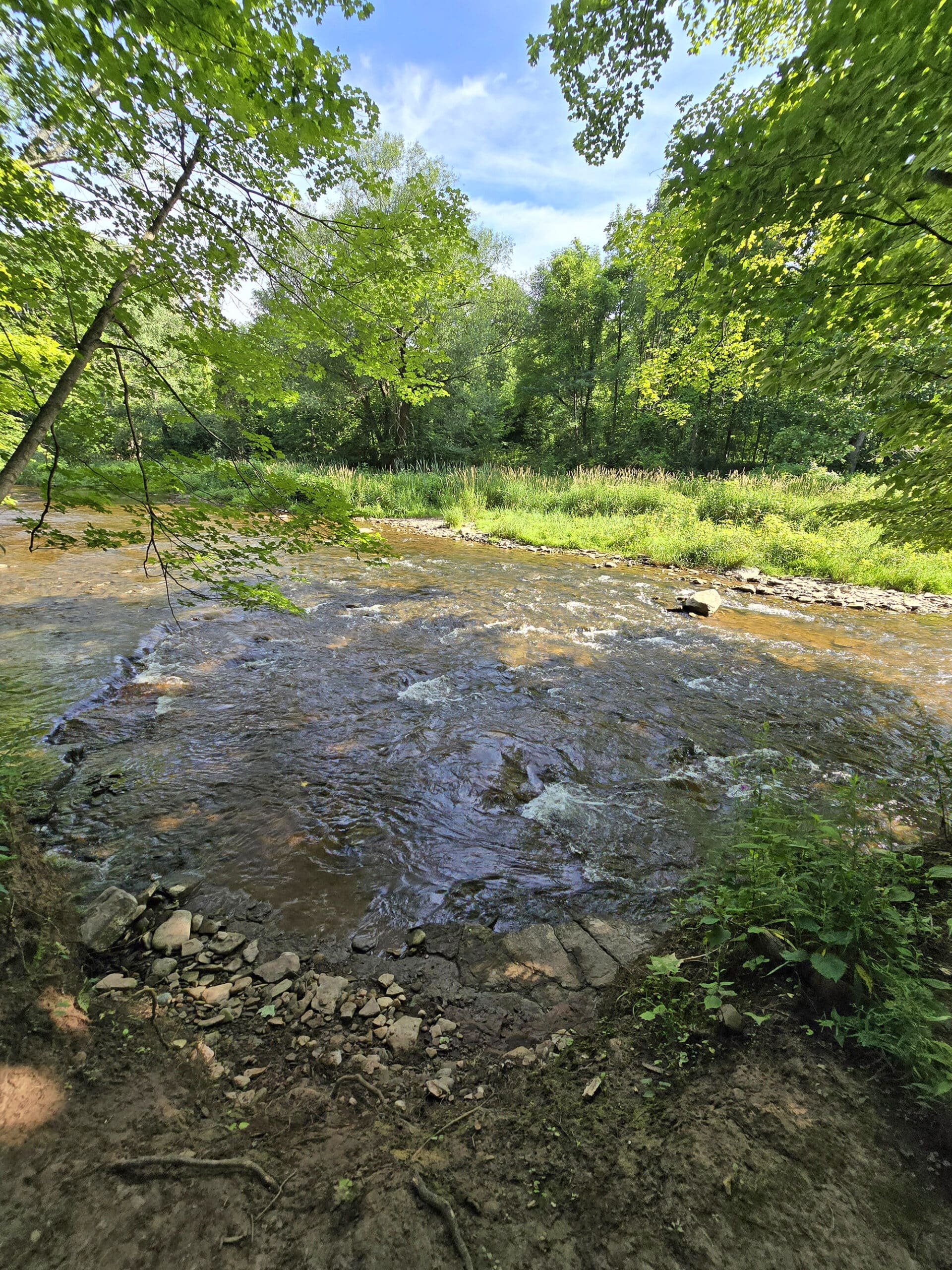
Fishing
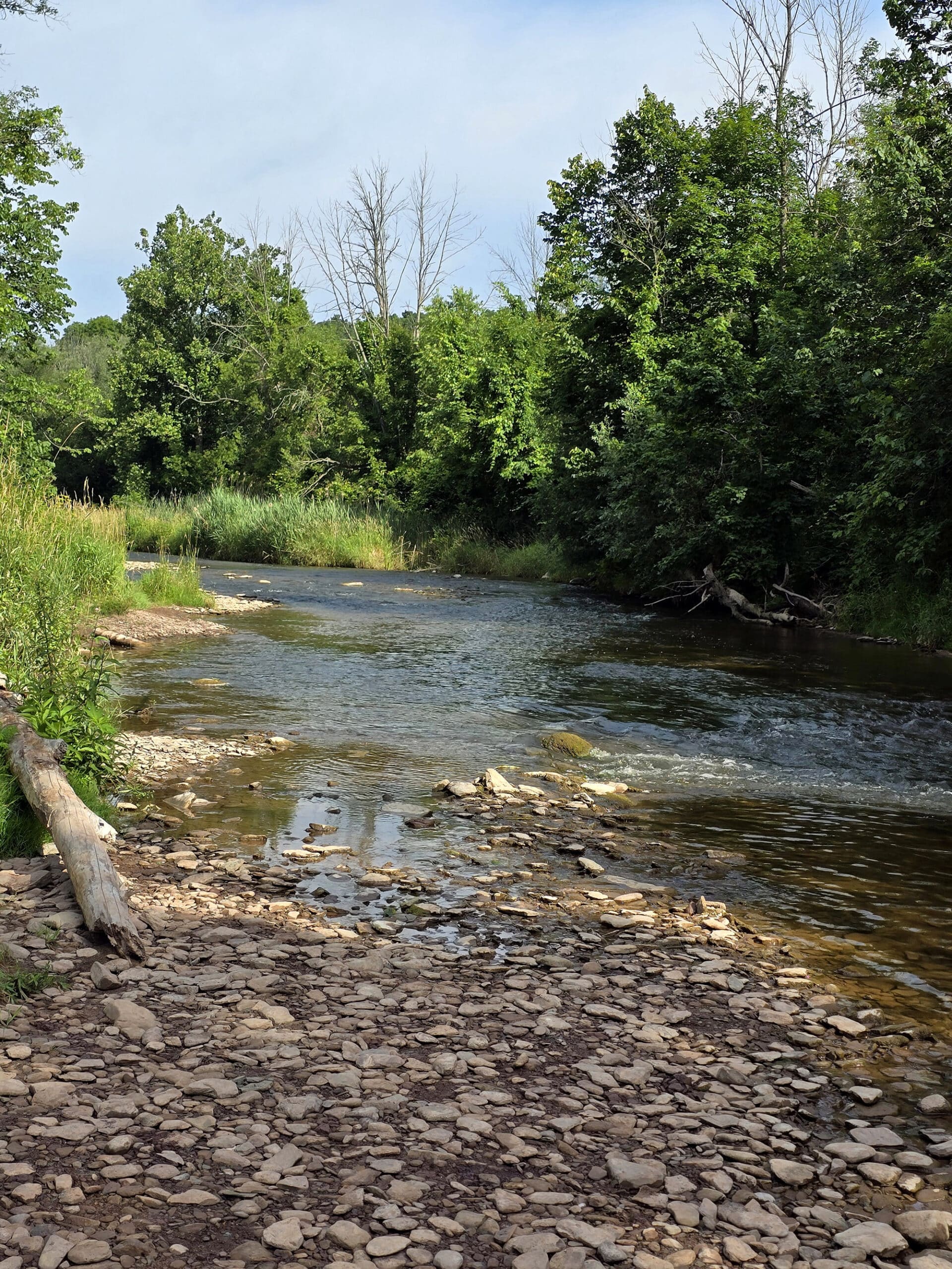
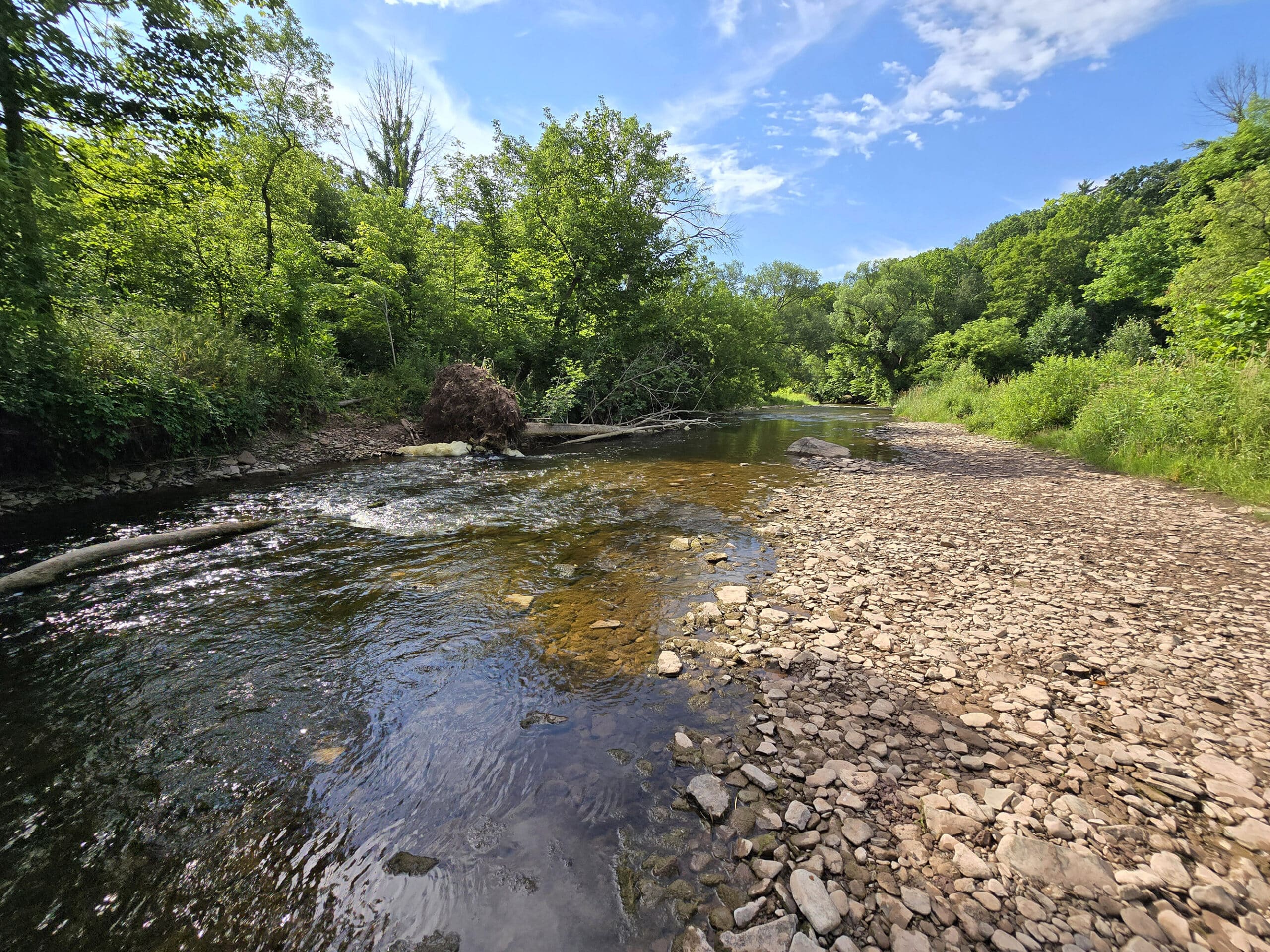
It’s a bit of a hike to get to fishing - and no one was fishing when we were there - but what a gorgeous stream!
The park’s website mentions it having Pacific Salmon, Rainbow Trout, Splake, and Steelhead, but we learned more about the fishing situation from the Friends of Bronte Creek site.
The salmon head up the creek in the fall - October or November, usually after rain. They’re mostly Chinook Salmon, but you can sometimes - rarely - come across some Coho Salmon or Atlantic Salmon.
Rainbow Trout hit the creek in early spring, and Smallmouth Bass are in the creek in late spring and early summer - for the most part.
As always, you need to have a fishing license, in order to fish there.
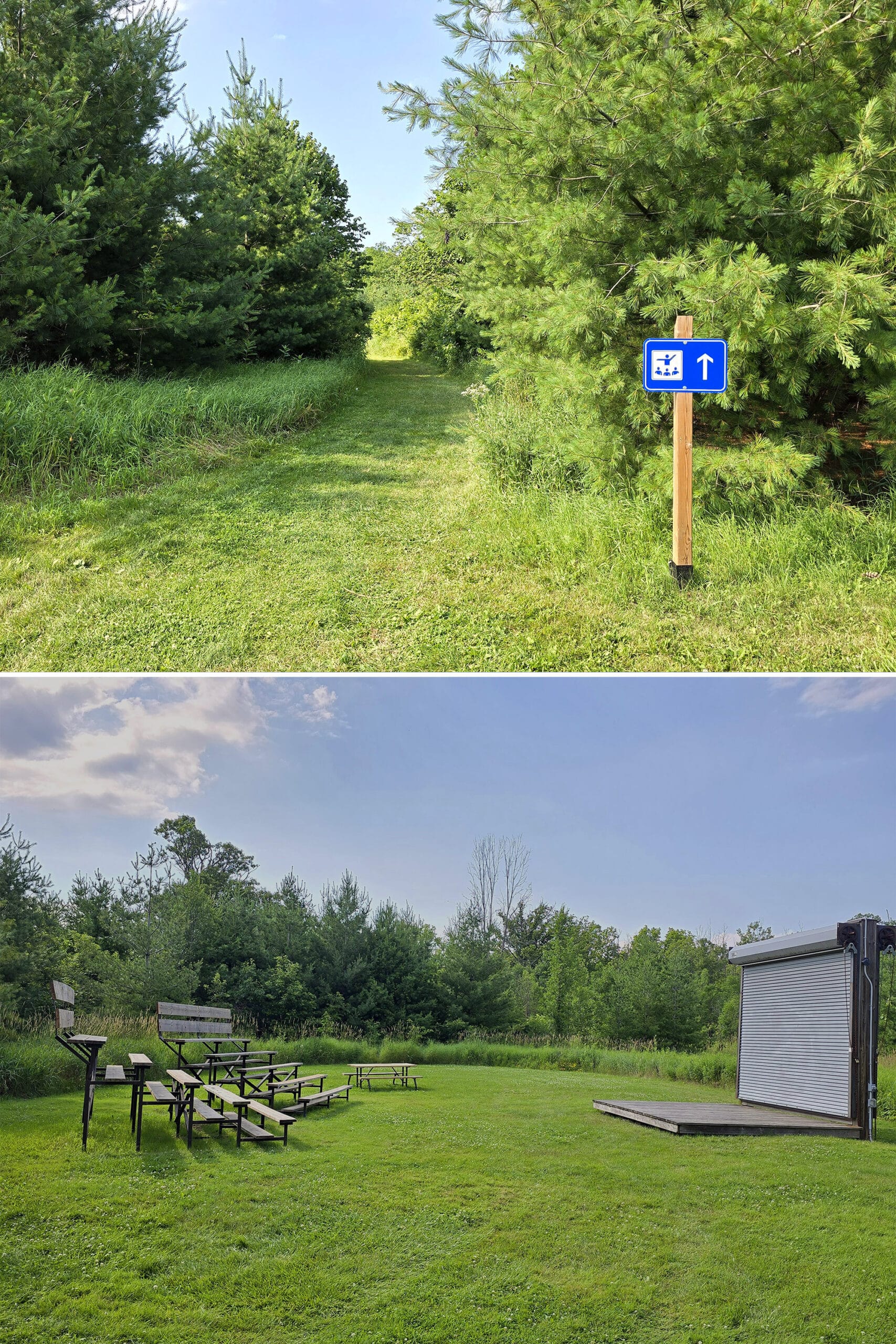
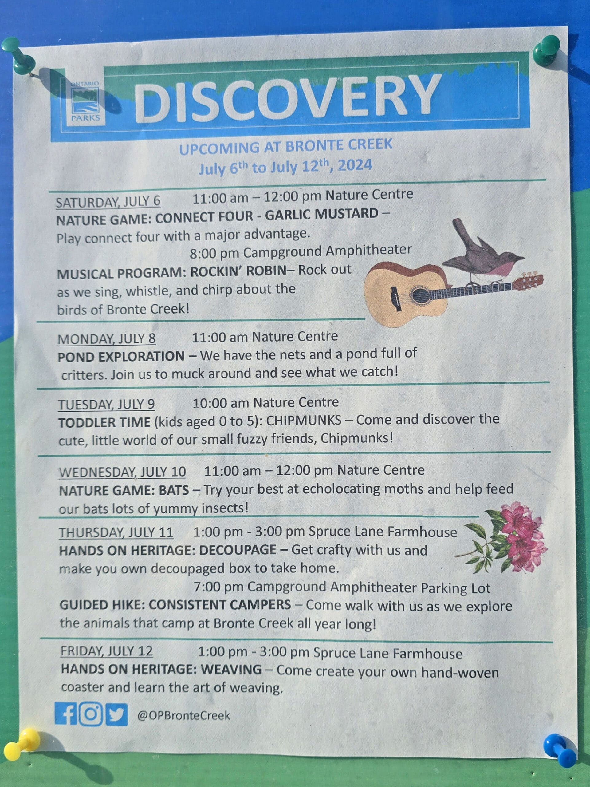
Discovery Program
The campground section of the park has an odd little amphitheatre, but we didn’t see any information about programming offered there.
It seems like the bulk of the Discovery Program offerings happen in the day use area.
Programming and events take place from March through to December.
Some are annual events - including “Camper Halloween”, Ghost Walks, a Harvest Festival, the Maple Syrup Festival, Victorian Christmas, and more.
There was a pretty cool lineup of programming listed the week of our visit:
Niantic Games
There were plenty of portals/Pokestops/gyms throughout the day use area, and a handful of them in the camping area.
Also: plenty of cell coverage throughout the park.
Winter Activities
Bronte Creek Provincial park has activities available every time of year - including the winter months!
When the snow falls (assuming it sticks, anyway. This IS the GTHA, and winter is not always a thing, LOL), the park offers cross country skiing, snow shoeing, and tobogganing.
There are about 10 km of cross-country skiing trails - ungroomed - and most of the hiking trails are available for the snowshoeing.
The toboggan hill is right in the centre of the Barrier-Free Trail, with plenty of access points from Parking Lots C & D.
As a note: Parking Lot F is closed in the winter.
Final Thoughts
We were pleasantly surprised with this park.
Having all of that right there - less than 30 minutes from our house - was kind of amazing.
This is one of those times where you really have to look at where the negative comments are coming from, and what exactly they’re about.
If swimming is a high priority for you, then yeah, it sucks this one has an abandoned pool. Same for boating - there’s no boat launch or anything, and the stream through the ravine definitely isn’t even kayak friendly.
Also: there’s the fact that the campground doesn’t have much going on. It’s basically a day use park with a campground tacked on, rather than the day use being a part OF the campground, if that makes sense.
Anyway, if the drive to the day use area is a sticking point, then yeah... probably not going to have a good time.
That said, it’s a really FULL park. So much to do and see!
We’ll definitely be back - we’ll just have to time it around good tendon days, as it’s absolutely not for the mobility impaired.
More Provincial Park Campground Reviews
Want to read some more of what we have to say about the campgrounds we've stayed at? Here are some more reviews!
Awenda Provincial Park
Balsam Lake Provincial Park
Bass Lake Provincial Park
Bon Echo Provincial Park
Canisbay Lake, Algonquin Provincial Park
Chutes Provincial Park
Driftwood Provincial Park
Earl Rowe Provincial Park
Emily Provincial Park
Inverhuron Provincial Park
Killbear Provincial Park
Lake Superior Provincial Park
Long Point Provincial Park
MacGregor Point Provincial Park
MacLeod Provincial Park
Mara Provincial Park
McRae Point Provincial Park
Neys Provincial Park
Pinery Provincial Park
Point Farms Provincial Park
Port Burwell Provincial Park
Quetico Provincial Park
Rideau River Provincial Park
Rock Point Provincial Park
Rondeau Provincial Park
Sauble Falls Provincial Park
Selkirk Provincial Park
Sibbald Point Provincial Park
Sleeping Giant Provincial Park
Turkey Point Provincial Park
Wheatley Provincial Park
Thanks for Reading!If you loved this post - or have any questions about it - please leave a comment below! We'd also love it if you would consider sharing the link on social media! |


sheila
Thank you for creating this very through review of Bronte Creek Provincial Park. Great to see some constructive feedback! Yes, Bronte Creek is bit of a departure from other Provincial Parks. In the 1970's we were near-urban ... today ... we are definitely URBAN. We lead 1000's of school groups and due to our signature events like the Maple Syrup Festival, Harvest Festival, Victorian Christmas and New Years Eve Coyote Howl we are a popular location for families with kids.