
Bonnechere Provincial Park is a charming little campground and day use area in Eastern Ontario. Jam packed with amenities, here's what you need to know!
Originally Published Aug 6, 2024, Updated on 5/24/2026.

We’ve since returned, and there have been some BIG changes - all for the better!- in the time between our visits. The bulk of this post was written back in 2024, but everything has been updated where applicable.
Back to the original post....
There’s a beautiful sandy beach, accessible trails, and generally seems really thoughtfully laid out and maintained.
That’s a weird word for campground reviews, but it definitely kept coming to mind during our stay. We noticed a lot of aspects of the park that seems thoughtful, and planned with intention.
Less “we have some room over there, let’s put the (whatever) there”, and more “How can we make this park the most welcoming, accessible one out there?”.
I know the word “cozy” gets used as a synonym for “small”, and I do try to avoid the word as a result. In this case, though - I found Bonnechere cozy.
Yes, it’s a small park... but it’s more about the vibe. The intentional feeling behind everything really made it feel welcoming and warm, in a way we don’t notice at other parks.
It was like... staying in a country bed and breakfast, vs staying in a hotel.
I hope that makes sense. Anyway, let me tell you all about it!
The Basics:
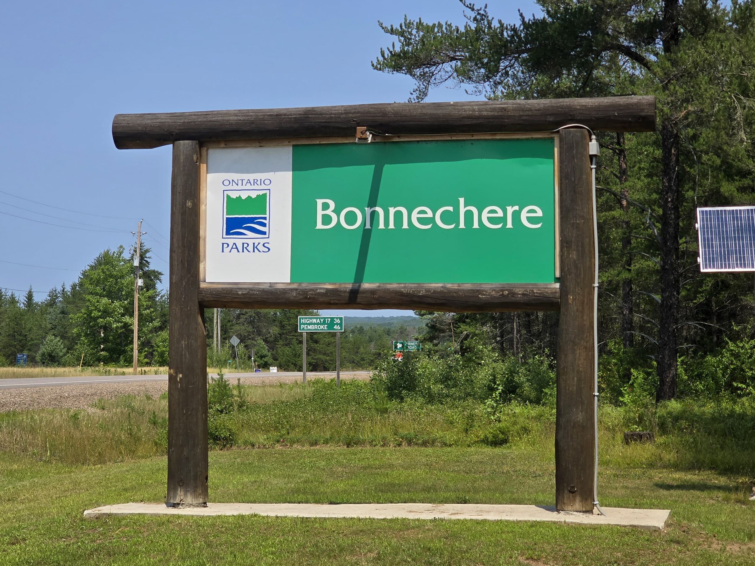
Campground Name: Bonnechere Provincial Park
Address: 4024 Round Lake Rd. Killaloe, ON K0J 2A0
Website: https://www.ontarioparks.ca/park/bonnechere
Price: Ontario Provincial Parks uses a pricing matrix across all their parks. See 2026 Camping Fees for more details on reservation fees.
Reservations: Ontario Parks Reservations
Park Classification: Recreational
Season: May 8, 2026 to October 18, 2026
Park Warden: 613 401-3252
Logistics
As with our then-recent stay at Darlington Provincial Park, our first stay at Bonnechere involved some last minute site juggling, totally on us.
We had booked our site 5 months ahead of time, at 7am on the dot... and we were unable to get one of the electric sites.
5 months worth of watching for any electric sites to come available, no luck!
As it turned out, it was *extremely* hot during our stay. I knew that a few days ahead of time, and managed to get a single night of an electric site, our first night there.
SO glad we did - the heat nearly killed me!
Anyway, wanted to mention that here, in case it factors in to anything I say in this review!
Registration and Check In
Booking that first site was technically easy enough, but definitely had that “Campground Reservation Hunger Games” feel to it. As a very small campground - with precious few electrical sites! - it’s hard to get a spot in the summer.
(This was much less of an issue on our second trip, when we booked during a week in May - with the visit ending on a weekend.)
Also: I didn’t get any notifications at all that an electric site became available in the entire 5 months. So, once people have their site, it’s a good chance they’re holding onto it.
Anyway, registration was exceptionally easy, once we got to the park.
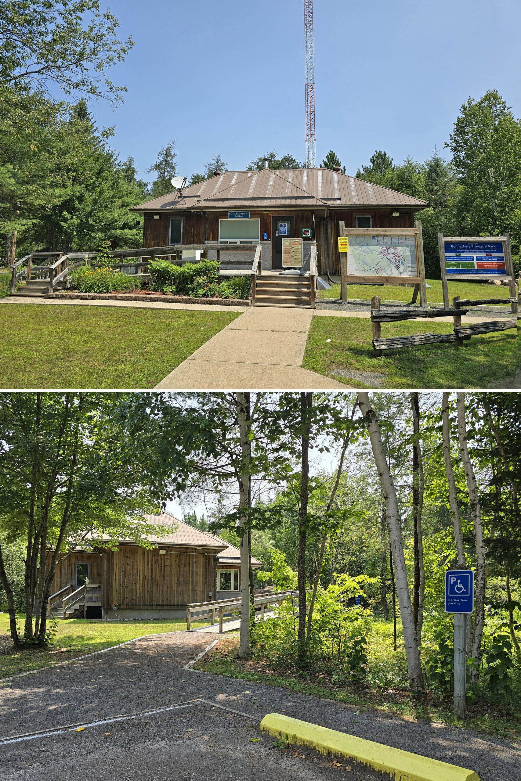
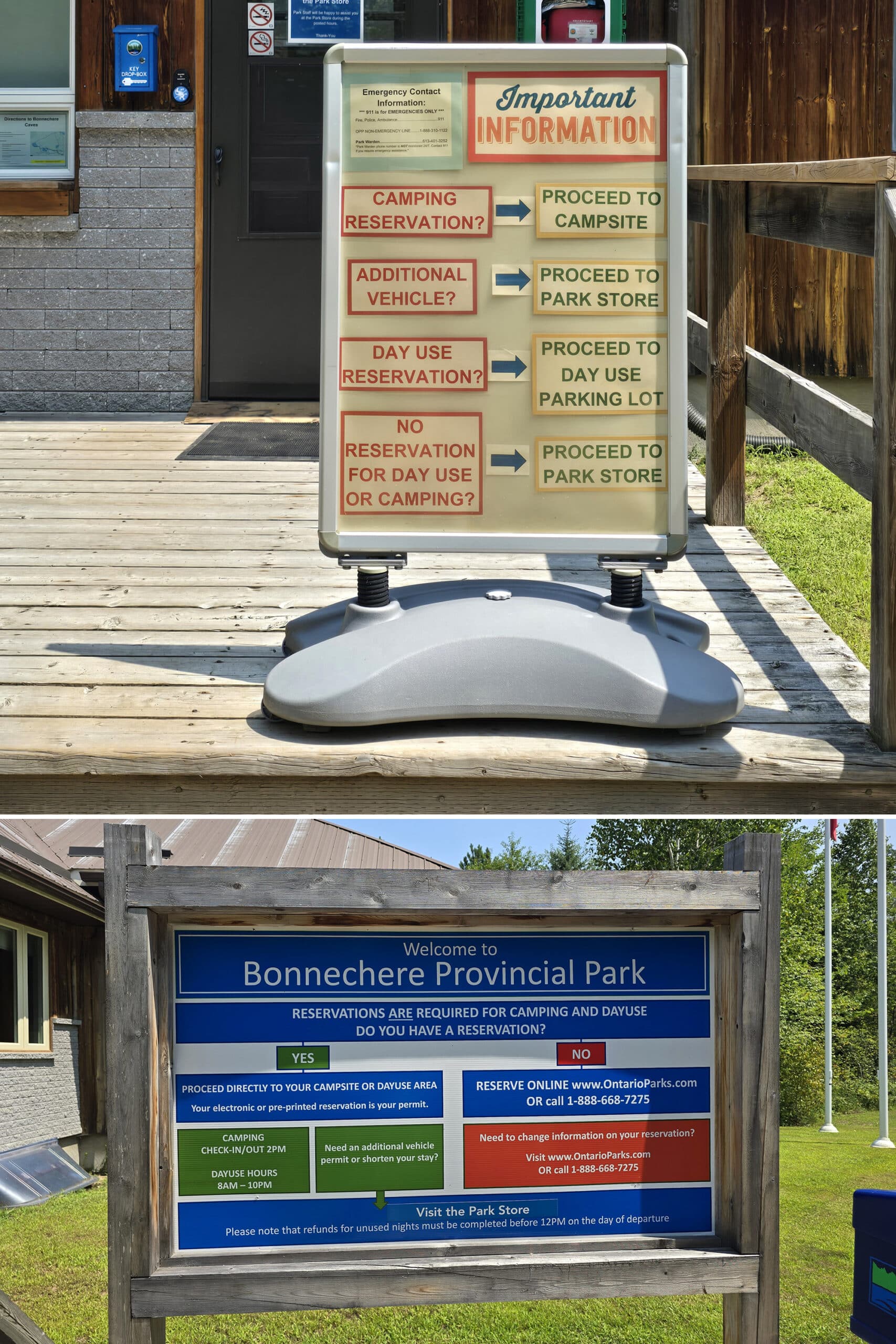
On both visits, we pulled up to the main park office, and were greeted by two large signs telling people how to check in.
As a paperless permit park - and as I’d done the pre-registration when I booked - we were directed to go straight to our first campsite.
No need to deal with people at all, AND it made it much easier when we changed sites the next day - we just moved over, no need to check in a second time.
Slick!
Those that don’t pre-register, register at the Park Store in the day use area. There was a line to do so, when we visited it, in 2024.
There were no lines during our 2026 visit - probably at least partially because of the new system with day-of prompts to check in online..
Maps and Signage
When we originally posted this review, there was some weirdness between the first map we were given and the one we had to replace it with when we lost it. As it turned out, one map was the 2023 version, the other was 2024 - and there had been some significant changes in that time.
When we revisited the park in 2026, we noticed some pretty significant changes to the park in general, so this whole section has been updated!
Park Map
The park map is the same newspaper style map that some parks - like Algonquin Provincial Park - have, with the map taking the whole back page.
We loved that there were park maps readily available in those self service dispenser pod things that you used to see when newspapers were a thing. (Ouch, I know!). One was located at the front office, and another in the day use area.
Aside from there not being aa ton of contrast on the map - at least partially due to the newsprint format, rather than the glossy pages at some parks - it’s a good map.
You’ll definitely want to have one on hand as you navigate the park until you get used to the layout - especially right at the gate, if it’s your first time.
... there are some pretty significant signage issues, that really necessitate the map!

Signage
We have two VERY different views on the signage, depending on what aspect of the park we’re talking about.
In the day use area and on the trails, the signage is *fantastic*. Clear, easy to read, well-placed, and very informative. 10/10, no further comments.
Well, except that I LOVE that they’re mostly tri-lingual!
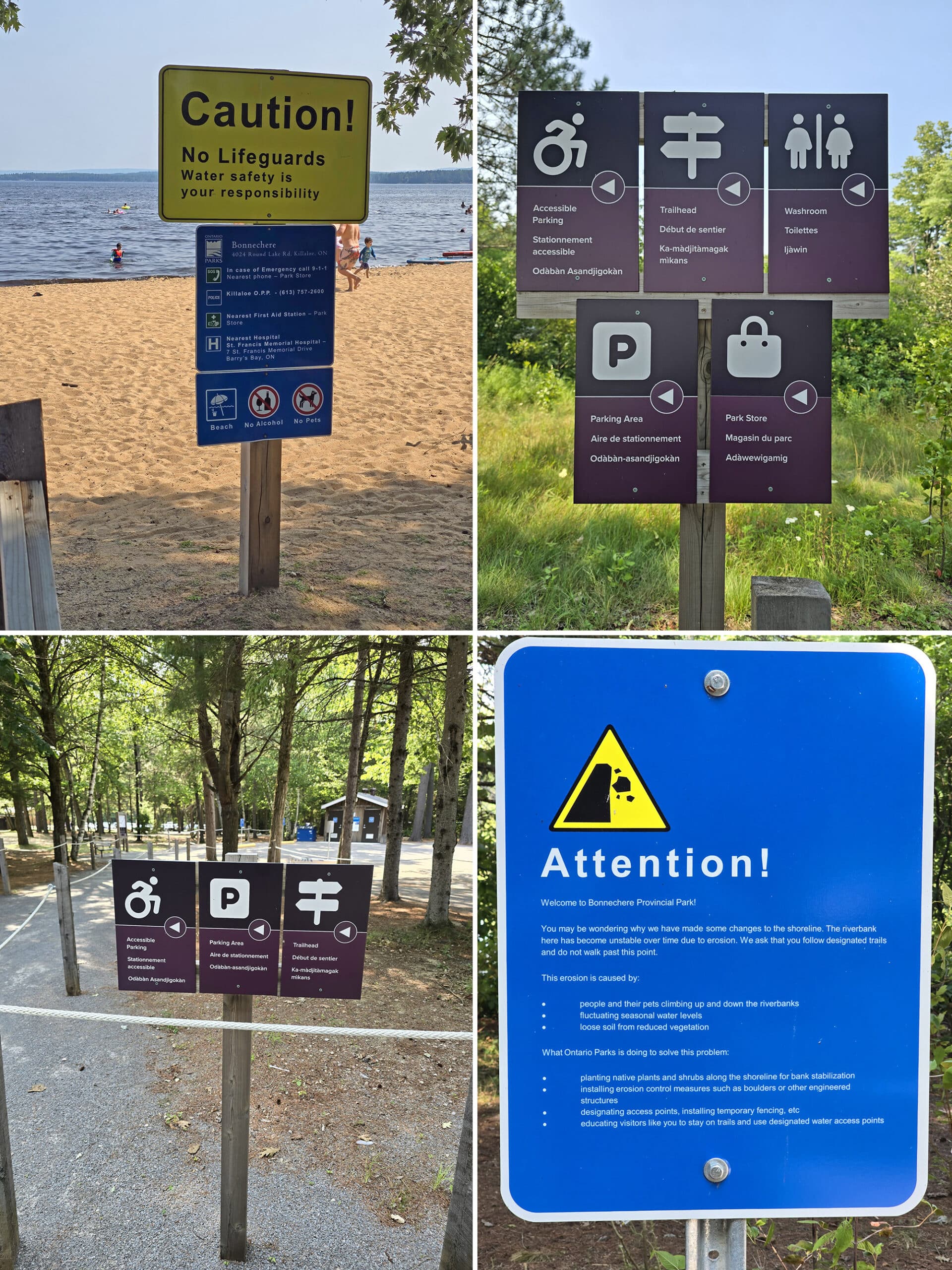
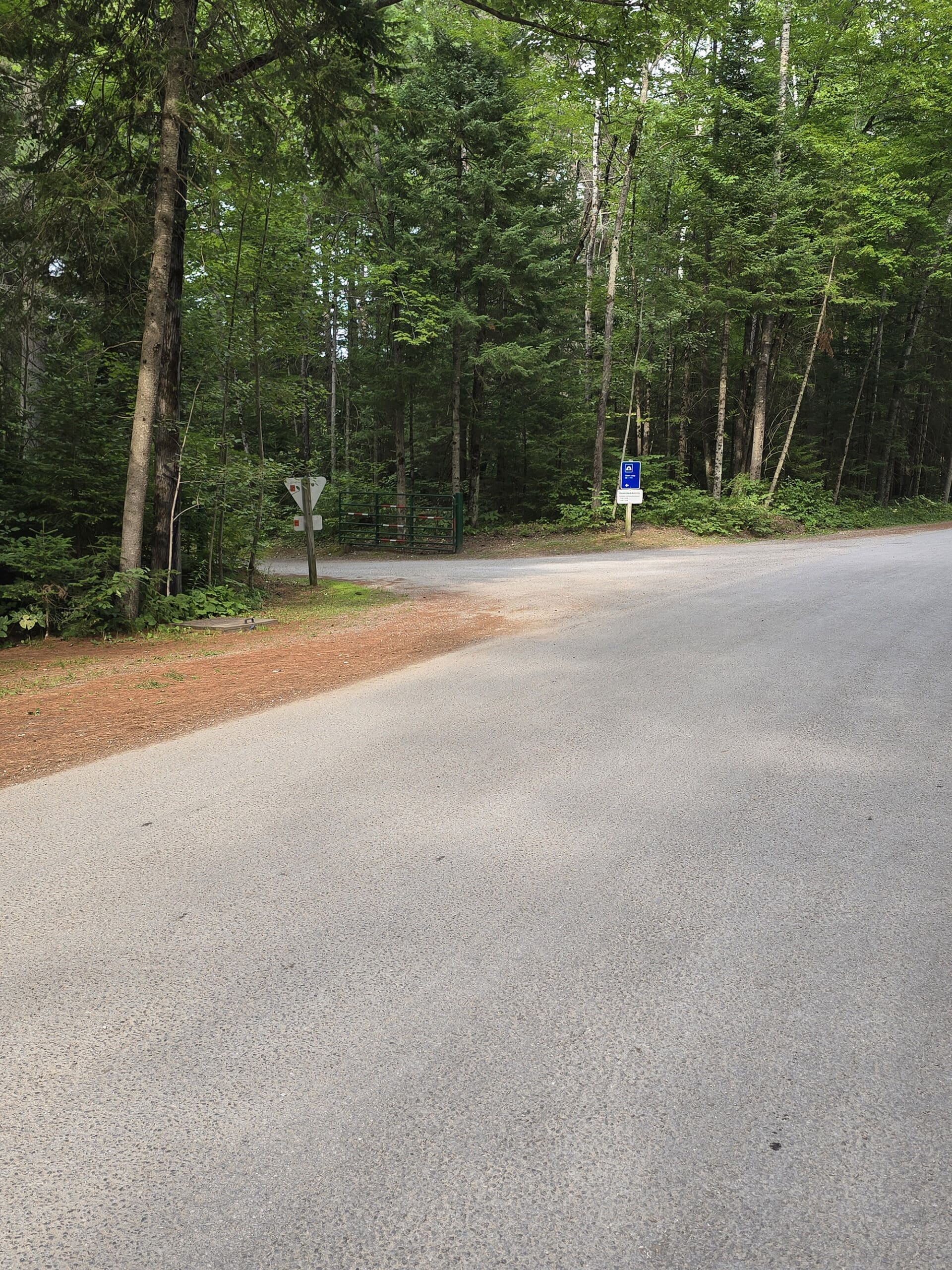
Within the campground, the signs have really small type, are placed RIGHT at the entrances to each offshoot from the main road (campgrounds, waste area, the road to the cabins, etc).
In some cases, they only face one way. If you’re looking for the road to the cabins, you’ll see the sign when entering from the front gate... but not when you’re returning to your cabin from the day use area.
Another issue is that the campground loops aren’t labeled. Usually if there’s a loop splitting off from a main campground road, the park will erect signage that tells you which campsites are down that loop.
.... that is not the case at Bonnechere Provincial Park.
On our second visit, we forgot to grab a map at the front, figuring we’d just get one a bit later. We’d been here, and knew the general layout well enough, figured we’d rely on campground signage to find our site.
Whoops. Staying in Site #45, we were on a split-off loop from the main campground road in the Tall Pines Campground. We went most of the way around that main loop, and came to the split... which wasn’t signed.
I had to quickly log onto the reservations page to realize that we had to turn right - if we hadn’t done that, we would have found ourselves back out on the main road through the park!
There are only a couple sections where this applies, mind you... but starting a trip out crabby because we missed an unmarked turn and had to loop all the way back to that campground entrance and start again... isn’t ideal!
I hope they’ll get whoever designed the day use signage to redesign the campground / road signage.
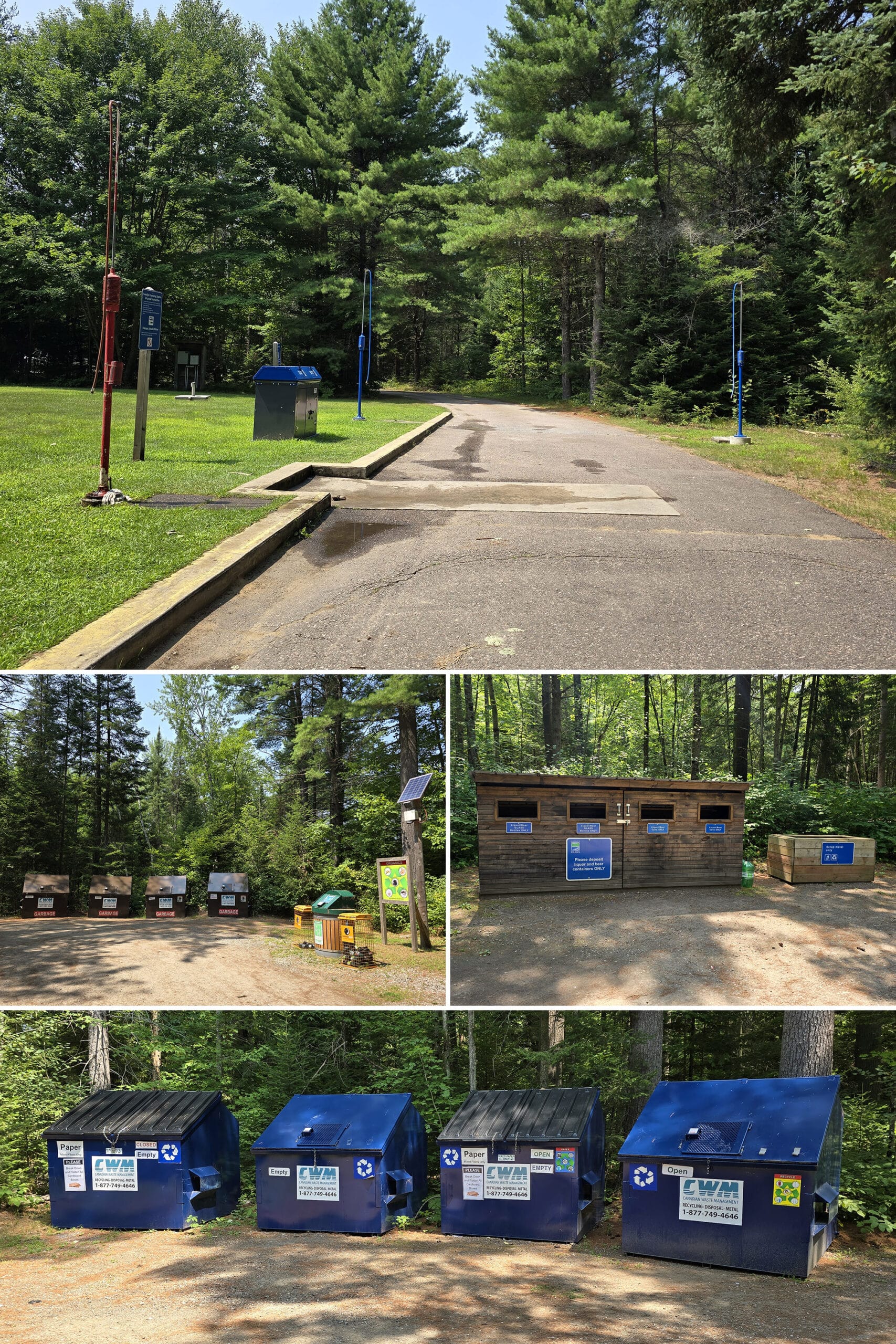
Waste & Water Services
The trailer sanitation station is kind of a mess at Bonnechere Park.
The Poop Loop has two fill platforms and one dump platform, on a single lane with no bypass.
The dump platform is first - on the left - followed by fill platforms on either side of the lane, afterwards. By “afterwards”, I mean *IMMEDIATELY* afterwards.
There’s not really enough room for someone to be using either of the fill platforms, AND for someone else to be using the dump platform behind them.
So, 3 platforms, only one can really be used at a time. On our way out, we literally had to pull up only about 1 metre to use the fill platform, after using the dump platform.
It’s also on a loop, with 4 sections to it:
A row of garbage bins, a row of basic recycling bins, another section specifically for liquor bottles and cans - as well as scrap metal - then another area for organics, as well as 2 “Orange Drop” bins for used propane canisters.
Connectivity
Something definitely changed in the year and a half since our first visit to Bonnechere Provincial Park.
Last time, the cell phone reception in the park was pretty abysmal. We had a BIT of connection near the day use area, and absolutely none, everywhere else.
This time around, we had fantastic cell reception throughout the park. We’re still on Rogers Wireless, so I’m assuming they’ve put up a new cell tower nearby.
As always, your mileage may vary with other carriers, and with more people in the park. For what it’s worth, the park says that the best bet for cell reception is in the day use area and at the beach.
Beyond cellular reception, Bonnechere Provincial Park is one of the few Ontario Provincial Parks we’ve seen that offer WiFi - in theory, anyway.
On the first visit, we noticed open WiFi Networks near - and named after - both of the accessible trails.
However, any time we tried to connect, it said “connected without internet”, and... that was that.
What a tease! The shame of it is that both of those trails offer interactive experiences, with a self guided tour online, and QR codes to scan on signage along the way.
As an update - one of the trails had working wifi on our second visit - the Nopiming Trail had good wifi at the trailhead. Not sure how far in that went, as we didn’t do that trail this time.
Finally, there is a payphone located beside the park store.
Accessibility
This park is *far and away* the most accessible park we’ve ever seen.
While some (MOST, let’s be real) seem to tick off a few boxes to meet some kind of minimum standard, Bonnechere is the first where it really feels like an effort was made to welcome disabled people.
Let’s look at the various ways that the park is super disability friendly:
Barrier-Free Basics
Unlike a LOT of Provincial Parks, Bonnechere is liberal with their accessibility information dissemination - love it!
There’s a fair amount of accessibility info on the park’s website (though it definitely has some omissions / glossing over / underselling itself issues, on that front), and ALMOST all of the accessible facilities are on the map.
There’s a wheelchair accessible vault toilet in the day use area that’s not represented, that’s about it.
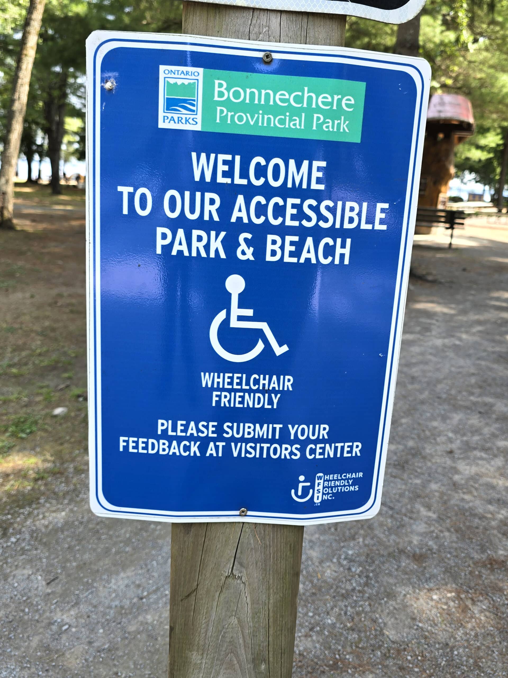
One thing that really stood out was a sign at the day use area that not only said “welcome to our accessible park and beach”, it ACTUALLY requested feedback!
That’s... wild. No one ever seems to want to hear from disabled people, much less SOLICIT feedback from us!
As it turns out, we’re not the only ones noticing - and being impressed by - the inclusion efforts at Bonnechere Provincial Park.
They were awarded the Rick Hansen Foundation Gold rating for Accessibility, the only Provincial Park in Ontario with that distinction.
Well deserved!
Barrier-Free Facilities
The gatehouse / park office at the front of the park has both accessible parking, and an accessible entrance - you just have to loop around and go in the back side of it.
The main comfort station has a wheelchair accessible shower. It has a handheld sprayer with appropriately placed controls ... shockingly rare at “barrier-free” showers in Ontario Parks!
There’s also a single wheelchair accessible stall in the multi-stall washroom there.
The mini comfort station is not wheelchair accessible.
There are two barrier-free outhouses in the day use area. The first is one of the set of two vault toilets near the park store - it’s the one further from the store.
The second is a set of two composting toilets in a little building next to the boat launch - both stalls are accessible, *actually* easy to get to, and in good condition!

Row 2: Composting Toilets by Boat Launch
Row 3: Day Use Outhouse
Barrier-Free Activities
Going a little further, they now have not only one, but TWO Mobi-Mats at the beach.
... and not only do they go all the way to the water, they both go right INTO the water, by a few feet!
New since our last visit, they’ve added a wheelchair ramp from the boardwalk area (behind the playground), down into the water. There’s also at least one wheelchair accessible picnic table in the day use area, next to the first Mobimat. (The one closer to the Park Store.)
The park also has loans of both a WaterWheels floating wheelchair, AND a TerraWheels all-terrain wheelchair.
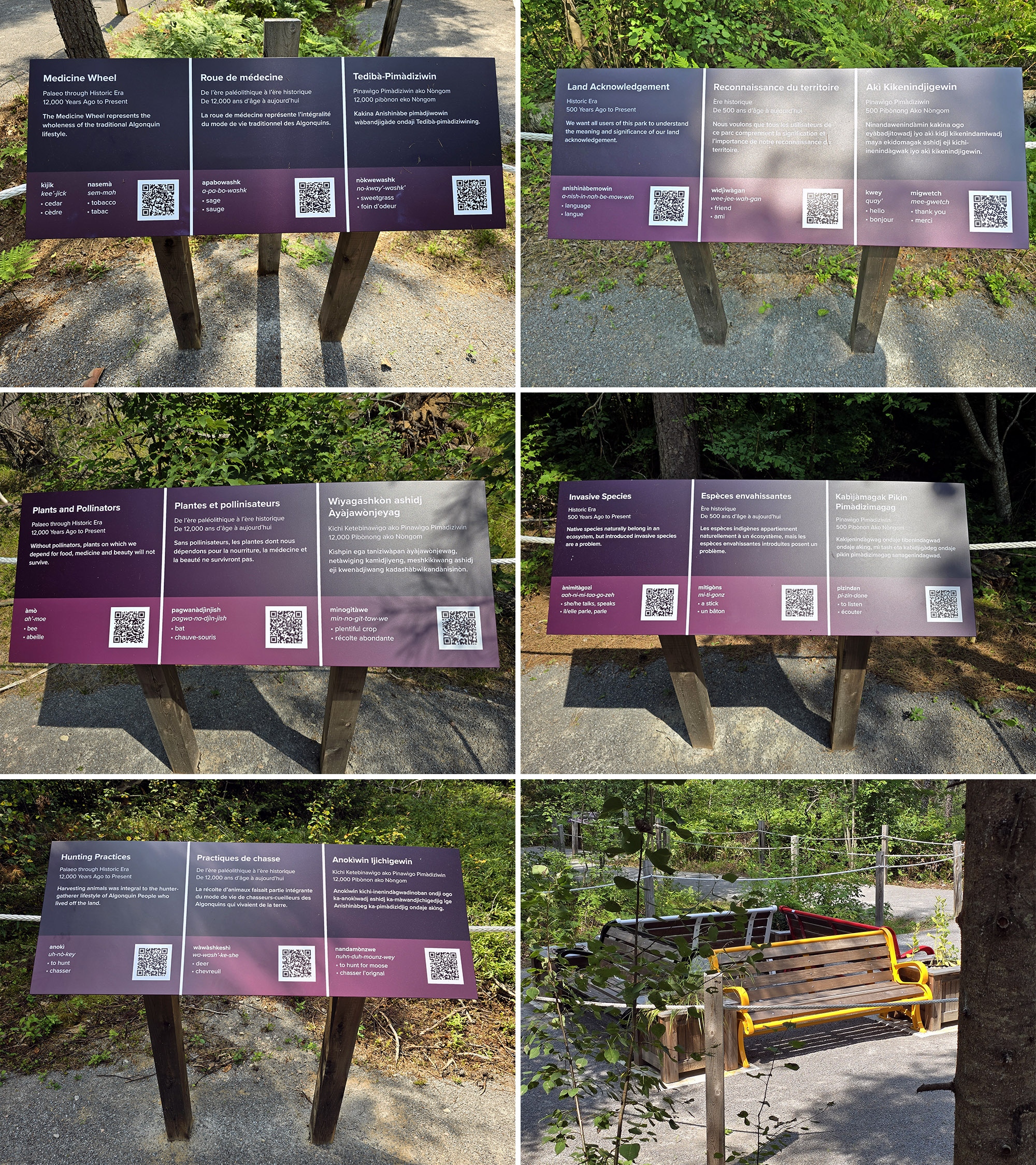
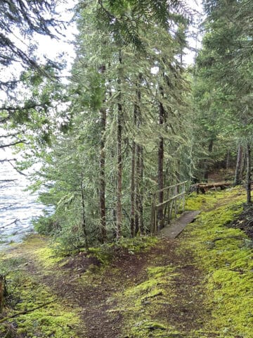
There are also two wheelchair accessible trails: Nòpiming FIT Trail (Formerly known as Woodland Trail) and Nàdòbìkana FIT Trail (Formerly known as Water Front Trail).
Both trails have accessible parking available and are flat, wide trails of well packed gravel that are lined with guide ropes, and have are benches along the path. The Nadobikana Trail also has a wheelchair accessible picnic table .
They also both offer accessible navigation through the BlindSquare Event app, which is something I didn’t even know existed - we certainly haven’t seen it in any other parks.
Also: There’s accessible parking all over the place AND drop-off zones at the accessible trails!
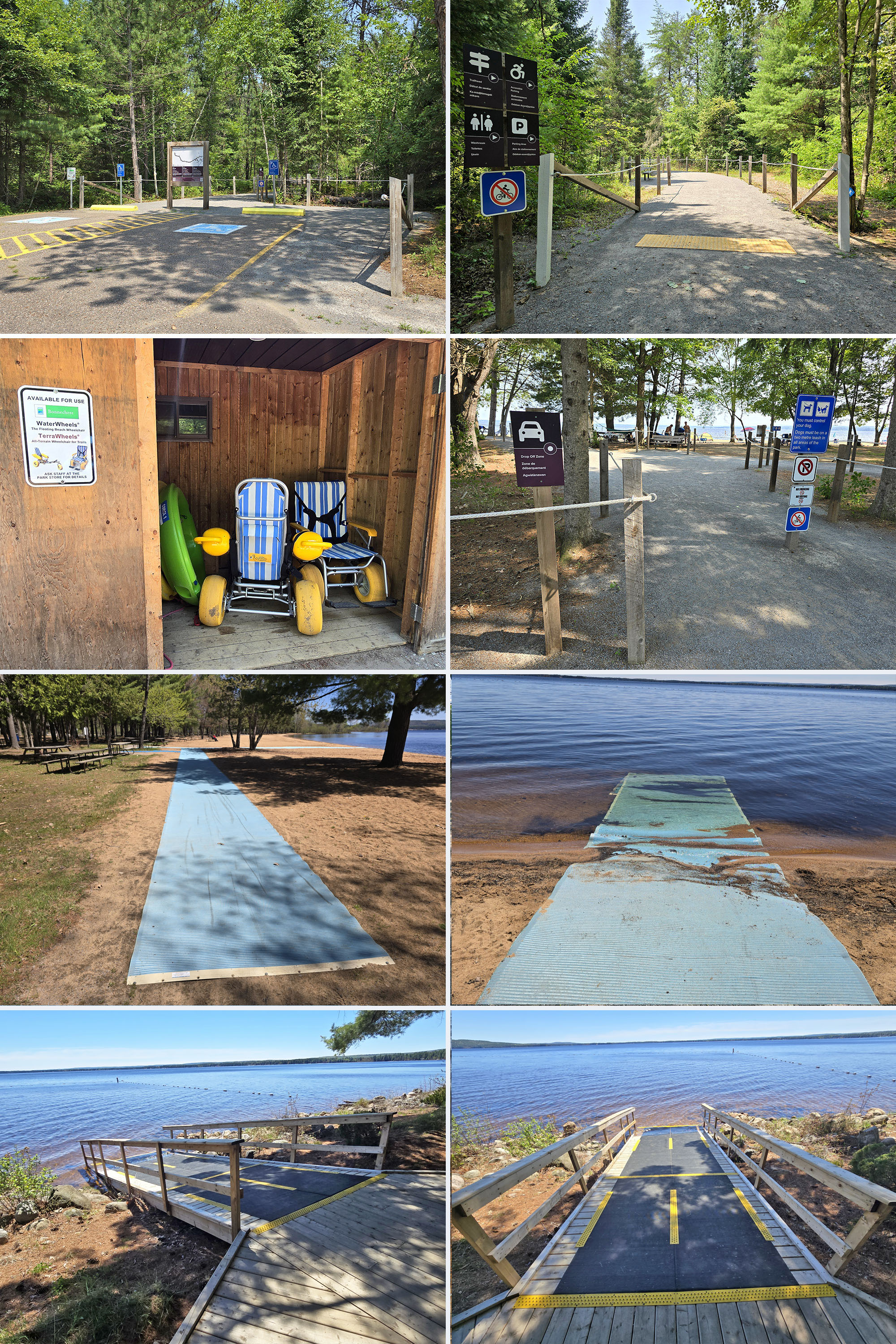
They both feature adaptive seating, and vessel stabilizers, and the kayak also features assistive paddle devices.

Bottom: The Adaptive Canoe
Barrier-Free Camping
Bonnechere offers two options for accessible camping.
First of all, there are two barrier-free campsites right next to the main comfort station - #37 and #39, both electrical. One was in use at the time of our second visit, but we were able to check out the unoccupied site.
Not only was it close to the comfort station - with its own path there - and feature the wheelchair accessible style of picnic table, it had a kind of fire pit I haven’t seen before.
The park’s website refers to it as an adaptive firepit - very cool!
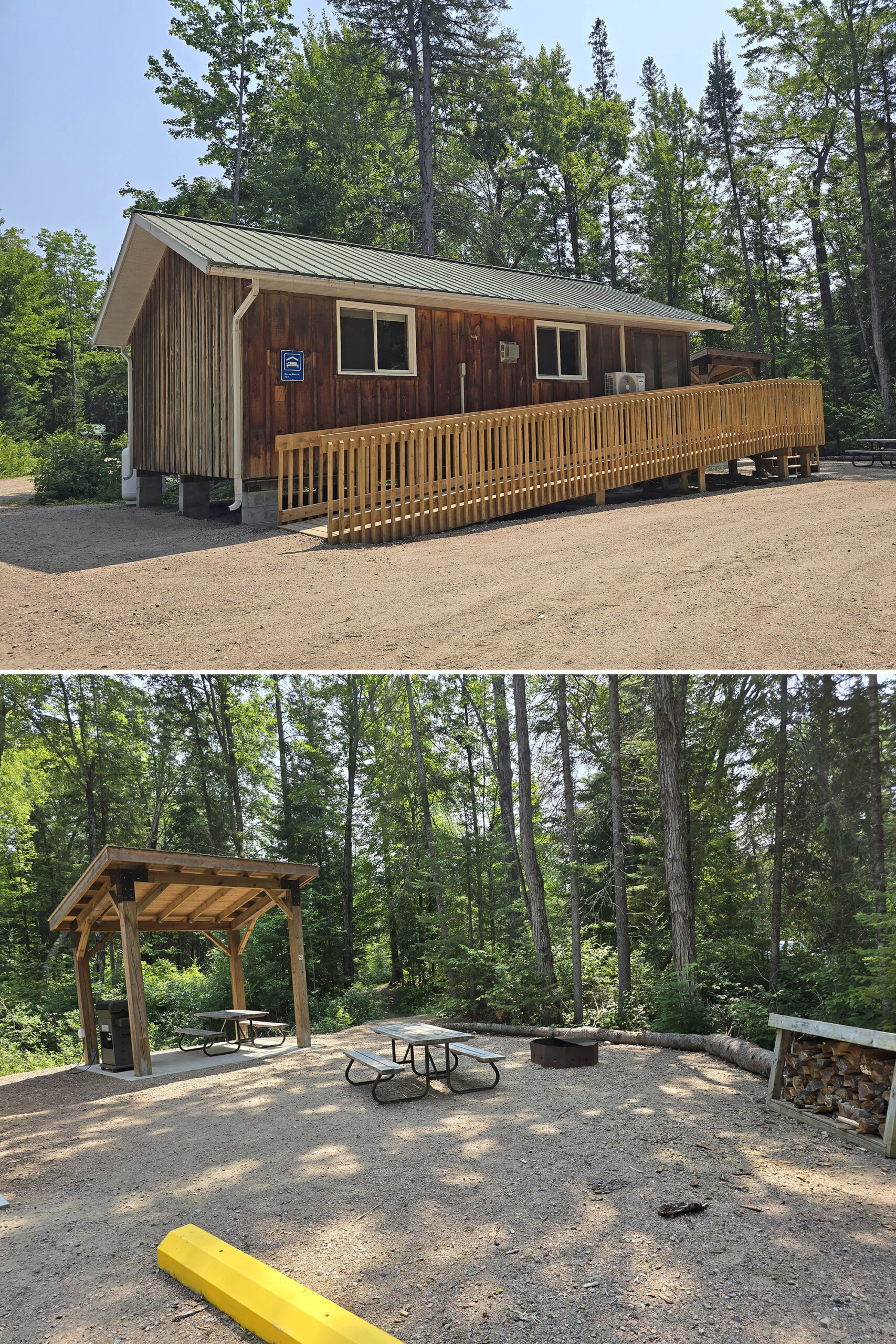
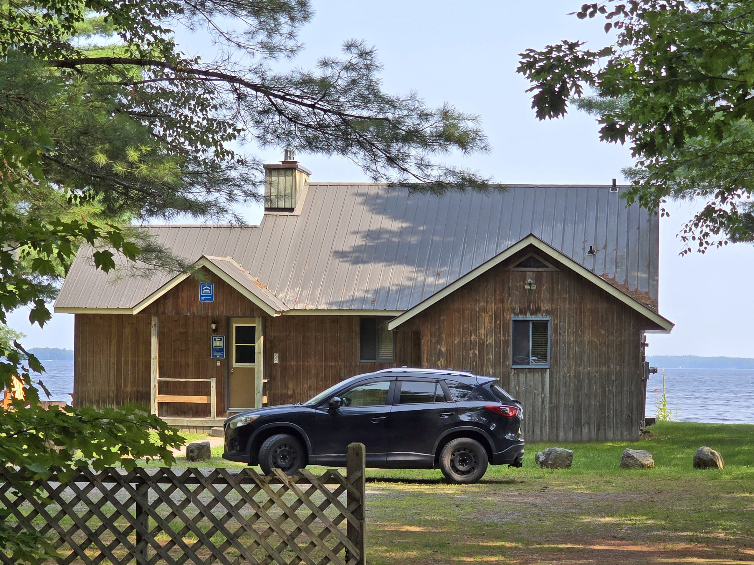
In addition to that, the Fallen Tree cabin is also listed as being barrier-free.

Pets
When we originally posted this review, we said that Bonnechere isn’t the MOST dog-friendly park we’ve been to. At the time, they were allowed to visit, but basically weren’t allowed to do anything but swim at the boat launch.
They’re still not allowed on the main swimming beach - and all the standard rules still apply.
Dogs are required to be on a leash no longer than 2 metres at all times, must be picked up after, and aren’t allowed to make excessive noise or disturb anyone - human or wildlife.
... but at some point since our last visit, Bonnechere Provincial Park added a dog beach AND a dog exercise area!
Dog Beach
The dog beach is located on the far end of the beach, past the boat launch. You just walk a short distance on the accessible trail there, and go out by the Mobimat.
The dog beach is to the left of the Mobimat, and dogs are required to stay outside of the bouyed swim area. They’re allowed to be off-leash, but must be under “effective control” of the owner at all times.
There are probably about 10 picnic tables at the dog beach, as well as a poop baggy dispenser on the sign for the dog beach - but no garbage can nearby.
Dog Exercise Area
The dog exercise area has two paths to it - one from a trail next to site #209 (170 metres), and the other from a trail on the side of the main road, near the garbage and recycling area (110 metres).
The actual pet exercise area is about the size of a campsite and flat, with two picnic tables, and poop bag dispenser but again - no garbage can!
It’s an off-leash dog area, but owners are required to keep their dogs under control at all times.

Row 2 & 3: Dog Exercise Area
Parking
The parking lots in Bonnchere Provincial Park seem more or less amply sized for the areas they’re serving.
The Day-Use area could probably use a bit more parking - it was pretty busy the whole time we were there on our first visit. In fairness though, it was hotter than Satan’s taint during our stay, so they may have had more visitors than normal?
In terms of campground parking specifically...
If I recall correctly, pretty much every campsite we saw had a sign saying that only one vehicle was allowed per campsite.
There were several small parking areas sprinkled throughout the two larger campground areas, though, and the smallest campground area had one as well.
Miscellaneous
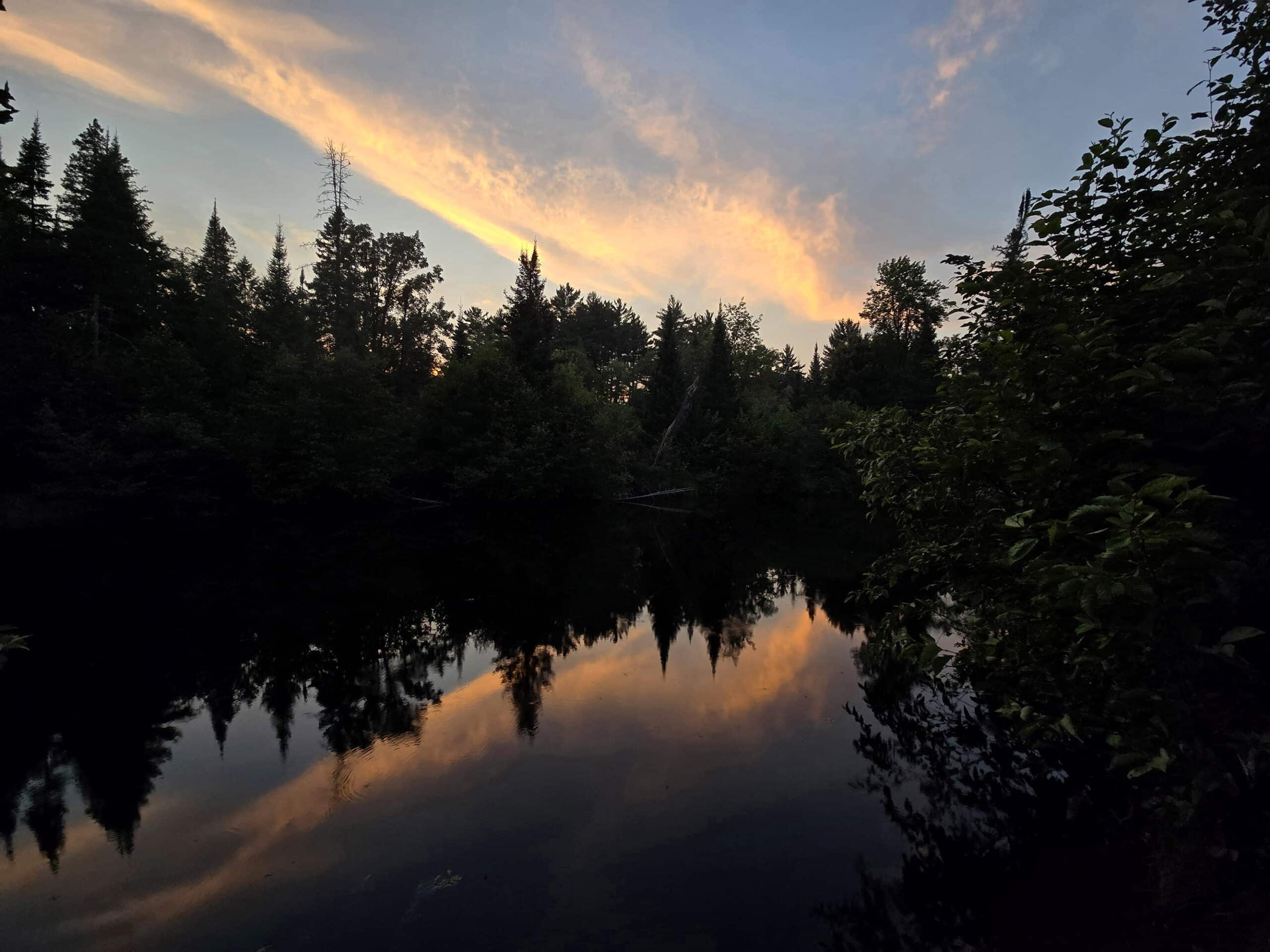
1. The park is in an area of very low light pollution, though there aren’t really any great north-facing views that we could find, in terms of Aurora hunting. Great for star gazing, though!
2. With very few exceptions, we’ve found Ontario Provincial Parks staff to be friendly, but at this park it was... different.
The few park staff we talked to seemed genuinely invested in our opinions of the park, and really seemed proud / to take it personally when we said that we found it lovely.
We actually chatted at length with one employee - Kay - who was *awesome*.
She’s actually the one who told us all about the Rick Hanson award, and you could tell she was really PROUD of it.
We’d told her about the weirdness with the parking at the trail that I mentioned above, and she seemed really keen on looking into it.
Also, we’re pretty feral at this point, so I’m sure we talked her ear off and probably scared her with our weirdness. She was really gracious about indulging our sudden spurt of “HEY LETS BE SOCIAL!”.
Anyway, Kay is awesome, and more parks need a Kay, IMHO.
Campground Amenities & Info
Here’s some basic information on the amenities at Bonnechere Provincial Park:
Creature Comforts
There are two comfort stations in the park.
The main comfort station is fairly centrally located, in between the Tall Pines Campground and the Day Use Area. This one is barrier-free, and has flush toilets, laundry facilities, and showers.
Specifically, there are four individual showers, plus a wheelchair accessible shower on top of that. There are also two gendered, multi-stall washrooms with an accessible stall at the end.
Interesting note about the laundromat: The two washers, two dryers and a folding table are located *outside*. We hadn’t seen that before our first stay at Bonnechere, and have only seen it once or twice since!
Something that might be new since our last stay are the electronic charging stations, located between the two sets of laundry machines.
There are a few power outlets out in the open (with covers), as well as a set of reservable, lockable cubbies for charging, below.

From the outside, it just looked like an oversized outhouse, but it was so much cuter inside than I actually expected!
It's all wood panel, and it kind of feels like you're walking into a like a sauna building at a spa. (There's no sauna facility and it's not super steamy or anything like that, just the vibe!
Super cute. Anyway, the toilets in there are flush toilets..

There’s also a small building with 2 composting toilets, next to the boat launch.

Bottom: Vault Toilets
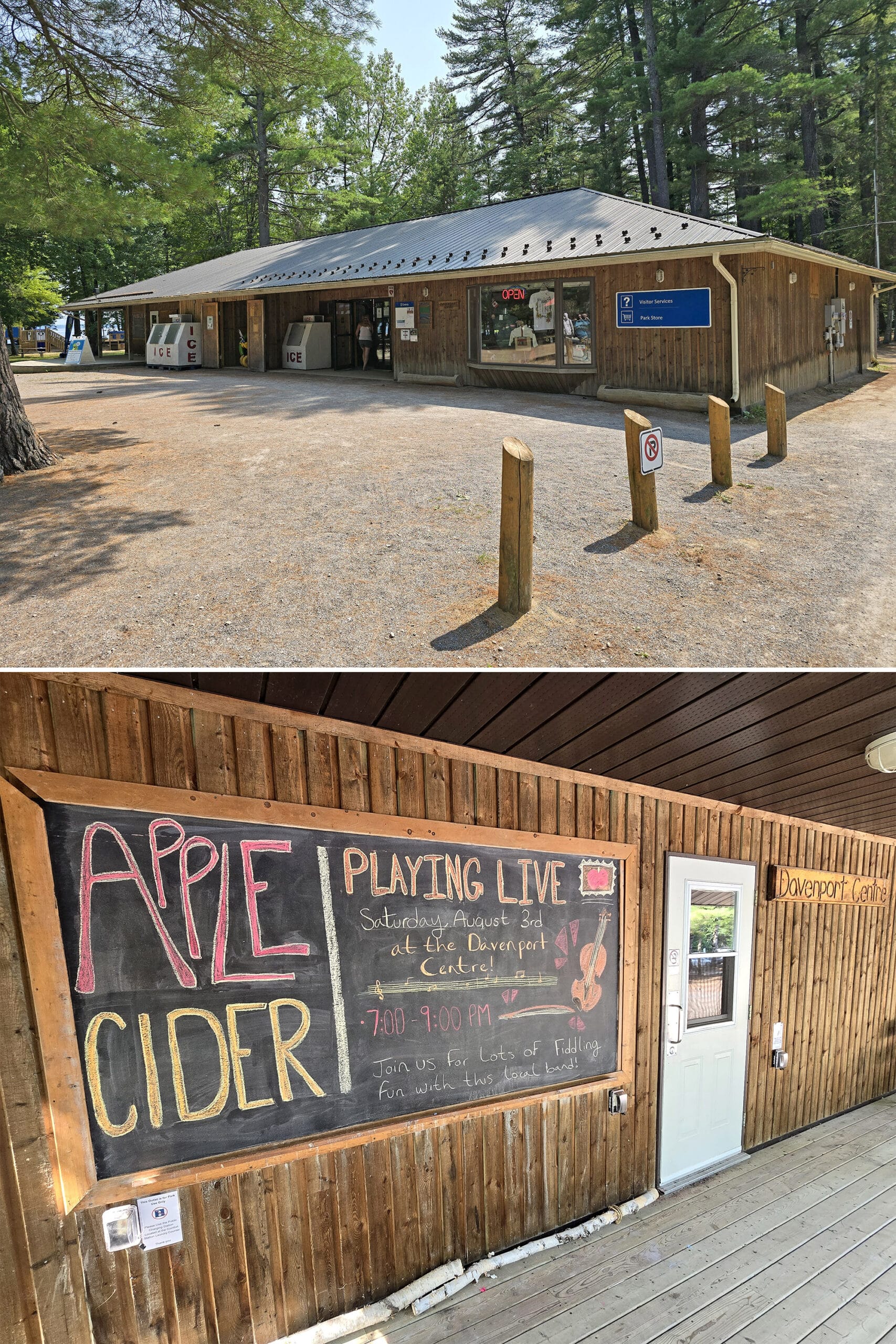
Park Store
The park store is located in the day use area, and shares space with the visitor center - it’s also where people who didn’t pre-register their vehicles have to check in for their campsite.
It’s a really cute, well-appointed shop, across two large-ish rooms.
They sell the usual drinks, firewood, ice, Ontario Parks merchandise, snacks, etc, as well as camping supplies, Friends of Bonnechere Parks merchandise, and a fair amount of reading material as well.
They have some bougie items like body scrubs, and an impressive selection of groceries, including some things we’ve definitely never seen in Provincial Parks stores - like frozen chicken burgers.

Visitor Centre
The Visitor Centre is called the Davenport Centre, and it’s located on the end of the Park Store.
It was closed the times we visited the area, but we liked the set up - the deck in front of the door extends out to form a kind of stage, and there are several picnic tables arranged below, for the audience.
Anyway, this is where they host some of their Discovery Programs and special events, where people can learn about the rich Ottawa Valley history, both in terms of cultural history (especially with regards to First Nations people), as well as natural history and current natural features of the area.
At the time of our first visit, there was a big chalkboard sign on the outside of the Davenport Center, advertising an upcoming event with live fiddle music performances and apple cider!
Unfortunately, it was scheduled for after we left. Boo - it sounded like fun!
Day Use Area
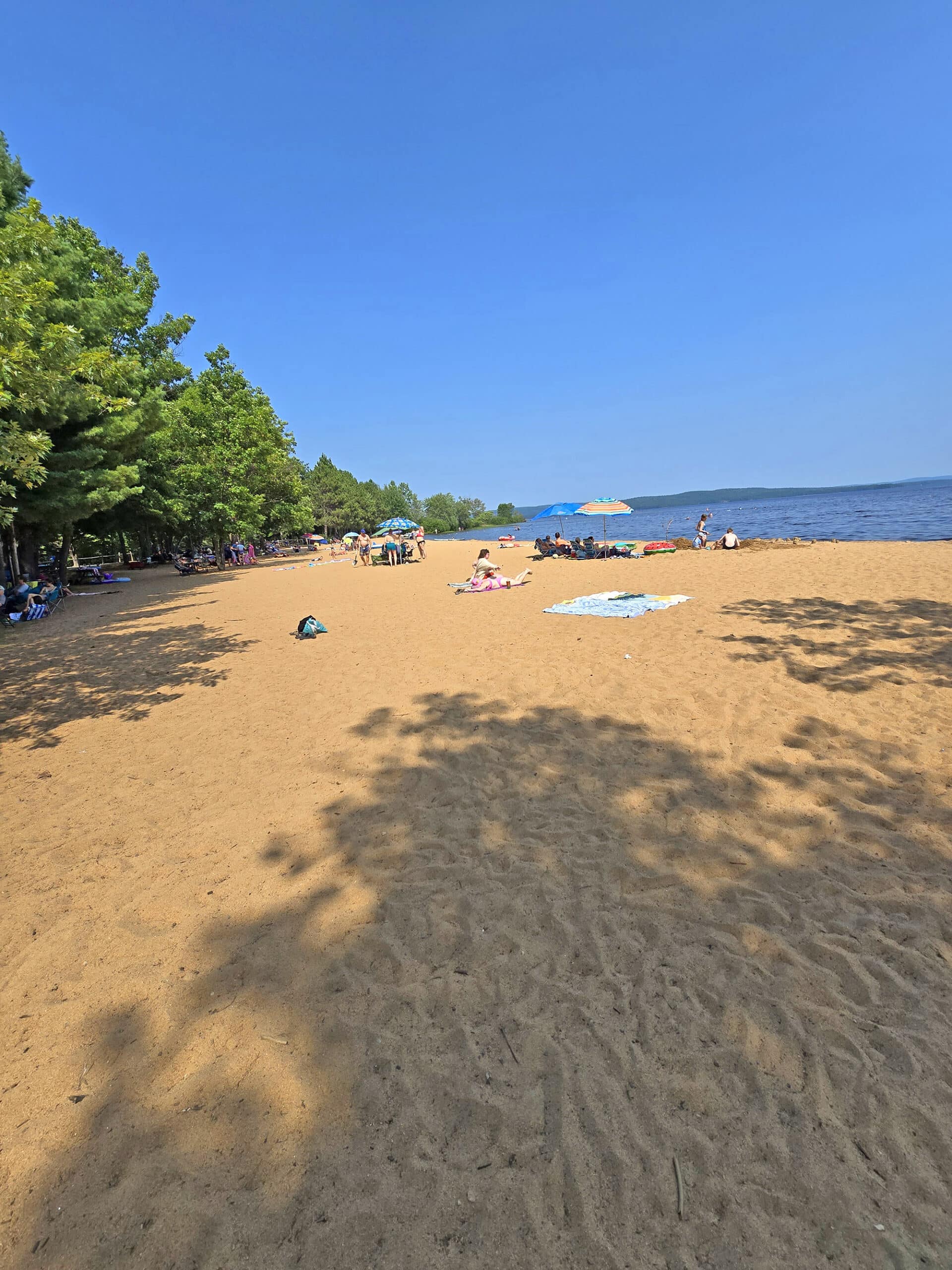
The day use area at Bonnechere Provincial Park is REALLY well appointed, and all in really great condition.
This was where we really started forming our opinion that Bonnechere seemed really *thoughtfully* appointed and maintained.
The first thing we noticed were all the little “extras” - activity areas that sometimes exist in other campgrounds, but definitely aren’t a default.
Also? They’re usually in disrepair, and - a lot of the time - seem to be completely forgotten and abandoned.
Here, there’s a beach volleyball area, a basketball court, a horseshoe ... pitch?.. and a playground, all in really good condition *and were being used*!
There was also basically a “Little Free Library”, though it was called a “Book Tree” - a large “tree” with library cupboards low down, and an overturned canoe overhead.
Super cute!

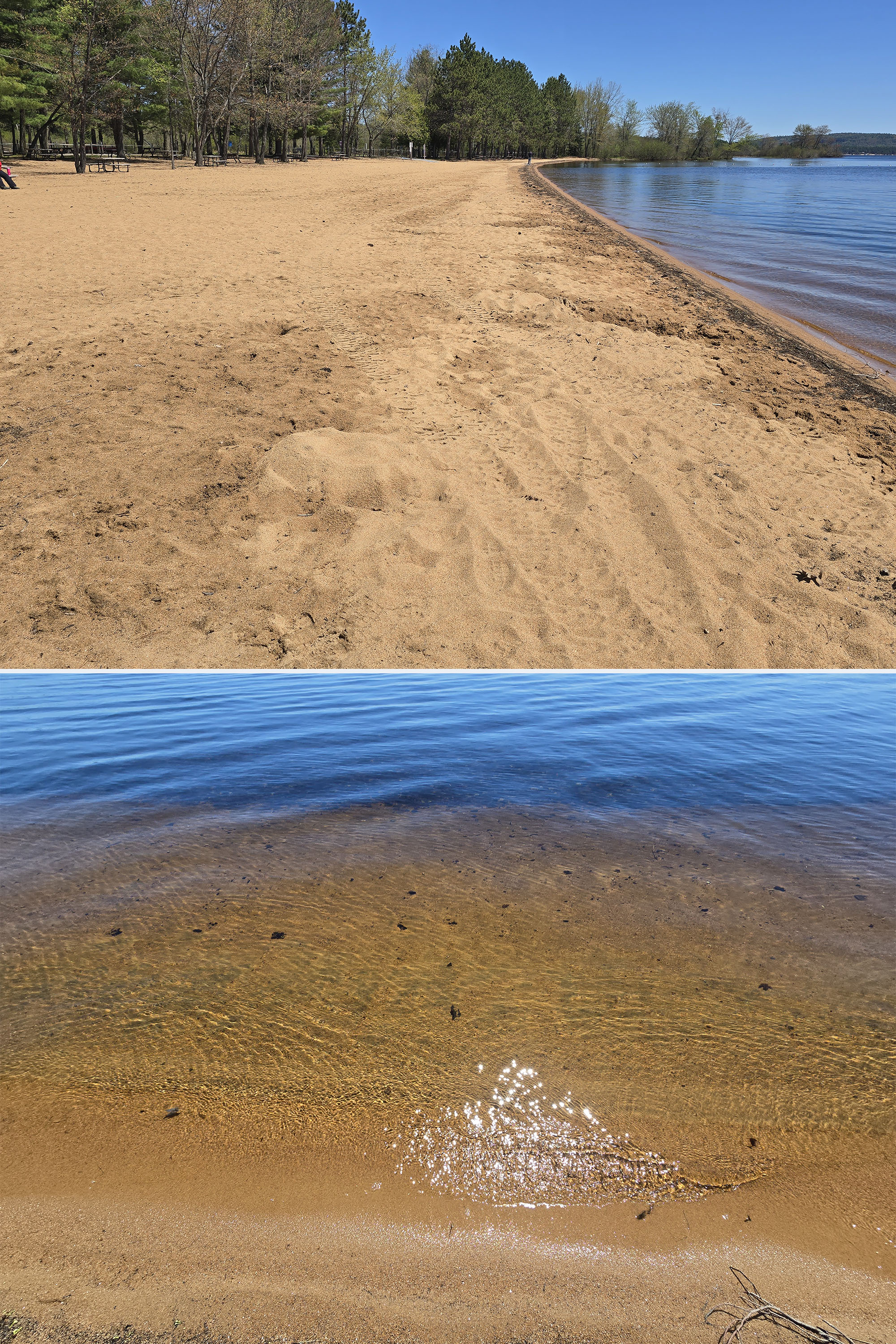
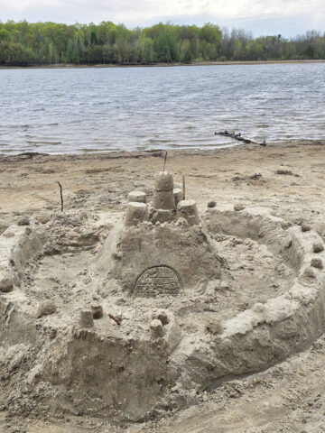
The sand was a different kind than we normally see - darker - and seemed clean. The swimming area itself was bouyed off from the rest of the lake.
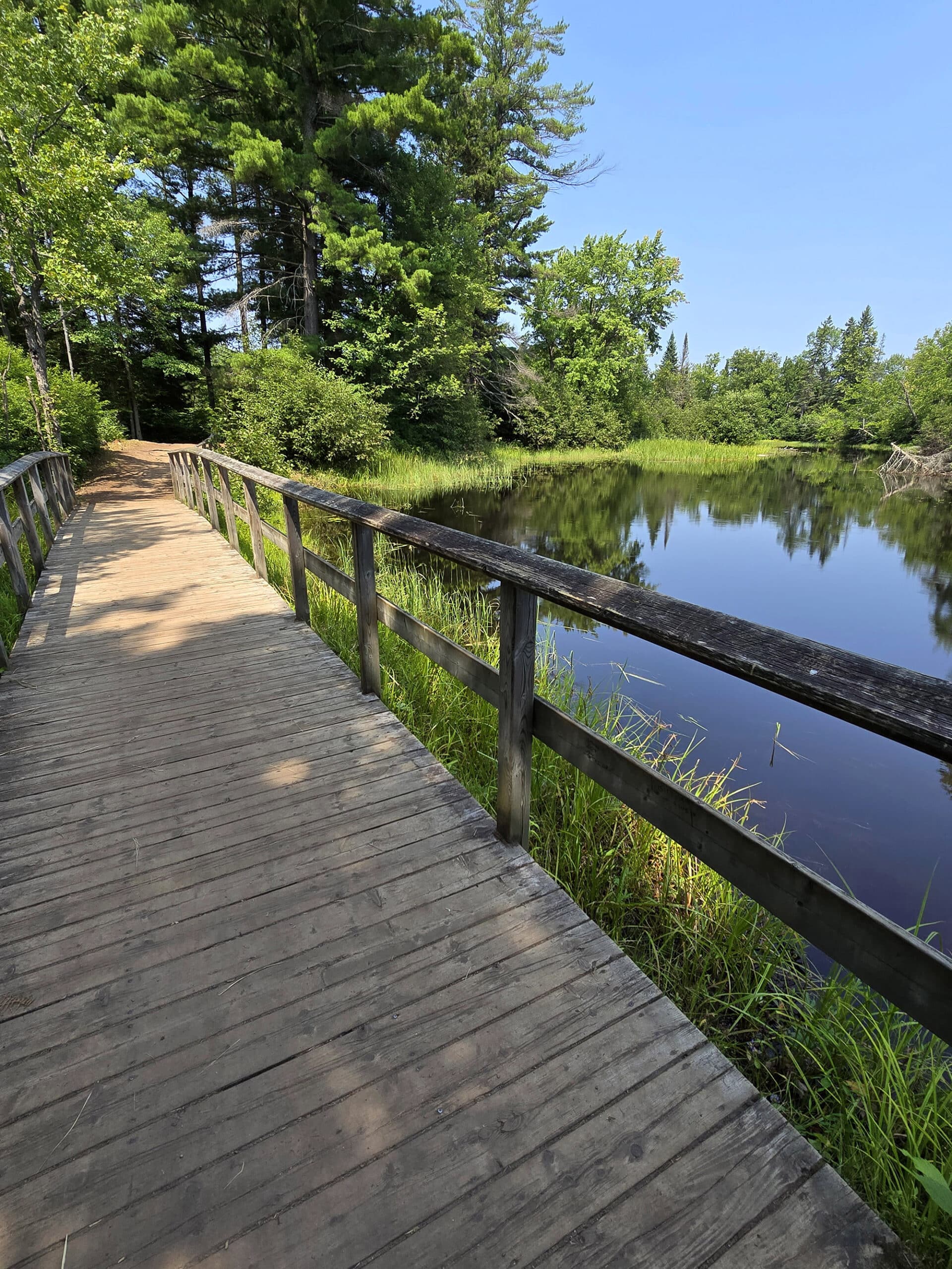
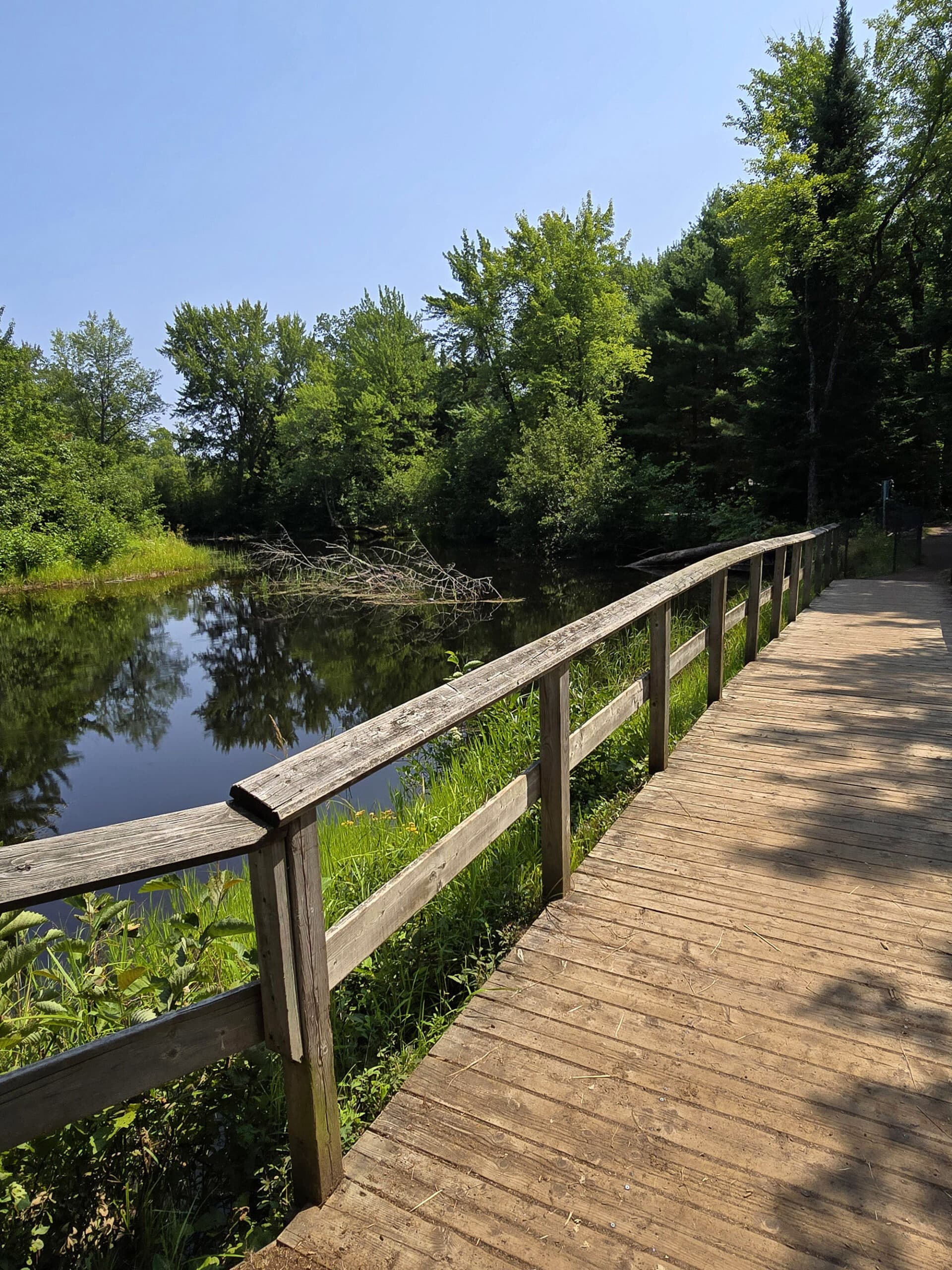
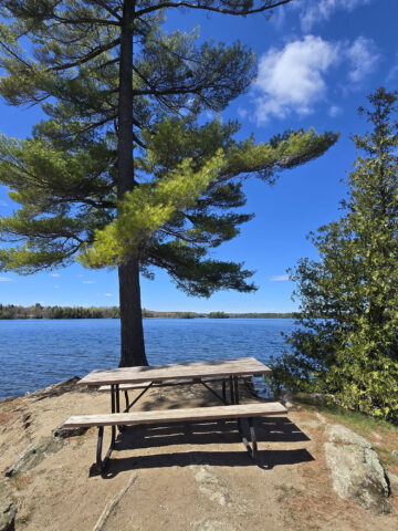
There’s a short boardwalk with a bench, picnic tables everywhere, and it’s just a really nice day use area in general.
Lovely!

Rentals
Bonnechere Provincial Park has a ROBUST rentals offering!
In terms of watercraft, they have canoes, Corcls, Kayaks (including kids kayaks), stand up paddleboards, pedal boats, and even tandem kayaks - we didn’t see those, though.
In term of accessible equipment, they have the aforementioned all-terrain and water wheelchairs, as well as the newer offerings of adaptive canoe and kayak rentals. (See the accessibility section - above - for more info!)
The park also has extension cords available to rent - both 30 amp and 15 amp.
As a note: They don’t take reservations for rental equipment, it’s all first-come, first-served.
In addition to the actual rentals, they have equipment to borrow, as well!
Like many parks, you can borrow personal flotation devices. I didn’t see any mention of it at Bonnechere, but parks usually require $25 refundable deposit for that.
A sign outside of the store invited people to come inside to borrow from a range of sports equipment they have available, free of charge: basketballs, badminton rackets, footballs, frisbees, horseshoes, soccerballs, and volleyballs.
Finally, there is fishing equipment available to borrow, through the TackleShare program.

Campsite Details
There are two main types of camping areas in Bonnechere PP - actual campgrounds, and a few roofed accommodation offerings.
Car Camping
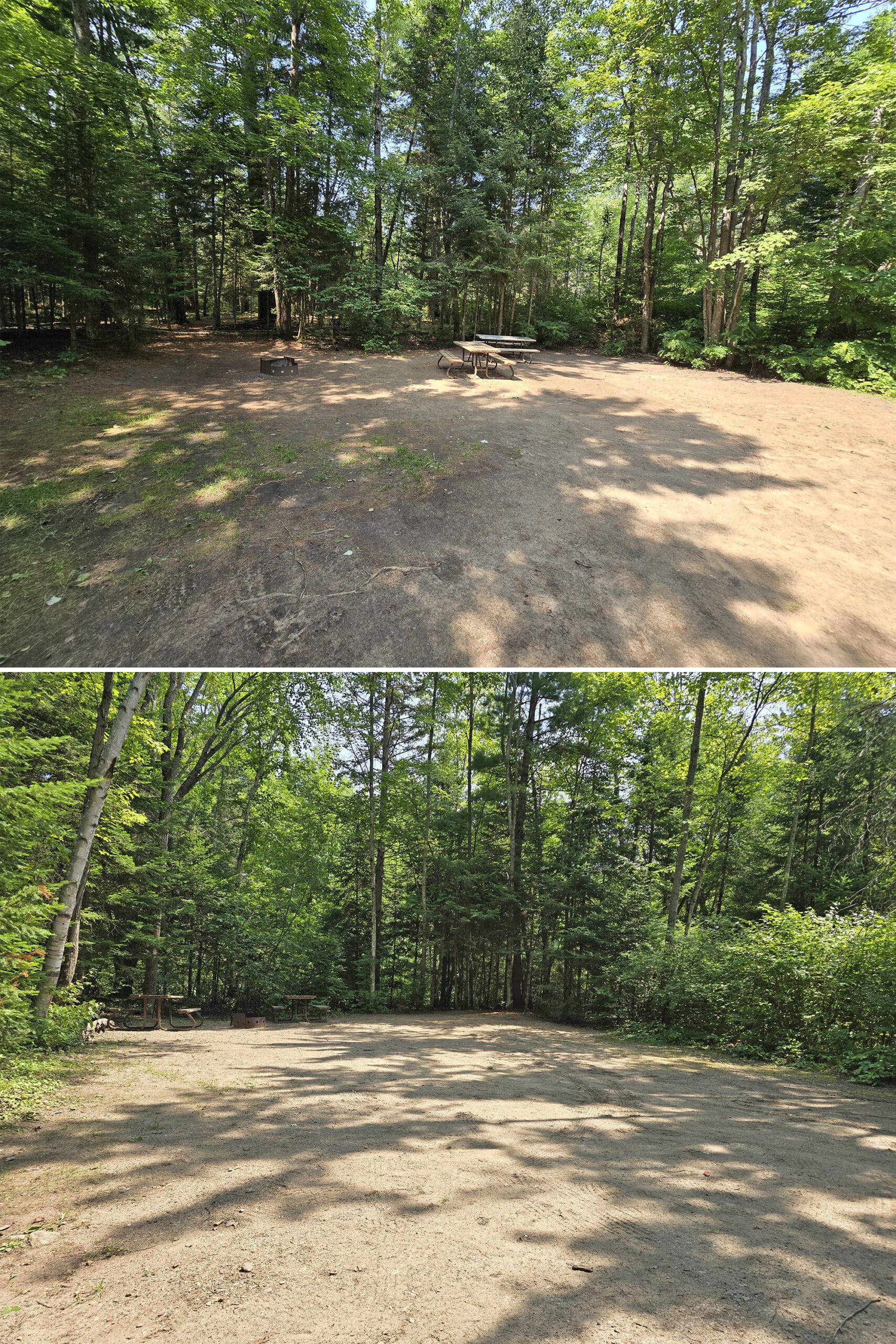
There are three campgrounds in Bonnechere: Tall Pines, River Loop and Sandy Flats. Each have water taps and vault toilets scattered throughout, but differ in other ways.
Weirdly, most/all of the campsites seem to have 2 picnic tables - most we’ve seen at other parks have a single picnic table.
Anyway...
Tall Pines is the only campground with electrical sites, and it’s the closest to the comfort station. Only 40 of the about 60 campsites in this area are electrical, though - so it’s hard to reserve one!
It’s only a short walk from the day-use area, beach, and visitor centre - about 5 minutes from the furthest site in the campground.
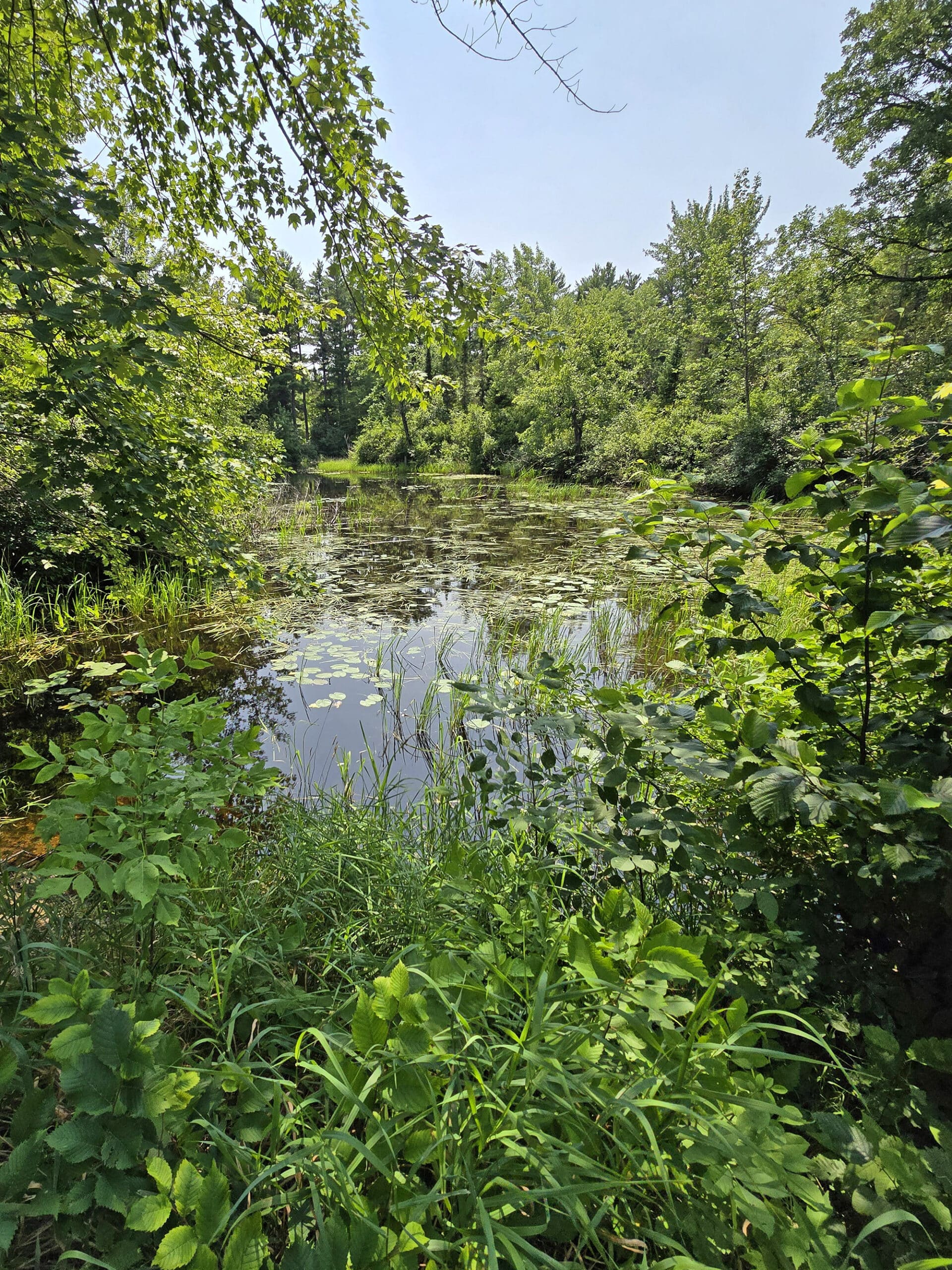
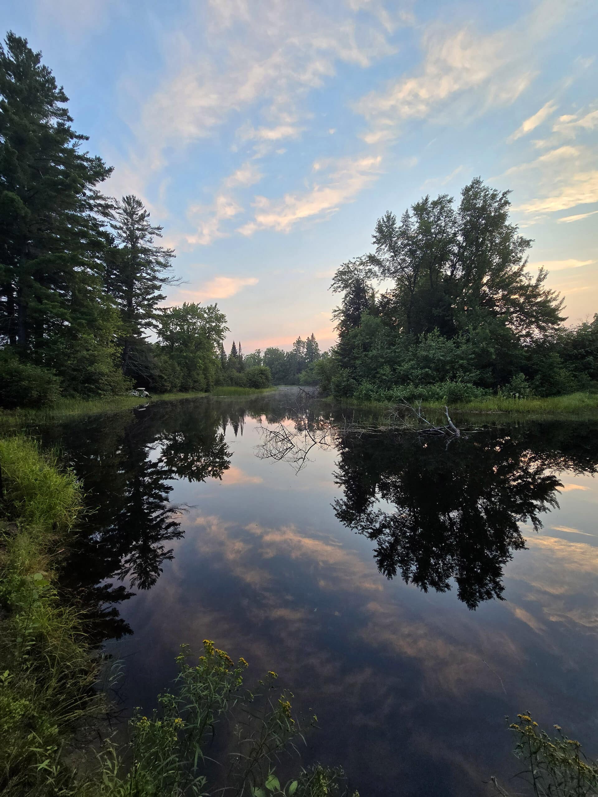
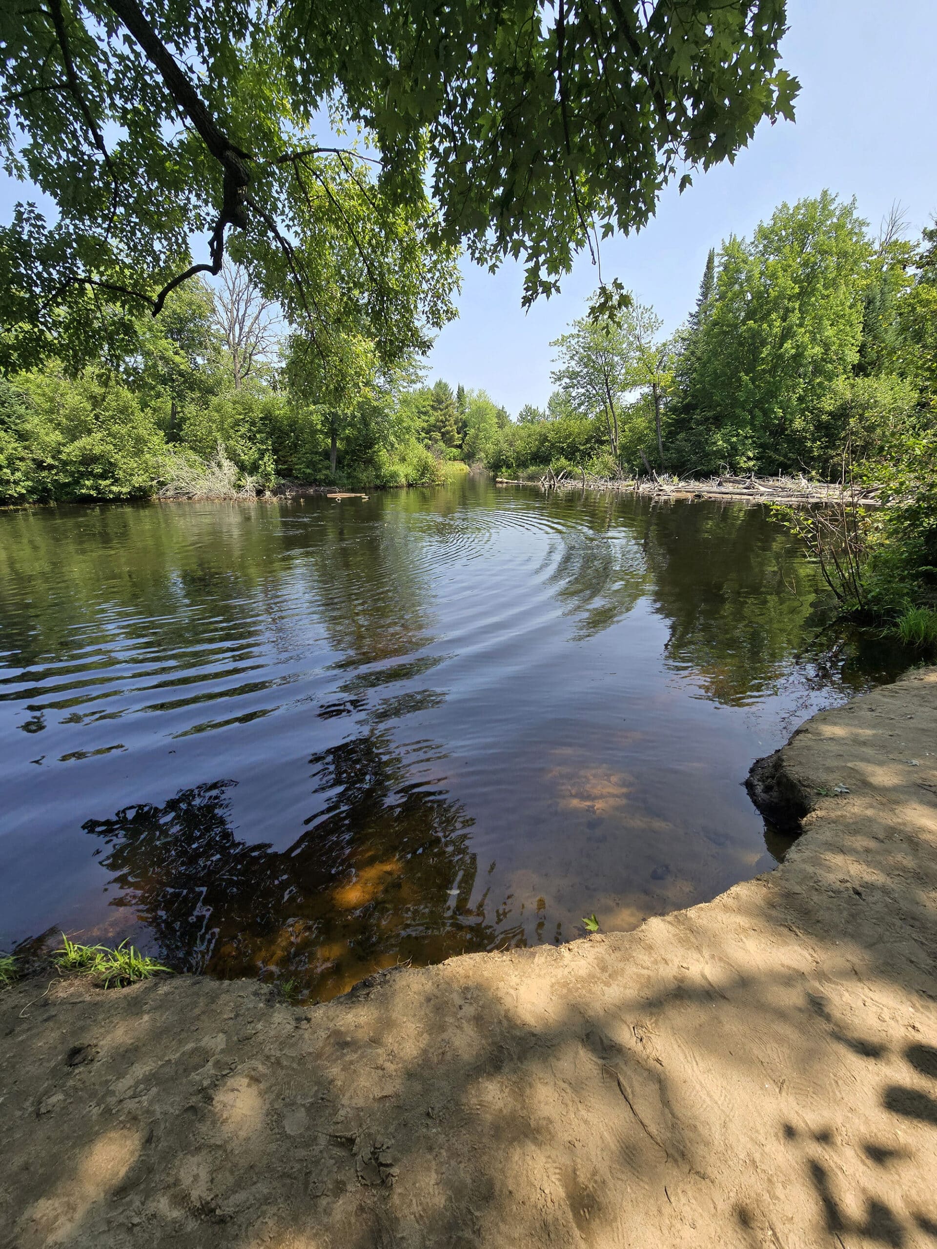
None have electricity, but a LOT of them back onto water, whether the Bonnechere River itself, or a little pond in the middle of the campground.
Also: We saw several sites that had boats in the water, right at their site. These were all occupied, so we’re not sure if there were actual docks, or if they were pulled up on shore or whatever.
Anyway, as with the Tall Pines Campground, these sites are also about 5 minutes from the day use area.
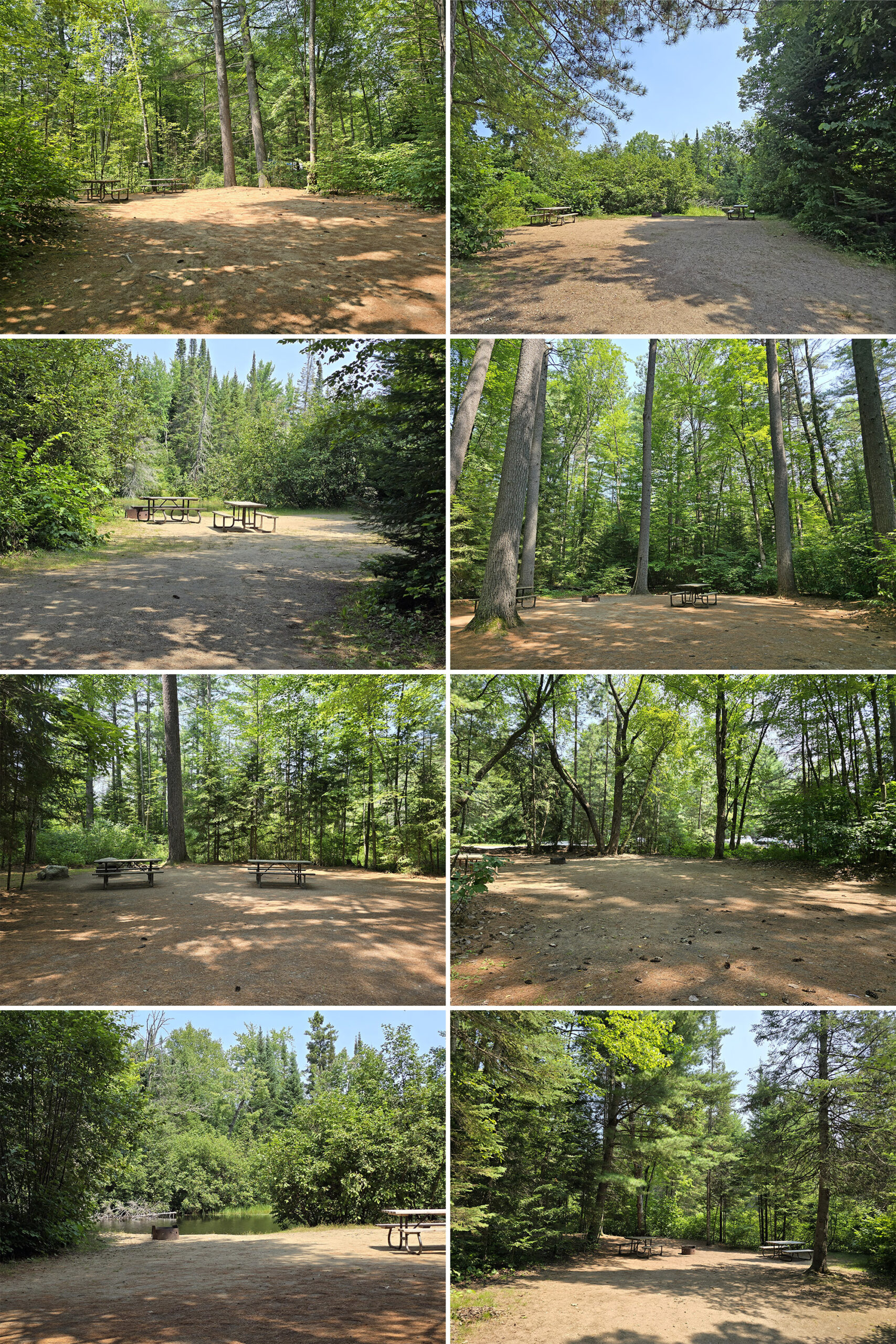
All the sites there are smallish, non-electic, AND radio-free.
It’s also apparently a generator free campground. I didn’t see anything about that on the website, but the campground newspaper and signage says as much.
Roofed Accommodation
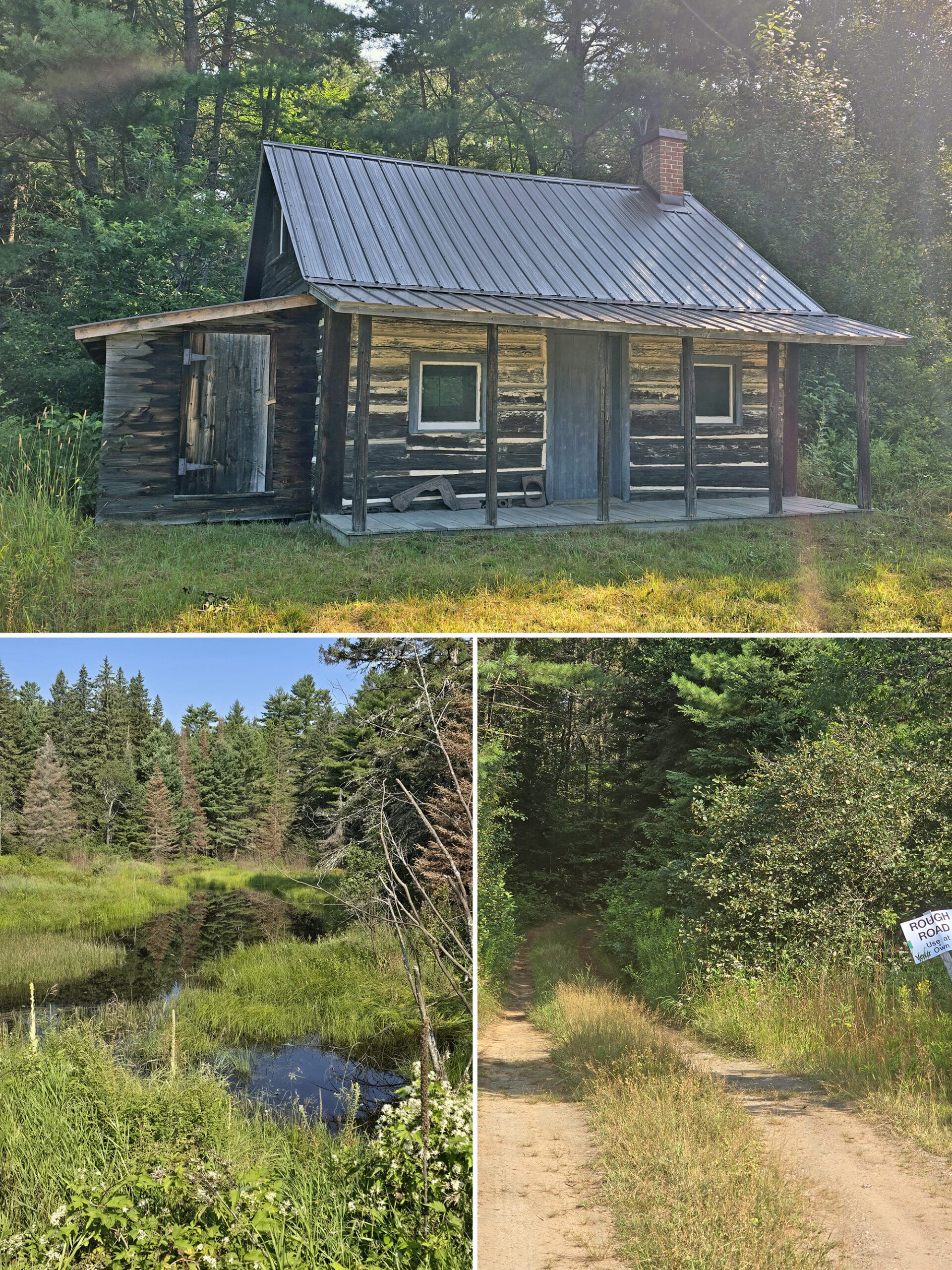
There are two different types of roofed accommodations offered at Bonnechere Provincial Park: “Rustic Cabins”, and a Cottage.
Rustic Cabins
There are 5 “Rustic Cabins” in the park, located a bit away from the main park area, on its own road.
These are SUPER cute, and each are located right next to the river. The rental fee also includes the use of a canoe, so that’s cool.
At least one of the cabins is barrier free - that we saw. Two are marked barrier free on the map, but the website only mentions one as being accessible.
Anyway, these don’t have running water and don’t allow pets, so ... not an option for us.
Too bad - they’re super cute, and I LOVE the whole patio set up they’ve got going. It’s got to be super quiet and peaceful!
The Pine Shores Cottage
The cottage is a lakeside one, right on the shores of Round Lake.
It’s built and trimmed in pine and sleeps 6, over 3 bedrooms.
One bedroom has a queen sized bed, another has a bunk bed with a double bed on the bottom and a single bed overhead, and the third bedroom has a bunk bed with single beds for both top and bottom.
It sounds really bougie in terms of provincial park accommodations: A walk in shower, provided firewood, an what sounds to be a private swimming area on the beach.
It also includes a canoe!
Unfortunately, pets aren’t allowed... so it’ll never be an option for us 🙁
Share the Love!If you’ve made one of our recipes, be sure to take some pics of your handiwork! If you post it to Bluesky, be sure to tag us - @2NerdsInATruck, or you can tag us on TikTok, if you’re posting video. We're also on Pinterest, so you can save all your favourite recipes and park reviews to your own boards! Also, be sure to subscribe to our free email newsletter, so you never miss out on any of our nonsense. Well, the published nonsense, anyway! |
Entertainment and Activity
I’ve already gotten into the various activities in the day use area - Basketball, Volleyball, Horseshoes, etc - but there are even more things to do, throughout the park.
Here’s what you need to know:
Hiking
The hiking set up in Bonnechere Provincial Park is a little weird.
The site mentions one trail in the park, as well as a series of 9 trails NOT in the park - but vaguely, and without much info.
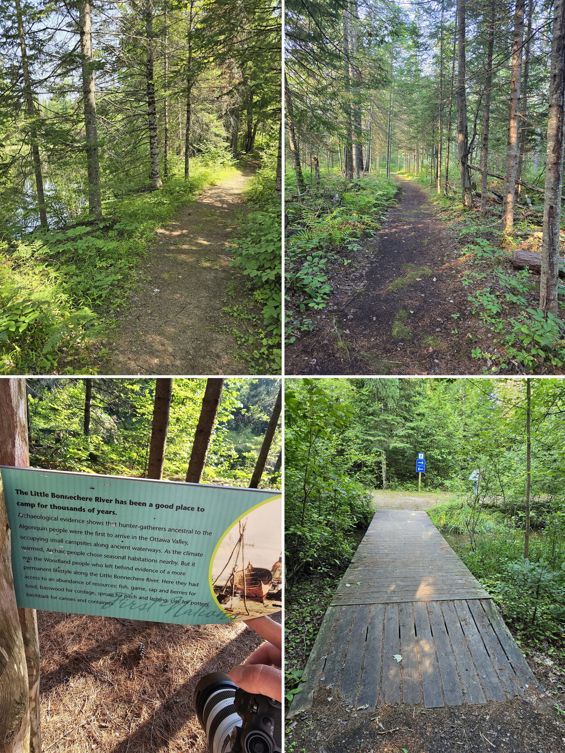
There are actually 3 trails within the park - all of which give different experiences from each other, and provide a lot of opportunities to learn about the history of the area, along the way:
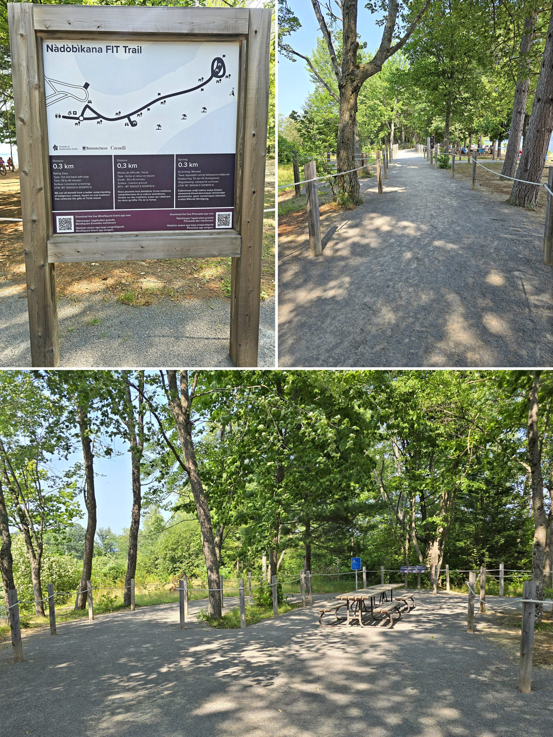
Nadobikana FIT Trail - 0.3 km, Easy
Formerly known as “Water Front Trail”, this is a wheelchair accessible path, located in the day use area - near the boat launch.
It’s really short, wide, and well packed - just a short little trail leading along part of the beach, with picnic tables at the end of it.
Along the way, there are several informational, trilingual plaques (English, French, and - I THINK - Ojibwe) with printed information about the history of the area, and QR codes to access a self guided tour.
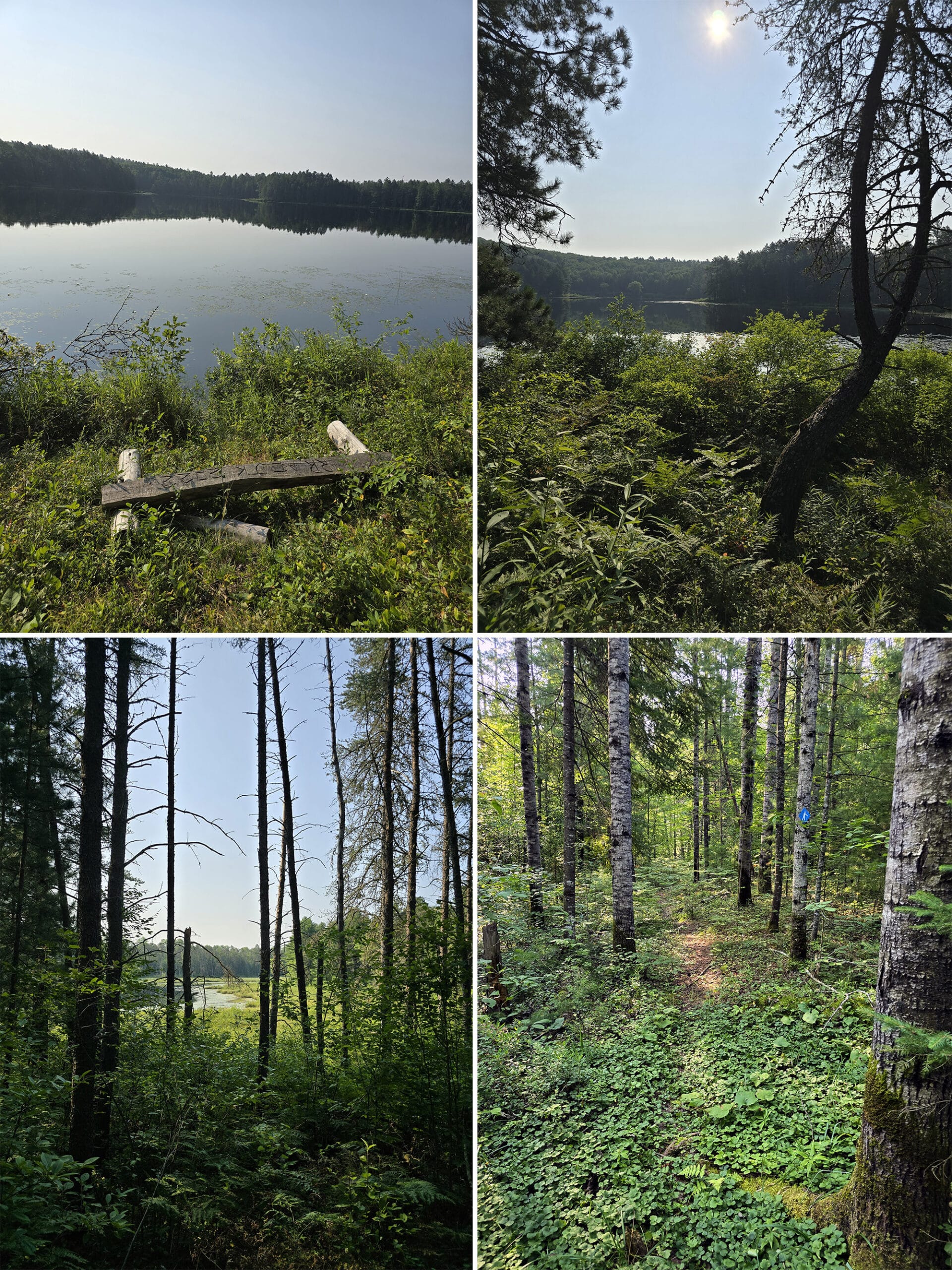
This mostly gives you a view of the beach, with a little bit of an outlook towards the river.
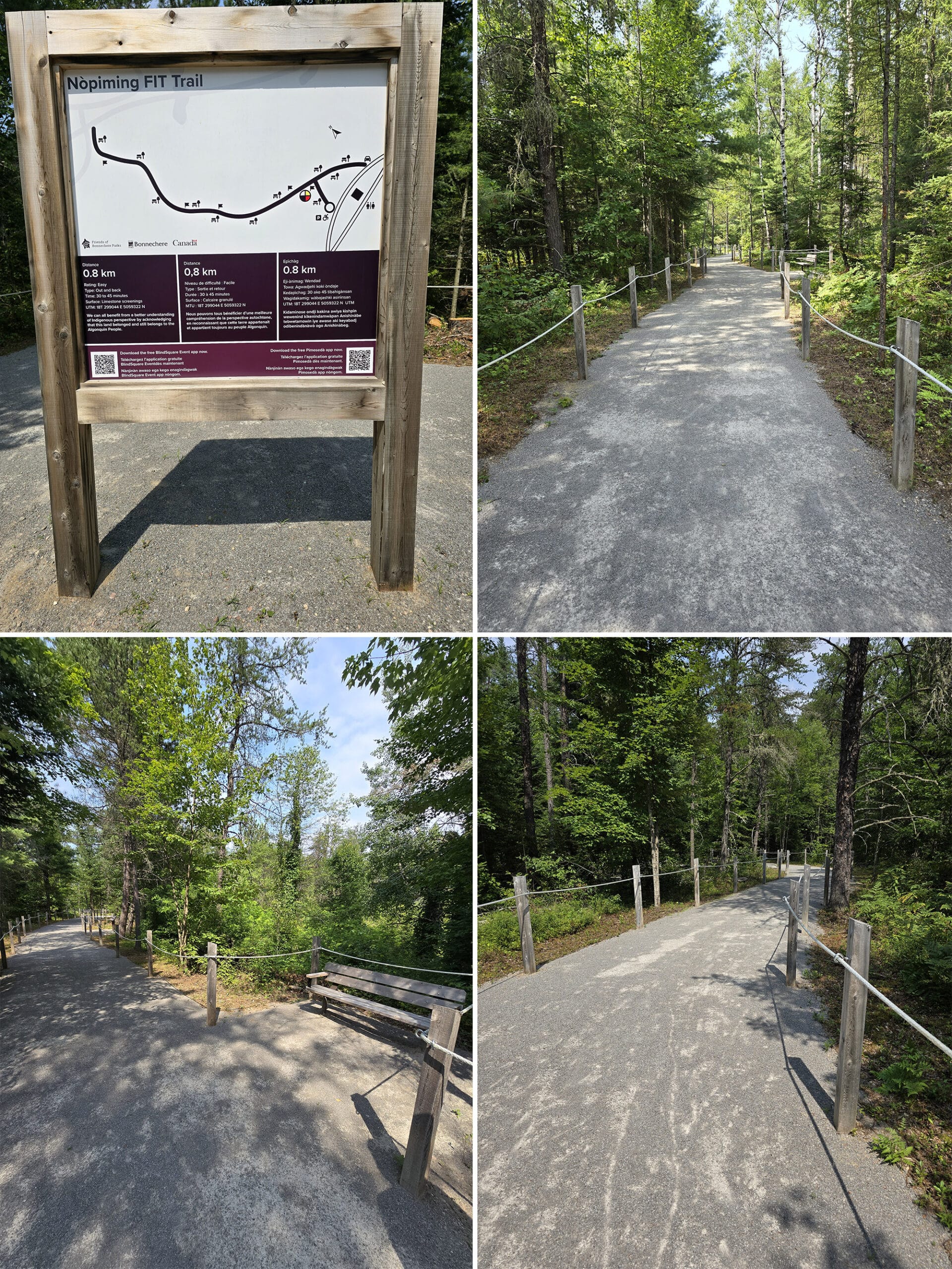
Nopiming FIT Trail - 0.8 km, Easy
Formerly known as “Woodland Trail”, this is a wheelchair accessible path, located near the gatehouse.
Basically the same as Nadobikana, just a bit longer and in a different setting. It has the same format - wide, well packed, accessible, and lined with informational plaques.
While Nadobikana mostly gives a beach view, this one goes through the woods. It was actually pretty good for birding - it’s where we saw one of the broad winged hawks we saw during our stay!
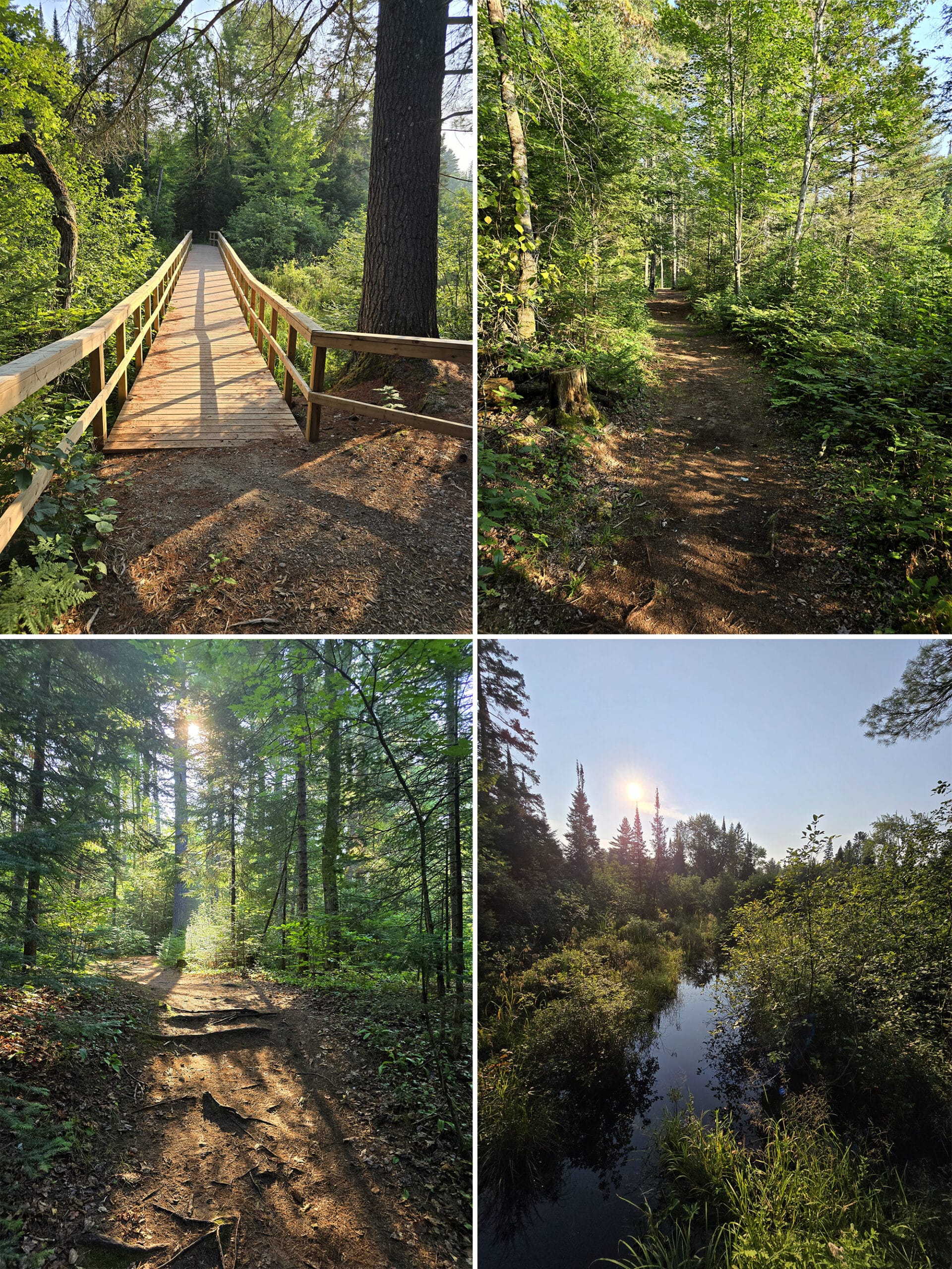
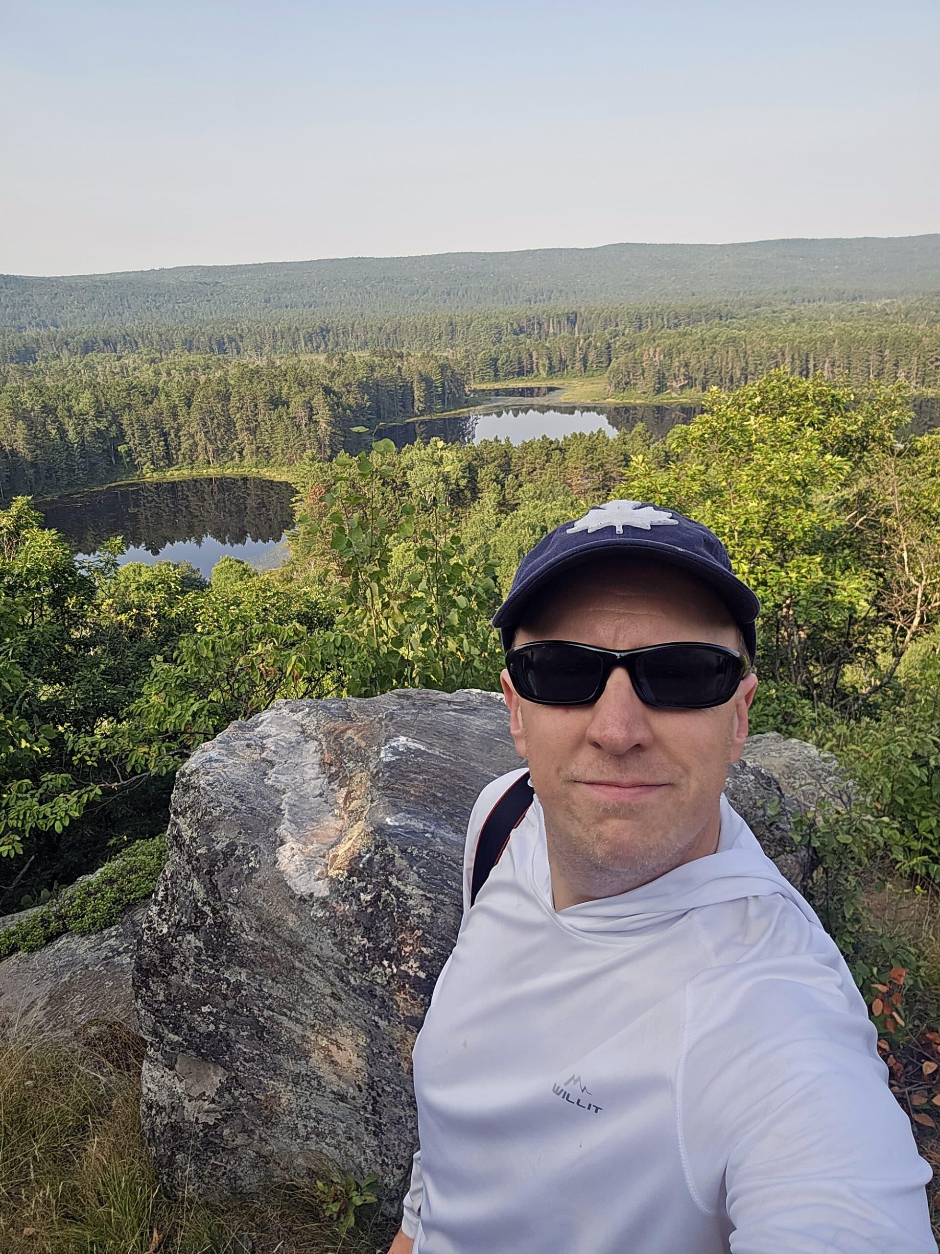
Footprints in Time Trail - ~2.5 km, Easy
This one is either currently (signage) or formerly (map and website) called with the McNaughton Trail or the McNaugton Trail, depending on whether you’re looking at the site description or the signage in the park.
The website says it’s 2 km long and easy, the signage says it’s a 2.5 km loop trail. It’s probably at least the 2.5 km - maybe slightly longer - and has a few different access point.
Anyway, this trail seems to have been the first “FIT Trail” in the park, or “Foot Prints in Time”. The info says it was designed based on a traditional local First Nations way of teaching.
Along this hiking trail are 12 (map) or 13 (website description) “Foot Prints”, which are posts that have pull out panels with educational text.
At one point you walk right up to one of the cabins, which feels a bit intrusive, but I imagine it's great to have trail access if you're renting that cabin.
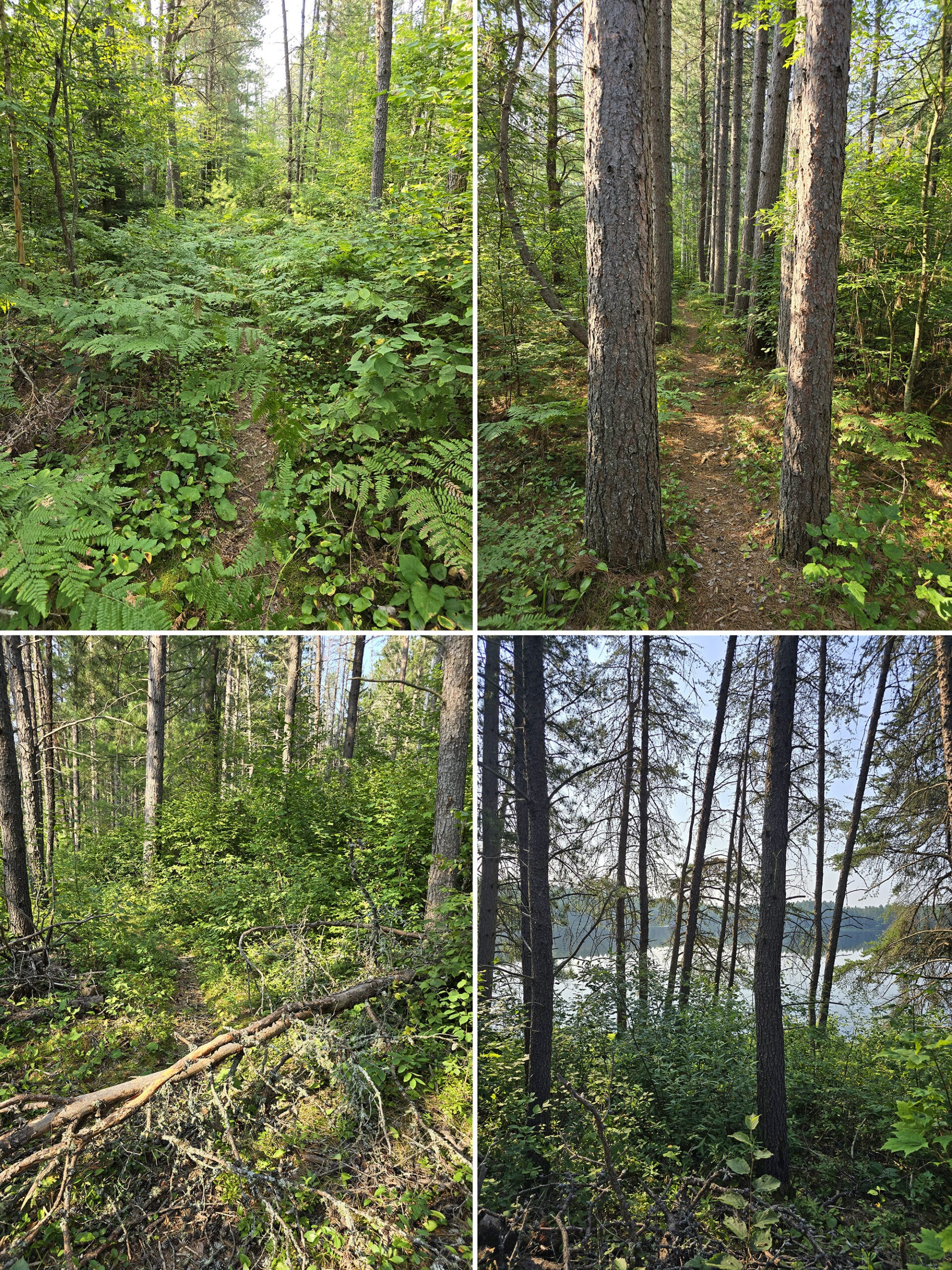
There's a variety of forest types to keep you entertained, tall pines with a sparse floor, to young and dense trees and bushes where you climb short hills using roots as steps.
Keep an eye out for the swing-out signs with interesting facts.
I'll definitely be back to this trail, as it was the first time I got to see an Evening Grosbeak - but only fleetingly. I need to go back to get pictures!
This trail is easy, with only short inclines/declines in some places.
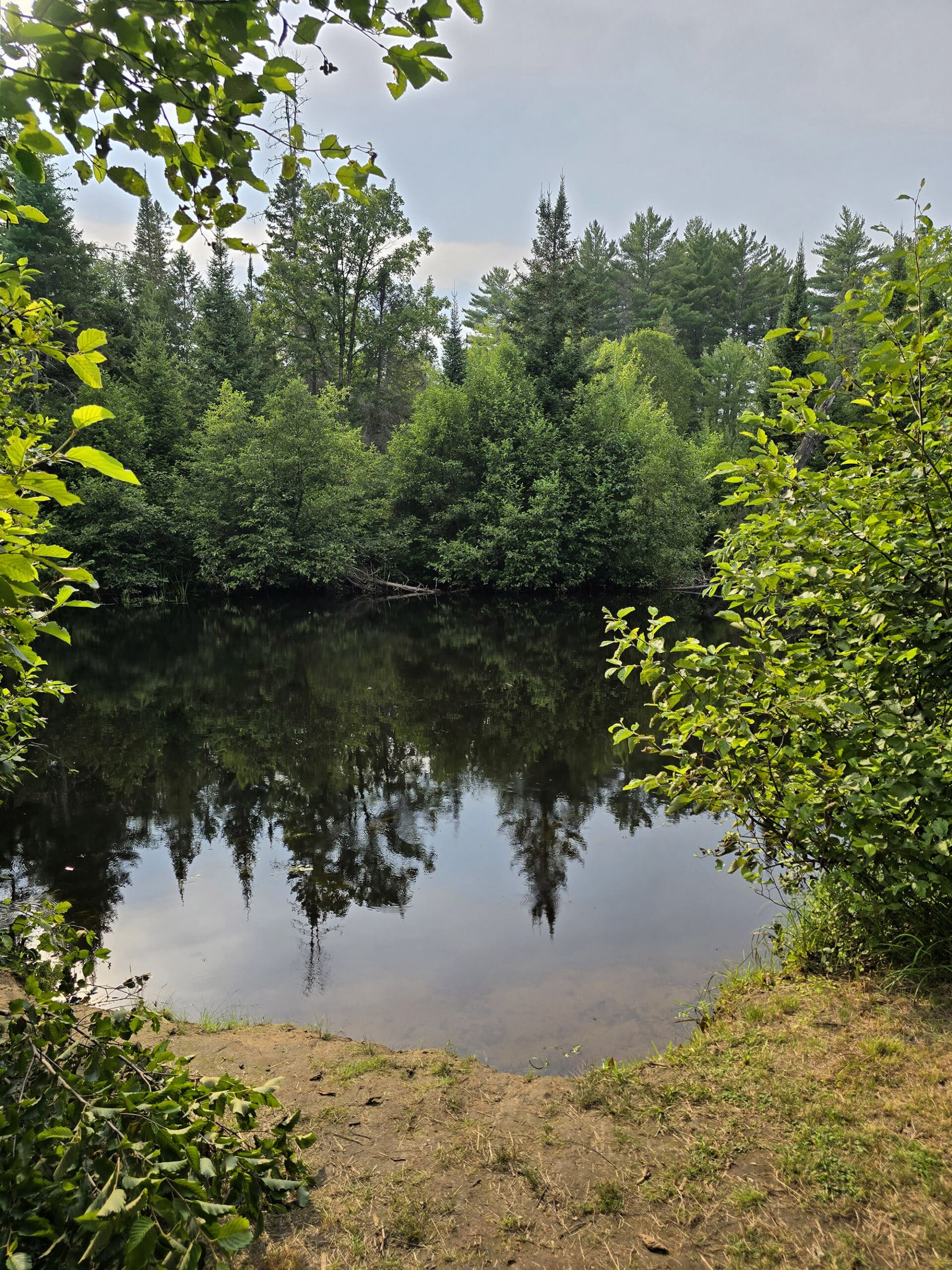
Walks of the Little Bonnechere River - Varied Lengths & Difficulty Ratings
What I didn’t realize when getting ready for this trip, is that the Walks of the Little Bonnechere River aren’t actually in the main park - they’re all out along a couple logging roads nearby
Well, nearbyISH. As Porter put it: “Nearby in the ‘Algonquin Provincial Park’ sense, maybe!”
Trying to find these local trails was definitely frustrating. First, you have to buy a booklet - $7 - for any information at all about them.
Then, once you do buy the booklet, you’ll find that the information provided is almost completely useless, given the logistics involved.
There’s a map with the locations marked, but it’s a topographical map. The ridges and such take center stage, barely any roads are listed, really difficult to figure out where you are. Also, it doesn’t seem to match Google Maps very well.
So, you know, when it says “Follow X road”, maybe they’ll know which instance of this road he’s talking about. Several of the logging roads - and offshoots of the same - all have the same name.
Finally, there’s the matter of coordinates. They’re listed in UTM, which we had to Google - we’d never seen that format before.
It’s also a format that you can’t use in Google maps without using converters - which added several layers of frustration, especially given the internet situation in the park.
There’s also NO cell reception for the majority of the area of road you’ll be traveling on to reach these trails, AND we lost GPS in a few places.
Not super fun.
Anyway, here’s a bit of information we were able to put together on the trails we did find:
Omanique’s Mill - 0.5 km, Easy
Trail Head: Couldn’t tell you. Not sure it exists.
This was the first trail we started with, and - after driving around logging roads for an hour without a GPS signal, we gave up.
The directions tell you to “Follow White Mountain Chute Trail to Omanique Mill Road Sign”, and to park on the left at that point, on the concrete footing.
There were several instances of White Mountain Chute Road, for one. I tried to use both the very zoomed in section of map on the trail page, AND the topographical map at the front of the booklet for clues as to where this was.
I even consulted AllTrails, nothing.
We got to the point that I was pretty sure they were talking about... nothing. We couldn’t find the road sign, a road CALLED that, or concrete footing anywhere in the area, much less a marked trailhead.
Gorgeous drive, though. Driving along whichever version(s?) of White Mountain Chute Road we were on took us along several lakes, with beautiful early morning views.
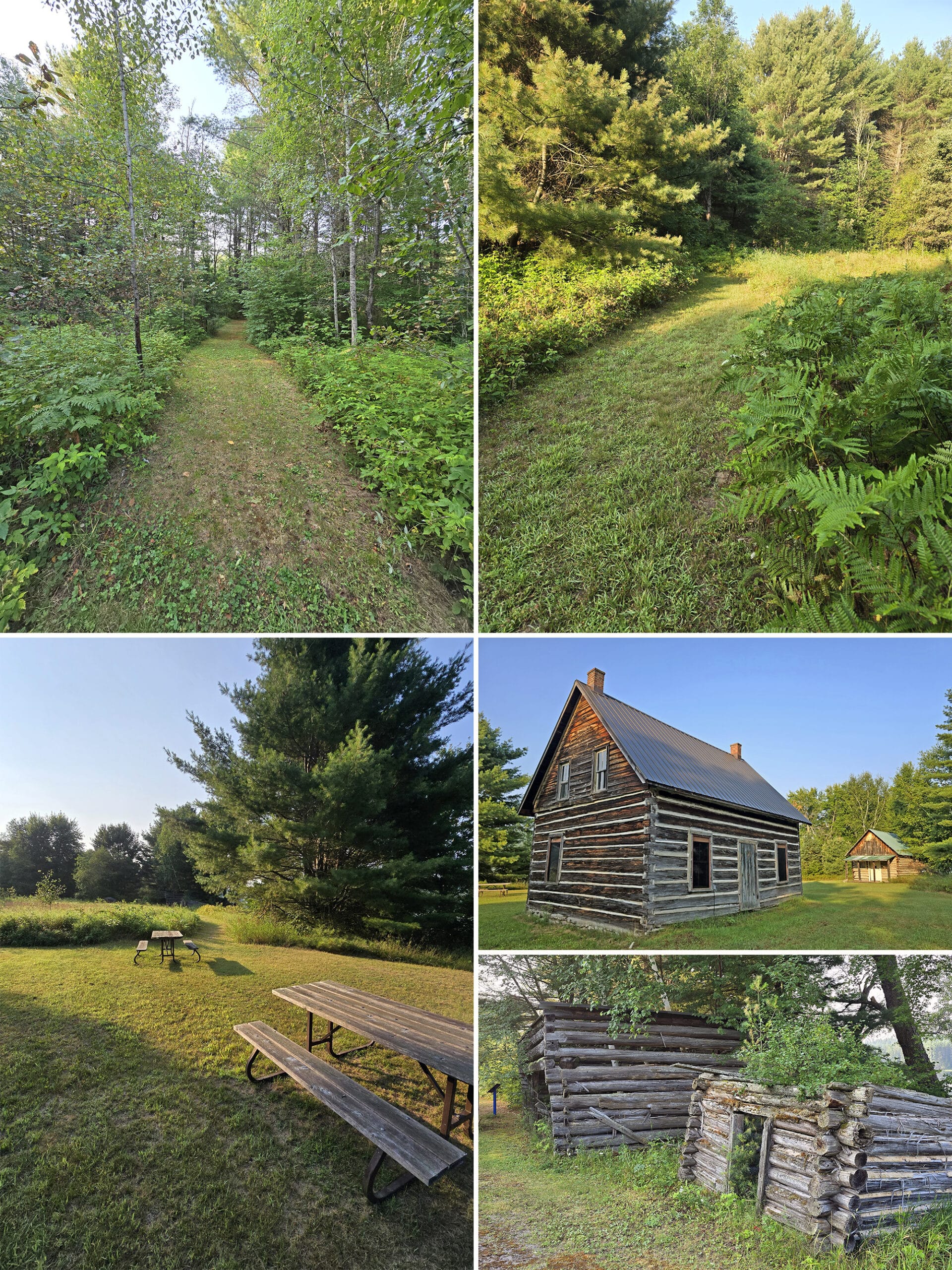
LaFleur Homestead - 0.6 km, Easy
Trail Head: We Googled “Lafleur Homestead” and found it on Google Maps, mapped right to it.
This is a short, easy trail through grass that leads to - you guessed it - the LaFleur Homestead.
We walked along the house - a small log cabin style house, and a wooden shelter building.
We love seeing old structures, how they're built and how they age, but this didn't provide much in the way of things to look at.
We ended up more interested in the warblers that were jumping around the pine tree, before heading out in hope of finding the next trailhead on the list!
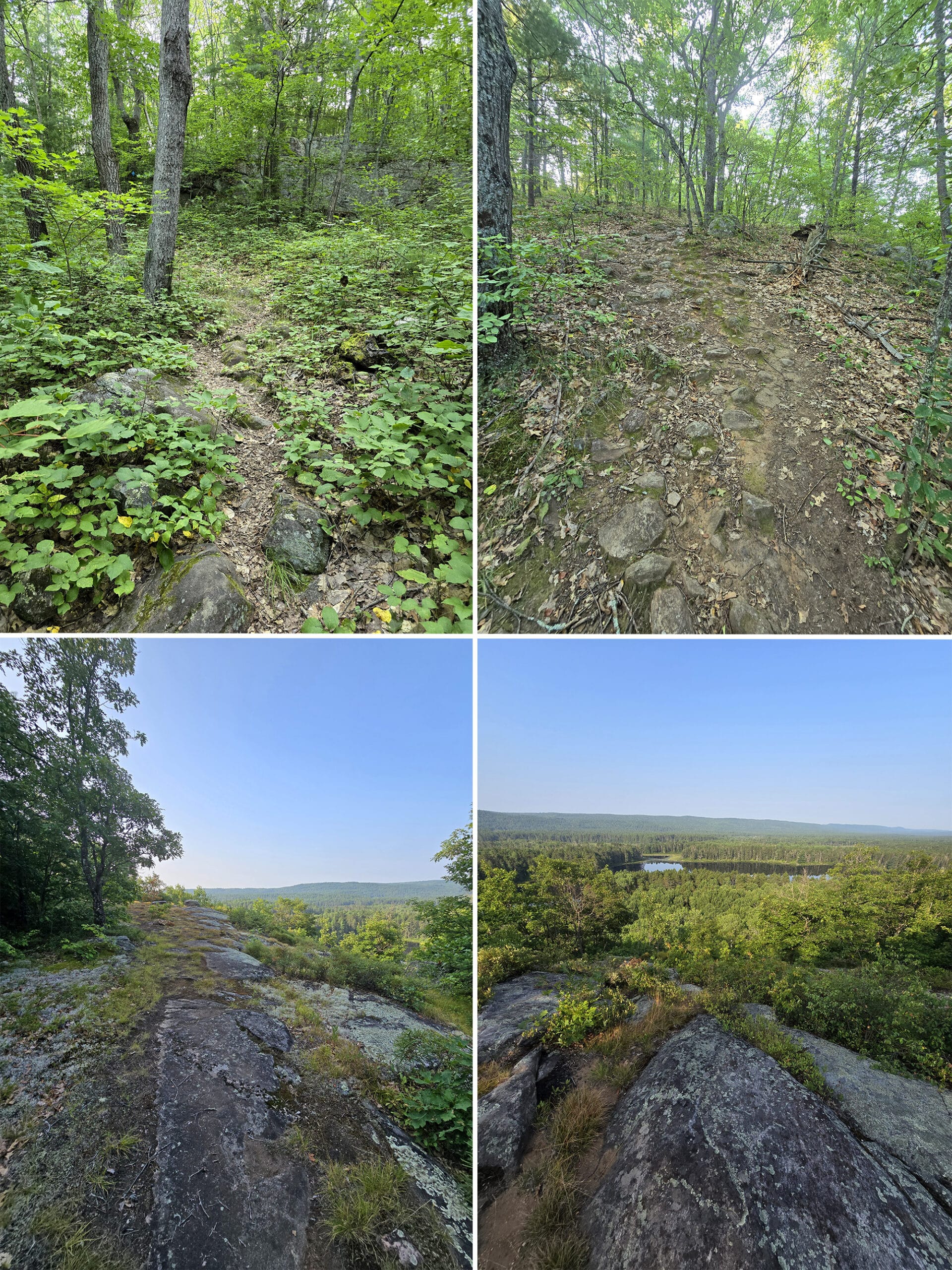
Whispering Winds Lookout on Egg Rock- 0.5 km, Challenging
Trail Head: We Googled “Egg Rock” and found it on Google Maps, mapped right to it. It’s on the right side of the road.
Porter’s Thoughts:
“Be prepared to climb up a steep hill (and across some parallel faultlines)!
I chose to do this as a fast walk, and I was out of breath by the time I reached the top.
It was worth it though, with its great view of the surrounding area as you stand upon an outlook made of large boulders.
There are some unofficial trails that lead away from the outlook where people have explored the area a bit, but I didn't venture far down them.
The flies were really annoying on the day I went out, so I kept my visit short.
I took the path slower on the way back to prevent falling down the steep decline.”
Payne’s Pine - 2.6 km, Easy
Trail Head: Just under 1 km past the trailhead for Whispering Winds. We parked on the right side of the road, the trail access was on the left side.
Porter’s Thoughts:
“This is an easy trail through a lush forest, coming up to water in some places.
The water was still on the day I hiked, providing for a beautiful glassy surface.
This was a nice walk, but I did this after Whispering Winds and it wasn't as exciting. I wish I had done this trail first, to build up to the view of Whispering Winds.”
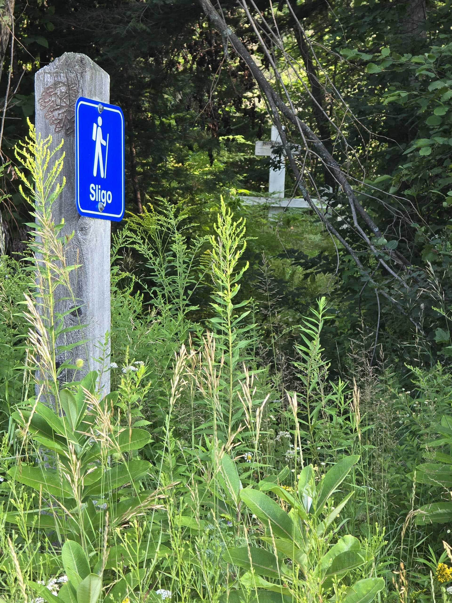
Sligo - 0.3 km, Very Easy
Trail Head: Just over 2.5 km past the trail access point for Payne’s Pine, on the right side of the road.
Between the booklet description of this one - all about getting eaten alive by the various monster flies in that location - and the completely overgrown path?
We took one look and noped out. Was hard to see any kind of payoff for actually walking up to the grave site.
Basin Depot - 0.8 km, Easy
Trail Head: About 3 km past the access point for Sligo, on the right side of the road. You’ll see the log cabin building, it’s right on the side of the road.
This one was confusing and disappointing. The booklet shows it as being two little short trails off the other side of the road, but the only trail we could find in the area was one on the right side of the road.
We walked up and down that logging road trying to find any evidence of these two trails, and the heat and bugs were getting pretty miserable.
At this point, we decided to call it, and headed back to the RV. We were getting pretty frustrated with the whole thing.
High Falls - 4.4 km, Challenging
Trail Head: Should be about 2 km past Basin Depot, with trail access and parking on the left side of Basin road (per the booklet).
We didn’t do this trail.
McGuey Farm - 5.2 km, Easy
Trail Head: Should be about 8 km past High Falls, with trail access and parking on the left side of Basin road (per the booklet).
Note: The book lists this trail name as both “McGuey Homestead” and “McGuey Farm”, depending on whether you’re looking at their map, or the trail information page.
We didn’t do this trail.
McIntyre Homestead - 1.2 km, Easy
Trail Head: Should be slightly more than 13 km past McGuey Farm, with trail access and parking via a short road off the left side of Basin road (per the booklet).
Note: The book lists this trail name as both “McIntyre Homestead” and “McIntyre Clearing”, depending on whether you’re looking at their map, or the trail information page.
We didn’t do this trail.
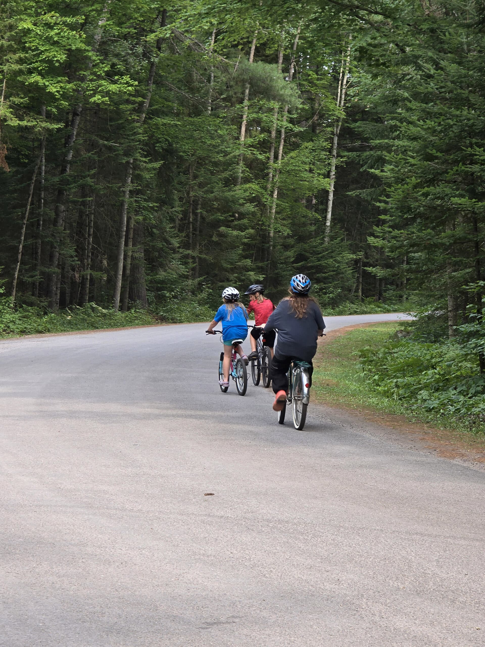
Biking
There aren’t any designated bike trails, but we saw plenty of people biking on the park roads during our stay.
The roads are in really nice condition for biking, too. The “we don’t have trails, but you can bike on the roads” hits a bit different when the roads aren’t anything you’d want to bike on, you know?
Swimming
Bonnechere has one of the better sandy beaches we’ve seen lately.
The swimming area is really nice - Paths alongside and leading up to the beach, lots of picnic tables, etc.
As I mentioned earlier, there are two Mobi-Mats that go right into the water.
As with the vast majority of provincial parks, there are no lifeguards on duty at any time.
Birding, Wildlife, and Nature
Bonnechere Provincial Park’s website notes that almost 300 species of birds have been seen in the general area of the park, and that they have a birding checklist available for sale.
I meant to pick one up during our stay, but completely forgot!
Anyway, we managed to see a TON of birds across both of our, both in the park itself and nearby, on our Walks of the Little Bonnechere River excursion.
All told, we heard and/or saw: American Crow, American Goldfinch, American Robin, Black-and-White Warbler, Black-Capped Chickadee, Blue Jay, Blue-Headed Vireo, Broad-Winged Hawk, Brown Creeper, Canada Goose, Cedar Waxwing, Chipping Sparrow, Common Grackle, Common Raven, Common Yellowthroat, Dark-Eyed Junco, Eastern Kingbird, Eastern Wood-Pewee, Evening Grosbeak, Golden-Crowned Kinglet, Great Crested Flycatcher, Northern Cardinal, Northern Flicker, Northern Waterthrush, Olive-Sided Flycatcher, Pine Warbler, Red-Breasted Nuthatch, Red-Eyed Vireo, Ring-Billed Gull, Rose-Breasted Grosbeak, Song Sparrow, Swainson’s Thrush, Swamp Sparrow, White-Breasted Nuthatch, White-Throated Sparrow, Wild Turkey, Wood Thrush, Yellow-Bellied Sapsucker, and Yellow-Rumped Warbler.
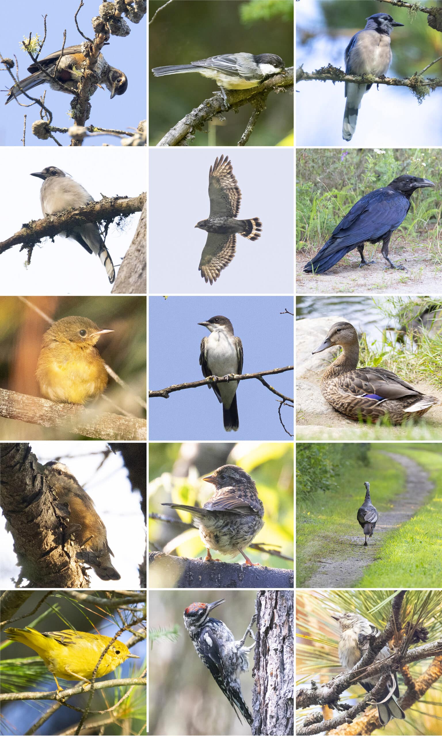
2nd Row: Blue Jay (Bald!), Broad-Winged Hawk, Common Raven
3rd Row: Common Yellowthroat, Eastern Kingbird, Mallard Duck
4th Row: Red-Breasted Nuthatch, Song Sparrow, Wild Turkey
5th Row: Yellow Warbler, Yellow-Bellied Sapsucker, Yellow-Rumped Warbler
In addition to the birding, we saw quite a few chipmunks and squirrels, as well as a few different species of frogs, and a big snapping turtle!
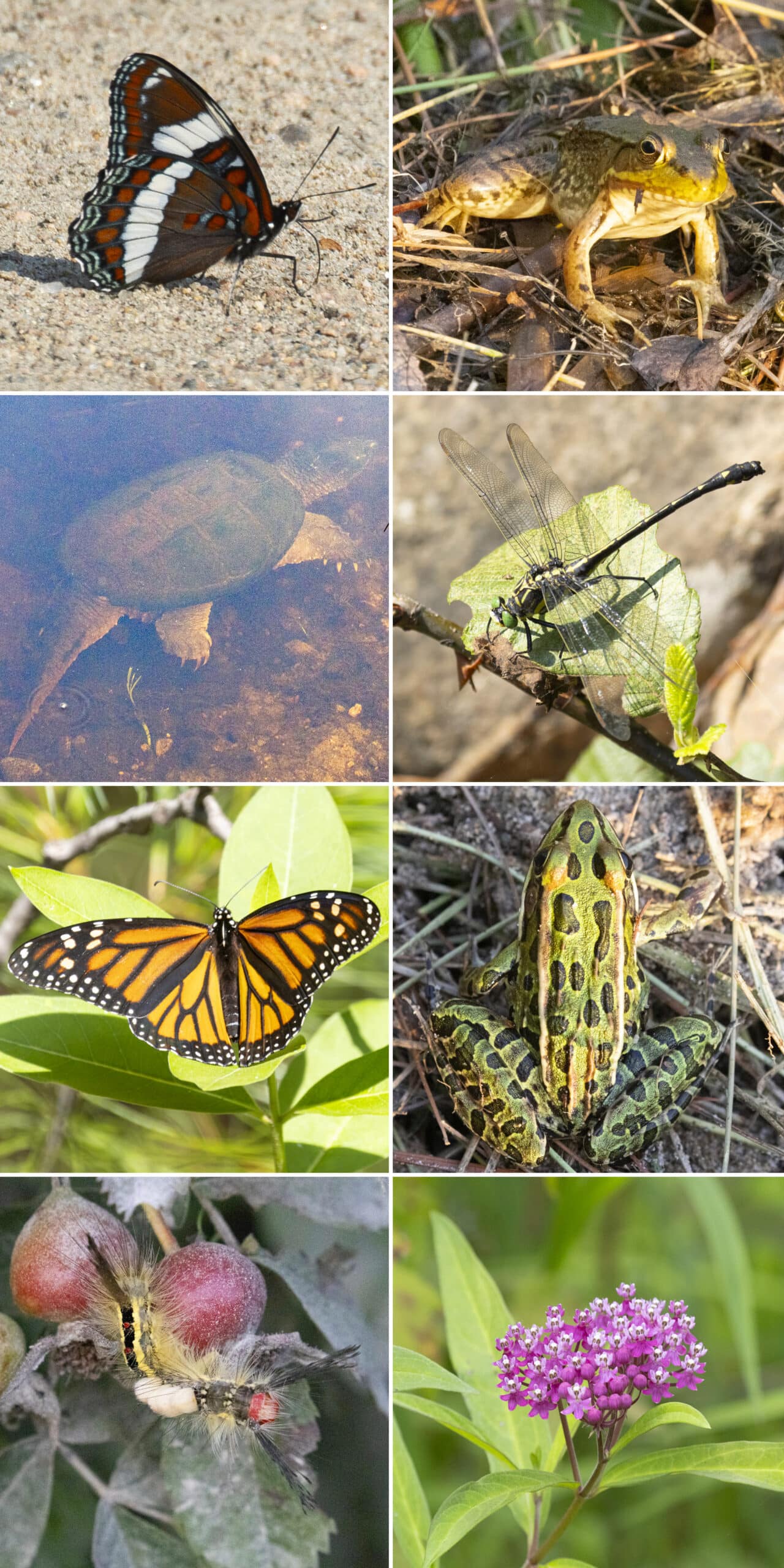
2nd Row: Common Snapping Turtle, Dragon Hunter
3rd Row: Monarch Butterfly, Northern Leopard Frog
4th Row: White-Marked Tussock Moth, Swamp Milkweed
Boating
Boating is a huge thing at Bonnechere Provincial Park, what with the meandering Bonnechere River going right through it, and all.
There’s a boat launch and small dock located in the day use area - on the river. It’s different from the first time we visited - looks like they completely renovated that area. (The updated photo is below!)
Same as last time, though, it still as a maximum recommended boat length of 18 feet, btw.
We also saw several campsites in the River Loop Campground that had small power boats pulled up to them! Not sure if they had little docks or what.
Anyway, the park requests that boaters take care to not use wake speeds on the river as there are sensitive species of plants and animals living there.
Bonnechere Provincial Park rents out canoes and kayaks, and has a loaner program for Personal Flotation Devices (PFDs).
We saw quite a few canoes, kayaks, and stand up paddle boards being used on the river during our first visit. The park recommends canoeing up the river to Jack’s Chute, roughly 3 km away.
There are oxbows along the way, and apparently they make for great wildlife viewing!

Fishing
Fishing opportunities are available on both the Bonnechere River and Round Lake, though we didn’t manage to see anyone fishing right in the park, during our stay.
Had there been anyone fishing, they’d possibly have been aiming to catch Lake Trout, Large Mouth Bass, Pickerel, Pike, Pumpkinseed, Rock Bass, and/or Small Mouth Bass.
We DID see a fair amount of people fishing off a bridge nearby, when looking for one of the Walks of the Little Bonnechere River.
About 7 minutes from the park, on Paugh Lake Road, right after turning left onto it from Turners Road.
There’s a cute little open area lookout out over a large lake, then a small bridge shortly after it.
That whole area was great for wildlife - we saw a bunch of frogs, birds, and even a large turtle!
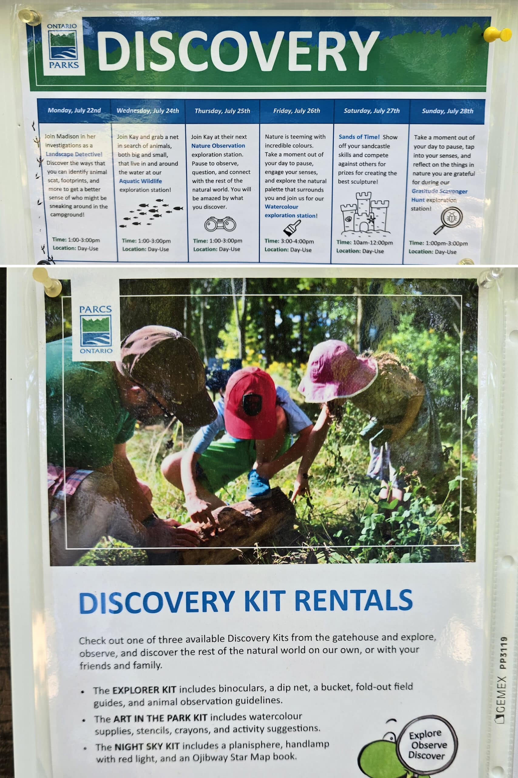
Discovery Program
As with most Provincial Parks we’ve been to, the Discovery Program at Bonnechere seems to be limited to the months of July and August, and mostly be centered around the Discovery Activity Book.
We did happen across an Exploration Station at the day use area on our first day. That’s where we met Kay, who was just finishing up an event about naming the animals we’re grateful for.
With the exception of Tuesday, there was something planned for every day of the calendar week our trip landed in. (We were only there 3 days, though).
We liked that the Discovery Program information was posted EVERYWHERE - including on every vault toilet we saw. Some parks, we never see any information posted!
Niantic Games
There are a few Niantic game features (Ingress Portals / Pokestops / Pokegyms) in the day use area - 4 or 5 .
There are also a few scattered throughout the park beyond that, but really not many. I’m guessing that’s a holdout from the park historically not having much/any cell reception.
Nearby Attractions
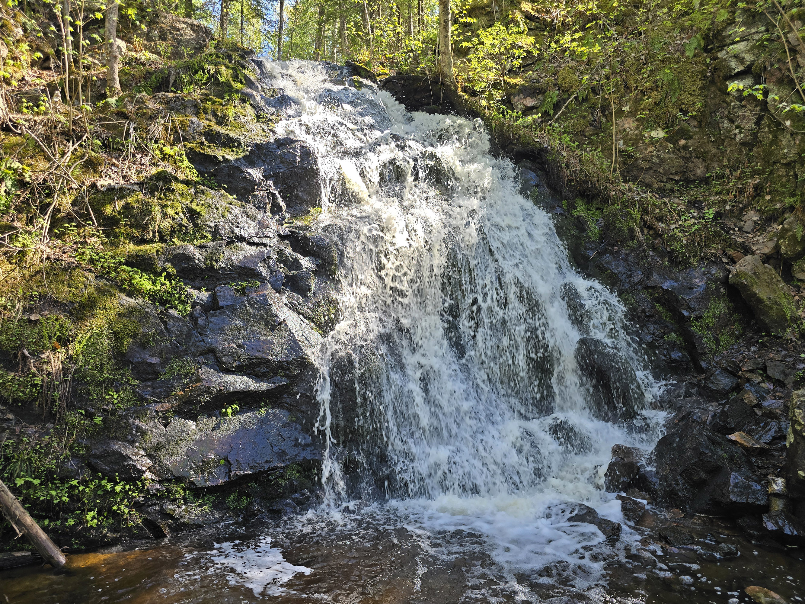
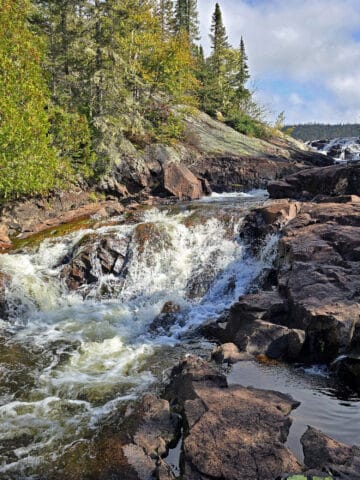
First of all, Gariepy Creek Falls is located about 10 minutes away from the park - check out that post for all of the info you'll need!
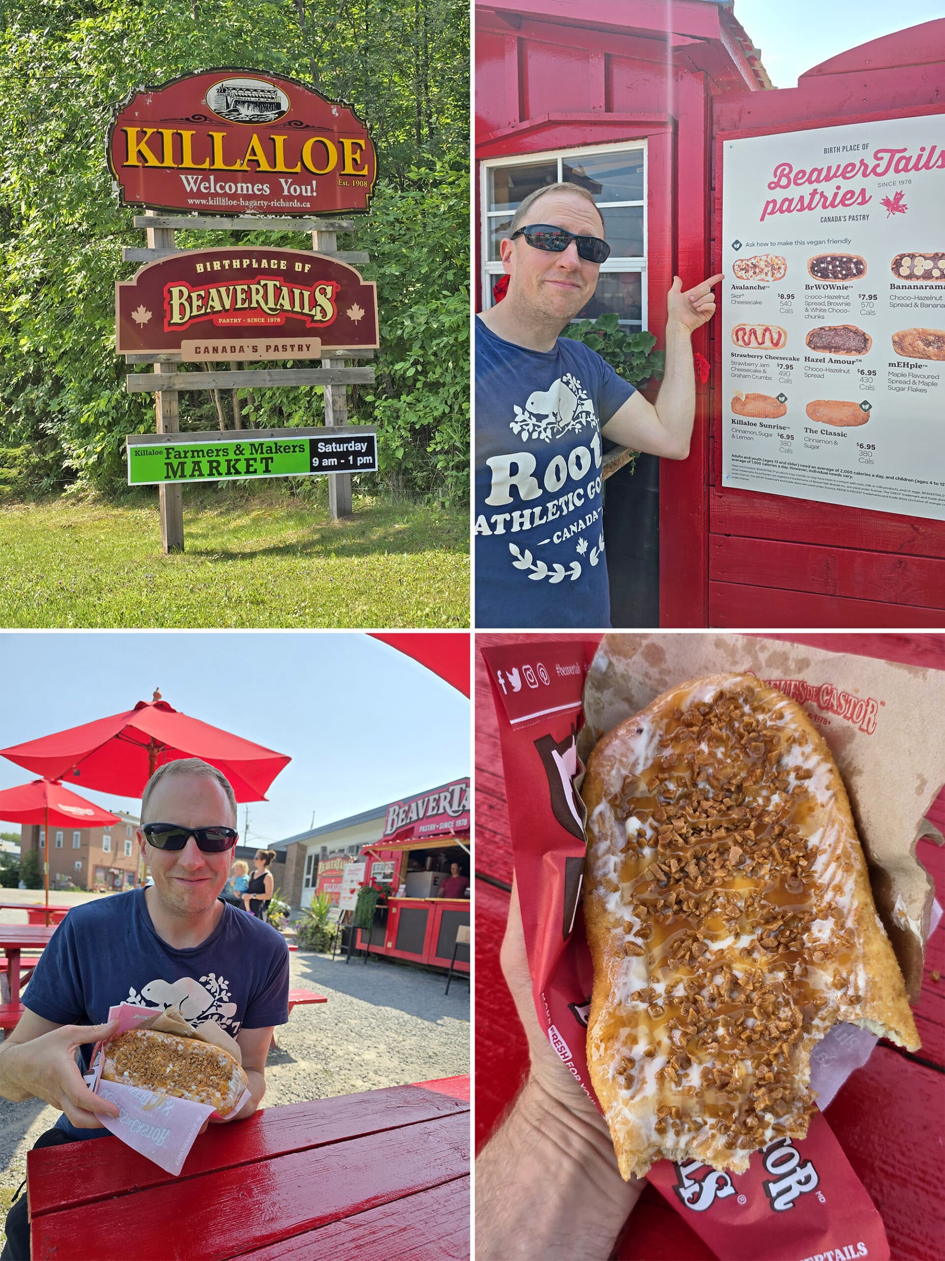
The closest towns are Barry’s Bay and Killaloe, and we went to both.
Killaloe is the birthplace of Beavertails, so obviously we - well, Porter - had to do the thing.
He didn’t get the Killaloe Sunrise, though - he got the “Avalanche”. I guess cinnamon and lemon can’t compete with cheesecake and Skor, LOL.
The grocery store in Killaloe left a lot to be desired, so we had to go on a second roadtrip to Barry’s Bay for our groceries. It had a Metro and a large ValueMart, and generally seemed to have more going on than Killaloe in general.
Final Thoughts
Just going to be real here, on the way to Bonnechere, I had made the comment that planning a stay at Bon Echo Provincial Park immediately before checking out a new-to-us park felt like setting ourselves up for disappointment.
I was *wrong*.
This park may be small and kind of remote, but we LOVED it.
Would have been nicer if we’d been able to get an electrical site and not be dying from the heat, but that’s our biggest complaint - and it’s not really on them, either. Had the weather been at ALL humane, the lack of electricity wouldn’t have been an issue at all!
For such a small park, it’s wild how well appointed this one is. So much to do, and everything’s just in such great condition.
Also, it really stands out to me for the efforts made to include disabled people.
It really makes a huge difference to not feel like my mobility issues are something that someone else is forced to (grudgingly) deal with, you know?
For his (abled!) part, Porter also loved this park.
“It’s a lovely park with a lot of really great views. Some of the best birding opportunities we’ve had, too!”
100%, we’ll be back again... and again. Just, you know ... maybe not in the height of summer!
More Southeast Ontario Provincial Parks & Places to See
Want to read some more about the parks we've camped and at places we've seen in Southeastern Ontario? Here are some more posts!
Southeastern Ontario Campground Reviews:
Bon Echo Provincial Park
Charleston Lake Provincial Park
Ferris Provincial Park
Presqu'ile Provincial Park
Rideau River Provincial Park
Sandbanks Provincial Park
Silent Lake Provincial Park
Winter Camping at Silent Lake Provincial Park
Southeastern Ontario Places to See:
Gariepy Creek Falls
Lake on the Mountain Provincial Park
North Beach Provincial Park
Want to explore beyond Southeastern Ontario? Check out our full list of Campground Reviews, Ontario Waterfalls, and other Places to See.
We also have a ton of Camping Recipes to cook up, while on your adventures!
Thanks for Reading!If you loved this post - or have any questions about it - please leave a comment below! We'd also love it if you would consider sharing the link on social media! |
Kay!
Hey, that’s me! I’m so happy I could be of a help!
Thanks for showing me all the, ahem, completely normal bird photos. Also, I do hope you know that I will be spreading your feedback as far as I can to fix some stuff up! Hope to see you again next year! 🙂
Marie & Michael Porter
Hahaha, so about those bird photos...
When we were able to get the actual photos into Google (rather than taking a photo of the back of the camera), Google changed its mind and decided that they were chickadees after all.
So, I guess you could say they were... Fake. 😀
Kay!
Always too good to be true!
AK
I’m so glad I stumbled across your blog. After spending 2 summers vacationing at Rene Brunelle, luck of the second last available cabin during our vacation week led us to Bonnechere. This park sounds outstanding.
Annie
These blog entries are so useful, thanks for writing out all the information. The Walks of the Little Bonnechere River confused me too, and so I decided not to do them.
When you mentioned how bad the biting flies were I wondered if you were wearing anything blue, and then I saw the photo with the blue hat. They are very attracted to the colour blue! I learned this the hard way.
Marie & Michael Porter
Are you serious!?
I've never heard about them being attracted to blue! Most of our clothes are blue, LOL.
I don't know if this is good news (that we can do something about it), or bad news (needing to rethink/repurchase our hiking wardrobes)!
Thank you for the heads up! We'll definitely have to do some experimenting.