
Agawa Bay Campground is a GORGEOUS set of sites, one of two campgrounds in Lake Superior Provincial Park. Here's our campground review!
Originally Posted September 14, 2023, Updated on 8/2/2025.

Just up the Trans Canada Highway from Sault Ste. Marie, Agawa Bay is the first of 2 campgrounds located in Lake Superior park - an amazing provincial park on the north shore of Lake Superior.
While summer is always popular for camping, I happen to think we picked the best time of year to visit, that first time in 2023.
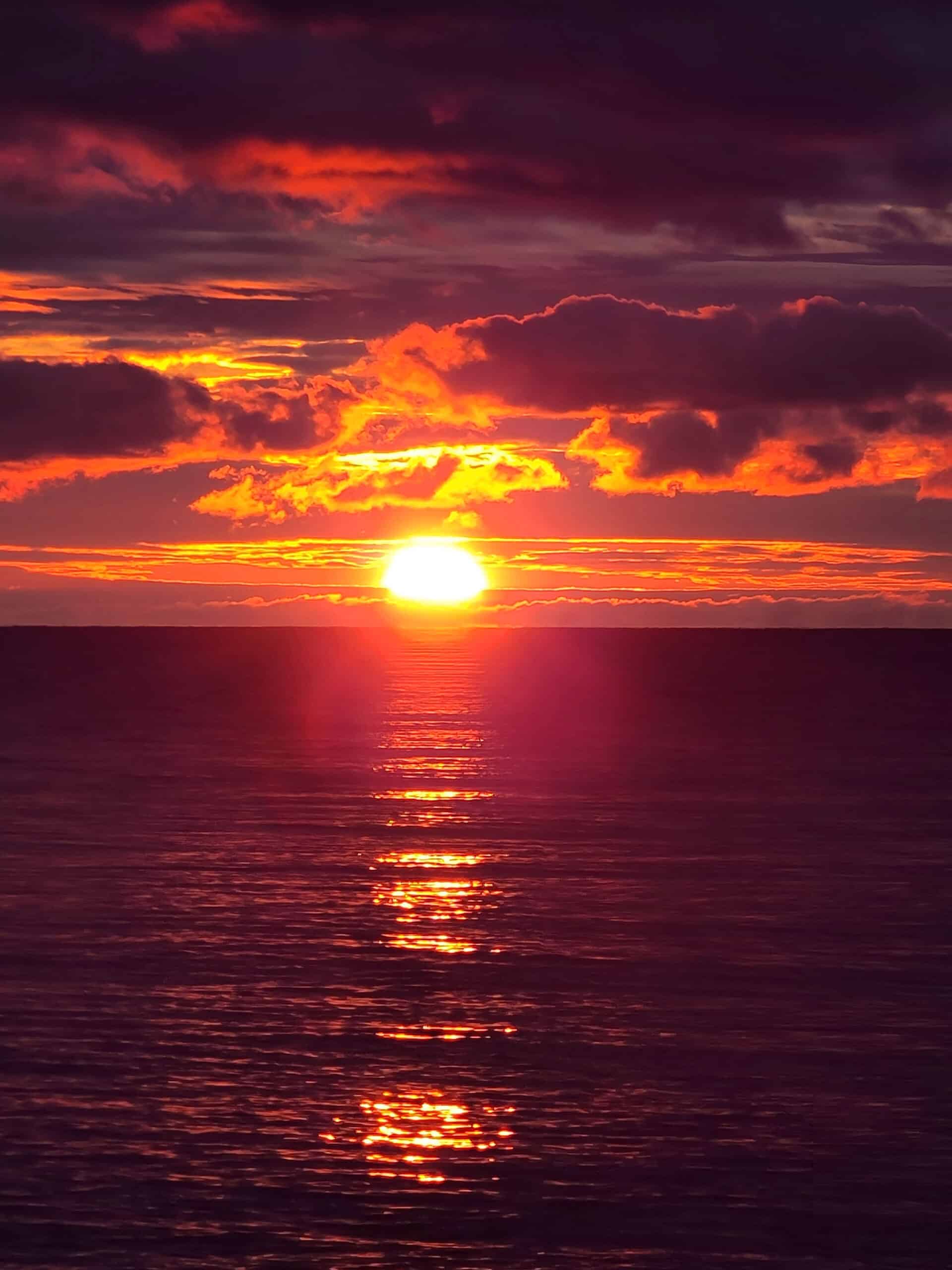
I’m sure that the diverse scenery - and spectacular sunsets! - are amazing any time of year, mind you.
... but the weather was crisp and cool, and with the fall came then potential of seeing the northern lights!
It rained our first night, but on the second night, we were able to catch a glimpse of some green glow... through the clouds.
Anyway, more on that in a bit!

As has been a running theme on this trip, it was a matter of “the weather is supposed to be decent or good the first night, then rain out for the rest of the trip”.
I guess it keeps us on our toes?
So, after setting up at our camp site, we journeyed down to the Awaga Rock Pictographs... where it immediately started pouring.
Nothing like being out in the Northern Ontario wilderness, in the pouring rain!
Anyway, despite the weather, Agawa Bay was a GREAT place to camp and enjoy nature. So much so, that we went back in 2024!
Loads to talk about, so let’s get to it!
Since publishing this review, we’ve been back to Agawa Bay Campground - Three times! We’ve updated it following those two trips, apologies if anything seems disjointed. We ARE talking about 4 separate stays now!

The Basics:
Campground Name: Agawa Bay Campground - Lake Superior Provincial Park
Address: PO Box 267 Wawa, ON P0S 1K0
Website: https://www.ontarioparks.com/park/lakesuperior
Price: Ontario Provincial Parks uses a pricing matrix across all their parks. See 2025 Camping Fees for more details.
Reservations: Ontario Parks Reservations
Park Classification: Natural Environment
Season:: May 1, 2026 to October 13, 2026.

Logistics
Some information to help you plan your stay at Agawa Bay Campground:
Registration and Check In
All four stays, it was quick and easy to book our reservation online. Check in was quick and easy - once we found where we needed to go.
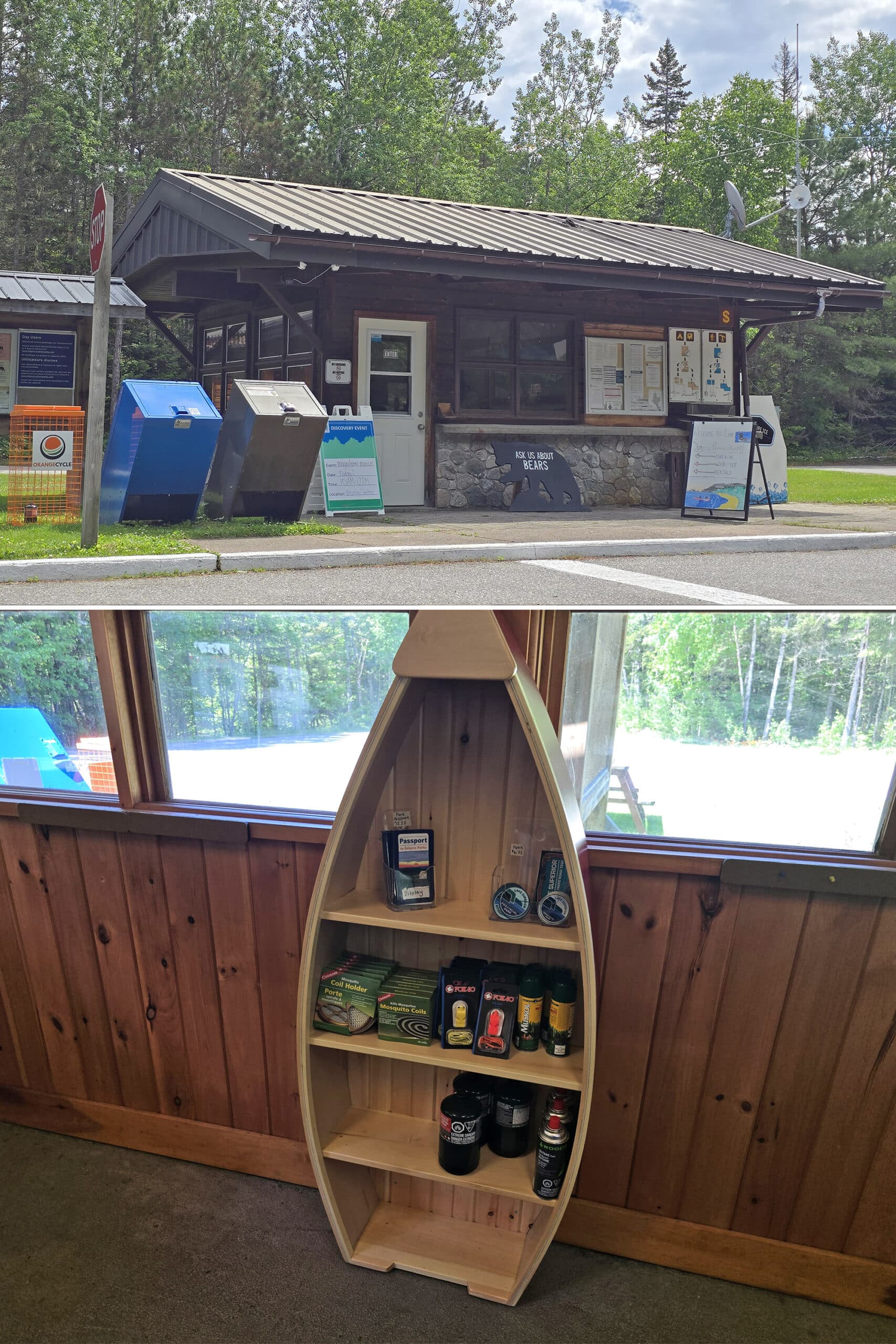
Getting signed in at the park on our first stay - was a bit of a mess.
As you enter the park, you can go left or right - it tells you camping to the left, so that’s where we went.
The gate house was closed, though, with a sign telling us to check in at the park offices at the visitor centre.

The signage in that area ... wasn’t great. As it turns out, we’d driven right past the visitor center, to the far end of the parking lot from it.
The centre was set back from the parking area, up a little trail.
Once in there, Porter went to the information booth... who then referred him to the gift shop.
Once he finally got up to the cashier, check in was quick and easy, but getting to that point was a bit frustrating.
As a note: This was still the case in 2024, a whole year after our first visit. We passed another RV sitting at the closed gatehouse, reading the sign saying to go to the visitor centre.
You’d think they could redirect traffic at the split point, with a seasonal sign.
June 2025 Update
When we stayed at Agawa Bay Campground for the Canada Day long weekend, a new system was in effect. The morning we were due to arrive, I received an email that allowed me to do the check in process online.
This was just a few short screens to confirm my information, and check a box saying that I would NOT show up before 2 pm - I guess they’re cracking down on early arrivals, as it seemed pretty adamant!
Once I was checked in, it told me that I would have to find a staff member to print off our permit, upon arrival.
That was just a matter of confirming our name and phone number - super quick and easy!

Maps and Signage
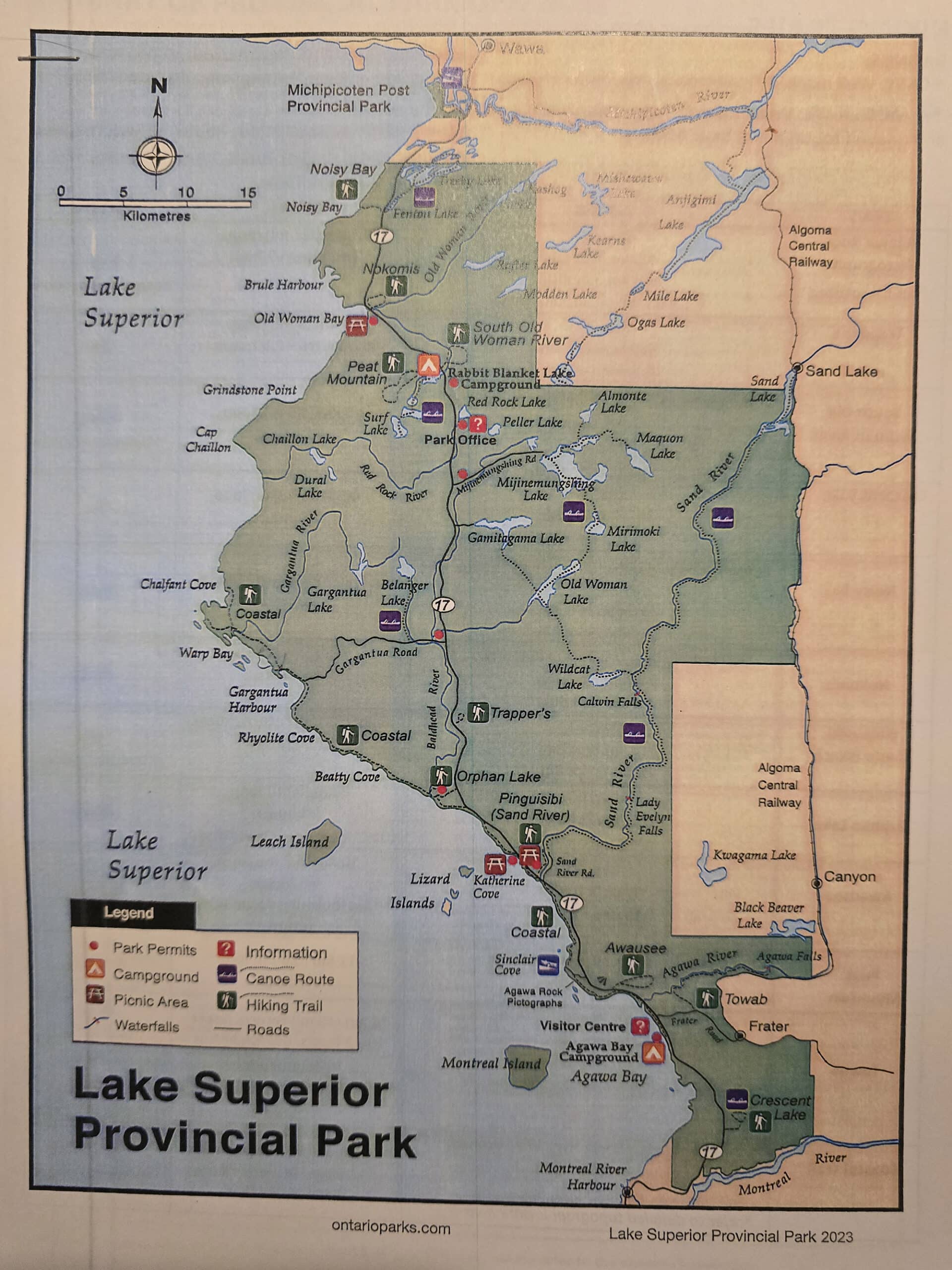
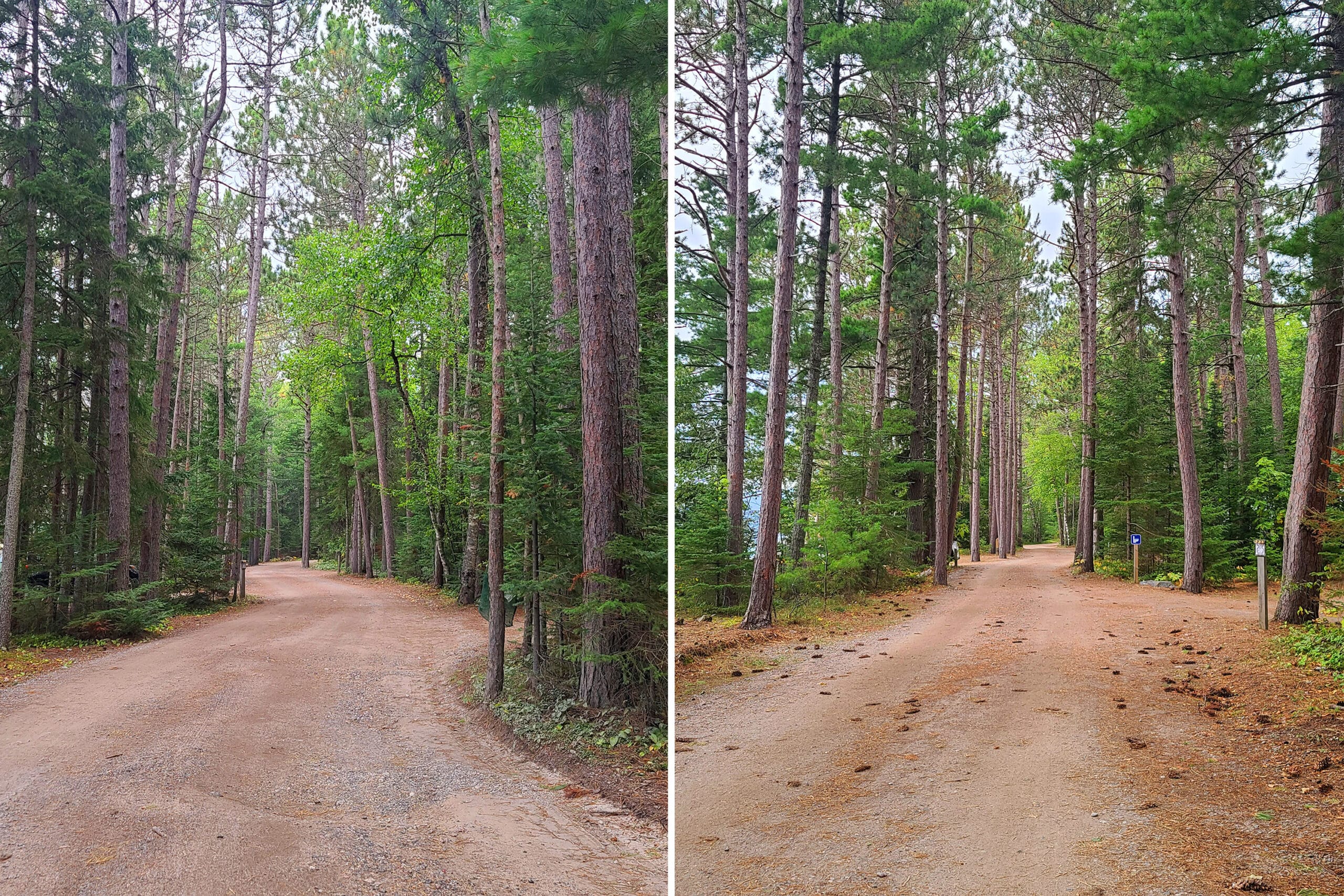
This is a small campground, so - as far as Agawa Bay specifically is concerned - it’s really easy to get around, and only one simple map is needed.
The signage is decent, but once you’ve driven the campground once, you really don’t even need the signs or map - it’s pretty easy to get around.
As for the park map, it’s two sheets of black and white photocopies, stapled together. The outer sides have maps of Agawa Bay and Rabbit Blanket Lake Campgrounds on one sheet, and an overall park map on the other.
The inner sides of the sheets have hiking trail information on one sheet, and a list of park offenses and fines on the other.

This was a first for us - I don’t know if it’s a new thing, or something they reserve for the main camping season in general.
I liked the campground map being in colour, but the accompanying park overview map was kind of hard to read - the background colours were too dark/intense, so there wasn’t a ton of contrast between that, and the typed information.
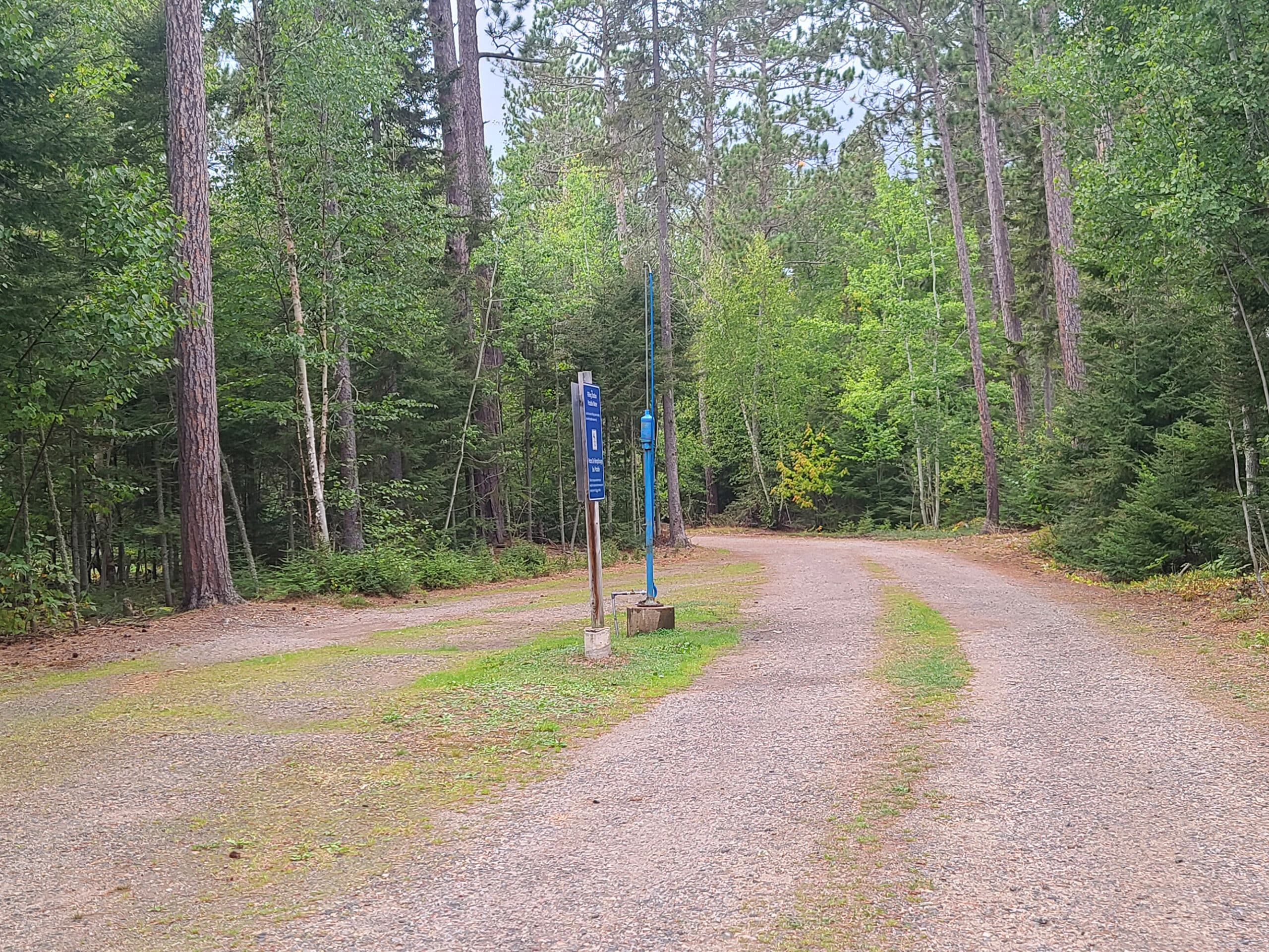
Waste & Water Services
As with most provincial parks, there are no water or sewer hookups in the individual camp sites.
There is a loop just before the camp ground area, containing both the dumping station - 2 platforms, one on either side of a central platform:

Beyond that, there are potable water taps throughout the campground areas.
In theory, anyway - the whole campground was under a boil water advisory on our second trip. So, on the way out of the campground, we had to visit Rabbit Blanket Lake Campground, which was NOT under a boil water order.
This would be a recurring theme - Agawa was under a boil water advisory during our May 2025 and June 2025 stays as well.
The loop closest to the front entry has a garbage center near the front of the loop (further from the lake), the second loop has their garbage center with the comfort station.

Connectivity
Cellphone reception was pretty spotty for us - pretty good in the campground itself, for the most part... but not consistently so.
Anywhere outside of the camp ground had pretty much no cell phone coverage at all, though - and that includes the major trail heads, swimming areas, etc.
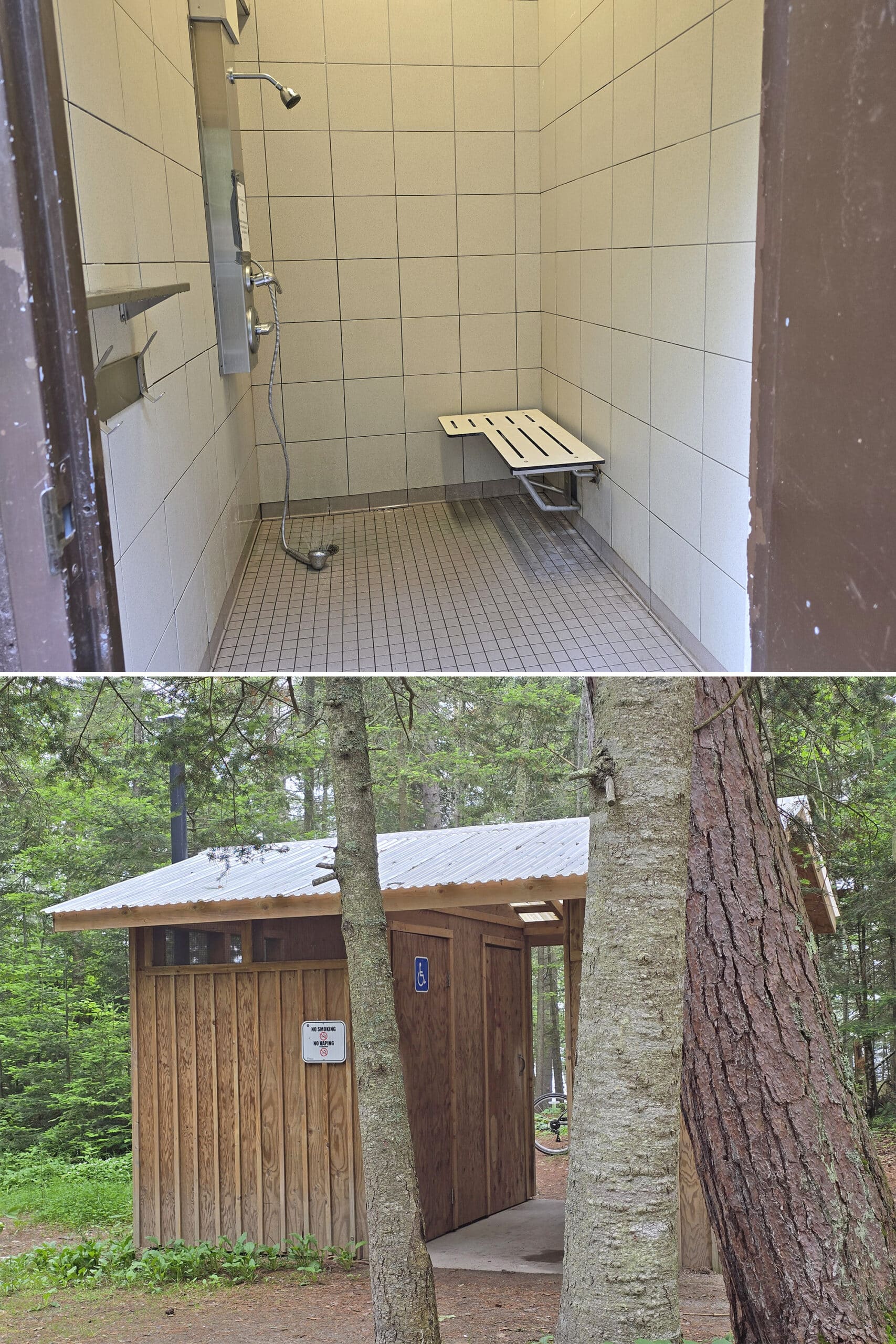
Accessibility
The comfort stations, amphitheatre, park office, and visitor center are all listed as being barrier-free. The shower in the central comfort station was actually barrier free - with an appropriately mounted shower head.
The second comfort station had the accessible shower out of order. I’d assume it to be the same as the first - why is it ALWAYS the accessible shower that’s out of order?
Anyway, there is also one barrier-free campsite available for those who need it.
On our second trip, we saw some type of all-terrain wheelchair on display at the Visitor Center, though I’m not sure what kind - it looked different from the two styles we normally see, at the campgrounds that offer them.
There are no artificial paths down to the beach, and the sand is quite loose and rocky to navigate.
So far as I can tell - at least based on the multiple trails we’ve done, and what they were rated - I can’t imagine that any of the trails in this park are suitable for anyone using any kind of a mobility aid at all.

Pets
There is an off-leash dog beach at the north end of the campground - kind of halfway between the campsites, and the visitor center.
It can be accessed via a trail at the visitor center, or via a (walking) road from the campground.
Aside from that, dogs have to be leashed everywhere else in the park.
They’re not allowed on the Agawa Pictograph trail, but ARE allowed on the rest of the trails.

Parking
There’s a fair amount of parking at most of the campsites, the comfort stations, and also at the Visitor Centre.
In addition to those, there are also a few small parking areas throughout the campground, for additional vehicles.

Miscellaneous
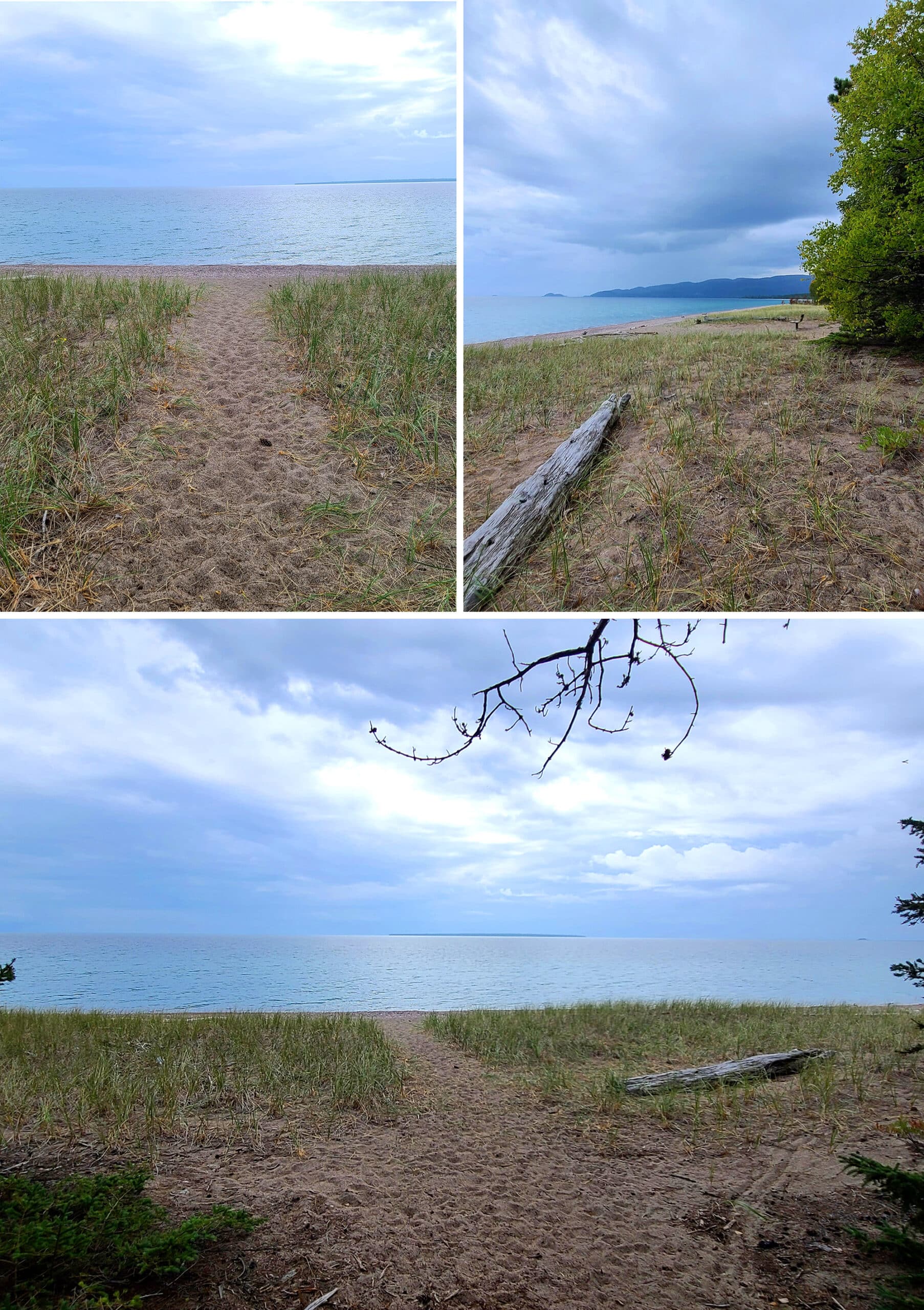
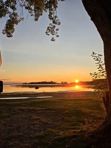
Agawa Bay is in an area of very low light pollution, but is almost directly west-facing from the beach.
It’s great for sky watching, but you’ll need to look north on the beach if you’re looking for the Northern Lights.
We saw Aurora Borealis activity a few times during our second stay, but it wasn’t under the best conditions - just before sunrise, an almost-full moon, and a fair amount of cloud cover.
The first time was OK (above), but we got a STUNNING show the morning we left. No activity on the third stay, though!
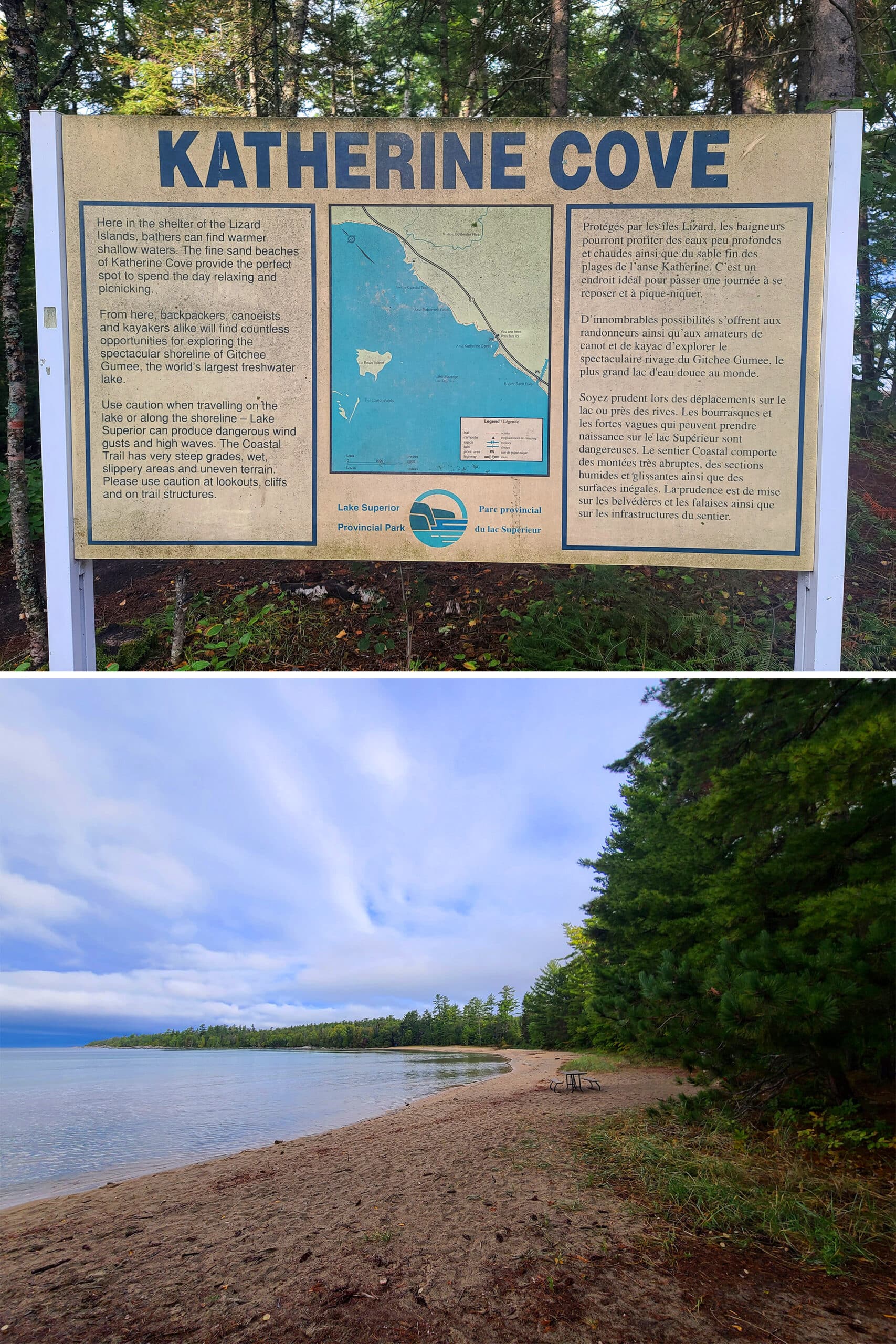
Next time around, I think we’ll be heading to Katherine Cove - there are some nice northern-facing views from the south side of that beach.
If you’re interested in possibly seeing the northern lights, check out our posts: Aurora Hunting, How to Photograph the Northern Lights, Can I See the Northern Lights Tonight?, and Where to See Northern Lights in Ontario.

Campground Amenities & Info
Here’s some basic information on the amenities at Lake Superior Provincial Park, and the Agawa Bay Campground:
Creature Comforts
There are two comfort stations in Agawa Bay campground, one in each loop of campsites.
Both have hot showers, clean bathrooms with flush toilets, and laundry facilities. The comfort station in the further loop also has a garbage / recycling area.
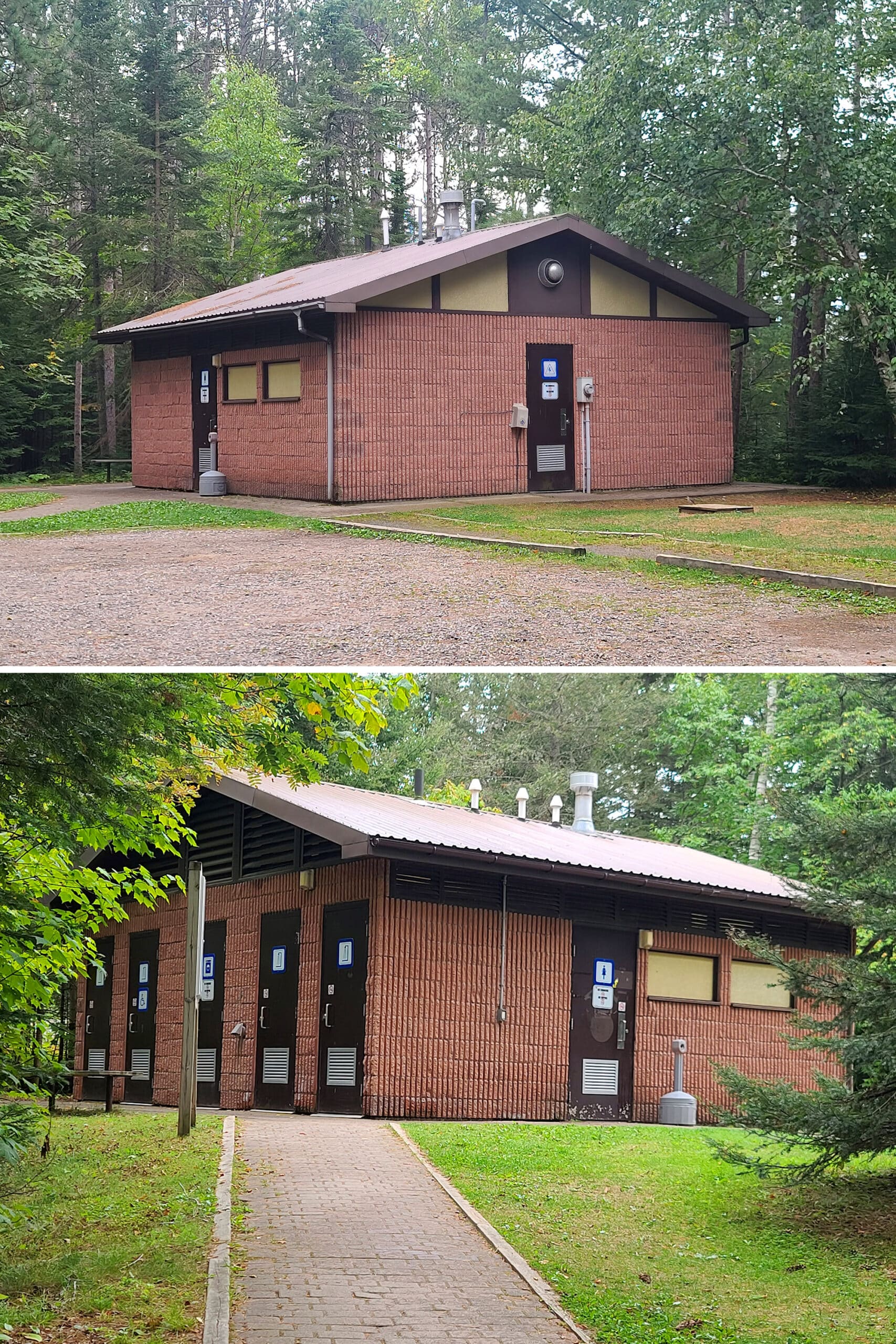
They all looked to be relatively new, and in decent condition.

Park Store
The park store is located in the Visitor Centre, selling clothing items, books, artwork, snacks, grilling tools, souvenirs, firewood, etc.
It felt a bit more upscale than some of the other campground stores we’ve seen.

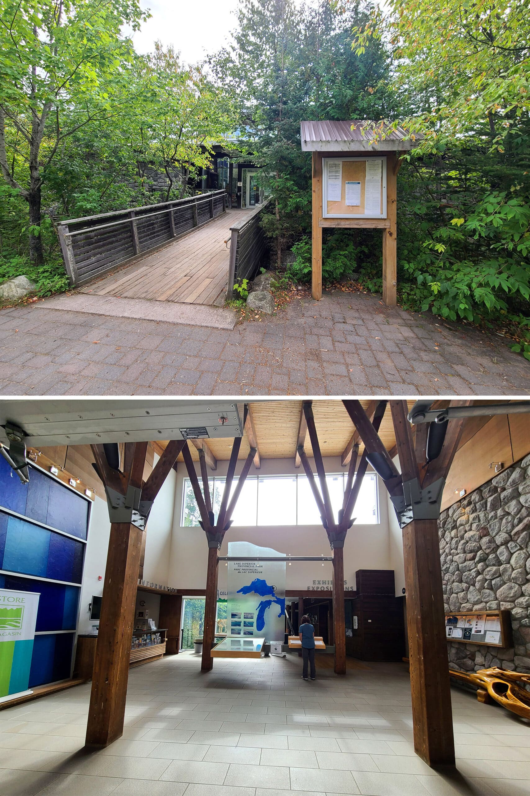
Visitor Centre
The visitor center - where we had to check in - has displays highlighting the area’s geography, nature, and cultural history.
Day Use Area
There are 3 main day use areas in the park for picnicking or use as rest stops: Sand River (Next to waterfalls!), Katherine Cove (A beach area), and Old Woman Bay (also a beach area).
I think all of the picnic tables we saw were out in the open, I didn’t see any picnic shelters during our stay.
Note: You will need a vehicle permit to park in these areas.
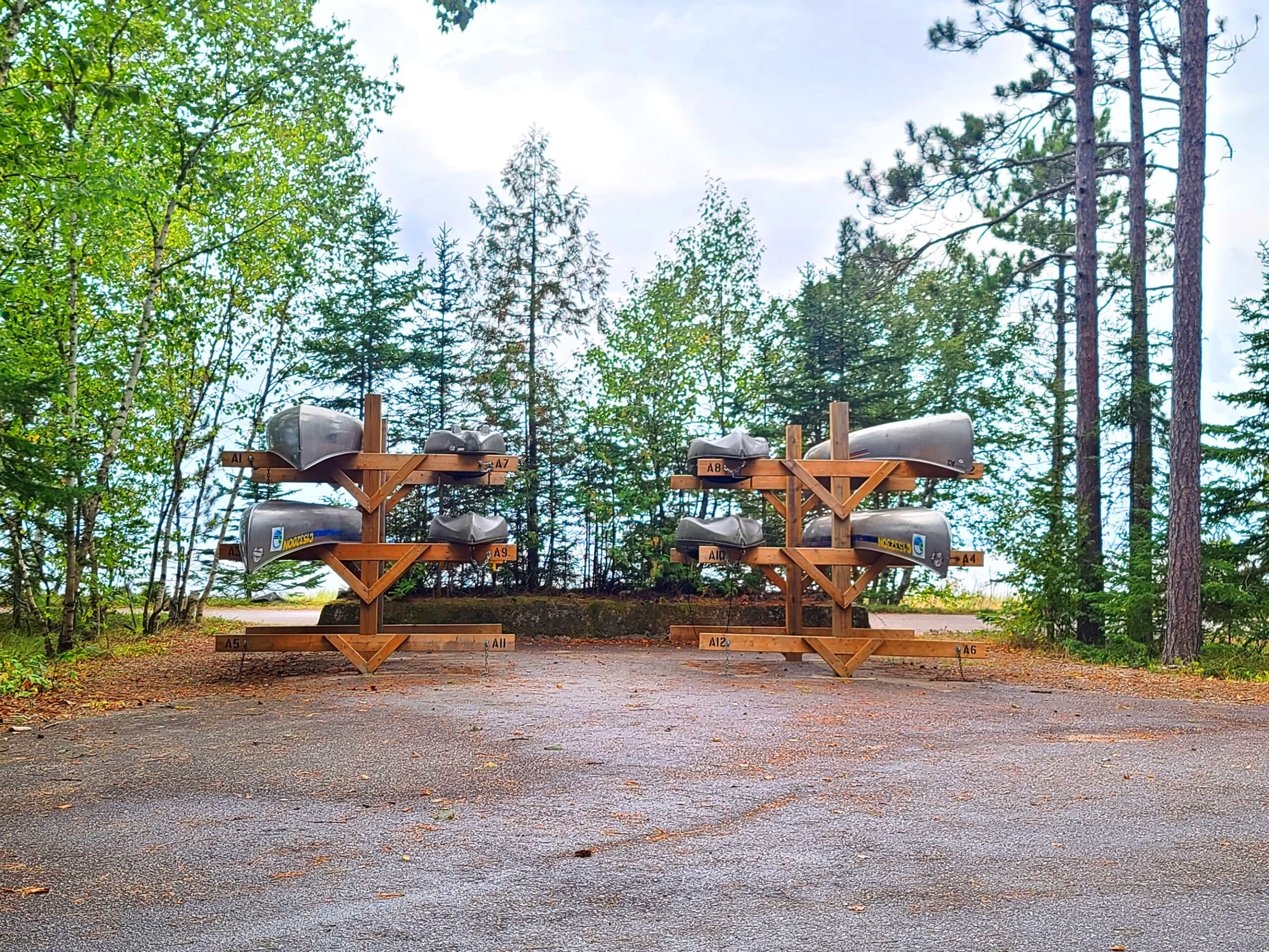
Rentals
Canoe rentals are available at the gate house for Agawa Bay, and also at Rabbit Blanket Lake, and the Park Office for Mijinemungshing Lake.
The canoes in Agawa Bay Campground are located near the amphitheatre, fairly close to the water.
Campsite Details
Agawa Campground has plenty of options for camping, whether you want electrical or not.
Almost ¾ of the campsites in Agawa Bay campground are non electrical, though.
Most are at least fairly spacious sites, with some large sites nestled in.
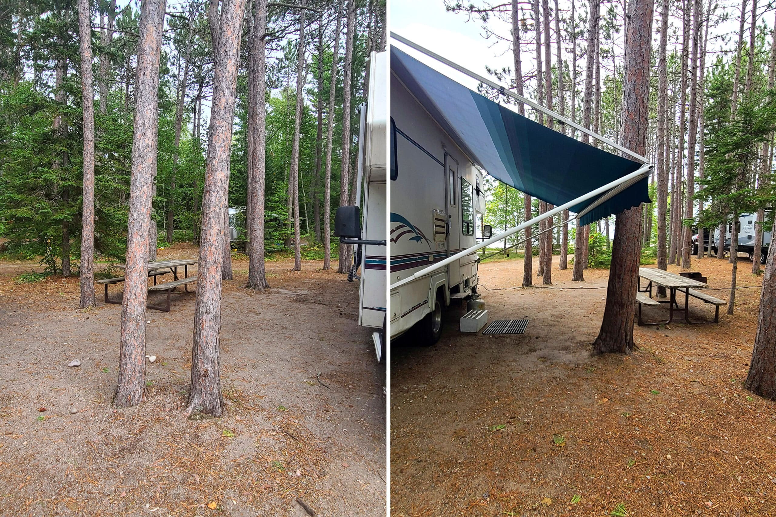
The southern loop is a radio free campground, with a variety of types of sites.

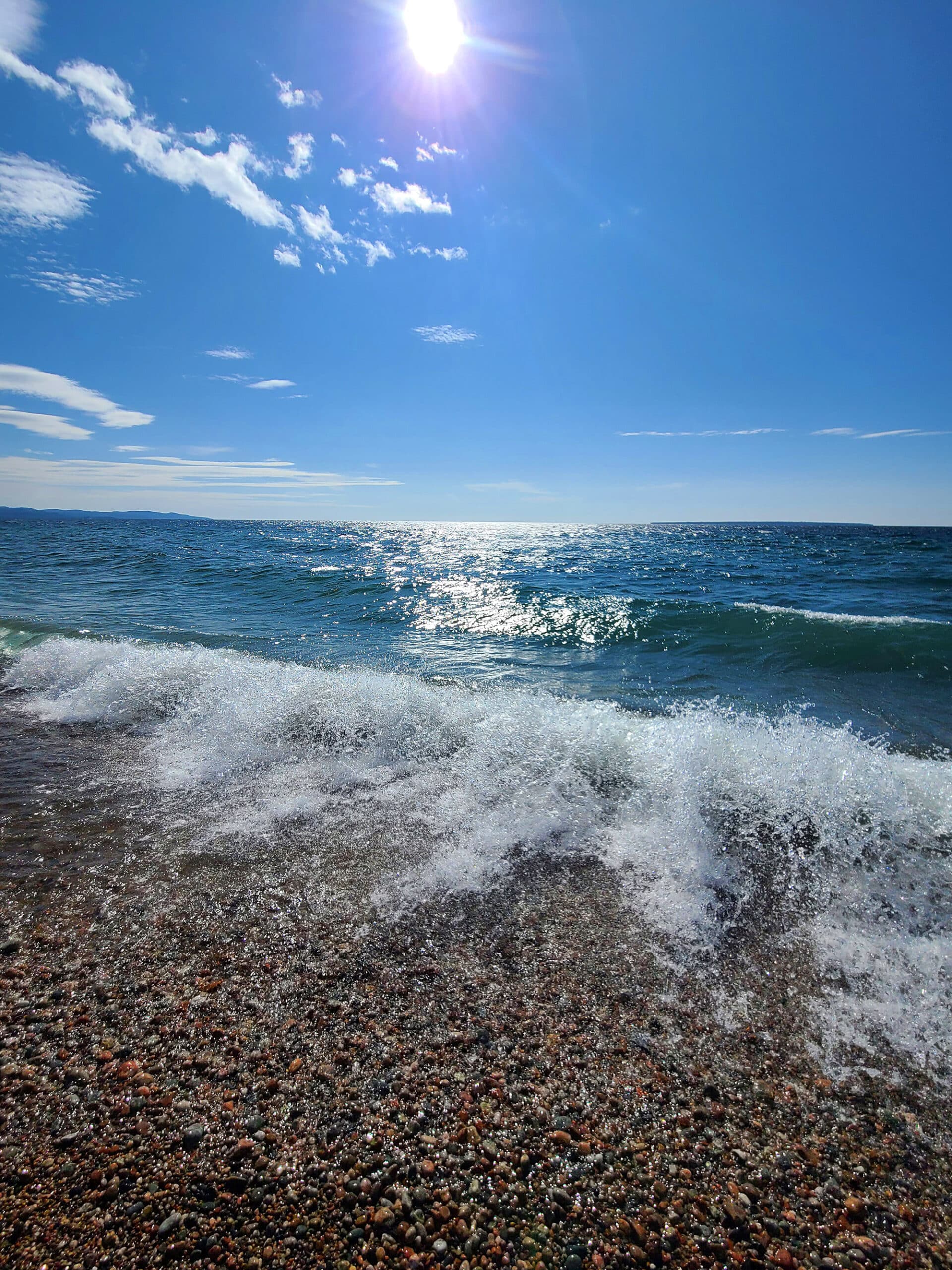
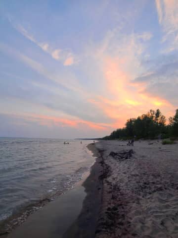
I’m sure some of those lakeside tent camp grounds get some wild weather, but on the other hand... what a VIEW they have! Especially when it comes to the beautiful sunsets, right across from them!

While we could hear the highway traffic, it was mostly drowned out by our A/C and heater.
Outside, the sound from the highway is quite loud.
If you’re tent camping and will be bothered by the noise, try to camp as close to the water as possible, to at least put some space - and campers - between you and the highway.
Our first site - 114 - was a nice spot, right across from the water. Kind of narrow to get into, but absolutely worth it for that view!
Backcountry Camping
There are almost 200 backcountry campsites in Lake Superior Provincial Park, divided into over 70 zones.
Some backcountry sites have fire pits, some have access to box privies, and some even have a picnic table or food locker.
While some sites are available on a first come, first served basis, it’s recommended that you book your site / interior camping permit ahead of time.
Share the Love!If you’ve made one of our recipes, be sure to take some pics of your handiwork! If you post it to Bluesky, be sure to tag us - @2NerdsInATruck, or you can tag us on TikTok, if you’re posting video. We're also on Pinterest, so you can save all your favourite recipes and park reviews to your own boards! Also, be sure to subscribe to our free email newsletter, so you never miss out on any of our nonsense. Well, the published nonsense, anyway! |
Entertainment and Activity
While the campground itself is small, the park is HUGE. There’s a lot to see and do within the boundaries of Lake Superior Provincial Park!
Hiking
Whether you’re up for a relatively short hike, full day trips, or long trips spanning multiple days, there are plenty of options when it comes to hiking trails - 11 main trails, specifically, adding up to over 130 km of trail!
The park map we got when we registered was good about laying out the info for the various trails, the distance from the campground, and their ratings.
Trail Ratings
When it comes to ratings, that’s decided by both considering the terrain, and the length of time it takes you to walk the trail.
By their definitions:
Easy: “Level terrain; less than 3 hours”
Moderate: “Some steep inclines and uneven footing; less than 4 hours”
Demanding: “Some steep inclines and uneven footing; long distance trails, 4 - 6 hours”
Very Demanding: “Route not well marked at times; many steep, rugged areas and uneven footing; long distance, overnight trails.”
Assume the most extreme possible condition for that variable.
Definitely wear sturdy footwear (I did NOT wear flip flops for these hikes, LOL!), and definitely pack suitable water / food / bug protection / weather gear / first aid supplies / etc.
Also note that a can and bottle ban is in effect for all backcountry areas. Keep this in mind when planning your food!
As we were only there for 3 nights, were rained out for part, and dealing with injury, we only did 2 hikes:

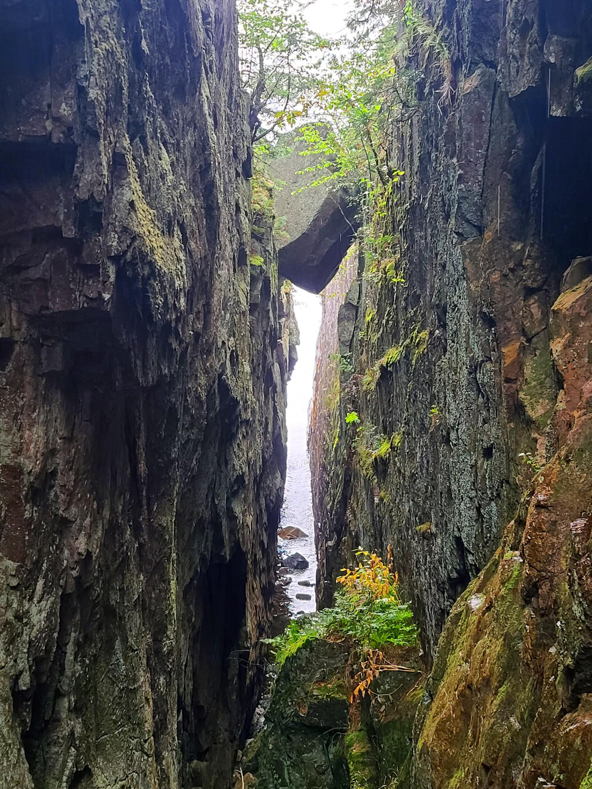
Agawa Rock Pictographs
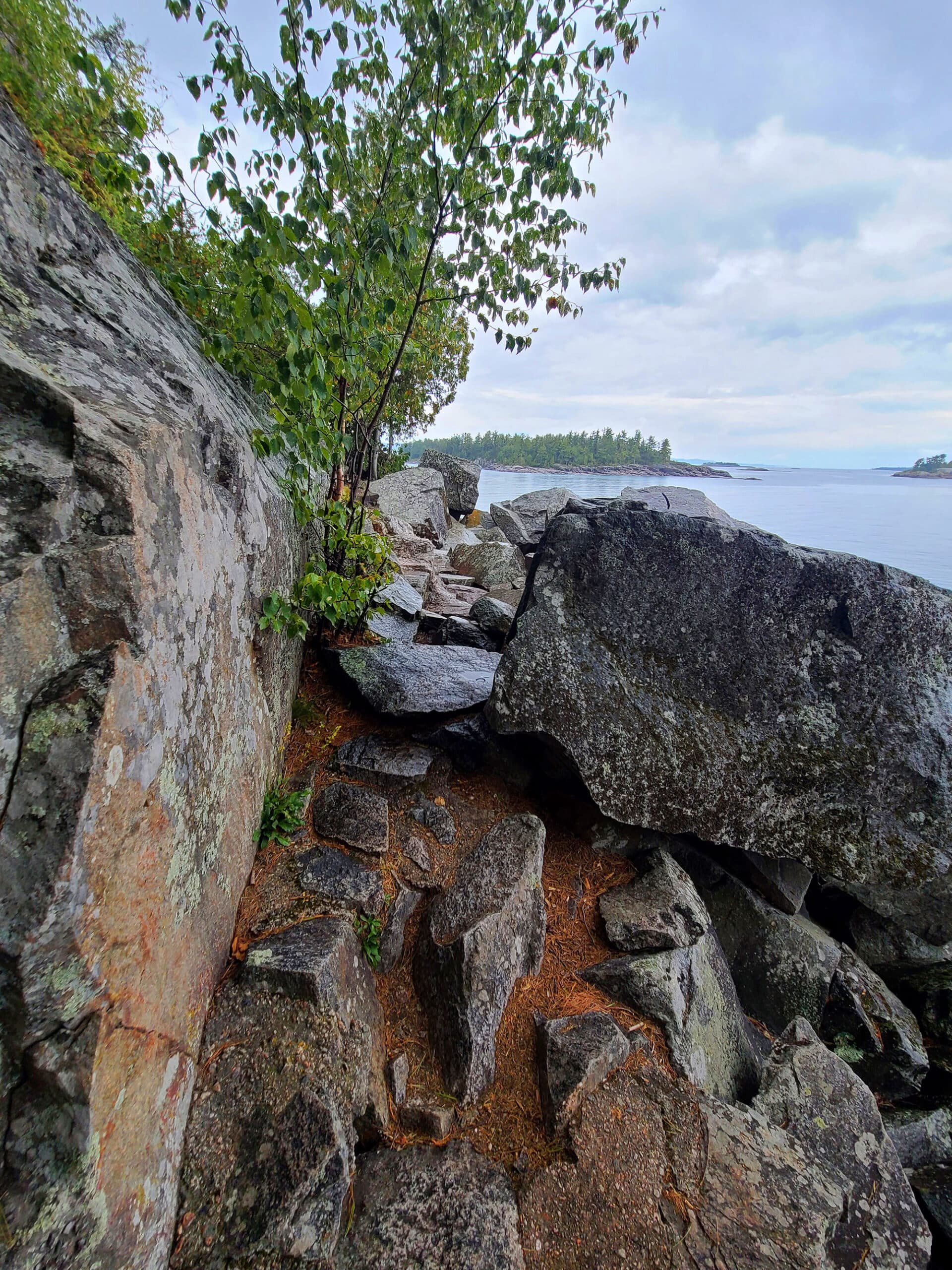
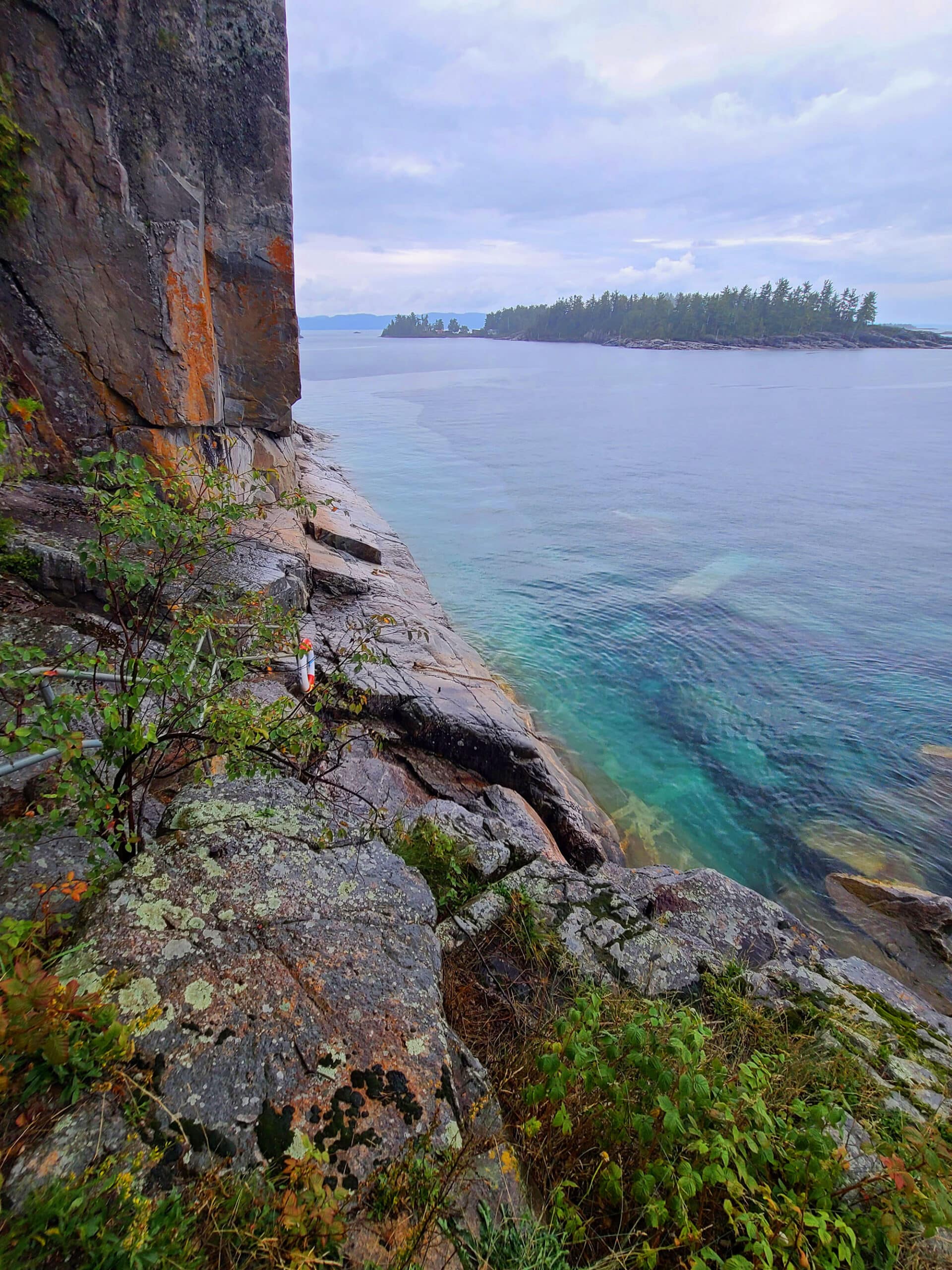
This trail begins a short drive north of the campground, and is an absolutely stunning hike.
The Agawa Bay pictographs are a series of 35 red ochre paintings on a cliff wall overlooking the lake.
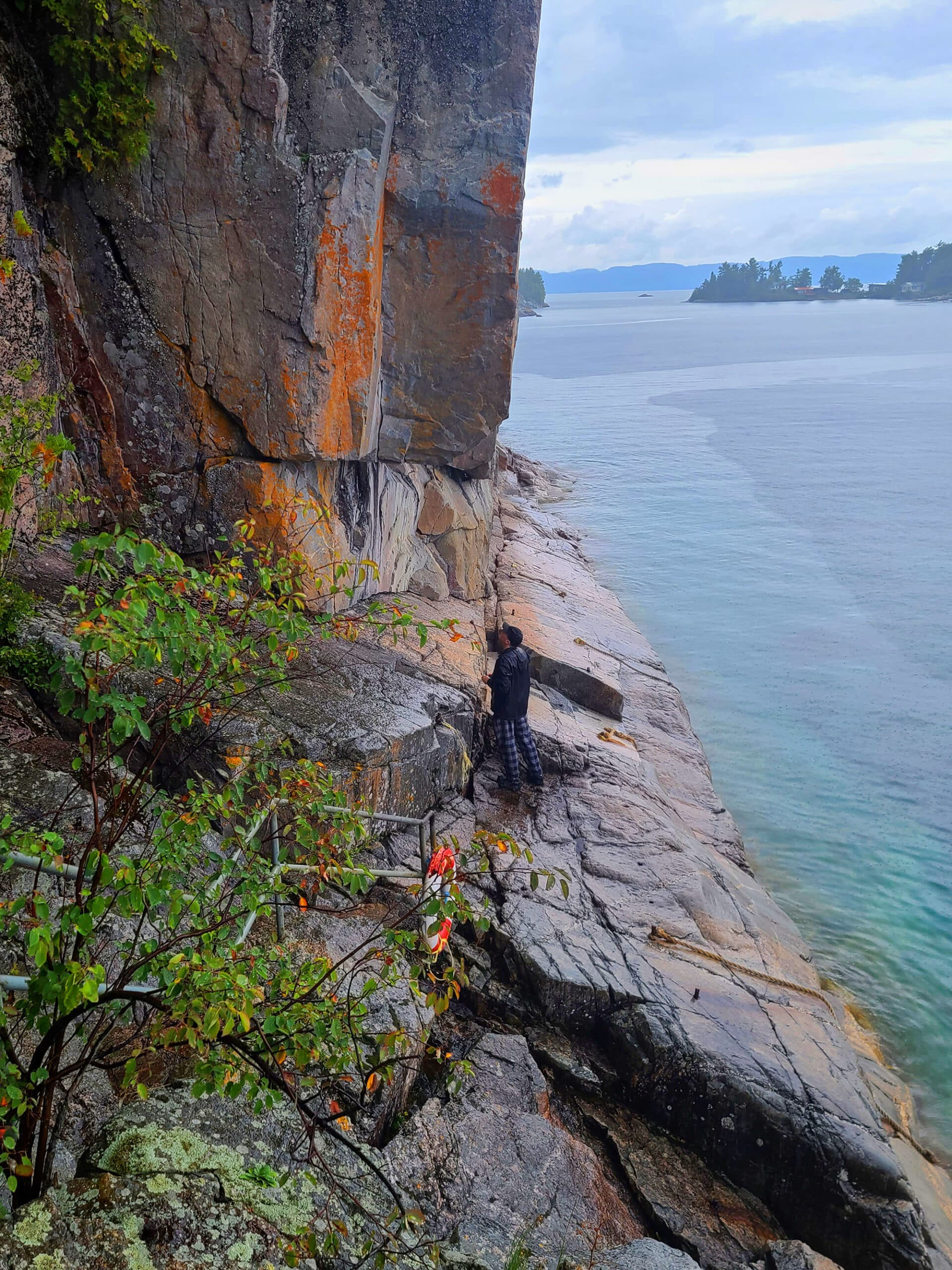
It’s one of only a handful of Ontario pictograph sites that are accessible by foot, and that’s ONLY under certain conditions.

The natural beauty of the area can make it easy to forget that the site is extremely dangerous - a fact that multiple signs remind you of, though.
People have apparently been swept out by rogue waves, when attempting to view the pictographs.

A Reality Check
The park lists it as a 0.5 km loop, and calls it “moderate”, saying you can expect it to take 30 minutes to an hour.
For one, it’s closer to one km. We didn’t start our trackers until we were ½ of the way to the end point, and we were well over 0.5 when we got back to the car- no deviation from the trail at all.
Secondly, I have to side eye that “moderate”, based on their “Some steep inclines and uneven footing”.
Remember what I said about “assume the most extreme value for that variable”? Yeah. “Some steep” = Hardcore, WILDLY steep, the whole way.
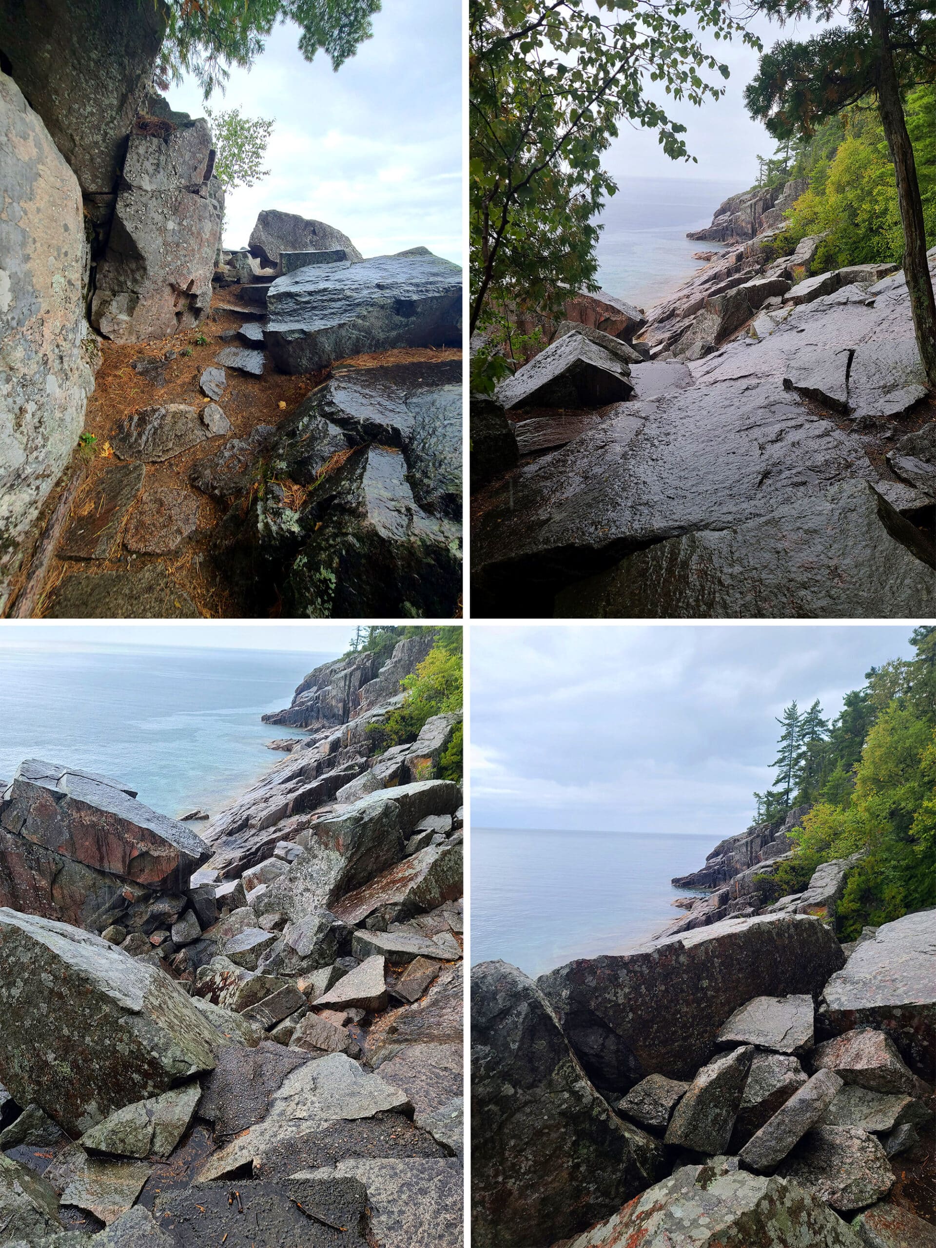
Anyway, in NO WAY do our photos do any justice at all to how wildly hardcore this walk was, or to the beautiful views we took in along the way.

One of the best hikes I’ve ever done (probably THE best), and I felt like such a bad ass for completing it.
10/10, will absolutely do this again someday... though we’ll probably be a bit more careful to avoid the rain, next time!

Trapper’s Trail
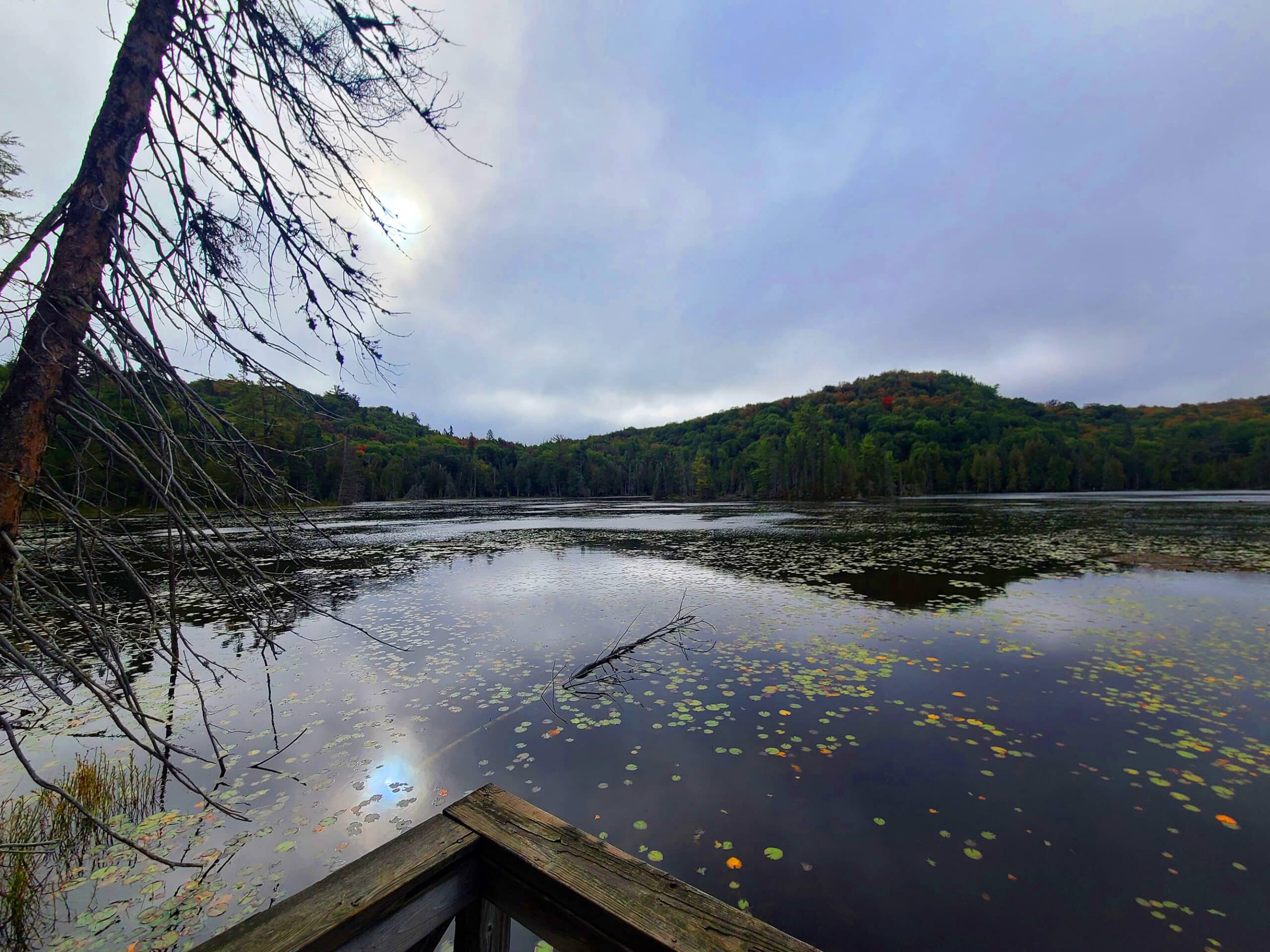
This was a much easier trail, around one of the inland lakes in the area - Rustle Lake.
It’s listed as being 1.5 km (accurate), and says it’ll take 45 minutes to 1.5 hours to do - also accurate. We did it in 55 minutes.
Going back to their trail definitions, though... It’s listed as “easy”, with the description for “easy” including “level terrain”.
... I mean, there was a short section of level terrain at the end, and the boardwalk was level... that was about it.
There was a lot of uneven footing, elevation climbing, rocks, etc involved here. DEFINITELY wear waterproof hiking boots, as you’ll be going through some marshy areas.

Our Wildlife Memory!
Anyway, this is the trail they recommend if you’re wanting to see wildlife - “such as beaver, otter, marten, Great Blue Heron, and moose.”
On our first trip, the first ⅔ of the trail, we didn’t see so much as a bird. So, we considered it to be more about the rich autumn colours, instead.
Then we heard a weird noise, and saw two otters messing around in the distance!
As a JOKE, I said something like "I wonder if they'll answer to PSPSPSPS?".
So I PSPSPS'd at them.
... they popped up, stared right at me, CHANGED DIRECTION, and started swimming right for us!
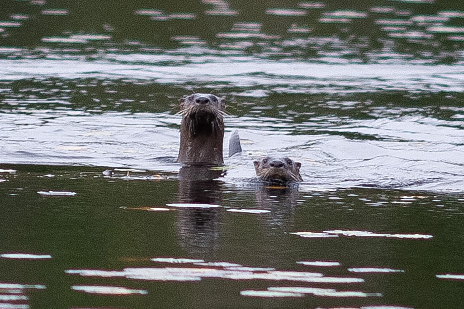
... And they turned around and started swimming towards us again!
This is the best photo Porter got - SUPER zoomed in. I'm shocked we got any photos at all, we were stunned at them swimming towards us when called!
I still can't believe this happened - I wish we'd thought to get video!
Anyway...
We continued the trail, and saw a giant bird fly up and away, as we rounded a corner to a bit of a clearing on the side of the lake.
Might have been one of those great blue herons? Didn’t manage to get a good photo, whatever it was.
We soon came to the end of the trail and headed back to the camper.
Unfortunately, we didn’t see any otters on either of the subsequent trips 🙁
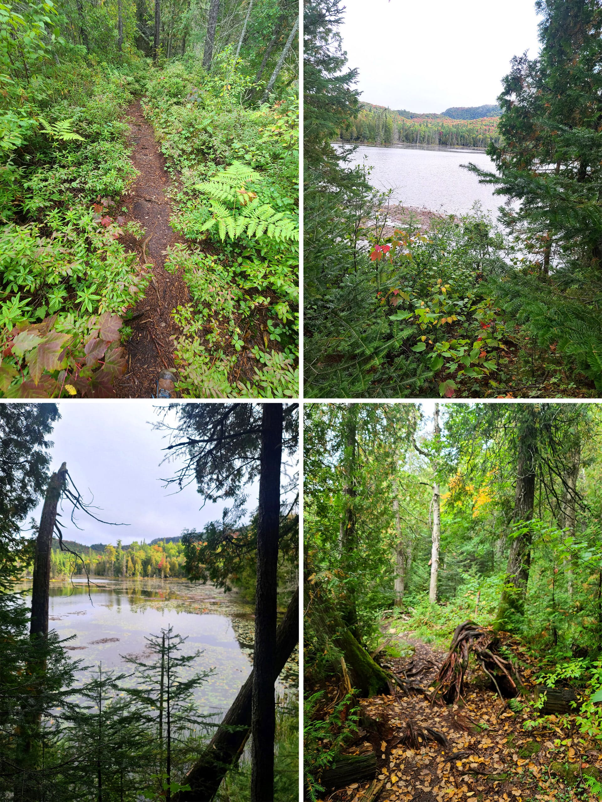
Nokomis Trail
On our second visit, Porter did the Nokomis Trail. This one is a 5 km loop, ranked “moderate”, with a stated completion time of 1.5 - 3 hours, and it’s the other one we were planning on doing.
After seeing what “moderate” meant on that first hike, though... kinda doubting I would have been able to handle this.
This one is located in the Old Woman Bay area, and takes you through boreal forest areas to visit scenic lookouts over the cliffs of Old Woman Bay.
This trail is ranked one of the top 5 day hikes in Lonely Planet’s “Discover Canada” book.
Here’s what Porter had to say about it:

With many steep areas of boulders and tree roots, this applies. By the time I was at the top of the trail - roughly halfway - I was pretty fatigued, but thrilled!
This is the most diverse trail I've ever walked on. You'll see cedar forests, smooth river rock routes, jagged boudler areas, and more. It's almost as if it were constructed to keep you interested as you go along!
The trail has a lot of curves, so you're always sort of wondering what's around the next curve. You can bet it's another great view or interesting scenery.
I knew already this was listed as a top 5 trail in Canada, so my expectations were high. I was definitely not disappointed!
Don't let the "difficult" rating stop you from doing this, but plan ahead with protein bars and water, and pace yourself according to your needs.”

I also like that this is a loop trail, meaning when you're done with the overlook views, you still get to view new trail on the way back.
Keep an eye out for mushrooms, you'll see lots of varieties on the path.
The sound of red-breasted nuthatches was intense - there were so many around me, but I only saw a few!
I think the only downside of this trail is that you have to cross a highway to get to the entrance. There is no parking on the trailhead side, and there's no pedestrian crosswalk.
The speed limit is 90 km/h, and many people speed in this area - be careful! During our visit it wasn't busy, but I can imagine this is a dangerous crossing on popular holiday weekends.
I definitely recommend taking on this trail if you're in the area. Make sure you have plenty of storage room on your camera for all the amazing views!”

Pinguisibi (Sand River)
Another hike that’s just up the highway from the campground, this was another that got canceled on our first trip when I blew my knee out.
Because the trail head - along with some amazing views of a waterfall - was right off the highway, we pulled in to check it out during that trip, and fell in love with... a picnic area.

It was GLORIOUS - so much so, it deserved its own post: Sand River Falls & The Pinguisibi Trail.
Update: The falls were even nicer in the spring of 2025! You couldn’t go out onto them as much - certainly not the 3rd set - but much more flow made for some amazing views anyway!

Crescent Lake
This one’s listed as an easy 2 km loop, taking 30 minutes to an hour to complete. I think that’s old information, from before the Crescent Lake Campground closed.
When Porter did the trail on our 2025 visit, it was 0.85 km to get from the parking lot to the actual start of the trail, alone - so 1.7 km, before you even get to the lake!
Overall, the trail came to 5.5 km, which included the multiple short branches to get to the lake lookouts along the trail.
Here’s what Porter had to say about it:
“The campground road is an easy hike, two narrow trails where vehicles used to drive. Grassy with small bushes encroaching the space, but still plenty wide and easy to hike.
Once it gets to the actual trail, it's more narrow and moderate difficulty. The trail is packed dirt and winds through the forest. Some easy slopes and small roots to step over.
The main loop trail is a nice walk through the woods, lovely but not amazing on its own. Much of it has a high tree canopy yet still has a lush forest floor with small bushes and ferns.”
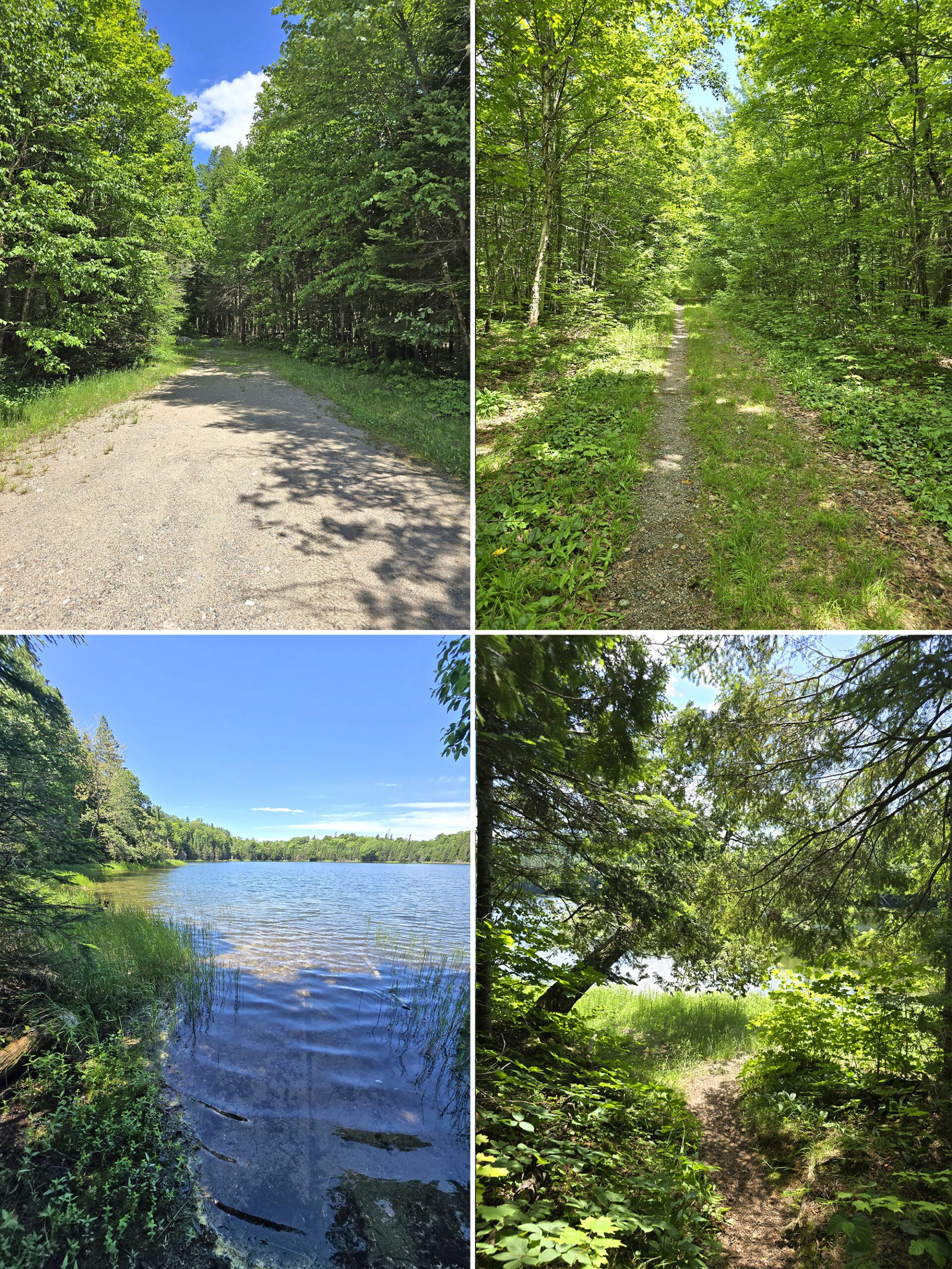
You first come upon Mud Lake and Crescent Lake, which were my favorite lookout on the trail. Both of these lakes were very calm, it felt very inviting.
Most of the trail offshoots to the portage are very short, perhaps 20 to 50 meters. The Kenney Lake portage starting from the parking lot is longer, about 350 meters. This one also runs right next to the highway, making it the least interesting part of the hike for me.
The two access paths to Kenney Lake are a bit steep. The rest of the trail and paths are pretty flat.”
The Other Trails
Eventually, we’ll get around to doing more of the trails. In the meantime, here’s a quick overview of the other available trails:
South Old Woman River
Listed as being a moderate difficulty trail, 2.5 km loop, 1-2 hours to complete.
This one is on the far end of the park, across from the Rabbit Blanket Lake Campground.
The description says most of the trail is easy with some sections that are uneven, and some rock hopping involved to cross the river.
Peat Mountain
Another one that’s located at the Rabbit Blanket Lake Campground, with access points near site #30 and #49. (No parking nearby, though?)
This is listed as a “demanding” 11 km loop, and a time of 3-5 hours to complete.
Orphan Lake
This one’s listed as a moderate 8 km loop, that’s expected to take 2-4 hours to complete.
The highlights of this one include going though various types of forest, climbing up to lookout, a beach, waterfalls, and more.
Awausee Trail
This one is listed as a demanding 10 km loop that should take 4-6 hours to complete.
It follows an old logging road at the base of Agawa mountain, then takes you up hills, along a ravine, past lookouts, and through forest areas.
Towab
This one is listed as “very demanding”. Seeing what gets passed off as “easy” and “moderate”, I can’t even begin to wrap my head around what “very demanding” may look like!
This one is a linear trail, 24 km return, and says it’ll take 8-14 hours to complete - it’s recommended as an overnight trip.
It goes out to Agawa falls - one of the highest waterfalls in Lake Superior Provincial Park - and back, passing several back country campsites en route.

Lake Superior Coastal Trail
This one sounds absolutely wild. It’s “very demanding”, 65 - SIXTY FIVE!!! - km in length, and they recommend 5-7 days to complete the entire trail.
I can’t imagine.
Definitely take a park map (or two!) with you if you’re going to brave this kind of nonsense.
It uses blue diamond shaped symbols to mark the trail in wooded areas , and rock cairns throughout the more exposed, rocky areas.
This one takes you around some of the most remote sections of the Lake Superior shoreline, and I bet it’s absolutely amazing.
I just can’t wrap my head around carrying a week’s worth of food and camping gear, while ALSO climbing something deemed “very demanding”!

Biking
I haven’t seen any information about biking in Lake Superior Provincial Park, and none of the trails seem to be marked as mixed use.
I’m guessing campground roads are about it, in terms of cycling.
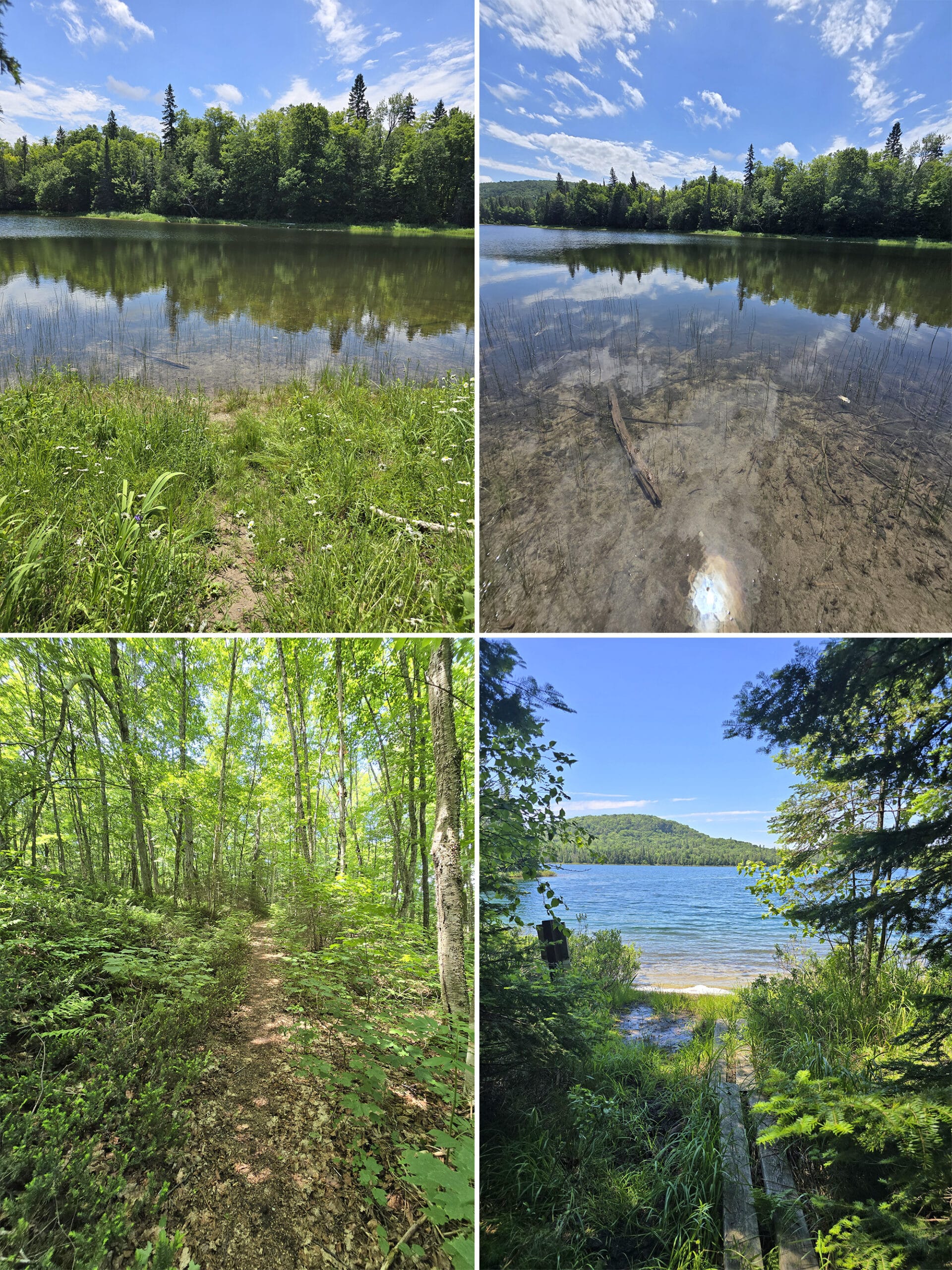
Swimming
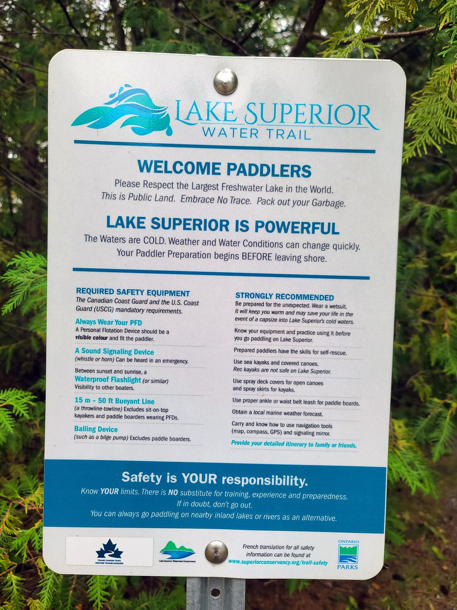
As the largest freshwater lake in the world, it shouldn’t surprise you that swimming is a whole thing at Lake Superior Provincial Park.
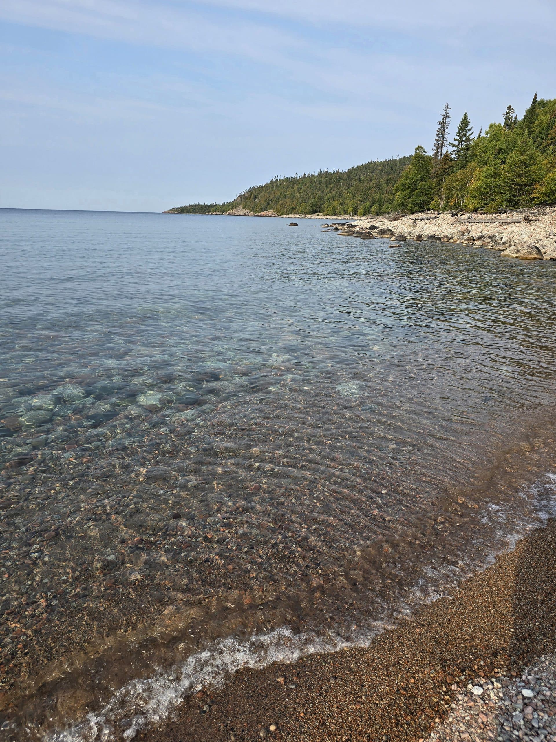
There is a long beach up the length of the Agawa Bay Campground - it’s a rocky beach, but gorgeous.
Just up the highway, Katherine Cove is a gorgeous sandy beach and day use area.
Finally, Old Woman Bay also has a swimming area... which we had not visited, by the time we published this review!
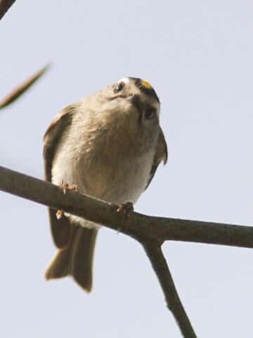
Birding, Wildlife, and Nature
As I’ve mentioned in previous posts, the first trip had use starting to think the birds have something against us!
Lake Superior Provincial Park is supposed to have a ton of bird species - 250 identified within the park, over 120 of which nest there! - and touts the great bird watching opportunities.
We saw that one large bird at Trapper’s Trail, and we had one small bird visit us while having lunch at our campsite.
... the entire stay.
Anyway, aside from the birds, the park is also known for black bears, moose, otters, and more. We just didn’t see much wildlife, during our stay!
Oh well. Those two otters made up in quality, what we’re lacking in quantity!

2nd Row: Common Raven, Dark-Eyed Junco
3rd Row: Greater Scaup, Red-Breasted Nuthatch
Update!
While we didn’t have a ton of luck *photographing* birds on the second, third, and fourth trips, we heard and saw a LOT more.
Overall - between the two of us - we either heard or saw:
American Pipit, American Redstart, American Robin, American Woodcock, Bald Eagle, Baltimore Oriole, Black-and-White Warbler, Blackburnian Warbler, Black-Capped Chickadee, Black-Throated Blue Warbler, Black-Throated Green Warbler, Blue-Headed Vireo, Blue Jay, Broad-Winged Hawk, Brown Creeper, Cedar Waxwing, Chimney Swift, Chipping Sparrow, Common Loon, Common Raven, Common Yellowthroat, Dark-Eyed Junco, Downy Woodpecker, Eastern Phoebe, Golden-Crowned Kinglet, Great Horned Owl, Greater Scaup, Hairy Woodpecker, Horned Lark, Least Flycatcher, Northern Flicker, Northern Parula, Ovenbird, Pileated Woodpecker, Pine Siskin, Pine Warbler, Purple Finch, Red-Breasted Nuthatch, Red Crossbill, Red-Eyed Vireo, Rose-Breasted Grosbeak, Ruby-Crowned Kinglet, Ruffed Grouse, Savannah Sparrow, Swainson's Thrush, Swamp Sparrow, Tennessee Warbler, Turkey Vulture, White-Crowned Sparrow, White-Throated Sparrow, White-Winged Crossbill, and Yellow-Rumped Warbler.

Row 2: Black-Throated Green Warbler, Broad-Winged Hawk, Canada Goose
Row 3: Chipping Sparrow, Common Loon, Common Loon BABIES (!!!!),
Row 4: Dark-Eyed Junco, Downy Woodpecker, Ruffed Grouse
Row 5: Swainson's Thrush, Tennessee Warbler, Yellow-Rumped Warbler
Also saw a TON of fungi in the fall of 2024, which is always fun:

On our June 2025 trip, there were wild flowers EVERYWHERE!
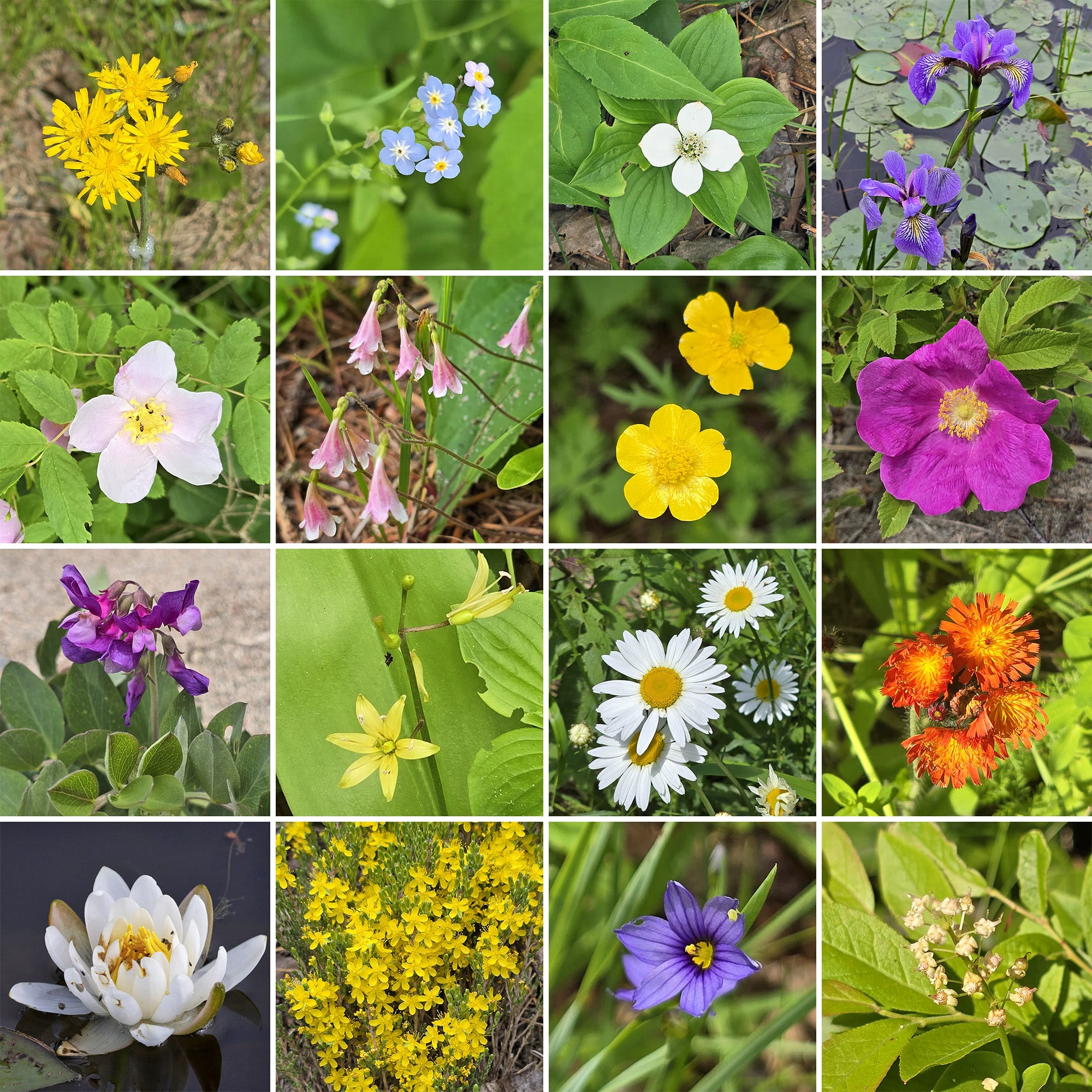
... as well as a ton of butterflies. Most were Canada Tiger Swallowtail Butterflies, but we also saw some Mourning Cloak Butterflies, Monarch Butterflies, a few smaller butterflies we couldn’t identify, a cool black iridescent moth, and a bunch of Dragonflies.
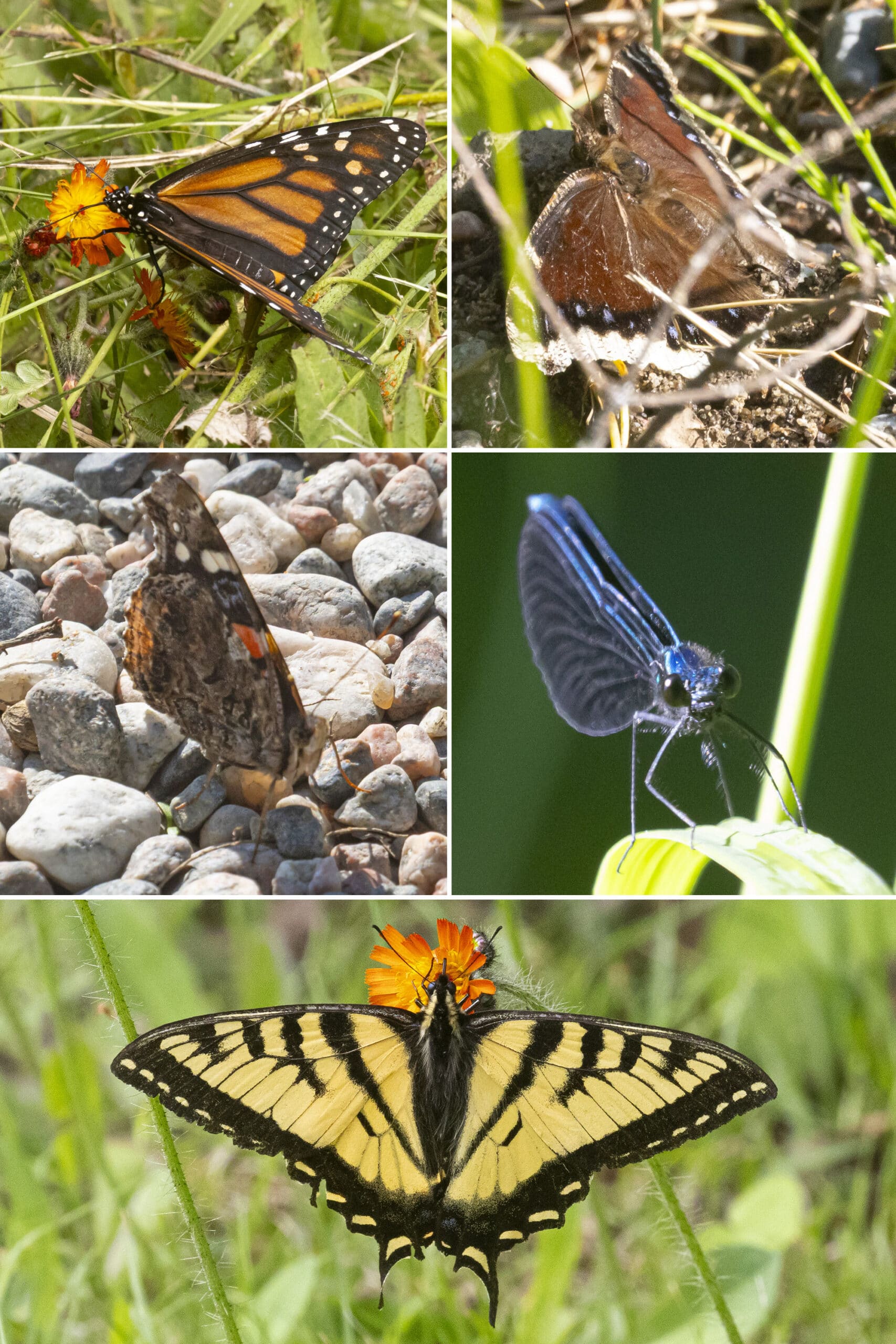
Row 2: Red Admiral Butterfly, Damselfly
Bottom: Canada Tiger Swallowtail Butterfly
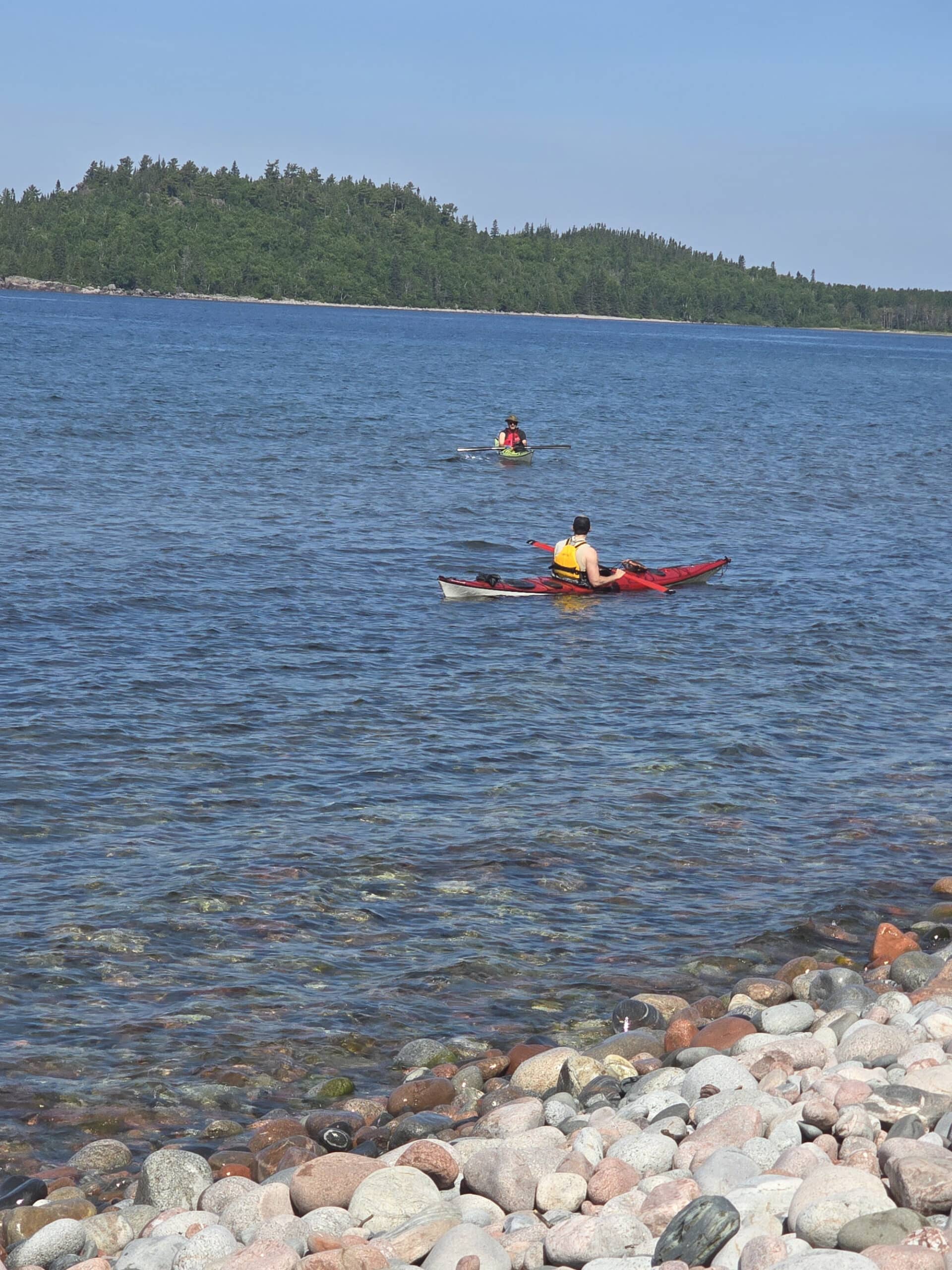
Boating
Lake Superior Provincial Park is a popular spot for boating - especially canoeing - but there are some restrictions you should know about.
Power boats are allowed on Lake Superior with no motor restrictions in place. Motors need to be 10 hp or less on Sand lake, and power boats are not allowed on any other lakes in the park.
There aren’t any boat launches in Agawa Bay campground itself, but there is one in Sinclair Cove, just a few kilometres north of the campground. It’s accessed via the same exit as the Agawa Rock Pictographs trail

Also, Kenney Lake - just a few km south of the campground, accessed via the Crescent Lake Campground Parking - seemed to be a popular place for stand-up paddleboards, during our June 2025 visit.
Fishing & Hunting
You can fish for brook trout, lake trout, rainbow trout, and salmon throughout the park, subject to various restrictions and seasons.
Additionally, the use - and possession - of live baitfish is prohibited on interior park lakes.
Sand River Falls seems to be a super popular place for fishing, across each of our visits to Lake Superior Provincial Park.

Man, I wish I knew some moose hunters. I could do with a nice batch of my moose stew right about now...
Discovery Program
As with most provincial parks, there are several different offerings for interpretive programs, special events, etc in Lake Superior Provincial Park, and Agawa Bay Campground, specifically.
The Agawa Bay Visitor Centre hosts some programming, with park staff offering kids programs, speakers, evening programs, guided walks, and more during the summer months.
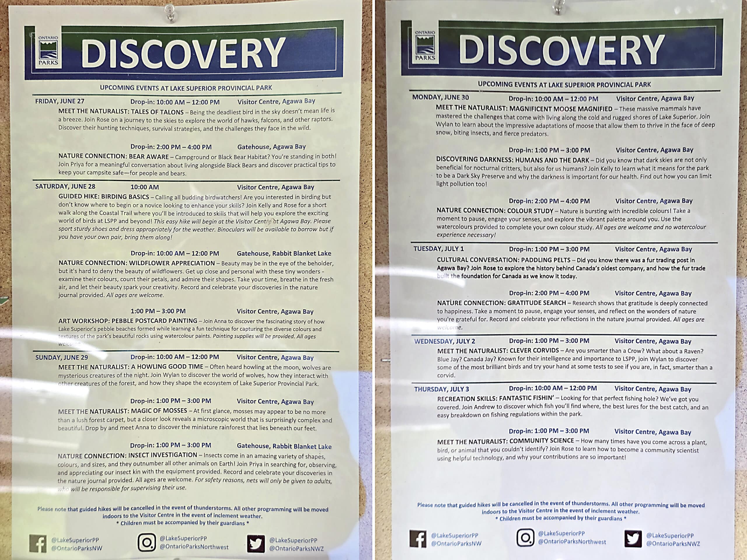
There’s also a large-ish amphitheatre on the north end of the campground.

Winter Activities
While the camp grounds and park roads are closed and gated off in the winter, the park welcomes you to ice fish, ski, and snowshoe as weather and conditions permit.
Snowmobiles aren’t permitted anywhere in the park, except on Frater road.
Niantic Games, etc
There are a few pokestops / gyms / Ingress Portals in the campground - 2 in the campground, 2 by the visitor center, one at the amphitheatre, and one at the gate house.
You’re never all that far away from a stop, and cell reception was generally OK enough to get your daily tasks in, at minimum.
Final Thoughts
DAAAAAMN!
Gorgeous park, amazing views, fantastic hiking.
As my husband said, it’s the most fun he’s ever had climbing rocks. It’s not something he’d ever sought out, but now he gets it!
Being able to park our camper just a few metres from Lake Superior and only have to look out our door to see a beautiful sunset over the lake has been wonderful.
We’ll definitely be back... again and again, it seems!

More Northern Ontario Provincial Parks & Places to See
Want to read some more about the parks we've camped and at places we've seen in Northern Ontario? Here are some more posts!
Northern Ontario Campground Reviews:
Aaron Provincial Park
Blue Lake Provincial Park
Caliper Lake Provincial Park
Kakabeka Falls Provincial Park
Lake Superior Provincial Park
MacLeod Provincial Park
Neys Provincial Park
Ojibway Provincial Park
Pakwash Provincial Park
Pancake Bay Provincial Park
Pukaskwa National Park
Quetico Provincial Park
Rabbit Blanket Lake, Lake Superior Provincial Park
Rainbow Falls Provincial Park
Rushing River Provincial Park
Sandbar Lake Provincial Park
Sioux Narrows Provincial Park
Sleeping Giant Provincial Park
White Lake Provincial Park
Northern Ontario Places to See:
Aguasabon Falls & Gorge
Amethyst Mine Panorama
Batchawana Bay
Chippewa Falls
Kakabeka Falls
Mink Creek Falls
Old Woman Bay
Ouimet Canyon Provincial Park
Potholes Provincial Park
Roy Wilson Suspension Bridge
Sand River Falls
Scenic High Falls
Temagami Fire Tower
Terrace Bay Beach
Want to explore beyond Northern Ontario? Check out our full list of Campground Reviews, Ontario Waterfalls, and other Places to See.
We also have a ton of Camping Recipes to cook up, while on your adventures!

Thanks for Reading!If you loved this post - or have any questions about it - please leave a comment below! We'd also love it if you would consider sharing the link on social media! |

Leave a Reply