

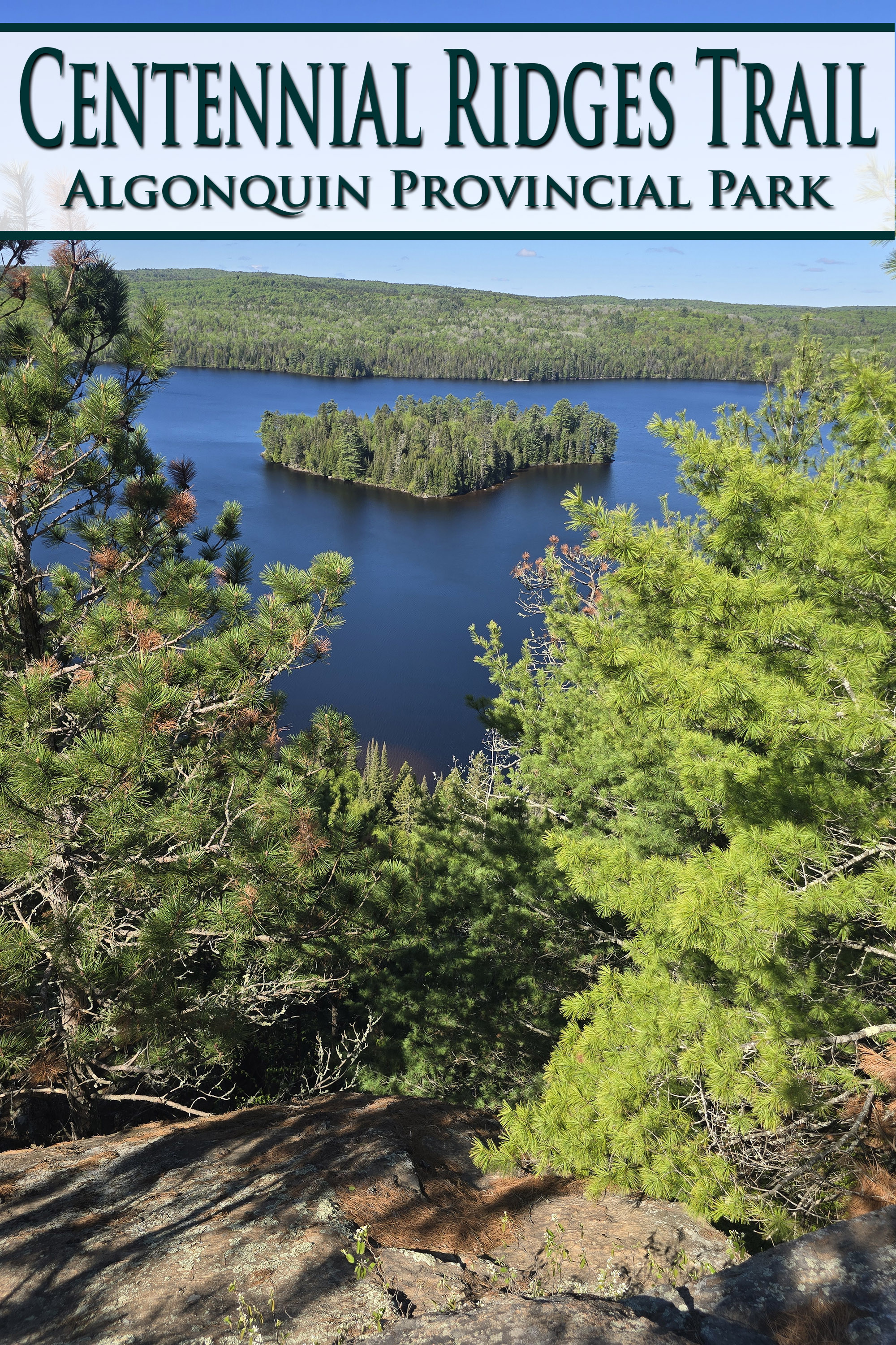
Centennial Ridges Trail is a popular and challenging trail in Algonquin Provincial Park. Here's what you need to know about this epic hiking trail!
We already wrote a post on Barron Canyon Trail before actually deciding that this would be a whole thing.
Centennial Ridges Trail has been intriguing us for a while, as people who tend to enjoy Winter Camping in Algonquin Provincial Park.
See, the road that goes up to the Centennial Ridges Trail is gated over the winter, but - pretty much without fail - we tend to see SEVERAL cars parked at that gate.
Knowing that the trail head is 2 km - uphill - from that gate, we’ve long wondered what the draw must be, that people will go to THAT effort (in the snow, up an un-maintained road!), to do the trail.
In the spring of 2026, we finally got our answer!
He came back GIDDY.
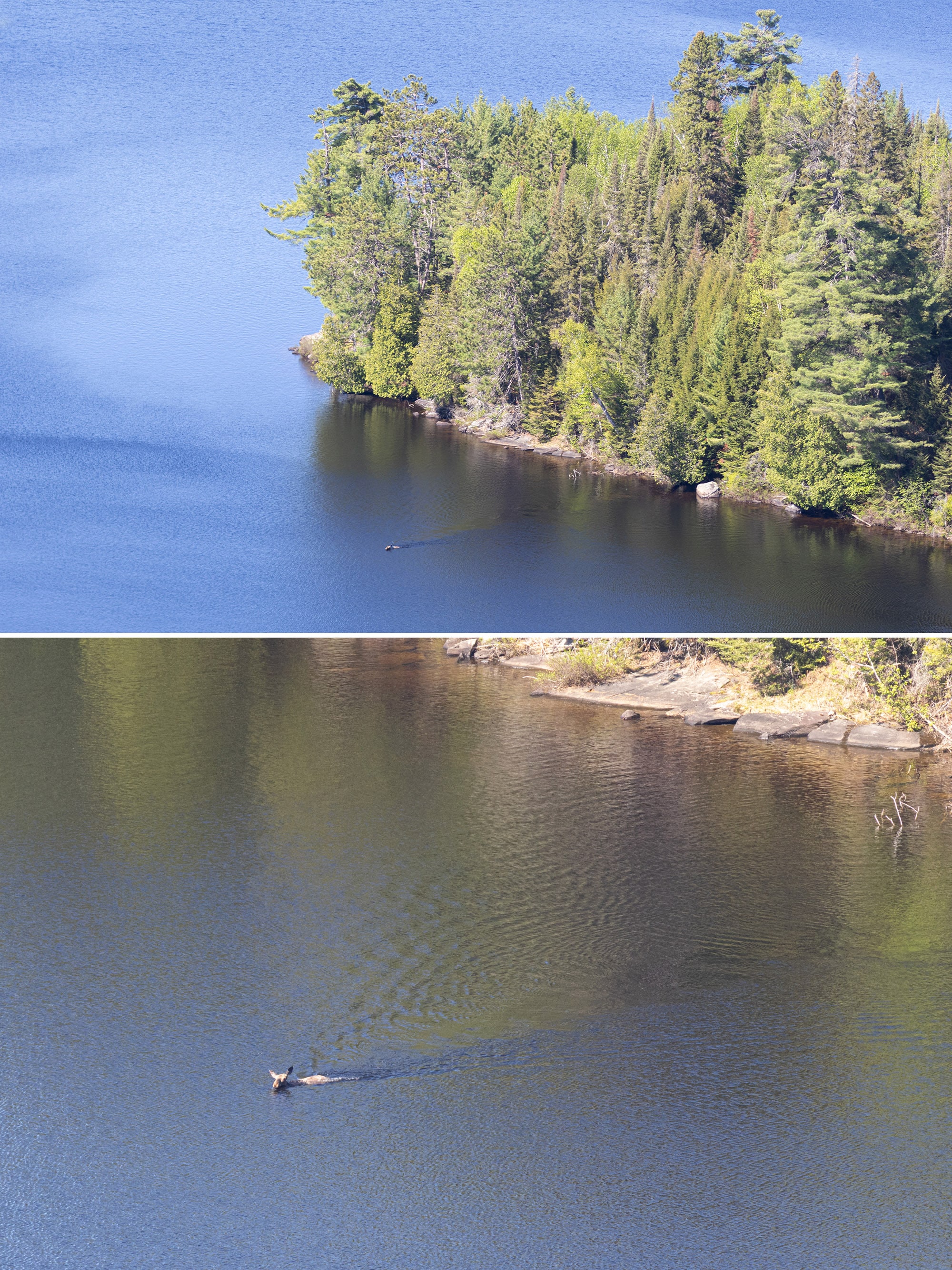
Not only did he have a fantastic time on the trail itself, with all of the amazing views it offered ... he’d seen a moose.
Not just on the side of the road or anything, but WAY down below, as he was up on a cliff. It was swimming in a lake, something we’d never seen before.
He was thrilled with the whole experience. So, it seems like this trail is a good one to start with, right?
So much to talk about, so let’s get right to it.
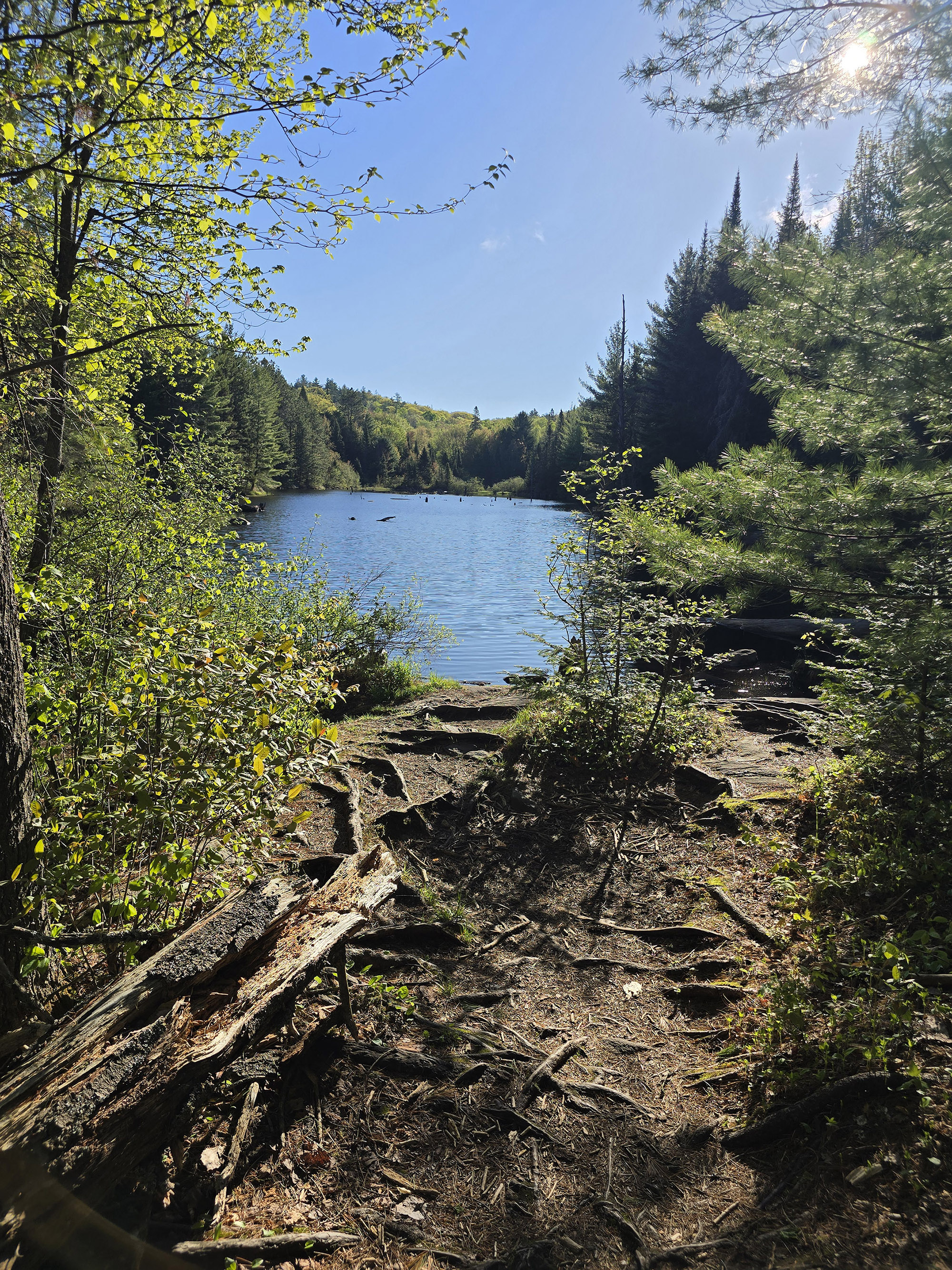
The Basics:
Name: Centennial Ridges Trail
Algonquin Park Section: Highway 60 Corridor
Kilometre Marker: km 37.6
Season:
Trail Length: 10.4 km (Not really accurate!)
Difficulty: Difficult
Suggested Completion Time: 6 hours
Logistics
Some basic information to help you plan your hike on the Centennial Ridges Trail in Algonquin Provincial Park:
Registration and Check In
All hiking trails in Algonquin Provincial Park require a valid permit to be within the park in the first place. There are a few different ways you can do this, depending on how you’re visiting the trail.
1. If you’re currently camping in Algonquin
If you have a current, valid camping permit for a campground in Algonquin Provincial Park - you just show up to the trail. Your license plate number is already registered with the park, and you’re good to go.
2. If you’re currently camping in a DIFFERENT Provincial Park
If you’re driving in for a day trip from somewhere like nearby Arrowhead Provincial Park, Bonnechere Provincial Park, Lake St Peter Provincial Park, or Silent Lake Provincial Park - you can take advantage of the reciprocal program.
With a few exceptions, a current and valid camping permit from one Ontario Provincial Park will act as a daily vehicle permit at another.
You just need to show up at one of the gates on the way in (East Gate and West Gate are the ones on either end of Highway 60), and show proof of that permit - a paper permit if your campground has it, or your email confirmation.
They will register your license plate number and you’re free to go - no additional fees required!
3. If you have an annual Ontario Parks Pass
Generally speaking, all you have to do is show up at one of the gates, present your pass, and have your license plate noted.
Note: Sometimes you’ll need to reserve a daily vehicle permit ahead of time. This is usually during peak fall colours season, when certain areas of the park reach capacity.
4. If you don’t have any sort of camping permit or Parks Pass in place
You can book your Daily Vehicle Permit online at Ontario Parks Reservations - up to 5 days in advance of your visit.
If you’re planning your visit for October... you might want to be ready to do so right when that 5 day window opens up, to ensure availability!
Otherwise, you can pay for a DVP at any one of the Algonquin Provincial Park gates.
Note: Some of the trailheads have QR codes for booking your DVP, but with such spotty internet throughout the park ... I really recommend doing it ahead of time.
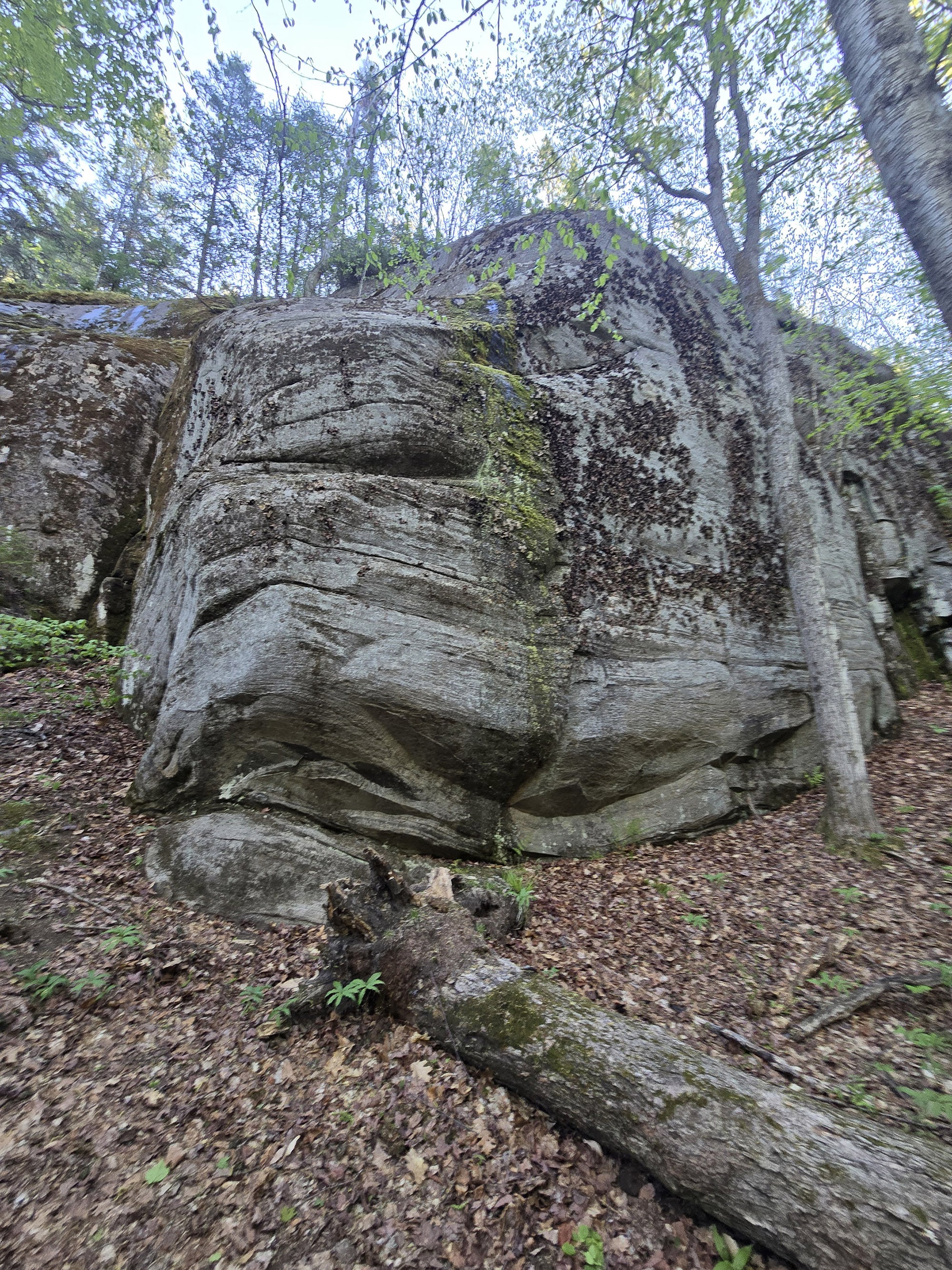
Parking
The trailhead is located 2 km off the highway, and tends to be gated in the shoulder season and winter.
People will park right at that gate - just off the highway - but the road isn’t maintained past that point. Also, a lot of the road in is quite uphill.
Once you get to the trailhead, there’s very large parking lot. There’s definitely enough room to park and RV and/or turn it around, if needed.
That said... we expect this would get really busy in certain seasons - like the fall. During peak fall colours season, you’ll definitely want to get there early, to get a spot.
We saw what appeared to be a second lot, partway down the main road in - probably overflow parking. Apparently THAT fills up, also!

Washrooms
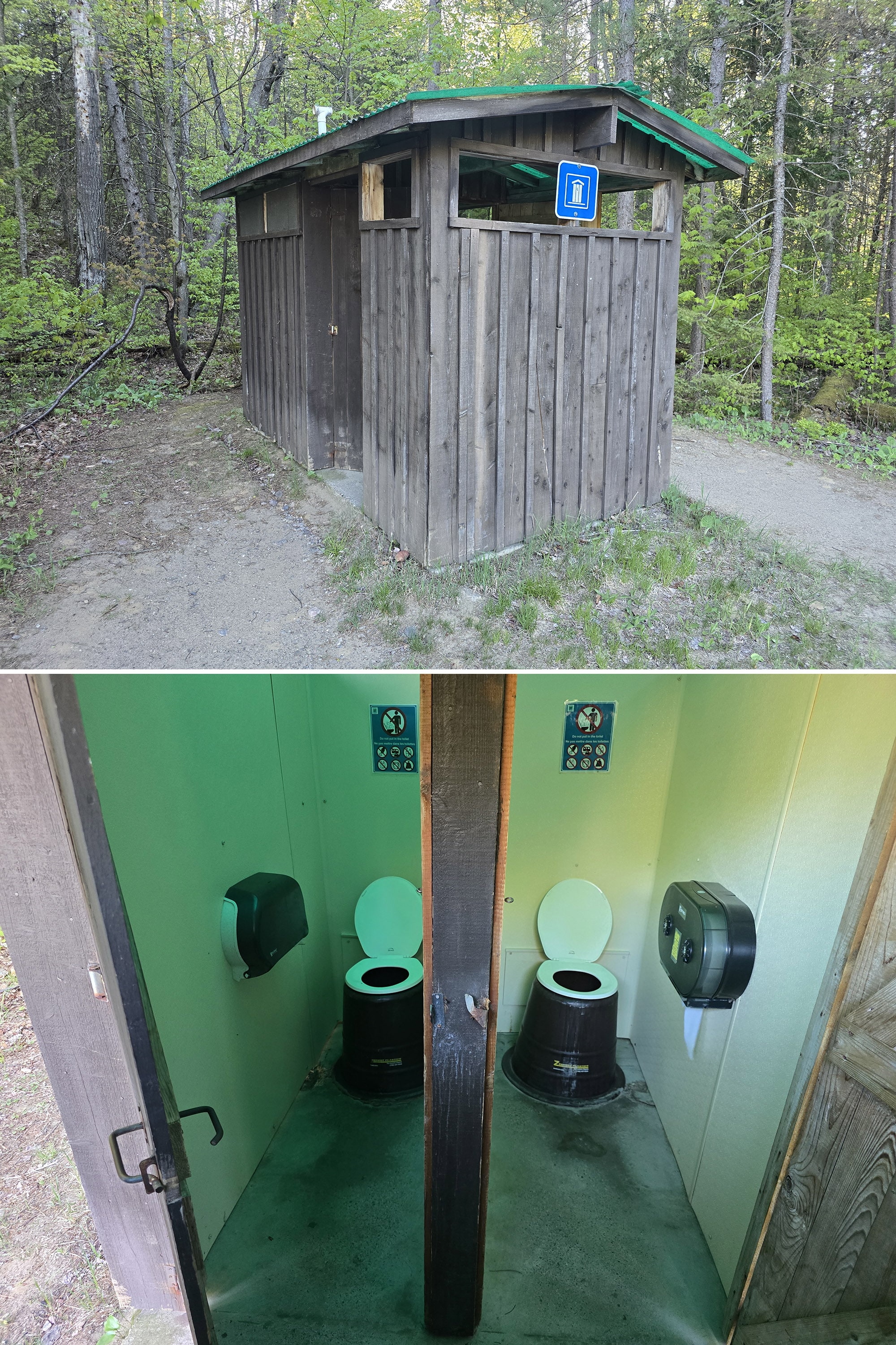
There’s a single outhouse on the edge of the parking lot, and this is the only washroom along the trail itself.
That said - if you REALLY need to go - there’s a 1.1 km long offshoot trail, around 8.5 km in. It’ll take you down to the Raccoon Lake Campground, where there are some (really nasty, in our experience) outhouses.
At that trail split, though, you only have about 4 km left to go... so keep that in mind!
Maps and Signage
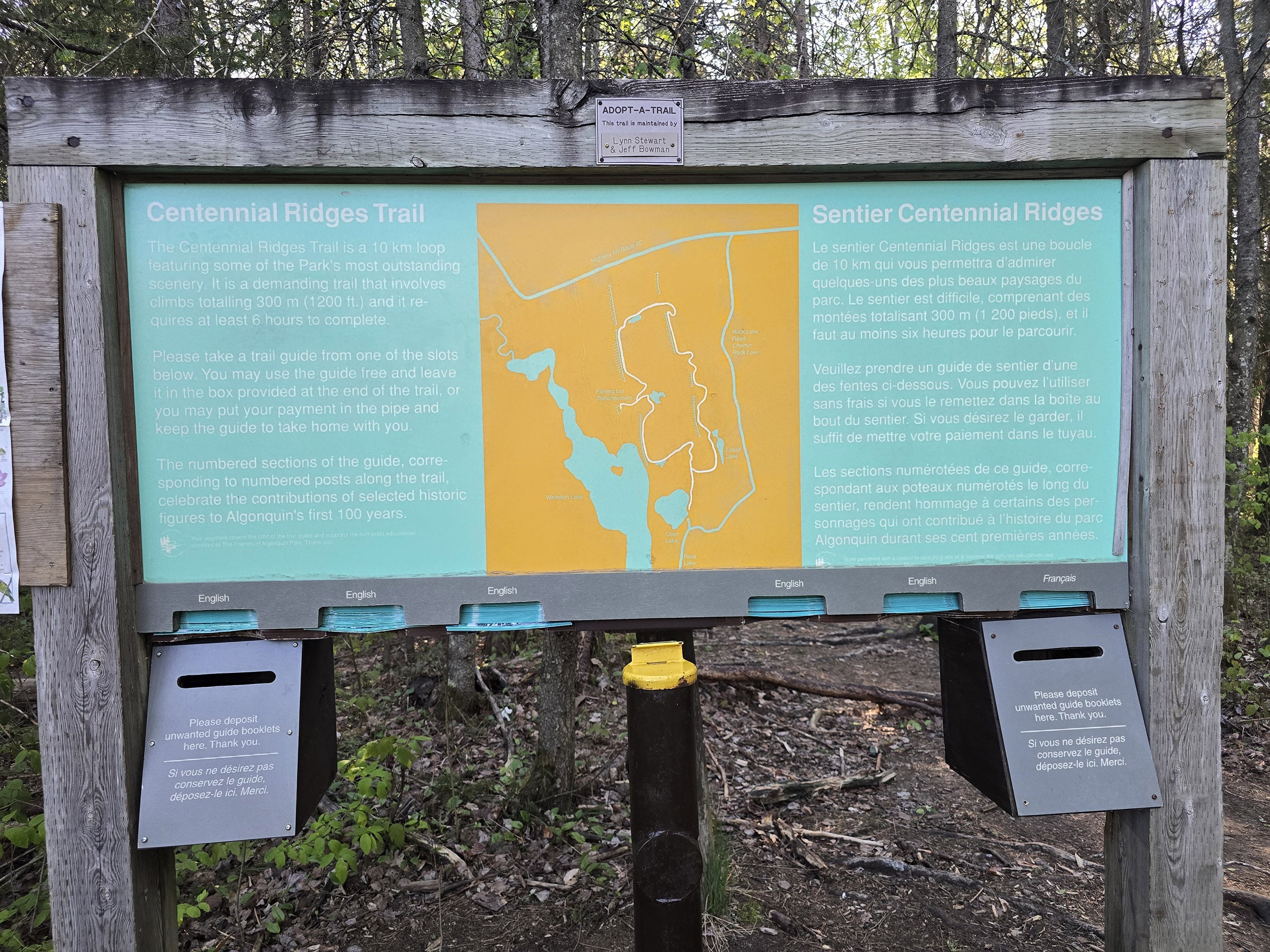
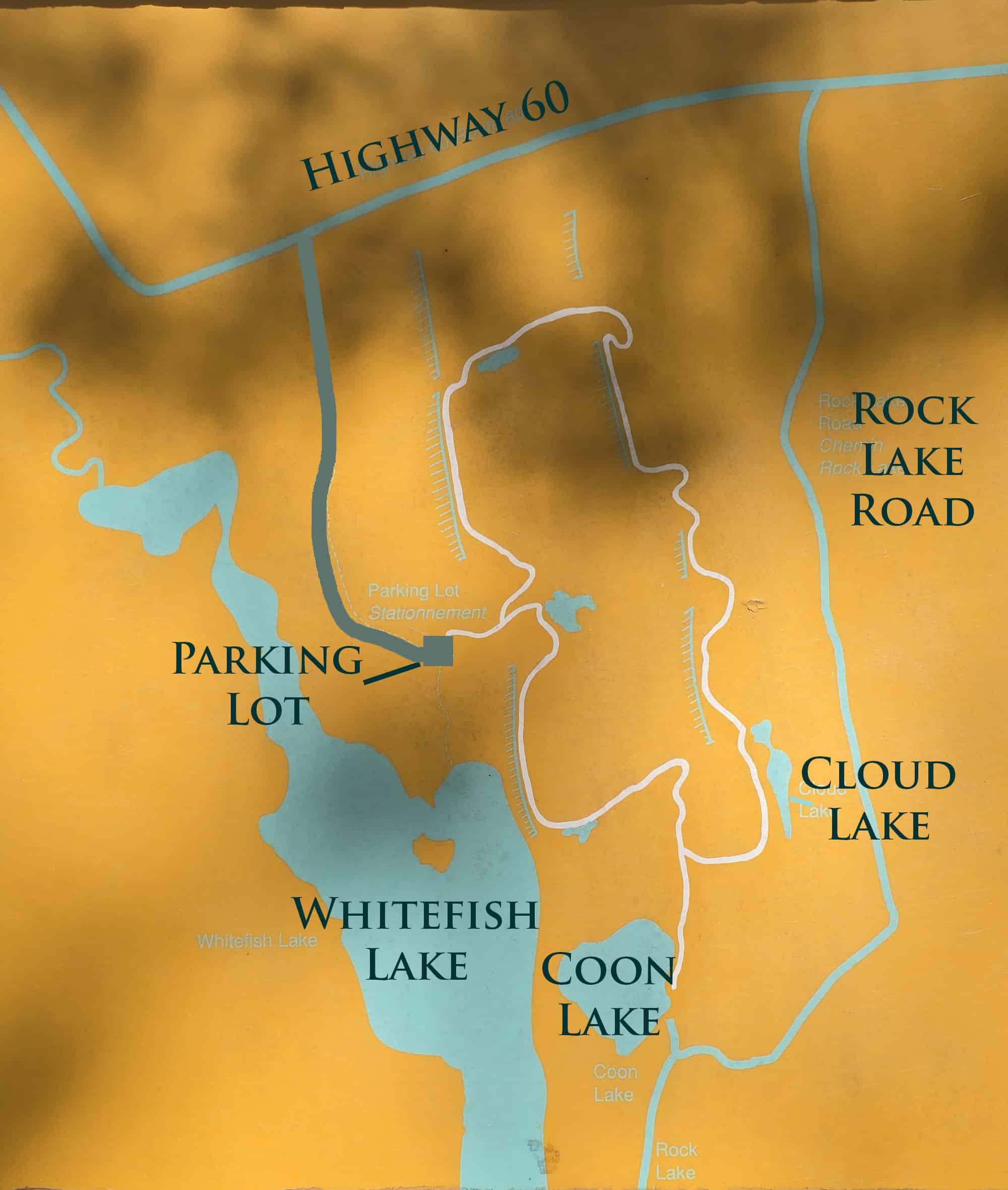
There is a map of the trail at the trailhead, on a large sign. There are also at least a couple “you are here” type map signs along the trail itself.
Also at the trailhead are the trail guides, which can also be purchased at the Visitor Centre.
These have a better map, with points of interest denoted, as well as a chart showing elevation changes.
Love it!

Accessibility
To quote Porter:
“No. Just no”.
This long and difficult trail that is really not suitable for anyone with mobility impairments or in need of assistive devices - beyond a walking stick.
Pets
Dogs are allowed on the Centennial Ridges Trail, but we don’t really recommend it on this trail.
There are some bouldery sections that will be difficult for most dogs, and the cliff edges also present a danger. You’re going to want to be sure your dog is under control at all times on this on.
Beyond that, all the standard Ontario Provincial Parks rules apply.
They must be leashed at all times, and aren’t allowed to harass other hikers, wildlife, or plants.
They can’t be left unsupervised, and aren’t allowed to make excessive noise.
Owners must pick up after their dogs, and properly dispose of the droppings.
On that note, there are no poop baggie dispensers on site, we didn't see a garbage can at the trail head. Plan ahead!
Day Use Area
Porter did not see any benches or picnic tables along the trail or in the parking lot.
If you’re looking for some great picnic spots, the closest will be either the East Beach Day Use Area, the Lake of Two Rivers Day Use Area, or the Costello Creek Day Use Area.
That last one is a bit of a drive - up Opeongo Rd - but worth it, on account of the potential for wildlife sightings.
Connectivity
Porter had great internet up on the top of the ridges, which was kind of nice after having so many connectivity issues in the park.
On that note, cell phone coverage varies wildly in Algonquin Provincial Park, far more so than anywhere else we’ve been.
A spot may have fantastic coverage one day, then none the next. You may have fantastic coverage at one point on a trail, then none just ten metres later.
Carrier, how busy the area is, elevation, and the weather all seem to play a part.
We can’t reliably tell you what the cell coverage will be like on this trail, as a result. Our best advice is to assume there will be no cellular coverage, and plan accordingly.
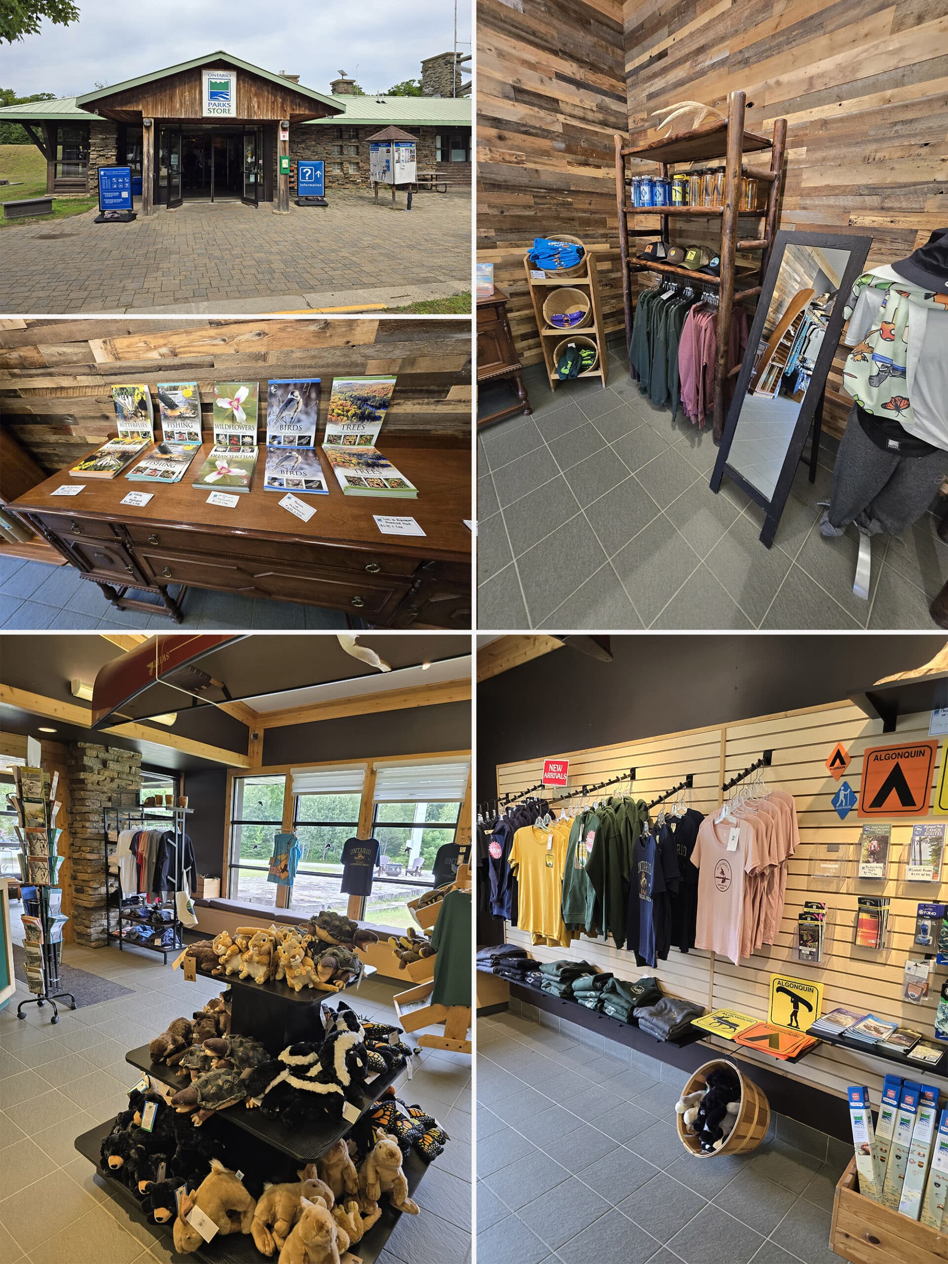
Note: We can say that the most reliable place we’ve found for cell coverage in Algonquin PP has been the Visitor Center Parking lot. Also, there is wifi available inside the Visitor Centre itself.
Miscellaneous
1. As previously mentioned, the road access to this trail is seasonal, with it gated from late fall/early winter, until sometime in the spring. Apparently you’re still allowed up there, but it’s at your own risk.
2. Porter got to the trail pretty early in the morning and there were some deep shadows. The view looks great in person, but photos - especially of the cliffs - will look better a little later in the day, when the sun is higher.
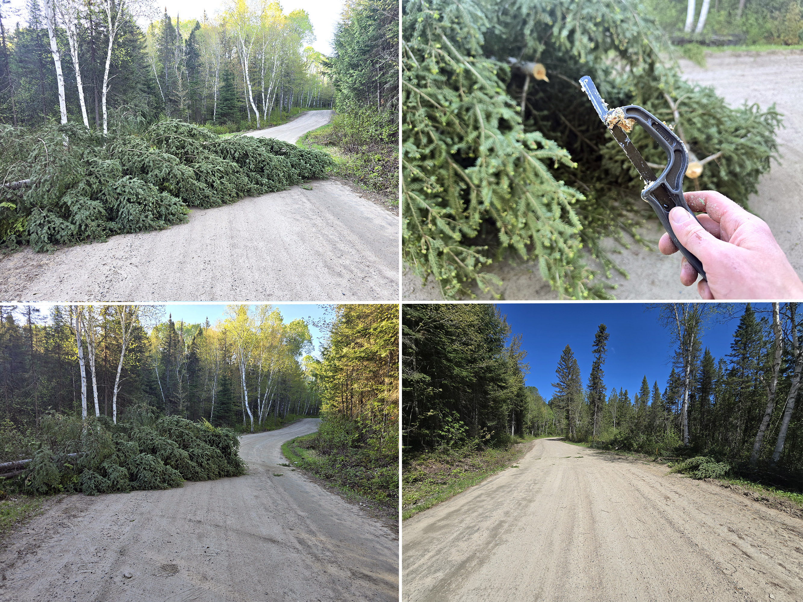
3. He encountered an obstacle on the way to the trail:
“About halfway up the road to the trailhead, there was a downed tree completely blocking the road. There was a big wind storm the night before, many trees were down and the power was out.
I considered parking by the tree and walking in, but there are "no parking" signs along this road, and I didn't want to get a ticket, or worse, towed.
I didn't want to turn around and go back, so I decided to clear it myself. It was far too heavy to simply pull to the side, I had to cut it.
I dug through my car toolbag and found my little mini hacksaw. It's made to cut metal, but it ended up working pretty well on the tree.
I cut the tree in a spot such that clearing one side would let a car pass on the road. This smaller piece was easy enough to drag to the side, allowing a single vehicle to pass by without any damage.
The tree was cleared by the time I finished the trail.”
Share the Love!If you’ve made one of our recipes, be sure to take some pics of your handiwork! If you post it to Bluesky, be sure to tag us - @2NerdsInATruck, or you can tag us on TikTok, if you’re posting video. We're also on Pinterest, so you can save all your favourite recipes and park reviews to your own boards! Also, be sure to subscribe to our free email newsletter, so you never miss out on any of our nonsense. Well, the published nonsense, anyway! |
Entertainment and Activity
Some information on the various recreational activities you can partake in along the Centennial Ridges Trail:
Hiking
Note: Porter wrote this trail review, I sorted and grouped the trail photos. He had taken literally hundreds of them, it was a LOT to sort through!
So - while they’re shown here in chronological order - they don’t necessarily line up with where he is in the commentary!
Since this is one of the long trails at Algonquin Park, I made note of how far in some of the features are located. I find it helpful to know how far the next feature is, and how far is left on the trail.
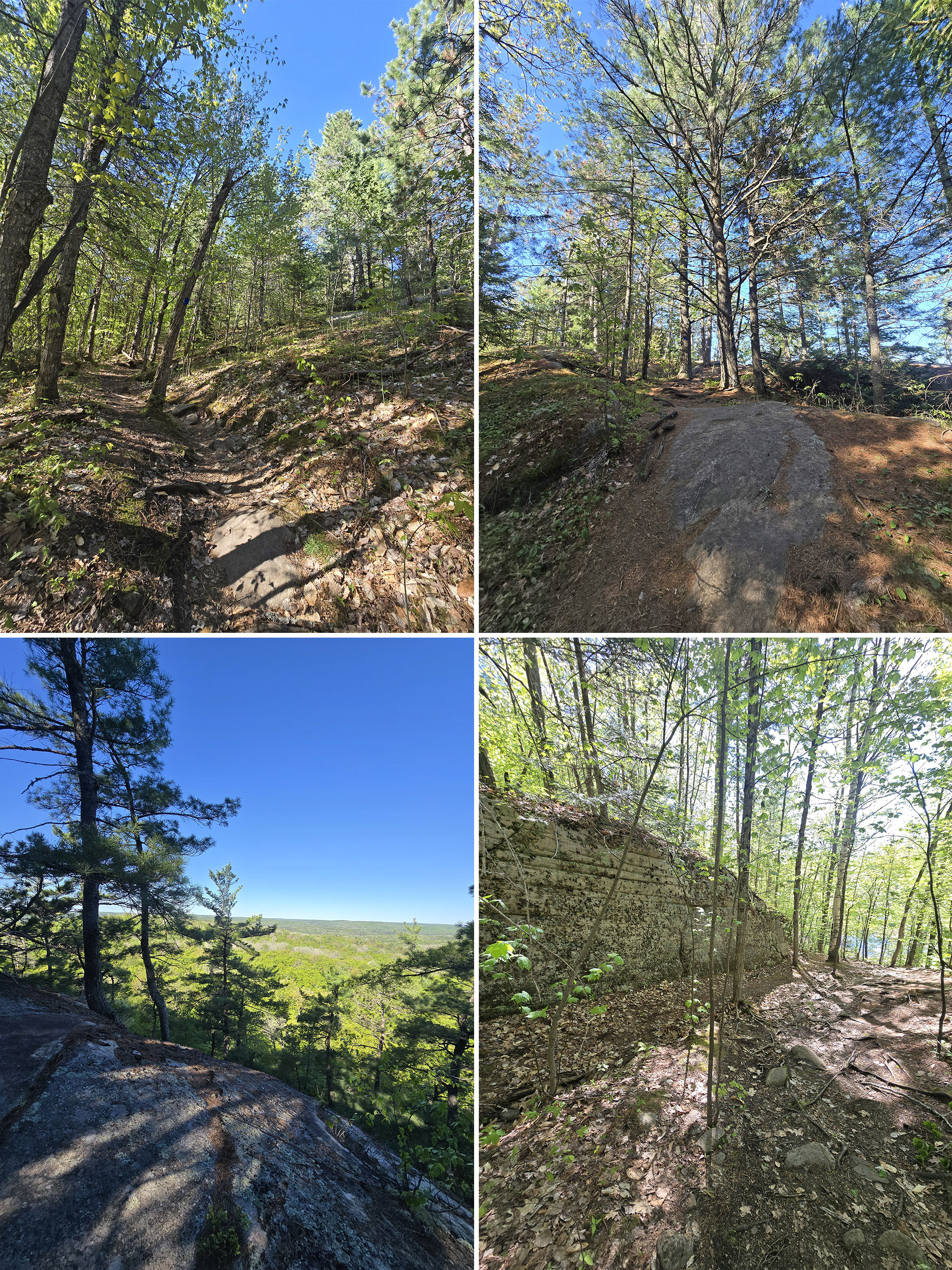
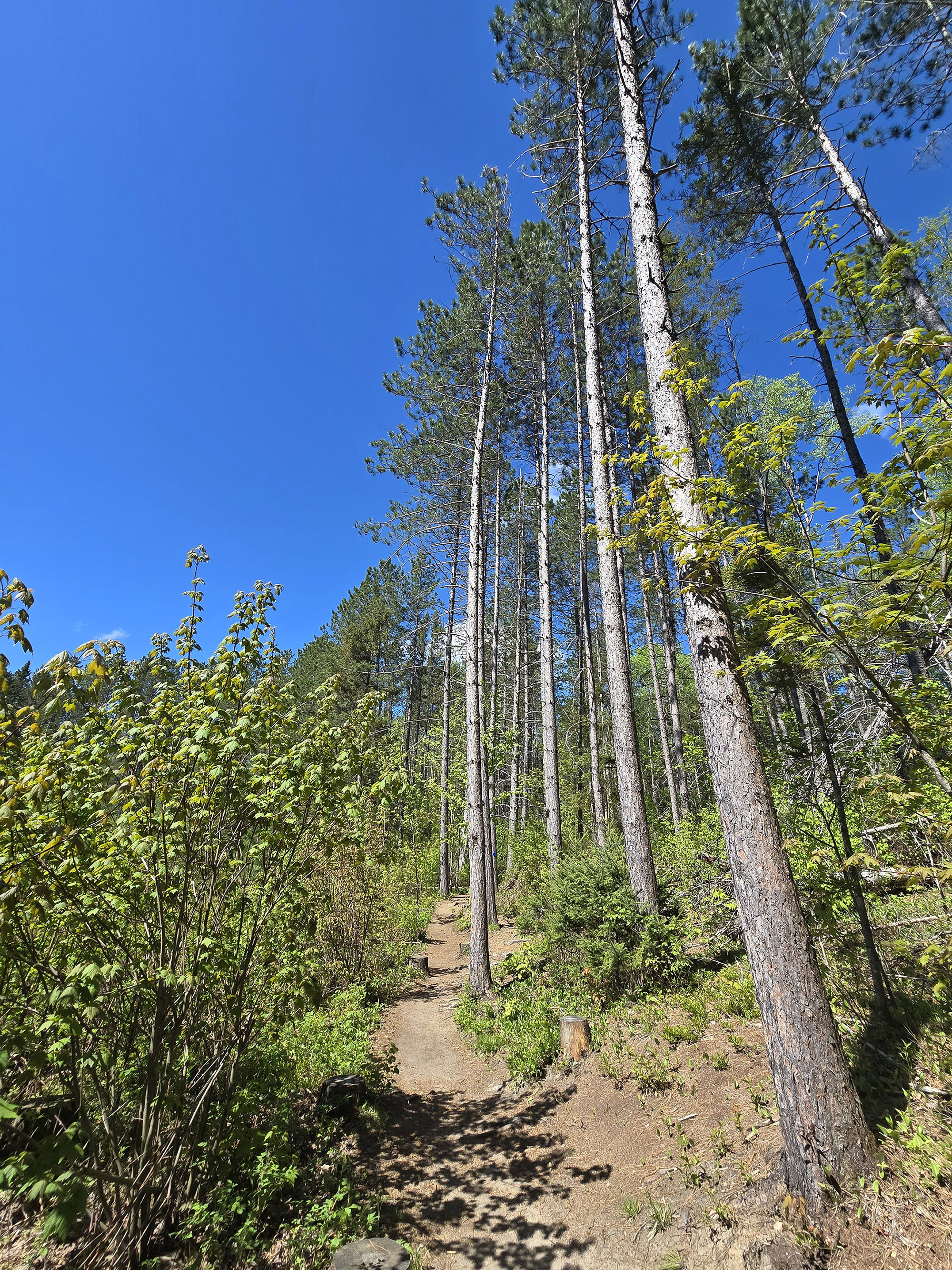
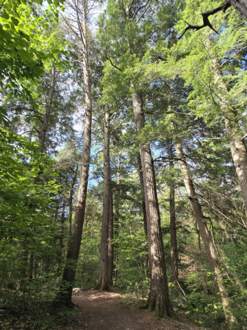
The trail starts out in a beautiful forest, lush with large trees, as well as a green forest floor with small plants. The trail is pretty wide, well packed, and well-blazed but you don't need it, at least at this point. It's really obvious where you're going.
By 1 km in, I've done quite a bit of climbing. It's all moderate slope, but it's fairly continuous.
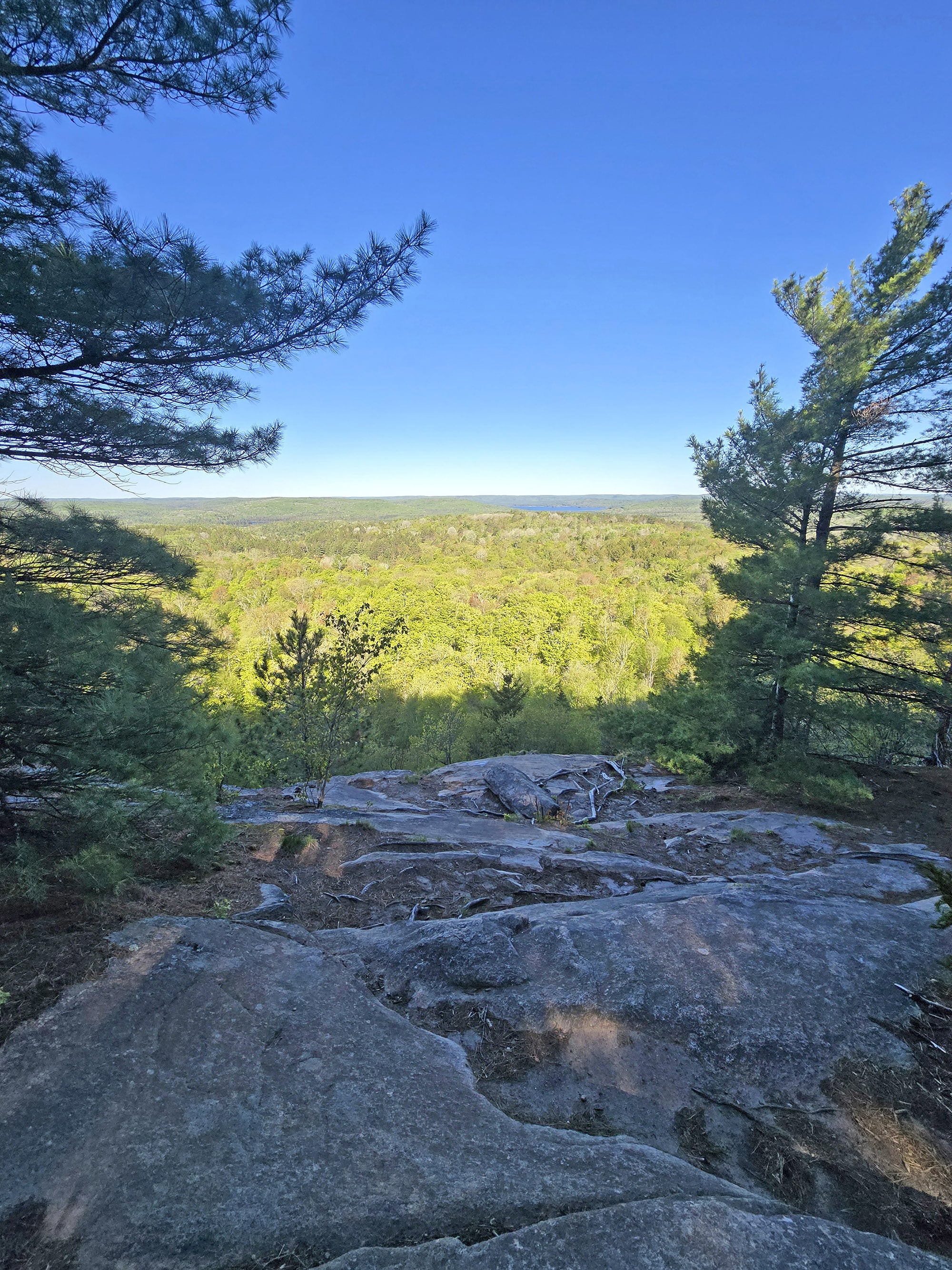
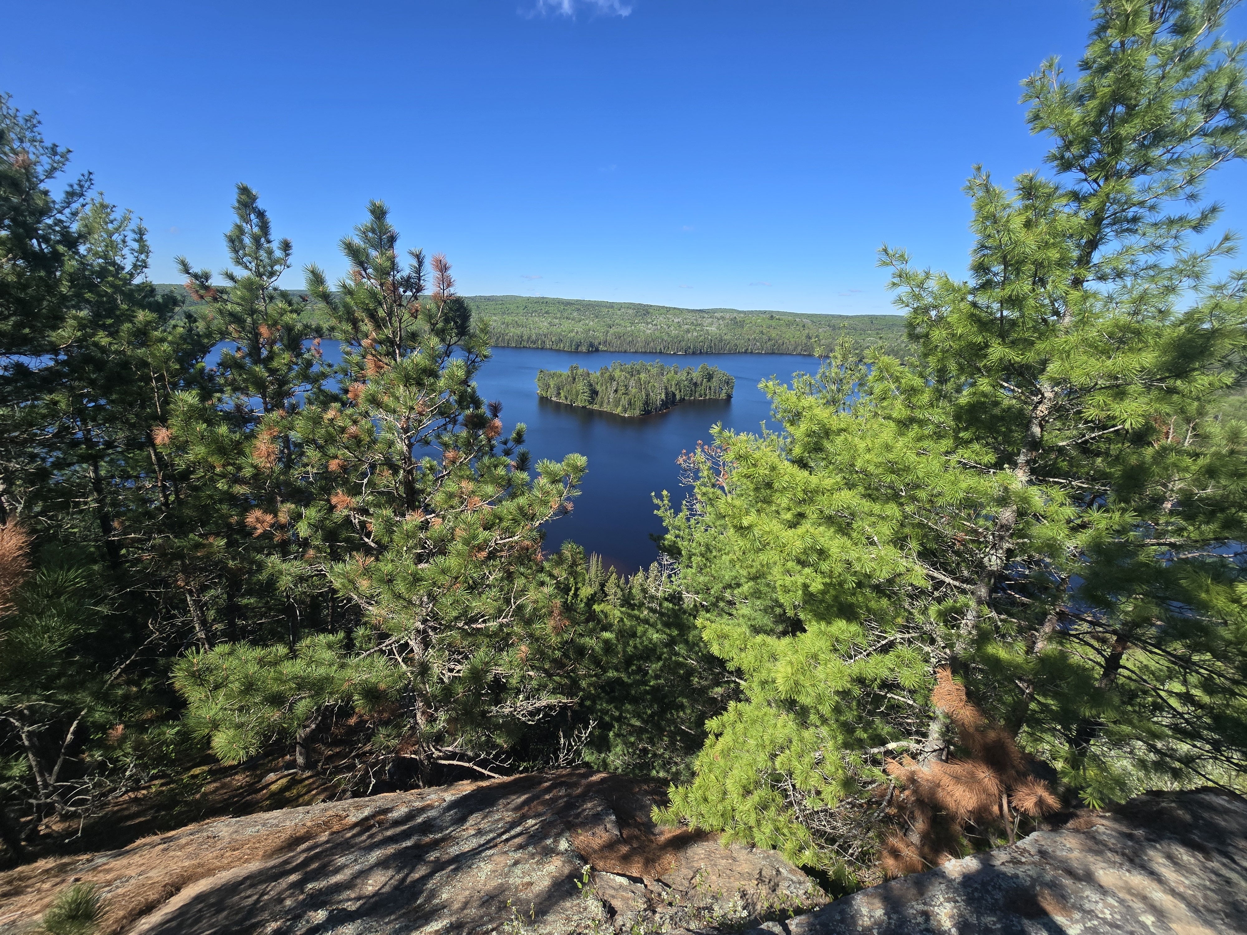
1.2 km in you get to the first overlook. It's a really nice view of the landscape filled with trees, and a body of water off to the left. You're standing on these giant smooth boulders which are really cool themselves.
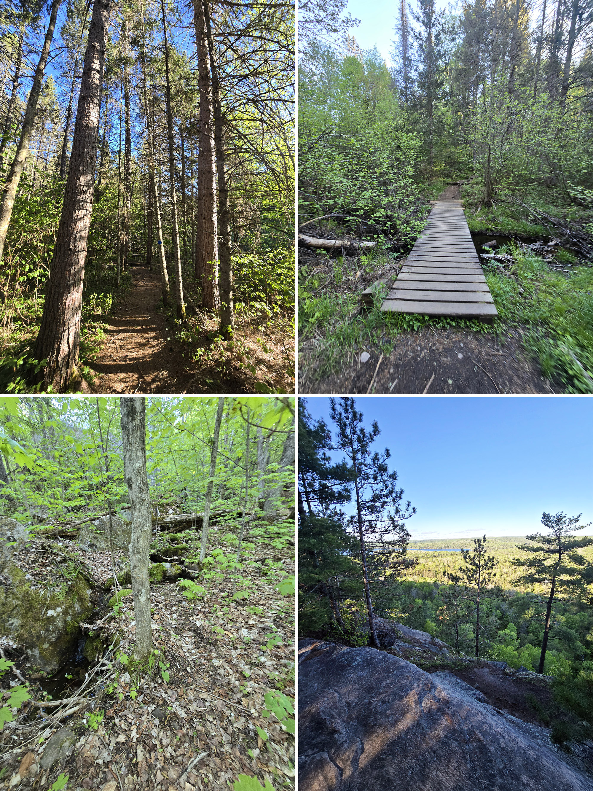
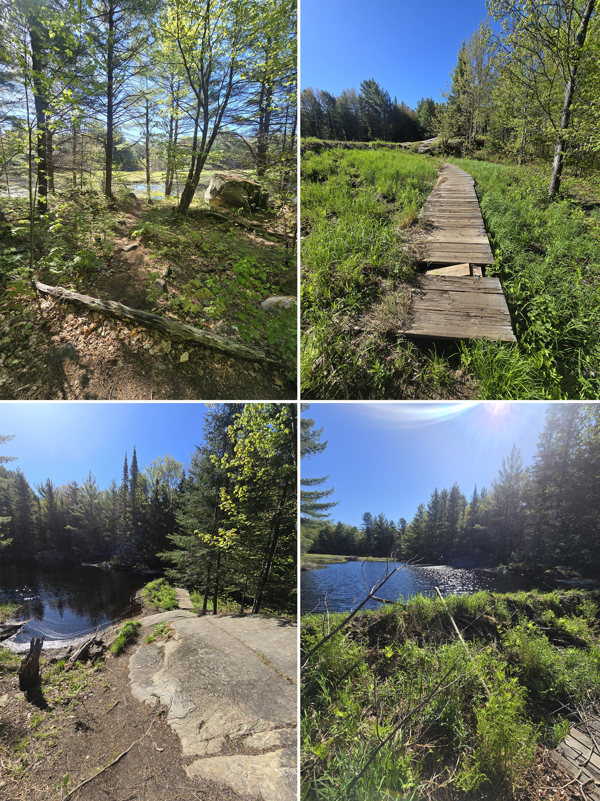
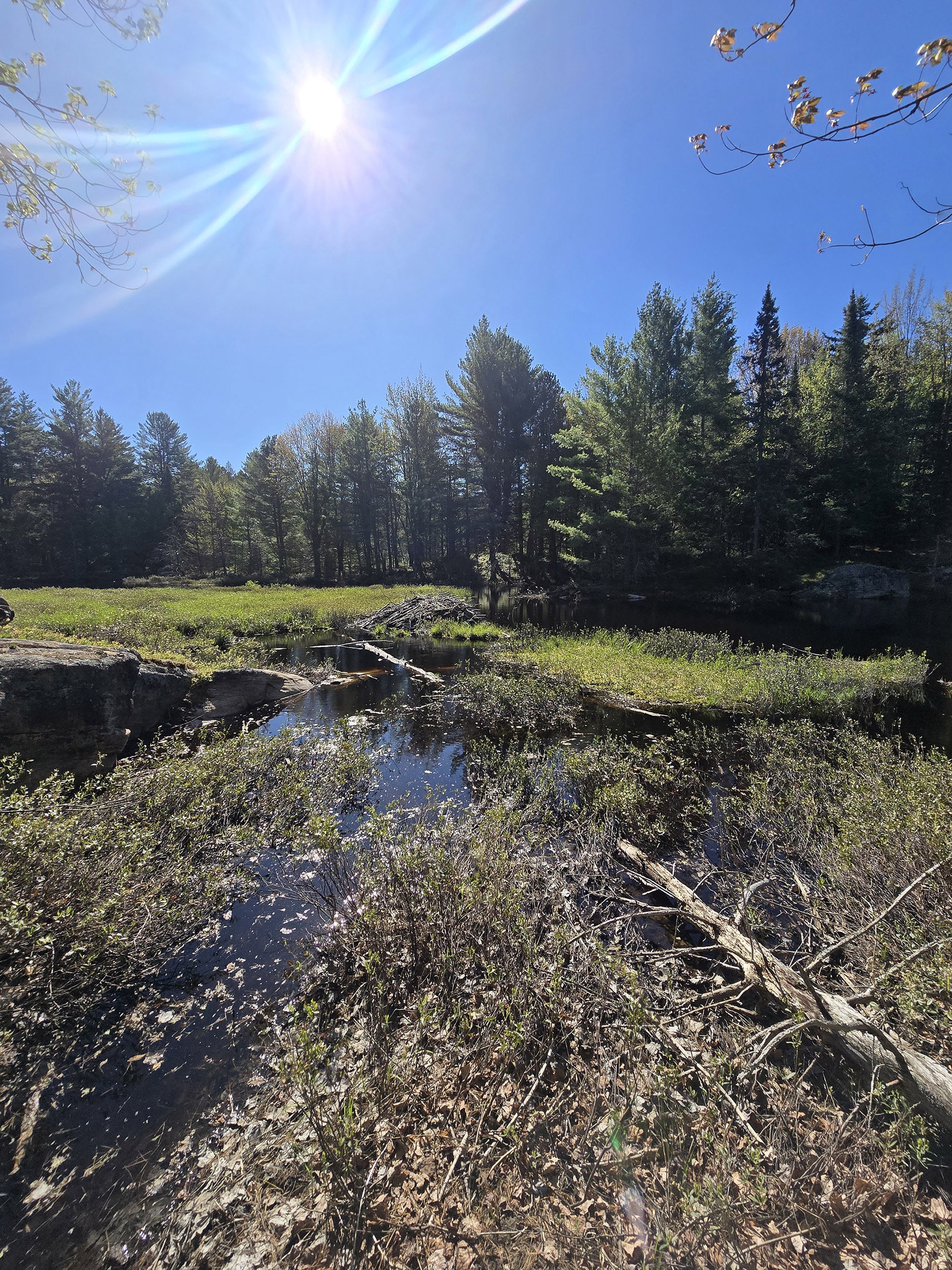
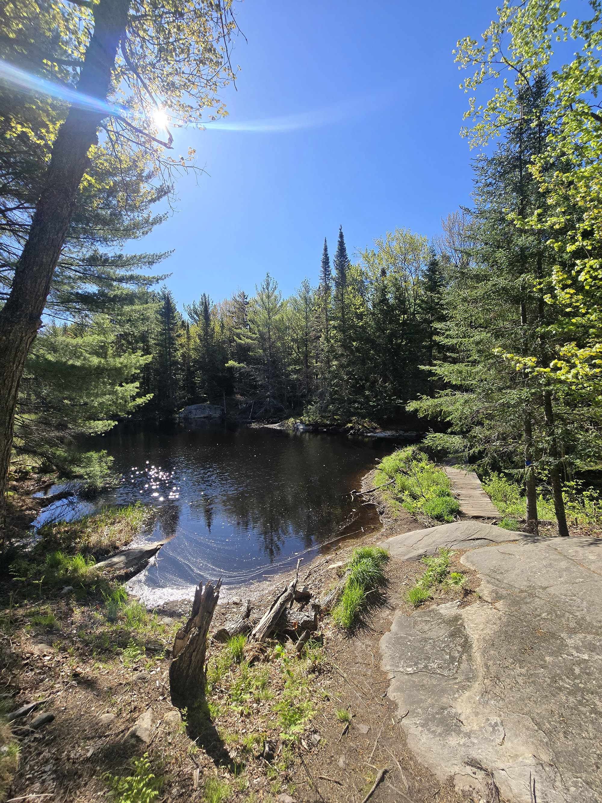
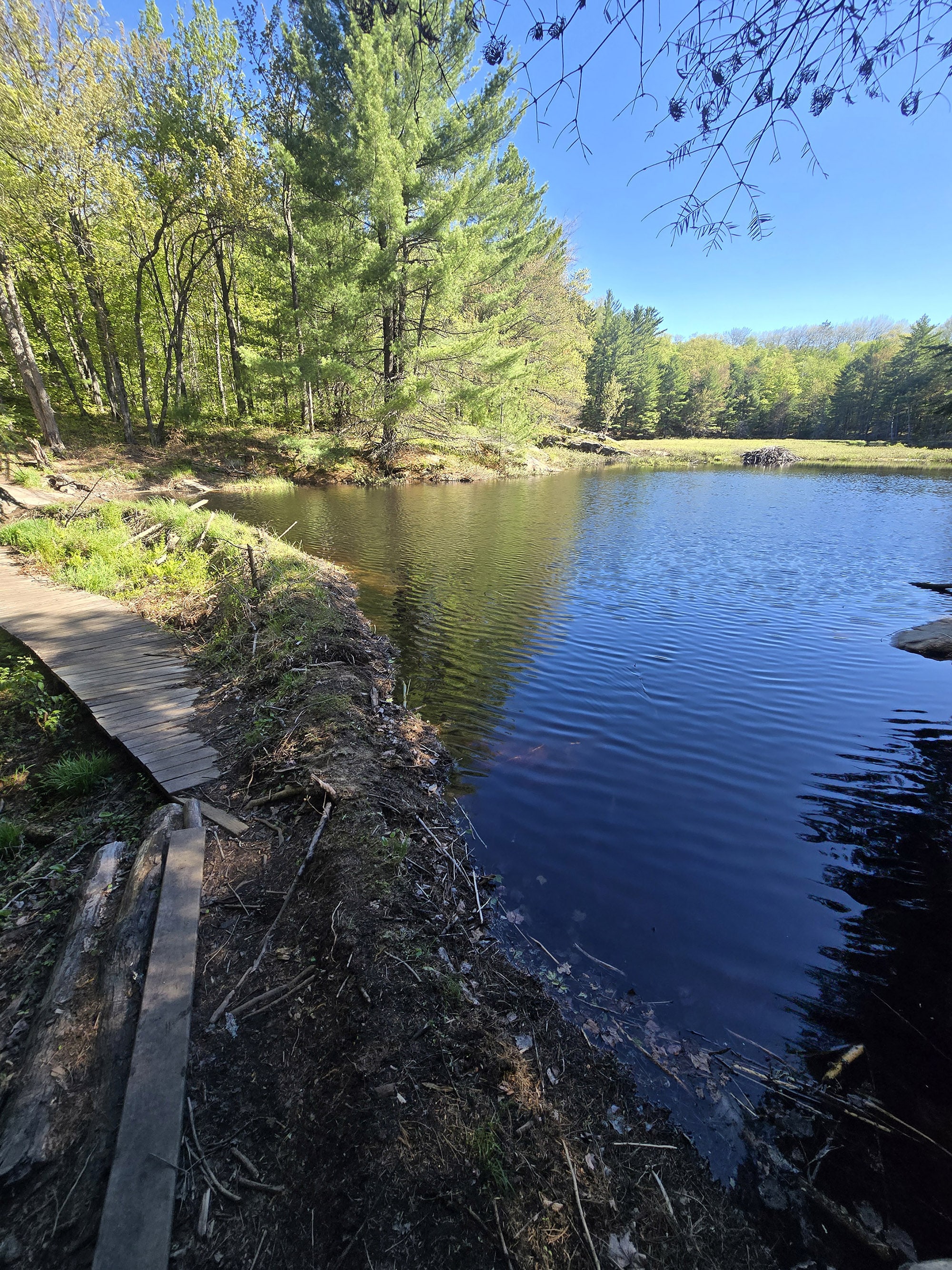
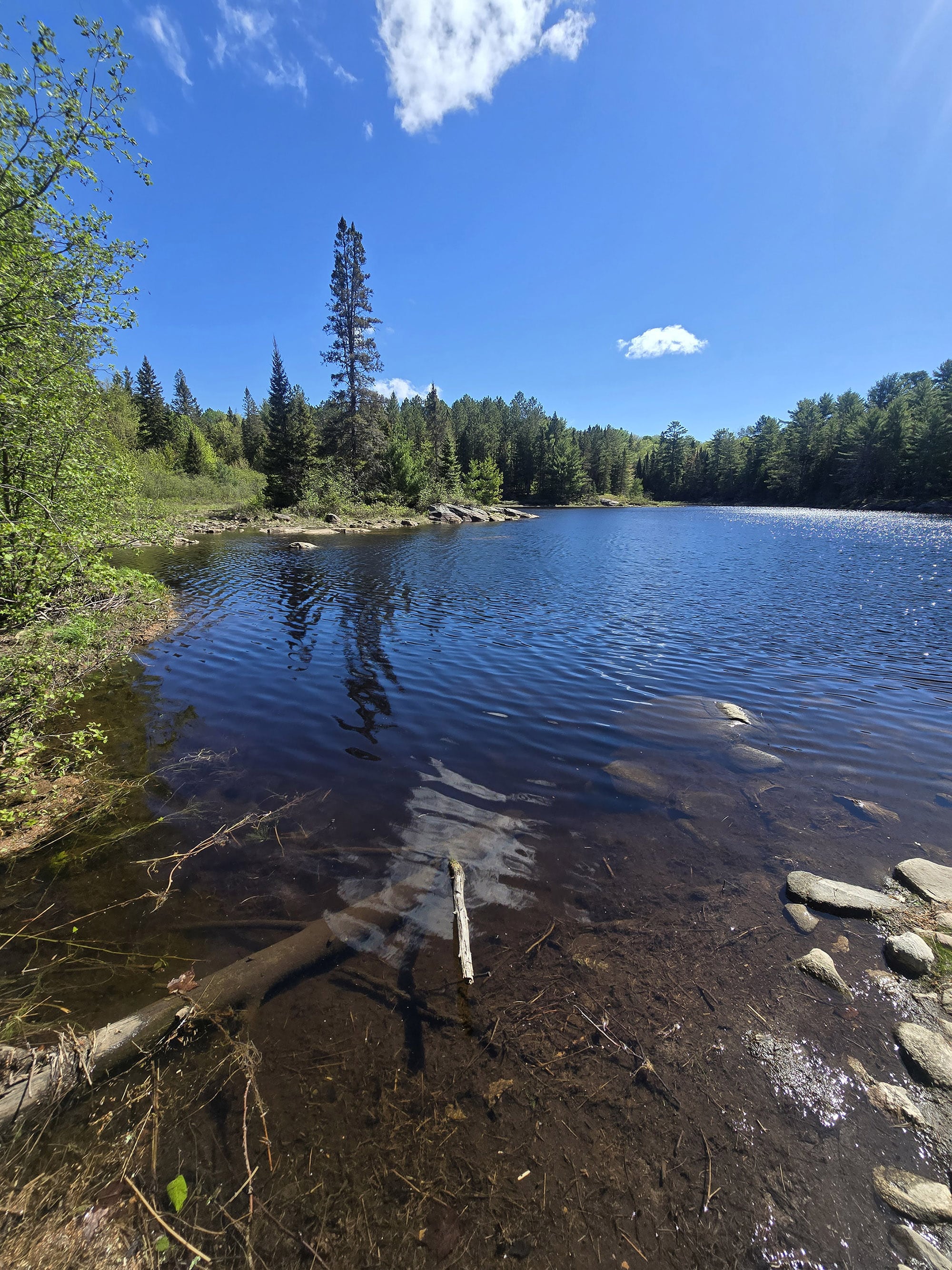
At 2.3 km, you go up and up and up and then you see a lake - a very elevated lake.
As you cross by a little bridge you see why the lake is there - there’s a very large beaver dam.
You can actually stand basically at the base of this dam and see the water level is above your head. It's really a fantastic view, and just an amazing feat. This is awesome, I kind of want to hang out here, but I have a long hike ahead of me and I really need to get moving.
3 km in, we're still doing a lot of climbing. Sure there are some areas where we go downhill for a stretch, but it really feels like we're doing a lot more climbing overall. Some really nice erratic boulders, make sure to check those out as you go by, they rock!
I'm definitely enjoying the hike, but the forest views are kind of the same for a stretch. There's a lot of big mossy boulders, and interesting areas to hike on. It's just not quite that super ADD friendly trail that we generally love - at least at this point in the trail.
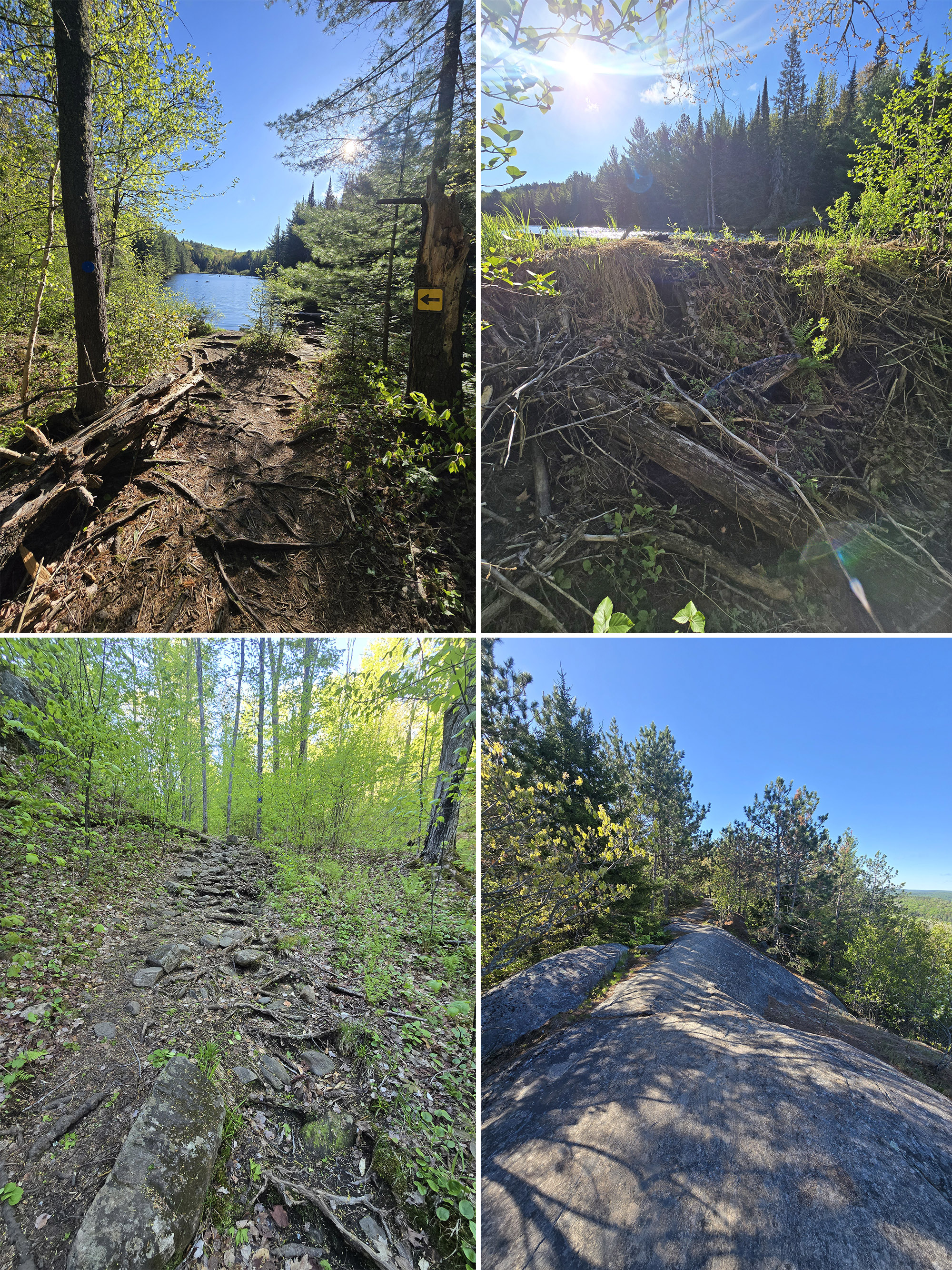
There are a couple areas that could use an extra trail blaze. I ended up finding a bit of a dead end several times, but it's not too difficult to go back to find the right branch.
I think this is another case where a couple people miss the trail, accidentally forged a bit of a trail of their own, leading the rest of us to follow this dead end.
4.5 km in, just passed sign post five, still walking along the cliff's edge with beautiful views.
Just after that signpost, we dive back into the forest and actually start to descend a bit. Feels kind of nice to be descending instead of climbing for a while.
The forest vibe has changed, there are lots of very small, young trees. It's got a much more dense feel to it because he can't see as far with all the small trees and it's lush green leaves. Google Lens says they are American Beech trees.
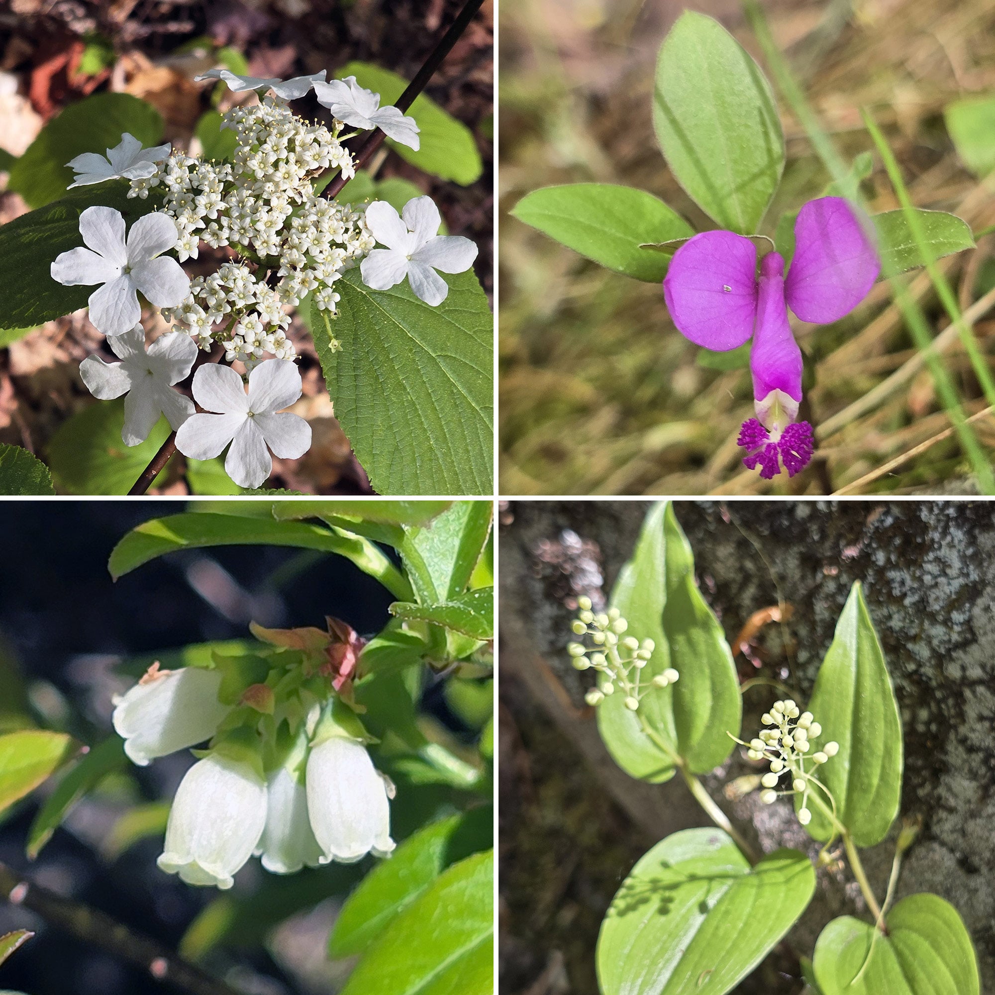
It's at the very end of May, and I'm loving the fact that there are just flowers everywhere.
Purple ones, white ones, trees with flowers, small little plants, and we still have the trillium out.
It's just a really cool scene to be in a thick forest, and then just come upon a bunch of flowers. There's also blueberry bushes all along the cliff's edge, though of course they're not producing fruit in this time of year.
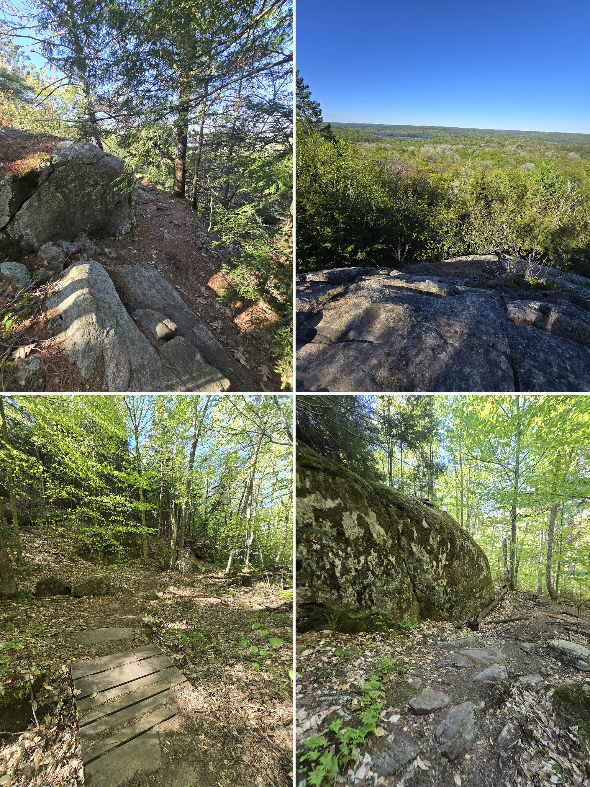
The vibe completely shifted right after that signpost.
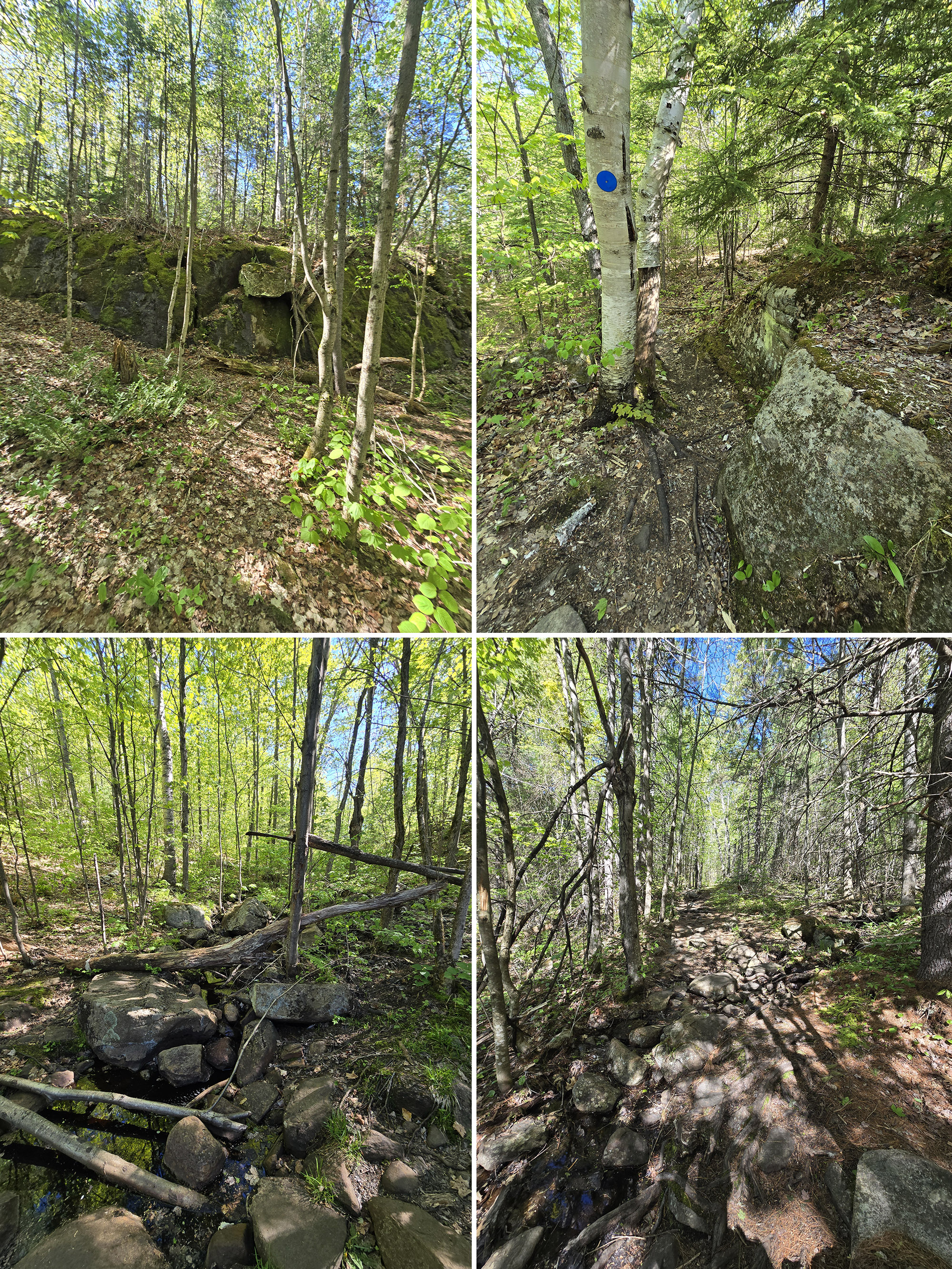
There are huge boulders that almost look like they have caves in them, now I'm in much more mature trees, birches, pines... it has almost like a rainforest vibe with the moss-covered boulders to the side. Also: a little trickling stream to the other side.
Almost 6 km, I've been doing a lot of climbing in the last half kilometer, and I really don't know how because it feels like we're still going up a lot more than we are going down.
Some of these are moderate inclines and other areas are only slightly inclined, but it's been fairly consistently upward for a while.
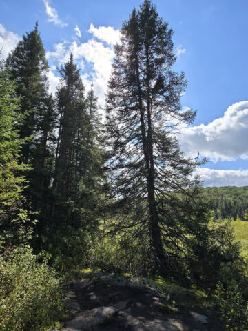
This area of the forest is primarily pines and other evergreens. Still walking up a lot of boulders, I just came upon another cliff edge but this one has a lot less of a view due to the tall trees in the way.
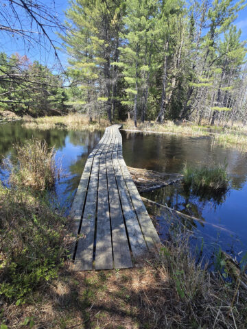
Once again, there are boardwalks that follow along underneath the water level.
It's so cool looking next to you seeing the surface of the water next to your head as you're walking along a trail. And once again these little animals did this with sticks. Just amazing.
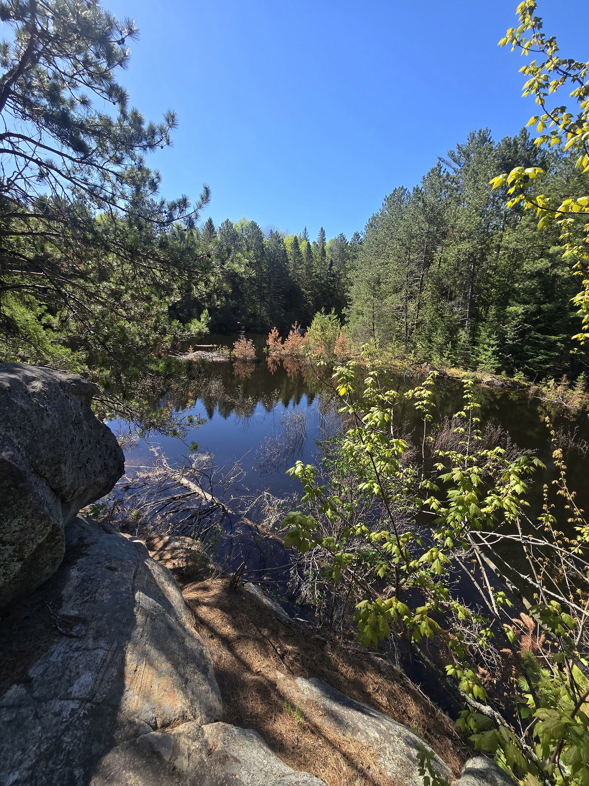
7.45 km in, passed sign post number 8, a lovely little overlook to some water. Unfortunately the water's edge is rather mucky so I'm just kind of hanging back and enjoying the view from a few meters out.
If you've been to Killbear Provincial Park or Sleeping Giant Provincial Park, this trail really feels a lot like those kind of trails in several areas.
Massive boulders that are smooth that you're walking along and on, mossy lichen off to the sides, evergreen trees all around. Just beautiful views all around.
There are some somewhat steep sections where you're walking down a very rocky path. It's not quite into the difficult range - you don't need to put your hand down to help yourself down - but you do want to be a bit careful as they're kind of jagged rocks and pretty steep.
Overall, there are quite a few short sections that are really gushy and flooded out.
I find myself walking on boulder tips across mucky areas fairly often. They are each fairly short, but you're going to want waterproof hiking boots.
Even if you don't have the balance to stay on the boulder tops, the water isn't really all that deep, I just don't want mud up to my ankles if I can avoid it.
8.6 km, just left the maple tree zone, back in a heavily evergreen zone. It's really wild see just all these different zones you're walking through.
At 2 ½ hours of hiking, I'm at 9.16 km.
Still in the woods walking on boulders, a marshy area to my left which clearly has been flooded out for a long time because it's full of dead trees in the middle.
I did see a whitetail deer, but unfortunately, he saw me first so all I got was a good view of his butt.
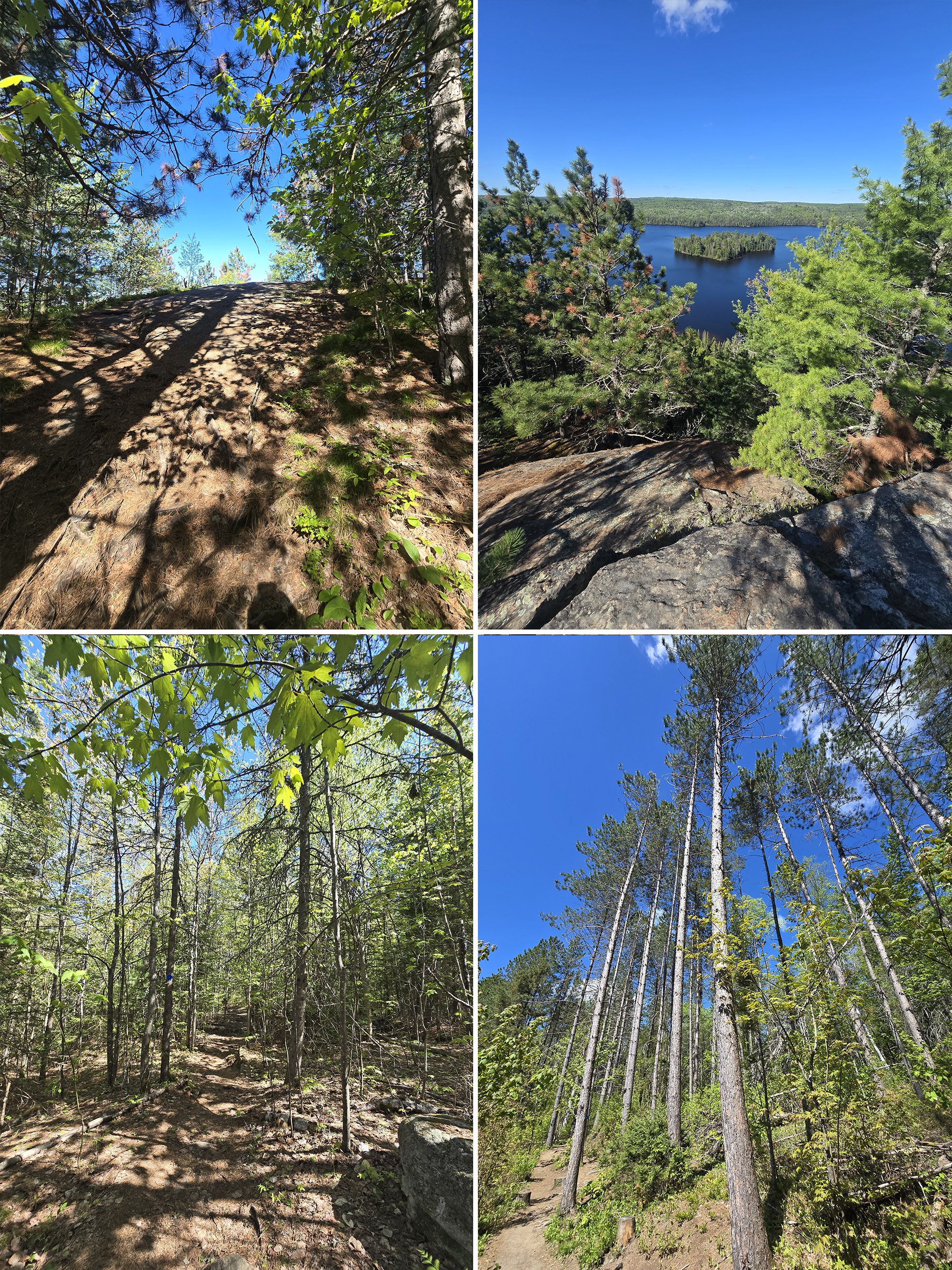
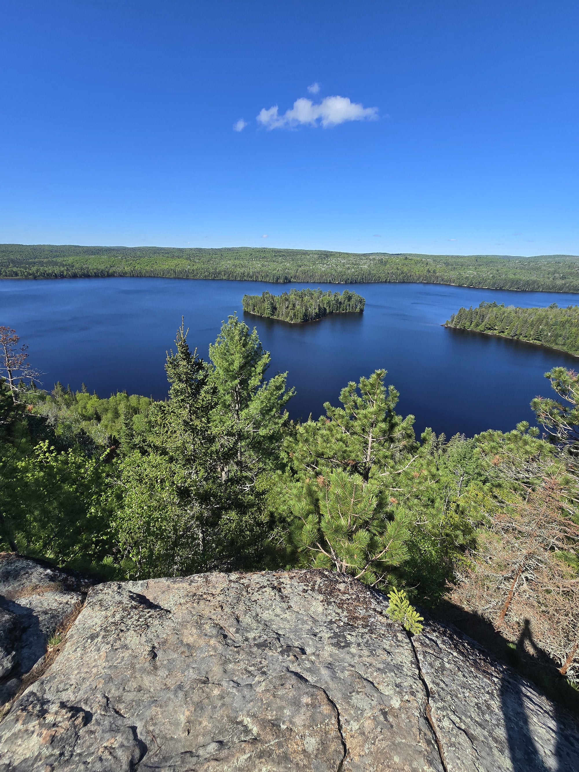
There's an island a little ways out, I got to watch a moose swim from the island to the mainland!
Absolutely amazing to watch from this elevated view. Now I'm really glad I brought my big camera so I can get some good photos and videos of that.
10.4 km in, sign post 11. Still at the cliff's edge with great views, then the trail veers away from the cliff into the forest.
After you meet up with the end of the loop portion, at about 12 km, you follow the same path you came in on back to the parking lot.
I found it interesting that it is blazed white only. Actually went back to the map at the beginning of the loop to make sure there wasn't a different little trail I was supposed to take off to the side.
So just keep that in mind, it looks like you're heading backwards for that last leg to the parking lot.
Further up, almost 12 and a half kilometers in, I finally see blue blazes as well. A little frustrating that they blazed it correctly in both directions for part of the stretch, but not that entire stretch.
By the time I got back, there were 14 cars in the parking lot. So this is definitely a very popular trail. It is 10:45 a.m. on a Saturday though - and not yet in peak camping season.
I clocked the trailer at 12.72 km and did it in 3 hours and 26 minutes.
Birding, Wildlife, and Nature
Porter heard a few birds, but wasn’t able to get any photos - they were all far too high up in the trees, and hidden in the greens.
He did manage to get a few photos of wildflowers, which he assumed was going to be the extent of his nature photos for the day.
About 10 km in, he was looking down off the cliff and saw something big go into the water, way down below. It was a moose!
We’d always heard about how moose can swim, but we’d never seen it - and he was thrilled to watch it, that day!
Educational & Cultural Opportunities
While there are no educational signs on the Centennial Ridges Trail, you can pick up a Friends of Algonquin trail guide at the trailhead.
It’s free to use and return, or you can keep it for $0.50 - there’s a coin collection pay tube thing at the trailhead.
Alternately, the guides are available for purchase at the visitor centre, and at the gates.
These guides are amazing educational accompaniments to the trails in Algonquin Provincial Park, teaching about the geology, flora, and fauna you might see on your hike, as well as some of the history of the area.
They also tend to include information about the elevation changes throughout each trail.
For many trails - including Centennial Ridges Trail - they have information that goes into a lot of specific detail for what you’re looking at, when you come to numbered posts along the trail.
In this case, there were about a dozen of them, sprinkled along the trail.
All around, a great resource to refer to while you’re on the trail!

Winter Activities
As previously mentioned, the 2 km road from then highway to the trail head is gated in the winter, and the road up is not maintained.
That said, people definitely do it - there ALWAYS seems to be a car or two parked at the gate.
We’ve seen the road up described as “brutal” when snow covered, but if you’re willing to add all that extra work to your hike, it can be done!
Snowshoes would probably be a good idea on way up, and you’ll definitely want cleats for hiking the trail itself.
Final Thoughts
Says Porter:
“I loved the Centennial Ridges trail, it's a great hike with many, many great views.
If you wanted to make it a little shorter, I recommend taking the loop backwards so you can see that stunning view at sign post 10, then heading back the way you came in.
That would probably cut the distance in half.
I'll definitely do this trail again, I'm kind of a sucker for those cliffside views!
Specifically, I’ve seen some AMAZING photos taken during peak fall colours season. Now that I’ve seen what the trail has to offer, it’s definitely high up on the priority list, if we happen to be in Algonquin at the right time.
This is definitely in my top ten favourite trails.”
More Algonquin Provincial Park Trail and Campground Reviews
Want to read some more of what we have to say about the campgrounds and attractions in Algonquin Park?
Check out our Algonquin Provincial Park Mega Post, or any of the links below for even more in-depth info:
Algonquin Provincial Park Campground Guides / Reviews
Achray Campground, Algonquin Provincial Park
Brent Campground, Algonquin Provincial Park
Canisbay Lake Campground, Algonquin Provincial Park
Kearney Lake Campground, Algonquin Provincial Park
Kiosk Campground, Algonquin Provincial Park
Lake of Two Rivers Campground, Algonquin Provincial Park
Mew Lake Campground, Algonquin Provincial Park
Pog Lake Campground, Algonquin Provincial Park
Raccoon Lake Campground, Algonquin Provincial Park
Rock Lake Campground, Algonquin Provincial Park
Tea Lake Campground, Algonquin Provincial Park
Whitefish Lake Campground, Algonquin Provincial Park
Winter Camping in Algonquin Provincial Park
Algonquin Provincial Park Trail Guides / Reviews
Barron Canyon Trail, Algonquin Provincial Park
Provoking Falls, Algonquin Provincial Park
Interested in exploring campgrounds beyond Algonquin Park? We've got a huge - and ever-growing! - list of them here: 2 Nerds in a Truck Campground Reviews.
We also have posts on Ontario Waterfalls, other Places to See, and a ton of Camping Recipes to cook up, while on your adventures!
Thanks for Reading!If you loved this post - or have any questions about it - please leave a comment below! We'd also love it if you would consider sharing the link on social media! |
Leave a Reply