
Rattlesnake Point Conservation Area is a gorgeous park in the Greater Toronto Area. With Hiking, Birding, and Rock Climbing, it's an absolute must see!

I was working on finally getting around to writing up posts on some older trips, and came across something interesting.
In the notes for an upcoming post, I mentioned that we had to choose between doing the one we did, and going to Rattlesnake Point Conservation Area.
It was early enough in my tendon recovery that Crawford Lake won, just due to having a wheelchair accessible trail - ie: flat enough that I should be able to do it. We weren’t entirely sure I could handle Rattlesnake Point, just based on what we were reading.
2 years later, I’m more mobile, and took it as a sign that we should drop everything we were supposed to be doing to go check it out - just to say I could.
Shirking responsibility in favour of a fun activity!
You know. Adulting.
Rattlesnake Point Conservation Area is right up there among the most beautiful places we’ve seen in the general vicinity of our home - it’s only 25 minutes away!
The park is 100 square kilometres of forest trails, scenic views, group campsites, and general awesomeness.
They even offer an outdoor yoga class - Yoga in the Park - if you want to go get your downward dog on.
Anyway, lots to talk about - and a ton of gorgeous photos to share - so let’s get to our newest park review!
The Basics:
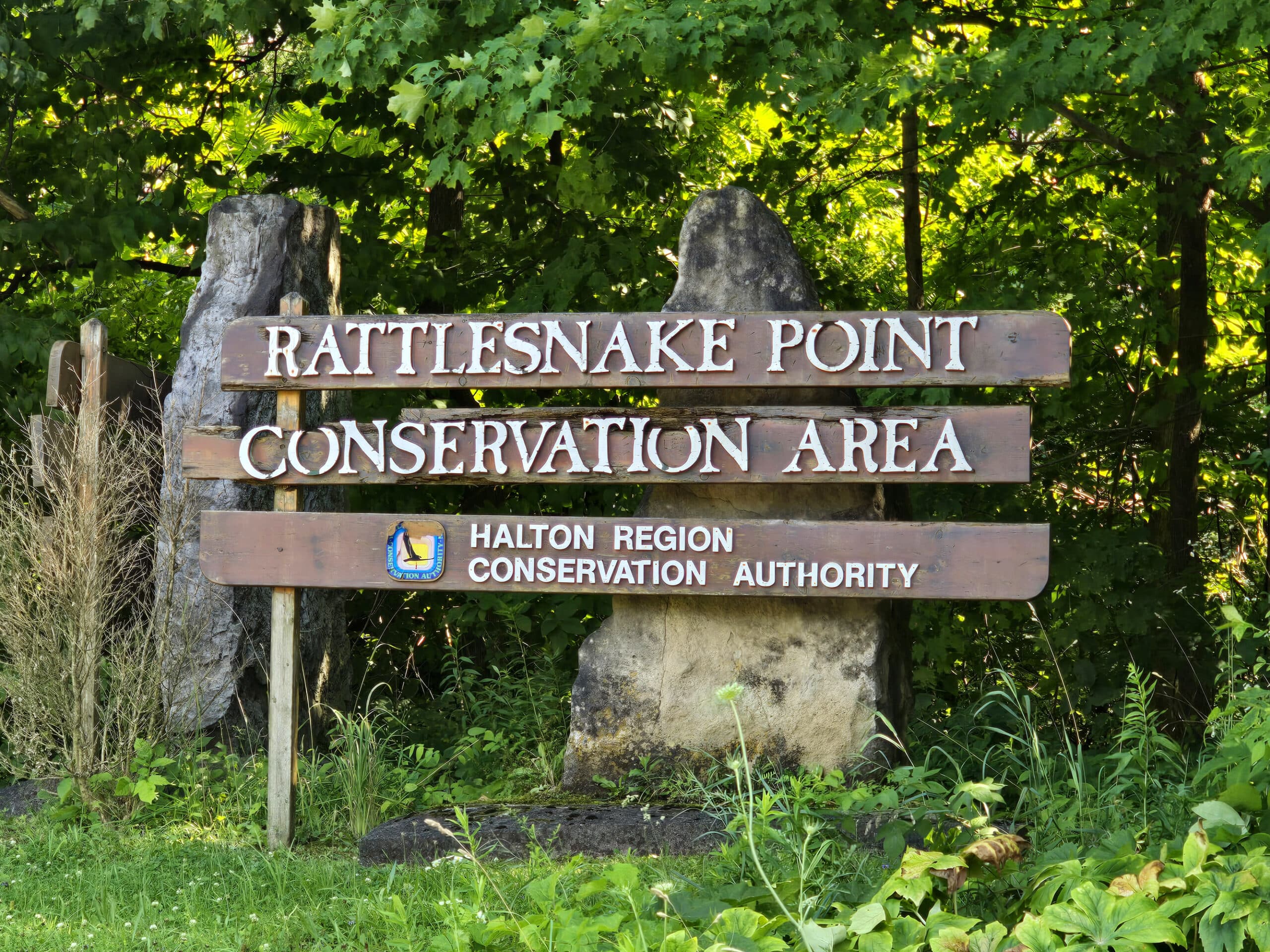
Location Name: Rattlesnake Point Conservation Area
Address: 7200 Appleby Line Milton, ON
Website: Conservation Halton Website
Price: We paid $10.50 each, plus tax. See the Conservation Halton Parks Website for current pricing.
Reservations: Book online at the Conservation Halton Website
Logistics
A bit of information to help you plan your stay:
Getting There
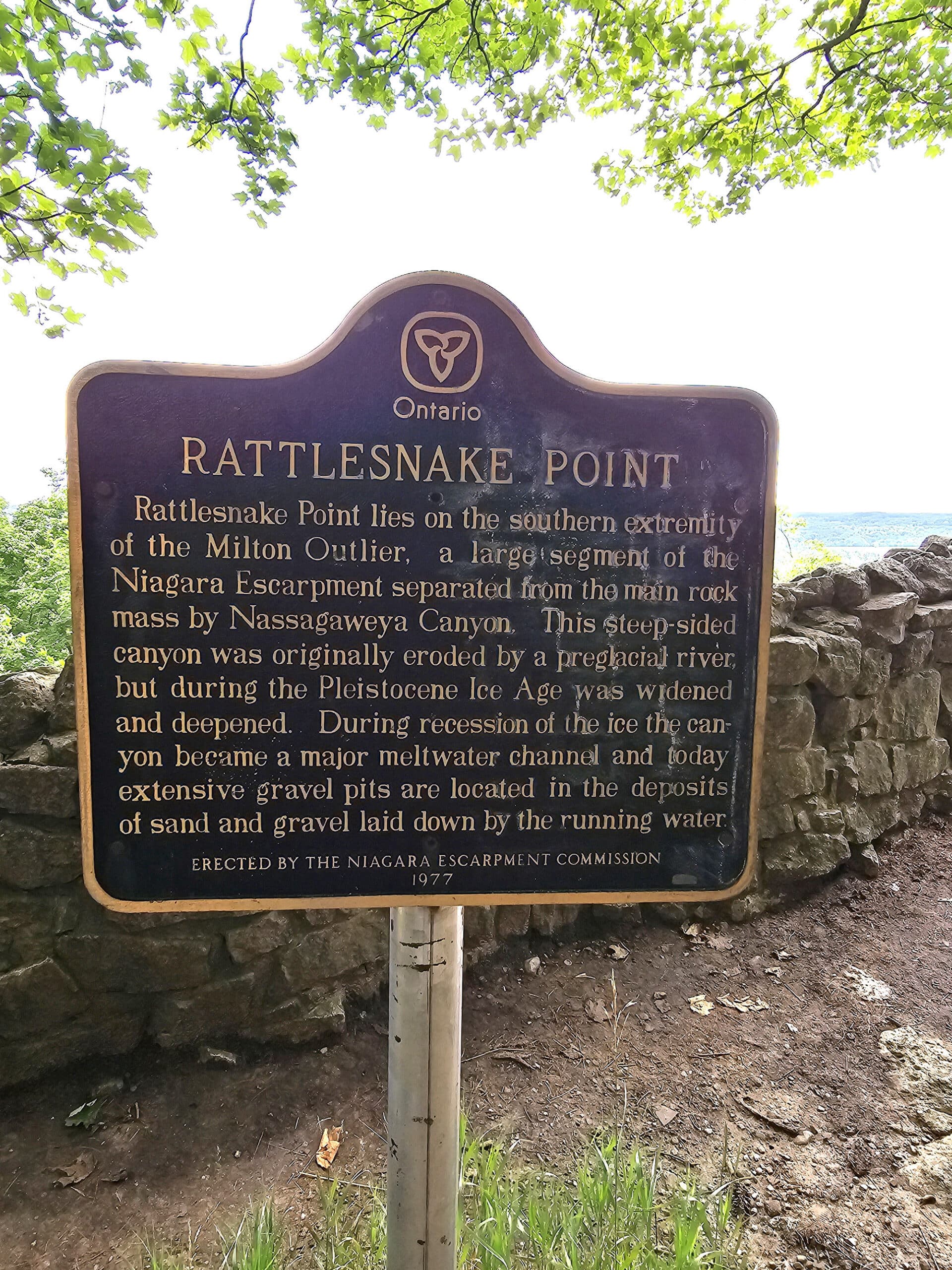
So, the park is named Rattlesnake Point not because of the presence of snakes (apparently there aren’t any), but for the shape of the trails as seen from above.
The thing is, I think it should be more about Appleby Line, in the short distance right before the park.
It gets really steep, narrow, has a weird drop off in places, and takes some really tight corners. There's not really enough room for two cars to get through in places, and there is a sign that big trucks can't get through.
At one point there's even a mirror on the side rail to see oncoming traffic because it's just so perilous.
Figured I’d give a heads up - ESPECIALLY if you’re planning on driving up there in any kind of inclement weather!
Registration and Check In
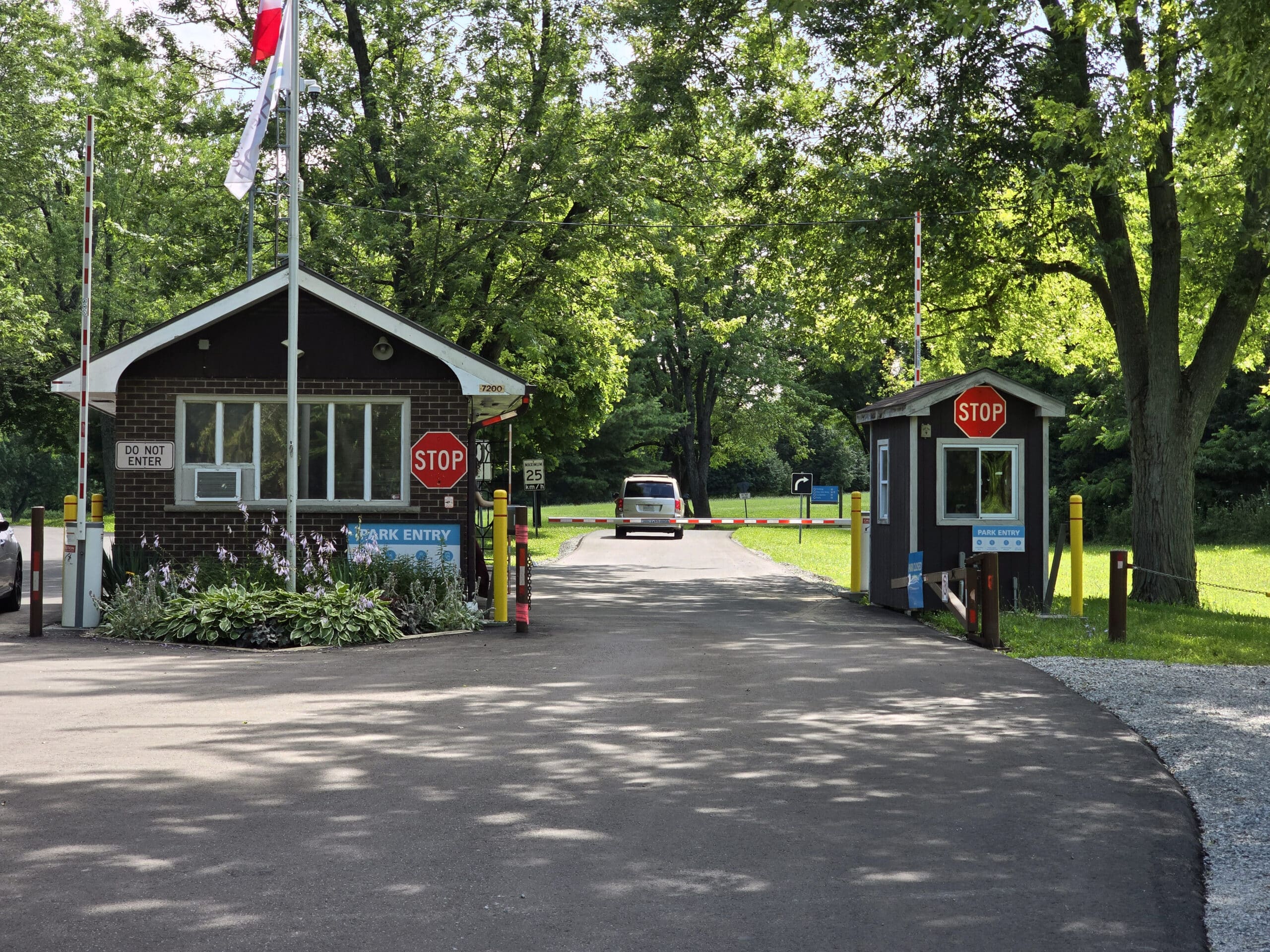
As another heads up - the website says that reservations aren’t required but are recommended... but a big sign at the front gate indicated that reservations are required for entry.
I’d booked ahead, as we’d run into an issue with booking on the spot at Crawford Lake recently. Also, the site said that online booking saves you money on gate fees.
There was a group of cars kind of splayed all over the road at the entrance, with people who seemed confused about how to get in. I’m guessing they took the website at face value.
Anyway, when you book online, you give your license plate number. The gate scans your plate when you pull up, and automatically opens.
A slick system, but they definitely need to do better about letting people know... BEFORE they arrive.
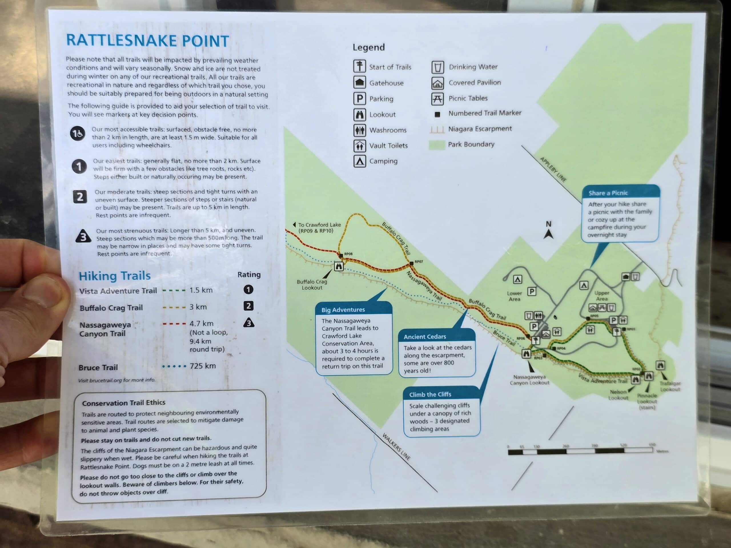
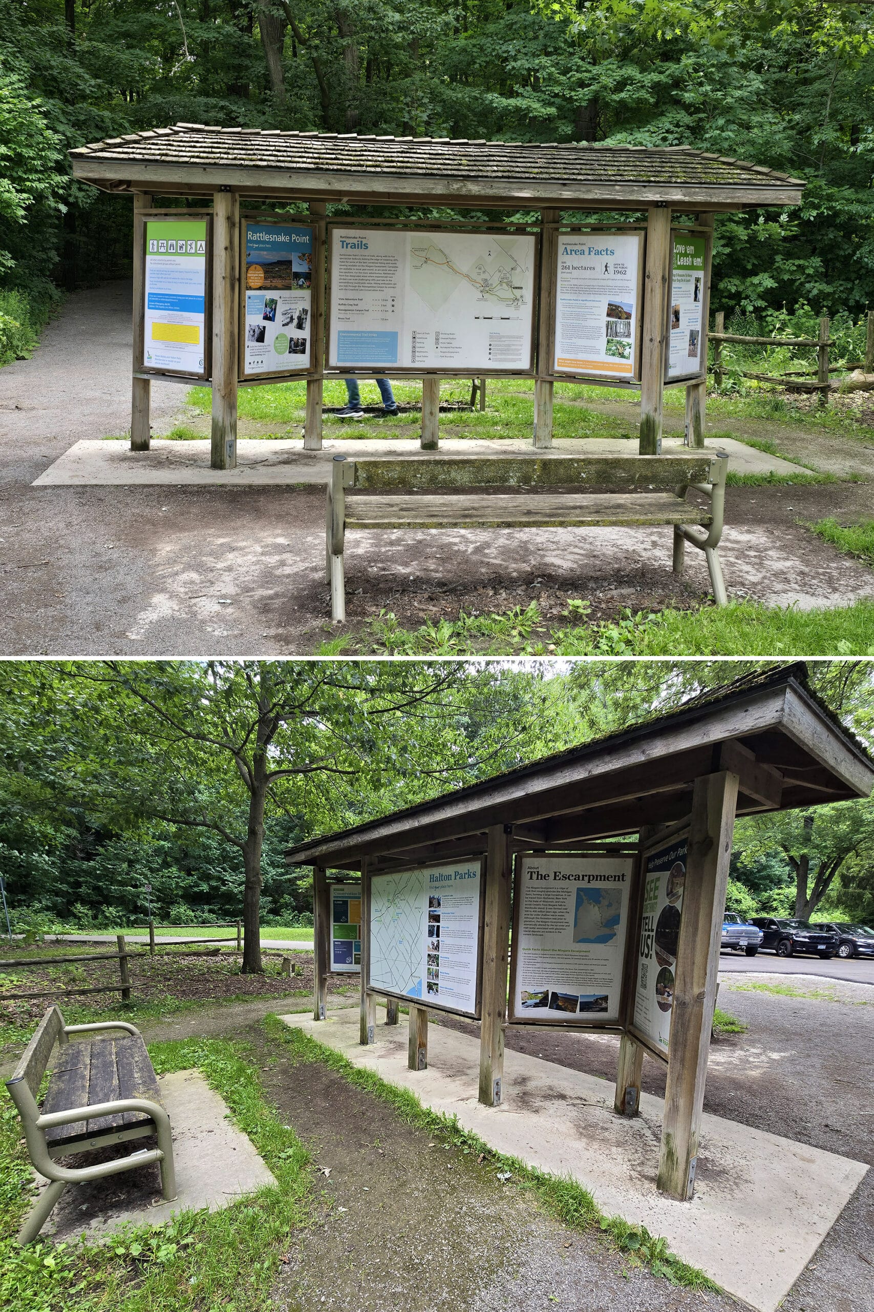
Park Map
Disappointingly, there were no printed maps available - I’d kind of assumed there would be, as Crawford Lake (another Halton Region Conservation Area) had them.
The attendant at the front gate had a laminated copy of the map, and let us take a photo of it.
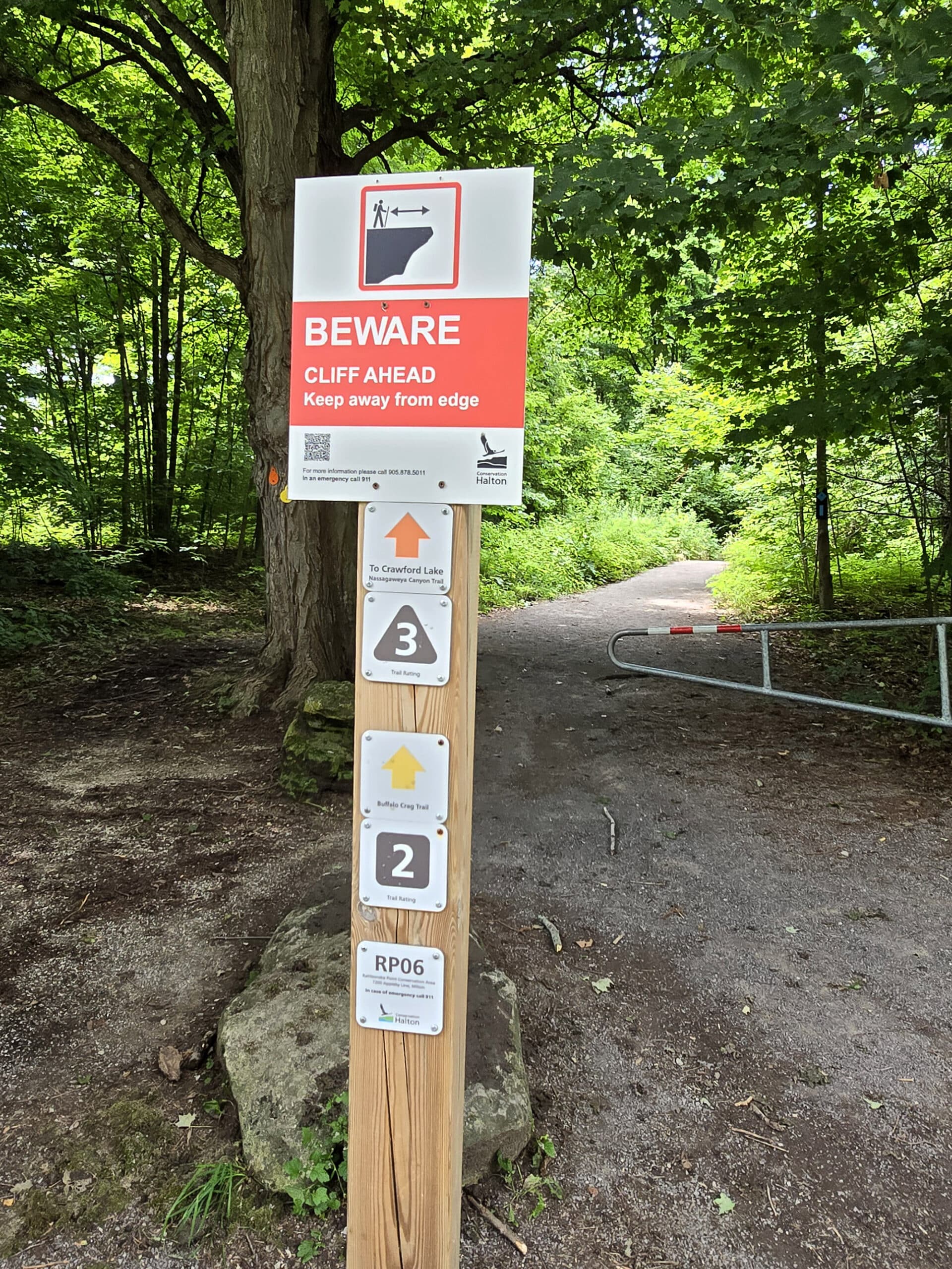
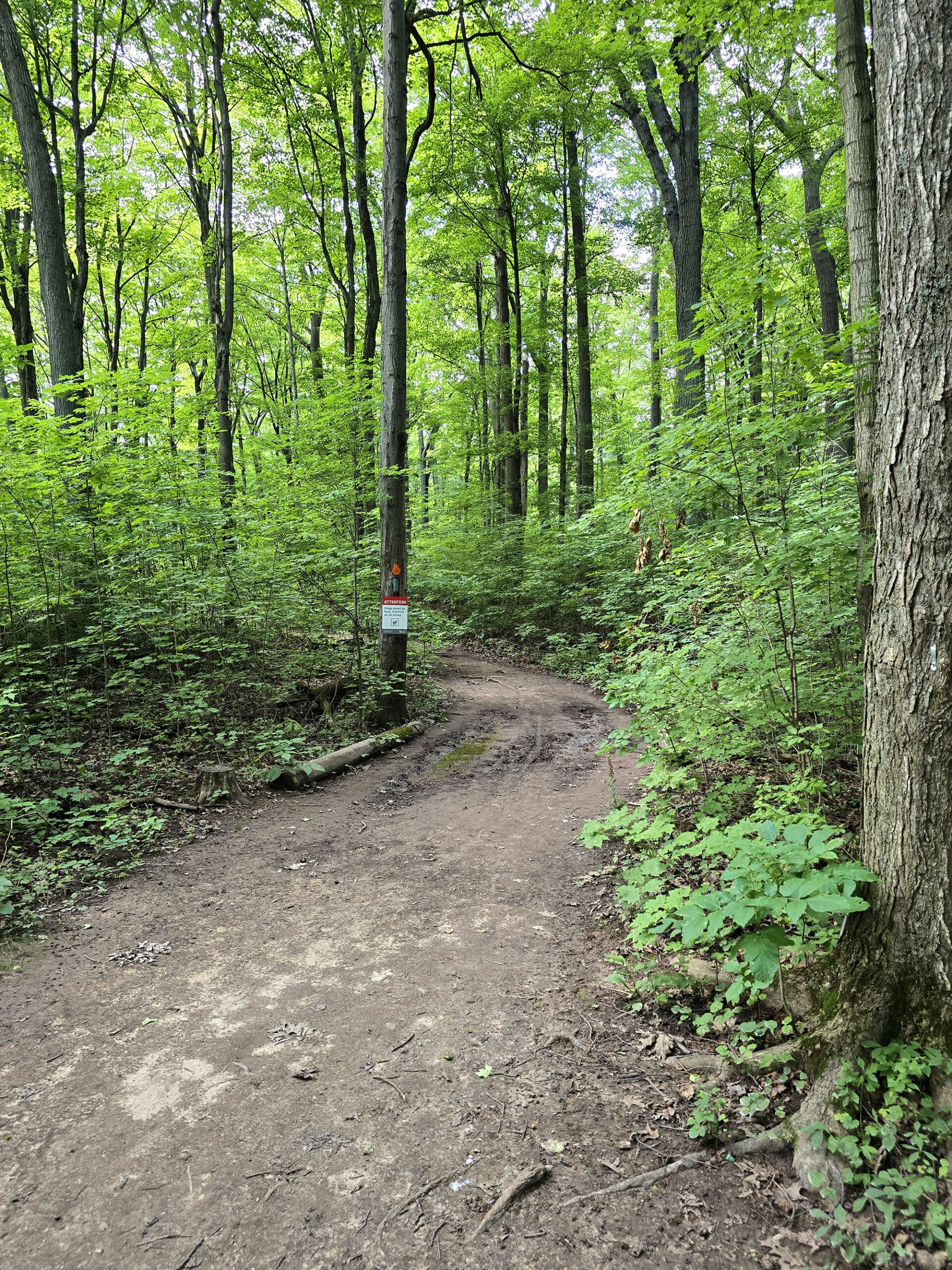
Signage
The signage through the park was good. Easy to see, clearly laid out, etc.
It’s not a really complicated layout - a little annoying, but straightforward. You won’t get lost here.
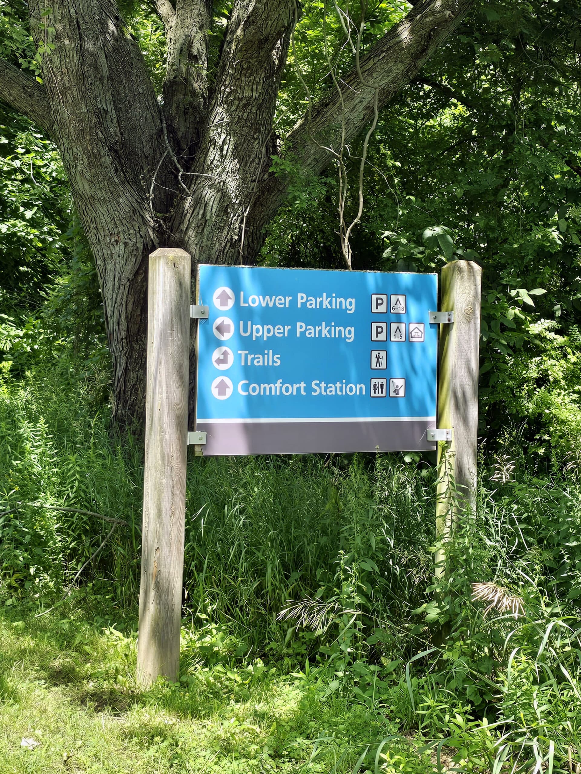
While we weren’t able to obtain a printed park map, there was a large map at both entrances to the trail - one at the upper parking lot, and one on the lower parking lot.
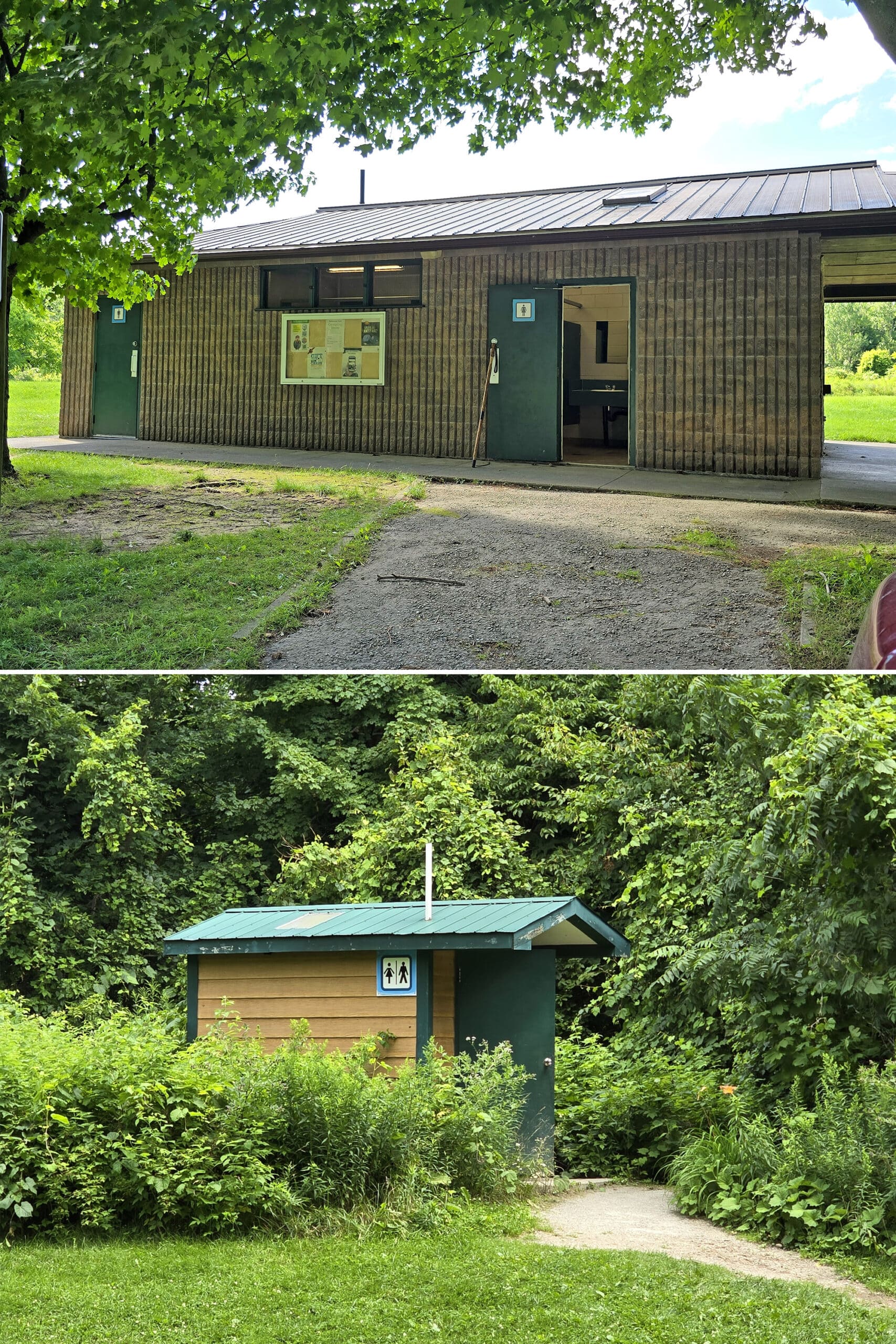
Washrooms
There are two public washroom facilities in Rattlesnake Point Conservation Area.
One is in the lower parking area - you get there by going straight, rather than left when presented with two “trails” options, shortly after coming in the front gate.
This had a few stalls in each side, and was in good condition. Old, but clean.
There’s also a single outhouse / vault toilet at the upper parking area.
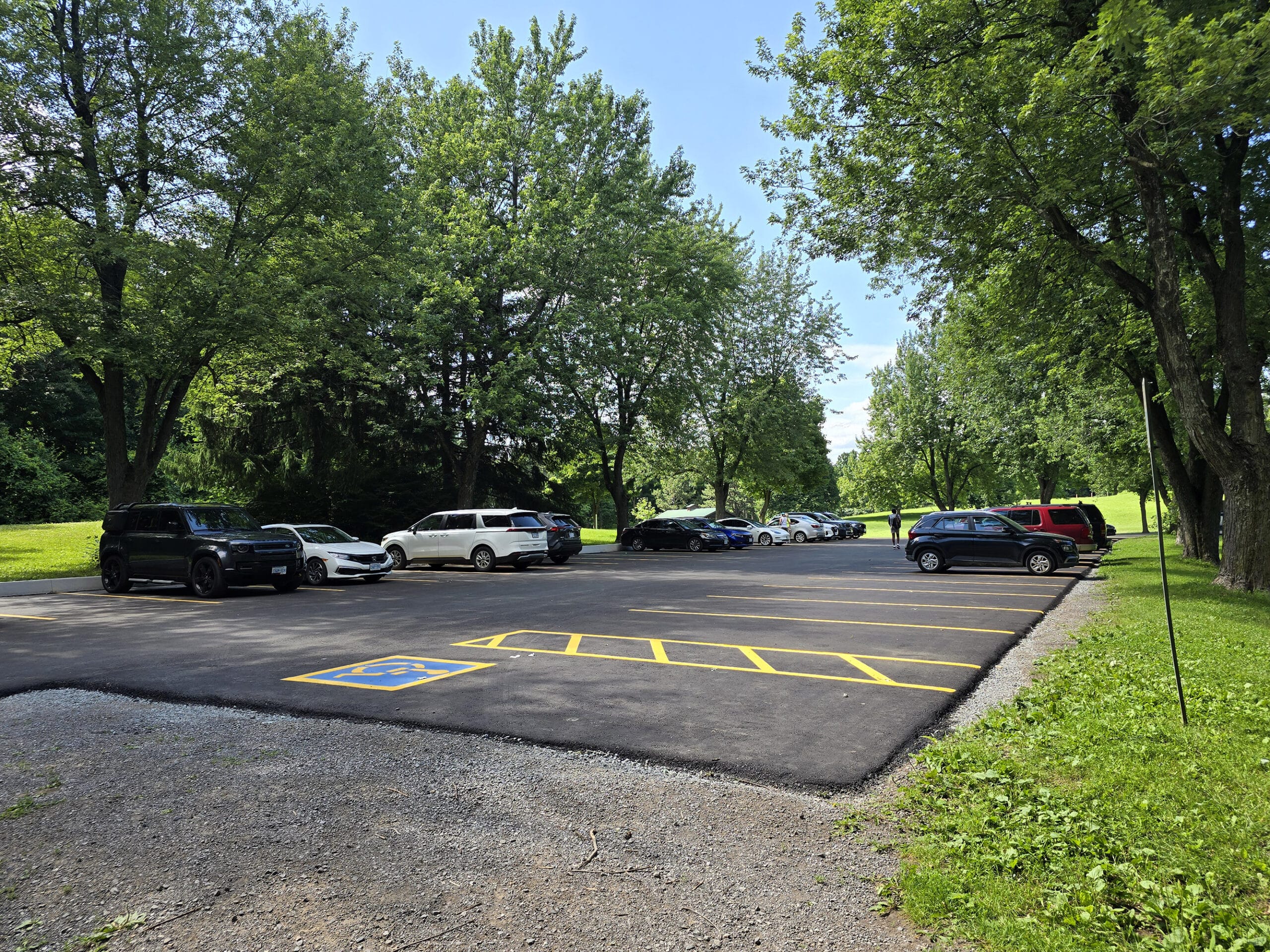
Parking
There are two main parking lots... sort of.
The lower parking area is in front of a large group campsite - I think.
It looked like a campsite when we were there, but really FULL - and it’s not shown as one on the map. Apparently there’s a second pavilion and another vault toilet in there.
Anyway, with all of the tents RIGHT there, it felt like parking there would be really intrusive, so we went to the upper parking lot. (Some people were parking at the comfort station for using the trails though. REALLY small lot.)
The upper parking lot is fairly small, but was in great shape and looked to be newly paved and painted.
I would definitely worry about the parking situation in the fall. I bet this particular conservation area is WILD when the leaves change... and there was barely enough parking for a random Thursday afternoon in summer!
Accessibility
The comfort station had an accessible stall, but the vault toilet at the upper parking did not seem accessible.
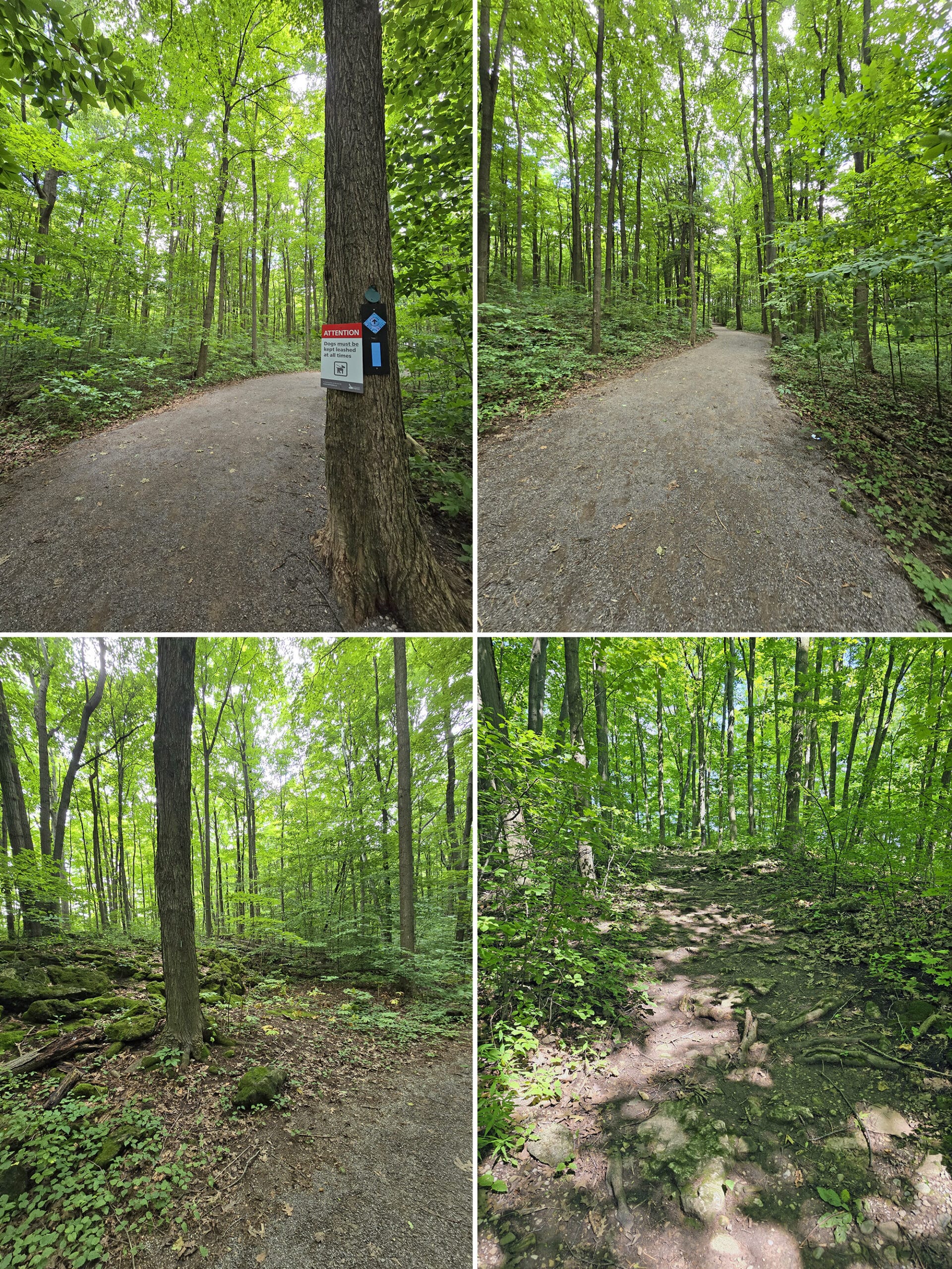
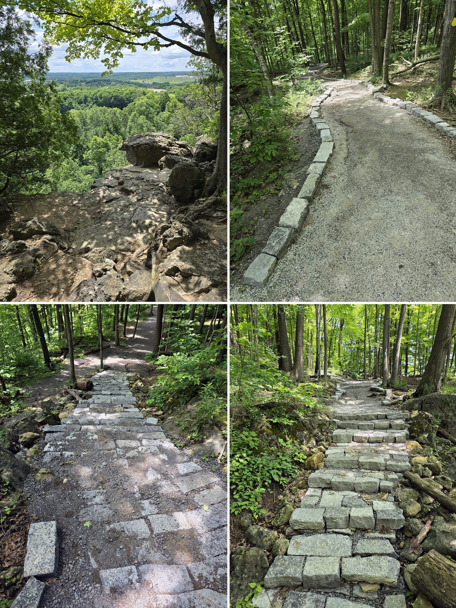
SOME of the trail is wheelchair accessible, but those areas get broken up with stairs and wild slopes here and there, so I’d probably avoid this park if I was a wheelchair user.
That said, MOST of the trail is pretty easy, if you’re using any kind of other mobility aid. Wide trails, well-packed gravel - I could easily have done them in a walking boot, or with a cane.
There are some steep parts - still all the well packed gravel - the actual trails are not very rocky, you don't really have to climb over anything to get around.
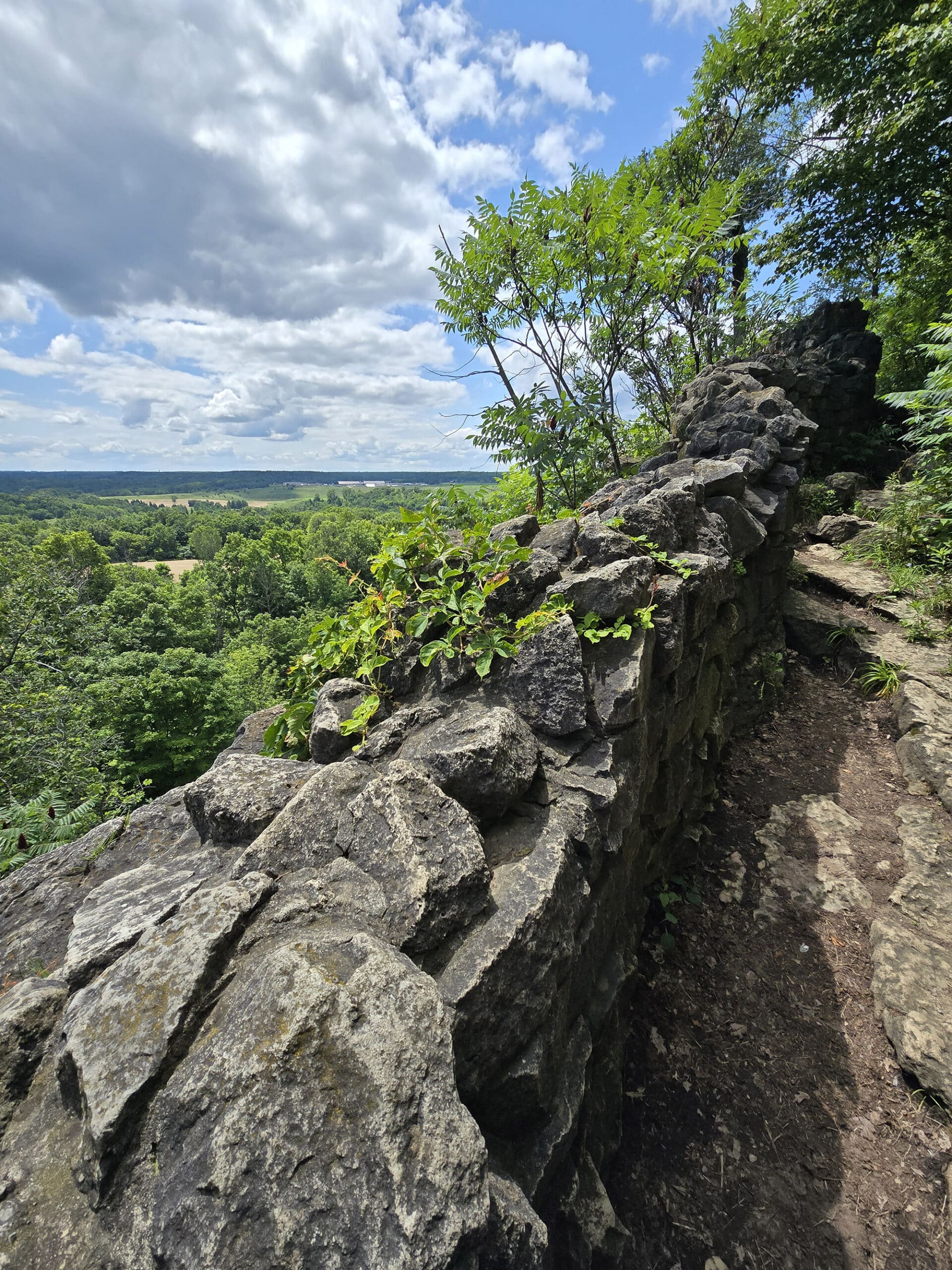
That said, if you are mobile enough to climb down over rocks and such towards the cliffs - it’s worth the effort.
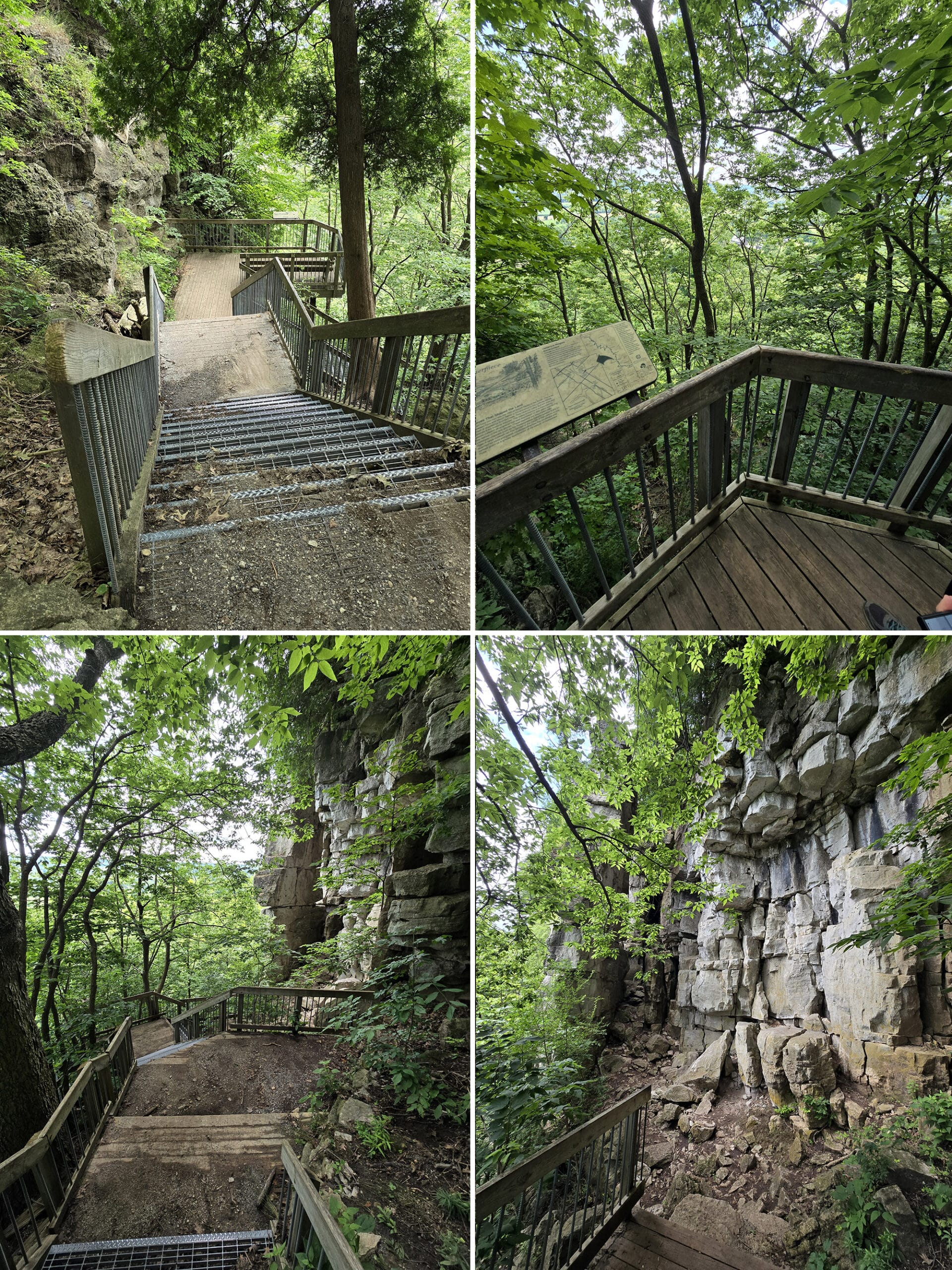
On that note, some of the more gorgeous views do involve climbing up on some rocks first.
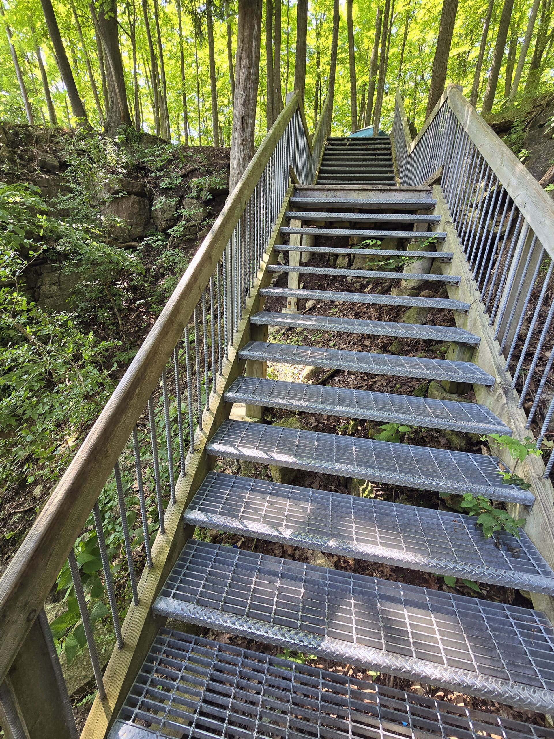
Also - at one point early on in the Vista Adventure Trail - there’s a staircase down - OFF the main trail - to get some viewing platforms.
Pets
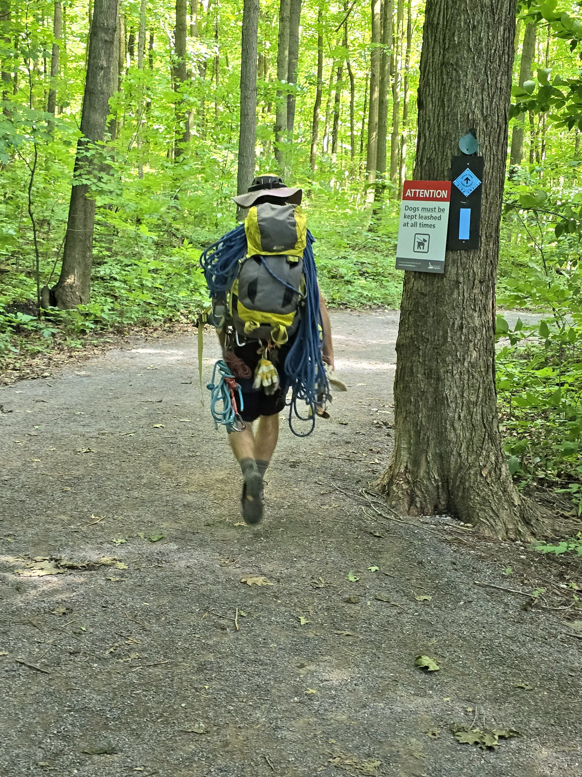
While we didn’t see any dogs during our stay, dog walking is permitted on the trails - with a few rules.
They have to be kept leashed and under control at all times, on a leash no longer than 2 metres / 6 feet.
Owners are expected to ensure that they don’t approach, attack, chase, or harass wildlife or other people, and they’re to remain on the marked trails and away from the cliffs.
As always, owners must pick up after their dogs and properly dispose of the waste.
Connectivity
We had really good cell reception everywhere in the park.
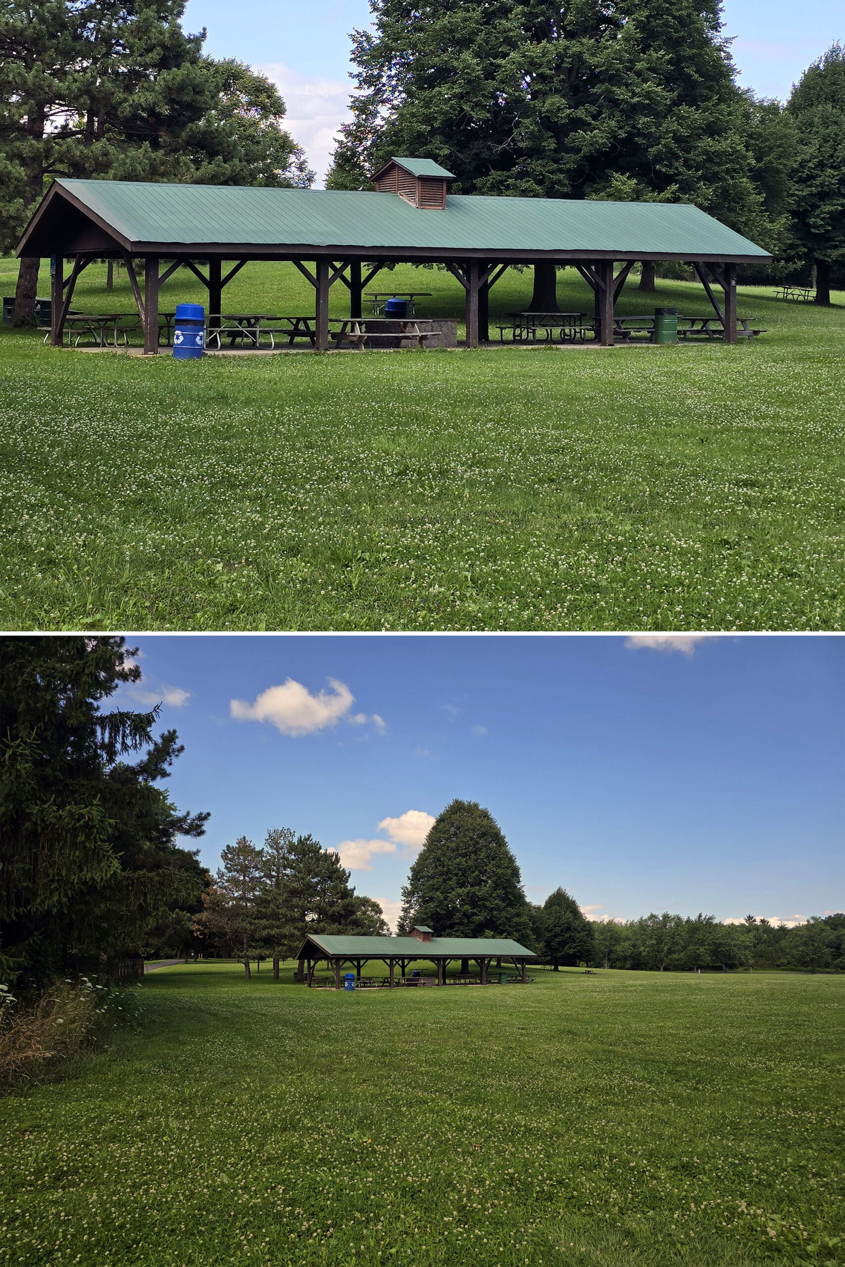
Day Use Area
There’s at least one picnic shelter (again, we weren’t able to see what was up in the lower parking area), and the odd picnic table scattered in the field around that shelter.
There are also a handful of picnic tables by the outhouse at the upper parking lot.
Trigger Warning?
When we first started onto the Vista Adventure Trail - approaching the first lookout - we came across a pretty concerning scene.
There were emergency workers, what looked to be a body on the ground, and then what looked to be a leg - like a lower leg with a boot attached, no blood or anything - as well, along with a gurney.
As it turned out, the body and leg were dummies, and they were doing some kind of rescue training. Whew!
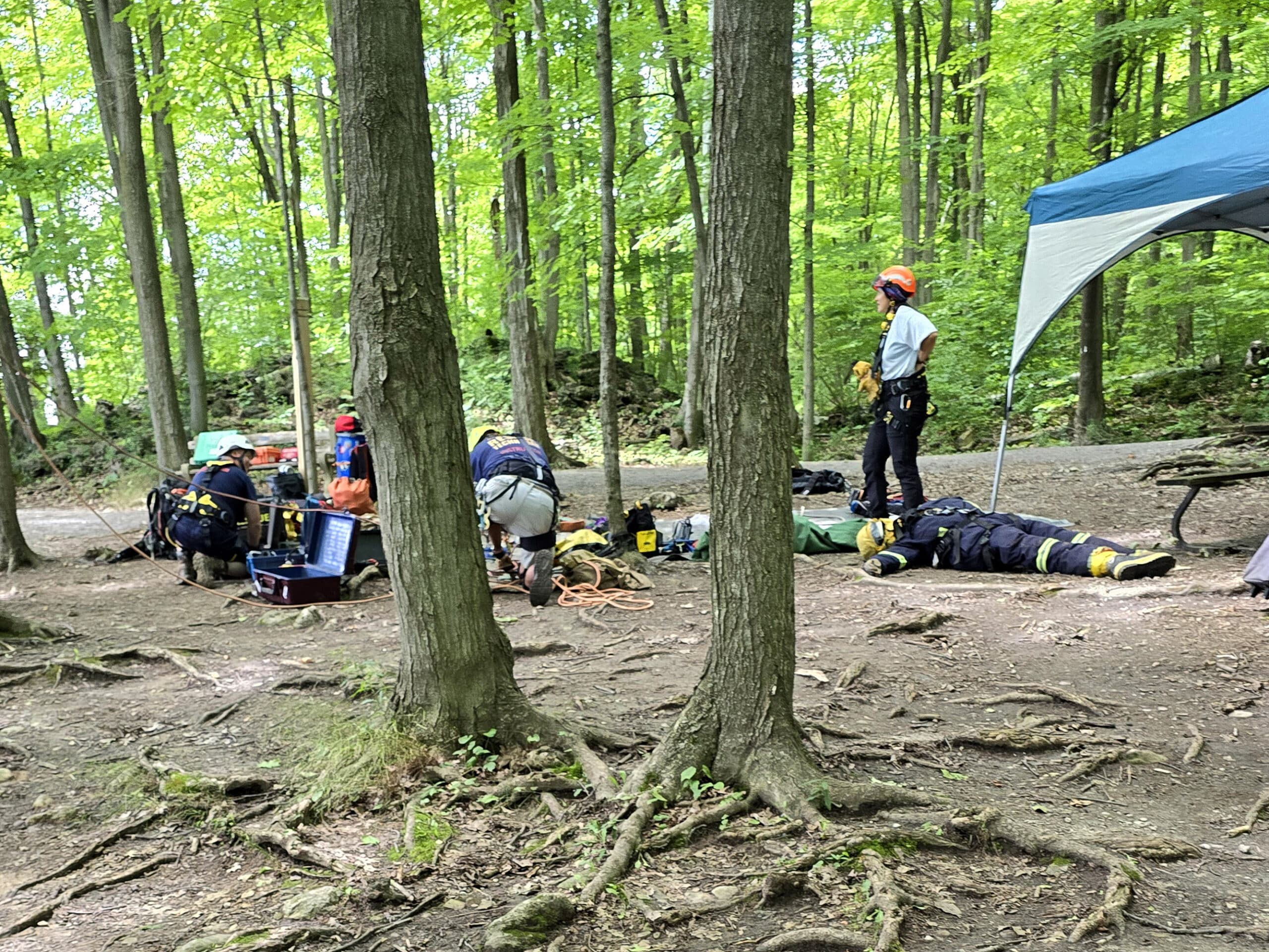
So, if one of your party is sensitive to such things... just a heads up about that.
Miscellaneous
The roads are generally in nice condition for the main / upper part of the park, but the road heading down to the campground is not quite as new or nice.
The road between between upper and lower parking areas is very narrow, very uphill and gorgeous.
This part of the road overlaps with park of a trail though - so be sure to keep an eye out for hikers!
Share the Love!If you’ve made one of our recipes, be sure to take some pics of your handiwork! If you post it to Bluesky, be sure to tag us - @2NerdsInATruck, or you can tag us on TikTok, if you’re posting video. We're also on Pinterest, so you can save all your favourite recipes and park reviews to your own boards! Also, be sure to subscribe to our free email newsletter, so you never miss out on any of our nonsense. Well, the published nonsense, anyway! |
Entertainment and Activity
This is a fairly basic park, in that there are only a few outdoor activities to choose from. That said, the activities it DOES host are *stellar*:
Hiking
This is a great park for hiking, whether you’re looking to take a quick scenic hike to stretch your legs, or go on day hikes out to Crawford Lake - or out the Bruce Trail.
Here’s what we thought of the various trails in Rattlesnake Point Conservation Area:
Bruce Trail
One of the Bruce side trails runs through Rattlesnake Point Conservation Area, along the side of the escarpment.
Then, this hooks up with the Main Bruce Trail along the Nassagaweya Canyon Trail, and continues on to either Crawford Lake Conservation Area or Kelso Conservation Area, depending on which way you go.
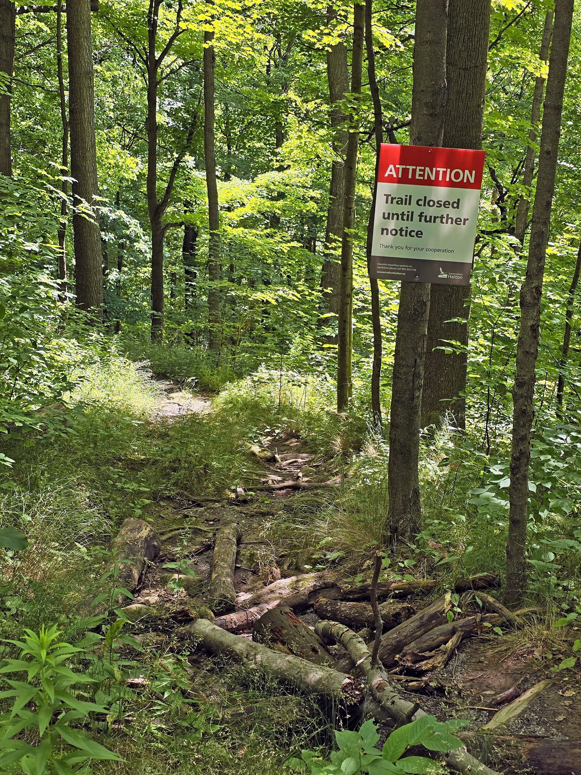
Unfortunately, each of the access points to the Bruce Side Trail in the park were blocked off, with signs saying that the trail was closed. 🙁
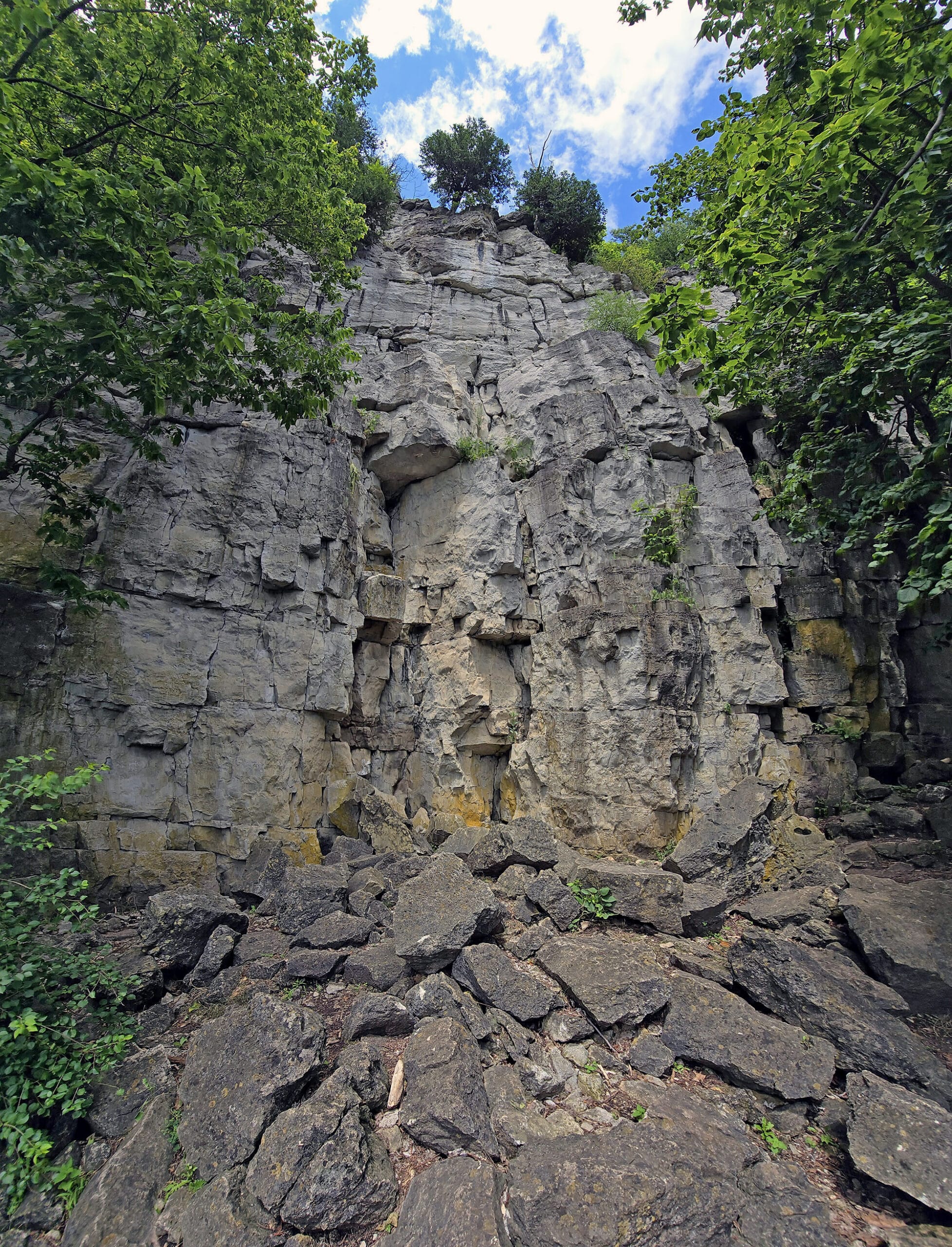
From what we could see of the actual side trail at a few points - going up and over some rocks off to the side - it looks gorgeous.
It reminds me of the trail at Inglis Falls, where it's got those kind of rocks you climb up over. It looks to be the same Vibe.
Annoying that it was closed - it looks like fun! Oh well, not like we weren’t planning on coming back!
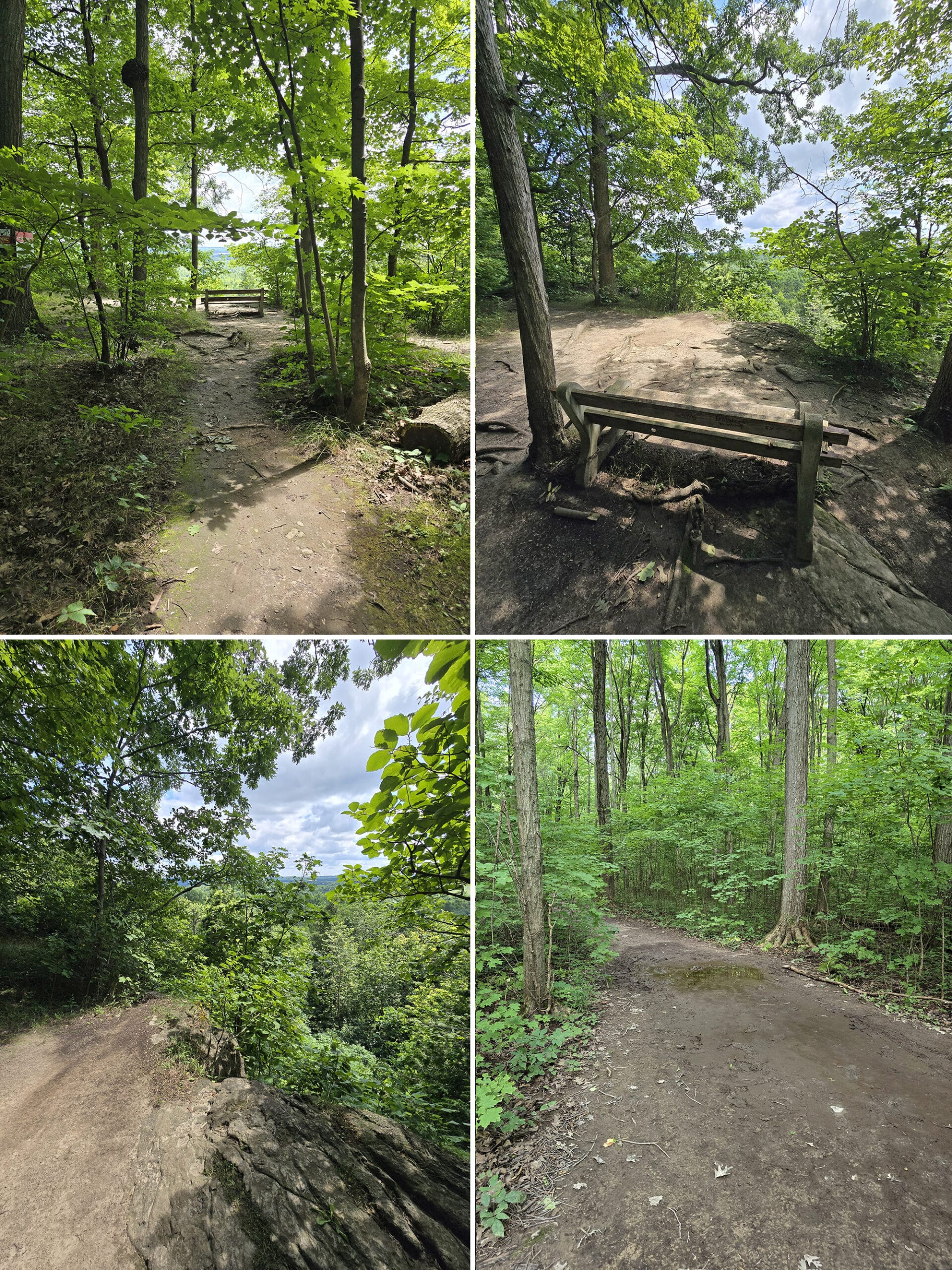
Buffalo Crag Trail - 3 km, moderate
This one was rated as a moderate trail, but it was generally fairly easy. I’m assuming the distance - 3km - factored into the rating.
In general, the Buffalo Crag trail is wide and mostly flat, but there was some water damage to the trail in places, and it’s a bit more bumpy than the Vista Adventure Trail.
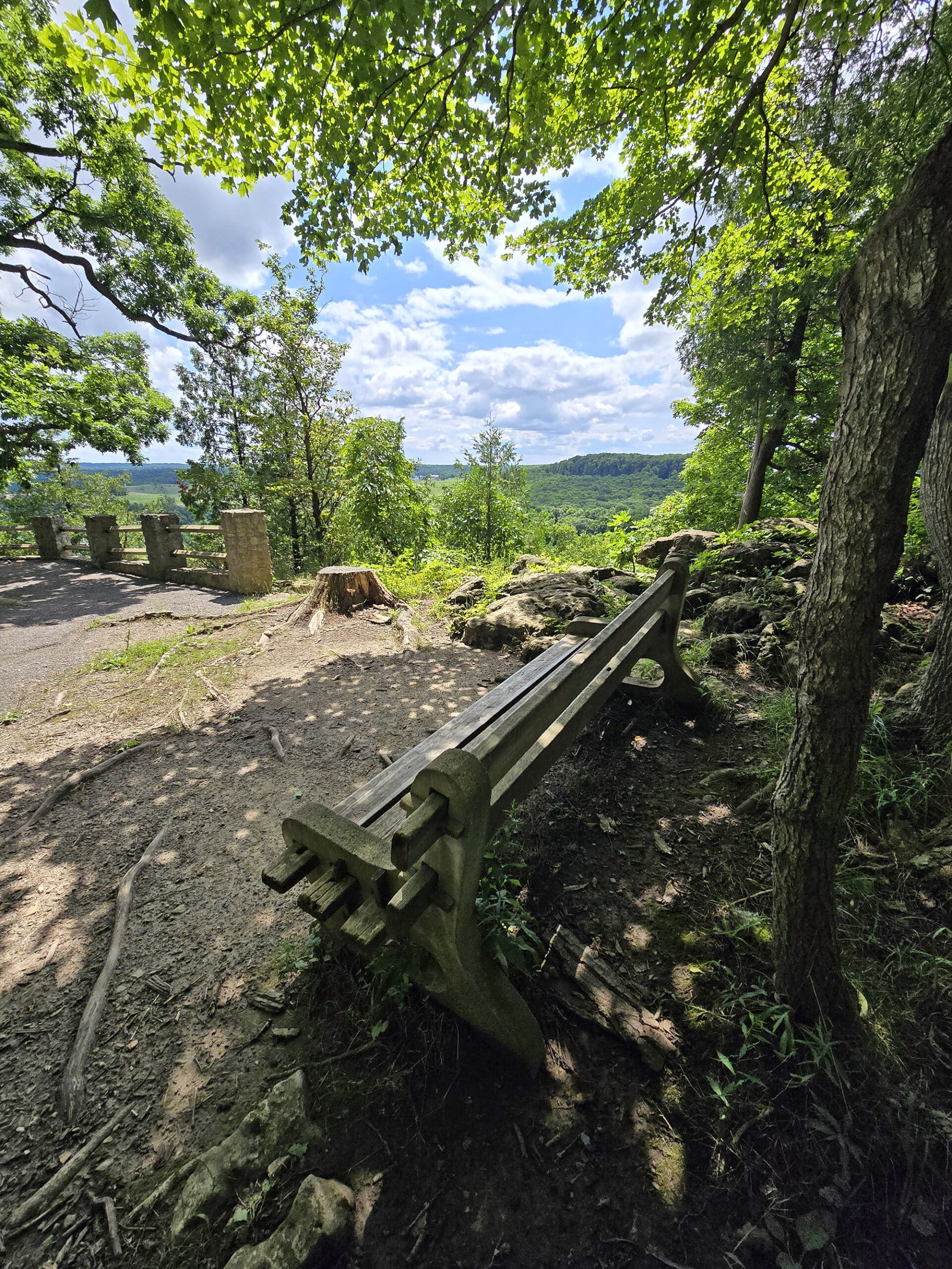
One is the Buffalo Crag Lookout, and the other - shortly before Buffalo Crag - isn’t named or even shown on the map. Each one had a bench, if you need to take a little break along the way.
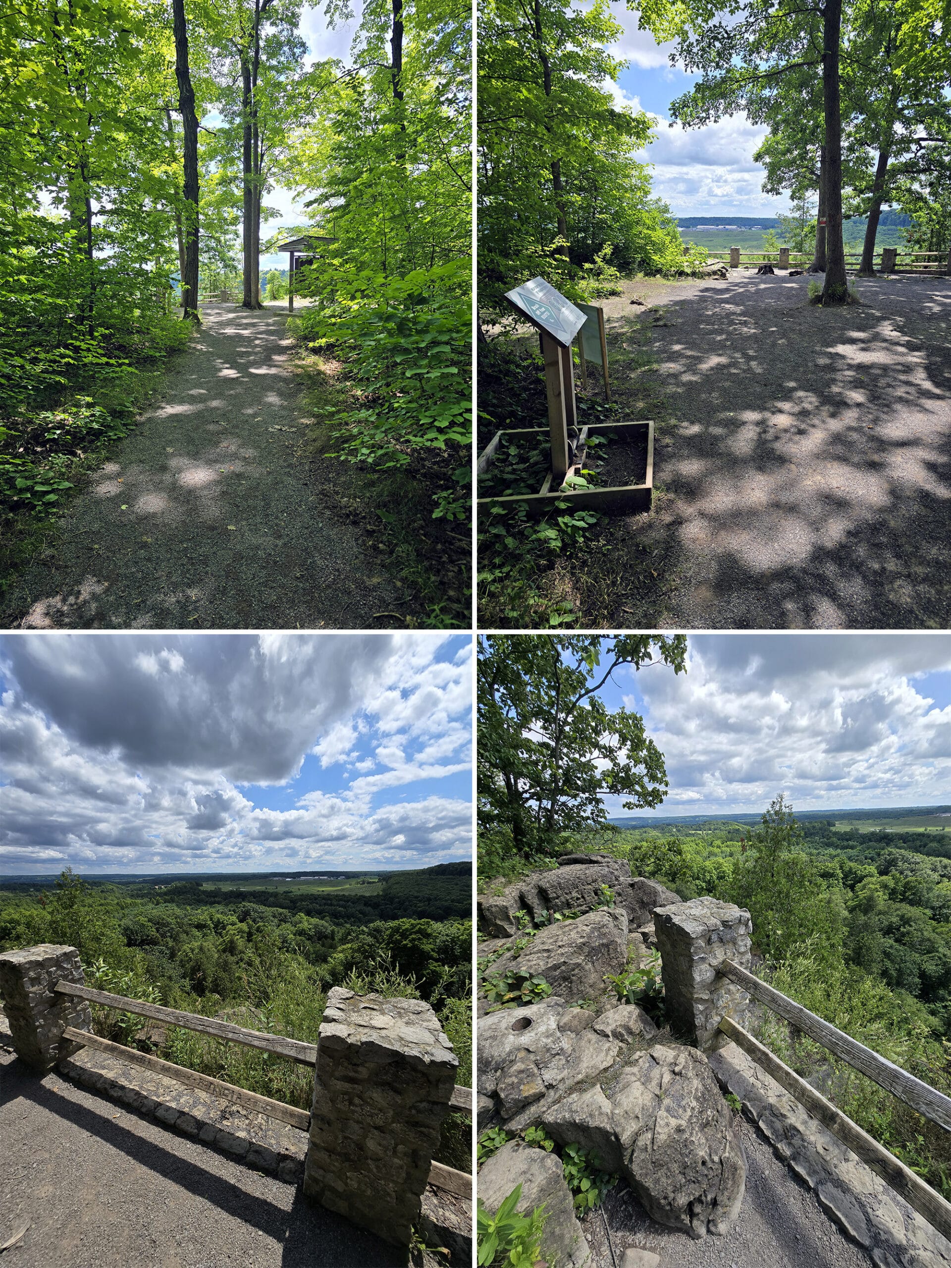
Of the two lookouts, Buffalo Crag lookout was bigger, more open, and had a better view.
The trail got really wet and muddy as it hit the top of the trail there, and looked to be wet a fair distance out.
We debated seeing the whole trail, vs not dealing with mud.
The fact that going back the way we came not only didn’t have any muddy areas, it ALSO had the escarpment view... made our choice pretty easy!
At that time of year - summer - I doubt we missed much, it looked like a pretty basic walk through the woods.
I bet it’s GORGEOUS in the fall, though!
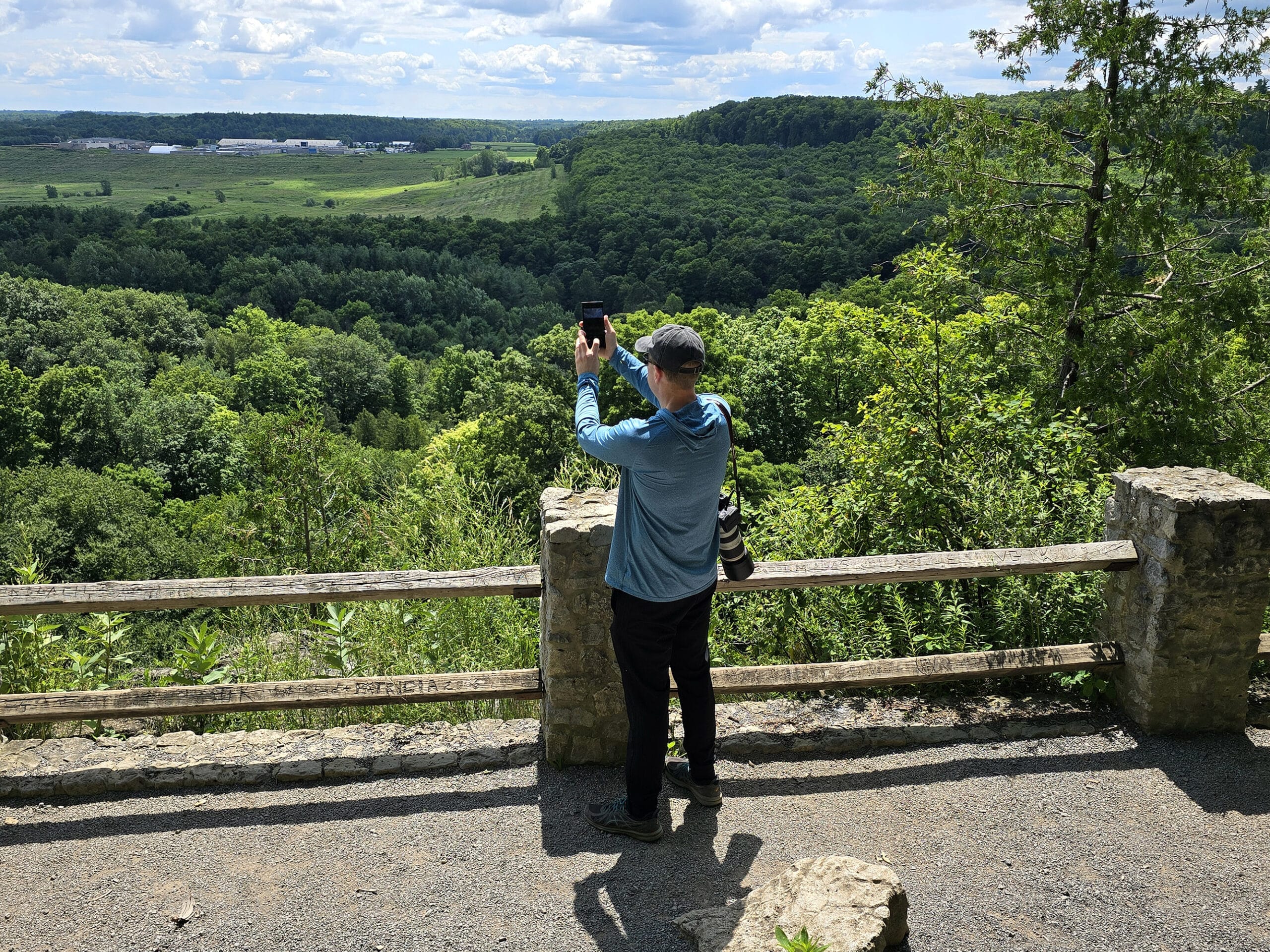
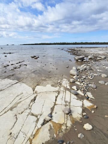
Nassagaweya Canyon Trail 4.7 km one way, 9.4 km round trip, strenuous
The Nassagaweya Trail is a *commitment* - like 4-5 hours worth of commitment!
This one takes you to the Crawford Lake Conservation Area, another gorgeous park nearby. The claims to fame for that one are the rare meromictic lake with a boardwalk trail around it, and a replica Iroquoian Village.
Definitely worth a visit, one way or the other... I just don’t think I have QUITE enough mobility yet, to tack 9+ km of hiking onto a visit of it!
Some day, we’ll tackle this trail. In the meantime, here’s what it looked like, from the far point of the Buffalo Crag Trail:
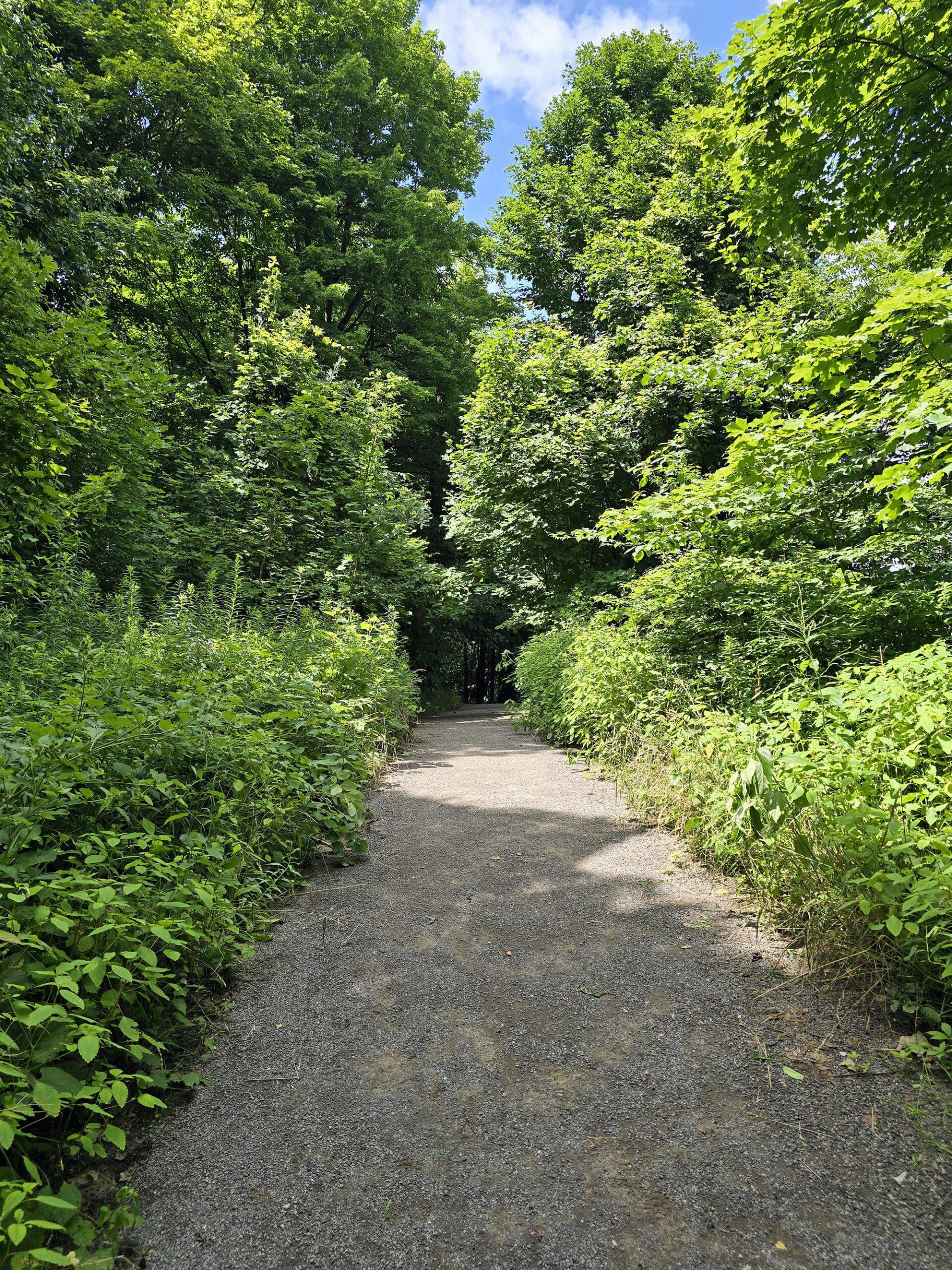
Vista Adventure Trail - 1.5 km, Easy
This was actually the first section of our hiking trip, even if it comes last alphabetically!
The Vista Adventure Trail starts out from the upper parking area. We started off with the trail entrance right off the parking lot*, which led straight into the woods.
The trail was wide, relatively flat, and had some nice views of the woods and moss covered rocky areas.
* Alternately, you can do the trail “backwards” - by leaving the parking lot, turning left, and walking down the road a bit, to reach the trail entrance that way.
(We were unable to find Trafalgar Lookout, which is off the trail down a rough, narrow side trail. There’s also Nassagaweya Lookout, further along the trail.).
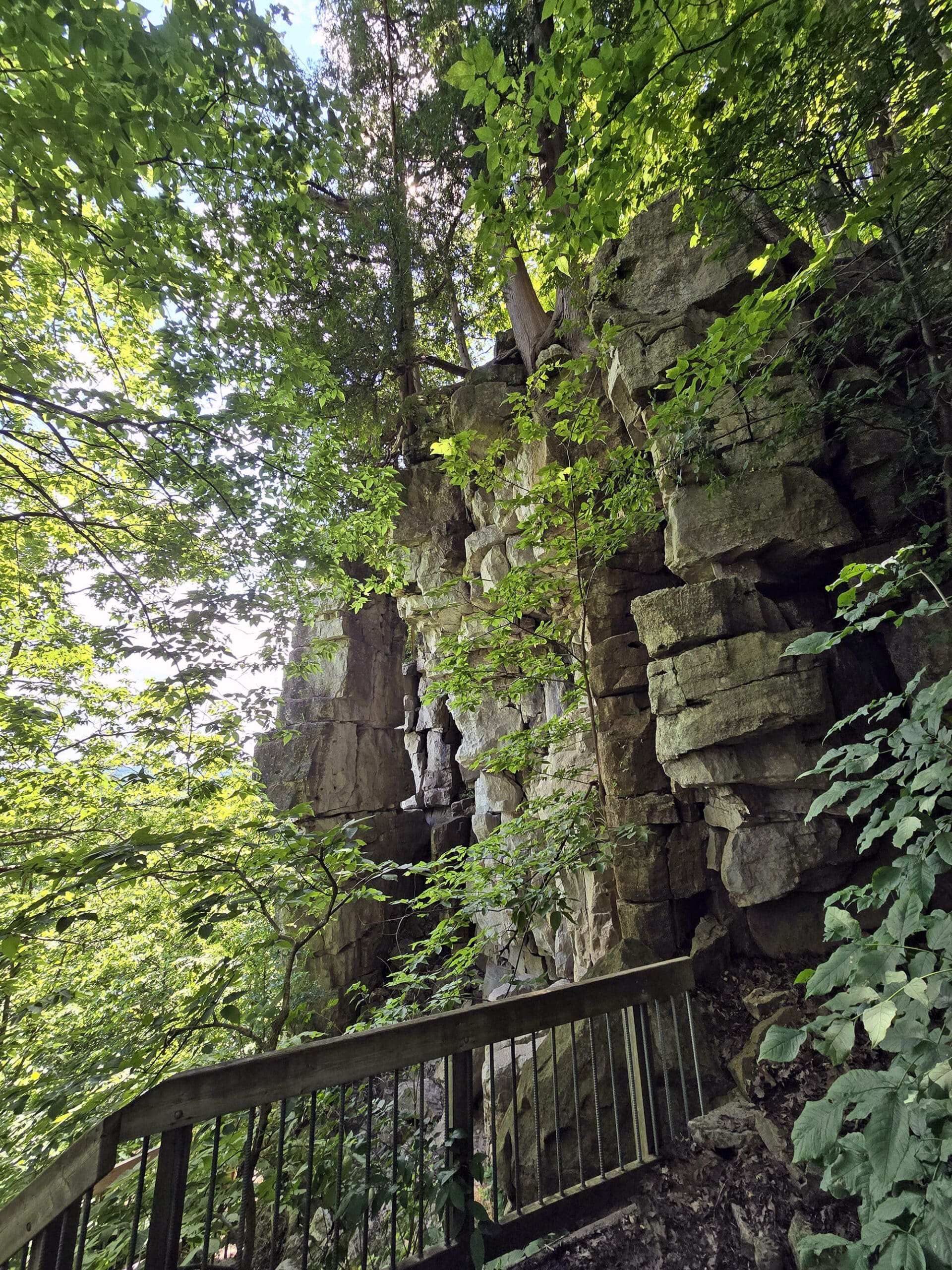
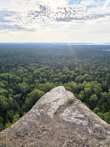
Pinnacle Lookout is down a tiered set of stairs, taking you down to a few levels of platform, as well as some off-platform trail at the bottom.
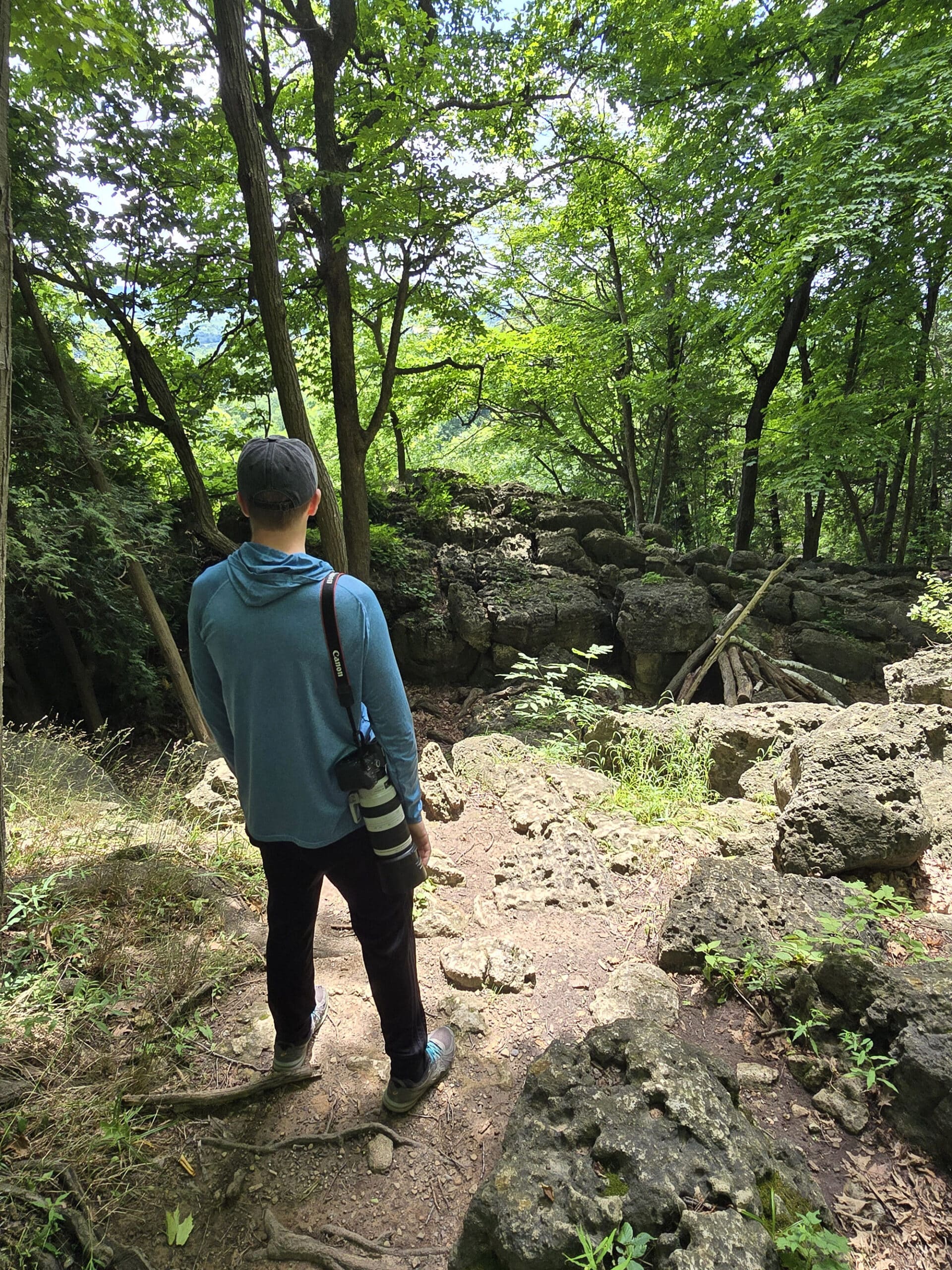
The area seems to be a popular one for rock climbers. It’s also where we were really hit with the “I can’t believe this is only 25 minutes from our house!!” incredulity!
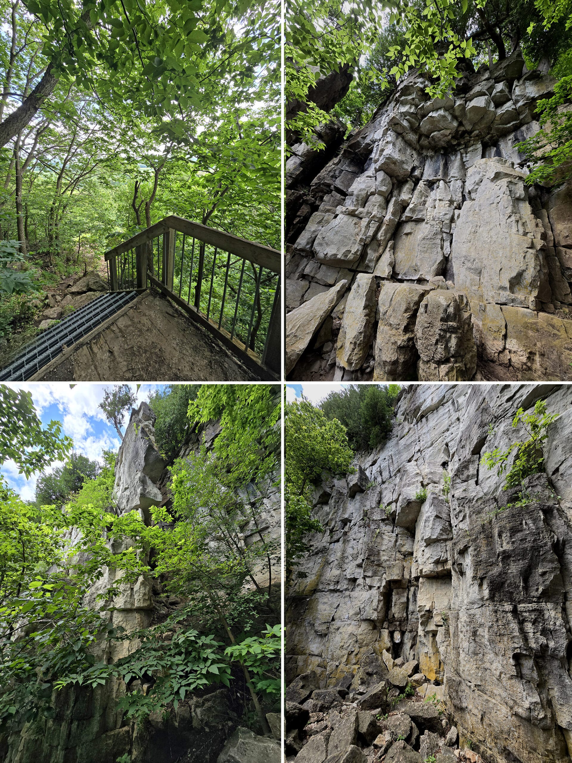
This time, you’ll need to climb up over some rocks to get to it - a stone fence, overlooking a huge area of land below.
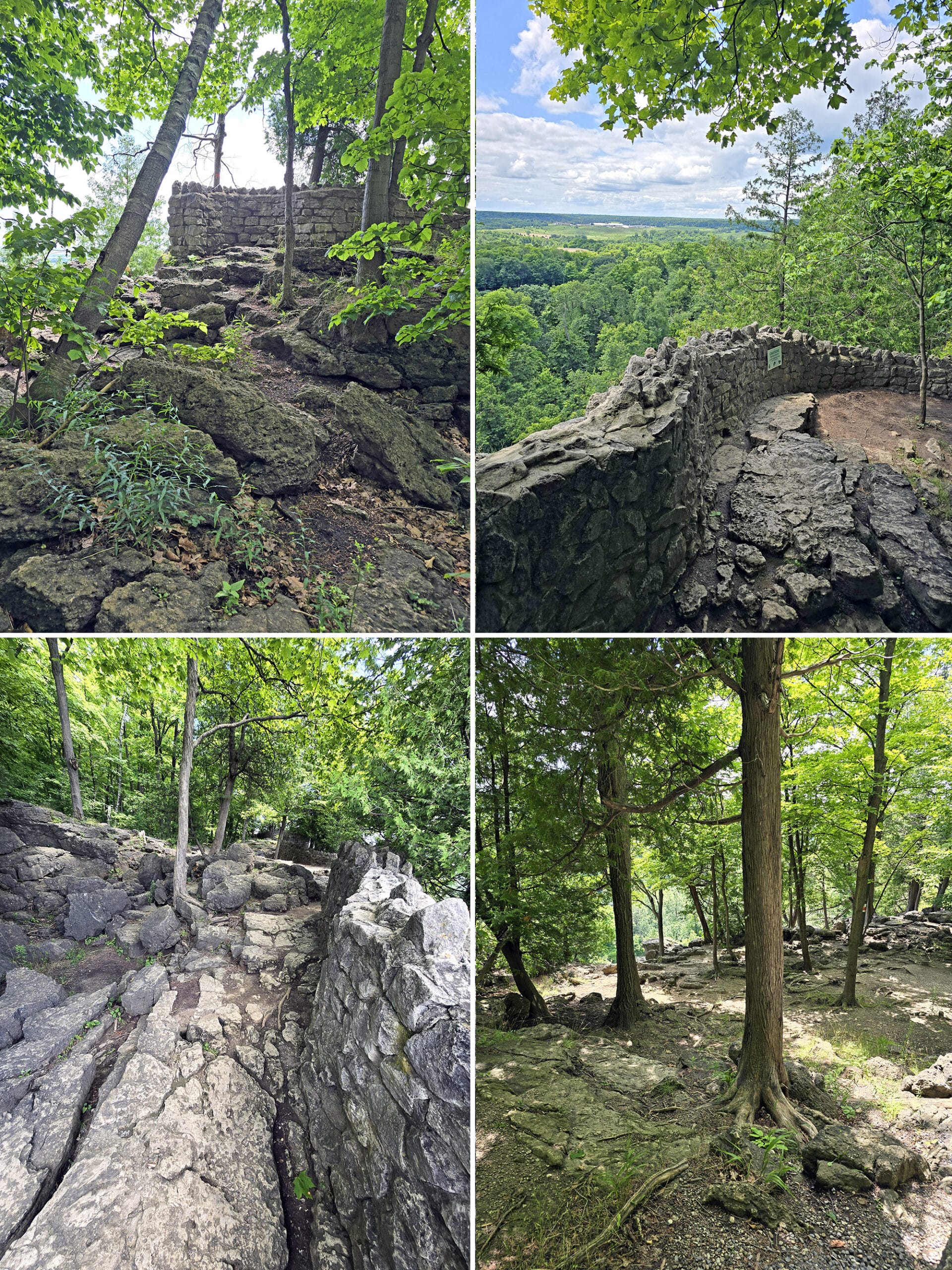
There are a lot of cliffs to look over and such, but most of the views do involve getting slightly off the trail, and scaling some rocks.
Anyway, this trail is completely overlapped with part of the Buffalo Crag Trail. We elected to continue onto that one, when we came to the split - the lower parking area.
To finish out the Vista Adventure Trail, you just loop back on the road, and walk back to the parking lot.
Birding, Wildlife, and Nature
First off: No, there are no snakes at Rattlesnake Point Conservation Area! The park is named after the snake-like path through it.
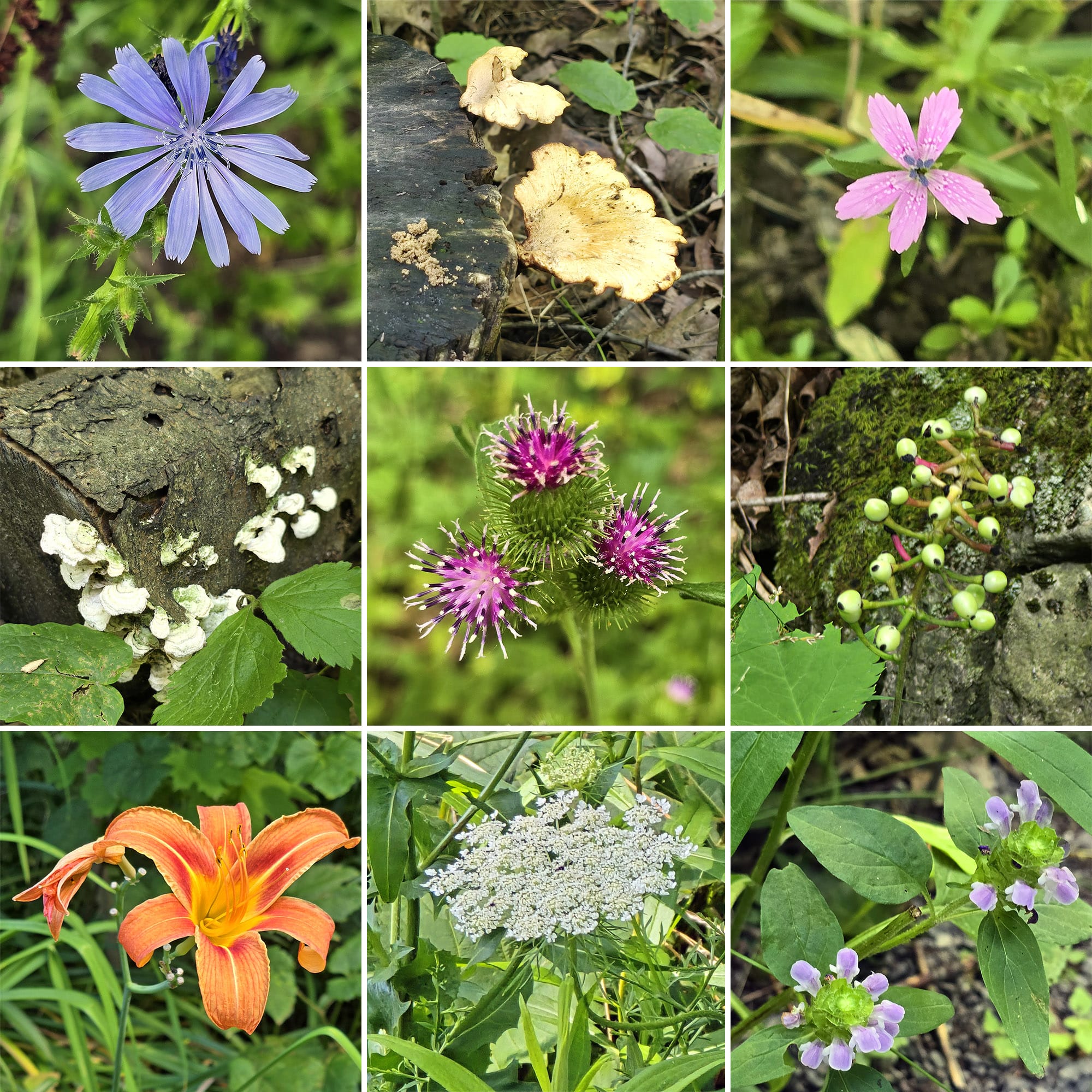
In terms of other animal species, though, it was all about the birds. We saw a single squirrel our entire time, and that was it for non-bird animals!
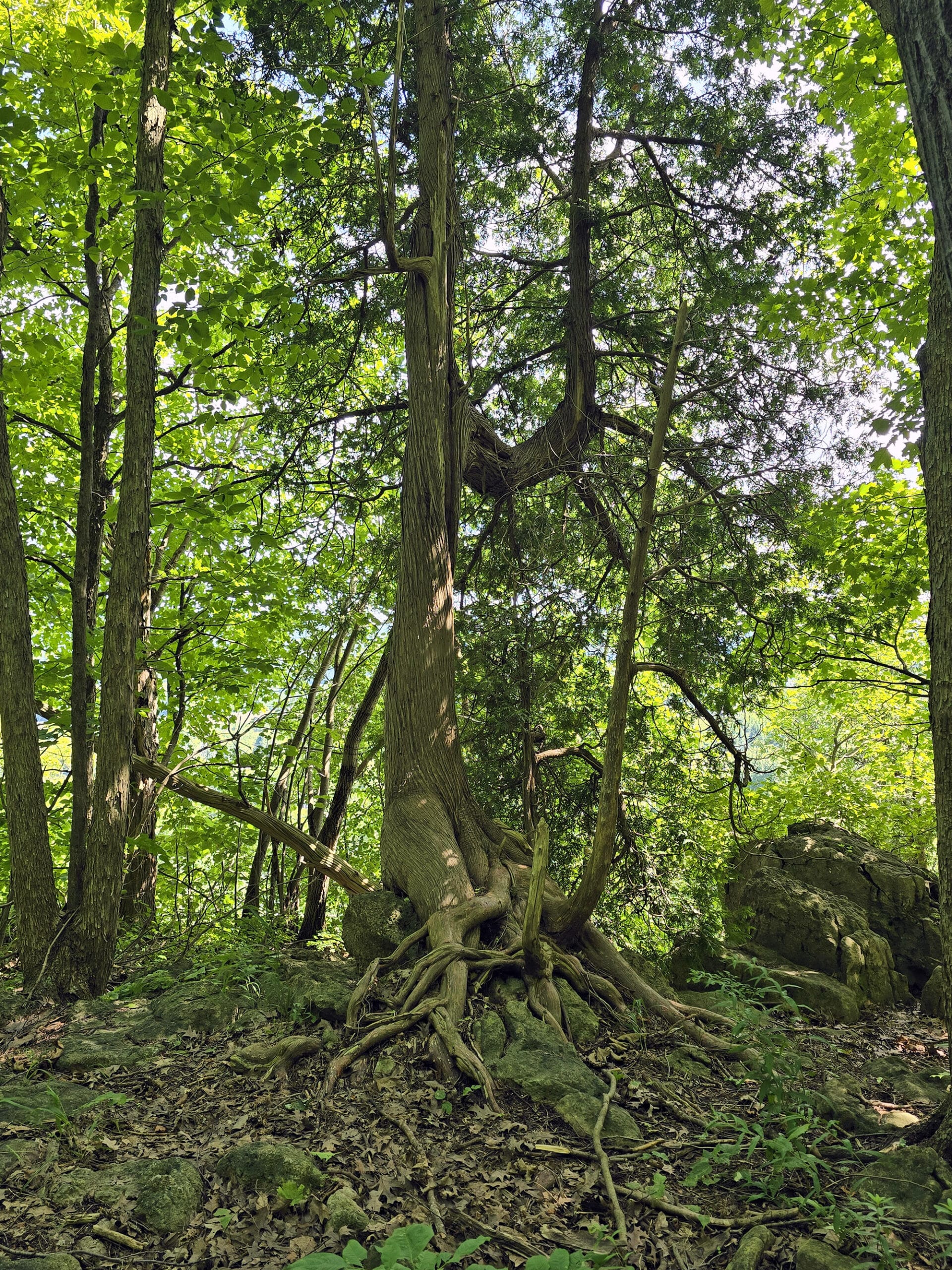
The cedar trees are another draw for the park. The eastern white cedar trees growing along the cliff are referred to as their ancient cedars. Depending on where you’re reading about them, they’re either 600-800 or thousand-year-old cedars!
We heard: American Goldfinch, Eastern Wood-Pewee, Red-Eyed Vireo, and Scarlet Tanager.
The Carolina Wrens were VERY loud, there were a bunch of Northern Flickers along the trail. When we came to the lower parking lot, there were several Indigot Buntings in a large tree there.
Unfortunately, due to the lighting and tree conditions, we weren’t able to get ANY photos worth sharing.
SO, here’s a photo of some of the wildflowers and fungi we saw, instead!
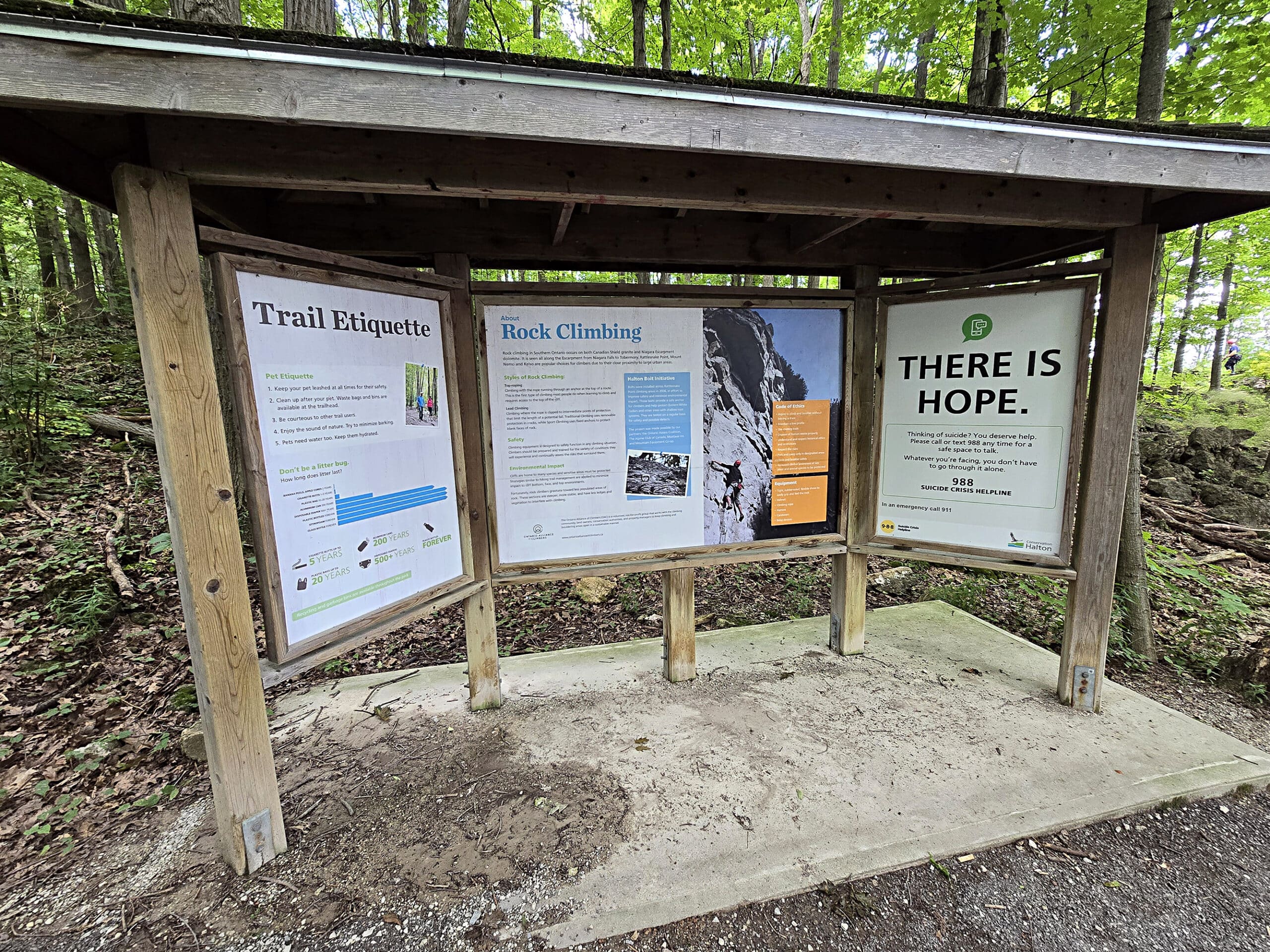
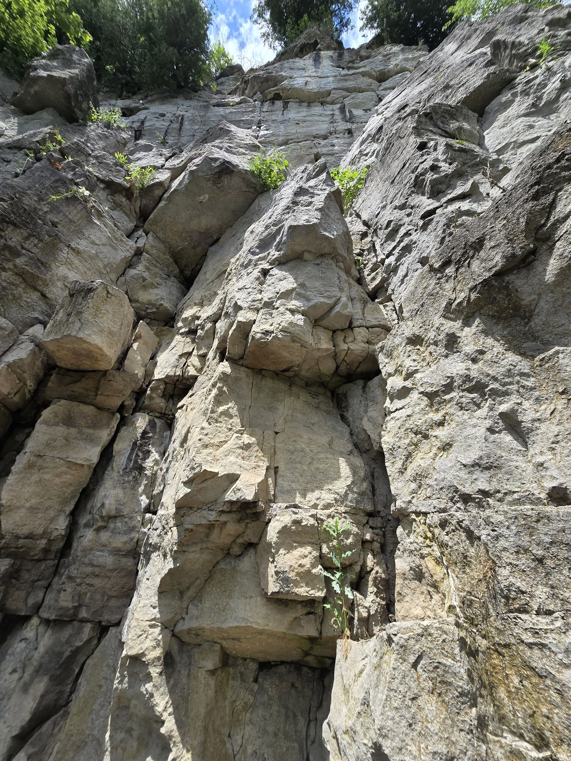
Rock Climbing
This park seems to be really popular with rock climbers, and signage indicated that it had a variety of opportunities to explore.
The edges of the Niagara Escarpment have a variety of challenging cliffs, rated as either Instructional, Recreational, Sport, or Traditional.
Some people enjoy exploring the crevice caves, but after seeing a Facebook post about a wild caving accident... I don’t think it’s something we’ll ever try. Nightmare fuel!
Niantic Games
There are a fair number of Ingress Portals and Pokemon Go Pokestops / gyms along the trails, with a high concentration of them near the Pinnacle Lookout, on the Vista Adventure Trail.
Also, we had a really good cell phone signal throughout the park.
Final Thoughts
Let me just start out by saying that I’m really kicking myself that we’ve lived 25 minutes away from Rattlesnake Point Conservation Area for over 6 years now, and it took us this long to visit it.
Sure, the last 4 of those were complicated by the tendon damage, but still! I really wish we’d gotten some exploration in, soon after we moved to the area.
It’s so easy to forget, when out on the trails there, that we’re actually surrounded by very urban area, and are actually in the Greater Toronto / Hamilton Area!
Anyway, a great walk, amazing views of the area, and just all around a totally worthwhile place to explore. We love how varied the views and the trail conditions were, in such a short area.
I hope the timing works out for us to check it out in the fall, because I bet it will be AMAZING. The vast majority of the trees on the hike are deciduous, and the forest floor is carpeted with very small trees as well.
Definitely looking forward to going back, whether in the fall or otherwise.
Just, you know, not in the winter. That road leading up to it seems like an absolute death wish!
More Places to See
Looking for some nice sights to see and great places to visit while you're out on your camping adventures? Here are a few of our favourite day use parks, attractions, etc.
Batchawana Bay
Big Bay, Ontario
Bruce Peninsula National Park
Cheltenham Badlands
Doube's Trestle Bridge
Eugenia Falls Conservation Area
Devil's Monument, Bruce Peninsula
Falls Reserve Conservation Area
Flowerpot Island
Hogg's Falls
Indian Falls Conservation Area
Inglis Falls Conservation Area
Keith McLean Conservation Lands
Jones Falls / Pottawatomi Conservation Area
Menesetung Bridge
Mono Cliffs Provincial Park
Point Pelee National Park
Scenic Caves Nature Adventures
Spirit Rock Conservation Area
Temagami Fire Tower
Webwood Falls Nature Preserve
Walter's Falls
Wasaga Beach Provincial Park
Thanks for Reading!If you loved this post - or have any questions about it - please leave a comment below! We'd also love it if you would consider sharing the link on social media! |
Leave a Reply