
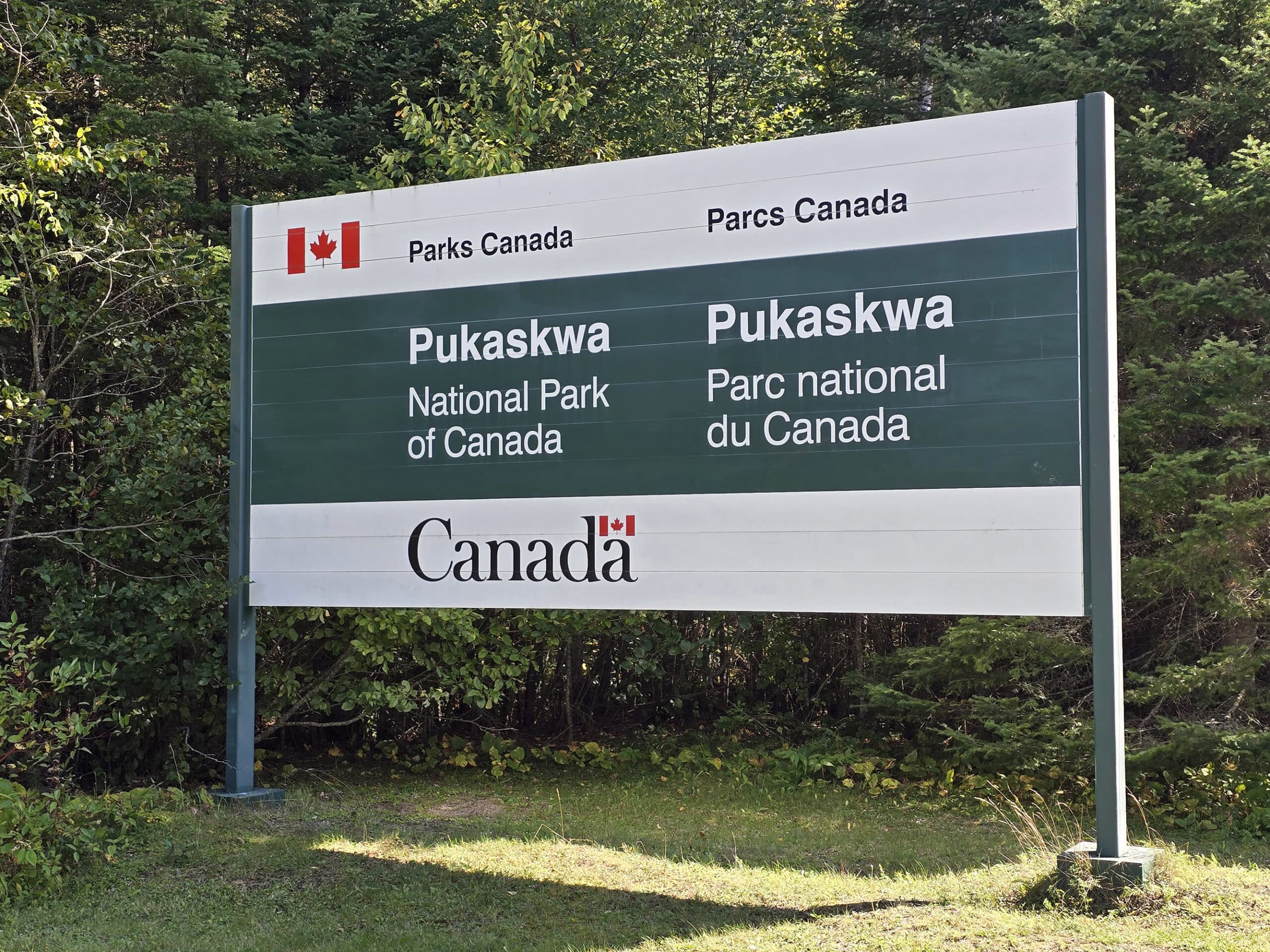
Pukaskwa National Park is a gorgeous campground - with fabulous hiking trails - on the shore of Lake Superior. Here's our review & guide!
Originally posted on September 26, 2024, Updated on 8/9/2025.

Nestled on the shoreline of Lake Superior, Pukaskwa covers 1,880 square kilometres, on part of the longest undeveloped shoreline out of all the Great Lakes.
It is Ontario's largest National Park, and only the second of the Canadian National Parks we’ve stayed in. As huge fans of Bruce Peninsula National Park, we definitely wanted to give Pukaskwa a try!
Like Bruce Peninsula, Pukaskwa is a STUNNINGLY beautiful place.
It’s a lot more remote than Bruce Peninsula, though. Located about 20 minutes from the Town of Marathon, it’s about 4.5 hours from Sault Ste. Marie, and around a 4 hour drive from Thunder Bay.
On the way up to Pukaskwa National Park, we made stops at Batchawana Bay, Chippewa Falls, French River Provincial Park, Mink Creek Falls, Old Woman Bay, Onaping Falls, Sand River Falls, and Scenic High Falls ... and that’s on top of all the cool campgrounds we’ve stayed at!
(Grundy Lake Provincial Park, Fairbank Provincial Park, Chutes Provincial Park, Pancake Bay Provincial Park, Lake Superior Provincial Park, and White Lake Provincial Park, this time around!)
Anyway, we had a fantastic stay - both at the time, and again in May 2025 - let us tell you all about it!
The Basics:
Campground Name: Pukaskwa National Park
Address: ON-627, Heron Bay, ON P0T 1R0 (Click for the Google Maps location!).
Website: https://parks.canada.ca/pn-np/on/pukaskwa
Price: There are several fees involved, even beyond the campsite itself. See the Parks Canada’s Fees Page for more up to date information.
Reservations: Parks Canada Reservations
Season: May 15 - October 15.
Logistics
Some basic information to help you plan your trip to Pukaskwa National Park:
Registration and Check In
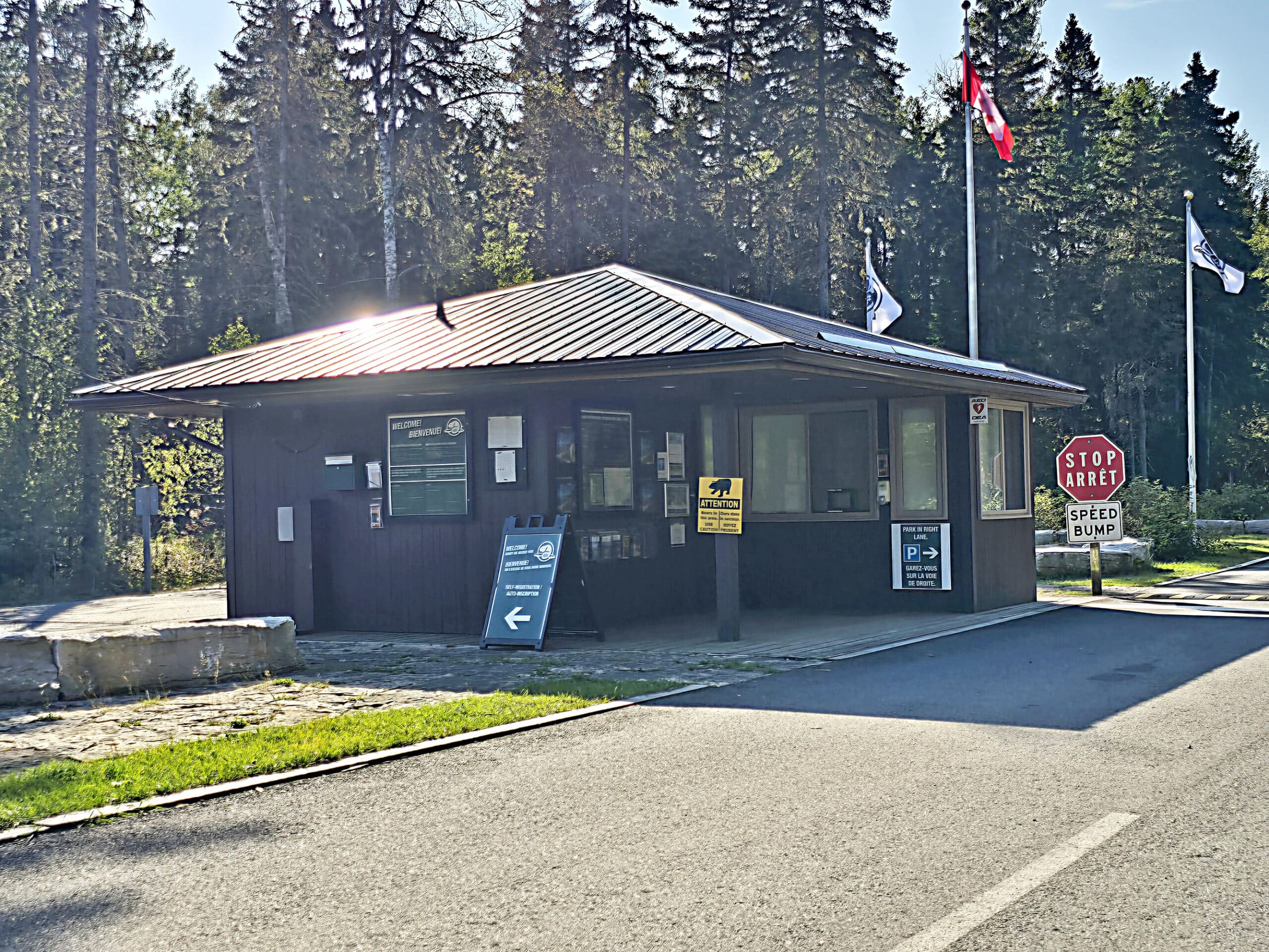
Pukaskwa has a kind of chaotic setup - they don’t take reservations.
At. All.
It’s first-come, first-served basis. You show up at the park kiosk (check in / check out time is 11 am), a park staff member hands you a map, and you drive in to claim a site.
If you don’t see a person, car, or belongings, it’s “unclaimed”.
Then you claim the one you want - by leaving a person, vehicle or belongings in it. Then you tell the front the number of the site you claimed, and pay for it.
Woof.
I’ve never been a fan of the national park system’s online reservation portal, but there’s definitely something to be said about actually knowing whether or not you have a site, before driving ~20 minutes off the Trans-Canada Highway and hoping for the best!
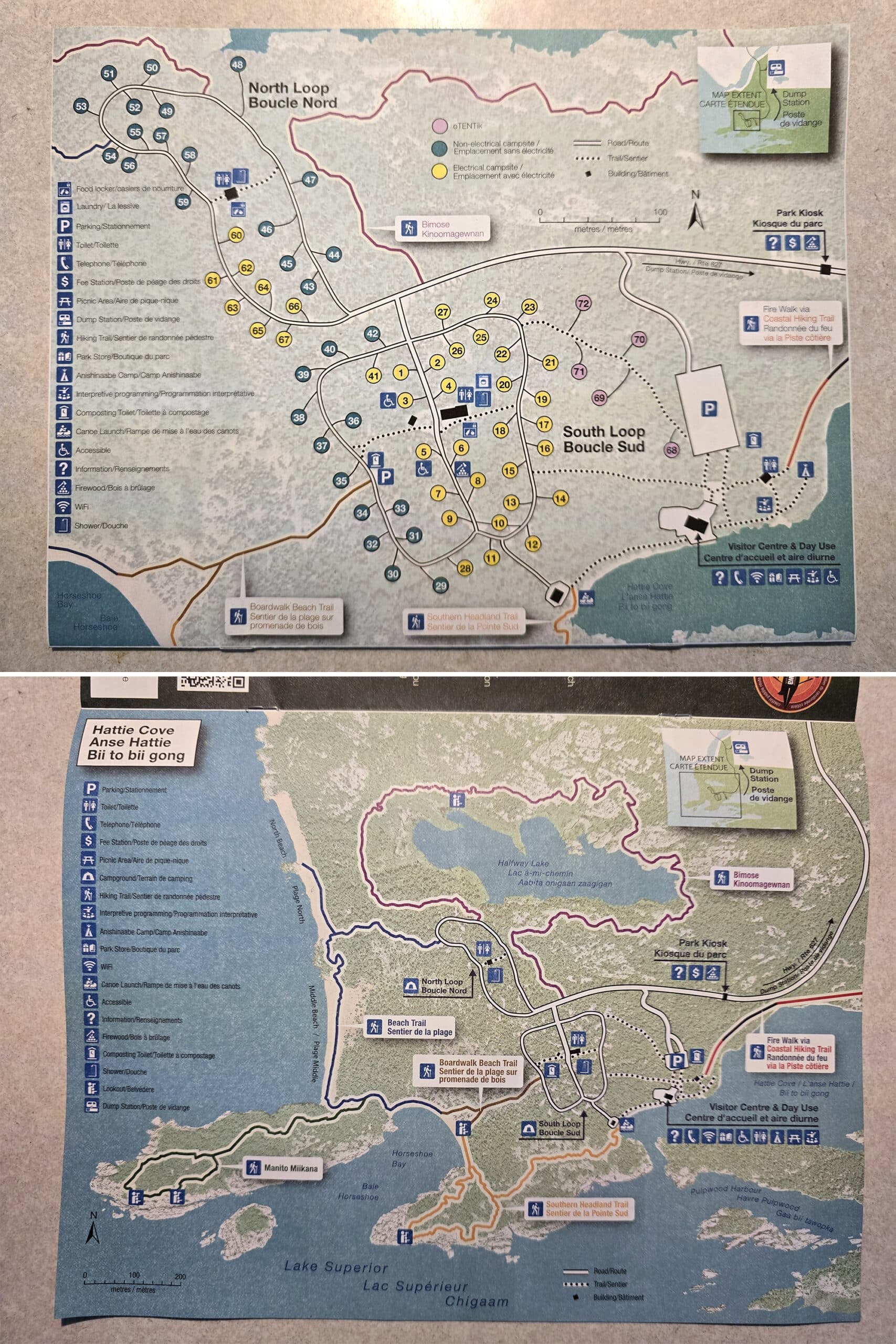
Maps and Signage
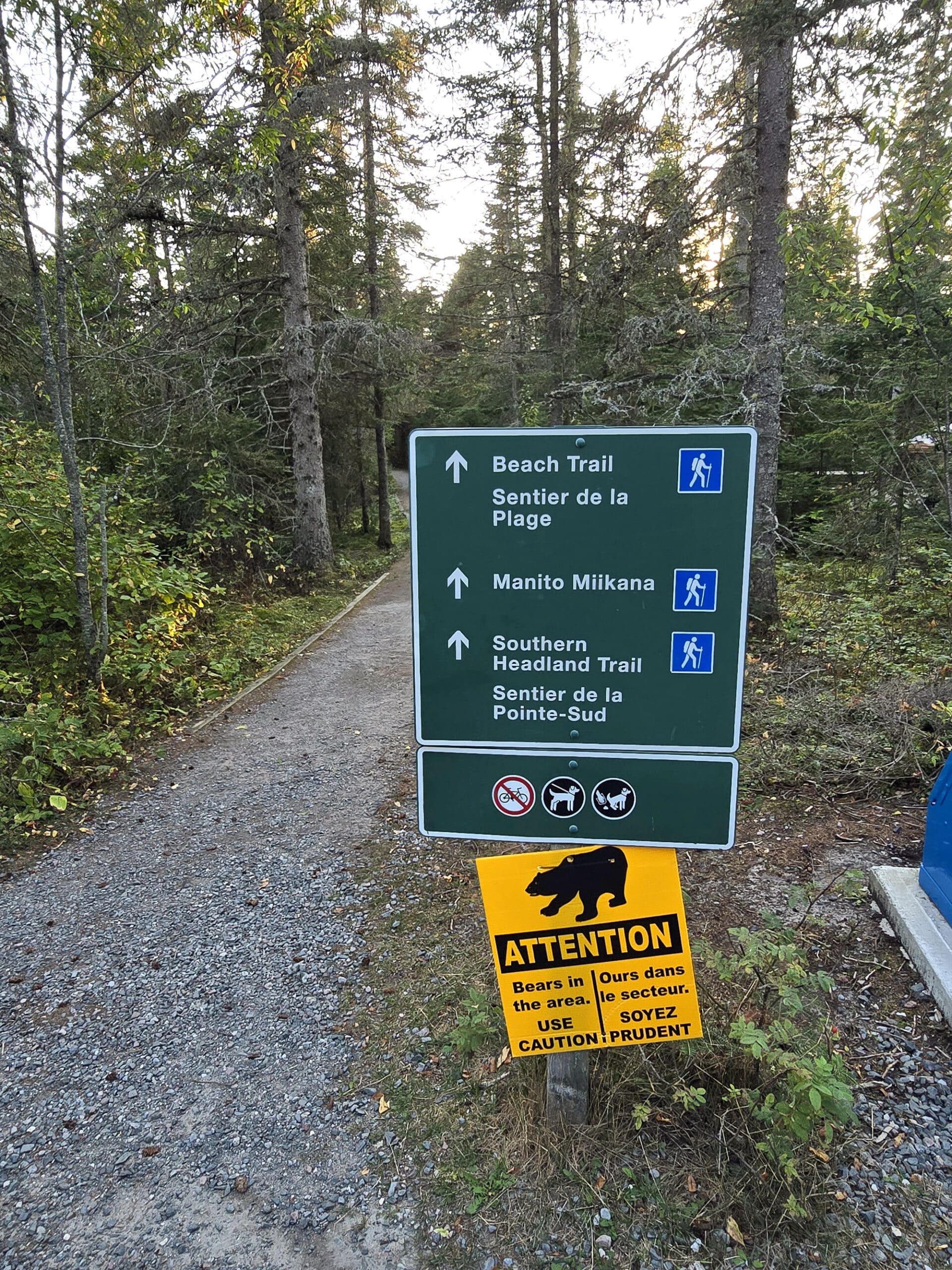
The signage on the roads throughout the campground - and on some parts of the trail - is excellent.
Clear, concise, comprehensive, thoughtfully placed, no issues at all.
That said... the trails could *definitely* use some work in terms of trail signage. A few more blazes on the Manito Miikana trail - especially near the lookouts - would have been lovely.
The Visitor Guide is a full colour, 8.5x11" booklet with information and multiple maps. One is a campground map, and the other a trail map - both are well done and informative.
Then, there are trail maps and such in a few other areas, all very well detailed, clear, and comprehensive.
Whoever is in charge of some of Ontario Parks’ maps really needs to get ahold of the Parks Canada cartographer.
Waste and Water Services
None of the campsites in Pukaskwa National Park have water or sewer hookups, though there are dump and fill stations in the park - separately.
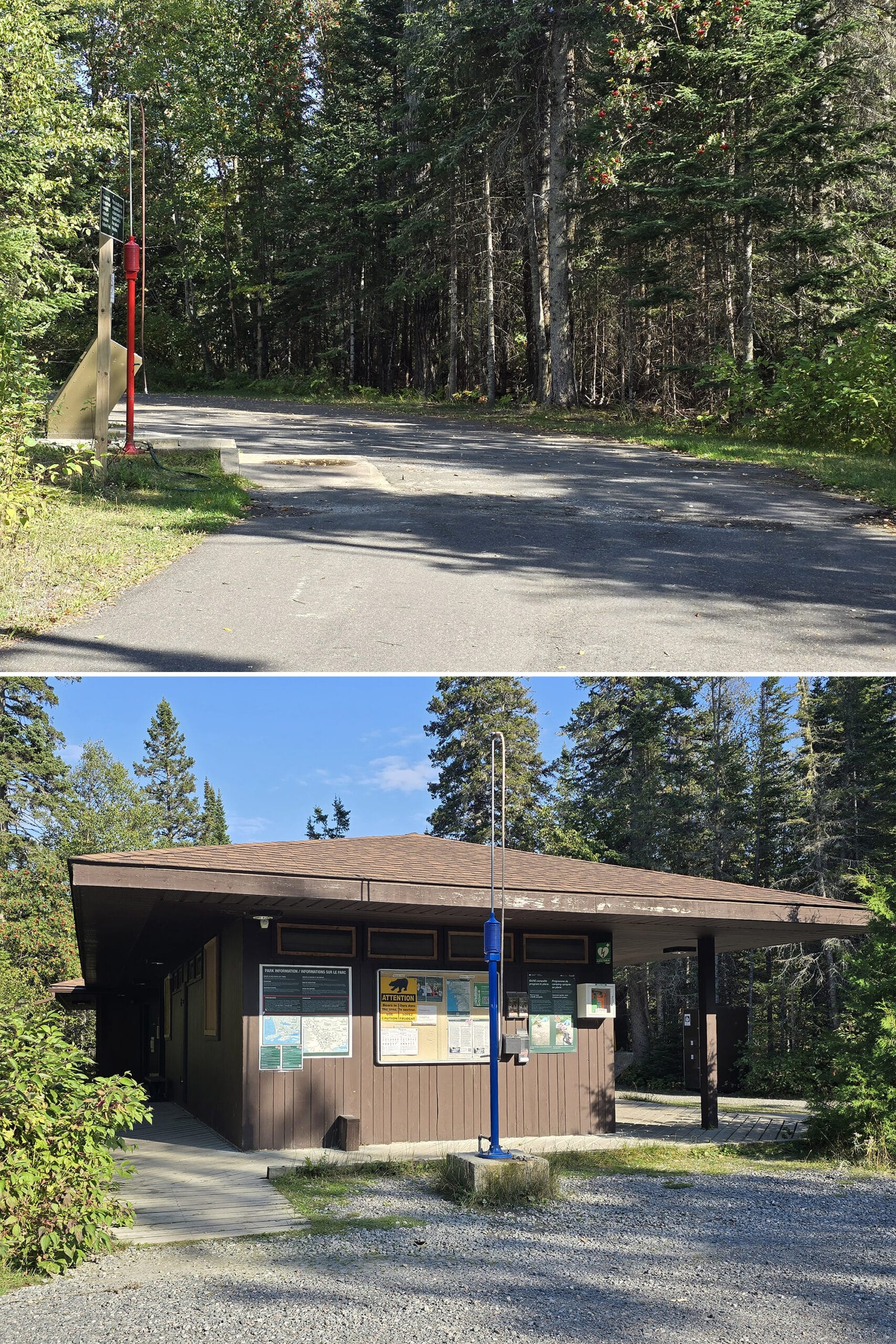
On your way into the park, you’ll pass the dump station before the gatehouse - and you probably won’t even notice it. The road is marked with something like “park office” or “administration” or something, from that direction.
On your way out of the park, though, it’s well marked and much easier to find.
The dump station is just a single platform on the driver’s side. It’s a wide lane - not so much a double lane / with a bypass lane, but wide enough that another vehicle could probably get through.
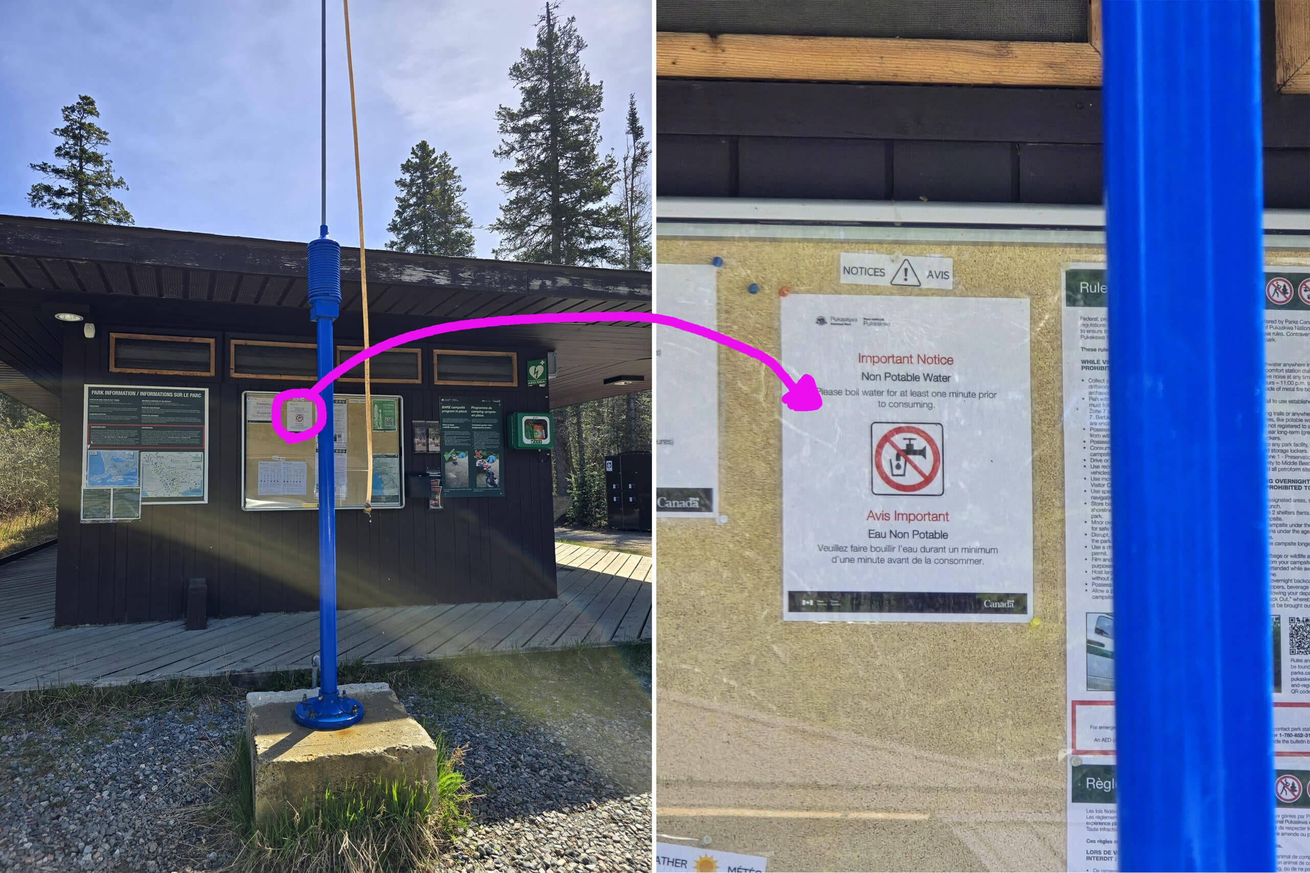
The trailer fill station is inside the south loop campground, right on that centre campground road, in front of the comfort station.
Given the way check in works, I could see this being super awkward to use in peak season.
We were told that no, it was not. The wild thing was that there was no sign on the post indicating as much!
Upon closer inspection, there was a little notice about it on the bulletin board on the comfort station, behind it.
I guarantee you that NO ONE who pulls up to that fill station is going to notice the boil water advisory, as posted. This is sloppy and potentially dangerous - not at all what we’re used to from Parks Canada!
Connectivity
While we were able to get a bit of cell reception on the beaches - at times - there is generally no cell coverage in Pukaskwa National Park.
That said, the Visitor Centre does have wifi - with the login information posted on a window on the back side of it.
I can think of worse places to check my email, LOL.
Accessibility
Overall, it’s a pretty accessible campground.
Pros: Nice ramps up to the comfort stations, accessible amenities there. The campground roads - and walking paths - are wide, well packed gravel, and really well maintained.
There are two accessible campsites, and the both the Visitor Centre (when open) and the Boardwalk Beach Trail is wheelchair accessible.
Cons: While access to look at Horseshoe Bay - via the boardwalk trail - is wheelchair accessible, getting out onto ANY of the Pukaskwa beaches is not.
Parking
For the most part, there’s plenty of parking - given the size of the park.
Most campsites have ample space for your vehicles, and there’s a big parking lot at the Visitor Centre.
There didn’t seem to be any parking at the comfort station, though.
Pets
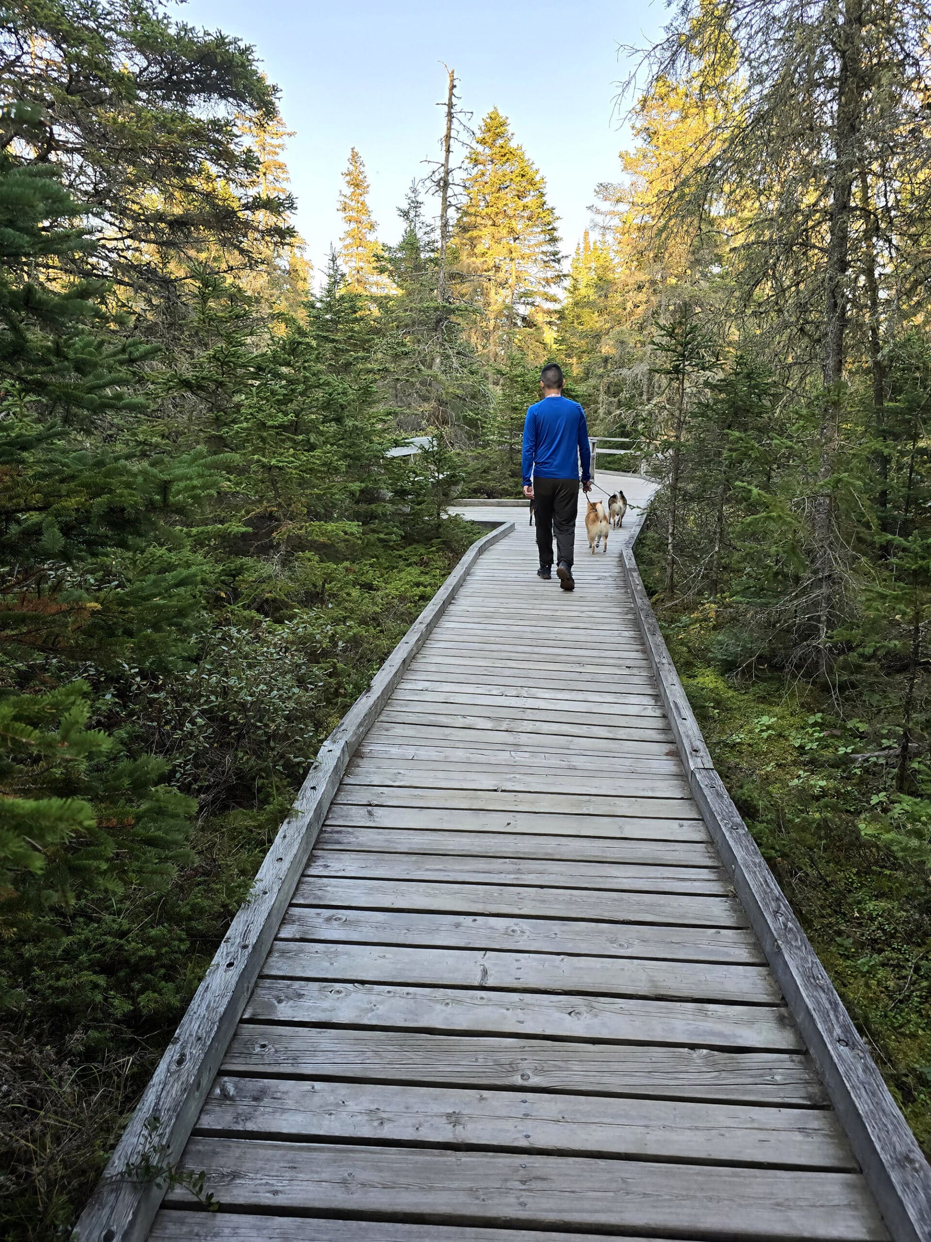
Pets are allowed, though there isn’t any specific areas for them. The boardwalk trail and campground roads seem to be popular places for walking them, though.
Dogs have to be kept on a leash at all times, and can’t be left unattended in a vehicle or campsite. Not properly removing pet waste is also specifically prohibited.
Miscellaneous
A few random notes on Pukaskwa National Park:
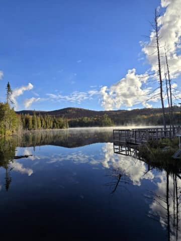
1. While the park is in an area of low light pollution, there’s no really great north-facing view. The beach areas all face south, and that’s where the best views are.
I suppose you could always go up one of the trails with lookouts, but that seems AWFULLY risky to do at night - especially considering the lack of internet /availability of Aurora condition updates, as a result.
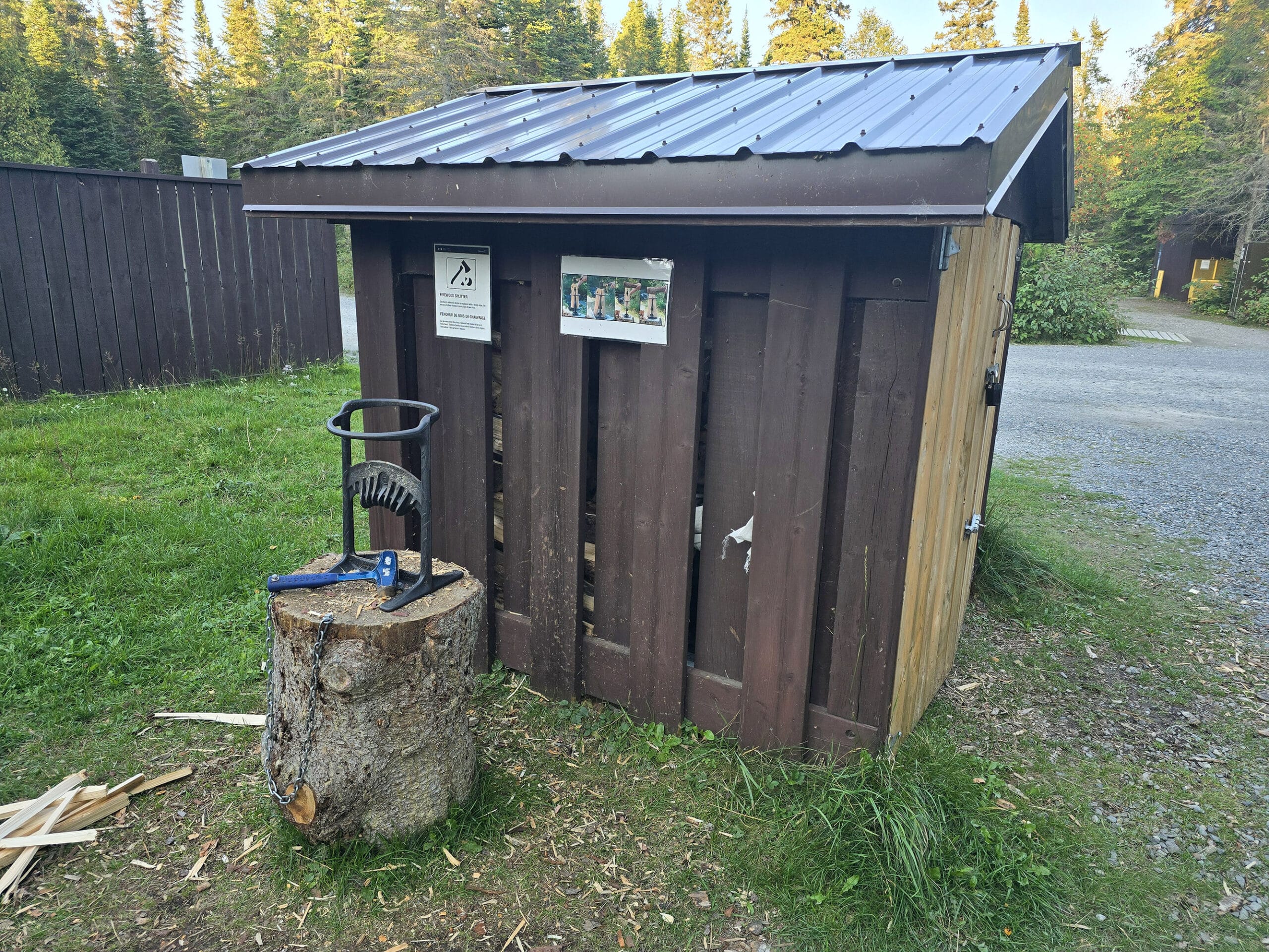
2. Across from the South Loop Comfort Station is a wood shed... and a little wood splitter setup! Super handy - and something we haven’t seen at any campground before.
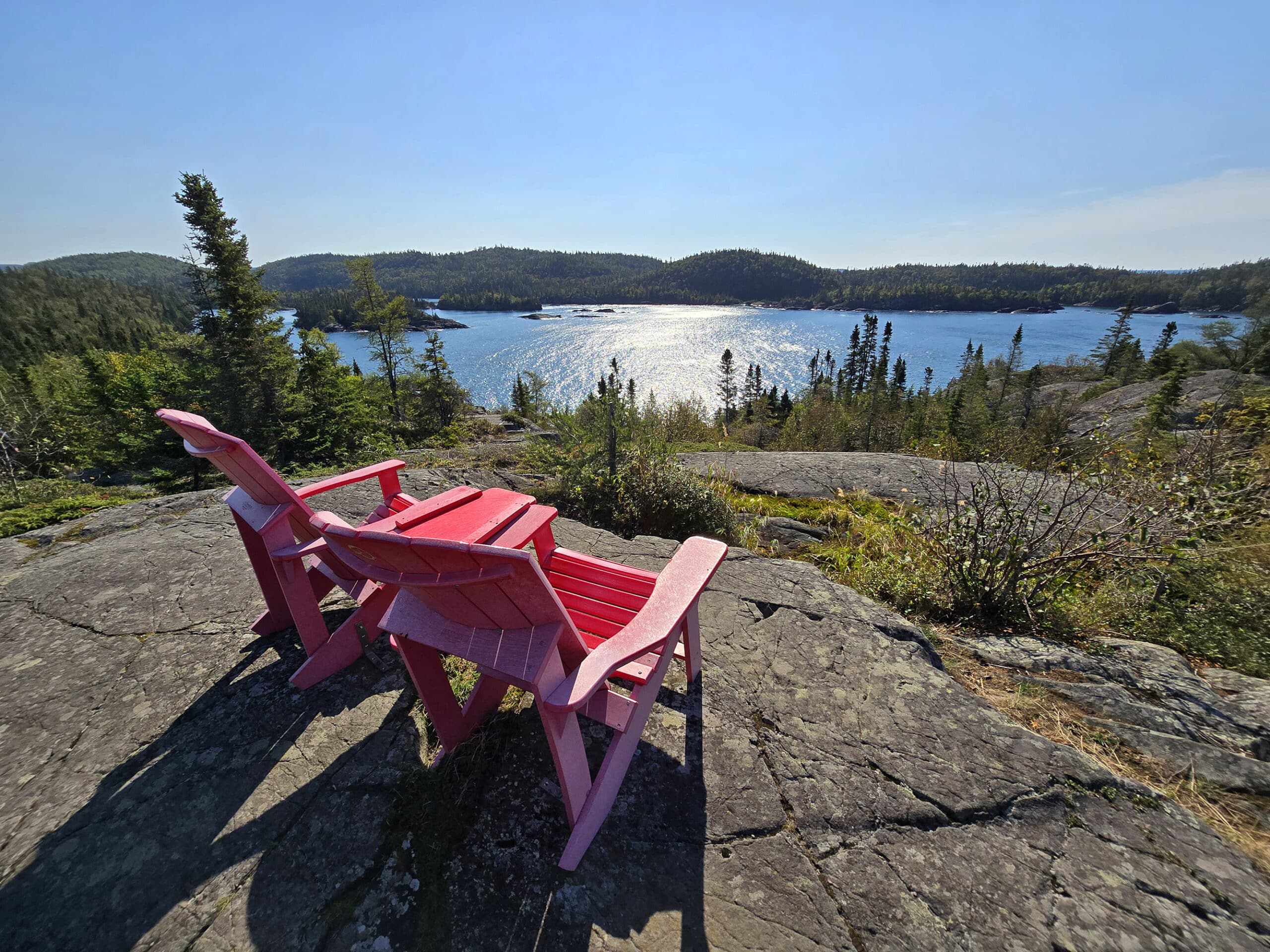
4. If you’re looking for the Red Chairs, we found two sets of them - one behind the Visitor Centre and off to the right, and one on the Southern Headland Trail.
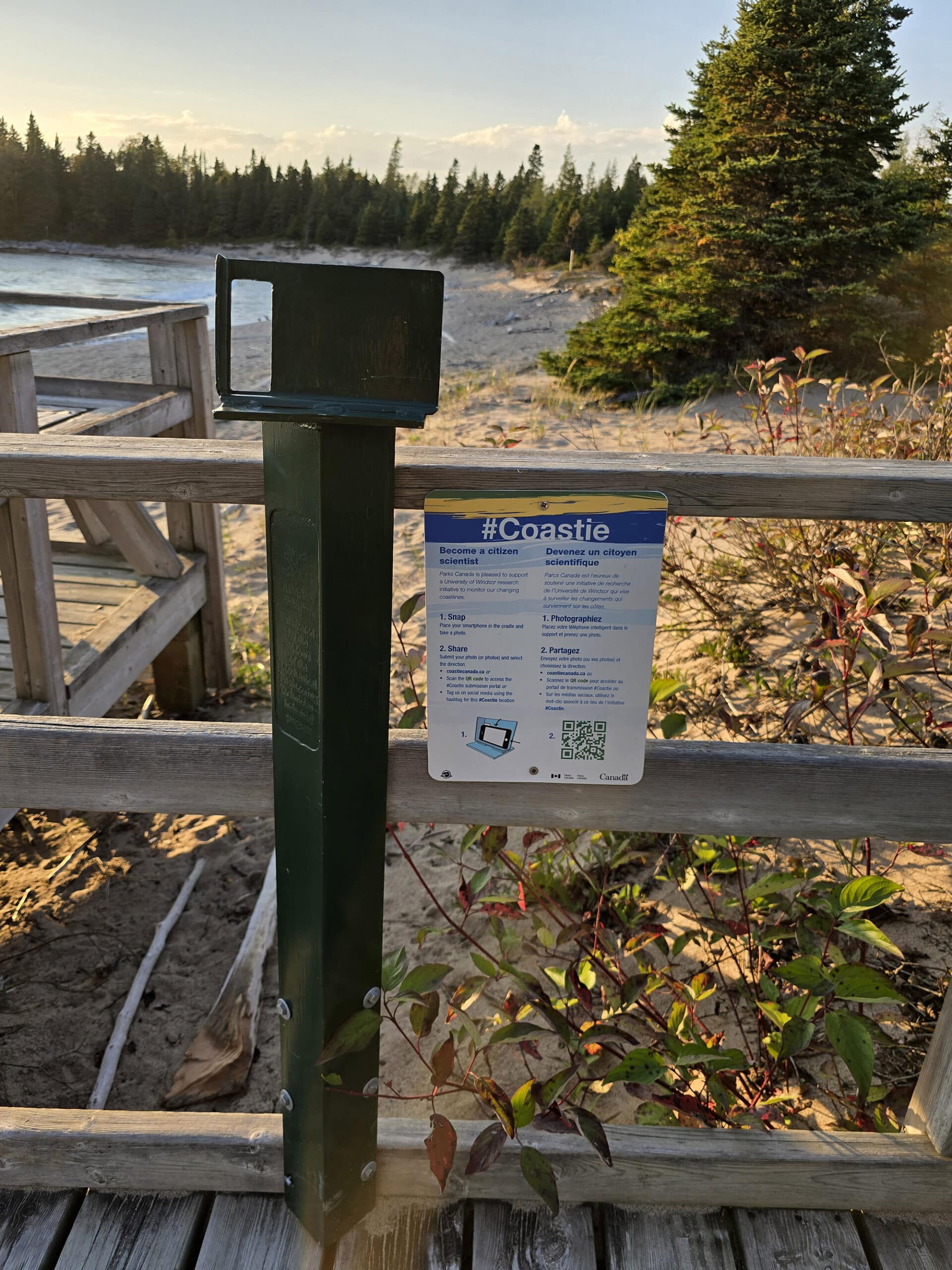
Run through the Coastie Canada website, there are little stations that invite you to orient your phone through their holder.
Then, you take and submit a photo of the current state of the coastline in question. This is an initiative from a research team out of the University of Windsor, tracking the changes in the coastline over time.
Campground Amenities & Info
We visited during the off season, so part of the campground was closed for the season.
Here’s some basic information, though:
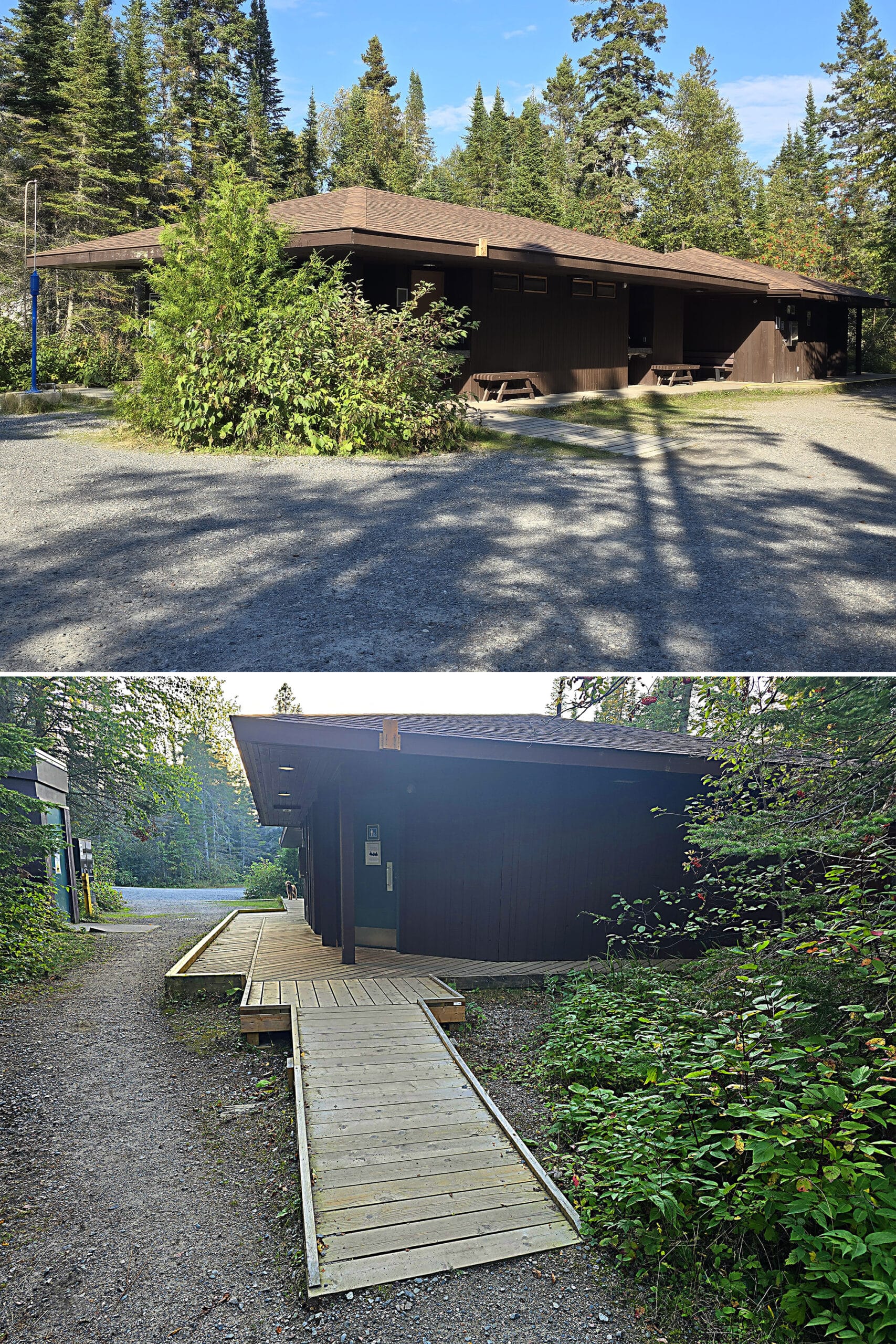
Creature Comforts
The main comfort station is in the South Loop campground, with flush toilets, laundry facilities, and hot showers. Change for the laundry machines is available at the Park Kiosk.
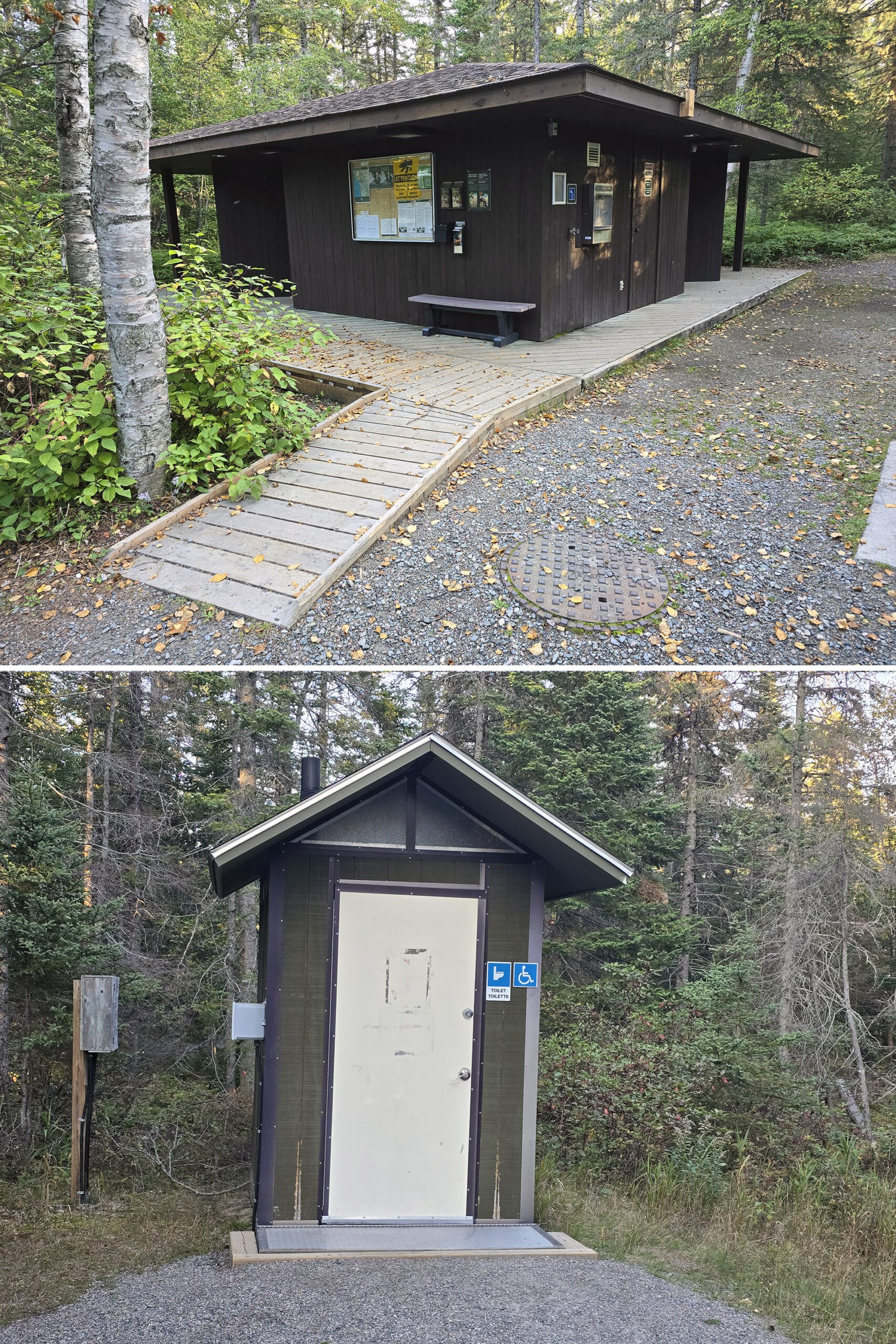
There’s also another building with flush toilets between the Visitor Centre and the Anishinaabe Camp.
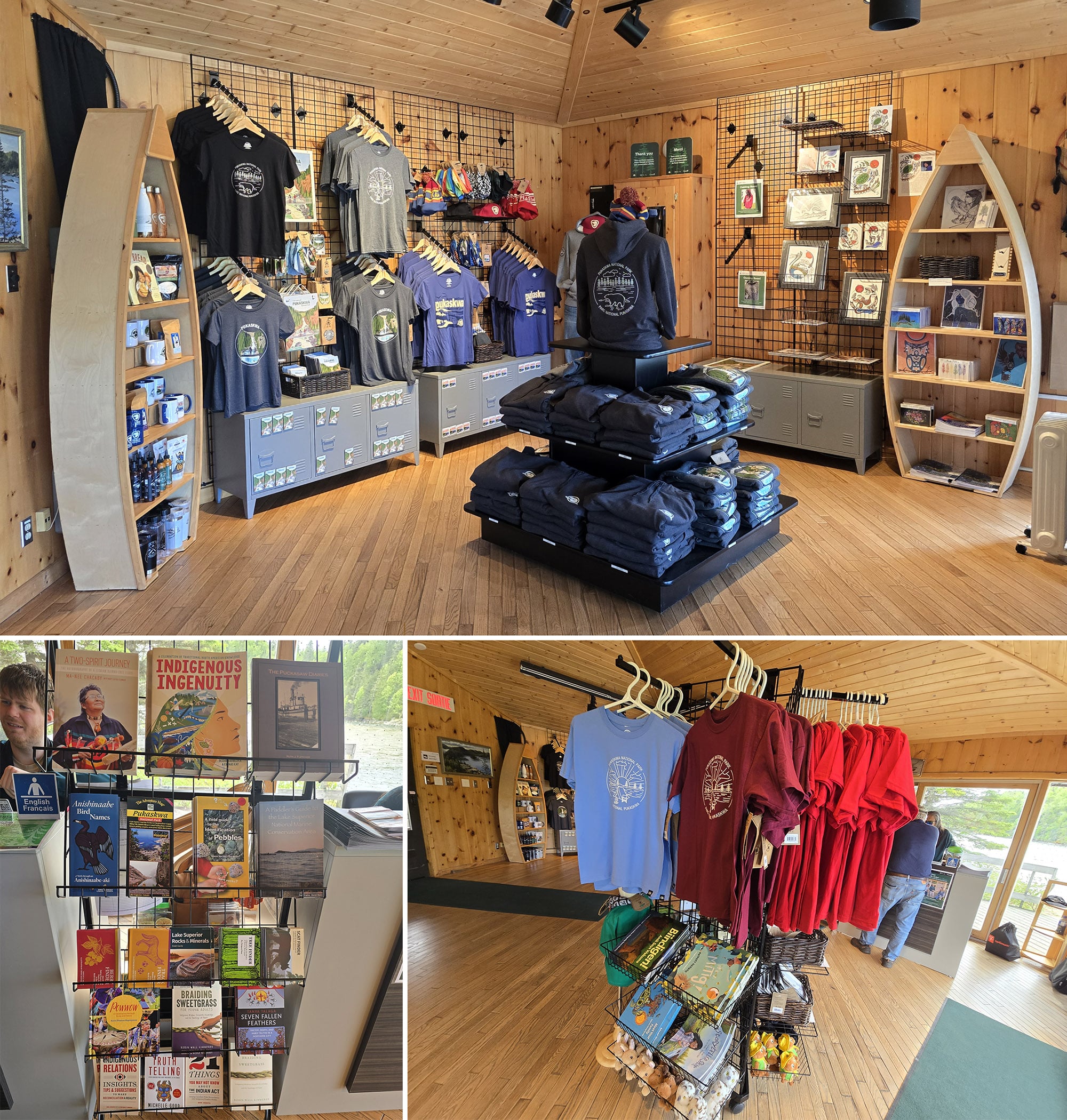
Park Store
The main park store is located in the Visitor Centre, which - unfortunately - closed for the season a few days before our first visit. There, you can find souvenirs, collectibles, and even park apparel.
There’s a smaller selection of souvenirs available at the Park Kiosk / Gatehouse. We bought a fridge magnet, to go with our Bruce Peninsula National Park magnet.
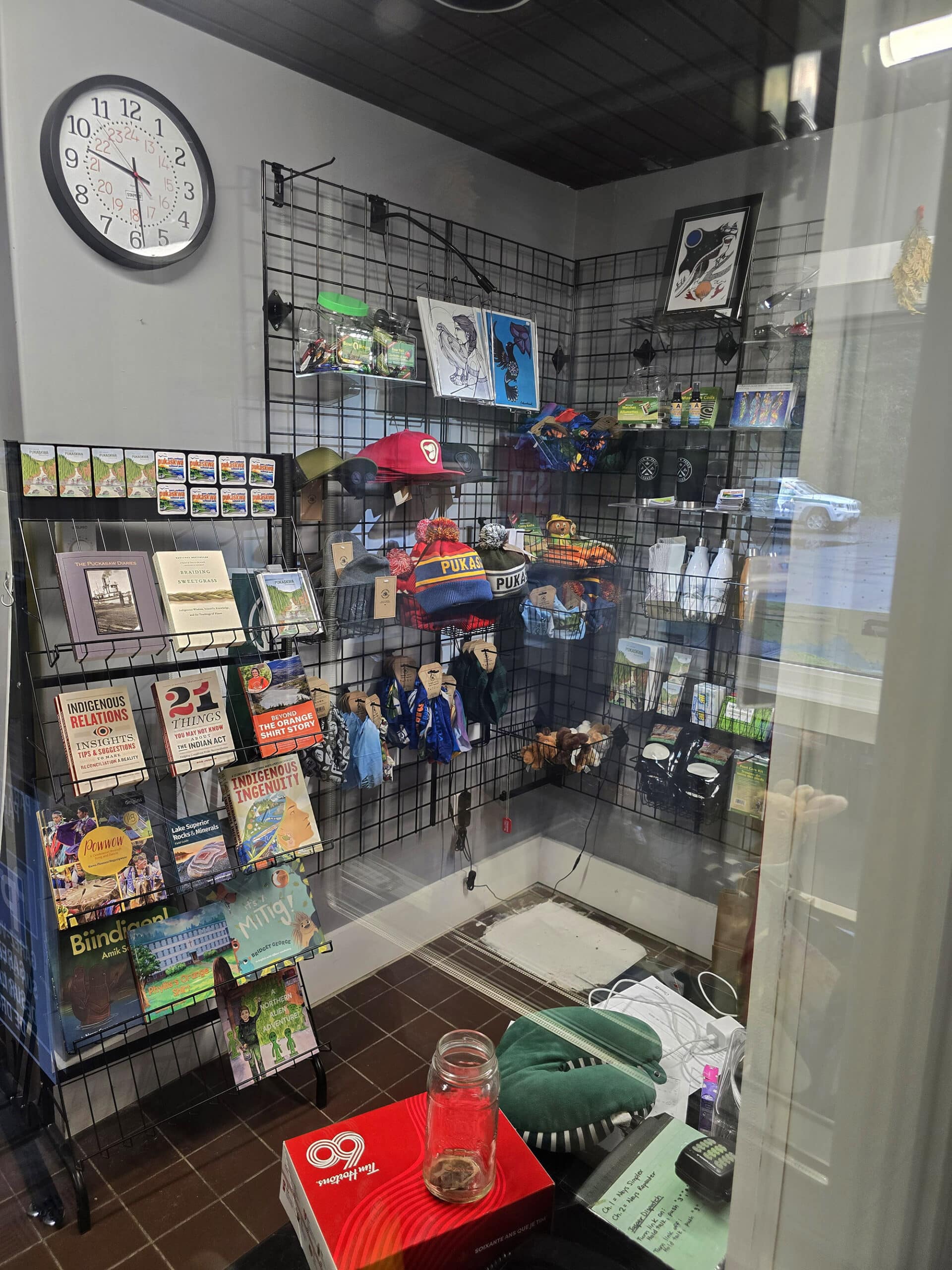
Mugs, T shirts, stuffed animals, some artwork, and a nice selection of Indigenous written/themed books.
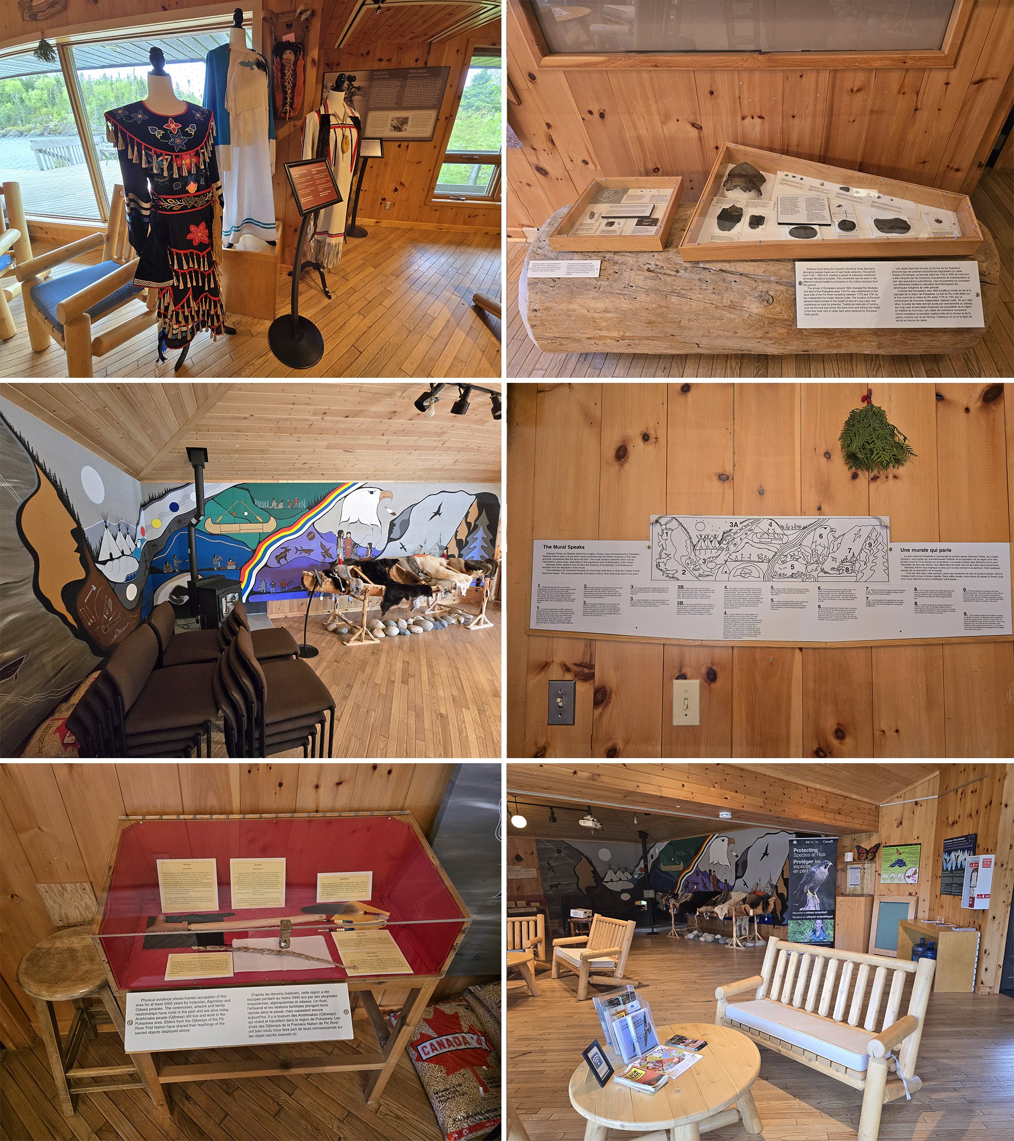
Visitor Centre
The Visitor Centre was much smaller and less flashy looking than the Bruce Peninsula National Park Visitor Centre, at least from the outside.
Unfortunately, it’s only open June 15 - September 15, so we missed it by just a few days on our first couple of visits.
According to the Visitor Guide, it’s less of the museum type setup if Bruce Peninsula, and more of a tourism information centre for the park.
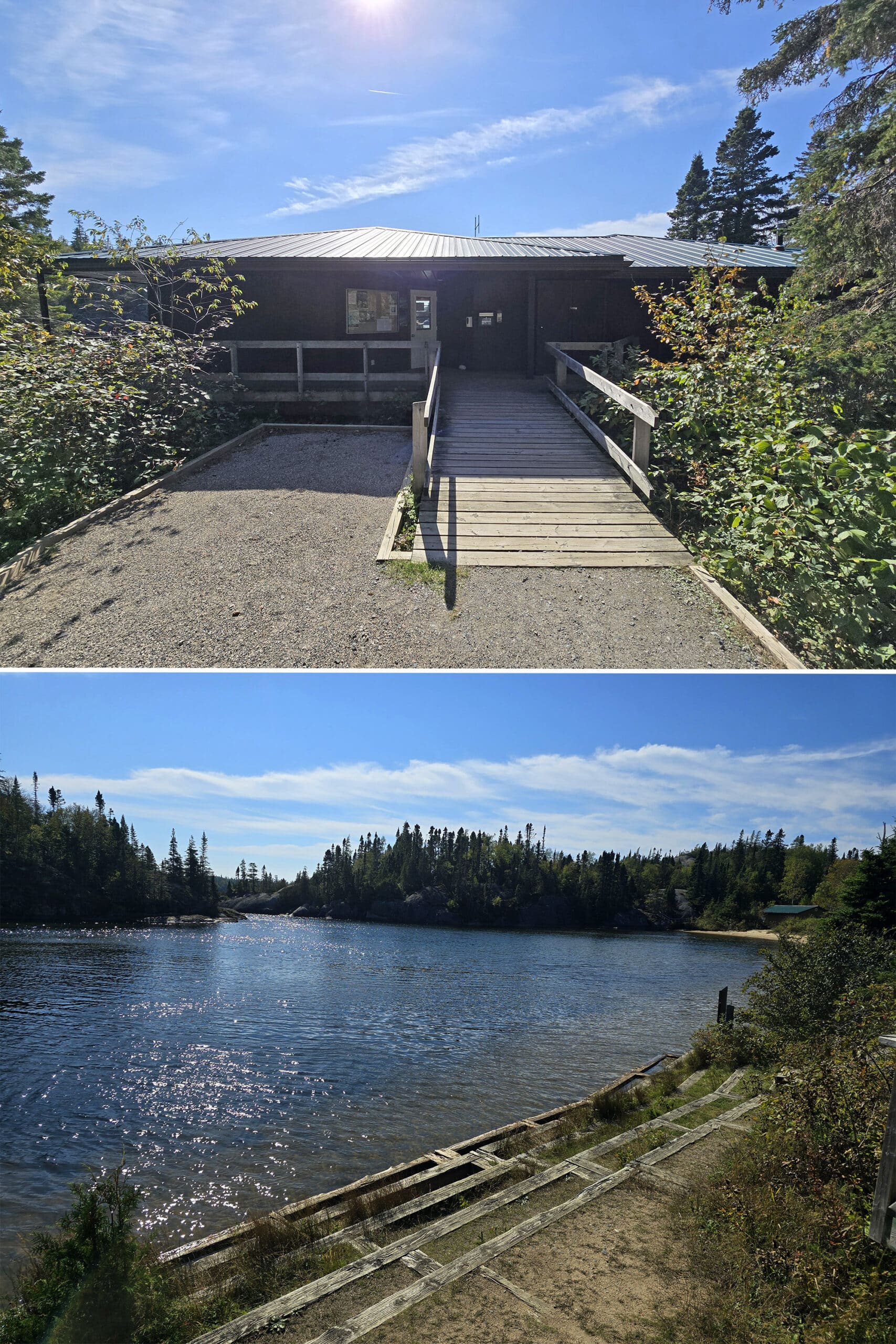
It was small, but nice - really well done, thoughtful displays on the local First Nations culture.
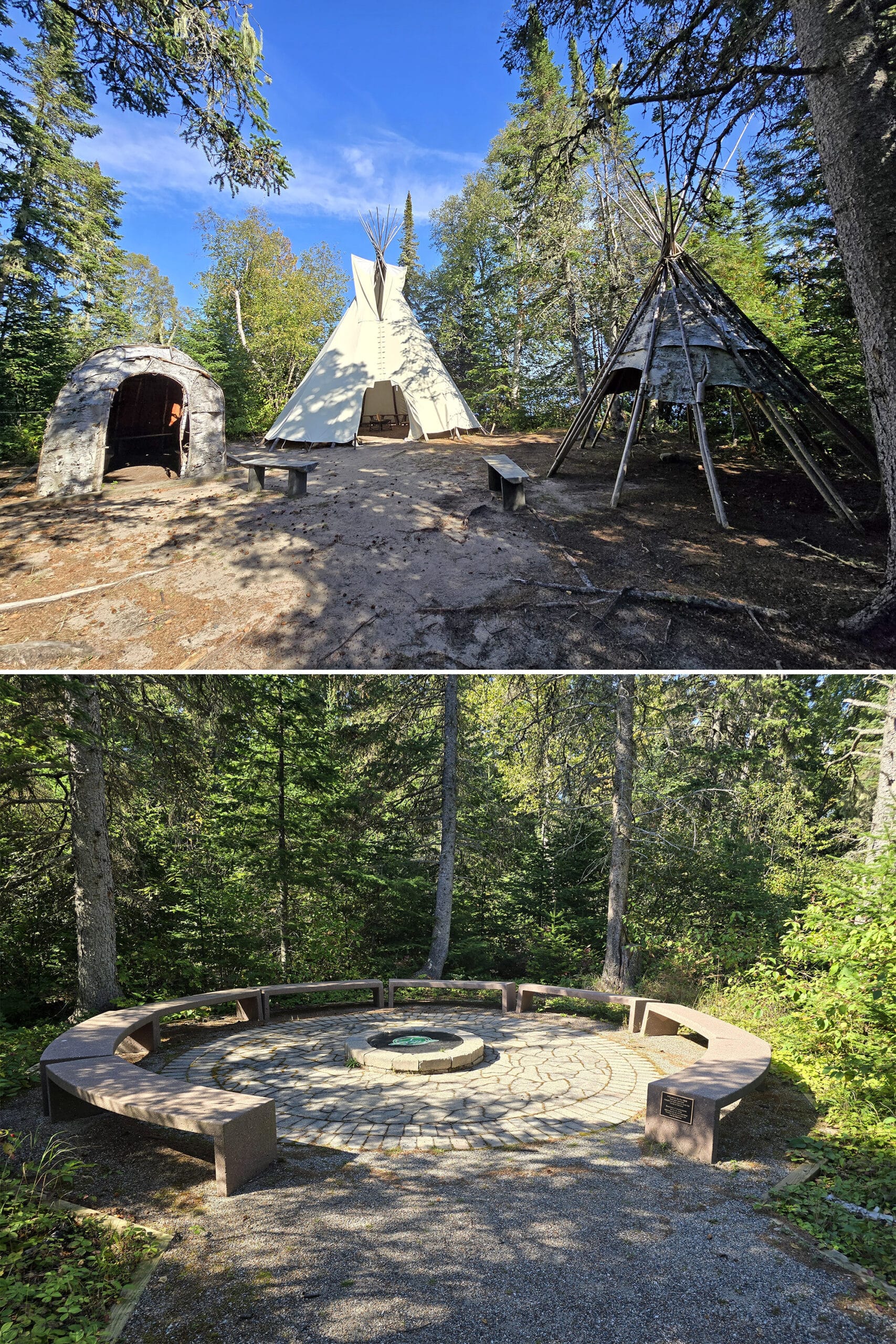
Anishinaabe Camp
A short walk from the Visitor Centre is the Anishinaabe Camp, which didn’t seem to be in use during our stay.
A set of 3 handcrafted structures - made by local Knowledge Keepers - it’s used as an educational and meeting space, playing host to special events and programming.
There’s also a Fire Circle nearby, as well as signage educating about local Anishinaabe history - and Anishinaabe culture.
On the subject of Indigenous culture, the Visitor Guide also has about ¼ page dedicated to talking about Indigenous identity language, which was nice to see.
Day Use Area
Pukaskwa National Park doesn’t seem to have a “day use area” in the sense we tend to see at Provincial Parks - there’s no central picnicking area, playground, etc.
That said, there’s no end to picnic spots, if you get a little creative - and bring your own picnic blanket.
The beaches are all fabulous spots to grab a lunch, with two caveats: There are no picnic tables, and you’ll need to pack out your garbage on account of there being no garbage receptacles either.
The area behind the comfort station not only has Wifi, there are a few benches, and a set of long steps leading down to the shore. Again, not really any picnic tables that we saw, but plenty of places to sit and chill for a bit.
Rentals
When the Visitor Centre is open, you can arrange to rent a canoe!
They’re only for use in Hattie Cove, at the launch nearby.
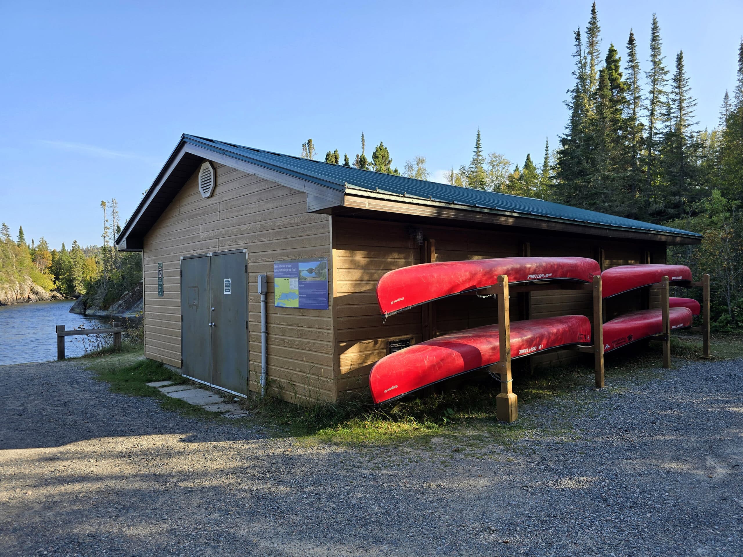
We were shocked at how cheap it was - $11 for 2 hours!
He had a blast exploring the cove, going up on a little island out there, seeing birds on the far shoreline, etc!
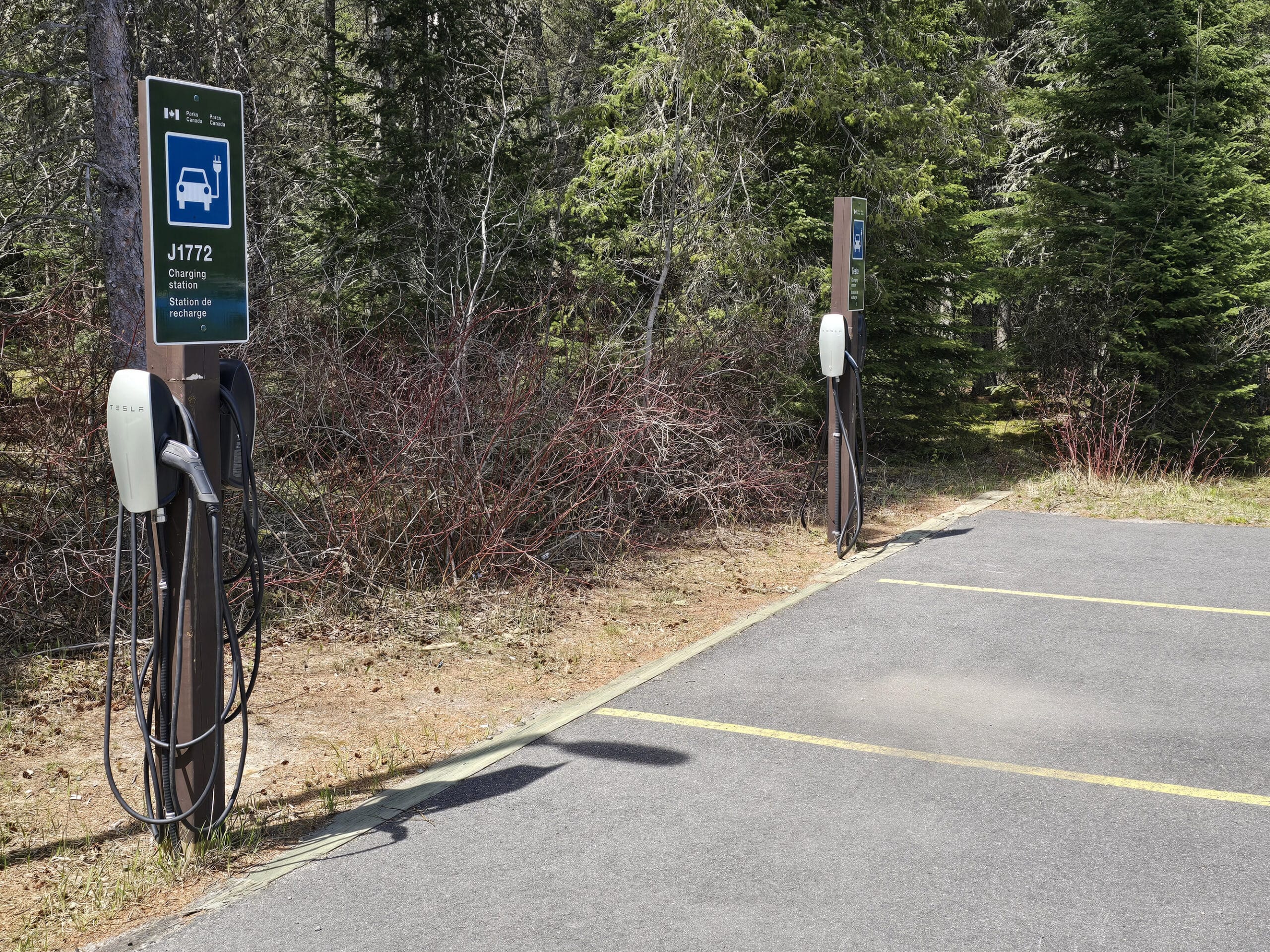
EV Charging Station
I don’t know if this was new for 2025, or if we somehow missed it last year... but there’s an EV charging station in the Visitor Centre parking lot.
It’s 2 stands - across 4 parking spots - and each stand has two charging ports.
Weirdly, one sign says J1772, the other sign says Tesla... but the chargers on both are branded Tesla.
Campsite Details
Some basic information on camping at Pukaskwa National Park:
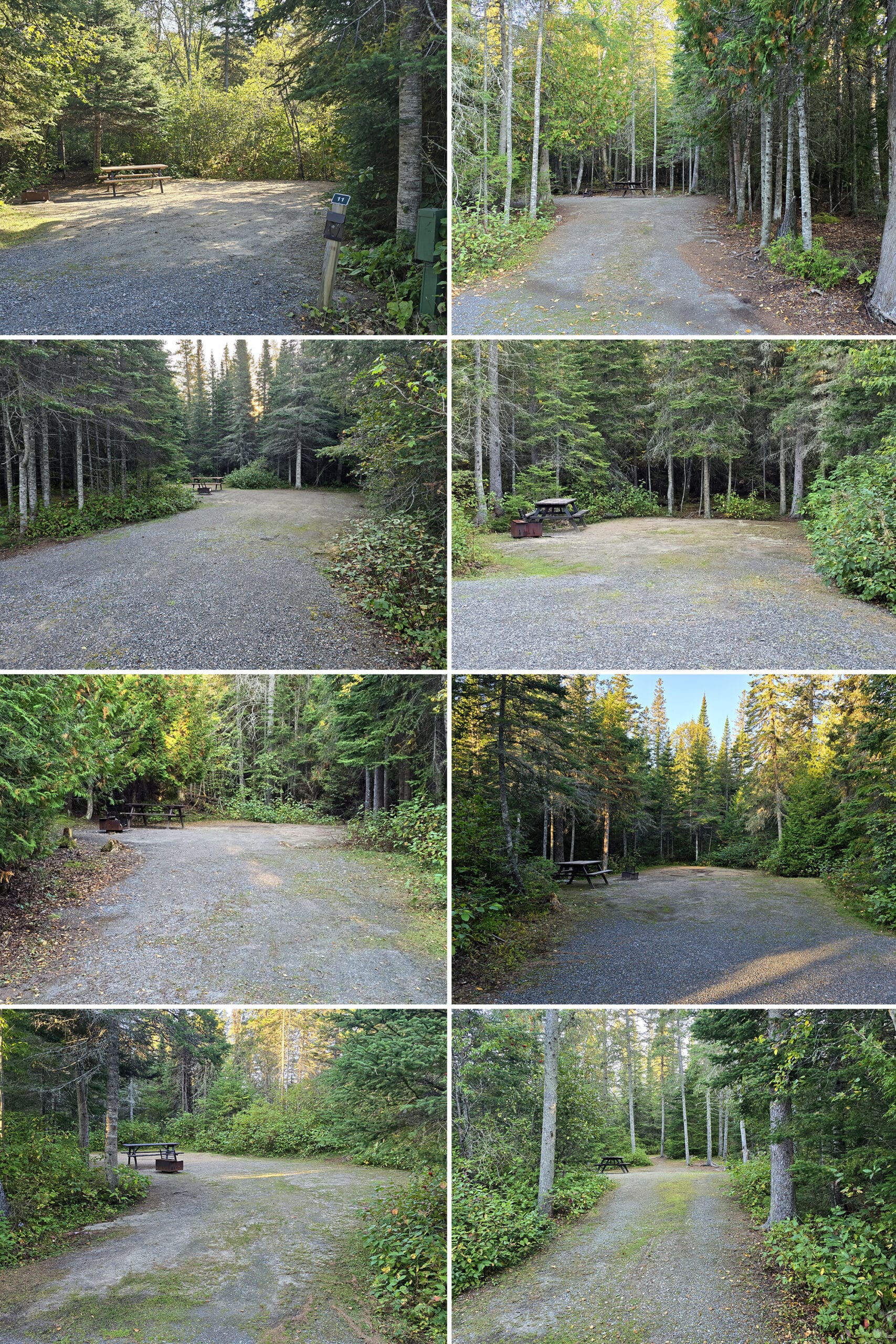
Car Camping
All of Pukaskwa’s car camping sites are located within the park’s Hattie Cove Campground; check in and check out times are 11:00
This front country campground has around 70 sites total, divided between North Loop Campground, and South Loop Campground.
During the spring and fall shoulder seasons (May 15-June 15, and September 15-October 14), the North Loop Campground is closed and gated. As a bonus, staying in the South Loop at those times comes at a reduced rate!
No worries about the gate - though - you are still welcome to walk in to access the trails that start in that campground!
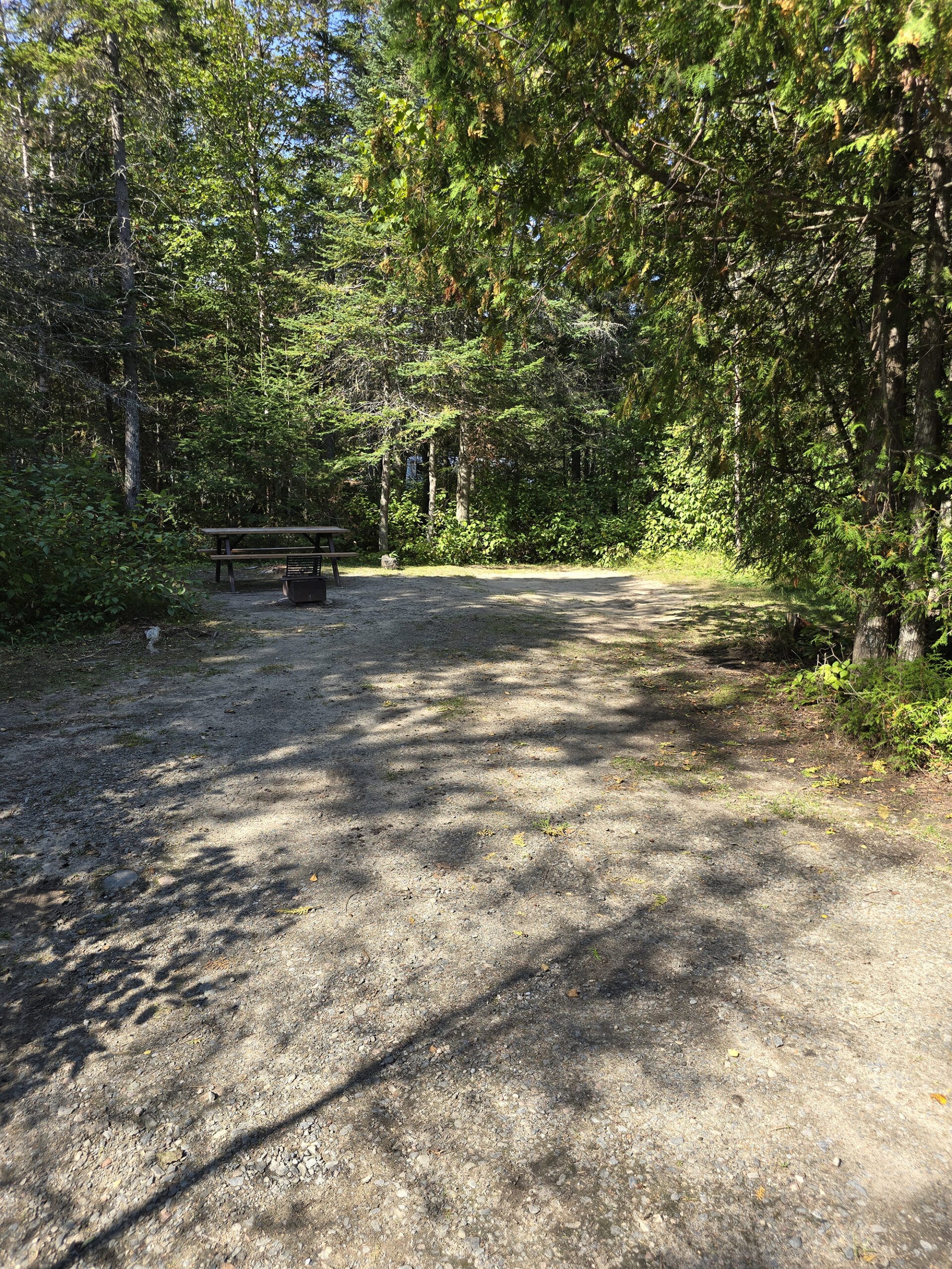
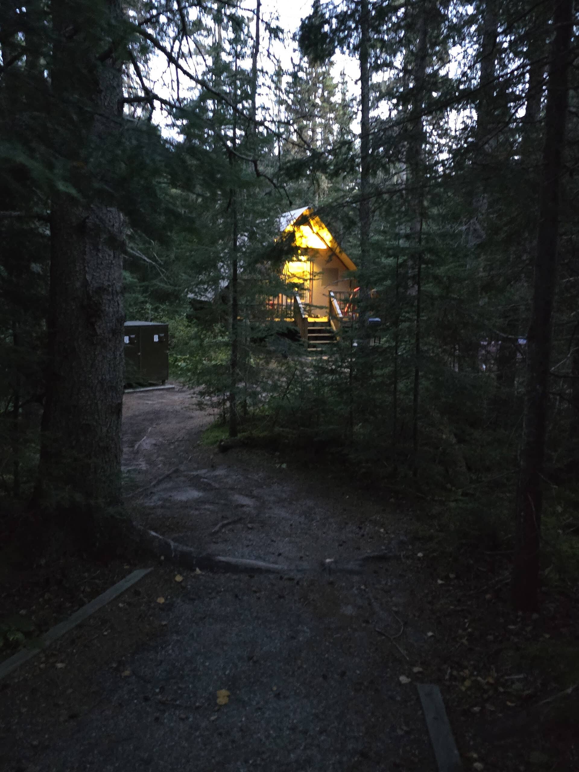
Generally speaking, all the sites we saw seemed to be really well maintained, pretty level, and in decent condition all around. Most were fairly private, though there were definitely some exceptions.
Once to suss out how many sites were unclaimed - and which we wanted - and the second to go claim the one we decided on - #13.
Our site was really nice - fairly level, well-packed gravel, set back from the road a bit, and with good privacy.
There was a bit of a narrow approach - we were brushing up against trees on the way in. The driveway curved back away from the road, which gave a fair bit of privacy itself.
Roofed Accommodations
There are 5 oTENTik sites available, on a nice little path that runs from the Visitor Centre Parking to the main South Loop campground road.
There’s no parking AT each site, but it’s a very short walk from that parking lot.
Super cute sites - every last one was booked during our stay.
I think you can actually reserve those ahead of time, though - we bet they get snapped up as soon as reservations are available.
Backcountry Camping
Pukaskwa National Park has a few hike-in backcountry campsites, located along the Coastal Hiking Trail and the Mdaabii Miikna Loop that branches off from it.
I haven’t seen much information at all about those sites - aside from their marked existence on a trail map.
Kinda wish I could do the tent camping thing, I bet the views from some of those campsites are *stellar*, just based on the map locations.
Share the Love!If you’ve made one of our recipes, be sure to take some pics of your handiwork! If you post it to Bluesky, be sure to tag us - @2NerdsInATruck, or you can tag us on TikTok, if you’re posting video. We're also on Pinterest, so you can save all your favourite recipes and park reviews to your own boards! Also, be sure to subscribe to our free email newsletter, so you never miss out on any of our nonsense. Well, the published nonsense, anyway! |
Entertainment and Activity
There are a bunch of things you can do while enjoying the great outdoors at Pukaskwa National Park, here’s some information on your options:
Hiking
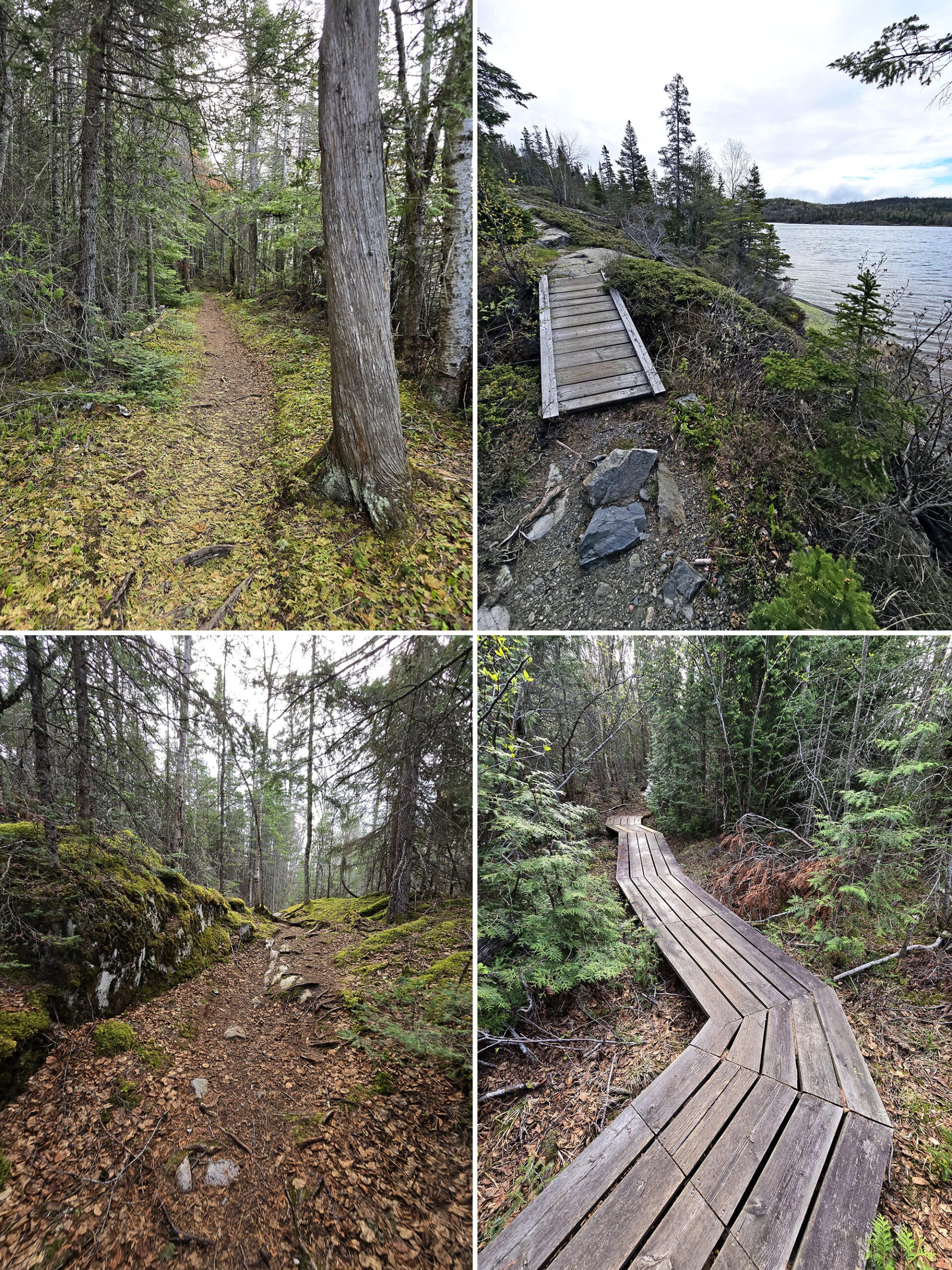
There are several hiking trails in Pukaskwa National Park, ranging from easy strolls, to day hikes, to multi-day backcountry adventures.
Here’s what you need to know about each trail:
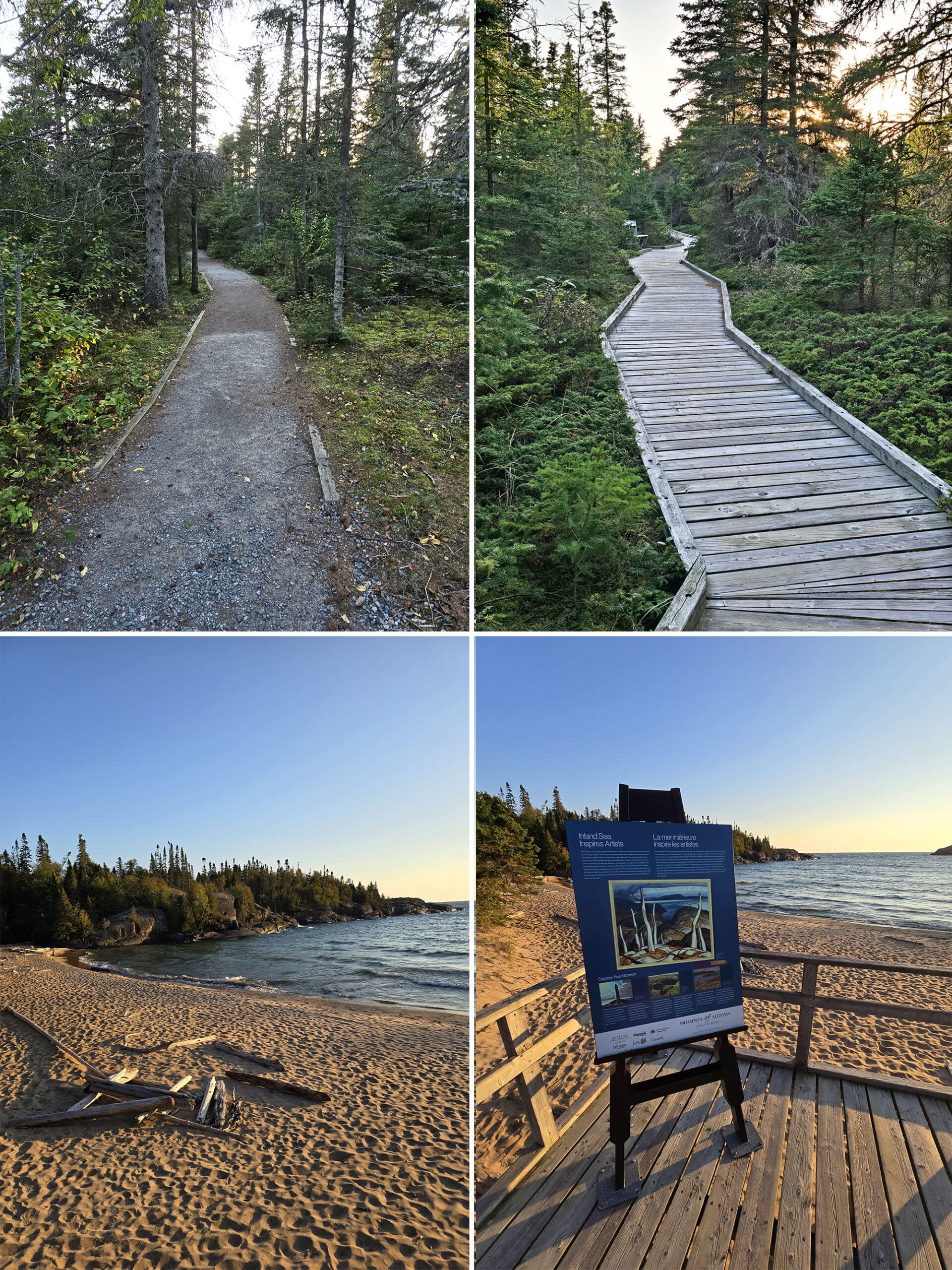
Boardwalk Beach Trail - Easy, 1.2 km
This trail is 1.2 km if you start from the Visitor Centre and walk through the campground to the start of the boardwalk.
There’s parking right in front of the start of the boardwalk, so you can skip the campground road entirely, for a shorter walk if needed.
It’s a wheelchair accessible trail and super easy to walk - well packed gravel, very level surfaces, wide trail, no obstacles at all.
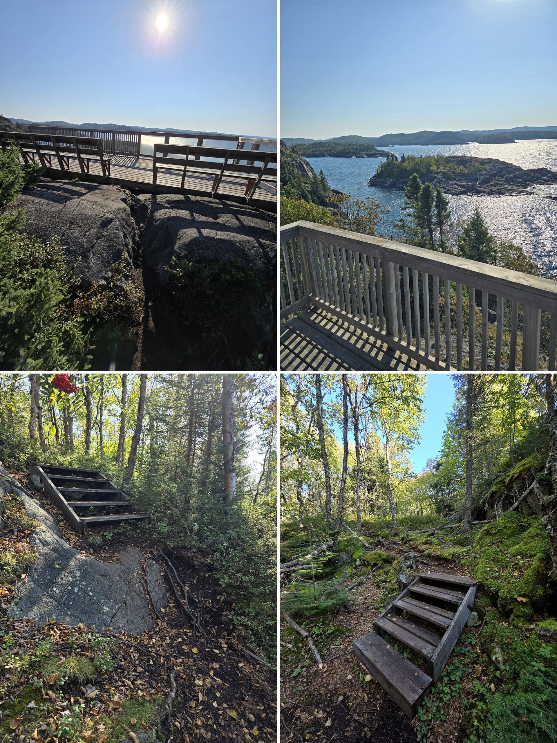
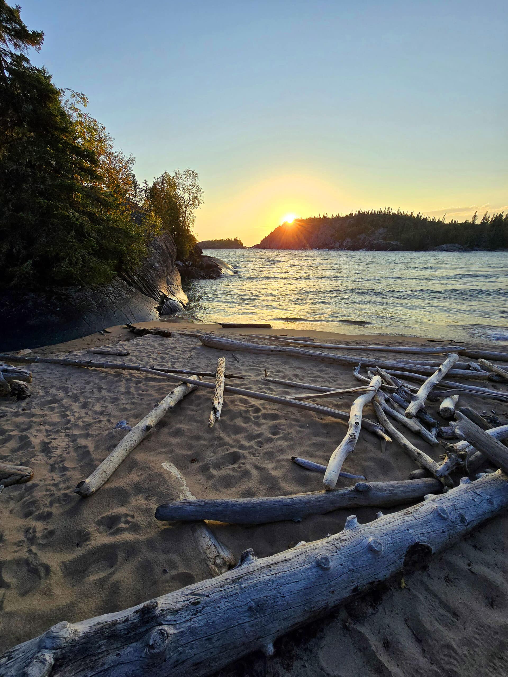
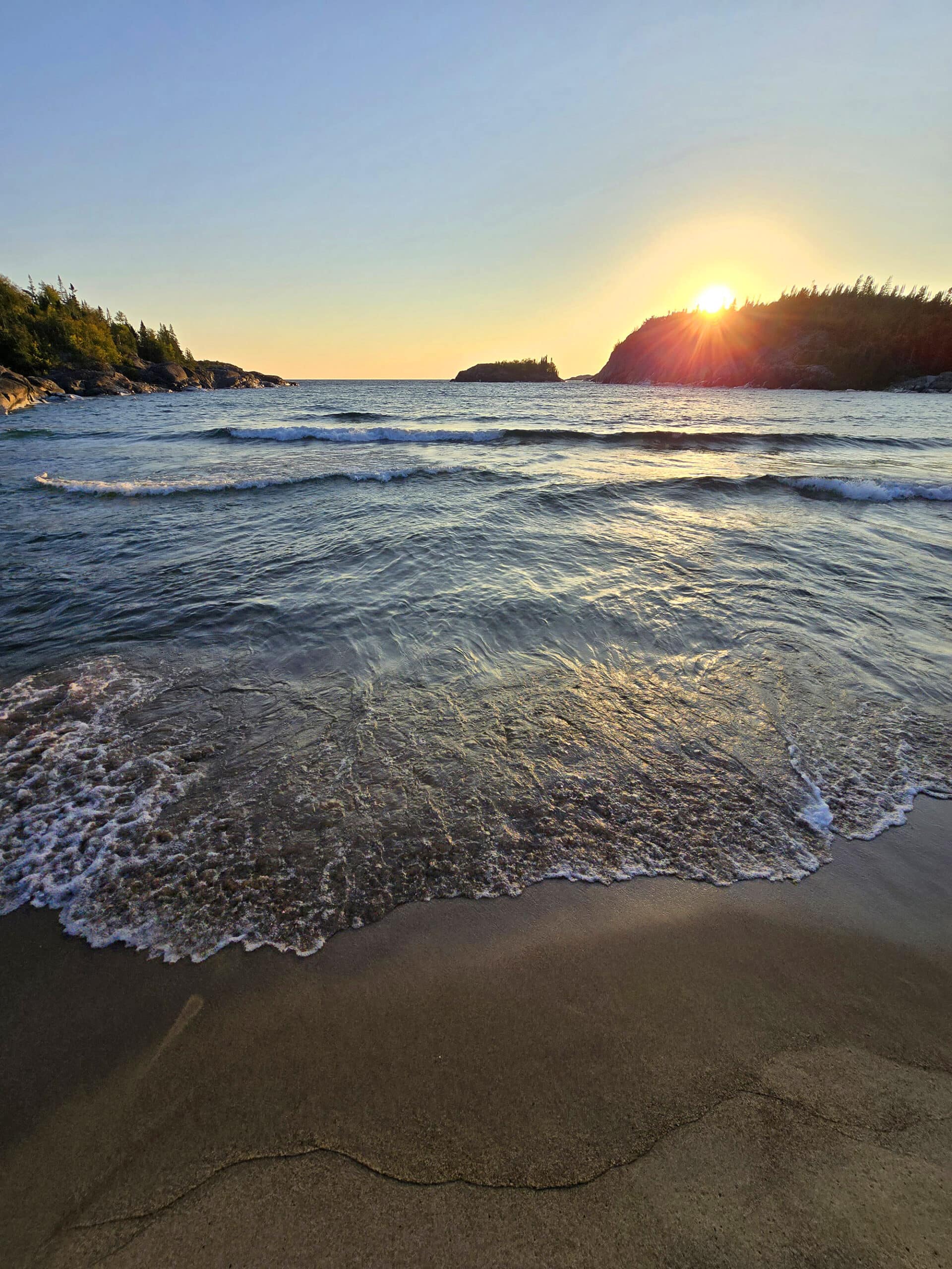
At the beach, there’s a lookout platform, with one of the Moments of Algoma displays - this is a FANTASTIC place to watch the sun set, btw.
It’s a nice enough walk, but definitely feels like a really nice path to get somewhere, rather than a destination trail itself.
Aside from the lookout point, the bay end of this trail also serves as access points to both the Beach Trail and the Southern Headland Trail.
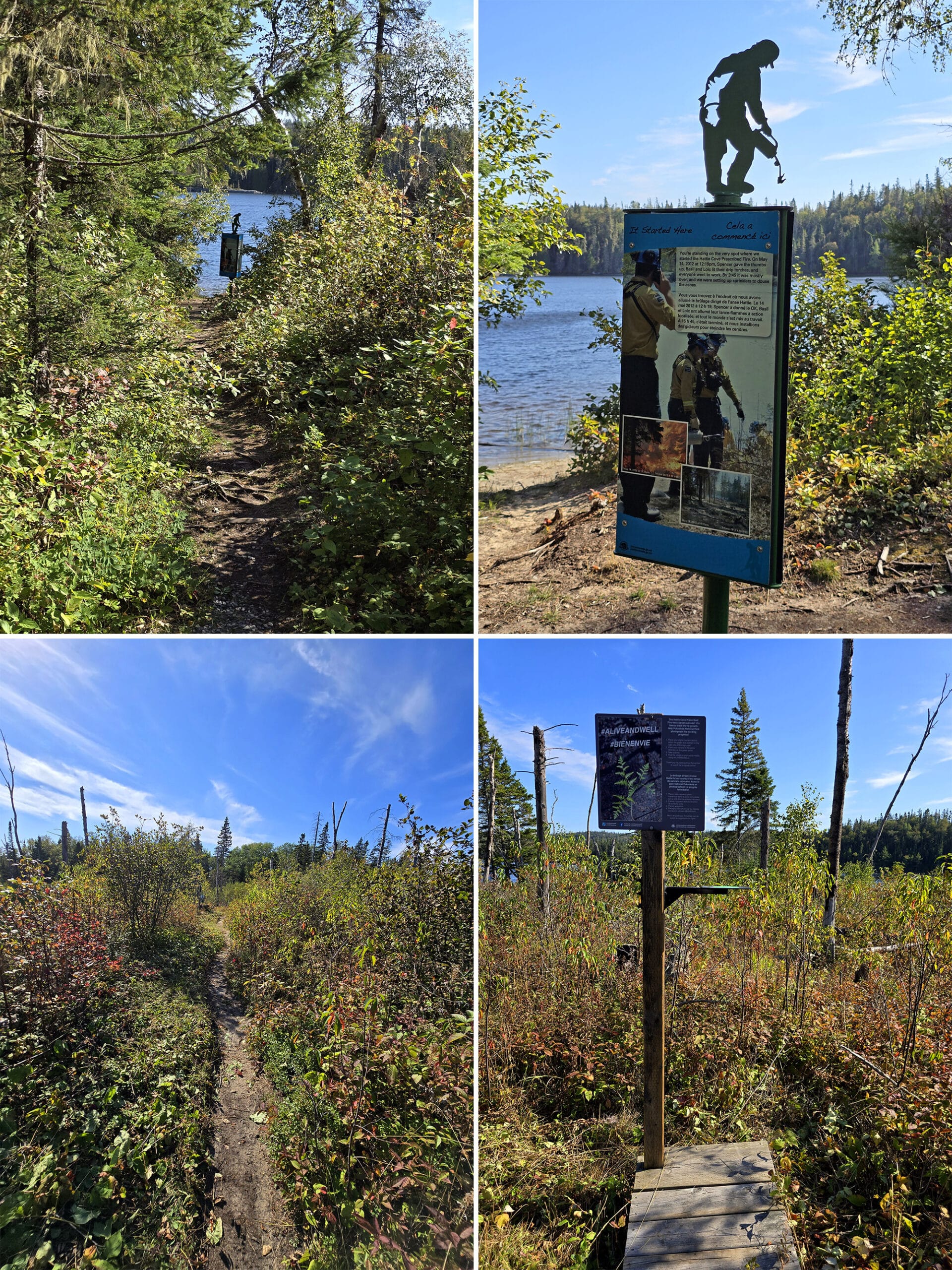
Hattie Cove Fire Walk Trail - Easy, 0.7 km
This trail is a short section of the Coastal Hiking Trail. Easy, but not wheelchair accessible.
This one can be accessed either from behind the Visitor Centre - at the start of the Coastal Trail - or by parking at the Park Kiosk and walking outwards from there for about 100 m, then taking the trail from that main road.
It’s not marked, but pretty obvious - you can see a little statue thing on the trail, from the road.
This section of trail takes you through an area that was a prescribed fire in 2012. There’s a ton of signage educating about how prescribed fires are used to regenerate boreal forest, and all the planning and work that goes into carrying out such a fire.
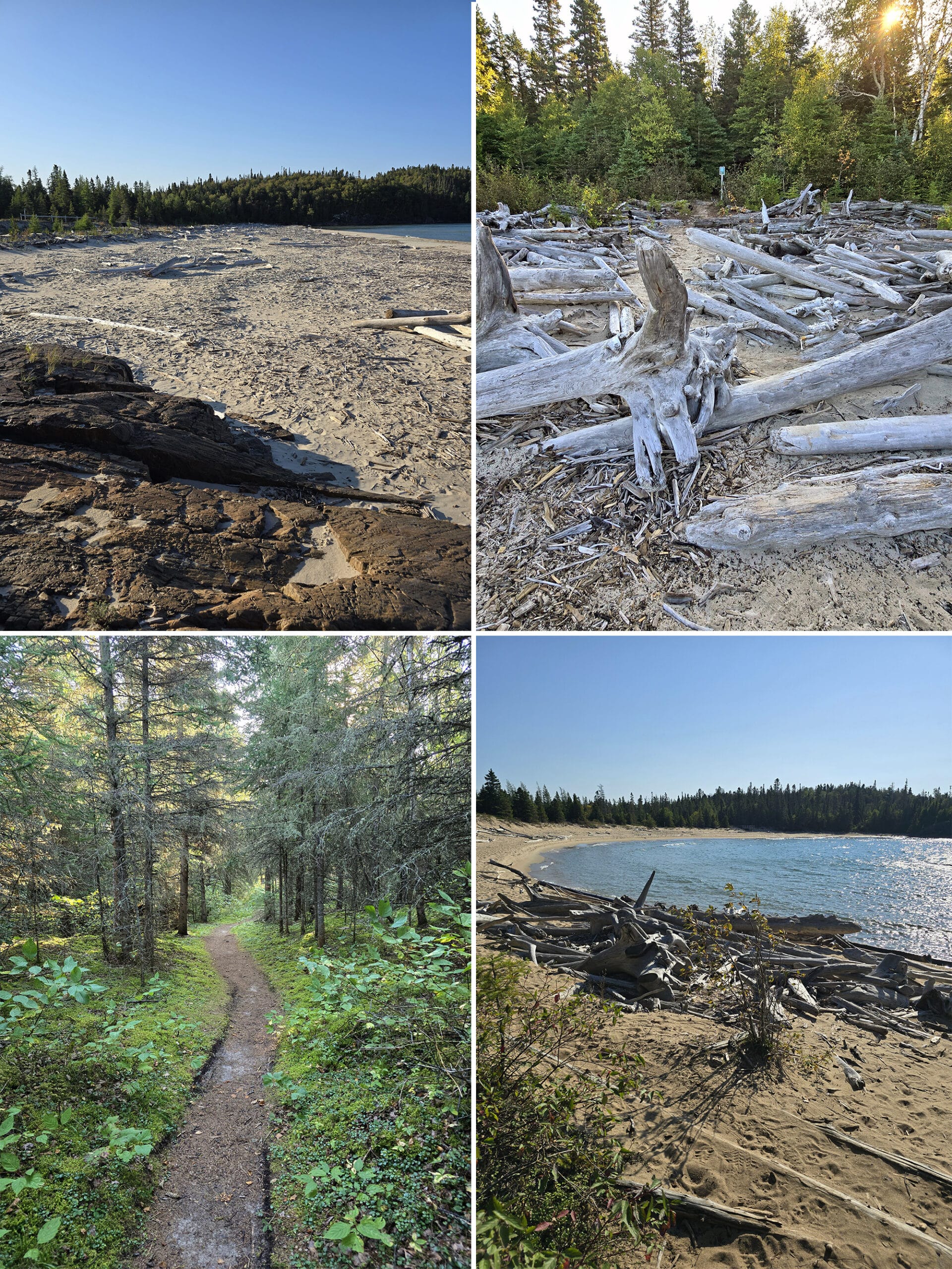
Beach Trail - Moderate, 2 km
This is listed as being a moderate trail, but the bulk of it is actually pretty easy.
It starts out from the North Loop campground, with a wide, fairly flat, pretty easy trail. There are a couple sections of boardwalk - this whole part of the trail really feels like a “This is the path from the campground to the beach” thing, rather than a regular hiking trail.
We actually ran into a couple in swimsuits, who’d just taken an early morning swim. You know, in Lake Superior... in mid September!
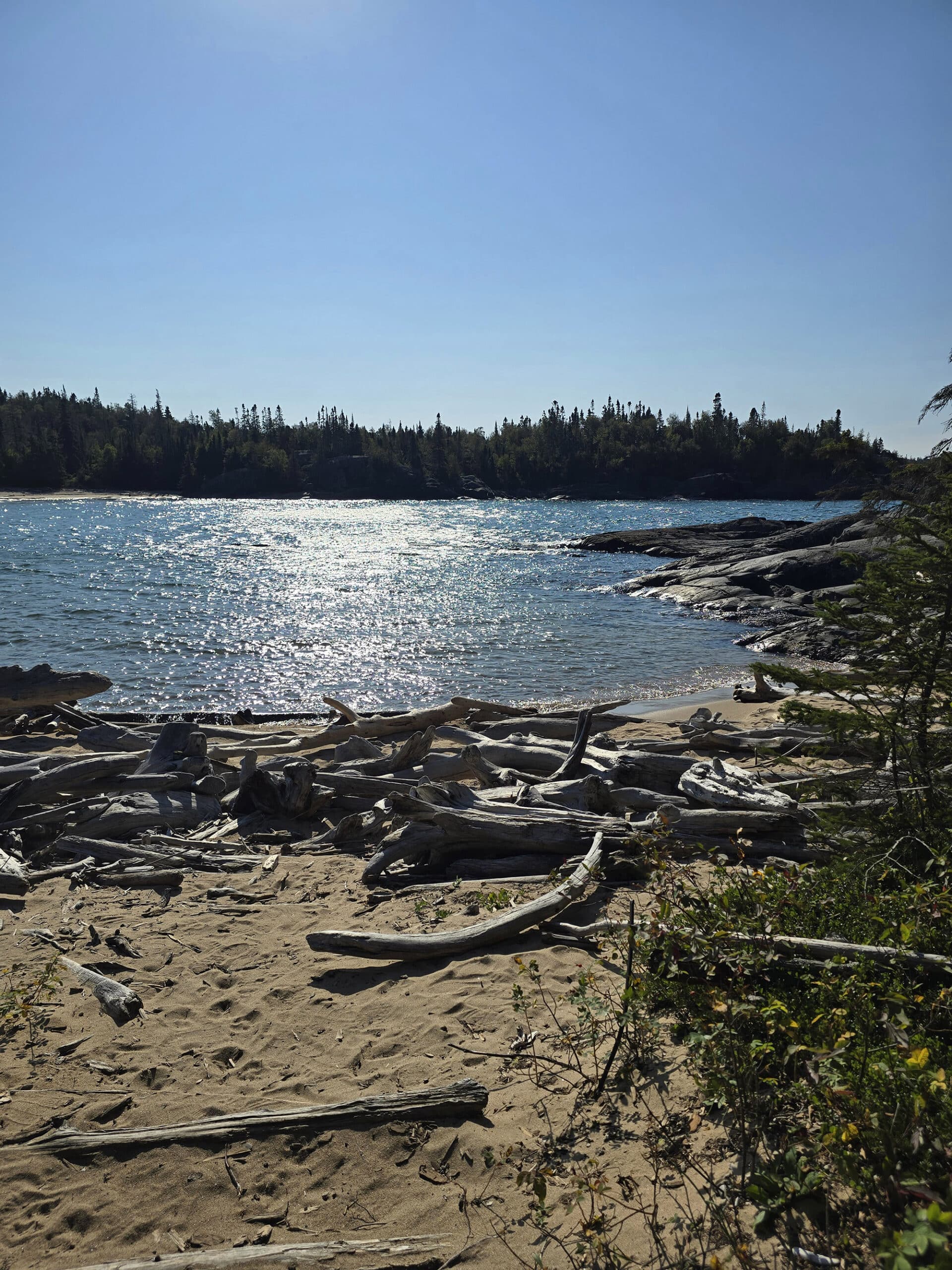
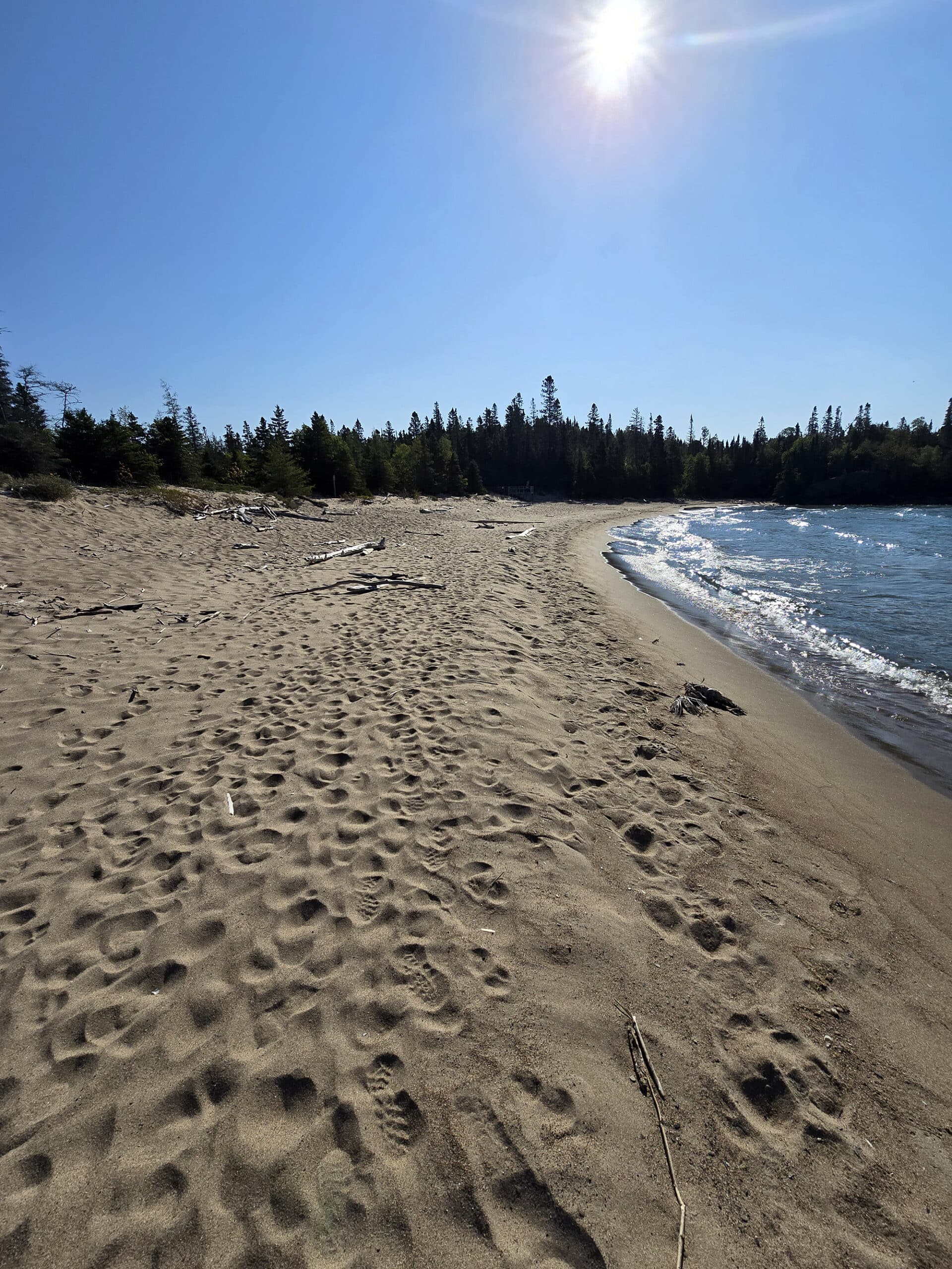
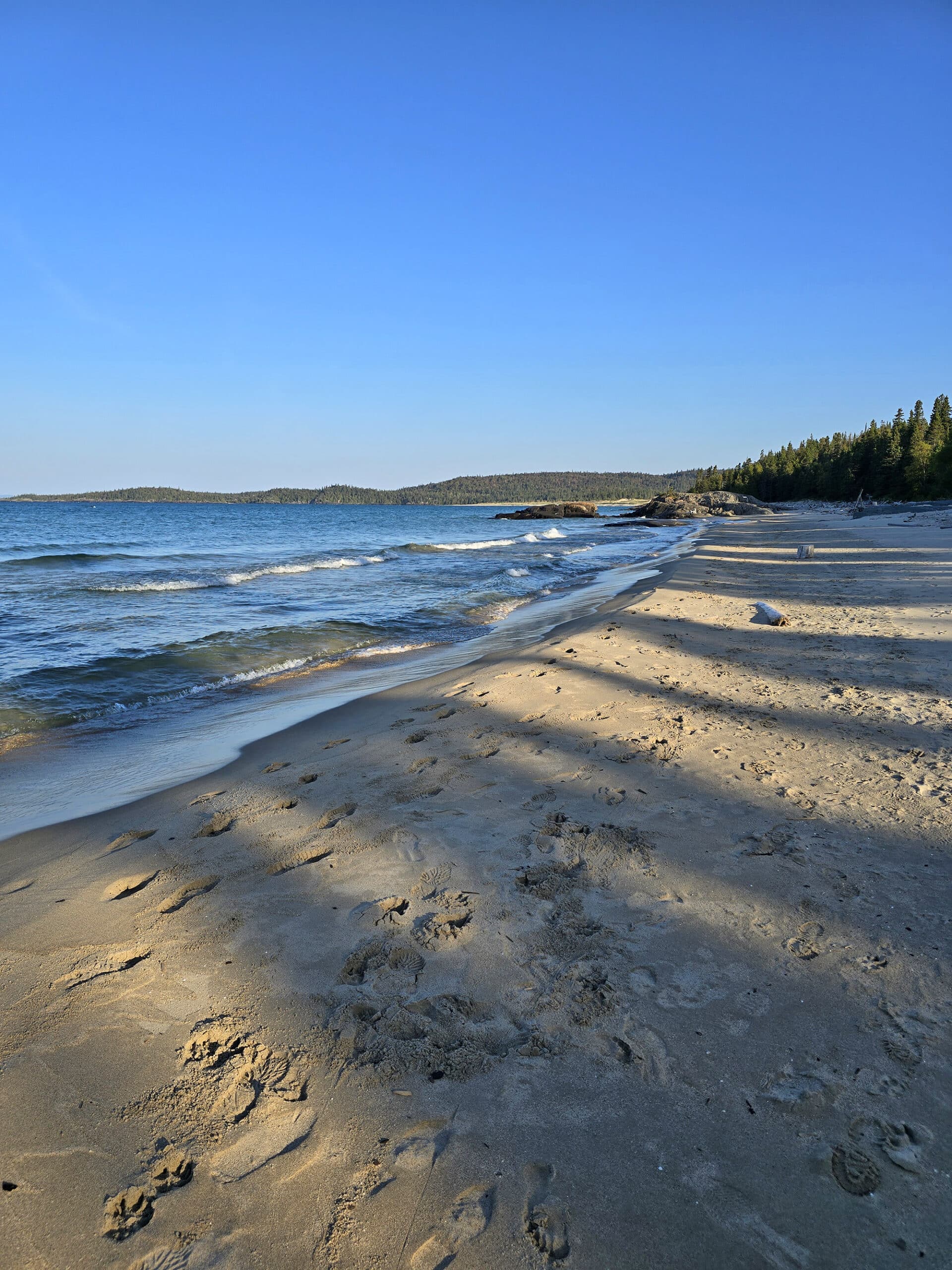
Anyway, the trail eventually takes you to North Beach, which we walked around on for a bit. This area of sand was really easy to walk on, unlike the sand in Horseshoe Bay.
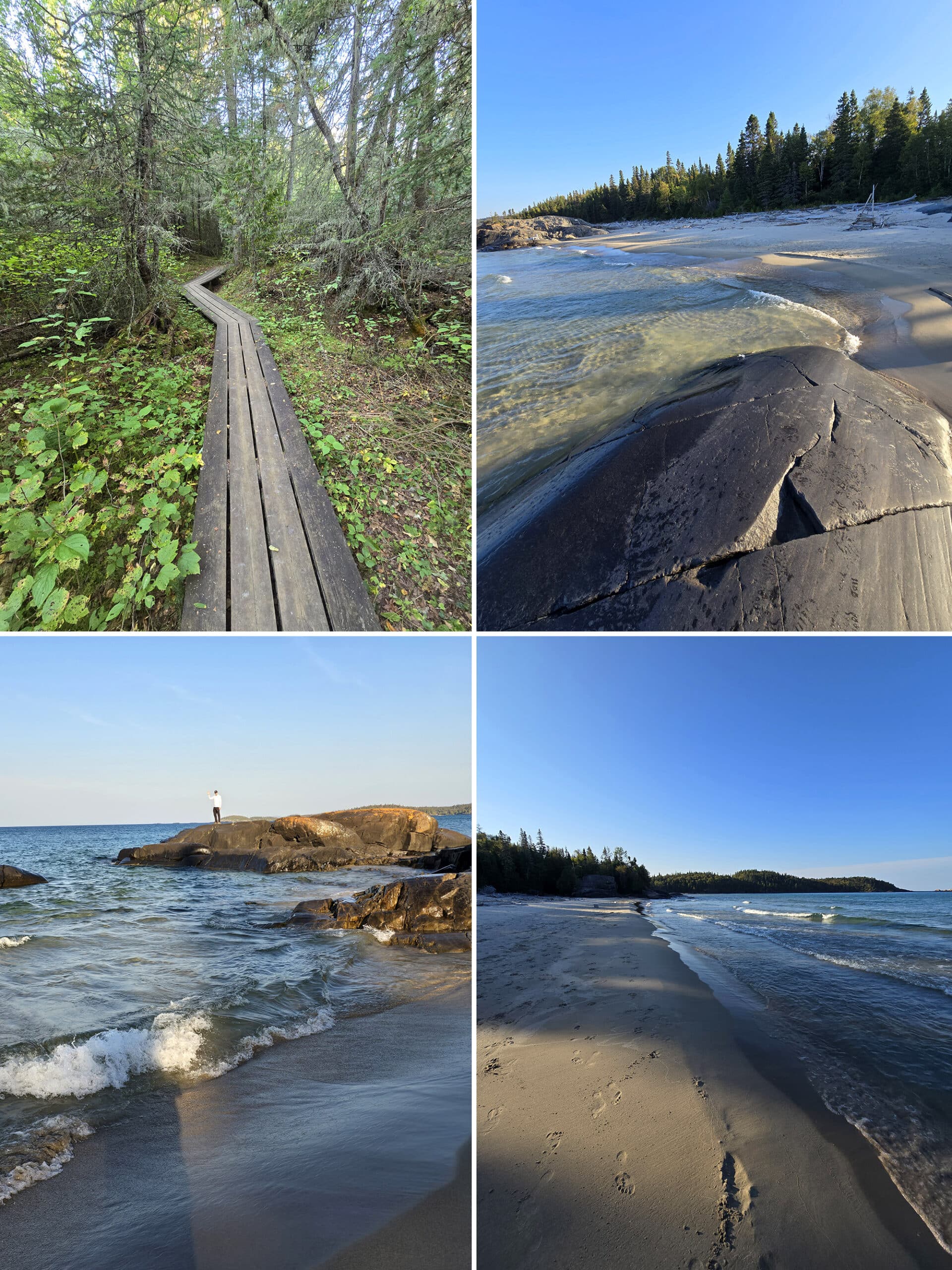
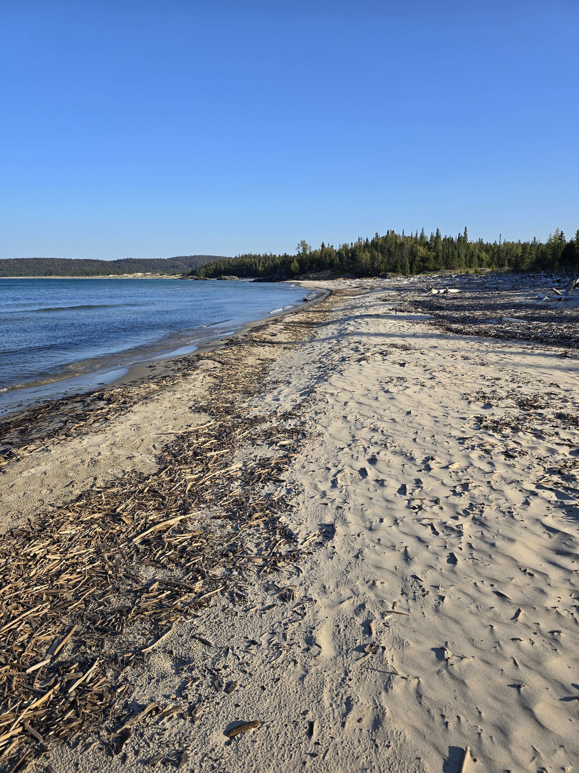
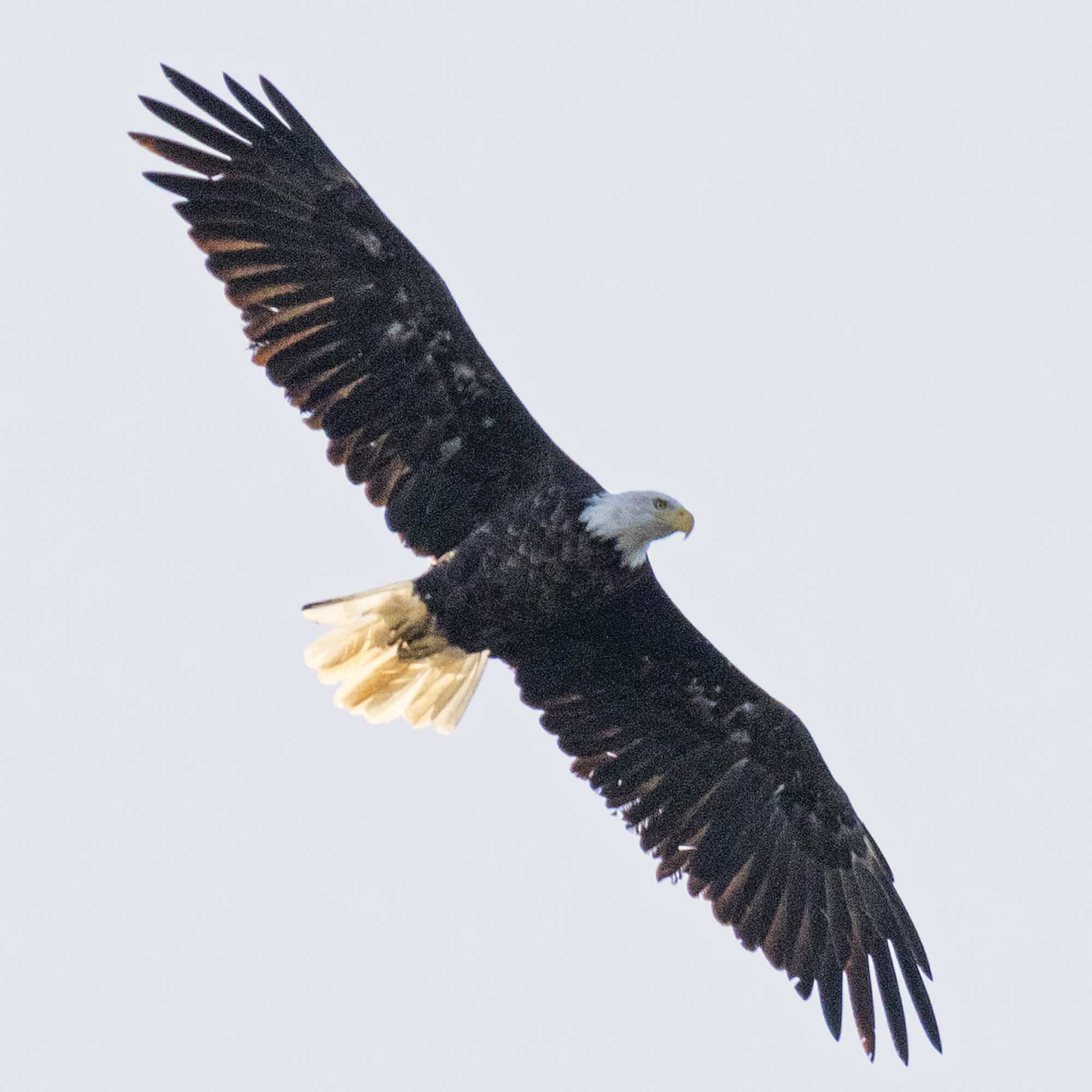
That quickly takes you out to Middle Beach - with more driftwood than I’ve ever seen in my whole life! A Bald Eagle was flying overhead as we crossed this beach, which was relatively easy to walk on.
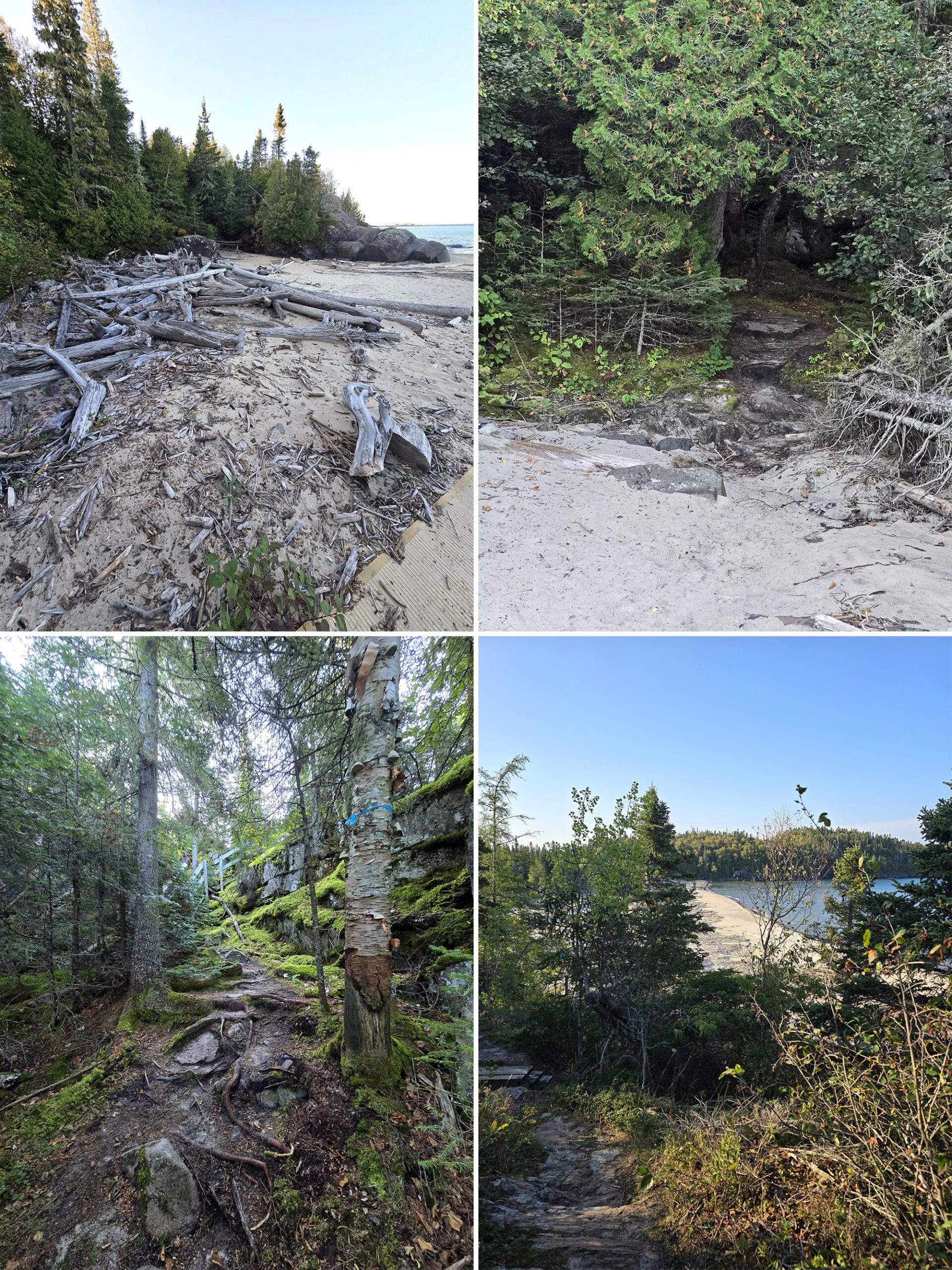
Then, it’s a fairly easy wooded trail to get to Horseshoe Bay Beach, which - for me - was the most physically difficult part of the trail. Join up with the Boardwalk trail, and you’re done!
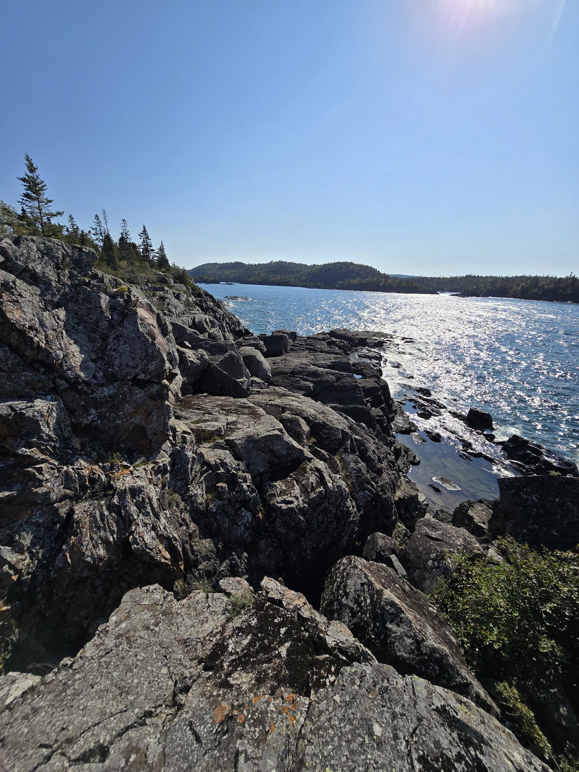
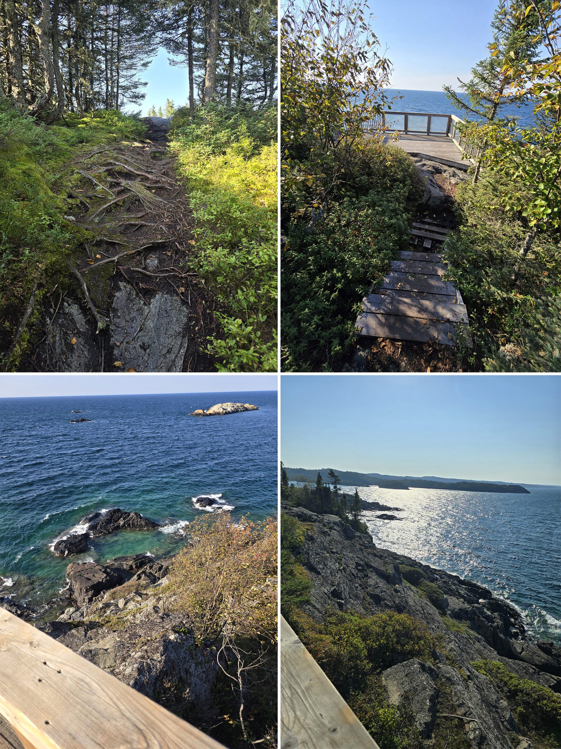
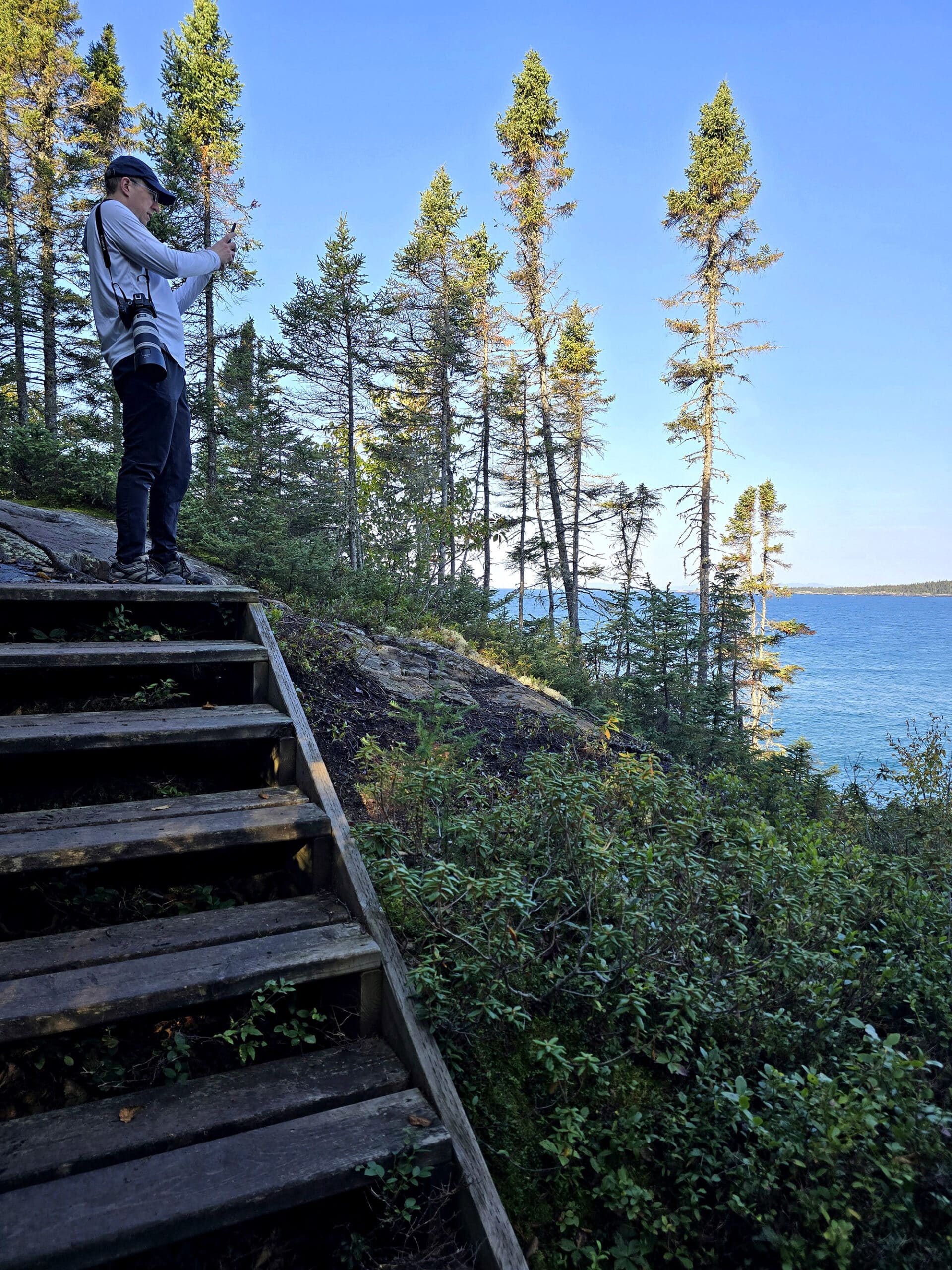
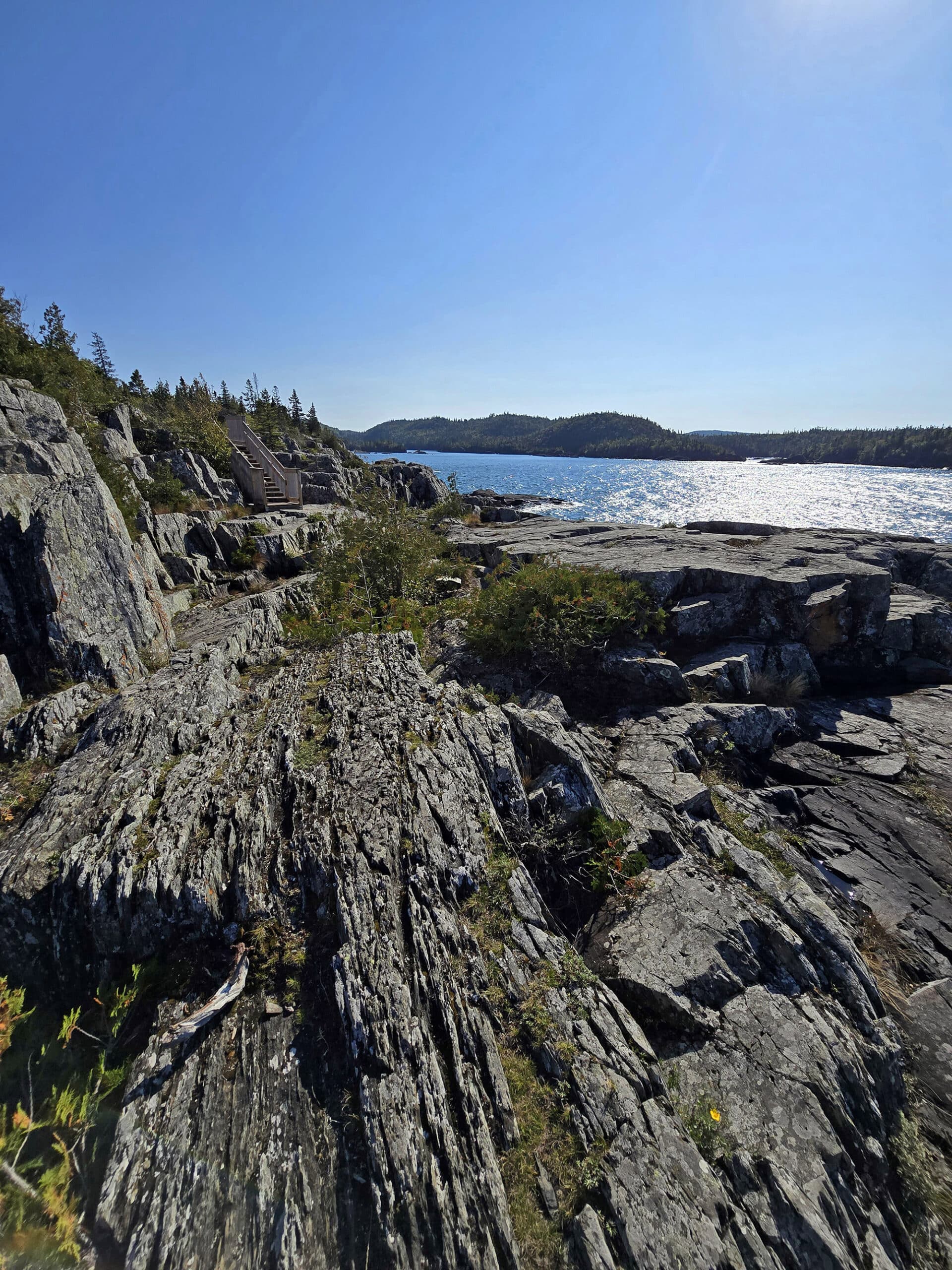
Southern Headland Trail - Moderate, 2.2 km
This trail is on a bit of a rocky peninsula that juts out into Lake Superior, and offers views of Hattie Cove, Horseshoe Bay, and Pulpwood Harbour.
Porter did this trail himself, after we’d done the Beach and Manito Miikana Trails together.
My legs were DONE, but we both wanted to see what there was to see up on Southern Headland- which we’d peeked up on the night before.
Says he:
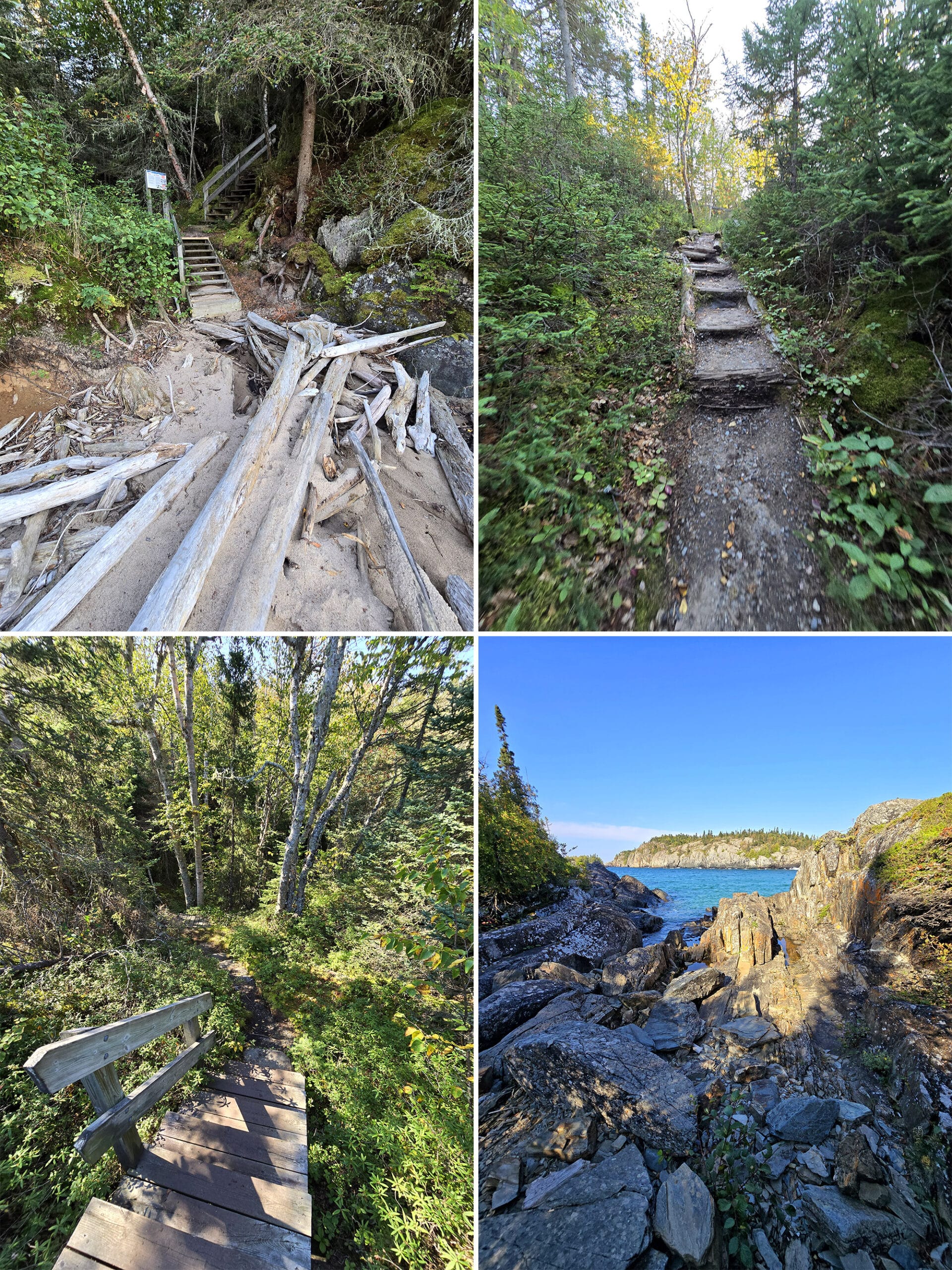
I would describe it - compared to Manito Miikana - as being more bouldery than foresty-rooty, at least in terms of what really stood out to me.”
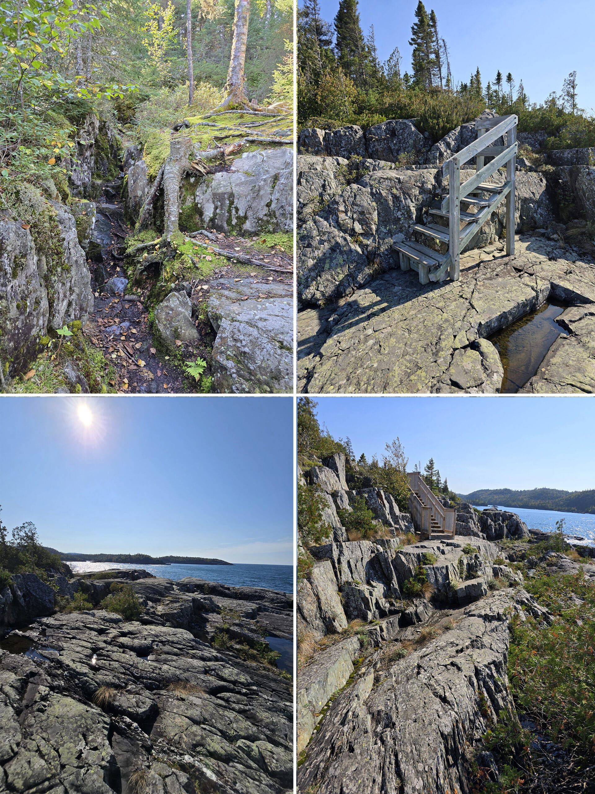
“The overlooks aren’t as high up, but there’s more access to explore the boulders around those areas, rather than be constrained to just the overlook. You could get down pretty close to the water in places.”
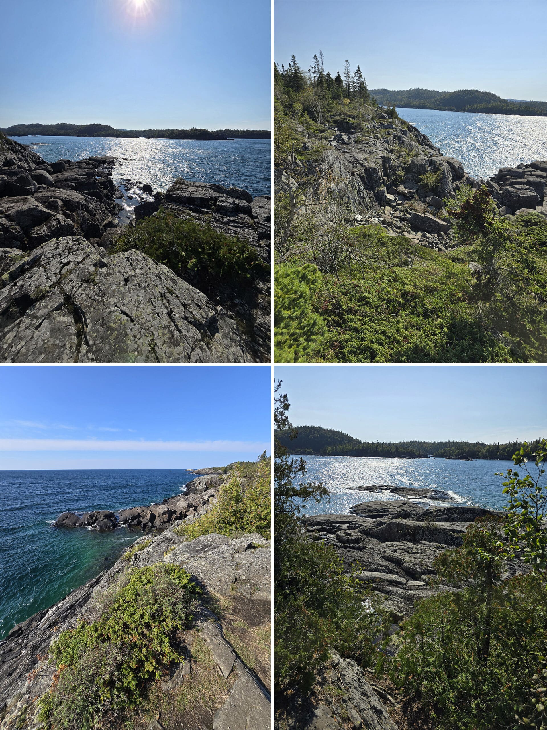
I was just constantly taken in by the lookouts, and felt like I was saying “Oh, WOW!” every few minutes. Just gorgeous!”
The park’s description mentions looking for the smaller species of arctic lichens and other plants on the trail, I’m not sure how much time he spent looking down, though!
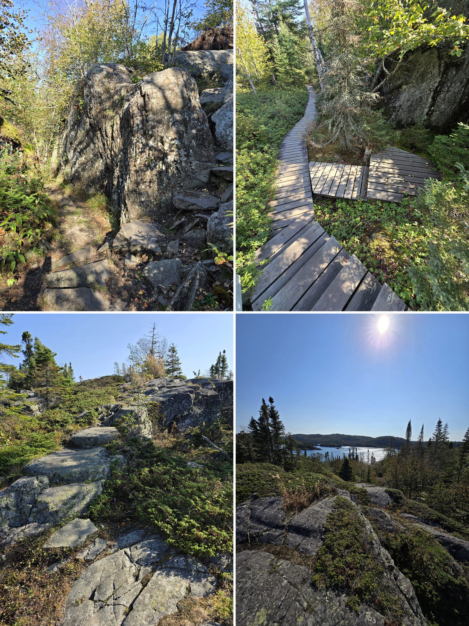
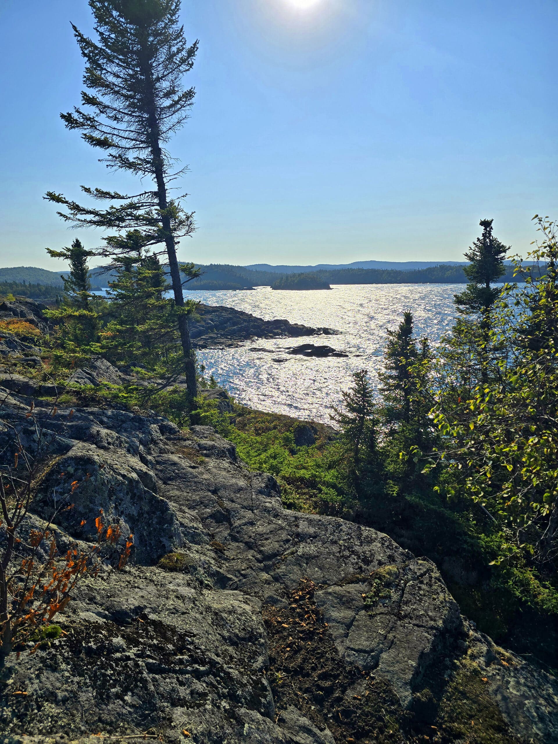
Manito Miikana Trail - Moderate, 2 km
This hike was also known as “Spirit Trail” - we did it on our second day of our stay at Pukaskwa National Park, accessing it via the Beach Trail.
This was a WILD trail, I’m glad I stretched first and “warmed up” with the Beach Trail.
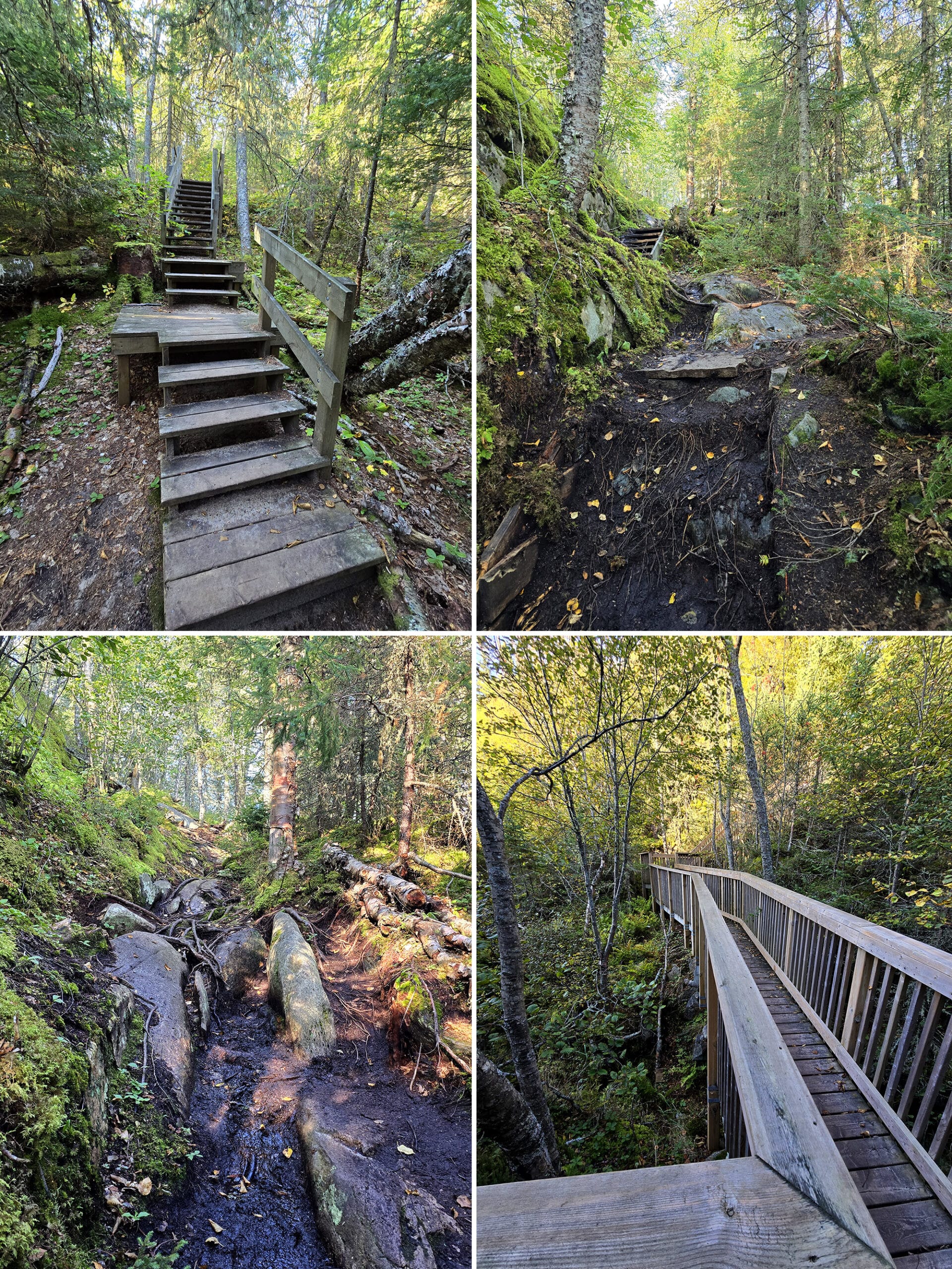
You’re climbing up rocks, navigating over muddy areas, there are some INCREDIBLY steep areas, and a lot of stairs. Just when you think you’ve made it to the highest point, the trail dips down steeply and brings you back up again!
The park’s trail description mentions it being a place to “slip away for a moment of peace and relaxation”.
On. What. Planet?!!
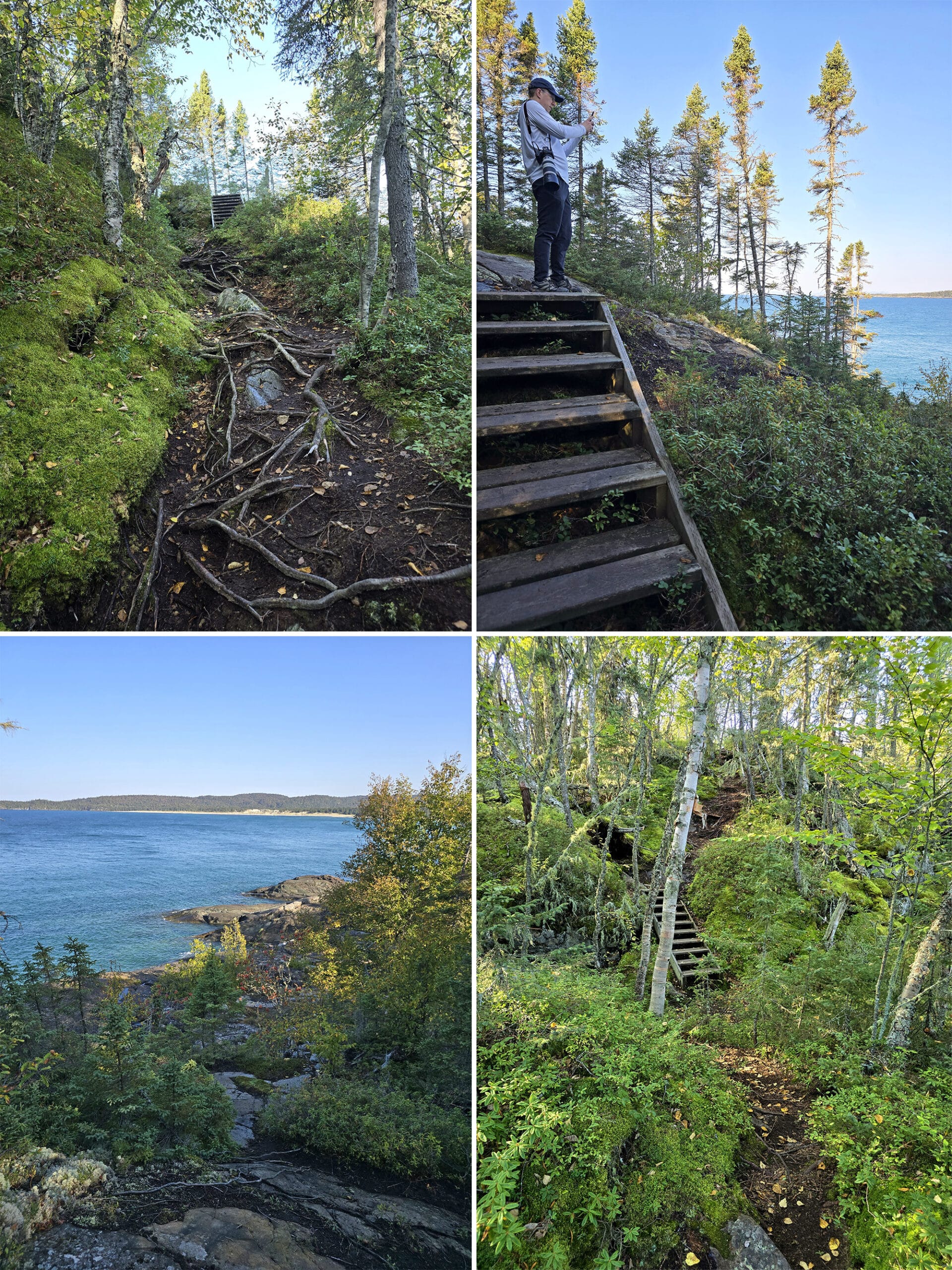
As you get out to the point where the trail splits into a loop, I recommend going to the right.
In my mind, it delayed the two viewing platforms to closer to the end of the trail, so we’d know the bulk of the work was behind us. It would be kind of a reward for our efforts at that point.
In actuality - on the way up to those lookouts - we climbed up a bunch of areas that would have been much more difficult coming down, had we gone the other direction.
Finishing out the loop in the direction we went was pretty easy, comparatively speaking.
(My husband appreciated the plexiglass barriers to protect him from the wind, while I was standing up, arms out, full out “Titanic”-ing it up to cool down!)
This was probably what they meant by “moment of peace and relaxation”, LOL!
I’d count this one in my top 5 trails of all time.
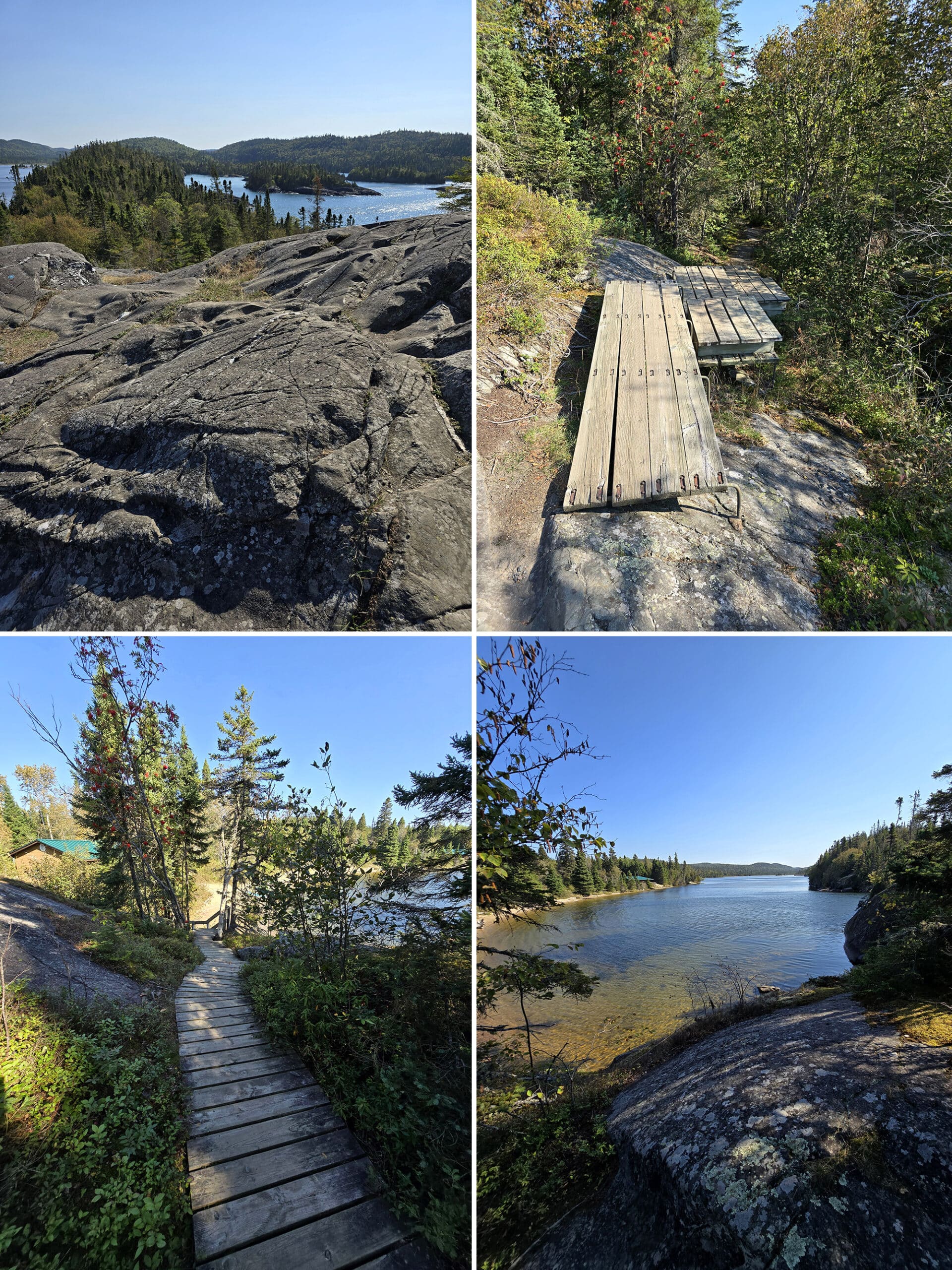
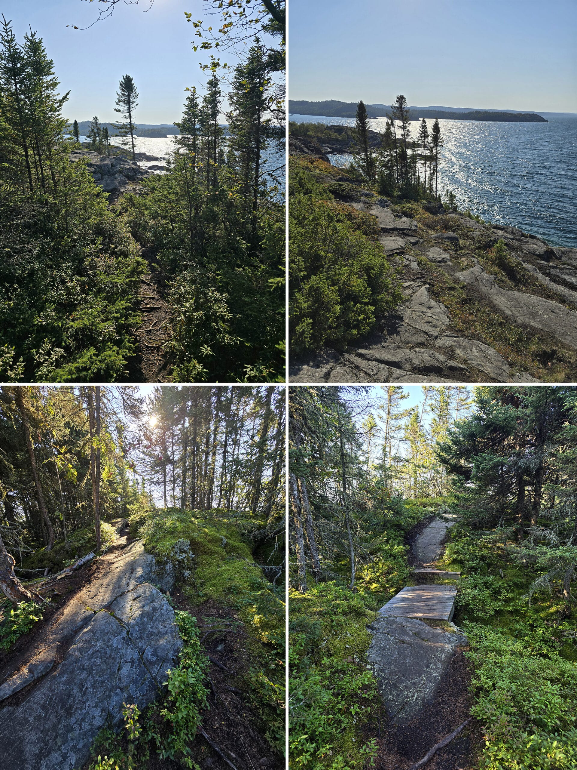
Bimose Kinoomagewnan Trail - Moderate, 3.7 km
This was the only one of the easy / moderate trails that we didn’t get around to doing during our first stay, which was a bit of a shame. We got *violently* rained out on our last full day, though, so that would have made for pretty miserable hiking!
Porter was able to do the trail during our second visit, though.
The verdict: The Bimose Kinoomagewnan trail description VASTLY undersells this trail!
The trail description for this one talks about how it’s an educational trail, covering the Seven Grandfather Teachings of love, honesty, respect, wisdom, truth, humility, and bravery. Signage along the way tells stores about the local culture, as told by Ojibway elders.
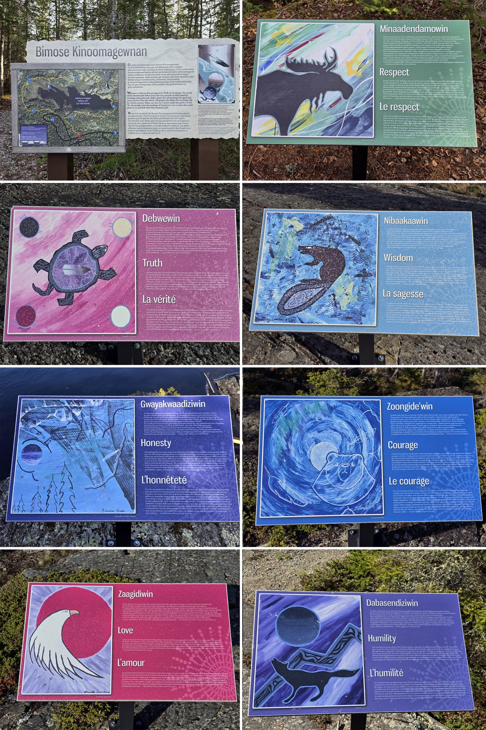
We figured the real stunning views of the park would be those on the trails we’d already done, with the coastal views of Lake Superior.
Porter COULD. NOT. SHUT. UP. about how glorious the views were on this trail! I was laid up with a bad tendon day (week/month, really!), so there was a lot of FOMO happening.
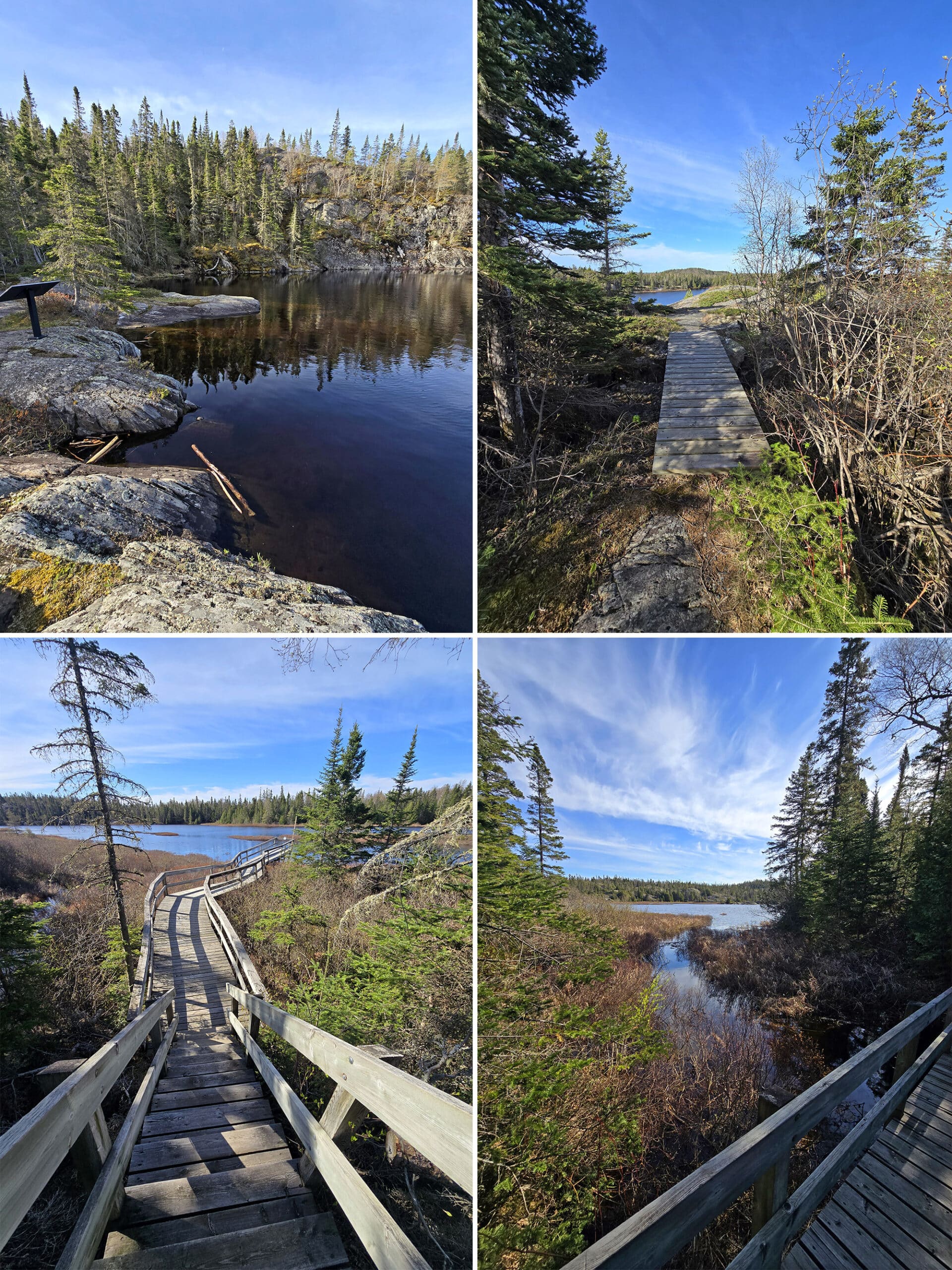
You start out the trail in the woods, with multiple sections of boardwalks to get over wet areas or lower-laying areas.
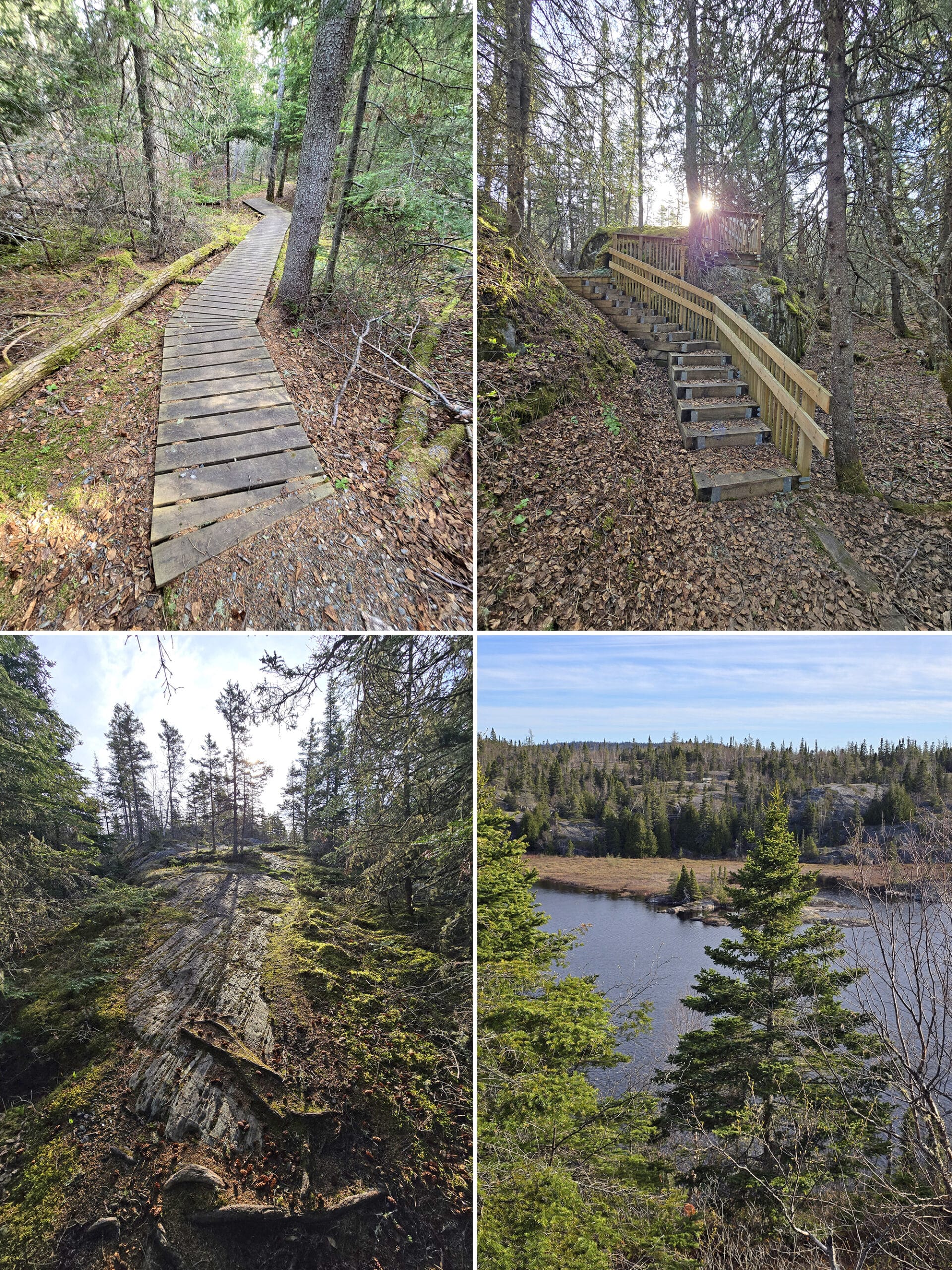
As you get closer to the lake, you start walking up large rocky surfaces, usually covered in lichens and mosses.
You get both elevated views over the lake, as well as water-level viewing, so the up-and-down of the trail is definitely a workout!
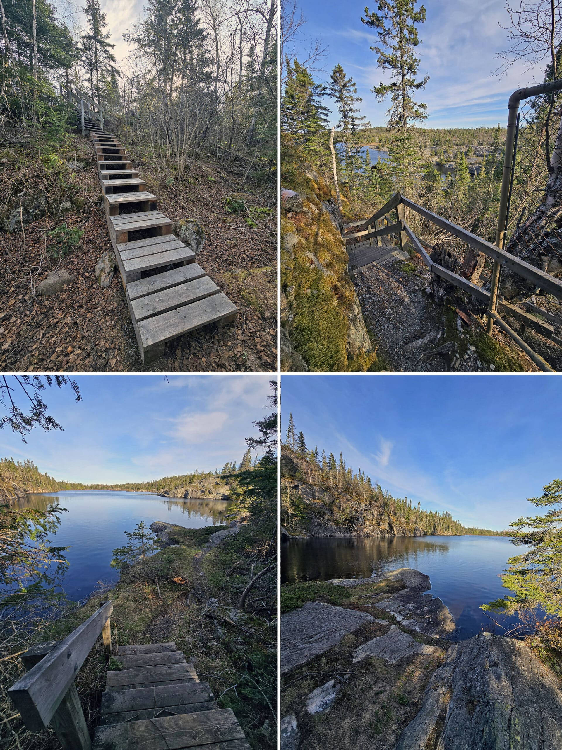
It was MOSTLY easy enough to tell where the path was, but there was one spot where he couldn’t find where the trail was. He found himself getting walked around in loops when he’d follow anything that looked like the trail- he assumes others had also gotten lost in that place.
He knew where he was supposed to be, as he could see a staircase in the distance. Ultimately, he ended up having to go off trail to get there, as he never did find the actual trail.
Some of the outlooks are slightly off the trail - ten meters or so - so you need to keep an eye out for the signage. They tend to be posted *at* the outlooks, rather than pointing you *to* the outlooks.
“Beautiful trail, 10/10, I would do it again right now” - Porter, 5 minutes after returning.
Combination Hike - Moderate, 6.4 km
This hike is a combination of a few of the trails, rather than a trail listed on the trail maps itself.
Normally, I wouldn’t bother including information on something like this, as you can really join whichever hikes you want to. We did a ~5 km hike one morning - just slightly different choice of 3 trails than those listed as combination.
I just... Let me share the start of the site’s description:
It goes on to give details of the proposed hiking route - Starting the Southern Headland Trail at the Visitor Centre, joining on to the Beach Trail, walking through the Loop Campground, and continuing on to Halfway Lake Trail (I’m assuming Halfway Lake Trail was renamed and is the Bimose Kinoomagewnan Trail).
Anyway.
Am I the only one to read their opening sentences in the voice of “Stefan” from Saturday Night Live?
Maybe it’s early, maybe I amuse too easily... but I can’t read those sentences aloud to my husband without pausing to put my hands over my mouth at times.
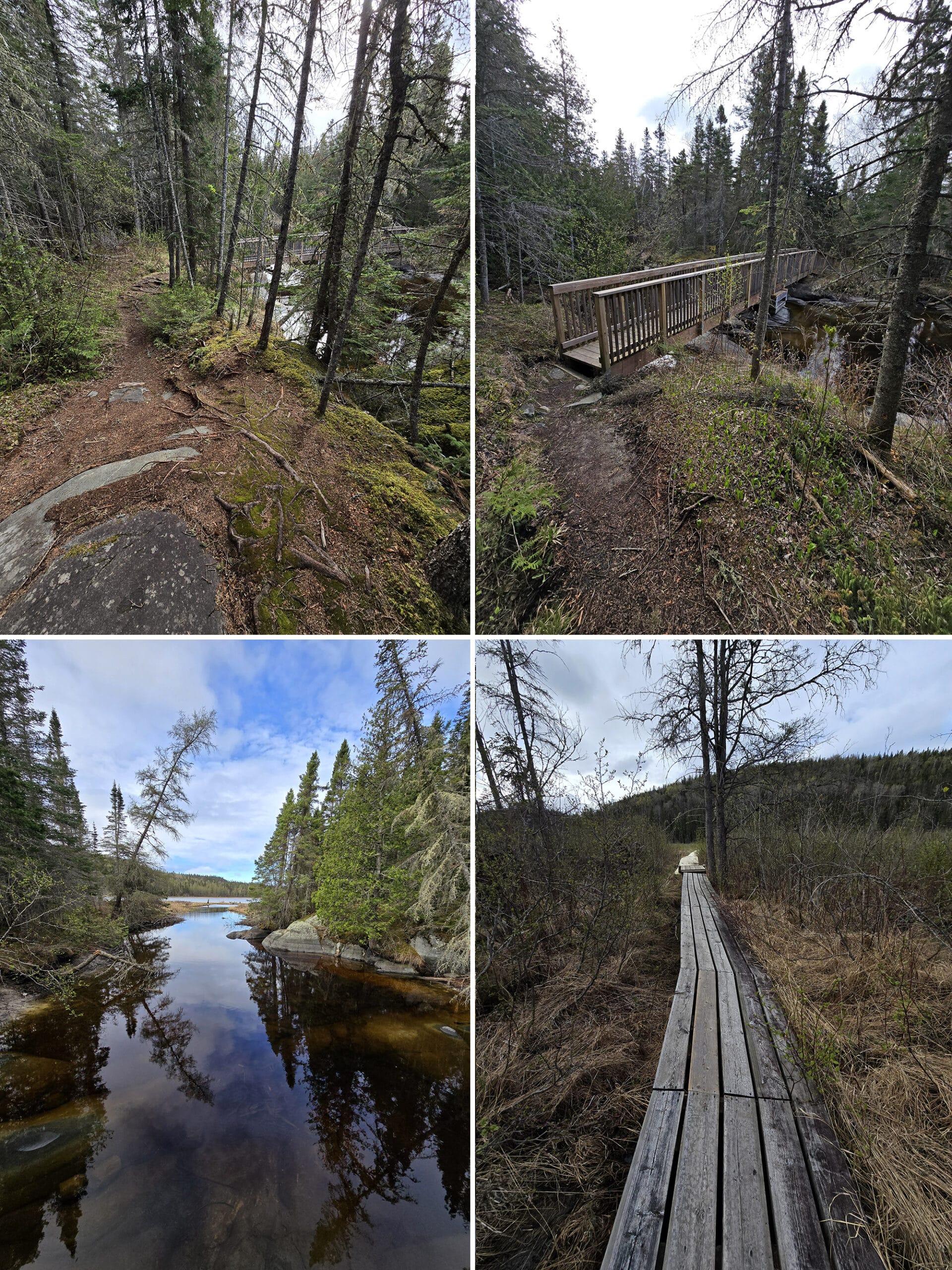
White River Suspension Bridge Trail - Difficult, 18 km
Suspension bridges aren’t really my thing, but this trail sounds REALLY cool. It’s the first 9 km of the Coastal Hiking Trail, once you set out from near the Visitor Centre.
Maybe some day in the future, my tendons will be recovered enough to be up for the EIGHT TO NINE HOUR HIKE (!!!) along the challenging Coastal Hiking Trail.
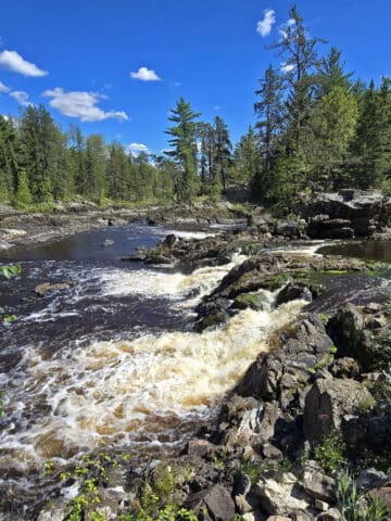
The White River Suspension Bridge takes you 23 metres high, over Chigamiwinigum Falls - I bet the views are amazing, though - let’s be real - I would be waiting on solid land while sending Porter across for photos!
For now, though - Porter walked a few km of it during our May 2025 visit:
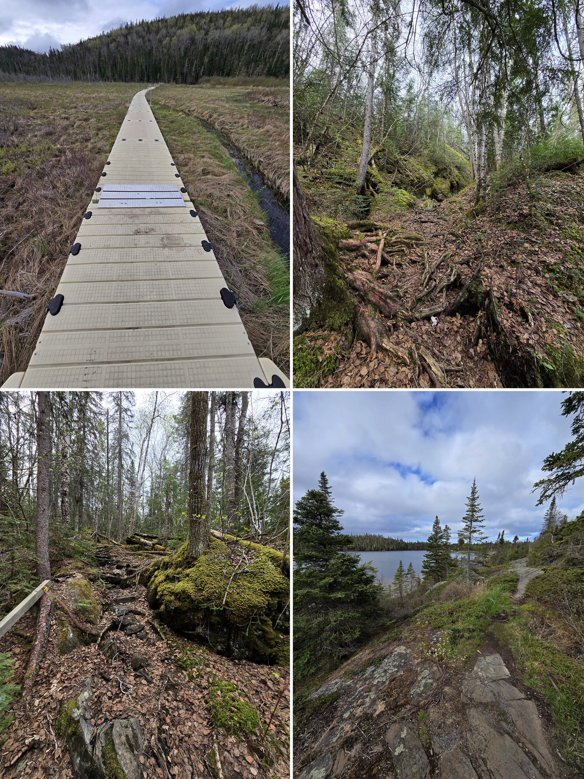
This is a moderate difficulty trail, where you have to watch your step but there are only a few places with short steep ascents or descents. It seemed to get more rugged after the trail veered away from Hattie Cove.
There are several sections of boardwalk, which appear old but are in great condition, no rotton or loose boards. Some of the footings have sank a little bit, resulting in a bit of unlevel surfaces, but definitely stable. One such boardwalk gives way to a long dock crossing a marshy area. Again, very wide and stable all the way.
After the marshy area you walk though forest with large boulders covered in moss and lichen. Photos didn't really do it justice, it was beautiful! I enjoyed the way the trail changes style reapeatly throughout the walk - dirt path, rocky path, walking up boulder sections.”
I was hoping for some elevated panoramic views of the surrounding area, but unfortunately the elevated views are mostly obscured by trees. When you're there, you can see Lake Superior in the distance, but photos never do it justice - it just looks like a photo of trees.
The trail eventually leads to the White River Suspension Bridge, about 9km out. I definitely want to check that out in a future trip. Not only would I get to see more of this gorgeous trail, a suspension bridge is right up my alley!
Backcountry Hiking
As if the Suspension Bridge Trail wasn’t challenging enough, there are a couple of back country hiking trails, as well!
The Pukaskwa Coastal Trail is 60 km long, meandering along the Lake Superior shoreline, up and down rock formations, across beaches, and through dense boreal forest areas.
It’s part of the Trans-Canada Trail, and has backcountry campsites along the way.
There’s also the Mdaabii Miikna Trail, which is a loop off the Coastal Trail. The name means “go to the shore trail” in Anishinaabemowin, and it does just that.
Sounds amazing!
Biking
There aren’t any dedicated bike trails in the park, but we did see a few people cycling along the campground roads.
The roads are all decently wide and in good condition.
Swimming
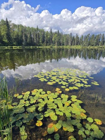
There are a few sandy beaches in the park, 2 of which would make for a fabulous beach day.
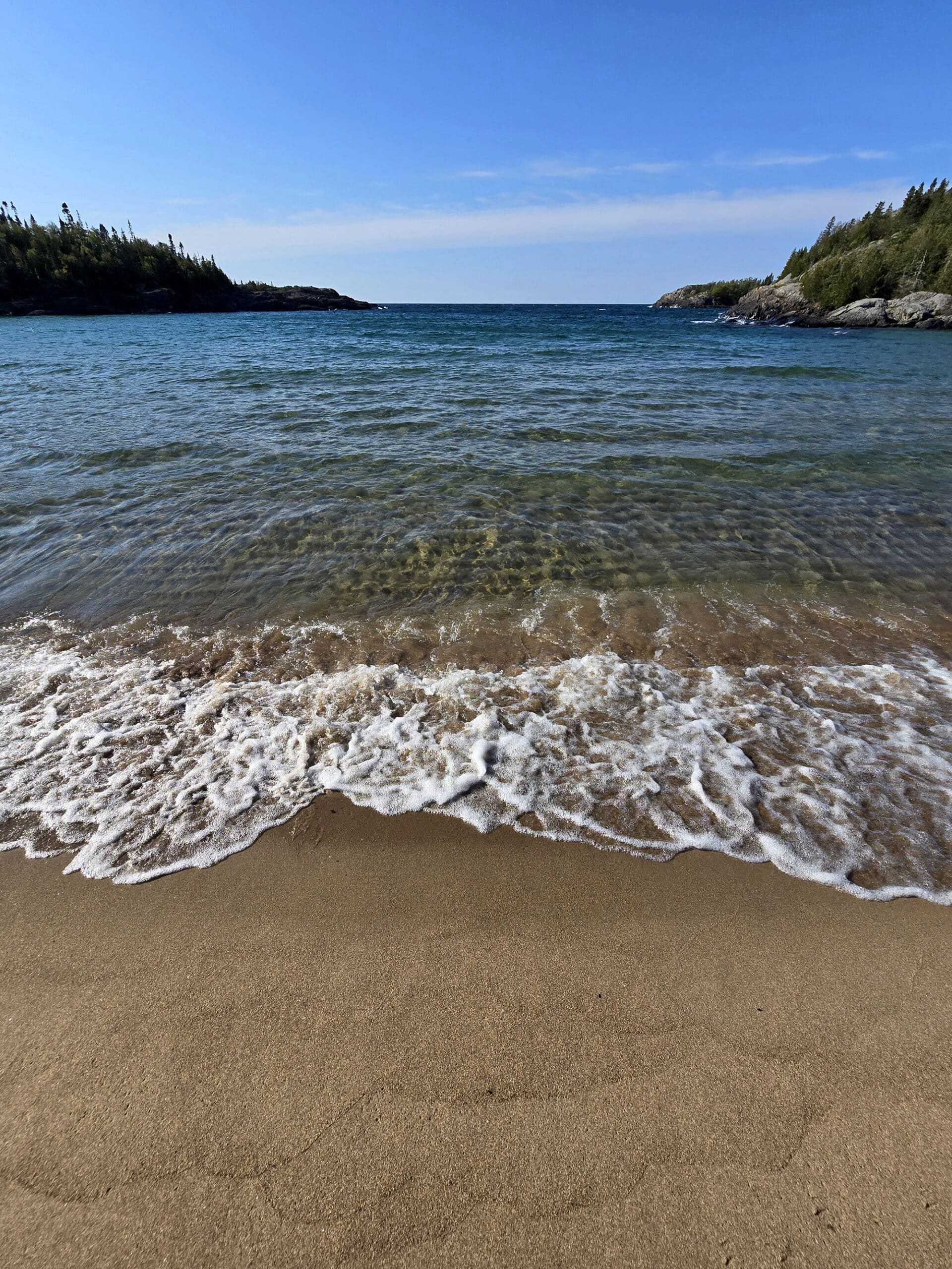
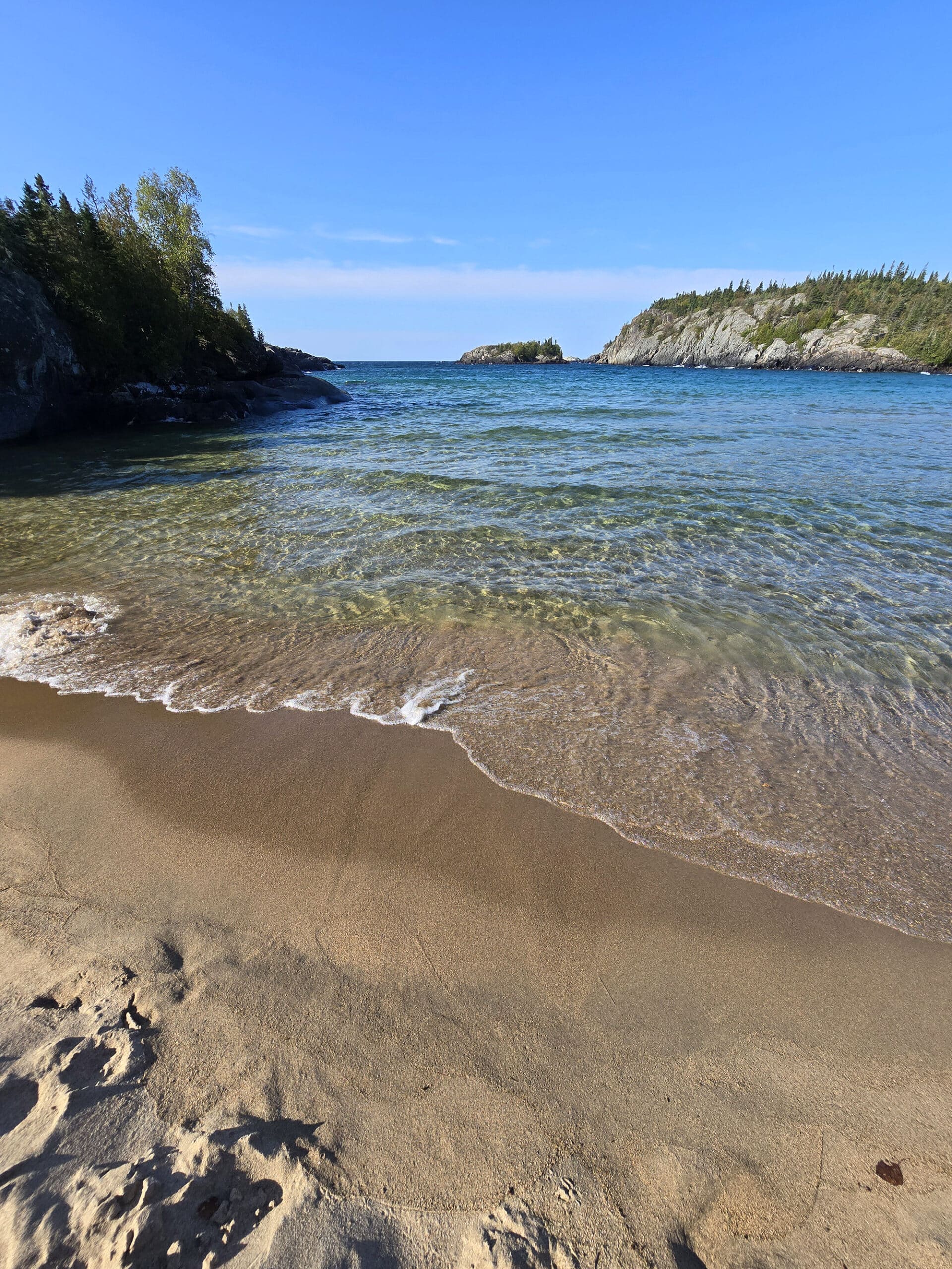
Horseshoe Bay Beach is most easily accessed from the Boardwalk Trail in the South Loop Campground, though there are also access points via the Southern Headlands Trail and Beach Trail.
GORGEOUS sandy beach, with crystal clear Lake Superior water, and amazing views.
This one is less of what I’d consider a swimming beach, just on account of how rough the actual beach is. The entire thing is covered with driftwood - large pieces further up the beach, but really small pieces covering pretty much the whole beach area.
This one can be accessed via a trail from Middle Beach, or - more easily and directly - via a pretty easy trail from the North Loop Campground.
This one is a gorgeous sandy beach, with some large boulders along the way. Beauty!
Birding, Wildlife, and Nature
We may have been expecting a lot in terms of wildlife viewing.
The park’s website mentions Great Blue Heron, Peregrine Falcons, Moose, Grey Wolves, Lynx, Beavers, and Otter being prevalent (at least on the backcountry trails).
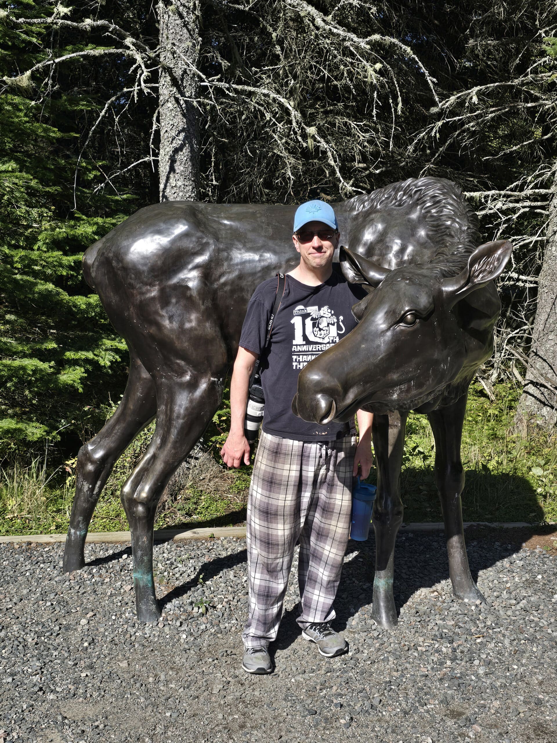
We ... didn’t see any of that. The only large mammals we saw were statues of moose at the Visitor Centre.
There were also warnings about black bears throughout the campground - They even told us at the front gate that there’s a mama bear with two cubs in the area! - but we didn’t see any.
Overall, we saw: American Crow, Bald Eagle, Black-Capped Chickadee, Common Raven, Golden-Crowned Kinglet, Herring Gull.
... and we heard: Downy Woodpecker, Long-Eared Owl, Pileated Woodpecker, Red-Breasted Nuthatch, Ruby-Crowned Kinglet, Swamp Sparrow, White-Throated Sparrow.
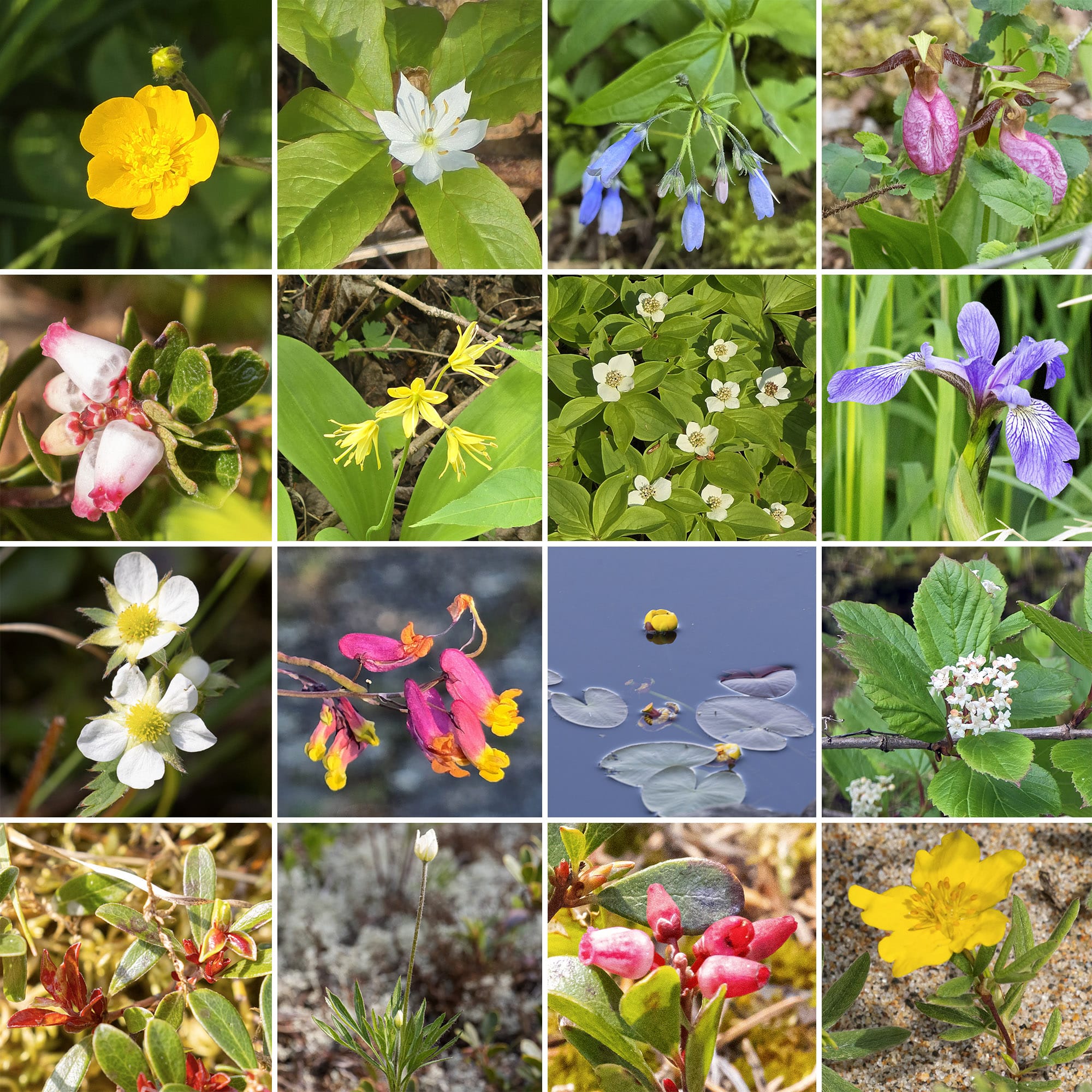
We saw SO MUCH FUNGI.
The trails are just lined with every kind of fungus you can imagine, it was really cool to see the variety!
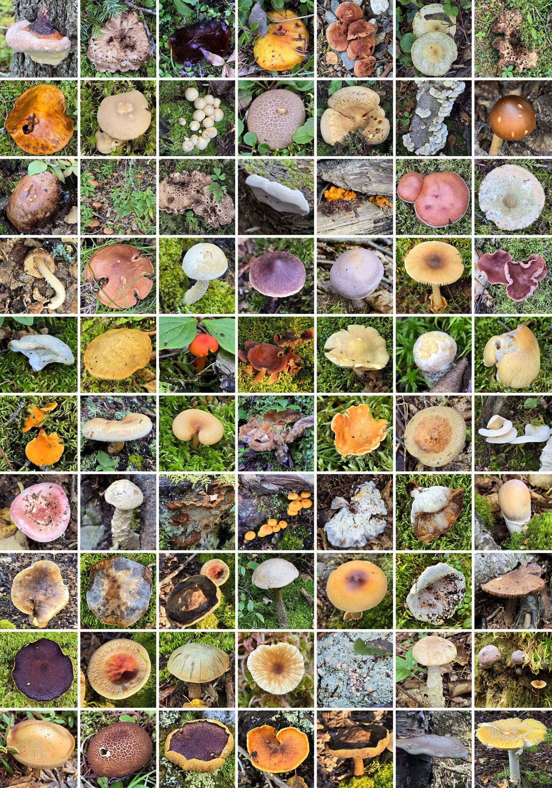
We saw a few that we’d never seen before, and I managed to keep up my streak of finding wild orchids in almost every Northern Ontario park we visited over a couple weeks. In this case, it was another Lady Slipper / Moccasin Flower.
June 2025 Birding Update
MUCH better luck with birding this time! Overall - during our May and June trips - we heard and/or saw:
Alder Flycatcher, American Crow, American Herring Gull, American Redstart, American Tree Sparrow, Bay-Breasted Warbler, Belted Kingfisher, Black-and-White Warbler, Blackburnian Warbler, Black-Capped Chickadee, Black-Throated Green Warbler, Blue-Headed Vireo, Boreal Chickadee, Broad-Winged Hawk, Brown-Headed Cowbird, Canada Goose, Canada Warbler, Cape May Warbler, Cedar Waxwing, Chipping Sparrow, Common Raven, Common Yellowthroat, Dark-Eyed Junco, Downy Woodpecker, Golden-Crowned Kinglet, Goldeneye, Golden-Crowned Kinglet, Great Blue Heron, Hermit Thrush, House Finch, Killdeer, Lincoln's Sparrow, Long-Eared Owl, Magnolia Warbler, Merlin, Nashville Warbler, Northern Cardinal, Northern Flicker, Northern Parula, Orange-Crowned Warbler, Palm Warbler, Pine Siskin, Purple Finch, Red-Breasted Nuthatch, Red-Eyed Vireo, Rose-Breasted Grosbeak, Ruffed Grouse, Sharp-Tailed Grouse, Song Sparrow, Swainson's Thrush, Swamp Sparrow, Tennessee Warbler, Turkey Vulture, Warbling Vireo, Western Meadowlark, White-Crowned Sparrow, White-Throated Sparrow, Wilson’s Warbler, Winter Wren, Wood Thrush, Yellow-Bellied Flycatcher, Yellow-Rumped Warbler, Yellow Warbler.
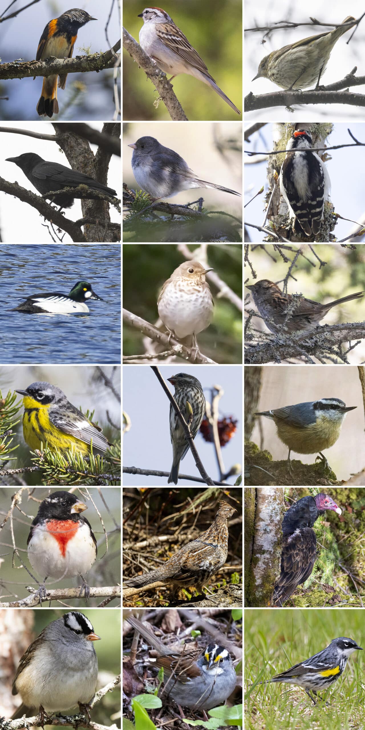
Row 2: Common Raven, Dark-Eyed Junco, Downy Woodpecker
Row 3: Goldeneye, Hermit Thrush, Lincoln's Sparrow
Row 4: Magnolia Warbler, Purple Finch, Red-Breasted Nuthatch
Row 5: Rose-Breasted Grosbeak, Ruffed Grouse, Turkey Vulture
Row 6: White-Crowned Sparrow, White-Throated Sparrow, Yellow-Rumped Warbler
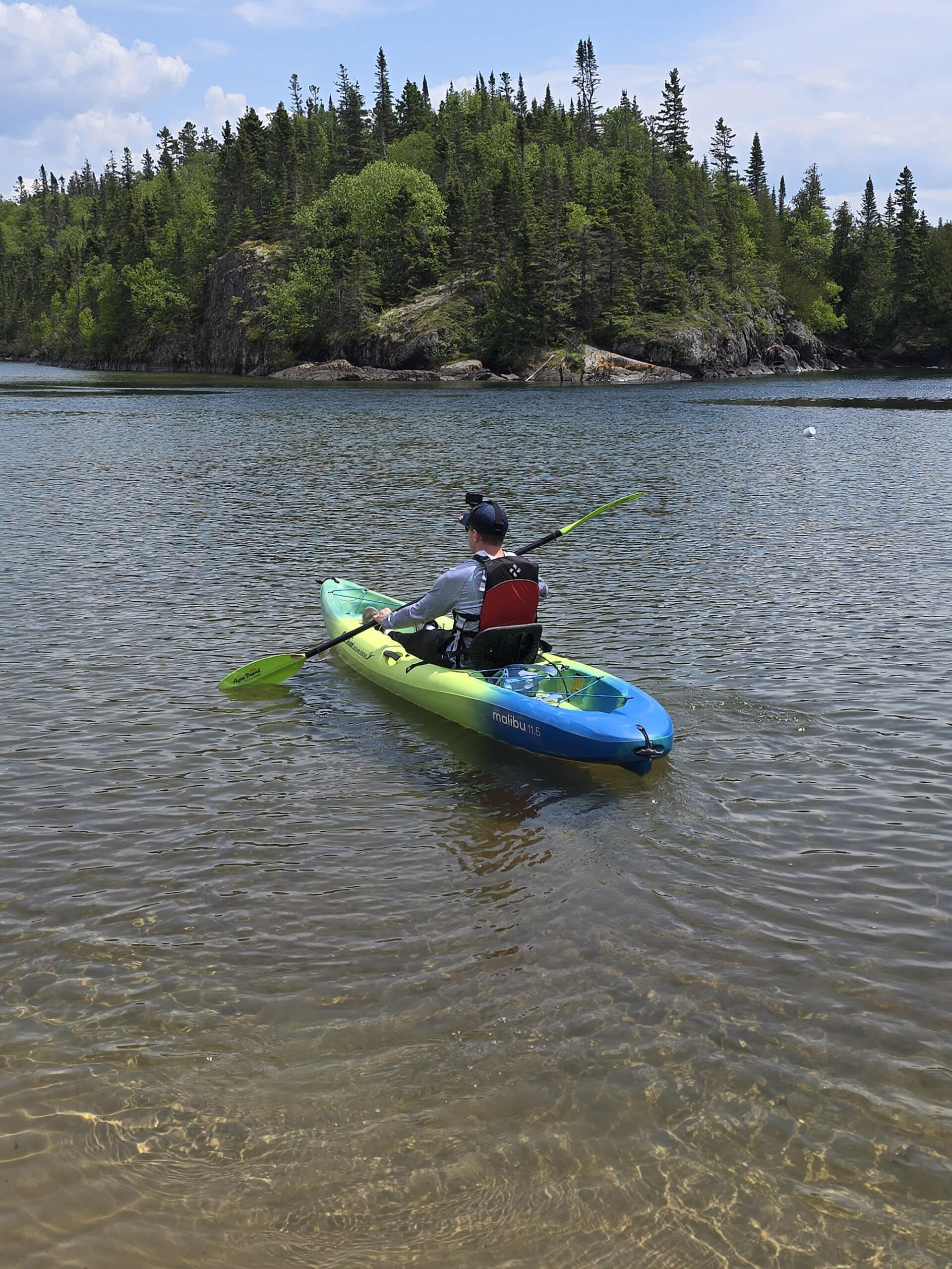
Boating
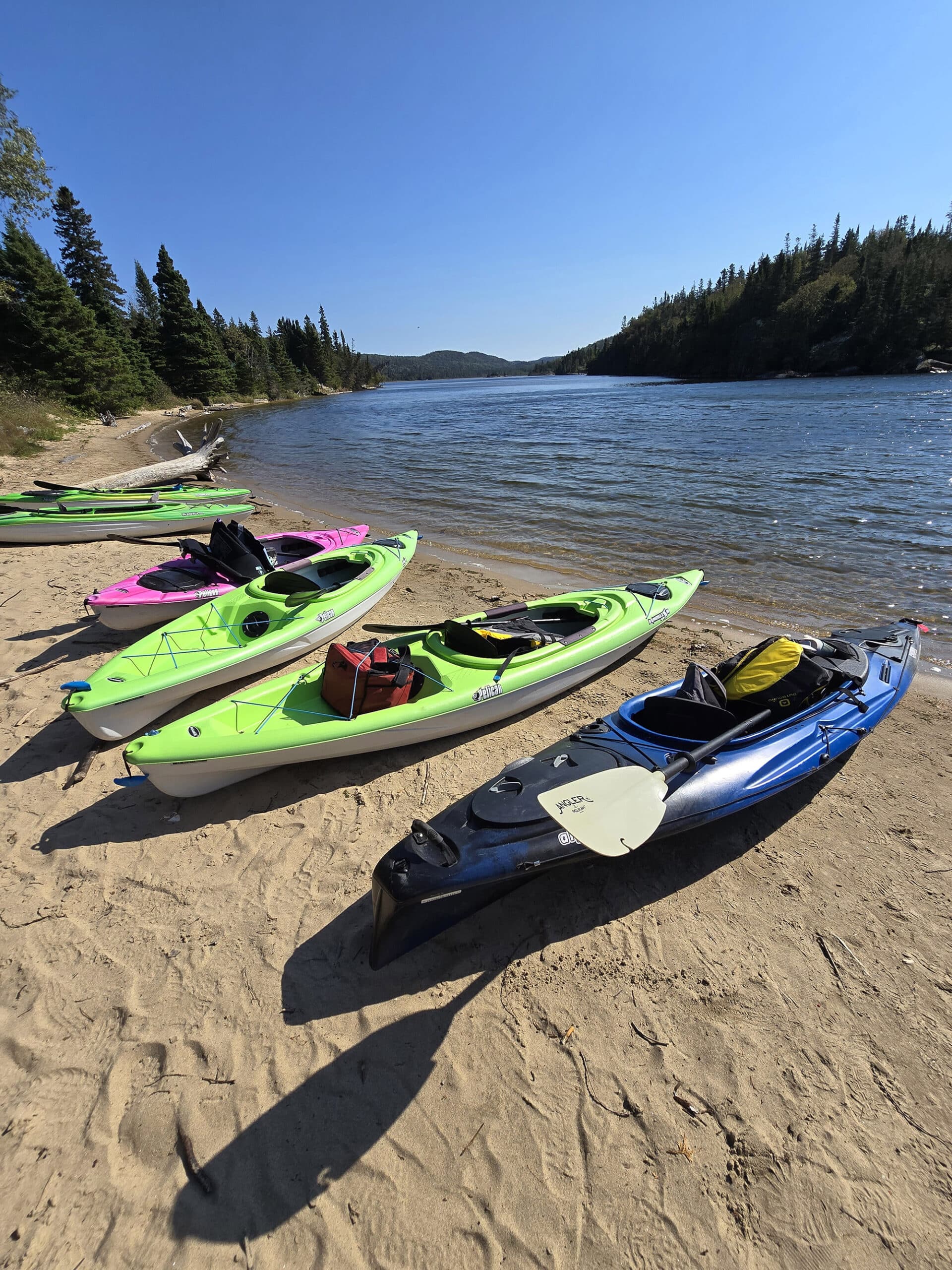
Pukaskwa National Park offers a few options for paddlers.
For those who’d like to keep it pretty simple, you can canoe or kayak around Hattie Cove, which is a relatively sheltered little cove. It looked pretty un-intimidating for the duration of our stay.
The more adventurous are able to paddle along the shores of Lake Superior, along the coastal paddling route. You’ll definitely want to know what you’re doing, and keep a close eye on weather conditions.
As the largest lake (Freshwater, anyway!) in the world - at over 31,000 square miles - the conditions can change quickly. It’s supposed to be basically the same as canoeing on an ocean!
Then, there’s interior paddling, on White River and Pukaskwa River.
It sounds like these options involve boat shuttles, backcountry camping, and backup plans.
Waaay out of our wheelhouse!
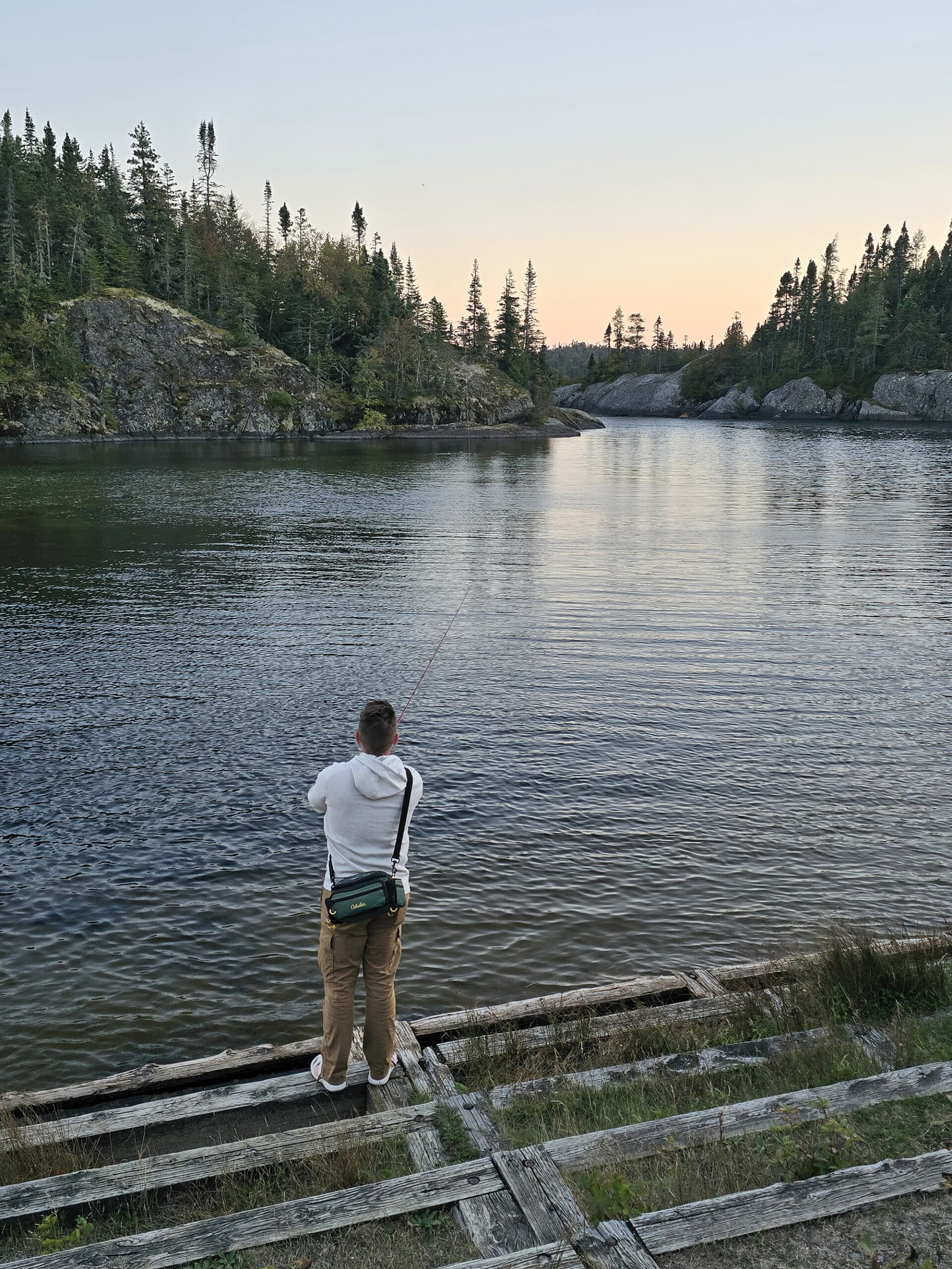
Fishing
We saw a guy catch a Northern Pike - first time I ever saw one.
He was nice enough to ask my - probably really dumb - questions about fishing. I bought fishing gear before this trip, and I’ve been really hung up on “so what happens once it’s on your hook?”.
I’ve watched a bunch of Youtube videos, no one ever seems to cover that! I can fillet a fish, but I had no idea how to ... dispatch it ... humanely.
Niantic Games, Etc
There is a Pokestop and a Gym / Ingress Portals at the Visitor Centre, which is likely the only place you’ll be able to play, anyway.
If you’re looking to do something similar, Pukaskwa National Park encourages Geocaching, with its “Heritage Hide’n’Seek” Geocache Series.
And hey, you don’t need cell reception to use GPS to find a Geocache!
When it’s open - ie: not during our stay - the Visitor Centre rents out GPS units for $5.00 / day - with all of the necessary coordinates pre-loaded!
Final Thoughts
We aren’t a fan of the Hunger Games aspect of the camping setup.
Not only do you not know if there’s going to be *a* site available when you drive the ~20 minutes from the highway, you also don’t know what the situation will be, IF you get one.
Will you find one suitable for your camper? Will you have electricity? Who knows?
I would absolutely not want to camp here in the summer, without a backup reservation at a nearby Provincial Park. That’s just way too chaotic for me, thanks.
Once we HAD a site though - absolutely love this park.
Pretty much everything was walkable from our campsite, giving Porter a much-needed respite from driving everywhere.
Everything was really well maintained, the hikes were fantastic, and the views from the beaches - and out on the trails - we spectacular.
FANTASTIC Park... if you get a site.
More Northern Ontario Provincial Parks & Places to See
Want to read some more about the parks we've camped and at places we've seen in Northern Ontario? Here are some more posts!
Northern Ontario Campground Reviews:
Aaron Provincial Park
Agawa Bay Campground, Lake Superior Provincial Park
Blue Lake Provincial Park
Caliper Lake Provincial Park
Kakabeka Falls Provincial Park
MacLeod Provincial Park
Neys Provincial Park
Ojibway Provincial Park
Pakwash Provincial Park
Pancake Bay Provincial Park
Quetico Provincial Park
Rabbit Blanket Lake, Lake Superior Provincial Park
Rainbow Falls Provincial Park
Rushing River Provincial Park
Sandbar Lake Provincial Park
Sioux Narrows Provincial Park
Sleeping Giant Provincial Park
White Lake Provincial Park
Northern Ontario Places to See:
Aguasabon Falls & Gorge
Amethyst Mine Panorama
Batchawana Bay
Chippewa Falls
Kakabeka Falls
Mink Creek Falls
Old Woman Bay
Ouimet Canyon Provincial Park
Roy Wilson Suspension Bridge
Sand River Falls
Scenic High Falls
Temagami Fire Tower
Terrace Bay Beach
Want to explore beyond Northern Ontario? Check out our full list of Campground Reviews, Ontario Waterfalls, and other Places to See.
We also have a ton of Camping Recipes to cook up, while on your adventures!
Thanks for Reading!If you loved this post - or have any questions about it - please leave a comment below! We'd also love it if you would consider sharing the link on social media! |

Steve D
Great review. We stayed at Pukaskwa in 2020. A return visit is a must. Your suggestion to have a reservation (July & August) is exactly what we did. At that time, 2020 - after we 'claimed ' our campsite - drove out to the railway crossing at Heron Bay to obtain a strong internet connection to cancel the provincial park reservation. Pukaskwa is truly a cathedral to the Group of Seven! sd.