
Neys Provincial Park is an quiet little campground on the north shore of Lake Superior, with a LOT going on! Here's our review of our two stays there.
Originally published September 15, 2023, Updated on 7/29/2025.

Located just a few hours from Thunder Bay - and just over a half hour up the Trans-Canada Highway from Pukaskwa National Park - Neys was our last stop before Sleeping Giant provincial park.
This one has just what we love in these lakefront campgrounds: A great view of Lake Superior - right from our camp site! - coastal trails, and a prisoner of war camp.
Ok, so that last one is incredibly specific and unique to this park, but I stand by the rest of what I said.
Neys has several hiking options, so it has something for any difficulty level and length of trail you may be looking for.
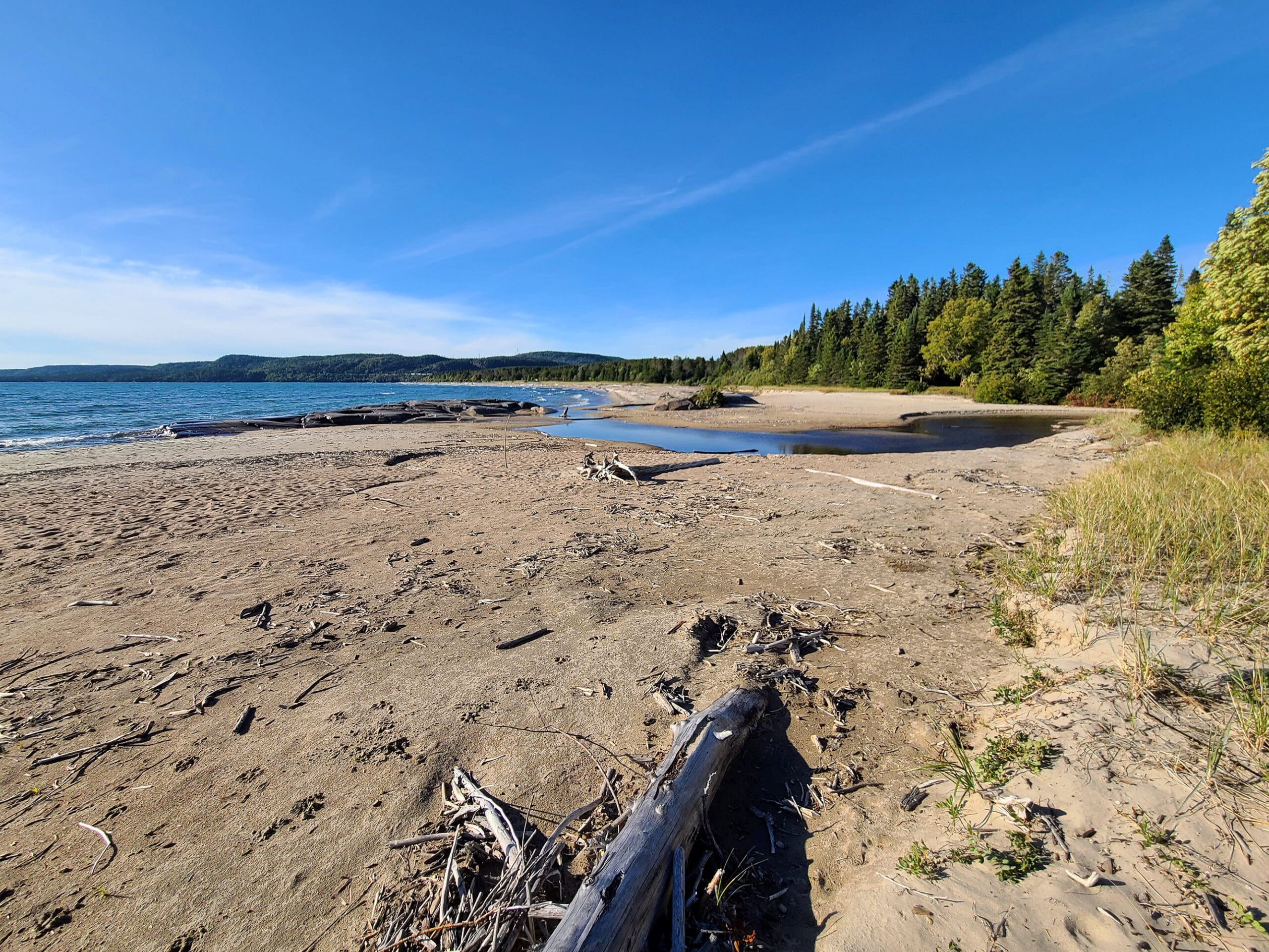
It also has a couple kilometers of clean, sandy beach, stretching across the bulk of their campgrounds. Absolutely gorgeous!
We liked it so much, we returned in 2025 - Let us tell you all about it!

The Basics:
Campground Name: Neys Provincial Park
Address: P.O. Box 280, 1004 Hwy 17 Terrace Bay, ON P0T 2W0
Website: https://www.ontarioparks.com/park/neys
Price Ontario Provincial Parks uses a pricing matrix across all their parks. See 2025 Camping Fees for more details.
Reservations: Ontario Parks Reservations
Park Classification: Natural Environment
Season: May 15, 2026 to October 13, 2026

Logistics
Some basic information to help you plan your stay at Neys Provincial Park:
Registration and Check In
Online reservation on both occasions was quick and easy with the Ontario Parks online portal.
Registration at the park was very quick and friendly, inside the gatehouse. The park is now on the paperless permit system, which is always nice to see.
Also, I received an email the morning of our check-in, allowing me to complete check in online. Slick!

Maps and Signage
The maps and signage leave a bit to be desired.
Park Map
In terms of maps, any of the roads that aren’t for campers ... aren’t on the map. It can make it confusing when comparing the map to what you’re seeing, as you go through the park.
Also, when it says that it may not be to scale - yeah, it’s definitely not kidding.
Beyond that, some of the aspects of the park are shown in confusing places (the opposite side of the road from where it actually is, something being shown directly across from another point, but being further up the road), implied paths/access points that don’t exist, actual access paths in the park that are not shown on the map, etc.
The map we got included a page specific to the trails, but it had been SO blown up from a small image, that a lot of the writing on those 2 maps was fairly illegible - especially the smaller one.
June 2025 Update: These issues seem -mostly - to have been resolved. Aside from the “there are roads in reality that aren’t on the map” thing, I don’t really have any complaints about the current map.

Signage
In terms of the signage, there are a few locations where the sign is VERY specifically showing only to traffic from one direction, and you’ll miss the sign until you see it in your rear view.
For instance, the sign for the Little Pic River day use area is only visible from one direction, and it’s off around a weird turn/corner. If you’re coming from area 4, you’ll miss it.
Other than that kind of thing, the signage is pretty decent. It’s a pretty straightforward park, so you shouldn’t have any trouble finding your way around.

Waste & Water Services
As with most provincial park campgrounds, there are no water or sewer hookups in the camp sites.
There is a dump station / filling station set up near the front gate.
The loop - off to the right, as you leave the park - will put the taps on the driver’s side of your rig.
There’s one platform for the dumping station, and another single platform / threaded hose for the fill station. They’re both in line - single lane - with no passing lane.
As a note: It’s very much designed to be accessed on the way out of the park. If you’re entering on the way in, it’s going to be a pretty tight u-turn to get in there.
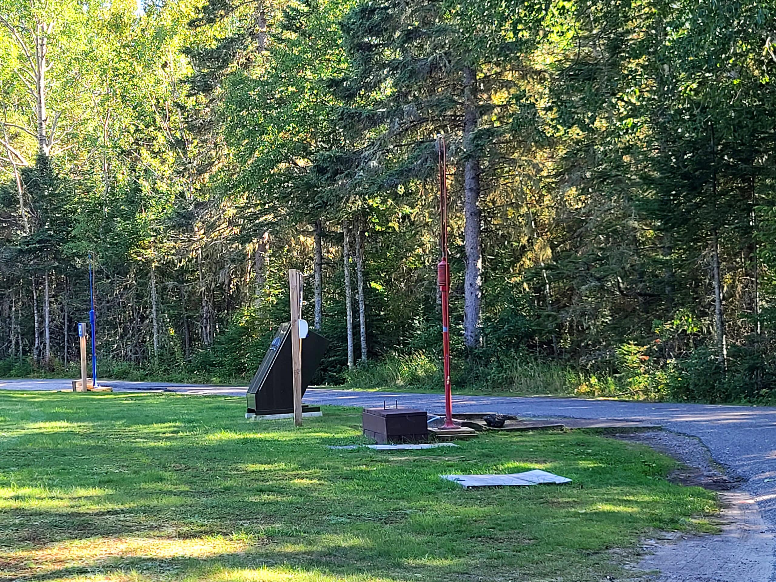
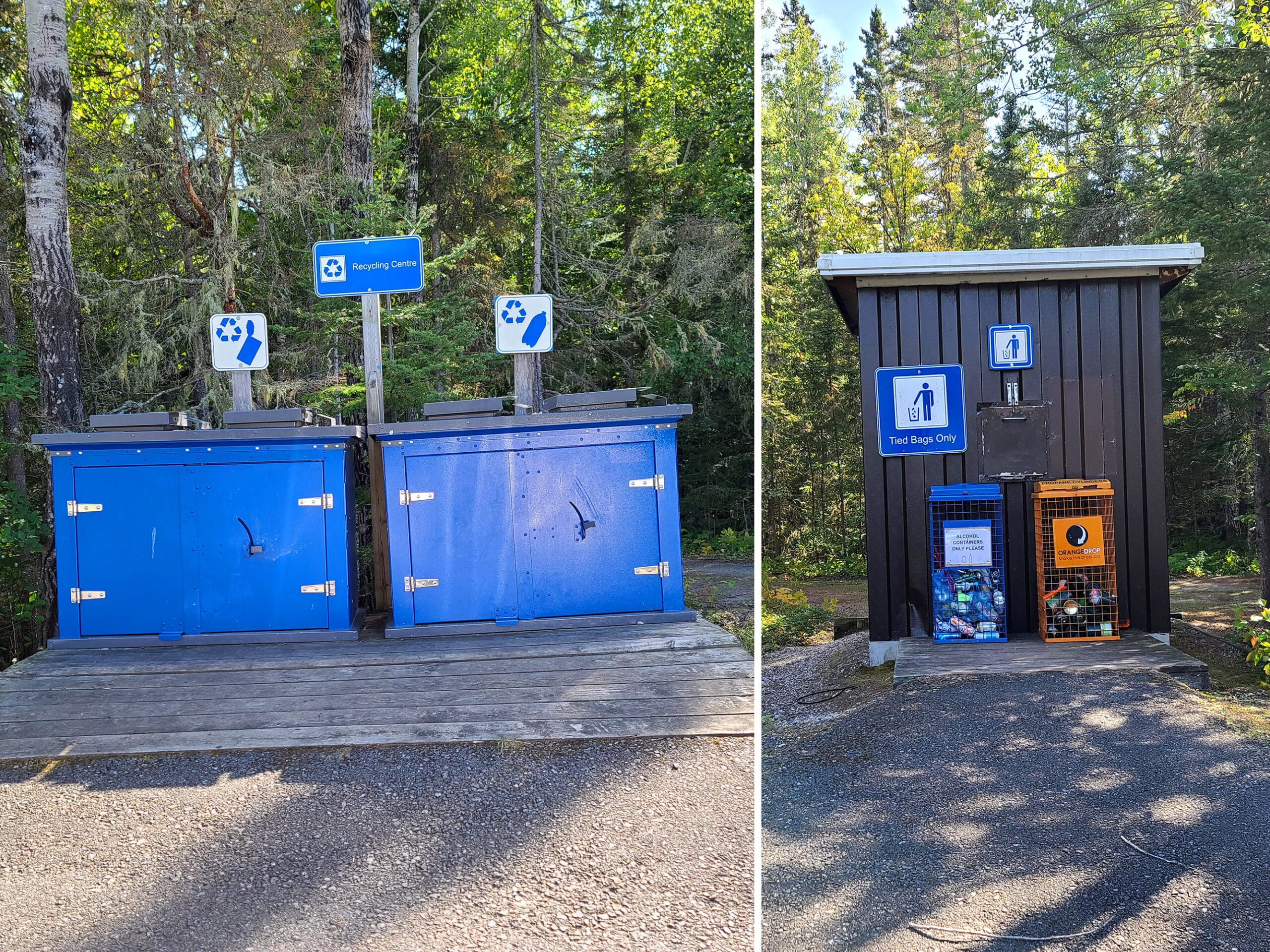
Weirdly, the recycling are doesn’t have a bin for cardboard or paper. Also, some weird accessibility issues - more on that in a bit.
Connectivity
Cell phone coverage (Rogers) was fairly spotty during our 2023 visit, but pretty good in 2025.
We had pretty good cell reception in most of the park, from about the Prisoner Cove area inwards. We lost reception around the gatehouse, and it was spotty to nonexistent from there to the highway, and along the highway in both directions for a while.
There is no Wifi in the park.

Accessibility
So, a bit of a mixed bag on this one.
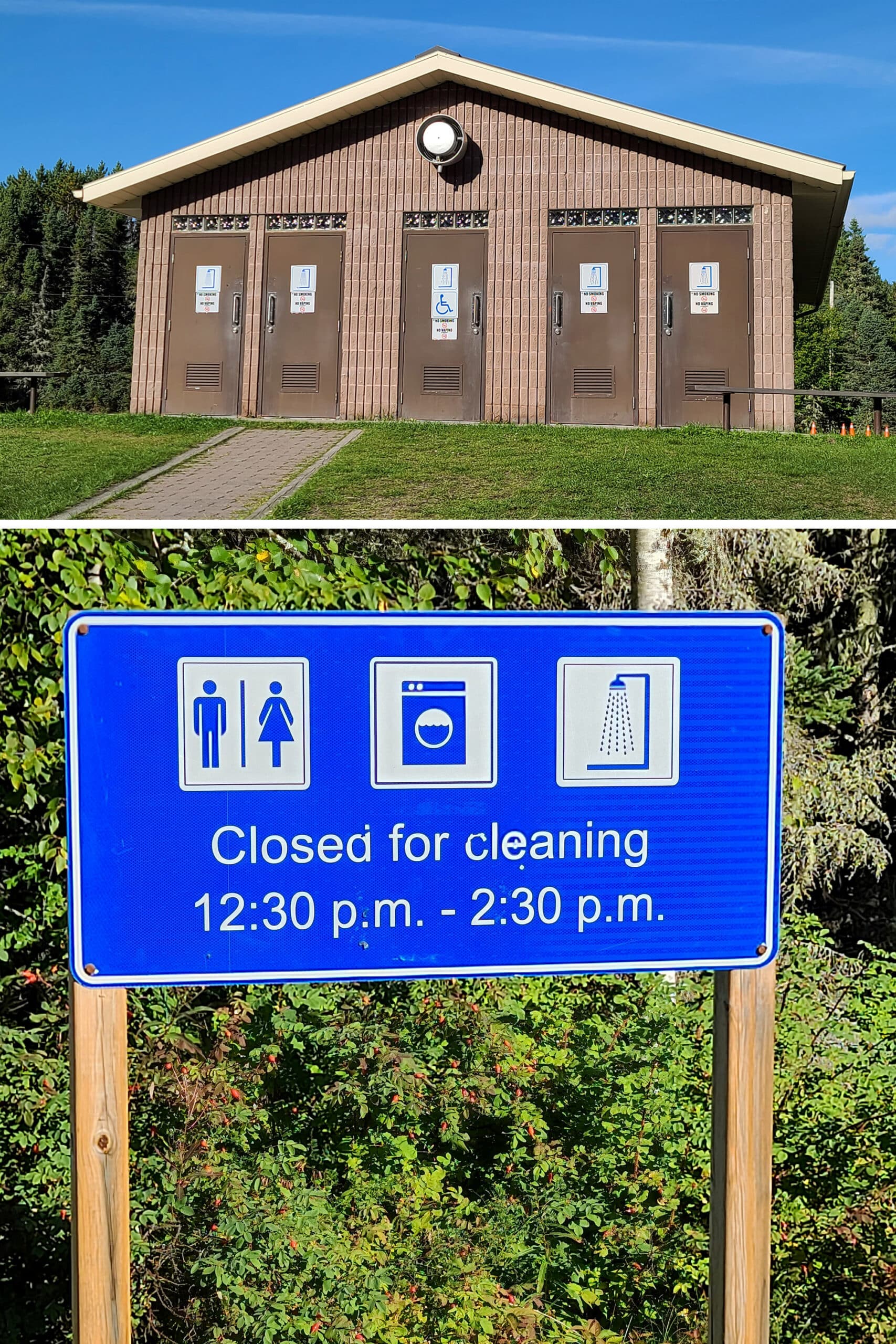
As with most Ontario provincial parks, the comfort station is noted to have barrier-free access - it is up on a bit of a hill, so heads up on that.
The path up the hill probably isn’t super wheelchair friendly - there’s a low step partway up.
There is a parking lot up the hill, on the side of the comfort station... but it’s awkward access to get from the parking spot to the comfort station platform. Just a narrow space between a parking curb and a wooden border.
That said, the shower is actually wheelchair accessible.
The garbage stations are another weird situation.
The one across from the comfort station has a ramp up to it ... but the bottom is basically right in the bushes, and there are a couple of recycling bins right at the top of the ramp, blocking access to the platform.
The garbage station by the gatehouse as a wide ramp up to the garbage hut, but no platform. If you’re wheeling up, you’re going to be sloping backwards, trying to get your garbage into the dump.

Bottom: The accessible shower, and the garbage area by the comfort station.
The trail we did - the Point Trail - is one of two advertised to be “easy”.
This one was not wheelchair friendly, but could be used by those with other types of mobility aids.
Based on my own experience, I would have been ok taking that one with a cane or in a boot, but may have had trouble if using crutches.
It’s mostly flat, there are some roots to navigate in a few areas, and a few - 3, if I recall correctly - little raised bridges that involve a bit of a step up onto.
As well, there’s a short staircase towards the end of the trail. There are handrails, but the steps are very narrow, and VERY steep.
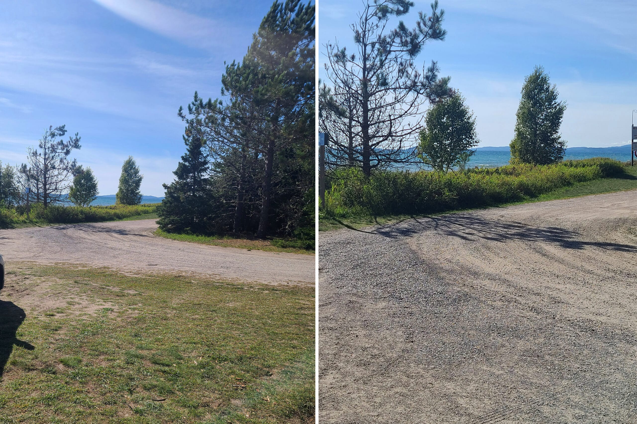
The roads in the park are fairly rough.
One really cool thing about accessible options in this park is that there’s a wheelchair ramp down to the beach in the Area 2 Campground!
That’s the first one we’ve seen at any provincial park campground. It looked a little janky, but I definitely appreciate the fact that it’s even there.

Pets
There’s an off leash dog beach that you can access from a little ways up the Point Trail - though we didn’t actually see any signage in the parking lot or the trail entry to indicate that to be the way to get to it.
The weird thing is that it appears to be the ONLY way to access the dog beach.
Dogs aren’t allowed on the beach area adjacent to it on one side (the right, when looking out to the lake), and there’s no access BUT the trail, to the left.
Anyway, you’re required to keep your dogs on a 2 meter leash in all areas of the park that they’re allowed in, aside from that section of the beach.
As a note: There are a TON of sticks on or near the beach, so it should keep a lot of dogs very happy!

Parking
The camp sites all seem large enough to accommodate at least one vehicle, beyond your camping equipment.
There are also several parking areas throughout the campground, including by the comfort station, by the fish cleaning station, at each of the trail heads, the visitor center, etc.

Miscellaneous
A couple things to note about Neys Provincial Park:
1. The road is in pretty terrible condition on the way into the park. DEFINITELY take your time and keep an eye out for surprise dips.
2. There’s a train that passes very close to the park. It’s nowhere near as bad as some other parks (Ahem, Oastler... White Lake)... but it does come by frequently, all through the night, and does blare its horn occasionally - but from really far off. There’s a pretty good view of it from the Pic River Day Use Area.

The best north-facing view in the park is at the boat launch - basically look towards the bridge. The problem is... there’s the Trans Canada highway back there.
So, while it’s an interesting view for aurora photography, expect passing lights from the traffic.
If you’re interested in possibly seeing the northern lights, check out our posts: Aurora Hunting, How to Photograph the Northern Lights, Can I See the Northern Lights Tonight?, and Where to See Northern Lights in Ontario.

Campground Amenities & Info
Neys Provincial Park may be a smallish park compared to some of the others we’ve been to, but it’s got a LOT going on!
Creature Comforts
There is a single comfort station for the park, between Campgrounds 1 & 2.
You can access it via the road in campground 2, from the main road (with a parking lot and short walk up a trail), or a short trail from campground 1 to the road on campground 2, leading up to the comfort station.
The comfort station has flush toilets, laundry facilities, and showers.
It’s nice to have a heads up - haven’t seen such a sign outside any of the others we’ve been to - maybe it’s noted inside?

We thought it said “beer lockers” as we pulled up, had a laugh about it!
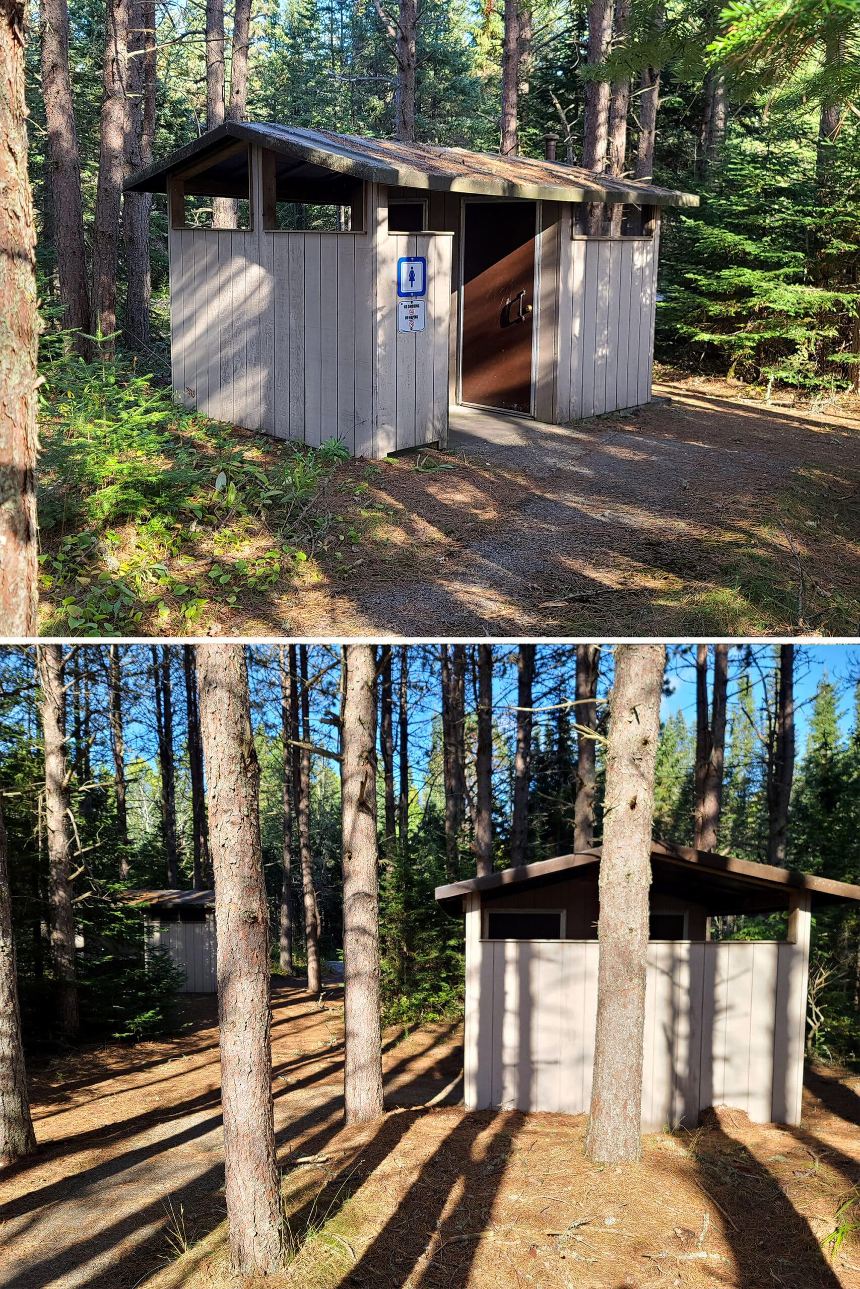
In 2023, we both felt like we saw more privy washrooms, than are represented on the park map.

Park Store
There’s a small camp store located at the front gate, where you can buy souvenirs, clothing, electric adapters, various types of mosquito repellant, snacks, batteries, etc.
Outside of the gatehouse is a second building, where you can buy firewood and ice. The canoe rentals are also handled at that building.

Visitor Centre
Unfortunately for us - on our mid-September 2023 stay - the visitor center is only open in July and August.
I had managed to miss that fact when booking - I had thought it was really cool that they advertized having a model of one of the German POW camps from World War II - apparently there’s also some remains of POW camp 100.
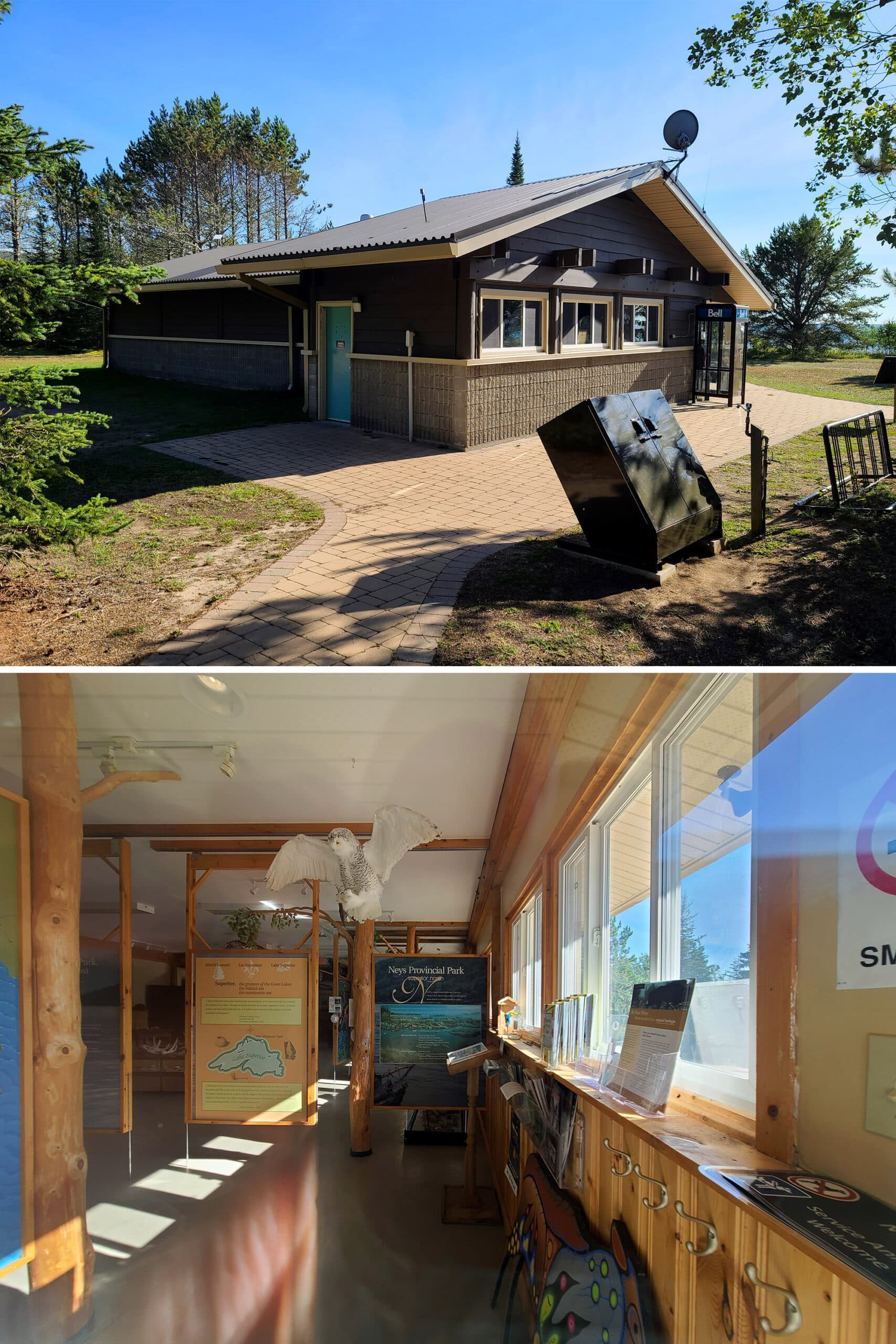
Anyway, it was a super cute Visitor Center, with a LOT of displays.
Aside from the POW camp model, there was a functioning model train going around the ceiling, a display on various types of scat you may see, pelts you could touch, and more.

Prisoner of War Camp
When we stopped in Wawa, we’d read some displays there about how the Canadian government had put captured German soldiers to work in the area, during the war.
They were tasked with non-war activities, such as logging and forestry.
These German POWs were given pay - the Wawa sign had said 50 cents a day (Wasn’t that a fair amount of money back in the day?).
They were also given a ton of freedom, allowed to move about fairly freely in their spare time, as long as they didn’t leave the area.
Apparently the German prisoners were treated so well here, that many immigrated to Canada after WWII - another factoid we learned from signage we’ve seen on our journey!
Anyway, the Neys camp is the only one we’ve seen so far that has made any mention of war prisoners, so it definitely stuck out!

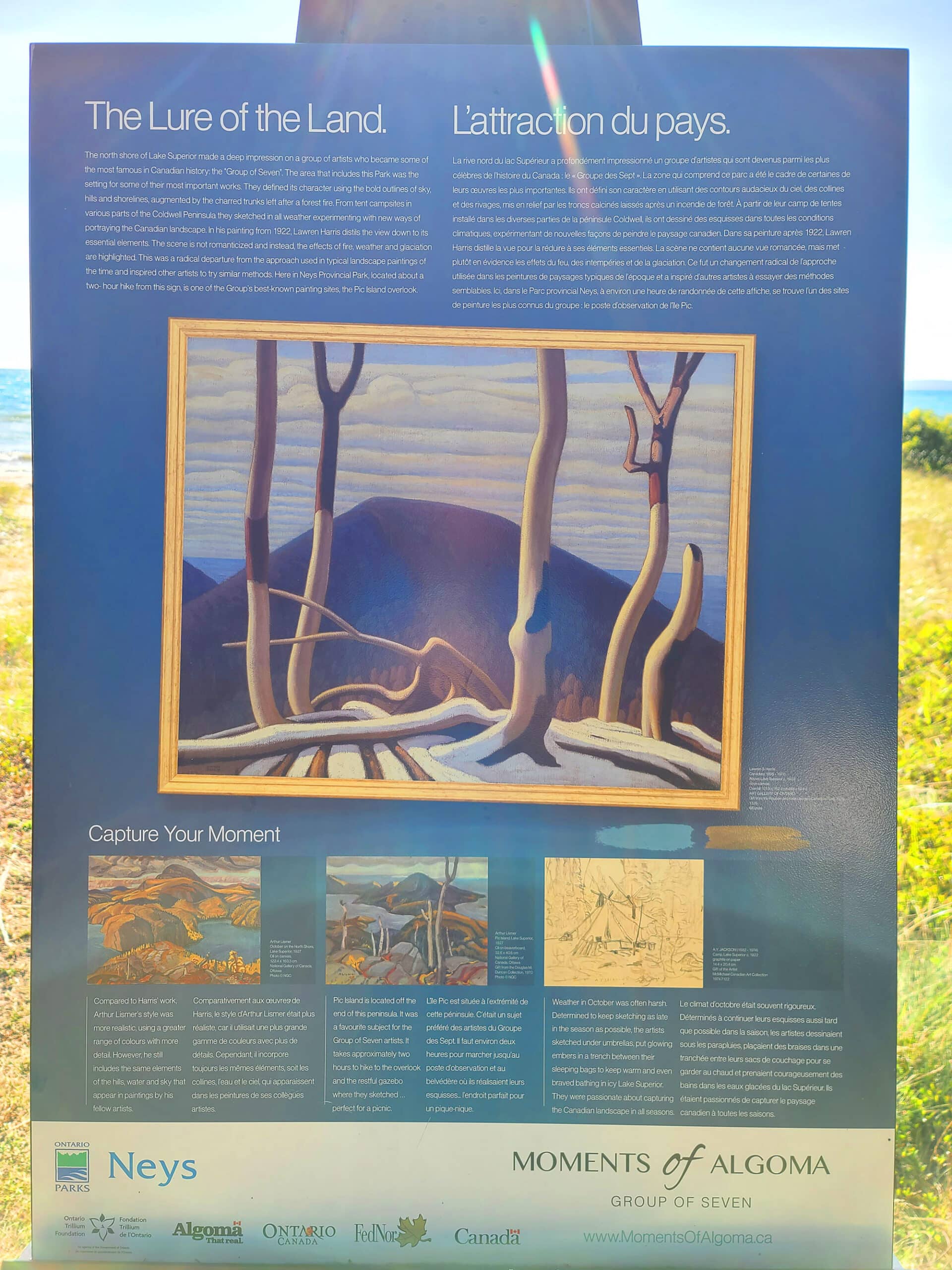
Moments of Algoma
Between the visitor center and the beach is another Moments of Algoma display, much like the one we saw in Katherine Cove in Lake Superior Provincial Park.
This was another easel / artist’s seat display, this time focused on Lawren Harris of the Group of Seven, and how this remote location on the northern shore of Lake Superior influenced his paintings.
Day Use Area
There are 3 picnic areas, one at either end of the beach, and one at the Visitor Centre.
Little Pic River Day Use Area
This is the day use area at the south end of the park (the far end from the entrance).
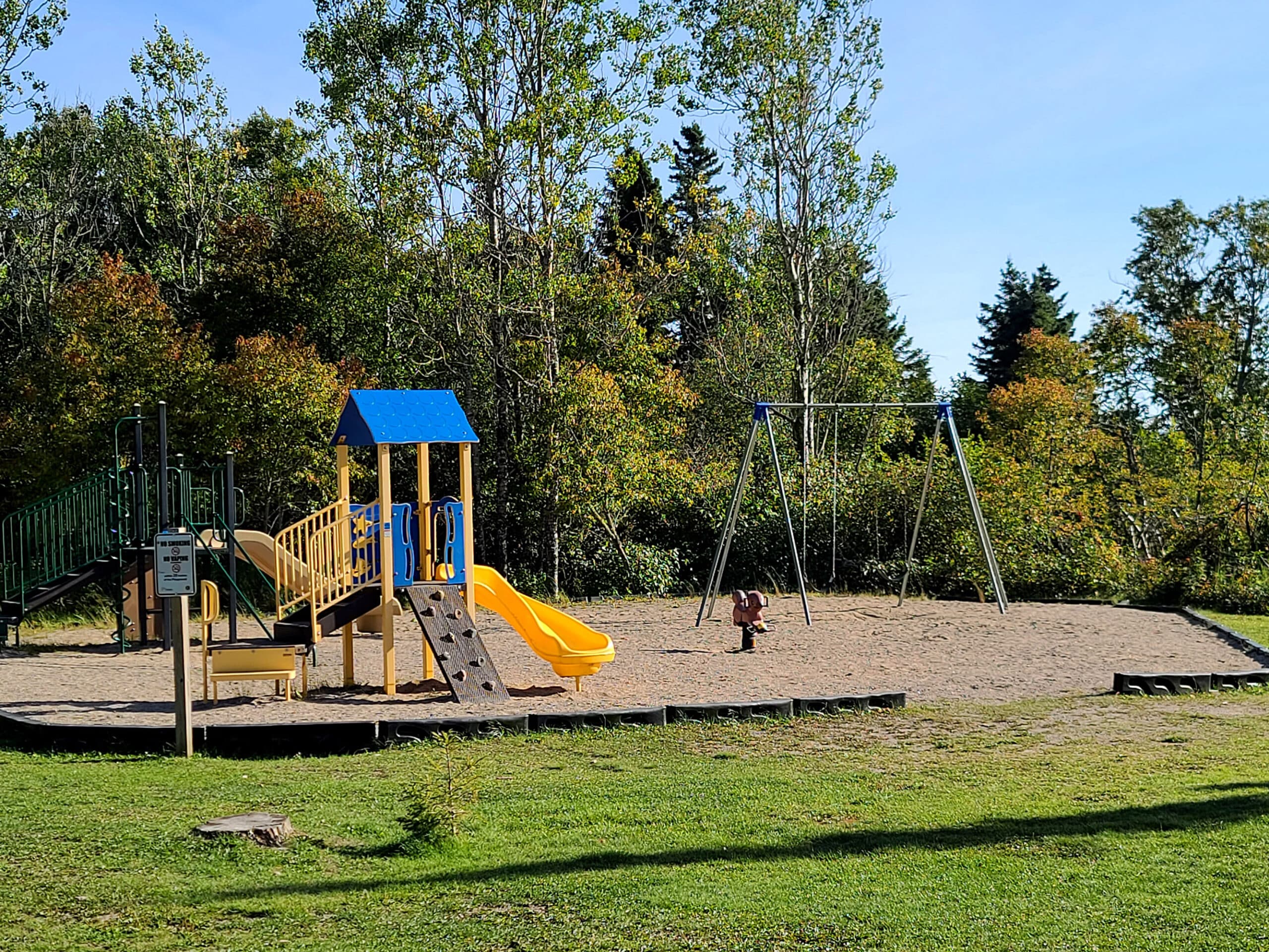
Located near the boat launch, this are has picnic tables and benches - some overlooking Lake Superior - as well as a fairly large picnic shelter that can be reserved.
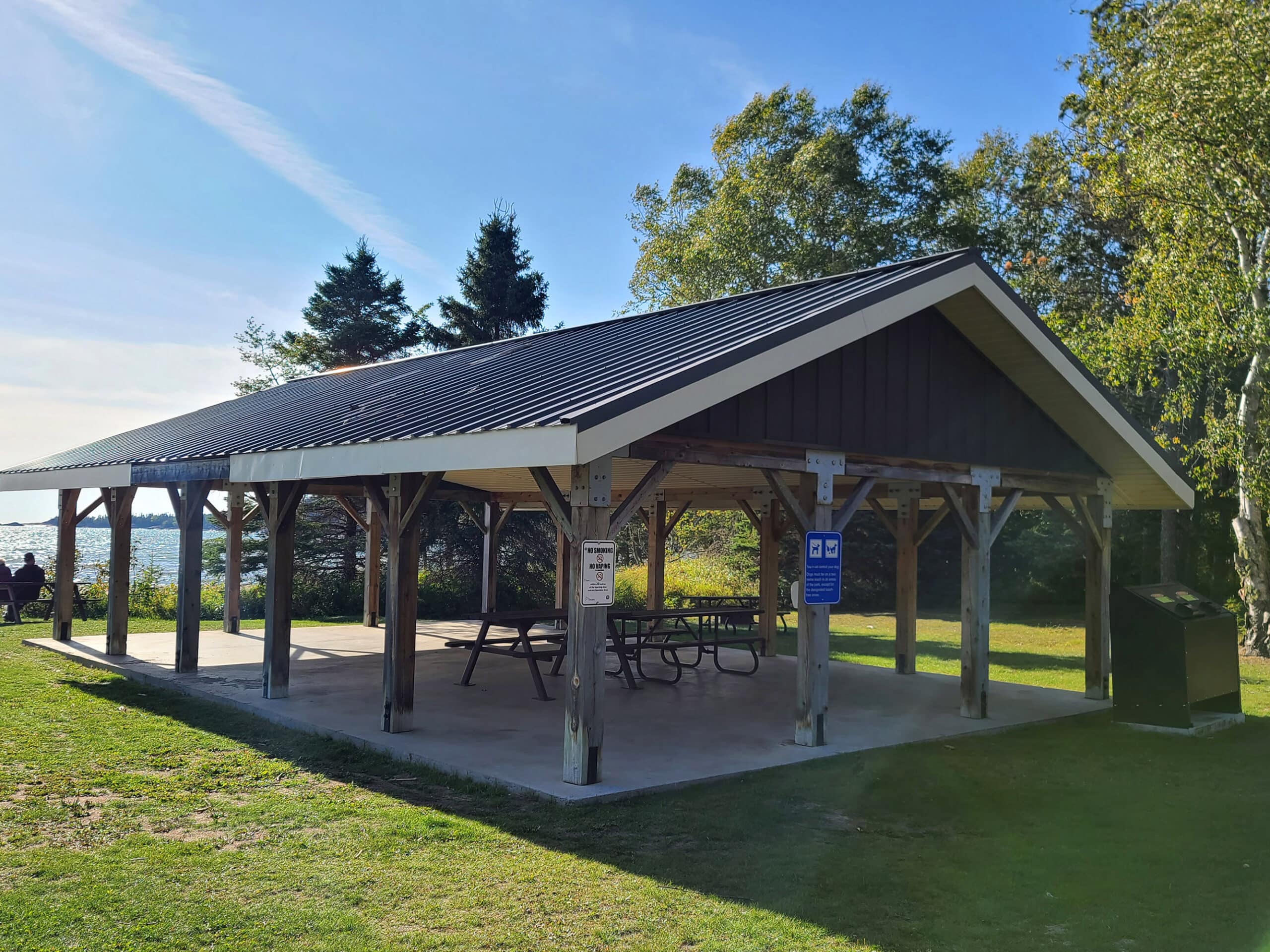
There’s also a playground, next to the picnic shelter.
Anyway, this day use area can be accessed via a parking lot, or via a trail from the Area 3 campground.
Visitor Center Picnic Area
There’s a small picnic area outside of the Visitor Centre, overlooking the lake.
There are picnic tables on a bit of a patio, the Moments of Algoma display nearby, and a cute Lake Trout art piece.

Prisoner Cove Day Use Area
This might be my favourite picnic area, though there are only 2 picnic tables... and those don’t have a great view!
The picnic tables are in a grassy area next to the parking lot, but if you take the short trail to the beach from there, you’ll come to the COOLEST beach area in the park.
Streams sculpt out interesting ridges in the sand, there are cool rocks to climb on, etc.
In 2025, this was where I experienced quicksand for the first time in my life - it was very exciting. Nothing like what the shows from my childhood would lead me to believe, but I DID get sucked down as far as my ankles before I realized what was happening!
Obviously, I had to make Porter go stand in the same place so HE could experience it as well!
Anyway, just a really beautiful spot!

Rentals
Neys has a rack of rental canoes available at the boat launch. Rentals are arranged out of the gatehouse, and include a boat safety kit, paddles, and personal flotation devices.

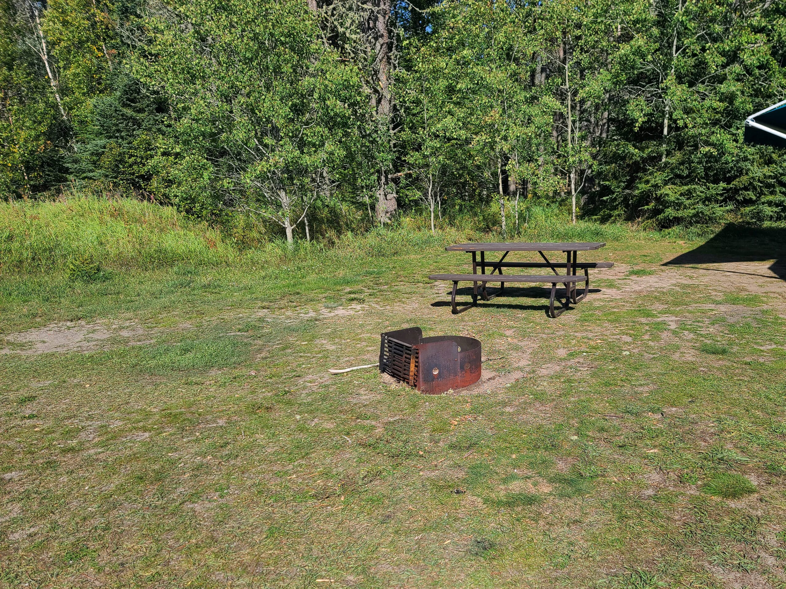
Campsite Details
About half of the almost 150 campsites in the campground are electrical sites, and the posts seem to be fairly close to each site.
(Definitely check your site’s info when booking, though - the estimates for power tower distance are in the site details!)
There are 4 campground areas in Neys Provincial Park, some having a very different vibe and feel than the others.
Car Camping
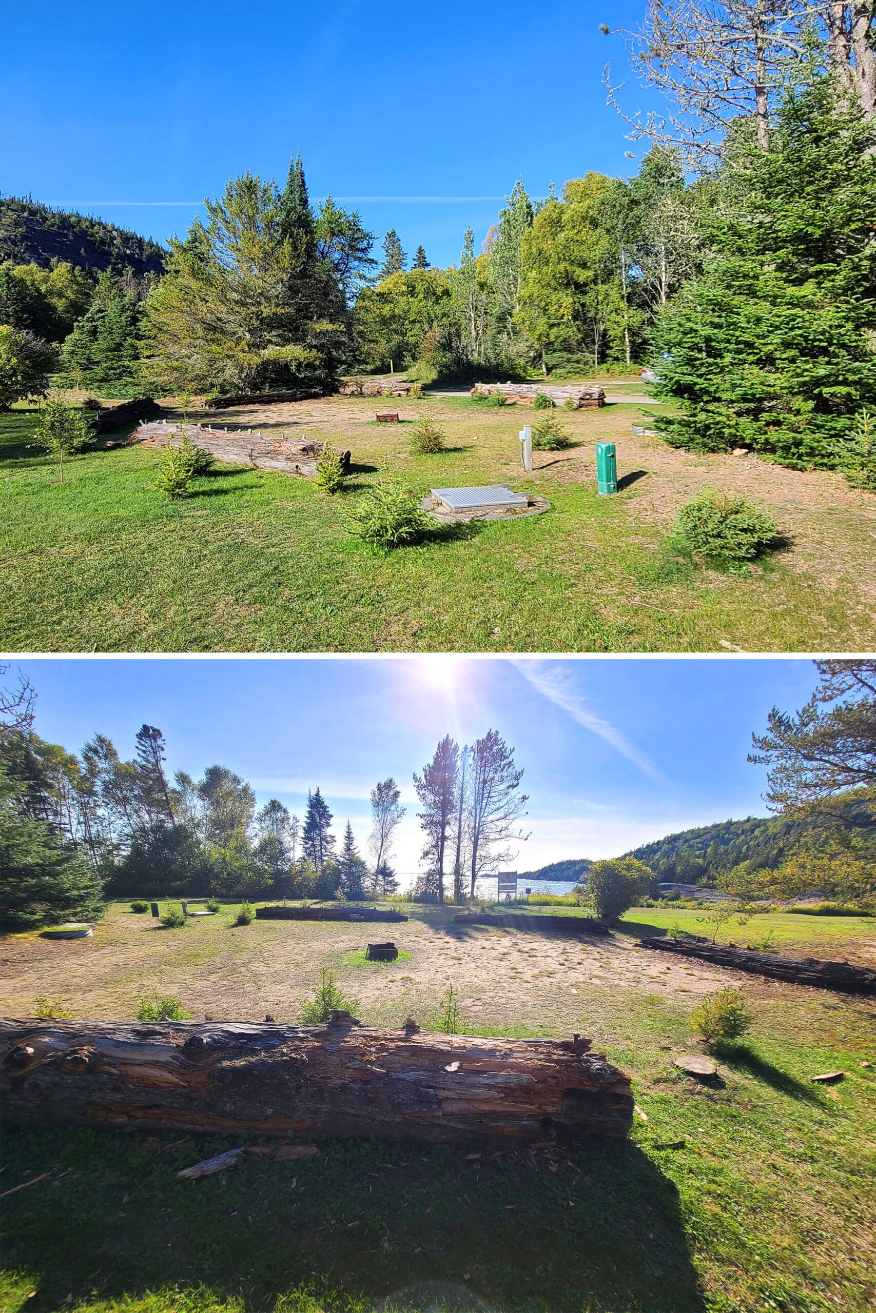
Area 1 is where we stayed on both occasions, and it’s relatively open - there’s some tree cover over the center / back of it, but sparse.
Most of the sites in this area - most of which are pull-through sites - have a decent to good view of the lake, and easy access to the beach.
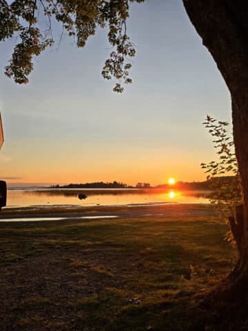
The first time, we stayed in #25, which is on a corner. Very little privacy, but it was surprisingly quiet, given that everyone has to drive by us when leaving. We didn’t even notice!
While our view of the lake was a little more set back than some of the rest in that first row, I think we had a fantastic view overall:
Every time I stepped out of the RV, there was a little momentary confusion. I don’t think we’ve ever stayed somewhere that SO wildly replicated the vibe of another favourite campground.

Area 4 feels way more remote. It’s not on the lake, the road is more rough, etc.
We thought it was probably exclusively for tents, but we did see a couple trailers when we drove through.

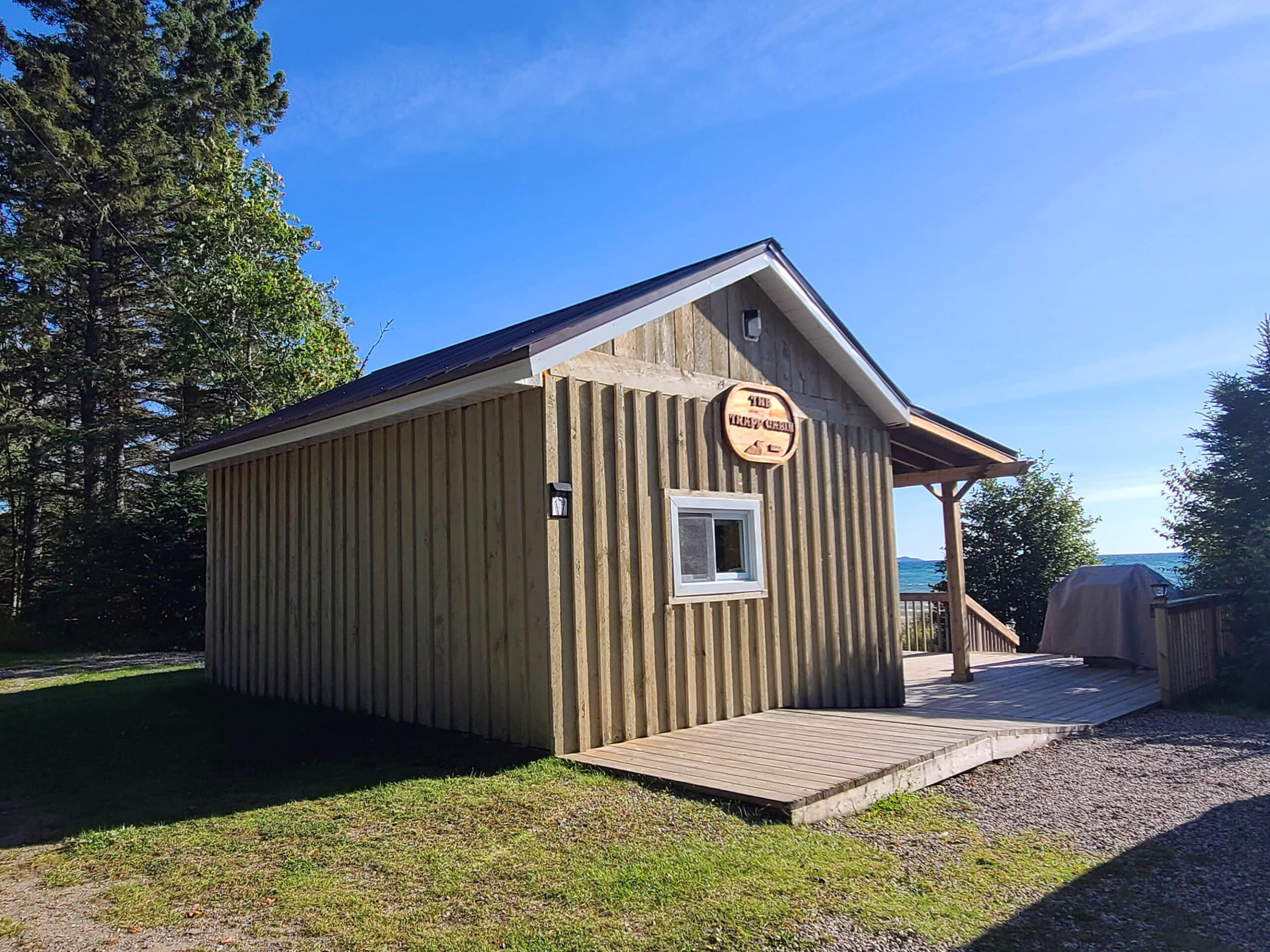
The Cabin
One interesting thing to note is that Neys Provincial Park also has a single cabin for rent. It’s in area 2, overlooks the lake directly, has a grill, and it’s super cute from what we could see!
Apparently they provide everything you need to cook and serve your food on / with, you just need to bring the food itself.
You also need to bring your own bedding, which sounds a bit weird... but also a good idea in general.
Note: Pets aren’t allowed in the cabin or on the cabin site at all.
Share the Love!If you’ve made one of our recipes, be sure to take some pics of your handiwork! If you post it to Bluesky, be sure to tag us - @2NerdsInATruck, or you can tag us on TikTok, if you’re posting video. We're also on Pinterest, so you can save all your favourite recipes and park reviews to your own boards! Also, be sure to subscribe to our free email newsletter, so you never miss out on any of our nonsense. Well, the published nonsense, anyway! |
Entertainment and Activity
There’s a LOT to do at Neys Provincial Park this park, here’s some information on your options:
Hiking
There are several trails in Neys Provincial Park, with various degrees of difficulty. The Neys PP map had a helpful trail insert, laying out the distances and difficulty ratings.
Unfortunately, we only had the evening we arrived to do any exploring, as we were rained out the rest of the trip. We only got to do one trail 🙁
Further, I was still recovering from wrecking my landing knee during our hikes at Lake Superior Provincial Park. So, we decided early on that IF I was going to do a trail, it should be short-ish and marked easy.
Anyway, here are our thoughts on the trail we did, and some general info about the options we were not able to check out personally:
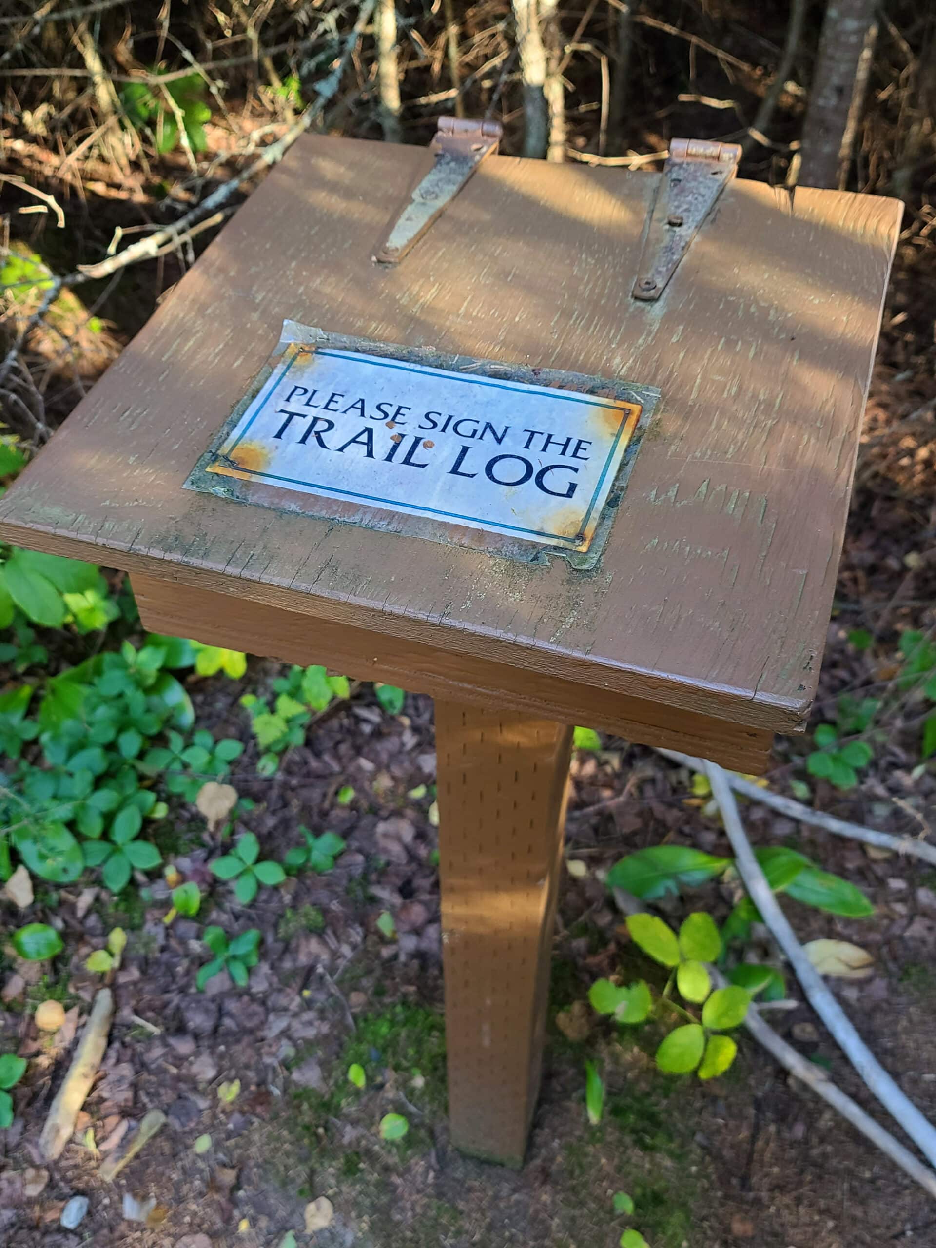
Point Trail
This is a 1 km linear trail (so 2 km total), one of two advertised as being “Easy”. The description made it sound more interesting to us than the other easy one, so it was our choice.
We did it as a quick walk between setting up at the campground, and having a (somewhat late) supper.
It took us almost exactly an hour - we were walking with INTENT, but did take some time at the end to enjoy the scene and take photos.
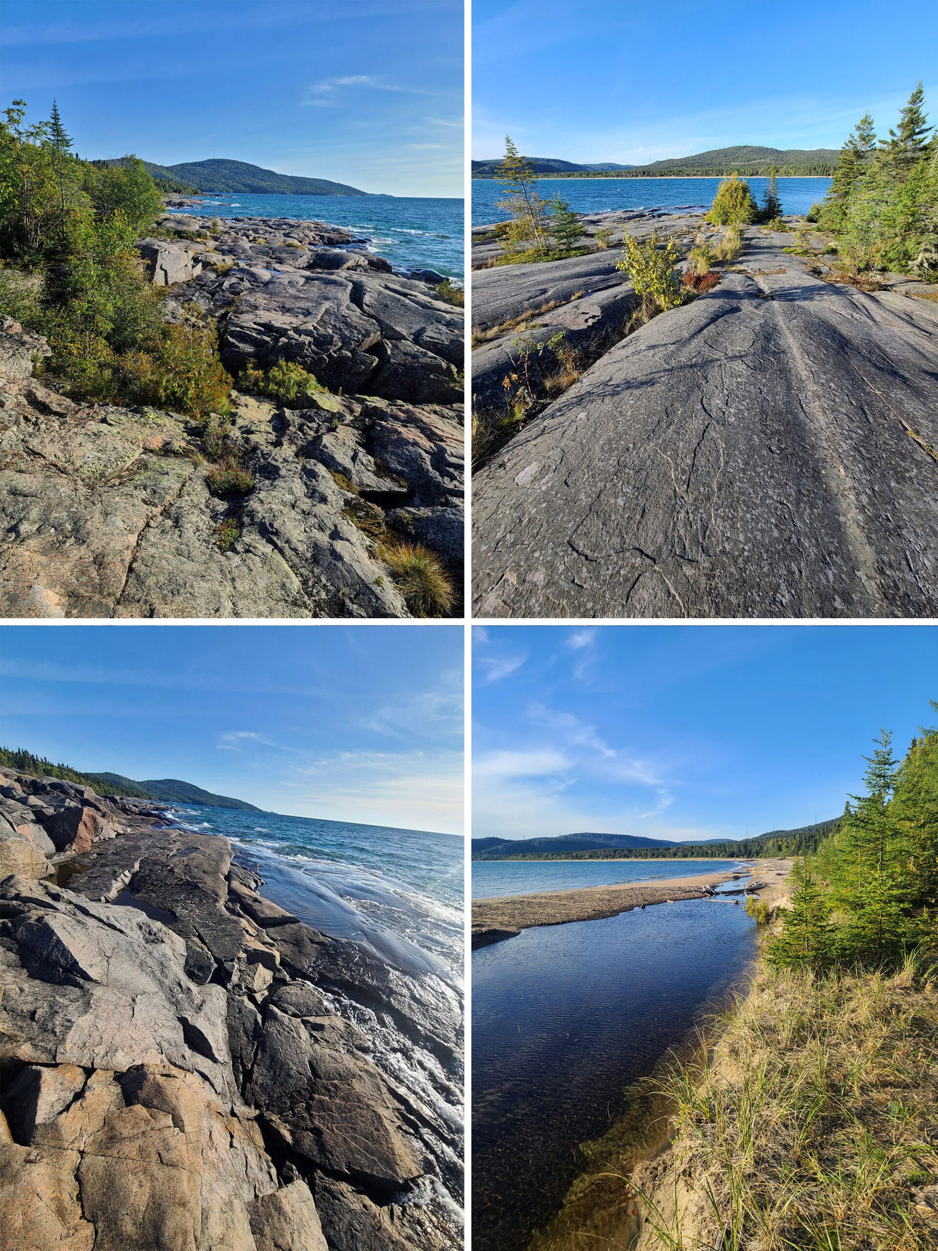
This one started at Prisoner’s Cove, walked past the off-leash dog beach through some woods, opened out onto the rocky shore for a bit, back through some woods, then onto wide open rocky areas overlooking the lake.

It was a fun, beautiful trail with a wide variety of views. In the wooded areas, the trail was lined with various types of sub-arctic plants that we haven’t seen on other trails we’ve done.
This is the furthest north we’ve camped so far, though... so that tracks.
Anyway, I’d say that their “easy” designation was a lot more accurate than the “easy” designation we ran into at Lake Superior Provincial Park, LOL!

Dune Trail
This is the second of two trails marked as easy, and it’s a 1.3 km loop, accessed from the main road - sort of across from the Prisoner’s Cove area.
As the name implies, this one’s all about sand dunes, and sand dune vegetation. The trail info suggests that it’ll take 30 minutes to walk it.

2025 Update
Porter ended up doing this trail in 2025, here’s what he had to say about it:
“This trail is a skinny loop, totaling 1.3 km. It starts and ends going through a replanted pine forest (they're all in rows), I'd say a little more than half the trail is through this area. This zone is an easy trail, very flat, very few tree roots.
The back half of the trail is more of an older boreal forest, blanketed with flowers and lichen.
A lot of this zone is easy, but there are multiple small areas of moderate trail - a short steep hill, a short section of boulders, some tree roots in the way.
The back half is definitely the better portion of the trail, overall I enjoyed the quick walk through the forest.”

Lookout Trail
This was the trail I was originally considering doing, before blowing out my knee.
It’s a 1.6 km loop, rated as moderate and with a suggested completion time of an hour. It’s accessed via the far end of the Area 4 campground.
This one says it takes you up over scenic rocky areas, overlooking Lake Superior. The trail is supposed to wind through dense forests, a shaded valley, sand dunes, and more.
Rocks, scenery, and variety! Augh, wish I could have done this one!
2025 Update
Porter ended up doing this trail in 2025, here’s what he had to say about it:
“This one starts out as a lovely walk through the forest, then suddenly turns really cool. A short wood bridge leads to a wall of rocks with a tiny flow of water cascading down one side. The path is directly up the pile of rocks!”

The lookout isn't labeled, but it's pretty clear where it is, from its great view of the forest and lake in the distance.”

This trail keeps changing, and fast, which really keeps it interesting. This is definitely a trail I would like to do again.”

Under the Volcano Trail
This is the first of a series of more difficult trails that stack onto the Point Trail.
The trail head for this linear trail is at the far end of the Point Trail, and it ends where Copa Cove trail begins.
This section of trail is 2.5 km in length (so 5 km return), is supposed to take 2 hours to do, and is rated “difficult”.
It takes you out along the Lake Superior coastline, with a focus on geological formations, and the history of glaciers and volcano activity in the area.

Kopa Cove Trail
This one starts at the end of the Under the Volcano Trail, and can continue on to the Pic Island Overlook trail.
The Kopa Cove section of the overall trail is 2.6 km long - or 5.2 km return. It’s rated “very difficult”, and is supposed to take 2 - 2.5 hours to complete.
It takes you across a rocky beach and a steep climb, ending at an overlook point with a view of Thompson Channel and Pic Island.
Pic Island Overlook Trail
The final trail in the long series of more difficult trails, this one is 4.5 km long / 9 km return, and rated difficult. This section is supposed to take 2.5 - 3 hours to do.
It’s described as a dirt road that takes you up to a Pic Island overlook, with a spectacular view of the Island.
Apparently this particular view inspired the Group of 7's Lawren Harris.

Biking
Bikes are allowed on the park roads - which are fairly rough - but not on the trails.

Swimming
Campground Areas 1, 2, and 3 are fronted by a 2 kilometre beach , said to be one of the finest sand beaches along Lake Superior’s north shore.
This section of Ashburton Bay is relatively shallow, so the water apparently warms up a fair amount in the summer.
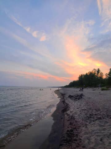
It was cold enough during both of our stays, that our enjoyment of the sandy beaches was limited to sitting and watching the waves, while enjoying a gorgeous Lake Superior sunset.

Swimming is also available in Little Pic River... not a super attractive option, IMHO. Very muddy and murky water during our stays.

Birding, Wildlife, and Nature
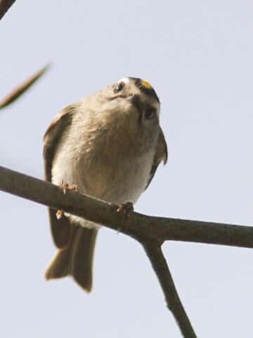
The literature says that the park has birds “typical of the boreal forest”, but our “the birds must hate us” streak continued in this park in 2023.
We saw a single bird, on the road. It mustn’t have gotten the memo that it’s supposed to hide from us, because it clearly DNGAF, taking its sweet time to cross in front of us, absolutely unbothered.
I don’t know what it was, but clearly it THINKS it’s a seagull or Canadian Goose.
Update: It was a Ruffed Grouse. Before even seeing the photo when looking back on this post, we knew from the description what it had been!
During our June 2025 visit, we saw and/or heard:
American Crow, American Redstart, American Robin, Bay-Breasted Warbler, Black-and-White Warbler, Blackburnian Warbler, Black-Capped Chickadee, Black-Throated Blue Warbler, Black-Throated Green Warbler, Blue-Headed Vireo, Brown Creeper, Cape May Warbler, Cedar Waxwing, Chipping Sparrow, Common Raven, Dark-Eyed Junco, Golden-Crowned Kinglet, Hermit Thrush, Magnolia Warbler, Nashville Warbler, Northern Parula, Ovenbird, Pine Siskin, Red-Breasted Nuthatch, Red-Eyed Vireo, Ruby-Crowned Kinglet, Ruffed Grouse, Song Sparrow, Swainson’s Thrush, Swamp Sparrow, Tennessee Warbler, White-Throated Sparrow, Yellow-Rumped Warbler, Yellow Warbler.
We also saw a LOT of butterflies - mostly Canada Tiger Swallowtail Butterflies, with a couple Mourning Cloak Butterflies as well.

Row 2: Dark-Eyed Junco, Hermit Thrush
Row 3: Pine Siskin, Ruffed Grouse
We also kept up our streak of finding wild orchids in pretty every Northern Ontario Park we’d been to on that trip, along with other wildflowers.

Boating
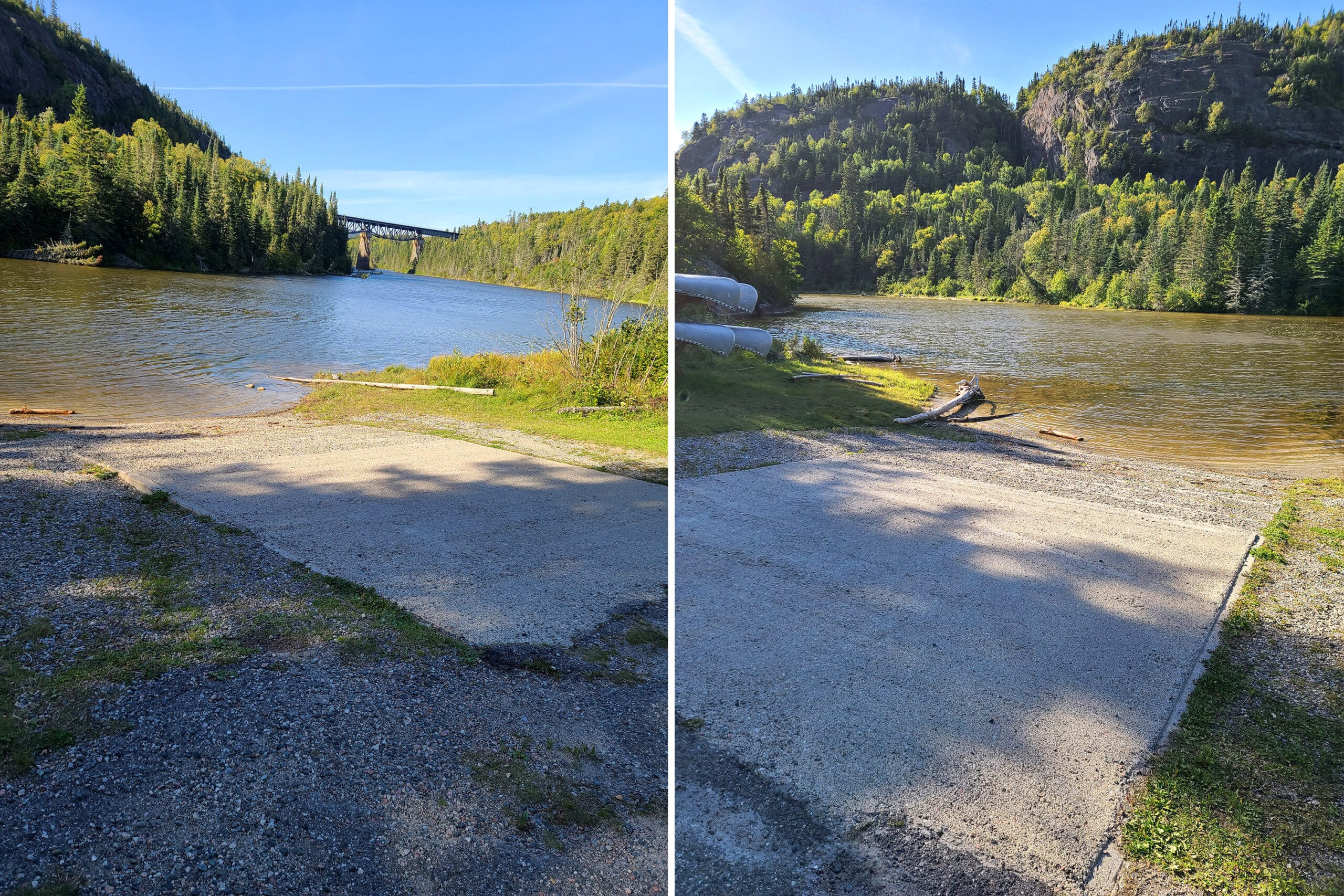
There’s a boat launch onto Little Pic River, in between the day use area and the Area 4 Campground.
I’ll be honest, that boat ramp - as viewed from the road - looked pretty nerve wracking. It LOOKED like you’d have to back your trailer down over a very steep road, directly to the boat launch.

An exit-only road out of the launch area is far less steep than the way in, btw.
If you don’t have your own canoe, the park offers canoe rental through the main gate, complete with paddles, a boat safety kit, and life jackets.
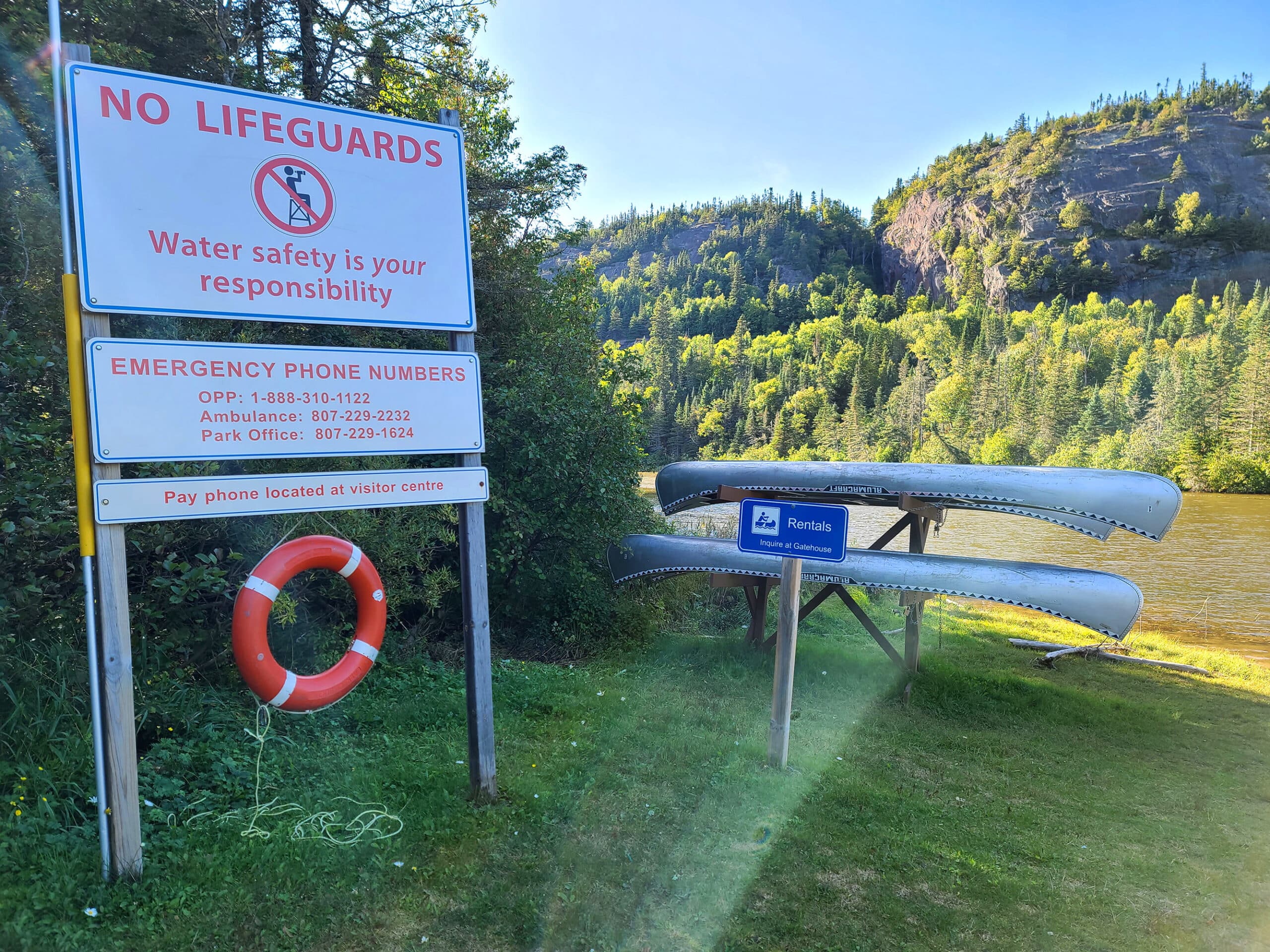
Fishing
If you happen to have some fishing gear, you can use it out on Lake Superior! This area is known for lake trout, rainbow trout, salmon, and whitefish.
There is a fish cleaning station across from the boat launch.

Discovery Program
As with all of the provincial parks we’ve been to, Neys PP has a Discovery Program that it offers during July and August.
This one offers children’s programs, evening talks, guided walks, and even movie nights!
Additionally, they have special weekend events throughout the summer - “Superior Sand and Sun” is one, but another - “Neys Nostalgia Days” sounds WILD.
The description says it “gives visitors a chance to meet the spirits of the past including the prisoners-of-war who once stayed in this remote spot, voyageurs who passed by here, Canadian Pacific Rail navvies, loggers and fishermen.”
Ok, maybe it’s less that it sounds wild, and more that what I’m picturing is wild. I really hope that it involves ghost cosplayers and ~hijinks~.
... Or maybe there’s a seance? “Meet the spirits...” could go either way, IMHO.

Niantic Games
There are only 2 Ingress portals in the park, both located at the Visitor center, overlooking Prisoner’s Cove.
Those are 2 of the 3 Pokemon stops - well, 2 stops, 1 gym. They’re in a tight cluster.
All 3 are in range of campsites 25, 26, and 27 - with the bonus of cellphone reception being generally decent in that area, as well.
We hadn’t known this when we booked - I was more concerned about views and such - but we lucked out and had easy access to all 3, for the duration of our first stay.
Given how rainy it was, it was nice to be able to raid from our bed or dining room table!

Final Thoughts
We were kind of shocked at how much this park had going on for it.
I kind of assumed a sleepy little campground, with a bit of a WWII display, more like a stopover between the larger parks that are a few hours on either side of it.
One of the things we liked - even if not able to take advantage of it this trip - was the stack on, choose-your-own-adventure thing that the one trail had going on.
You don’t have to commit to the whole trail - or any more of it than you feel able to handle- in order to access amazing views and signage telling you some of the geological history and themes of the upcoming trail.
The view from our campsite was gorgeous, too. Aside from the frustration with map inaccuracy and poor signage, everything was great!
We’ll definitely be back - hopefully with a more functional knee, more time, and better weather!

More Northern Ontario Provincial Parks & Places to See
Want to read some more about the parks we've camped and at places we've seen in Northern Ontario? Here are some more posts!
Northern Ontario Campground Reviews:
Aaron Provincial Park
Agawa Bay Campground, Lake Superior Provincial Park
Blue Lake Provincial Park
Caliper Lake Provincial Park
Kakabeka Falls Provincial Park
Lake Superior Provincial Park
MacLeod Provincial Park
Ojibway Provincial Park
Pakwash Provincial Park
Pancake Bay Provincial Park
Pukaskwa National Park
Quetico Provincial Park
Rabbit Blanket Lake, Lake Superior Provincial Park
Rainbow Falls Provincial Park
Rushing River Provincial Park
Sandbar Lake Provincial Park
Sioux Narrows Provincial Park
Sleeping Giant Provincial Park
White Lake Provincial Park
Northern Ontario Places to See:
Aguasabon Falls & Gorge
Amethyst Mine Panorama
Batchawana Bay
Chippewa Falls
Kakabeka Falls
Mink Creek Falls
Old Woman Bay
Ouimet Canyon Provincial Park
Potholes Provincial Park
Roy Wilson Suspension Bridge
Sand River Falls
Scenic High Falls
Temagami Fire Tower
Terrace Bay Beach
Want to explore beyond Northern Ontario? Check out our full list of Campground Reviews, Ontario Waterfalls, and other Places to See.
We also have a ton of Camping Recipes to cook up, while on your adventures!

Thanks for Reading!If you loved this post - or have any questions about it - please leave a comment below! We'd also love it if you would consider sharing the link on social media! |


Leave a Reply