
Scenic Caves Nature Adventures is an amazing adventure park in the Blue Mountains. Here's our review, and everything you need to know, to plan your visit!
This southern Ontario attraction is located at highest point of the Niagara Escarpment, in one of the UNESCO biosphere reserves.
It’s a gorgeous, well maintained attraction offering caves to explore, beautiful scenery to enjoy, and the longest suspension bridge in Ontario, for those looking to take their adventure to – ahem - new heights.
The park offers unique adventures year-round, with something for everyone. Really, it’s a great place for the whole family.
Ever since reading about it a few years ago, I’ve been wanting to go there to experience a few memorable adventures of our own.
Well, except for that bridge.
Porter, however, was ALL about going on the suspension bridge at Scenic Caves - more on that in a bit.
One thing that stood out to us about this property was how gorgeous and well maintained everything was.
The hiking trails were all well groomed, the lawns were immaculate, the washrooms were clean, and everything was just in really great condition.
It really was a series of little things, but the condition of everything - and the care that was put into the property - definitely made for an even more memorable experience!
Anyway, SO much to talk about, so let’s get to it!
A Quick Note on Voice
This post is the first we’ve done, where we’ve both written sections of it independently.
Unlike pretty much every other experience we’ve had, there were parts of our time at Scenic Caves that Porter did completely on his own - the bridge and the caves, specifically.
So, when it comes to those sections, I’ve turned this post over to him, to tell about his experience in his own words.
Hope it doesn’t come off too disjointed, going between “Hell no, I would never go on that bridge” and his raving about what a great time he had on it!

The Basics:
Location Name: Scenic Caves Nature Adventures
Address: 260 Scenic Caves Rd, Blue Mountains, ON, L9Y 0P2
Website: https://sceniccaves.com/
Price: We paid $35 each, but fees vary based on what you want, and when. See the park’s Admission Fees table for more details.
Reservations: The park does not do online reservations, or ticket sales, but allows for gift cards to be purchased.
Registration and Check In
Having never been to the Scenic Caves before, we called in advance with some questions. Friendly, helpful staff provided the answers we were looking for - and then some.
Purchasing our tickets - paper wristbands - was quick and easy, and we were on our way just a couple minutes after entering the building.
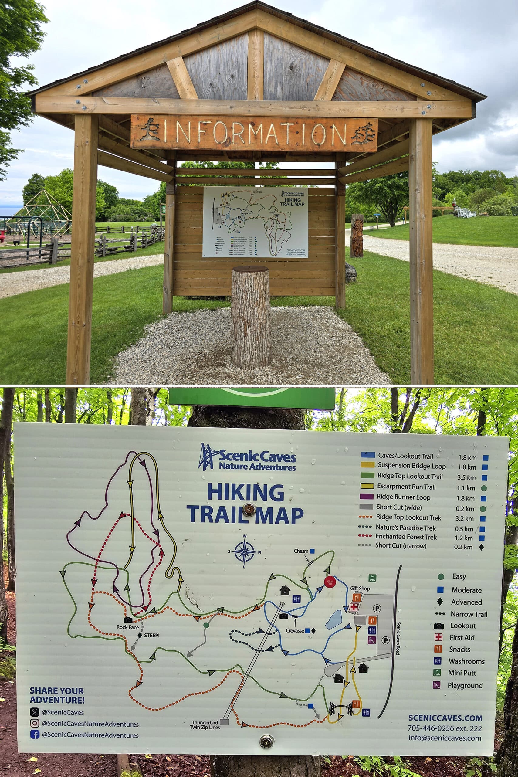
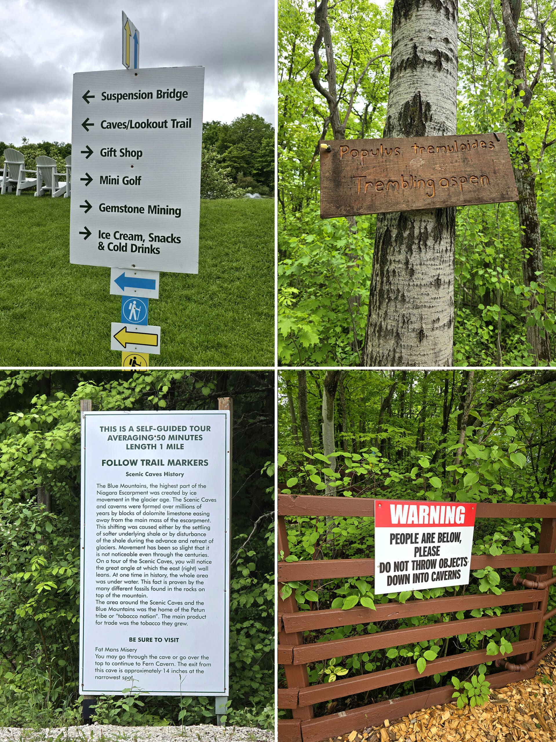
Maps and Signage
This park was AMAZING for maps and signage. We actually geeked out about it a bit on a few occasions.
Park Map
Upon buying your entry wristbands, you’re given a beautifully designed, full colour and glossy map with TONS of information on it.
As a bit of a logistics nerd, let me tell you, THIS is how maps should be done.
Each trail was colour coded, with solid lines denoting wide trails, and dotted lines showing narrow trails. The distance of each trail was clearly marked, as was the difficulty.
BEAUTY!!!
This map was also repeated throughout the park - 2 large sign versions up front, and various smaller ones along the trail, marked to show where you were.
Love it. LOVE LOVE LOVE.
Signage
This is another area where the park absolutely did not disappoint.
The entrances to the two trail openings were very well marked, with colour coded archways. The trails themselves were colour coded the whole way, matching up to the map colours.
There were signs EVERYWHERE! Where you are, where you’re going, directional signs, and what kind of tree you’re looking at.
There were educational signs, both about the nature, and the historical side of the park. In particular, a few talked about the First Nations’ Huron Petun tribe that used to inhabit the area.
There were even signs telling you which shoulder you should lead with, entering the really tight spaces (more on that in a bit).
I will always be in favour of too much - rather than too little - information!
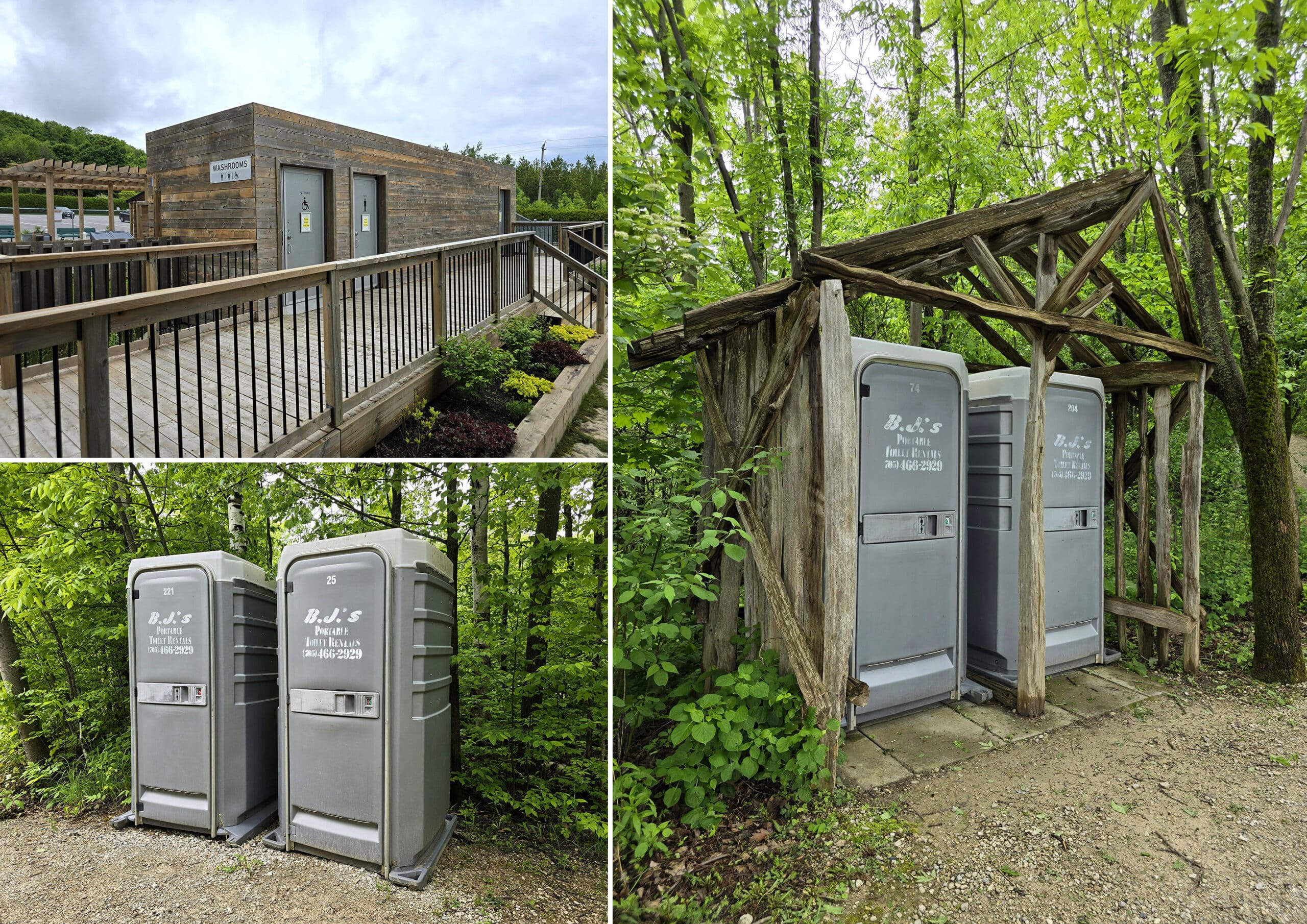
Creature Comforts
There were a few washrooms in the gift shop, then another washroom building outside, near the playground (had a wheelchair ramp).
There were porta potties by the suspension bridge, and at a few places along the Caves and Lookout trail that we hiked.
Actually, now that I look at the map to see if there were any I’m forgetting, I’ve come up with a single complaint about the map - the toilets aren’t listed on there.
From what we saw, though, they’re considerately placed. If the rest of the trails are like the first, I doubt you’ll go more than a km or so without coming across one.
All of the washrooms that we used were clean and in good condition. Really, that’s a running theme of this park: Just really well maintained!
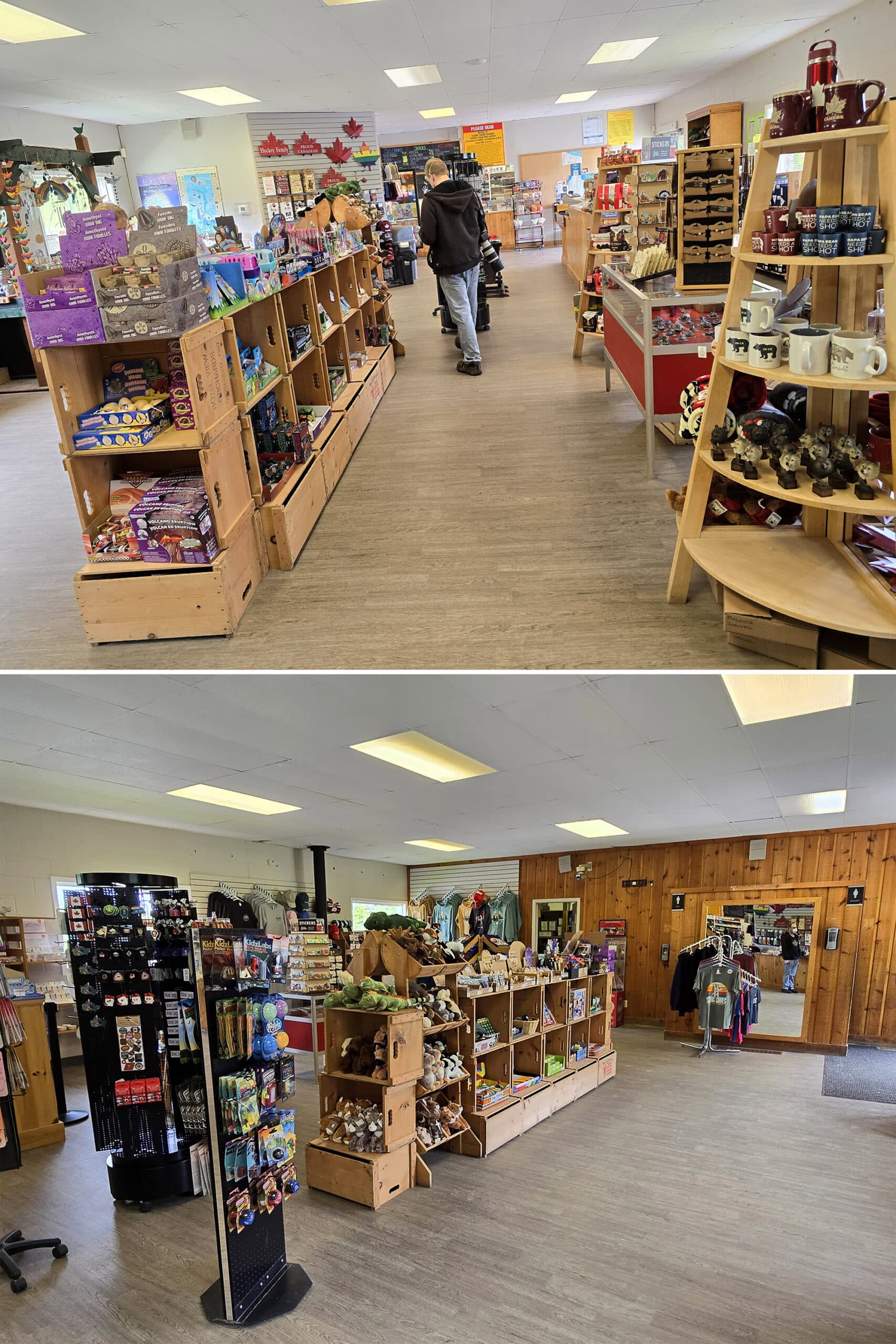
Park Store
You enter and exit through the souvenir shop, and it’s SUPER cute. We definitely spent more money than we’d planned to!
Of particular interest were:
1. Tiny little gemstone mining and fossil dig kits, I think they were only $5 each or so.
2. SUPER cute maple leaf shaped shot glasses.
3. ALL THE MAPLE GOODIES. So much for staying keto in the next couple days, Maple is my *weakness*.
5. Porter got a little tub of gelato. “Salted Peanut and Caramel” - he loved it.
6. A little table with loose gemstones that you could buy individually, or by the little drawstring bag. Super cute - and reasonably priced, too.
There were also t-shirts, trinkets, some souvenir type jewelry, stickers, and all kinds of other stuff. Really nice setup.
Food & Refreshments
There is a little snack bar in the gift shop, some packaged snacks and ice cream sold in the gift shop itself.
Aside from that, there was a little “snack shack” near the suspension bridge. It was closed at the time of our visit.
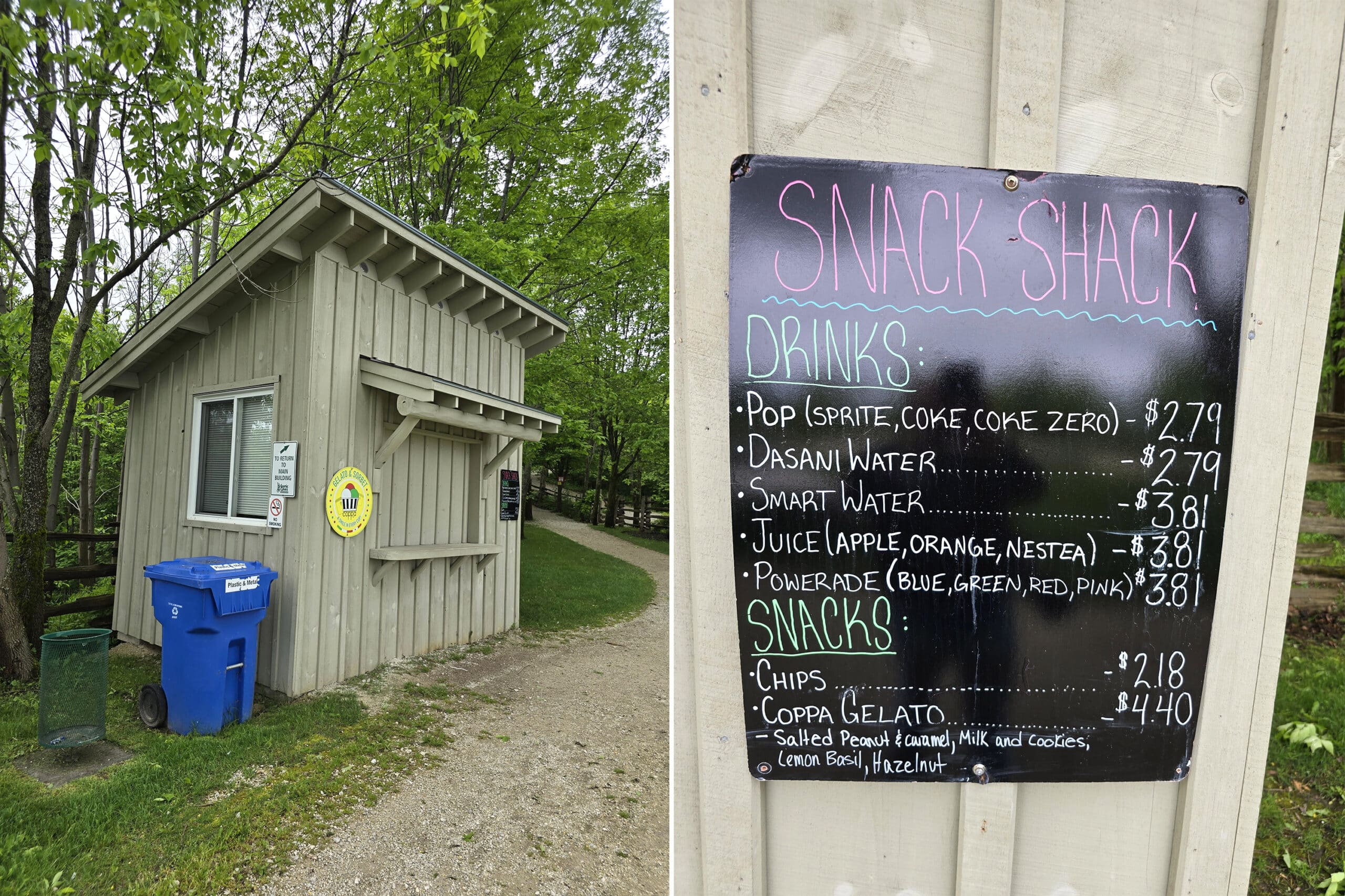
There are a bunch in the big open area as soon as you enter the park, as well as up by the suspension bridges, and along at least some of the hikes.
Connectivity
Due to the way we had to work around my mobility, we actually did have to check our phones a fair amount during the trip.
At the start of our trip, I stayed in the main area, while he quickly went and did the bridge (trying to stay ahead of a school group). We texted back and forth a couple times, no issues.
When he went down into the caves and I took the over-cave trail, we did lose connection briefly.
Other than that, we seemed to have decent to good connection throughout the areas of the park that we visited.
Accessibility
Overall, it’s not a super accessible venue.
The two main paths - that all other trails are connected to - are not wheelchair accessible, and are of moderate difficulty.
I was actually having a pretty good mobility day and was talking big about how MANY of the extra trails we’d be doing, but I had to call it after just doing the Caves / Lookout Trail (Only 1.8 km!!!).
Whoops. I mean, we’ll DEFINITELY be back to see more, but yeah - I was totally unprepared for how intense it was. BIG steep areas, some obstacles, etc.
I’ve gotten pretty wild with what I’ve deemed to be OK for a walking boot or cane *for myself*, but there’s no way I would have been able to do that trail with anything more than maybe an ankle brace.
... and really, if I was in the position of needing one at the time, it probably wouldn’t be a great idea to do that trail.
Per the park, there are 2 accessible parking spaces in the parking lot, and the fish pond, gemstone mining, gift shop, picnic area, and snack bar are the only real options for those with mobility impairment.
Pets
Pets aren’t allowed at Scenic Caves Nature Adventures.
Parking
There was a relatively large parking lot just outside of the main entrance building, and parking was free.
Share the Love!If you’ve made one of our recipes, be sure to take some pics of your handiwork! If you post it to Bluesky, be sure to tag us - @2NerdsInATruck, or you can tag us on TikTok, if you’re posting video. We're also on Pinterest, so you can save all your favourite recipes and park reviews to your own boards! Also, be sure to subscribe to our free email newsletter, so you never miss out on any of our nonsense. Well, the published nonsense, anyway! |
Attractions and Activities
There are SO many things to see and do at Scenic Caves Nature Adventures, it would take all day to really detail them all.
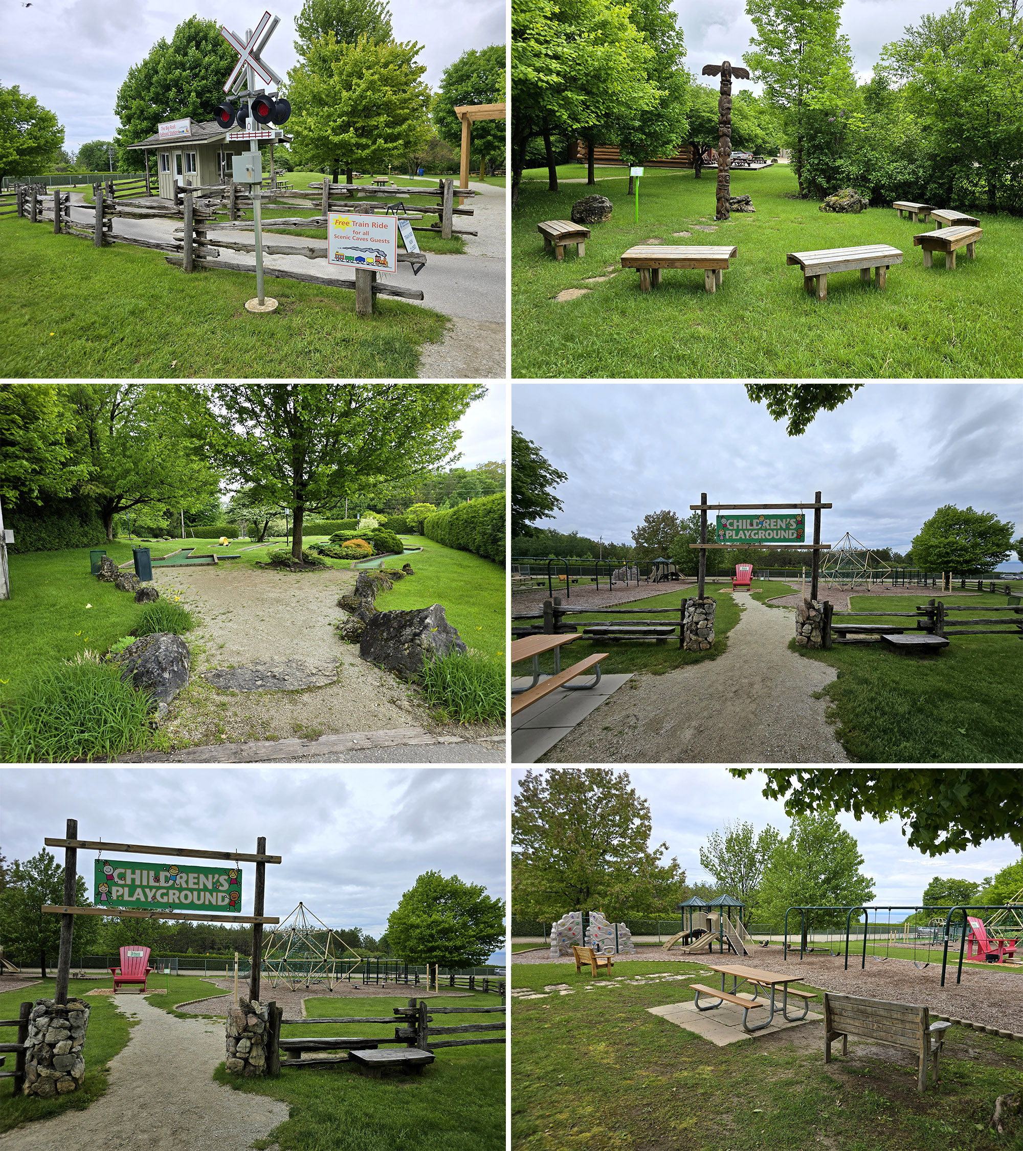
Literally as soon as you enter the park through the gift shop, you’re surrounded with picnic areas - and well maintained garden like spaces - a children's adventure playground, a trout pond, and even a super cute mini golf area.
... but these are really all just additional features, IMHO. Let’s get to the meat of the main attractions of the park:
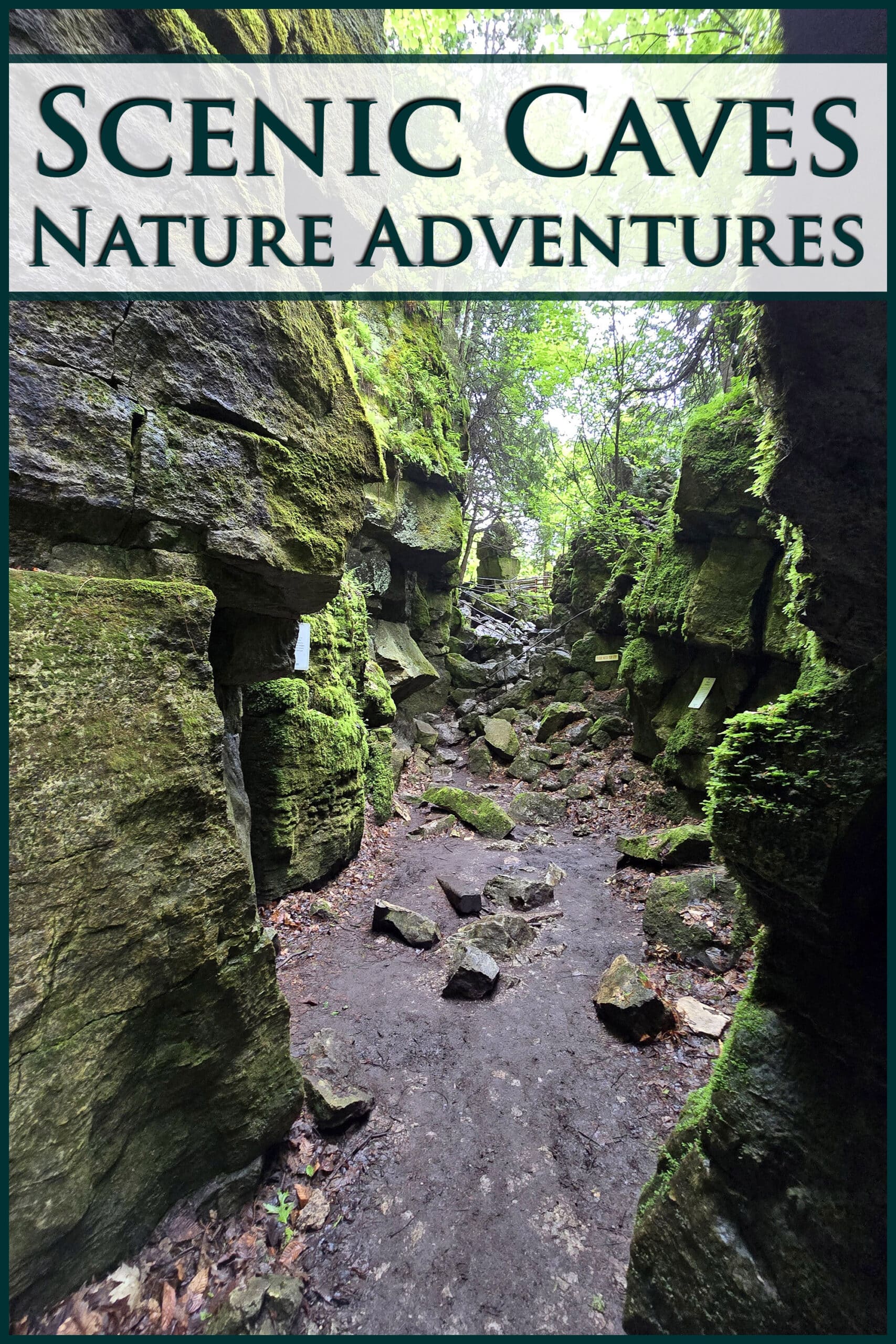
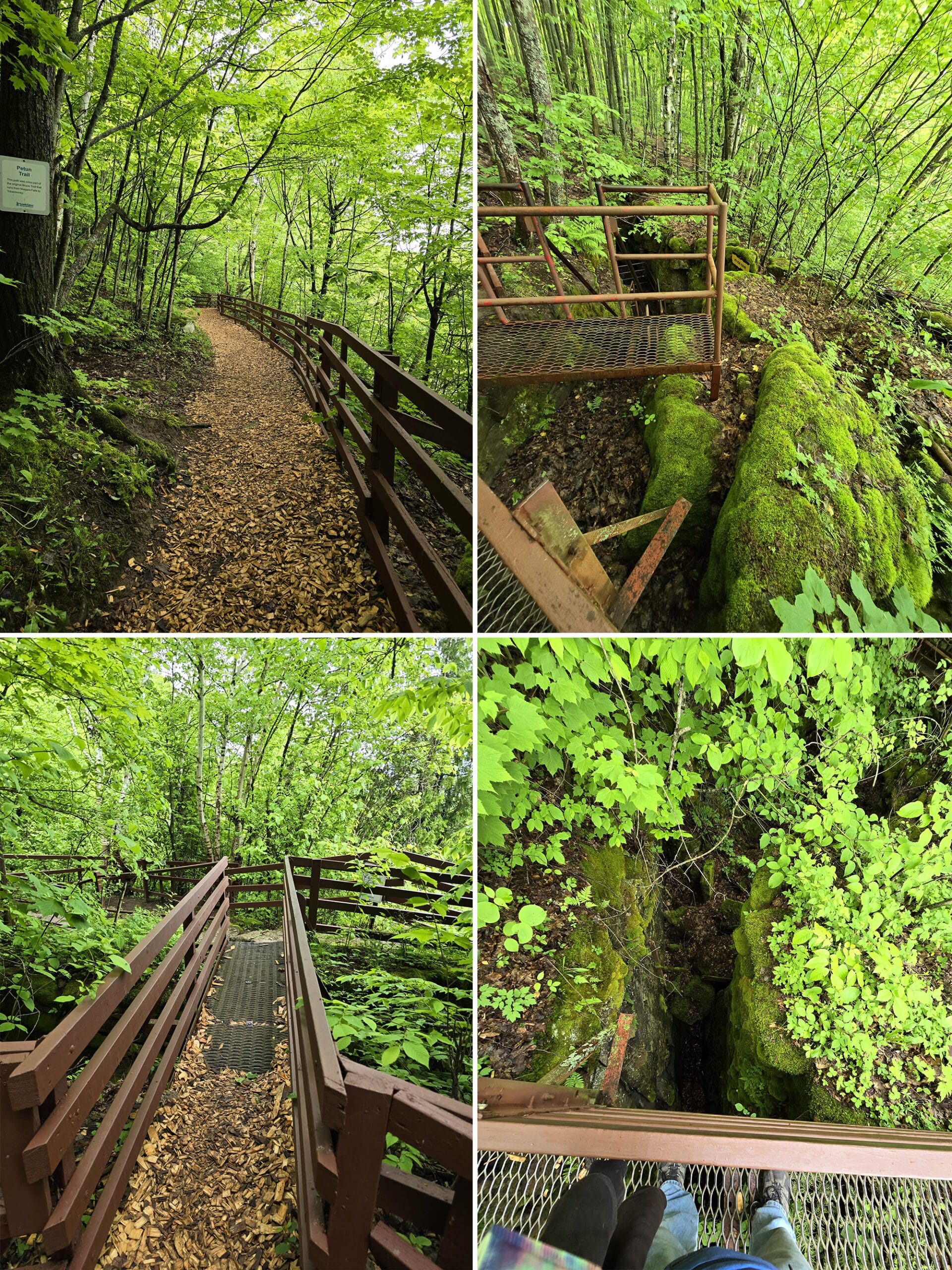
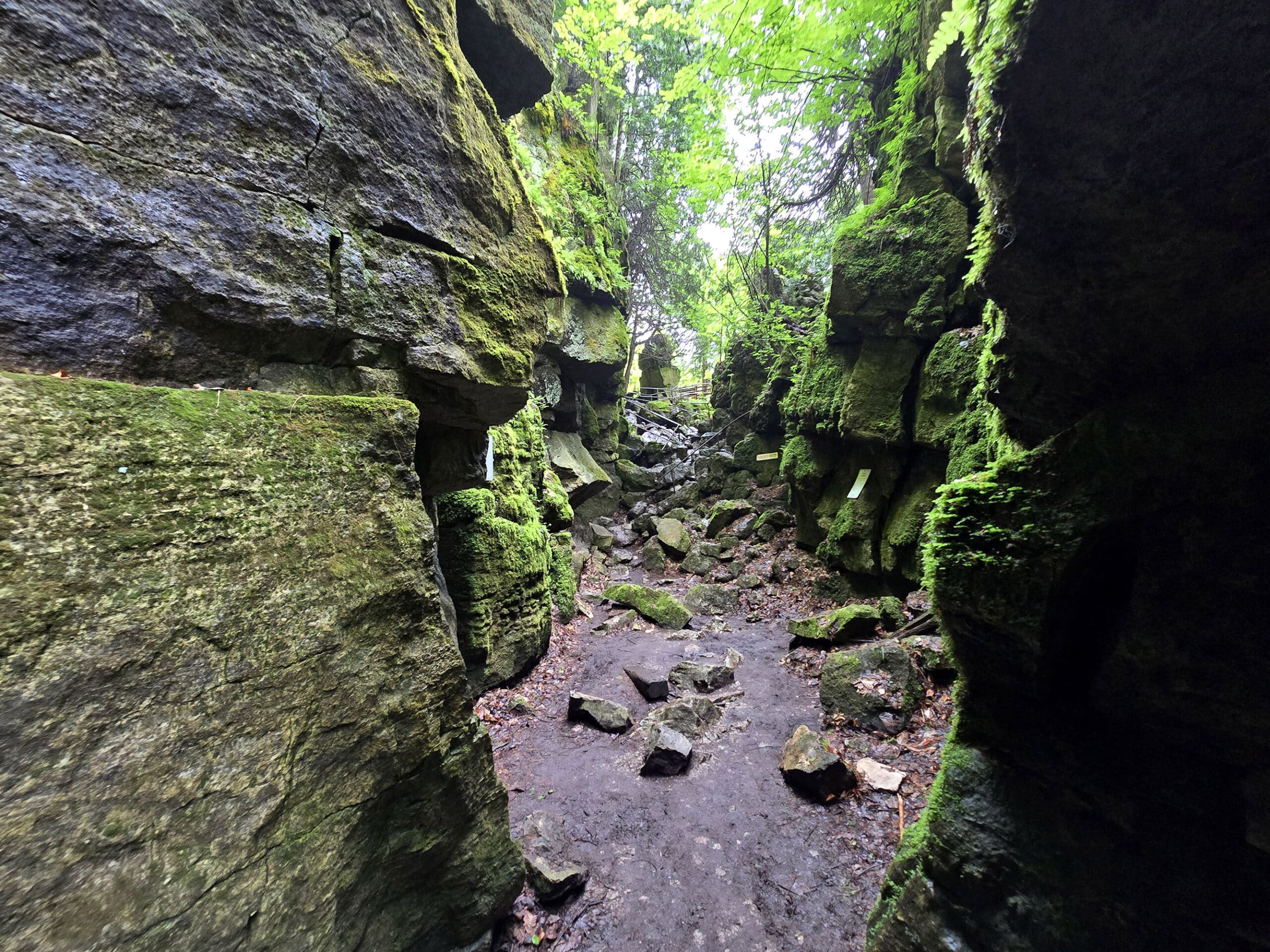
The Caves
The rock formations at Scenic Caves form a network of caves, as well as crevices and cool rock walls. Some areas can be viewed from a distance, some from a viewing platform or bridge.
There are a few places you can get INTO, which are the really cool views!
As with everything in the park, there are plenty of signs to allow you to take a self-guided trail of caves on your adventure.
Fat Man's Misery
This is their term, not mine. This is the BIG cave attraction in my opinion, one you won't want to miss.
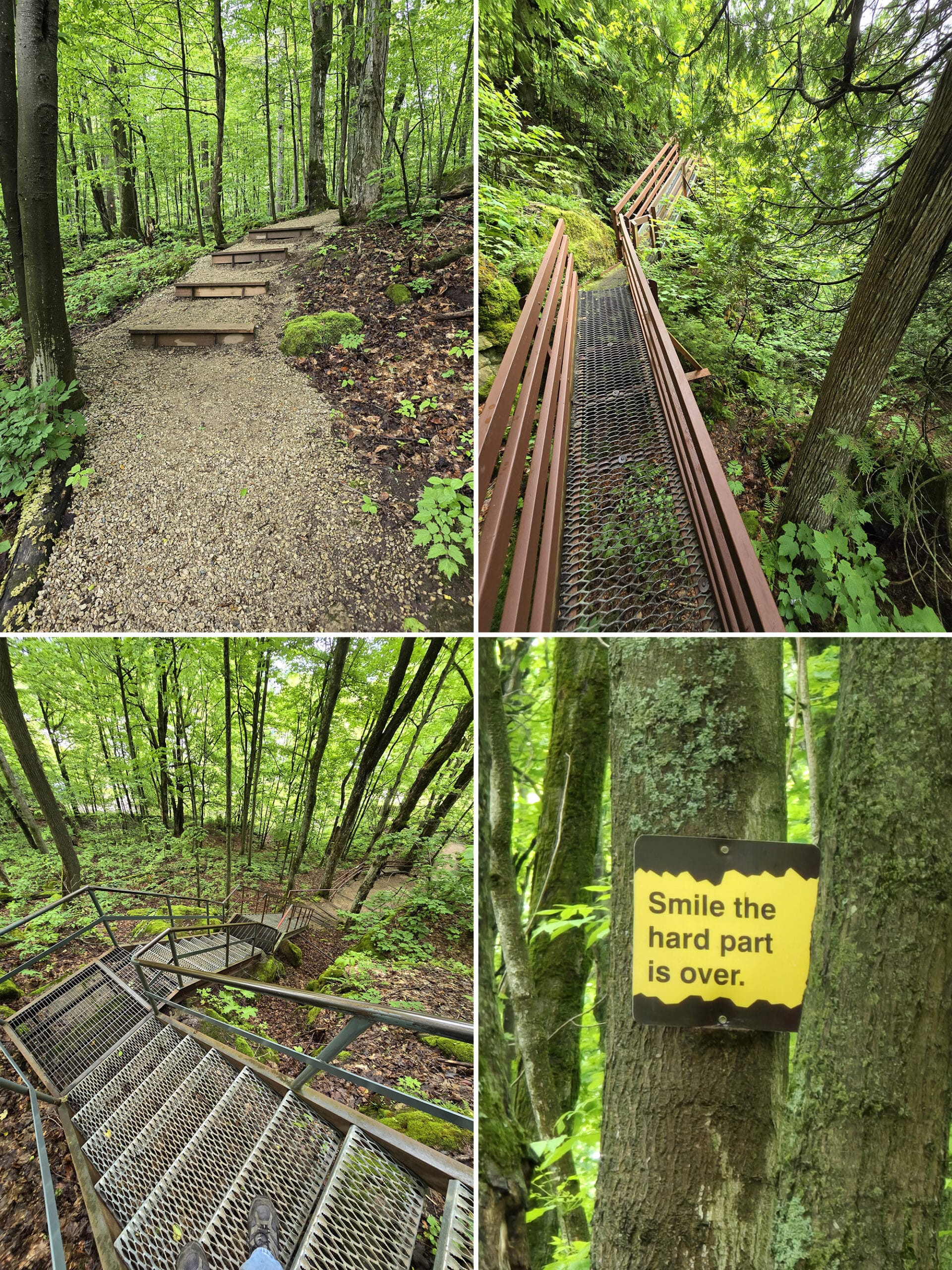
The name is due to the very small exit that you have to squeeze through. I'm going to walk you through this one to give you a sense of being there.
Your spelunking adventure begins with a narrow but sturdy metal staircase descending between two rock walls. Moss covers the rocks as it does everywhere in the park, giving a welcoming bright green scene.
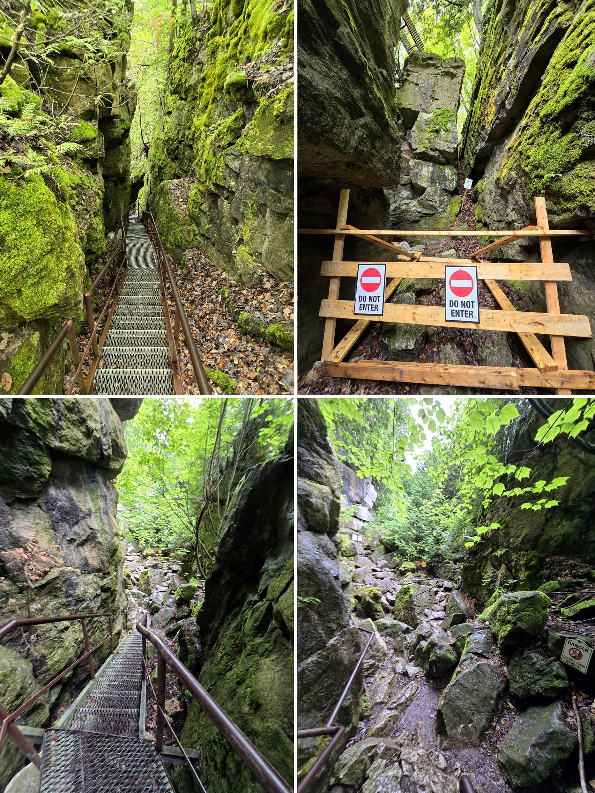
You walk a rough rock path but there are sturdy metal railings to help you on your path. The scene looks like something out of a video game, almost fake looking.
The path is clearly laid out with signs and railings, but it's not an easy path. You then face a stairway and a rock path.
The sign indicates the narrow exit of the cave and offers the stairs as a bypass.
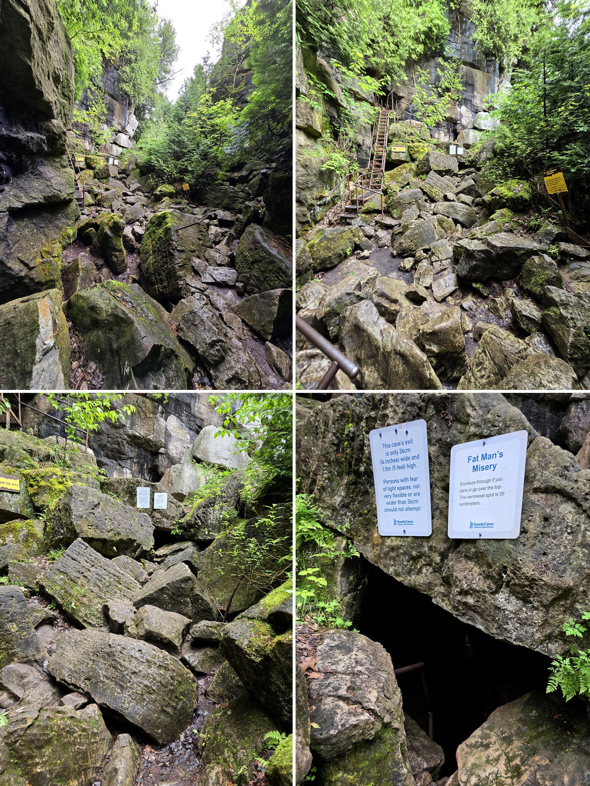
Even the first part is tough, you feed yourself onto a narrow metal staircase and let the ancient caves swallow you up.
As you descend, you see small rocks and little cracks everywhere. It's surreal walking THROUGH rock like that.
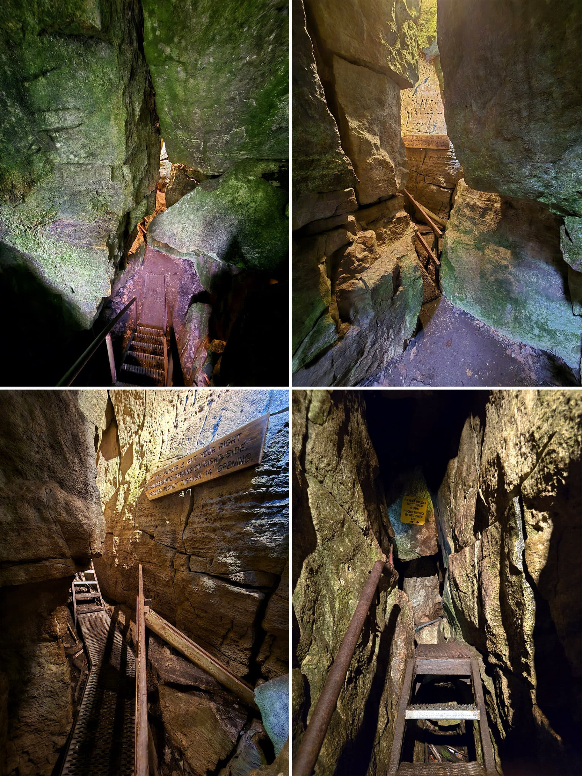
Exiting Fat Man's Misery
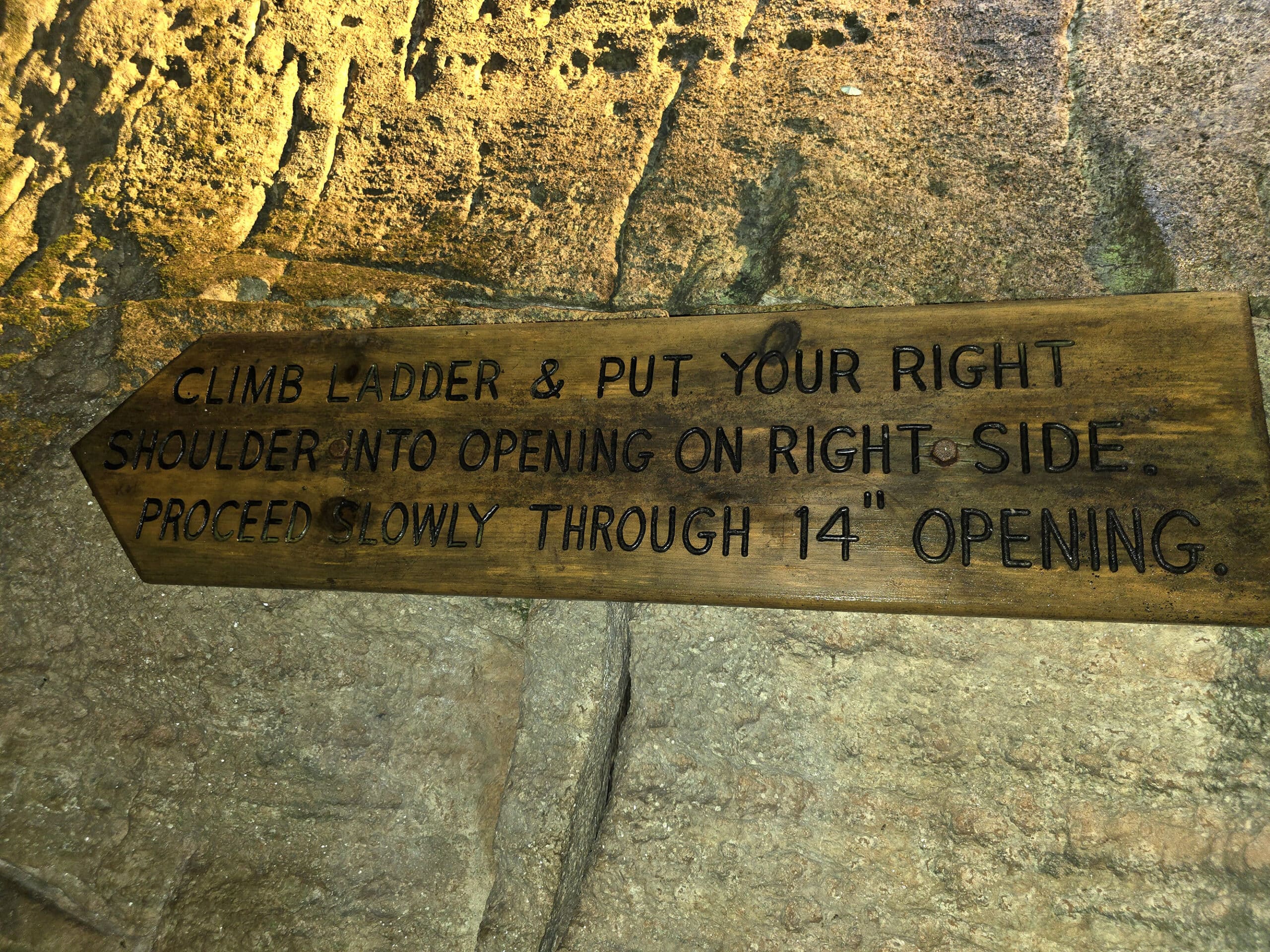
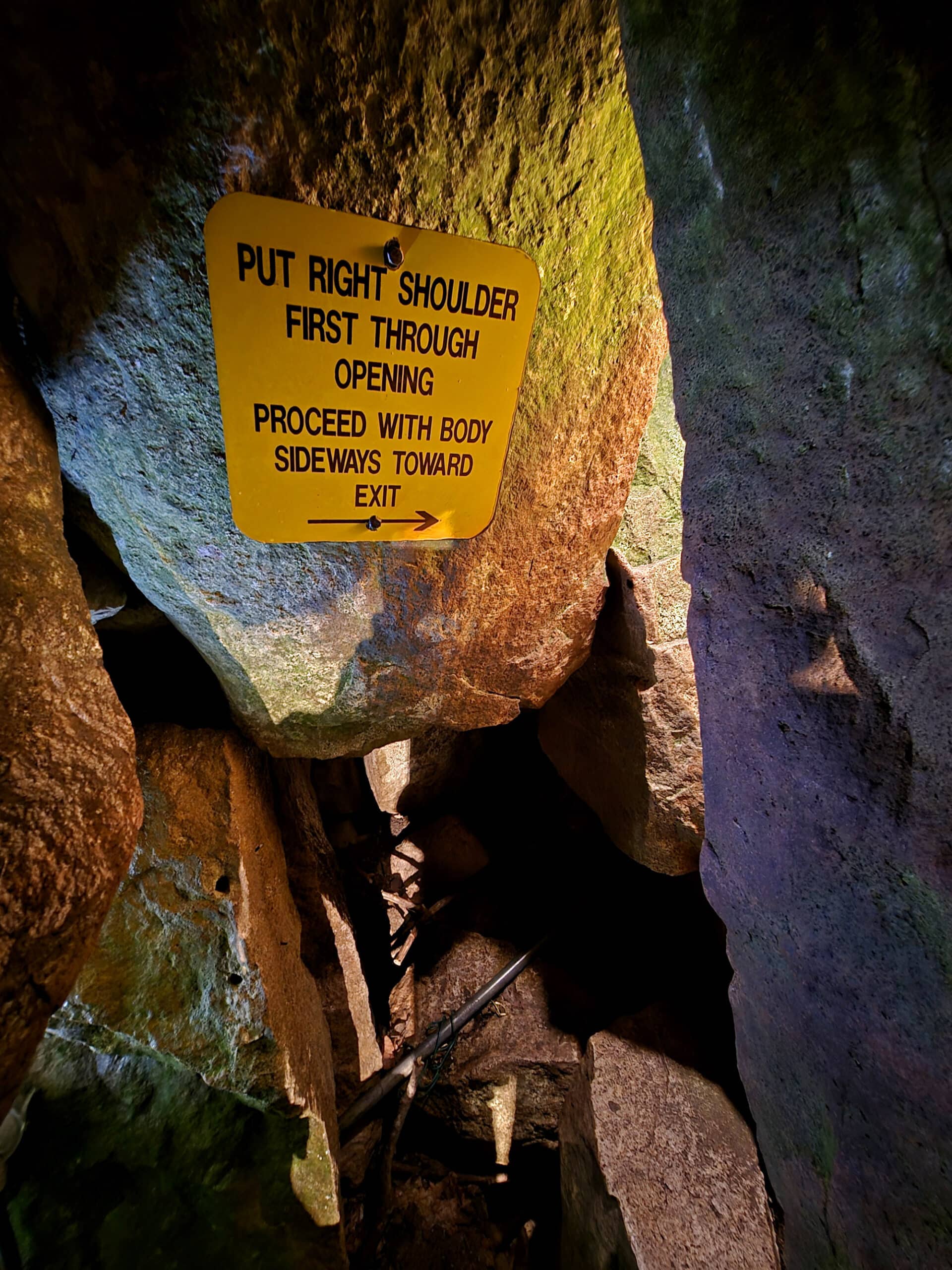
A metal platform guides you to a staircase with a sign that instructs you HOW to exit. Yes, it's important to follow their method!
You need to lead with your right shoulder as you exit.
You see, the 14” / 36cm wide opening that they mentioned before, that's not just a “pinch point” – It's not merely two rocks that have edges 14” apart.
Oh no, you have to shimmy around a curve, and that entire curve is extremely narrow. And short. And you have to climb up a big step while in that curve. Am I selling it here?
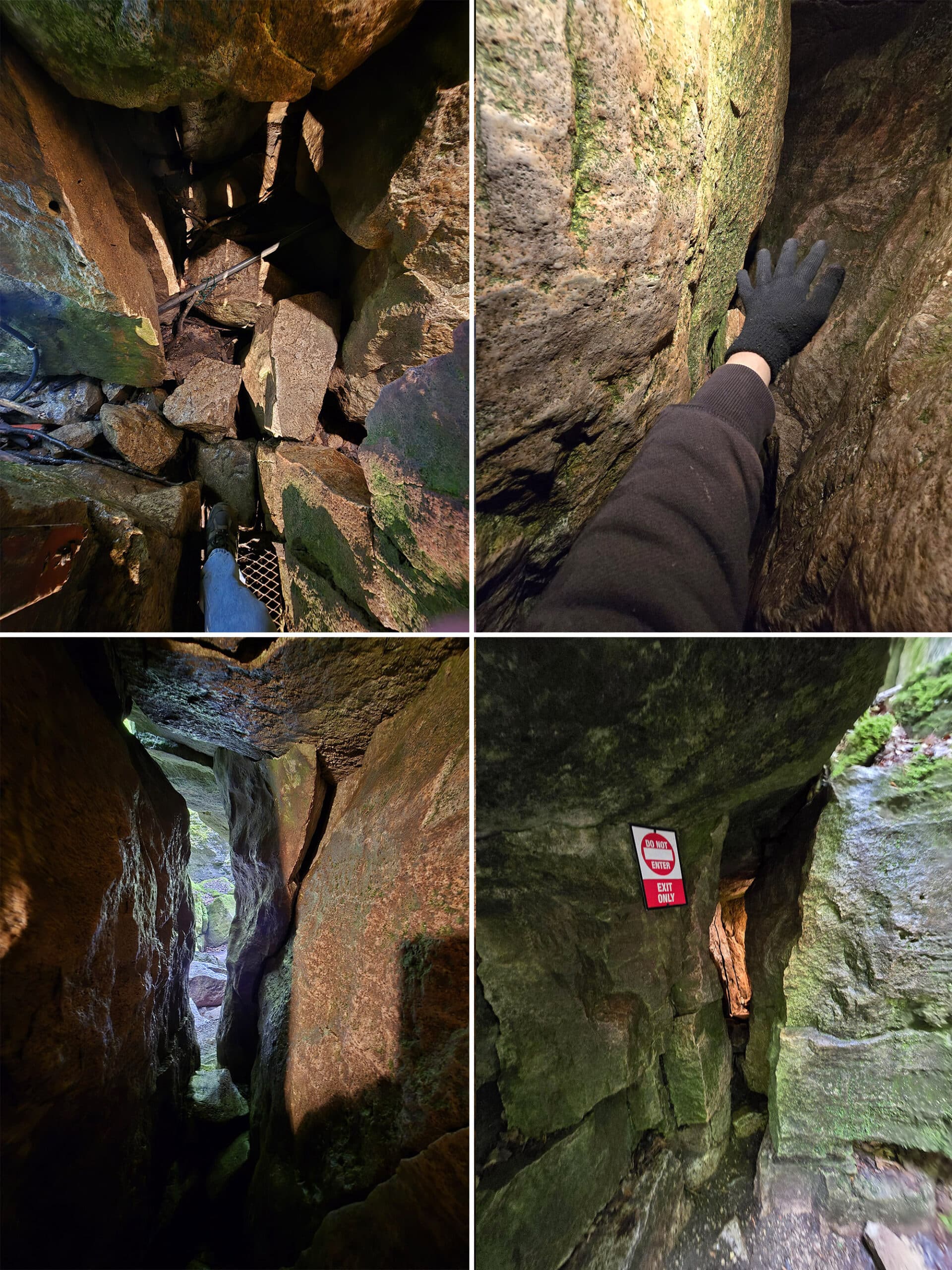
Many people have done it before you, so you know you can do it too! Honestly the hardest part is that big step because it's really difficult to get your leg up that high while squished between two giant rocks.
You squeeze through. You made it! Yay you!
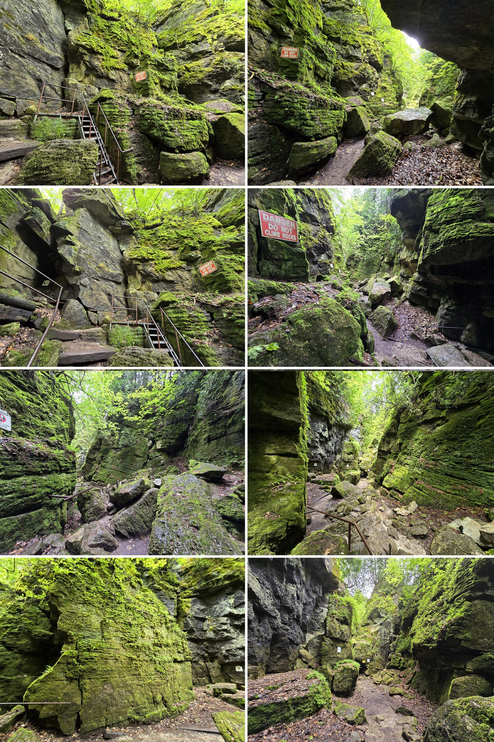
You climb up, rocks and stair cases, open areas and narrow bridges.
More signs describe some of the key formations and their history, such as how they were formed via glacial ice.
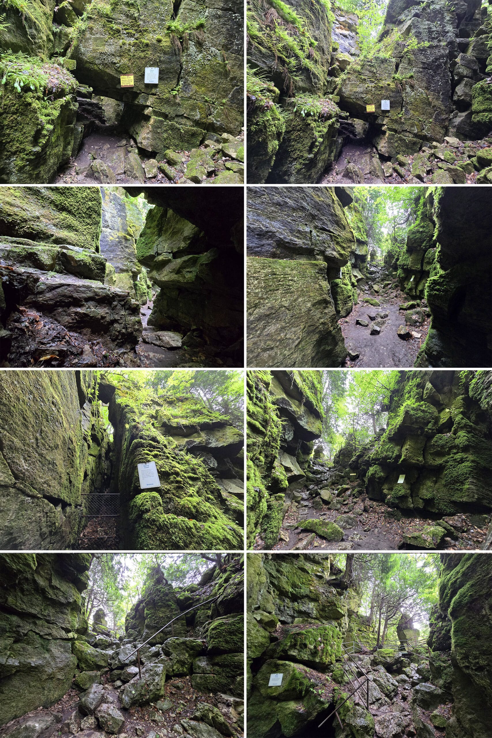
The big adrenaline event, however, is over. Allow yourself time to take in these grand views and slowly make your way back up to the main trail.
Ice Cave
On the Caves/Lookout Trail you'll find the Ice Cave. A sign describes how snow and ice can remain in the cave well into the summer!
We didn't have a lot of snow this past winter, so I wasn't surprised when I didn't see any at the end of May.
There's a narrow steel staircase that descends to a viewing platform. Looking over the edge you can see in to the small cave. They've installed a light to help you see further, which was really a nice touch!
Moss covered rocks are dotted with some fallen leaves but there's not much more to see. I think this would be really cool if there were still ice in it, you can feel the temperature drop as you descend the stairs.
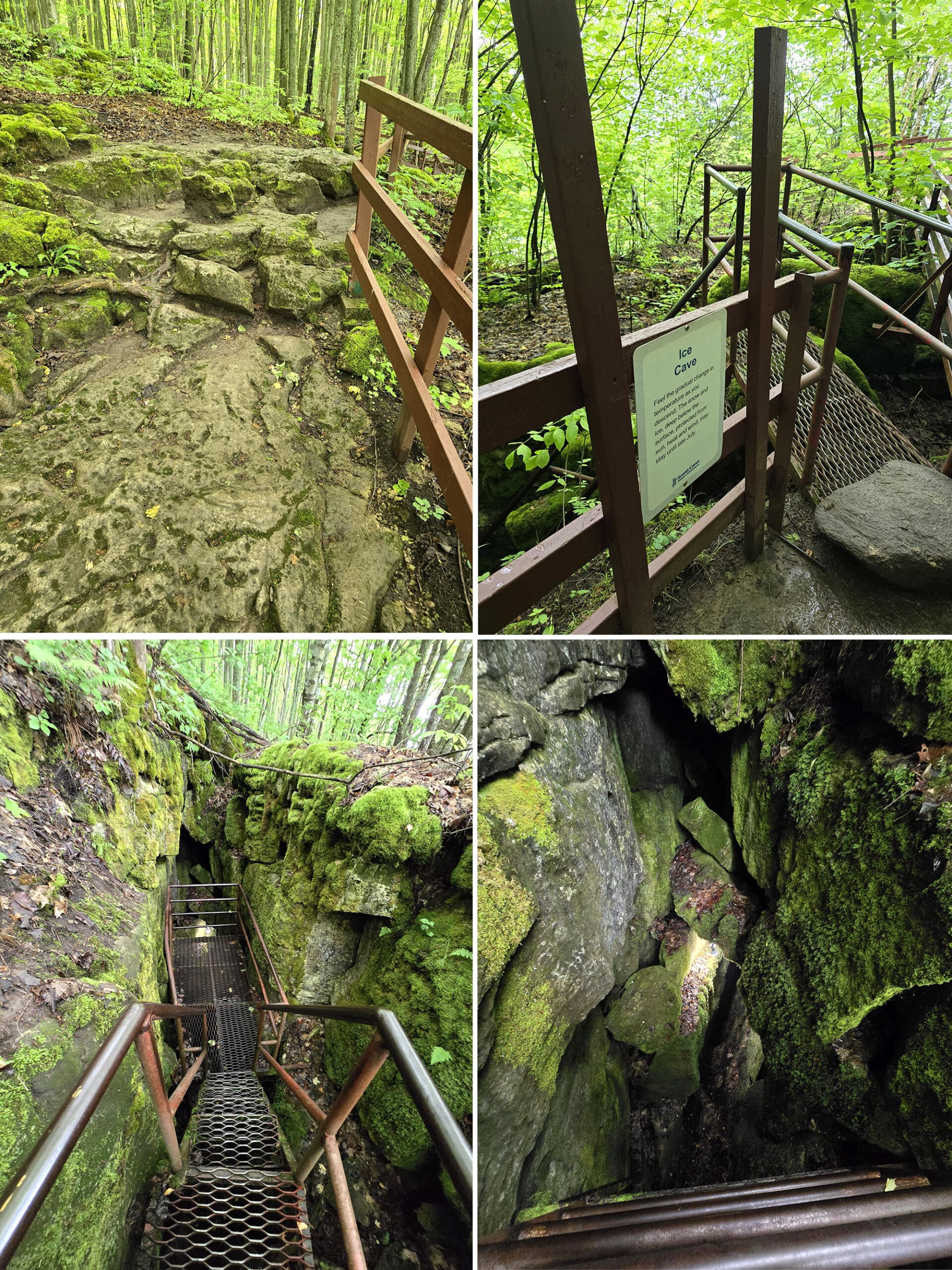
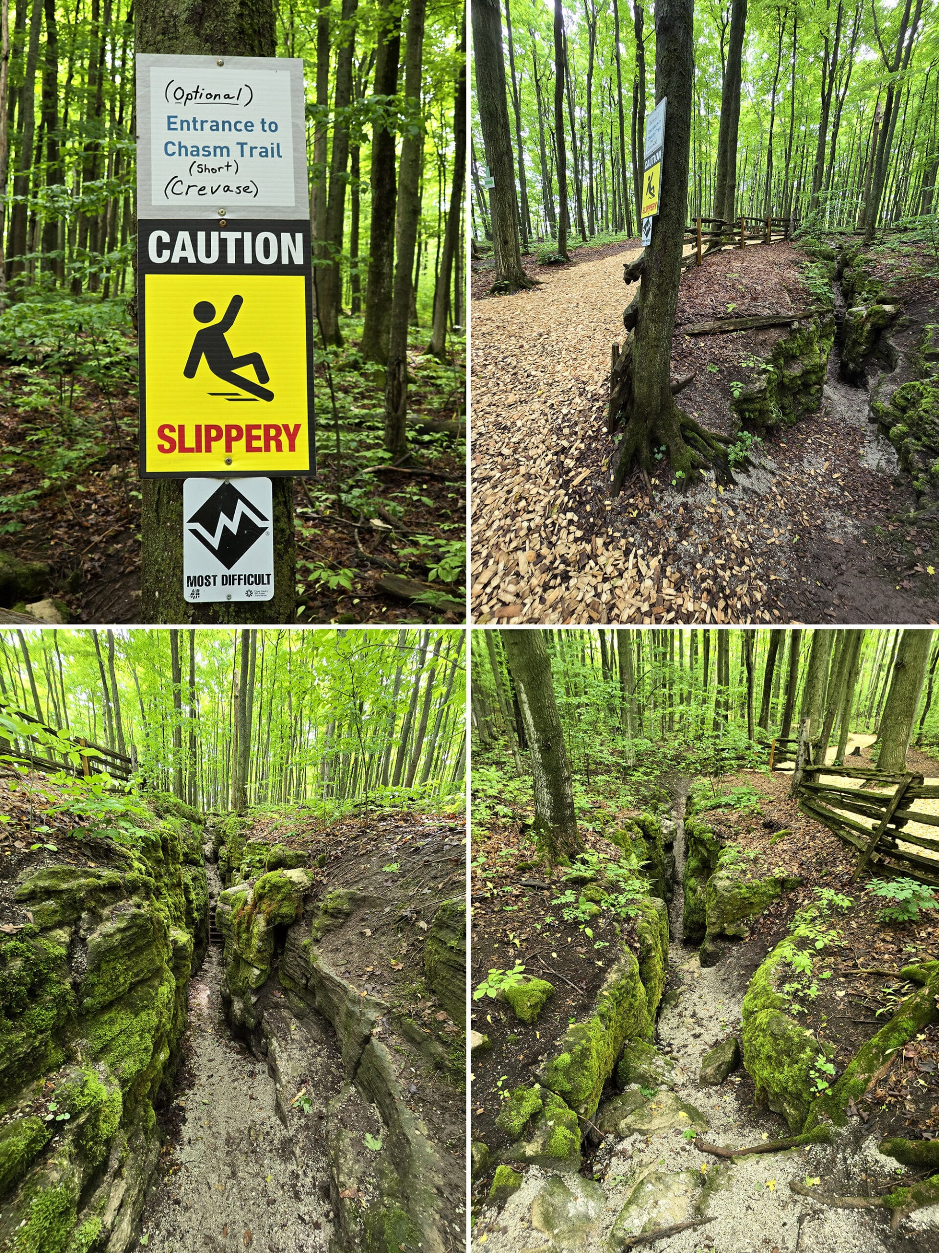
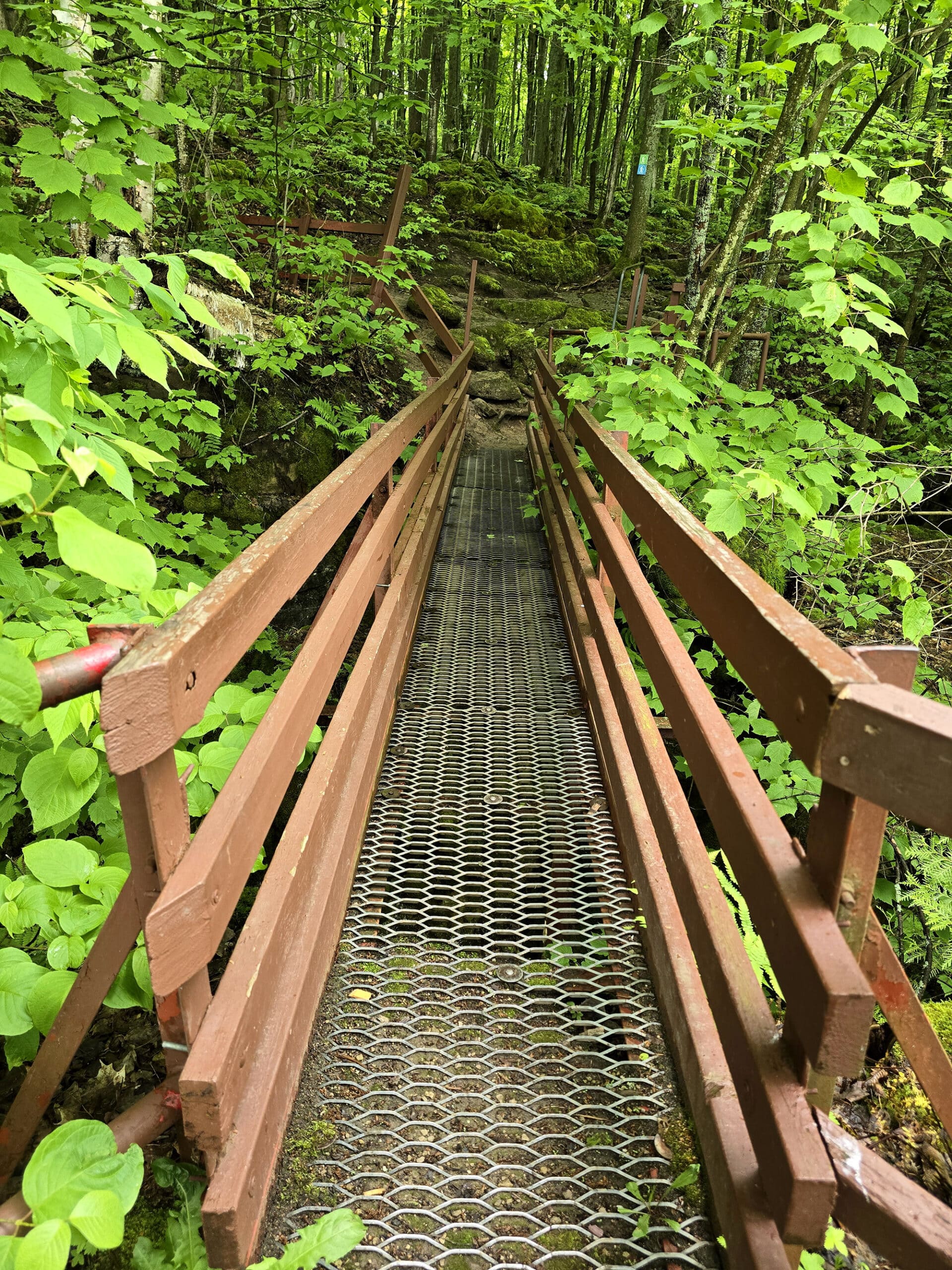
Chasm Trail
The Chasm Trail isn't a cave, but you're walking between rock walls, so it fits best here. It's part of the Ridge Top Lookout Trail. If you're on the Caves/Lookout trail, you can take a short loop to view the crevice without having to do the entire Ridge Top Lookout Trail.
The well-groomed trail offers a bypass around the crevice, but once again I encourage everyone to give it a try, it's really fun! It's also really short, which might be good for those who are scared.
The path is flat packed gravel with a short staircase and a step as you proceed. The step is pretty big, I found I needed to hold onto the rock on the side to assist.
The path is approximately 18” wide, with thick moss extending out from the rock walls making it perhaps a little narrower yet. I passed through turning my shoulders to the side so I wouldn't brush against the moss.
A short incline up and you meet back up with the main path.
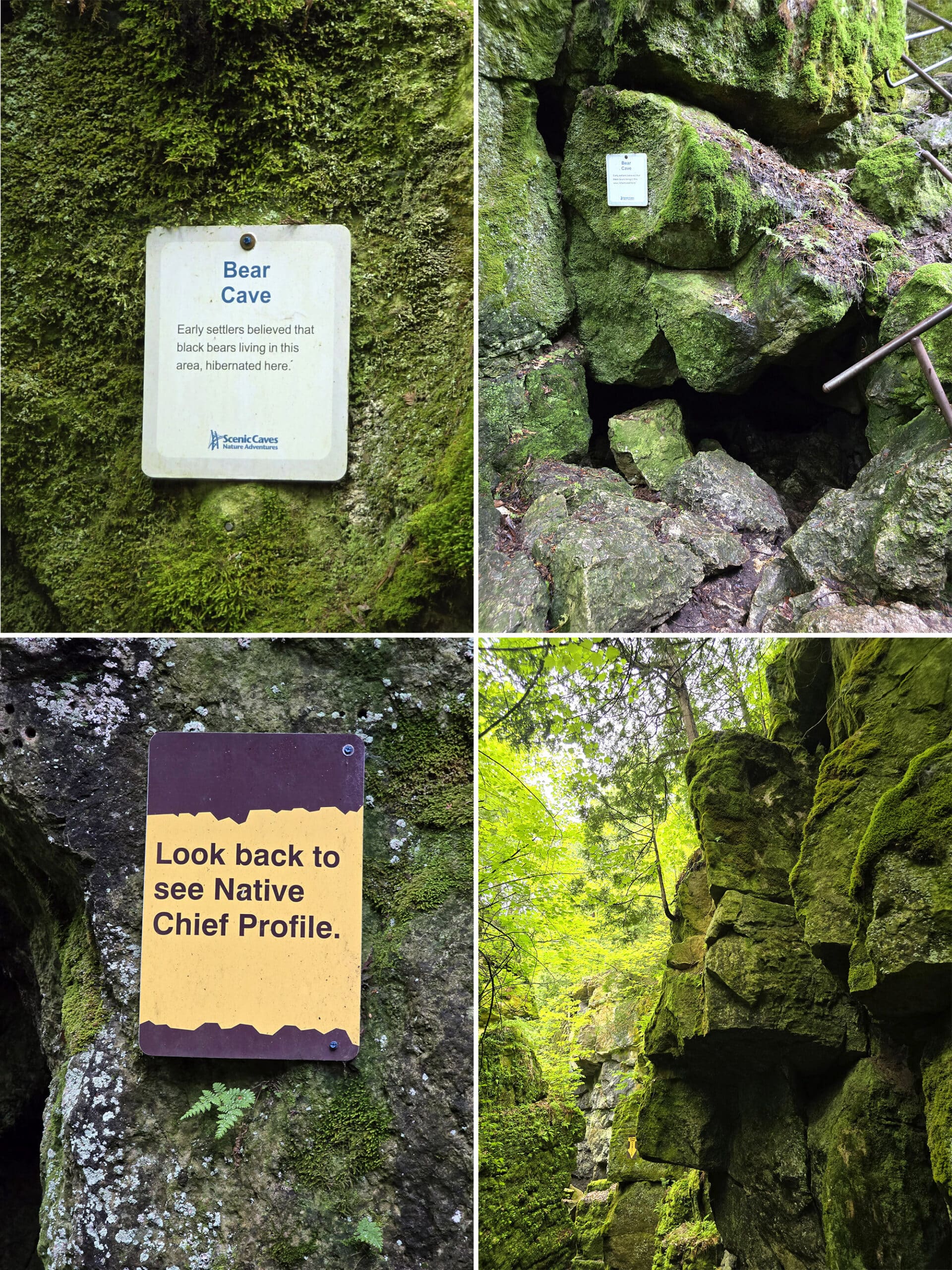
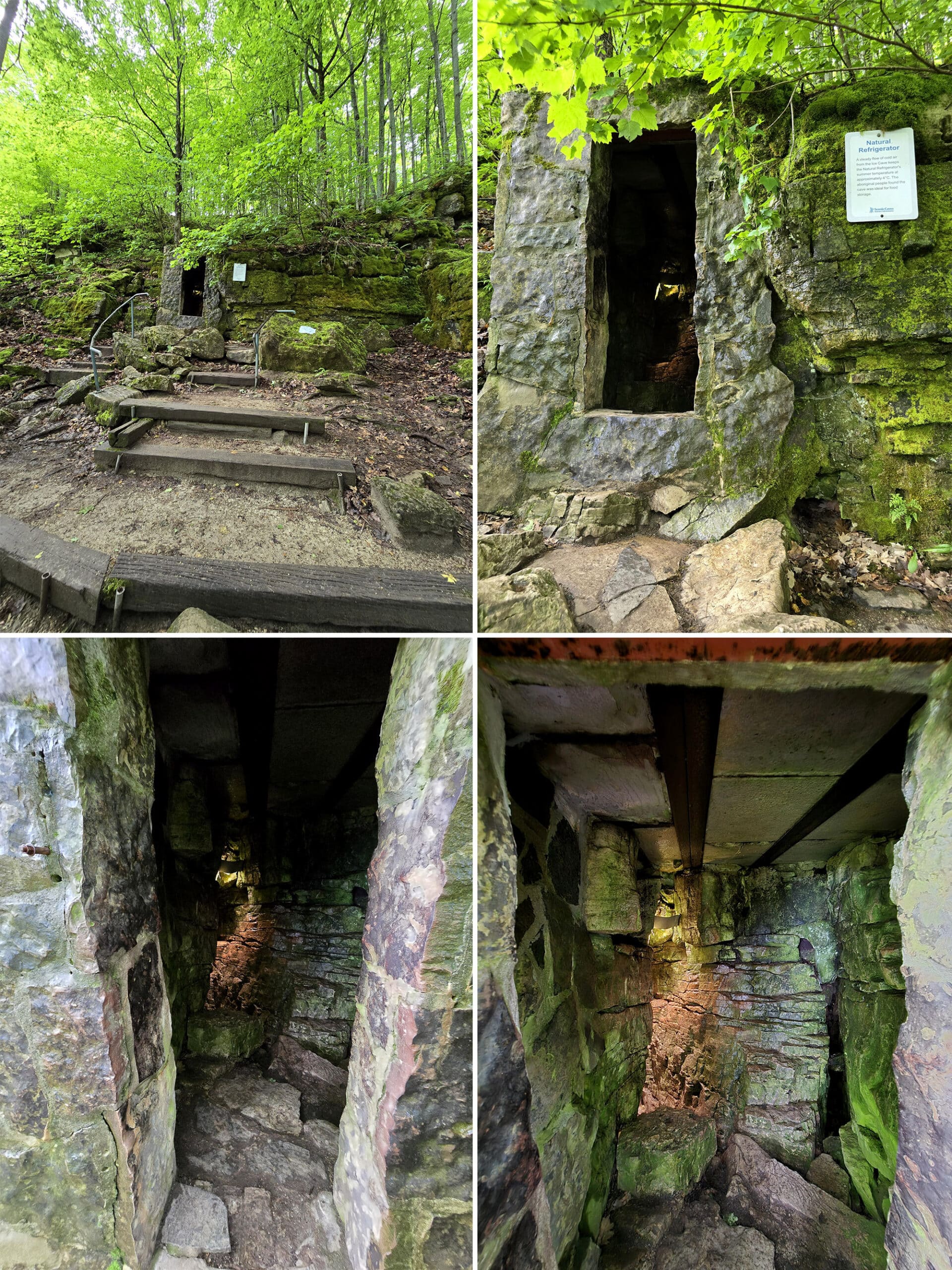
Natural Refrigerator
Further down the Caves/Lookout Trail you come upon the Natural Refrigerator.
It has a man-made front to it (block and mortar is clearly evident), but that must be pretty modern since you can see steel reinforcement on the ceiling portion.
A sign indicates this cave is fed cold air from the Ice Cave, keeping it 4°C all summer long, perfect for food storage. This would have been a great resource for aboriginal people.
Again there's a light inside so you can actually see well inside. It was a cool day when we visited, but you could definitely feel the cool air wafting out. I bet this is a fun one on a hot summer day!
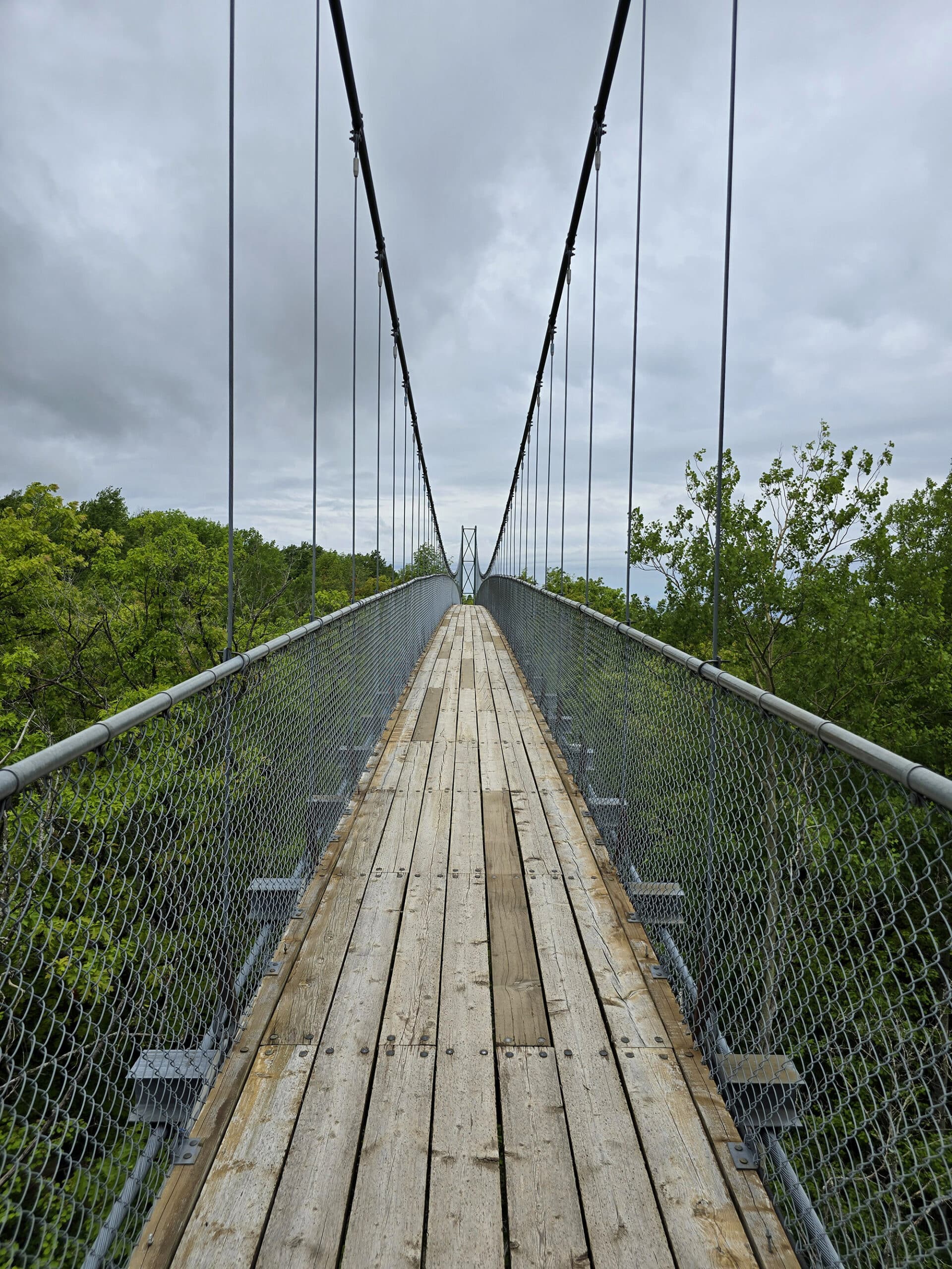
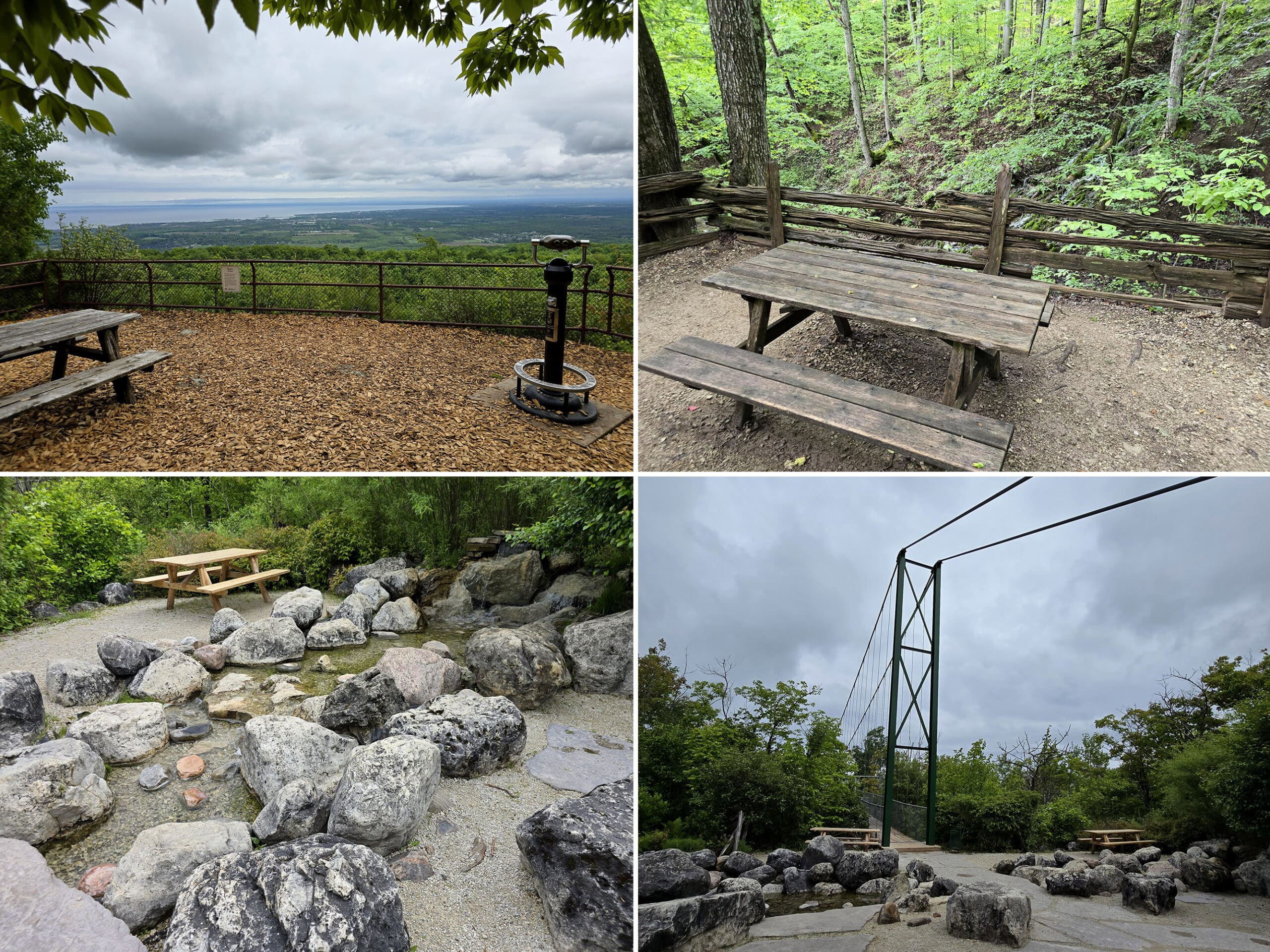
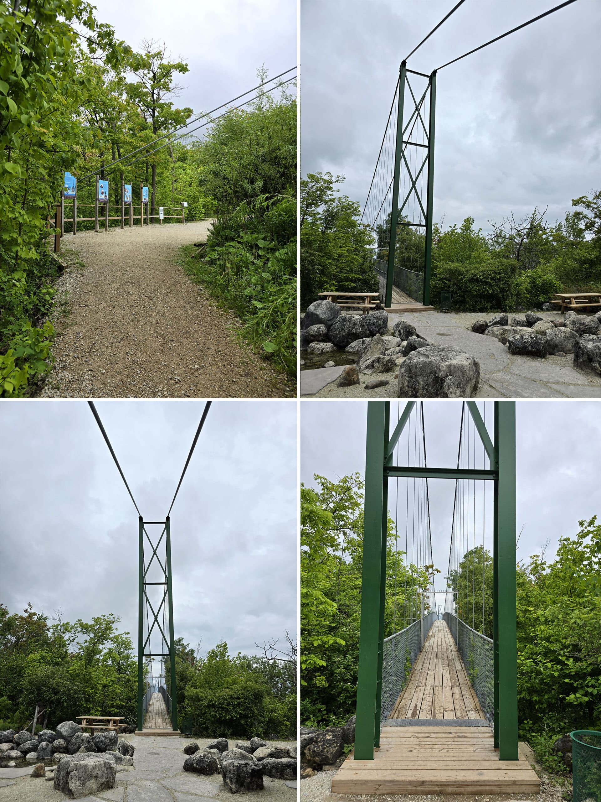
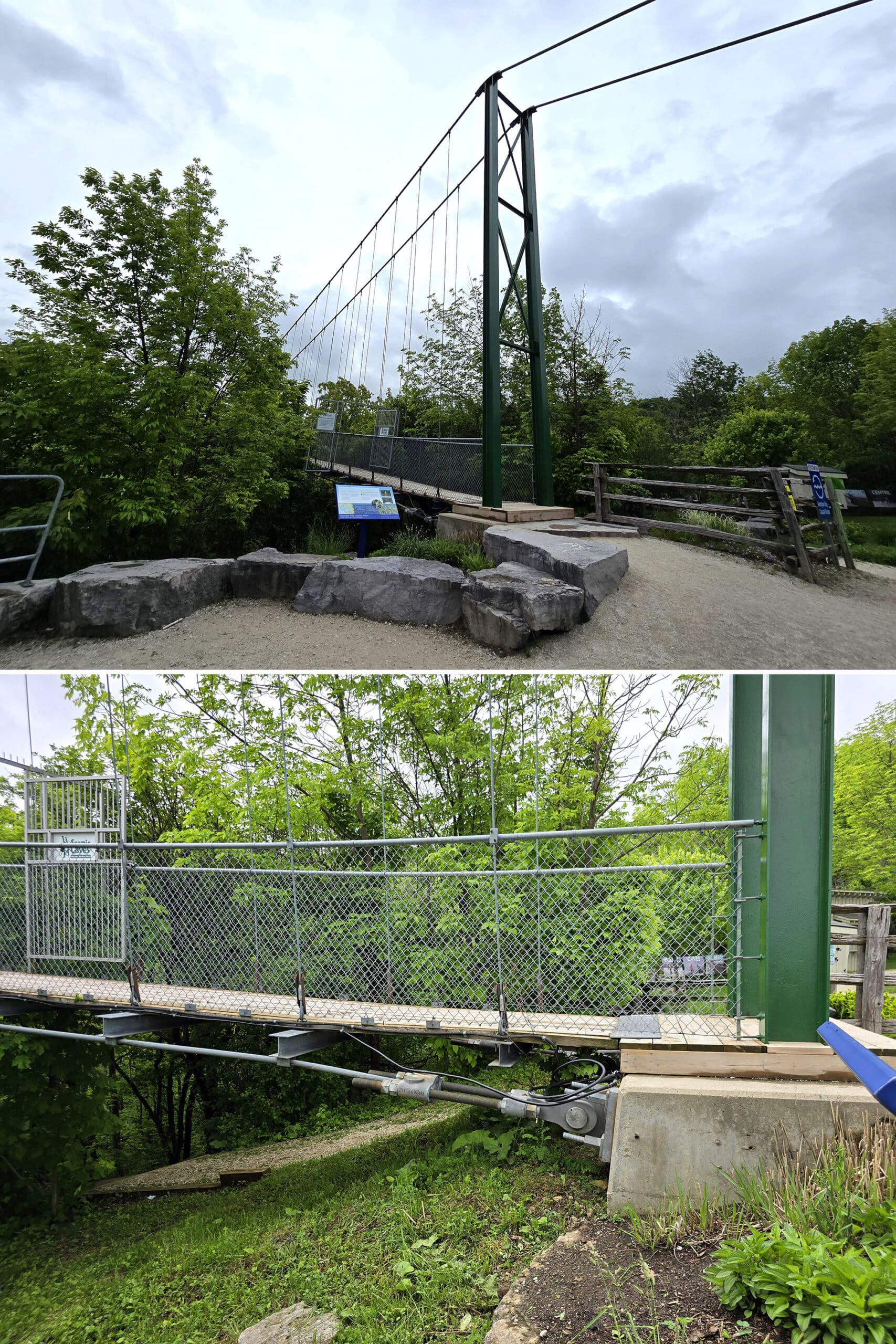
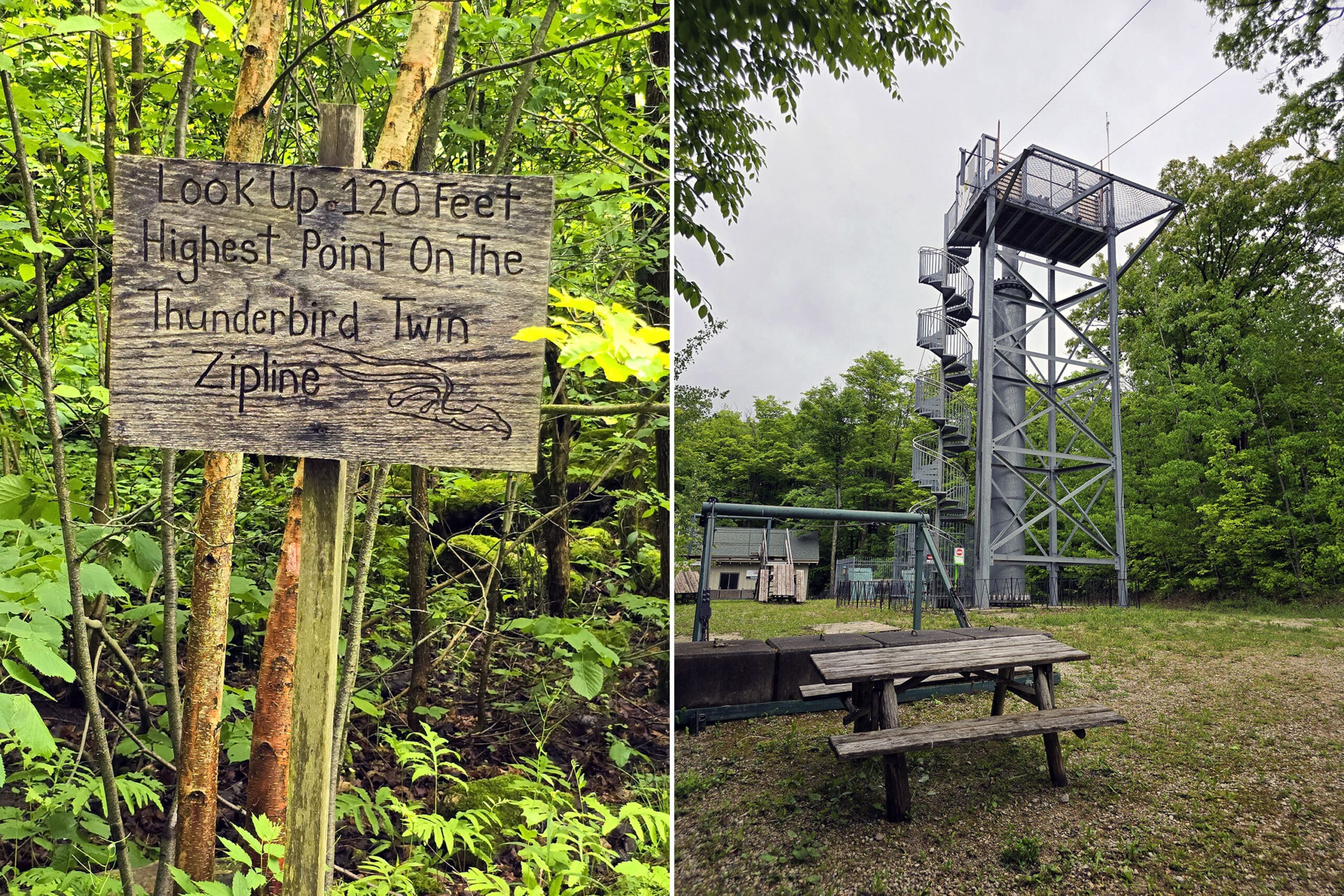
The Suspension Bridge
The first thing the interested me about Scenic Caves was their 420 foot long suspension footbridge - and it’s why Marie added it to the bucket list.
... for me, anyway!
It's 82 feet above the forest floor, and 984 feet above the water level of Georgian Bay, which you can see in the distance from the suspension bridge.
Oh. Yeah. Definitely.
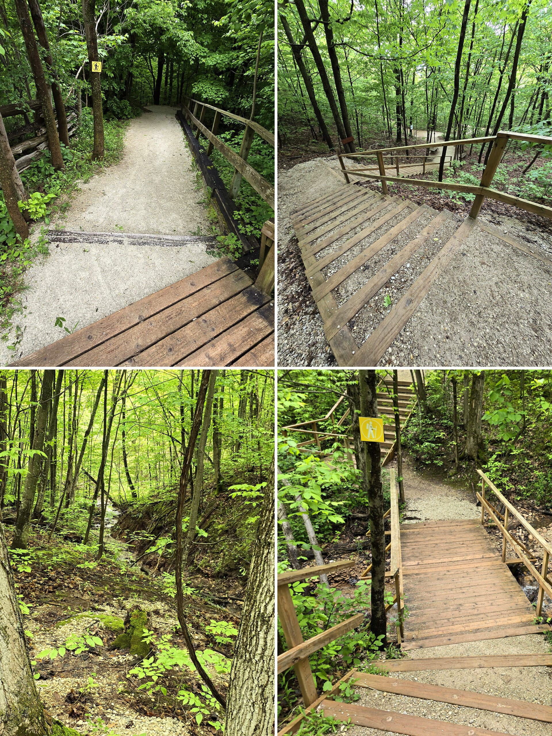
The Suspension Bridge Loop Trail is wide and well-groomed gravel, with nice wide wooden steps in some locations.
After descending a bit, there's a flat area with a small waterfall in the forest, and a picnic table.
Some signs talk about the bridge's construction and strength.
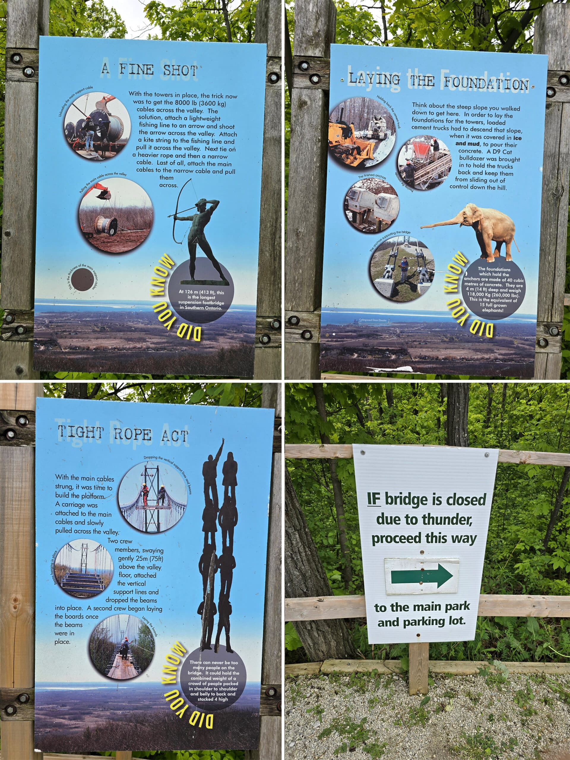
The walking platform is very sturdy and has chain link fencing on each side for safety, which also allows a view for children. Wood planks over steel structure form the walkway.
The solid wood is a good choice because you can't see through it, whereas some structures have that metal lathe that allows you to see through. That can by dizzying and scary.
Almost immediately upon starting to cross, you notice the bridge bounces with each step. This makes sense of course, the steel cables are flexible.
I will note that I was the only person on the bridge at the time, and it wasn't very windy. I would expect a lot more bounce and sway if there were a group there on a windy day.
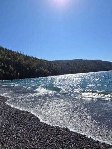
The suspension bridge provides spectacular views of Georgian Bay in the distance, off to the right as you're crossing. The panoramic views offered at the middle of the bridge are the best!
On the left you see the tree canopy below you. Not small, young trees, but massive tall trees, completely below you.
This is a view you just can't get from an outlook on the edge of a cliff. Being something like 200 feet from either edge and lofted so high, looking out at the view is just amazing.
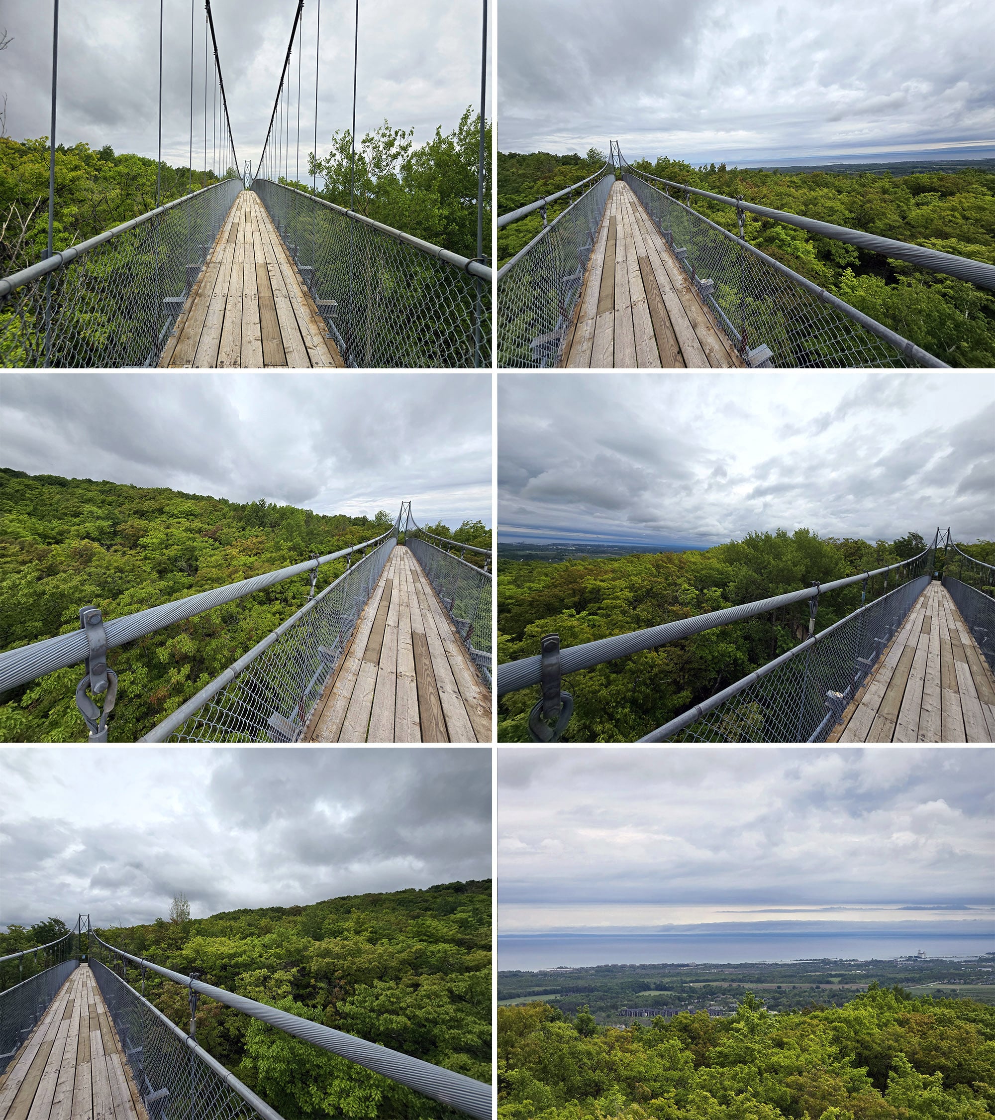
Thinking about that a bit, it makes sense because the bounciness is forming a wave, so it's easiest to form that wave at the one-quarter and three-quarter points.
At the other end of the suspension bridge is an outlook with viewing binoculars available to use for $2. A snack shack sells drinks, chips, and gelato, and there's a pair of portable toilets.
I like seeing how the ends are anchored and how the forces transfer. The signage in the beginning also shows pictures and discusses the anchor system.
The return path to the main entrance area is shorter, and rather steep uphill. Again though, it's very well maintained.
I actually saw the tractor grooming the trail right in front of me!
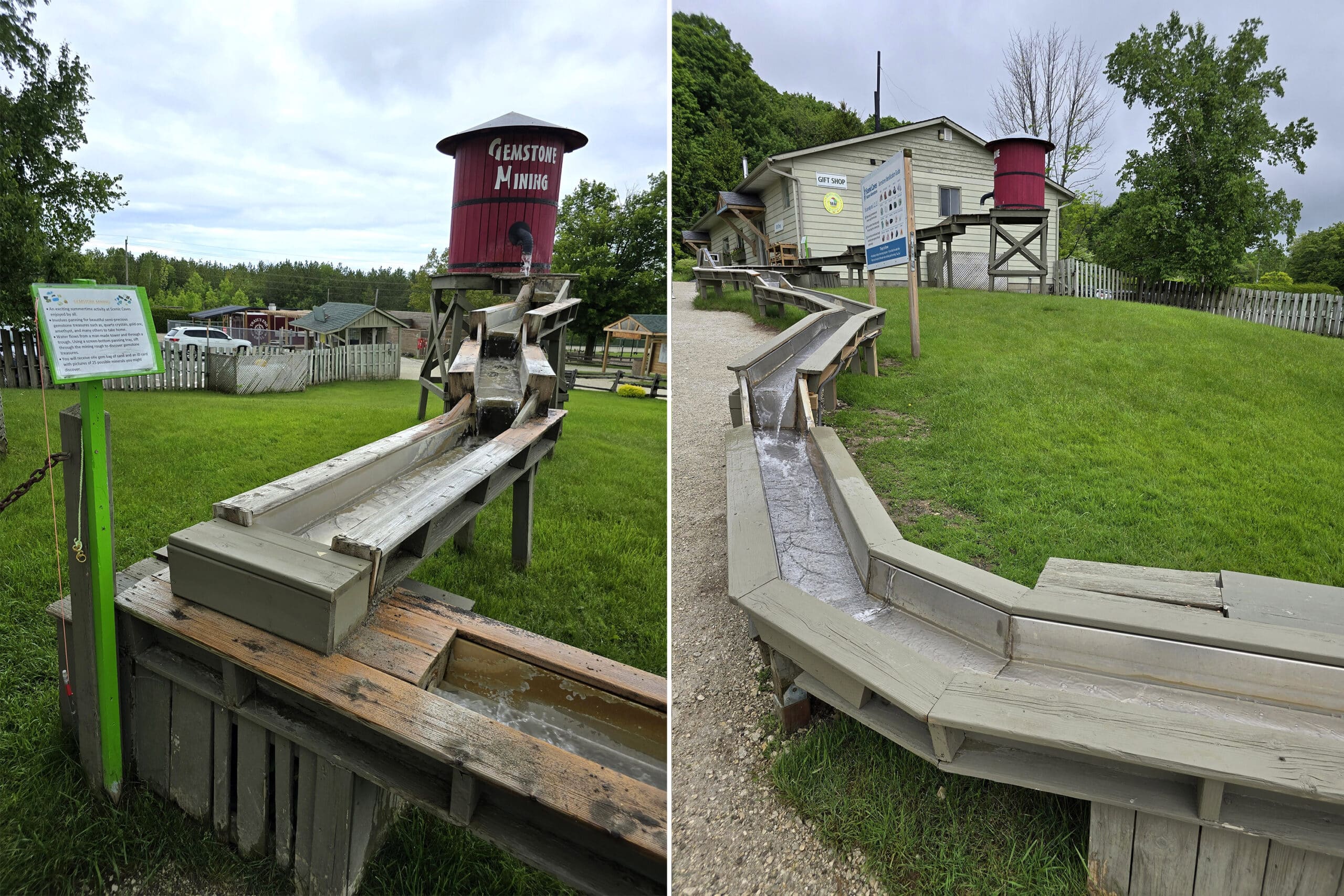
Gemstone Mining
“Mining” gemstones is another activity offered at Scenic Caves Nature Adventures. It has a SUPER cute setup, located just outside of the gift shop.
Basically, you buy a bag of sand and rocks, and pan through it at a running water trough.
The trough is set up almost like a slide, which is nice - the areas of varying heights mean that taller kids (or, let’s be real, adults) can pan standing up near the front, and smaller kids can do it a bit further down.
We both would have LOVED that, as kids!
(This feature is an additional cost, FYI).
Zip Lining
We saw the Thunderbird Twin Zip Line in a few places during our stay, and were hoping to see it in action.
Unfortunately, it was not in operation that day. According to their site, it won’t be operating in 2024 at all.
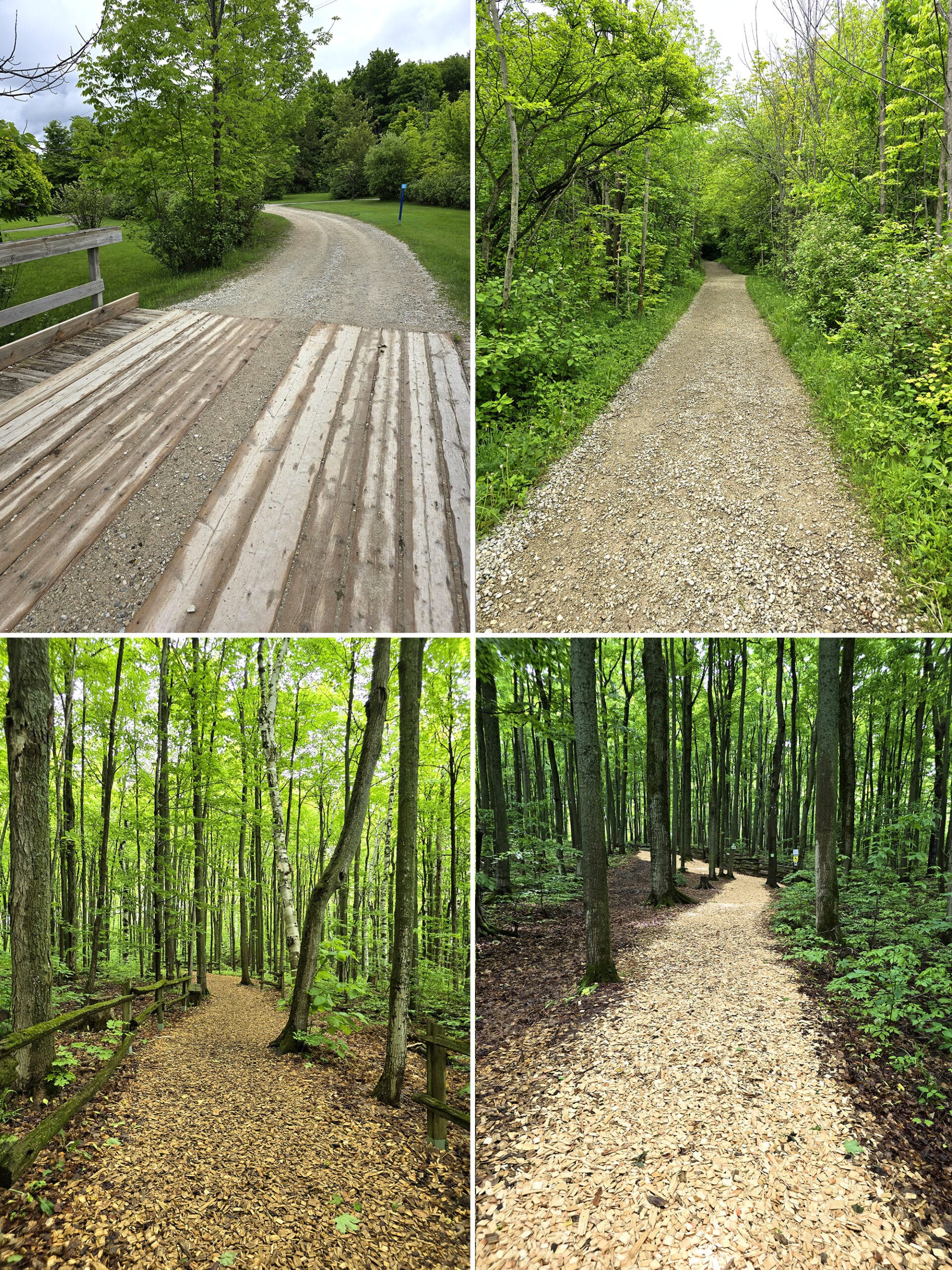
Hiking
Scenic Caves Nature Adventures has a bunch of hiking, mostly through old forest.
It’s definitely a bit of a challenge, but absolutely worth it. Situated in a UNESCO World Biosphere Reserve, you’re surrounded by ecologically significant surroundings.
And - being situated in the Blue Mountains, specifically - you can look forward to numerous breathtaking lookouts along the way!
Porter went on the Suspension Bridge Loop himself - as he detailed above - while I budgeted my mobility for trails I actually wanted to do.
When we started on the Caves / Lookout Trail, I was still talking big about how MANY of the trails we’d be doing.
It started out great - wide, flat, well groomed trails - it felt like an easy walk in the park.
HUGE inclines, some slippery rocks, and some absolutely terrifying bridges across the crevices.
This sucker went right over a super deep crevice - IIRC, 60'?
Porter wasn’t there with me, as he was exploring the caves at that point - this was the section that bypassed the caves.
After spending a good minute talking myself into crossing it, I took a step or two on the narrow bridge... and immediately snagged the jacket I had tied around my waist.
Scared the living crap out of myself, LOL.
Anyway, I composed myself and continued on.
It’s a shame, too. The trails we did see were AMAZING.
Super well groomed, gorgeous views, and super ADHD friendly. Also, educational in a way that we don’t usually see on hikes.
Every so often, a tree would either be labeled with a name, or have a little wooden stand at the base, posing the question ‘what tree am I?”, with a hint. You could lift the little door for the answer.
Super cute!
A few examples:
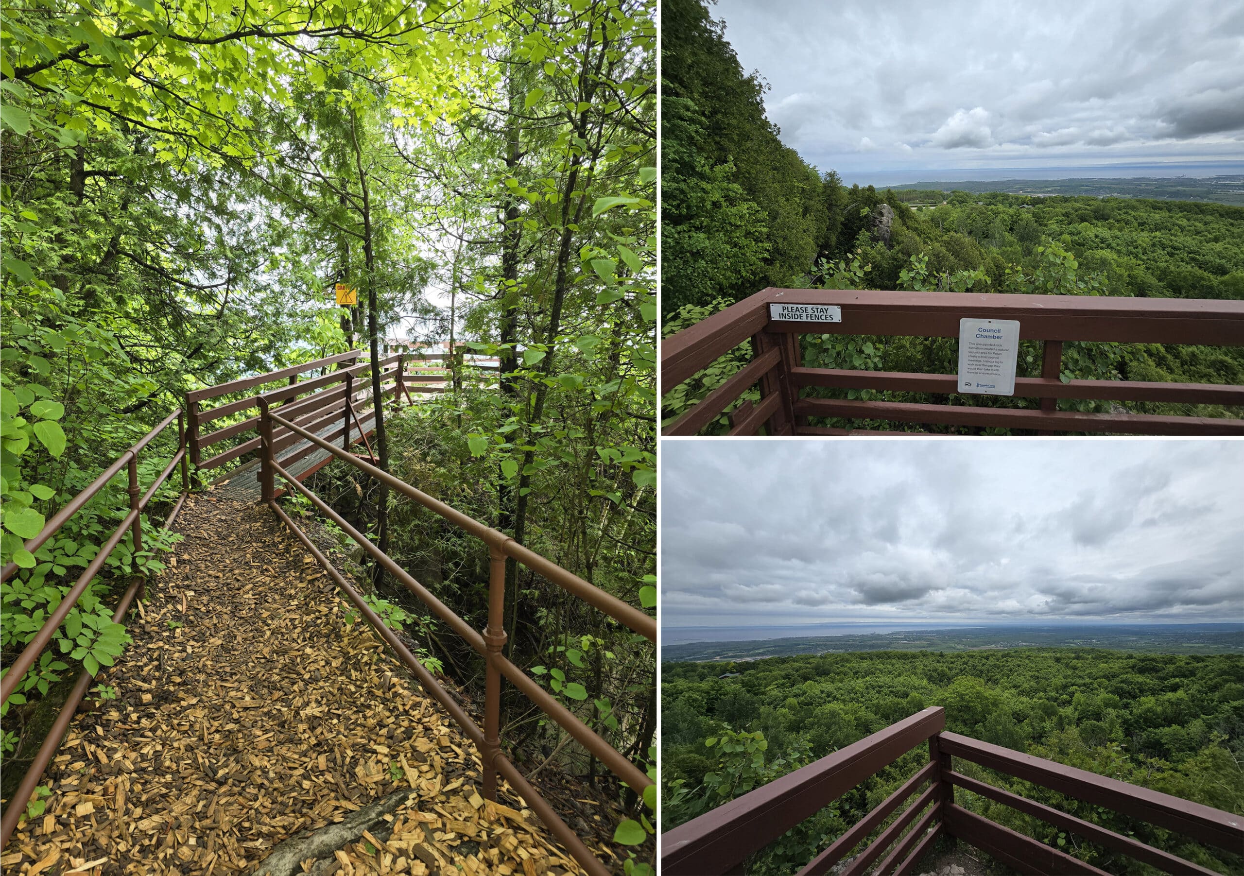
Council Chamber
This was an area where Petun Chiefs would reportedly hold council meetings in secret. A log was used to cross over to the area, then removed to ensure privacy.
Lookout Point
This scenic lookout had some signage telling you that you’re got a 10,000 square kilometre view of the area, and about how the escarpment is home to nearly 40% of the rare flora in Ontario.
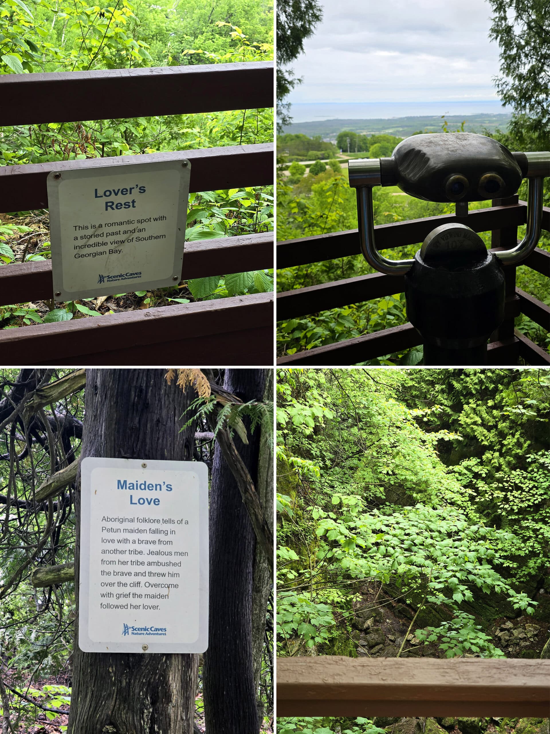
Lover’s Rest
A sign here tells you that this “romantic spot” has a storied past - which it does not elaborate on - and a spectacular view.
The view, yes, is great - but come on, spill the tea!
Maiden’s Love
This spot told the legend of a Petun maiden who fell in love with a brave from a neighbouring tribe.
The men in her own tribe took that poorly, and threw her man off the cliff.
Overcome with grief, she flung herself over to join him.
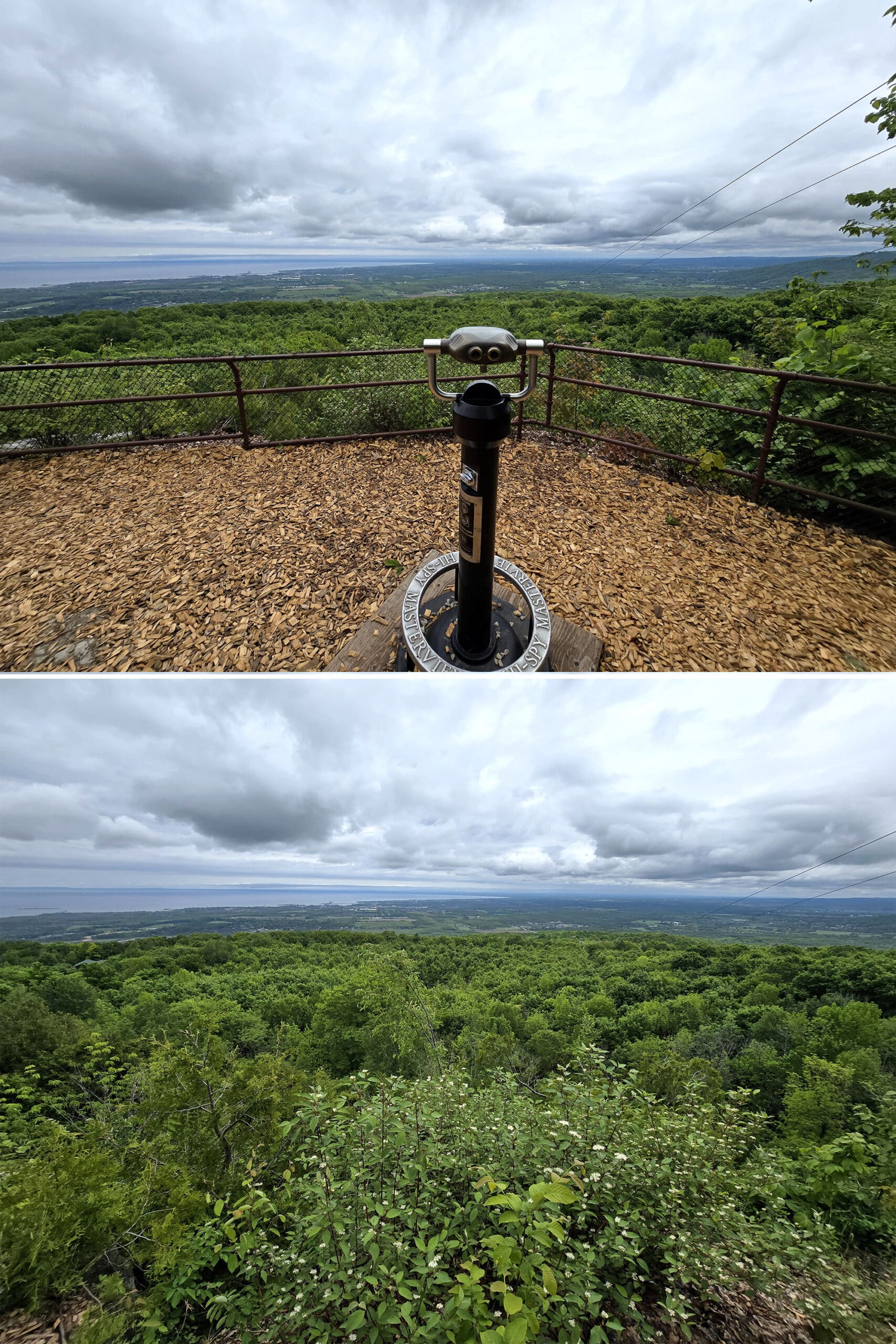
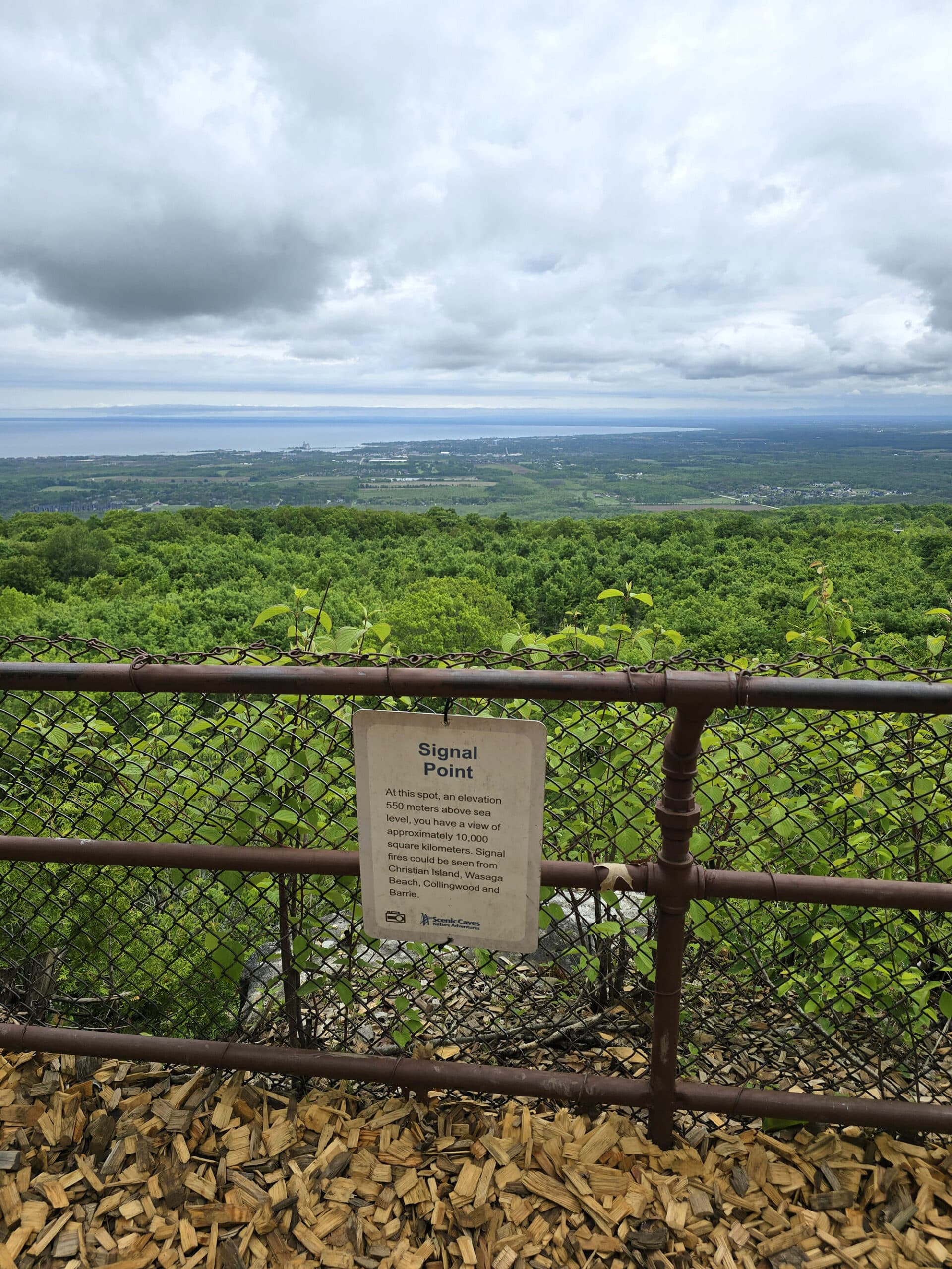
Signal Point
Like Lookout Point, Signal Point had signage telling of the 10,000 square km view.
It also had a telescope, and a picnic area. Very cute!
So, obviously a lot to see, even with the small section (1.8 km of the over 14 km of hiking trails there!) that I actually got to experience.
Can’t wait to see everything else that the hiking trails in Scenic Caves Nature Adventures have to offer!
Birding, Wildlife, and Nature
Shortly before our visit to the Scenic Caves park, we found and downloaded a great little app that listens to bird songs and tells you what it is.
It made birding during our recent stay in Bruce Peninsula National Park SO much more fun that previous camping trips.
... but it made birding on the trails in Scenic Caves a bit frustrating. At least during our stay, the birds were VERY vocal - and very *invisible*, LOL.
In addition to that, we heard - but did not see - Black Throated Green Warblers, an American Redstart, a Black and White Warbler, and Eastern Wood-Pewee, and at least one Great Crested Flycatcher... among a few others.
These were just the “Repeat offenders”!
We did see a lot of chipmunks, though - and they were really cute, obviously.
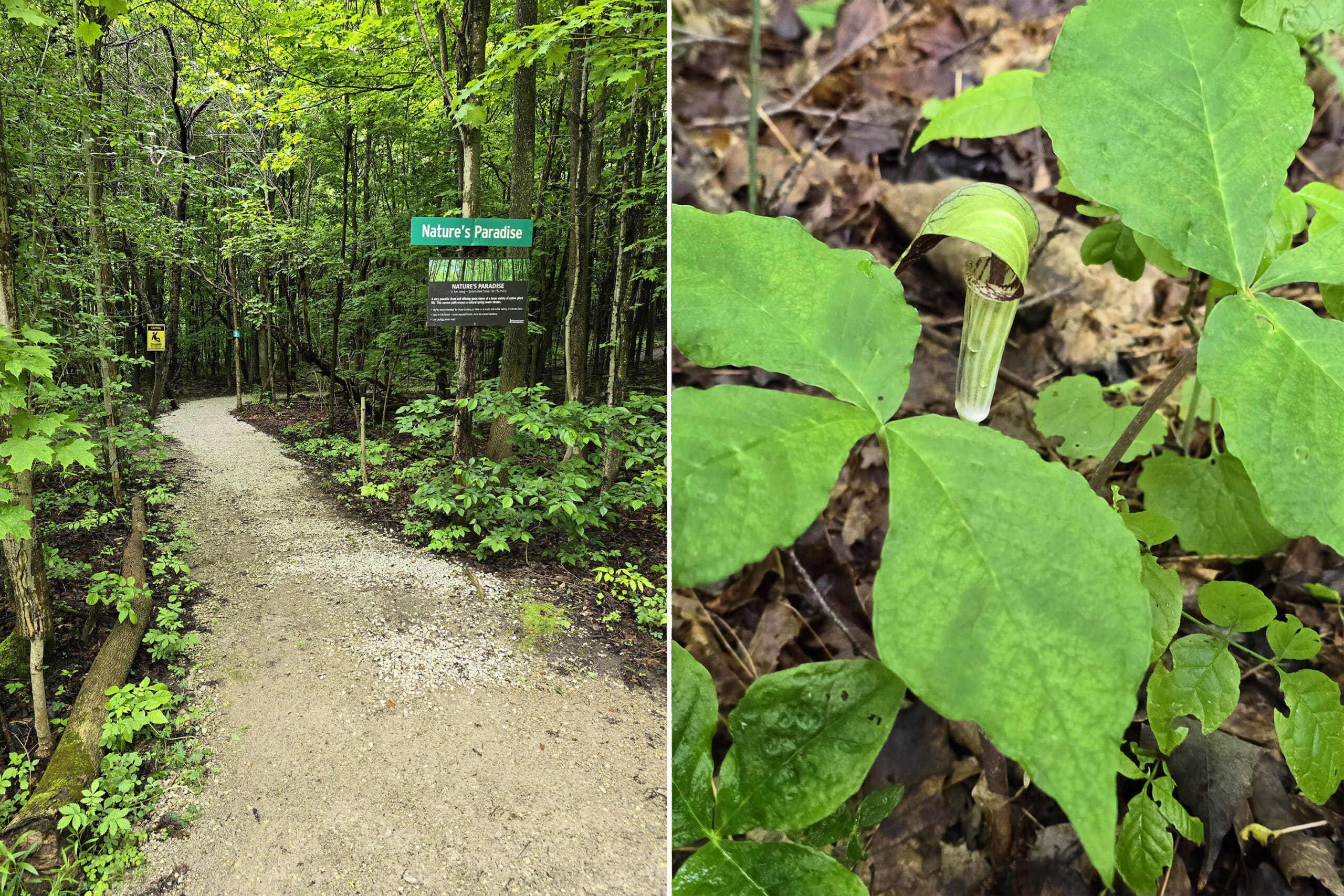
I saw a Jack-In-The-Pulpit for the first time, but forgot to tell Porter to look for the rare maidenhair fern when he was down in the caves. Whoops!
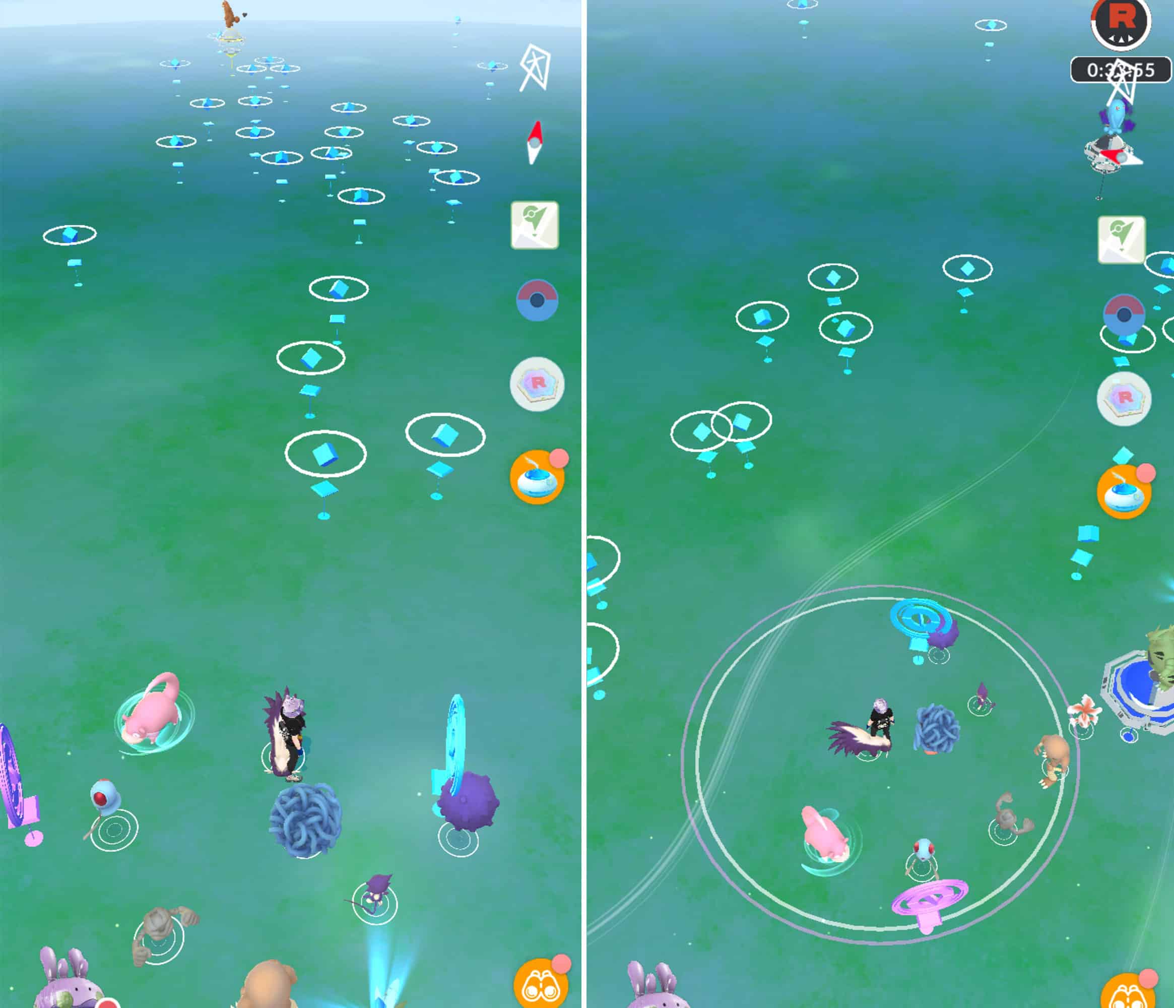
Niantic Games
If you need to take a bit of a break from your adventuring, there are plenty of Portals / Stops / Pokegyms in the park to keep you busy!
There were enough to make counting them difficult, but it looks like there were at least 43 pokestops and 7 gyms - so probably 50 or so Ingress Portals.
Don’t quote me on that, though!
Anyway, in the main entrance / park area and the more open sections of trail, we had plenty of connection to access the game.
Winter Activities
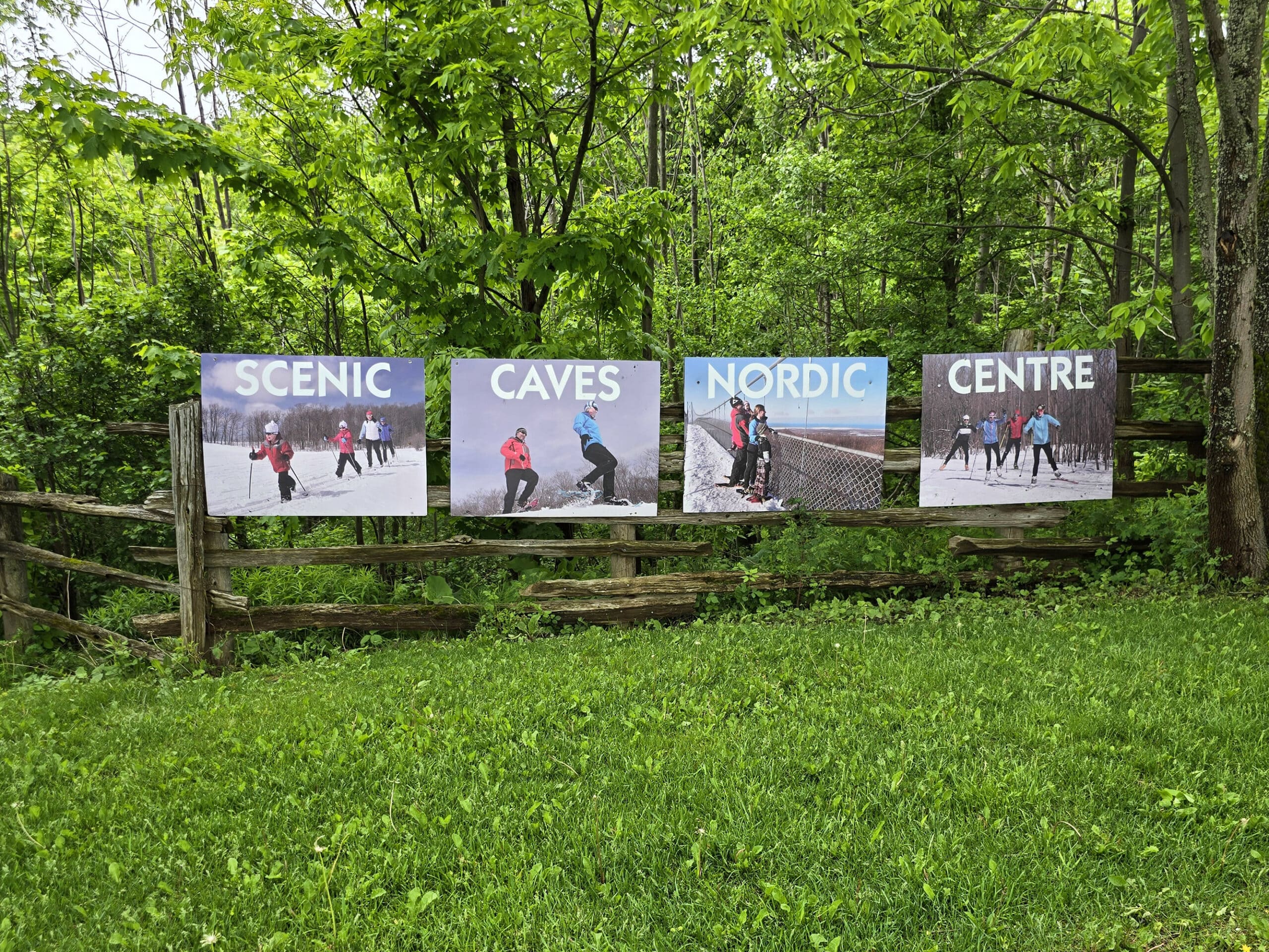
Once the weather turns cold, the park becomes the Nordic Centre, and focuses on winter fun.
The suspension bridge becomes one of the 7 cross-country skiing trails. 27 km of trails that are groomed daily, mind you.
If they take care of their ski trails like they take care of their grounds in the warmer months, you’re in for a treat!
There are 4 beginner/novice trails, 5 intermediate trails and 7 advanced trails, and all but one are suitable for skate skiing.
In addition to skiing, you can also go snowshoeing - including their guided night snowshoe hikes, which must be booked in advance.
There’s a warmup building at the main entrance area, and on weekends and holidays a second one opens (at Lookout Point)
For those that don’t have appropriate equipment, there are rentals available on a first come, first served basis. These include cross country ski boots, skis, and poles (both classic and skate style), as well as snowshoes.
Final Thoughts
What an amazing way to spend a day! There’s just so much to do and see at Scenic Caves Nature Adventures, you can easily spend a whole day there.
It’s on the list of places we’re going to want to go back to, to see more of. We definitely didn’t allocate enough time on our initial trip, and there was SO much we didn’t even get around to seeing.
I can imagine the place is an absolute zoo in the summertime, and probably again in the fall. I can’t even imagine how spectacular the fall leaves would look from any of the overlooks, or on the suspension bridge itself.
So, timing is key. Our timing was about perfect on this trip, we almost had the whole park to ourselves! So peaceful, once the school kids left.
Anyway, it may not be the cheapest form of entertainment, but DEFINITELY worth the money, in our opinions.
Just make sure to have good sturdy hiking shoes, a LOT of room on your camera, and some bug spray!
More Places to See
Looking for some nice sights to see and great places to visit while you're out on your camping adventures? Here are a few of our favourite day use parks, attractions, etc.
Batchawana Bay
Big Bay, Ontario
Bruce Peninsula National Park
Cheltenham Badlands
Devil's Monument, Bruce Peninsula
Falls Reserve Conservation Area
Flowerpot Island
Keith McLean Conservation Lands
Menesetung Bridge
Point Pelee National Park
Spirit Rock Conservation Area
Temagami Fire Tower
Thanks for Reading!If you loved this post - or have any questions about it - please leave a comment below! We'd also love it if you would consider sharing the link on social media! |


Leave a Reply