Sand River Falls & the Pinguisibi Trail is a popular attraction in Lake Superior Provincial Park. Here's everything you need to know!

Chippewa Falls, Chutes Provincial Park, Onaping Falls, Scenic High Falls ... there really is NO shortage of natural beauty in Ontario!
This time, we’re talking a couple hours north of Sault Ste. Marie: While enjoying our second stay in Lake Superior Provincial Park, we got to add another to our list.
Or, well.. 3 more? Hard to say. There were SO MANY waterfalls on the Pinguisibi Trail!
Sand River Falls aren’t the only falls in Lake Superior, not are they the tallest, widest, etc*.
They are, however, the most accessible - and there’s no way I’m dragging my busted body 14+ hours over “moderate” terrain to see a waterfall.
Further up Sand River itself, there are two more falls - Calwin Falls & Lady Evelyn Falls. Those are a more of a canoe-in situation, though - they’re on the way up to Sand Lake.
Sand River Falls, though, are near the highway and directly accessible via the Pinguisibi Hiking Trail.
... and by “directly accessible”, there are at least 3 sections of waterfalls that you can walk right out onto!
"Pinguisibi", by the way, was the Ojibwe word to the river, known as "River of Fine White Sand".
According to signage in the parking lot, the Sand River was an ancient hunting and canoe route used by the Indigenous peoples of the area.
Anyway, enough history and trivia, let me tell you all about this FANTASTIC hike, and the gorgeousness we basked in that morning!

The Basics:
Location Name: Sand River Falls
Address: Algoma, Unorganized, North Part, ON, Canada (Click that link for the Google Maps location!)
Website: Municipality of Wawa - Scenic High Falls
Price: Ontario Provincial Parks uses a pricing matrix across all their parks. See 2025 Camping Fees for more details.
Reservations: Ontario Parks Reservations
Park Classification: Natural Environment
Season: May 2, 2025 to October 19, 2025

Logistics
Sand River Falls and the Pinguisibi Trail are part of Lake Superior Provincial Park.
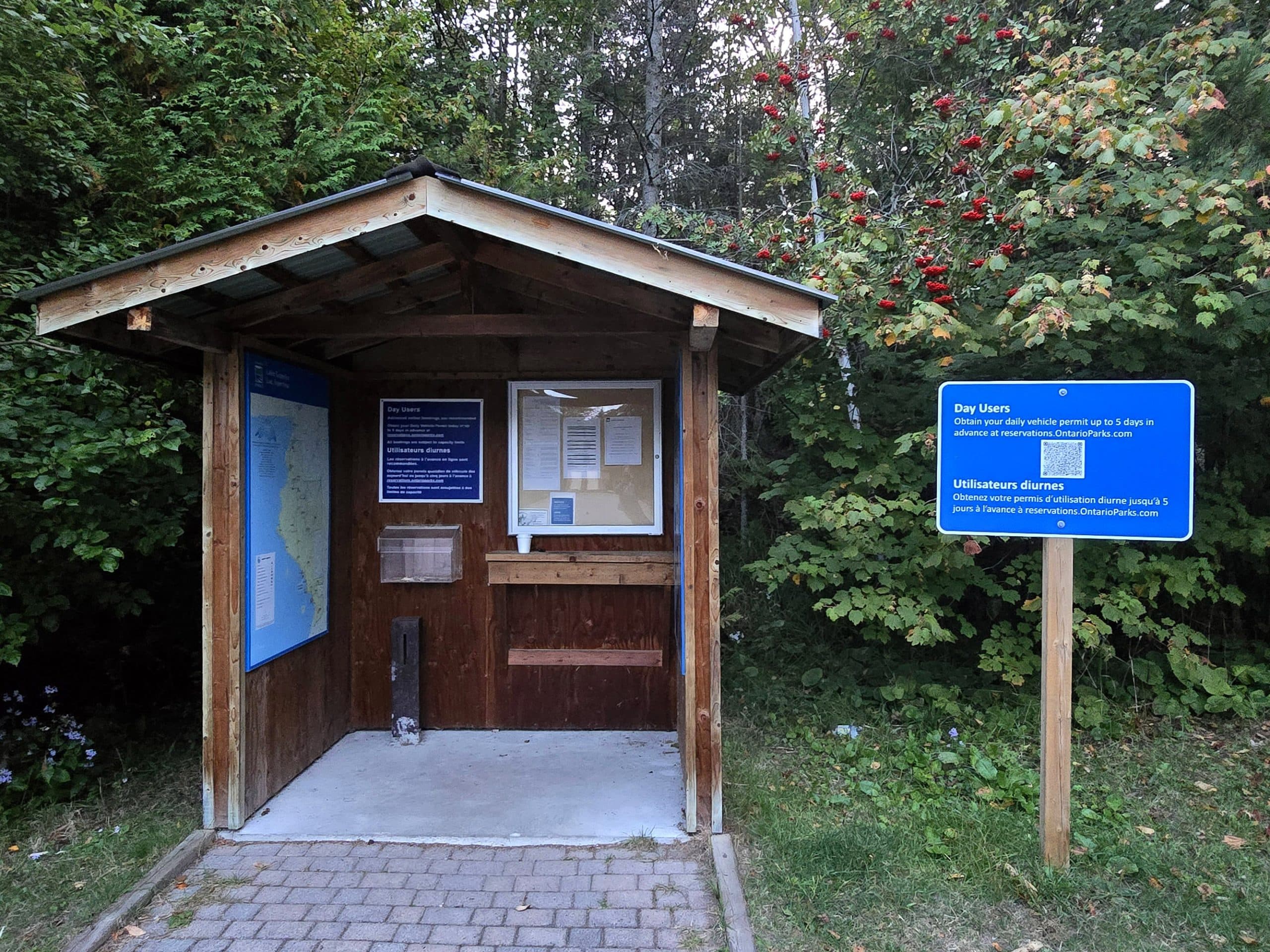
While there’s no specific registration or fee to use this trail specifically, you’ll need to pay to use the park in general, whether as a Day-Use pass, or with your current, valid camping pass.
Sand Falls isn’t staffed, but there IS a self serve kiosk thing, much like the one at Batchawana Bay.
As we didn’t need to pay - we had a current camping pass - we didn’t make use of the kiosk. We just displayed our printed pass on the dashboard, and were good to go!
Parking
There is a small parking lot right at the start of the trail, just off the Trans-Canada Highway.
When coming from the south, you’ll pass over Sand River - and see the falls over to your passenger side - and the parking lot is on the right, shortly after that.
We went first thing in the morning on the off season, and there were still a few people there. It’s apparently the most popular trail in the park - and it’s a popular spot for fishing - so I imagine that parking lot fills up pretty quickly in the busy season.

Maps and Signage
There’s not much in the way of maps or signage for this trail, but - at least as far as we made it on the trail - you really don’t need either.
The trail entrance is obvious, as is the trail itself. We saw a few trail blazes along the way, but honestly... you’d have to go out of your way to get lost on this particular trail.

Washrooms
There’s a small washroom building with 2 stalls in the parking lot. It looked nicer than most of the outhouses, at least from the outside.
We didn’t end up using it, though, so take that assessment with a grain of salt!

Accessibility
There is a single accessible parking spot in the parking lot, right next to the trail entrance.
The trail for the first little bit should be wheelchair accessible, but that’s pretty much just the picnic area. This is the only view of the falls that is in any way wheelchair friendly.
The washrooms aren’t marked as being accessible, but based on the size of the building, I think there’s a pretty decent chance that they actually were.
In terms of other mobility issues... the trail gets pretty intense, pretty quickly. I wouldn’t recommend going much beyond the first waterfall / rapids area if you’re in a boot or using a cane.
There’s a lot of inclines, rocks and roots to walk up over, etc - you’re really going to want to have functioning legs and feet for this one.
I was having a pretty good tendon day when we started this trail, but it did me in and I needed a fair amount of time to recover after. The pain - and major hit to my mobility - was ABSOLUTELY worth it, though!
Pets
Dogs are allowed on all of the trails in Lake Superior Provincial Park, except for the Agawa Pictographs Trail.
They do need to be kept on a leash at all times, picked up after, and their droppings disposed of properly. That is, NOT in a plastic baggie left on the trail.
Day Use Area
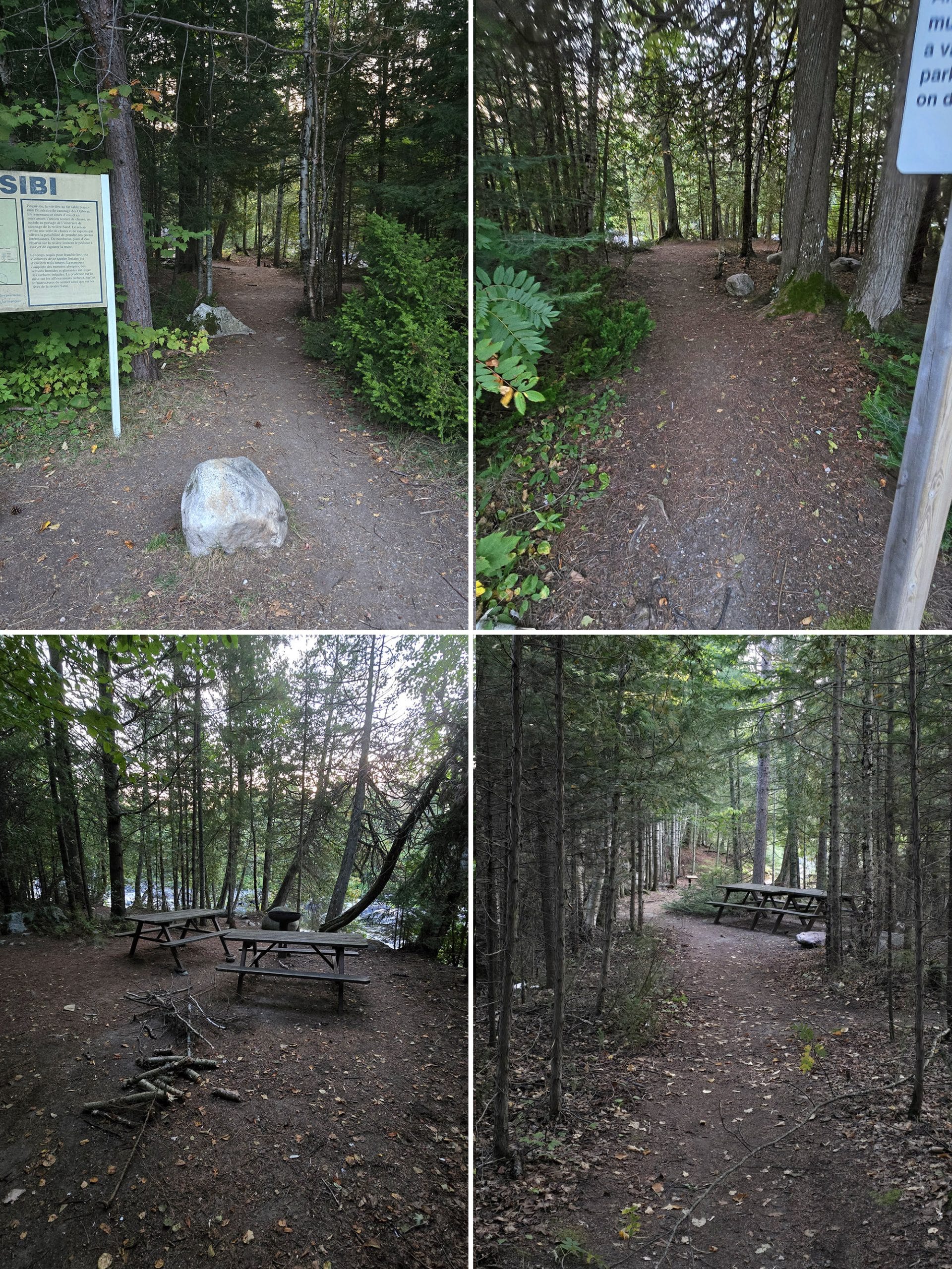
At the beginning of the trail - just steps from the parking lot - there are a few little picnic nooks.
These are super cute, and at least one has a pedestal style fire pit - I think that’s an accessibility thing. Anyway, some of them have a view over the river, and all are first come, first served.

Connectivity
As with most places in Lake Superior Provincial Park - aside from Agawa Bay Campground and Rabbit Blanket Lake Campground, for the most part - we had absolutely NO cell reception or internet connection while at Sand River.

Waterfalls
I’ll be honest, I’m not entirely sure of the technicalities surrounding waterfall identification.
As I see it, there were 3 distinct sets of waterfalls along the section of trail we did, though I’ve also seen some argument that the first section is more of a “rapids” thing.
I have thought of them as the lower falls ever since we first noticed them on a drive through, though, so for the purposes of this post, they’re the first waterfall.
Anyway...
The First Waterfall

I’m honestly surprised that we were able to get good photos of this water fall - every time we’ve driven by or visited the picnic area, the falls have had at least a handful of people all over this section, fishing from right in the rapids.
Having seen that, we already knew that walking right out onto the falls was an option, so we had fun doing exactly that!

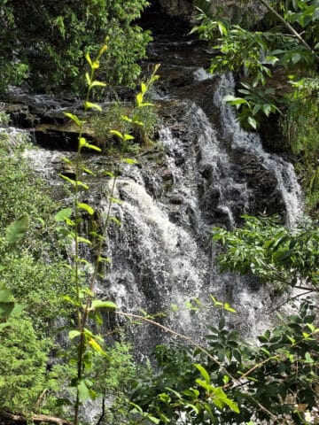
The Second Waterfall
The second waterfall isn’t super far beyond the first one, and really... I think the excitement may have been a huge distraction when registering the walking distance!
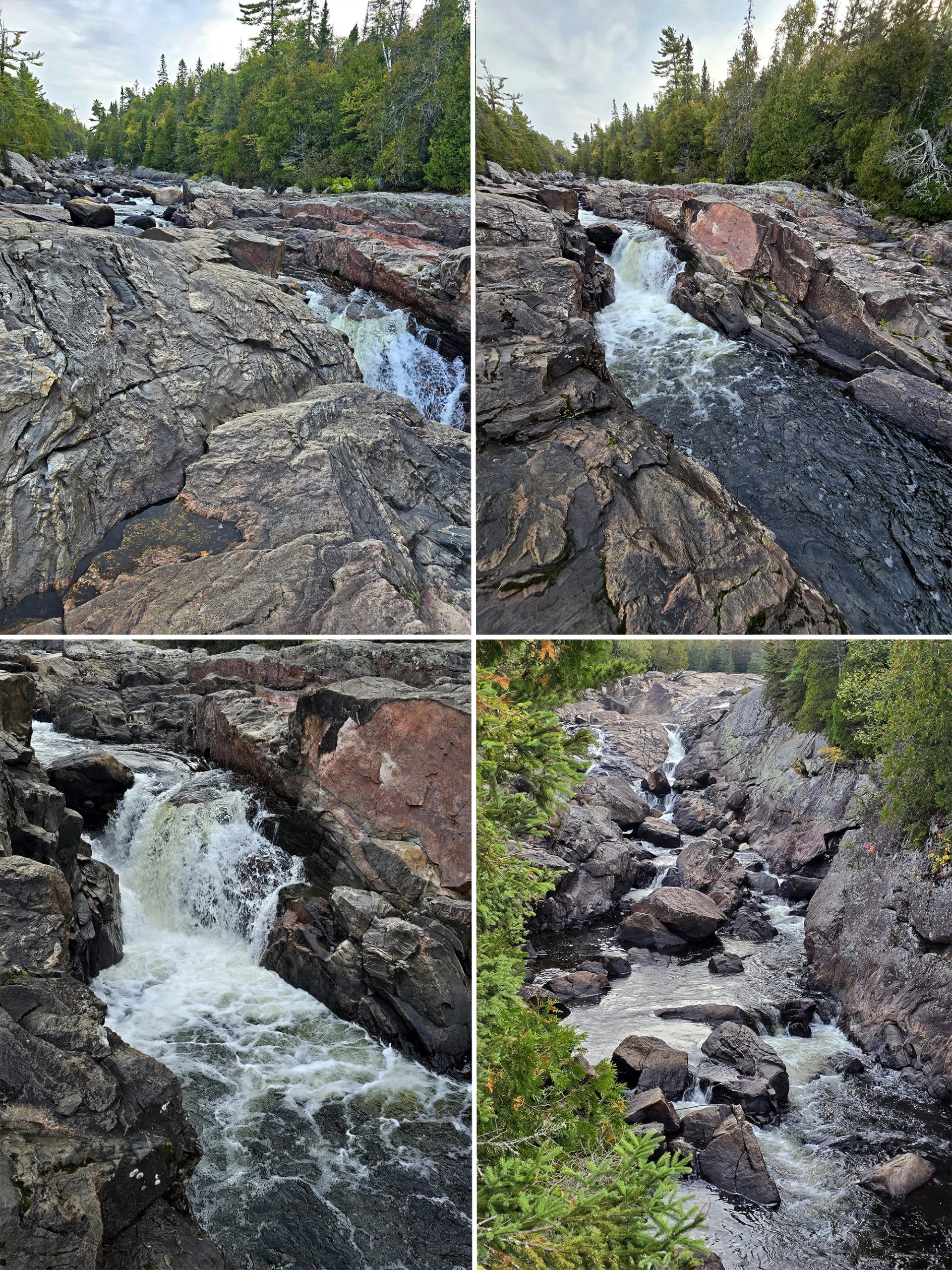
Just a totally different feel from the first waterfall area.
That said, we were happy to see that we could walk right out onto these falls, just like the first set. I’ve always been a big fan of “playing on rocks”, and being able to walk right out next to a waterfall like that?
*Chef’s Kiss*. The best way to start a morning, IMHO!

The Third Waterfall
As I mentioned earlier, I think the excitement of the experience distracted me from the distance we were walking. I was shocked to see we were about a km out when we reached the 3rd waterfall area.
It REALLY didn’t seem like we’d gone that far, even though the trail was rough - more on that in a bit, though.
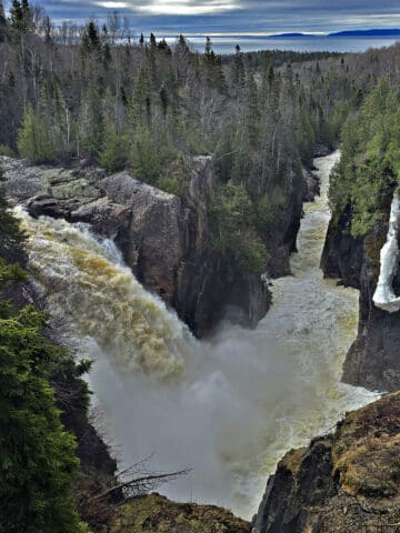
This waterfall area started out as a fantastic view from the trail. We were able to walk down a short offshoot trail to a cliff overlooking the front of the falls.
I thought that was amazing, and didn’t even think to feel sad about the fact that it didn’t look like there was a way out onto these falls - the most spectacular of the three, by the way.

Then - THEN!! - the trail turned to sand with a section split off to the right and BAM, we were facing a clear path right out to the main falls area!
At this point, my feet were just about done with me, so we decided to turn back after this one.
Let me tell you, I made sure to use up every last bit of my mobility budget on those falls.
When I was living in Newfoundland - long before Dr Fawad Khan crippled from me with his negligence - I used to love hiking.
I’d scramble down steep rock faces along the Atlantic Ocean shore, going out juuust to the point where I wasn’t sure I’d be able to crawl back out... and then I’d Spiderman my way back up.
It was glorious.
See, figure skating comes in handy - real world applications for that flexibility and strength!
It was GREAT. For just a moment there, I felt almost normal again. Hopeful.
I mean, it was short lived - and I paid for it later - but that little taste of physical freedom really ... I don’t know. I needed that, mentally. It was a glimmer of hope that I’ll get through this, you know?
Anyway... yeah. I had a fantastic time!

Share the Love!If you’ve made one of our recipes, be sure to take some pics of your handiwork! If you post it to Bluesky, be sure to tag us - @2NerdsInATruck, or you can tag us on TikTok, if you’re posting video. We're also on Pinterest, so you can save all your favourite recipes and park reviews to your own boards! Also, be sure to subscribe to our free email newsletter, so you never miss out on any of our nonsense. Well, the published nonsense, anyway! |
Entertainment and Activity
Some information on the recreational activities you can engage in while visiting Sand River Falls:
Hiking
So, the length of the Pinguisibi Trail seems to vary wildly based on where you’re looking.
According to the park, it’s a 6 km return, linear trail, and easy.
For one... in NO WAY is that trail easy, even if you stick to the trail and don’t go screwing around on the rocks. (Even though that’s ¾ of the fun!)
I don’t know if whoever graded the difficulty just looked at the first little area of trail by the parking lot, and assumed it was all like that?
Admittedly, THAT area is wide, flat packed, and easy enough that it’s probably even wheelchair accessible.
It’s even relatively easy to walk to the right - as you’re facing the river - to go check out the mouth of Sand River:

Once you pass the picnic area, it gets pretty chaotic - steep inclines, lots of roots, walking up over cascades of larger rocks, etc.

All Trails lists it as 3.5 km return, with the turnaround point being somewhere not SUPER far beyond where we ended up turning around. (It’s hard to say, as all our time walking on the falls definitely impacted the distance on MapMy Walk.)
Then, there are other references on AllTrails that say it continues beyond that point, but that the trail is overgrown.

Anything else would have felt anti-climactic!
While it was definitely challenging - and a GREAT workout! - it was a really fun, fantastic hike. 10/10, no complaints.

The ROCKS!
One point of interest - well, many points - are the rocks out in the gorge.
When you walk out by each of the waterfall areas, look at the rocks you’re hiking over. They’re super interesting - swirls of colour, really interesting shapes and patterns ... I could have spent hours out there.
*Happy sigh*

Swimming
While there were some little pools formed in the rapids, I wouldn’t recommend swimming at Sand River Falls. Seems like a poor choice, logistically... and probably pretty dangerous.
Just up the road from Sand River, though, is Catherine Cove - a gorgeous sandy beach!

Birding, Wildlife, and Nature
We heard and saw a few Black-Capped Chickadees - and we heard some kind of Woodpecker knocking near one of the falls - but that’s about it.
Our birding app wasn’t able to pick anything up over the roar of the falls, and - to be honest - I was far too entranced by the whole experience, to even remember to look up!
The park says that you have the chance of spotting Beaver, Moose, Osprey, Sandhill Crane and other birds along the river, though I think that may be more upstream, for the most part.
Boating
Sand River is a 56 km Canoe Route, with a recommended completion time of 5 days.
There are 29 marked portages, ranging from 9 metres to just over a kilometre in length. Absolutely wild - I bet it’s *gorgeous* to experience, though!
Fishing
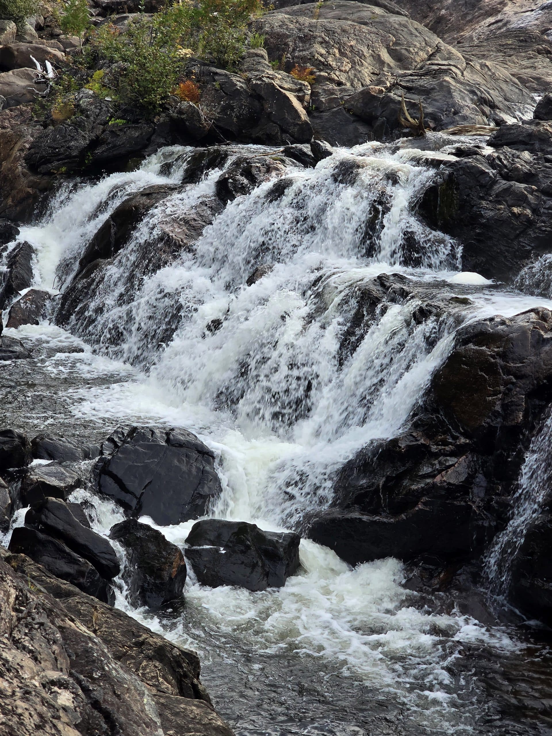
As I mentioned earlier, the lower part of the rapids / falls area - near the highway - is a super popular fishing spot.
In particular, it’s known for Brook Trout, and apparently has a Salmon run in the fall.
Niantic Games
We didn’t have any internet connectivity at all, so I have NO idea if there’s anything on the go there for Pokemon Go or Ingress.
Even if we’d had internet, I’m pretty sure I would have forgotten to check. I was SO enchanted by that trail, and the whole experience.

Final Thoughts
This was a super ADHD friendly trail - we probably overuse that term, but it really is the best description for an experience like this.
Things were ever changing, there was a new style of footing, or a new outlook, or completely different waterfalls - pretty much around every turn.
It kept held our interest SO strongly, that we lost track of time and space - literally. (Distance!)
Pretty sure this instantly became my favourite trail, of every one we’ve done to date... and probably even including the ones I did before having my tendons destroyed.
Porter sort of agrees - he just figures it’s in his top 3, rather than THE number 1 spot
To me, it was just magical. A lot of that was finally feeling a bit normal for the first time in years - just a glimpse, but it was THERE.
So, your mileage may vary, if you don’t have all that physical baggage coming into play!
Anyway, we got some photos (Keep scrolling after the review, I took WAY too many for this post, even when pared down!), and I took some video for one of my skating friends... but completely forgot to take the panoramic images I’d meant to.
Whoops, guess I’ll have to do it again...

More Ontario Waterfall Posts
Looking to waterfalling in Ontario? Here are more Ontario Waterfalls to check out:
Aguasabon Falls
Chippewa Falls
Eugenia Falls
Falls Reserve Conservation Area
Gariepy Creek Falls
Healey Falls
Hogg's Falls
Indian Falls Conservation Area
Inglis Falls
Jones Falls [Pottawatomi Conservation Area]
Kakabeka Falls
Mink Creek Falls
Onaping Falls
Oxtongue River-Ragged Falls Provincial Park
Provoking Falls
Rainbow Falls
Sauble Falls
Scenic High Falls
Walter's Falls
Webwood Falls
Beyond the waterfalls, be sure to check out our Places to See category, to find more interesting Ontario places to explore!

Thanks for Reading!If you loved this post - or have any questions about it - please leave a comment below! We'd also love it if you would consider sharing the link on social media! |



Leave a Reply