
Onaping Falls - and the A. Y. Jackson Lookout - is a fantastic attraction near Sudbury. Also known as High Falls, here's everything you need to know about visiting!

It was about an hour away from the northeastern Ontario park, which is also located on the edge of the Sudbury Basin.
As I’d mentioned in the Fairbank review, this was the site of a meteorite impact well over a billion years ago, and the origin of Sudbury’s status as “the Nickel City”.
Anyway, that meteorite strike obviously left a lasting impact (Why yes, I’m going to reuse that pun... how often do I get to talk about meteors on a camping blog?) on the area, and was likely a big part of the natural beauty of the general area.
The natural beauty of the area was an obsession of the Group of Seven artists, who you can see referenced all along the nearby Algoma region, and along Lake Superior.
Nowadays, it’s a popular tourist destination, with a variety of different ways to experience it.
For the mobility limited, you can view the falls from a distance, via 3 more accessible lookouts in and around the parking lot area.
For the more adventurous, you can climb down a cascade of rocks and on to a challenging trail that will take you to a bridge over the top of the falls - and beyond.
In the spring - after the snow melts - the falls are at their strongest flow. In the fall, it’s a fantastic place to view the fall colours.
Anyway, lots to talk about, so let’s get to it!
The Basics:
Location Name: A.Y. Jackson Lookout & Onaping's High Falls
Address: ON-144, Greater Sudbury, ON P0M 1R0 (Click for Google Map location!)
Website: A.Y. Jackson Lookout & Onaping Falls
Price: Free!
Reservations: Not Applicable
Season:
Hours: 6 am - 11 pm
Logistics
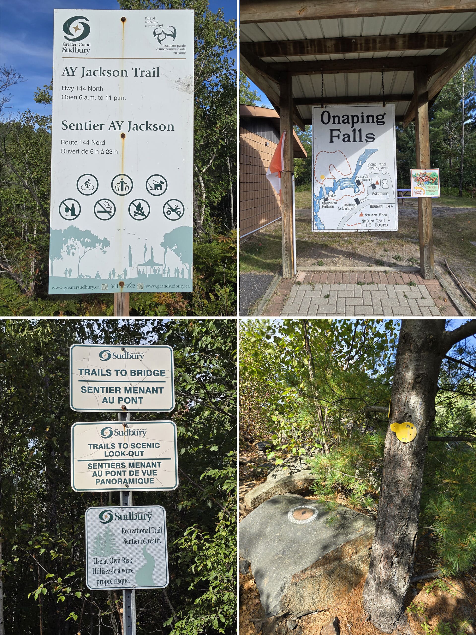
When mapping your way to Onaping Falls, be sure to map to “A.Y. Jackson Lookout”, rather than “Onaping Falls”.
There used to be a town there of the same name, which is where Google will take you. I had mapped to Onaping Falls, and we “arrived at our destination” a few km past the falls, at just a random spot on the highway!
Anyway, beyond mapping, here is some more information to help you plan your visit to Onaping Falls:
Maps and Signage
As we entered the park and drove to the trail entrance, we didn’t see anything in the way of maps. Not much in the way of signage either, but it was easy enough to find the trail entrance (which was marked, at that point.)
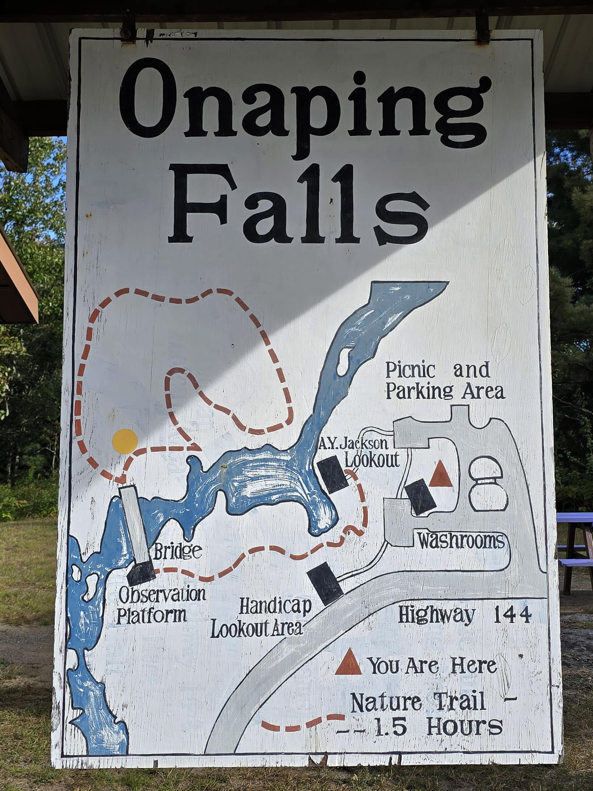
It was only after doing that trail, that we found a park map - it was up in the parking lot of the A.Y. Jackson Lookout / picnic shelter area.
Not a super useful map, other than as an overview. I have no idea why parks list times instead of distances.
A family with young kids, someone with mobility issues, a young/fit/able bodied person, a birder, someone with ADHD - they’re all going to have wildly different completion times on any trail!
We think one was an old style, and the other is what they changed them to - they seem to have been used interchangeably.
The A.Y. Jackson Welcome Centre
The A.Y Jackson Welcome Centre was closed at the time of our visit, and I haven’t been able to find much in the way of information on it.
A nearby sign mentioned the existence of a rock gallery in there, inviting people to come in and check out their display of different rocks found in the area.
I found one mention - online - of there being a small shop in there, but that’s about it.
Maybe it’ll be open the next time we’re in the area. I’m curious!
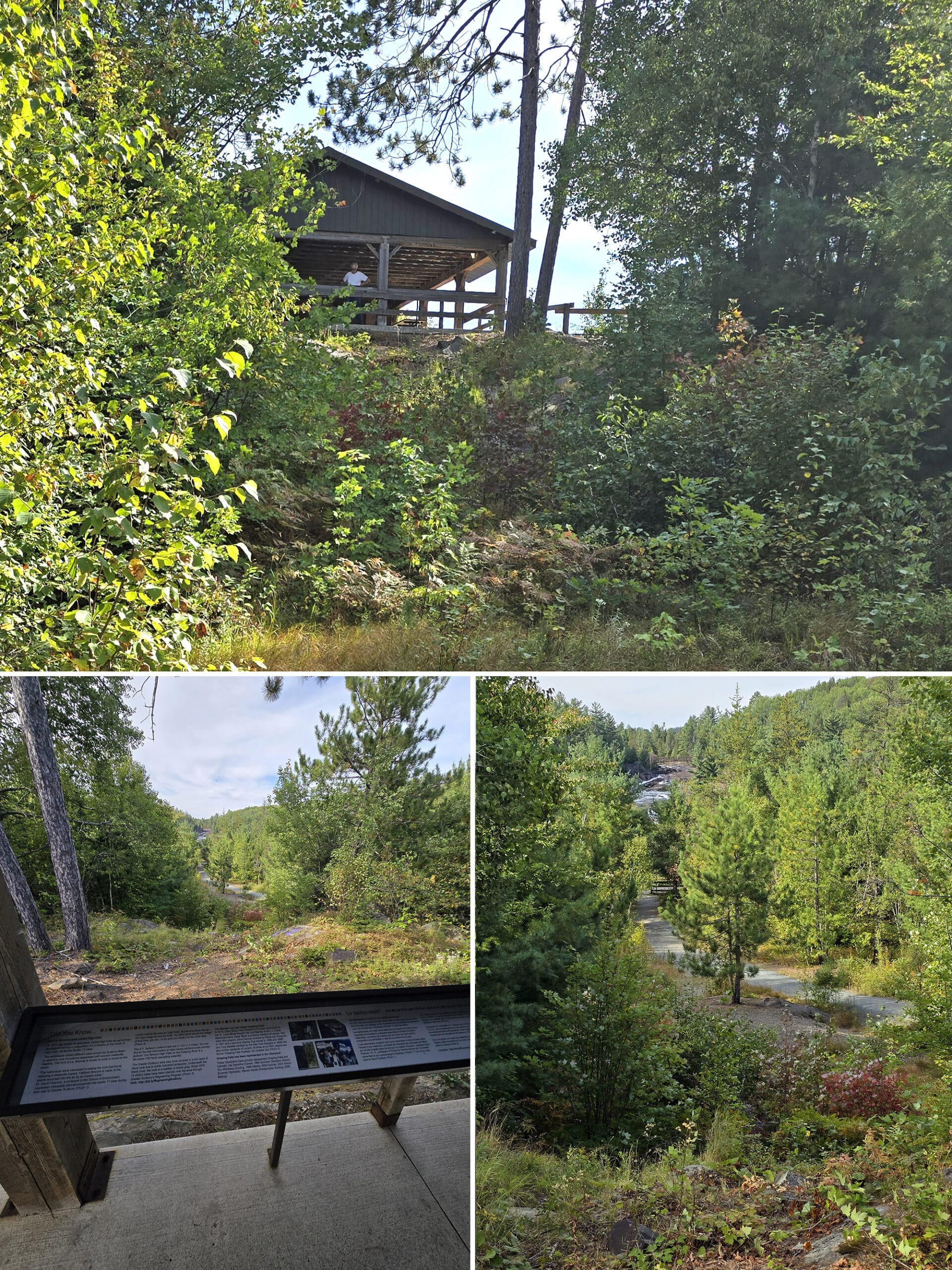
It’s not the BEST view of the waterfall - it’s the furthest and highest of all the lookouts - but it’s the lowest effort one to access.
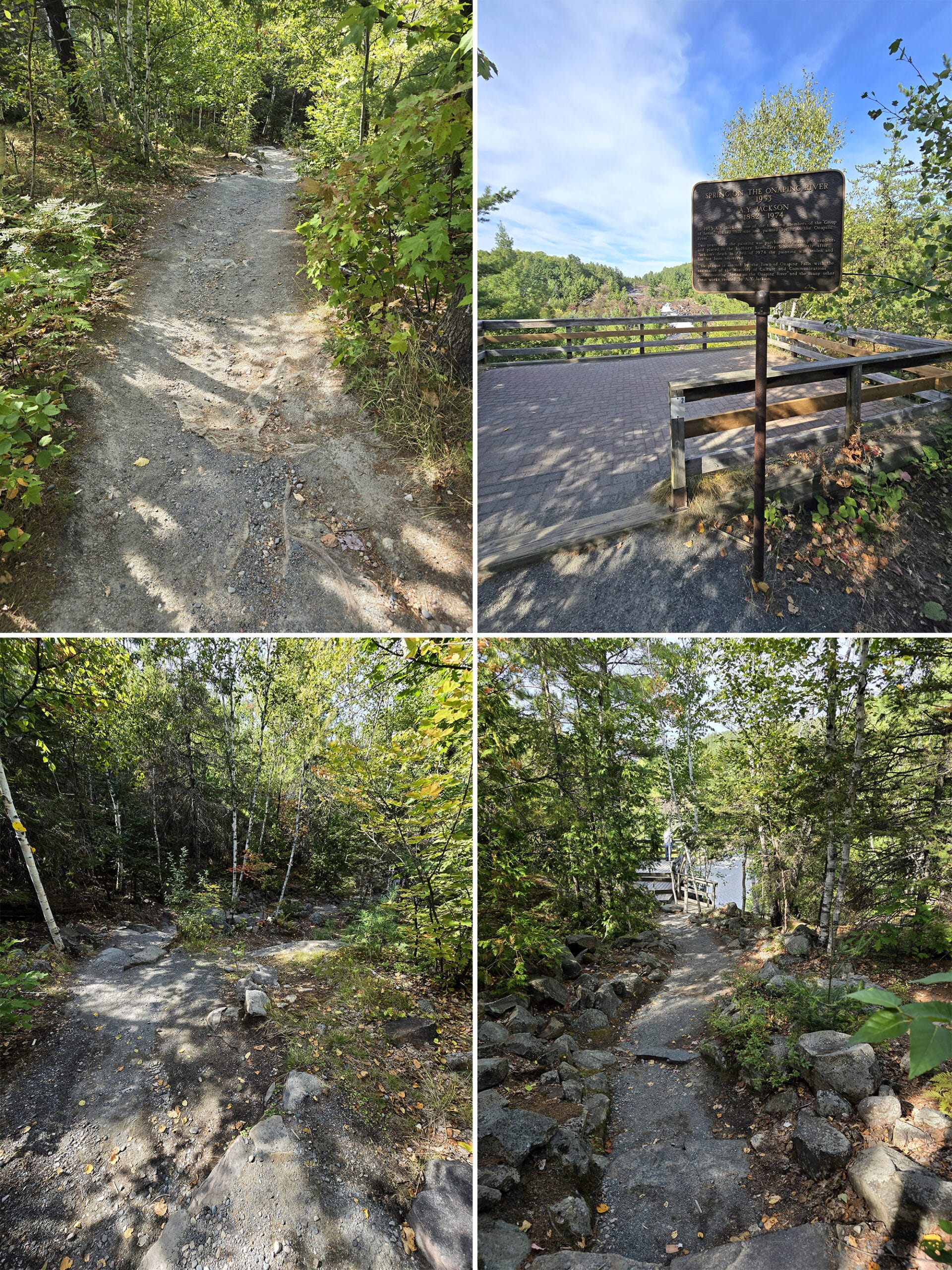
There are information panels along the inside of the lookout, talking about the history and geology of the falls, some of the tourist destinations in Sudbury, and - of course - about A.Y. Jackson, and his 1953 painting “Spring on the Onaping River”.
It had been purchased by a student group to display in Sudbury Secondary School. It hung there for almost 20 years, was stolen in 1974, and hasn’t been seen since!
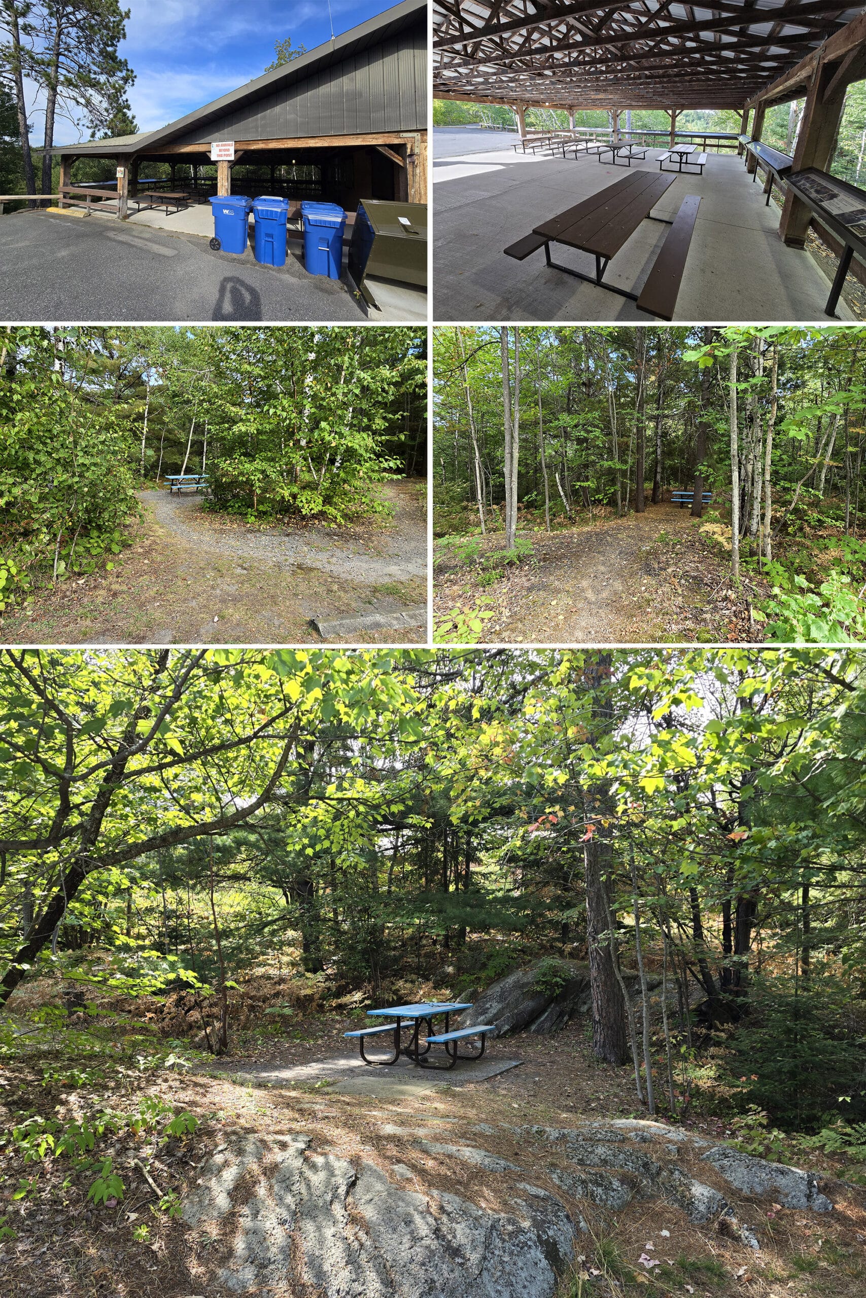
Picnic Areas
On the subject of the picnic area at the lookout, there are actually multiple picnic areas at the Onaping Falls park.
The large picnic shelter at the Welcome Center is the biggest picnic area, but keep an eye out for hidden little nooks around the parking area, with secluded picnic tables.
There are some really cute spots to grab a nice lunch outdoors!
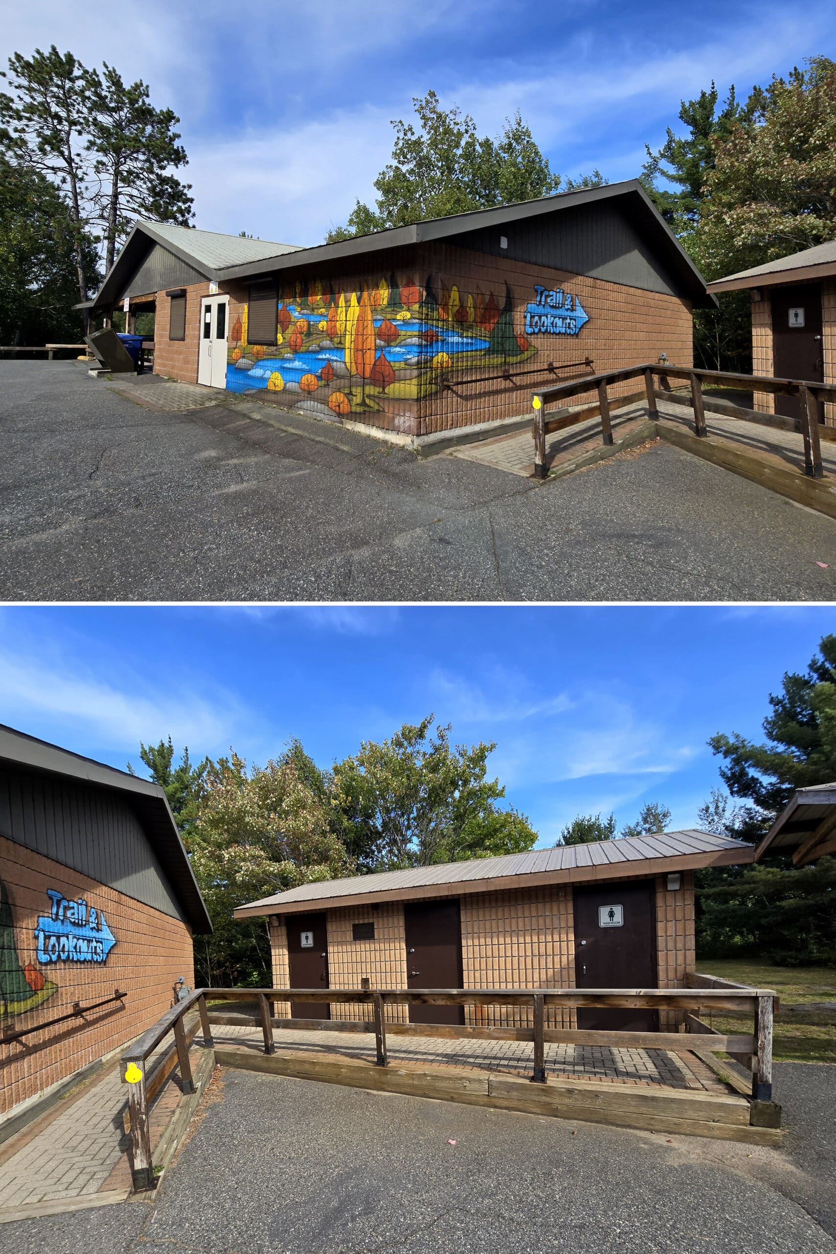
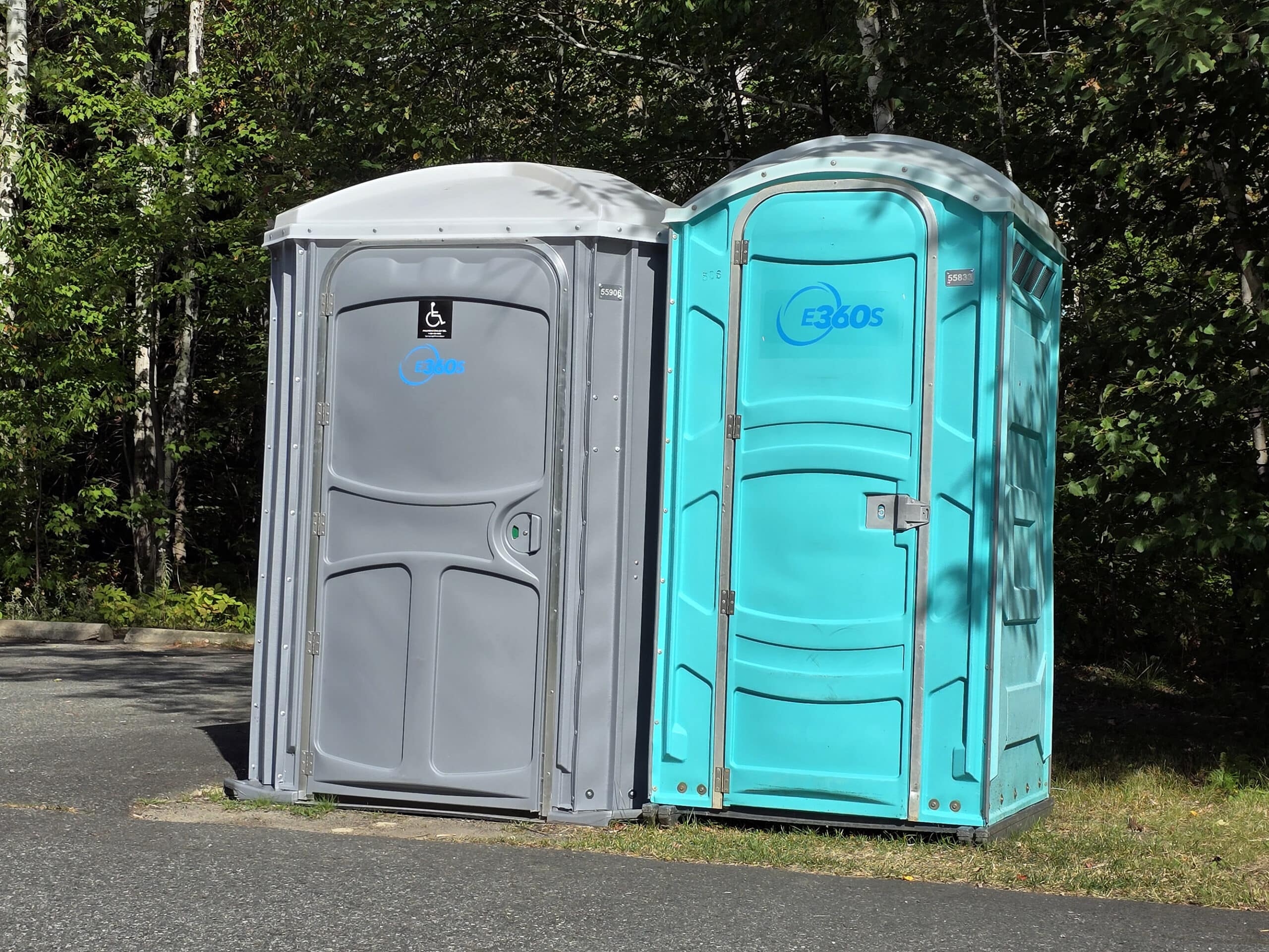
Washrooms
There are two sets of washroom facilities at Onaping Falls / A.Y. Jackson Lookout.
One is a set of two PortaPotties, which are easy to find as you enter the parking area. These were very close to where we parked - at the trail entrance - so I used one. It was in good condition, seemed well maintained, etc.
After that, I wandered up to the main parking lot, and found a building with more washrooms. Had no need to use them, at that point ... but hey, now we know that they’re there!
Accessibility
I wish there had been more accessibility information available when planning our trip. We followed the sign for “trails”, and it was... a bit much. I had seen that the “trails” were easy / accessible, but that was absolutely not the case.
More on that in a few minutes.
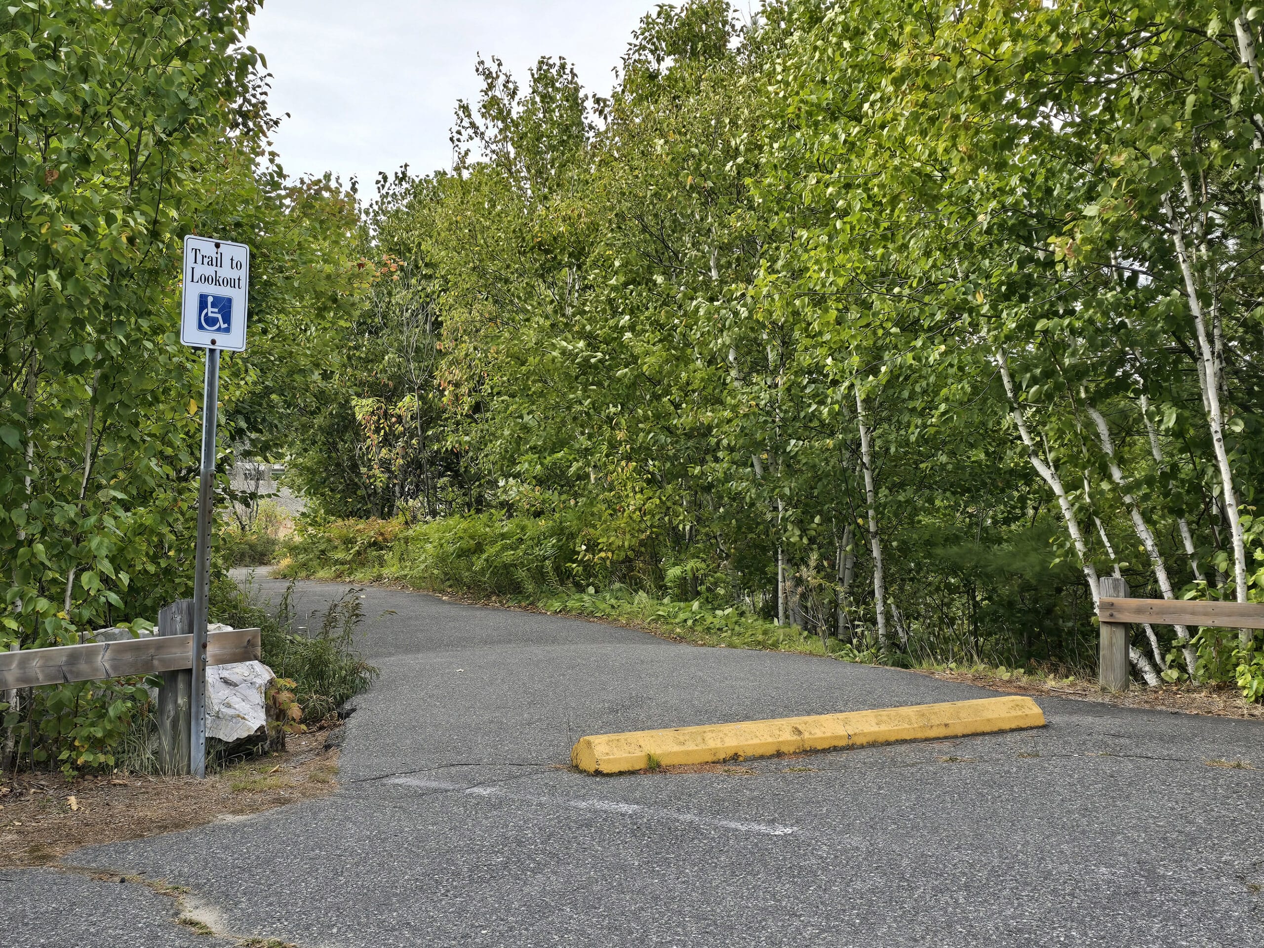
Anyway, after I got back to the parking lot, I wandered around for a bit... and happened across a wheelchair accessible trail up there.
There may have been some cursing involved!
That trail is about 0.1 km long from the parking lot to the lookout point, and runs along the side of the highway. The view isn’t as nice at that platform as it is at the other two, but it’s much easier to get to.
Weirdly, there were no accessible parking spots marked in that parking lot, AND there was a cement curb-type barrier across the entrance to the accessible trail.
I get wanting to prevent cars from going out there, but you’d think they’d use a post instead. There’s very little in the way of on-path clearance around the barrier.
So, this was a case of “I’m glad an attempt was made, but things definitely could have been done better” - including the information available online.
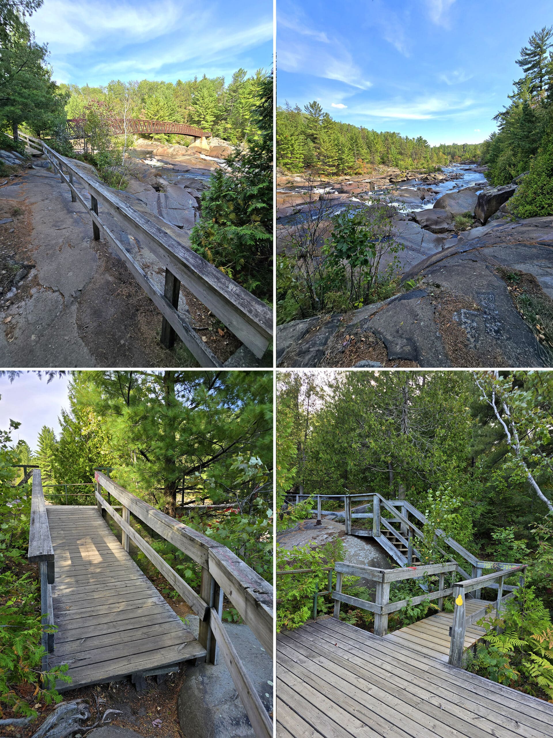
The Main Trail
If you, like me, have to budget your mobility, here’s what you’re looking at on the main trail:
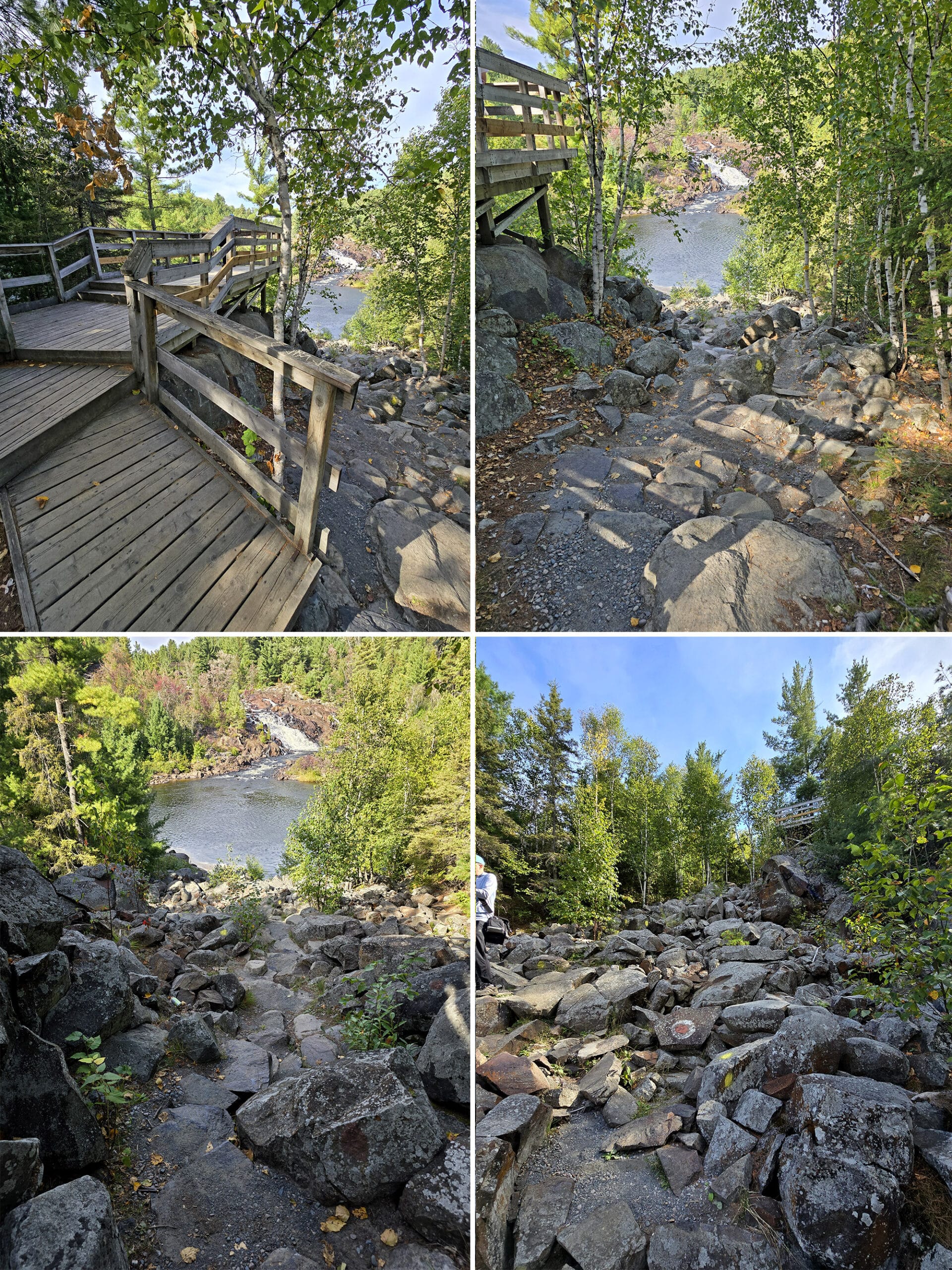
It’s 0.13 km from the closest parking lot, to the first lookout. The path is probably not wheelchair accessible - it’s well packed gravel, but downhill and with water runoff damage - but should be ok in a boot or with a cane.
This first platform is directly facing the falls, and will be your best view from that angle.
If you take the trail from there, it’s just under another 0.1 km to the second platform, but this trail is much more difficult. Steeper, rougher - absolutely not wheelchair accessible.
That platform is a little closer, lower down to the falls, but off to the side. This one is the closest view you’ll get if you’re mobility impaired, but the angle isn’t as nice as the first platform.
From there, you have to scale down over a cascade of big rocks - I wouldn’t recommend doing that if you have any mobility issues. I’ve done some pretty instense things in a walking boot, and there’s no way I’d tackle that.
I got to the base of the rock cascade, regretted my decision, looked up the trail a bit, and noped out at that point.
Connectivity
We had really good cell phone connection all the way through the parking lot and on the 1 km trail to the bridge.
We were able to call and send photos to each other the whole time, and I had no trouble mapping, looking up information, etc while I waited for him to finish the trail.
Pets
According to a sign on the accessible trail, dogs are allowed at the park, but must be leashed at all times.
The symbol used on one sign not-so-subtly drew attention to the fact that owners need to pick up after their dogs. Love it, LOL.
Parking
There are a few parking areas kind of branching off the main road in. We had gone straight in, past the porta potties, and parked at the main trail entrance.
Had we branched off to the left, the road would have taken us up to a bigger parking lot, with the A.Y Jackson Lookout, a washrooms building, and the accessible trail.
As a note: While there weren’t designated parking spaces for trailers - so far as we noticed - you’d definitely be able to get an RV or trailer into and out of the park.
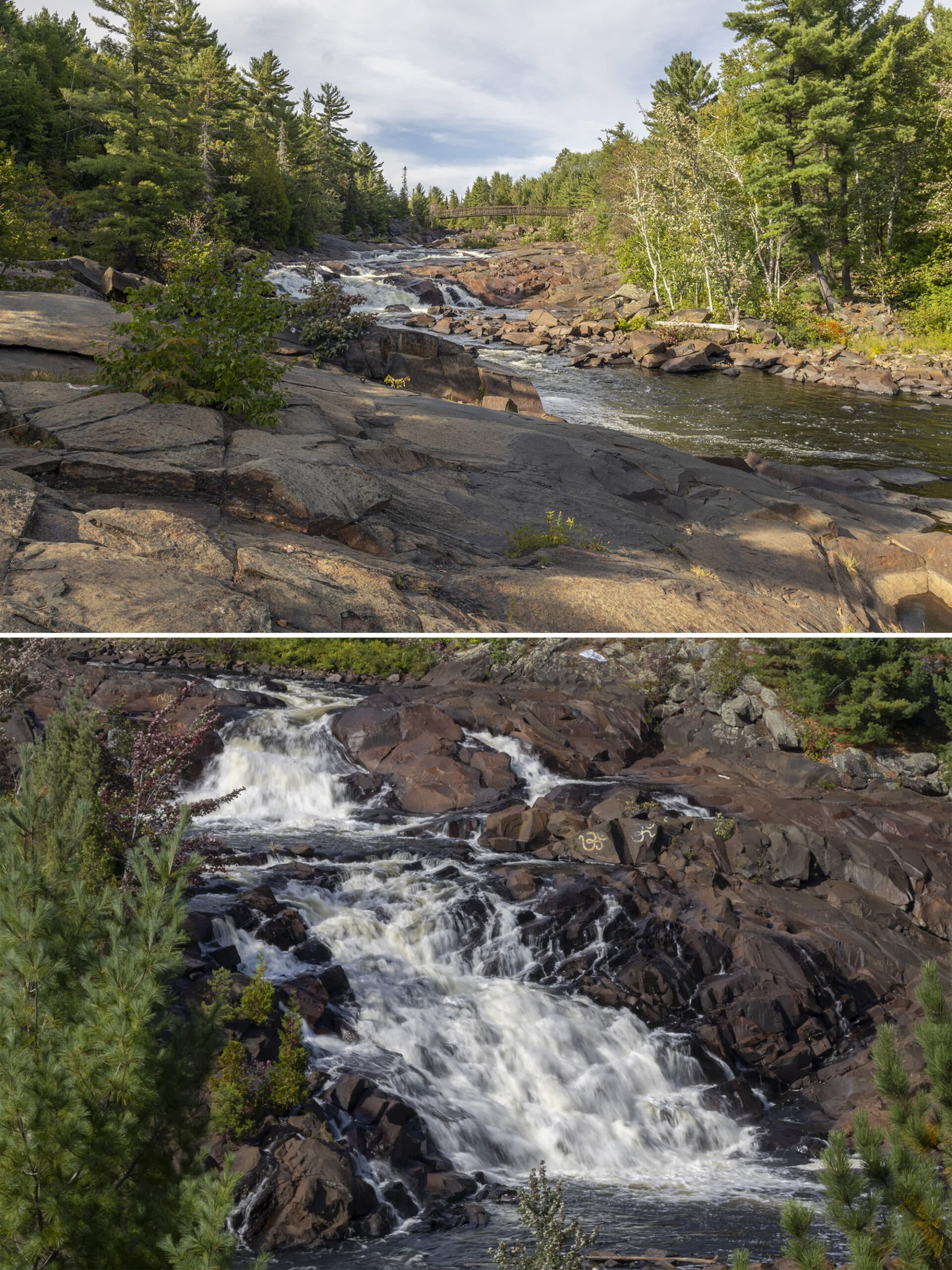
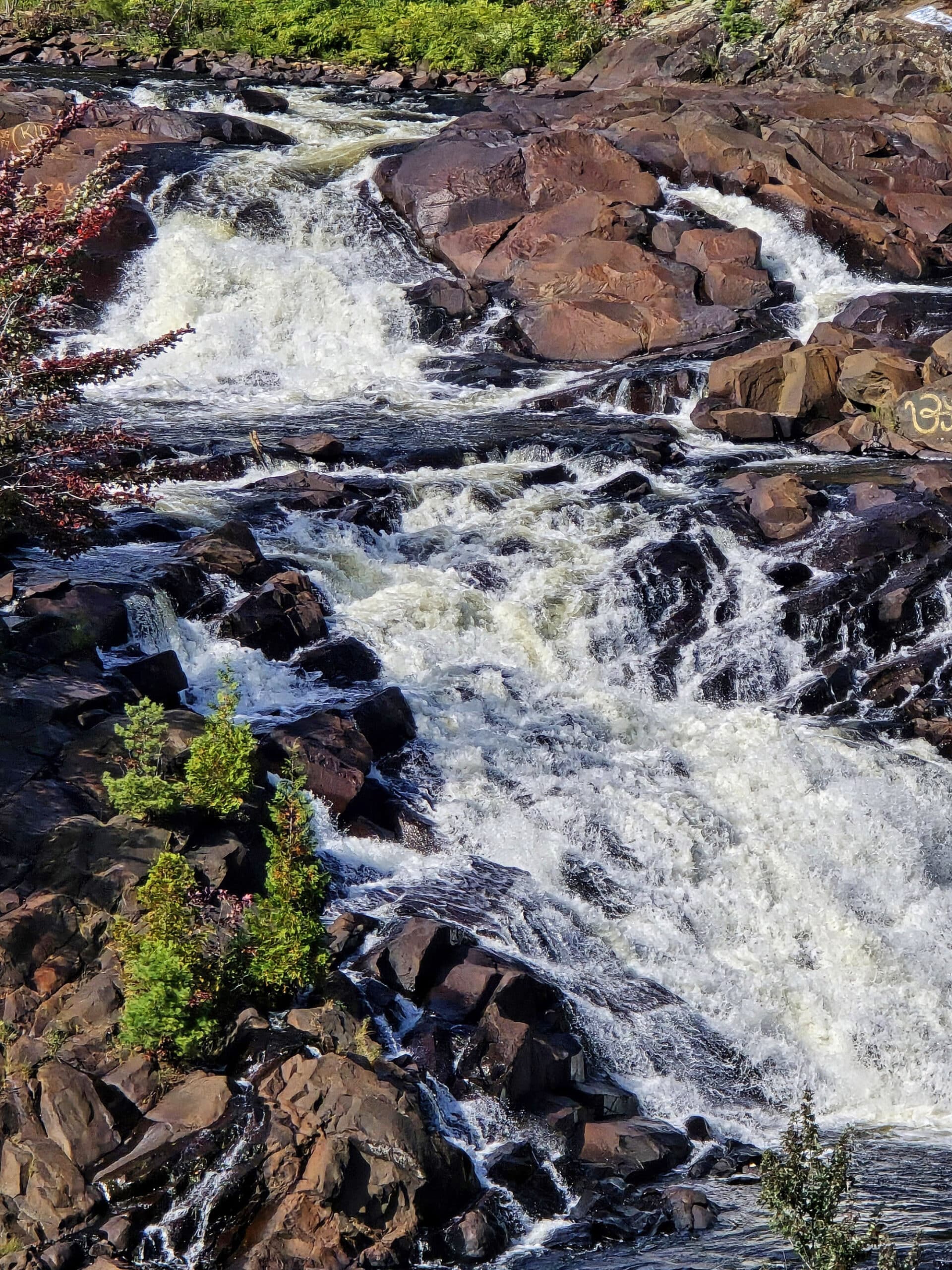
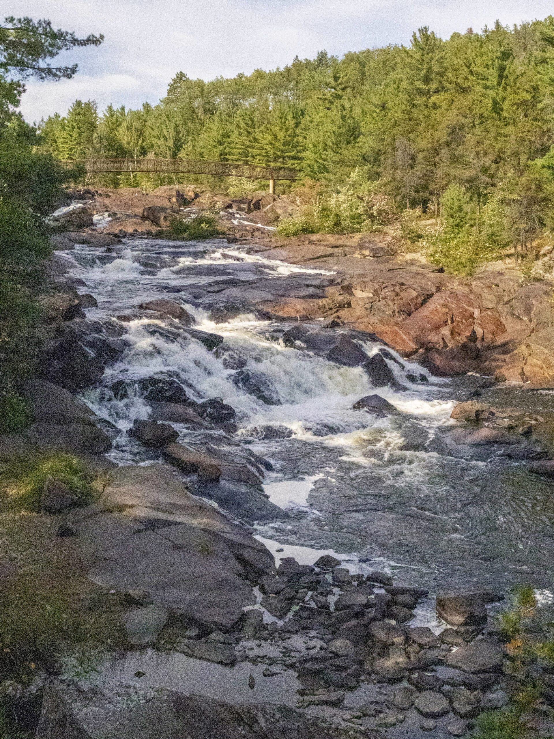
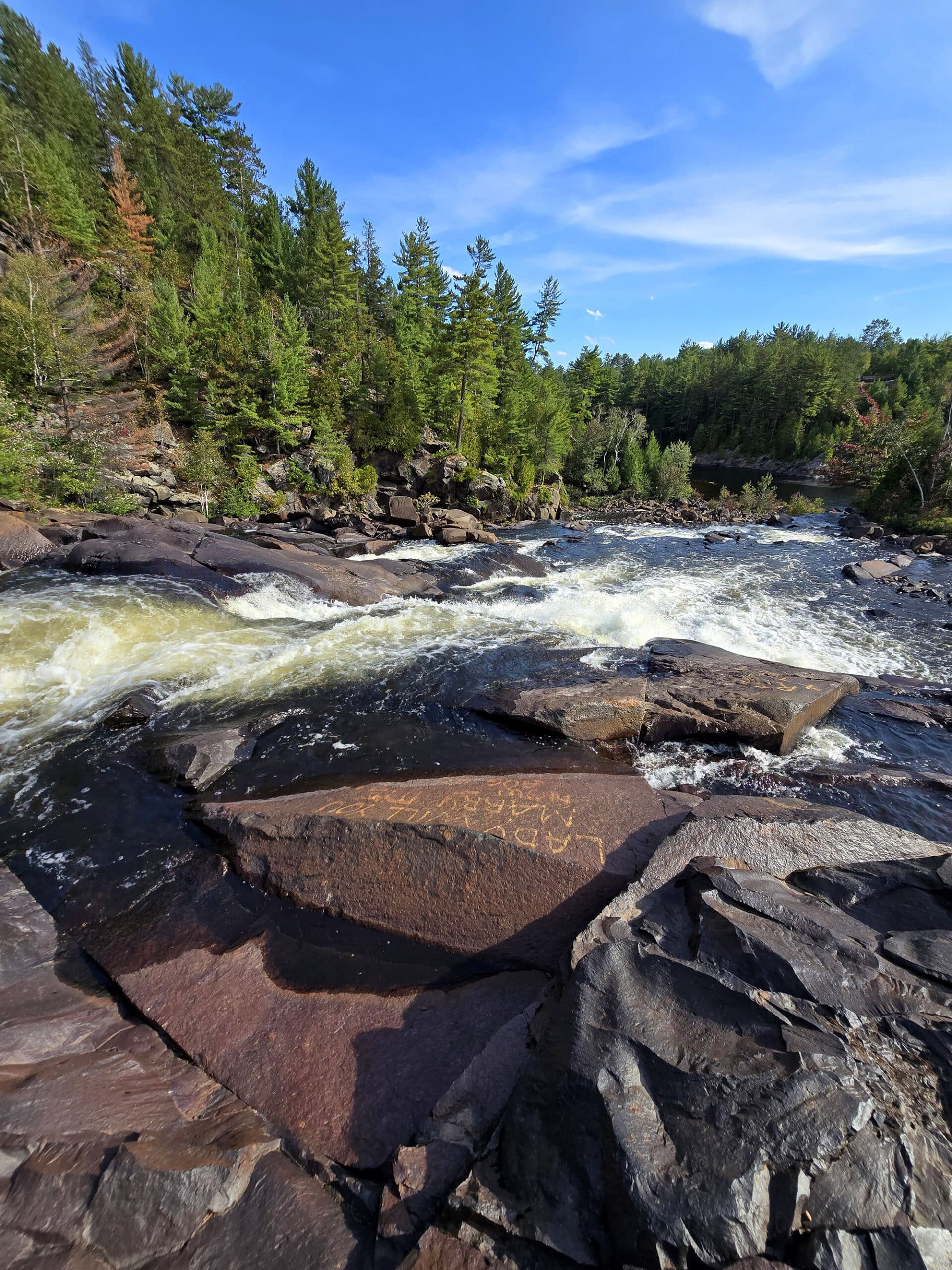
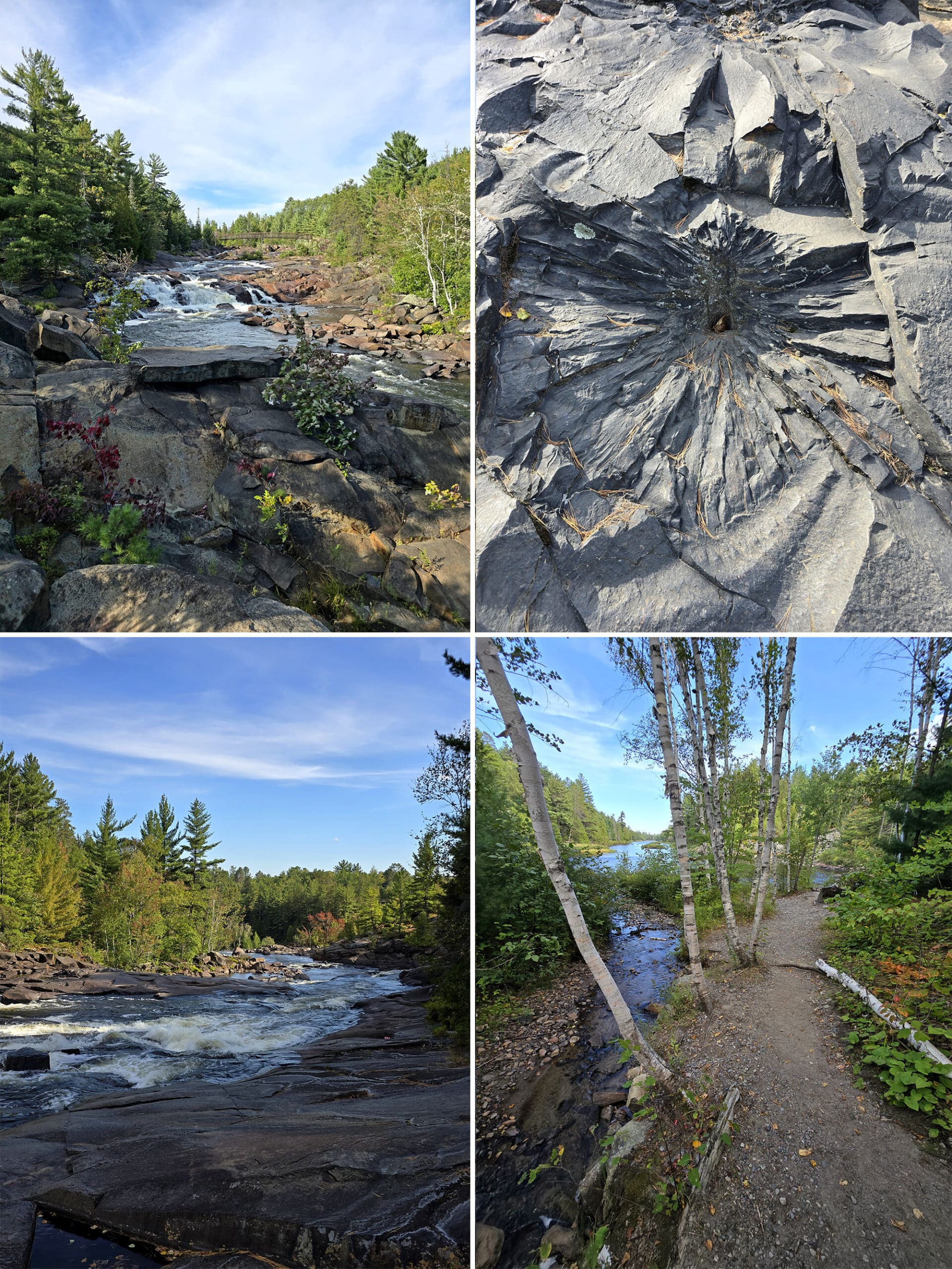
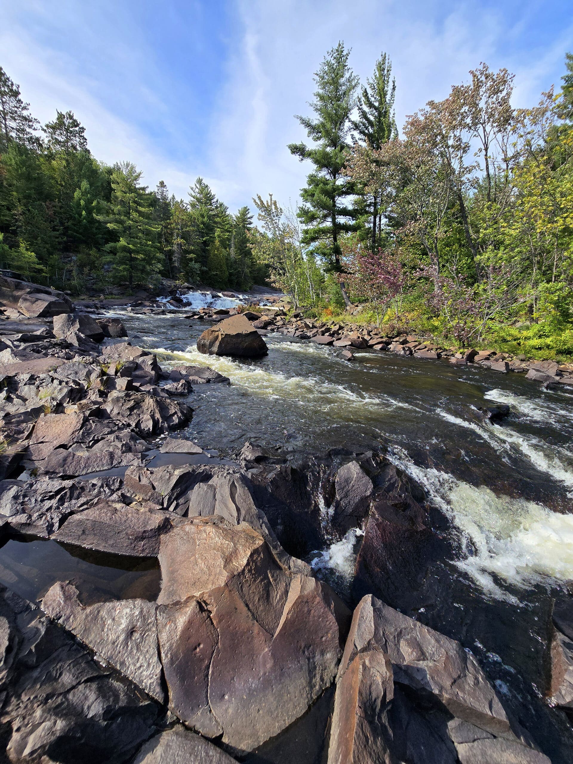
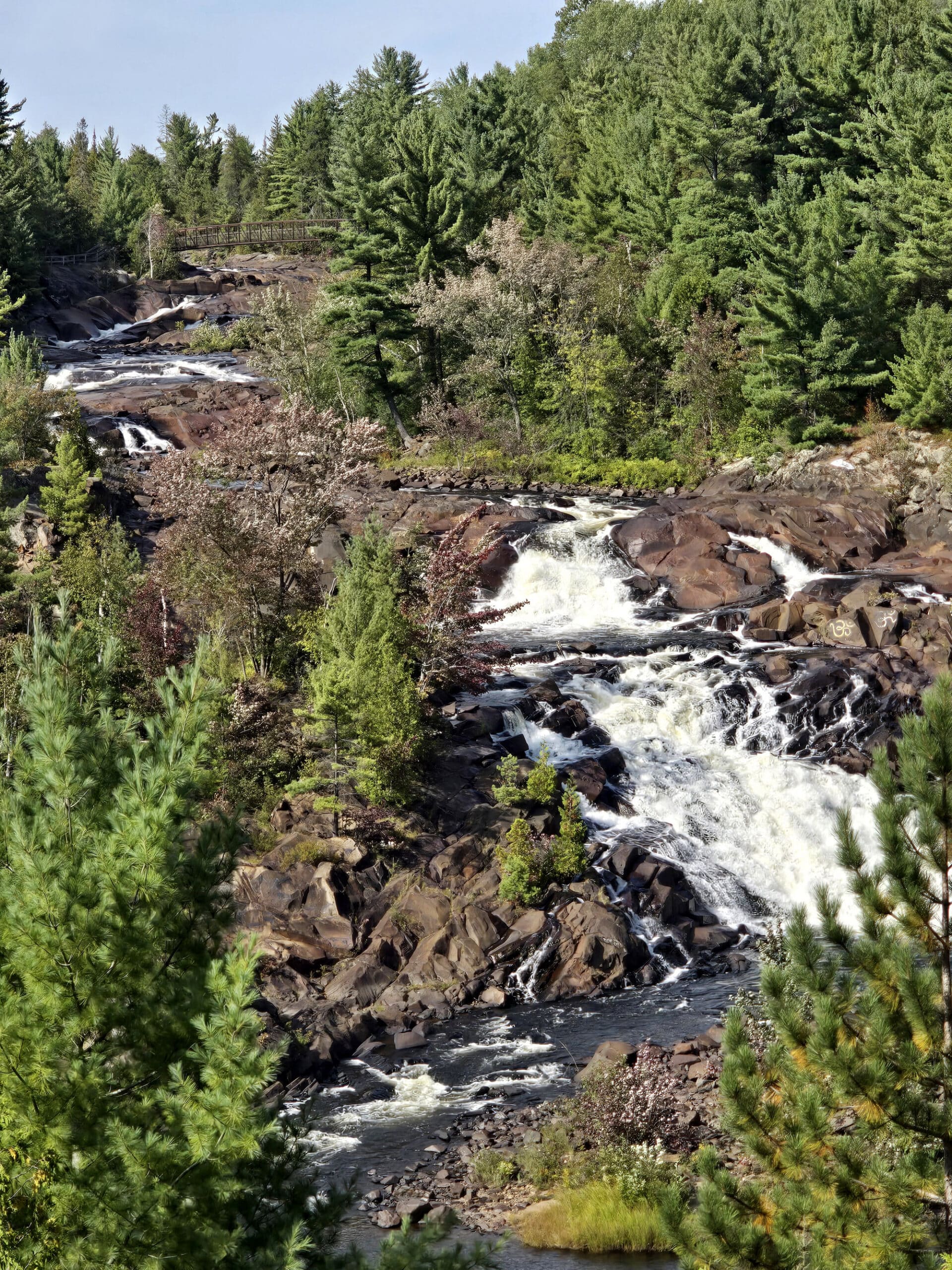
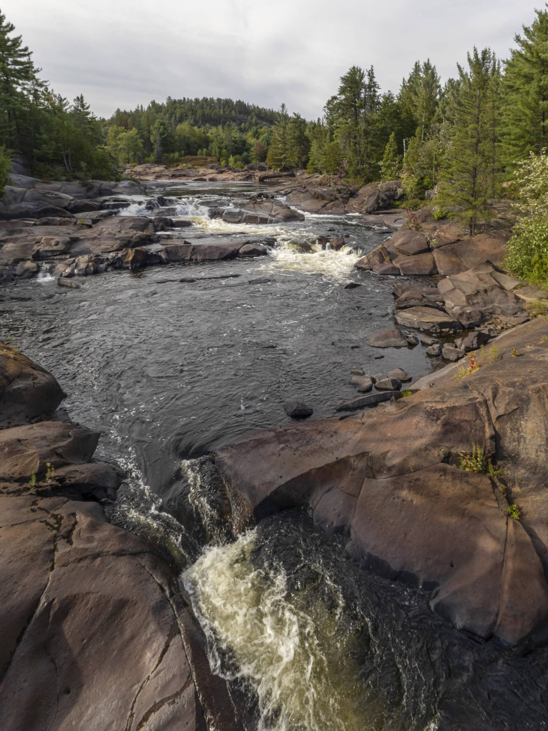
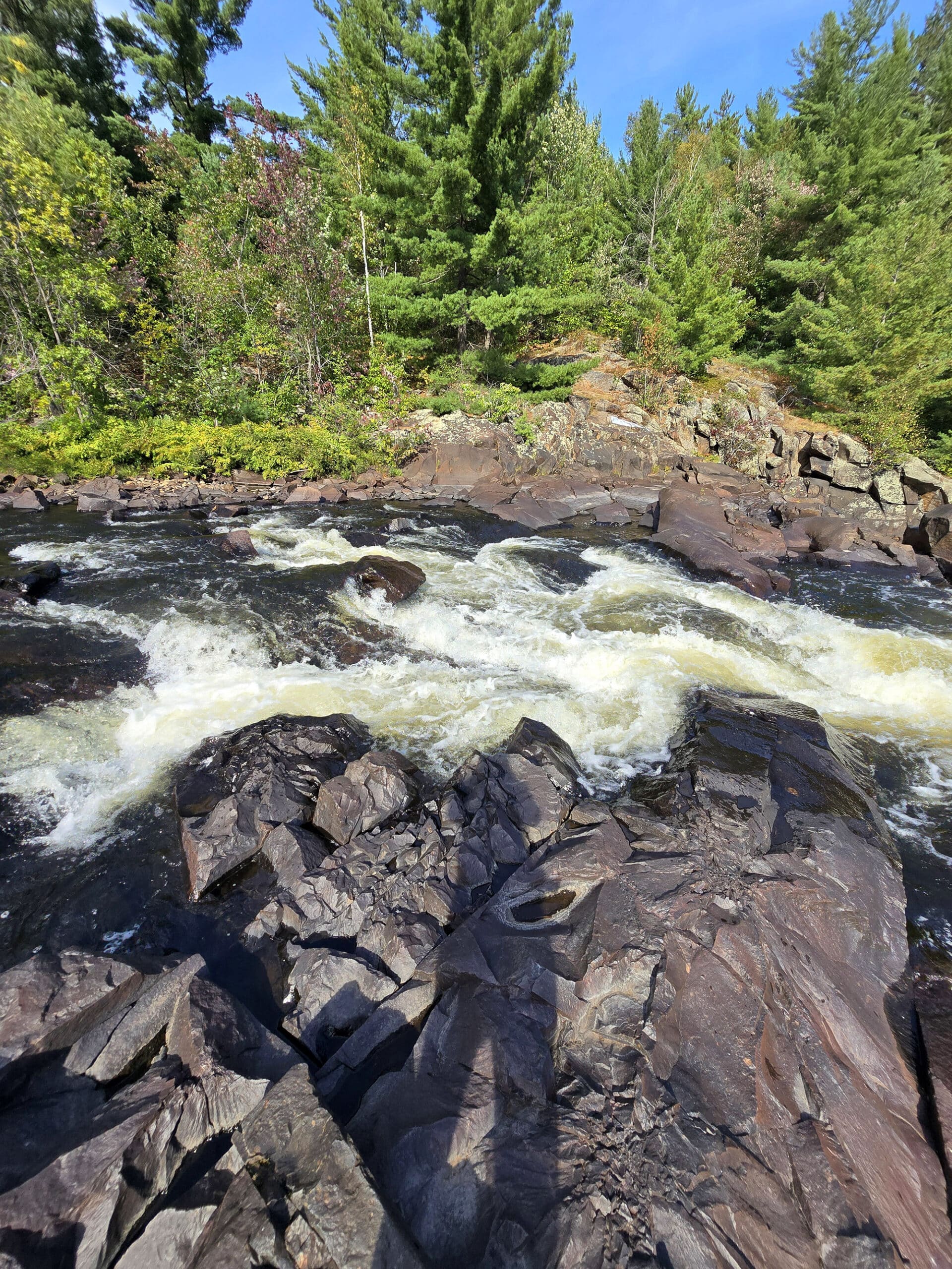
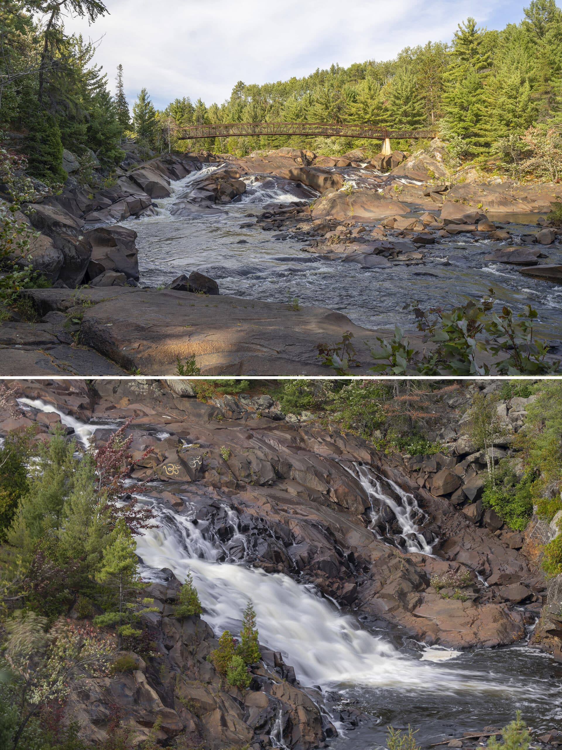
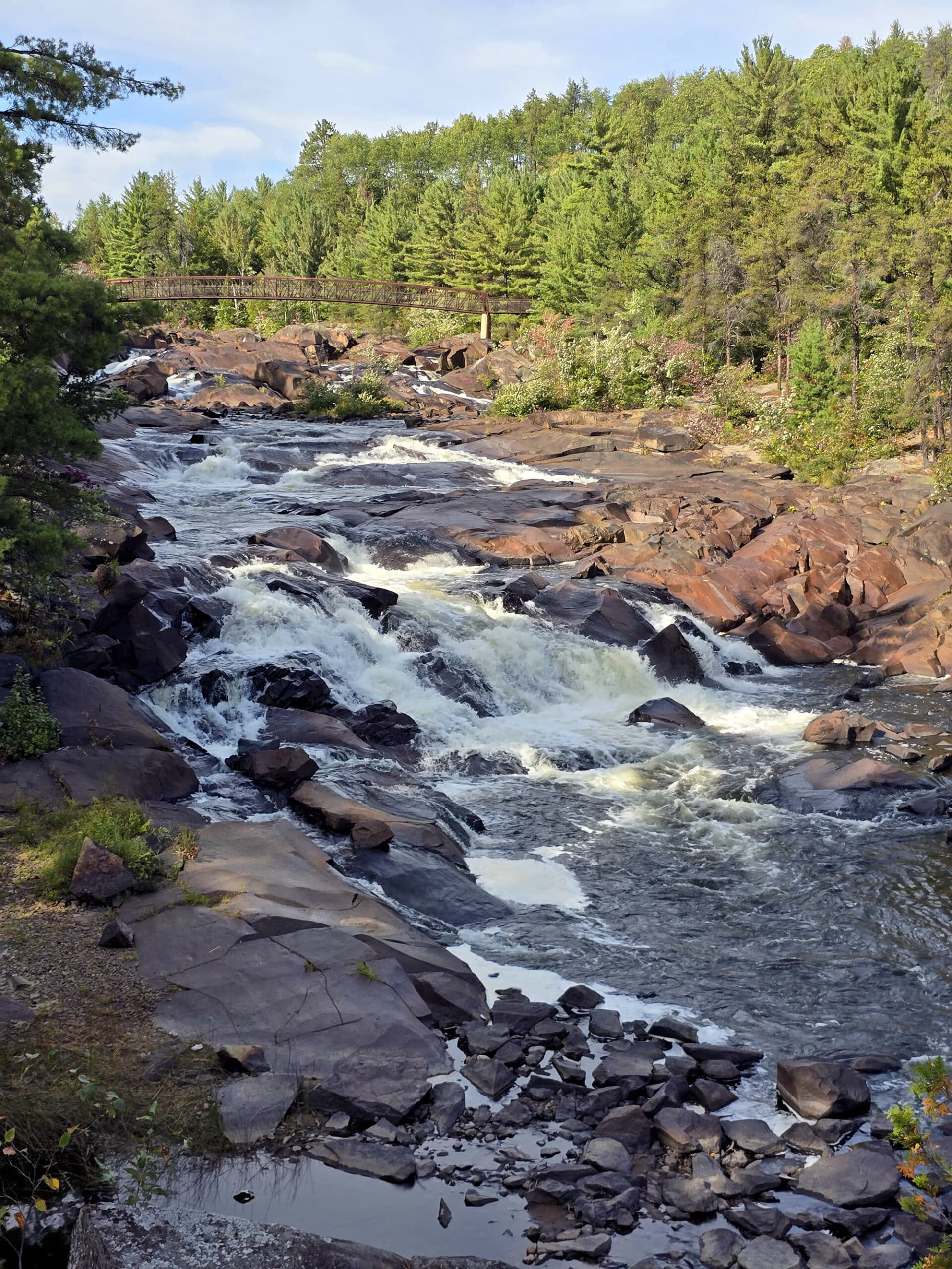
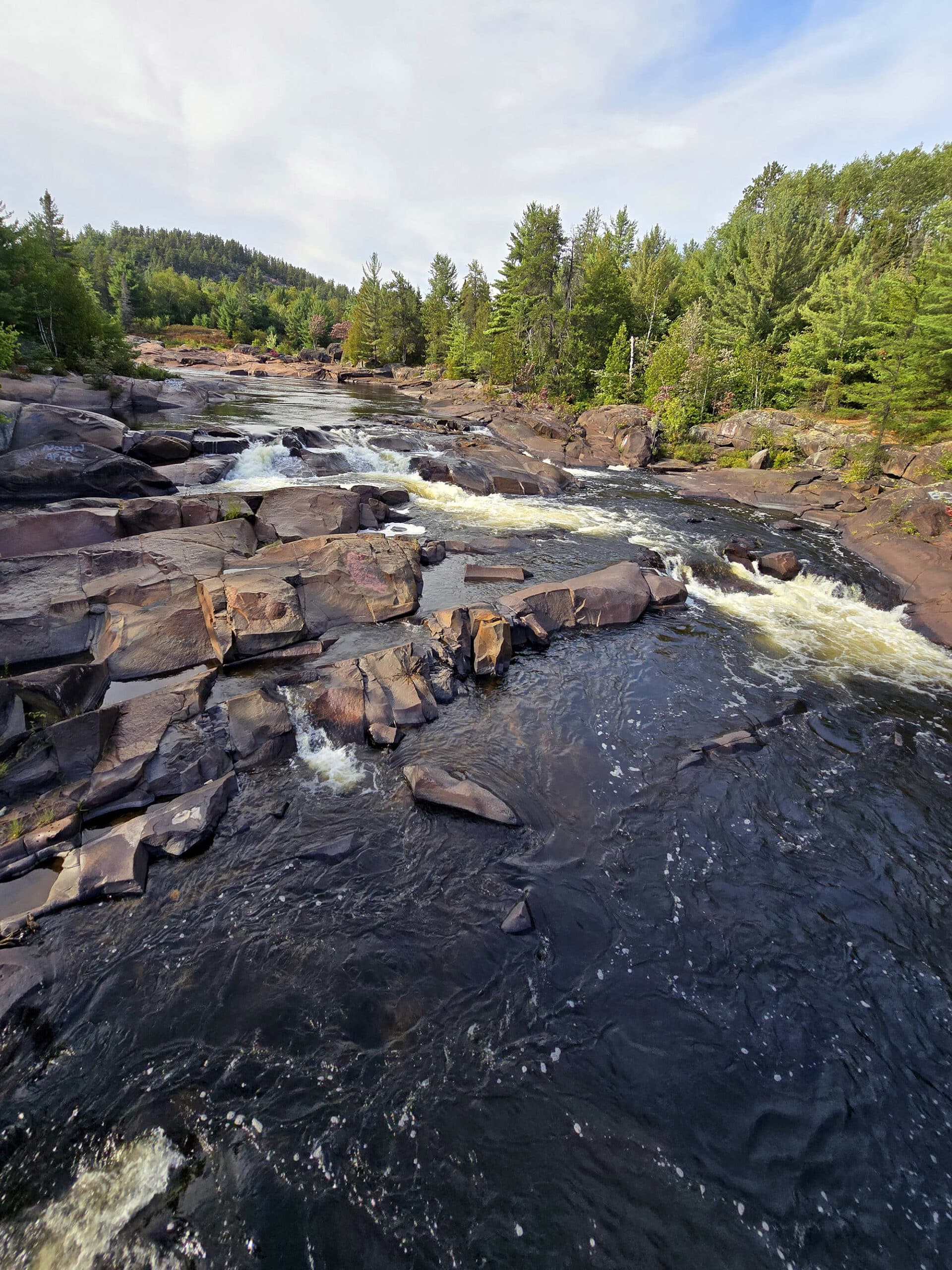
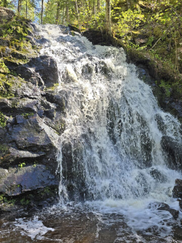
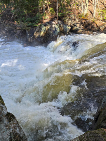
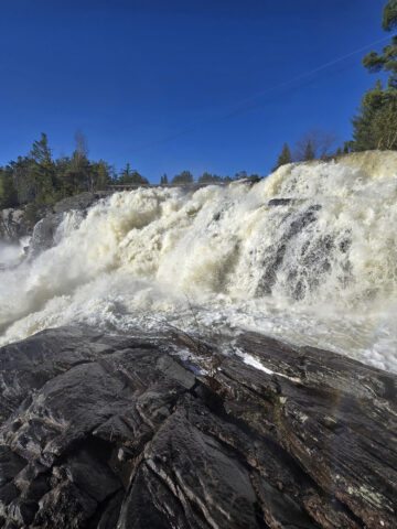
The Waterfall
Onaping Falls is a complex cascade waterfall. Personally, I prefer falls like this, to plunge waterfalls.
While plunge falls can have the height, I like the chaos of complex cascade falls.
Anyway, Onaping Falls is kind of hard to nail down dimensions on.
Best I can tell, it drops around 150 feet total, over a series of drops that cover just over 300 metres of the Onaping River.
Share the Love!If you’ve made one of our recipes, be sure to take some pics of your handiwork! If you post it to Bluesky, be sure to tag us - @2NerdsInATruck, or you can tag us on TikTok, if you’re posting video. We're also on Pinterest, so you can save all your favourite recipes and park reviews to your own boards! Also, be sure to subscribe to our free email newsletter, so you never miss out on any of our nonsense. Well, the published nonsense, anyway! |
Entertainment and Activity
Some information on the activities you can participate in, at Onaping Falls.
Hiking
There are a few options in terms of trails at the park, none of which seem to have an official name. I’ve seen “nature trail”, “Onaping Falls trail” and “riverside trail” used interchangeably, etc.
So, let’s just designate some names to make it easier to refer to them.
“Accessible Trail” is the one leading out from the upper parking lot, along the highway.
“Riverside Trail” / “Main Trail” is the one leading out from the lower part of the parking lot, to the two lookout platforms and on to the bridge.
“Nature Trail” will be the additional trail, on the far side of the bridge.
So, with that in mind...
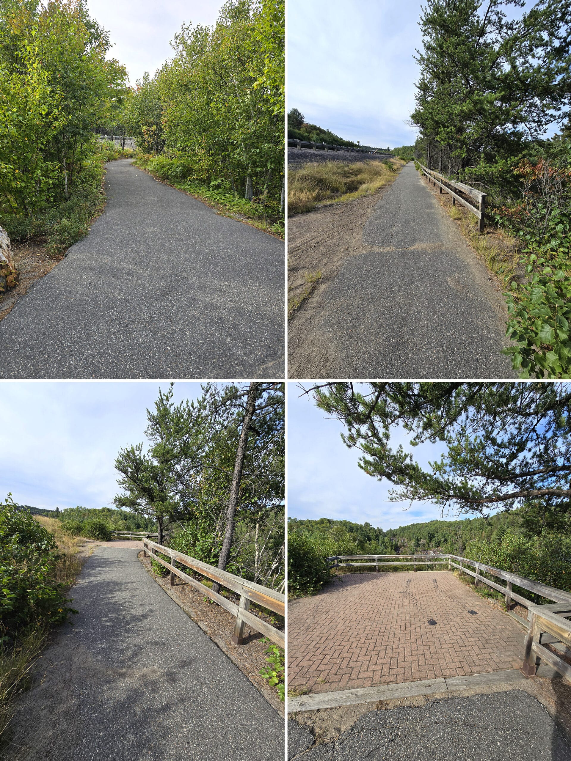
Accessible Trail
I’ve covered this in the accessibility section, but for the sake of convenience, I’ll go over it here, as well.
This is a 0.1 km trail from the upper parking lot, which goes along the highway to a viewing platform. The trail is paved, flat, and even, with a relatively smooth transition onto the brick viewing platform.
A very easy walk... ESPECIALLY after navigating the other option!
Riverside Trail
This trail starts with a 0.1 km walk down a slope (packed gravel, some water runoff damage) to a lookout platform, then another ~0.1 km down a steeper, rougher trail to a second viewing platform.
This is where I noped out, so I’ll let Porter tell you about the rest of the trail:
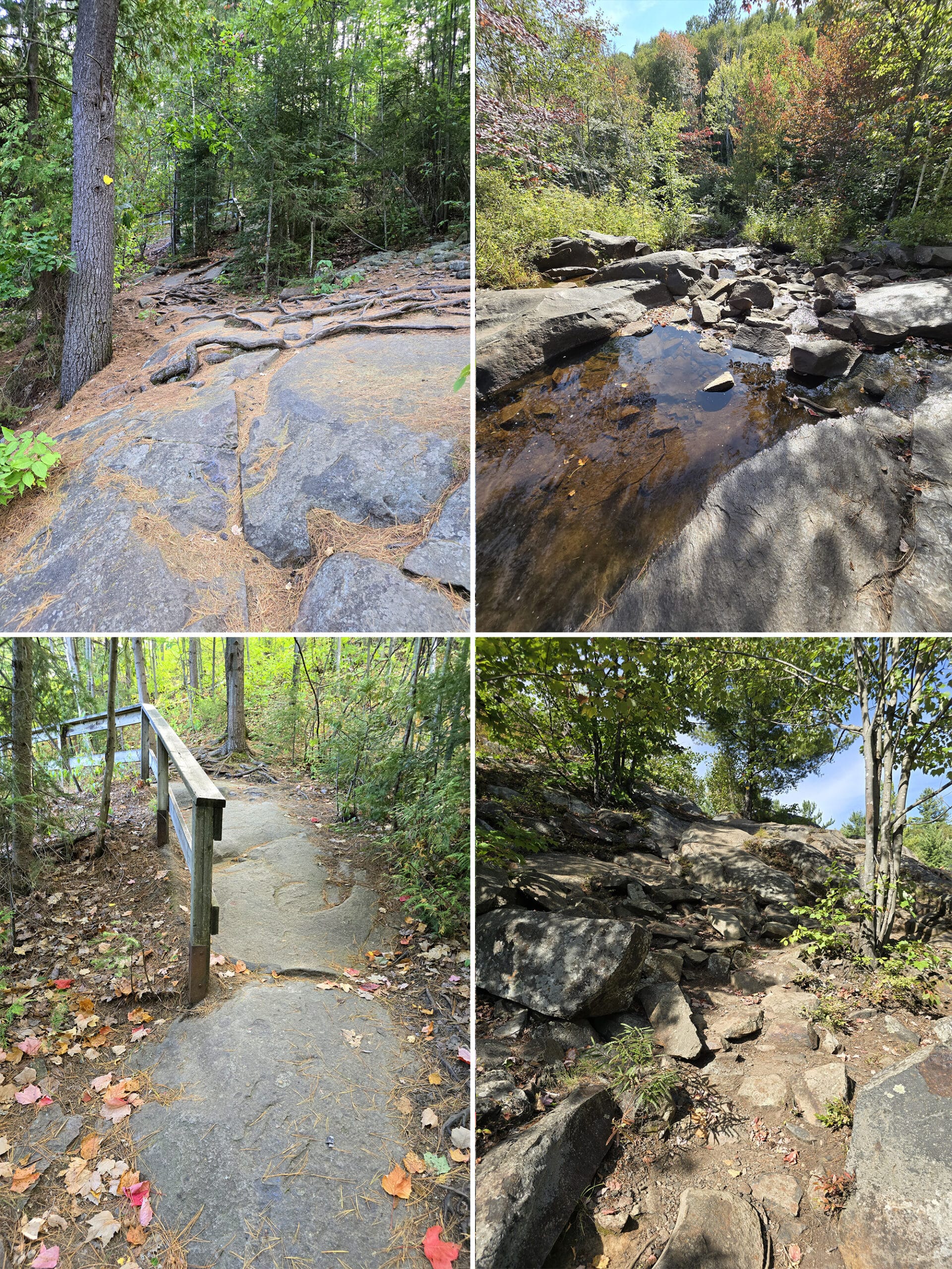
It took a minute for me to realize that the trail was down that pile. It was a tough path down, but it was clear that the main path was a little flatter with packed gravel to attempt to make it easier.
As I followed the path to the left, I was confused by the trail markings. The trees had yellow indicators with an arrow pointing out the trail direction.
On several spots I saw spray-painted marks - a red dot with a white circle around it. It reminded me of a "Do Not Enter" sign, so I thought these were indicating that you should not proceed in that direction.
It quickly became clear, however, that *BOTH* indicators were for the trail path. Once I realized that, it became much easier to follow.
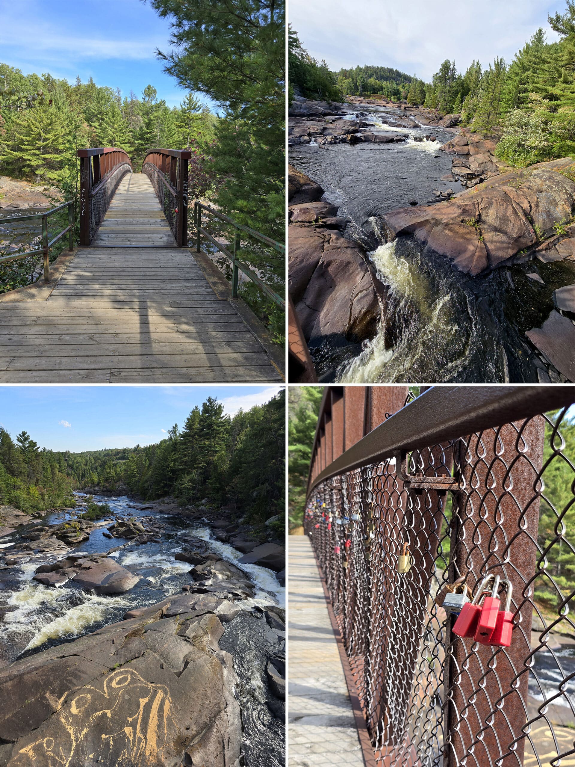
All told, it’s about 0.9 km from the lower parking lot to the bridge.”
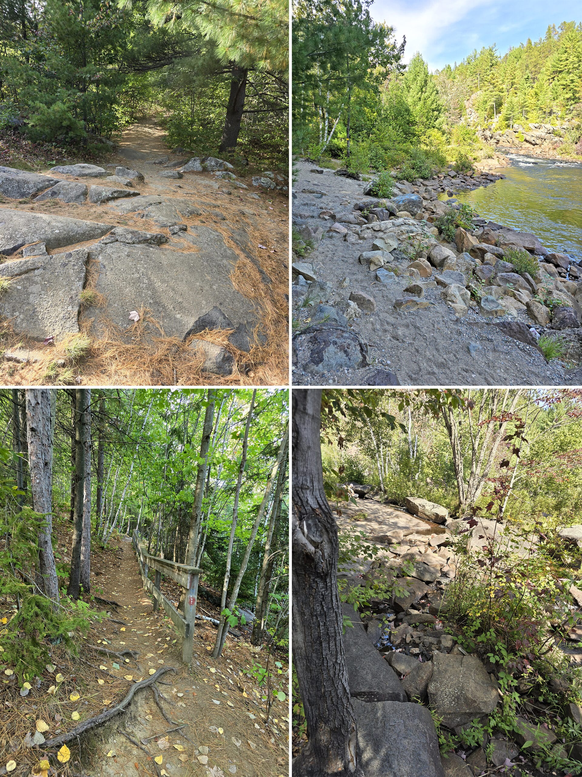
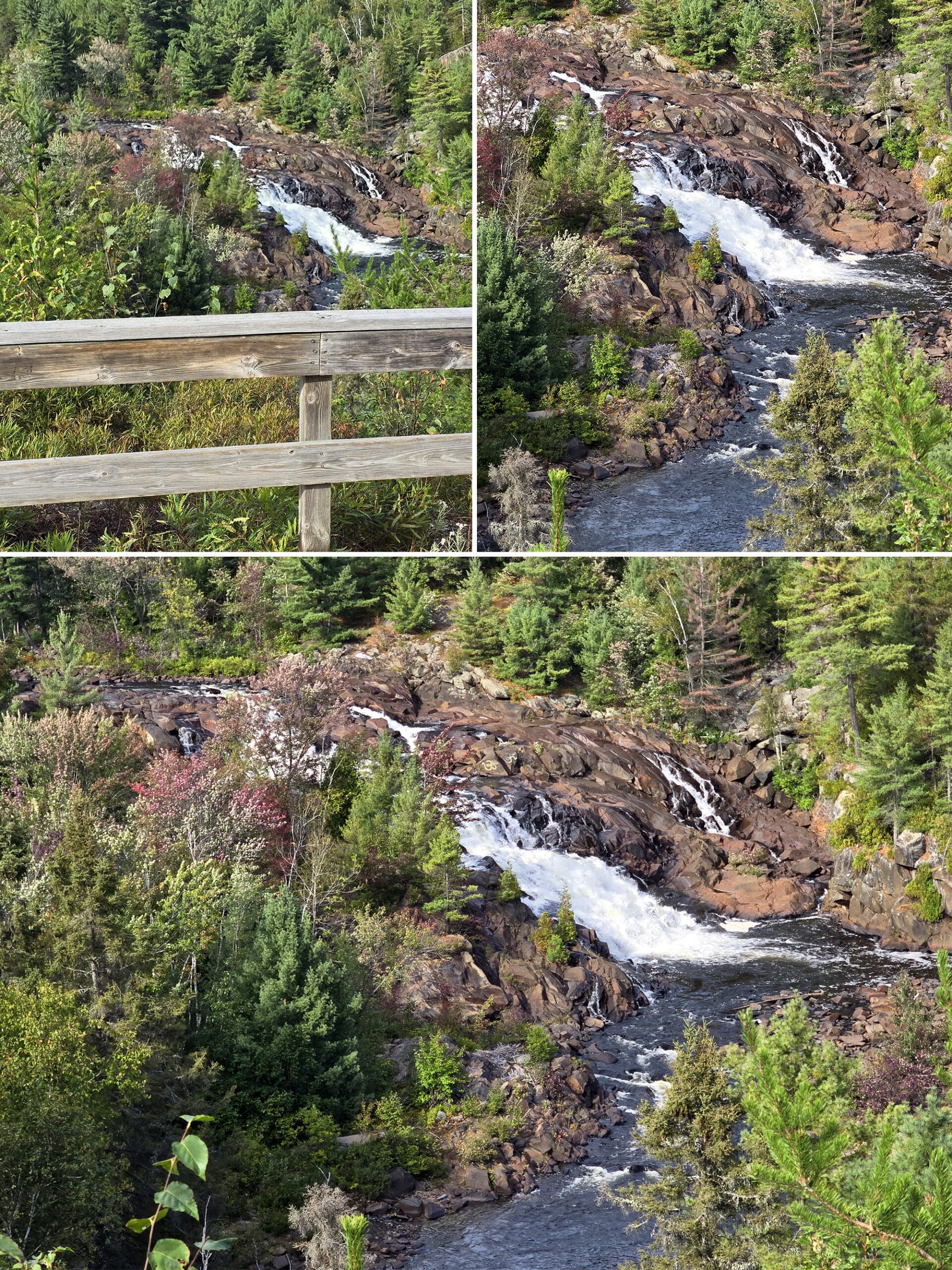
The trail keeps weaving to and away from the water, providing several scenic spots of small falls and rapids. This would be helpful when it's busy, to spread people out.
There were amazing views the whole way along this Riverside Trail, and lots of short little side trails to outlooks.
Some were to actual water access areas, there were a lot of sections of mini cascades or rapids that you could go right out to.”
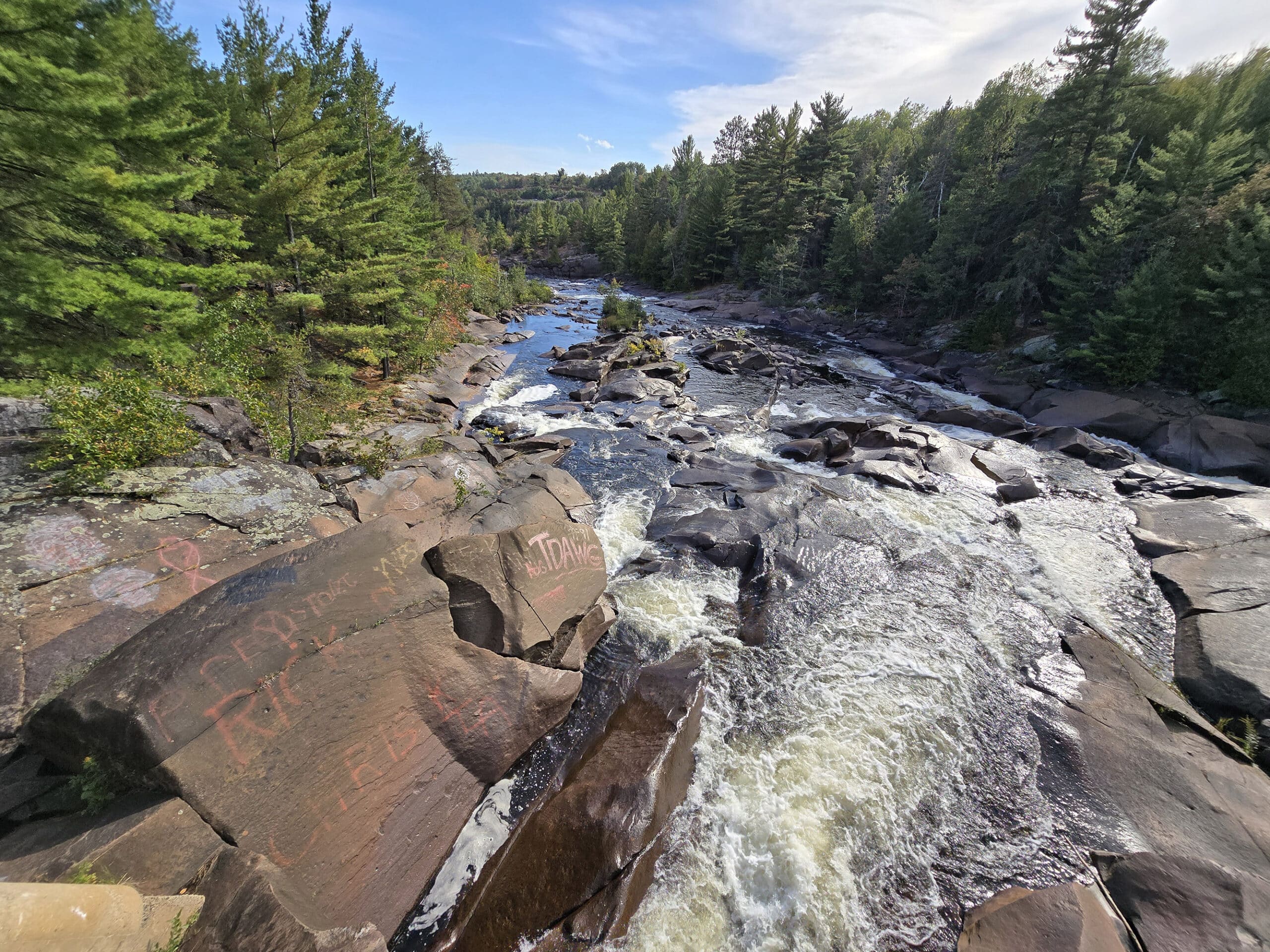
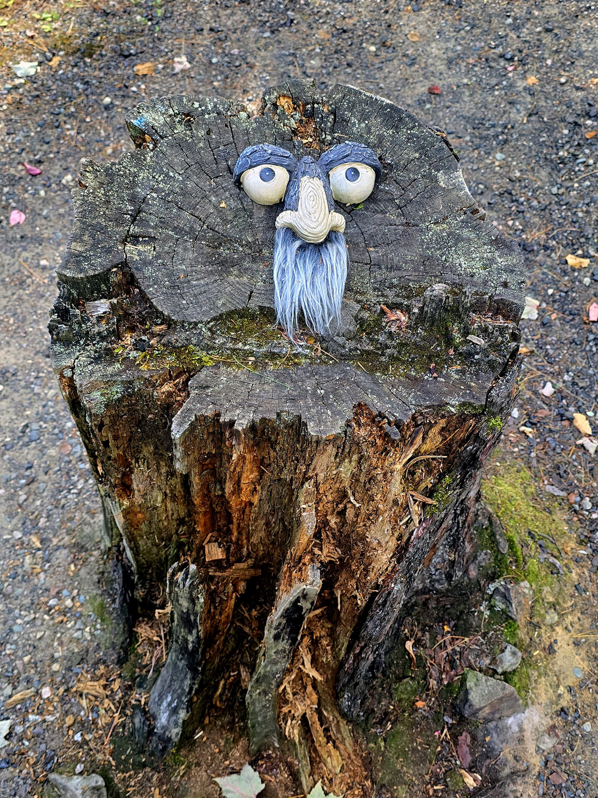
Unfortunately, there's a lot of graffiti. Most of the graffiti seemed to be earlier on the trail, but expect it to be in any photos you take.
There were a lot of cool rocks to see and climb on, including several formations that look like ... puckered lips.
I didn’t need bug spray on the trail this time, but it was a bit colder and windy that day. Might want to consider it in warmer weather, though.
I think the best view is from the bridge, as you can stand over the water for an amazing view downstream. It's a difficult trail, but I would definitely do it again!”
Nature Trail
This is a ~2 km loop - best we can tell - that starts on the other side of the bridge.
We were losing sunslight, though, so Porter decided to skip it and head back to the car.
So, we have no idea about the trial conditions or difficulty - we’ll update this some day, when we can get back out there!
The Bridge
Says Porter:
“The best overall view was from the pedestrian bridge, but there’s an unfortunate amount of graffiti in the area.
Also: the bridge had a lot of locks on it, like they do in Paris.
I’m sad you had to call it early on, but it’s probably good that you did - that trail was pretty rough. It wasn’t all like THAT, but there were some really steep, rocky sections along the way.”
Biking
One of the signs out front mentions that cycling is allowed, but I’d take that with a bit of a grain of salt.
The parking lots would be fine for cycling, just not much of a view, and not really anywhere to really go.
You could probably - technically - bike down that first bit of the trail, but I don’t see why. It’s only 0.1 km, and I’d think it would be pretty dangerous with the people walking on it.
The rest of the trail... really doesn’t even seem suitable for mountain biking, from what I could tell.
So, I’d leave the bicycles at home, personally.
Birding, Wildlife, and Nature
It’s probably a good area for birding in general, but - at least during our visit - the conditions really weren’t great for birding.
We didn’t really see any birds, and really - the sound of the rushing water would have made hearing them kind of difficult.
Swimming
There are some sections along the trail that would probably work if you wanted to wade in, but not really any swimming holes.
At one point on the Riverside Trail, there was a branch of the main river that came down to the side, and there was a family wading in there. We didn’t really see any signs that either welcomed or banned swimming.
That said, slightly further up the highway - maybe 1 km or so past the park entrance - there was a little parking area to the left, and a rough access trail to the river across the highway from it. As we passed, we saw a woman swimming in there - upstream from the falls.
Niantic Games
There are several Niantic Game stops (Ingress Portals, Pokestops , Pokemon Gyms) in the parking lot, along with many spawn points / energy on the ground, and plenty of cell reception to be able to play.
There are also a few more Portals / stops along the main trail to the bridge.
Final Thoughts
This was a really cool area to explore - IF you’re able bodied.
The bridge has the best view of the area, but it’s also almost 1 km up a really difficult trail. That said, there are all kinds of views along that trail, so it’s not one of those “a lot of work for ONE nice view” cases.
I’m going to continue to work on rehabbing my feet, and maybe I’ll be able to do that trail on a future trip north. Porter’s definitely enthusiastic about the possibility of visiting Onaping Falls - and the A.Y. Jackson Lookout - again.
Which is saying something, given how much he hates to drive!
More Ontario Waterfall Posts
Looking to waterfalling in Ontario? Here are more Ontario Waterfalls to check out:
Aguasabon Falls
Chippewa Falls
Eugenia Falls
Falls Reserve Conservation Area
Gariepy Creek Falls
Healey Falls
Hogg's Falls
Indian Falls Conservation Area
Inglis Falls
Jones Falls [Pottawatomi Conservation Area]
Kakabeka Falls
Mink Creek Falls
Oxtongue River-Ragged Falls Provincial Park
Provoking Falls
Rainbow Falls
Sand River Falls
Sauble Falls
Scenic High Falls
Walter's Falls
Webwood Falls
Beyond the waterfalls, be sure to check out our Places to See category, to find more interesting Ontario places to explore!
Thanks for Reading!If you loved this post - or have any questions about it - please leave a comment below! We'd also love it if you would consider sharing the link on social media! |
Leave a Reply