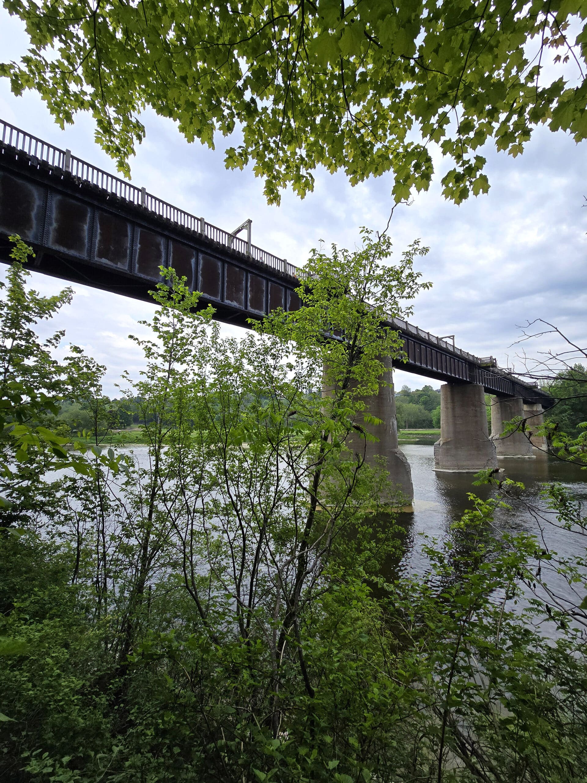
Menesetung Bridge is a historic - and thoroughly terrifying! - attraction in Goderich Ontario. Here's what you need to know about visiting!

Now personally, I could do without the bridges category... but my husband is weird and loves them.
Anyway, whenever we’re visiting a new area, I consult the MyMap and see if there’s anything we should be taking the opportunity to see.
This time around - touring Ontario’s west coast, and staying at Point Farms Provincial Park - there were two!
Falls Reserve Conservation Area, and the Menesetung Bridge.
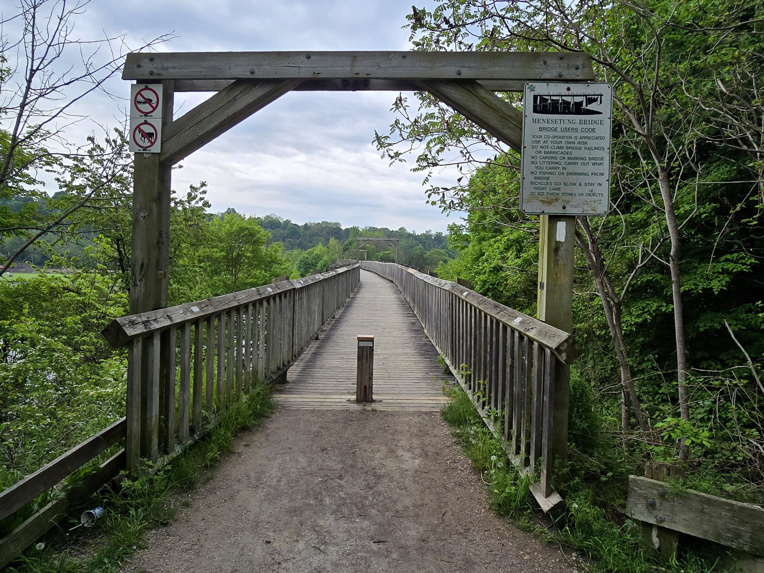
Located in the harbour town of Goderich, the Menesetung Bridge played a key role in the development of Goderich, helping it become the thriving port town it is today.
At the time of its construction, it was the longest bridge in Ontario, and was a fine example of a typical Canadian Pacific Rail bridge.
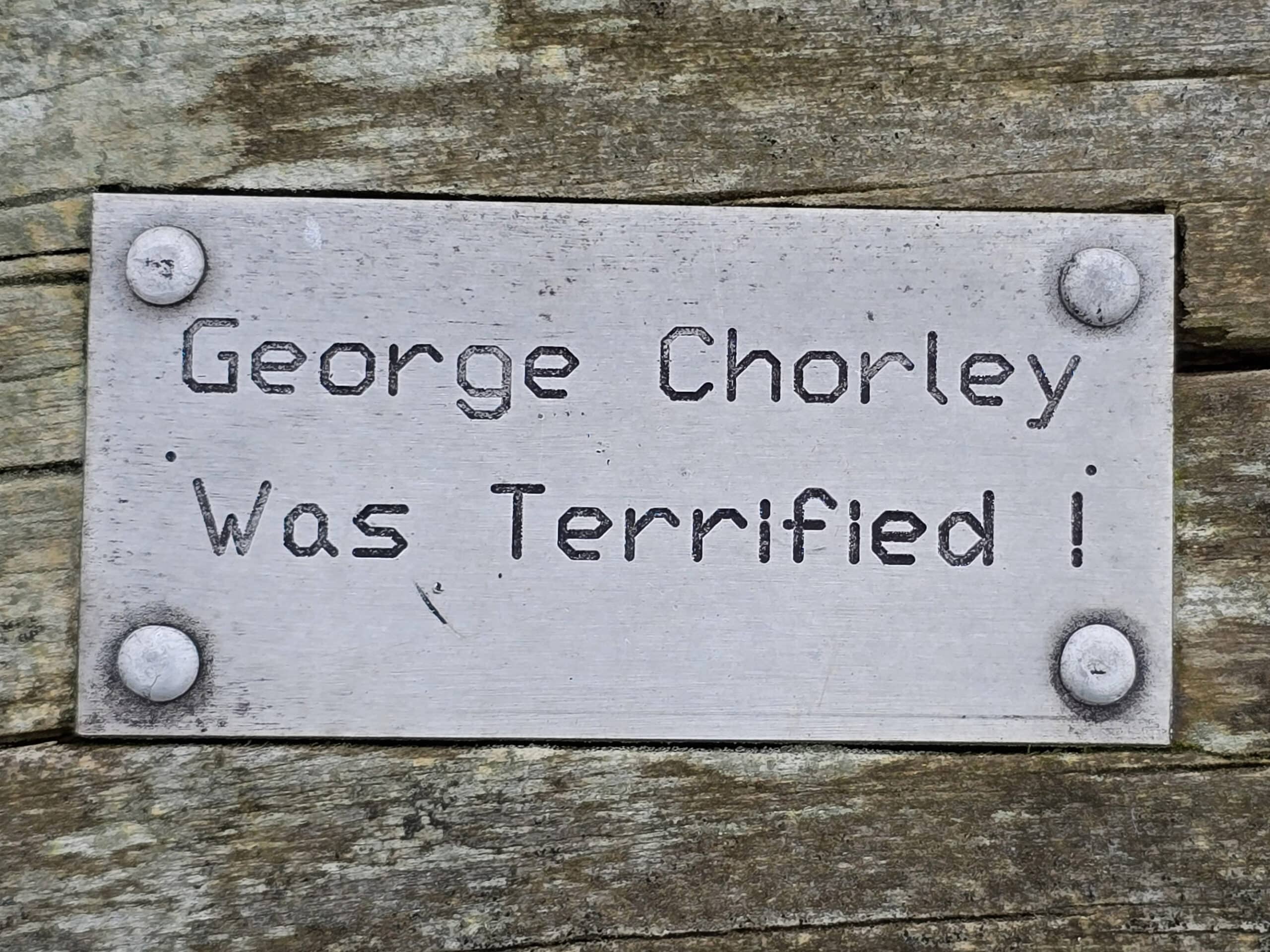
Oh, and if you’re not so into heights (See also: Spirit Rock Conservation Area!), it ABSOLUTELY terrifying!
I almost didn’t even cross it the one time... but I did, saw that there was an interesting trail on the other side, and convinced myself to not only cross back over to end the trip, but to come BACK the next day and do it again!
I took video on a digital camera when I crossed it for the final time, but it was far too laden with profanity to post. Whoops!
Anyway, don’t let my fear issues dissuade you. As terrified as I was, I’m still really glad I did it - and you will be, too!
Let us tell you all about it...
The Basics:
Location Name: Menesetung Bridge
Address: 3Y2, Goderich to Auburn Rail Trail, Goderich, ON
Website: Menesetung Bridge Association
Price: Parking is free for 3 hours.
Reservations: Not Applicable.
Logistics
Here is some basic information that will come in handy if you’re planning to visit the Menesetung Bridge, which is open year round:
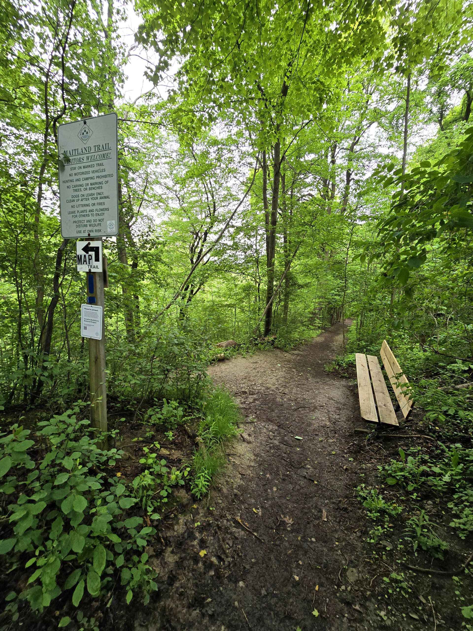
Maps and Signage
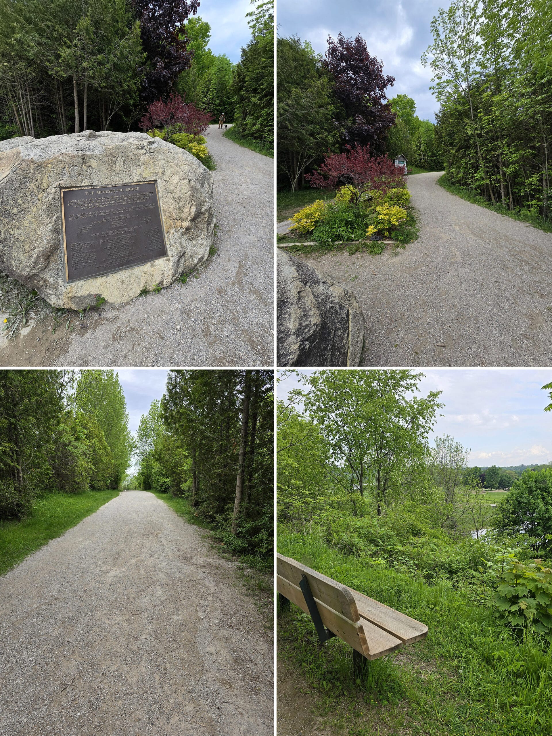
There’s a big trail map right near the beginning of the walkway from the parking lot, with some extra information about the history of the Bridge.
If you’re not looking to do any of the trails off the end of the bridge, though, a map - and signage - isn’t really needed. It’s just a straight shot up that trail to the bridge itself.
Accessibility
There is accessible parking in the small parking lot that’s south of the bridge. The trail from the parking lot to the walking bridge is wide and even, made of well packed gravel.
There is a little bit of an incline to start, but it smooths out pretty quickly.
There are also a few benches along the way. The one on the left looks out over a trailer park, the ones on the right have a much better view, looking out over a golf course.
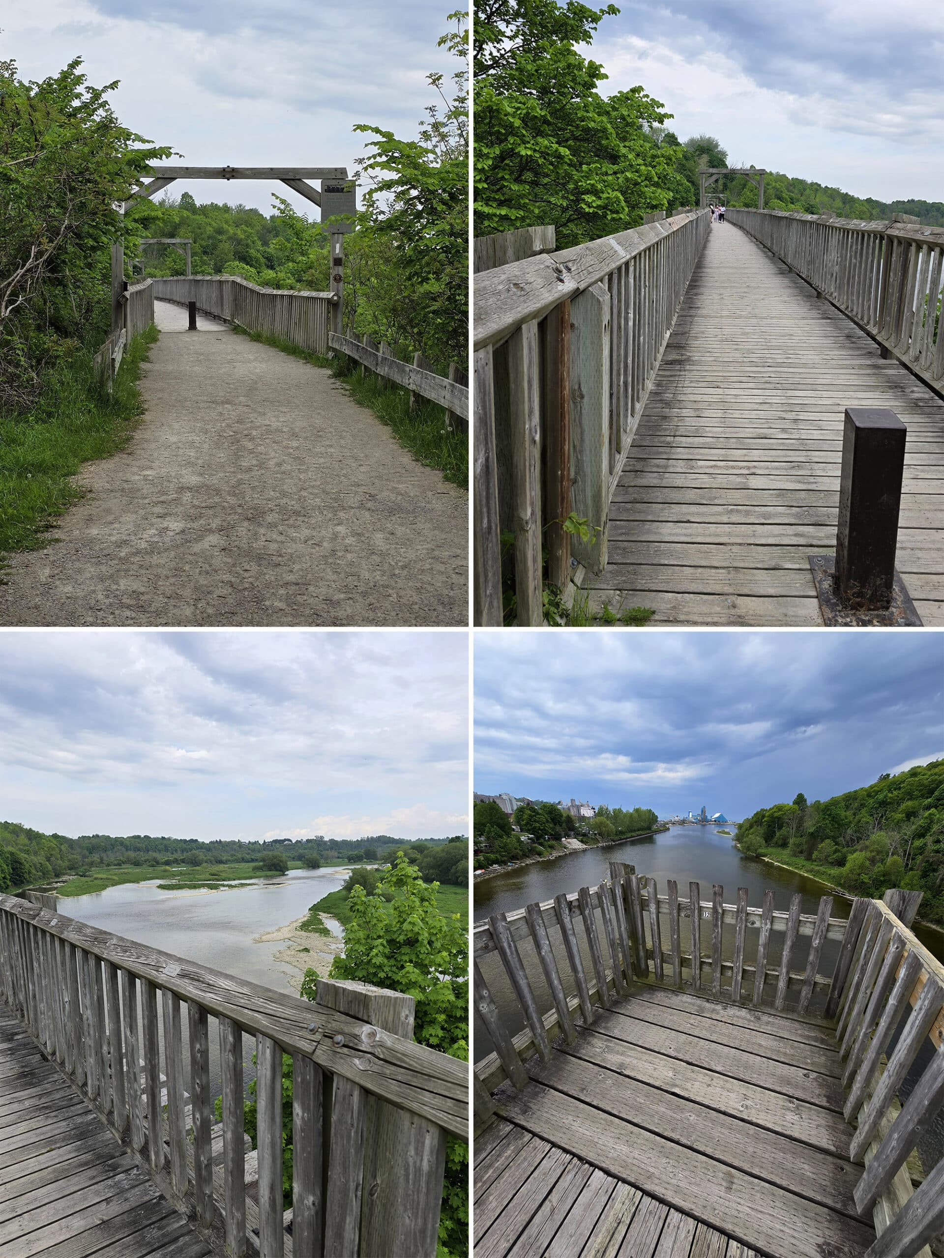
The bridge itself is wheelchair accessible, as are all the little viewing nooks on it.
Finally, the trail that extends from the other end of the bridge is also accessible, but the hiking trail (Sifto Loop) off to the side - that starts near the end of the bridge - is not.
It IS a relatively easy hike, though, if you are using other mobility aids. Generally a wide enough trail, flat packed, some minor changes in elevation, but nothing too wild.
Connectivity
We had good cell phone reception in the parking lot, on the trail leading up to the bridge, and on the Sifto Loop trail.
I did NOT check my phone while out on the bridge, but I imagine the reception would have been good there as well.
Pets
We didn’t see any signage that either welcomed or banned dogs, and we did see a few dogs in the area.
The only reference I can really find one way or the other is an AllTrails page saying that dogs are welcomed, but must be leashed.
They’re not an official source for the bridge / trails, though.
Parking
There’s a small parking area on North Harbour Road W, right at the head of the little walking trail that leads to the bridge.
Parking is free for 3 hours, which is plenty. Unless you’re looking at going REALLY wild on the trails, you don’t need a long time to see the bridge.
As a note: Google Maps didn’t seem to know about that parking lot when we visited, and tried to route us into the little trailer park around the corner from that parking lot.
If you see the trail and a big rock with flowers around it, you’re in the right place!
Miscellaneous
Keep an eye on the weather. The bridge crosses a river that leads into Lake Huron, and the winds can be STRONG.
Even if you’re not naturally terrified of crossing the bridge... a good gust of wind as you’re walking across can DEFINITELY spook a person!
Menestung Bridge History
How about a few interesting tidbits and additional information about the bridge and its historical significance?
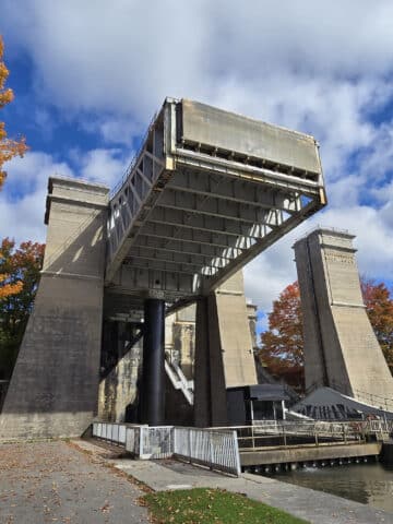
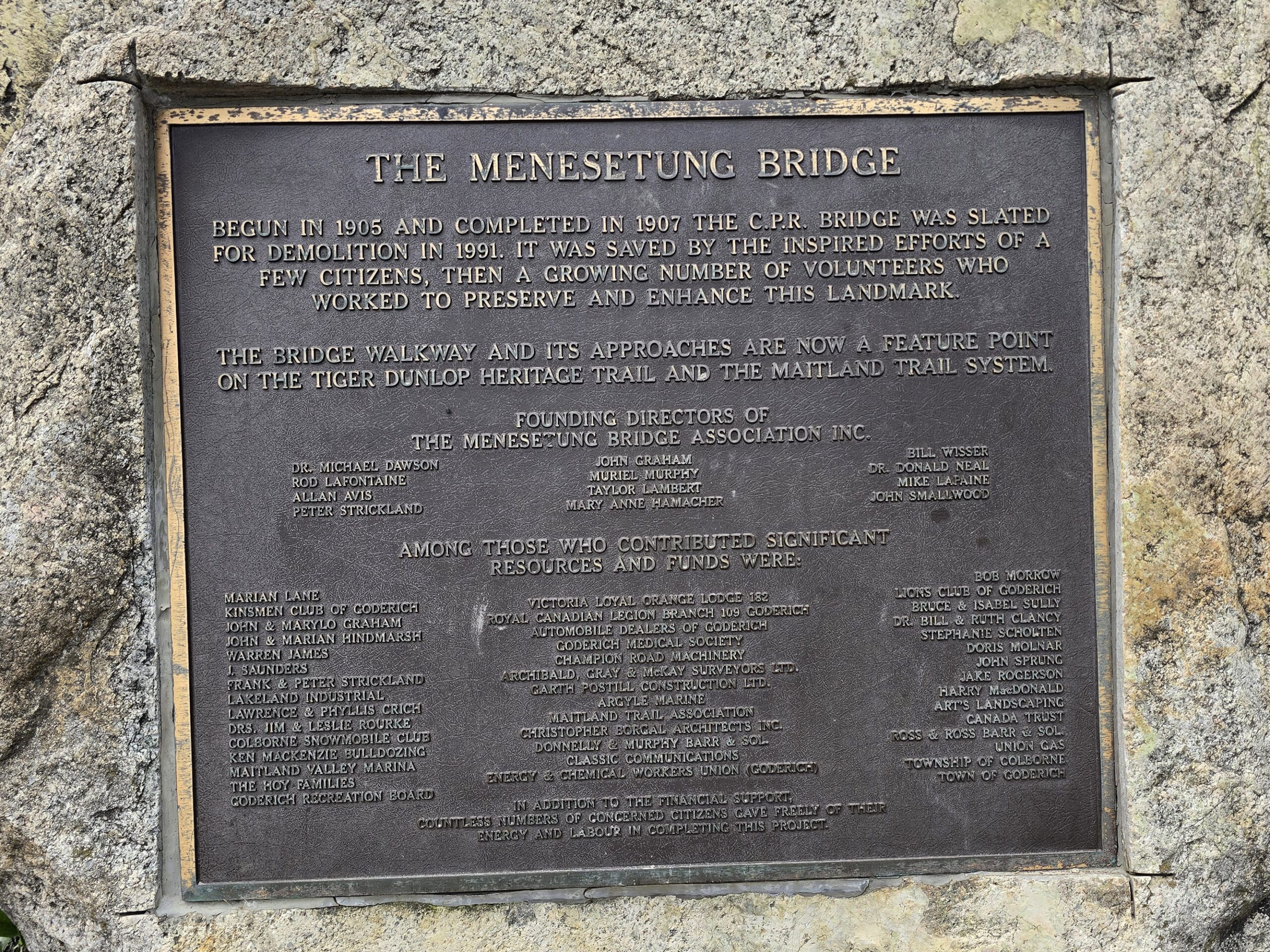
1. The bridge was built between 1904 and 1907, as a Canadian Pacific Railroad bridge. It was part of a 132 km CPR line running between Goderich and Guelph
At the time of its construction, it was the longest railway bridge in Ontario.
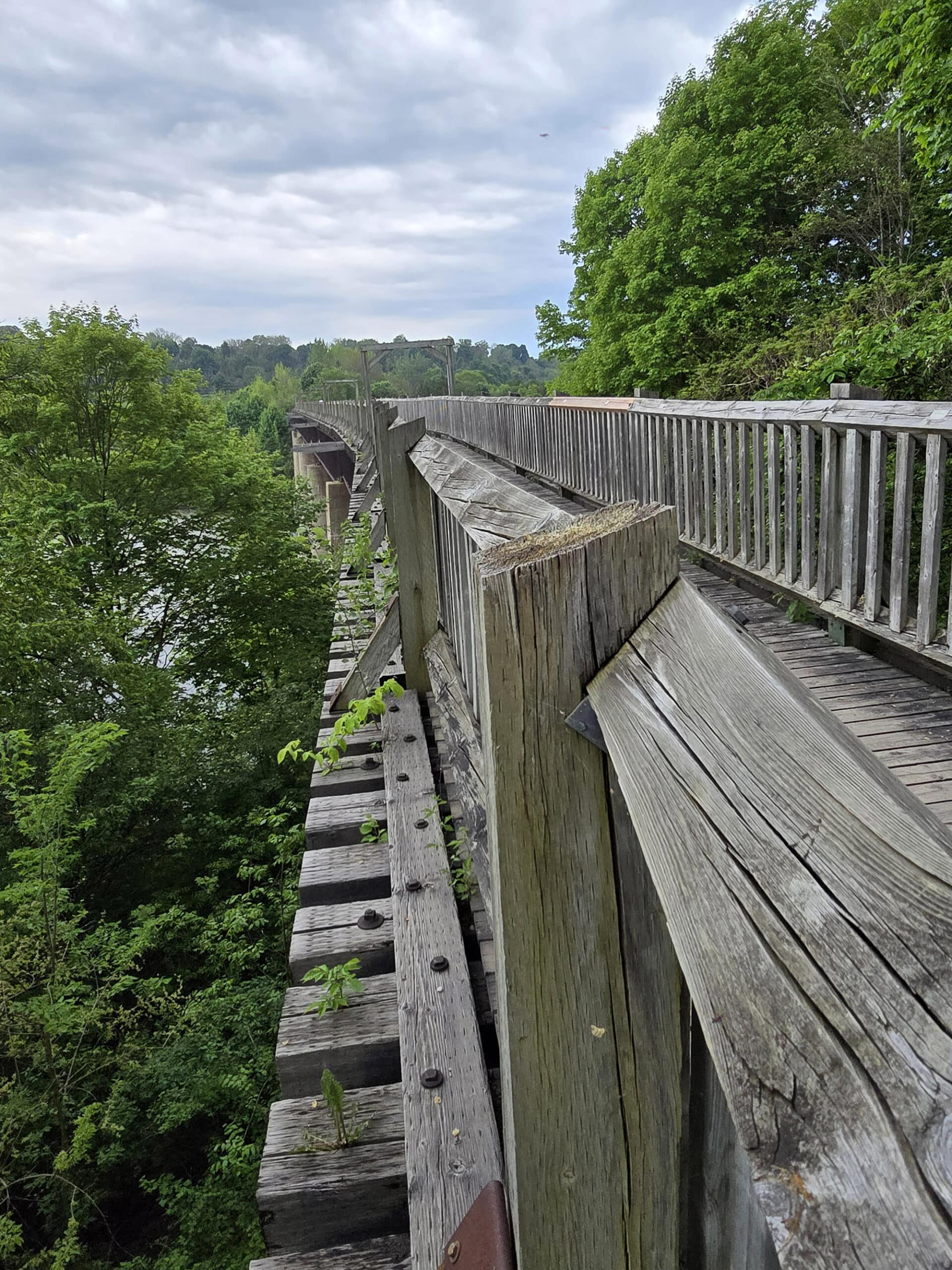
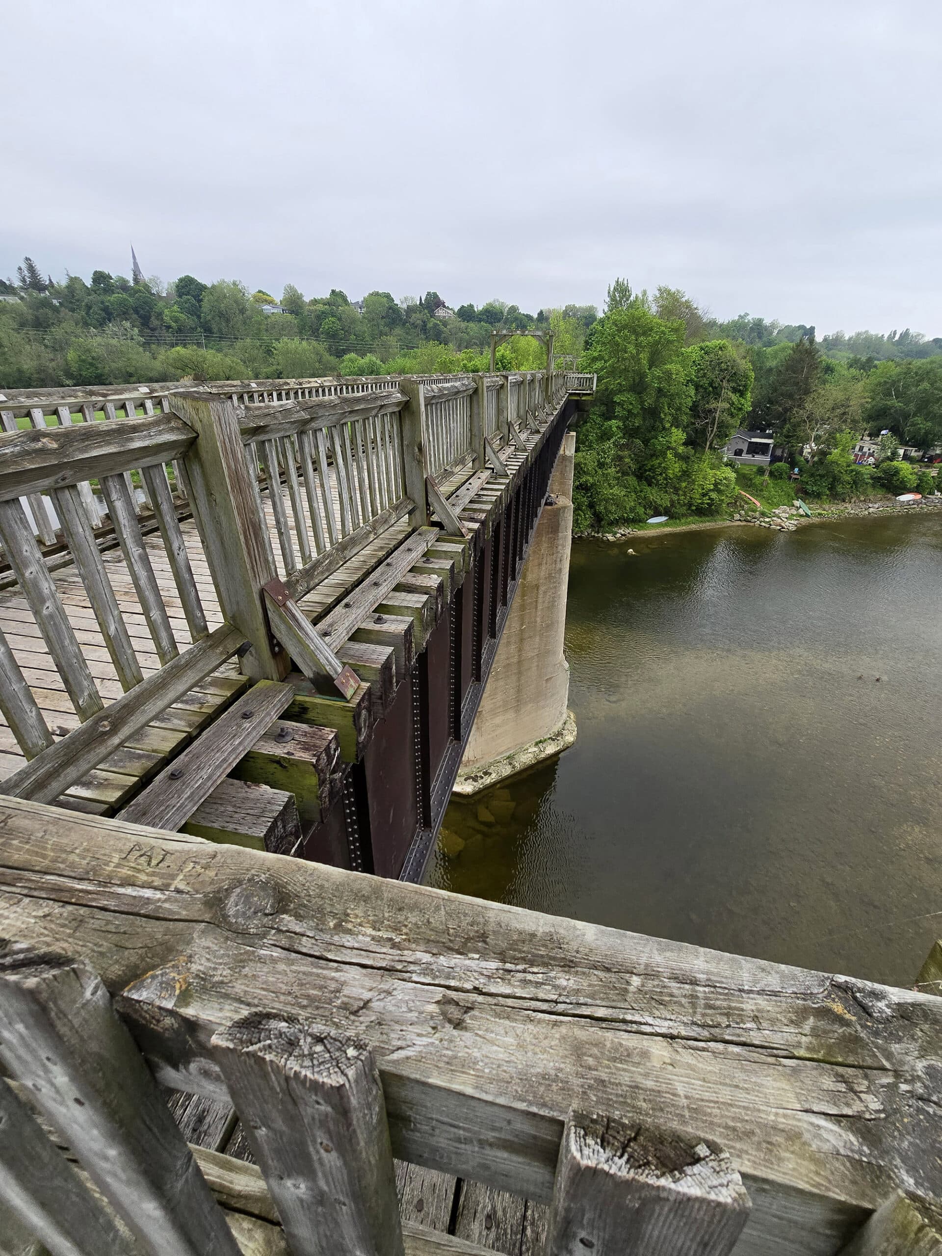
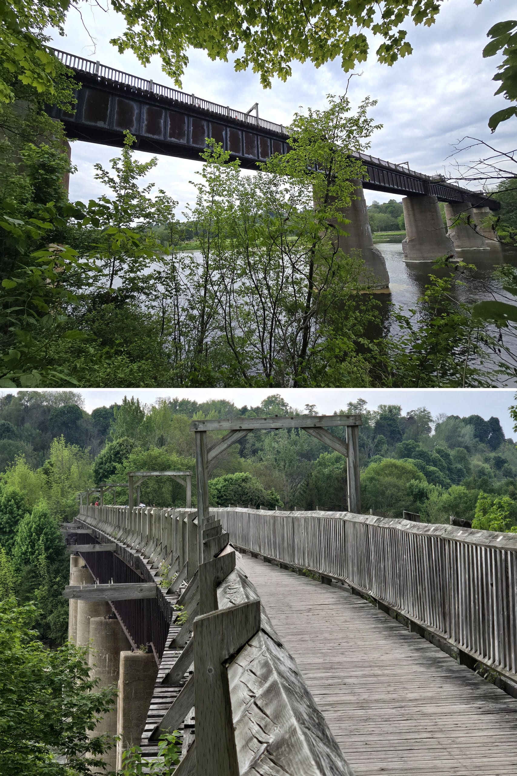
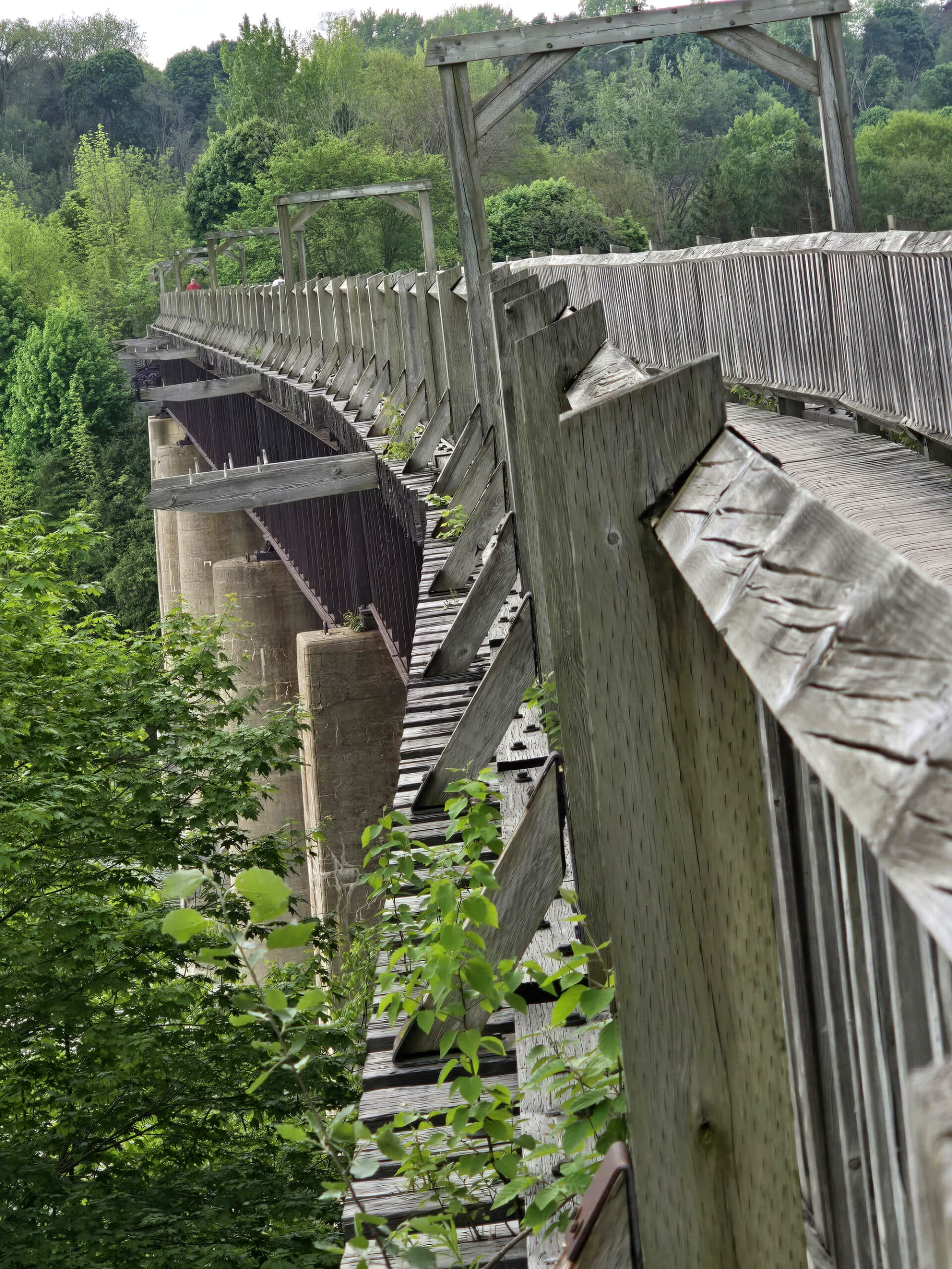
2. The bridge is a seven-span steel and wood bridge, and is supported on 6 concrete piers, with 2 abutments. The embankments were bolstered with MILLIONS of tons of earth.
The total length of the Menesetung Bridge is 750 feet, it’s 12 feet wide, and it’s about 60 feet above the Maitland River.
The construction of the bridge was marred with a series of accidents and tragedies. A 1905 landslide destroyed a lot of the work, workers were injured and killed in various mishaps and freak accidents, etc.
There were also delays as the results of disputes with the competing Grand Trunk Railway.
4. Passenger train service on the Guelph-Goderich CPR line ended in 1955. The final CPR train crossed the bridge over 30 years ago, in 1988. The rails were removed the next year.
5. The bridge almost got demolished just over 30 years ago. After the rails were removed, talks about dismantling the whole bridge began.
Then a doctor - Michael Dawson - took a walk on the bridge, got in his feels about demolishing it, and rallied friends on the hospital board to start working against demolition.
A lot of drama happened, a group of citizens formed the Menesetung Bridge Association, and fought to preserve it.
Money was raised, and the bridge was converted into the pedestrian bridge it exists as today.
7. Dr Dawson’s son - Grant Dawson - eventually followed in his father’s footsteps, as the chair of the Menesetung Brudge Association.
8. The boulder at the start of the walkway from the parking lot to the bridge weights 22 tons, and was transported from nearby Benmiller to honour the people who donated to saving the bridge.
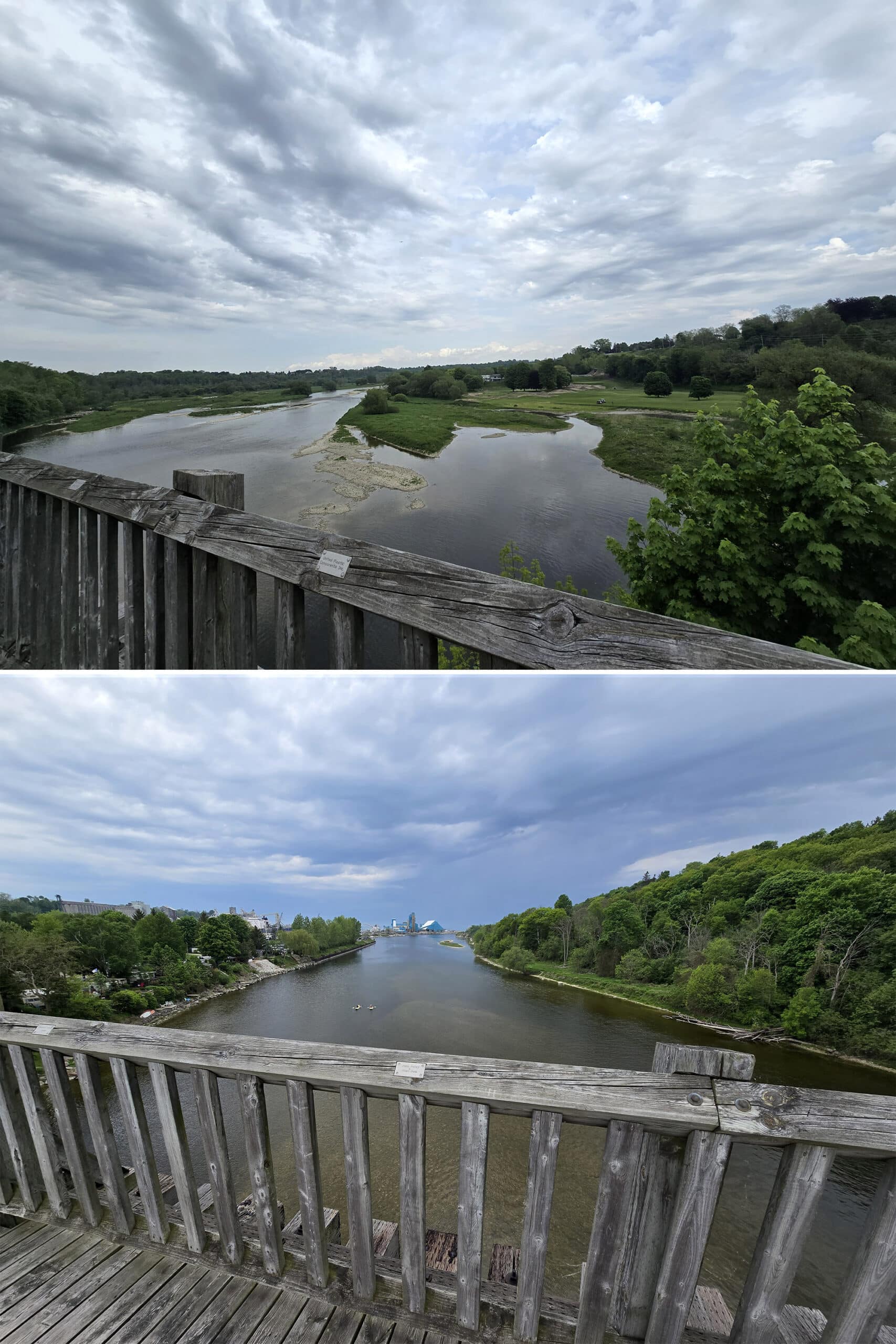
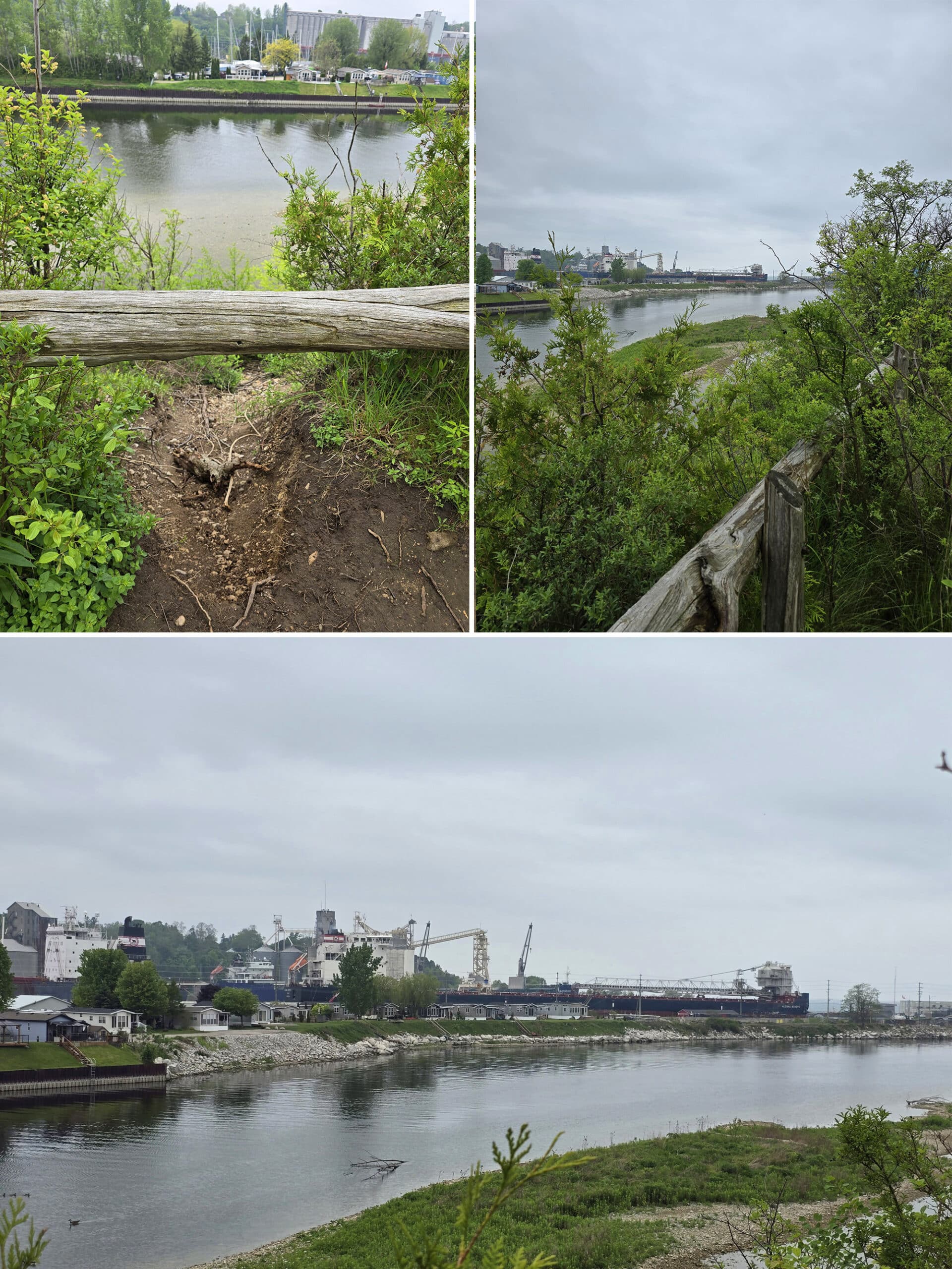
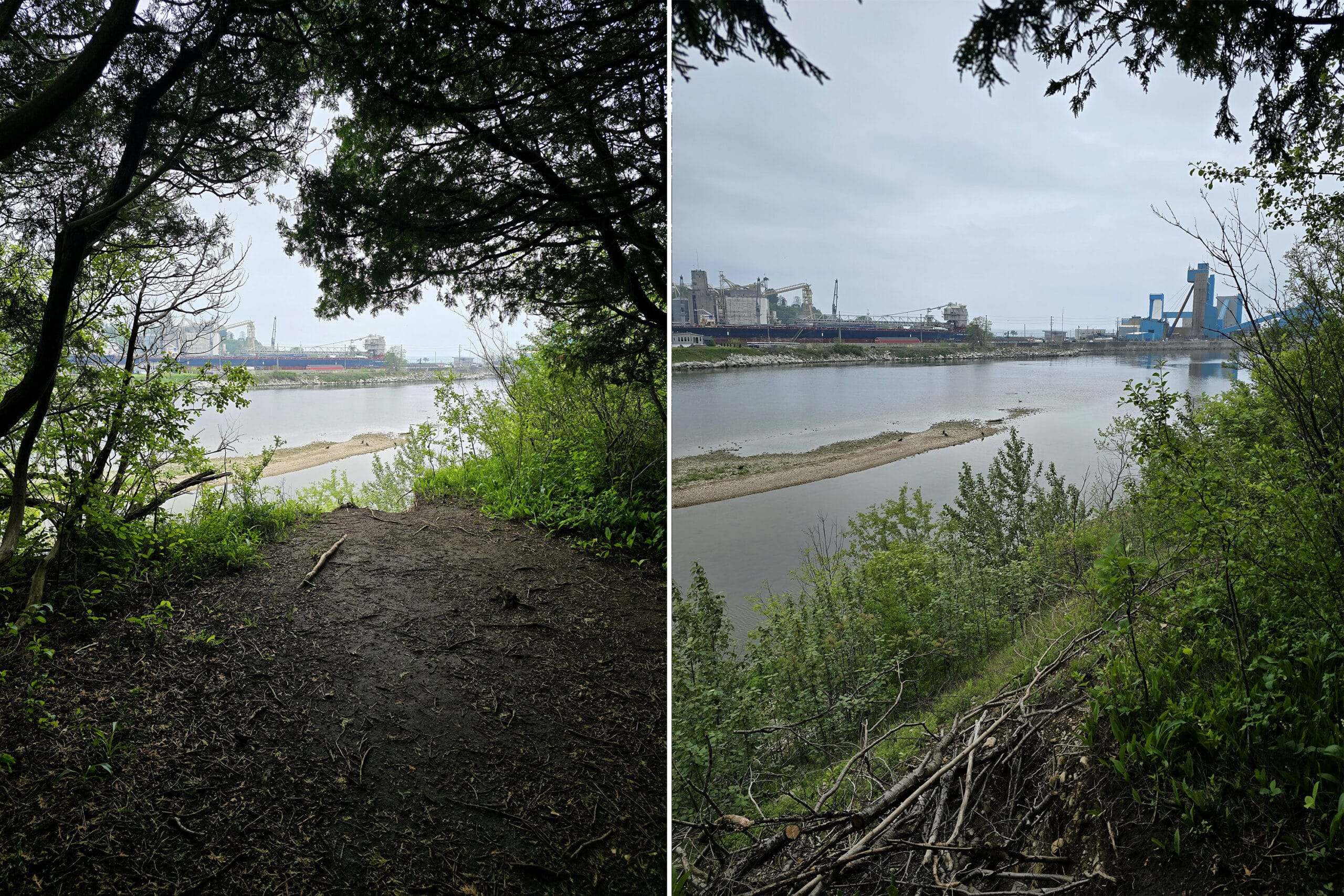
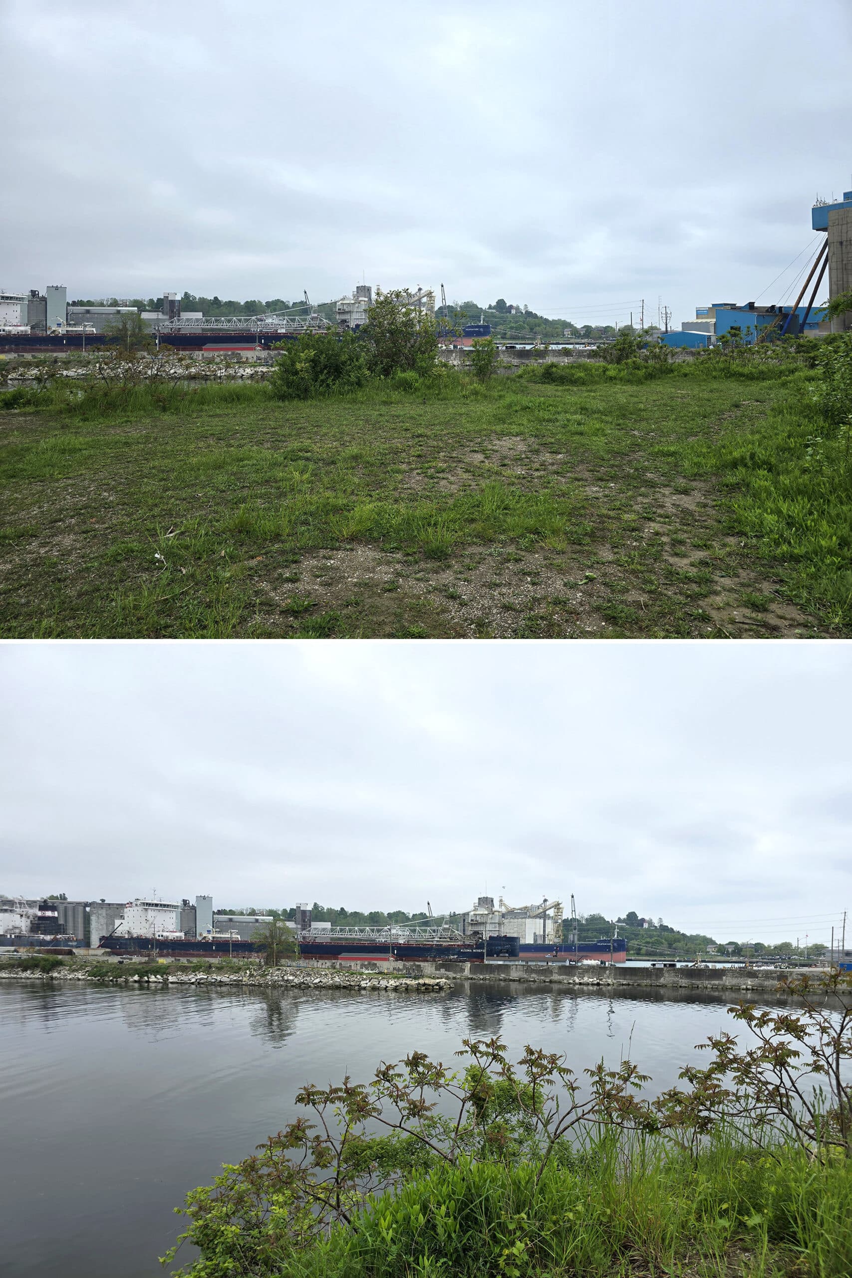
If you look to the west, you can see the salt mine, factory, shipping operations, Goderich Harbour, and Lake Huron itself. To the east, there’s the Maitland Golf and Curling Club, as well as the highway.
10. Weirdly, you can’t really hear the highway, city, or salt mine noise from on the bridge. It’s just the wind, birds, other people, and your pounding heartbeat, LOL!
Share the Love!If you’ve made one of our recipes, be sure to take some pics of your handiwork! If you post it to Bluesky, be sure to tag us - @2NerdsInATruck, or you can tag us on TikTok, if you’re posting video. We're also on Pinterest, so you can save all your favourite recipes and park reviews to your own boards! Also, be sure to subscribe to our free email newsletter, so you never miss out on any of our nonsense. Well, the published nonsense, anyway! |
Entertainment and Activity
Beyond just walking over a bridge, there are other ways to enjoy the immediate area, here are some details:
Hiking
The bridge is a part of more than one hiking trail, with other popular trails nearby.
The Maitland Trail Association has a printed guide with trail maps for sale, but I'll TRY to sort some options out for you, here.
The Bridge Itself
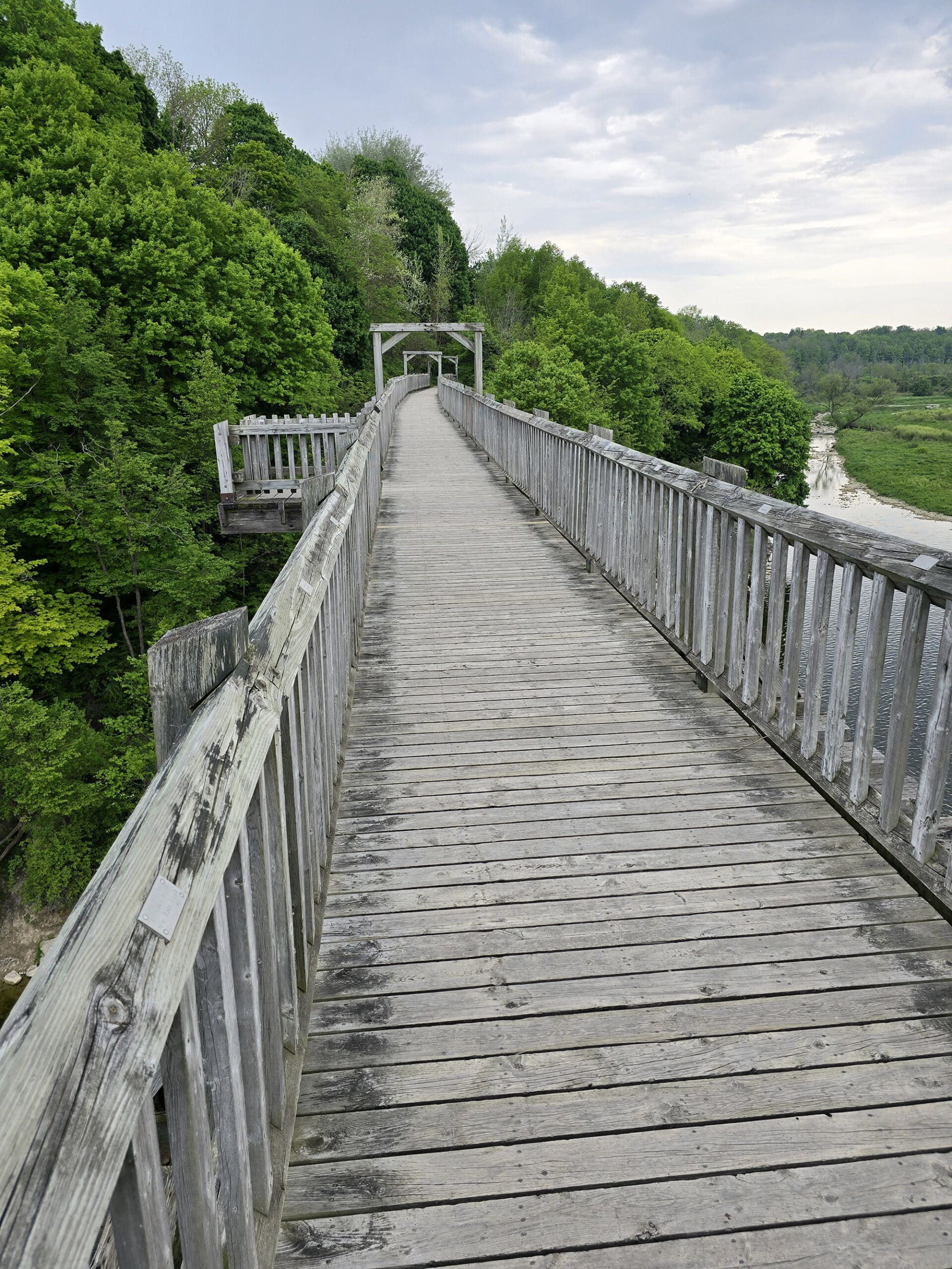
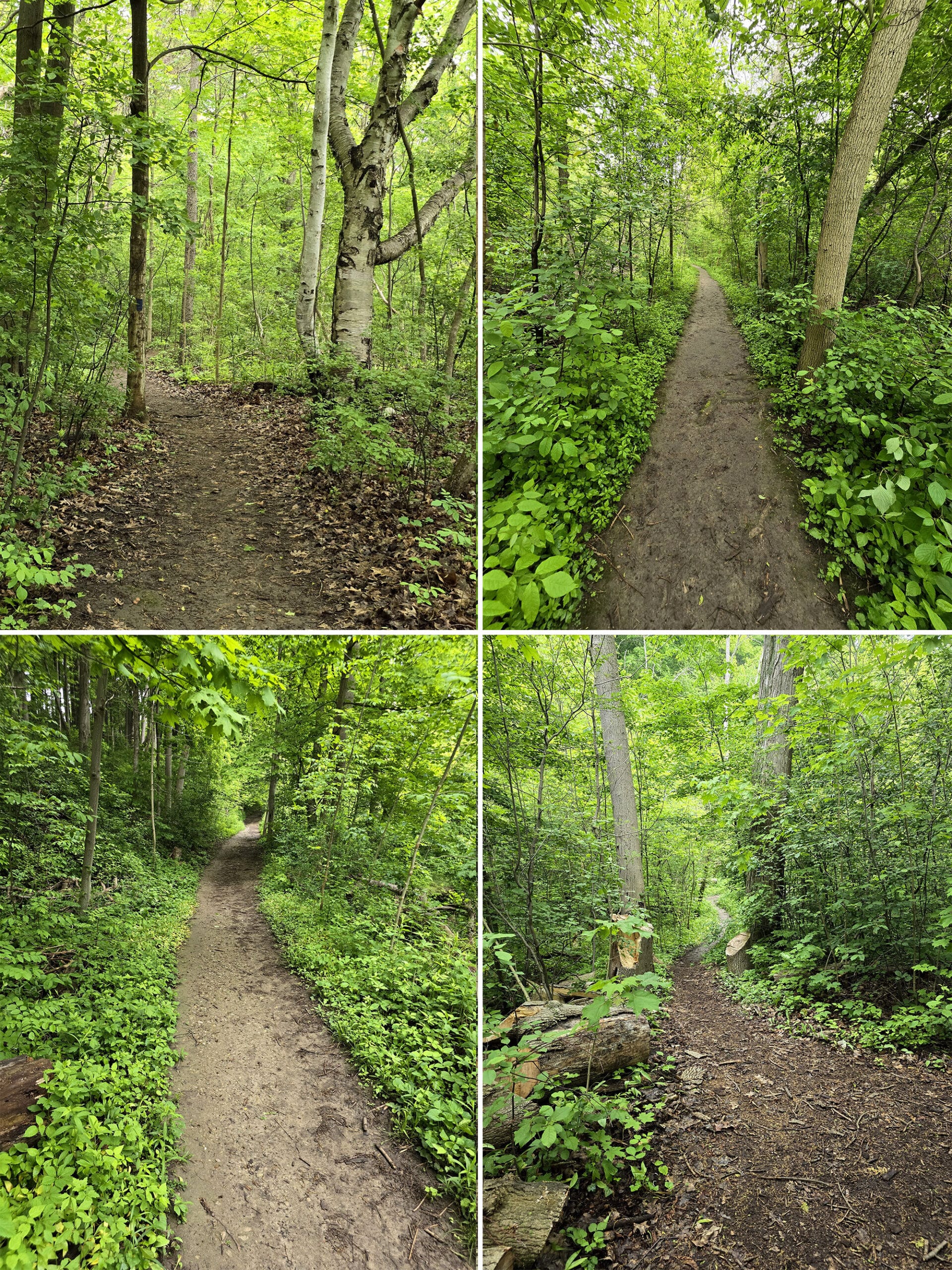
Walking from the parking lot, across the bridge, and back is just under 1km long, and is an easy walk.
Sifto Loop
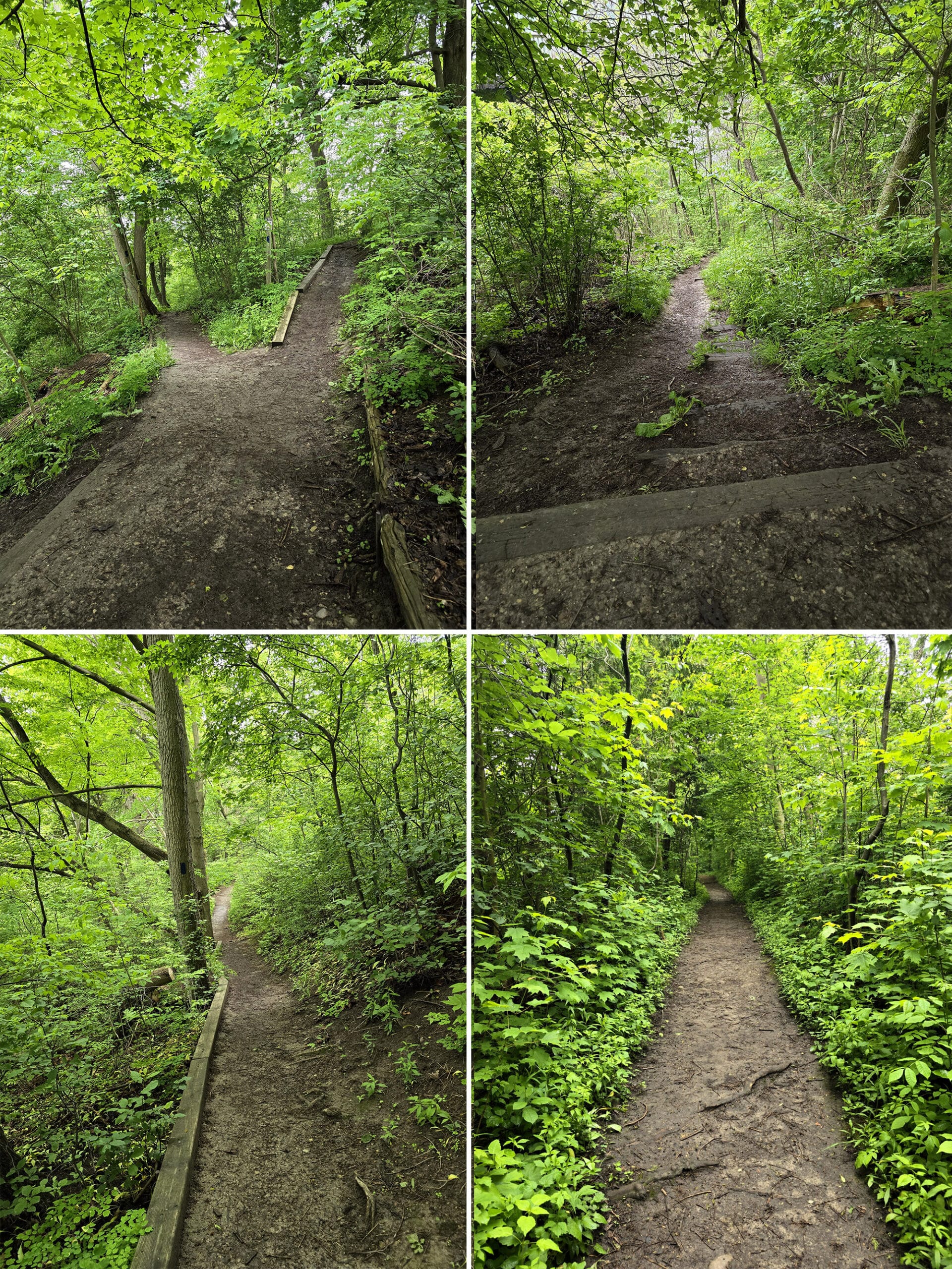
The Sifto Loop is a short - but interesting! - little hiking trail that starts on the north side of the bridge. It branches off from the main trail and takes you out to across from the salt mine, roughly following the river bank.
As you come to the other side of the bridge, you’ll notice the trail entrance on the left side, just to the left of the bench that’s waiting there.
We started out on the south side of the loop, which was easier - and lower - than the north side loop. (The south side is to the left, the north side is to the right.)
Below, you’ll see riverbed, and - if your experience is the same as ours was - a TON of turkey vultures down there.
Pretty much the entirety of this section of the loop - all the way out to the end - is fairly wide, well packed trail that’s pretty level, and without obstructions.
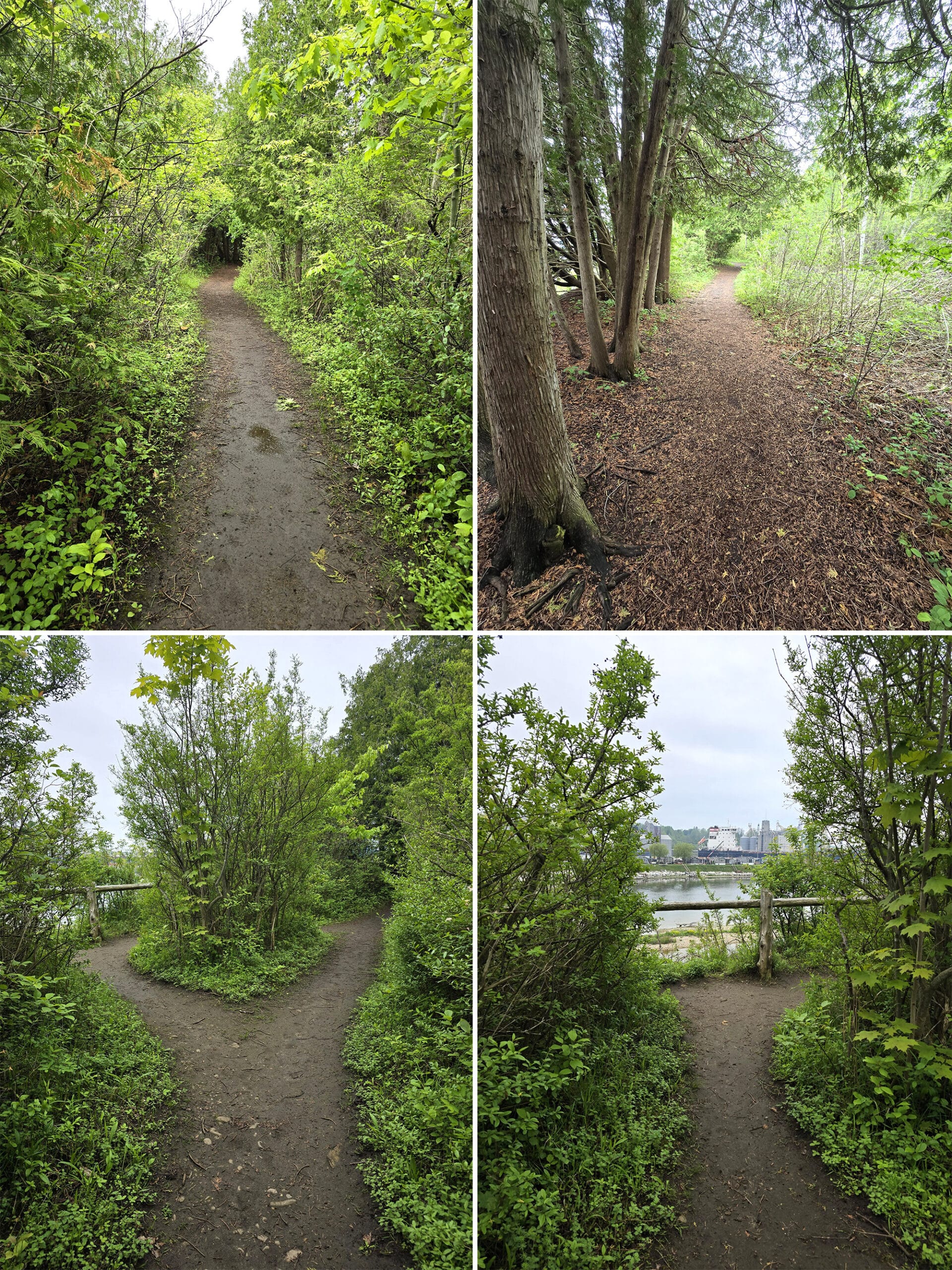
We loved how varied the views were. You’d walk through some standard forest, then there’d be a little tunnel of trees, and you’re looking out over a ship.
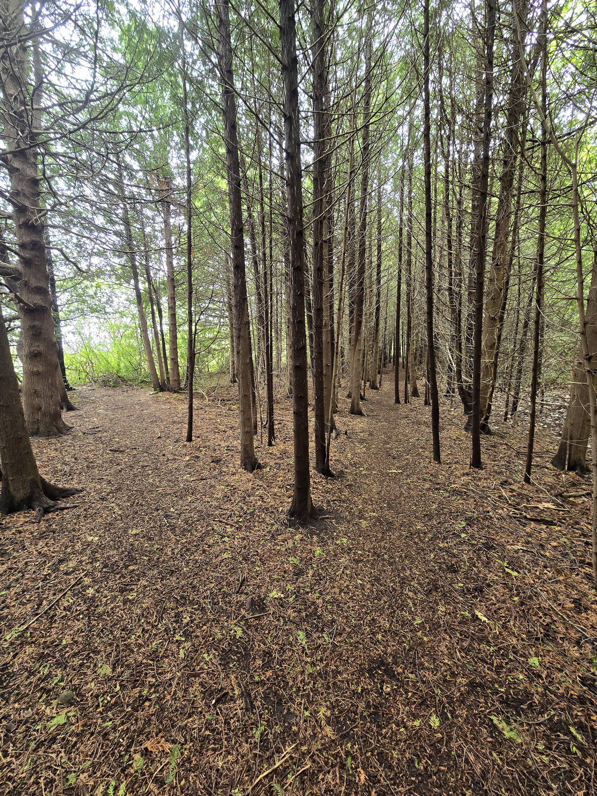
Then you’d be in a completely different type of wooded area, walking between tall skinny trees.
There’s also a great view of the Menesetung Bridge.
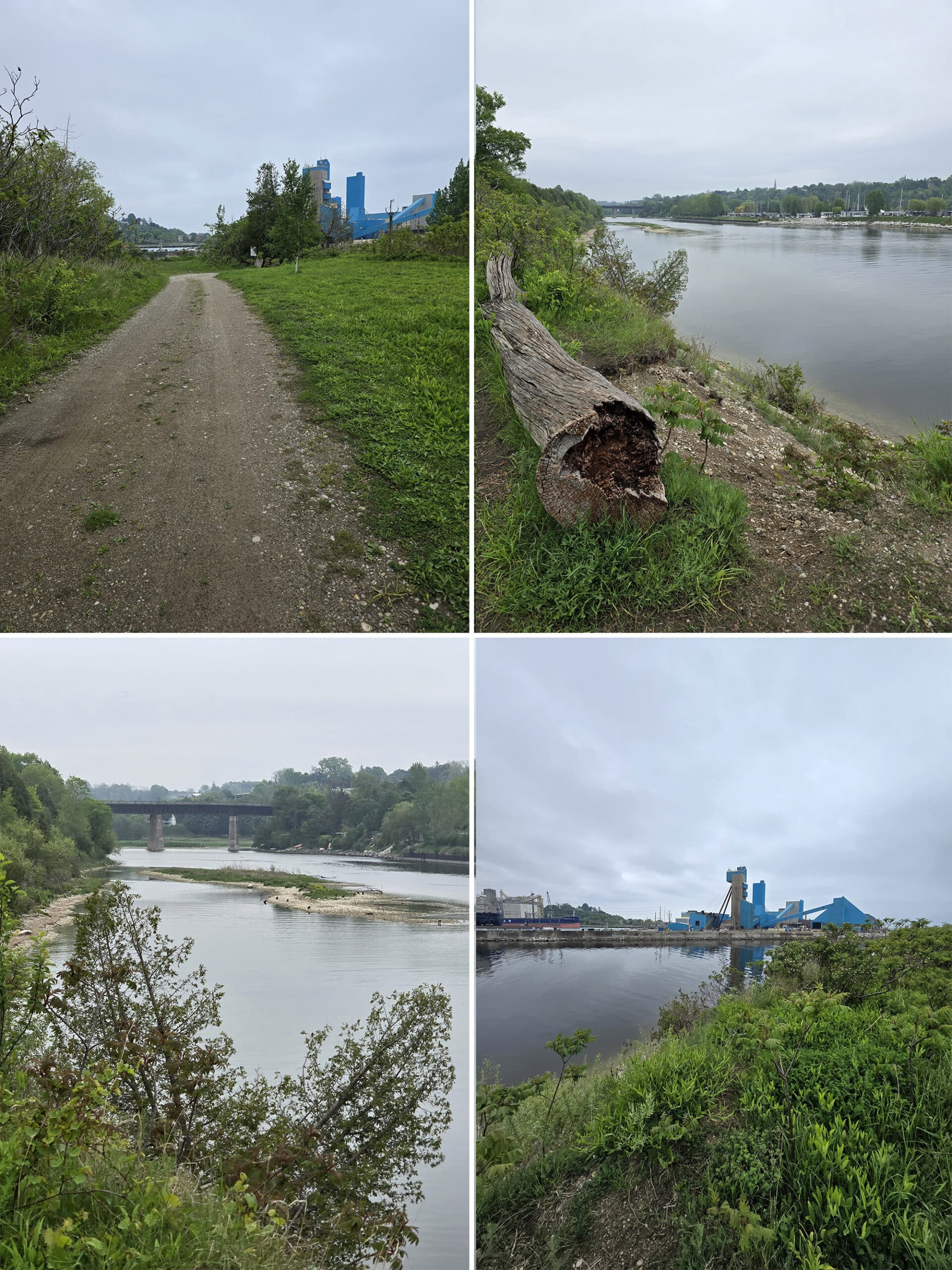
While we live near a big shipping harbour - Hamilton - it’s not a sight we tend to see while out on camping trips, hiking!
As it turns out, I was right. The northern loop was definitely more difficult, with a steep incline up at the start, and down at the end.
Unfortunately, it didn’t offer a great view of the river, on account of the dense forest. 🙁
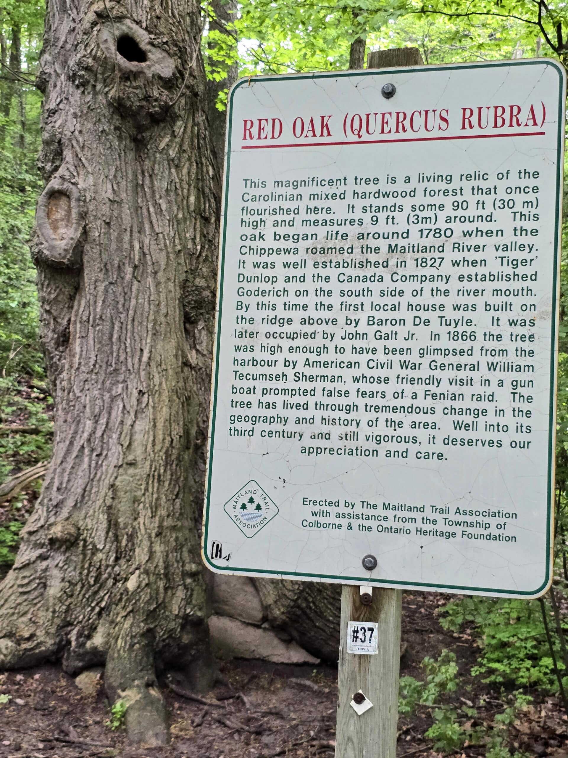
About halfway along the path, you’ll come across a gigantic, 30 metre tall Red Oak tree. A plaque next to it lets you know that it’s over 200 years old and 3 metres around!
It was an awe inspiring sight to see, for sure!
As a note - I bet this would be a nice place to see the fall colours. Both on this trail specifically, and from the bridge itself!
Maitland Trail
The Maitland Trail is 50 km trail that basically follows the Maitland River from Goderich to Auburn, with several little side trails along the way.
While you can access the trail via the bridge area, it actually starts over by Goderich Beach.
See the The Maitland Trail Association for more details, maps, and guides.
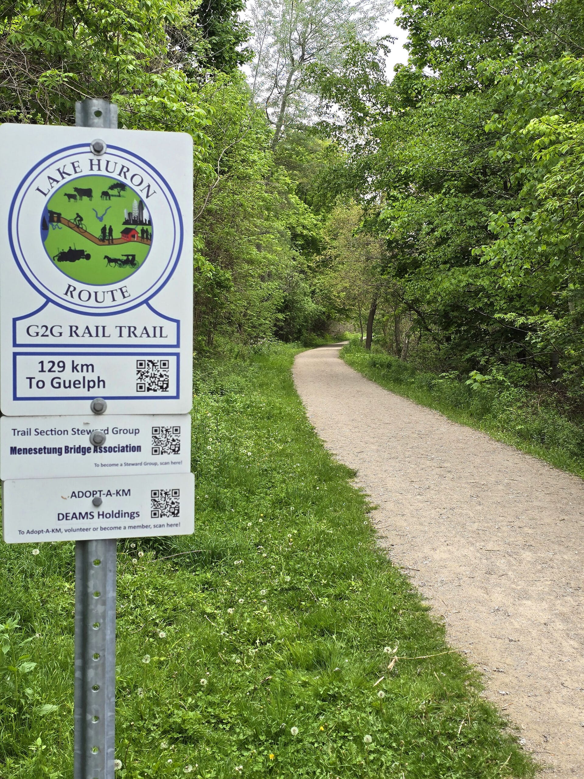
G2G Rail Trail
The G2G trail follows the old Guelph-Goderich line, and involves over 132 km of trail. It extends in both directions from the bridge itself.
See their website - https://www.g2grailtrail.com/ - for more details.
Goderich to Auburn Rail Trail
This is a 12 km linear developed trail running from Goderich to Auburn (shocking, I know!).
It’s packed gravel, and open for cycling, horseback riding, hiking, and - when the weather is appropriate - snowmobiling. It starts at the parking lot, crosses the bridge, and joins up with the Tiger Dunlop Heritage Trail for a bit before branching off into its own thing.
See the https://www.g2grailtrail.com/ - for more details.
Tiger Dunlop Heritage Trail
This is a 3.2 km gravel trail that takes you from the Menesetung Bridge parking area, across the bridge, and out to near Tiger Dunlop’s Tomb.
It’s available for walking, hiking, cycling, horseback riding, and - in the winter - apparently even cross country skiing and snowshoeing.
Biking
Most of the aforementioned trails are available for cycling.
I don’t know about Sifto Loop (it doesn’t seem very bike-able to me, but I’m no expert!), and the Maitland Trail (where it’s its own thing) is for foot traffic alone, but the rest are options.
Birding, Wildlife, and Nature
Being up on the bridge gives you a fantastic vantage point to see birds - they’ll even be flying BELOW you - when the conditions are right.
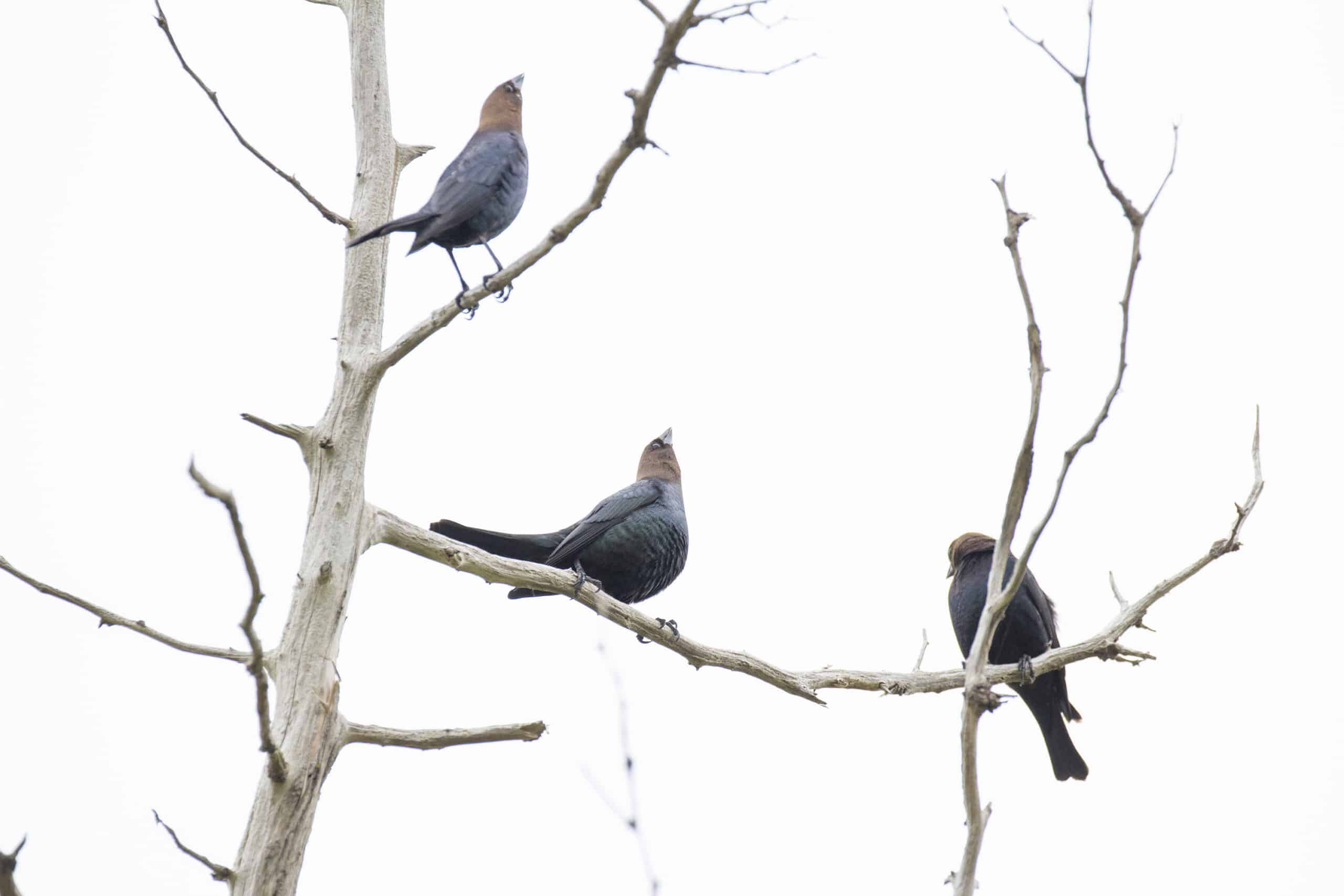
Out on the Sifto trail, we saw dozens of Turkey Vultures down on the river bed, as well as some Grey Catbirds, Bluejays, and a few things we couldn’t identify all along the trail.
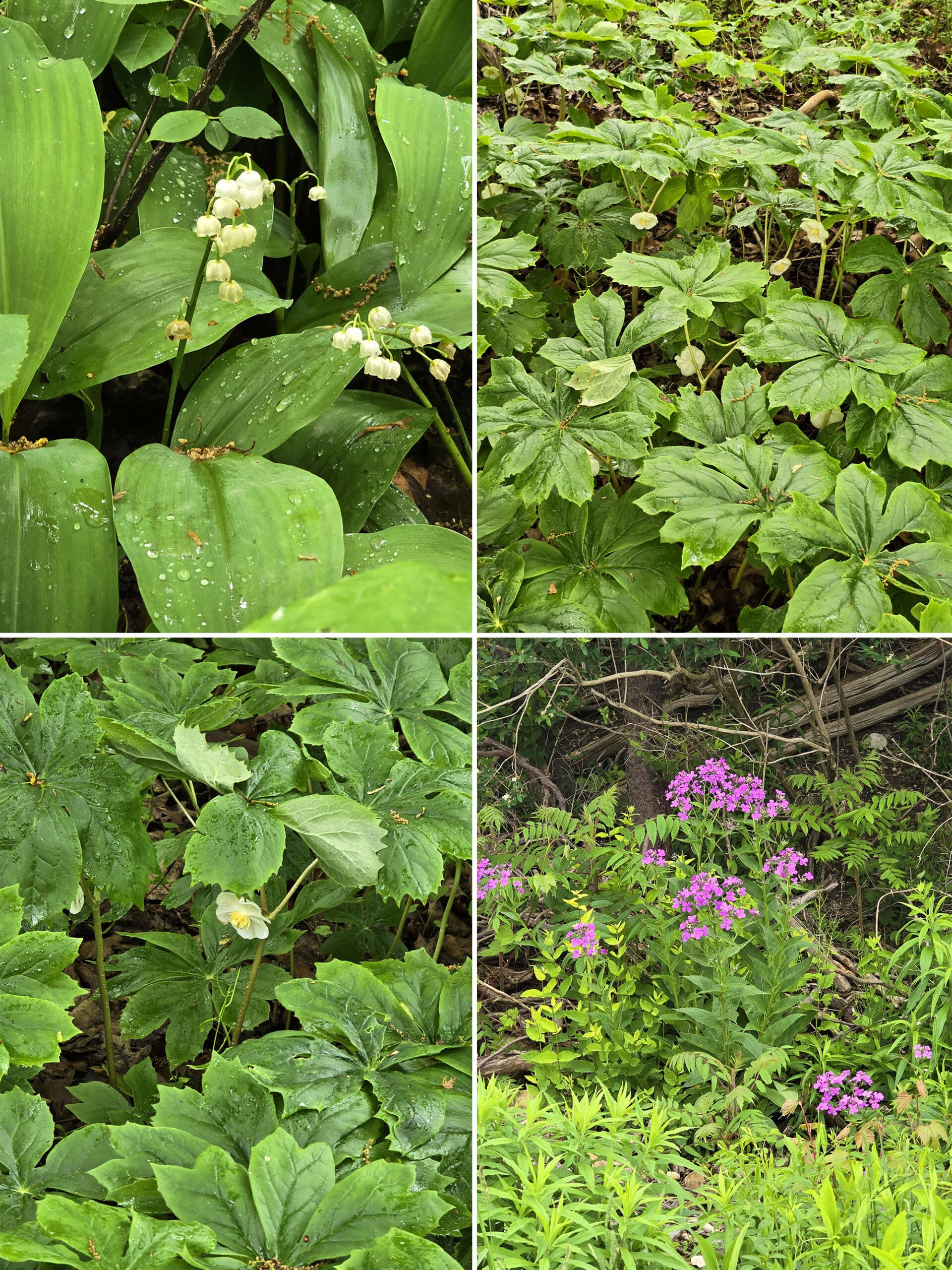
Tons of wildflowers and some really sassy chipmunks, too!
Fishing & Boating
There’s not really anywhere to access the Maitland River directly from the bridge area, but there are plenty of opportunities to access it in surrounding communities.
From everything I’ve seen, it would be a gorgeous trip!
Niantic Games
There are a few Pokestops in the area, and cell reception was plenty good enough to access them.
Nearby Attractions
The Menesetung Bridge in close proximity to all kinds of fun places to explore.
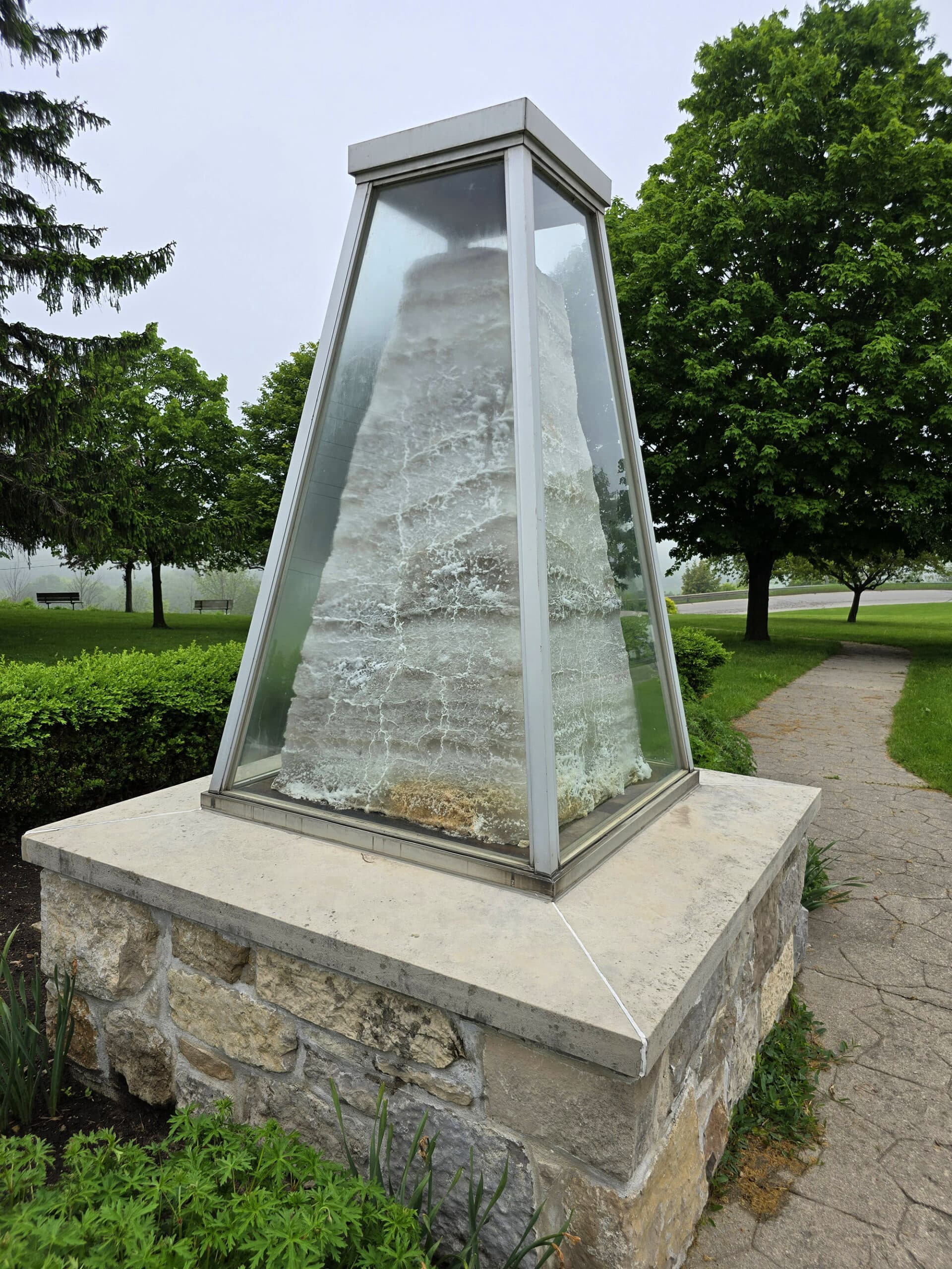
Near the road going towards the bridge parking area, you’ll find the Sifto Salt Monument, which was erected in 1966 to commemorate the 100th anniversary of the discovery of salt in the area.
A plaque on the monument tells about how salt as a commodity has been important for the Goderich economy.
Near that - basically across the road - is the Huron Historic Gaol. It took us way too long to realize that gaol = jail. Whoops.
Goderich Beach is maybe 5 minutes away, and GORGEOUS. We stopped there several times while staying in Point Farms Provincial Park .
Last but not least, Falls Reserve Conservation Area is a MUST see.
It plays host to a wide section of small waterfalls across the Maitland River, and you can wade right out to them. Glorious!
Final Thoughts
The bridge is an amazing way to see an amazing piece of history, as well as an amazing view of the area.
Porter had a great time looking out over the sides, and would do it again... and again.
Me... I’m glad I saw it the two times I did.
Obviously would have been happier to have seen it once - and done everything that one time! - but I AM glad that we went back and I was able to check out the Sifto hiking trail after all.
If you love bridges, you should definitely visit.
If you’re scared of heights... I still recommend finding some way to power through the fear and do it just the one time. Definitely an unforgettable experience!
FWIW, listening to 2 Unlimited’s “No Limits” helped me cross over the second time.
K’Naan’s “Take a Minute” helps in the opposite way. One pumps you up, the other chills you out. Do whatever you’ve gotta do!
More Places to See
Looking for some nice sights to see and great places to visit while you're out on your camping adventures? Here are a few of our favourite day use parks, attractions, etc.
Batchawana Bay
Big Bay, Ontario
Bruce Peninsula National Park
Cheltenham Badlands
Devil's Monument, Bruce Peninsula
Falls Reserve Conservation Area
Keith McLean Conservation Lands
Point Pelee National Park
Spirit Rock Conservation Area
Temagami Fire Tower
Thanks for Reading!If you loved this post - or have any questions about it - please leave a comment below! We'd also love it if you would consider sharing the link on social media! |