
Kap-Kig-Iwan Provincial Park is a cute park in NE Ontario, known for its waterfalls. Here's everything you need to know about camping there!

I saw “quasi”, as I had a full trip planned out, 5 months in advance. A week before we were due to leave, though, those plans started to really look cursed.
Not only had one of our stops been destroyed by a tragic weather event, forest fires were popping up, roads closing, etc. It felt like every day, we were getting an indication that this was not going to go well.
So, like any logistics minded person (LOL), I threw all those plans out the window a week beforehand, and rebooked that camping trip in an entirely different area.
No small feat, for a week’s notice in the summer!
(Yeah, how I managed to book 3 nights in a row, at the same site - with electricity! - in Algonquin, in early August, with 3 days notice is BEYOND ME!)
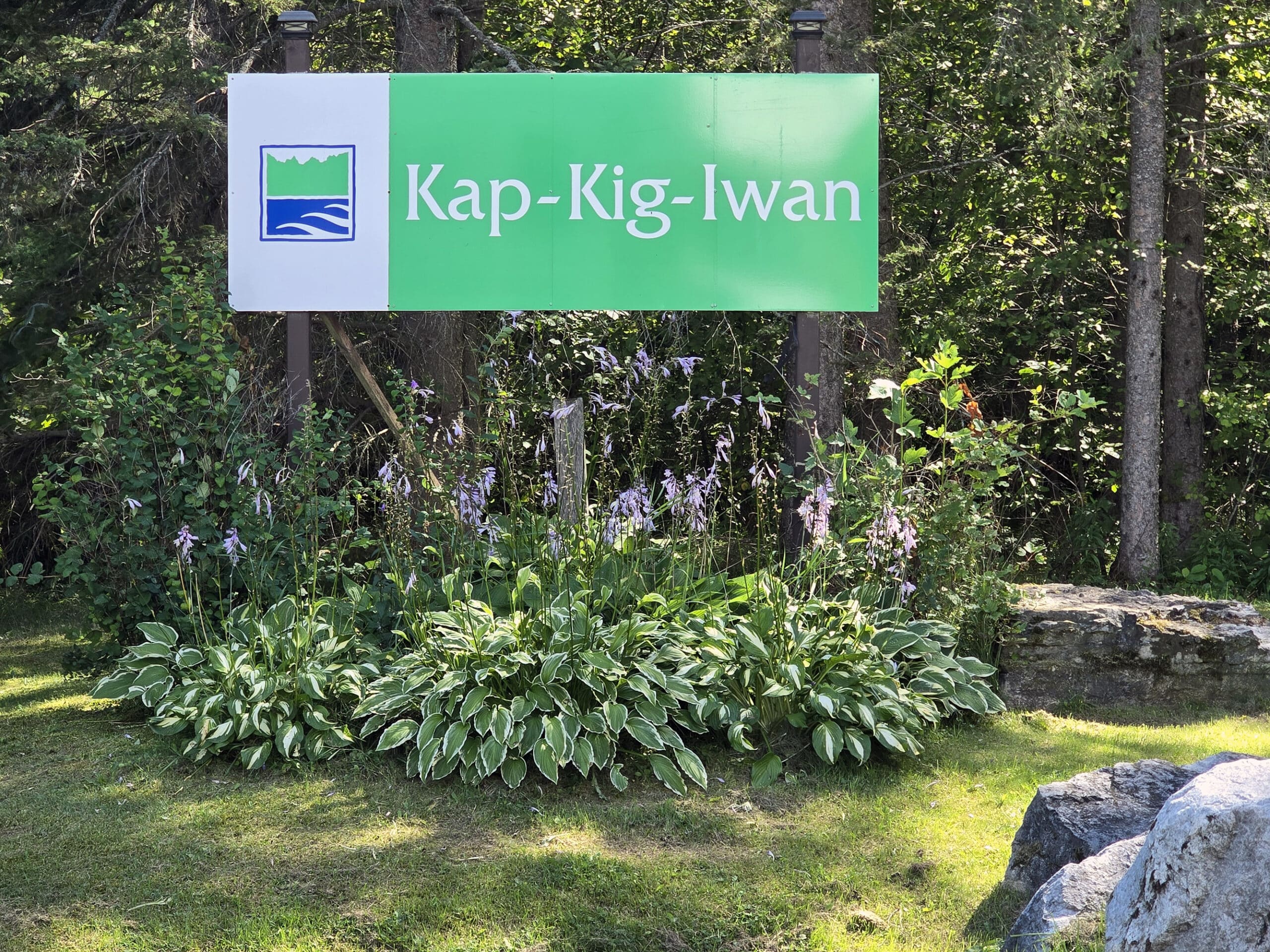
Known to be the smallest provincial park in the area, Kap-Kig-Iwan park is located just 5 minutes from the town of Englehart. It’s also an easy drive from Temiskaming Shores.
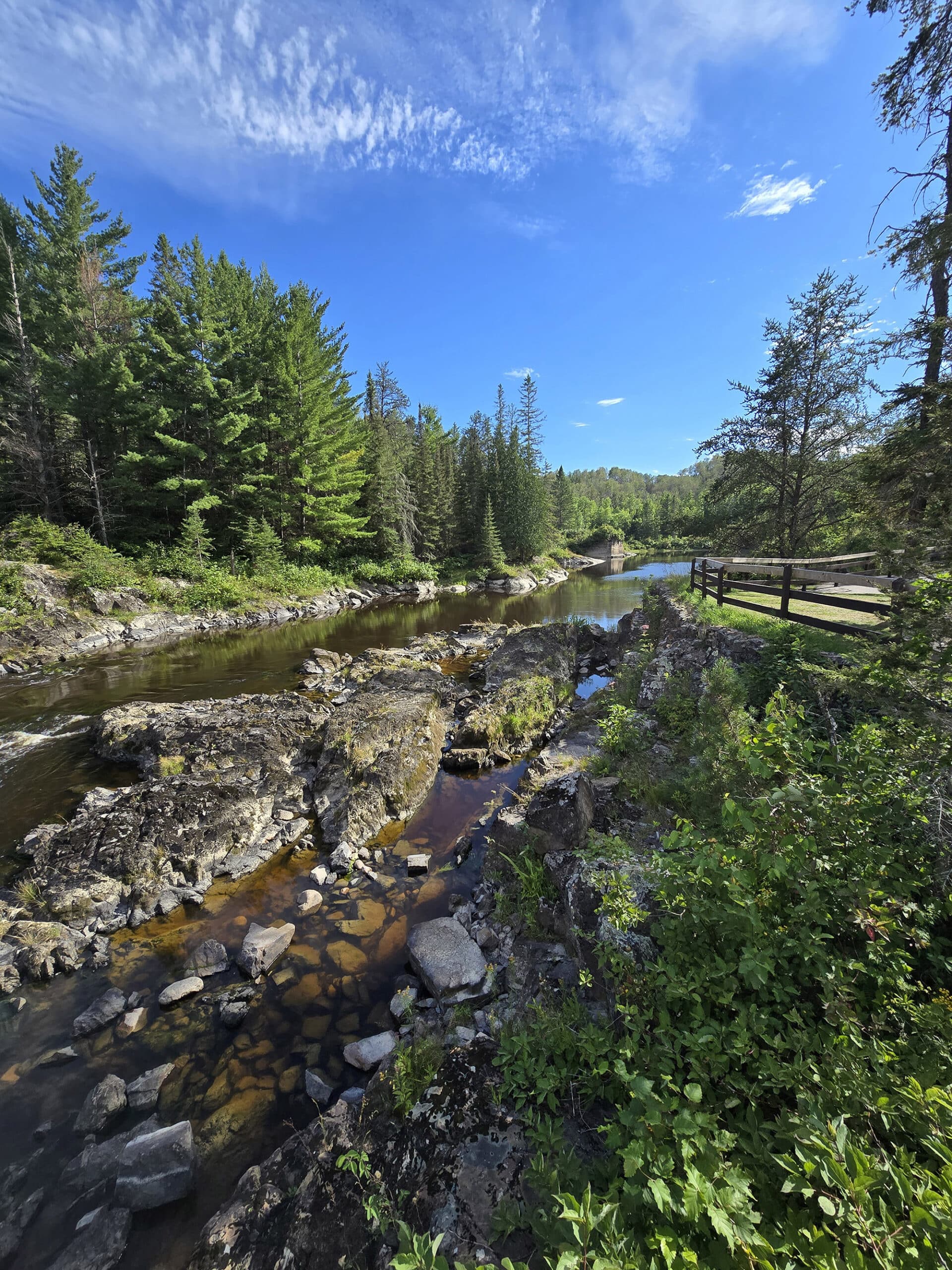
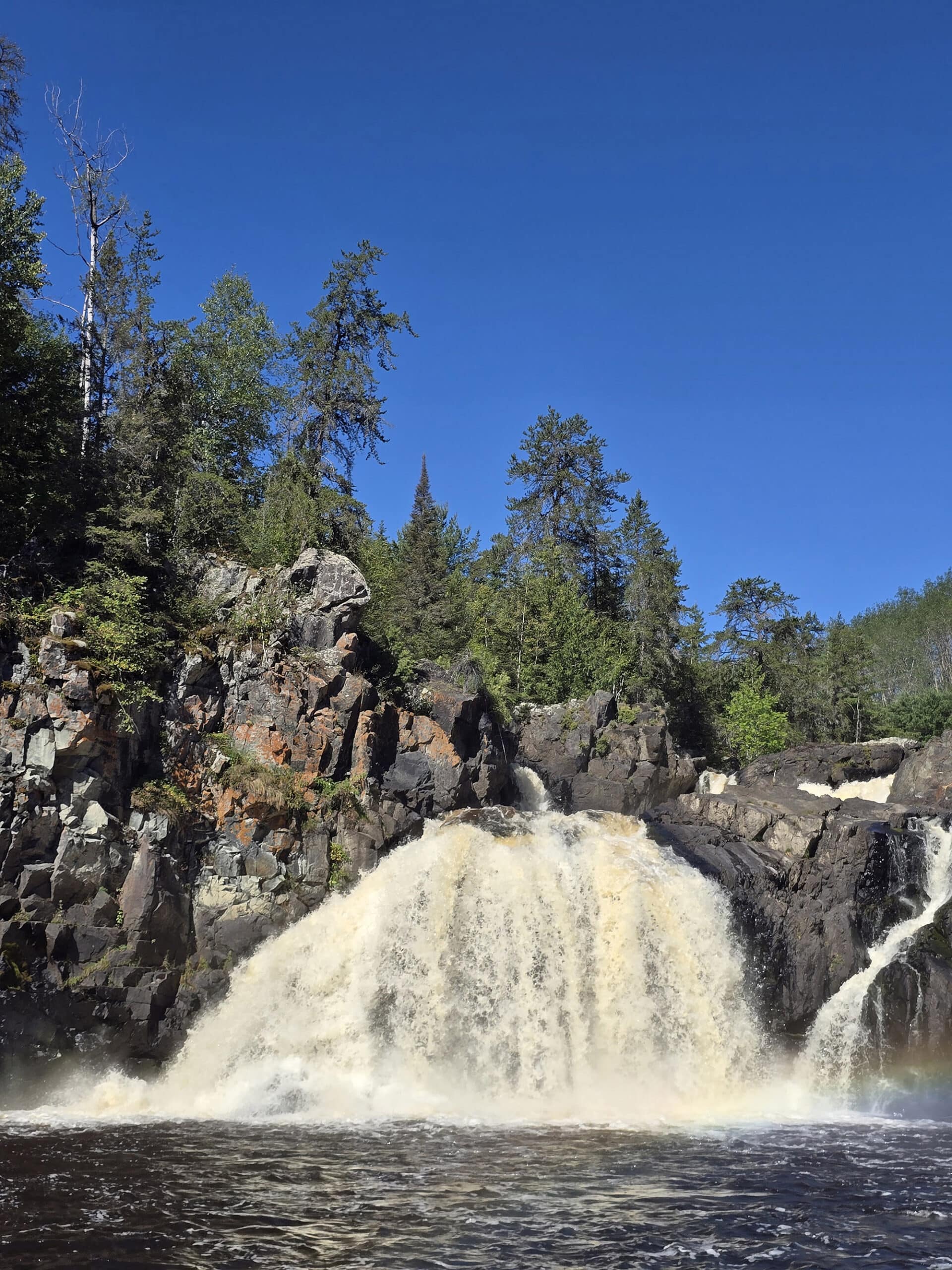
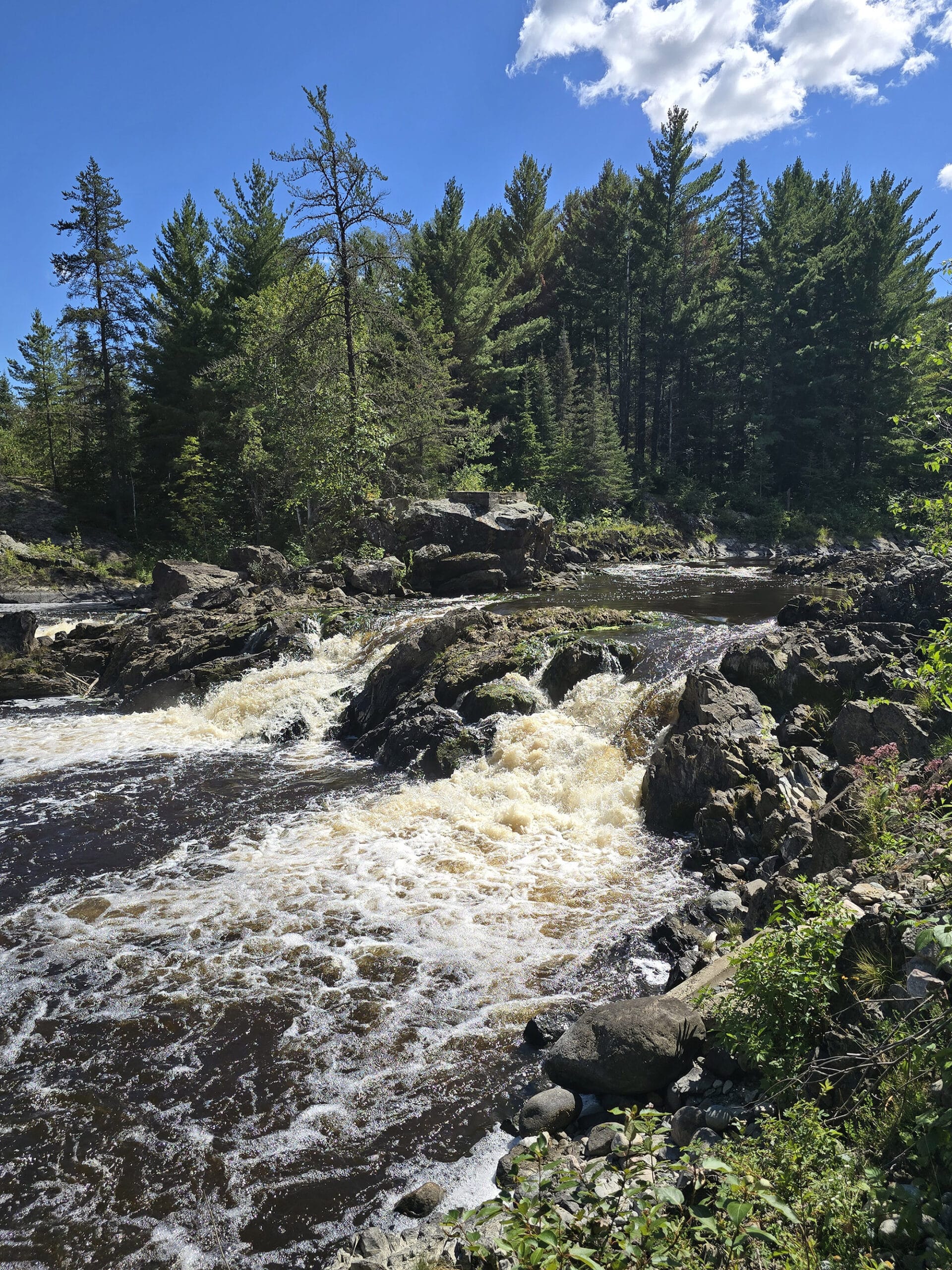
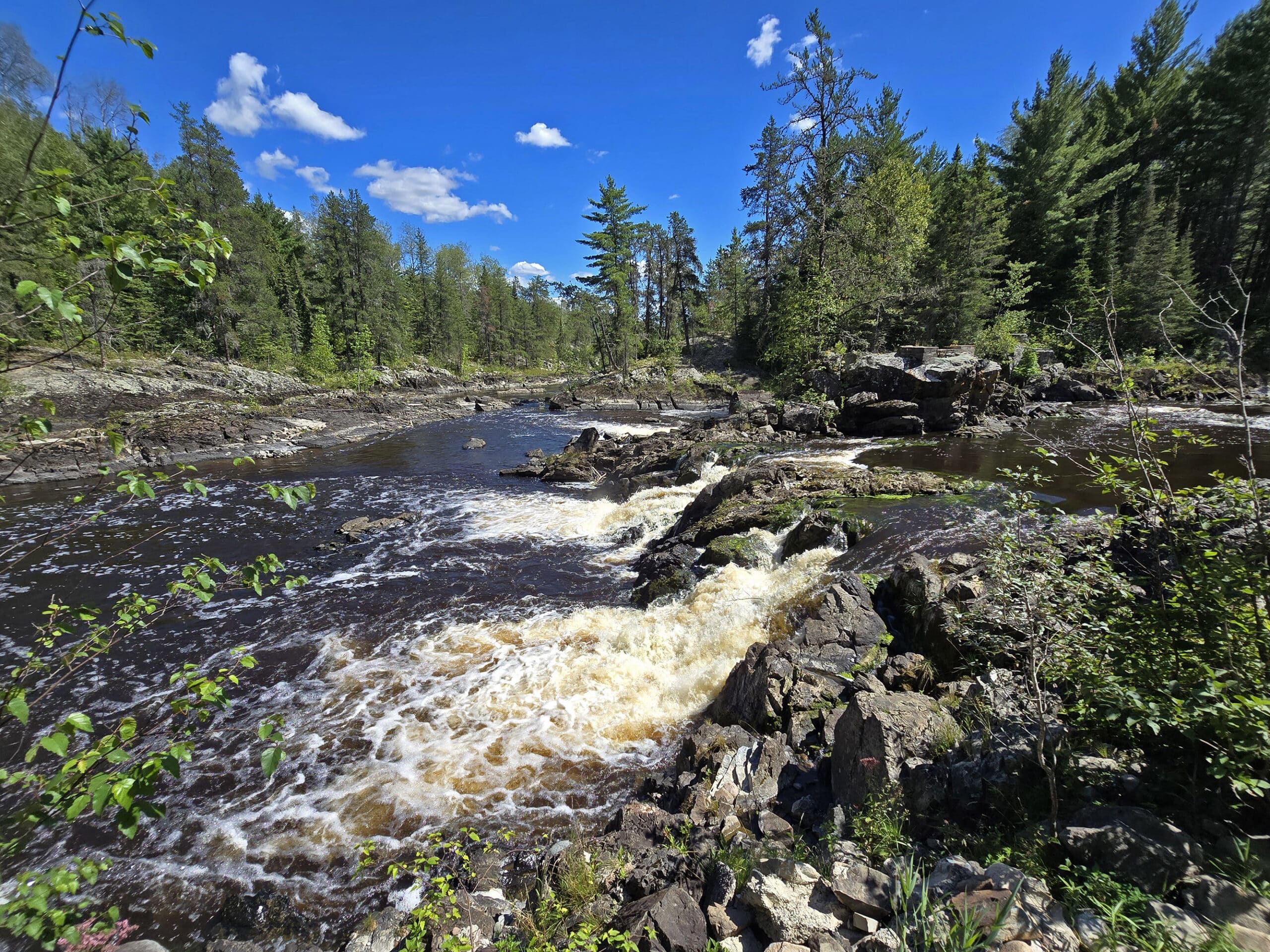
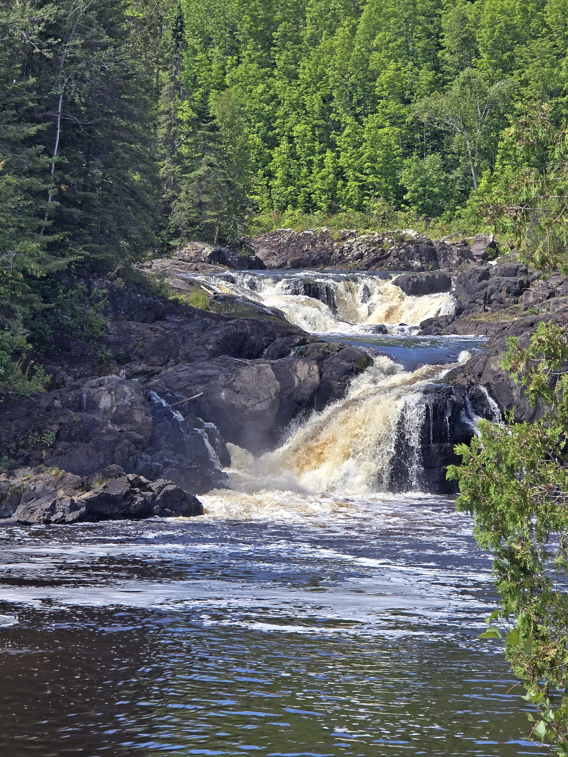
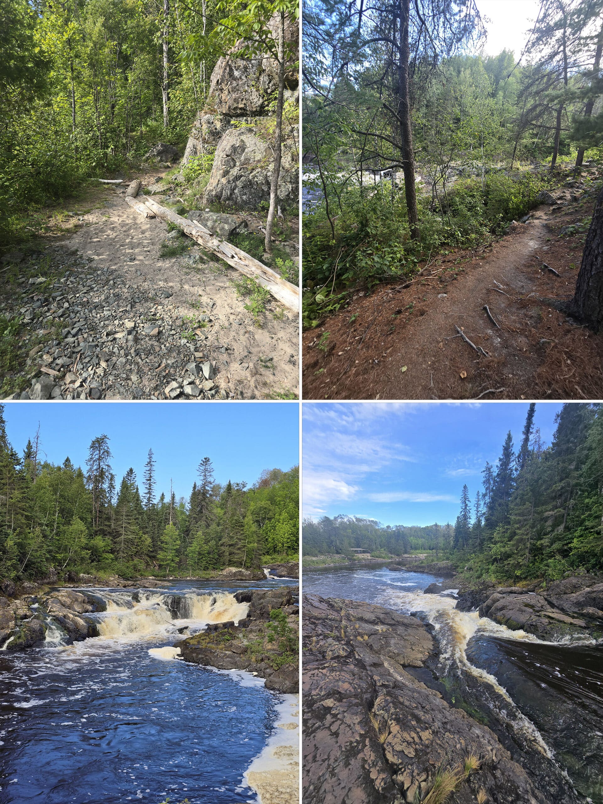
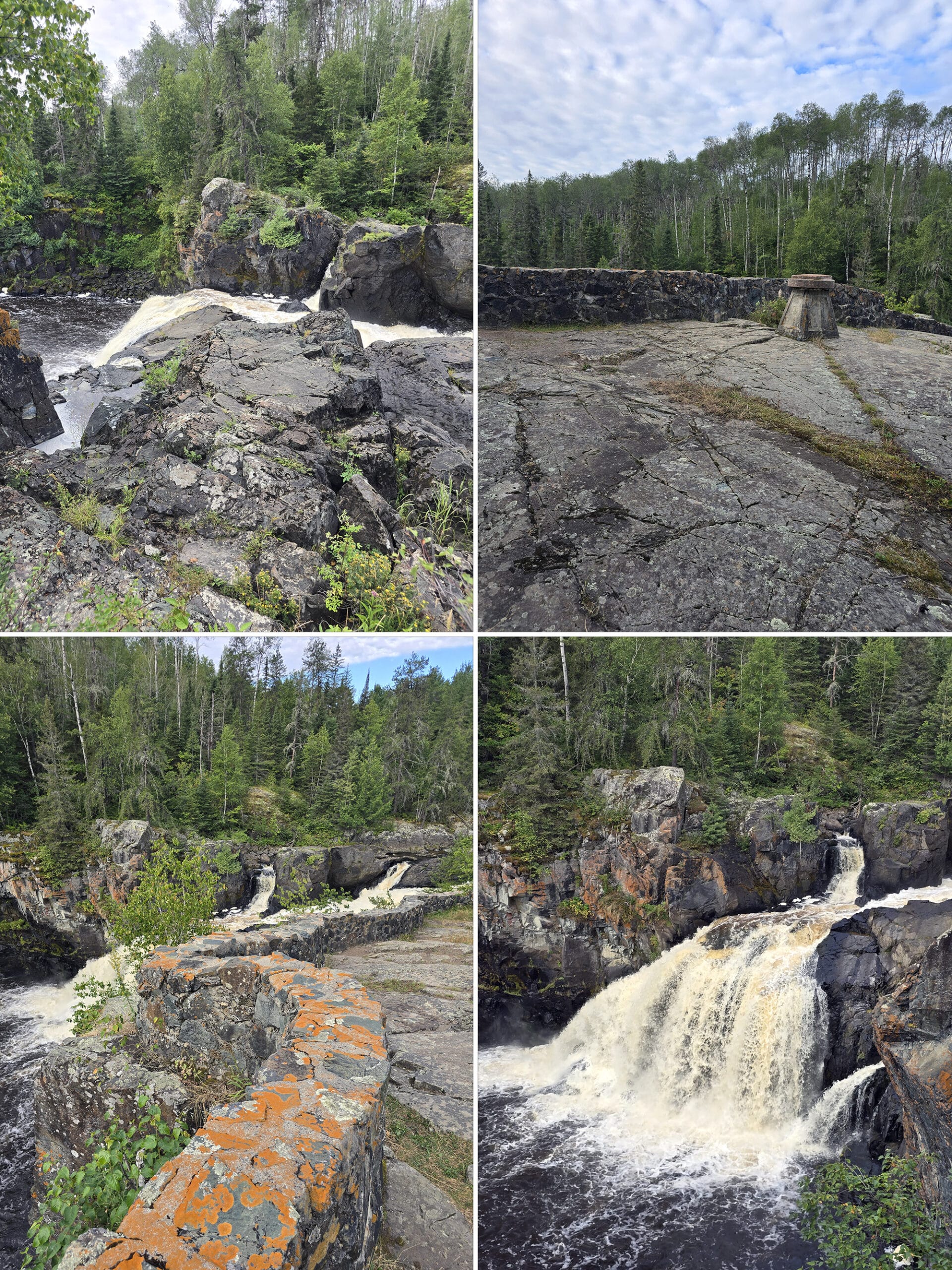
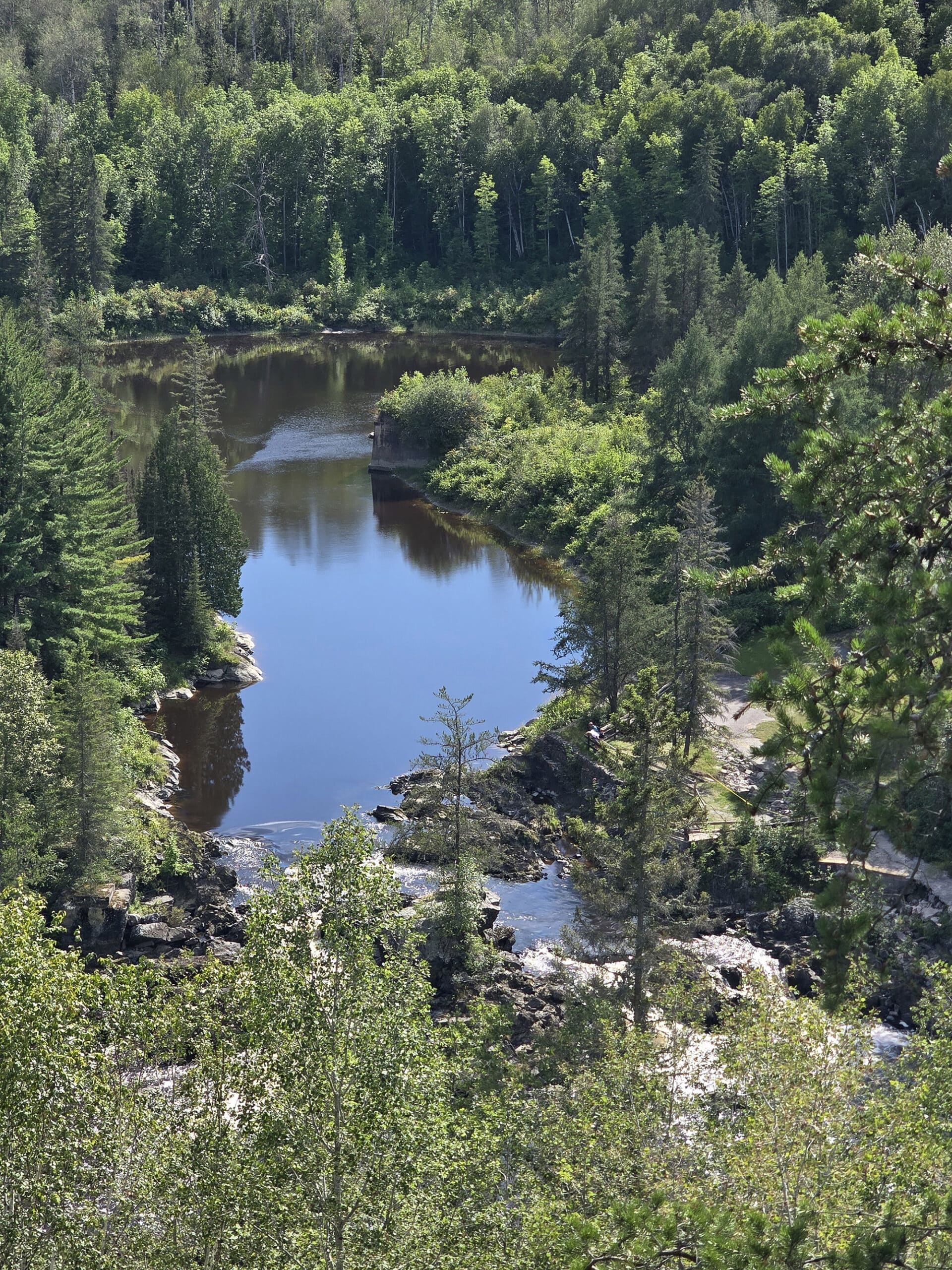
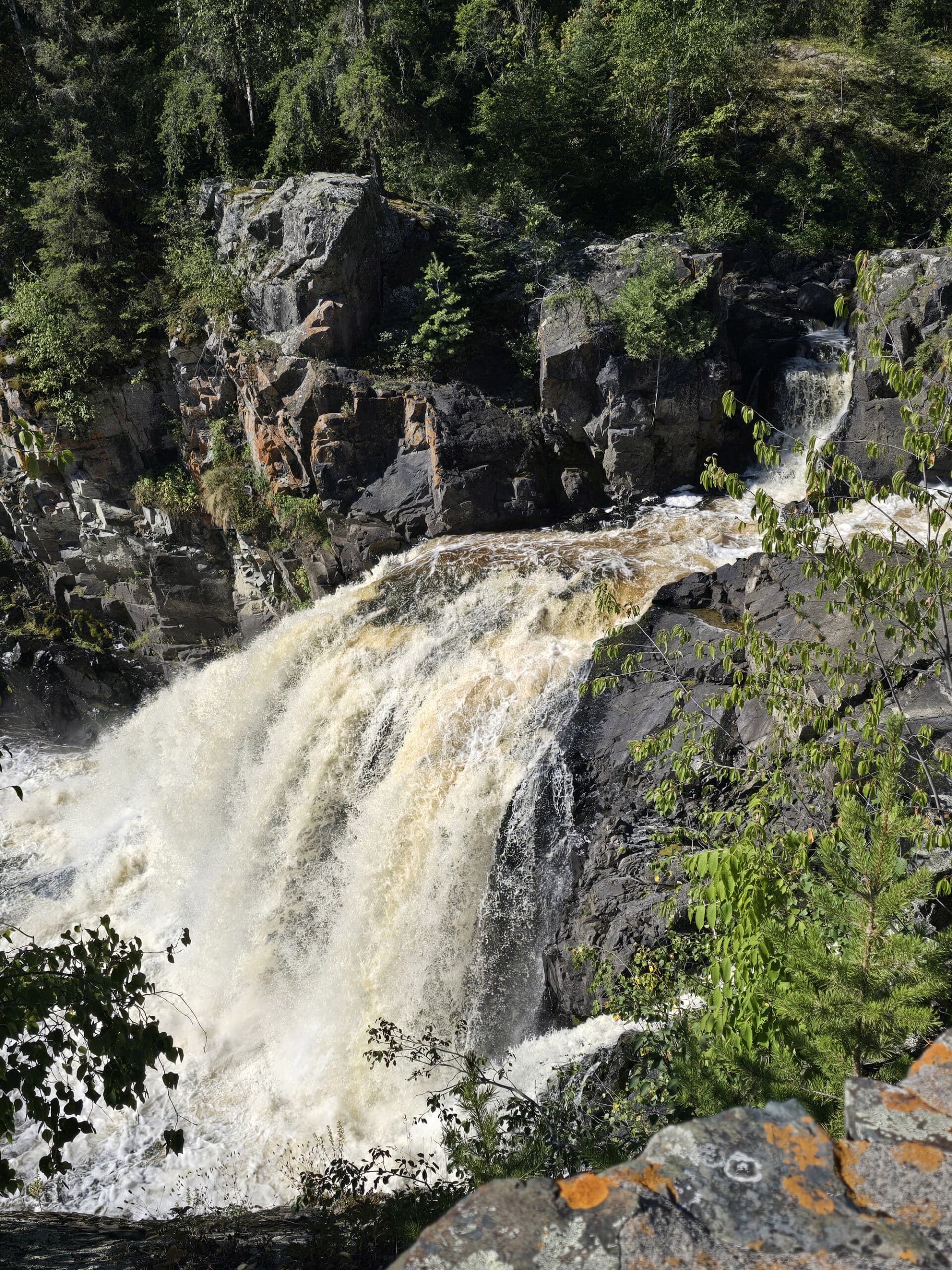
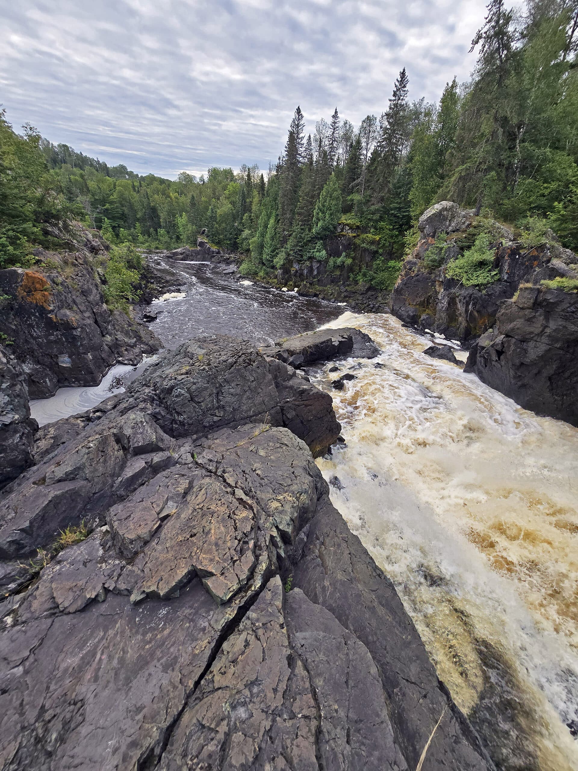
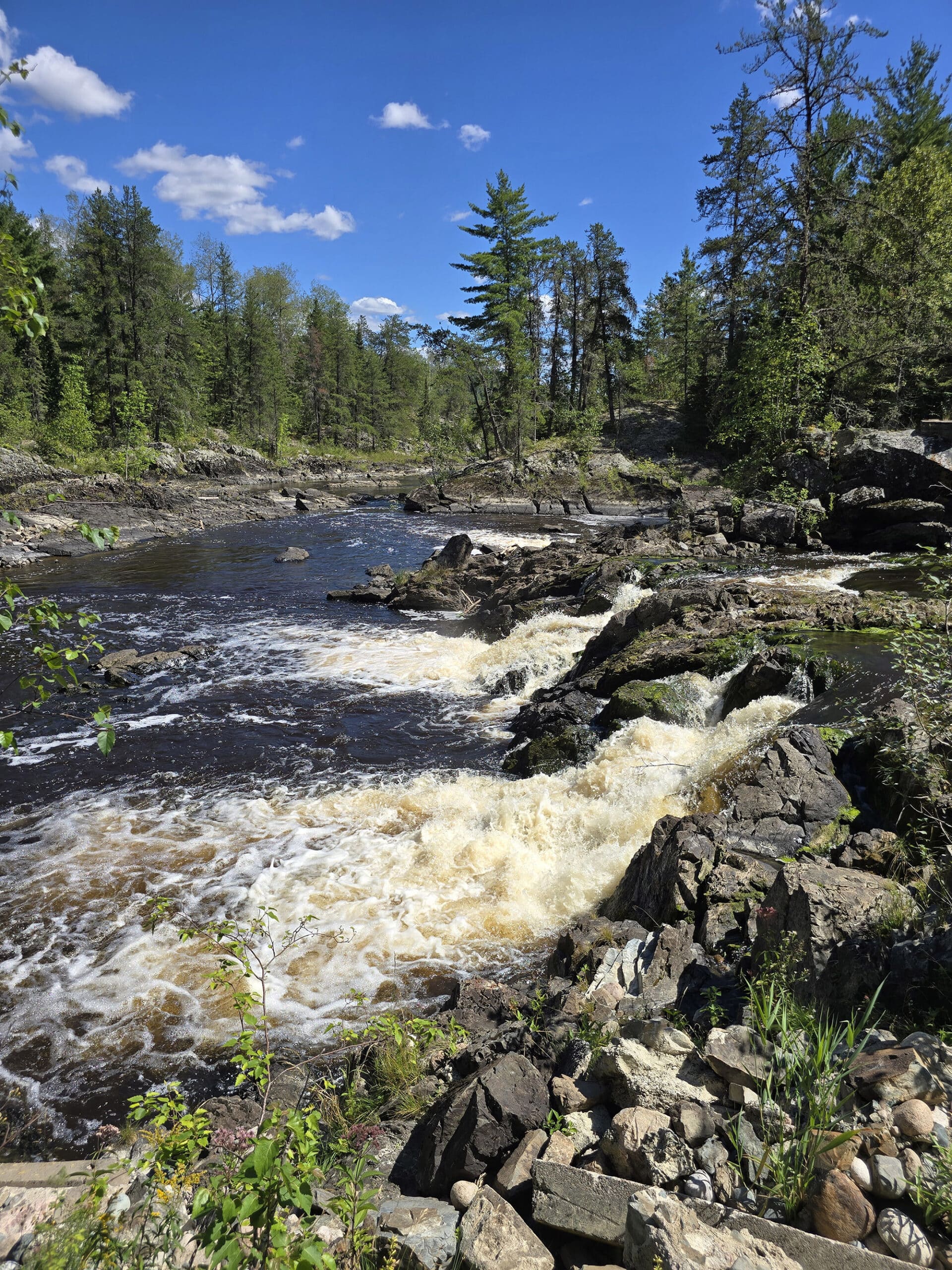
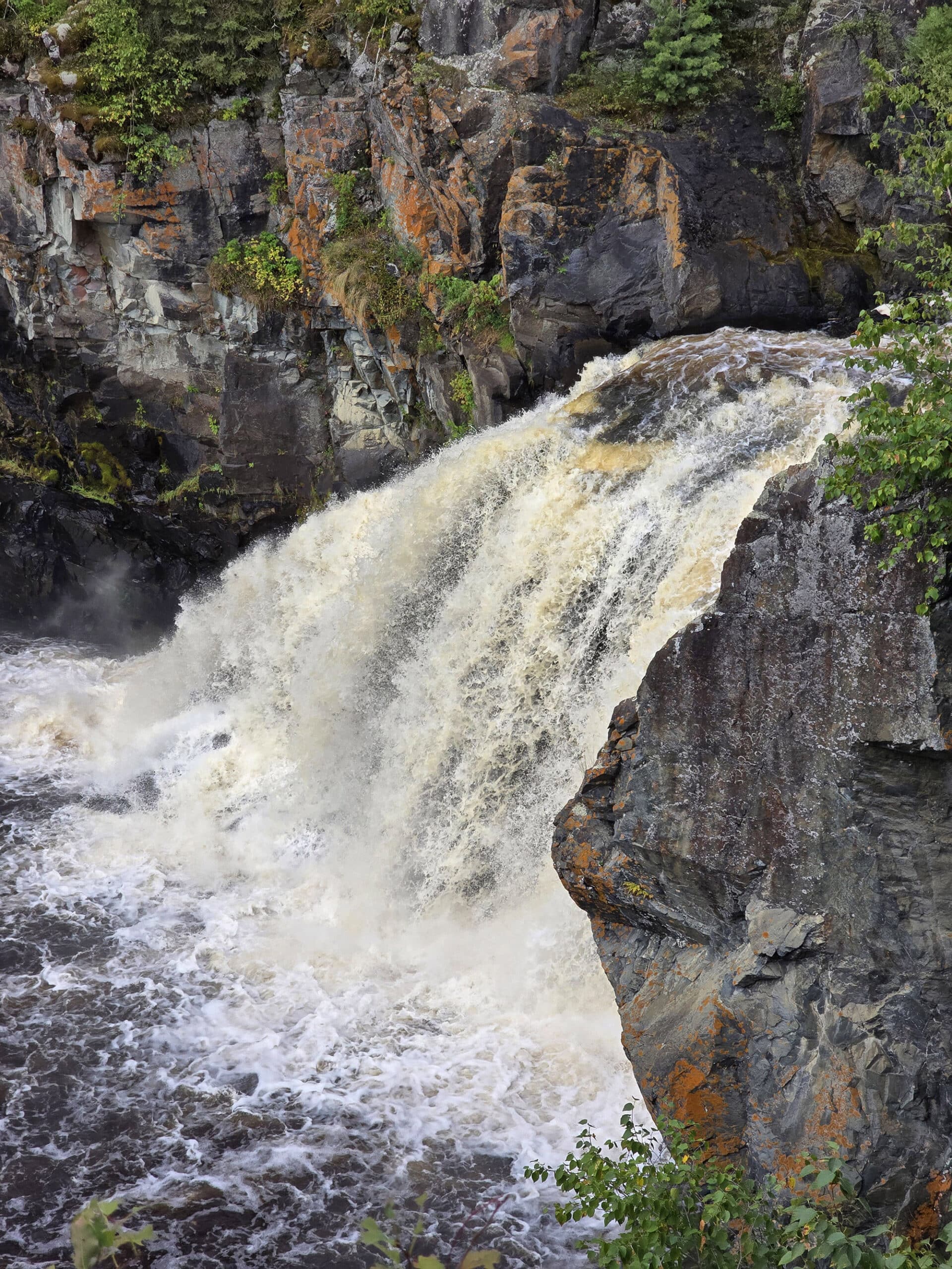
“Kap-Kig-Iwan” apparently comes from an Ojibwe phrase meaning “high falls” - appropriate, as a series of spectacular waterfalls and white water rapids is definitely the big draw of this Northeastern Ontario park!
Short trails provide easy access to the beautiful waterfalls , with nice views of the deep ravines that carve their way through the picturesque valley.
We had a great time - I’m a sucker for waterfalls! - so let us tell you all about it!
Spoiler: This is one of those parks were it sounds kind of terrible as we lay everything out, section by section... but we did end up loving the park.
The Basics:
Campground Name: Kap-Kig-Iwan Provincial Park
Address: 474030 Kap Kig Iwan Road, Englehart, ON P0J 1H0
Website: https://www.ontarioparks.ca/park/kapkigiwan
Price Ontario Provincial Parks uses a pricing matrix across all their parks. See 2025 Camping Fees for more details.
Reservations: Ontario Parks Reservations
Park Classification: Natural Environment Park
Season: May 15, 2026 to October 12, 2026
Logistics
Some basic information to help you plan your trip to Kap-Kig-Iwan Provincial Park:
Registration and Check In
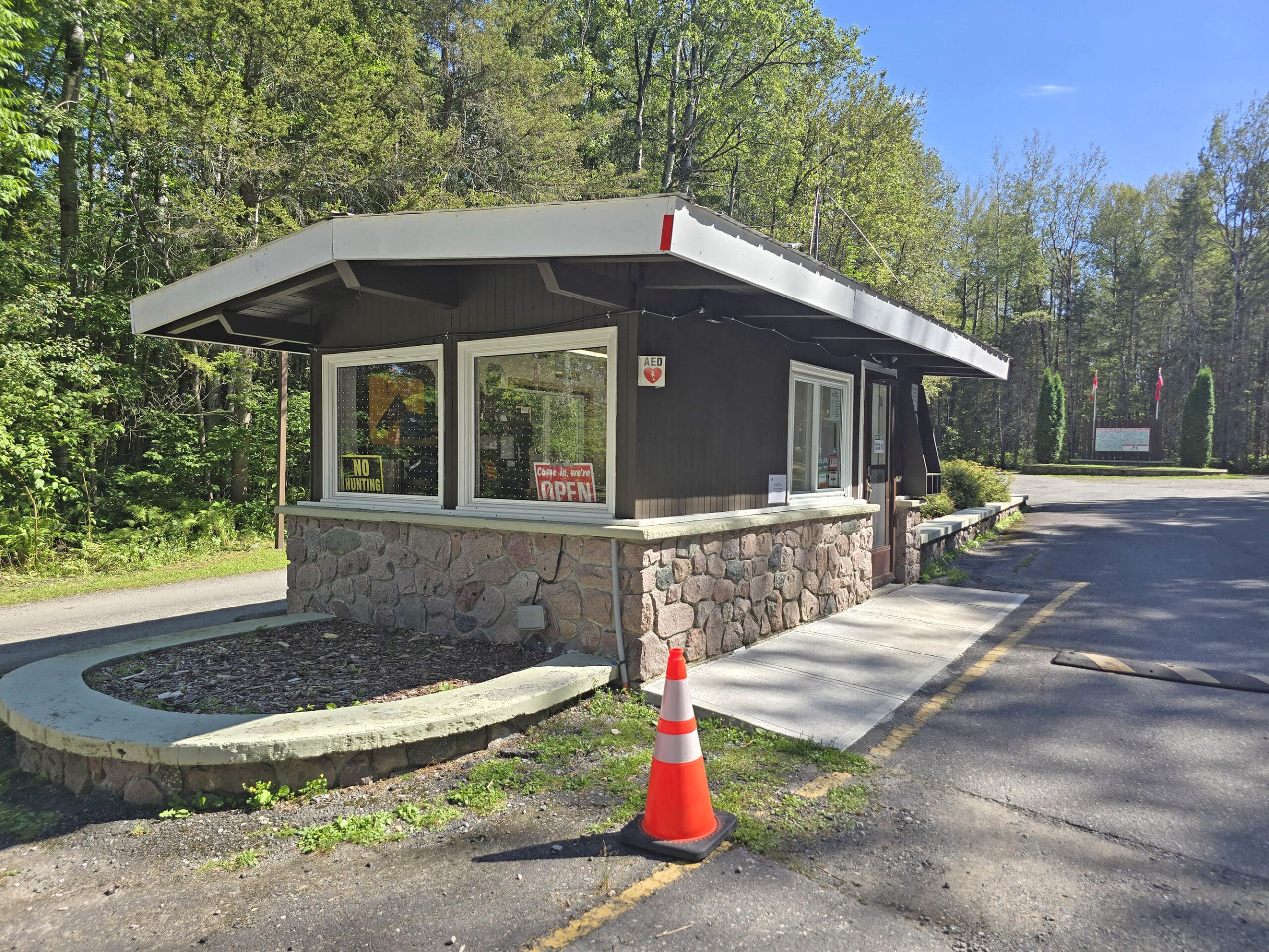
Kap-Kig-Iwan Park has joined in on the new system of check-in, where you get an email the morning of your arrival, allowing you to complete check in before even arriving.
In this case, the instructions said to proceed to our site... but they definitely wanted us to check in at the gatehouse. A park staff member came out to our RV before we even managed to get out.
As it turns out, there are paper permits for driving vehicles. Kinda weird - usually the parks that do that tell you to check in with staff, as a note on your online check-in.
Anyway, the on-site check in was quick and easy, as usual.
Maps and Signage
Kap-Kig-Iwan Provincial Park is a very small, VERY straightforward park. Everything is laid out along one main road, which extends in both directions from the gatehouse.
You’re not going to get lost, driving around this park - but you’ll want a map on hand!
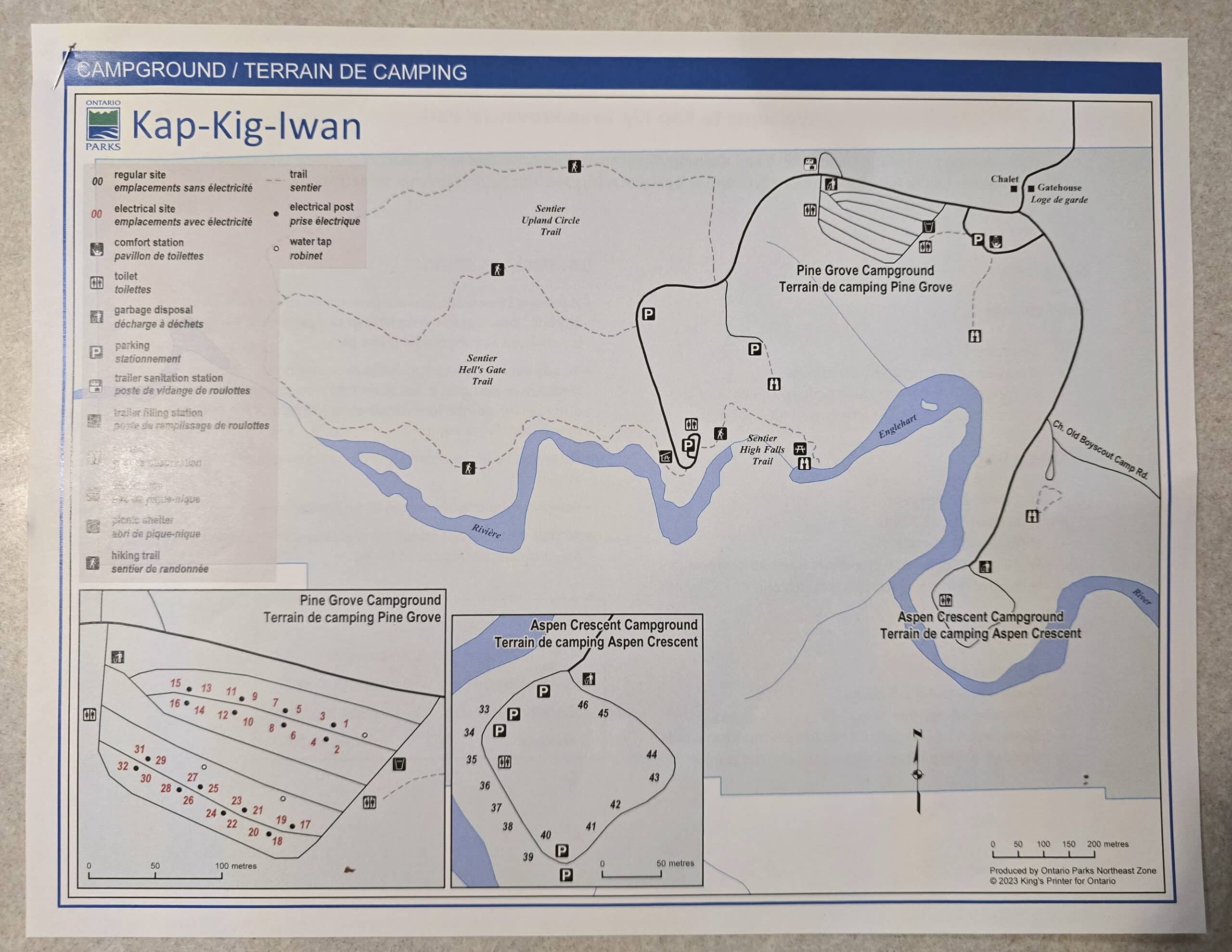
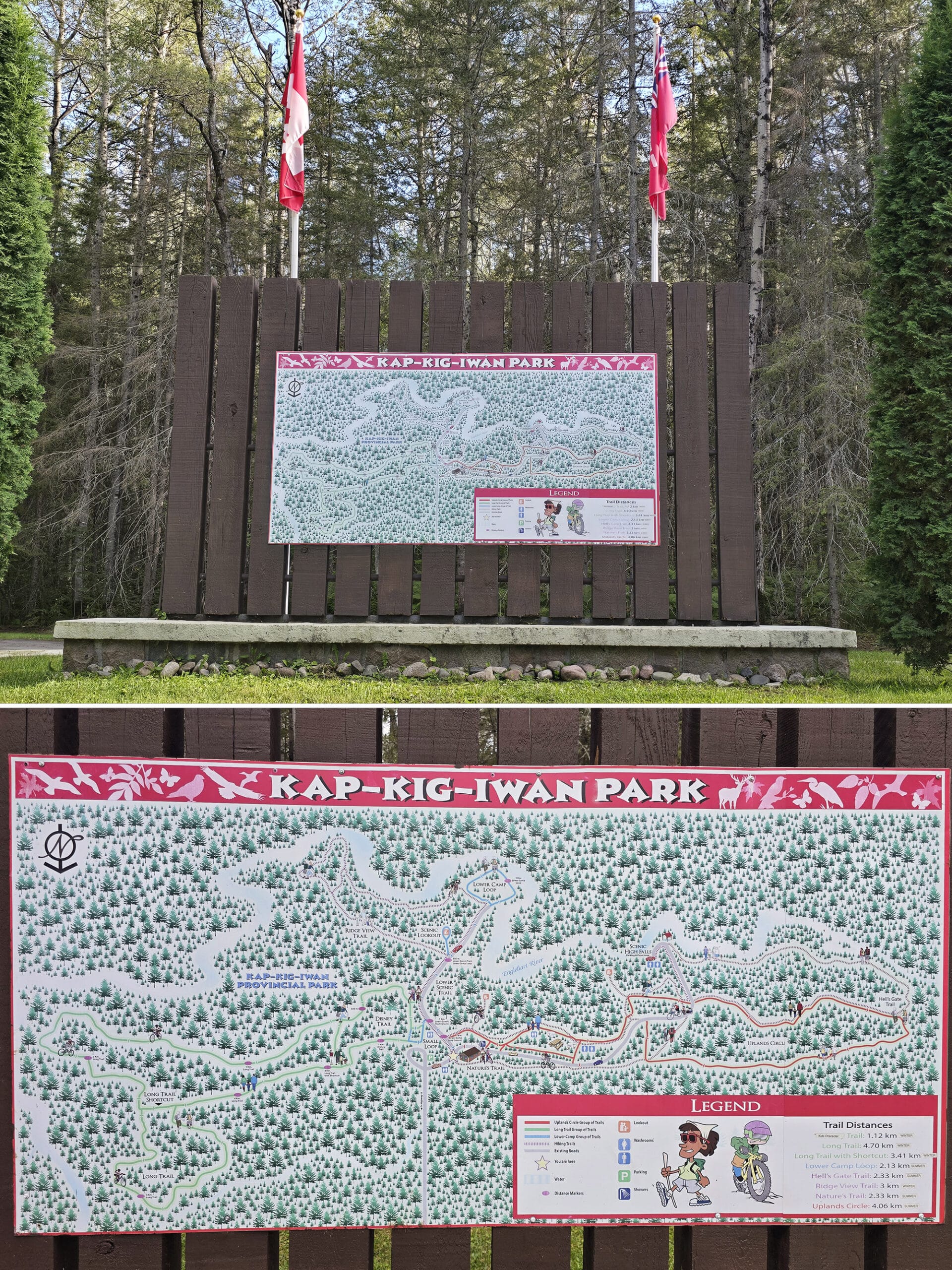
Park Map
The park map is an 8.5 x 11", full colour overview map - including a trail map - with two little inset maps for the two campgrounds.
Normally, I’d say that putting a whole park on a map like this would be way too small... but it works, in this case.
Like I said, it’s a very small, simple park. The park’s current offerings are all laid out clearly on the map, with plenty of information .
The campsites are colour coded for electrical service (or not!), and there’s nice information about the trails (and some of the campground rules) on the back of the map.
One big omission is anything about accessibility - which I’ll get to in a minute!
Historic Park Map
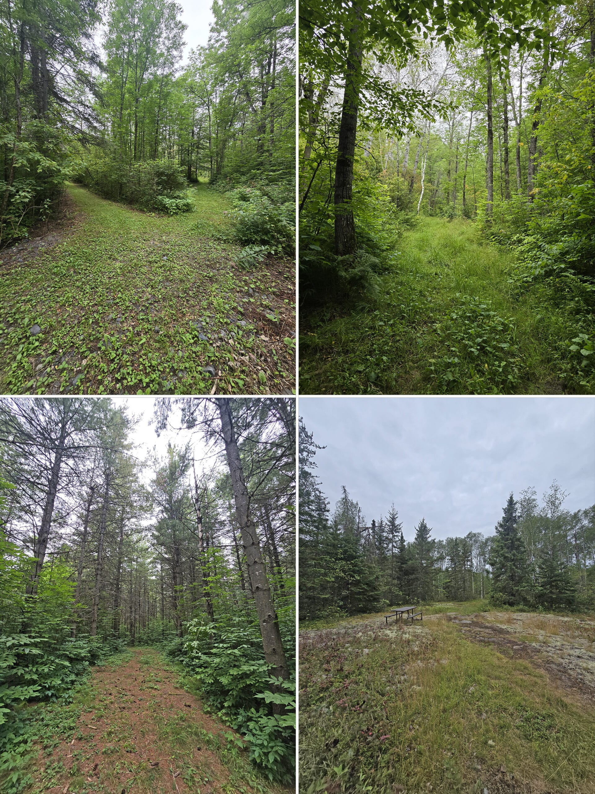
There are some old walking trails at the park that aren’t on the map. Some can be seen both in person, and/or in the Pokemon Go app... But aren’t on the current park map.
There IS an old trail map at the front of the park, that shows a lot of historical trail info.
Summer Trails:
Lower Camp Loop - 2.13 km
Hell's Gate Trail- 2.33 km
Nature's Trail - 2.33 km
Uplands Circle - 4.06 km
Winter Trails:
Disney Trail* - 1.12 km
Long Trail - 4.70 km
Long Trail with Shortcut - 3.41 km
Ridge View Trail - 2 km
* This one is taped over on the map legend, with "kid's character" written overtop. "Disney Trail" is what it's listed as on the map drawing, though.
Interestingly, the High Falls Trail isn't named or pictured on the map, though - in reality - it's definitely not a new trail. The picnic shelter on High Falls Trail also isn't shown, though that structure looks to be QUITE old, as well.
I wish I knew a time line for this park, it’s interesting! I don’t know when these trails last officially existed, when the High Falls Trail was opened - or when it got washed out - etc.
The map at the front must pre-date the bridge that no longer exists... so it doesn’t answer my questions about where that bridge might have gone!
The bridge seems to have been removed in late 2020... I wonder when High Falls trail went in, and how old that picnic structure is. The trail map must be REALLY old, as the bridge definitely didn’t look new in the photos I saw from 2019!
The Disney Trail - under that name, specifically - can’t be all THAT long-gone, as there is a Pokestop by that name, featuring a photo of trail signage.
That game started in 2016, though - theoretically - the Pokestop and photo could be as old as 2013, as it may have been submitted as an Ingress Portal, originally.
Signage
The signage at Kap-Kig-Iwan Provincial Park is pretty abysmal, for the most part.
You’ll be able to find your way to the campground, etc... but there are a lot of areas that don’t have any signage at all. For instance, most of the offshoot lookout trails aren’t marked from the road at all.
The one near the Upland Circle Trail - the road to it isn’t marked at all, aside from a speed limit sign. You kind of feel like you’re going somewhere you’re not supposed to, until you come to the parking lot. (Which also isn’t marked in person, but is obviously the spot marked as such on the map)
The one near the Aspen Crescent Campground isn’t marked - I’d assumed that Old Boyscout Camp Rd would be marked at least, but it’s not.
There IS a big sign at that fork in the road, though. When you come to the sign pointing right for the campground, turn left there, then veer right to get to the overlook.
Overall, if you have your map on you, you won’t get lost. If you don’t have your map on you, you probably won’t get lost, but you might miss out on some of the viewpoints, etc.
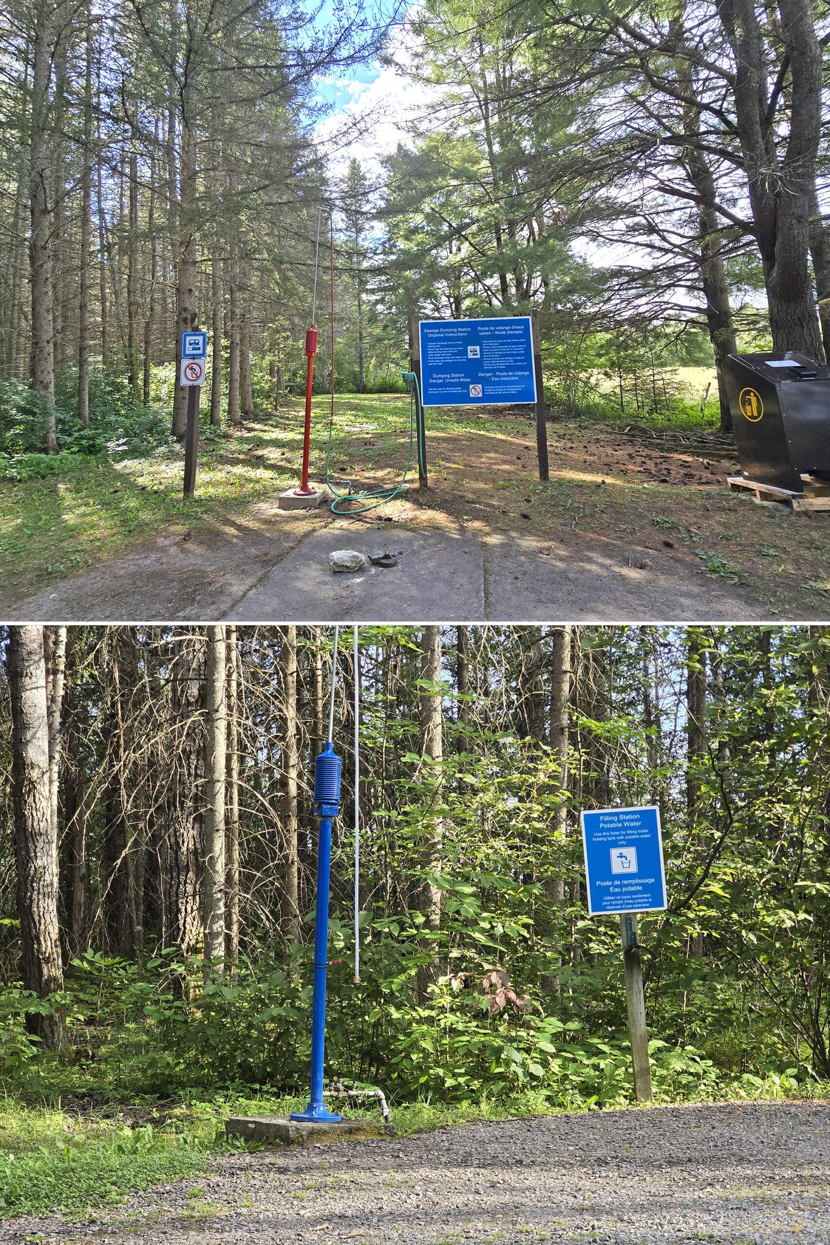
Waste & Water Services
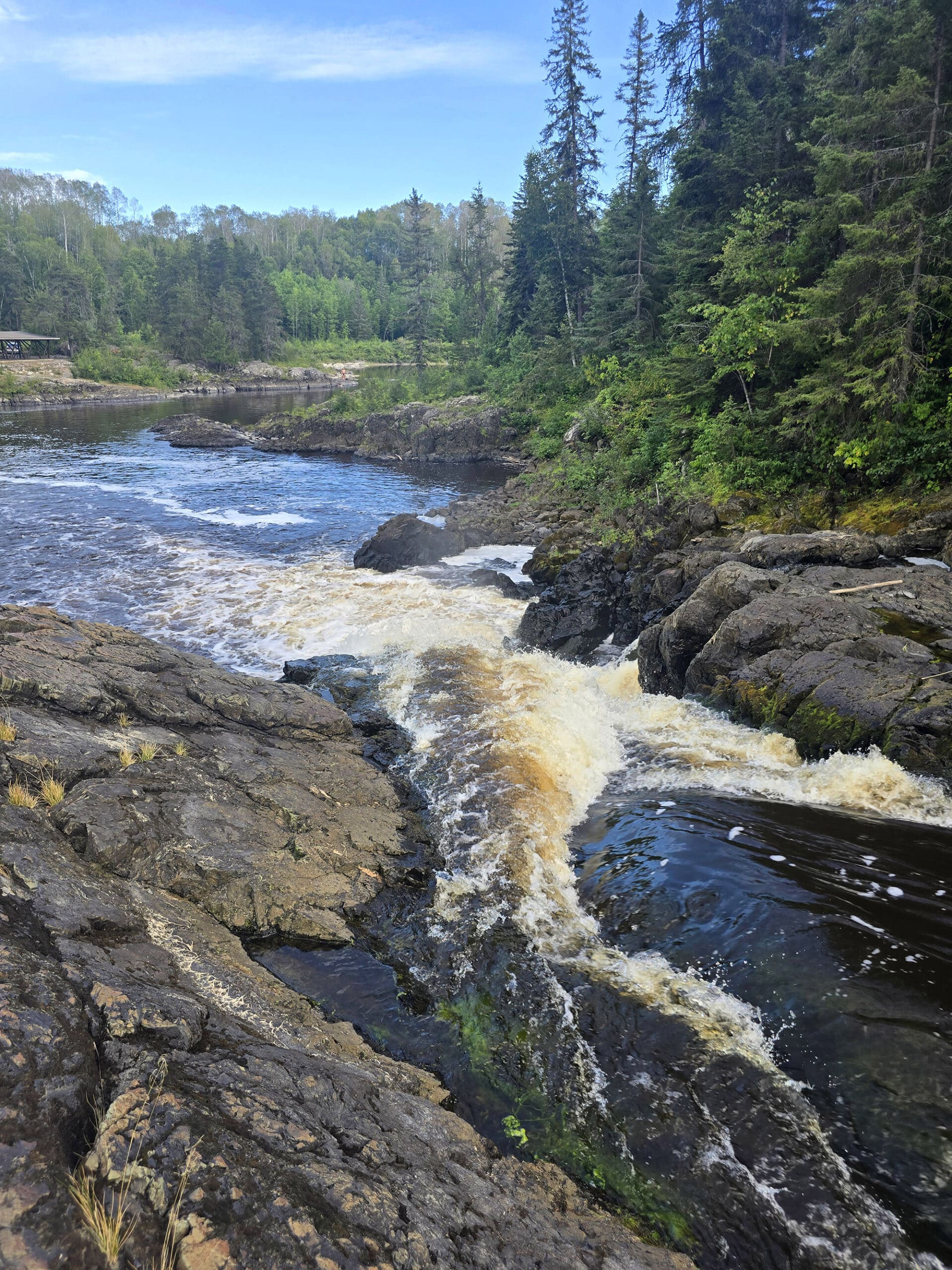
The water and trailer sanitation station situation at Kap-Kig-Iwan Provincial Park is a little odd.
There’s a single dump platform on a loop, near the Pine Grove Campground. It’s very much laid out in a way to be accessed on your way out of that campground - you basically drive straight across the main campground road, when exiting the campground area.
If you’re trying to access it on your way into the campground, it’s a pretty tight right turn off the main road - you’d probably be best off driving through the campground.
Anyway, it’s a short loop with a single dump platform on the driver’s side, with a bit of a scenic view over a field.
The fill platform is completely separate from the dump station loop - it’s located on your way into the Pine Grove Campground.
It’s on the left hand side of the road, almost as soon as you turn into that campground area, and it’s a threaded tap.
One important thing to note: This fill tap - and the comfort station - seem to be the only water sources in the park. We didn’t see any taps anywhere, nor are any indicated on the map.
Also, weirdly... the garbage receptacle at the exit of the Pine Grove Campground had a sign directing people to dispose of garbage at the facility in the front of the park.
Connectivity
We’re on Rogers Wireless, and found the cell reception to be spotty throughout the park.
At our campsite in Pine Grove, we sometimes had pretty decent reception... but at other times, we’d need to wait or refresh to get something to load. I had a bit of reception down by the picnic area and day use, then fairly spotty coverage throughout the rest of the park.
You’ll probably be able to check the weather and your email, but I wouldn’t count on being able to stream a movie or anything!
Accessibility
Kap-Kig-Iwan’s website indicates that it has a single barrier-free site, and that’s as far as their available information on accessibility goes.
The site is not indicated on the park map, nor is any other accessibility information.
I tried to find it on the Ontario Parks reservations page - I wonder if it might be old information, as the reservations portal does not allow you to use “barrier free” as a requirement filter at this campground.
So - the barrier-free site may or may not exist.
Beyond that, it’s just really not a disability friendly park. None of the trails are any less than a moderate difficulty rating, the picnic area and overlooks aren’t wheelchair accessible, etc.
The comfort station is incredibly old, not barrier-free, and none of the vault toilets appear to be wheelchair accessible either. Also: The comfort station is separate from both of the campgrounds, and the road to get there is in pretty rough shape.
So, if you’re a wheelchair user planning to camp at this park, be sure to bring your own washroom, and don’t expect to do much outside of your own campsite.
If you’re otherwise mobility impaired, the lookout point across from Upland Circle trail is flat and easy, with a nice view. Skip the one near Aspen Crescent campground entirely, and expect some difficulty trying to see any of the water / waterfall views down by the picnic area.
Pets
Kap-Kig-Iwan Provincial Park is not an especially dog friendly campground.
There are no dog exercise areas or beaches, and the few places that have access to the water... probably aren’t especially safe places for dogs to swim, on account of the currents.
Beyond that, dogs are required to be leashed (2 metres long or less) and supervised at all times, and picked up after. They’re also not allowed to harass other animals or people, or make excessive noise.
Parking
Parking at Kap-Kig-Iwan is generally suitable for the number of people you could expect to be using said parking.
The outlooks have really small lots, but it’s a small park, and those are very short trails. I don’t expect anyone is parked at any of them for any real amount of time.
There’s a large lot at the end of the campground with the picnic area and trail heads, and it seems PLENTY big for the size of the campground, and the types of destinations down in that area.
The picnic shelter has a tiny lot of its own, but it’s easy walking distance from the main lot, if mobility isn’t an issue. (Note: It’s a VERY steep, short road to get down there. We thought we were going to end up high-centered, getting out!)
The Pine Grove Campground sites are all big enough that parking shouldn’t be an issue. There aren’t any overflow parking spots in that campground.
The campsites in the Aspen Crescent Campground are smaller. They’re tent-only though, so it should be less of a problem. Also, there are several parking spots in that loop - I think they may be decommissioned campsites.
Miscellaneous
Some random info you should know about Kap-Kig-Iwan Provincial Park:
The Roads
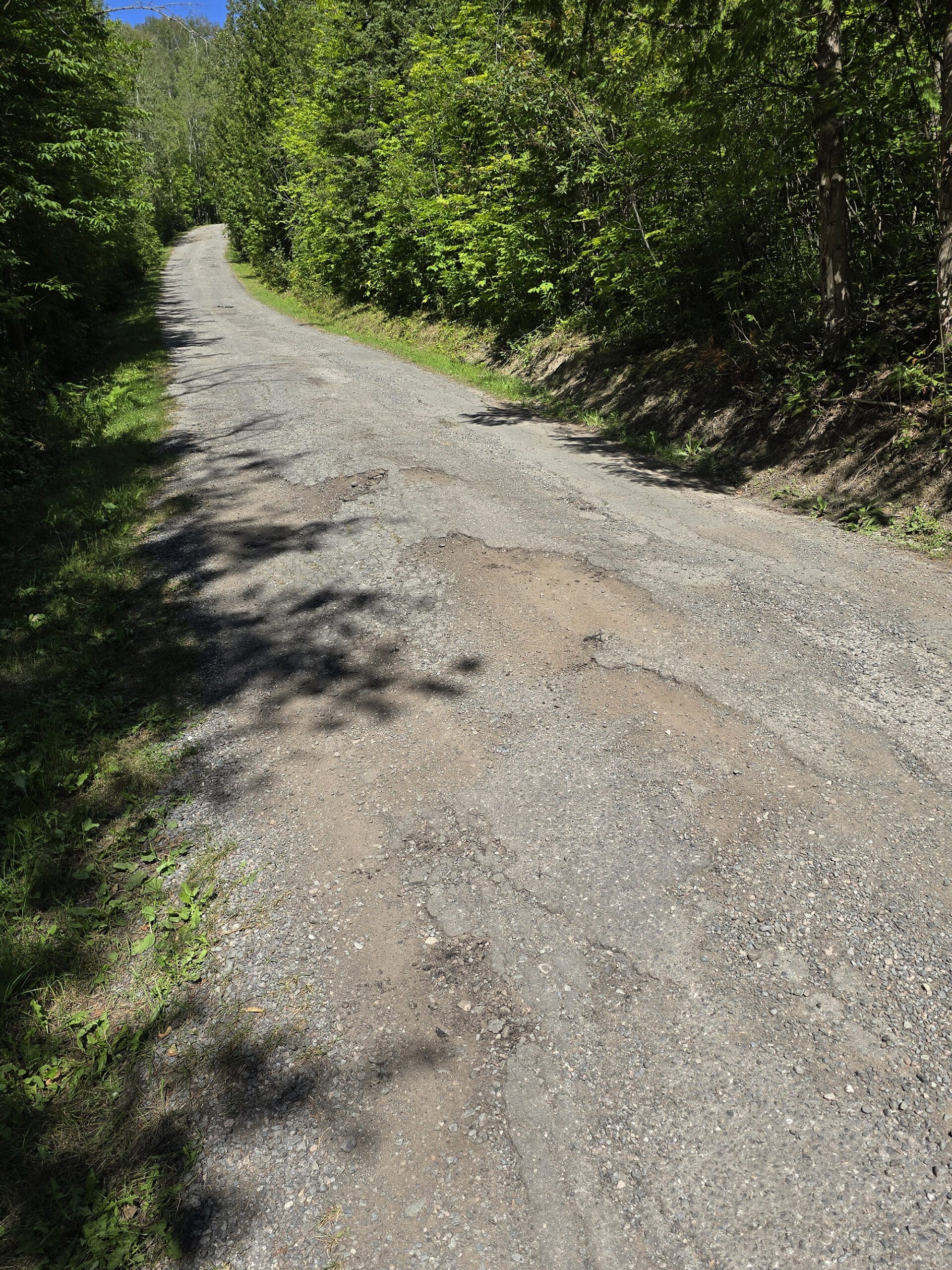
The roads are in atrocious shape: narrow, no shoulder, and showing what is probably decades of water damage.
This is ESPECIALLY the case heading down towards the Aspen Crescent Campground, where the condition is not only worse, it’s quite steep on top of it. I would not recommend bringing any kind of camper or trailer down to that campground.
Porter was joking that we should bring signs that say “Abandon hope, all ye who enter here” to set up in such situations.
Wildly, the speed limit is posted as being 40 km/h throughout the park. We couldn’t imagine driving that fast even just in our car!
The Train
There is a train that runs nearby.
It doesn't seem to come by anywhere near as often as we've experienced in other parks. It only blew its horn once or twice each time - it sounded pretty far off in the distance, so it wasn't awful. Unless you're a really light sleeper, it won't be a problem.
Caveat:
If you have really autistic ears - like I do - A minute or two after the horns, the train makes a weird pulsating noise.
I think it's going uphill. Anyway, it's the kind of noise that some of us can feel - deep in our eardrums - and it was quite unpleasant. It only lasts a minute or two, though.
Bad news for the train autistics, though - no view of the train, so far as we could see!
Night Sky Viewing
Theoretically, Kap-Kig-Iwan Provincial Park should be a great place for night sky viewing, due to the low light pollution that far north.
That said... there are NO good north-facing views in the entire park!
Literally everything is facing south!
If you happen to be camping there during an Aurora Borealis show, I think your best bet would be to either hang out in the trailer dump loop - overlooking the field. Hopefully it doesn’t smell too bad over there!
Otherwise, if you have a good strong Northern Lights show - the kind that goes overhead and all around - that overlook by the Upland Circle Trail would probably be great for it.
The picnic area MIGHT work, depending on the orientation of the lights... but the horizon is pretty close, down there.
If you’re interested in possibly seeing the northern lights, check out our posts: Aurora Hunting, How to Photograph the Northern Lights, Can I See the Northern Lights Tonight?, and Where to See Northern Lights in Ontario.
Campground Amenities & Info
Apparently Kap-Kig-Iwan was downgraded to a non-operating park sometime a couple/few decades ago, and fairly recently reinstated as an operating park.
That fact can, uh... definitely be seen when it comes to the few amenities at the park.
Here’s some basic information on what to expect:
Creature Comforts
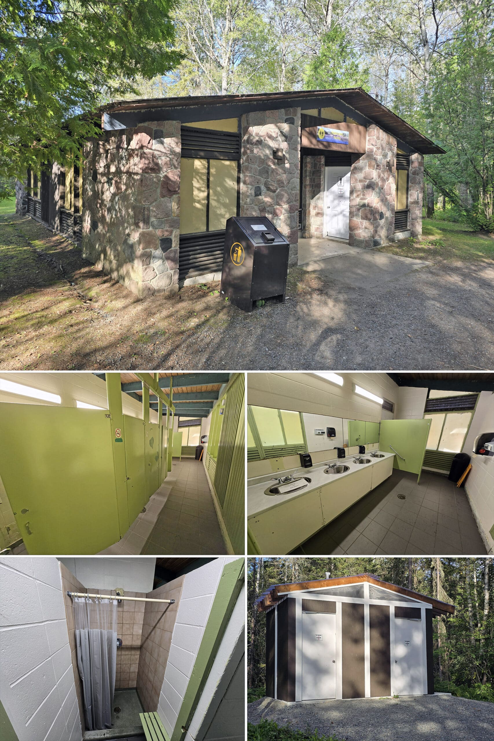
There’s a single comfort station, located on its own loop - right across from the gatehouse, as you get onto the main campground road.
There’s a short path from the Pine Grove Campground to walk there, but you’ll definitely be driving if coming up from the Aspen Crescent Loop. (And it won’t be a pleasant drive!)
This is a very old-style comfort station, with the flush toilets contained within a large washroom area inside, rather than stalls accessed from the outside.
There are a few shower stalls also, towards the back of the building. You can get to them from the front washroom doors, or more directly if you go around to the back of the building.
There are no laundry facilities.
I’m not sure this been updated since maybe the early 1970s, and features that weird ... seafoamy-bile green colour that is very much associated with that decade.
Anyway, a sign on the door indicates that the comfort station is closed between 10-11am, and 2-3 pm for cleaning.
Beyond that, there are a few vault toilets throughout the campground and day use area. A few of them seemed to have been relatively new, but there were also the older style (gross and creepy, IMHO) outhouses as well.
Visitor Centre
There is no Visitor Center at Kap-Kig-Iwan Provincial Park.
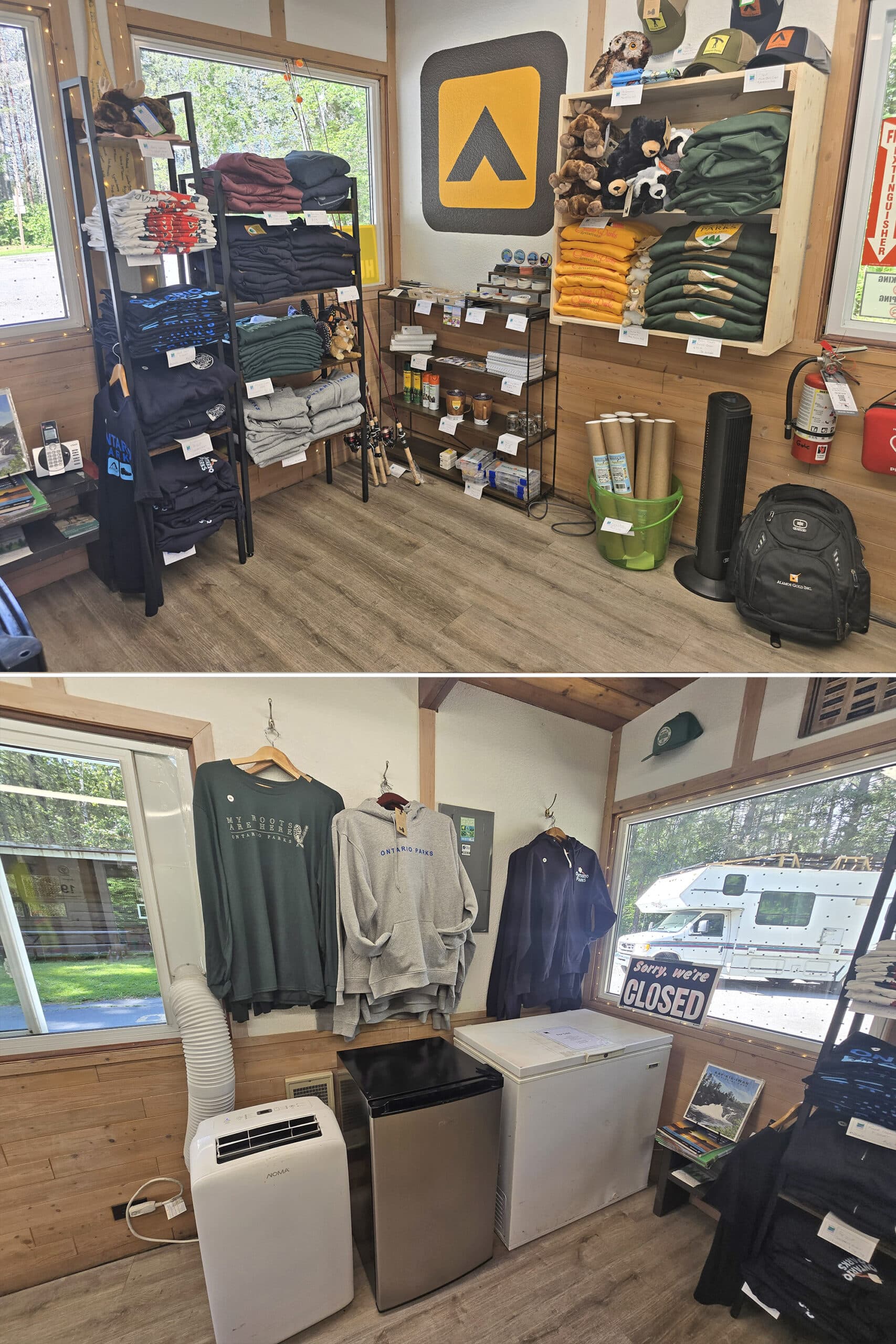
Park Store
There’s a very small park store inside the gatehouse at Kap-Kig-Iwan Provincial Park. Mostly Ontario Parks souvenirs - stickers, patches, some clothing items - as well a some bug spray, etc.
Day Use Area
The day use area is located at the southwest end of the park, with a relatively large parking lot.
This is the main access point for the trail system, which I’ll talk about in a bit.
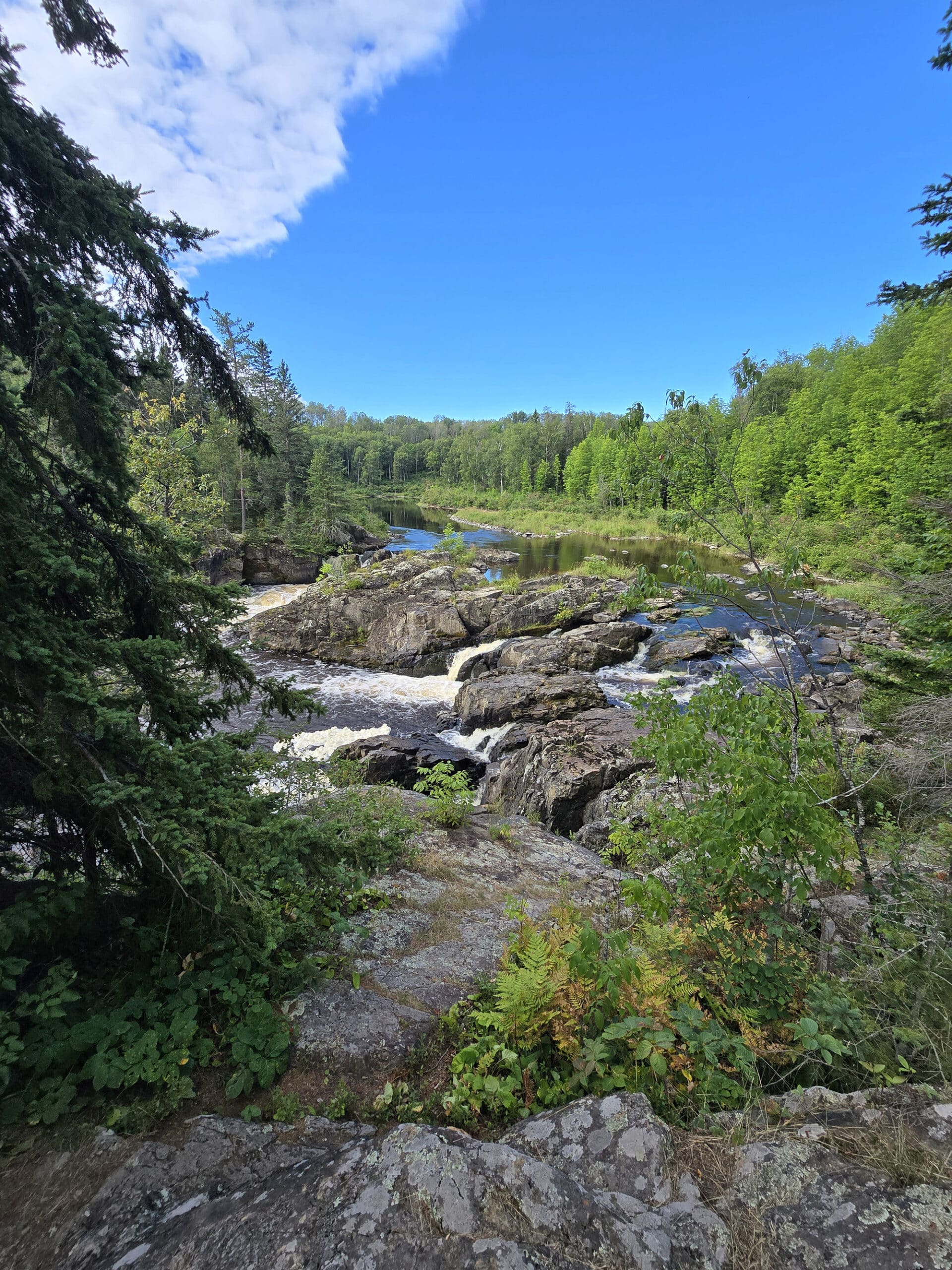
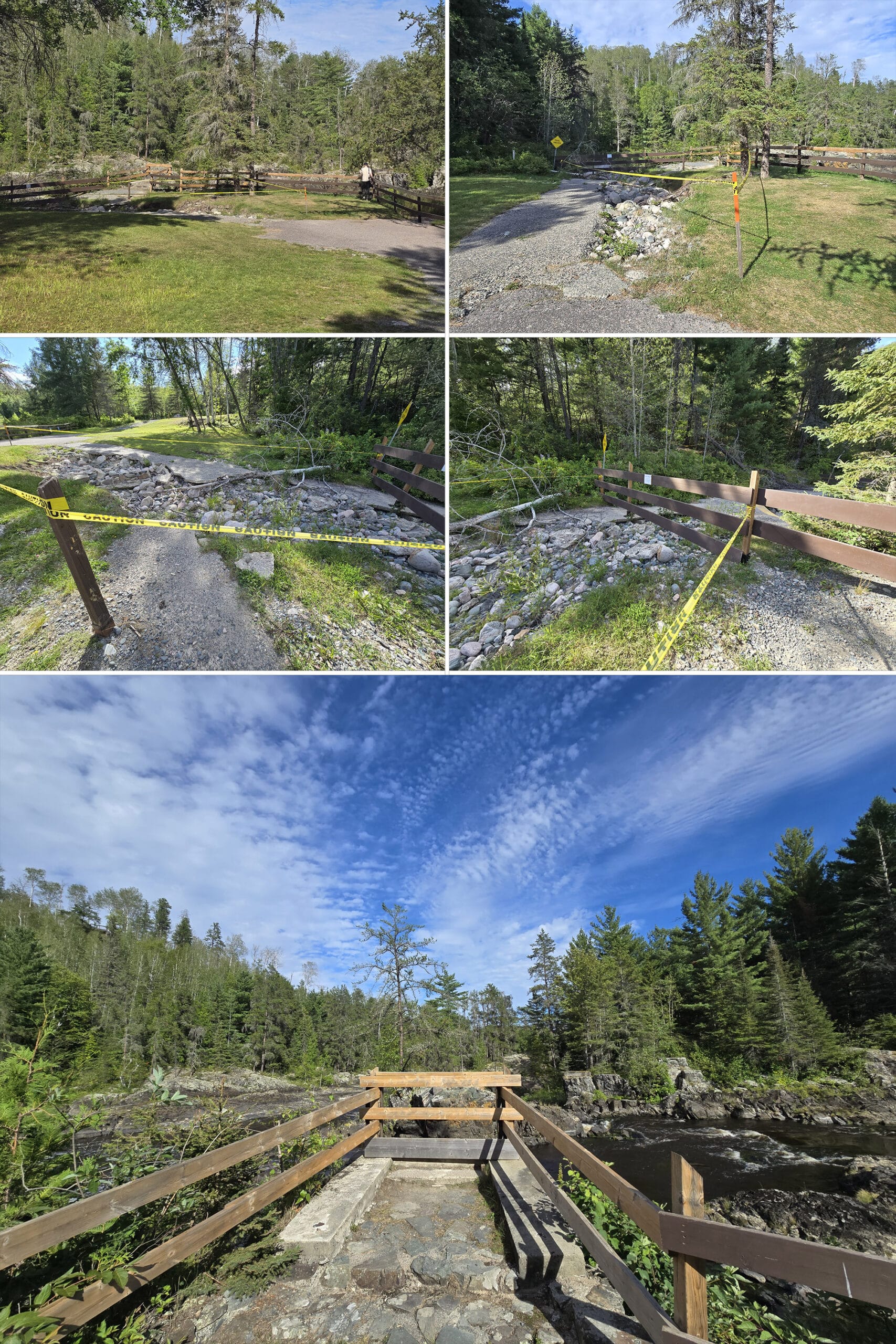
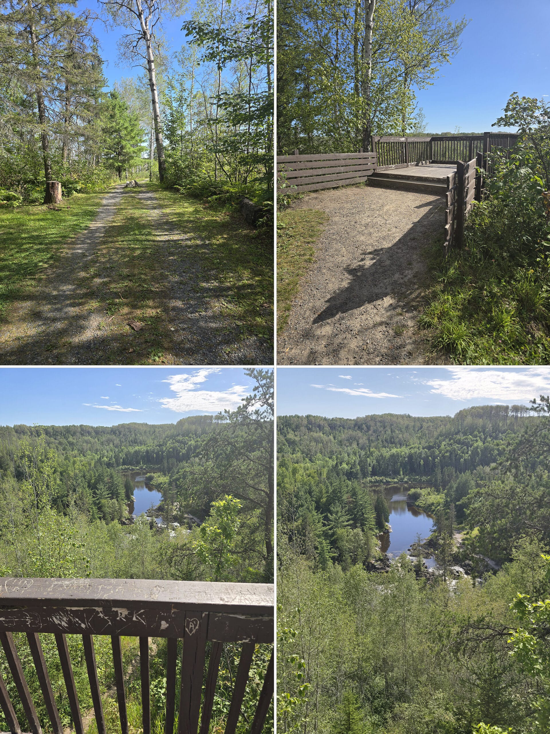
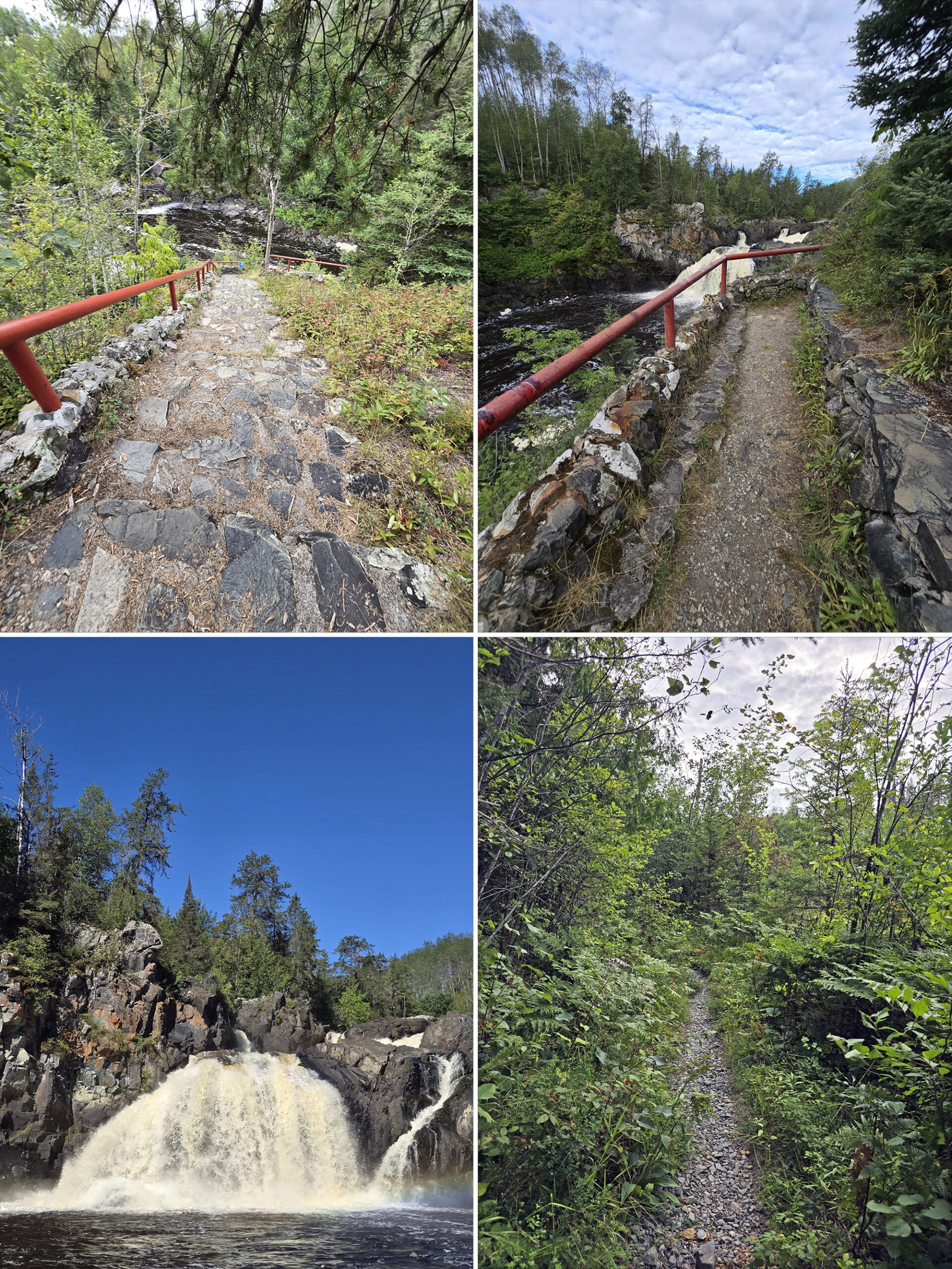
Beyond that, there are a few scenic viewpoints down there. One - right across from the parking lot - is down a short hill, and was definitely in a state of... Well, let’s say transition at the time of our visit. There had obviously been some major washout damage at some point, which was boarded and taped off with caution tape.
There was the remnant of what appeared to have been a bridge at some point, now repurposed as a lookout over the Englehart River, with some rapids nearby.
It’s a weird contrast between how pretty the scenery in front of you is, vs how dilapidated the ground/trail/etc behind you is!
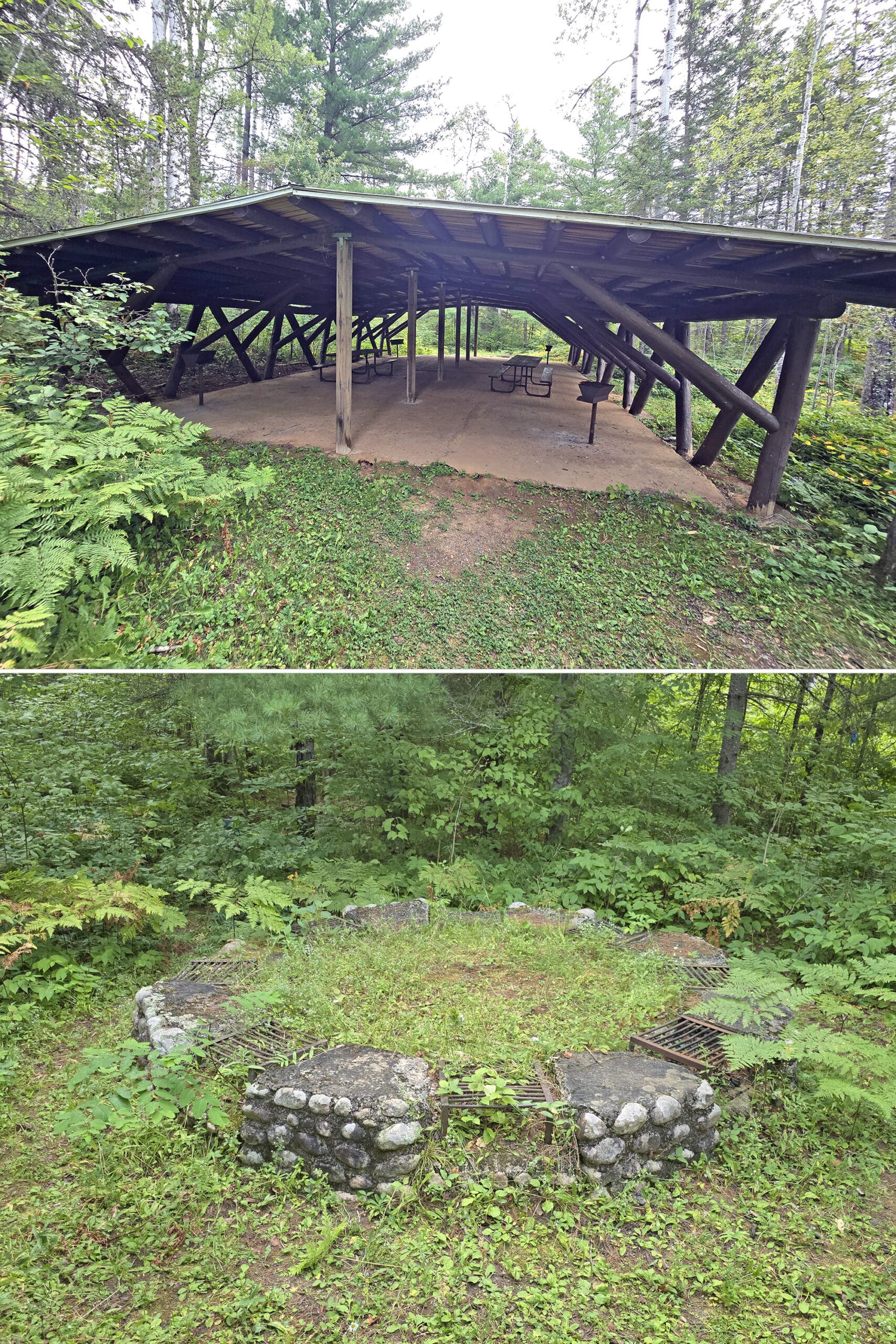
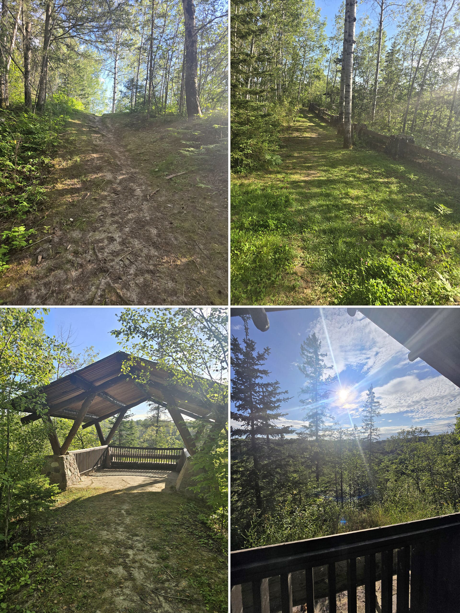
This is by far one of the cutest picnic areas I’ve seen in any provincial park! There’s a little shelter with 6 picnic tables, overlooking the Englehart river, with the waterfall in clear view.
As you approach the picnic shelter, there’s a HUGE firepit in the rock, with two smaller fire pits flanking it.
There’s also a simple grill setup in the picnic shelter, and another fire pit down on a rock closer to the water.
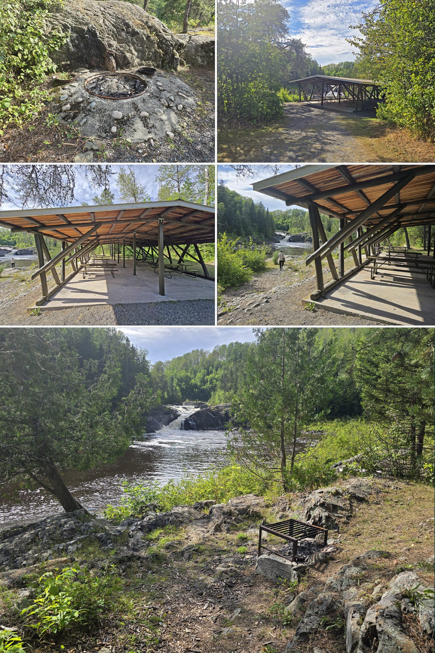
There are more along that trail and the High Falls trail - as Porter joked, “they have more random fire pits, than Earl Rowe had picnic tables”. (In the water. It was a whole thing!)
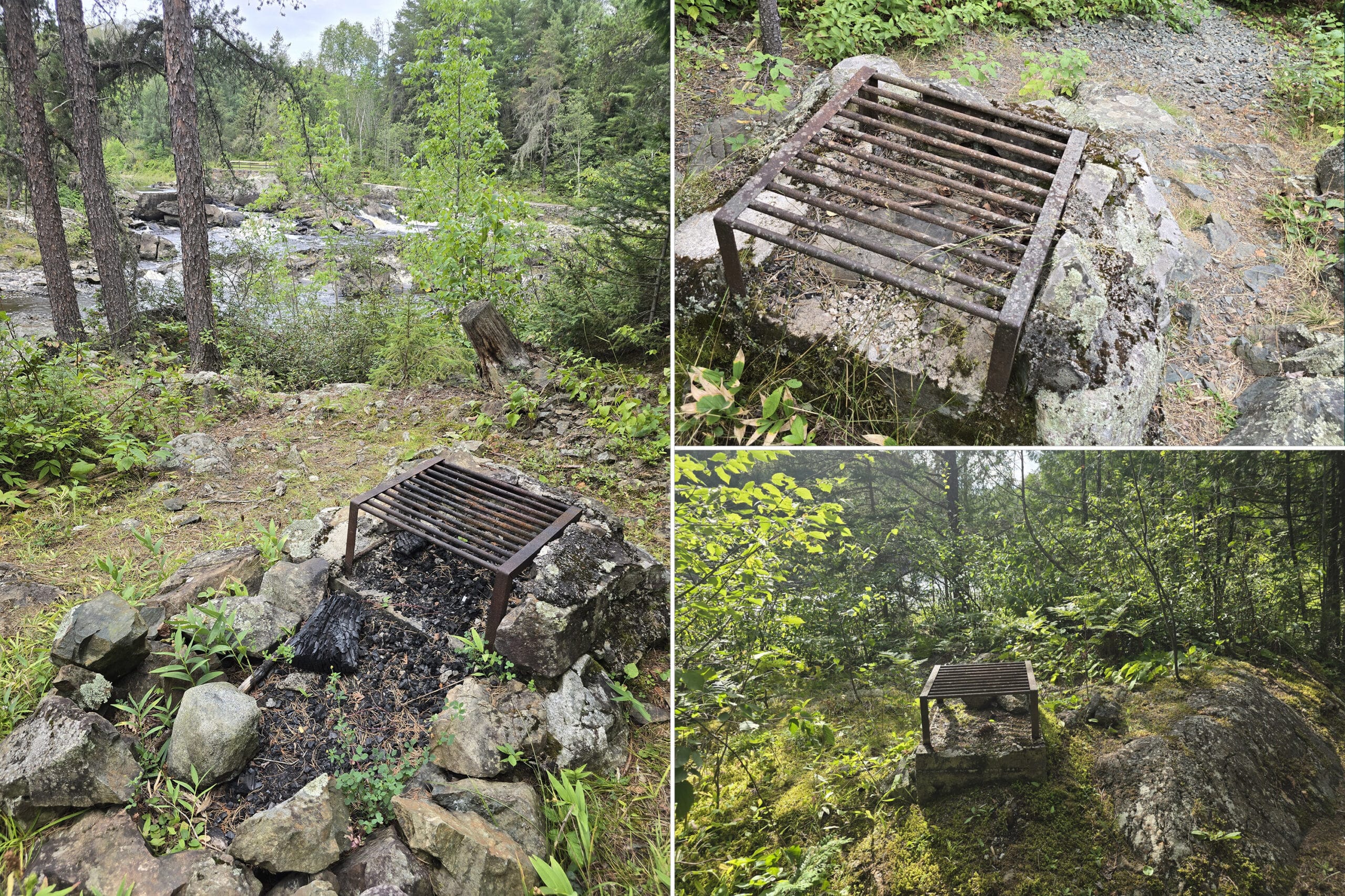
This is right near a rocky outlook over the falls, and consists of a picnic shelter and some picnic tables.
Weirdly, there are WAY more BBQs and firepits, than there are picnic tables - 4 grills inside the picnic shelter, then a weird ring of 8 of them outside of the picnic shelter.
There’s also at least one more random grill on the trail nearby - they really do seem to be nestled EVERYWHERE.
There are only 2 picnic tables in the shelter, though!
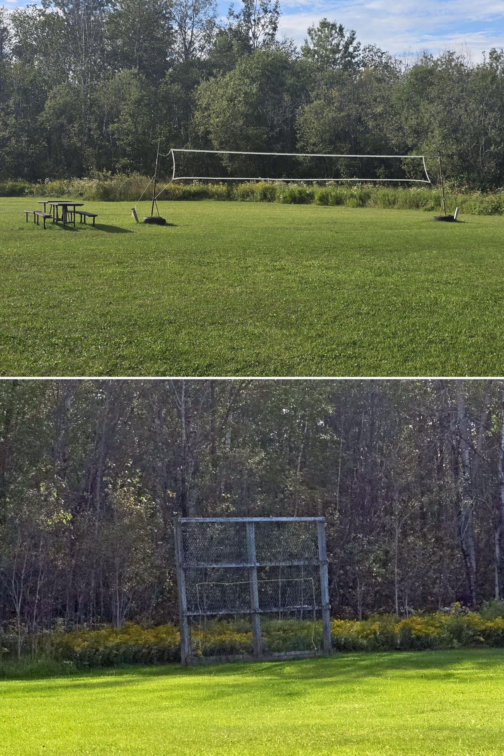
This is a large field with a volleyball net - set up - picnic tables, and some other form of net/goal type structure of some kind (we think!). It’s groomed... no idea why it’s not on the map or mentioned on the park’s site.
Also, there’s no good parking available for it, so you probably have to walk up the hill from the main day use area parking.
Campsite Details
I swear I’ve seen reference to this park having ~60 campsites, but there are only 46 indicated on the map. I wonder if that was information from before it apparently went from non-operating to operating?
Anyway, I say “ indicated on the map”, because several of those sites were closed at the time of our stay, and it looked to be a long term thing.
There are two small campgrounds in Kap-Kig-Iwan Provincial Park:
Pine Grove Campground
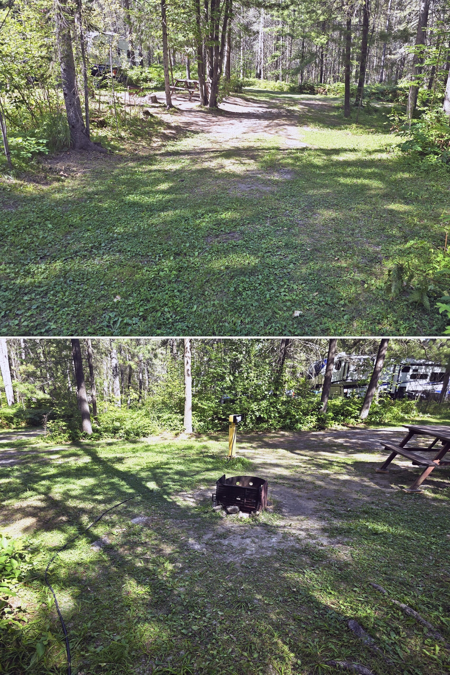
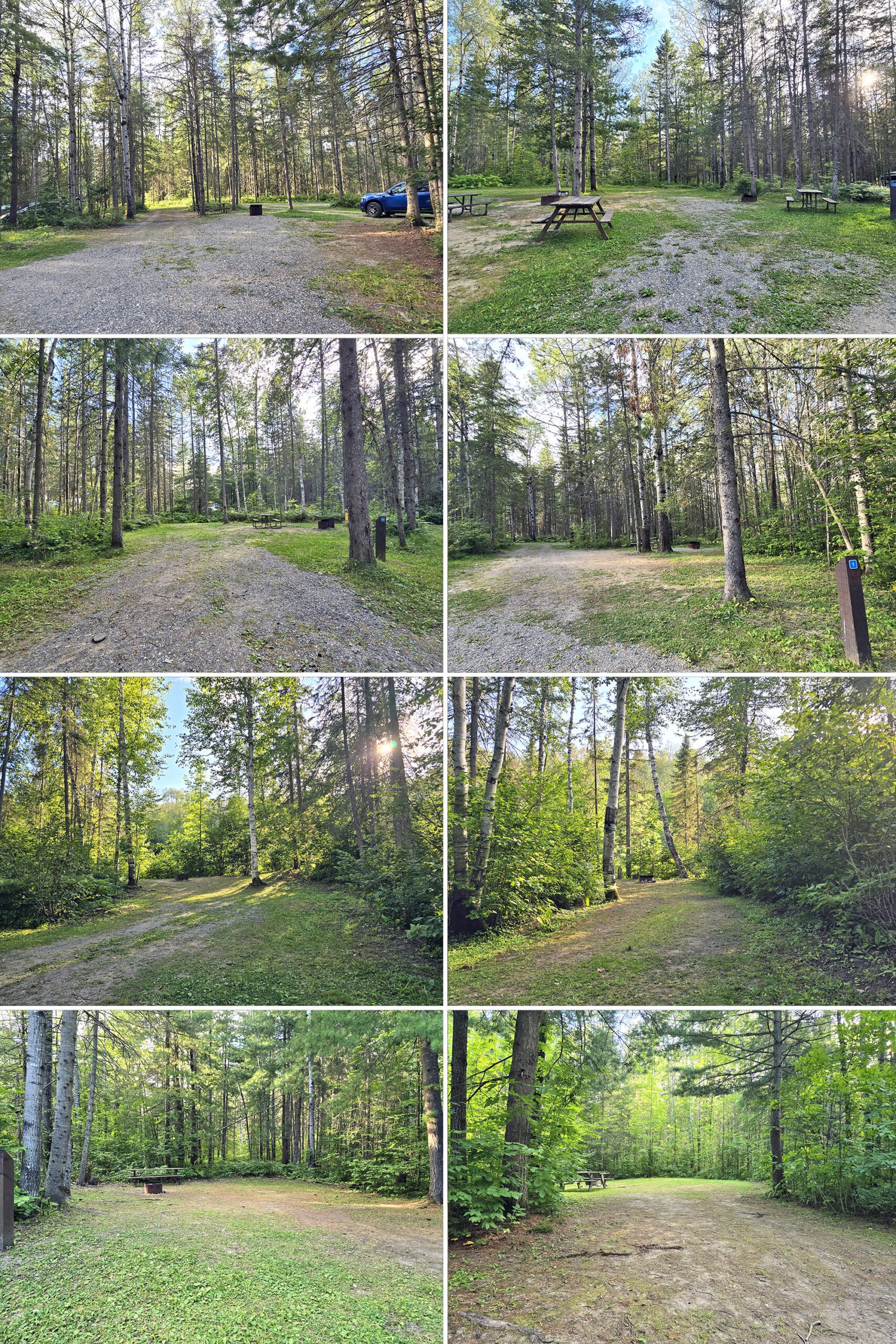
This is a small campground of 32 pull-through, electrical campsites. They’re all pretty large, but a lot are just really weirdly laid out.
For instance, we were in site #23 . At first, we had a hard time figuring out which was our site, as the numbers were laid out in a way that made it a little confusing.
We counted the actual pull-throughs from the front, though, and found ours.
Our picnic table and firepit was on the right side, when approaching from the direction the park directed us - a little weird. It was also sort of elevated up and above our site, which was cute... but it very much felt like we were in our neighbour’s site!
Then, our post was halfway into the OTHER neighbour’s site! Not on the side, but right in the site. Thankfully, no one was there the first day - that could be a bit awkward.
Unfortunately, campers were set up by the time we left, and we had to walk onto their site *and between their two tents* to unplug our cord!
In general, this campground has little privacy, but it doesn’t FEEL like it, on account of the tree cover and ground foliage. The pull throughs are VERY unlevel, bumpy, etc.
Ours said “slight pad slope” - definitely understated!
Aspen Crescent Campground
This is a small, lower camp loop of about a dozen non-electrical sites. I would assume that they’re designated as tent camping only, based on the size.
If they’re not, though... I’d definitely consider them tent-only based on the road in - as mentioned previously.
It’s a cute little camping area, though. A few of the sites along the outside of the loop seem to have a bit of a view of the river valley below.
The ones that looked to have that view were all occupied at the time of our visit, though.
Anyway, there aren’t any group campgrounds or backcountry camping options at the park, so far as we could tell.
Share the Love!If you’ve made one of our recipes, be sure to take some pics of your handiwork! If you post it to Bluesky, be sure to tag us - @2NerdsInATruck, or you can tag us on TikTok, if you’re posting video. We're also on Pinterest, so you can save all your favourite recipes and park reviews to your own boards! Also, be sure to subscribe to our free email newsletter, so you never miss out on any of our nonsense. Well, the published nonsense, anyway! |
Entertainment and Activity
Kap-Kig-Iwan Provincial Park is a pretty small park, with a relatively limited set of activities you can partake in.
Here’s what you’ll need to know:
Hiking
The hiking situation is a bit... weird.
The park’s website mentions 2 trails, but there are 3 - as well as several short walking trails to lookout points. Those paths aren’t mentioned on the site, but are on the map - just not named, or with any information attached.
Two of the trails exist as basically a big loop with a line through the middle, but it’s all shown as one colour - I had no idea what the distances even meant, because there was nothing telling you what it was counting as part of either of the longer trails.
Beyond that, there are some hiking trails that existed at one point, but aren’t designated on the map or mentioned on the site. Some of these other trails show up on the Pokemon Go app, but not on the park’s map or - in some cases - reality. Maybe they were hiking trails, maybe they were (or are?) Ski trails - who knows?
I’m guessing those have grown over in the past ~8+ years since that app was published.
Anyway, here’s the info on the actual trails and walking paths, as we experienced them:
Walking Paths
There are 3 little outlook trails in the park, none of which are named. Let’s just number them, left to right as you’re looking at the map.
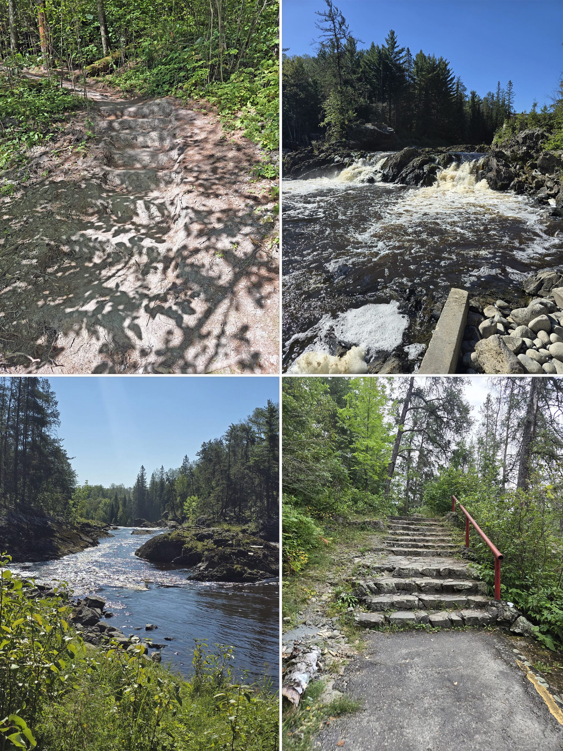
Outlook #1
This one is located across from the roadside trailhead for the Upland Circle Trail. It’s an unmarked road that ALMOST looks like a trail... until you notice the speed limit sign.
At the end of that road is a small loop with space for maybe 3 cars to park. From there, it’s about 80 metres straight ahead (flat ground!) to the overlook.
This is the nicest overlook trail in the park. From a wooden platform, you can see the river and some waterfalls down below. Easy, and probably the most accessible view in the park.
This is also the overlook I’d go to in the event of auroral activity.
Outlook #2
This one is the one that sets out from the comfort station parking lot - directly across from the comfort station itself.
It looks like you might be able to drive it - it’s definitely a driven path the whole way, despite being labeled as a walking path on the map.
Anyway, the lookout itself is about 200 meters in. It’s a nice enough view of the rapids off in the distance.
Outlook #3
This is a small loop of a lookout, next to the entrance to the Aspen Crescent Campground. To get to it, you’d turn left instead of going down the road to the campground, then veer to the right.
This was definitely skip-able. It’s about 100 m long, with a steep climb up and down.
The view is not great, and THAT is assuming you have a nice, big zoom lens to even see the not-great view of the falls, way off in the distance.
Hiking Trails
As mentioned earlier, the number of trails in the park depends on whether you’re looking at the park’s website, the current/online map, the map at the front of the park, or just the reality around you at the park.
For the sake of this review, we’re going with 3: The 3 actually depicted on the print map given to you at the park.
Porter did the trails, as I was dealing with tendon flare ups for most of the stay. He lists the park’s distance and difficulty in each header, then give the actual info in the description below it:
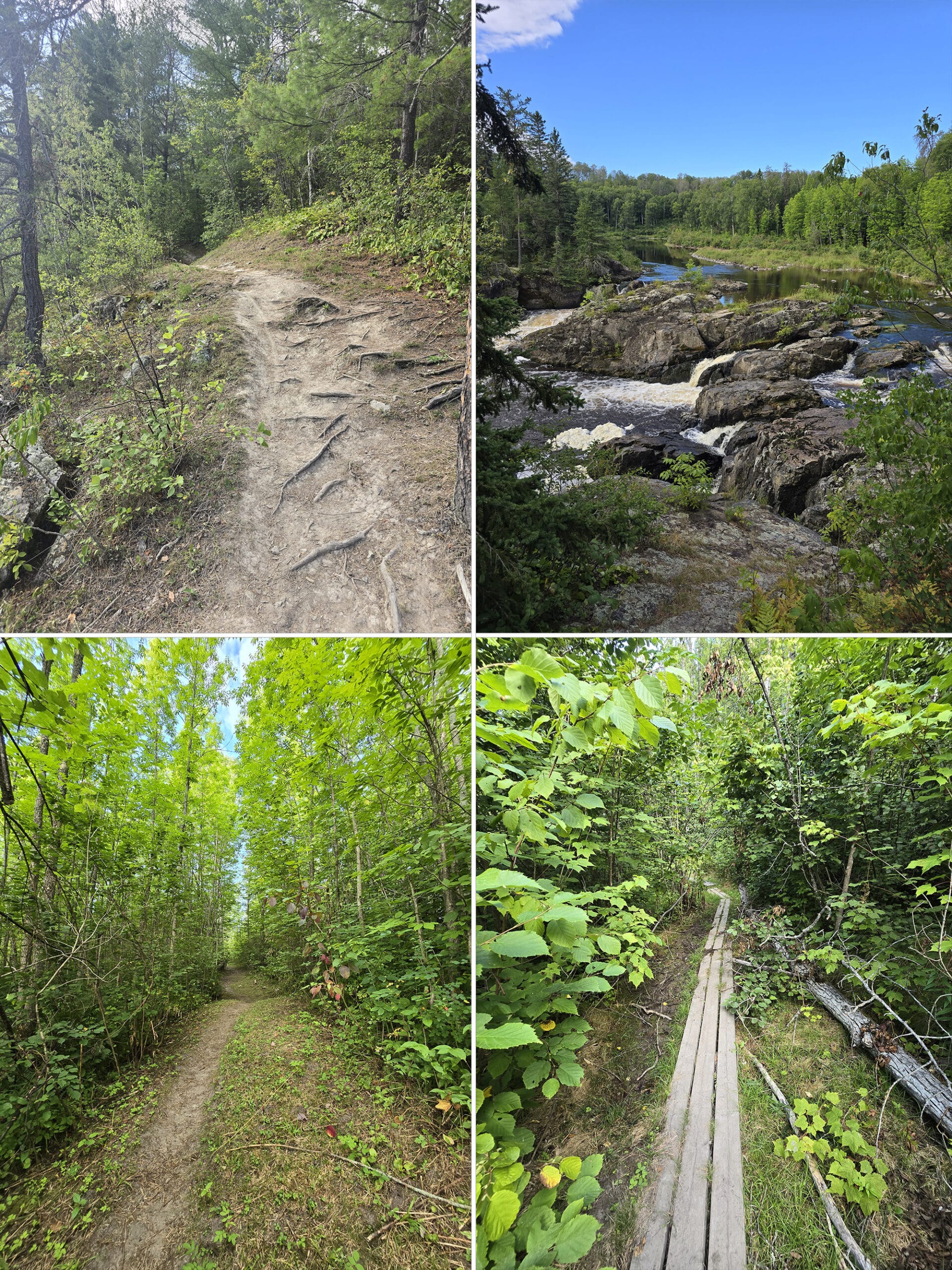
Hell’s Gate Trail - 2.3 km, Moderate
“Starting next to the picnic shelter, this trail follows along the water, providing several breathtaking views of the multiple falls every 150 meters or so. This continues for 3 or 4 viewpoints.
There are several outlooks with rocky paths allowing you to get right to the water.
The trail is narrow and winding, rocky and crosses multiple dry stream areas with narrow boards serving as a small bridge. This area is moderate in difficulty, with some very short areas that are a bit difficult.
At 1.3km you arrive at a tee, connecting with the Upland Circle trail. Small signs direct you to the shared exit path. This stretch is well-maintained and wide, pretty clearly setup for cross-country skiing in the winter.
As such it's a less interesting portion of the trail to me, as you sort of feel like you're walking down a long driveway through the woods instead of a hiking trail.
Overall the Hell's Gate Trail is 2.5km to get back to the picnic shelter, and I agree with the moderate rating.”
High Falls Trail - 0.5 km (Difficulty not stated)
“The viewing area at the parking lot has a washed out section, so a small sign directs you to the side to get to the High Falls Trail.
After a somewhat steep rocky decline and a short walk through the woods, you descend some steps that are carved from the soil to meet up with the paved trail at the water's edge.
The trail follows the water, up some stone stairs and a rocky path that I would rate as moderate difficulty.
I was surprised to find a large picnic shelter with many, many charcoal grills setup, but only two picnic tables.
A few meters up the path and there's a long stone fence as a viewing area. A closer look shows the outstanding attractions of the park, some white-water rapids leading to a large waterfall, with a couple of very small waterfalls behind it.
The path continues back into the woods, but there's a sign warning of poison ivy and the path becomes very narrow.
It doesn't appear to be part of the main path anymore so I turned around.
This trail is supposed to be 1 km return, but I ended up walking almost 1.5 km total because of adventuring around the area. I would say it’s a moderate difficulty trail.
Expect to take some time here, it's an amazing area to visit!”
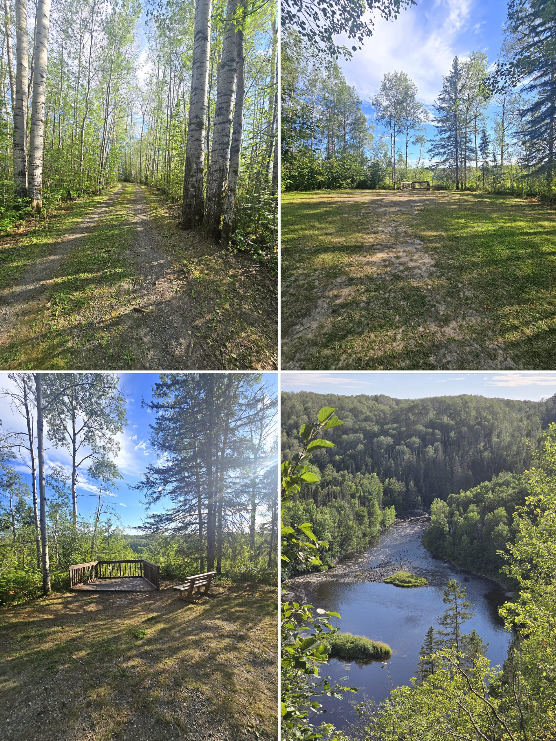
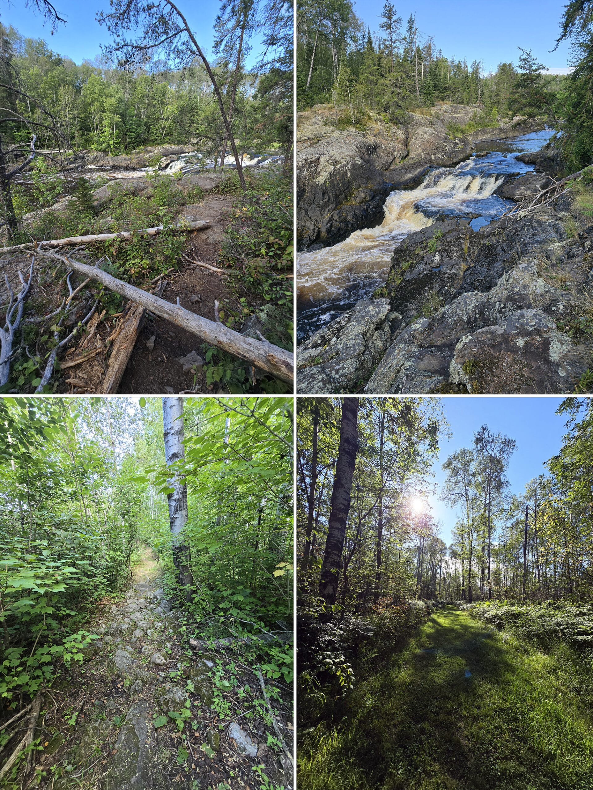
Upland Circle Trail - 4 km, Moderate
“I decided to park across from the open field area, thinking that was intended for parking. I later realized that area is actually trail, but not labelled on site or on the map. I walked up the road a bit to the Upland Circle trailhead.
It's well-maintained grass, cut wide presumably for winter skiing. Around 0.3km in you are at a tee in the trail. A narrow path goes into the woods to the right, a gate blocks what looks to be an abandoned skiing path straight ahead, and there are two trails to the left.
The leftmost trail was well-maintained, so I took that leg. Unfortunately, I ended up back at my car - it goes along that big open field and ends at the road where I had parked.
Walking back I took the right leg, which is the intended trail on the map. The trail is wide, but the grass is very tall, unmaintained.
The winding path goes up and down moderate hills, with unsure footing in many areas. I rate this as a moderate difficulty trail because you have to watch where you're stepping so you don't trip.
Since this is not maintained like other trails, it feels much more adventurous and enjoyable.
Personally, I had no desire to personally come in contact with a tick, after that!
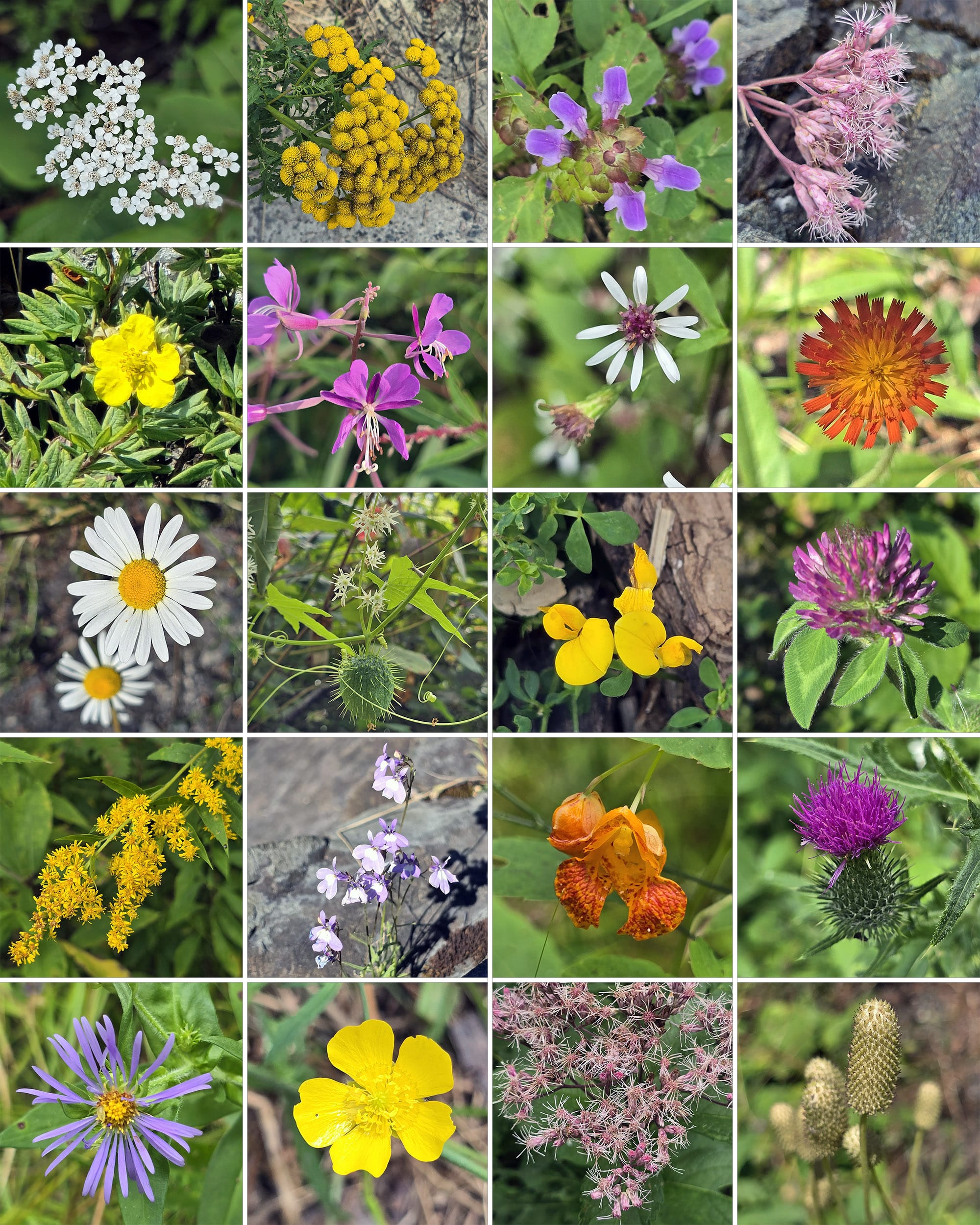
Anyway, the tall aspen trees are beautiful and there are various wildflowers all along the trail. There are multiple small sections of boreal forest along the route as well. I could hear lots of birds but only saw a few. Overall I really liked this trail, it kept my interest as the scenes constantly changed.
As a note on the distance - The trail distance marked on the map is inaccurate for the trail as depicted on the map. As mapped currently, the trail is about 2.2 km.
We noticed that the trail also said 4 km long on the older map... which has the Upland Circle Trail extending far beyond the current trail map.
Originally, the trail continued forward across the main campground road, out towards the lookout, then along the back of the campground to the comfort station - ending at THAT lookout.
That makes far more sense for a 4 km length.”
Biking
We would not recommend biking in this park. The roads are terrible, and there aren’t any designated cycling trails.
Interestingly, though... while cycling isn’t mentioned on the park’s website... the big trail map at the front of the park shows several trails with cycling graphics superimposed on them.
Oddly, most of those trails are labeled as being winter trails - no idea if this was a stylistic choice, or what!
Swimming
There are no beaches or other designated swimming areas at Kap-Kig-Iwan Provincial Park.
We did see some people jumping off rocks at the picnic shelter to swim in the Englehart River, but that was immediately behind a warning sign that said no swimming.
Birding, Wildlife, and Nature
After seeing very little in the way of birds at our first stop on this trip, we were shocked at how good the birding was at Kap-Kig-Iwan.
It started almost immediately, as we visited the picnic area. I’d never seen a Cedar Waxwing close up - just in Porter’s photos - but there were at least 5 of them in a nearby tree, right in full view, some only a few metres from me!
The funny thing was that they were eating red berries - the day before, I’d seen a Facebook post about Waxwings getting drunk on fermented berries.
At the time, I’d thought to myself that I’d love to see Waxwings eating berries at all - and here they were! They’re so PRETTY - these ones appeared to be sober, though!
My husband didn’t get to see this, though, as he was off shooting a Spotted Sandpiper that had flown by and was twerking on the shore across from him.
Overall, we saw and/or heard:
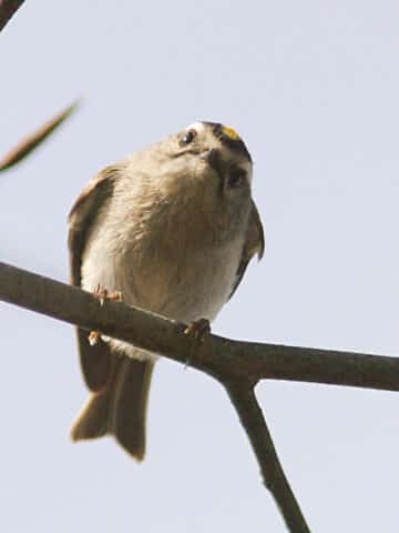
American Crow, American Goldfinch, American Redstart, American Robin, Bald Eagle, Black-Capped Chickadee, Blue Jay,Cedar Waxwing, Common Raven, Eastern Wood-Pewee, Golden-Crowned Kinglet, Hairy Woodpecker, Northern Flicker, Northern Parula, Pileated Woodpecker, Red-Breasted Nuthatch, Red-Eyed Vireo, Spotted Sandpiper, White-Breasted Nuthatch, White-Throated Sparrow, Yellow-Bellied Sapsucker.
Beyond that, we saw some squirrels and chipmunks - that was it as far as wildlife goes!
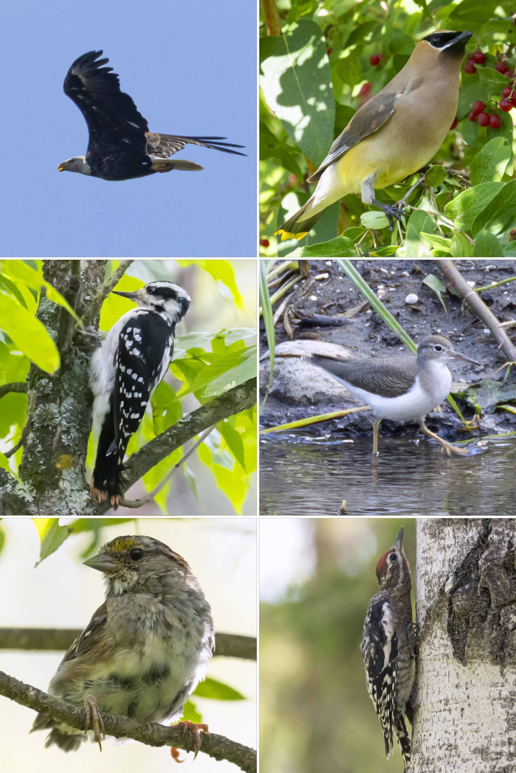
Row 2: Hairy Woodpecker, Spotted Sandpiper
Row 3: White-Throated Sparrow, Yellow-Bellied Sapsucker
Boating
There doesn’t appear to be anywhere to do any kind of boating at the park.
There are no boat launches or kayak areas, and the rushing Englehart River doesn’t seem like a great place for canoeing or kayaking - and there’s no information about canoeing, kayaking, portaging, etc on the park’s site or in the area.
Fishing
Apparently you can catch Brook Trout, Northern Pike, Small-mouth Bass, and Walleye - I’m assuming from the shore.
The park really doesn’t have much in the way of information about fishing, no are there any fish-cleaning stations, etc.
Discovery Program
There doesn’t appear to be any kind of Discovery Programming at Kap-Kig-Iwan Provincial Park, but I guess that tracks.
Not only is it a small park without the kind of facilities that usually host the programming (a visitor centre, amphitheatre, etc), but it’s not a really kid-friendly park, from what we could tell.
No playground, no beach, etc - I don’t think we saw or heard a single kid younger than maybe 15 during our stay.
Niantic Games
There are several PokemonGo Pokestops/Pokegyms, Ingress Portals, etc throughout the park - but they’re pretty spaced out, and connectivity can be an issue.
You can probably expect to be able to do your daily tasks, but that’s about it.
Final Thoughts
This is another one of those weird situations where the park sounds pretty bad when we go through our review, section-by-section... but we actually really liked it!
Yes, the roads are terrible, it’s abysmal for accessibility, and that comfort station could literally be hired out for 1970s period movies...
... But it was small, quiet, and beautiful. Such a contrast to our stop before this park - we love Algonquin on the shoulder season. In the summer, though? Screaming kids the whole time, people everywhere, general chaos.
Kap-Kig-Iwan was so peaceful!
No one at any of the scenic outlooks when we went, and we enjoyed the main waterfall by ourselves for a good long stretch of time before anyone else came through... and they were quiet as well!
Not the most kid-friendly, disability-friendly, or dog-friendly park... but if those aren’t concerns for you, we totally recommend visiting. We’ll definitely be back!
More Near-North Ontario Provincial Parks & Places to See
Want to read some more about the parks we've camped and at places we've seen in Near-Northern Ontario? Here are some more posts!
Near-Northern Ontario Campground Reviews:
Arrowhead Provincial Park
Chutes Provincial Park
Driftwood Provincial Park
Fairbank Provincial Park
Grundy Lake Provincial Park
Mikisew Provincial Park
Killbear Provincial Park
Oastler Lake Provincial Park
Six Mile Lake Provincial Park
Sturgeon Bay Provincial Park
Near-Northern Ontario Places to See:
Big Chute Marine Railway
Fielding Bird Sanctuary
French River Provincial Park
Hardy Lake Provincial Park
Onaping Falls
Oxtongue River-Ragged Falls Provincial Park
Screaming Heads
Want to explore beyond Near-Northern Ontario? Check out our full list of Campground Reviews, Ontario Waterfalls, and other Places to See.
We also have a ton of Camping Recipes to cook up, while on your adventures!
Thanks for Reading!If you loved this post - or have any questions about it - please leave a comment below! We'd also love it if you would consider sharing the link on social media! |
Leave a Reply