
Indian Falls Conservation Area - in Owen Sound - is one of our favourites of the Grey County waterfall parks. Here's what you need to know!

On one of our early summer stays at Meaford Memorial Park last year, we did a bit of a waterfall tour of Grey County.
I’ve already posted about a bunch of those falls - Hogg's Falls, Eugenia Falls Conservation Area, Walter's Falls, Inglis Falls Conservation Area, and Webwood Falls Nature Preserve - it was a fun set of excursions!
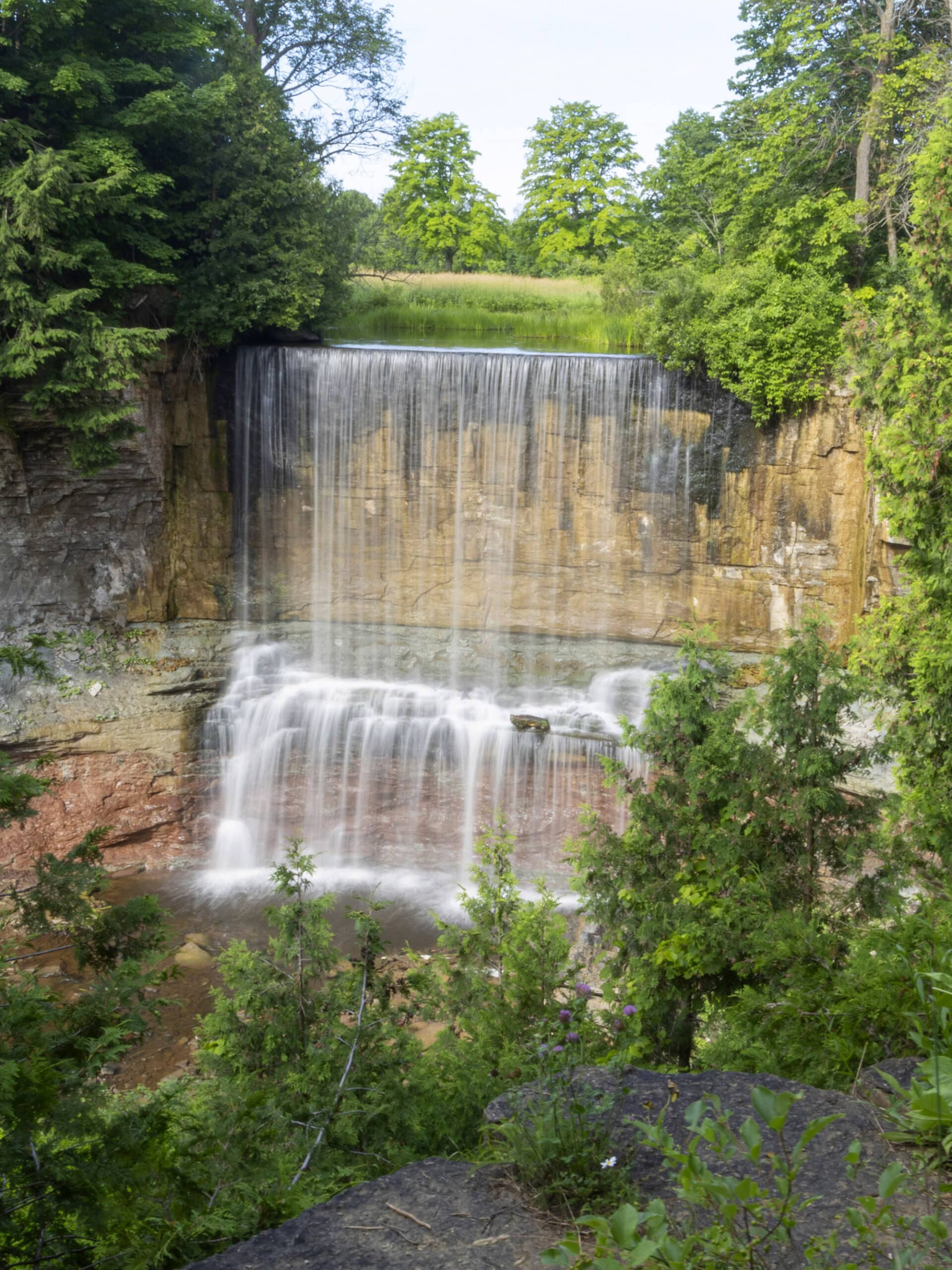
Anyway, Indian Falls Conservation Area is located in the township of Georgian Bluffs. As you may guess from the name, the main natural feature of this site is a breathtaking waterfall.
Either way, it was a great place to take in some fresh air and enjoy nature.
It’s a very short hike, but a bit of an arduous one - I’ll tell you all about that in a minute!
Anyway, overall it was just a really nice place to visit, both for the waterfall and the beautiful nature hike leading up to it.
So, let us tell you everything you’ll need to know about visiting Indian Falls Conservation Area...
The Basics:
Location Name: Indian Falls Conservation Area
Address: 318614 Grey Rd 1, Owen Sound, ON N4K 5N4
Website: Grey Sauble Conservation Authority - Indian Falls Conservation Area
Price: Free!
Reservations: Not Applicable
Season: Either May to October or year-round, depending on where you’re getting the info.
Getting There
When using Google Maps, be sure to map to “Indian Falls Conservation Area”, and not “Indian Falls”.
Our first time visiting, we mapped to “Indian Falls”... and the map took us up a really rough driveway from Grey Road. We got to the top and it was pretty clear we were NOT where we were supposed to be!
Registration and Check In
There is no registration or check in involved with visiting Indian Falls Conservation Area. Just get yourself to the parking area, and you’re good to go!
Parking
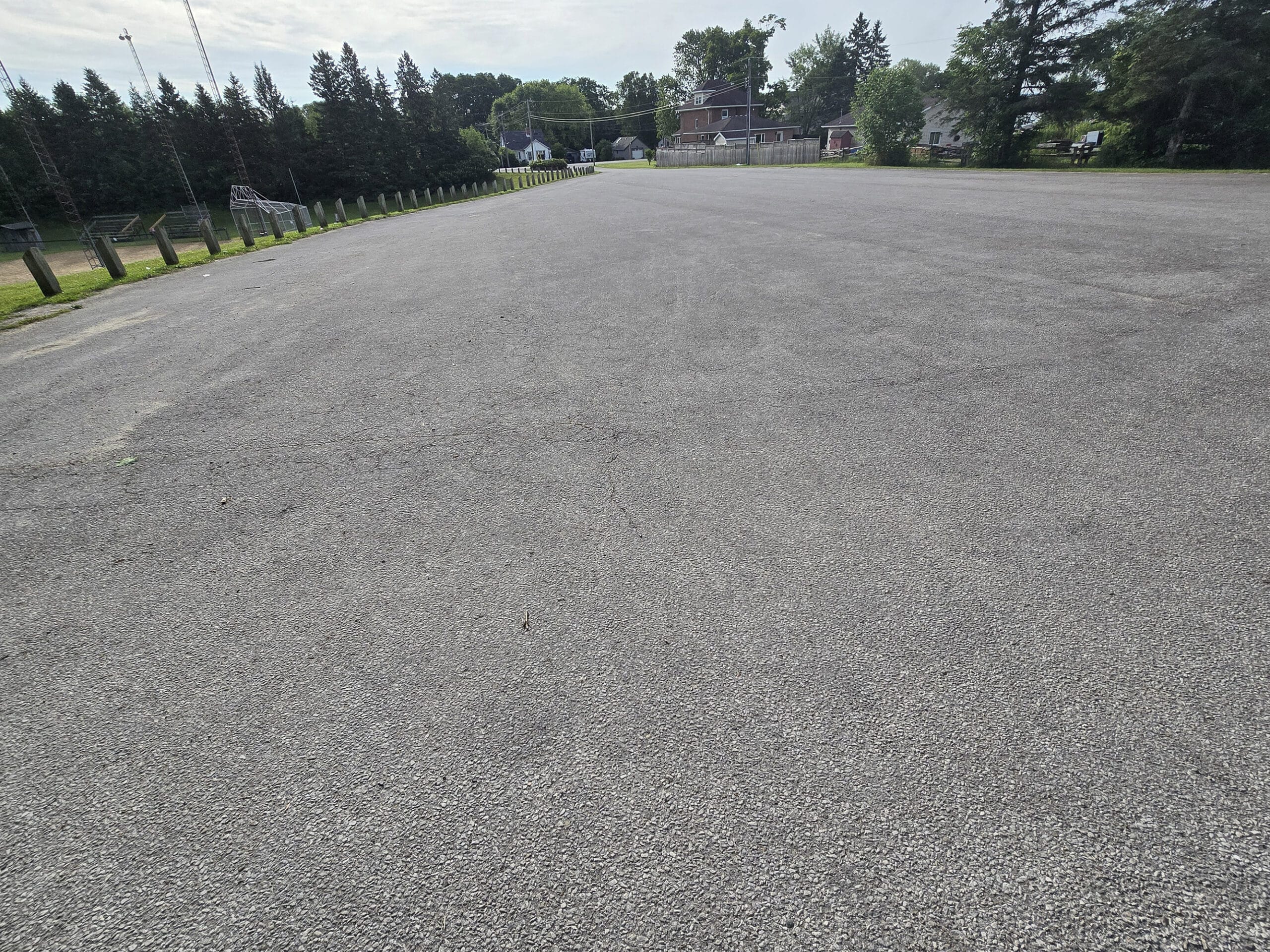
Parking is free at Indian Falls Conservation Area.
The parking lot was HUGE - and completely empty during each of our visits - but apparently it does get busy at times.
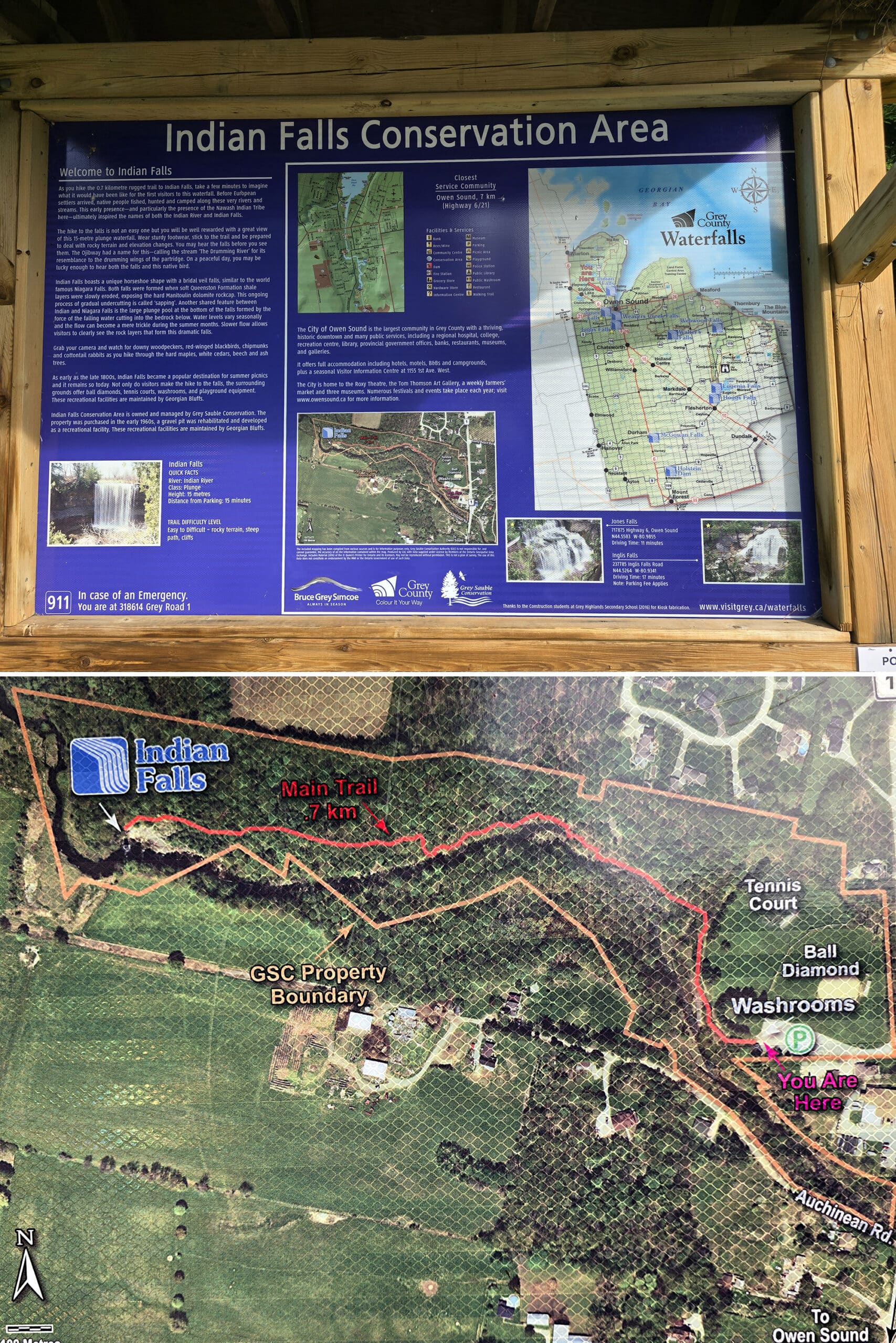
Maps and Signage
You won’t need much in the way of maps or signage for visiting Indian Falls Conservation Area, or Indian Falls itself.
There’s a trail map and general information on the edge of the parking lot, but it’s basically a straight shot from there to the falls.
Trail blazes were hard to find, but it was a well-used trail, so things were pretty obvious.
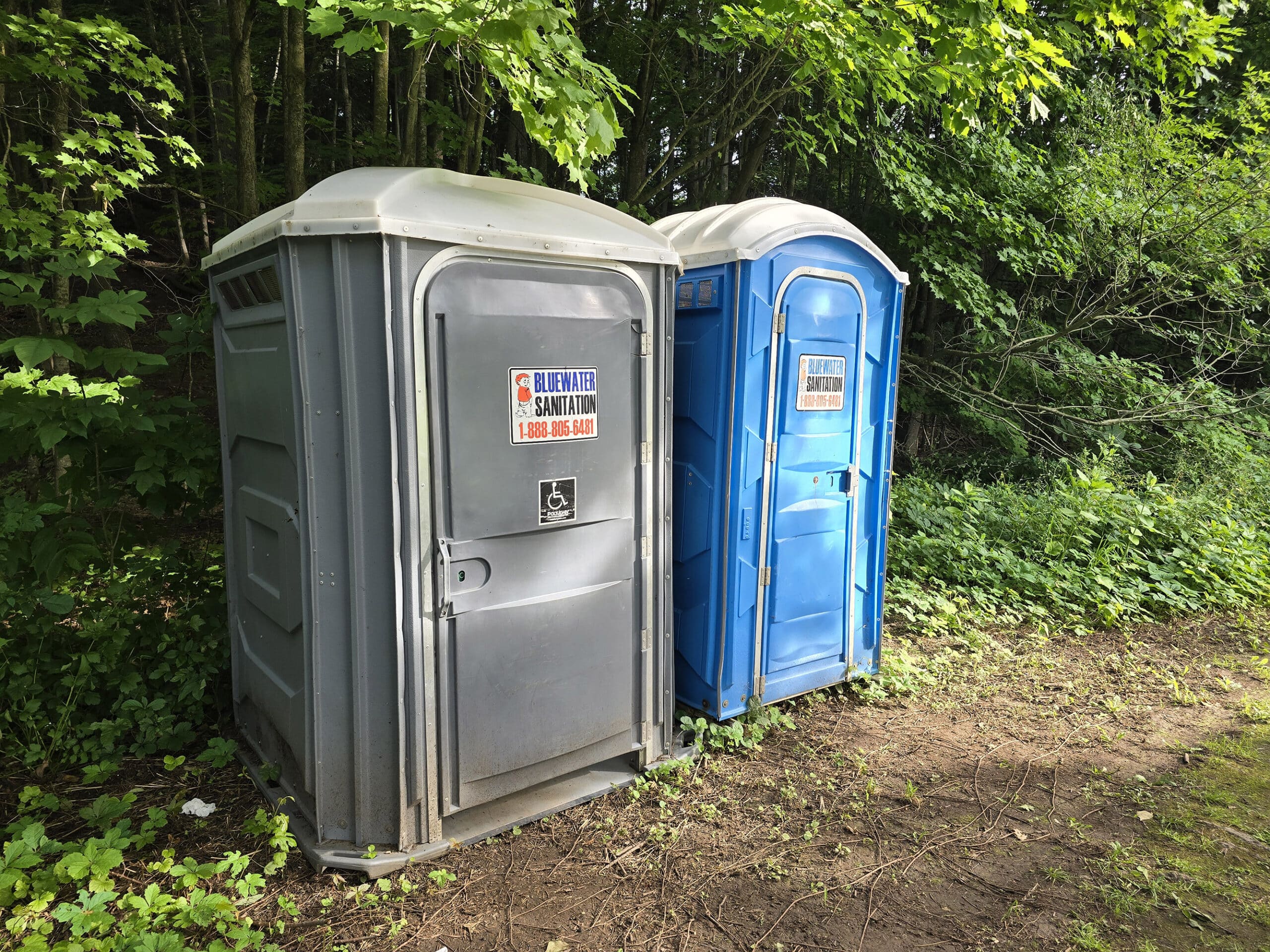
Washrooms
On-site privies are located at the bottom of the hill that you go down from the parking lot, basically at the level of the sports park.
It was a set of two Porta-Potties which seemed to be in decent condition... until you lifted the toilet seat. Ooof. Some things you can never unsee... or un-smell!
Anyway, one was an accessible washroom, even though the trail to get down there was definitely not wheelchair-friendly.
Connectivity
We had fairly spotty reception once we got onto the trail at Indian Falls Conservation Area.
It’s short and straightforward enough that we weren’t really on our phones much, but we did notice that we didn’t have enough connection to get our birding apps to work.
Accessibility
The only things wheelchair accessible about Indian Falls Conservation Area are the parking lot and one of the two portapotties... though the path to get from the parking lot TO the porta potty was NOT wheelchair accessible.
If you’re mobility impaired at all, I would recommend skipping this one.
The trail is incredibly rough in places - including using slippery rocks as stepping stones across water . There’s also stairs, and a VERY steep section.
I was having a good tendon day, absolutely would not have been able to do it if I was having any problem at all with my feet.
Pets
Dogs are allowed, and apparently it’s a popular place for dog walking.
That said, you’re supposed to keep them leashed at all times, pick up after them, and PROPERLY dispose of their droppings.
Miscellaneous
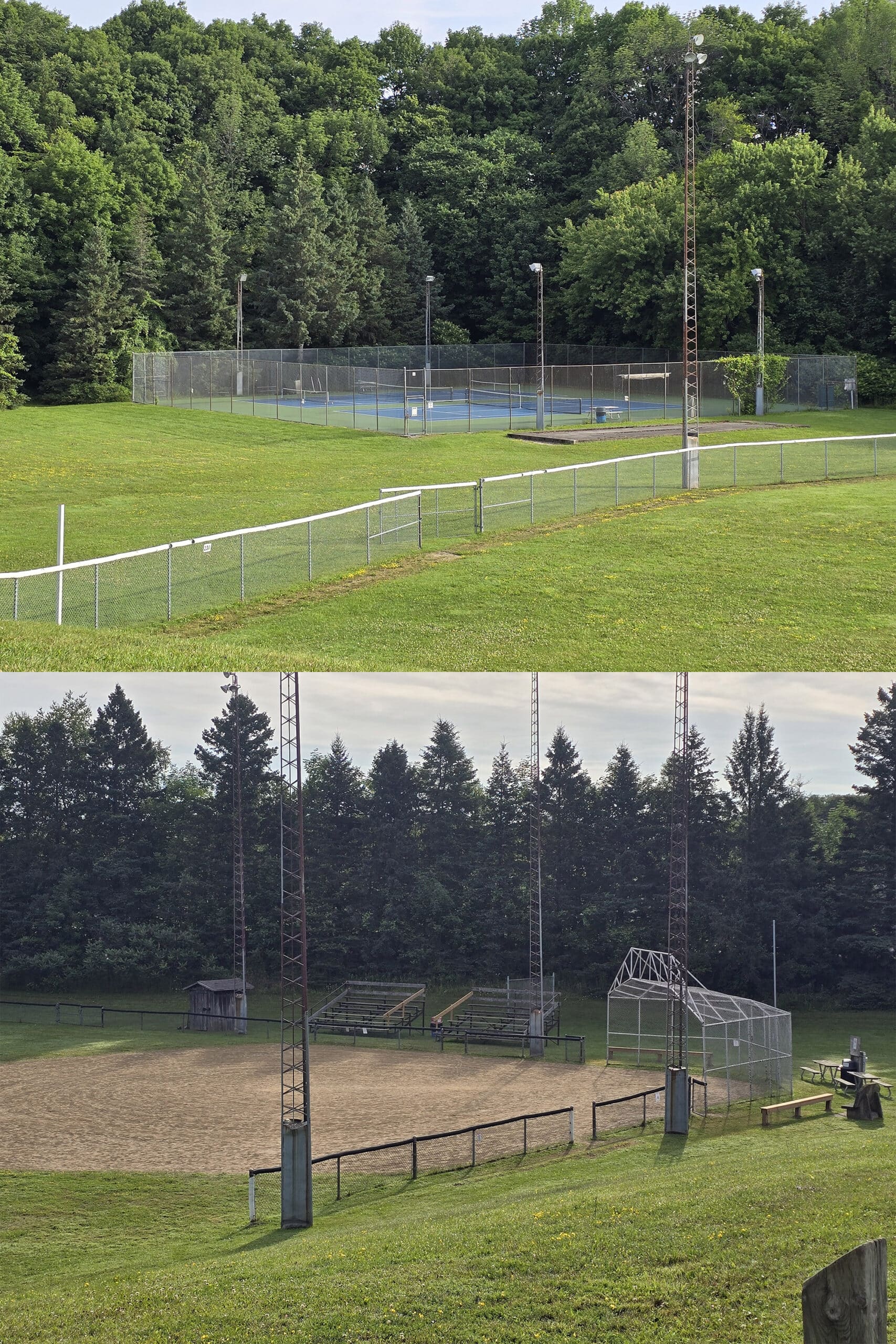
Just below the parking area - down a quiet walkway - there are some nice looking recreational facilities: ball diamonds, playground equipment, and tennis courts
Apparently this whole section is a reclaimed gravel pit!
Anyway, we didn’t notice any kind of a designated picnic area, but there were plenty of grassy areas to lay out a blanket, if you want!
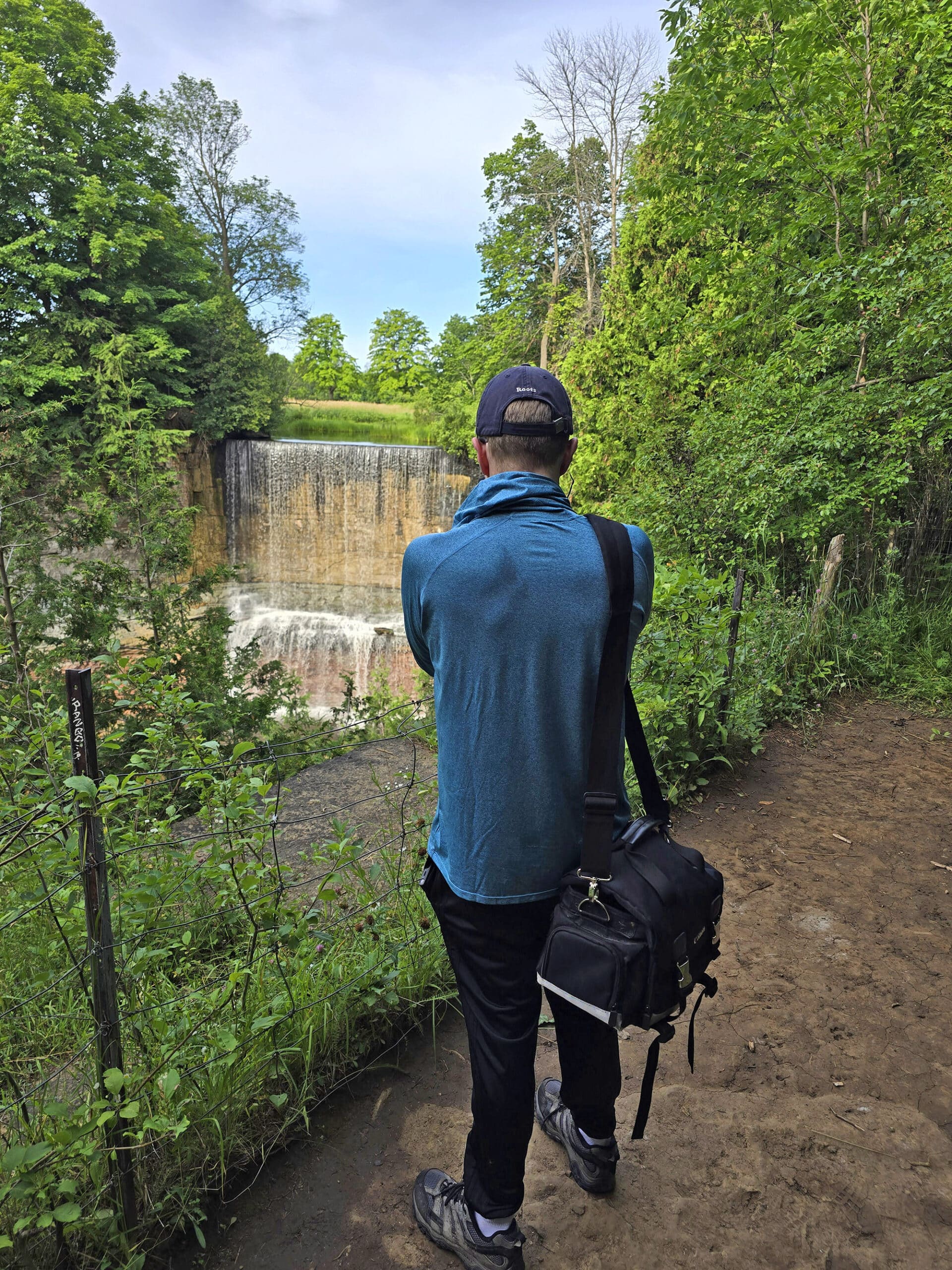
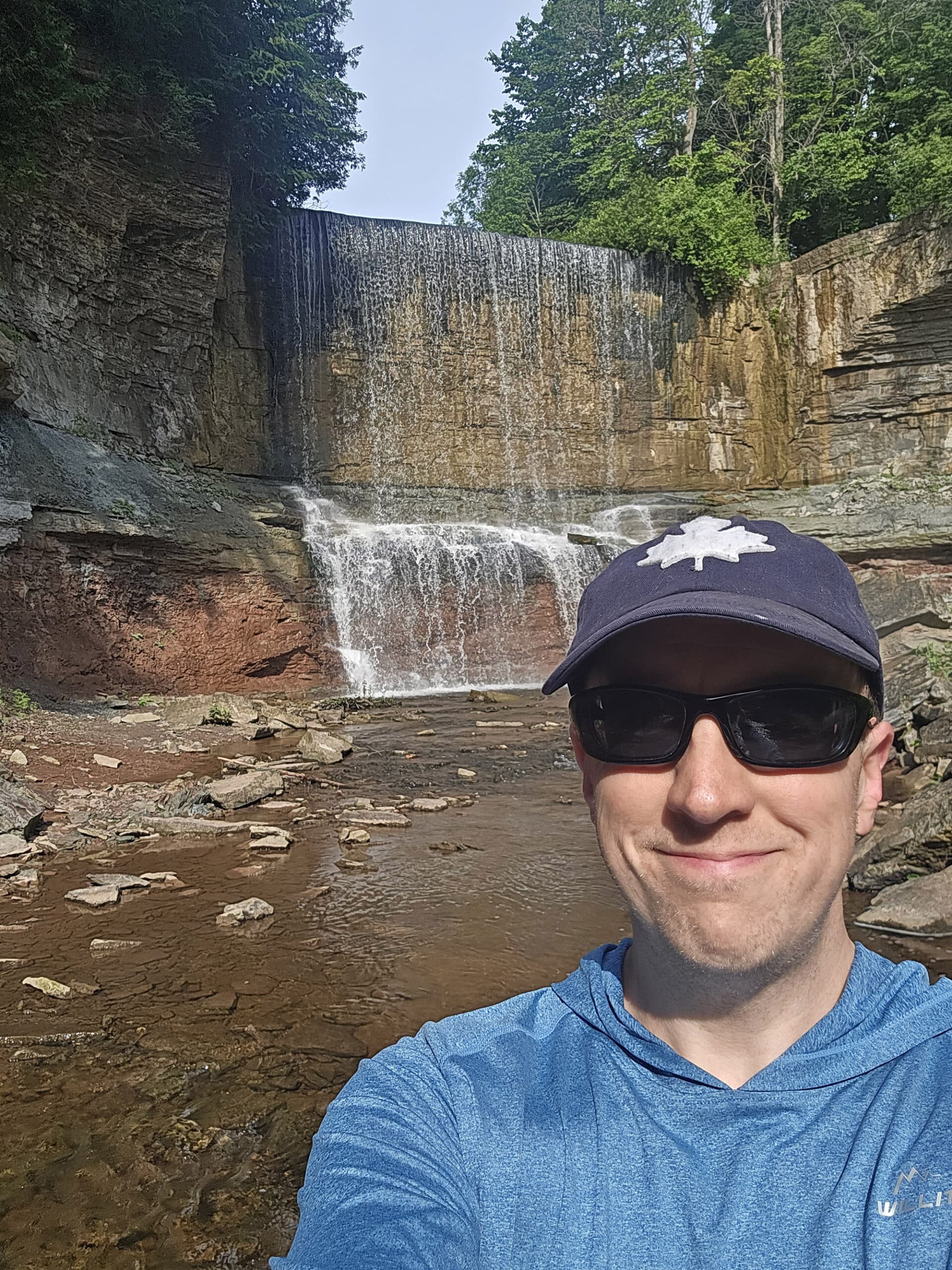
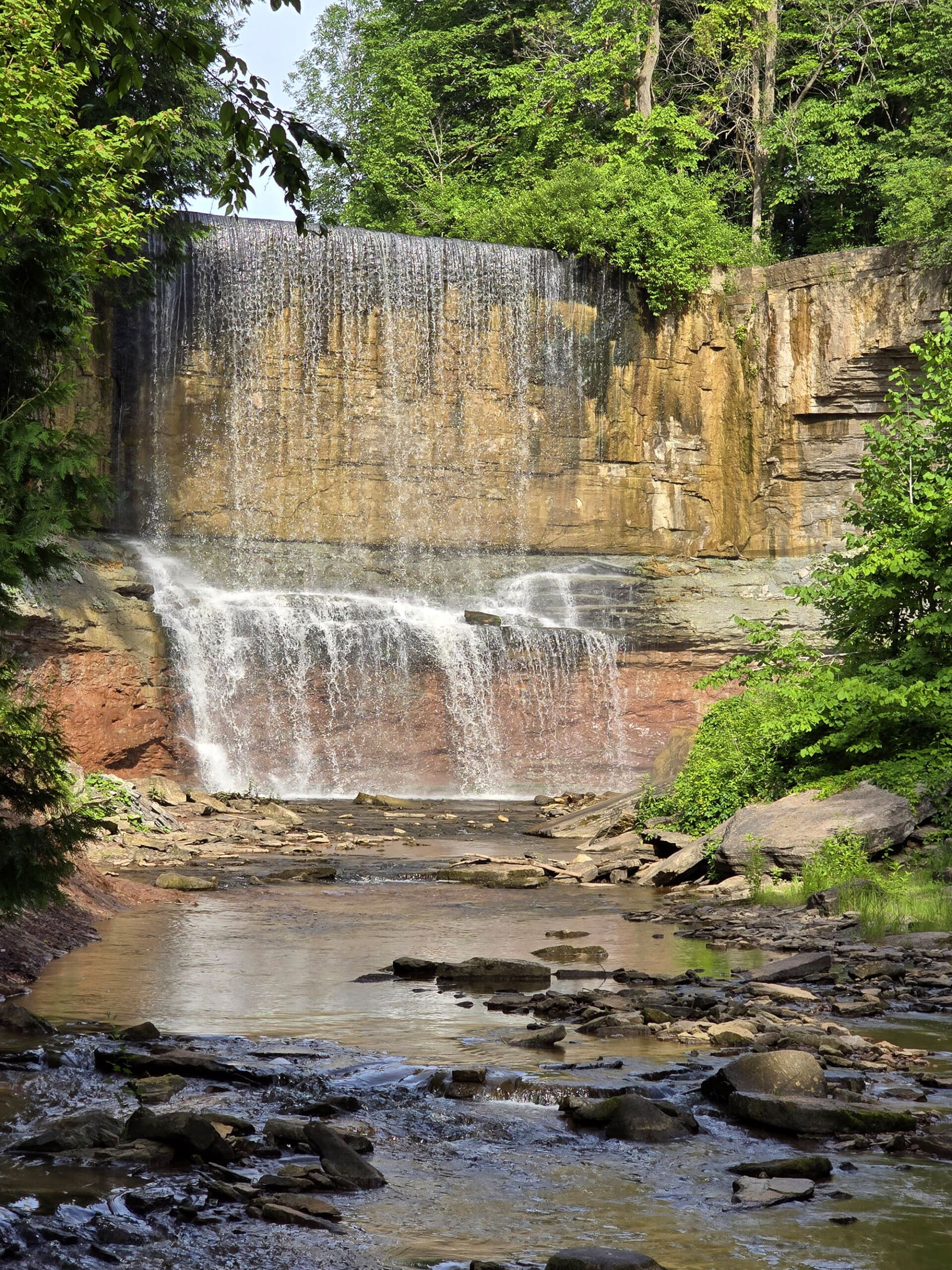
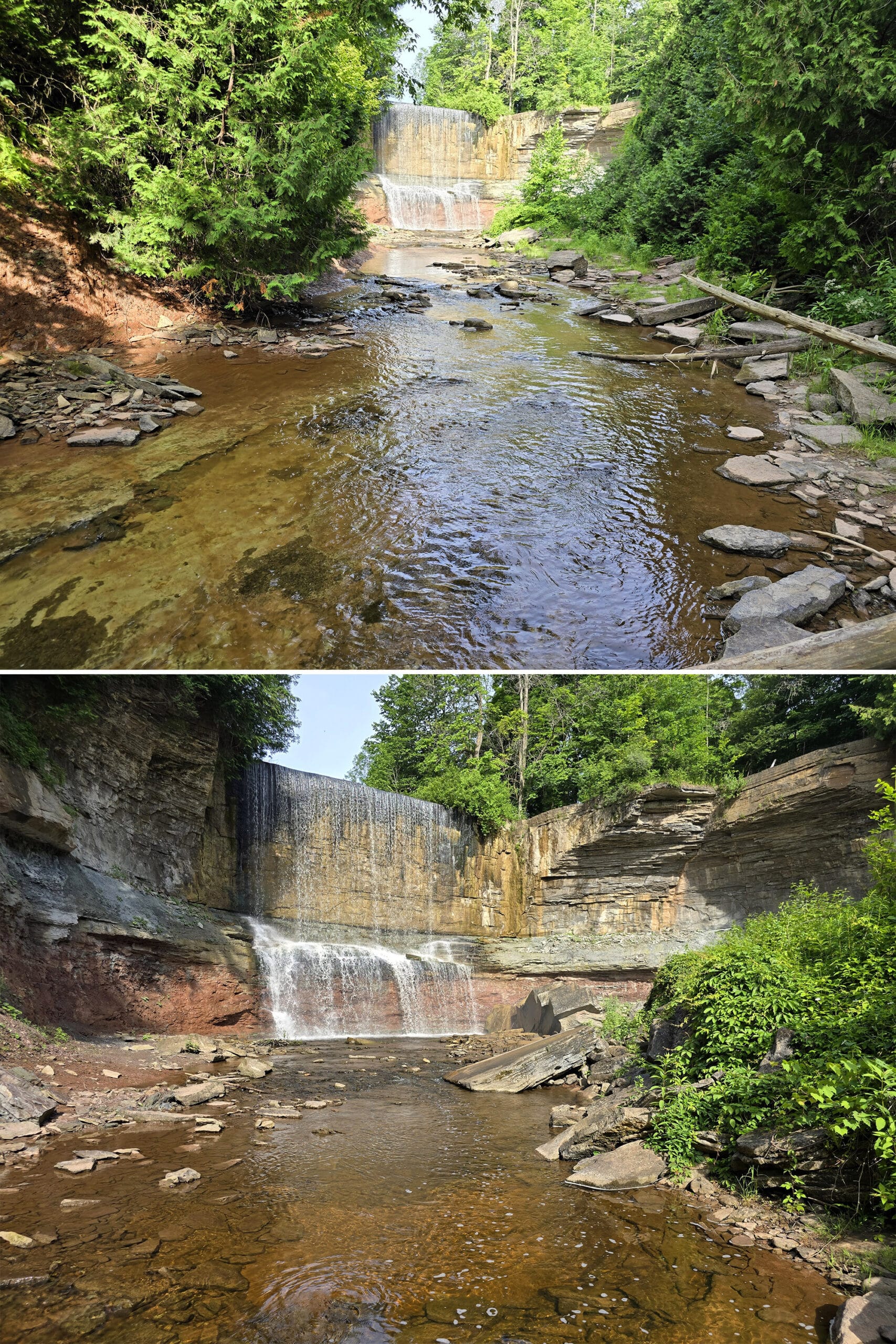
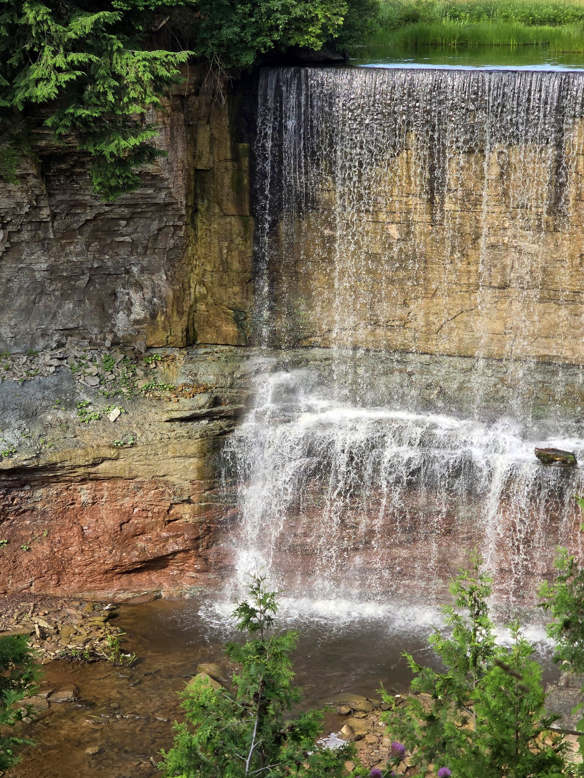
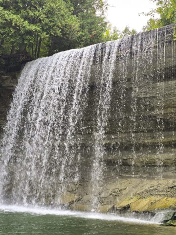
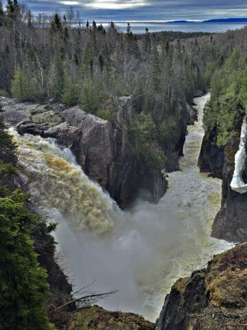
The Waterfall
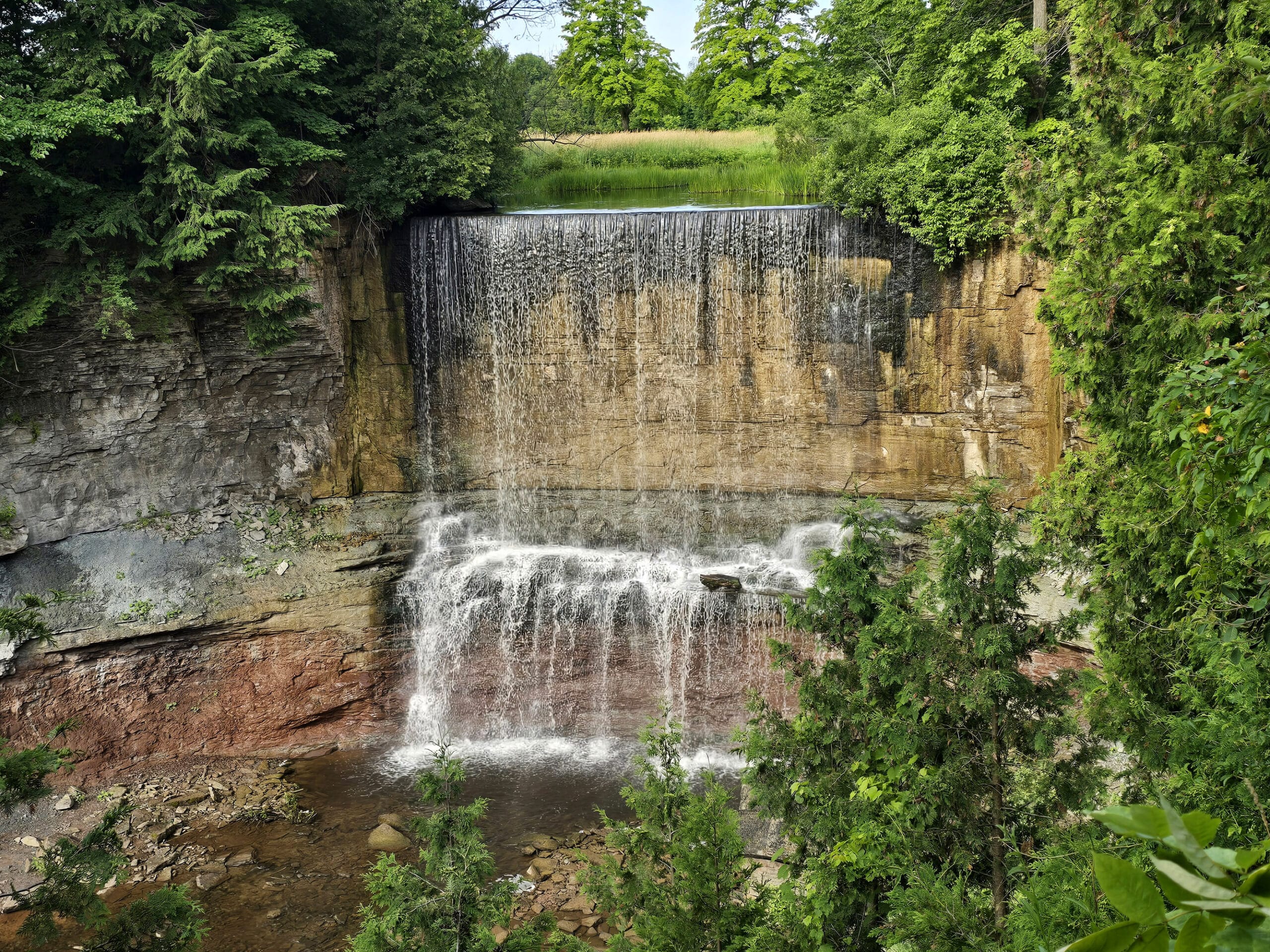
Much like with another of Ontario’s natural wonders - Niagara Falls - Indian Falls is a horseshoe-shaped waterfall.
It’s a plunge style, 15 metre high waterfall that’s about 12 metres across at peak flow.
The park’s website says that it was formed “by the erosion of soft Queenston shale beneath hard Manitoulin dolomite”, and that the flow of the water is “is minimal in the late summer and early fall months.”
Seasonality is a big thing to consider when visiting Indian Falls.
You’ll get a better view in early spring - the melting snow ensures the best flow on the Indian River - BUT the area is prone to flooding, so you’ll need to WORK for that view.
Also, better water flow = more dangerous conditions on the trail alongside the creek, so you’re probably better off sticking to the view of the top of the falls at that time of year.
Btw, the “Indian” in “Indian Falls” refers to the Newash Indian tribe that lived in the area in the 1800s.
The government kicked them off their land in 1857, and they were relocated to Cape Croker.
Share the Love!If you’ve made one of our recipes, be sure to take some pics of your handiwork! If you post it to Bluesky, be sure to tag us - @2NerdsInATruck, or you can tag us on TikTok, if you’re posting video. We're also on Pinterest, so you can save all your favourite recipes and park reviews to your own boards! Also, be sure to subscribe to our free email newsletter, so you never miss out on any of our nonsense. Well, the published nonsense, anyway! |
Entertainment and Activity
While the waterfall is the main attraction, there are a few things you can do while visiting Indian Falls Conservation Area:
Hiking
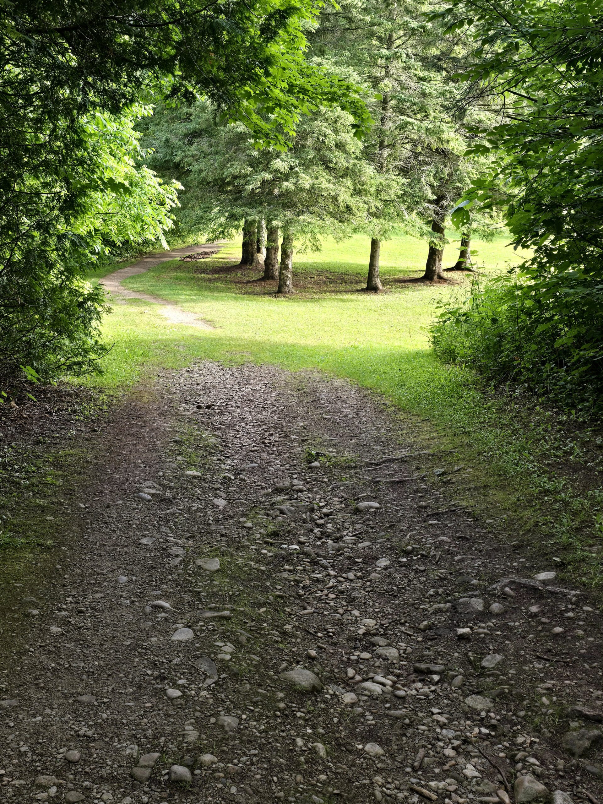
There is basically one hiking trail in the park, though you can split off from the main trail near the beginning, to visit the sports facilities.
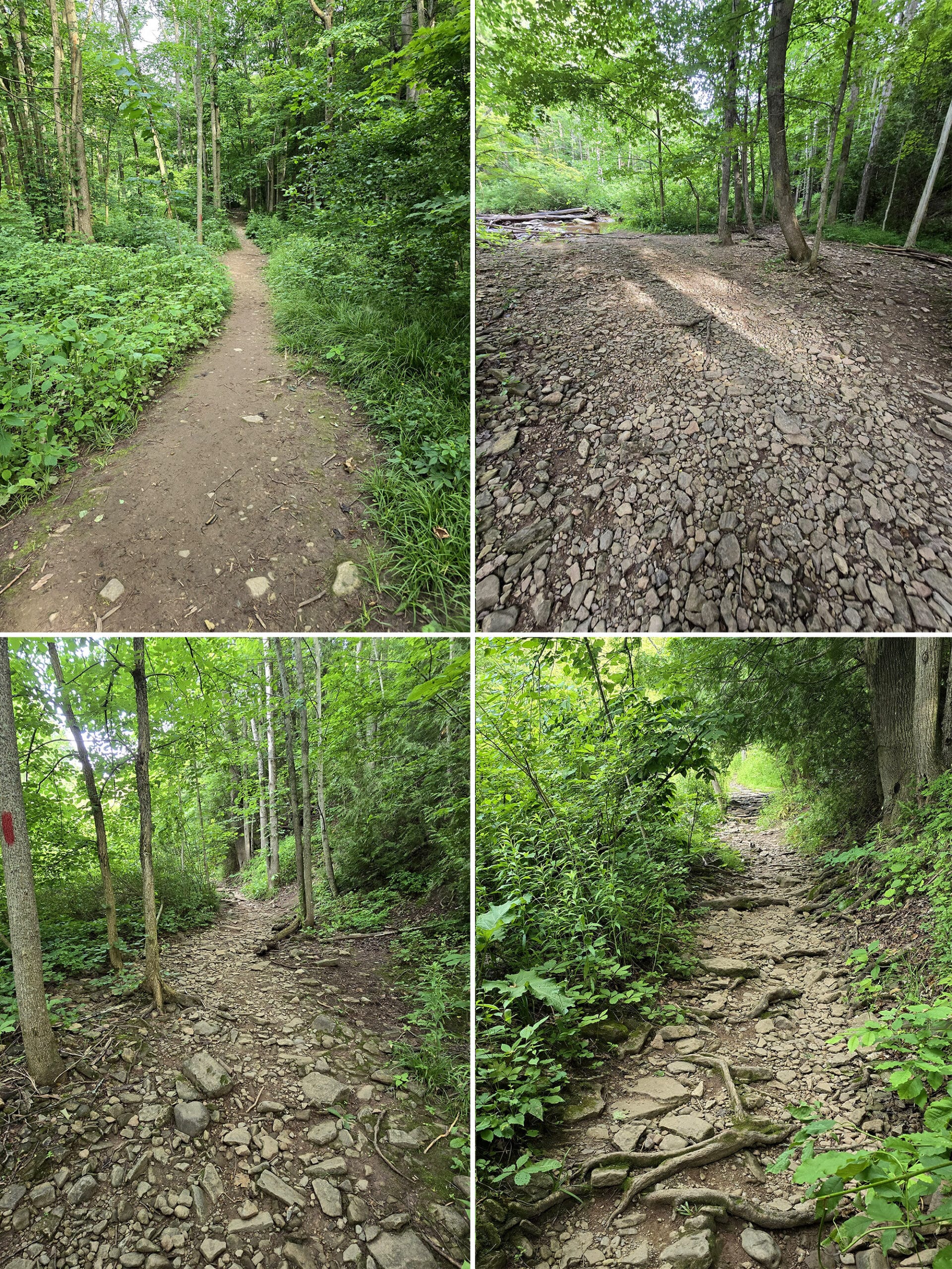
It’s a short walk - 0.8 km from the parking lot to the falls - but it’s not an EASY walk. You’re definitely going to need proper footwear for this rigorous trail.
It’s generally pretty rocky terrain, with some steep slopes involved... and parts of the site are prone to flooding.
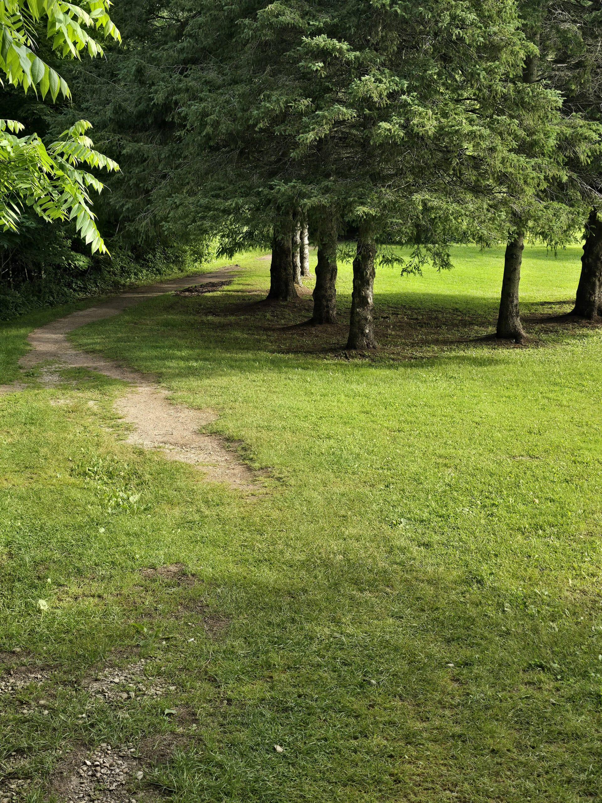
When you come to the split, you’ll go left for the waterfall trail. (The split off to the right takes you to the portapotties and fields).
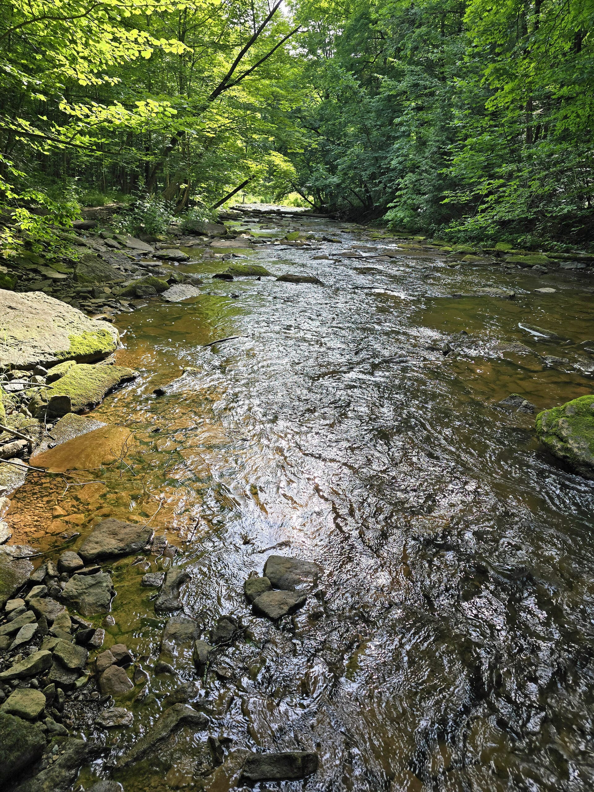
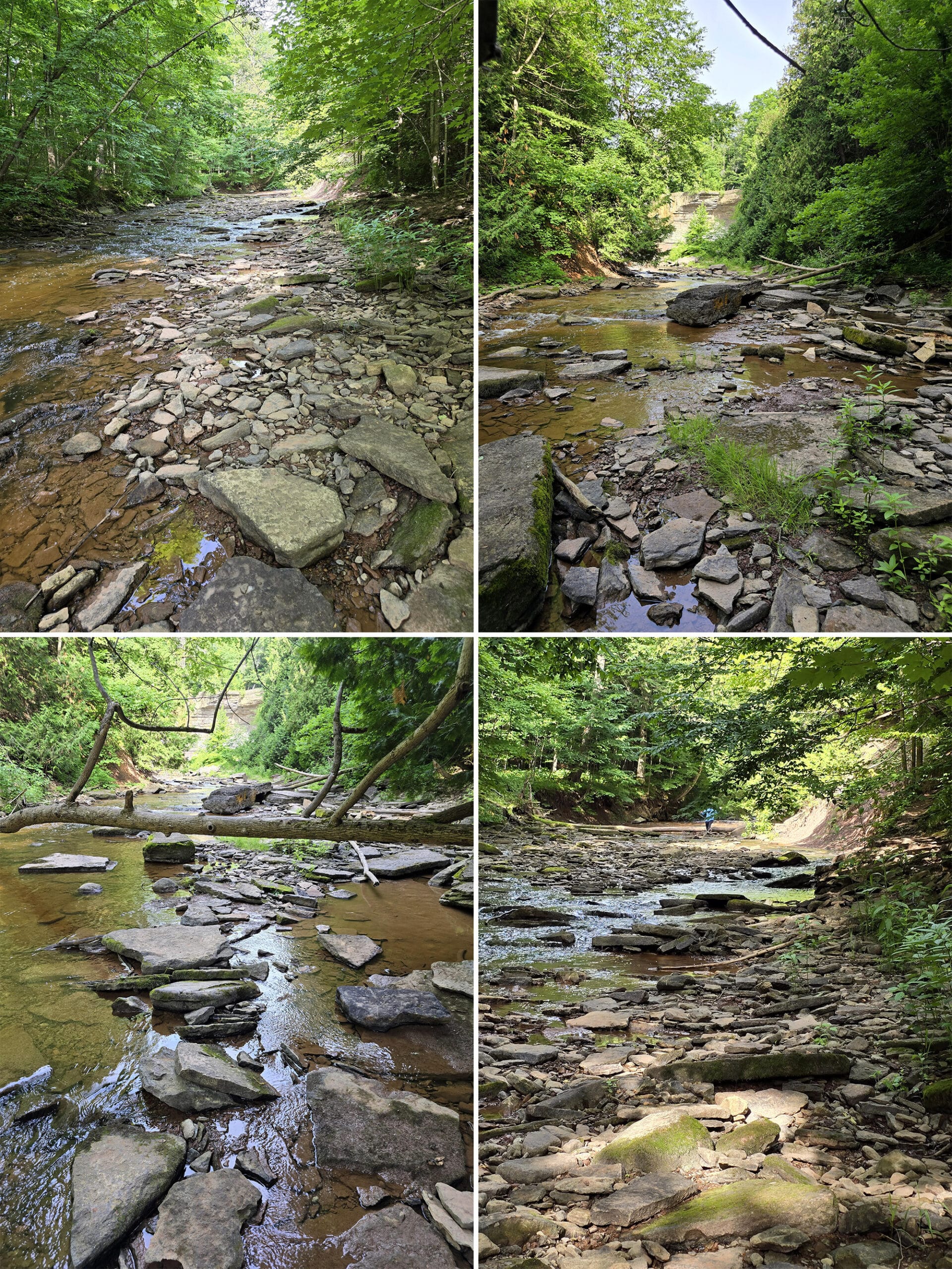
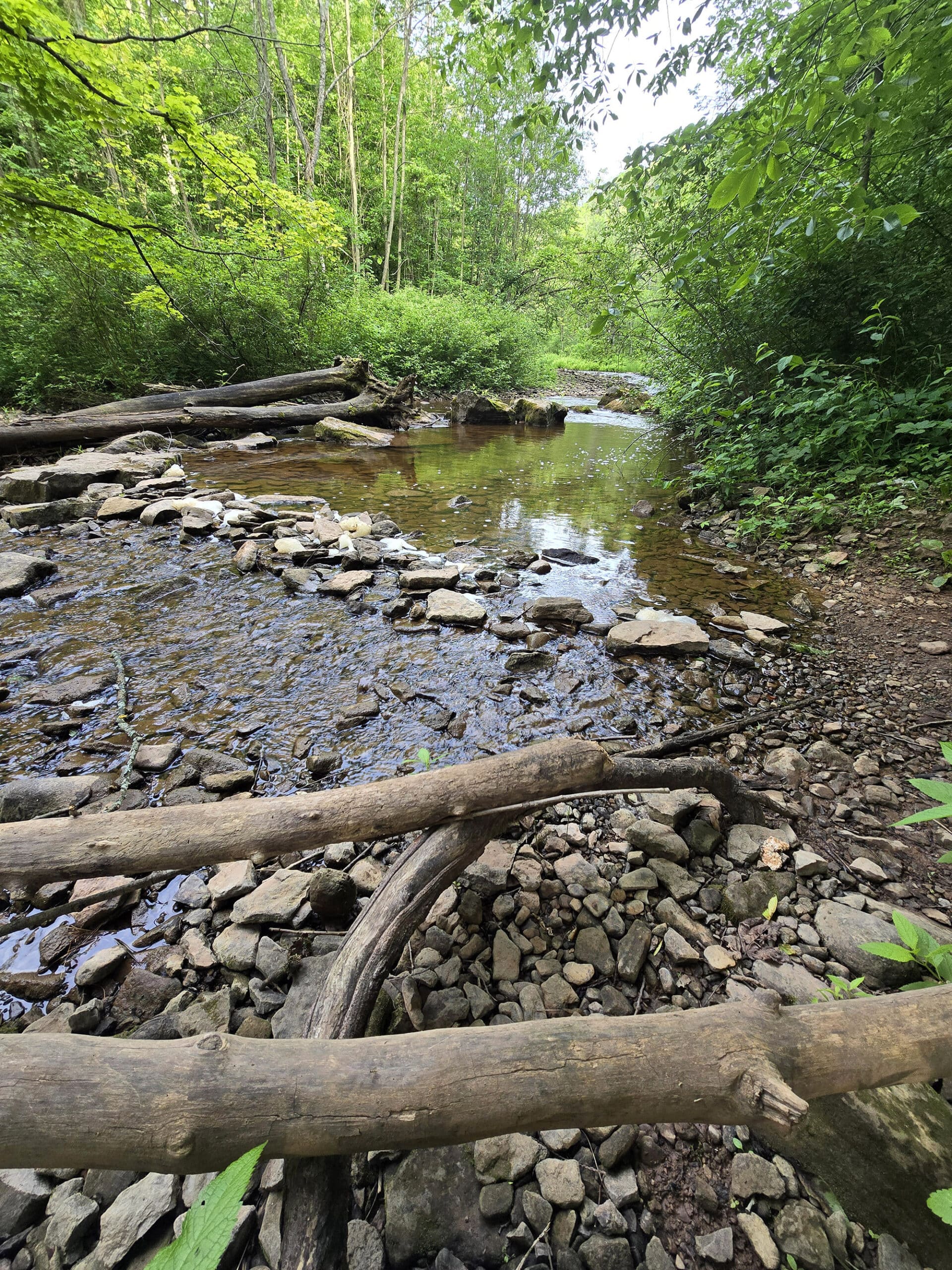
You’ll come to a clearing, then walk along the creek for a bit.
Soon, we came to a section of trail that involved using rocks as stepping stones to cross a flooded area.
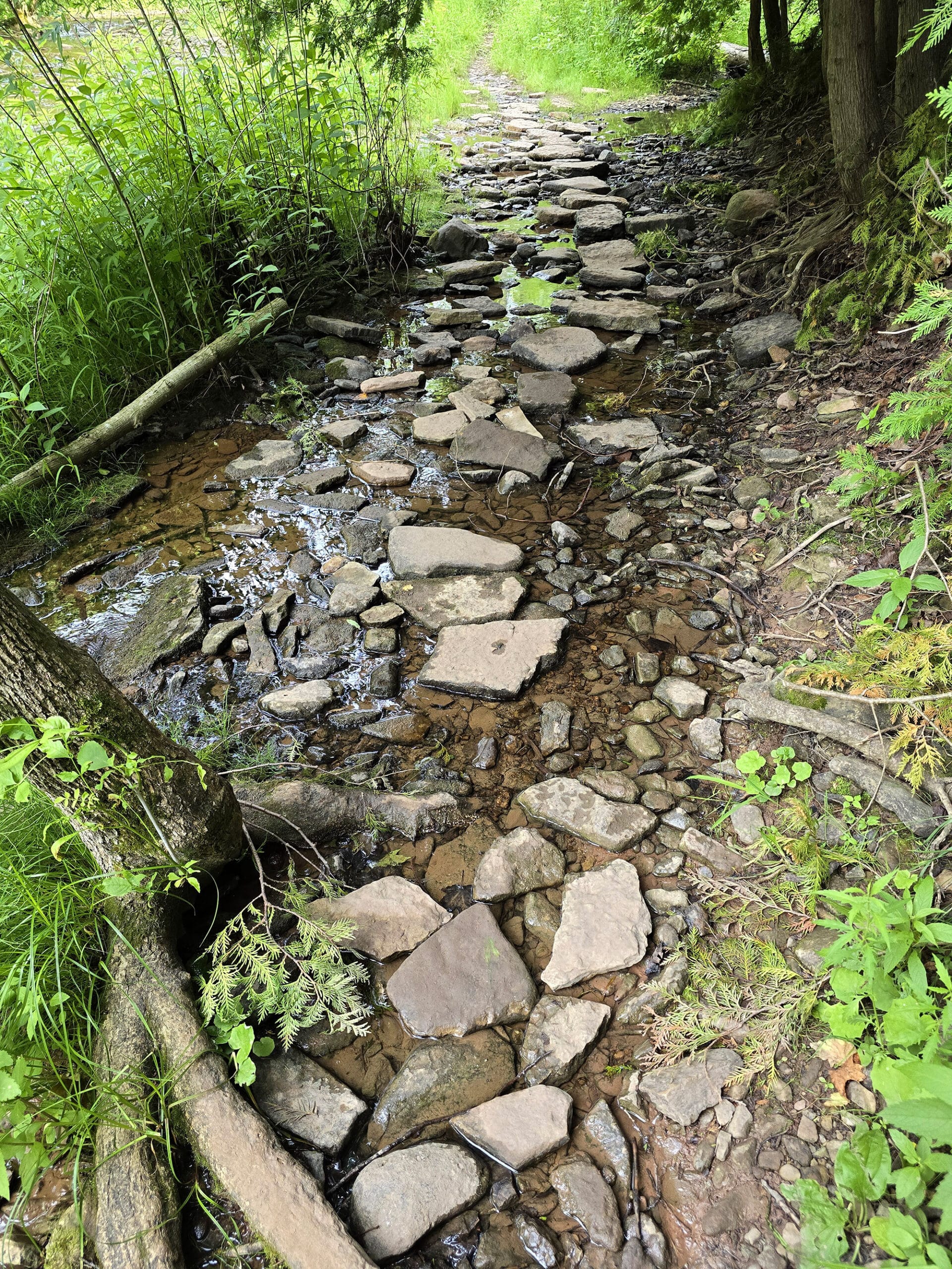
I’m guessing the side trails are probably a result of flooding, and trying to avoid those conditions at certain times of the year.
That ended up looking to be a side trail - staying to the right would have been a better option.
Anyway, about 0.6 km in, there’s a set of stairs going up to the right - that’s how you get up the high cliffs, to go view the waterfall.
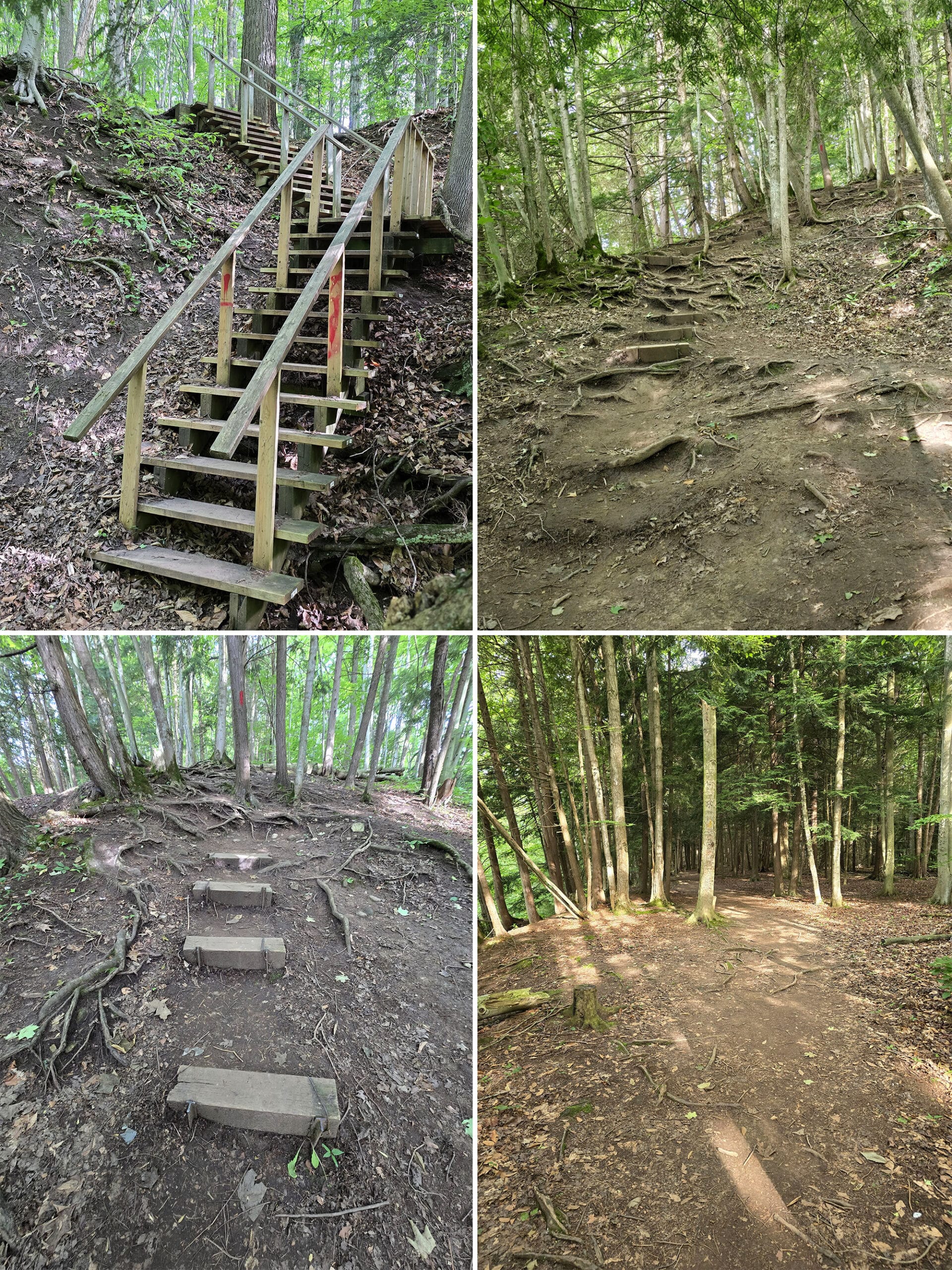
This is only for a short section, though- it levels out pretty quickly.
From there to the falls is actually the easiest section of the trail - wide, relatively flat, well packed, all the way to the lookout point for the waterfall.
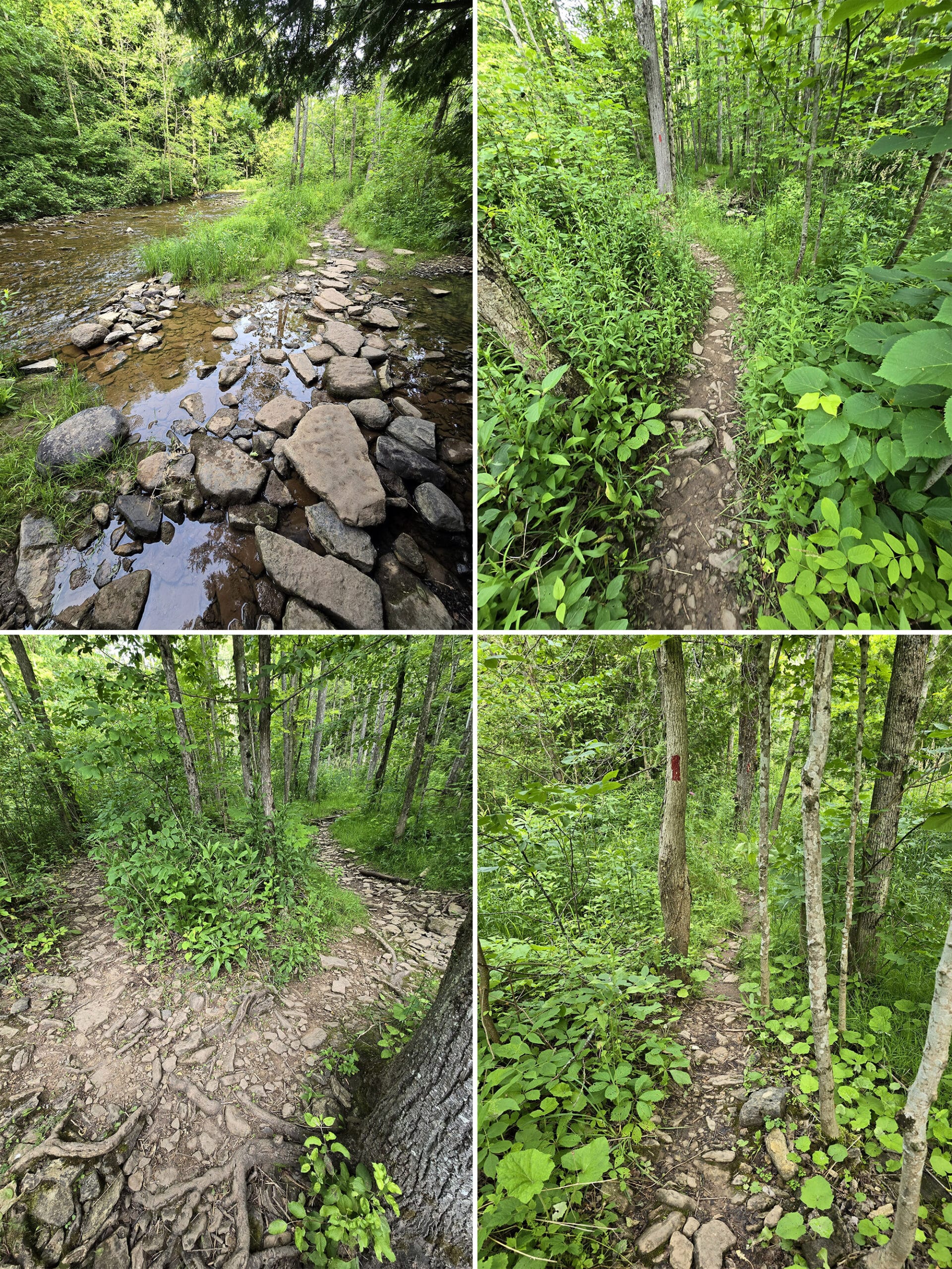
The Side Trail
When you’re walking towards the waterfall from the lower main trail, there’s a more adventurous side trail that takes you to a view near the bottom of the falls.
You’ll find it if you bypass the stairs and continue to the left. It didn’t look to be official, but was definitely well-worn.
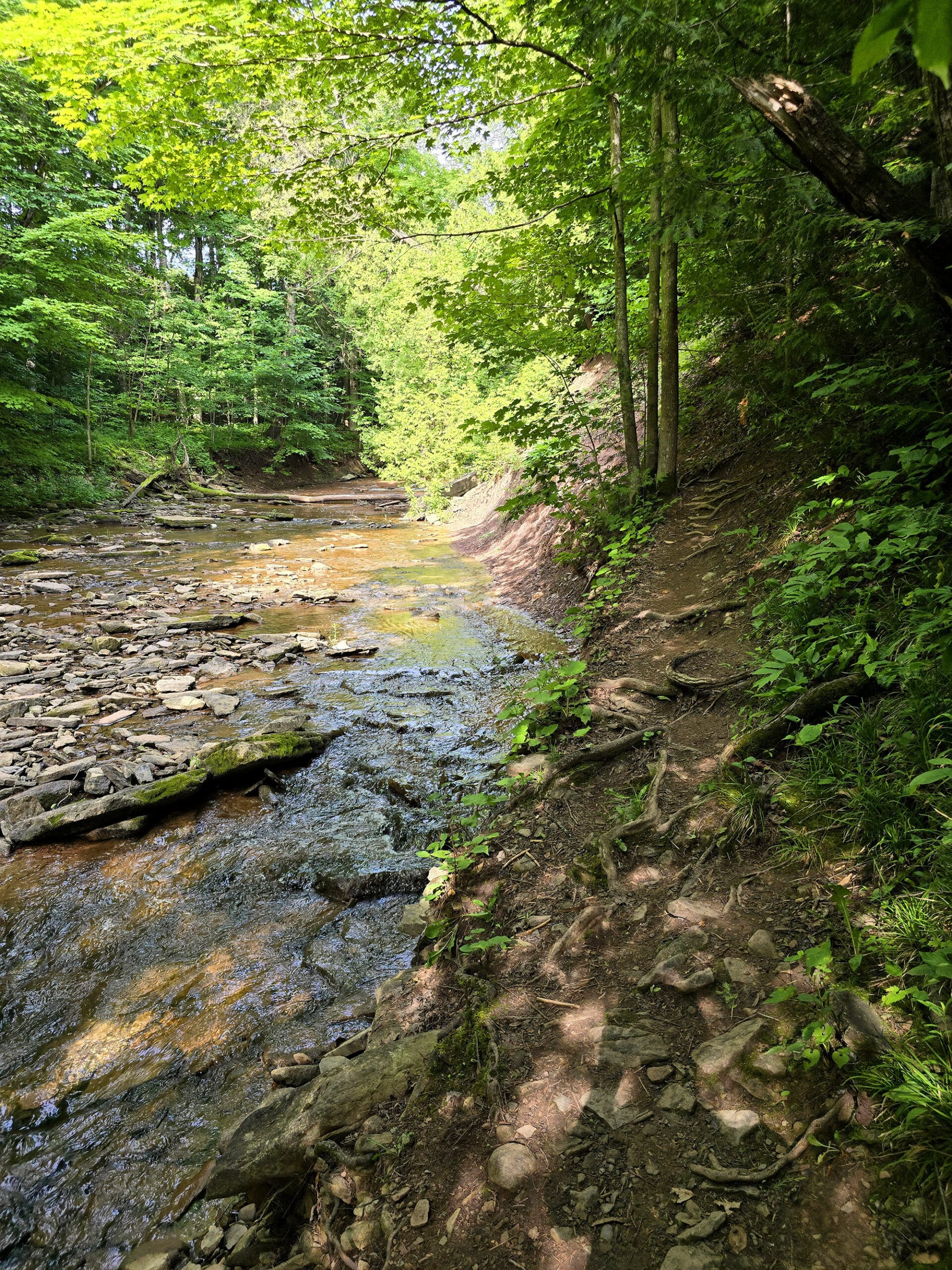
It was a much more narrow trail, that went up along the edge of the creek.
In some parts, it required going over more stepping on stones in the river. There was also one short section of very narrow, angled dirt trail right at the ledges.
It seemed like it could be dangerous, in other conditions - we assume it would be really slippery when wet.
After we got home, we read that access to the base of the falls is prohibited. We didn’t see any signs on site in terms of excluding people from using the obvious trail, though.
So, I’m not sure how far that prohibition goes. Maybe you’re not supposed to actually go IN the base of the falls, rather than “You’re not supposed to walk towards the area of the base”?
Clear communication would be wonderful!
Birding, Wildlife, and Nature
Due to the conditions at the time of our visit, we HEARD a lot more birds than we saw! Loads of tree cover, and the birds all seemed to be pretty high up.
I saw some kind of a Heron - I’m assuming a Great Blue Heron - flying down Indian Creek. We also saw some Blue Jays and an Eastern Wood-Pewee.
We heard: American Robin, Black-Capped Chickadee, Brown Creeper, Great Crested Flycatcher, Mourning Dove, Red-Breasted Nuthatch, Red-Eyed Vireo, Song Sparrow, White-Breasted Nuthatch, and White-Throasted Sparrow.
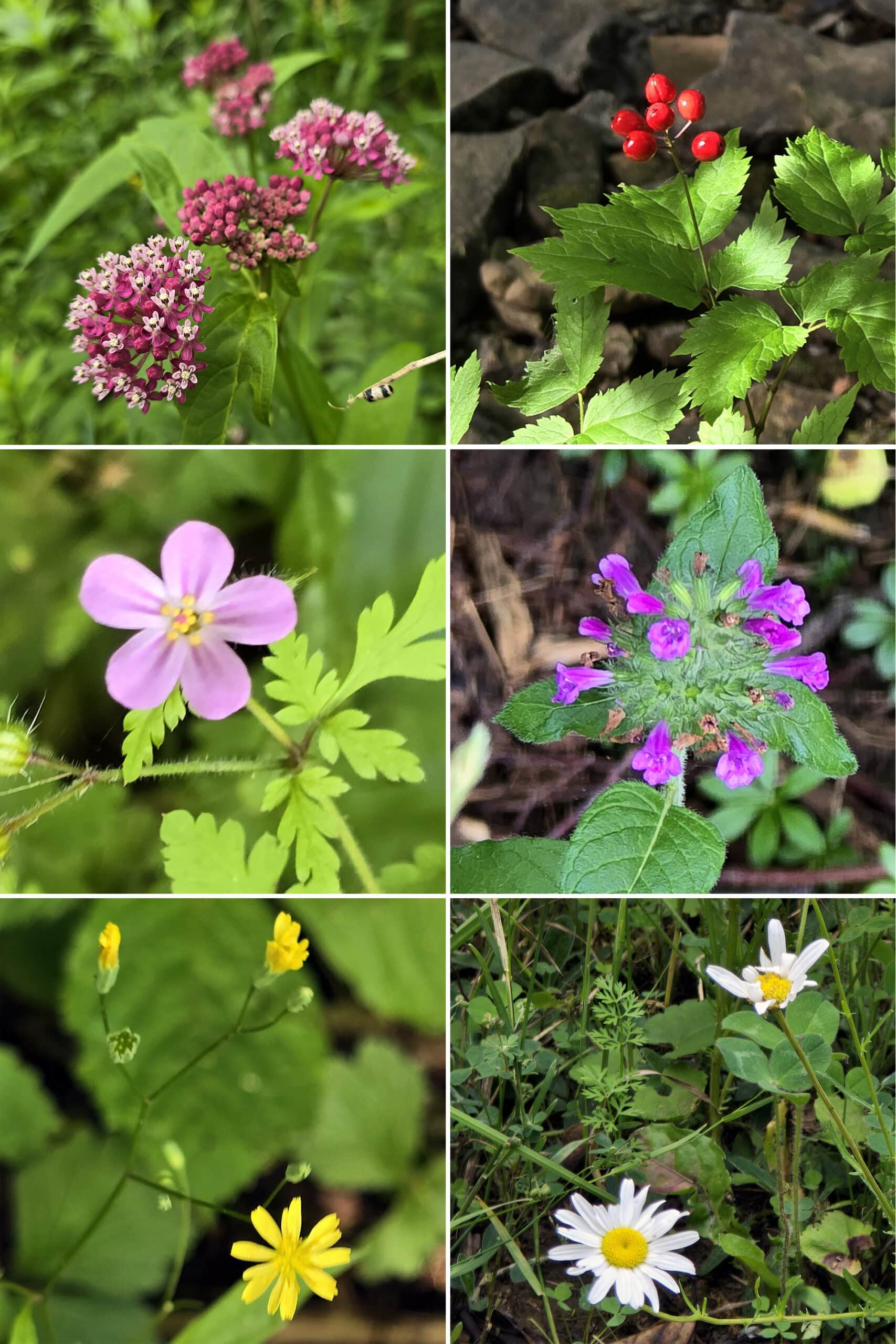
Beyond all those birds, there were a lot of wild flowers, and at least a couple of apple trees!
Biking
Once you get to the bottom of that first hill - where it splits off to go either to the waterfall trail or the sport fields, that’s where your biking opportunity ends, IMHO.
Apparently we’re not alone in that thought - we tend to see bikes left there, presumably by others who came to that same conclusion!
Swimming
Not sure of the legality or safety of it, but - in our observation - downstream of the falls isn’t super attractive as a swimming spot.
Also, access to the base of the falls is apparently prohibited now (though we’ve seen plenty of reviews talking about a swimming hole there!).
Fishing
The Indian Falls Conservation Area website lists fishing as an activity, but has no information on it.
After doing some digging - and looking for “Indian Creek”, specifically - apparently there are Chinook Salmon, Rainbow Trout, and Smallmouth Bass in the creek.
Now, that creek is long - it flows from the falls, all the way to Georgian Bay - so fish availability probably varies wildly along the watercourse, and I have no idea what the situation is in the park.
Niantic Games
There are a few Pokegyms / Pokestops / Portals at Indian Falls Conservation Area.
Three are right near the parking lot - The trail map sign, a plaque, and the ball field. There’s also a single one at the falls itself.
Final Thoughts
This is one of those trails where there’s a lot of payoff along the way, rather than a boring walk with a view at the end.
I loved how ADHD friendly the trail was - different terrain, views, and conditions the whole way. We stepped over rocks to cross water, walked through woods, up some stairs, navigated a steep section with roots, and even a flat, easy forested part.
We were so entertained the whole way, that getting to the falls was almost a minor letdown!
The falls were nice, of course... but coming up to them meant that the trail was over.
If you’re able bodied and looking for a short walk with some awesome scenery, definitely be sure to check this one out!
We’ll definitely be back, assuming I’m having a good tendon day while in the area.
More Ontario Waterfall Posts
Looking to waterfalling in Ontario? Here are more Ontario Waterfalls to check out:
Aguasabon Falls
Chippewa Falls
Eugenia Falls
Falls Reserve Conservation Area
Gariepy Creek Falls
Healey Falls
Hogg's Falls
Inglis Falls
Jones Falls [Pottawatomi Conservation Area]
Kakabeka Falls
Mink Creek Falls
Onaping Falls
Oxtongue River-Ragged Falls Provincial Park
Provoking Falls
Rainbow Falls
Sand River Falls
Sauble Falls
Scenic High Falls
Walter's Falls
Webwood Falls
Beyond the beautiful waterfalls, be sure to check out our Places to See category, to find more interesting Ontario places to explore!
Thanks for Reading!If you loved this post - or have any questions about it - please leave a comment below! We'd also love it if you would consider sharing the link on social media! |

Leave a Reply