
The Cup and Saucer Trail is known as one of the best hikes in Ontario, and is a must-do when visiting Manitoulin Island. Here's what you need to know!

Anyway - as nature lovers - we had a list of things we wanted to do and see. Cup and Saucer Nature Reserve - with its famous Cup and Saucer Trail - was WAY up on that list.
Everything I’ve ever seen about Manitoulin Island has it listed as a must-visit destination, due in part to the breathtaking views from along the epic Cup & Saucer Trail.
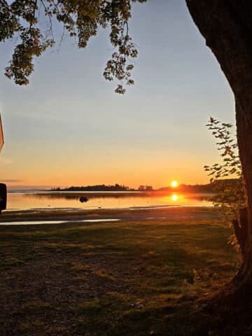
As a bonus, it was only a short distance from the campground we were staying at!
The thing is... information we’d seen on it seemed all over the place. Different final distances on the same trail, some people saying it was flat and easy, others calling it difficult.
So, he took lots of notes and photos, and we’re happy to be able to provide you with our comprehensive guide to visiting the park - and walking the main trail there.
Spoilers: I’ll definitely be doing the trail, the next time we visit Manitoulin Island!
Anyway, let’s get into everything you’ll need to know about the Cup & Saucer trail...
The Basics:
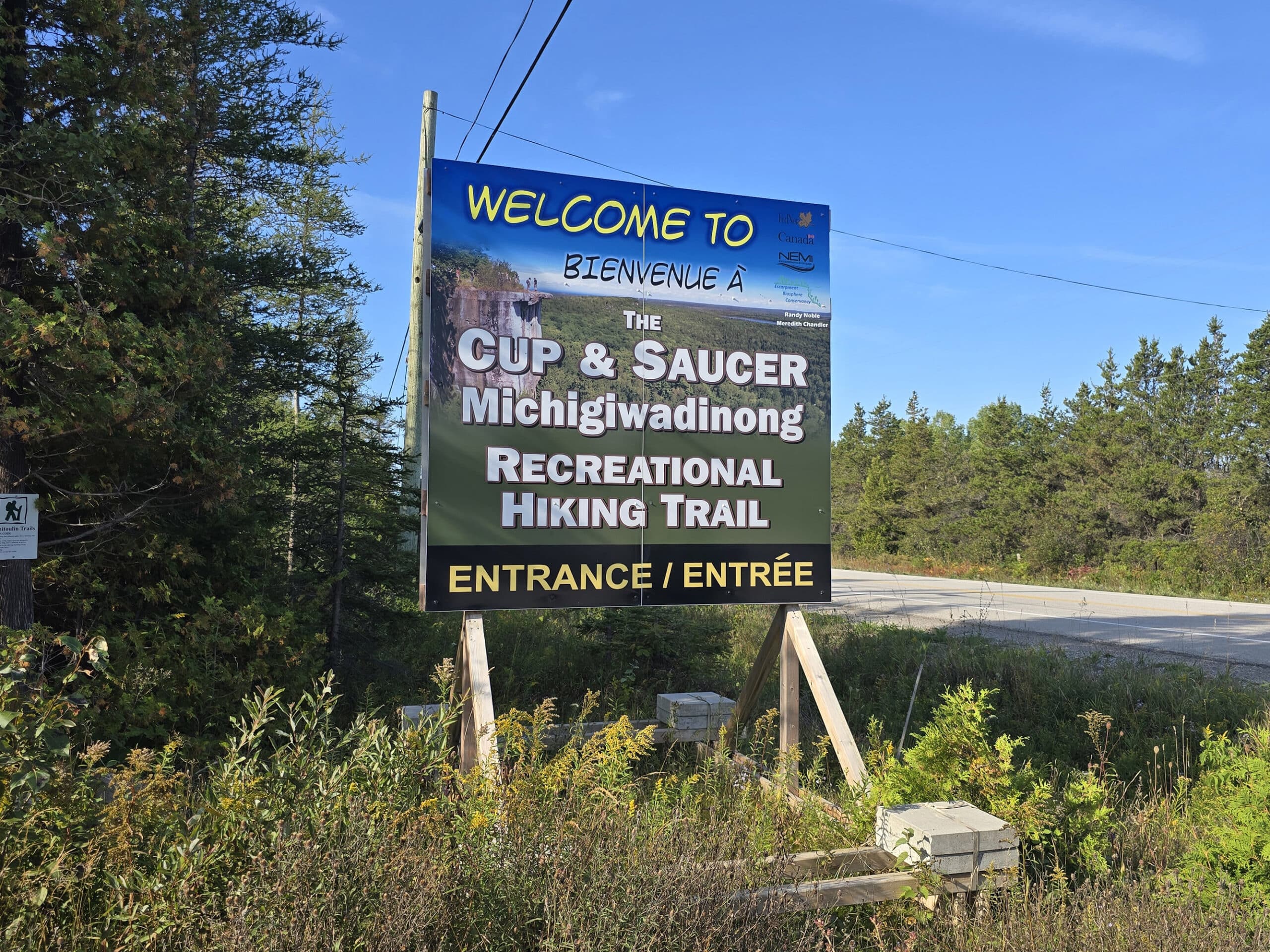
Location Name: Cup and Saucer Nature Reserve
Address: 4097 ON-540, Sheguiandah, ON P0P 1W0
Website: Escarpment Biosphere Conservancy - Cup and Saucer
Price Free!
Reservations: NA
Season: Year round
Logistics
Cup and Saucer Nature Preserve is located near the junction of hwy 540 and Bidwell Rd, about 18 km west of Little Current. It’s just outside the community of M’Chigeeng.
It’s also about 15 minutes away from Bridal Veil Falls - handy to know, if you’re looking to stack adventures!
Google Maps got us there, with no problem. Beyond that, here’s some basic information to help you plan your trip to Cup and Saucer Nature Reserve:
Registration and Check In
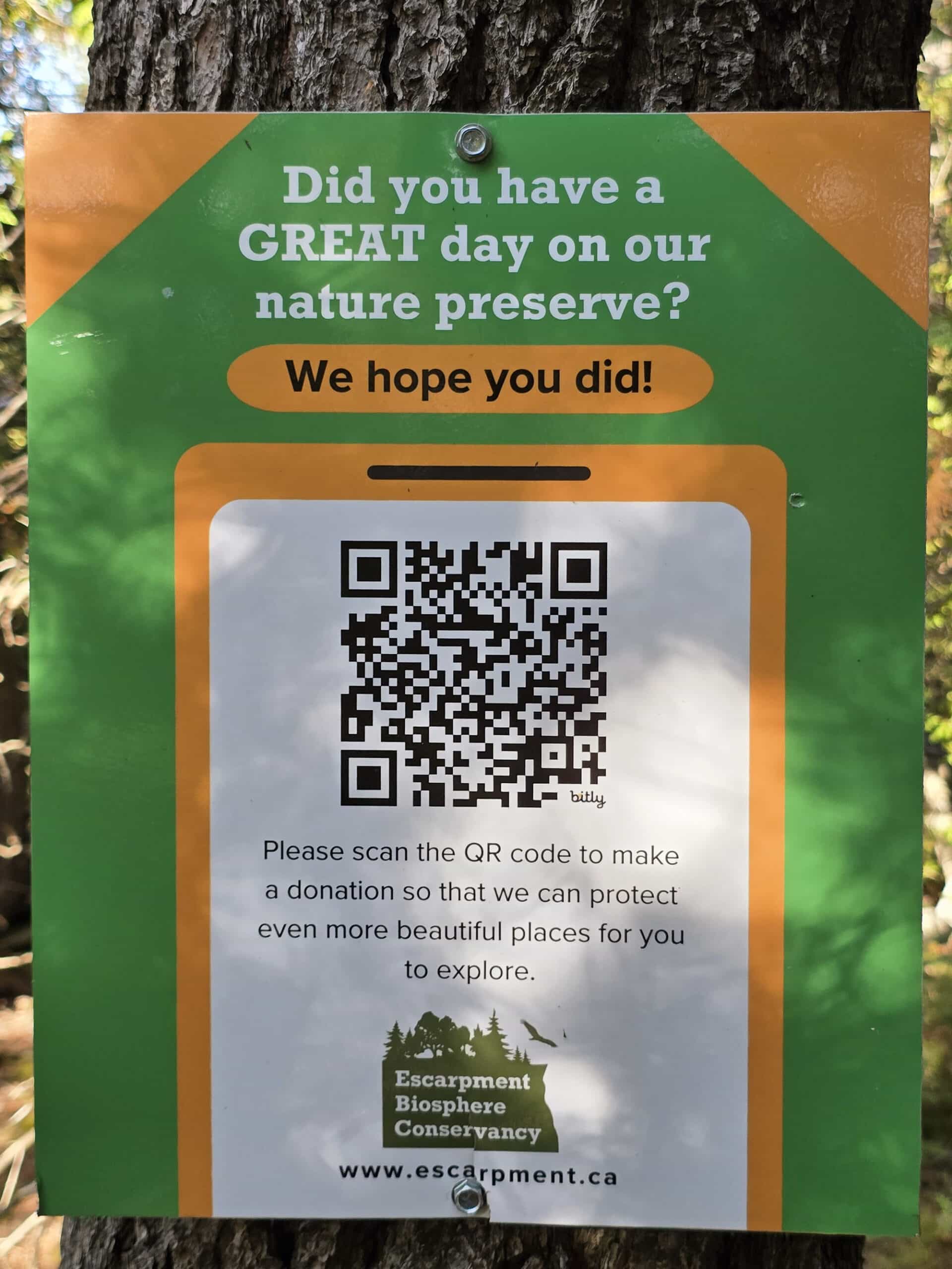
The trail is unstaffed - and parking is free - so there is no registration or check in involved. (There IS a QR code for donations, should you feel so inclined!)
That said, the Cup and Saucer Trail is one of THE most popular trails in Ontario - certainly on Manitoulin Island - so it gets BUSY.
We visited on a weekday in early September - before the leaves started changing colour - and the parking lot was still pretty busy by noon, each time.
So, definitely plan to get there early, especially if visiting in the summer, or during fall colours season.
Parking
There are two parking lots at the Cup and Saucer trail - a lower parking lot, just as you exit the highway, and an upper parking area, forward from the entrance.
Both parking areas are relatively large, with no parking spots actually marked out.
You could probably get a motorhome / RV / Trailer in there - especially the upper one - but I’d definitely worry about attempting that during the busy season.
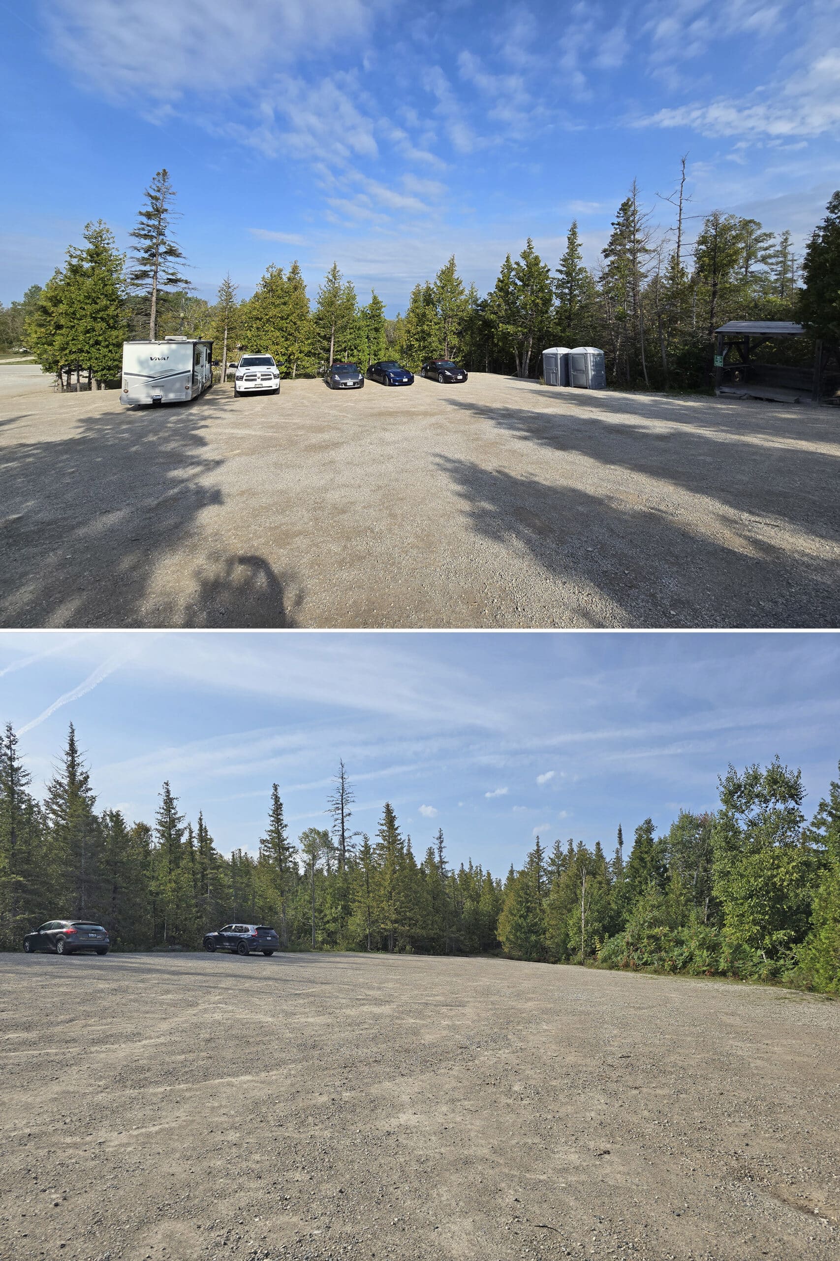
Bottom: Upper Parking Lot
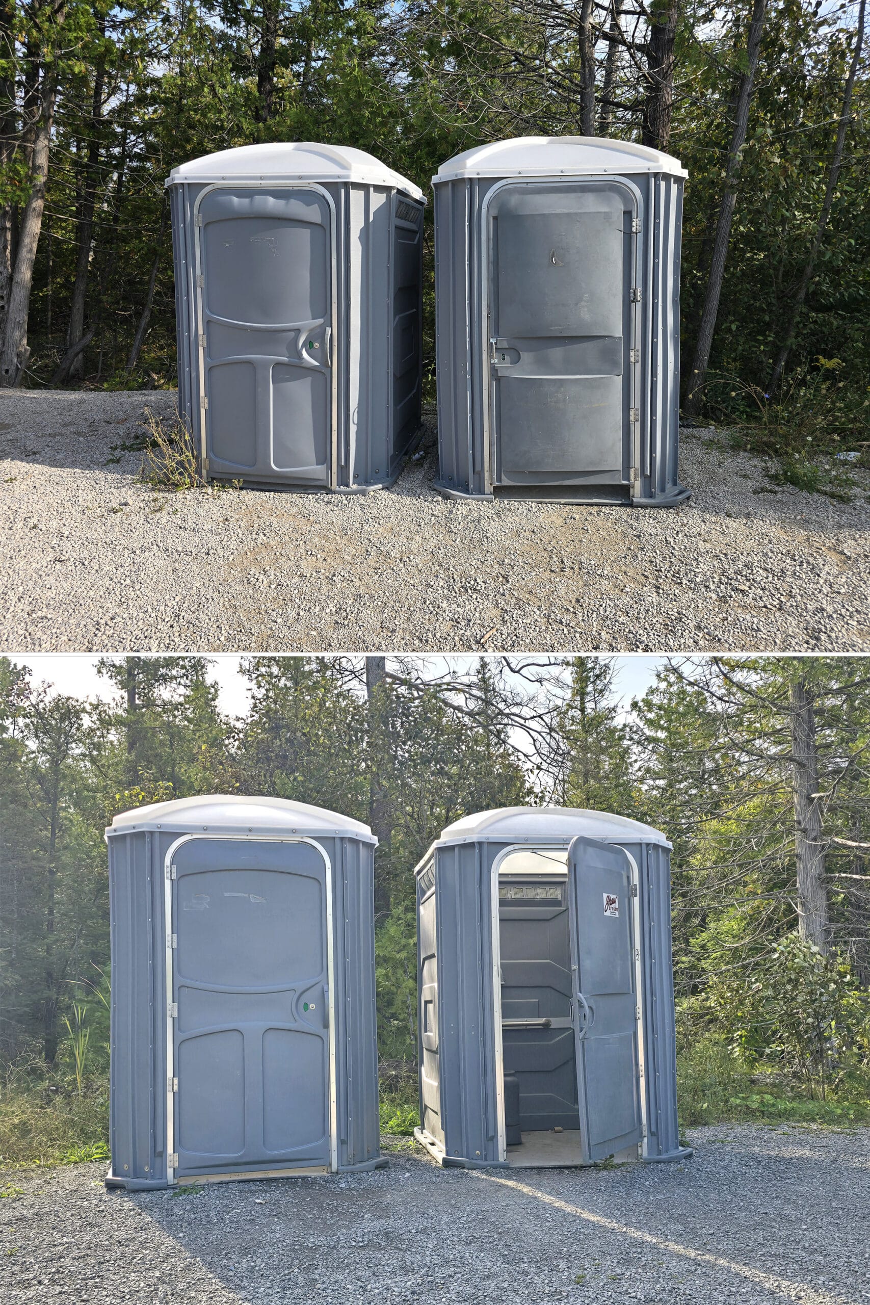
Washrooms
Each of the two parking areas has a set of portapotties, which were in good condition at the time of our visits.
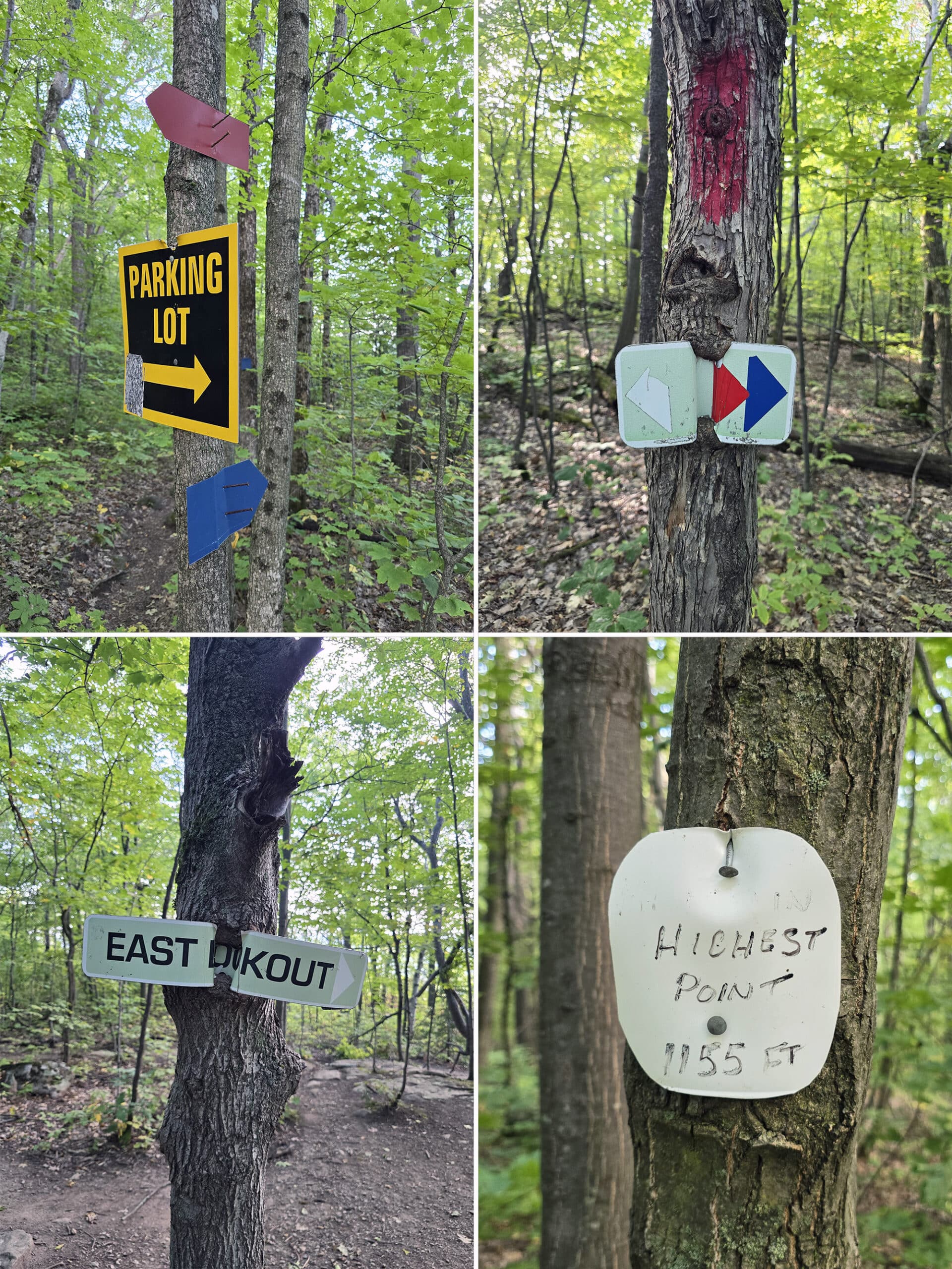
Maps and Signage
Some information to help you find your way around Cup and Saucer Nature Reserve:
Park Map
There is a large map in the lower parking lot, but that’s a map of the Manitoulin Island trails in general - NOT of the trails within Cup and Saucer Nature Reserve, specifically.
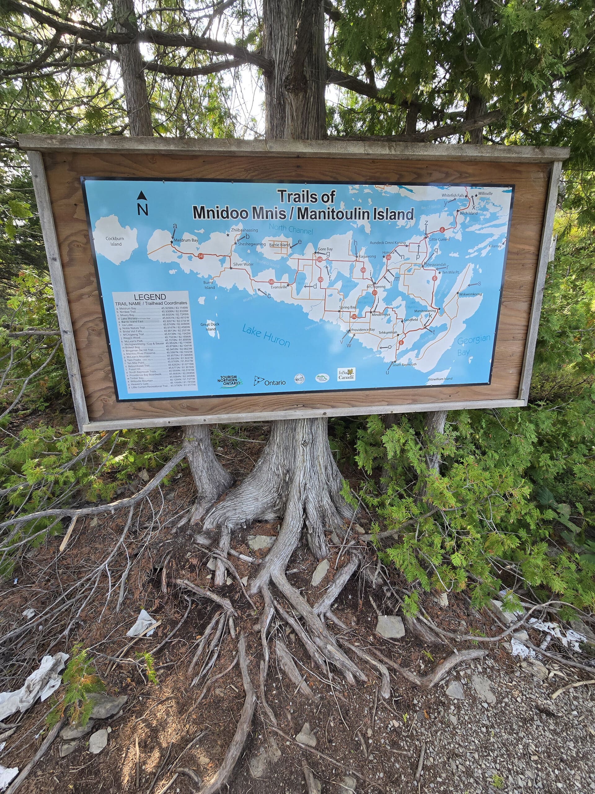
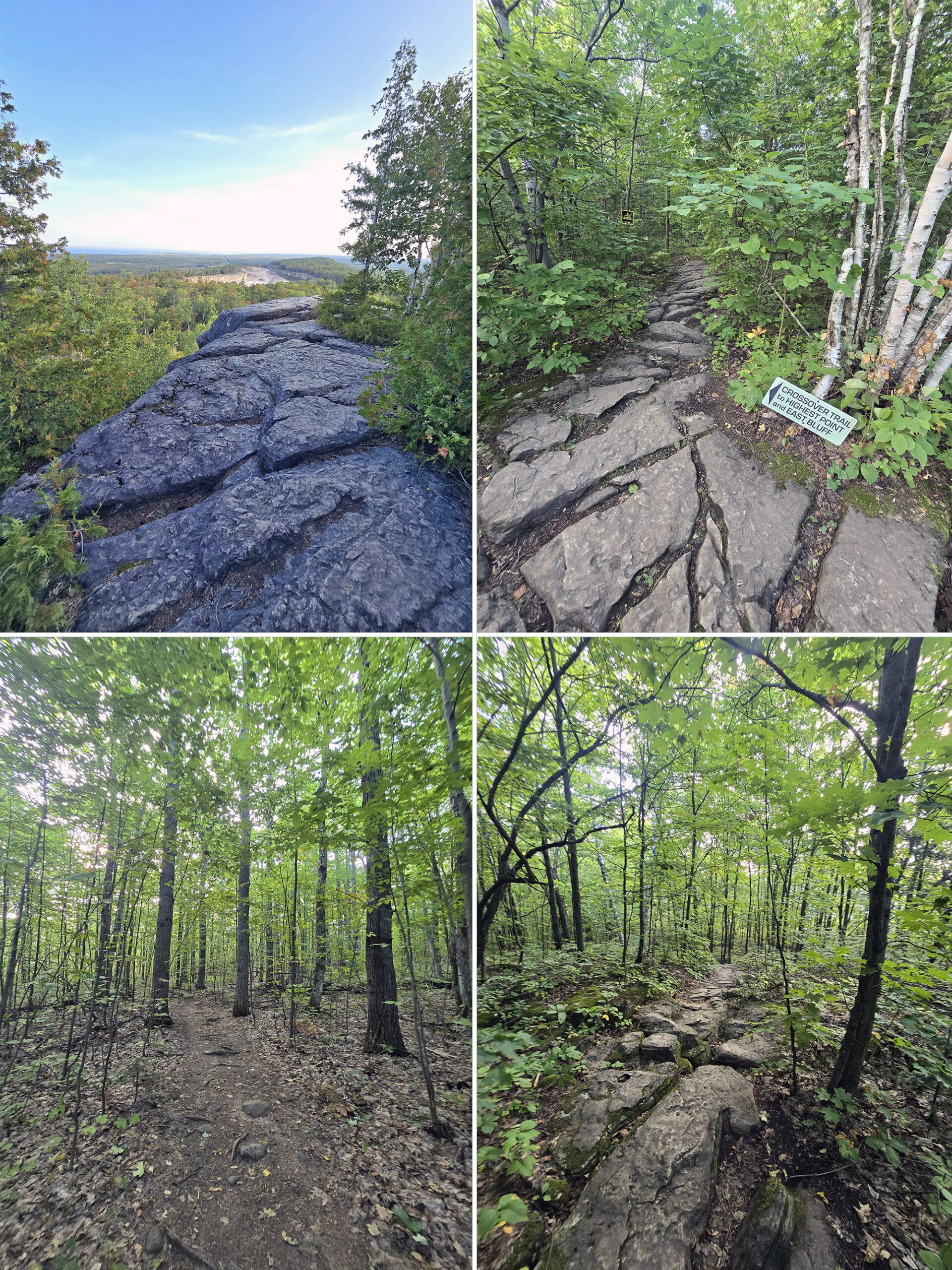
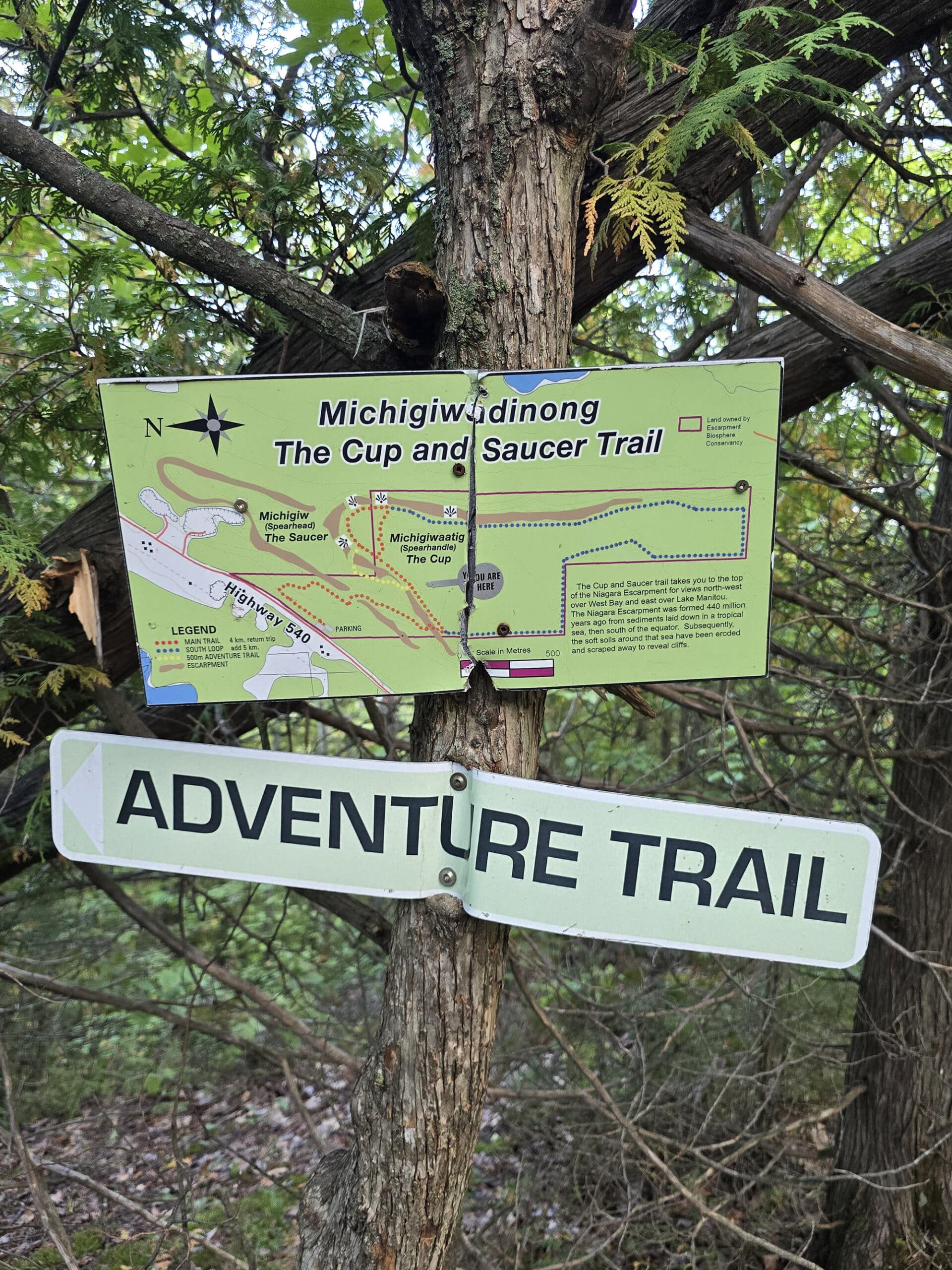
A short way onto the trail, you’ll come to the actual trail head, which has a large trail map.
This map was easy to read and pretty accurate. Between the map and the markers on the trail, you’re not going to get lost out there.
Signage
The only directional signage in the parking lot points you to the upper parking lot - as you’re entering the area - and one little sign pointing toward the trail, from that upper parking lot.
We were actually a bit confused as to where the trail started, as there was no obvious trailhead marked.
Opening Pokemon Go made it clear!
Along the trail itself, there weren’t a lot of trail blazes, but they were there where you needed them. All of the trail junctions were well marked, and there were a lot of signs pointing the way back to the parking area.
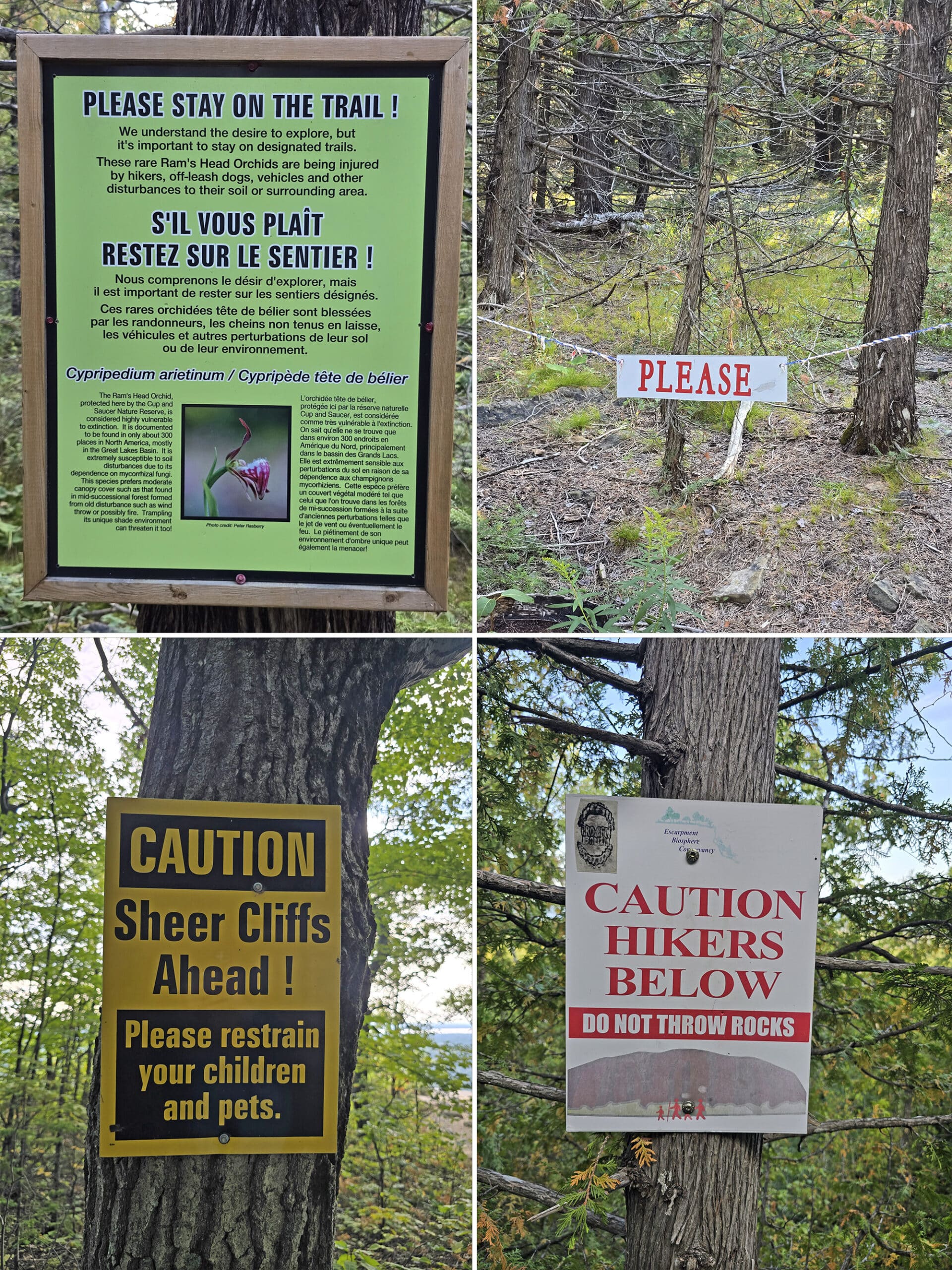
There was also a lot of warning signage, including about rare orchids in the area!
Accessibility
First of all, the Porta-Potties aren’t marked as being wheelchair accessible, but they ARE that larger kind that are generally marked that way.
Plenty of room inside, railings, a wider door - all of that.
If you’re a wheelchair user, that’s as accessible as the park gets - the trails are not wheelchair accessible.
The trails aren’t really accessible for those with any kind of mobility issue, either. It’s MOSTLY stretches of easy trail, but - in order to see anything - you’ll have to traverse more moderate and difficult sections, including steep hills, steep stairs, and rocky areas.
Pets
There are signs along the trail that tell you that your dogs have to be leashed and - at the cliff edge - warning that you should be careful with your kids and pets.
Other than that, please pick up after your dog, and properly dispose of their waste.
Park Store
There is no park store at the Cup and Saucer Trail.
Visitor Centre
There is no Visitor Center at Cup and Saucer Nature Preserve / Trail.
Day Use Area
There weren’t any picnic tables or benches, so far as we could see.
Connectivity
We’re on Rogers Wireless.
I had great reception in the parking lot, and Porter had really good reception all along the trail. He was actually able to send me video of him panning over the view below, from one of the outlooks.
Miscellaneous
1. Outdoor enthusiasts who do the whole 8 km hike can get a certificate of completion for doing so!
Just email the Escarpment Biosphere Conservancy (rbarnett@escarpment.ca) and let them know your name, mailing address, and the date you hiked the Cup and Saucer trail.
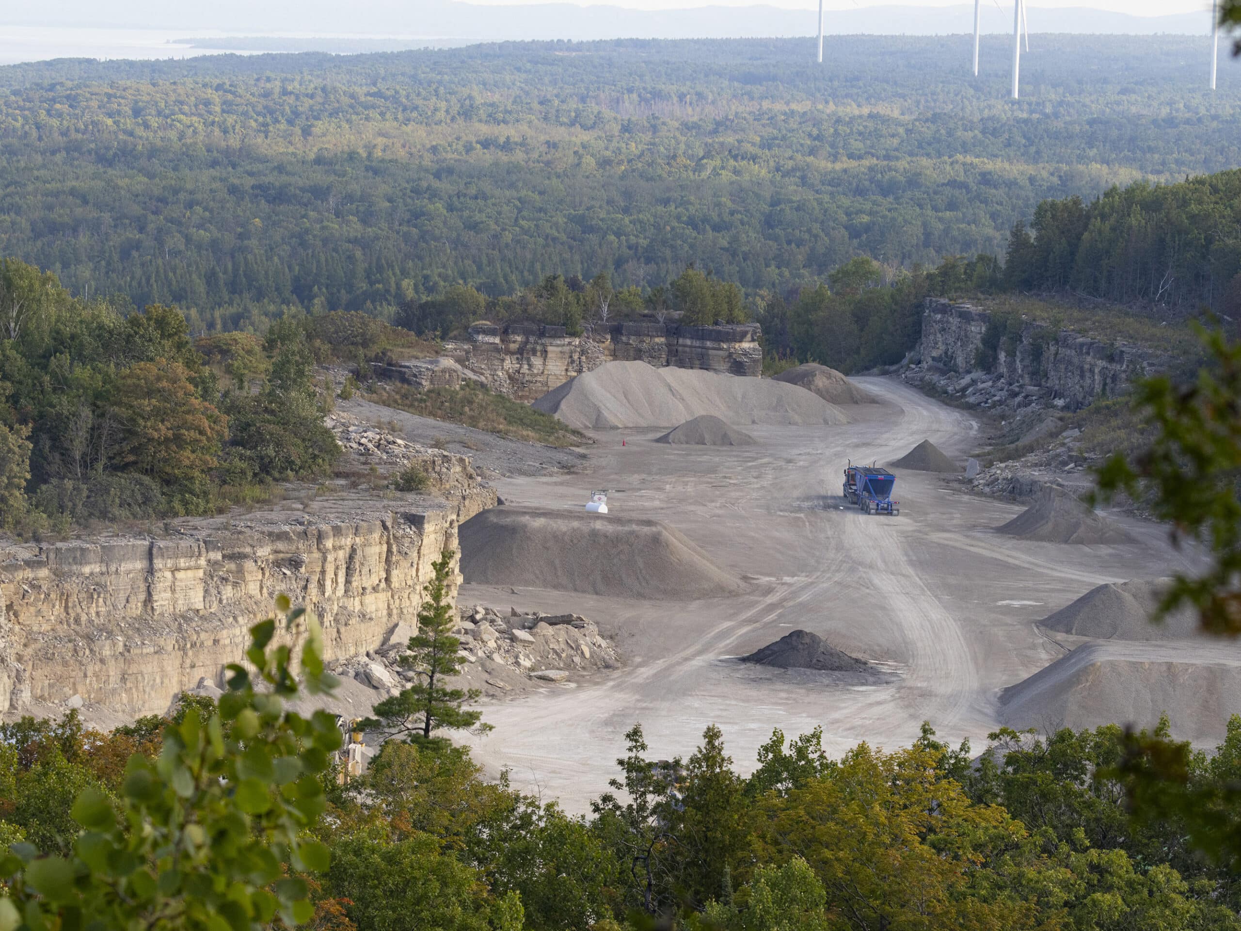
He had heard what he THOUGHT was a train, got all excited, and hoofed it to an overlook with the hopes of seeing it... only to realize that he’d heard quarry machinery below. *Sad Trombone*.
3. The east outlook would probably be particularly amazing at sunrise.
Share the Love!If you’ve made one of our recipes, be sure to take some pics of your handiwork! If you post it to Bluesky, be sure to tag us - @2NerdsInATruck, or you can tag us on TikTok, if you’re posting video. We're also on Pinterest, so you can save all your favourite recipes and park reviews to your own boards! Also, be sure to subscribe to our free email newsletter, so you never miss out on any of our nonsense. Well, the published nonsense, anyway! |
About the Cup and Saucer
Like a lot of the coolest places we’ve been to - Bruce Peninsula National Park, Cheltenham Badlands, Rattlesnake Point Conservation Area, Inglis Falls Conservation Area, Mono Cliffs Provincial Park, and Scenic Caves Nature Adventures - the Cup and Saucer Nature Reserve is part of the Niagara Escarpment... which is a World Biosphere Reserve.
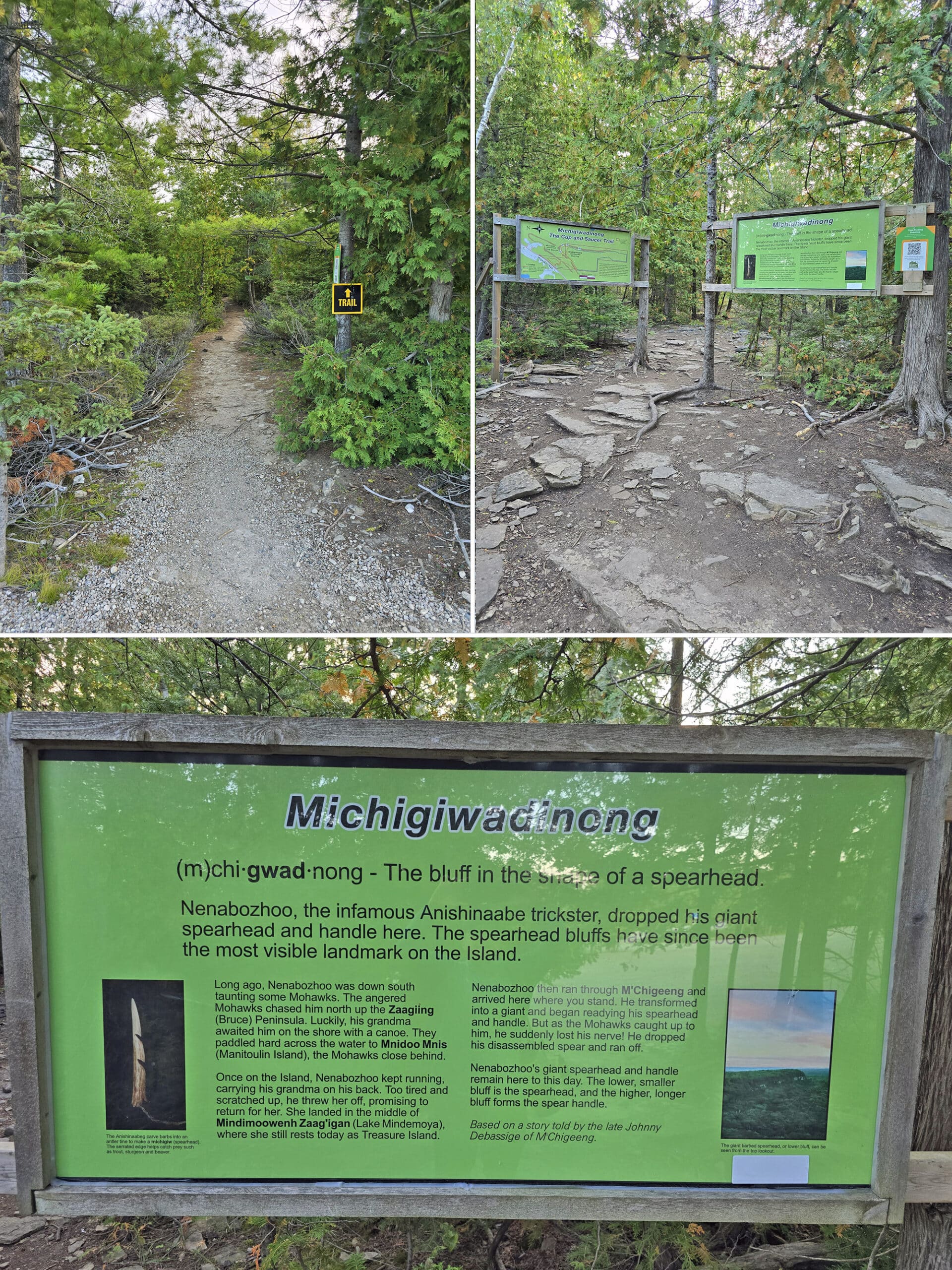
According to signage in the park, its traditional name is “Michigiwadinong”, which is Ojibwe for “bluff in the shape of a spearhead.”
The whole property is 345 acres, and named - in English - after its star attraction: the unique rock shape that the trails are built on.
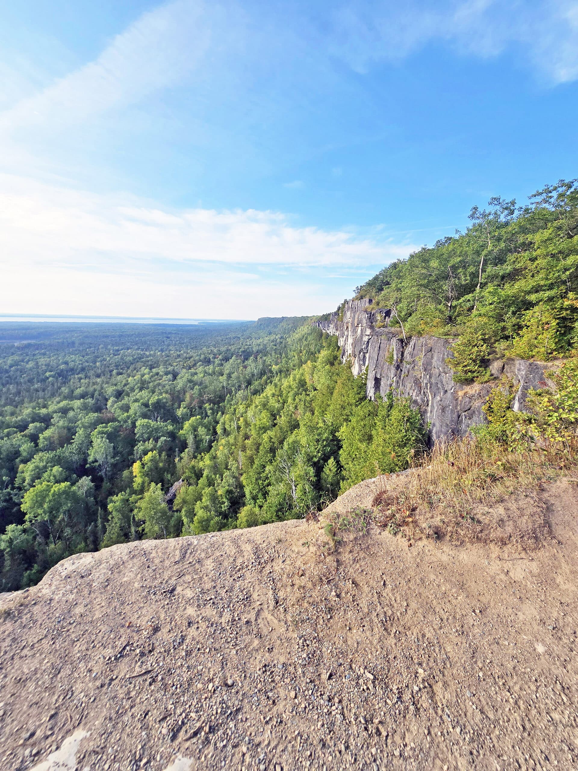
According to the park, the higher “cup” cliff is perched on top of a lower “saucer” formation. The whole thing is over 400 million years old, and formed by Silurian deposits.
Although our minds immediately went to Doctor Who, “Silurian”, in this case, refers to a geologic period during the Paleozoic era. This time period - which lasted over 23 million years - was when the Ozone Layer was established, and life on earth saw significant diversification.
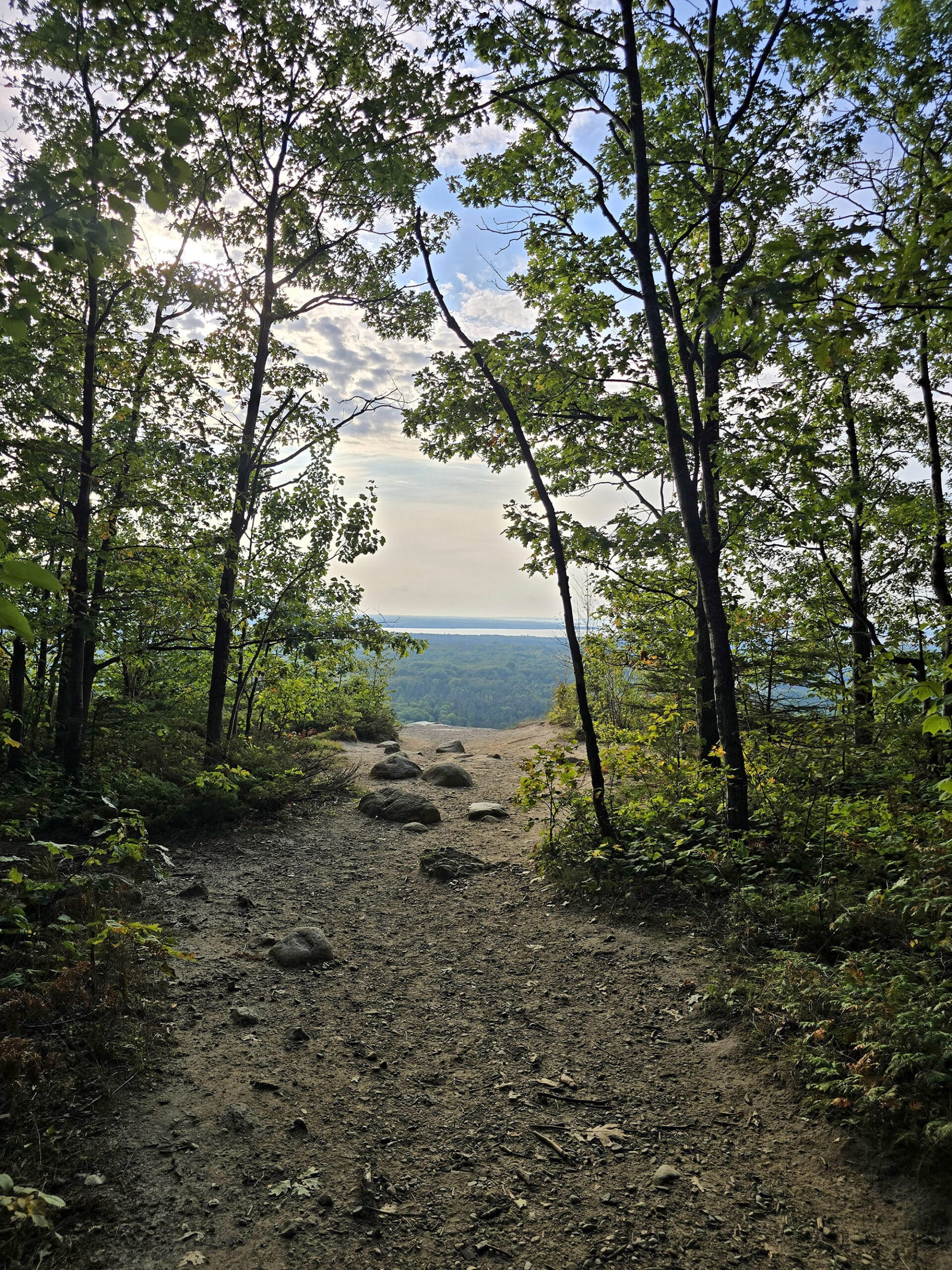
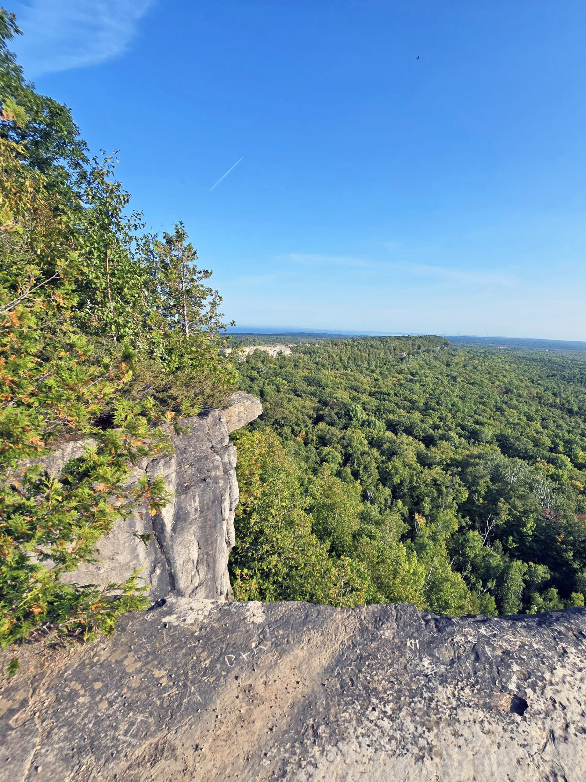
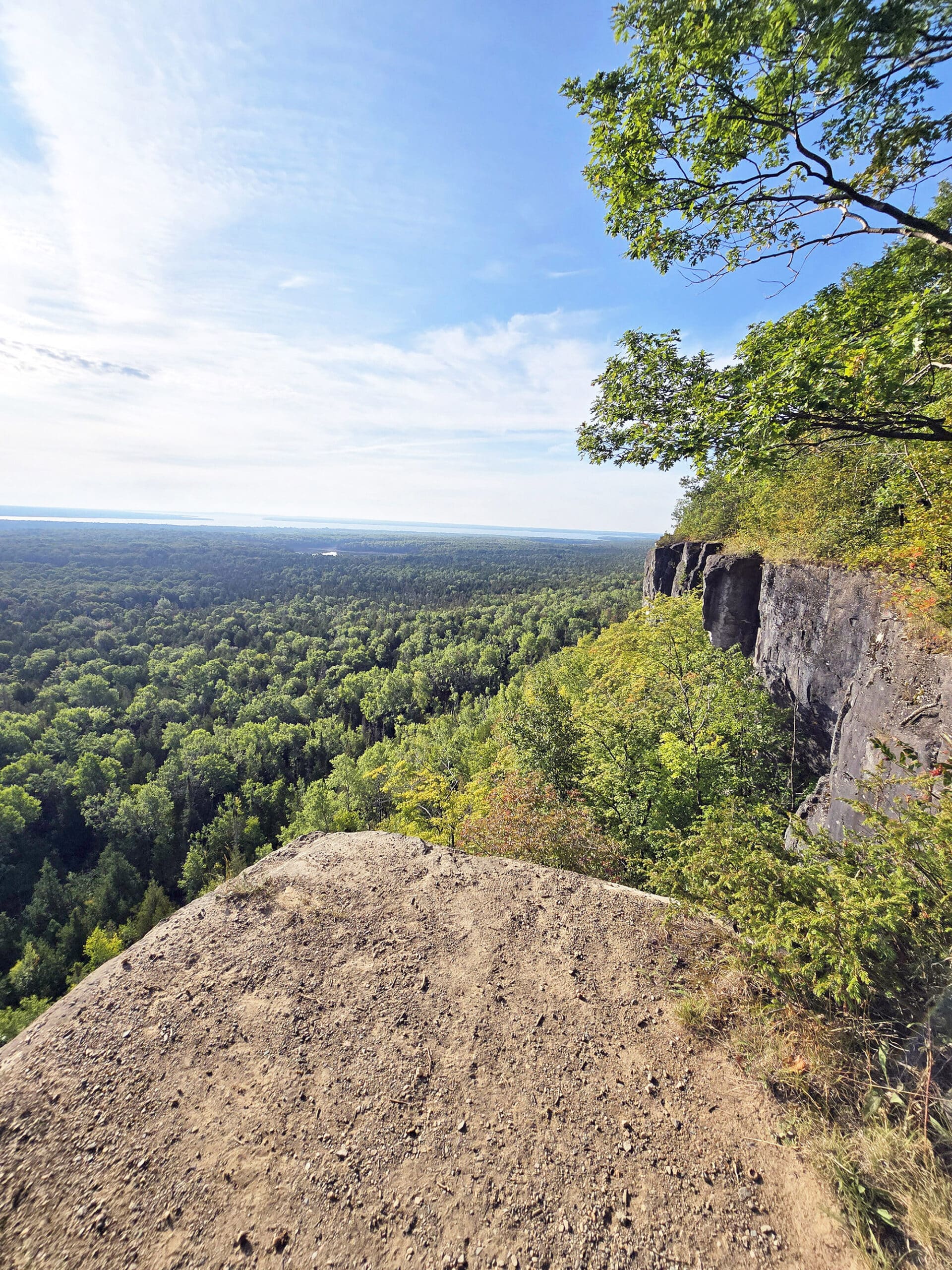
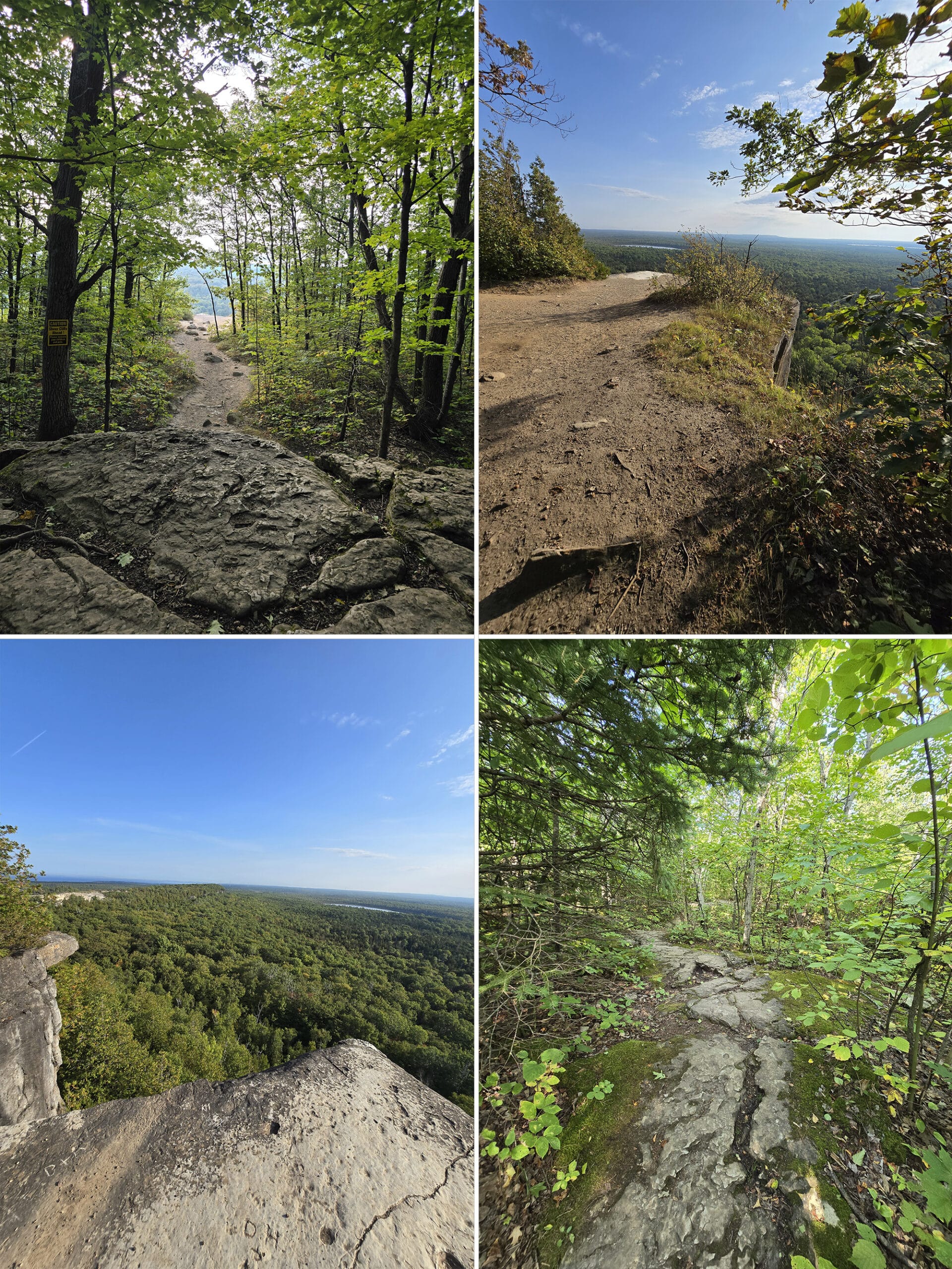
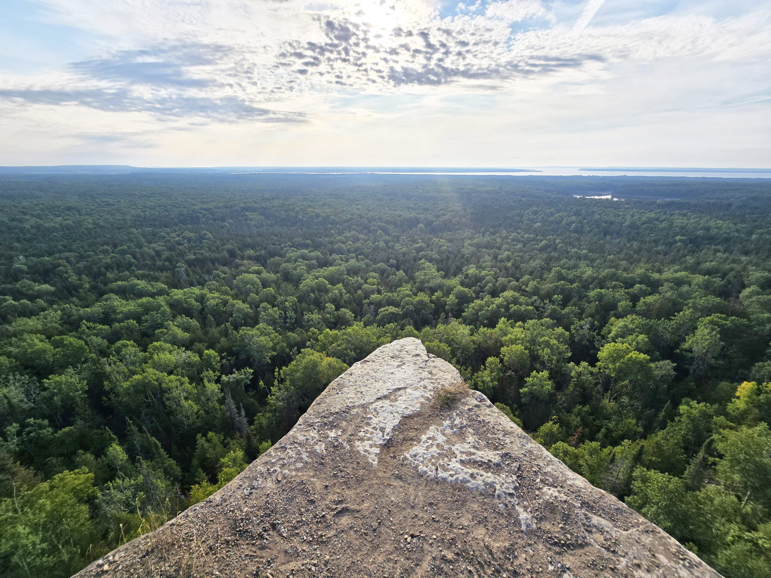
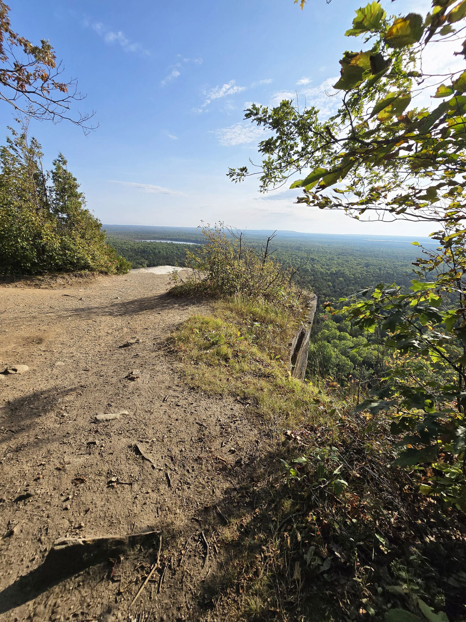
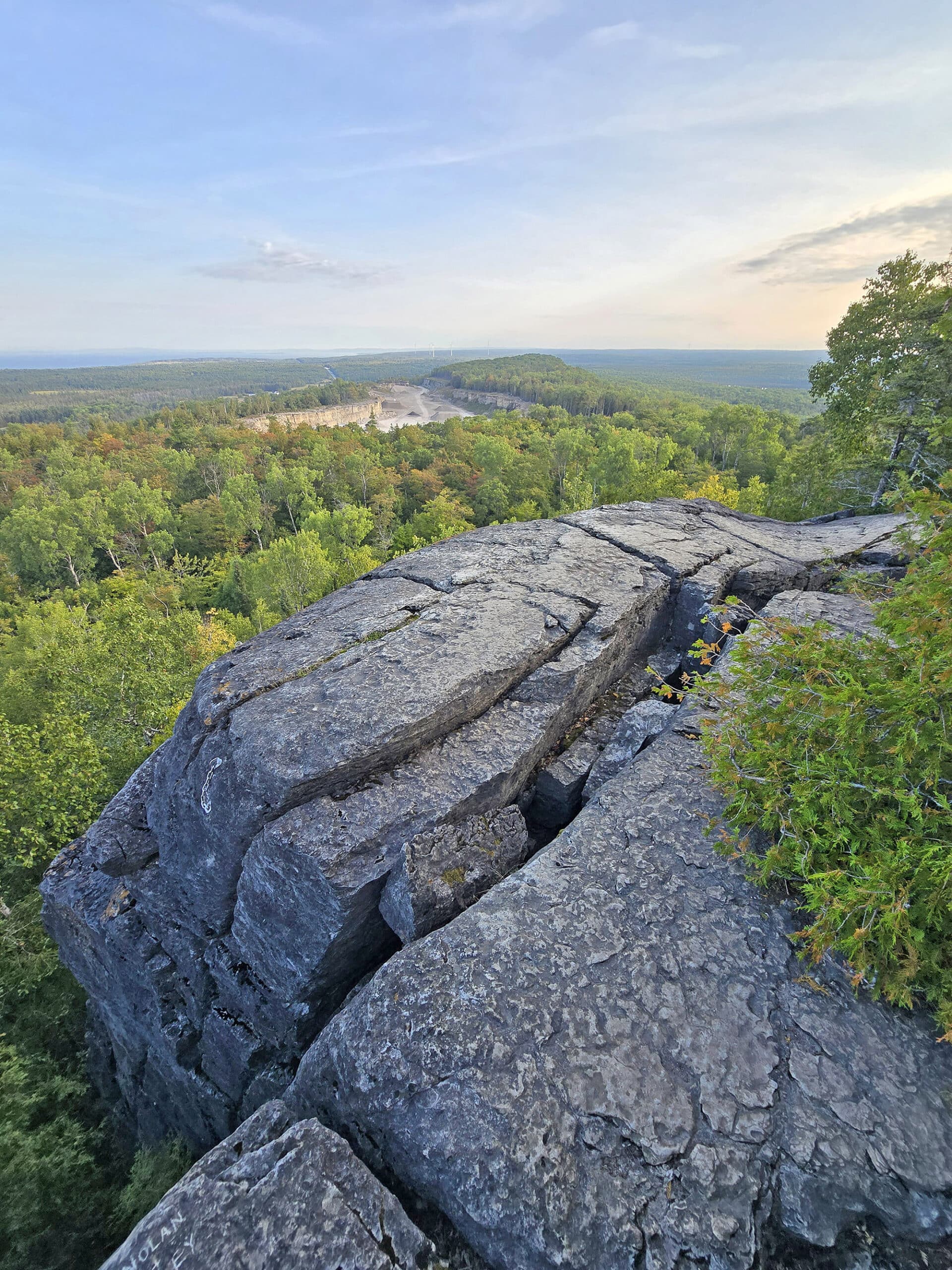
Anyway, the Cup and Saucer trail boasts 70 metre cliffs, and panoramic vistas seen from several lookout points along the top of the escarpment.
Entertainment and Activity
Hiking is - unsurprisingly - the main attraction at Cup and Saucer Nature Reserve, with a few different hiking trail options to choose from.
That said, there are a few ways you can enjoy the beauty of nature while visiting the park - here are some details.
Hiking
First of all - no matter which Cup and Saucer trail you’re doing, you’re going to want to wear sturdy footwear when visiting.
Beyond that, here is some information on the various trails available:
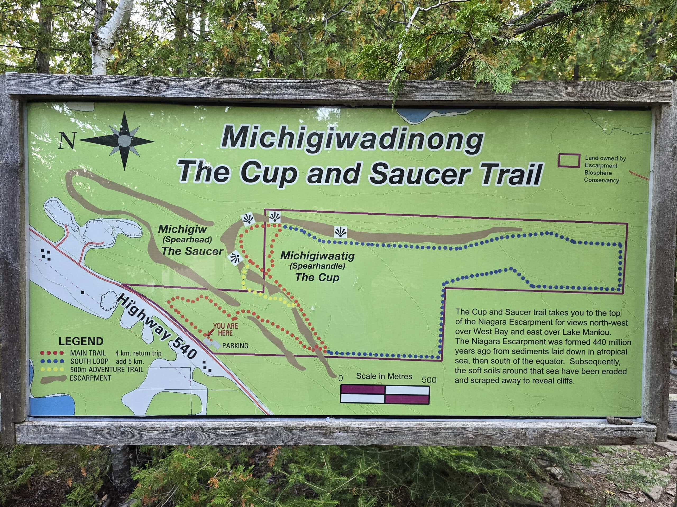
Red Trail, 5.7 km, Moderate
This is considered the main trail at Cup and Saucer Nature Preserve, and it’s the trail that the other trails branch off of. Here’s what Porter had to say about it:
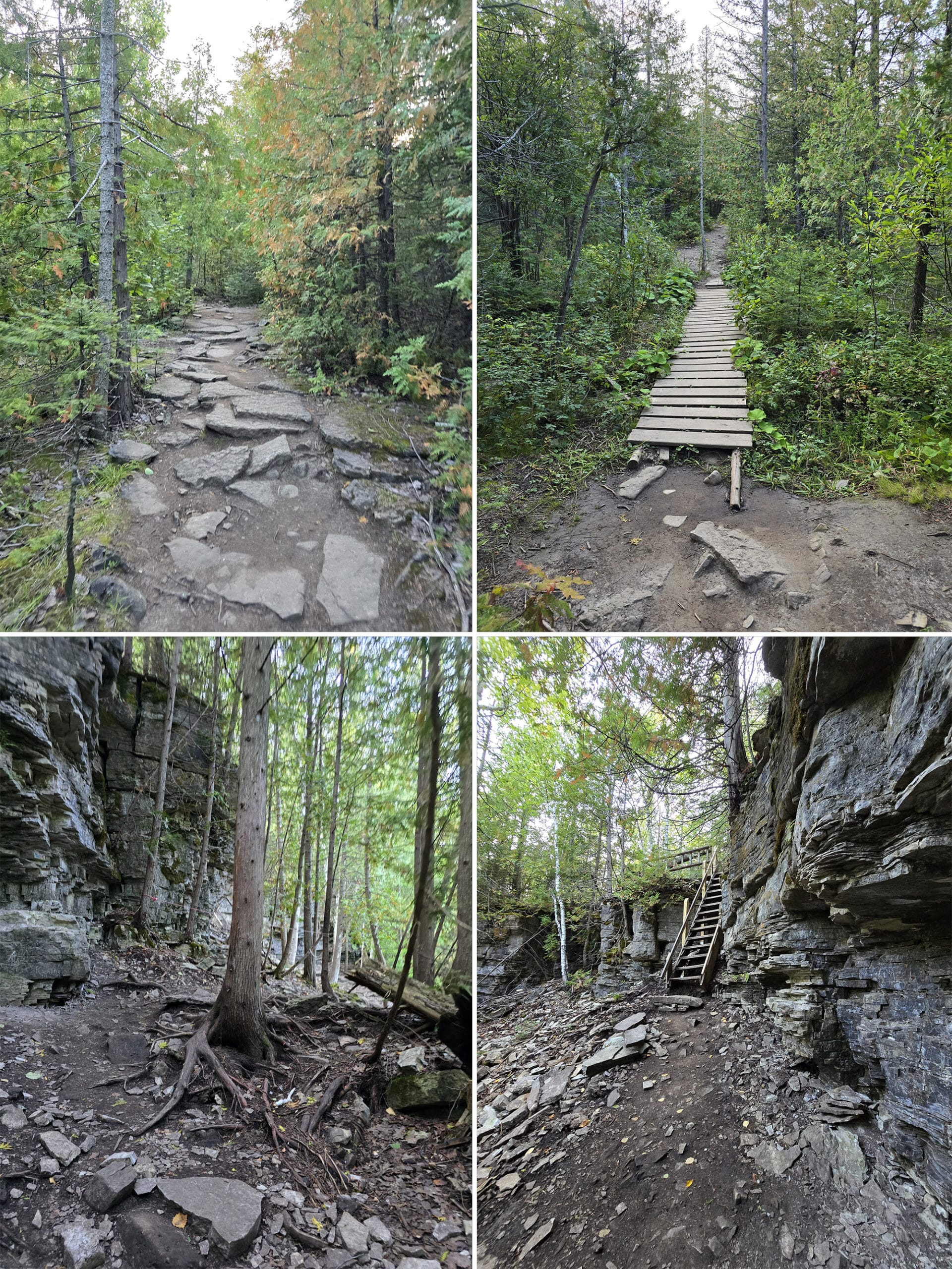
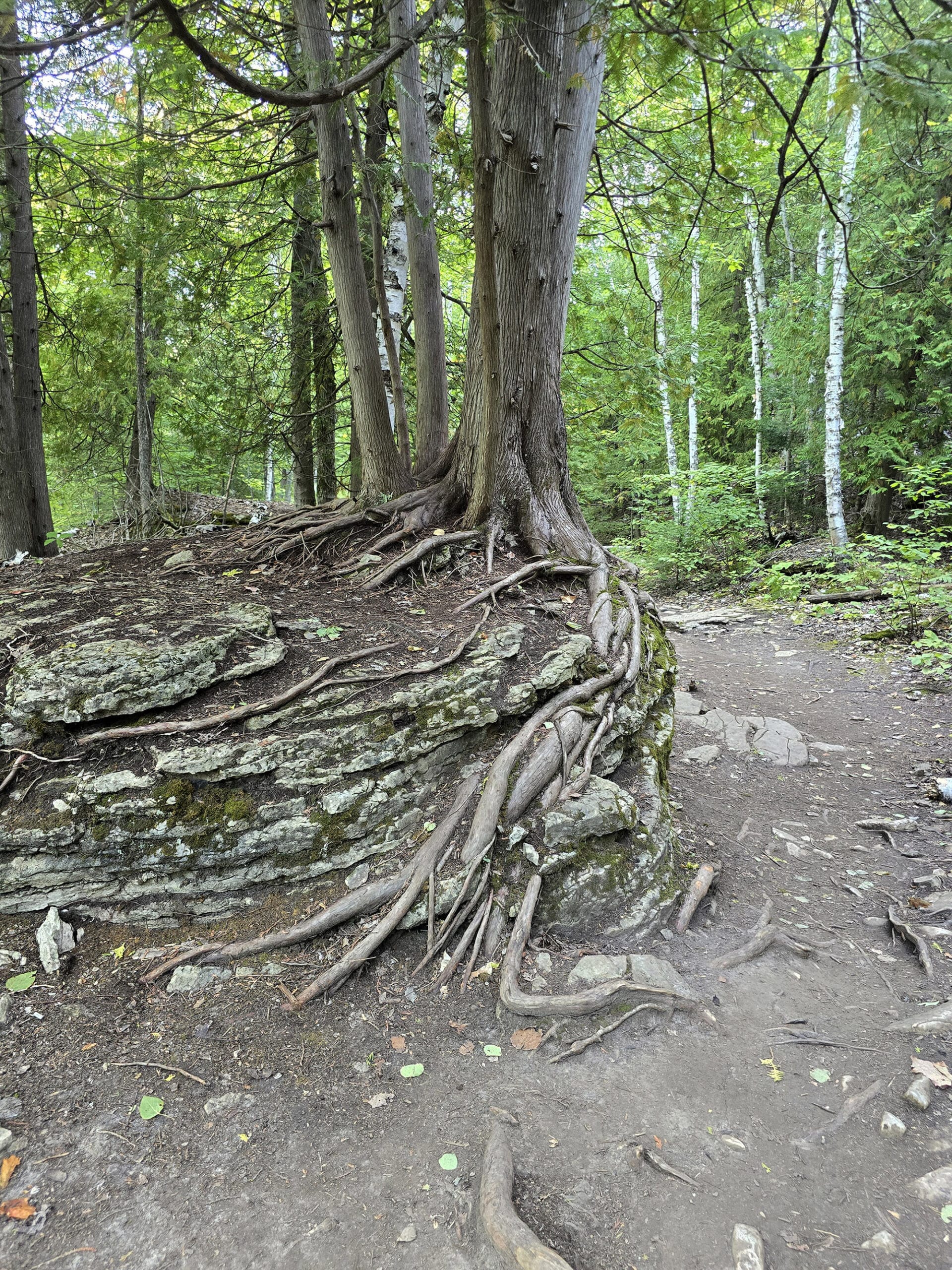
“This trail starts out as an easy trail, wide, flat, even, and well-packed.
As I kept going through the lush forests at the beginning, there were short parts of the trail that were more moderate. A bit of a steep hill, some boulders that you take a few steps up, things like that.
Further yet there are a couple of short areas that are more moderate-difficult, with a steep staircase and a bit of a wonky walk past a narrow gap in boulders. Overall I rate this as moderate because there are numerous short moderate sections.
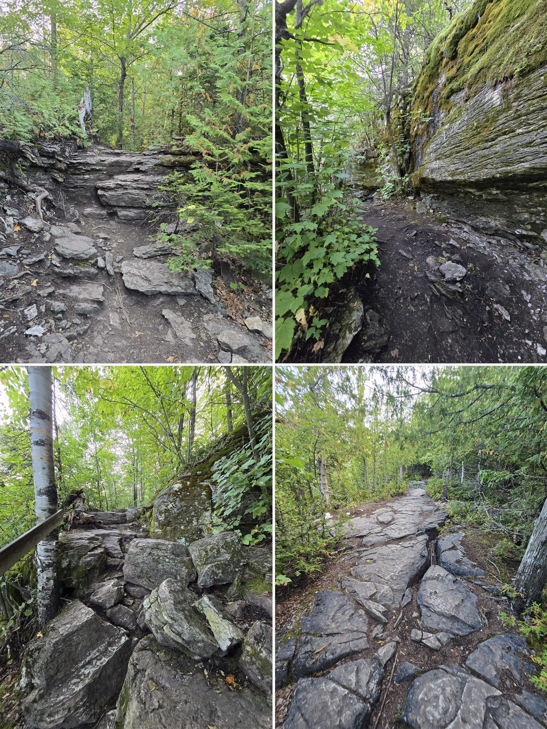
The rock formations. I don't even know how to describe them. I'm no geologist so I'll just say they rock!
Cool boulders that you walk on that have a rough surface to them, short mini cliffs of layered rock faces alongside the trail, to very large boulders that shape the landscape.
Look on the sides of the trail for different plants, the region grows some rare ones such as Ram's Head Orchids. Overall the trail slowly goes up and up, my MapMyRun software says I did 103 meters of elevation change.
Once you're at the top area, you'll see multiple outlooks.
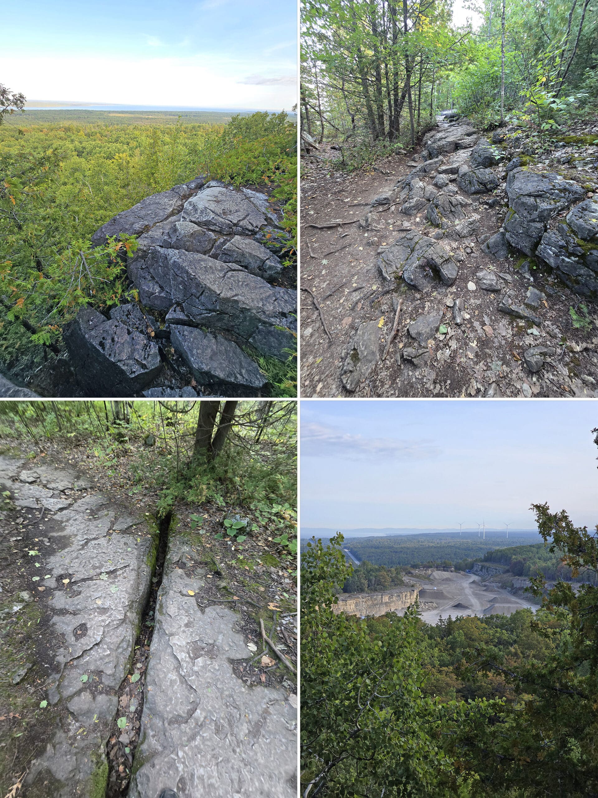
I recommend travelling the red trail clockwise on the loop portion, as this will make every lookout better than the last.
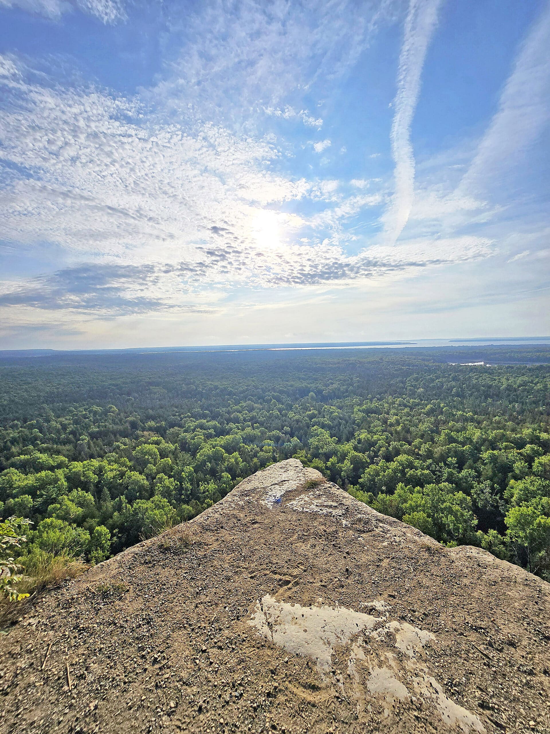
The views get stunning as you can approach the edge of the cliff for views that I cannot even describe.
I arrived a couple of hours after sunrise, and the sun was in a great spot for photos, at least in the middle of September when I did it.
Had I known, I would have done the hike at the first light that was safe to do so, putting the sun closer to the horizon. Doing it early not only will give you a great view, it will mean you can see this with fewer people around.
Overall the trail is amazing, and it just gets better and better the further in you go.
I'm definitely looking forward to doing the yellow trail that is more challenging, and the blue trail that travels further along the Niagara escarpment.”
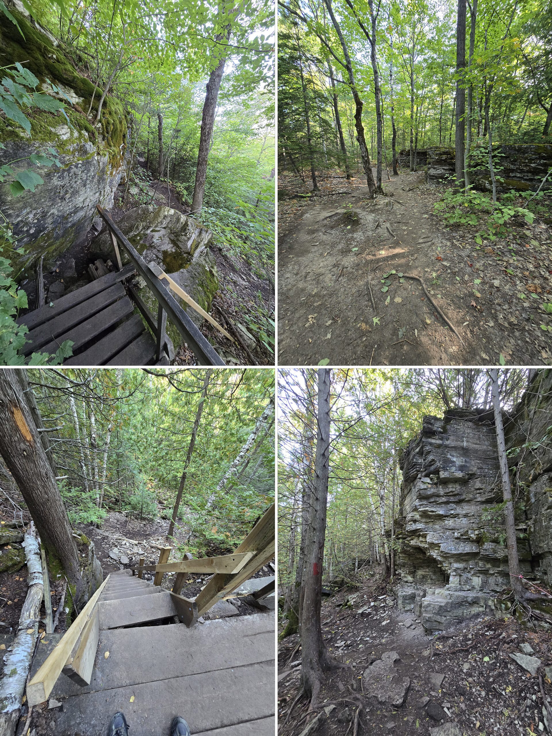
Yellow Trail / Adventure Trail, 0.5 km, Difficult
This is a short trail that loops off the Red Trail.
I’ve seen references likening the skill level of this section of trail to hiking “The Crack” at Killarney. There are ladders and rock scrambles, steep stairs, etc.
Given that Porter was going to be out there alone - and I’d seen references to “hugging the cliff”, I really didn’t want him doing this trail.
As it turns out, by the time he got to that spot, he was running out of time - it was a drive day for us.
So, we’re going to work on my mobility, and hopefully sometime in the future I’ll be able to take on some of the trails with wild difficulty ratings!
Blue Trail, 5 km, Moderate
This 5km long trail is a half loop extension off the Red Trail. The way it’s laid out, you can basically skip a section of the red trail and extend your overall walk to an 8 km loop.
Porter didn’t have time to do this larger loop trail, which is apparently relatively easy - with some steep sections - and gives you a nice view over Lake Manitou.
We’ll update this when we have a chance to do this trail!
Birding, Wildlife, and Nature
In terms of wildlife, Porter heard and/or saw:
American Crow, Black-and-White Warbler, Blackpoll Warbler, Blue Jay, European Starling, Hermit Thrush, Mallard, Peregrine Falcon, Pileated Woodpecker, Red-Breasted Nuthatch... along with some Chipmunks.
Niantic Games
There are a few Ingress Portals / Pokestops / Pokegyms / etc along the Cup and Saucer Trail.
There’s a cluster of them in the parking lot area, then other game stops at the wooden staircase and the Adventure Trail.
Final Thoughts
Says Porter:
“This was a BIG hit for me, I had a GREAT time hiking the Cup and Saucer Trail!
The Cup and Saucer Nature Reserve is a gorgeous area! There was beautiful scenery the whole way along the trail and you really can’t beat the spectacular view!
Amazing. I can see why this trail is so popular - it’s definitely among my favourite hiking trails ever, after just one visit!
The fact that it’s such a short drive from where we were staying was a great bonus.
I’ll definitely be doing it again the next time we’re on Manitoulin Island (and we’ll definitely be back!), and I’m hoping you’ll be able to do it next time as well. Maybe we could time it to coincide with orchid season, and see the rare orchids that the signage mentioned!
Anyway, definitely loved it. 9/10, fantastic hike!!”
More Near-North Ontario Provincial Parks & Places to See
Want to read some more about the parks we've camped and at places we've seen in Near-Northern Ontario? Here are some more posts!
Near-Northern Ontario Campground Reviews:
Arrowhead Provincial Park
Chutes Provincial Park
Driftwood Provincial Park
Fairbank Provincial Park
Finlayson Point Provincial Park
Grundy Lake Provincial Park
Kap-Kig-Iwan Provincial Park
Marten River Provincial Park
Mikisew Provincial Park
Killbear Provincial Park
Oastler Lake Provincial Park
Six Mile Lake Provincial Park
Sturgeon Bay Provincial Park
Near-Northern Ontario Places to See:
Big Chute Marine Railway
Fielding Bird Sanctuary
French River Provincial Park
Hardy Lake Provincial Park
Onaping Falls
Oxtongue River-Ragged Falls Provincial Park
Screaming Heads
Want to explore beyond Near-Northern Ontario? Check out our full list of Campground Reviews, Ontario Waterfalls, and other Places to See.
We also have a ton of Camping Recipes to cook up, while on your adventures!
Thanks for Reading!If you loved this post - or have any questions about it - please leave a comment below! We'd also love it if you would consider sharing the link on social media! |
Leave a Reply