
Eugenia Falls is a popular waterfall on the Bruce trail, and is the tallest waterfall in the area. Here's what you need to know to visit!

We made plans to stop back later (sans RV!) To check it out.
... then - what seemed to be only minutes later, in the town of Eugenia - we passed a sign for Eugenia Falls Conservation Area, a location NOT on that map.
A quick Googling told us that it was home to the “most impressive waterfalls” in the area, so we made a note to visit it, on our trip to Hogg’s Falls.
We’re all about checking out as many beautiful places as we can, after all!
Let us tell you all about it...
The Basics:
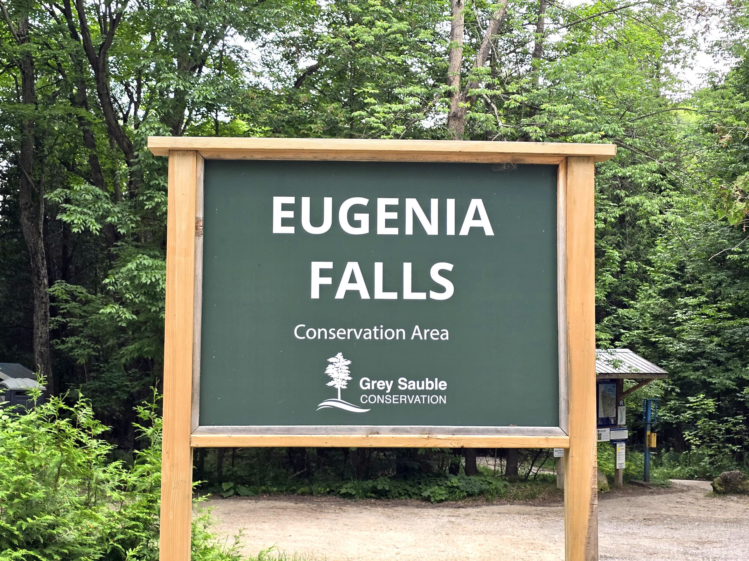
Location Name: Eugenia Falls Conservation Area
Address: Grey County Road 13, Eugenia, ON N0C 1E0
Website: Eugenia Falls Conservation Area
Price: Grey Sauble Conservation Area has a ticketing page for all applicable parks. See Parking at GSCA Properties for more details.
Reservations: Grey Sauble Parking
Logistics
A bit of key information you’ll need, if you’re planning to visit Eugenia Falls:
Registration and Check In
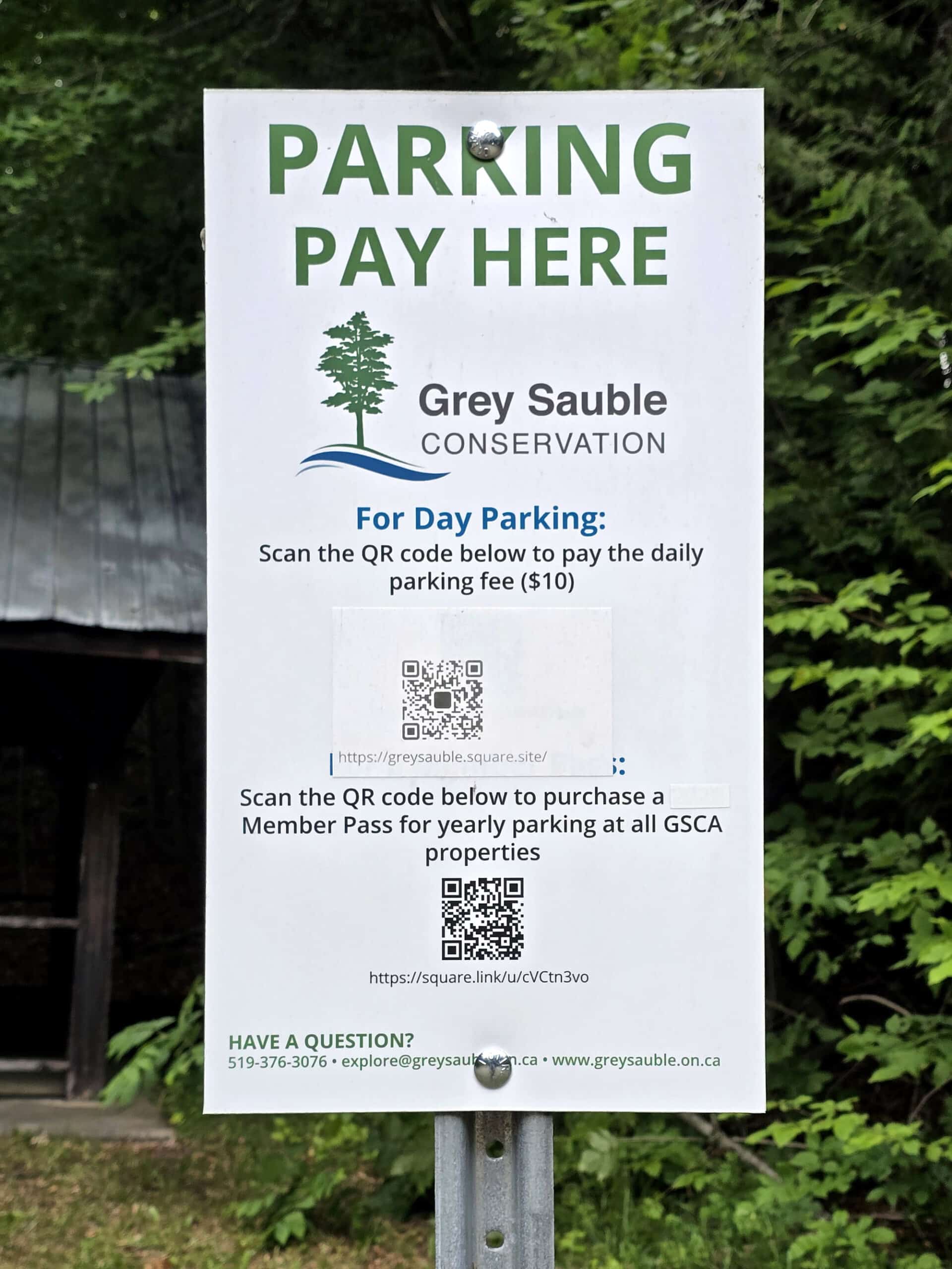
We had looked into visiting right before hitting the road, and saw that paying for parking on site was an option.
In an effort to get out of the door faster, we decided to pay on site.
At the time of our visit - A weekend afternoon in late June - the park was unstaffed at the gate.
There were a few signs around the parking lot - with a QR code to pay for parking - rather than any kind of parking meter. (Unless we missed it?).
Problem: Absolutely no cell phone coverage to speak of.
We decided to park anyway and hope for better reception near the falls, but at no point in the park were we able to fully load the payments page.
We paid after we left - thankfully not getting ticketed in the meantime - but I DEFINITELY recommend booking your parking ahead of time!
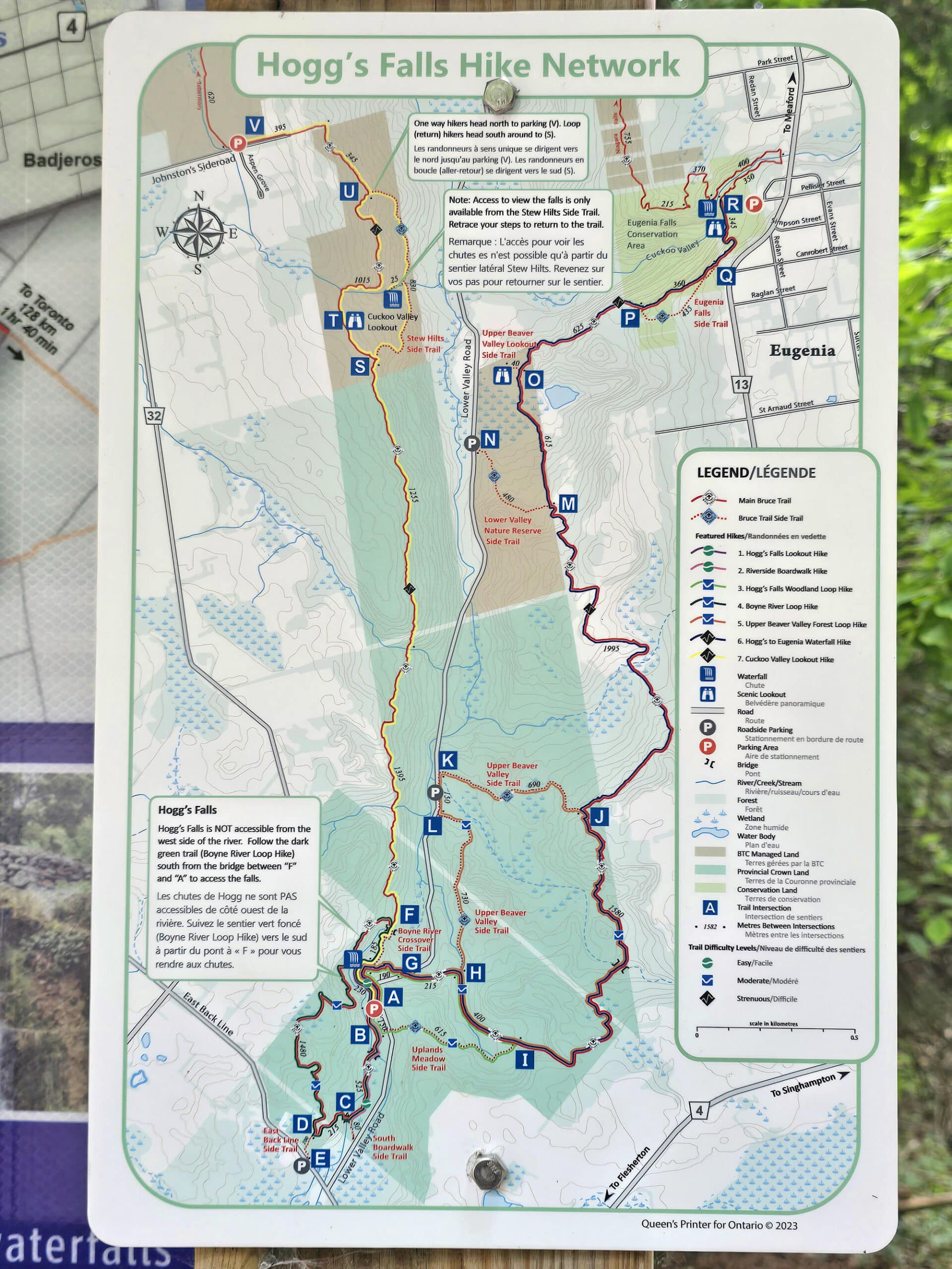
Maps and Signage
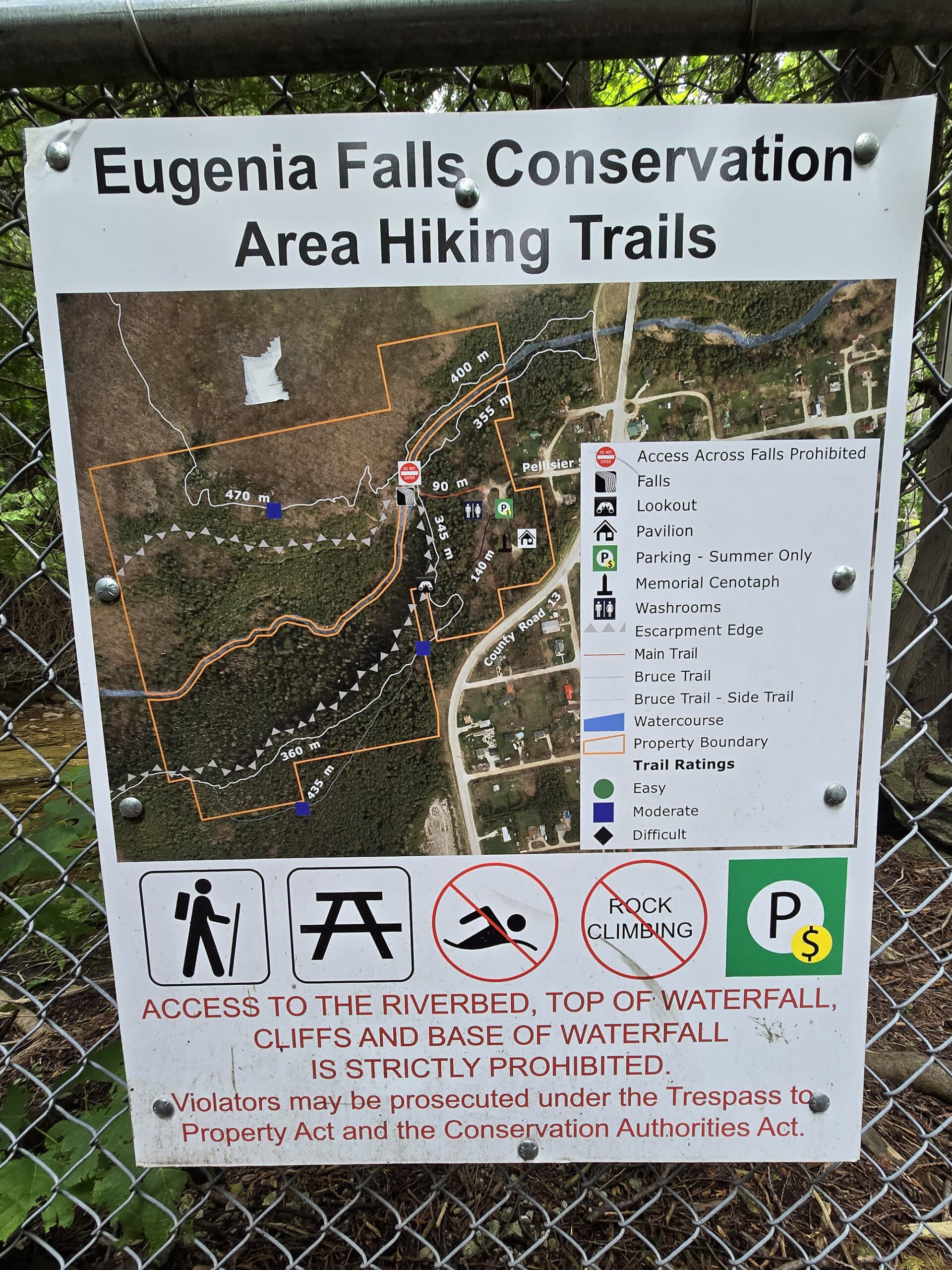
The maps and signage in Eugenia Falls Conservation Area are... not great.
There’s a large map sign in the parking area, which is definitely more of an overview of the entire Grey Bruce County area, than on Eugenia Falls itself.
Secondary to that, there was a relatively large map of the entire Hogg’s Falls trail network, and a small, fairly vague map focused on the actual Eugenia Falls area.
THAT map... wasn’t great. No distances marked, no trail shown from the parking lot to the falls, etc.
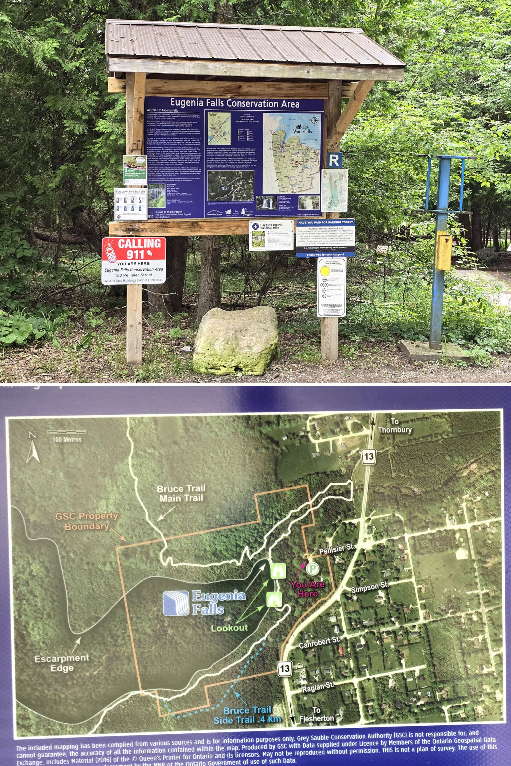
So, we picked the trail closest to the map, and that was the correct one.
Weirdly... once we got to the falls, we saw what looked to be another map sign in the distance - on a fence way off to the right of the falls.
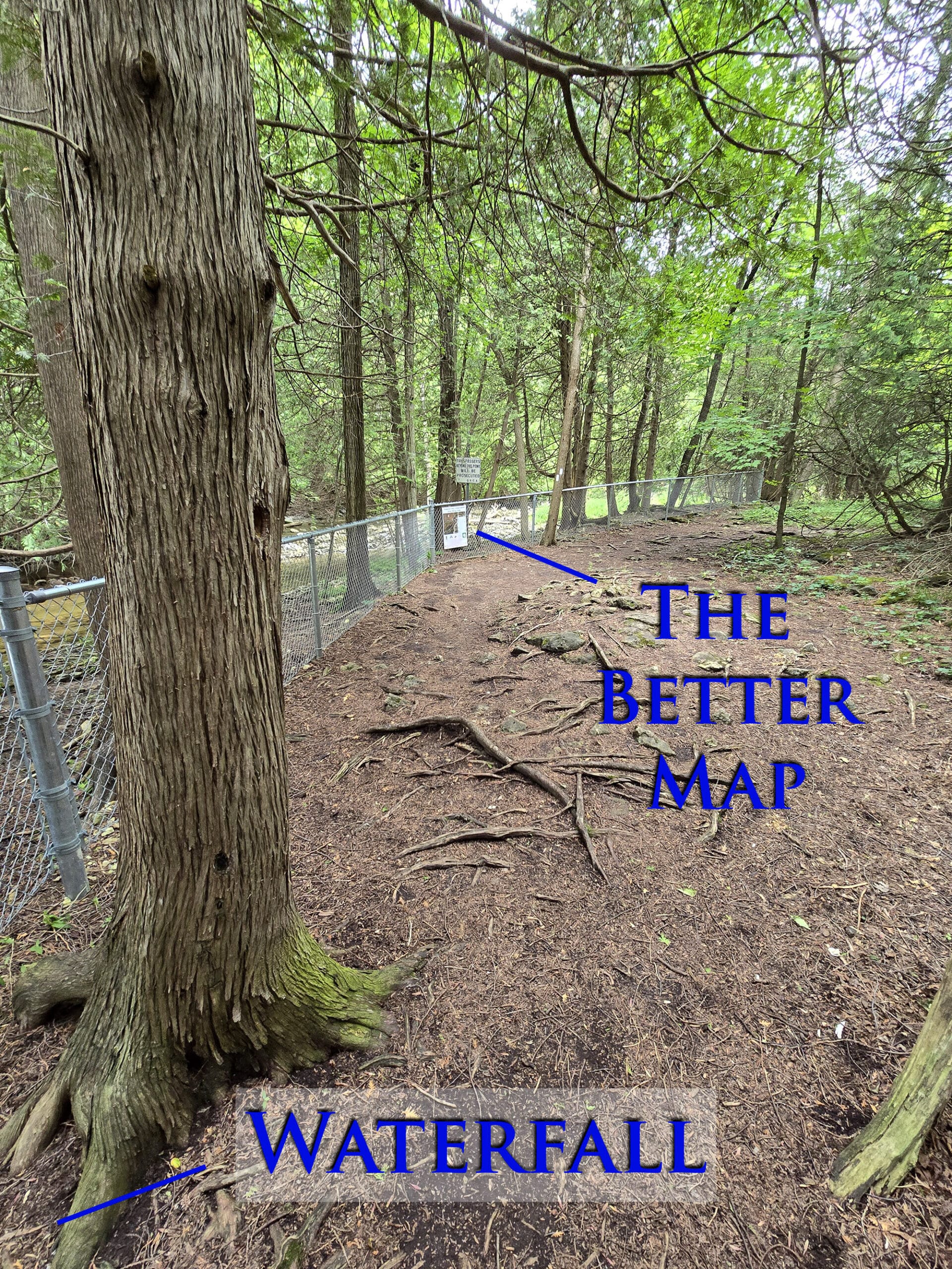
So weird.
Every time where I could have used it and seen a similar sign, though, has been somewhere without internet!
Connectivity
As previously mentioned, we had absolutely no cell reception anywhere on the trails, in the parking lot, etc.
For what it’s worth, we’re on Rogers - no idea if another carrier would have better coverage there.
Pets
Dogs are allowed on the trails, but must be kept leashed at all times.
Accessibility
So, the long and short of it - definitely not the most accessible attraction we’ve ever been to.
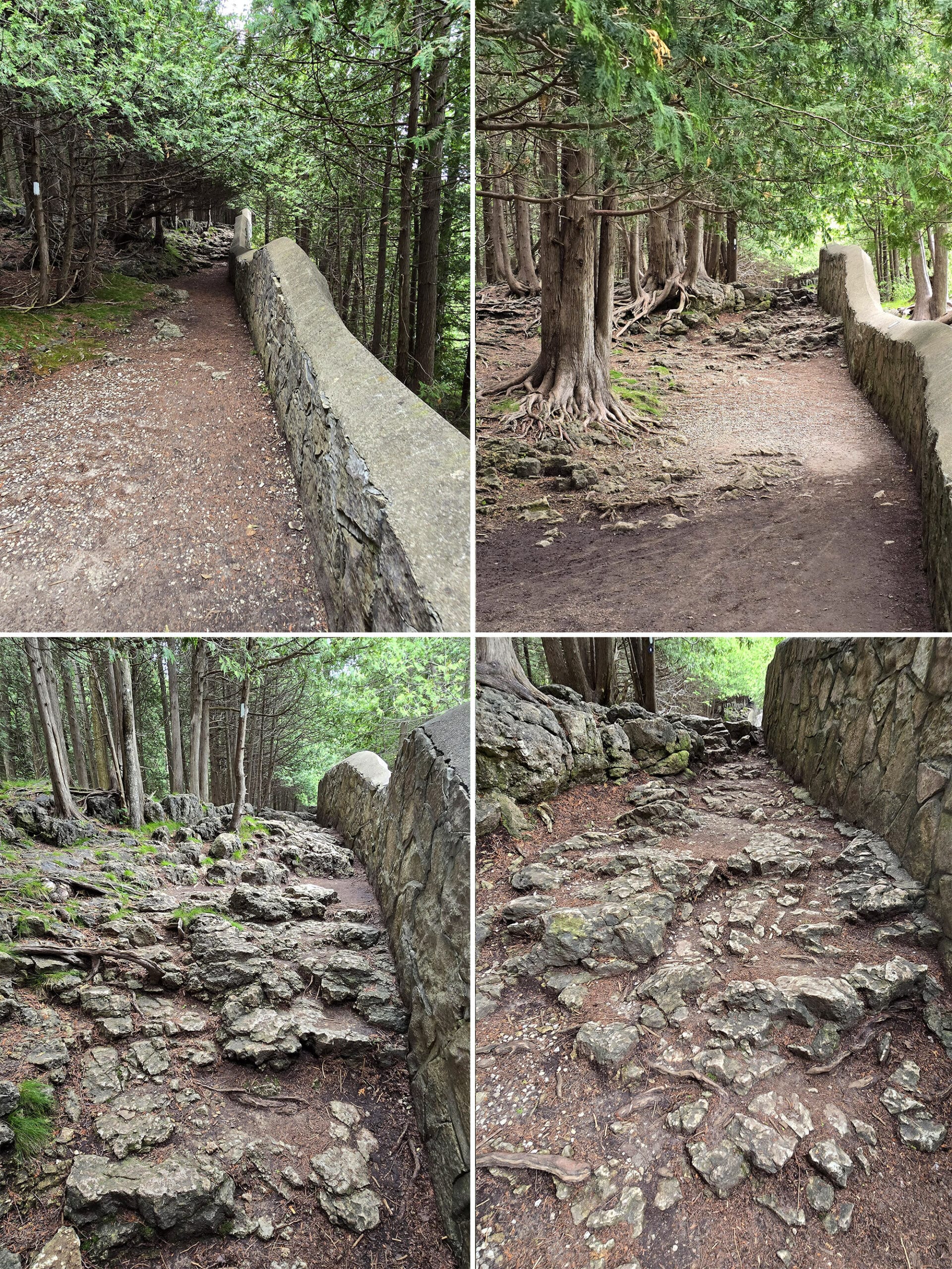
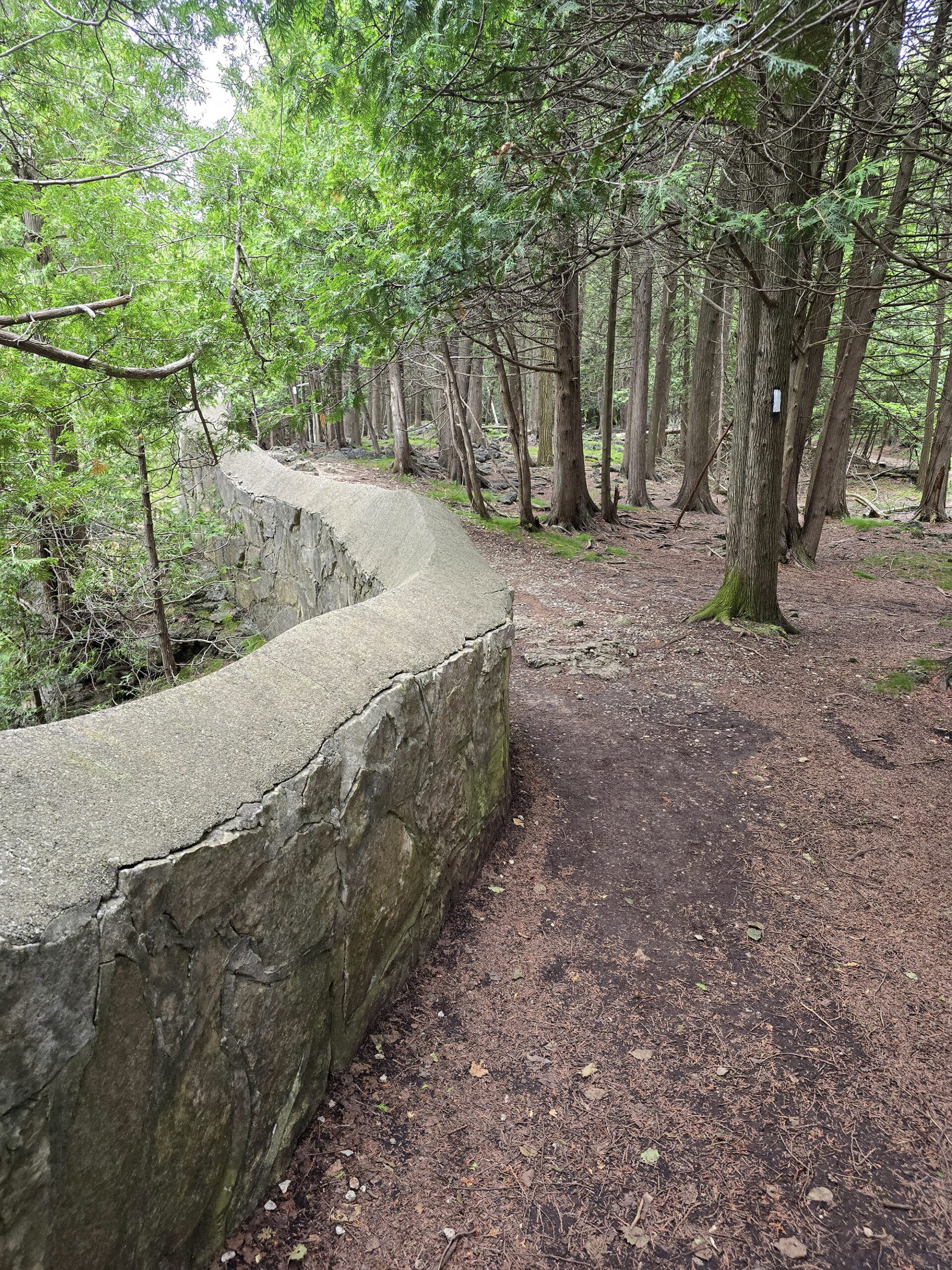
Basically, there are two main viewing areas. Both are a short distance from the parking lot, and connected by another trail - picture a triangle.
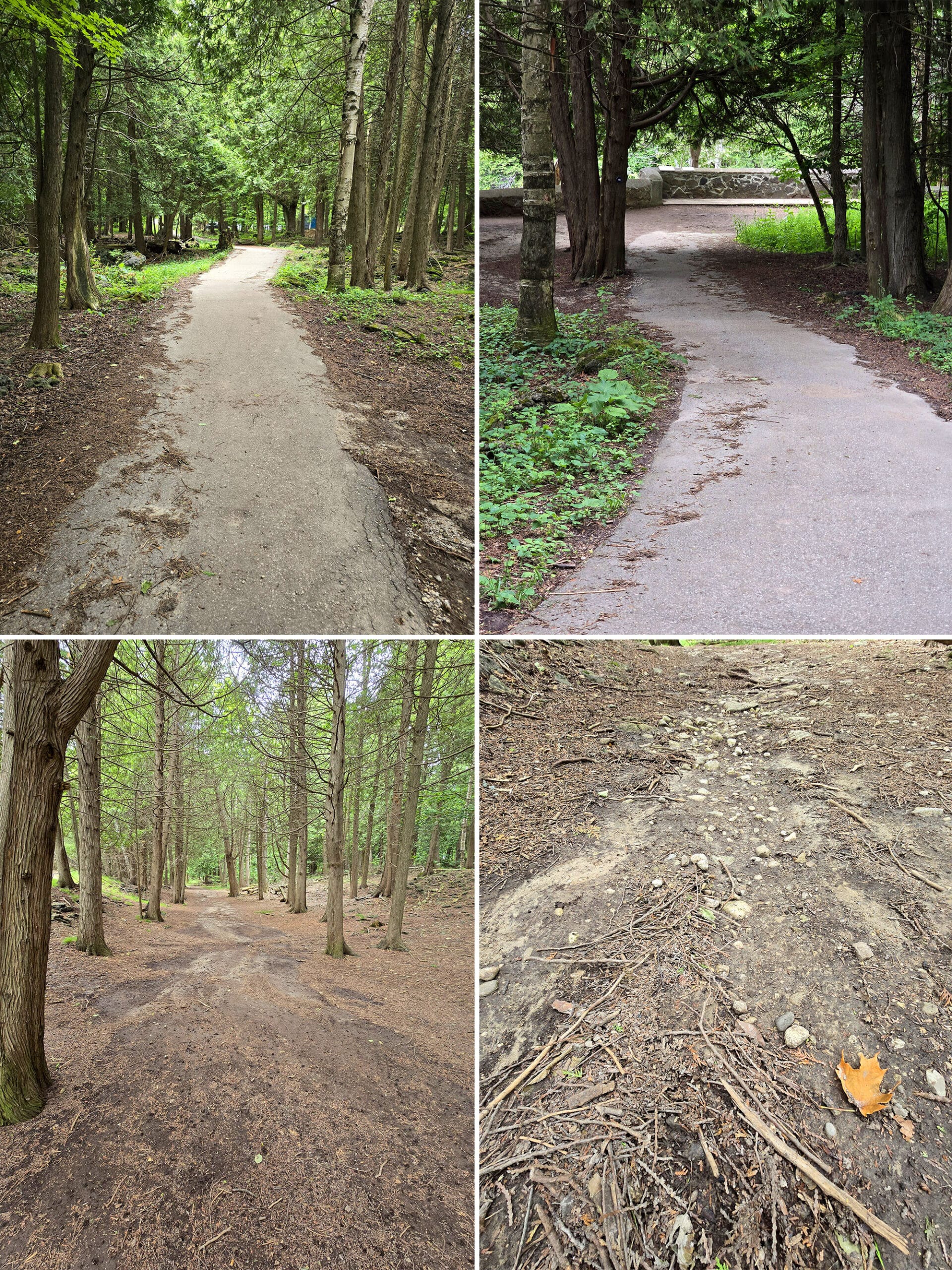
The trail from the parking area to the first viewing area - right at the top of the falls - is SOMEWHAT accessible.
It does go downhill, but is short, relatively smooth, paved until right at the end.
Bottom Row: The trail between the the parking lot and the second platform.
This is probably the better way to view the falls, anyway.
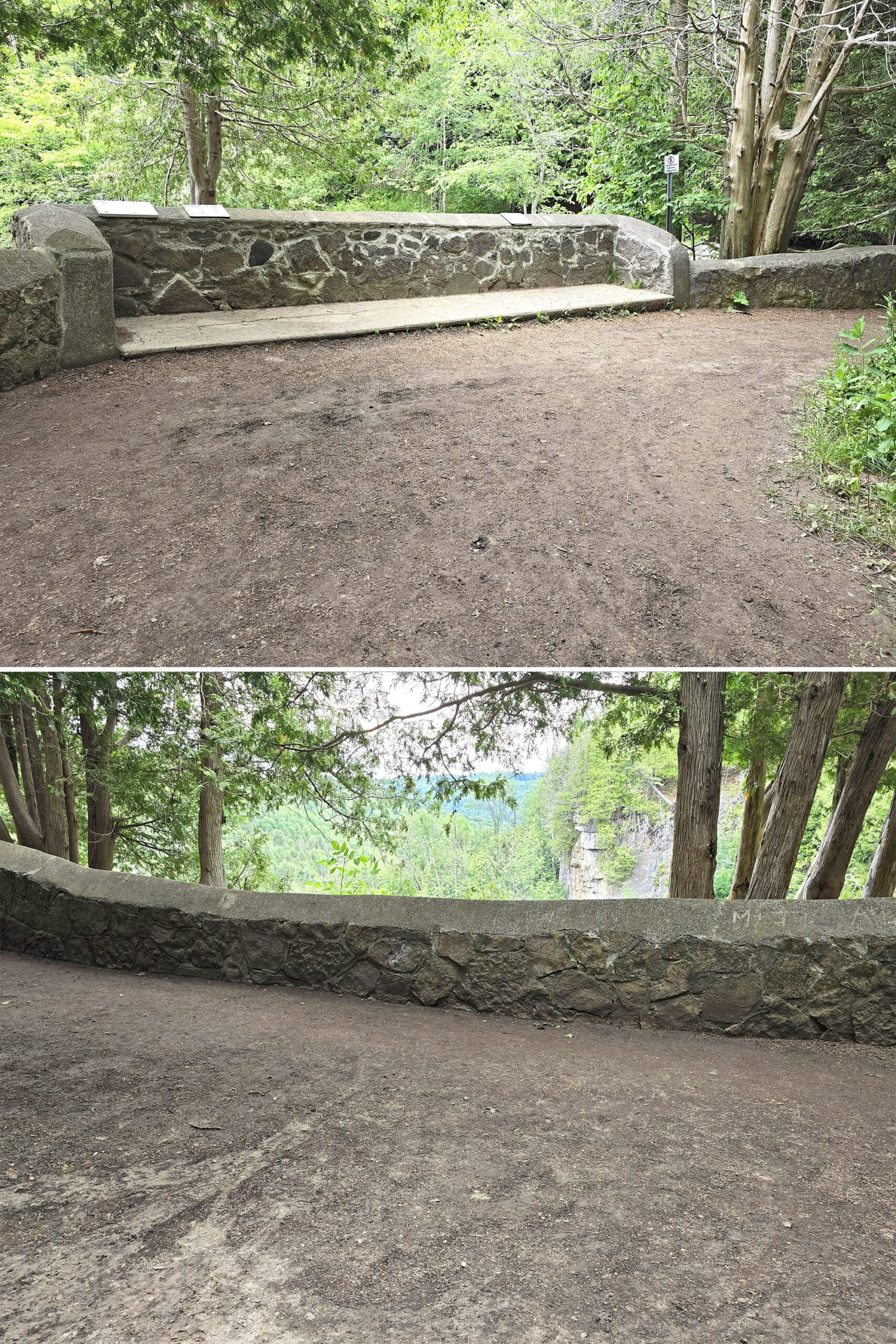
Bottom: The more accessible - and nicer - viewing area, to the left of the platform.
I MIGHT have been able to do it in a walking boot, but I do dumb things sometimes.
The trail between the second platform and the parking lot / near the beginning of the first trail is in no way wheelchair accessible, but would be more or less ok with a cane or boot.
Parking
The parking lot is small and unpaved - packed dirt / gravel.
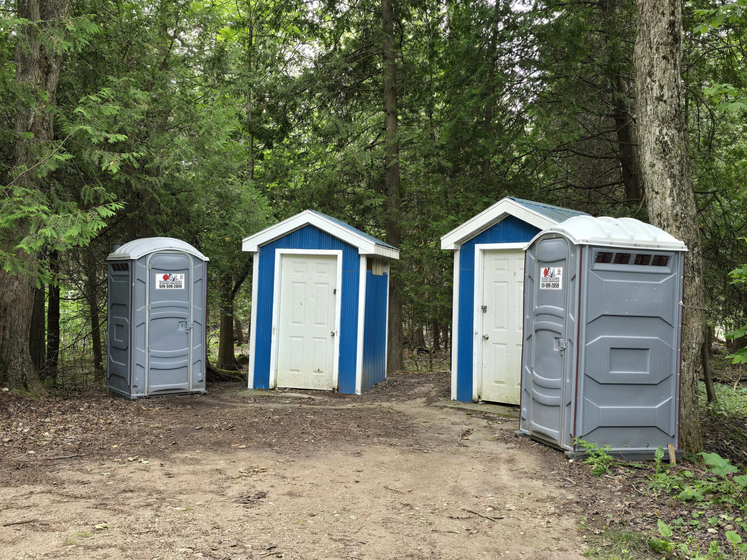
The Toilet Situation
There are a couple porta-potties right off the parking lot, along with 2 small, unlabelled buildings.
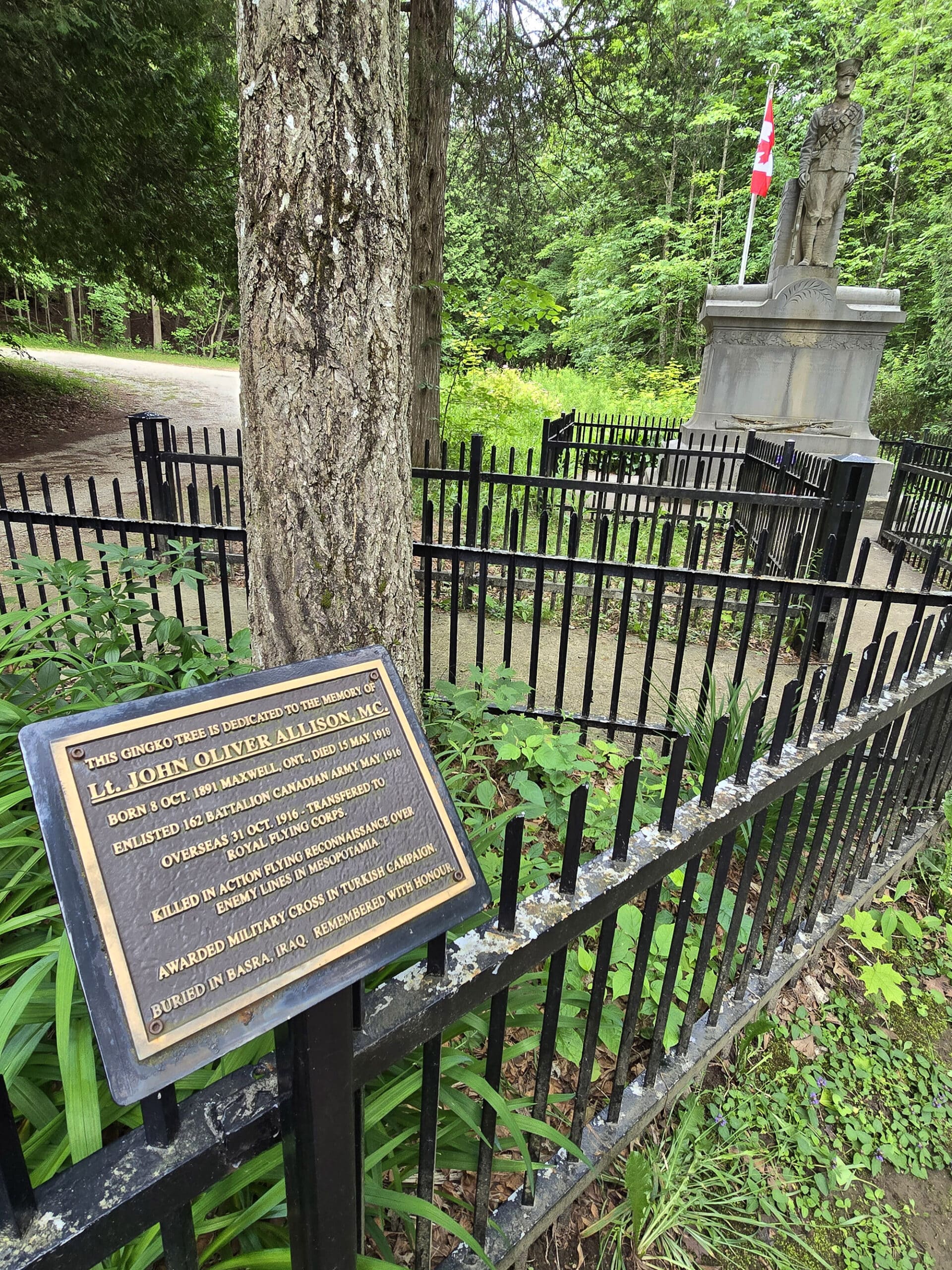
War Memorial
There is a small war memorial area, close to the parking lot.
This consists of a memorial Ginko tree - dedicated to Lt. John Oliver Allison, MC - and a cenotaph.
The cenotaph is inscribed with the names of 11 local soldiers who were casualties of WWI.
These are David Armstrong, Robert Bell, Fred Fisher, J. Howard, Robert Leppard, Earl Parliament, Stanley Parliament, Charles Roy, Emerson Smith, Fred Smith, and Wes Wilson.
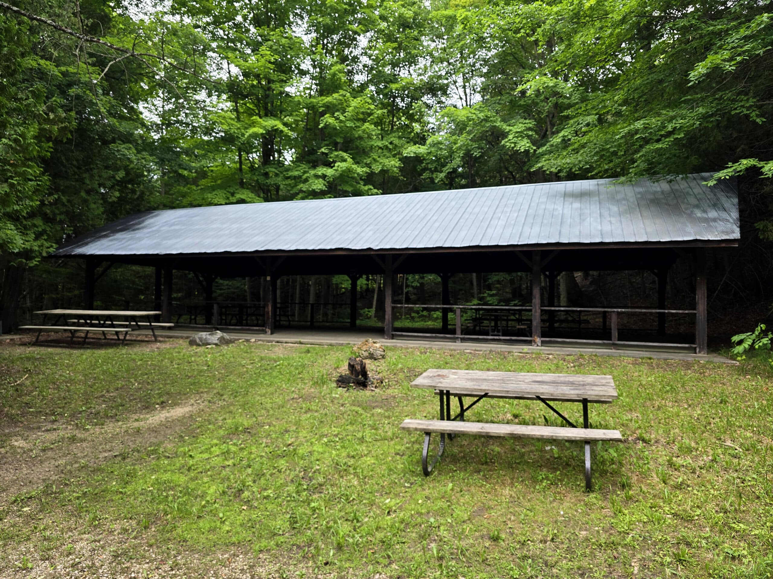
Picnic Shelter
There’s a small picnic shelter on the site, just beyond the war memorial.
It’s not in amazing condition, and didn’t seem to have been used in a while. That said, if you’re interested in booking it, see Grey Sauble Conservation Authority Pavilion Rental for more information.
History of Eugenia Falls
Originally referred to as Ke-waid-dun-dot - "Sparkling Waters" - by the Indigenous peoples of the area, colonizers renamed it after Princess Eugenie, wife of Napoleon III.
At the time, it was a much more voluminous waterfall, than what we see today. How it got that way is... a RIDE.
In 1853, there was a 3 week long mini gold rush, when Sandy Brownlee thought he discovered gold in the gorge below the falls. Hundreds of prospectors showed up... only to find it was Fool's Gold - Iron Pyrite.
Shortly afterwards, Robert Purdy started developing the area, with a home, a store, a post office, and - eventually - a sawmill and gristmill.
Several other industries soon popped up in the area, all harnessing the river for their production. This became the very tiny village of Eugenia.
Georgian Bay Power Company was formed a short while later, with the aim of damming the falls and diverting the river.
Just as all THAT work was nearing completion, the government gave control of the falls to the Hydro Electric Commission, out from under them.
Their work was blown up, with only one tunnel remaining today - we weren't able to figure out which direction that tunnel is, on the trail though.
Anyway, the Ontario hydro commission built a dam upstream, and reduced the water flow over the falls, as a result.
The Hydro Electric Power Company eventually sold Eugenia Falls to Grey Sauble Conservation Authority in the late 60s, and Eugenia Falls Conservation Area was born.
Eugenia Falls Info
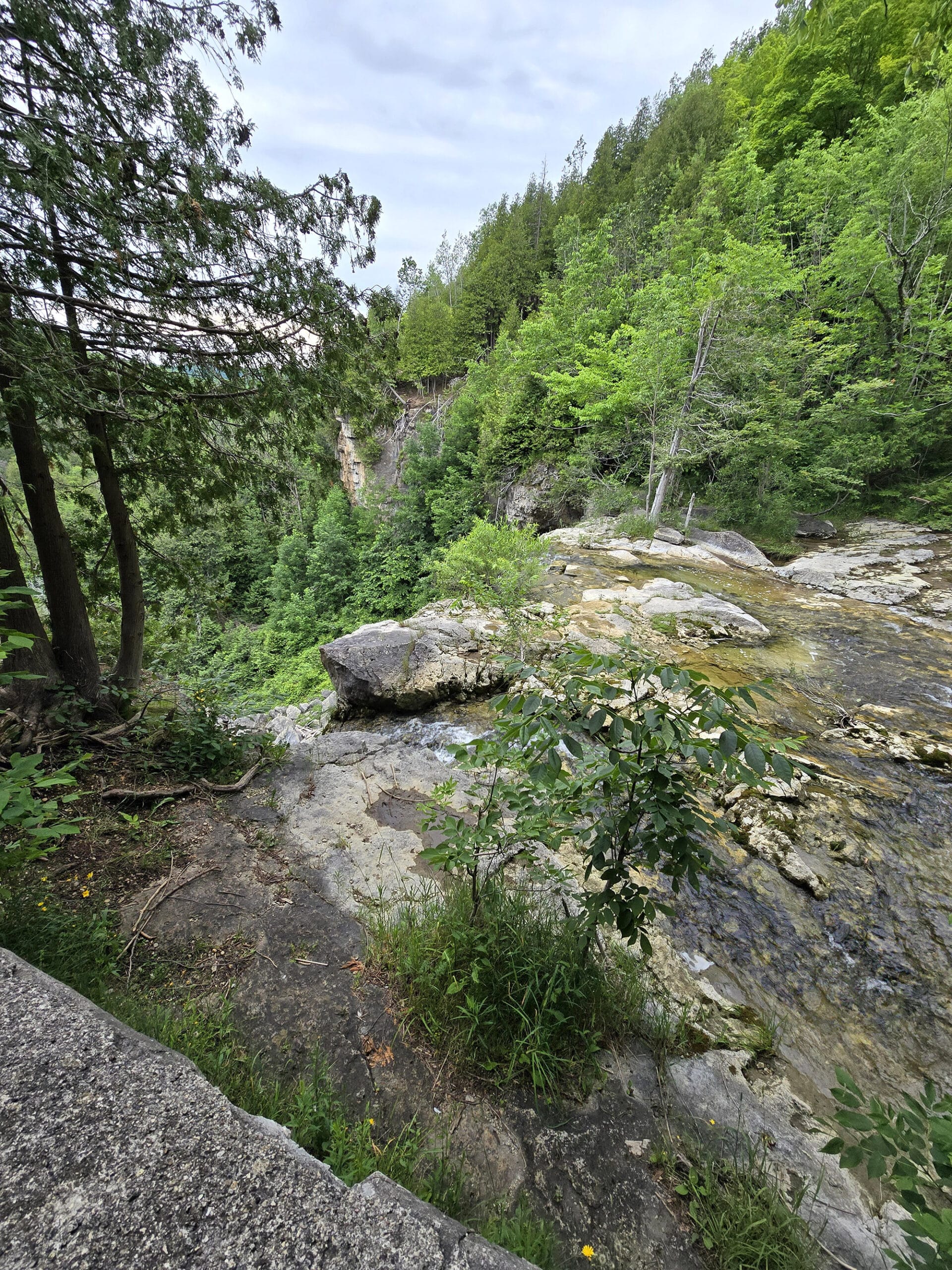
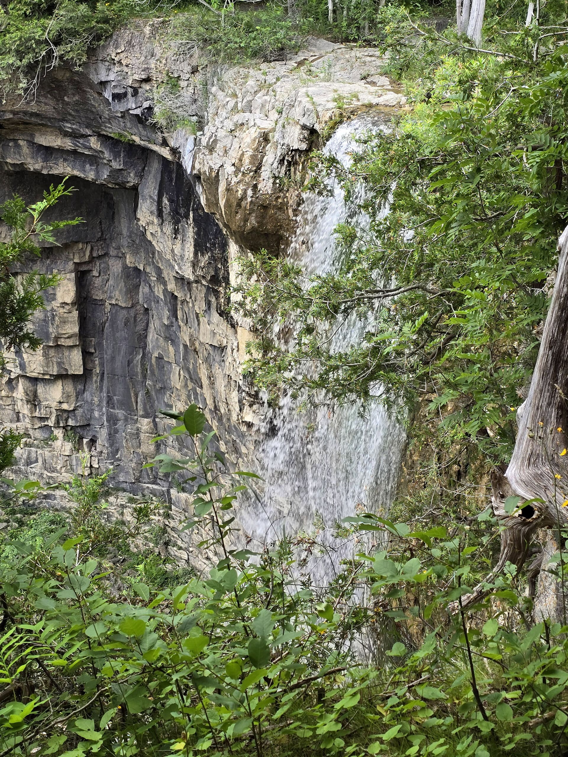
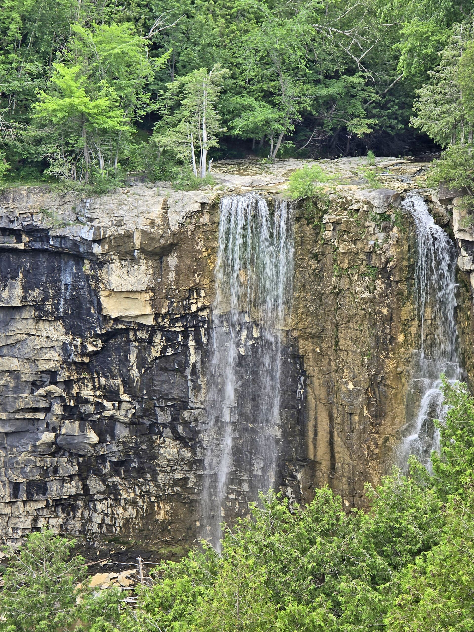
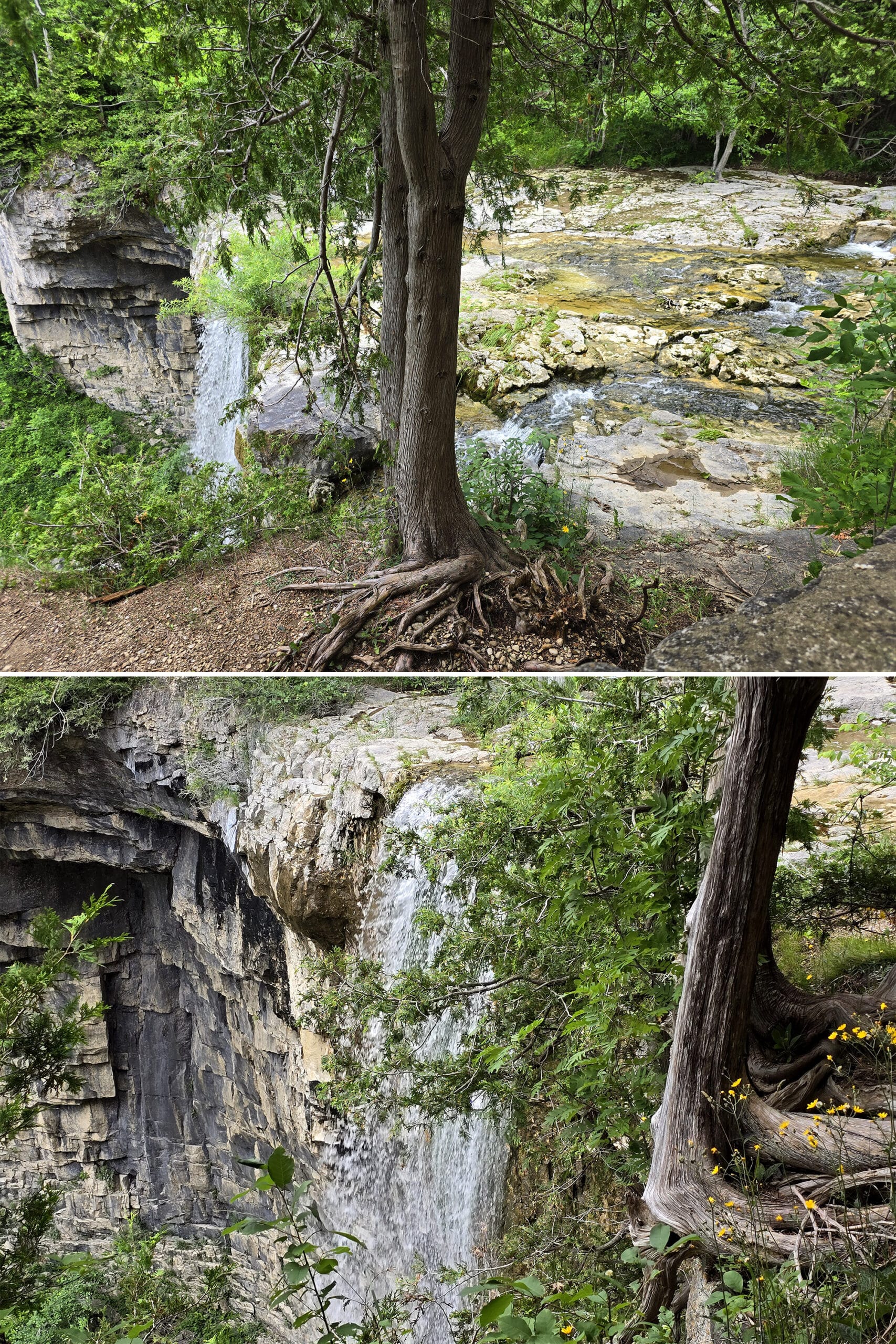
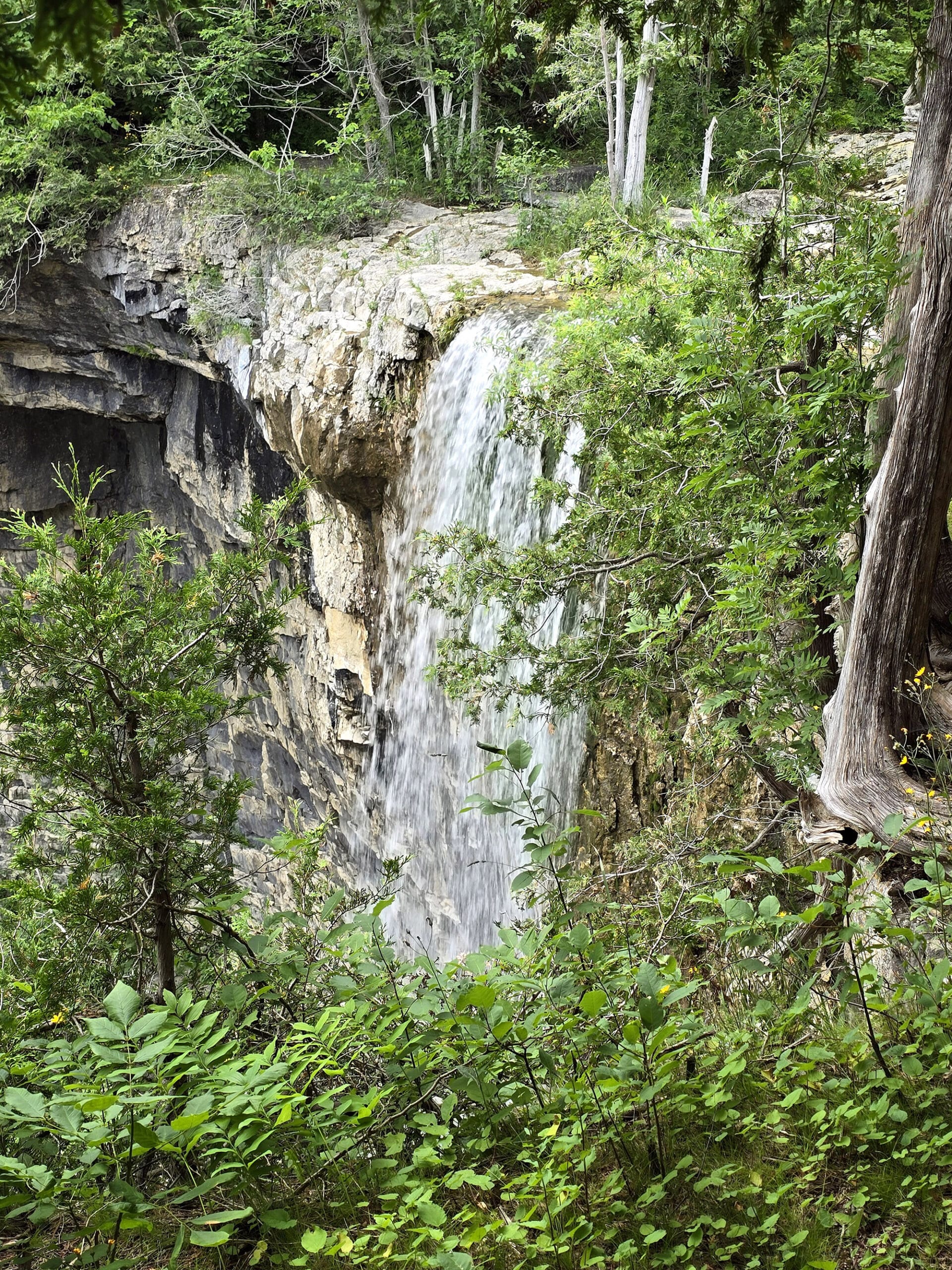
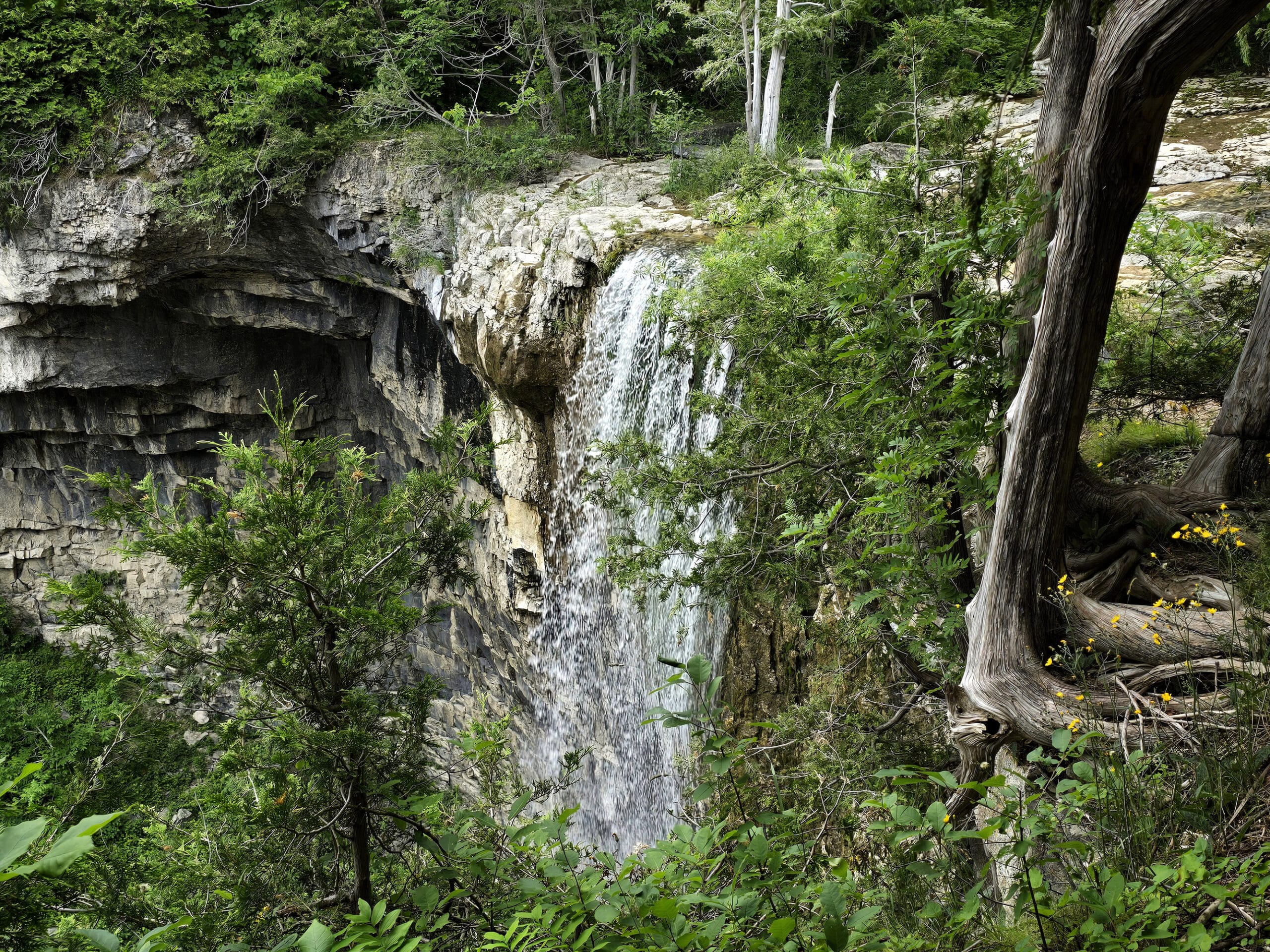
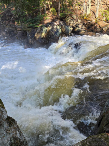
Eugenia Falls is the tallest waterfall in the area - a 30 meter high waterfall.
Located on Beaver River, it’s in the category of plunge waterfalls - a waterfall with a vertical drop that makes little to no contact with the cliff behind it.
The falls weren’t super impressive when we visited, and we learned - afterward - that the water levels can vary significantly through the year.
Apparently they’re at their lowest in the summer and fall. - I’d assume spring would be the best time to visit, as the snow thaws.
As a heads up, there’s no access to the base of the falls - or the falls in general. Visitors are required to stay behind the fence at all times.
If you’re looking for a more ...interactive... waterfall experience, Hogg's Falls is nearby!
Share the Love!If you’ve made one of our recipes, be sure to take some pics of your handiwork! If you post it to Bluesky, be sure to tag us - @2NerdsInATruck, or you can tag us on TikTok, if you’re posting video. We're also on Pinterest, so you can save all your favourite recipes and park reviews to your own boards! Also, be sure to subscribe to our free email newsletter, so you never miss out on any of our nonsense. Well, the published nonsense, anyway! |
Entertainment and Activity
Hiking
So, there are two aspects of hiking at Eugenia Falls- the walks involved to see the falls themselves, and then the numerous official GSCA trails that stretch out around the Beaver River valley - and beyond.
Eugenia Falls Hiking
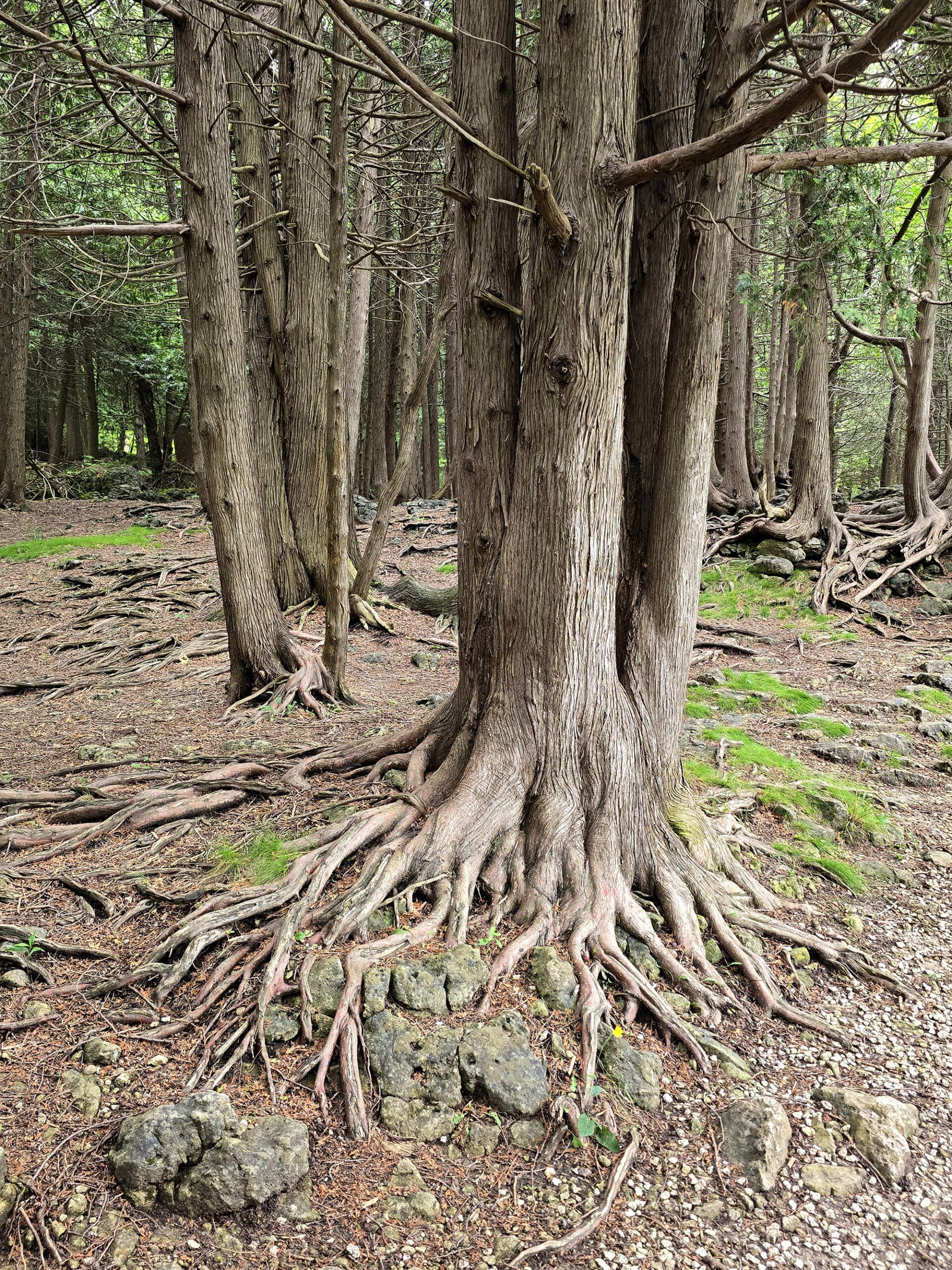
Eugenia Falls Conservation Area covers hectares of Niagara Escarpment, which includes the falls, some upland forests, and river valley.
Going by the distances on the good map - which I shared earlier on - there are just over 2 km of trails within the park itself, most of which are the Bruce Trail, or a Bruce side trail.
The main trail - Bruce Trail proper - goes from the southwest corner of the park, up to and past the falls, then over them and back to the west, exiting the park near the north west corner.
Access to the Bruce Trail - and the side trail off it - is via a short walk from the parking lot - a 90 m long paved trail.
There are interpretive plaques along the way, talking of the historical importance of the Beaver River and history of the area.
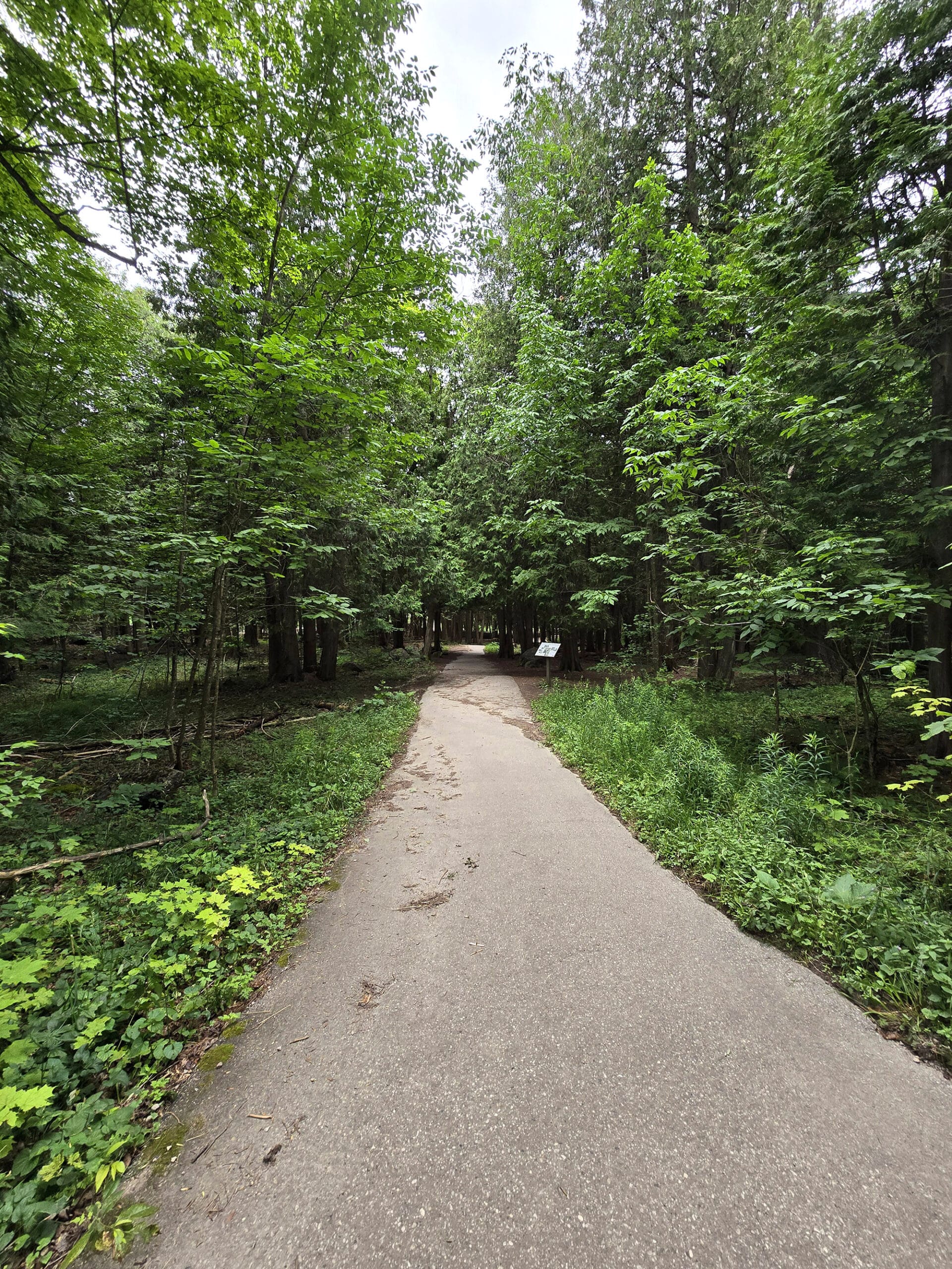
At the end of the paved trail is the first outlook, with a close up view of the top of the falls.
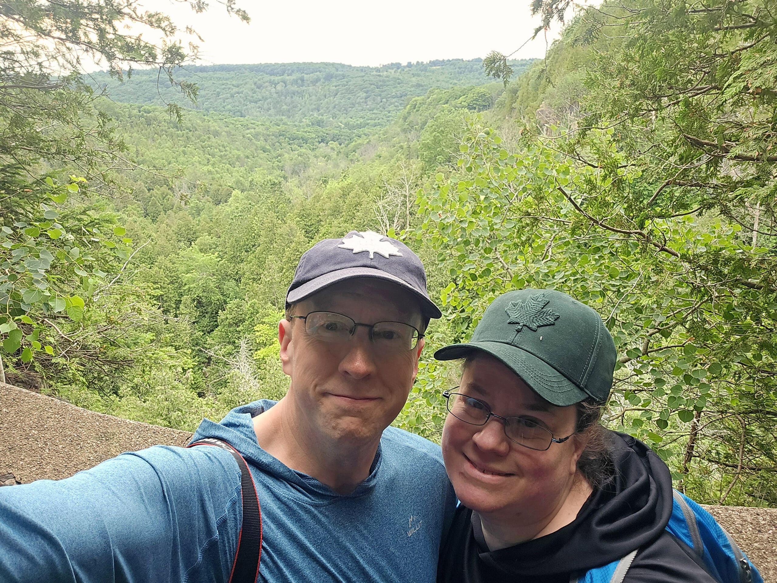
Along the way, you’re treated to some excellent views of Cuckoo Valley.
The viewing area doesn’t seem like a far walk from the first viewing platform, but the view makes it look REALLY far away.
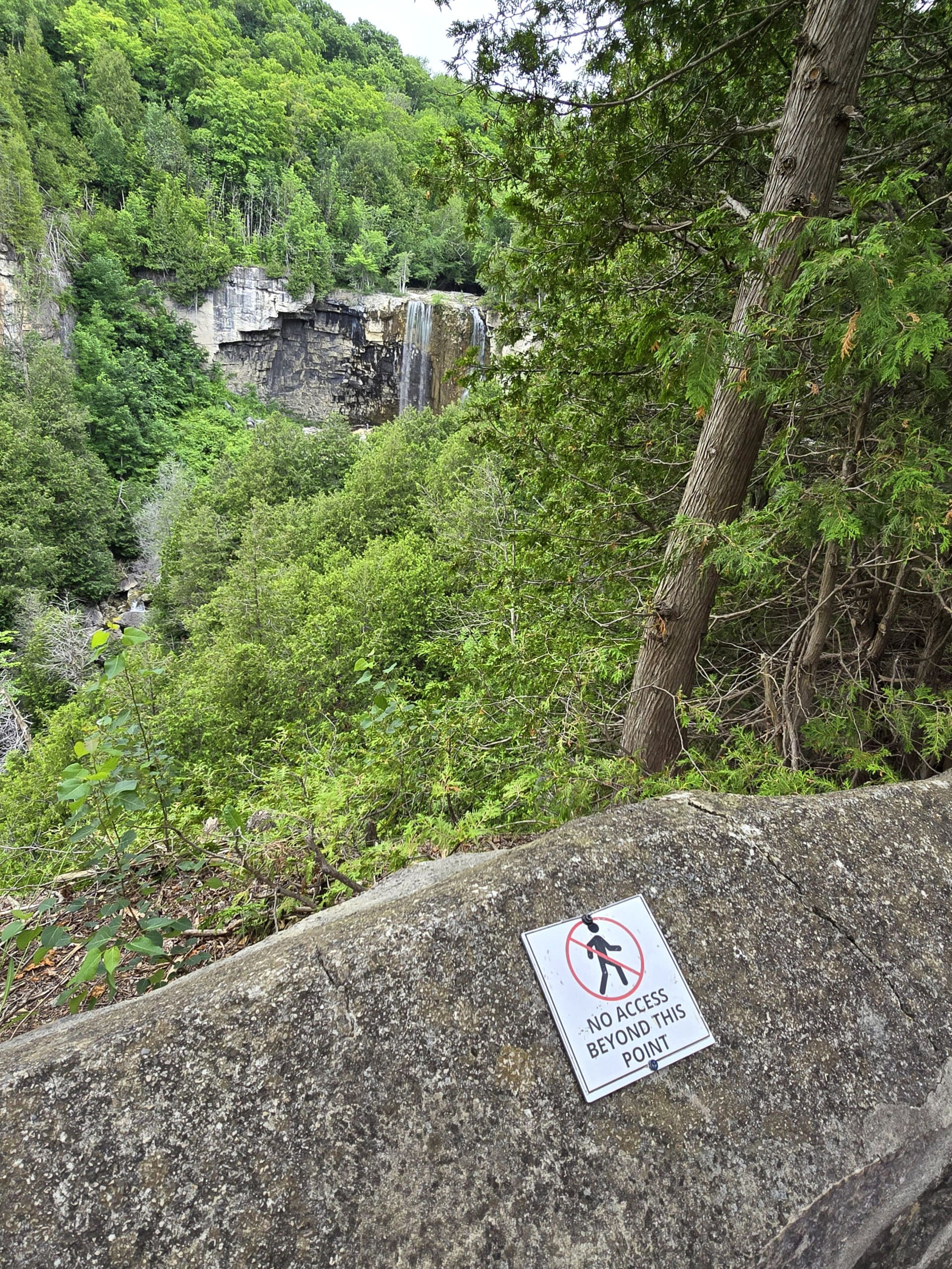
Note: We didn’t walk very far to the right of the falls, when leaving that first path.
Bruce Trail
The Bruce Trail continues out from the park, to the Northwest and Southwest.
The north west leg heads towards Owen Sound, while the southwest leg takes you down towards Hogg’s Falls.
Biking
This isn’t really a biking trail, so far as we could see.
Birding, Wildlife, and Nature
It wasn’t a great place for birding, at least during our trip. We didn’t see or hear much in the way of birds - a Red-Eyed Vireo and a Crow, that was it.
As for other wildlife, we didn’t see so much as a squirrel!
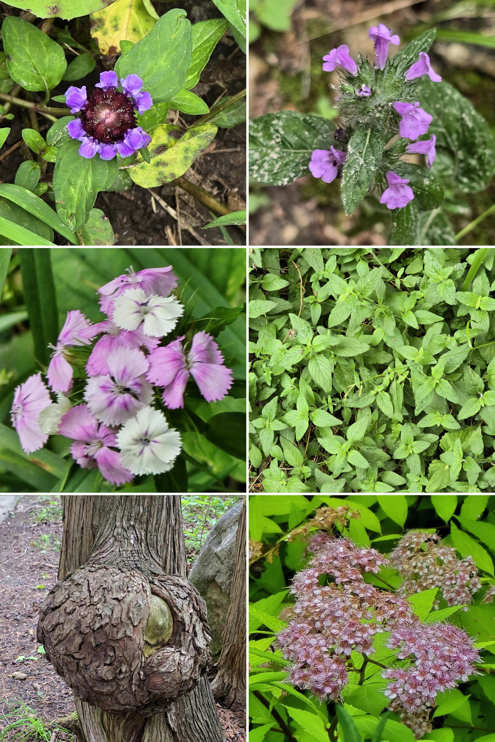
We did see a few wild flowers, some unique ferns, and some kind of wild mint growing, but that’s about it.
Niantic Games
We didn’t even have enough cell phone coverage to open the apps, so ... couldn’t tell you if there are any stops / portals / gyms in Eugenia Falls Conservation Area or not.
Final Thoughts
This one was a bit of a snooze, hate to say it. Nice enough falls, I guess, but I wouldn't make a trip out of the way, just for them.
It’s close enough to Hogg's Falls to do both of them in one trip, I’d just recommend doing Eugenia Falls first.
It would definitely have been a bigger letdown, after our Hogg’s Falls experience!
That said, if we’re in the area earlier in the spring - assuming we actually get a snowfall this year! - we may give it a second chance.
I’m curious about the remaining tunnel, maybe I’ll do more of a deep dive on Google to figure out where it actually is.
The conservation area’s website doesn’t have much information at all, and - between that and the main map - not knowing where anything really was made it frustrating.
Also of note: there’s a cute little store right before entrance to the Eugenia Falls Conservation Area that I’d like to check out, if we go back!
More Ontario Waterfall Posts
Looking to waterfalling in Ontario? Here are more Ontario Waterfalls to check out:
Aguasabon Falls
Chippewa Falls
Falls Reserve Conservation Area
Gariepy Creek Falls
Healey Falls
Hogg's Falls
Indian Falls Conservation Area
Inglis Falls
Jones Falls [Pottawatomi Conservation Area]
Kakabeka Falls
Mink Creek Falls
Onaping Falls
Oxtongue River-Ragged Falls Provincial Park
Provoking Falls
Rainbow Falls
Sand River Falls
Sauble Falls
Scenic High Falls
Walter's Falls
Webwood Falls
Beyond the waterfalls, be sure to check out our Places to See category, to find more interesting Ontario places to explore!
Thanks for Reading!If you loved this post - or have any questions about it - please leave a comment below! We'd also love it if you would consider sharing the link on social media! |
Leave a Reply