
Flowerpot Island is a gorgeous little island off the coast of Tobermory, part of Fathom Five National Marine Park. Here's what you need to know!

This is a one of the natural attractions I’ve been looking forward to seeing the most, ever since moving to Ontario 6 years ago.
Tobermory in general, yes - but Flowerpot Island specifically.
Before we had an RV, we just didn’t have any way to make that happen. It’s ~4 hours away from home, and we have cats. The RV - and bringing them along with us - has really opened up a world of possibilities for us, in terms of exploring Ontario!
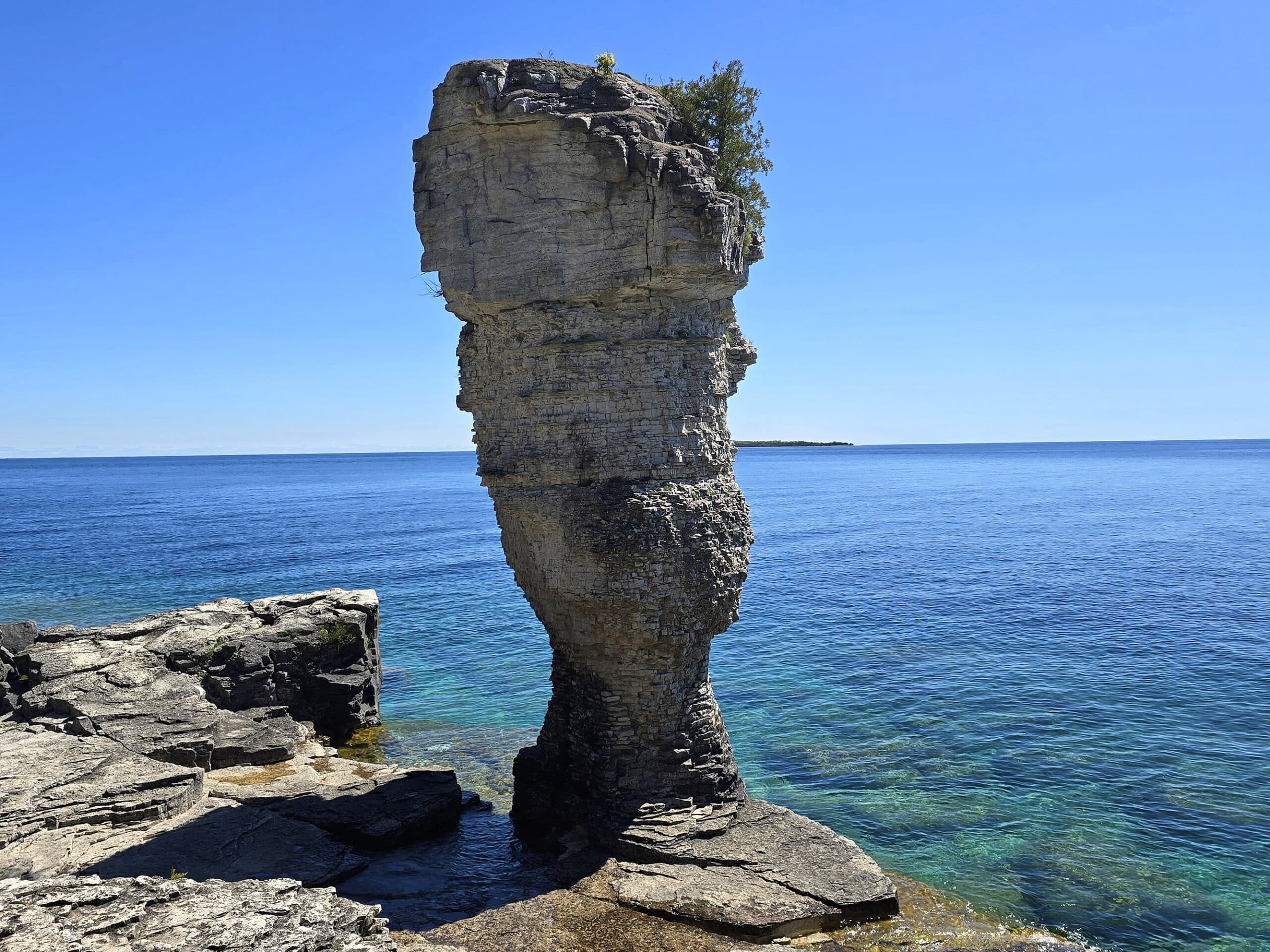
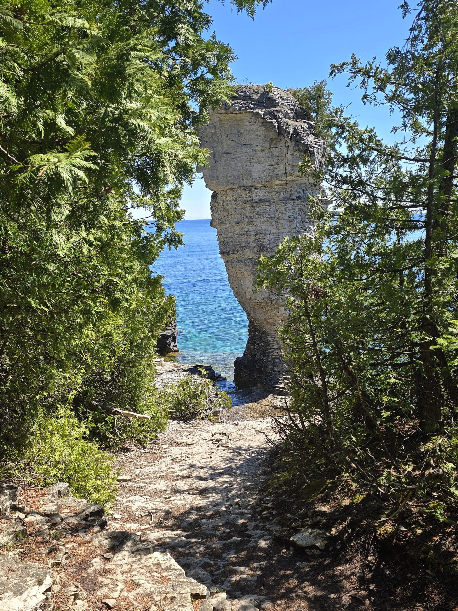
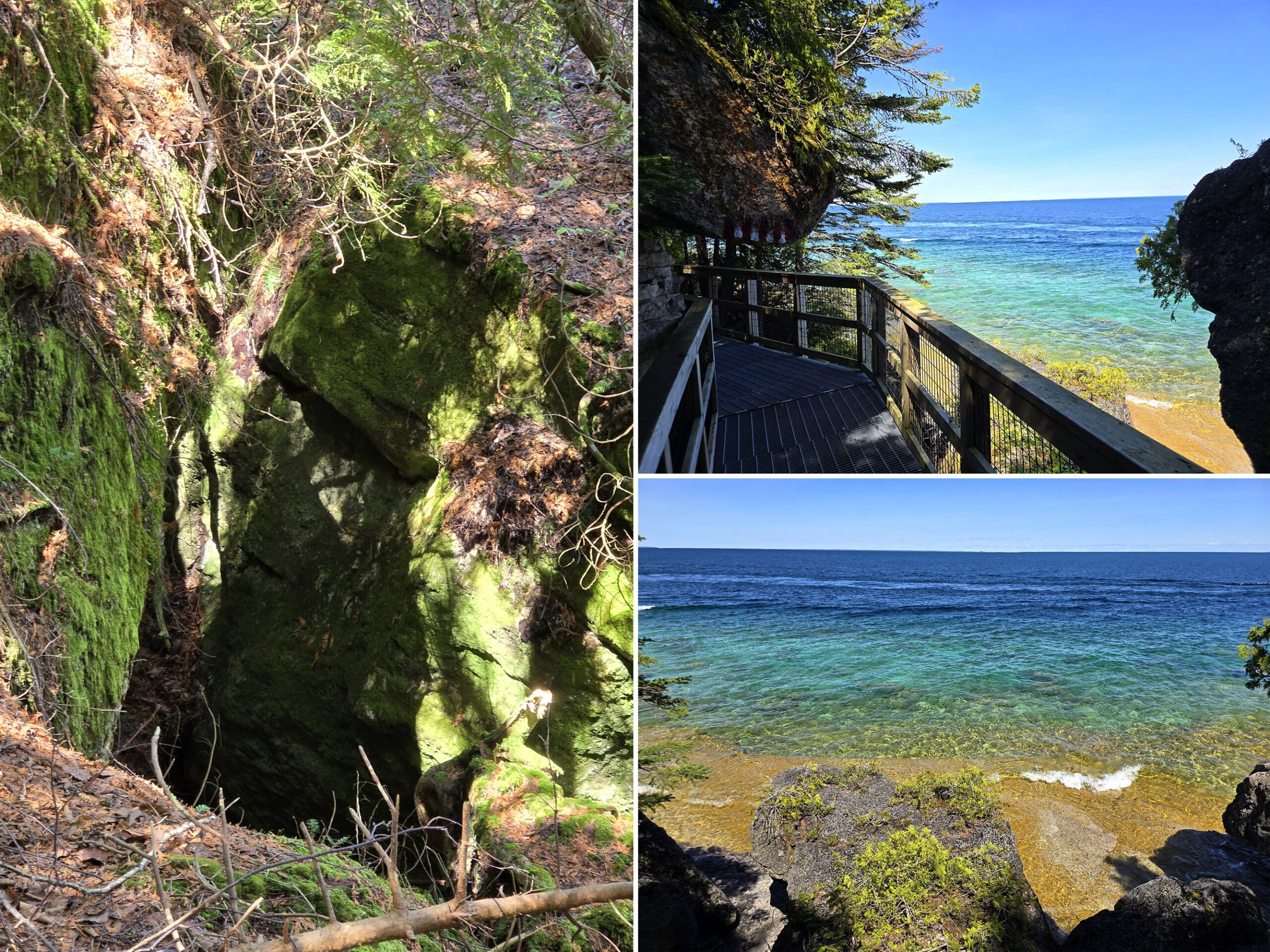
Anyway, Flowerpot Island is known for its large flower pot like rock formations, as well as gorgeous views of its own shoreline, and Georgian Bay in general.
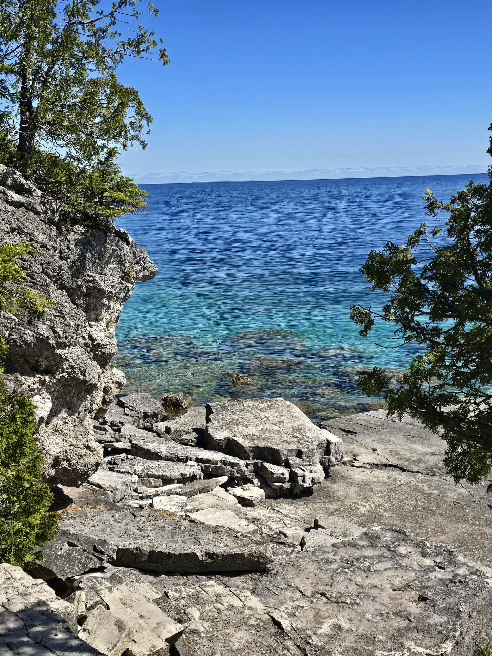
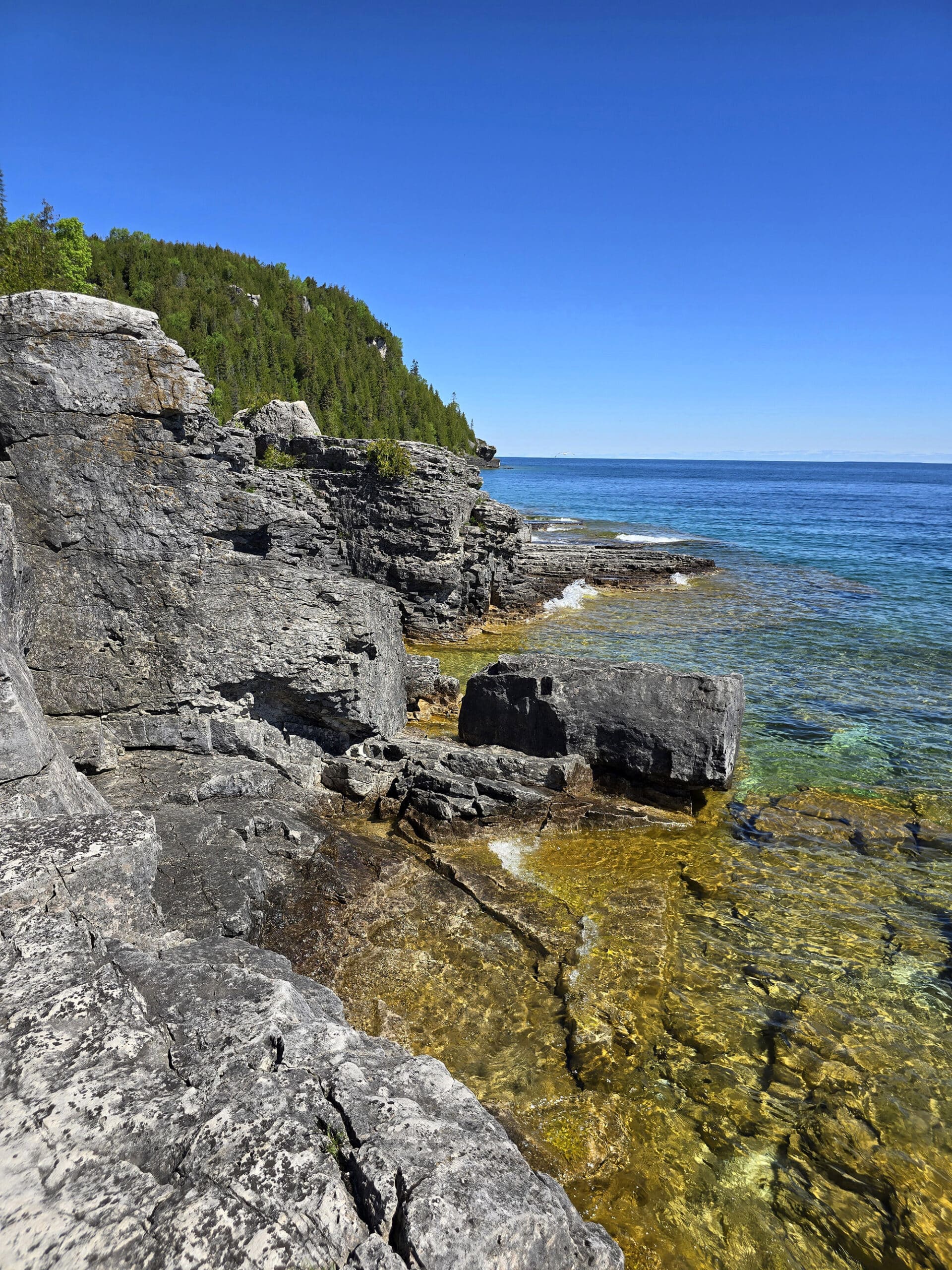
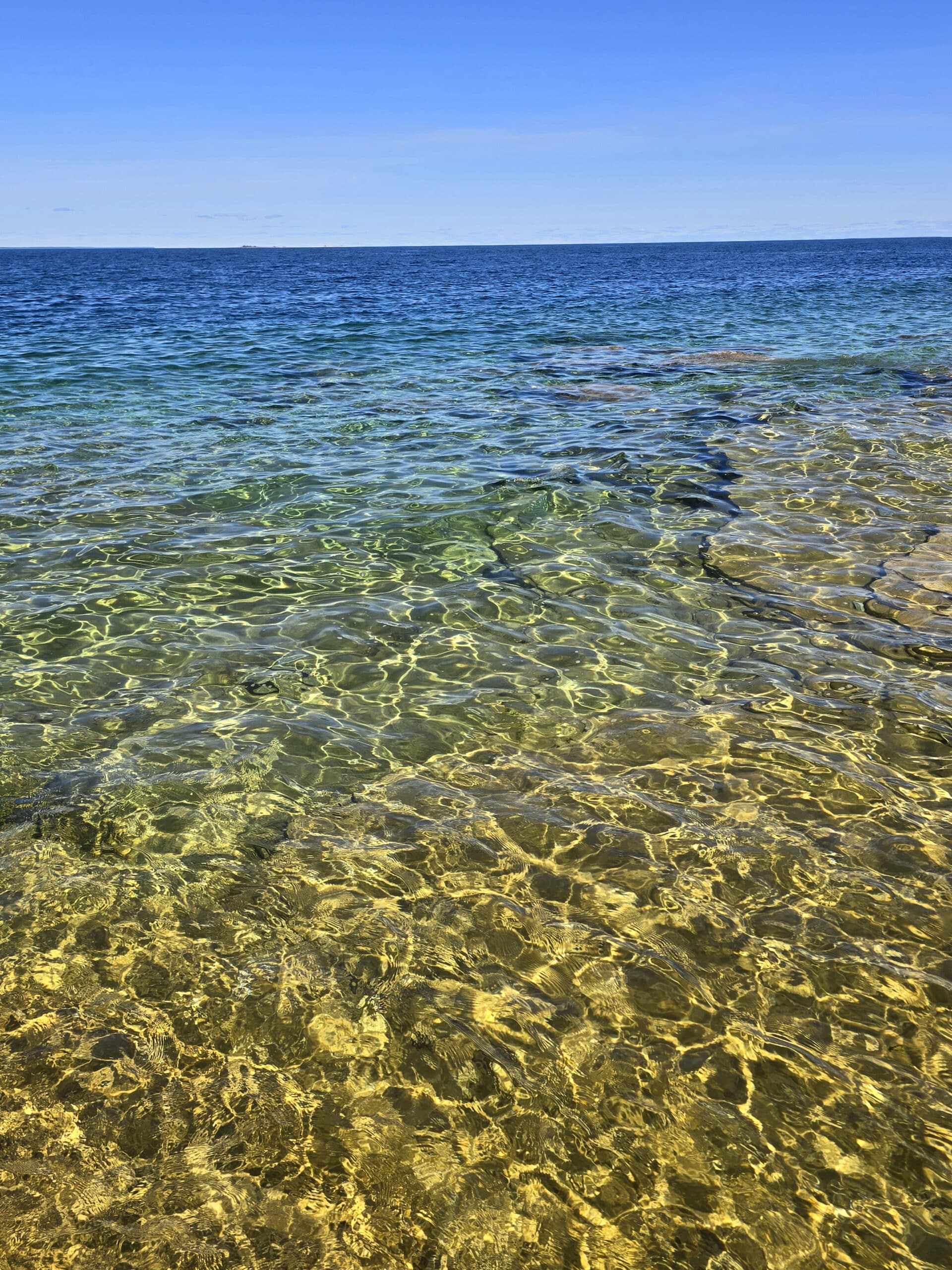
On a clear and sunny day - like the one on the day we went - the shallow water off the coast is crystal clear and turquoise. In places, ir’s hard to believe the scenery and water is even real, it’s almost too gorgeous.
It’s only accessible by water, though, which means you definitely have to plan ahead.
So, here’s our review, with a ton of information to help you plan YOUR trip!
Just as a heads up:
We had multiple VERY negative experiences with the boat tour company we used to access the island.
As such, the beginning part of this post is WAY more negative than you’re probably used to from us.
If you can get through my ranting, I promise (spoilers!), we had a great time on the island itself, and will definitely be back.
You know, just booking with the other company next time!
The Basics:
Location Name: Flowerpot Island
Address:
Website: Flowerpot Island
Price: See Fathom Five National Marine Park Fees for more details.
Logistics
Some of the basic info you’ll need to plan your trip to Flowerpot Island:
Reservations:
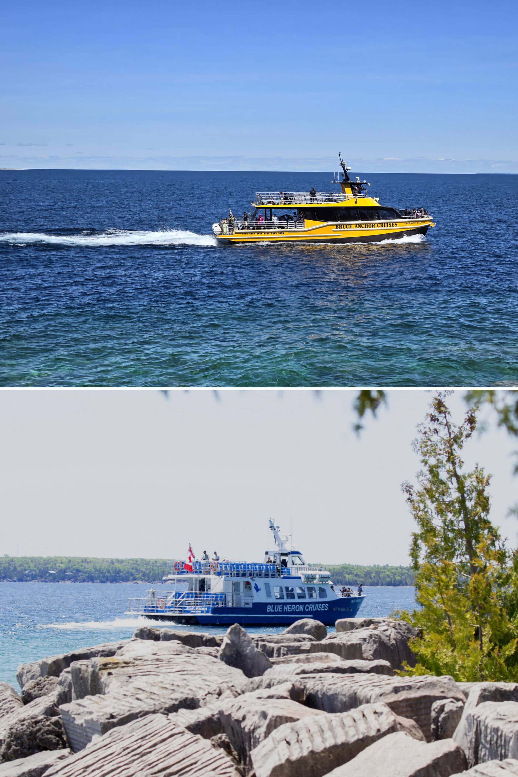
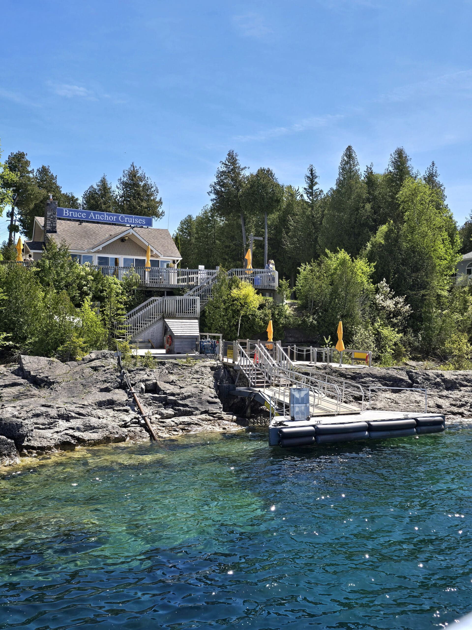
There are only two tour boat companies that run ferry cruises that drop passengers off at Flowerpot Island.
Both offer crossings in glass bottom boats, and are based out of the town of Tobermory. These are The Blue Heron Company, and Bruce Anchor Cruises.
After looking over their sites a bit, I let cost be the deciding factor (whoops!), and booked with the “early bird” discount cruise with Bruce Anchor.
I do want to say - their “beat the crowd!” marketing for the early bird cruise made us believe that they were discounting to try and sell hard to move tickets.
I even called the day before (when we booked) to see how busy our crossing was. The woman who answered told me that it was wide open.
This was NOT the case - we were later told that these were their busiest crossings.
You will not beat the crowd, you will BE the crowd.
Park Entrance Fee
As a note: You need to pay an entrance fee to get onto the island, one way or the other.
If you’re camping or have a day pass for Bruce Peninsula National Park or Fathom Five National Marine Park, that covers your entry to Flowerpot Island as well. The Canoo app or a National Parks Discovery pass also works.
If none of those apply to you, you’ll just end up paying the fee directly to the tour operator, and they’ll submit it on your behalf.
Check In
Check in was a bit weird.
We got a text the night before, telling us that we could come in that evening and check in, so we wouldn’t have to show up an hour before the crossing, as we’d had to agree to.
Score... but it would have been nice if that info had been made available during booking, or earlier in the day.
We got the text JUST after we’d gotten back to the campground after being basically across the street from their ticket office.
So, another 25 minute-each-way drive, just because it would clean up our plans for the morning.
Anyway, check in went fine enough.
He gave me our tickets and a parking pass, then pointed across the street and told me to park in the lot next to the house he was pointing at, and said our pass covered the time we were away, plus an hour on either end of the departure and return.
The Next Morning...
We enjoyed a leisurely sunrise hike out to the Grotto, and drove up to Tobermory to be at the indicated parking lot a few minutes before we had to be.
... except every sign in that lot said 15 minute parking, violators will be towed, etc.
It was also almost empty - I had expected a fair number more tourists by then. So, I called Bruce Anchor.
The Bruce Anchor employee that picked up the phone said that I must have “misunderstood”, because the parking was actually up a completely different road, then down another road, and up a steep hill.
I have no idea why we were given completely wrong - and potentially disastrous! - info, but I did NOT need the stress that came with driving to a much further lot and *racing* to meet the time we were supposed to be there.
Nothing bothers me more than when I plan everything right, and someone else’s mistake screws things up.
It was a really rough walk - especially at speed - and it wrecked me up a bit, to the point where I wasn’t able to do all the hiking I’d planned.
Had the guy the night before given me the correct information, we would have shown up at an appropriate time for Porter to drop me off, then go park the car.
It definitely put a damper on our day.
The Crossing
As it turned out, we would have had time, because they didn’t start boarding until well after we arrived.
We passed a large sign talking about their covid safety protocols - I only got a quick glance, but I was a bit shocked. It looked NEW - and it mentioned required masking.
Weird that they hadn’t taken it down - there were only 3 people masked on our crossing, us and one other guy.
REALLY glad we masked up, though.
A large family decided to bring several members that were visibly sick, open mouth coughing on everyone.
In a move that had me ready to throw up, a grown man seated in front of me open mouth coughed up a giant phlegm *garland* all over himself, and kind of shrugged it off.
What is wrong with people? Ugh.
The best is that a couple of their family members were visibly giving us the stink eye over our masks, while LITERALLY being the reason that some of us still mask in crowds.
Anyway, it was some wild punctuation to the signage we’d seen earlier.
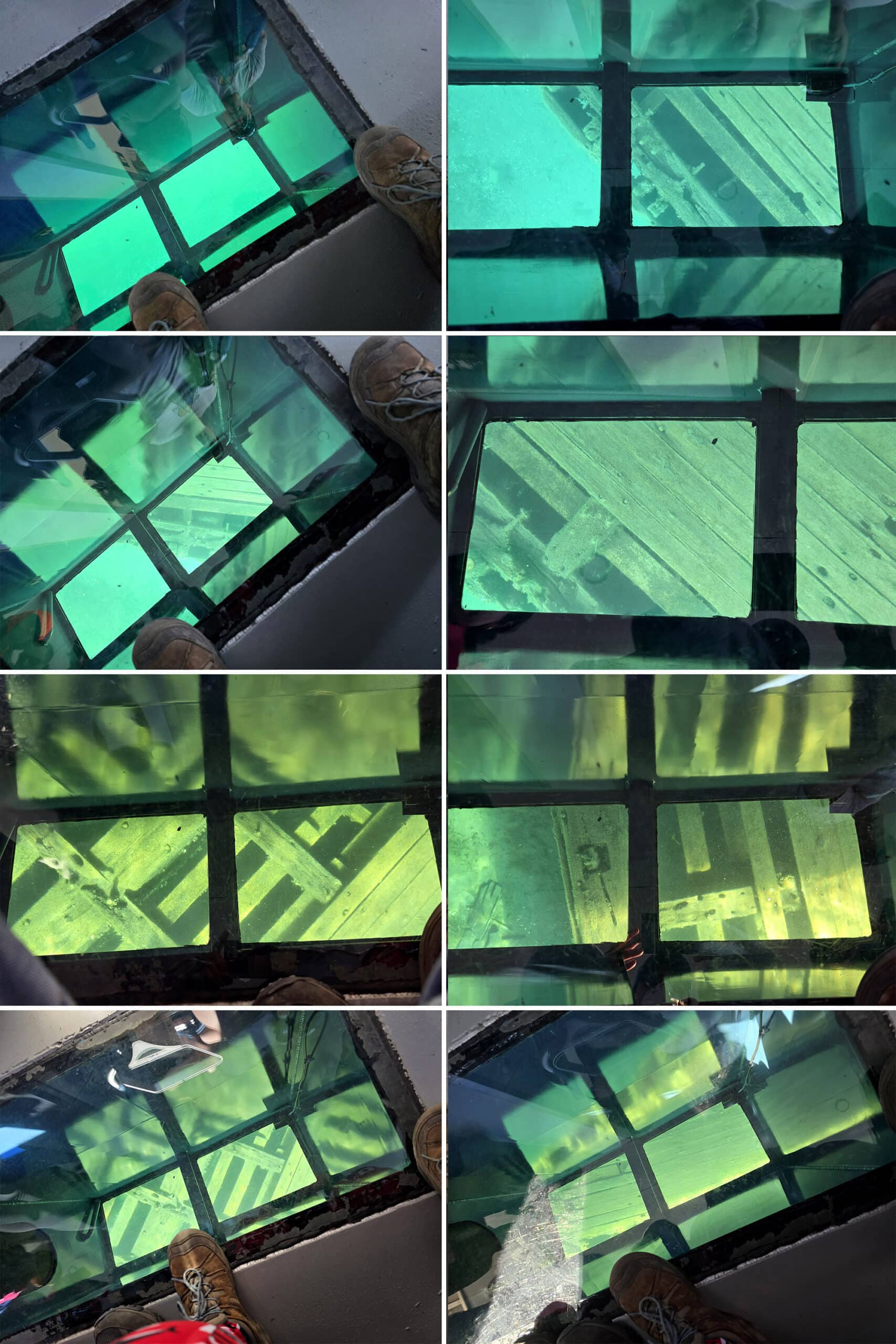
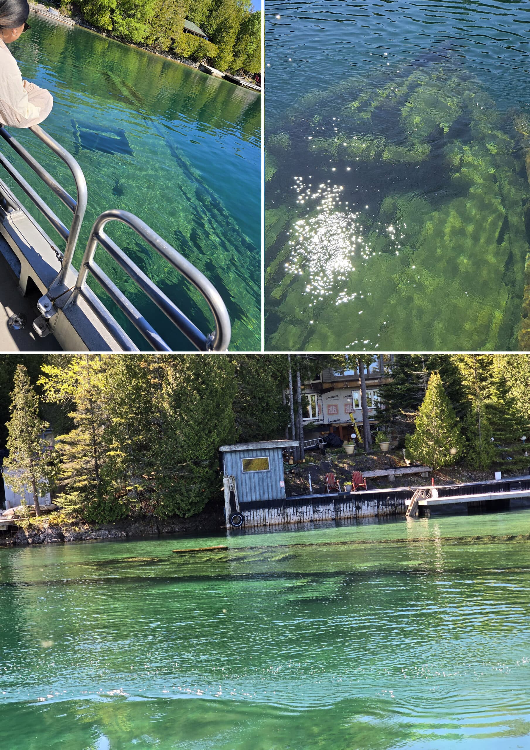
The Shipwreck Tour
So the shipwreck tour itself was something I’ve been wanting to do forever, and it really didn’t live up to expectations.
The “glass bottom boat” was actually just a few small sections of glass right in the walkways.
They weren’t big enough to see any context to whatever you passed over, and that’s WHEN you could look through them - people were constantly walking over them, as they were in the *aisles*.
I don’t know if I saw a picture of another boat or something, but I guess I’d been picturing a larger glass section, with people seated *around* it.
Wish I’d known that ahead of time, I could have completely avoided the *lovely* display of grossness!
Anyway, we only passed over one shipwreck, and saw another at a distance.
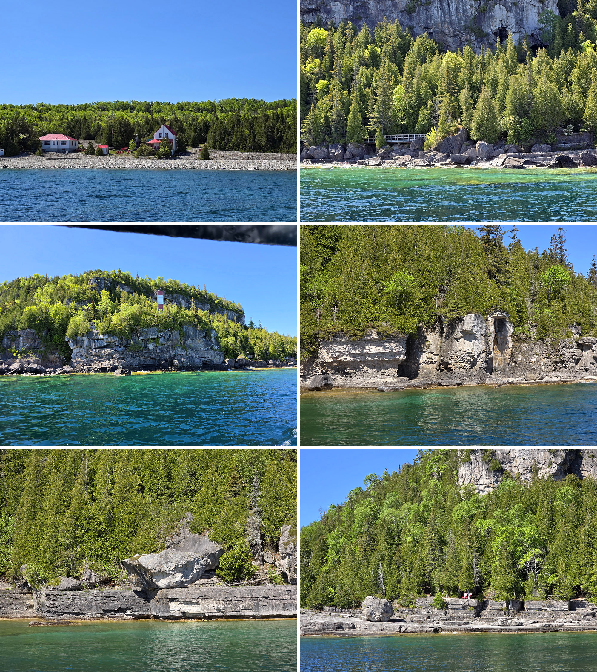
Arriving at Flowerpot Island
Other than people being gross, the crossing was uneventful.
As we pulled up alongside Flowerpot Island, it felt a little... Jurassic Park. Can’t explain why, but I wasn’t alone in thinking that!
We got to see the flowerpots from the lake, and marveled at the gorgeous scenery that awaited us on shore.
Seriously, why go to such a gorgeous place, and dump litter on the trails? Ugh.
Anyway, I’m ranting, let me get back on track.
Once we were actually on shore, the mass of people spread out significantly, and we were able to catch our breath - and footing!
The lack of line situation was even worse for the return trip. The dock area was clearly set up for lines, but everyone ignored it and just swarmed the boat, en masse, passing everyone that *has* formed lines.
Would have liked to see a little bit more control - both of the situation (Bruce Anchor), and just personal self control from people in general.
As a note:
The crossing was supposed to take 45 minutes both ways, and the site made it sound like there would be shipwreck tours on any crossing that departed land by 3:45 (I think it was 3:45, anyway. Maybe 3:50 - either way, I chose our crossing specifically to be before that point!)
As it turned out, only the first crossing was 45 minutes and involved the shipwrecks - the return leg was only 15 minutes, straight shot to the company’s dock.
I felt a little bait and switched.
When I asked about it, the employee I talked to shrugged it off and said that the website “mustn’t have been updated.” Thanks?
Anyway, we’ll be trying the other company next time, for multiple reasons.
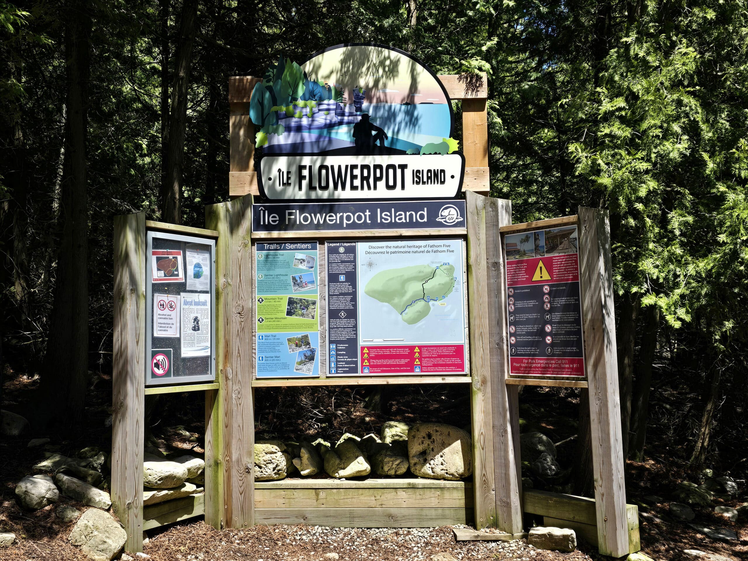
Maps and Signage
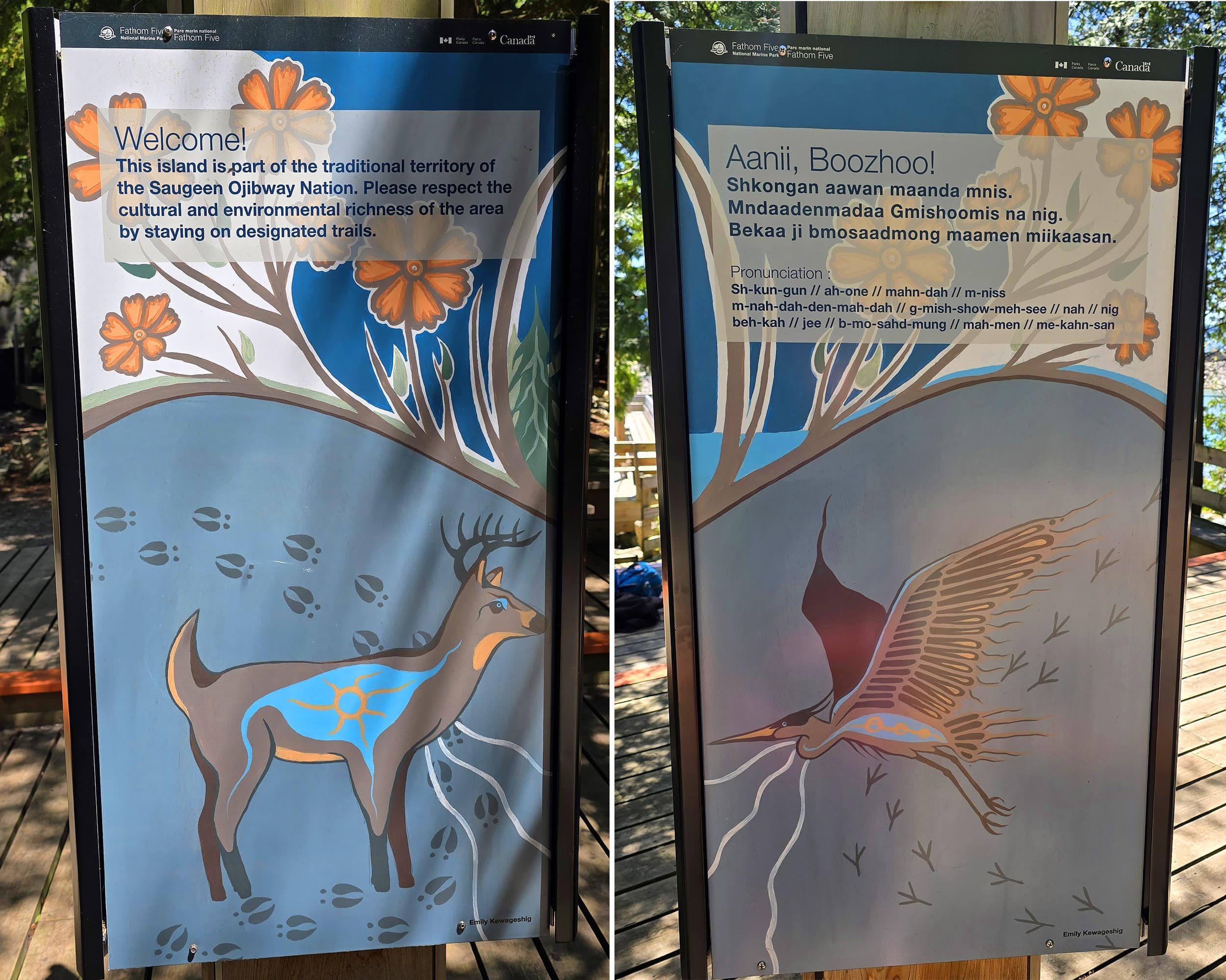
Some of the first signs you’ll see on Flowerpot Island are the big Flowerpot Island branded park sign, and some welcome signs.
As it’s a national park, pretty much everything we saw was bilingual (English and French), but I really liked the addition of Ojibwe on the welcome signs.
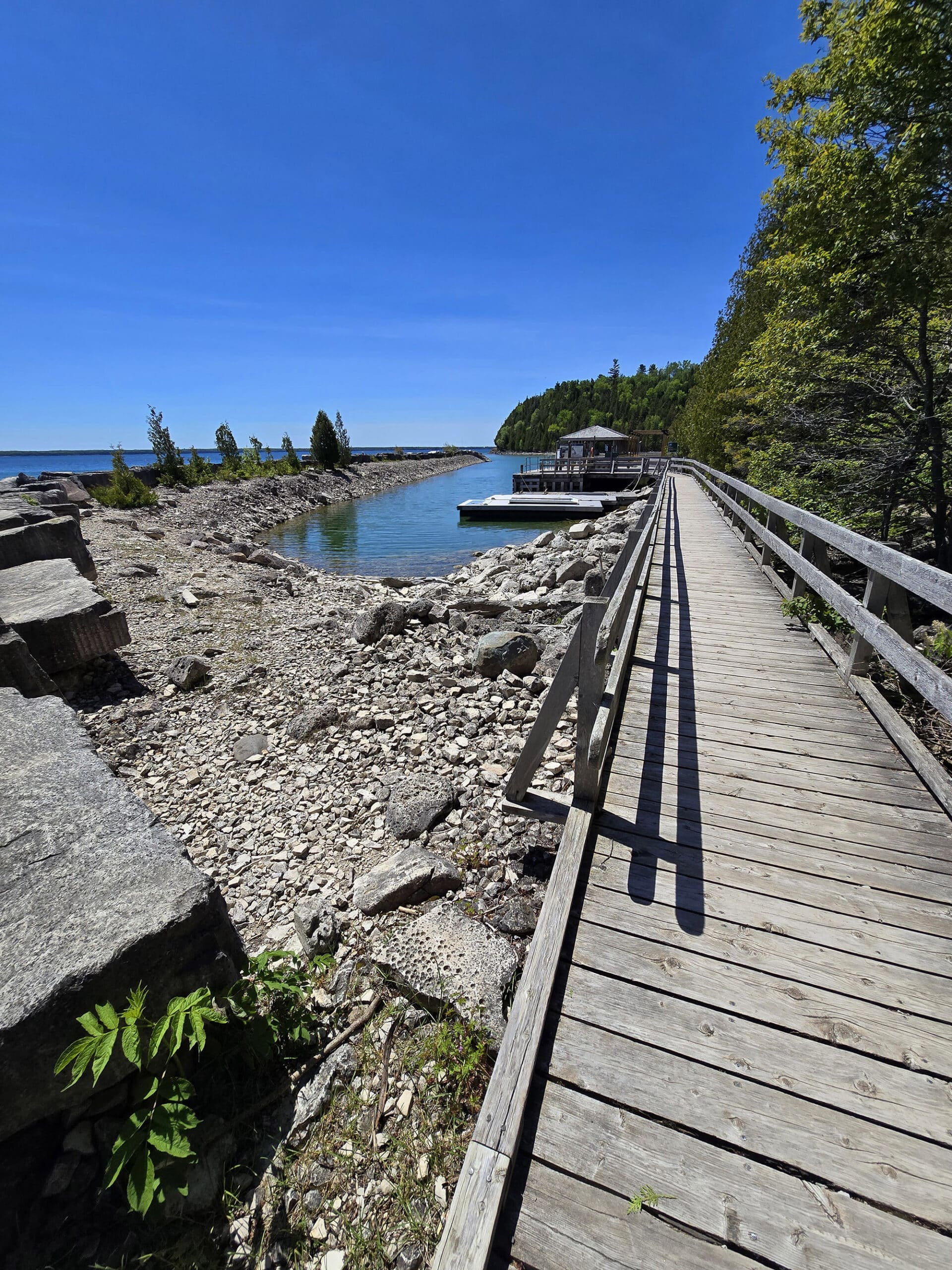
As you walk off the dock/boardwalk area, you’ll come to a pretty basic map which lays the island out. Along the way - I think we saw at least 2 - there were little “you are here” type maps.
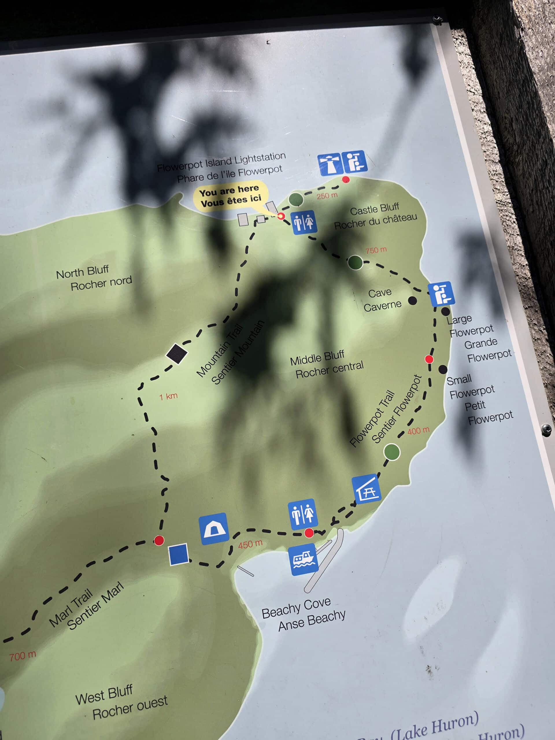
Not sure if they changed the layout of the dock area at some point, but that map definitely would have been more helpful on land, closer to where we disembarked.
Weirdly, every map we’ve seen has been missing at least one of the washroom facility locations - and they’re not all missing the same one!
(Not on the dock itself, though. Not a good place to stop, what with the swarming and shoving!)

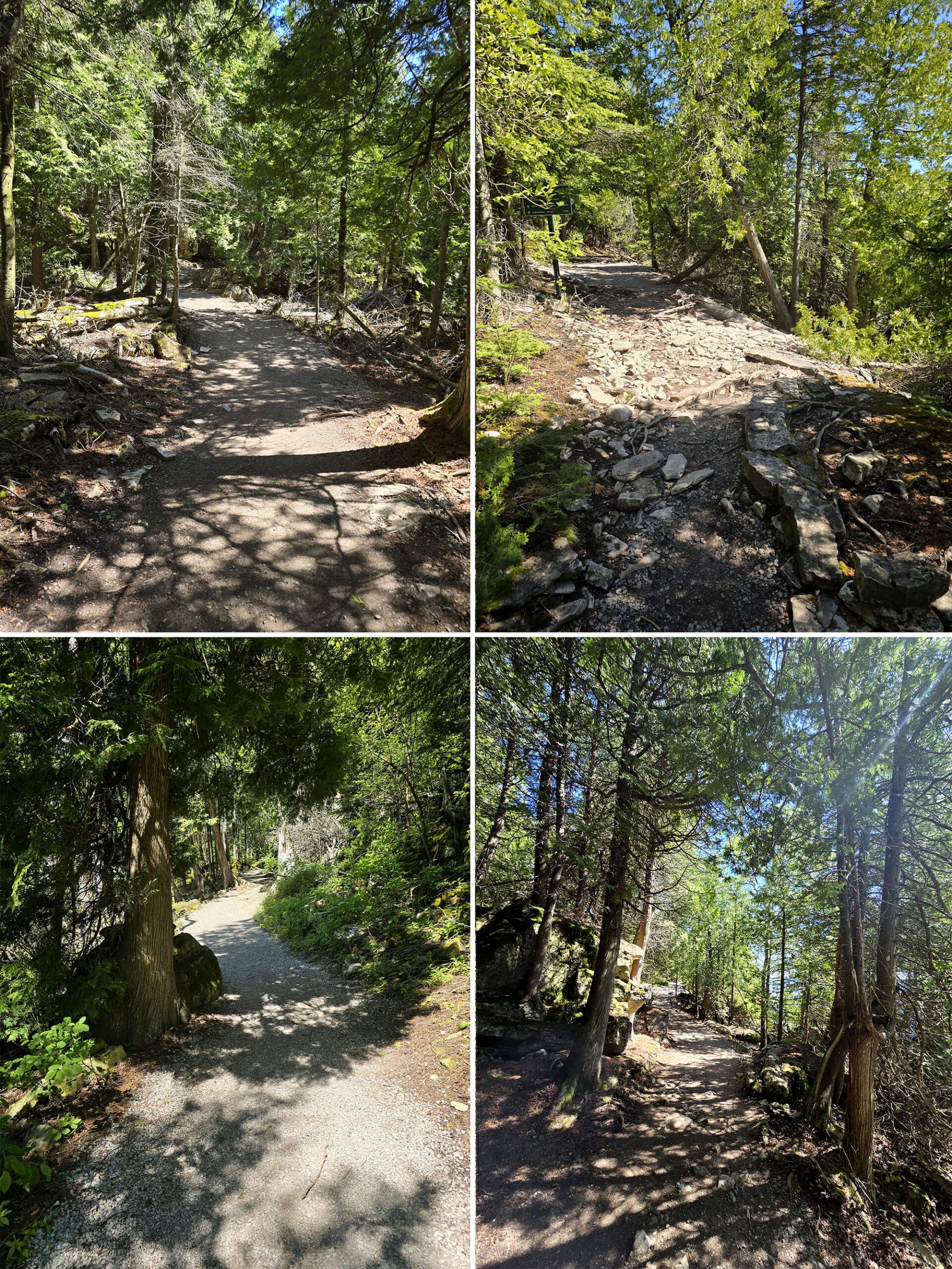
1. The trails of the island are a really simple layout - a loop, one long offshoot, and one short offshoot.
The two offshoot trails are on opposite sides of the island, so you won’t be getting them confused!
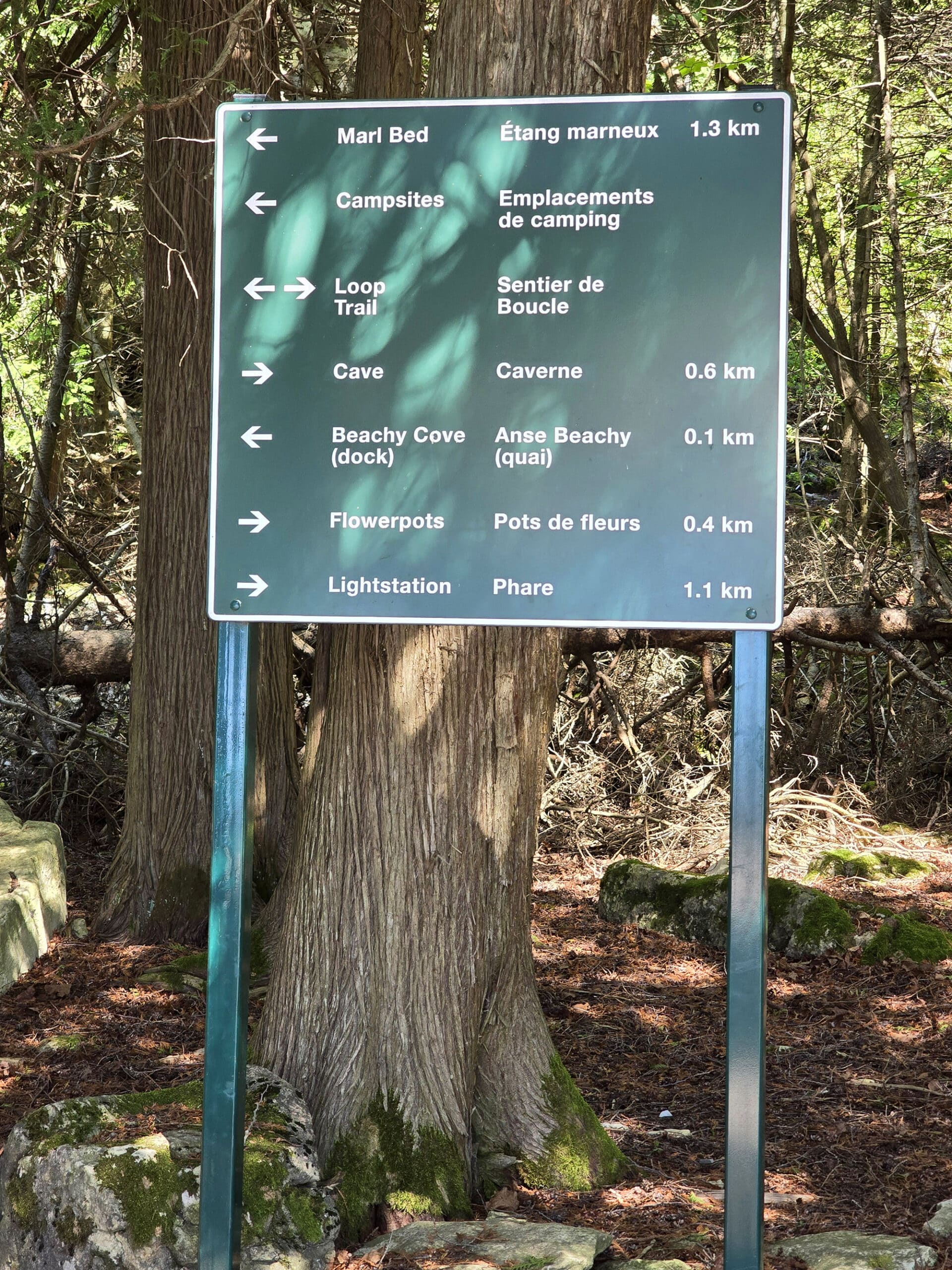
2. There are really clear direction/distance signs EVERYWHERE.
You won’t inadvertently miss one of the major attractions, and it’s always really easy to figure out where you are and where you’re going.
The distances are especially helpful when it comes to seeing how far you are from Beachy Cove, as you HAVE to be back there in time to board. The signs make it easier to budget your time.
Connectivity
We had decent cellphone reception and connectivity by the lighthouse station, and good service in Beachy Cove / by the dock.
We didn’t really check our phones much between those points, though - at one random point somewhere between those two areas - we noticed we had no signal.
Accessibility
This is unfortunately a really NON accessible attraction.
Wheelchair users are completely out of luck when it comes to visiting Flowerpot Island, and those with other kinds of mobility aids will definitely face some challenges.
First of all the boats to get there - at least with the company we used - aren’t wheelchair accessible.
Even if they were, wheelchair users would basically find themselves confined to one small section of Beachy Cove, as the obstacles start pretty much immediately.
Even the boardwalk involves a big step to get on and off it.
In terms of general accessibility...
The washroom building up front has a ramp, but be prepared - it’s long and steep.
I took it because the aforementioned race from the *correct* parking left me physically messed up, but I think - in that case - the stairs would have been easier for me.
That washroom is the only one with a ramp, as far as we saw.
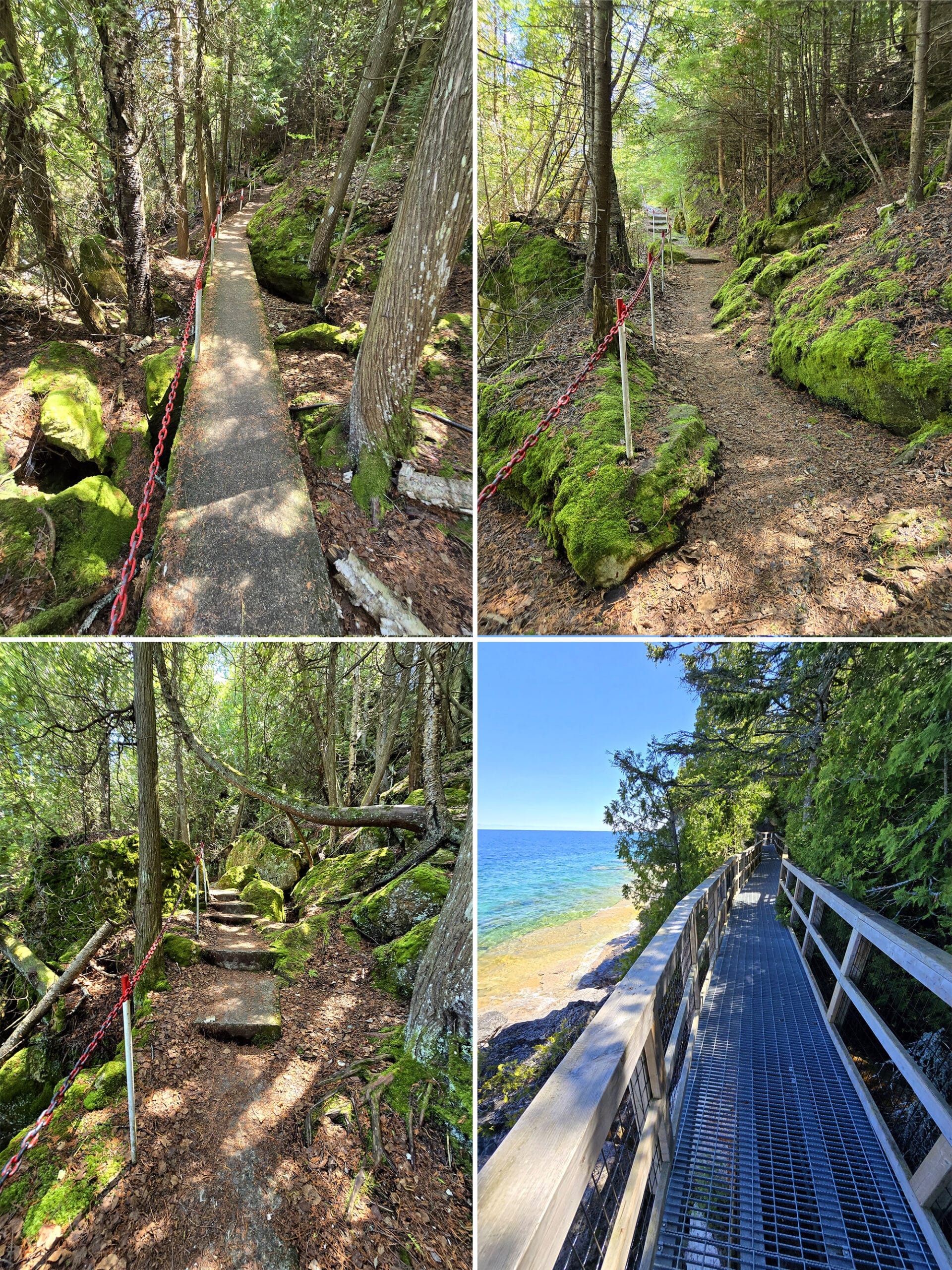
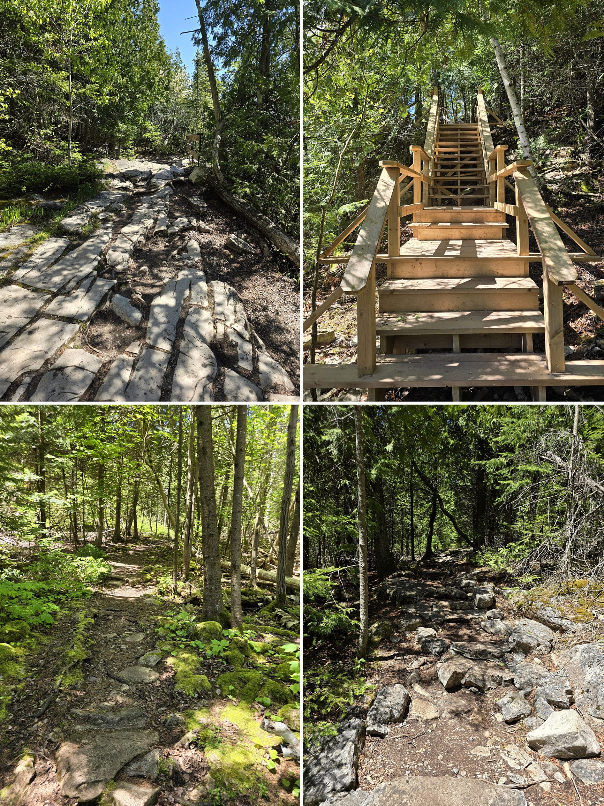
The first leg of the loop trail - the one marked as being easy - does have some more difficult spots, including some flat-ish rocks you’ll have to walk across.
They’re uneven, and if you’re using something like a walking boot, they’re going to be slippery. Be sure to have some kind of traction!
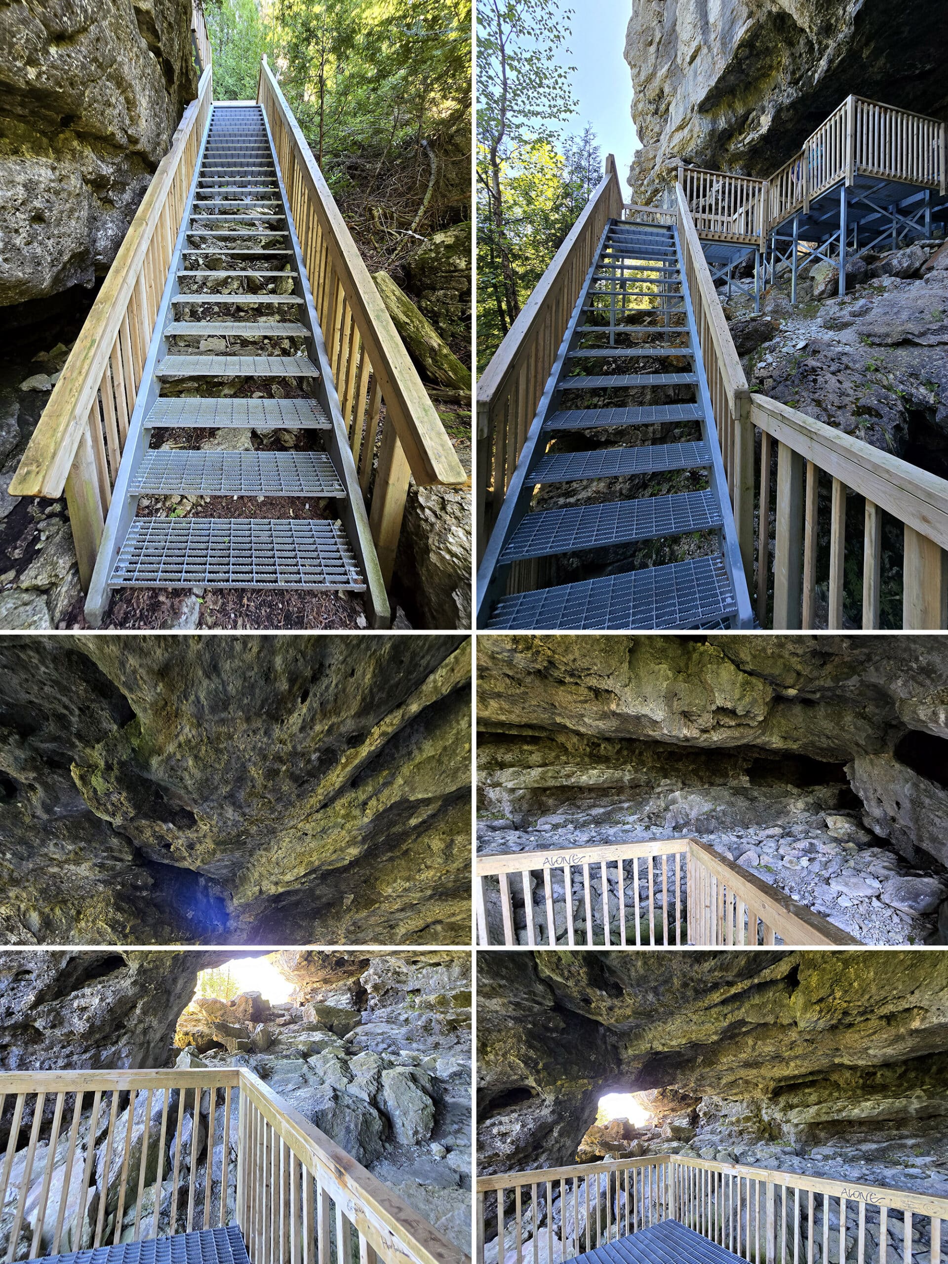
There’s a decently long set of stairs early on, and EVERY view of the beach (beyond that initial boardwalk) or the flowerpots involves going off the main trail.
The little side trails are all very rough and involve tree roots, big steps down from rocks, etc.
On several occasions, Porter had to go act as a scout to see if a particular trail/view would be doable for me.
Overall Accessibility
Wheelchair users: Skip this island.
Crutches: Would be VERY difficult, you’ll probably have to skip actually seeing the flowerpots, the cave, and the whole lighthouse / lightstation area*.
Cane: Very difficult but doable, especially if you have help. I’d say skip the lighthouse, and probably the cave and the whole lighthouse / light station area*.
Instability / Bad Tendons / Etc: Pretty difficult, you might want to bring a walking stick, and go with someone that can help you at the difficult parts.
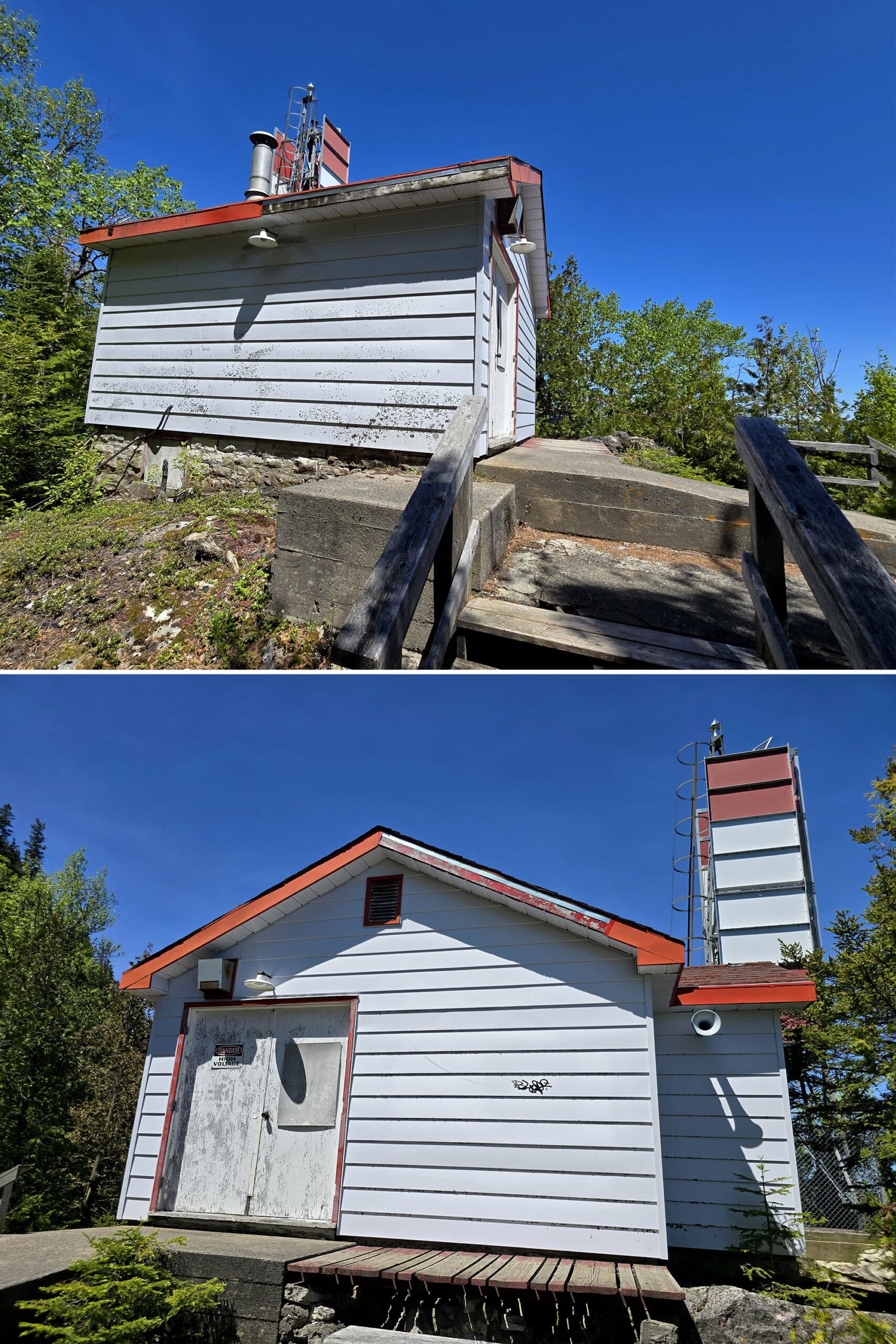
* There is a pretty steep rocky path leading down to the lightstation area, so that whole area - museum, picnic tables, washrooms, etc - can be difficult to access.
In terms of the lighthouse, the path to get to it is far too narrow to navigate with crutches, and the types of obstacles along the way would make it really difficult with a cane.
I noped out of it early on, and I wasn’t using any mobility aids that day. The photos my husband later shared showed me that I had chosen wisely!
Creature Comforts
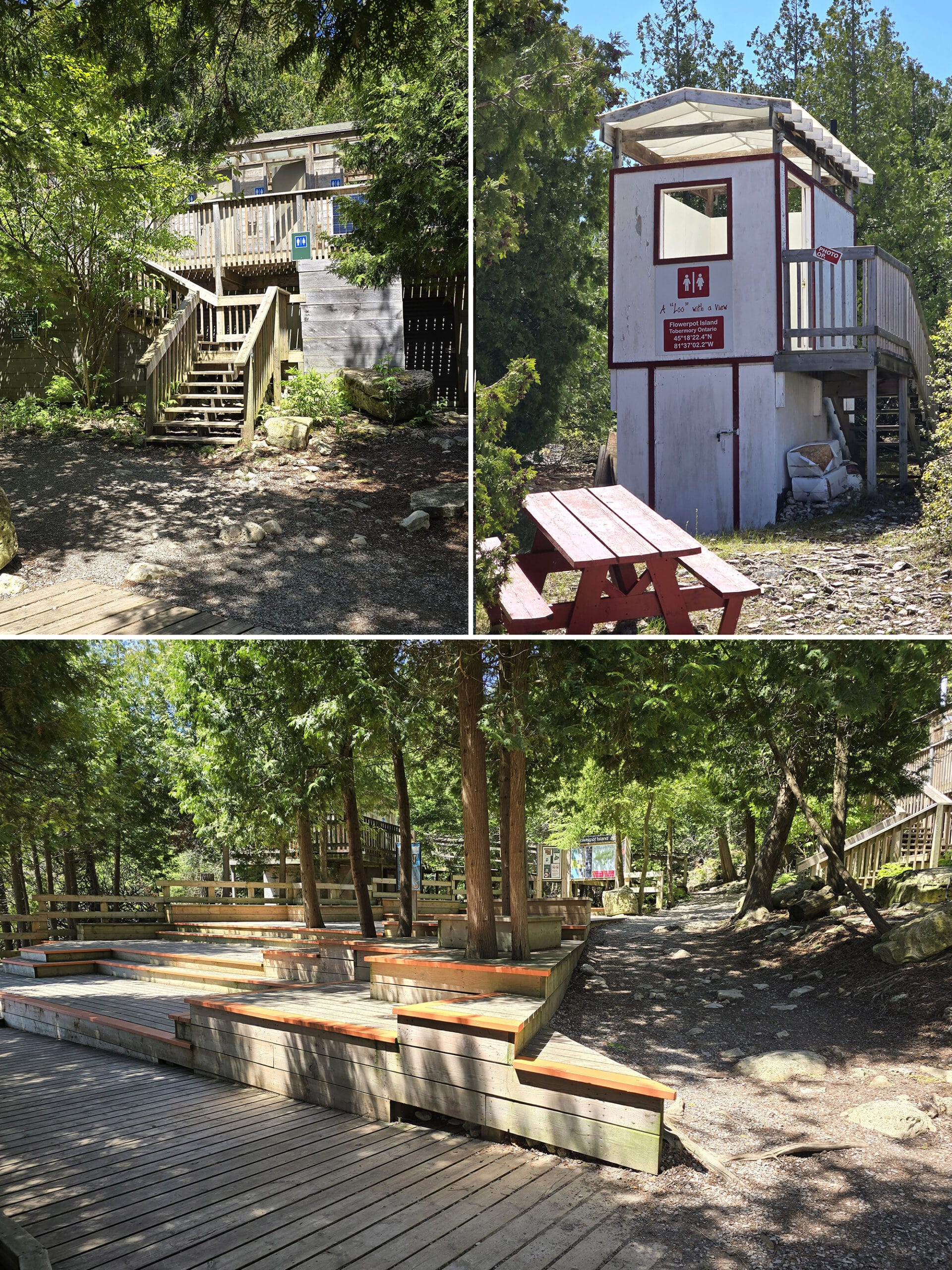
There are at least 3 ... well, 3 and a half ... washroom facilities on the island.
The ones on the “easy” part of the loop trail - 2 and a half of those - are all composting vault toilets.
Emphasis on both vault (they all involve tall stairs), and composting (holy crap, the SMELL.)
The first two toilets you’ll encounter are buildings with multiple stalls. One is as soon as you disembark (actually 2 buildings, one was closed at the time of our visit), and one is on the final bit of approach to the lighthouse station area.
The third toilet is in the camping area - we didn’t get a good look at that, but know it exists!
The “half” toilet is in the light station area - the “Loo with a View”. Single stall with a big window looking out at the coast. Cute idea!
Garbage and Recycling
There are NO garbage cans or anything of the sort on the entire island. You’re expected to pack out EVERYTHING you bring with you - so plan accordingly.
We saw far too much litter during our stay. 🙁
If you don’t want to carry it out... don’t carry it in!
Pets
Both boat tour companies allow well behaved, friendly dogs.
Dogs are allowed on Flowerpot Island, but must be leashed - and picked up after - at all times.
Parking
The only parking you need to worry about is in Tobermory, and should be available from your boat tour operator.
Share the Love!If you’ve made one of our recipes, be sure to take some pics of your handiwork! If you post it to Bluesky, be sure to tag us - @2NerdsInATruck, or you can tag us on TikTok, if you’re posting video. We're also on Pinterest, so you can save all your favourite recipes and park reviews to your own boards! Also, be sure to subscribe to our free email newsletter, so you never miss out on any of our nonsense. Well, the published nonsense, anyway! |
Activities and Attractions
For such a small island, there’s a ton to see and do! Here are some details:
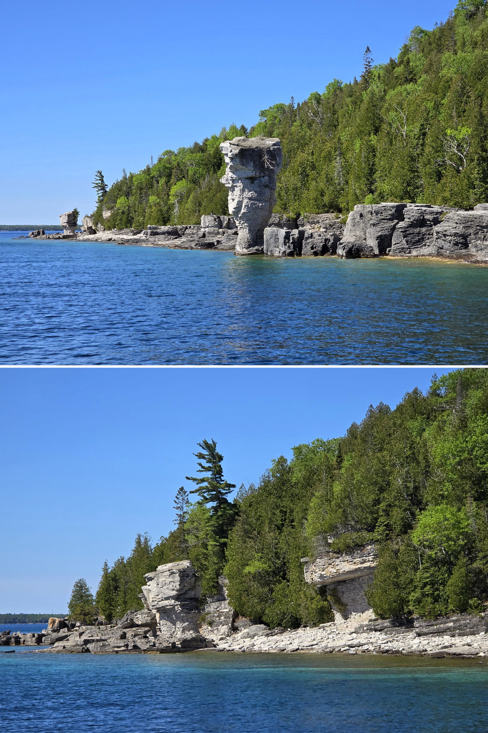
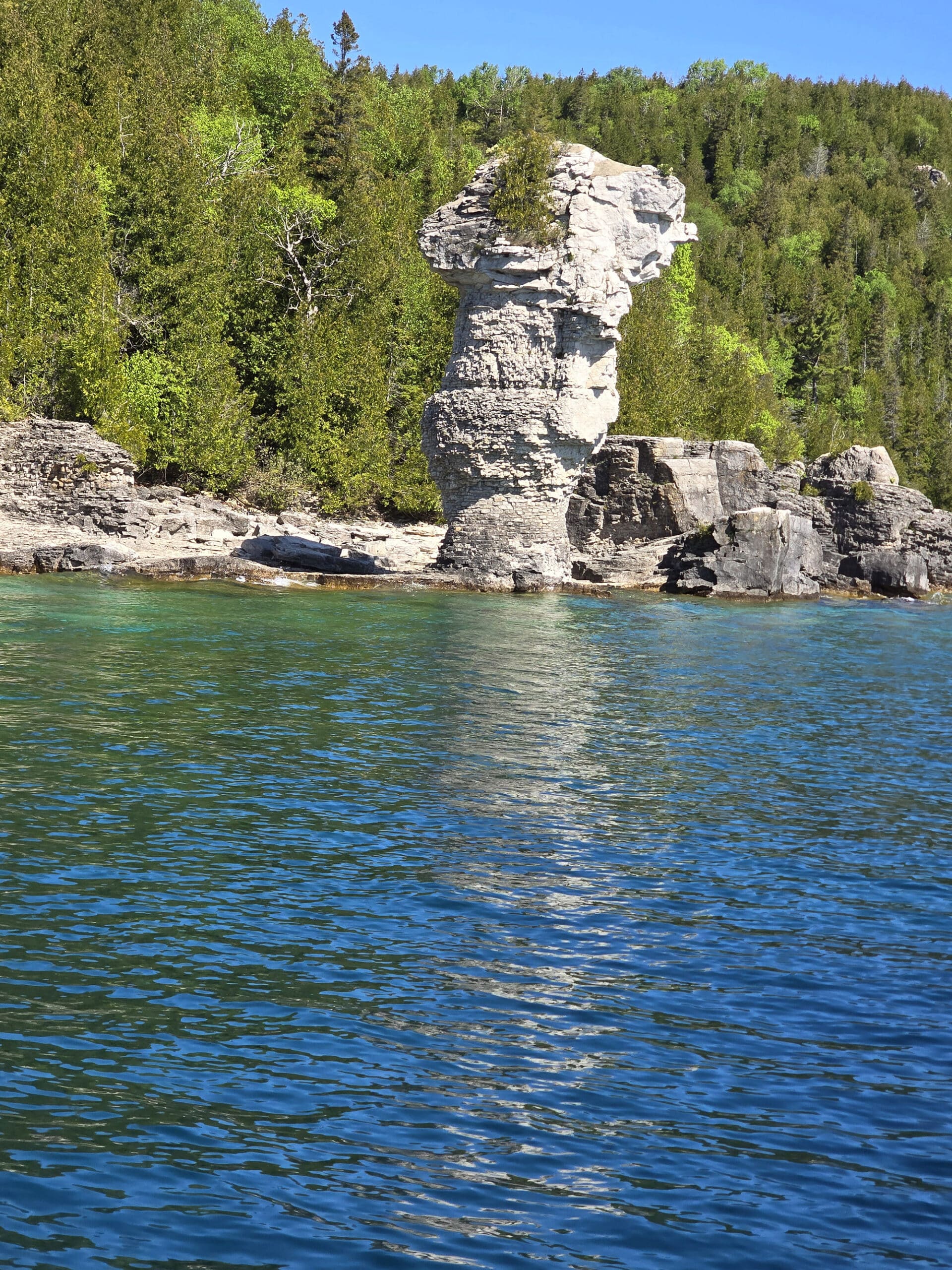
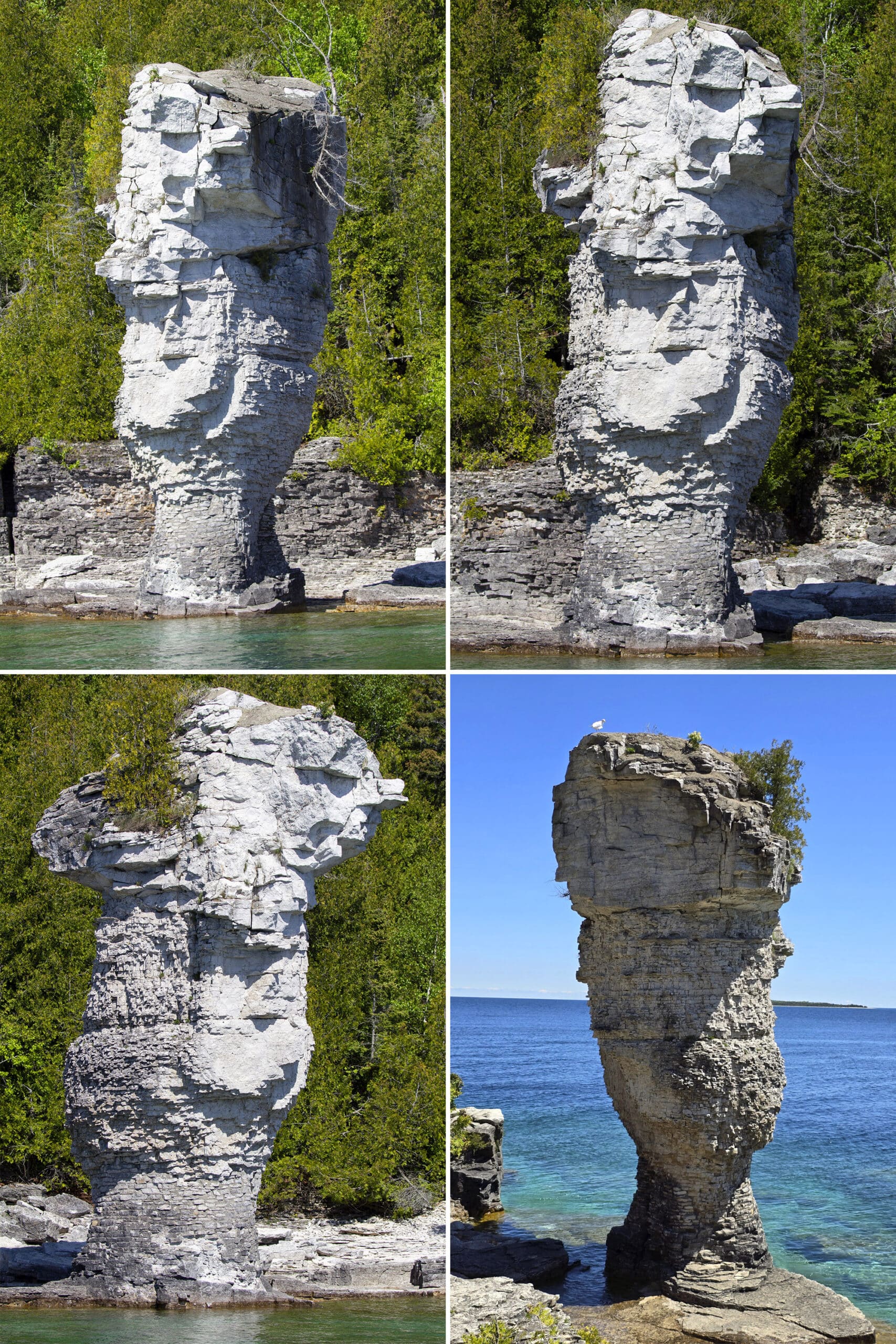
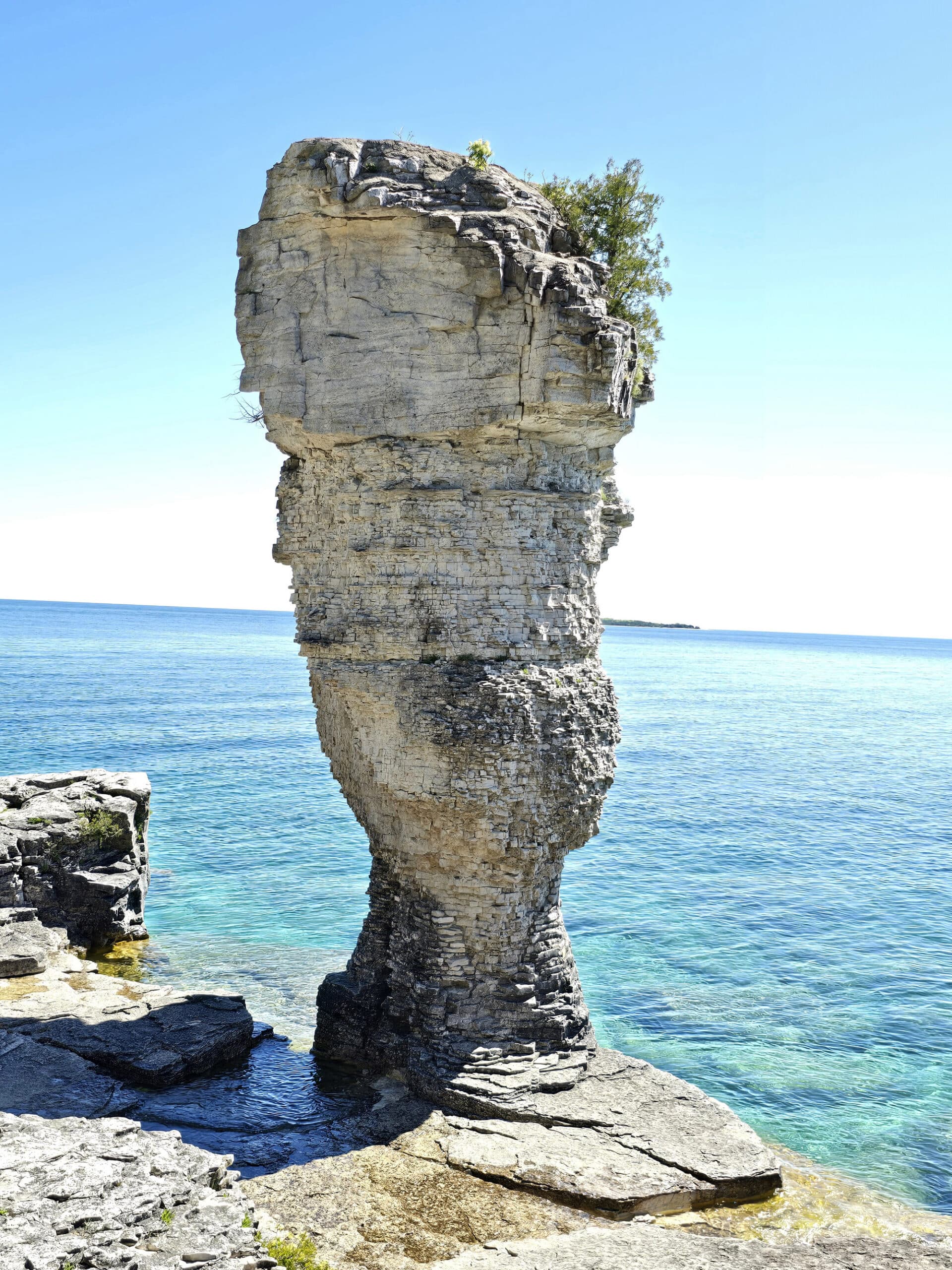
The Flowerpots
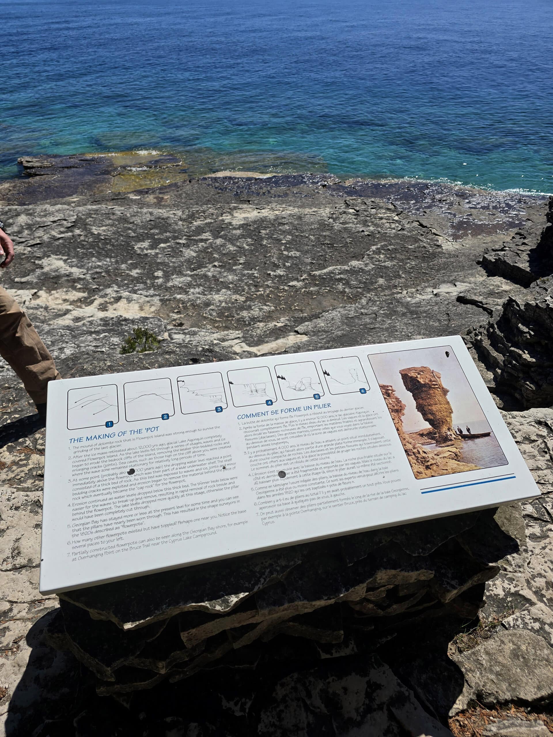
Obviously the main attraction, the namesake rock pillars are natural sea stacks that were formed over thousands of years of erosion.
12000 years ago, Flowerpot Island was completely covered by a glacier.
As the ice receded and the lake levels fell, erosion from the waves and ice carved out the island - including the caves and flower pots - as we see them today.
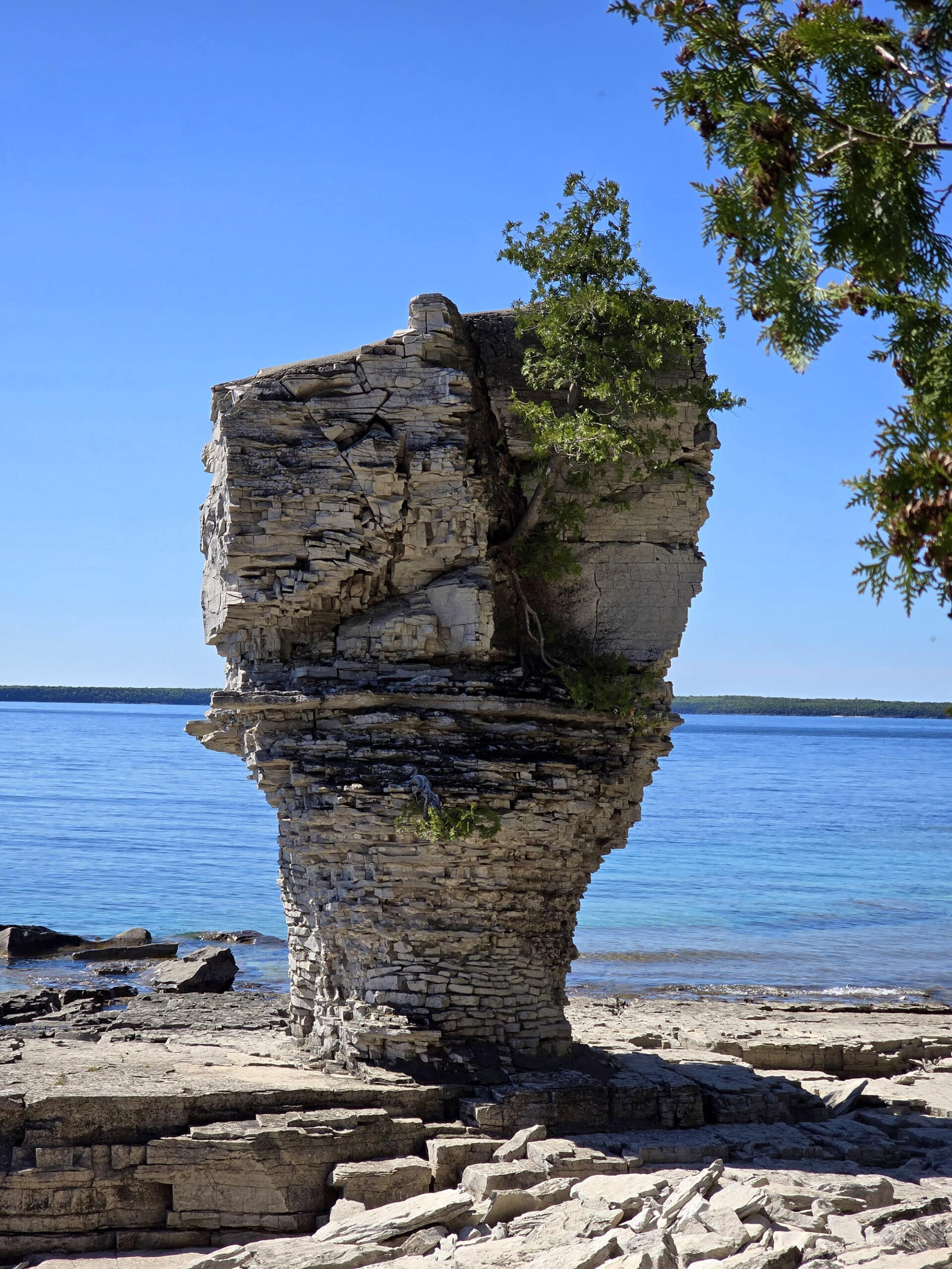
There are two full flowerpots that you can access on the island, plus a lot of formations that look to have formerly been flower pots, or at least have eroded in the same way as the pots were.
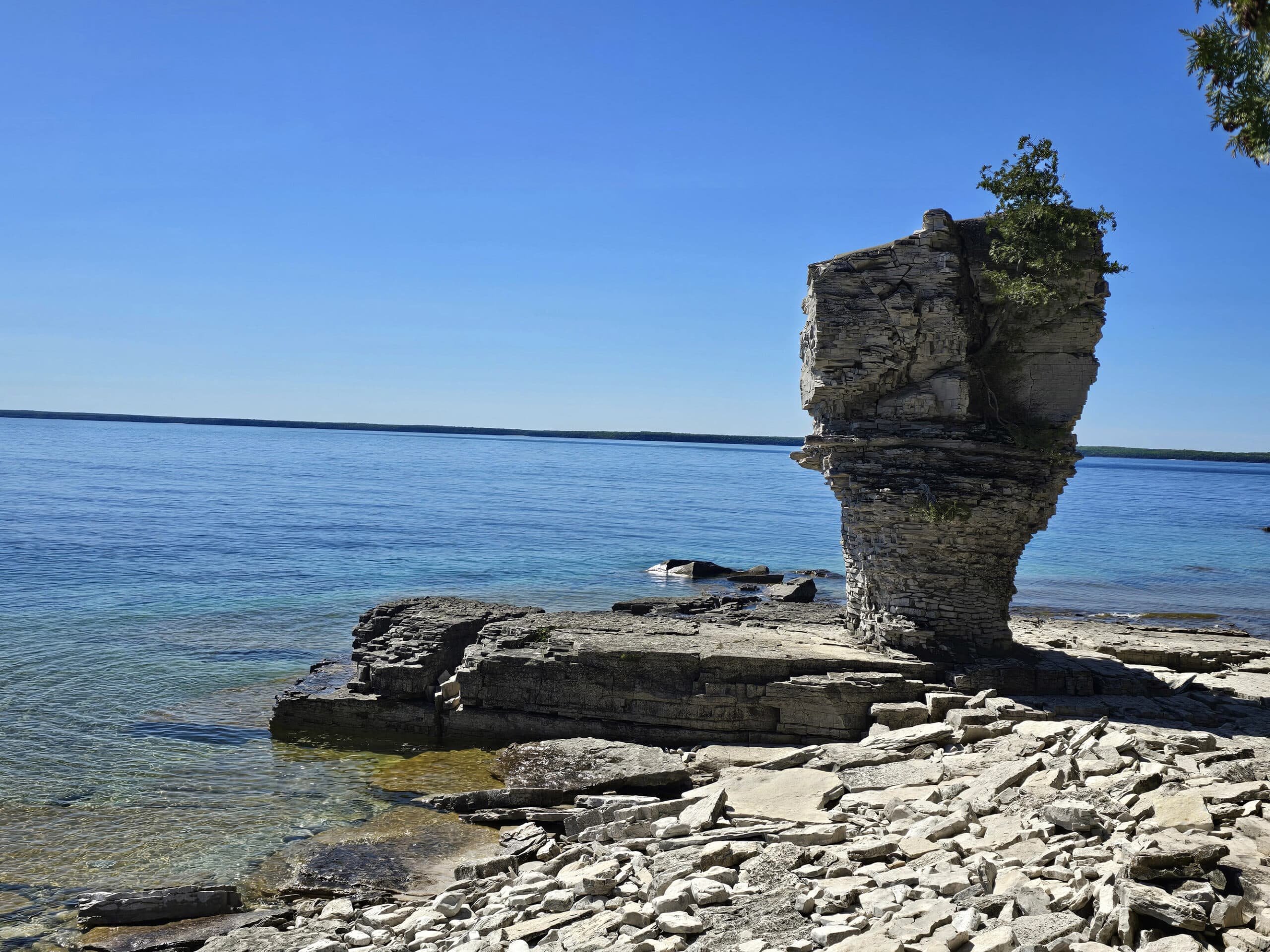
As for the two main flowerpots, there are several little access trails to get to them. They’re all pretty rustic, and some involve stepping down over rocks.
Word of advice: On a sunny day, you may need to get creative to work silhouetting, when taking photos.
If your PERFECT shot has the flower pot in silhouette, just go back in a few hours, and you might have better luck - that was the case with us!
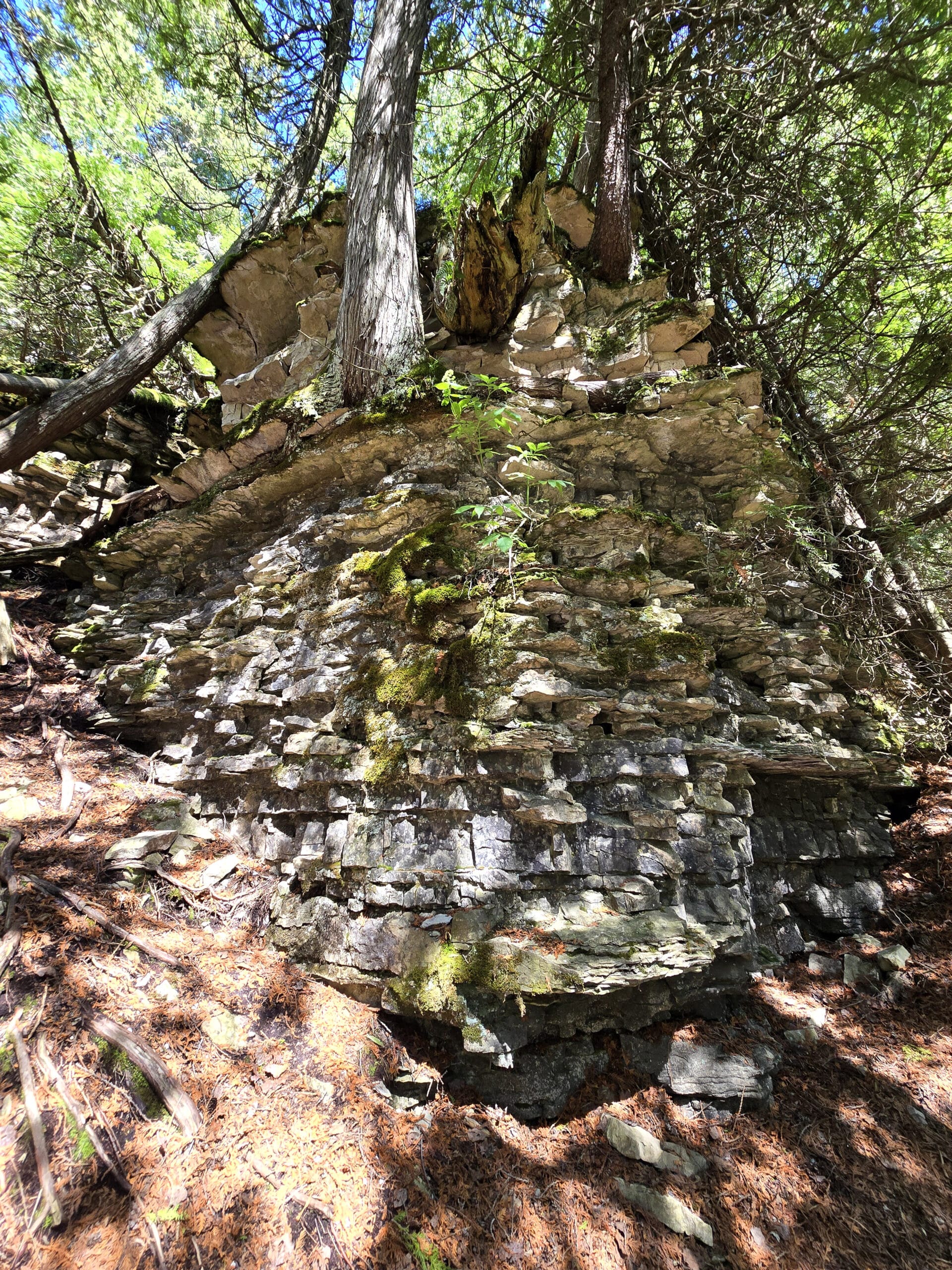
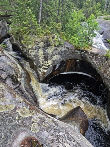
The Cave
Along the “easy” part of the loop trail - in the general vicinity of the flowerpots - you’ll eventually come across the trail leading to the caves.
This involves a TON of stairs to get there - I had to nope out. Porter went ahead, and reported back that it was “a little underwhelming”.
He said that the way TO the cave was actually more interesting -to him - than the cave itself.
He says there was a nice view, and it’s really cool to see the rocks the way they are... but you don’t really go *into* the cave, it’s just an observation deck at the mouth of it.
To be fair, we hadn’t looked into this before we went, so our expectations weren’t based on anything but imagination!
The Historic Light Station
The light station - and the lighthouse itself - are two areas that are relatively close together, near the halfway point of the main hiking loop.
It’s about 1.2 km from Beachy Cove, when you’re taking the easier half of the loop (along the shore).
Right on the main trail itself, you’ll come to the light station - an area where the lighthouse keepers would live while manning the station for a season.
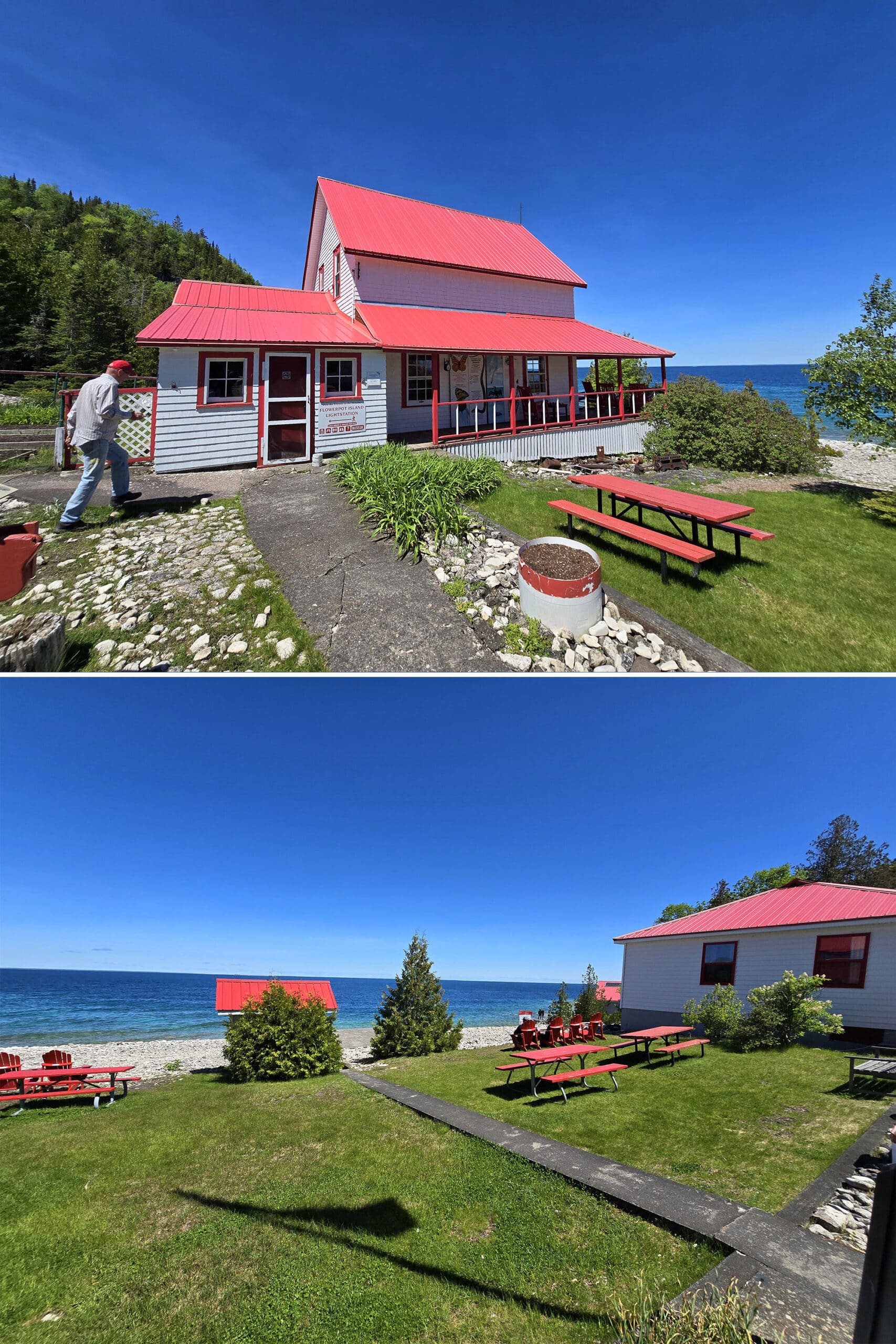
That was a bit of a weird one - the lighthouse itself was kind of meh.
Small, not really like anything we’d seen before... but nothing to write home about.
Really interesting.
There was boardwalk, a bridge, some stairs... and the view over the water is glorious, obviously!
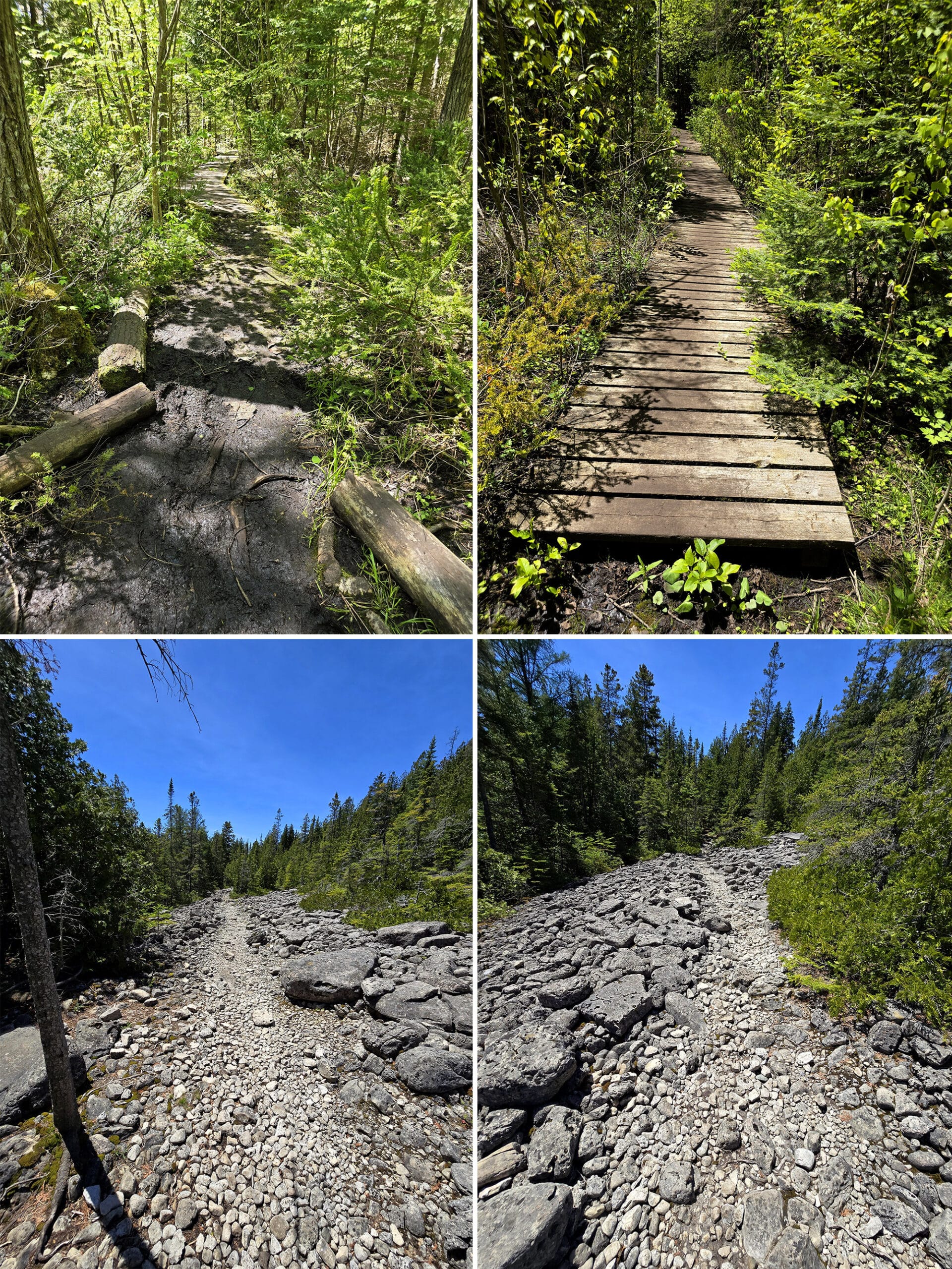
Hiking
The geology and general ecosystem of Flowerpot Island can set the stage for you to have some of the BEST experiences hiking.
Aside from the gorgeous views, there are rare plants to look for, and the trail is VERY ADHD friendly. The scenes are constantly changing!
There are 3 main sections of trails on Flowerpot Island, all of different difficulty levels:
Main Loop, Easy Half
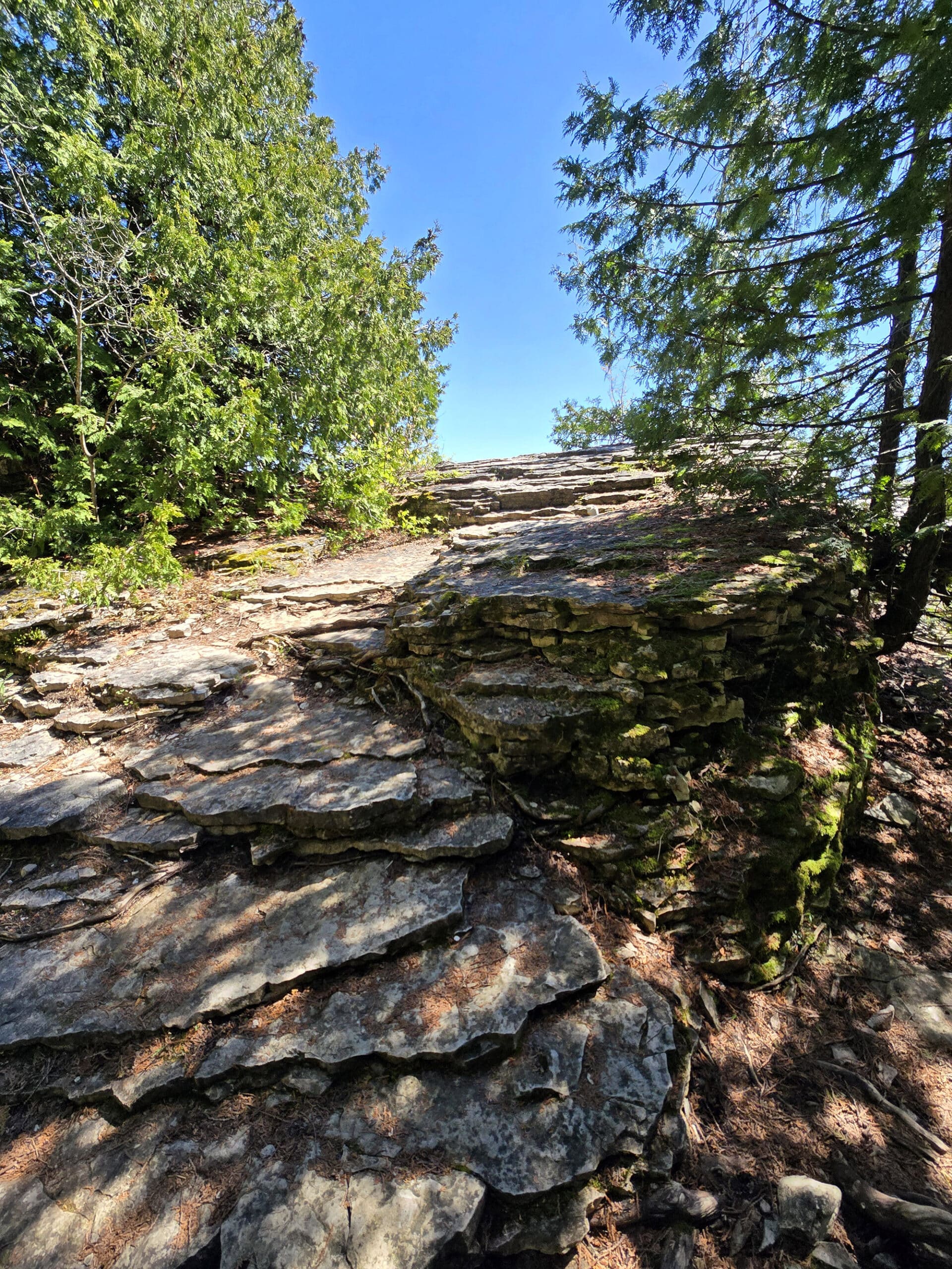
The first leg of trail you’re likely to take is the “easy” section of the main loop, 1.2 km long.
This starts out to the right when you disembark, and takes you out as far as the lightstation.
The trail here is MOSTLY wide, with rolling hills and some obstacles.
For reference, we saw people doing it in sundresses, and others lugging a full buffet picnic setup, so it’s really not TOO bad.
The flowerpots - and other gorgeous views - are all accessed via small trails off to the right side of the trail.
As mentioned earlier, these can be pretty “rustic”, but it’s worth getting over the obstacles presented!
Again, nothing TOO wild... but generally a bit more than I’d expect on a trail with an “easy” rating, so wanted to give you all a heads up!
Anyway, this is the main trail we did - I wasn’t feeling up to the other trails, so just doubled back on this section of trail.
For reference, the flowerpots are 0.5 km from Beachy Cove. The cave is 0.7 km into the trail, and the lightstation is at the 1.2 km mark.
Main Loop, Difficult Half (“Mountain Trail”)
Starting from the light station, you have the option of continuing on to the difficult leg of the loop trail - 1 km long - rated with a black diamond.
After a really bad downhill skiing experience as a kid, I dunno, black diamonds as a difficulty indicator spook me a bit!
We took a look at the beginning of the trail, and decided against either of us attempting it. It looked steep and rocky, and it seemed a bit of a gamble to go that way.
Not only for the physical issues I was having, but for the payoff. Why risk problems with a more adventurous hike, when we could just enjoy the amazing views we’d just seen a *second* time!
Some day we’ll be back and try the difficult loop, though.
Marl Trail
After dropping me off at Beachy Cove (at my request!), Porter continued along to the Marl Trail, to experience that part of the island for both of us.
This trail required walking up part of the difficult loop, then taking a side trail straight out to the Marl bed, and the coast.
The Marl trail itself is rated as a medium level of difficulty, and is 0.9 km (so 1.8 km, return).
This one’s a bit of a rocky path, you’ll definitely want to watch your footing. Sections were muddy, and there was a boardwalk section to get you over a particularly wet area.
Then you walk along the edge of... a boulder field? I don’t know if there’s a better term for it. The path itself isn’t that bad, though - you don’t really have to go over a bunch of boulders yourself.
There is one section where you have to navigate down some big rocks as steps, though.
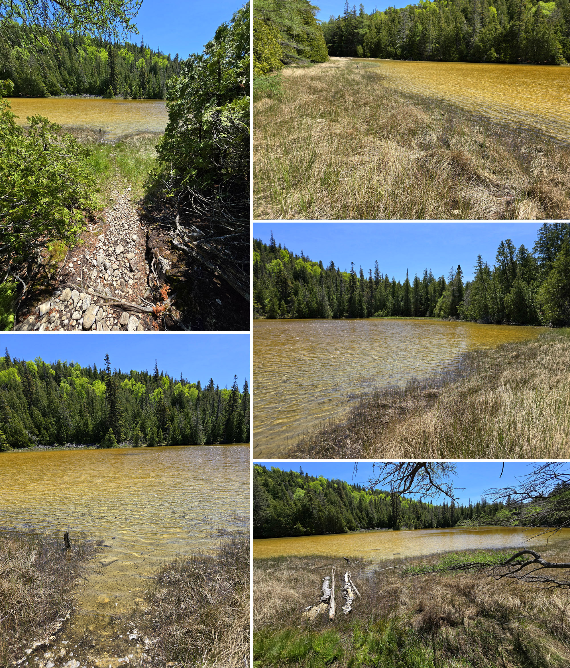
He says that there were two little offshoot paths to the actual marl bed, and the second one was a better path.
The first path got really swampy before you get to a good view, whereas the second one lets you get down right to the marl bed itself.
Another 100 meters or so beyond the marl bed, you come to a gorgeous rocky beach - and the end of the Marl Trail.
All told, it took him 37 minutes to walk it, from Beachy Cove and back (2.4 km total)... including the time he took to take in the scenery, take photos, and look for my orchid!
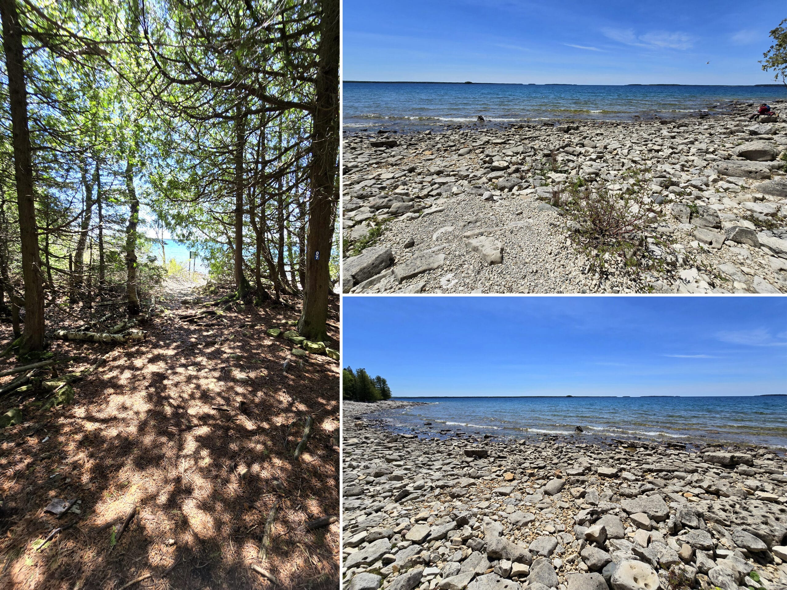
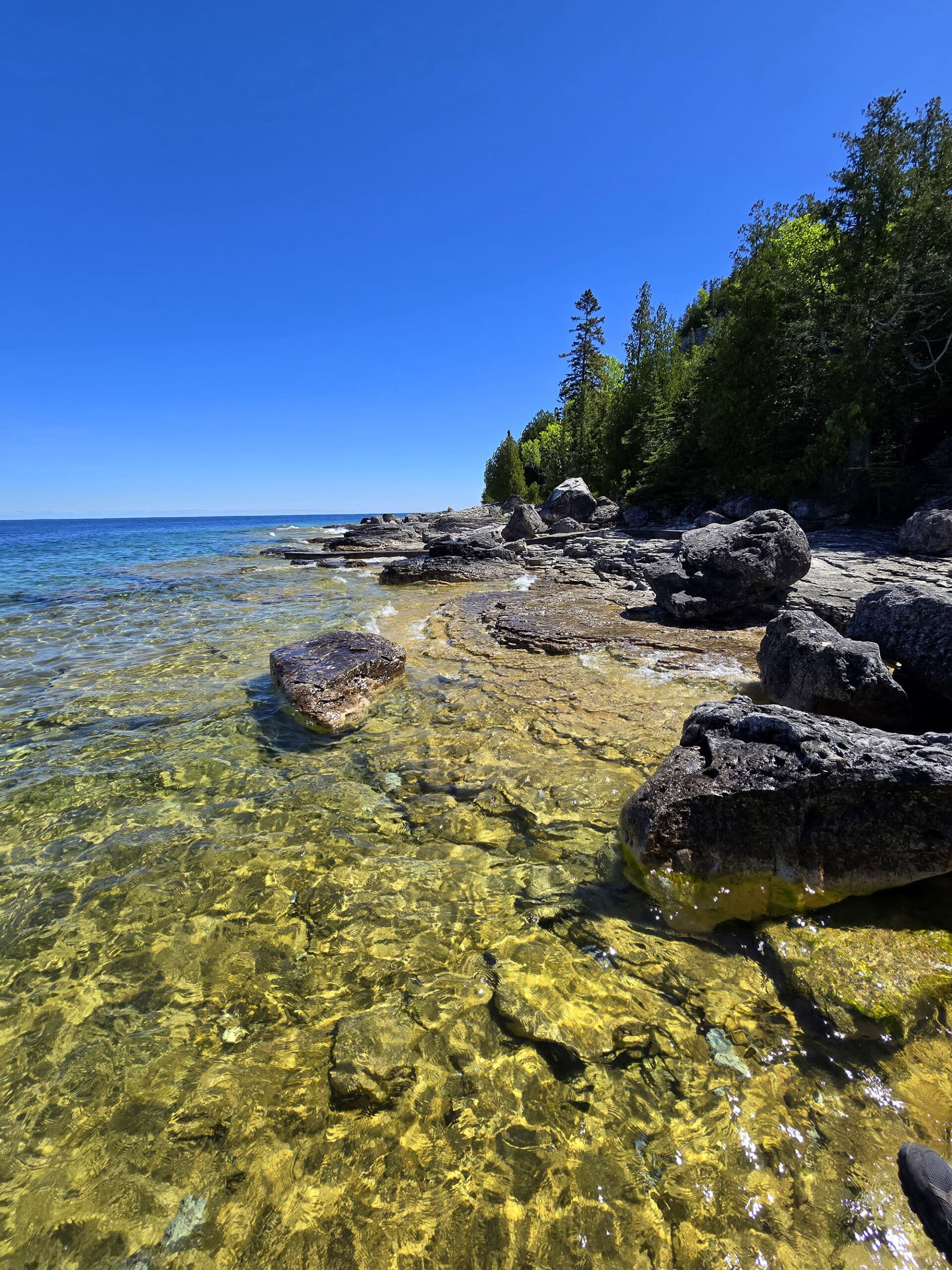
Swimming
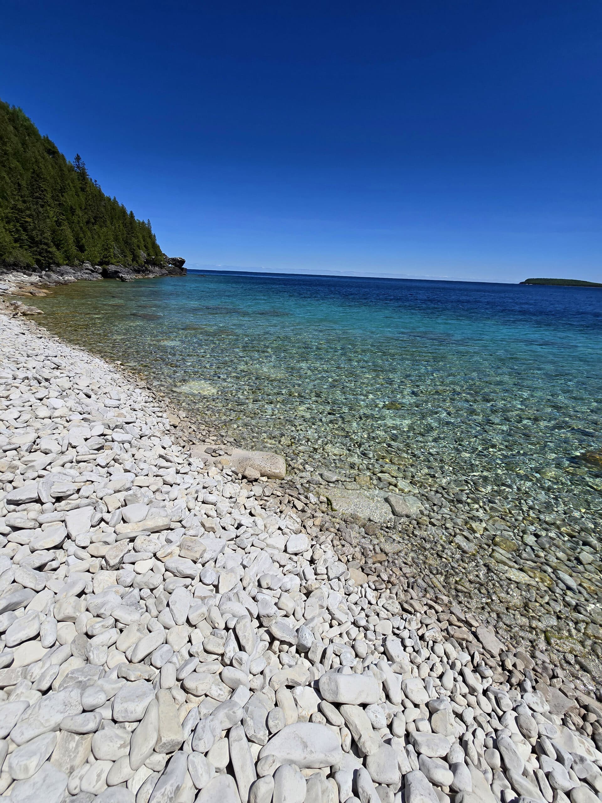
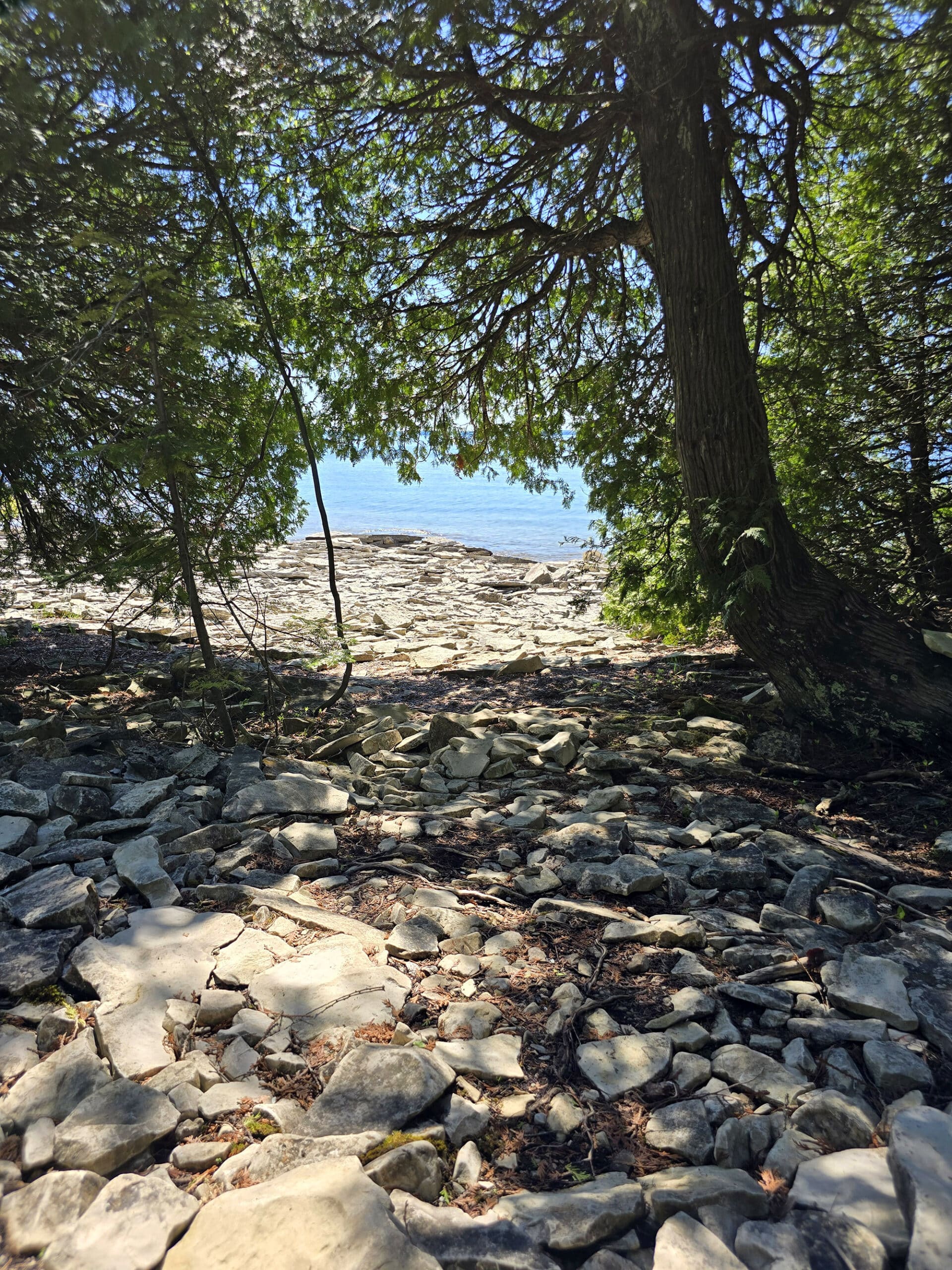
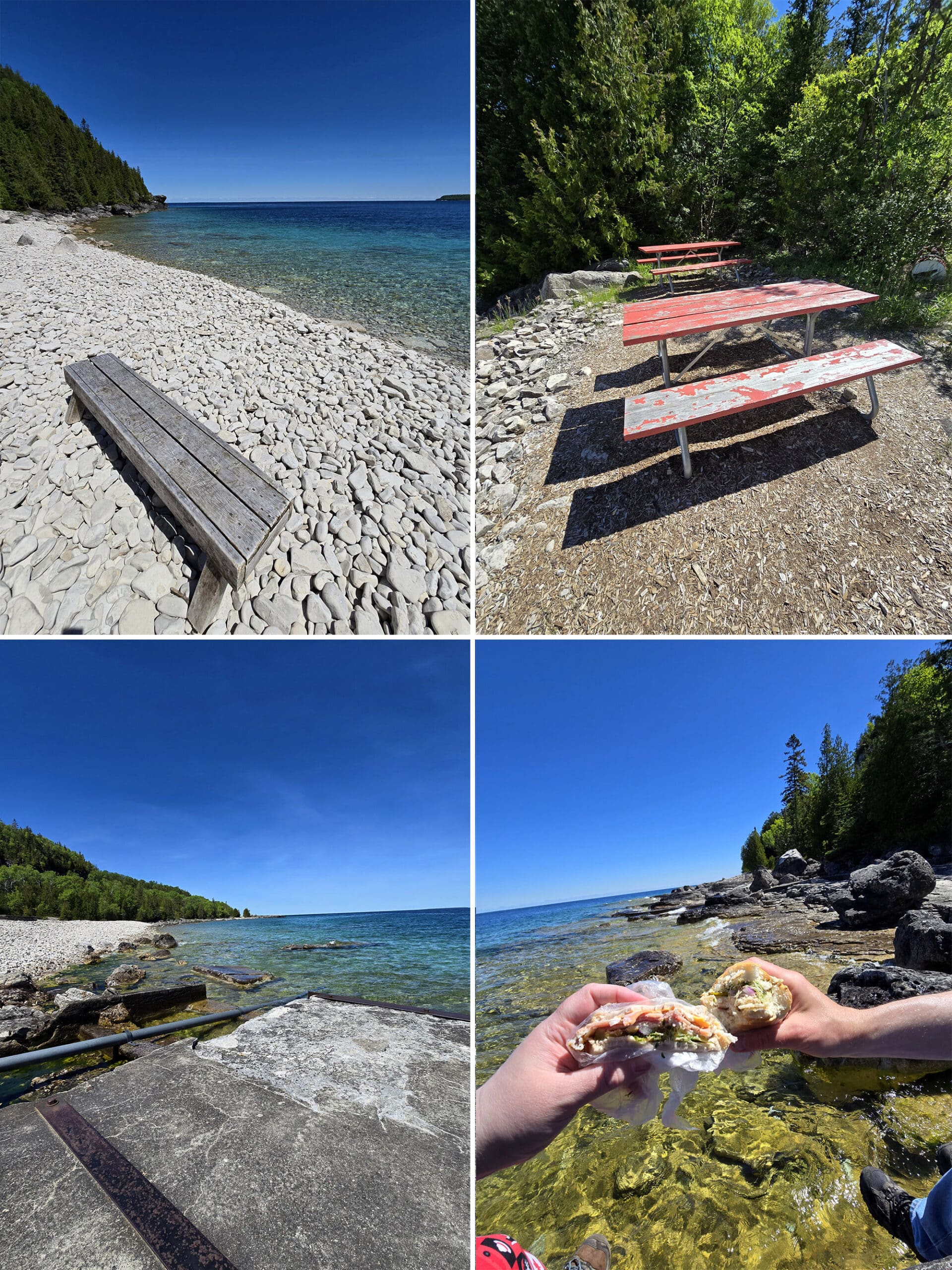
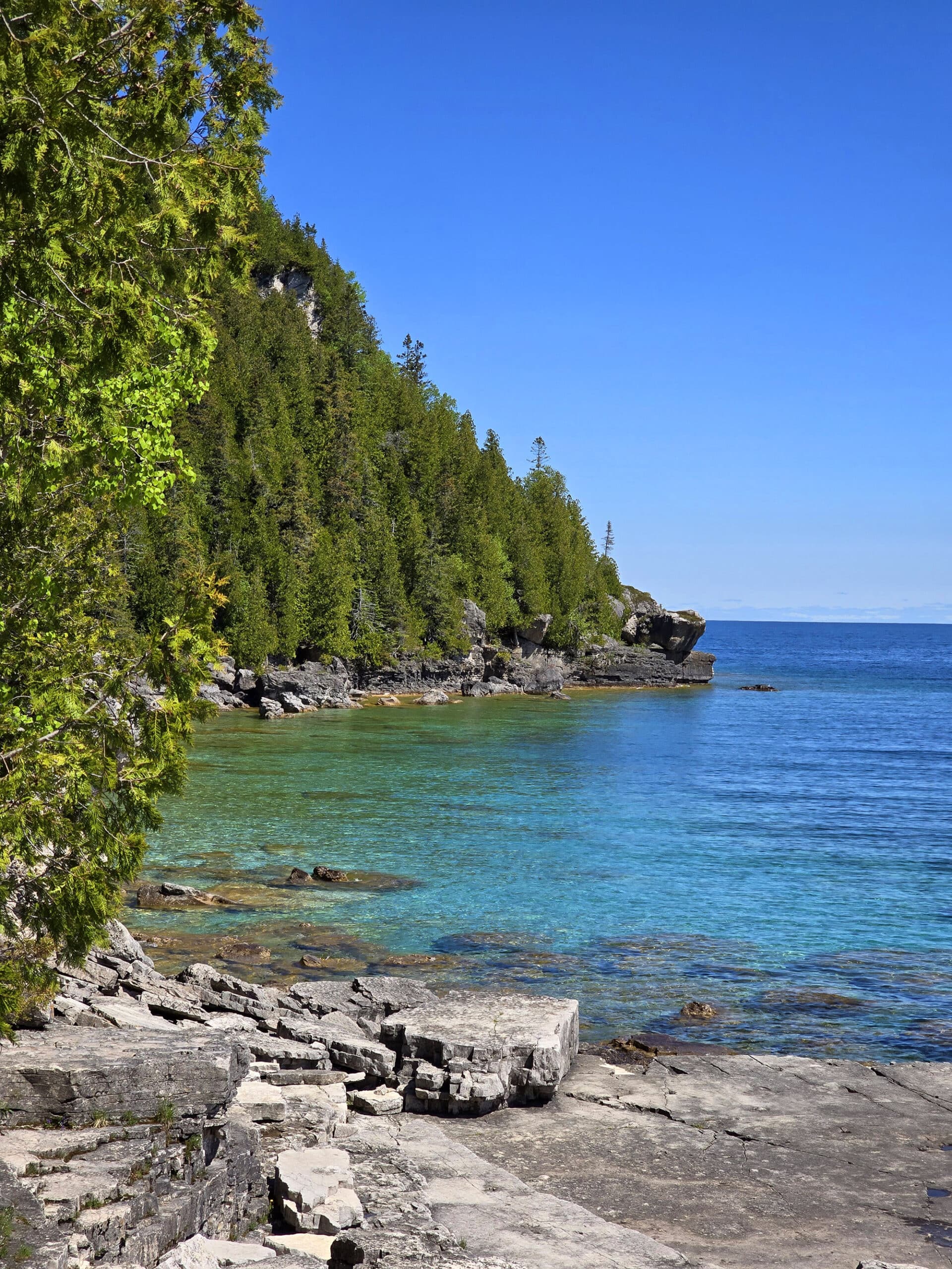
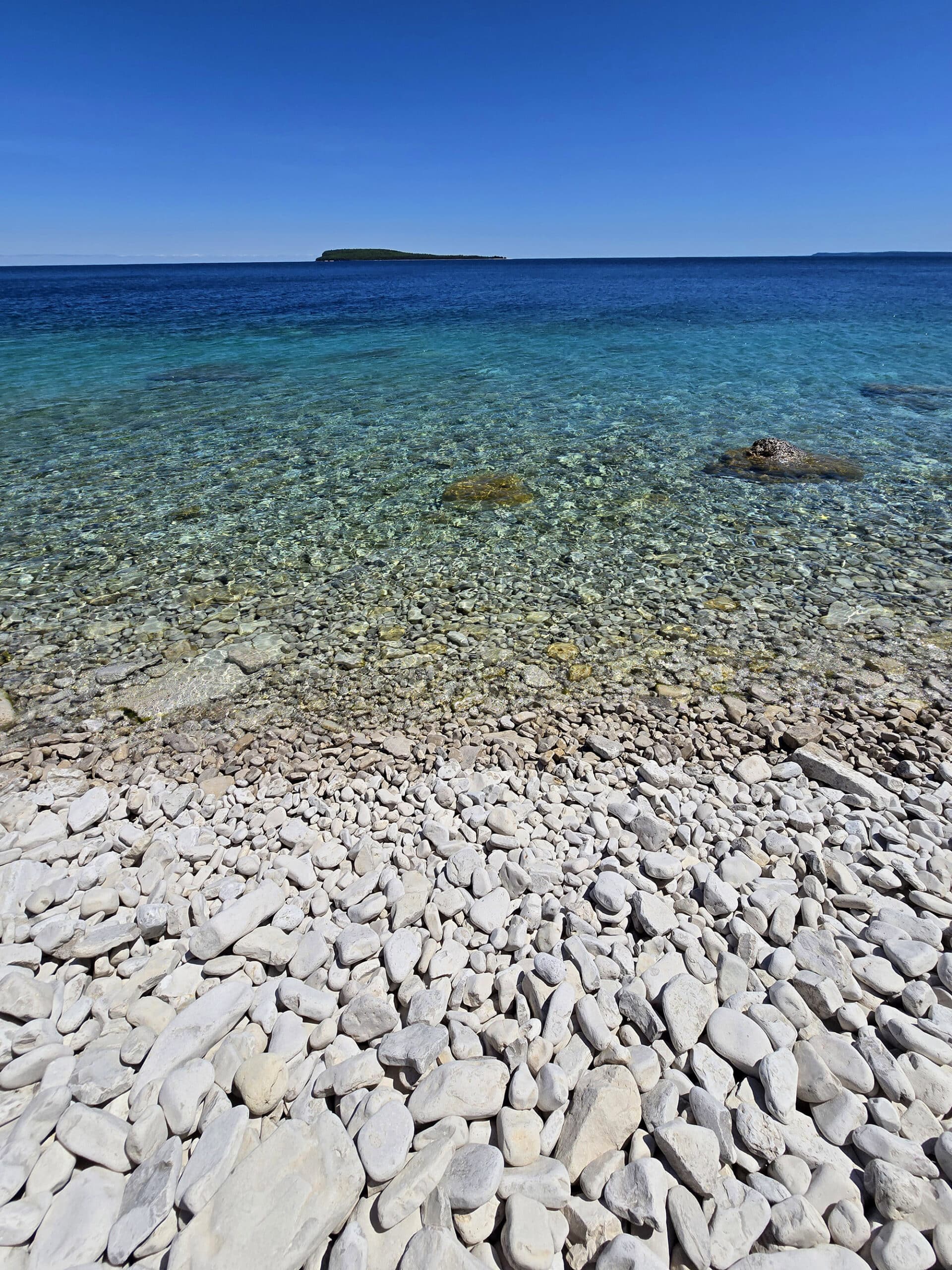
While we didn’t go swimming during our visit - the waters of Lake Huron are FREEZING in May! - there are absolutely gorgeous areas of beach that we would love to swim in some day.
There are many beach areas - or at least, rocky access points to the water - along the initial leg of the hiking.
The water is GORGEOUS. Seriously, the views we saw of the shoreline and out to the lake looked like something out of travel advertising for the Caribbean.
If it wasn’t so cold, I could absolute see spending a full day in the water there.
I mean, just LOOK at this place!
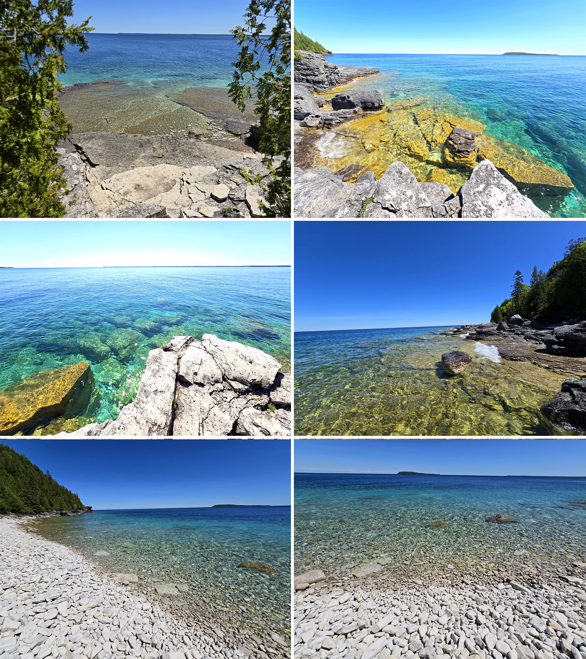
Bring water shoes - it’s rocky. Also, be careful of the deep drop-offs in the water.
Finally, just a heads up - the rocks on the shore are FULL of spiders.
You might want to leave your bags up closer to the boardwalk, lest you end up with an unwanted surprise later!
Birding, Wildlife, and Nature
I had one big goal in mind in terms of nature, for our visit to Flowerpot Island.
Having JUST learned of the existence of orchids throughout Bruce Peninsula - and admiring many of the yellow Ladyslippers we’d come across - I really wanted to see a Calypso Orchid for the first time.
Unfortunately... that was not to be.
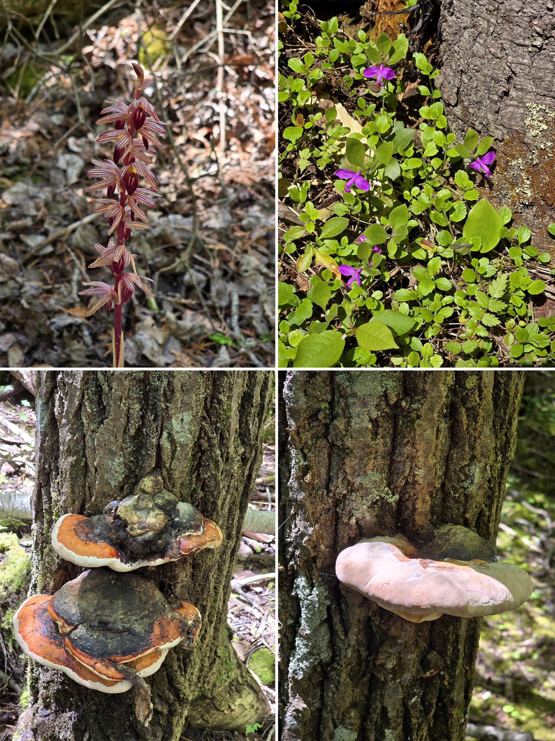
I DID get to see a new (to me) orchid, though - a Striped Coralroot Orchid! Very cute.
We also saw some Geranium Robertianum, Gaywings, Two-leaved Toothwort, a Red Belted Conk Fungus, and ... something else that looked like a freshly baked pita.
As far as birds or other wildlife go... just a bunch of seagulls!
Picnicking
With all those amazing views, it shouldn’t be surprising at all to hear that Flowerpot Island is a FANTASTIC place to have a picnic!
There are all kind of little beach areas, nooks, and secluded areas along the first leg of the trail (between Beachy Cove and the Lighthouse), as well as a bunch of picnic tables in and around the lightstation.
There are plenty of picnic tables scattered around for those who want them, and big flat rocks and other more rustic areas for people who prefer to just spread out on a picnic blanket.
Just as a heads up - no matter how out of the way you think you are, people have NO sense of personal space, and will literally trample you if they decide they want to see or do something.
It was SO bizarre!
I swear our presence sent out a beacon or something, because all of a sudden, it seemed like everyone in the area descended upon this otherwise ignored space!
It was wild to see all the beautiful areas surrounding us, while getting bumped into by someone that decided that was THE PLACE she needed to do a spontaneous, extended photo shoot.
Oh well, we had a great time anyway. Maybe next time we’ll have to hike out to an even more secluded rock or something!
Camping
Flowerpot Island is the only island in Fathom Five National Marine Park with maintained campsites and hiking trails.
There are 6 sites that are located just a short walk from Beachy Cove.
As the island is only accessible by boat, they’re for tent camping only.
Hardcore tent camping, mind you - the sites are completely unserviced, AND don’t allow fires!
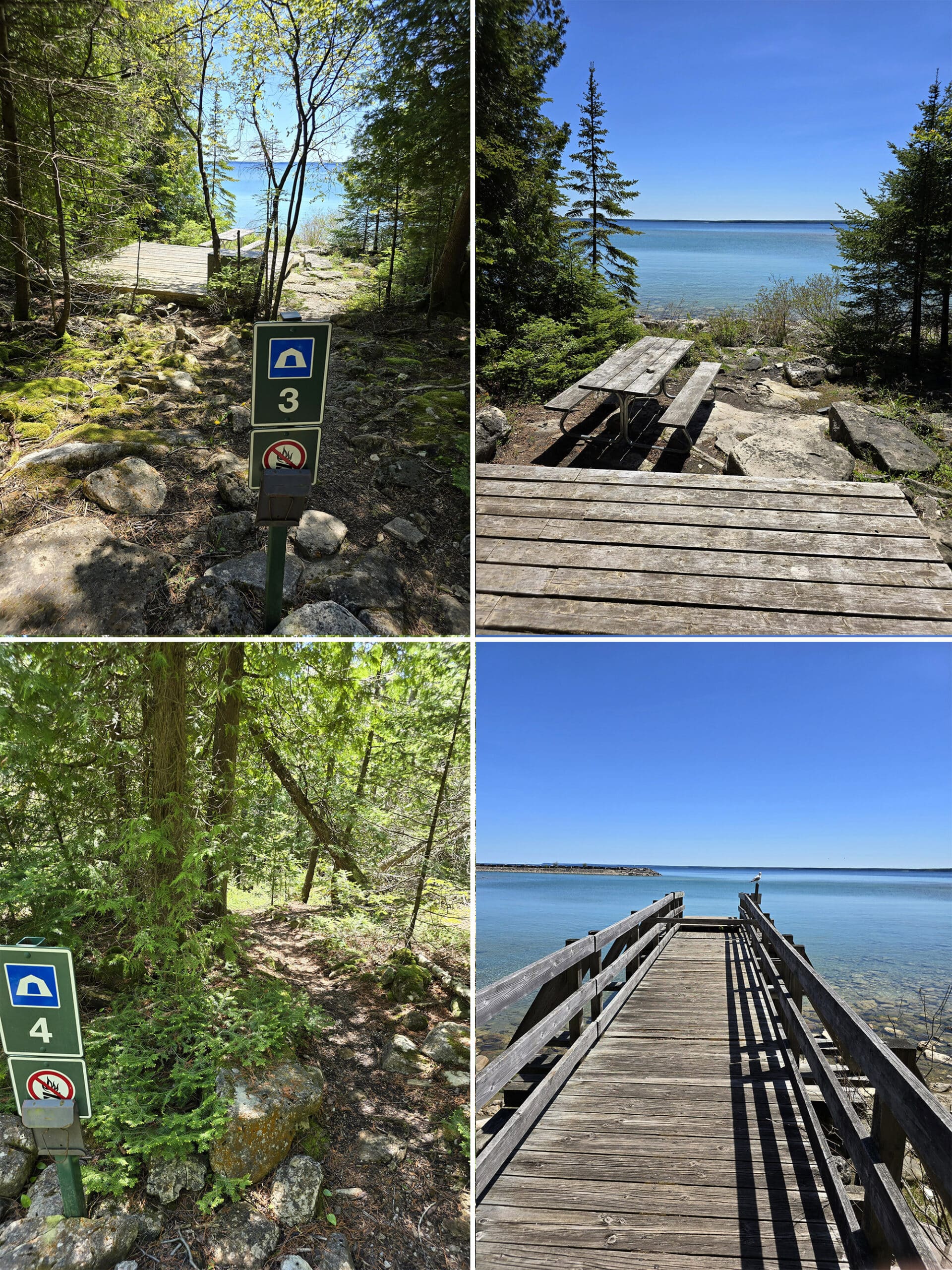
The site we were able to see (unoccupied) had a kind of wooden platform or deck, then a picnic table on the ground below it... overlooking Beachy Cove.
Nearby, there was a dock that seemed to be intended for the campers.
Really just a beautiful - though rustic! - setup!
Niantic Games
There are several portals / Pokestops just as you get onto / leave the island, in the Beachy Cove / welcome area.
We forgot to check our phones until we were back by Beachy Cove, so I’m not sure about the rest of the island.
The nice thing was that we had good enough cell phone signal to be able to spin a bunch of stops for vacation “gifts” to give friends!
Final Thoughts
You know, if not for the people... that would have been an absolutely perfect day.
Aside from not finding the orchid I wanted to see (and a minor issue with one of my hiking boots!), any issue we had with Flowerpot Island was just poor behaviour from the people visiting it.
The gross open mouth coughing all over every one, pushing, shoving, litter, etc - not great.
The island itself? AH. MAZE. ING.
Wish my feet would have held up enough to see the second part of the loop trail, but really?
It’s hard to feel like I missed out on anything, when I just got a SECOND look at all the amazing sights we saw on our way in!
The weather was perfect, and the clear skies with that turquoise blue water made for a surreal experience. It’s wild that we have places like that, here in Canada!
If not for the campfire ban, Flowerpot Island may have actually pushed me into actually wanting to give tent camping a go. Imagine waking up to THAT view, right from your site!
Anyway, we’ll definitely be back - we’ll just be trying the other boat tour company, and hoping for a better experience with them.
More Places to See
Looking for some nice sights to see and great places to visit while you're out on your camping adventures? Here are a few of our favourite day use parks, attractions, etc.
Batchawana Bay
Big Bay, Ontario
Bruce Peninsula National Park
Cheltenham Badlands
Devil's Monument, Bruce Peninsula
Falls Reserve Conservation Area
Keith McLean Conservation Lands
Menesetung Bridge
Point Pelee National Park
Spirit Rock Conservation Area
Temagami Fire Tower
Thanks for Reading!If you loved this post - or have any questions about it - please leave a comment below! We'd also love it if you would consider sharing the link on social media! |
Leave a Reply