
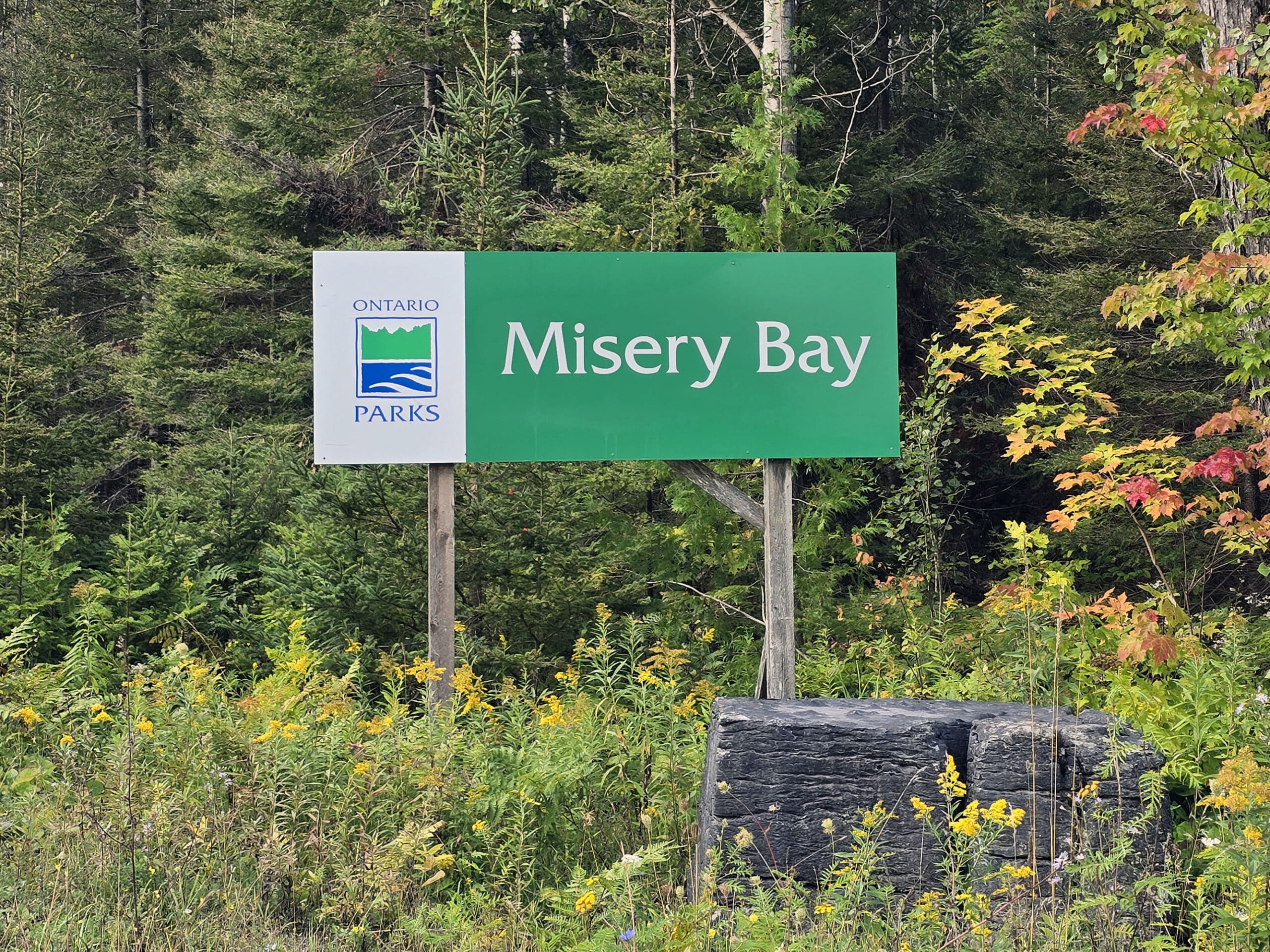
Misery Bay Provincial Park is an AMAZING day-use only park on Manitoulin Island. You’ll find all kinds of interesting birds, plants, rock formations, & more - here's what you need to know!

Located on the south shore of Manitoulin Island, it’s a day use park known for its natural features.
Sure, you could say the same about a lot of the Provincial Parks... but this is legitimately a unique area.
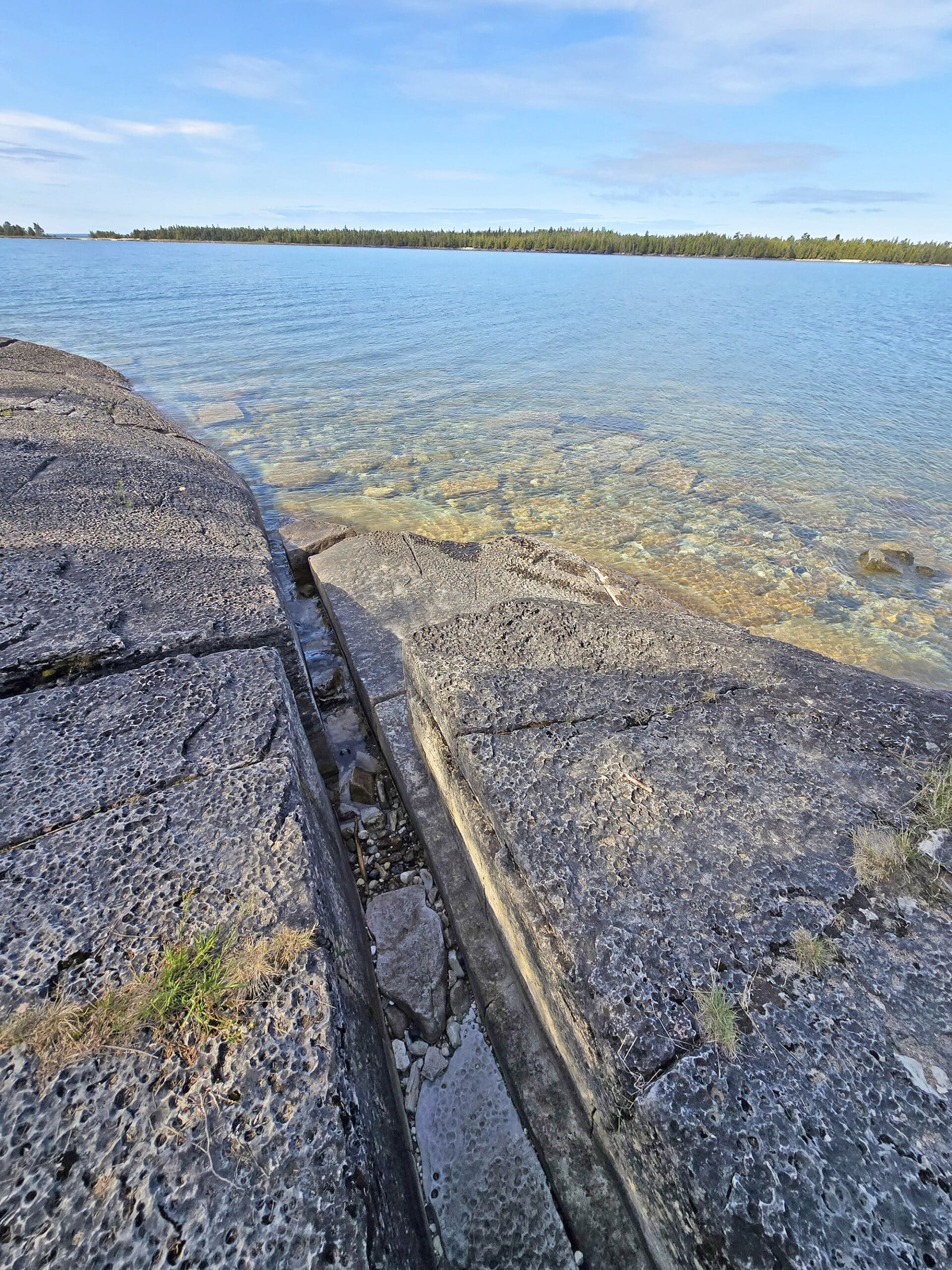
The “theme” of the park, if you could nail it down to just one focus, is definitely the geology, and ecology of the present-day shoreline ... which basically tells the history of the ancient flat rock sea bottom that used to cover the area.
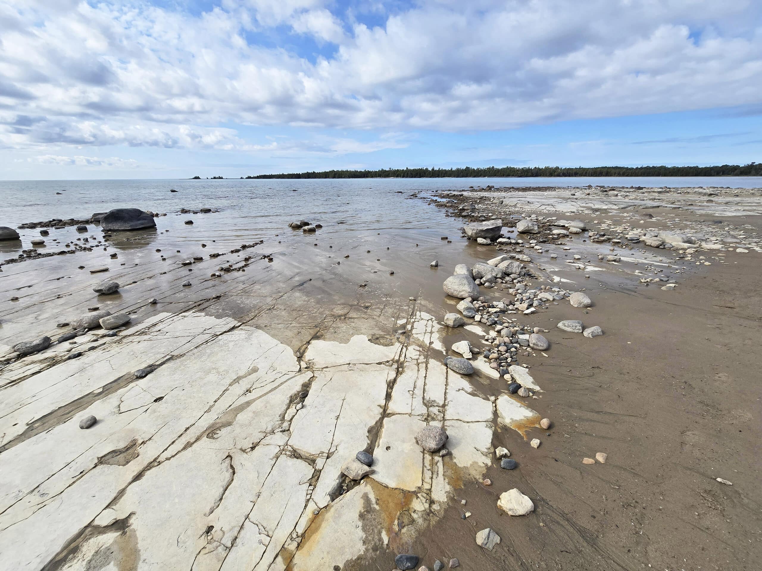
All through the park are rare alvars - large sections of flat limestone bedrock, which serve as a base to all kinds of rare plant life.
As you know if you follow this blog, we’re big fans of Boreal forest groundcover.
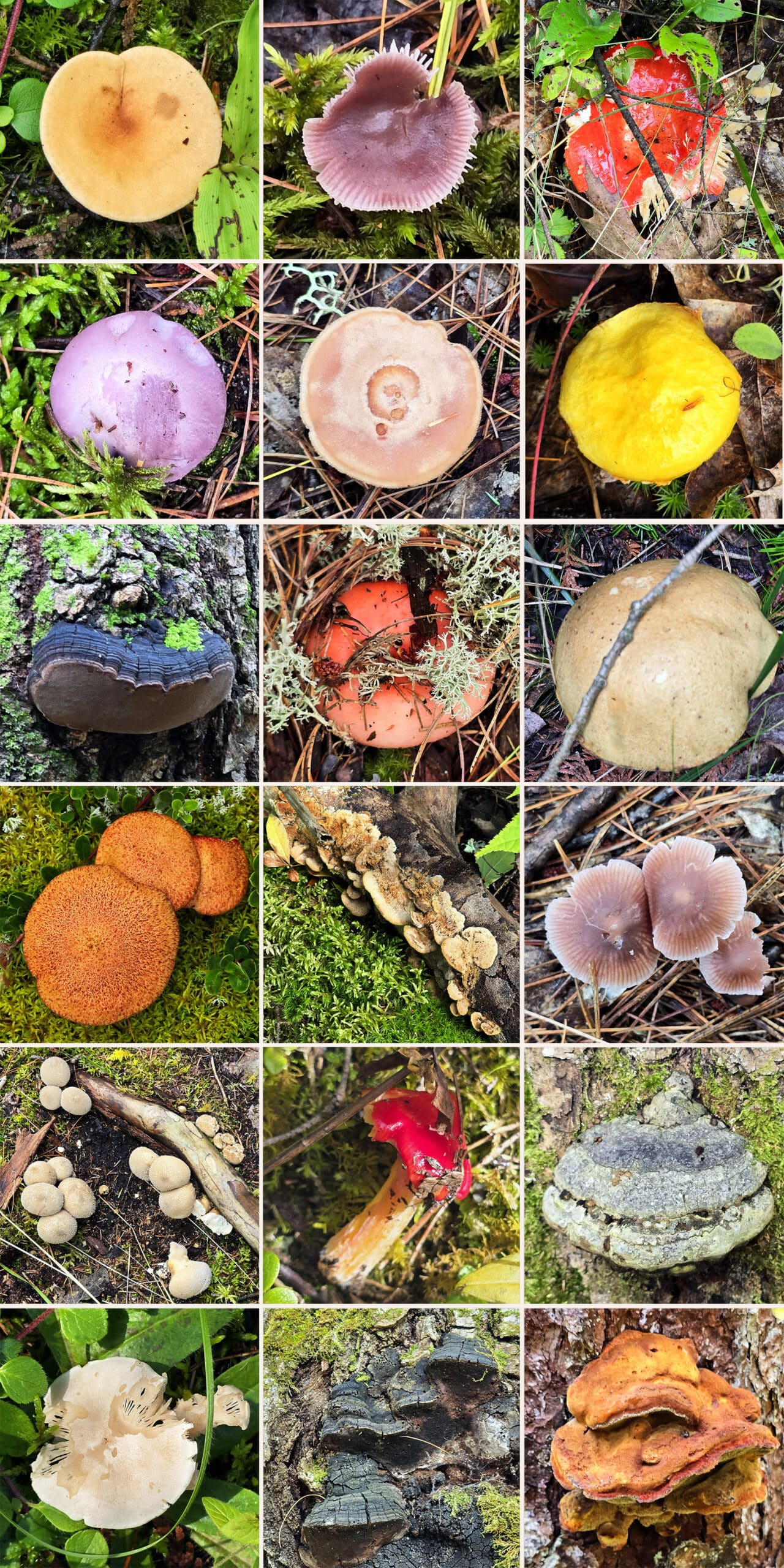
We love looking at all kinds of little plants, lichens, mosses, fungi, and wildflowers that we don’t see near our home - it’s a big part of why we love Northern Ontario so much!
We saw so many new and “weird” flowers and other plants that we’ve never seen before, anywhere. It was fascinating - and at times, it felt almost otherworldly.
Basically, it’s a really great place to visit if you like to look at All. The. Things.
The best, though? We visited in September, well after orchid season (they have rare orchids!), and generally past peak season for all kinds of other wild flowers and such.
Given how amazing our visit was, we can’t WAIT to check it out during peak growing / blooming season. (Ok, spoilers!).
Anyway, we didn’t get to spend anywhere near as much time in the park as we wanted to, just based on logistics. It’s not a park you can camp at, and it was an hour away from where we were camping.
So... now we know what we need to know to make a better go of it next time - let us tell you all about it!
The Basics:
Location Name: Misery Bay Provincial Park
Address: P.O. Box 560, c/o Windy Lake Provincial Park Levack, ON P0M 2C0
Website: https://www.ontarioparks.ca/park/miserybay
Price Ontario Provincial Parks uses a pricing matrix across all their parks. See 2025 Day Use Fees for more details.
Reservations: Ontario Parks Reservations
Park Classification: Nature Reserve Class
Season: May 15, 2026 to October 18, 2026
Logistics
Some basic information to help you plan your visit to Misery Bay Provincial Park:
Registration and Check In
I had planned to reserve our Daily Vehicle Permit for Misery Bay Provincial Park the morning before our visit, as I wasn’t sure if there was a gatehouse or staff on hand.
As it turned out, I wasn’t able to - it looked like they only allowed same-day purchase, after 7 am on the day of your visit.
So, I booked it en-route to the park, using the Ontario Parks reservations portal. At that point, I noticed that I had the wrong date in - it was for a couple weeks in the future.
After booking our current trip, I tried to “book” one for the following day - and it WAS allowing me the option. It looks like you can reserve them a few days in advance.
Anyway, booking was quick and easy, as always. I pre-registered at the time of booking, but was not given the “check in” option that I’ve been given when booking a campsite on the same day. I guess “check in” is only for camping permits.
Anyway, there was no gatehouse, office, or - so far as we could see - any staff on duty at the park.
For those who don’t pay their reservation fees online ahead of time, there’s a sign with a QR code to do so, in the parking lot.

Parking
The parking lot is very small and kind of weird, with a bit of a figure eight thing going on with it.
I’m not sure if it’s intended to be used for RVs, but that center part of the parking area would definitely fit motorhomes and trailers.
The problem is - aside from one designated accessible parking spot - NONE of the parking spots are marked with signs or lines on the ground. Kind of chaotic.
It’s also not a huge lot. I was surprised how many people were there at the time of our visit - a random Monday morning in September. It was after the labour day weekend and before the leaves changed colour, and there were 3 other cars in the lot when we returned to our car.
It might be difficult to find parking during the weekends in the main open season (summer).
Anyway, the parking lot is just a short distance from the Visitor Center / trailheads - about 100 metres.
Washrooms
The washroom situation at Misery Bay Provincial Park is a bit weird.
Googling ahead of time, I couldn’t get a clear answer as to whether their were washrooms on site, in the off season.
None were shown on the park map, the facilities section made mention of there being flush toilets *in* the Visitor Center (which I knew was closed for the season), etc.
But I did see a reference to a “composting toilet” on someone’s review... and another that said that there was no running water at the park, including at the Visitor Centre.
So, I had no idea if there actually were flush toilets in it, or if that was a mistake and it was referring to a composting toilet outside... and whether or not ANY of those options would even be open.
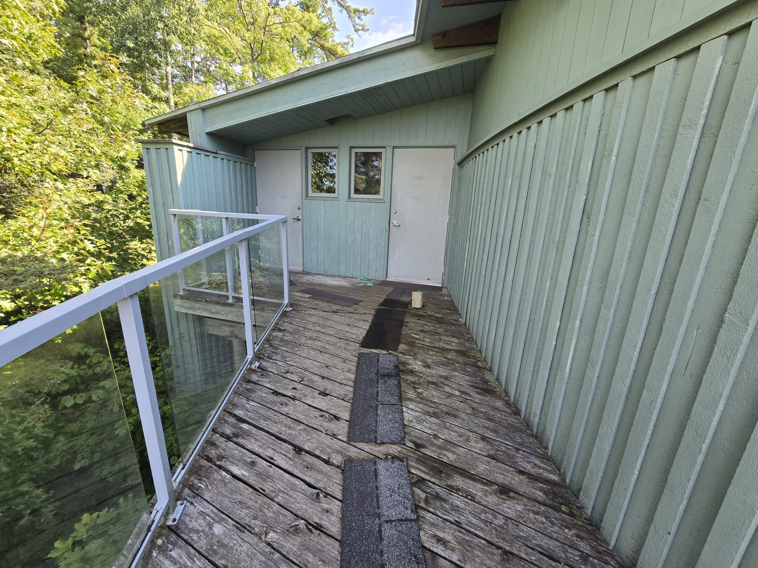
It took some work to find them, though - a sign on the deck pointed in the general direction, but I wasn’t sure if it meant ON the deck, or on the underside. I didn’t see anything on the deck level, so I proceeded to the lower level and didn’t find it.
On the way back to the car, I gave it one more attempt. As it turned out, the washrooms WERE on the deck level. Once you enter the deck area, you have to go all the way around to the other side - there are two doors there, VERY faintly marked “WC”, which I assumed to stand for “water closet”.
Unfortunately, they were both locked. It was noon by this time, so I’m kind of assuming they’re just locked after Labour Day.
That’s the only washroom in the park, so far as we could see, or could tell.
So... if you’re going on the off-season, you’re probably not going to want to hydrate much, the day of your visit.
As a heads up, there’s a picnic area maybe 10 minutes down the road, east of the park. That had a couple of washroom buildings that WERE open.
Maps and Signage
As a note: I’ve seen reference to someone having Google Maps direct them to the wrong place, when aiming for Misery Bay Provincial Park.
We didn’t have that experience - it took us directly to the park - but I figured I’d mention it just in case. I know Google can be weird sometimes!
We’d actually just had a weird little misadventure trying to find the Your Independent grocery store in North Bay - Google took us into a residential area, probably 5 minutes from the actual store!
Anyway, aside from that note, here’s some information to help you find your way around Misery Bay Provincial Park:
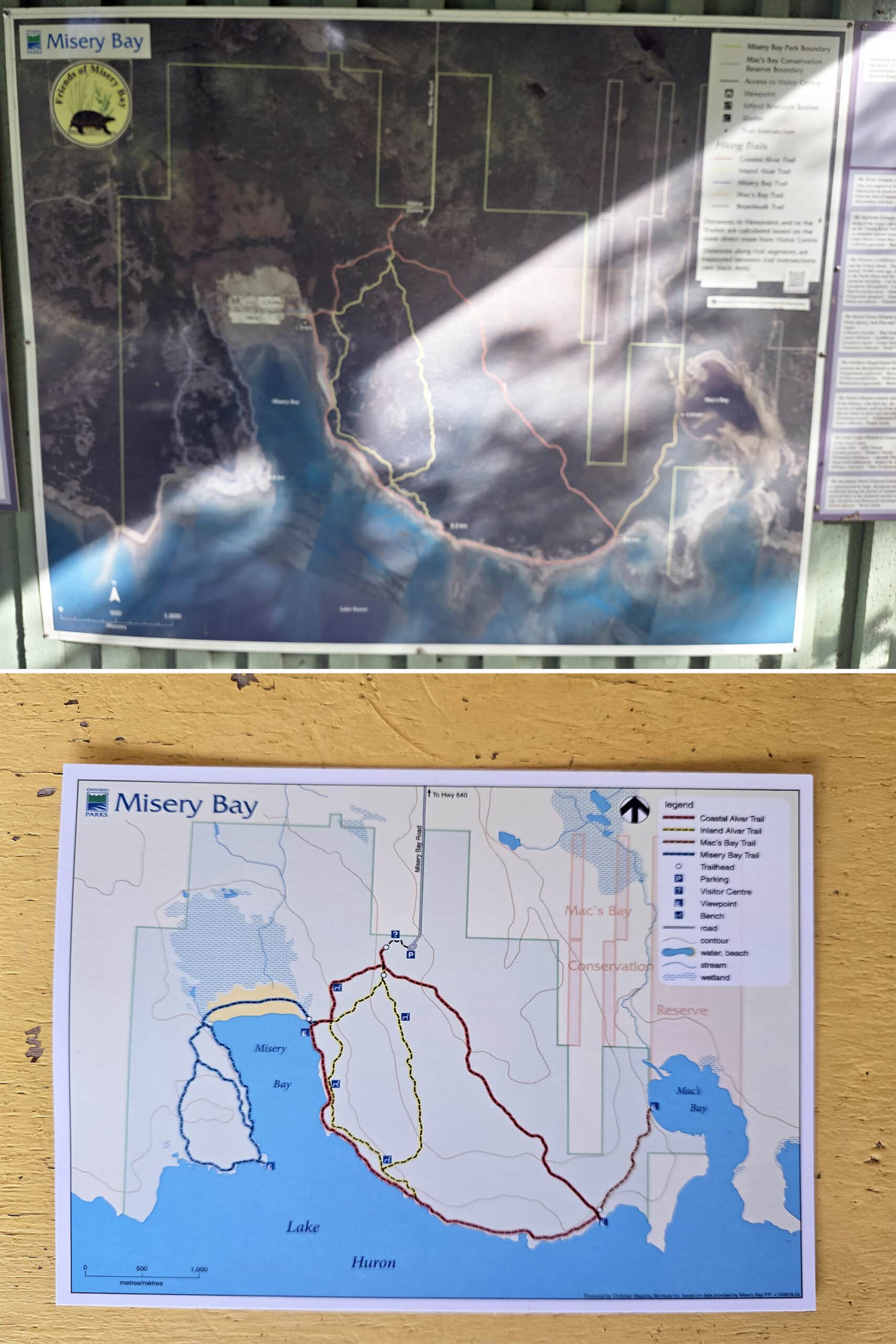
Park Map
When we arrived, I was surprised that there were no maps located in the parking lot. I guess I’d been expecting a map sign, along the lines of what we’ve seen in other day use parks - like Oxtongue River-Ragged Falls Provincial Park or Potholes Provincial Park.
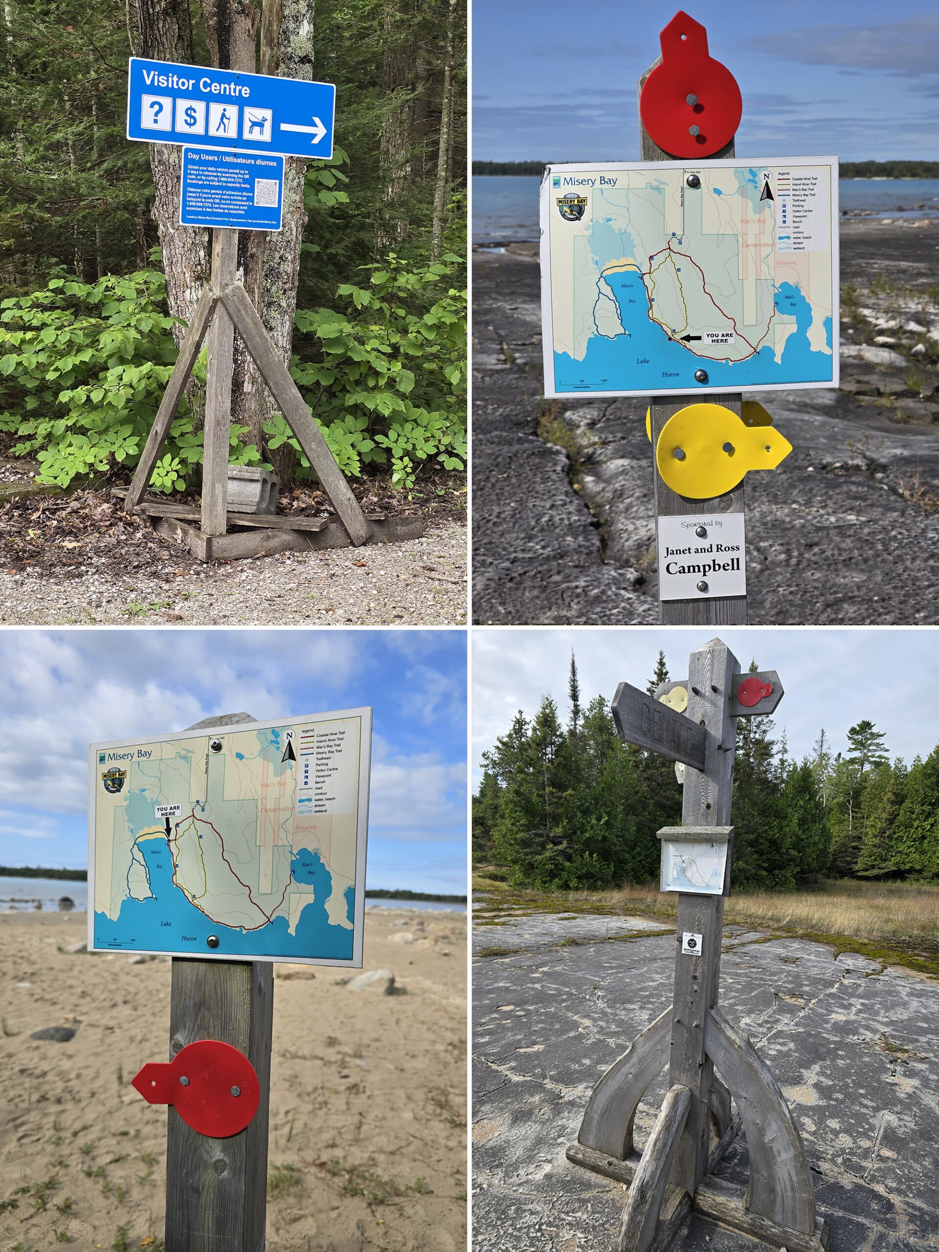
There was a little sign pointing towards the Visitor Centre, though, so that’s where we went.
At the Visitor Centre - on the outside - you’ve got a couple options for maps.
On the wall, there’s a large trail map with segmented distances marked. This was really helpful for us, as we’d planned to split up along the way.
This would allow Porter - far more able-bodied - to see more of the park, and me to live vicariously through him!

Obviously that wasn’t an option, but that was ok - there were little display boxes with glossy postcard trail maps on the wall with the big trail map.
As a note, neither the postcard maps nor the Misery Bay Provincial Park Map PDF version on the park’s site have those segmented trail distances on them.
So, if that’s information you’d like to have on hand, I recommend taking a photo of that big wall map, or the sections you’re interested in.
Also, as a note: Whether or not you actually play PokemonGo, this is one of those parks where that app comes in handy. The trail maps on the app are fantastic, and there were a few places where it really came in handy.
I’ll never understand why a Pokemon game tends to be far more accurate and useful than actual hiking / trail apps, but here we are!
Signage
The signage was great in some places, and not so great in others.
As you get started near the Visitor Centre, it’s great. We love that the trail intersections tended to have “You are here” map signs, with colour-coded arrows pointing in the directions of the various trail segments.
We did run into a bit of a problem at one junction, where it appeared that there was a trail segment missing.
This was where Pokemon Go came in handy - we could see the missing segment on that map, so I walked towards it... and we found it, just sort of out of view from where the directional trail signage was.
Accessibility
I was AMAZED at how accessible this park ended up being for me - as someone with significant mobility impairment, but not a wheelchair user.
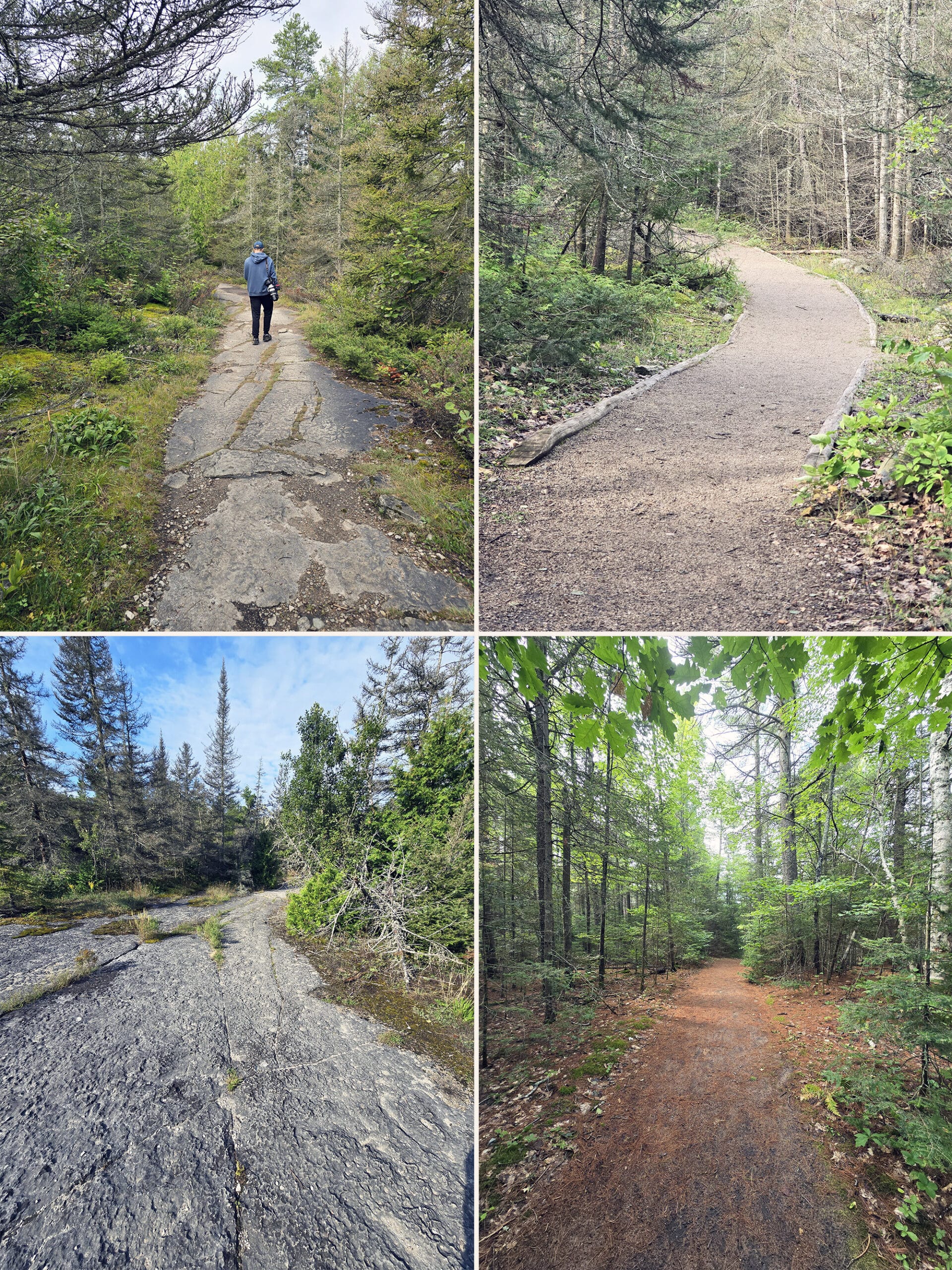
Starting at the parking lot (which had a single accessible parking spot - we left it open), the path to the Visitor Center was wide, well-packed gravel, and very flat. It reminded us of campground walking paths in national parks - and it was definitely wheelchair accessible.
Misery Bay Provincial Park’s website says that the Visitor Centre is barrier-free. Getting to the door is, but - as it was closed - I can’t comment beyond that.
The access to the washrooms on the outside is similarly barrier-free... but they were locked, so I can’t tell you how barrier-free they are in terms of actual use.
If you are a wheelchair user, the Visitor Centre is where your access to Misery Bay Provincial Park ends. You have to get down a really rough set of rock stairs (marked as “slippery when wet”, no less) in order to even get to the start of the trail system.

If you’re not a wheelchair user and are able to get down those steps, it’s actually a really accessible park!
I was able to walk FOUR KILOMETERS that day - 2 in, and 2 out - and had a fantastic time! That first 2 km of the Coastal Alvar Trail was really easy - flat, not much at all in the way of inclines, etc.
The trail surface varies between packed earth, and flat-ish rock surface. The rock surface isn’t much more difficult than a rough pavement.
I wasn’t requiring mobility aids that day, but I can confidently say that I wouldn’t have had any trouble doing that part of the trail had I been in a boot, brace, and/or using a cane.
Well, after that initial staircase, anyway. That still would have been do-able, though.
The big thing, to me, is that I didn’t feel like I was missing out on anything. The path I did was GORGEOUS, and I was able to walk right out onto Misery Bay. It was that packed sand, easy to walk on.
I had a great time!
That Coastal Alvar Trail got more difficult from that point - rocky, more loose sand, etc - but I’d already planned to turn around at that point anyway.
It felt amazing to actually be able to walk that far, and see so much!
Pets
There is NO information about pets - not on the park website, not on any signage we saw. There weren’t any poop bag dispensers to encourage bringing your dogs, and there also wasn’t any signage banning them.
Best we can tell, that means they’re allowed, and - we’re assuming - the standard rules apply.
Because it’s a nature reserve park, there’s a HEAVY emphasis on staying on the trails - so (as always), don’t let your dog mess with the plants or wildlife... or other people.
Dogs probably have to be leashed at all times - 2 metre max seems to be the default rule - and picked up after.
As a note - I didn’t notice any garbage cans anywhere. So, you should definitely plan to be packing out any poop, with you.

Park Store
Per the Friends of Misery Bay website, it sounds like there’s probably some sort of small gift shop inside the Visitor Centre.
It’s not mentioned on the park’s website, though, and that’s the only indication I saw anywhere of there being a store.
Visitor Centre
There’s a large interpretive centre at the park, though it keeps very limited hours: weekends in May and June, all week in July and August, and closed the rest of the year.
The park’s website gives some interesting information about the actual building, though - apparently it’s run off-grid, with solar energy. It also says that it uses “passive solar design” for heating and cooling.
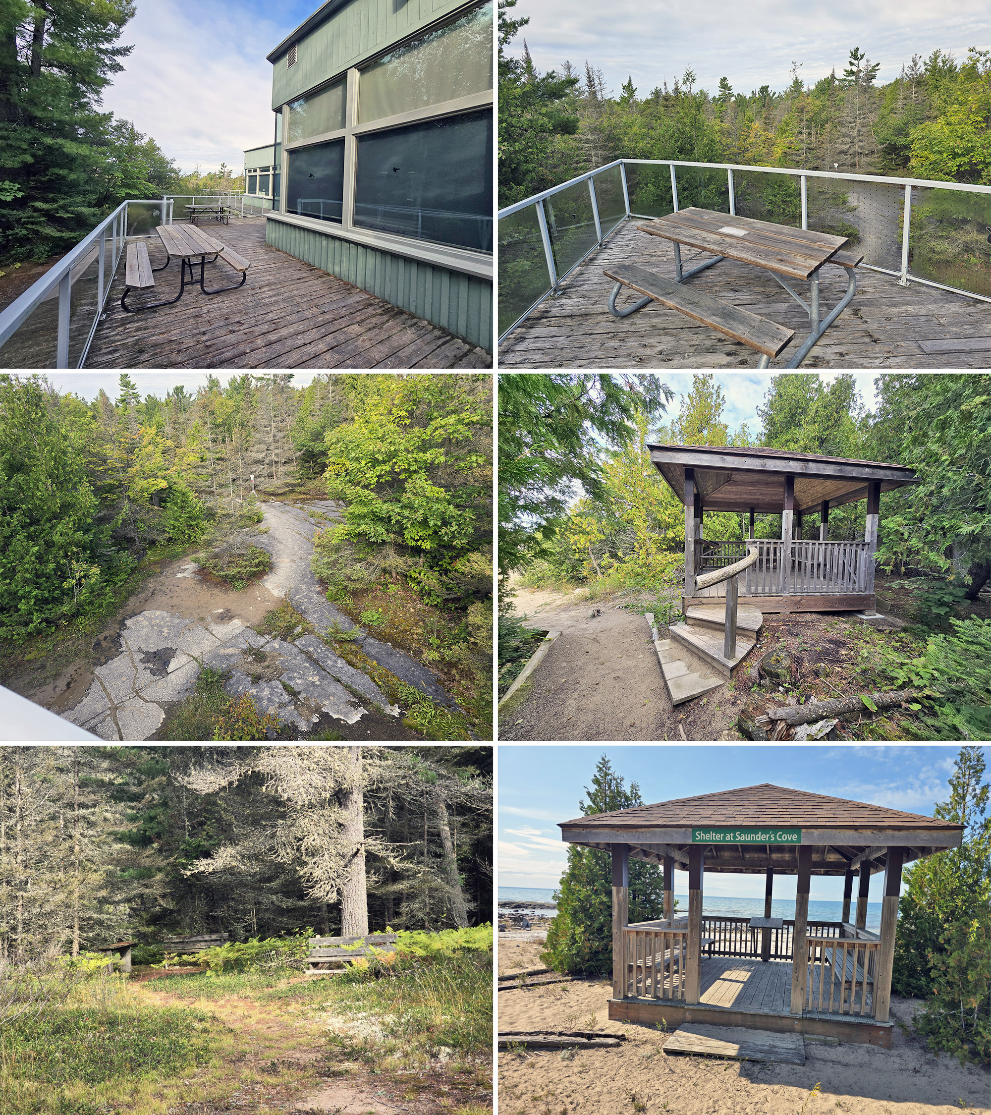
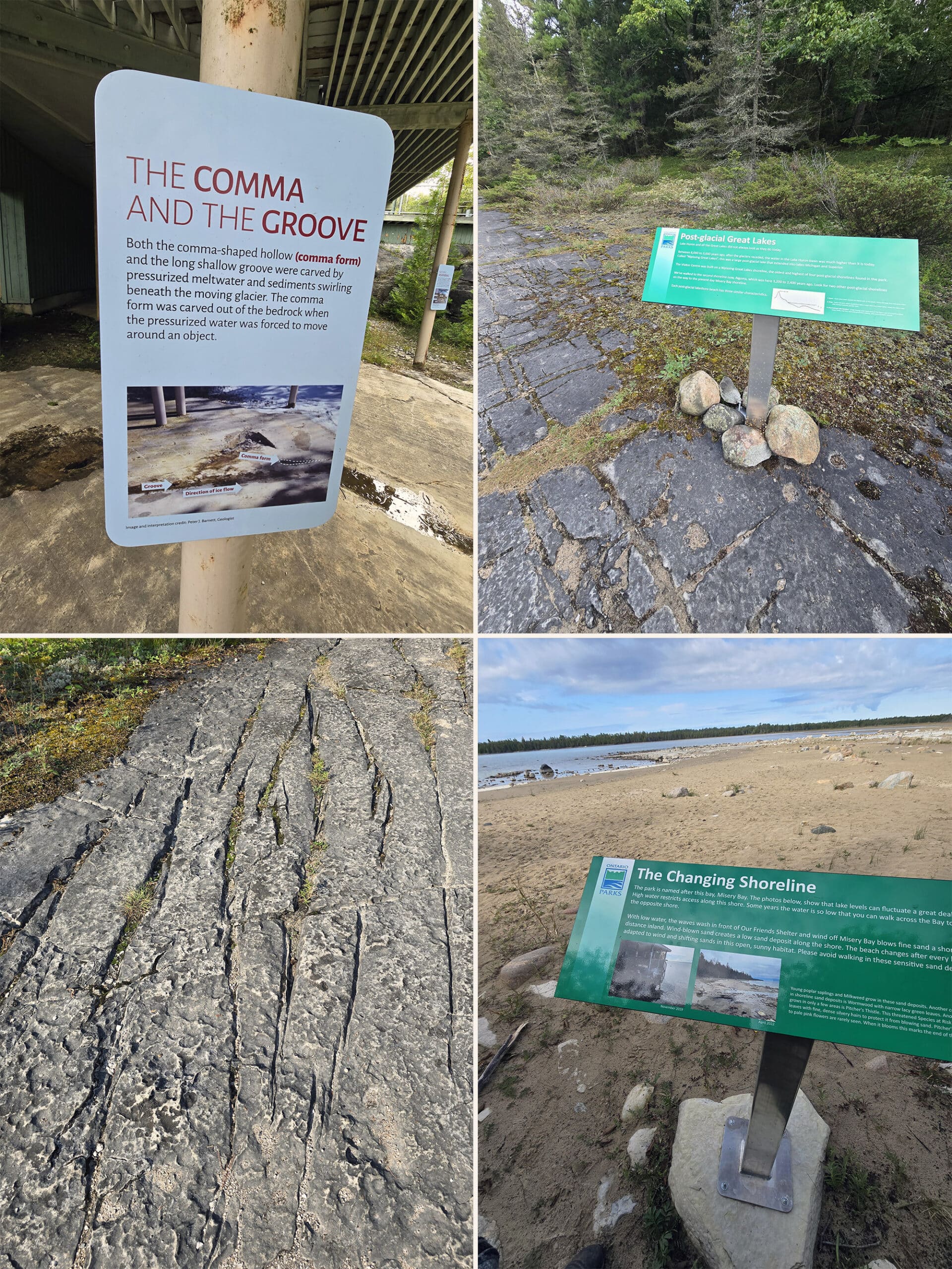
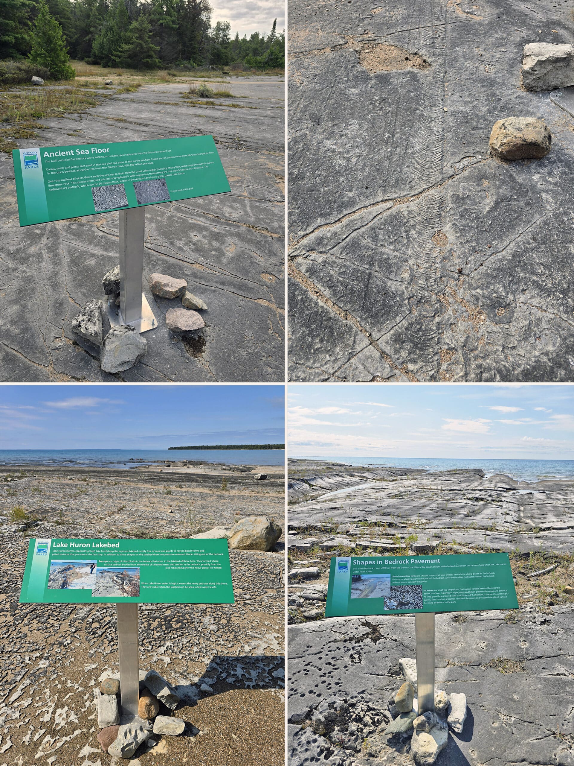
Anyway, obviously we can’t tell you anything about what’s in the Visitor Centre, but I CAN tell you what’s under it!
When you go down the stairs, be sure to visit the area underneath the deck.
The building is situated on ancient rock, and there’s some great signage down there - complete with labeled photos of the rocks you’re actually looking at - pointing out the various glacial rock features, and how they happened.
Loved it!

Day Use Area
Misery Bay Provincial Park’s website mentions “great picnic opportunities” - the only real picnic area we saw was at the Visitor Centre though.
The deck has several picnic tables overlooking the start of the trails, below.
Other than that, there were a few park benches along the trails (noted on the postcard and trail sign versions of the map), and there were at least a couple of little gazebos with bench seating in them.
One of these gazebos was where the Coastal Alvar Trail meets up with Misery Bay, and another was further down the shore, just past the last point where the Coastal Alvar Trail splits off for Inland Alvar Trail access.
Connectivity
We were surprised at how good our cell phone reception was, for the most part - we’re on Rogers Wireless..
We had pretty good reception right in the parking lot - important for those looking to book their parking permit on site.
Then, we had reception at MOST times throughout the park. The best reception seemed to be at the parking lot, and on Misery Bay beach.
That said, Pokemon Go tends to be finicky about opening when you don’t have good reception, and I was able to open and use the app as a trail map numerous times along the trail. Super handy!

Miscellaneous
A couple random things to note here:
1. If you’re a “hike with purpose” kind of person, you’re going to miss out a lot. If you’re a “stop and look at everything” kind of person, know that you should allot even MORE time for visiting, than you normally would.
This park - even during September - had SO many “weird” plants we’d never seen before, so many interesting rock formations to look at... it took us the better part of an hour and a half to walk 2 km!

It’s unpaved, but wide, well-packed, really nicely graded gravel. We’re not used to seeing such well maintained roads in parks at ALL, much less in super-rural day use only parks!
Felt like something we should applaud!

Share the Love!If you’ve made one of our recipes, be sure to take some pics of your handiwork! If you post it to Bluesky, be sure to tag us - @2NerdsInATruck, or you can tag us on TikTok, if you’re posting video. We're also on Pinterest, so you can save all your favourite recipes and park reviews to your own boards! Also, be sure to subscribe to our free email newsletter, so you never miss out on any of our nonsense. Well, the published nonsense, anyway! |
Entertainment and Activity
Misery Bay Provincial Park is very different from most other Provincial Parks, as it doesn’t offer much in the way of variety when it comes to recreational activities.
You cam walk the trail system, and you can look at stuff - that’s about it.
I feel like that definitely downplays how great this park really is, though, so lets get into some more details about the trail network and other things you can see and do at Misery Bay park.
Hiking
There are over 15 km of trails at Misery Bay Provincial Park.
The bulk of the trails - and the easiest of the trails - are formed as a large looping trail, with interconnected hiking trails in the loop, and veering off from the loop in different spots.
Here’s a bit of information on each of the trails:
Coastal Alvar Trail: 8km Loop, Moderate
This is the Red Trail, per the map and trail markers.
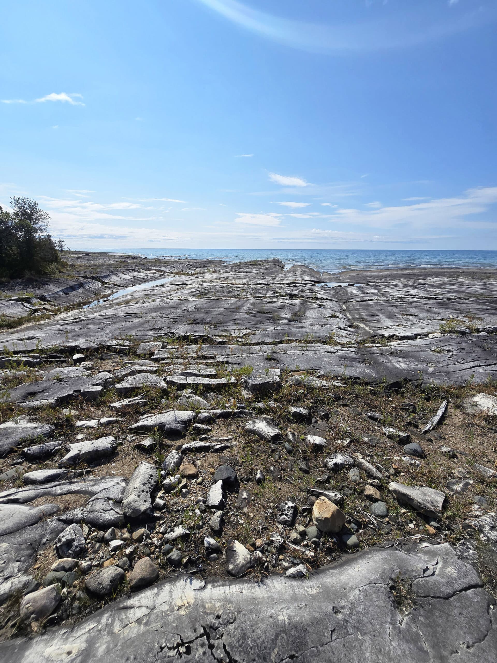
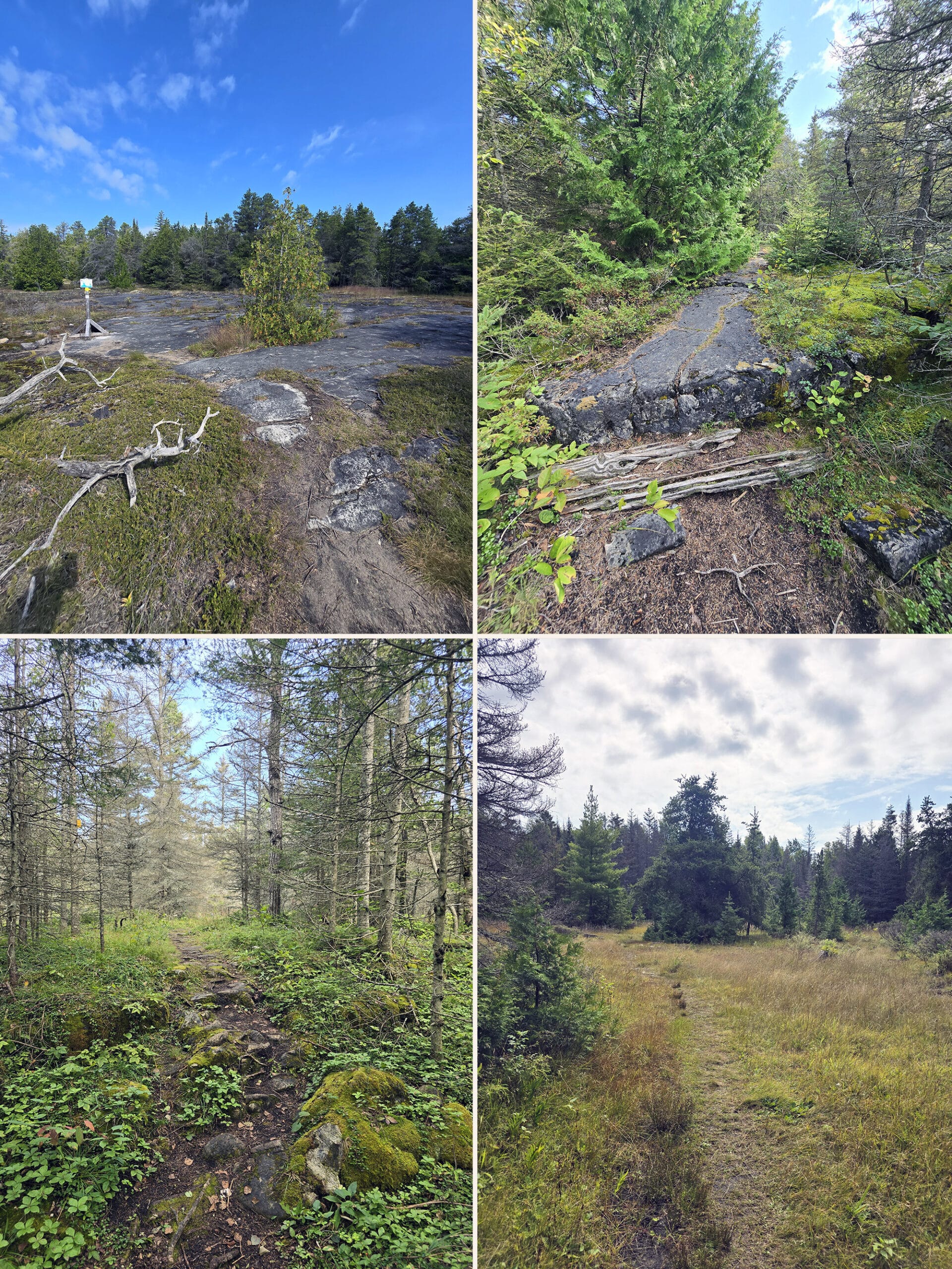
It starts out taking you over a variety of open alvar pavements, through sections of pine trees - a few different forest areas - and open spaces.
We weren't very far in on the trail before we really started feeling like we were walking in someone's garden.
The rock is all natural dolostone pavements, but it really feels like like it was paved with intent. Honestly, it kind of looked and felt like an expensive attempt to look natural, with the unique plants everywhere and just the scenery on either side.
It kind of felt like we were walking in some kind of Boreal Forest version of a botanical garden!
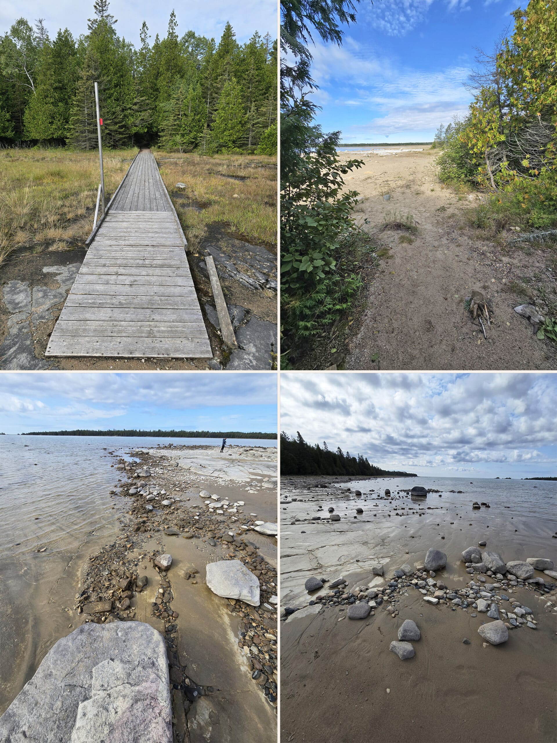
We came to a big opening with some more signage about glacial beaches, but this time with the addition of fossils ... so we spent some time looking more closely at the rock under our feet.
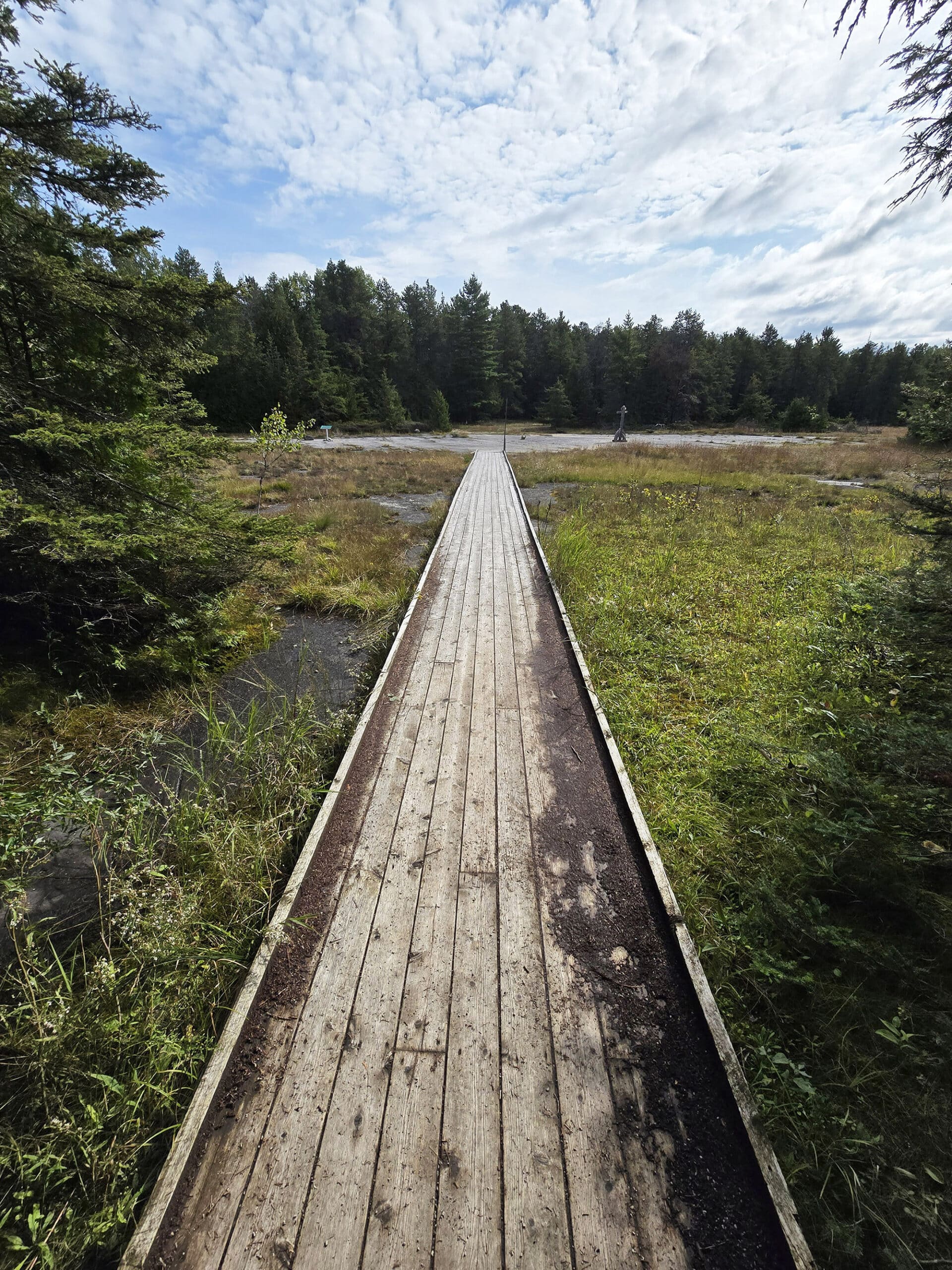
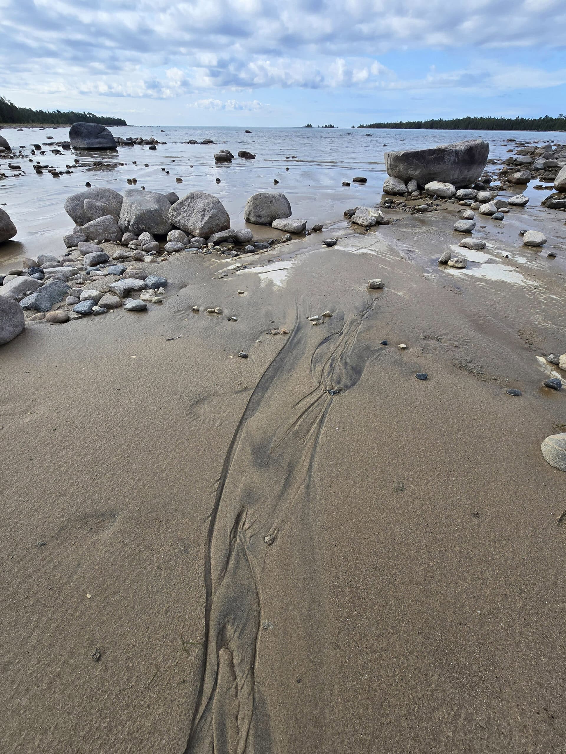
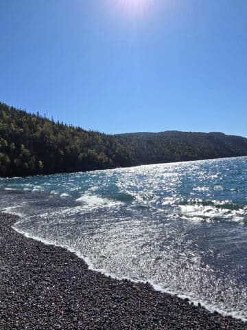
From there, we took a cute boardwalk trail out to Misery Bay itself, which was gorgeous!
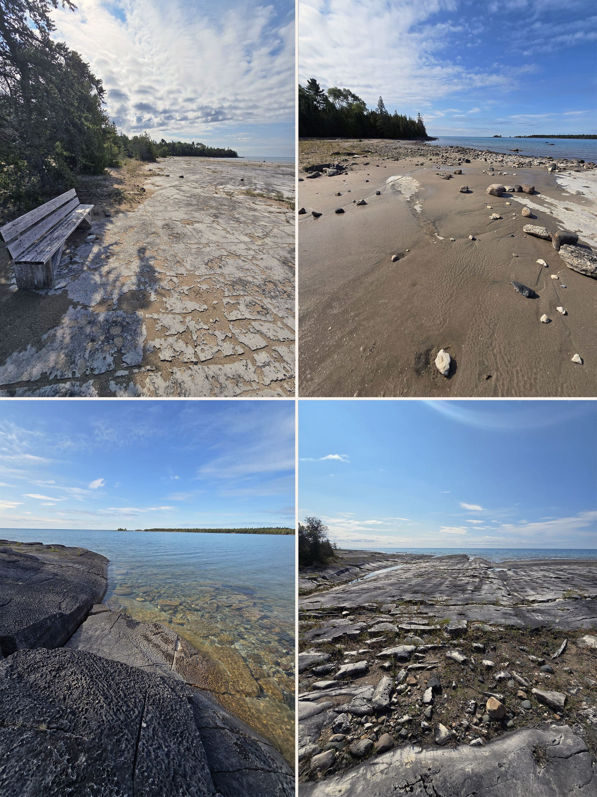
I got to enjoy the trail we’d just done one more time - in reverse - as Porter continued along the beach. He referred to the beach views as the views as “otherworldly”, with all of the interesting rock formations, weird plants, etc.
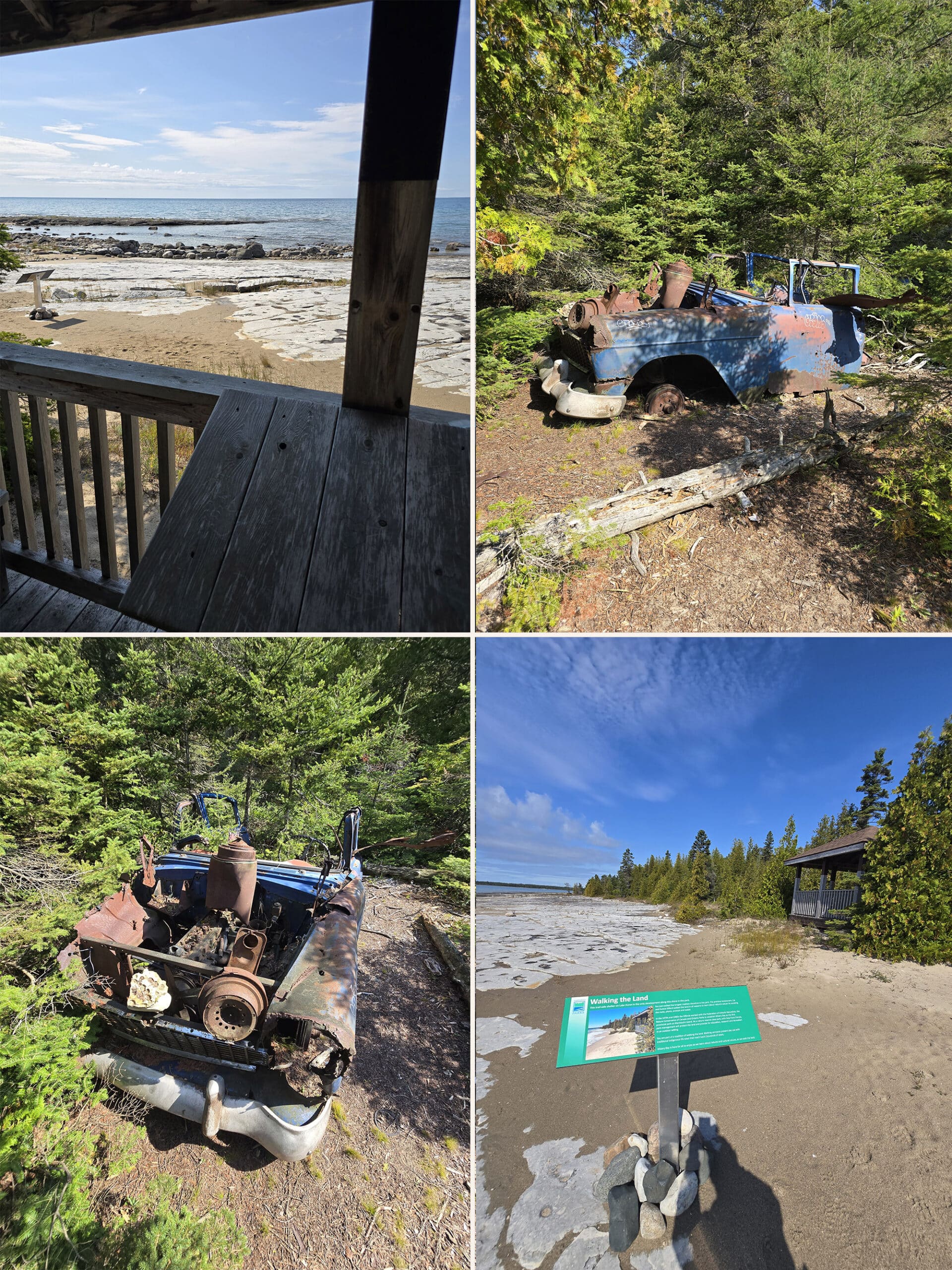
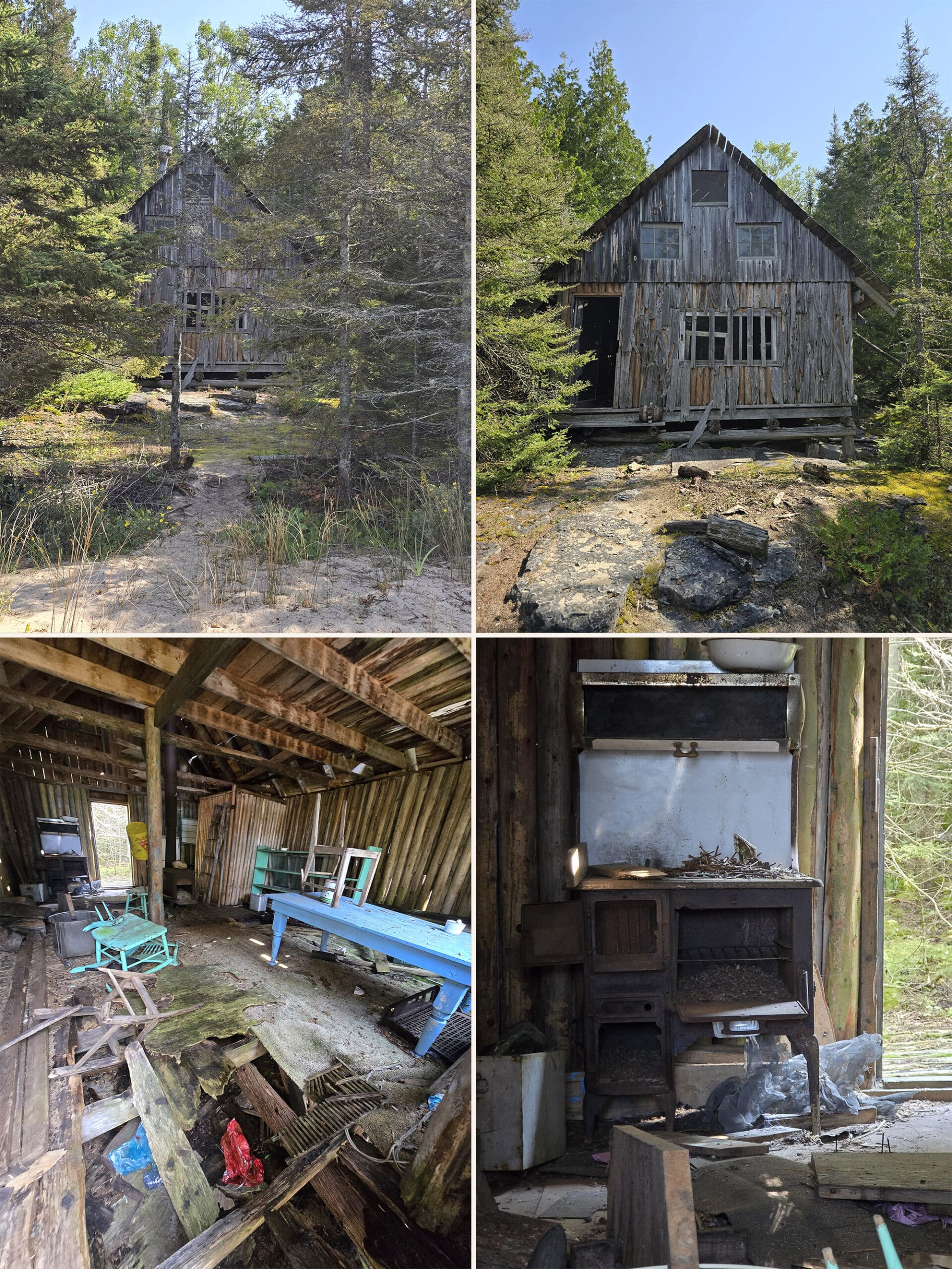
There was a little shanty from the 1800s, an abandoned house, and part of a really old car. Talk about an ADHD friendly trail!
Inland Alvar Trail: 5 km Loop, Easy
This easy loop is the Yellow Trail, per the map and trail signage.
Like the start of the Coastal Alvar Trail, this smaller looping trail takes you through different areas of forest, open Alvar Pavements, and former glacial beaches.
If you don’t want to / can’t handle walking on the sand - for the Coastal Trail - there are several spots where the Inland Alvar Trail have short offshoot trails that take you out to Misery Bay.
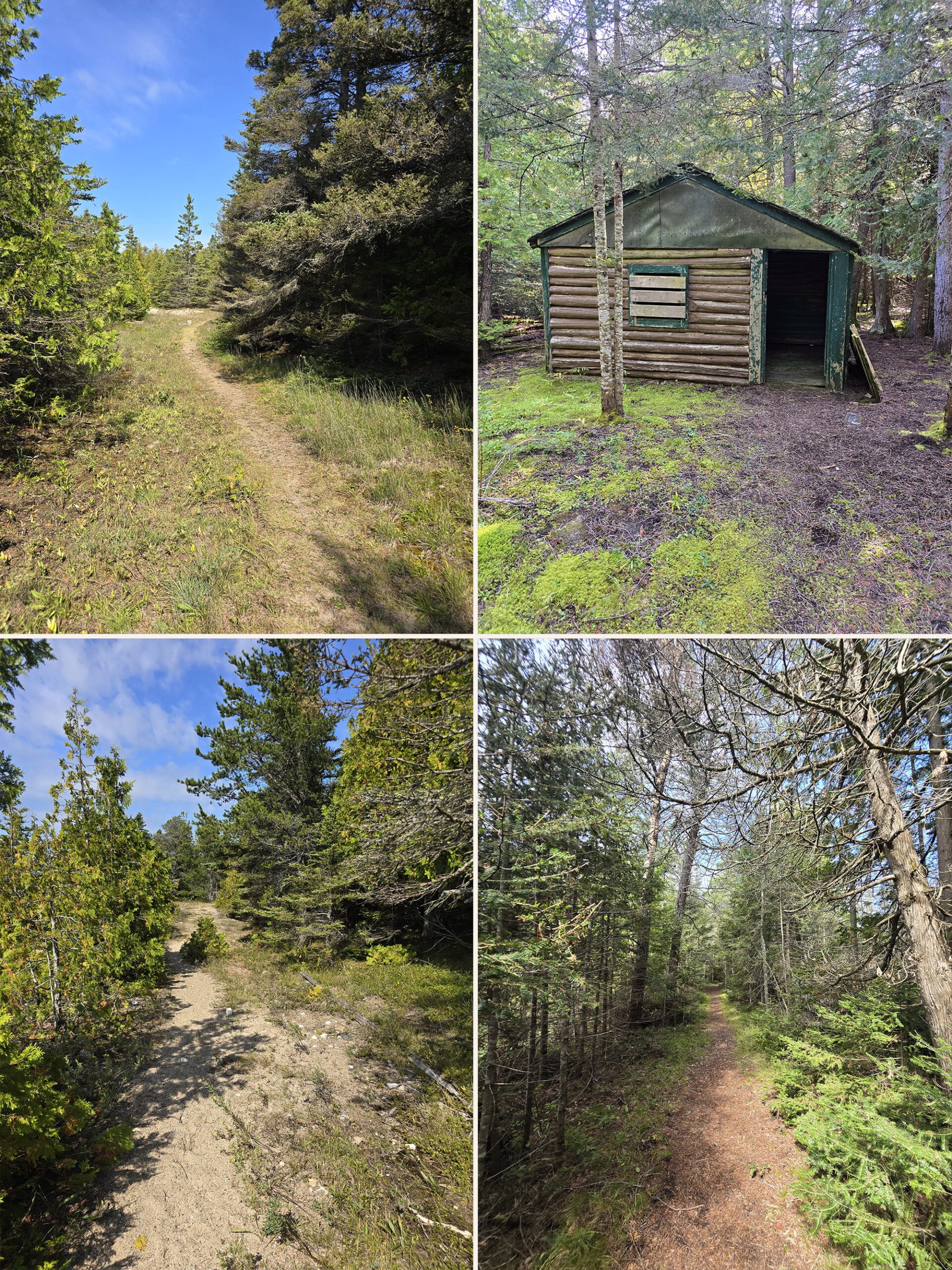
It’s generally a more narrow path than the Coastal Alvar Trail, going through more forests and open areas.
Porter says that it was “easy to moderate”, a little more difficult than the first 2 km of the Coastal Alvar Trail, but by no means a difficult trail.
Misery Bay Trail: 5 km Loops, Moderate/Difficult
This is the Blue Trail, per the Misery Bay Provincial Park map and signage. It starts about 2 km in on the Coastal Alvar Trail taking you along a beautiful sandy outwash to explore the western side of the park.
The thing is, the Misery Bay Trail may or may not be open to hiking, it wasn’t clear at the time of our visit.
The large map on the side of the Visitor Centre had a note saying that the trail was closed due to high waters, but that was the only mention we saw of that being the case.
While we didn’t see any actual trail markers on the bayhead wetland, it definitely didn’t look to be a matter of high water - and there were no signs about the trail being closed.
Either way, we didn’t have the time - or bladder capacity! - to head over to the west side of the park, though it sounded interesting.
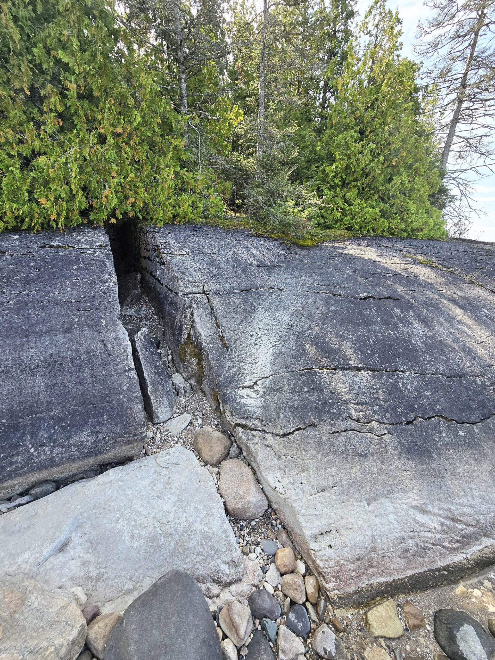
The park’s website says that there is where you’ll find the largest open alvar pavement in the park, along with more alvars, erratics, glacial boulders, glacial striations, grykes, old glacial beaches, and rare and interesting plants.
Mac’s Bay Trail: 2 km Return, Easy
This is the Orange Trail, per the park map and trial signage. It’s a relatively short offshoot trail that starts on the easterly portion of the coastal trail.
The start of this trail looks to be 3-4 km from the Visitor Centre, so you’re looking at 8-10 km total, to do this trail.
Much like the Misery Bay Trail, we didn’t have the time or capacity to explore this trail, which takes you to the eastern side of the park.
This one takes you out across more Alvar areas and through forest, to Mac’s Bay Conservation Reserve. The park’s website mentions that the shoreline there is “open and marshy and is a great place for birding”.
Biking
There’s a bike stand in the parking lot, right before the trail to the visitor center.
It has a sign saying that bikes aren’t allowed on the trails, which struck us as weird - due to the location, we couldn’t imagine anyone biking in to the park!
Swimming
While there’s a big sandy beach at Misery Bay, it really doesn’t strike us as the kind of place you could - or should - be swimming.
As the park’s website doesn’t mention swimming, I would assume the beach falls under the “stick to the trails” expectation.
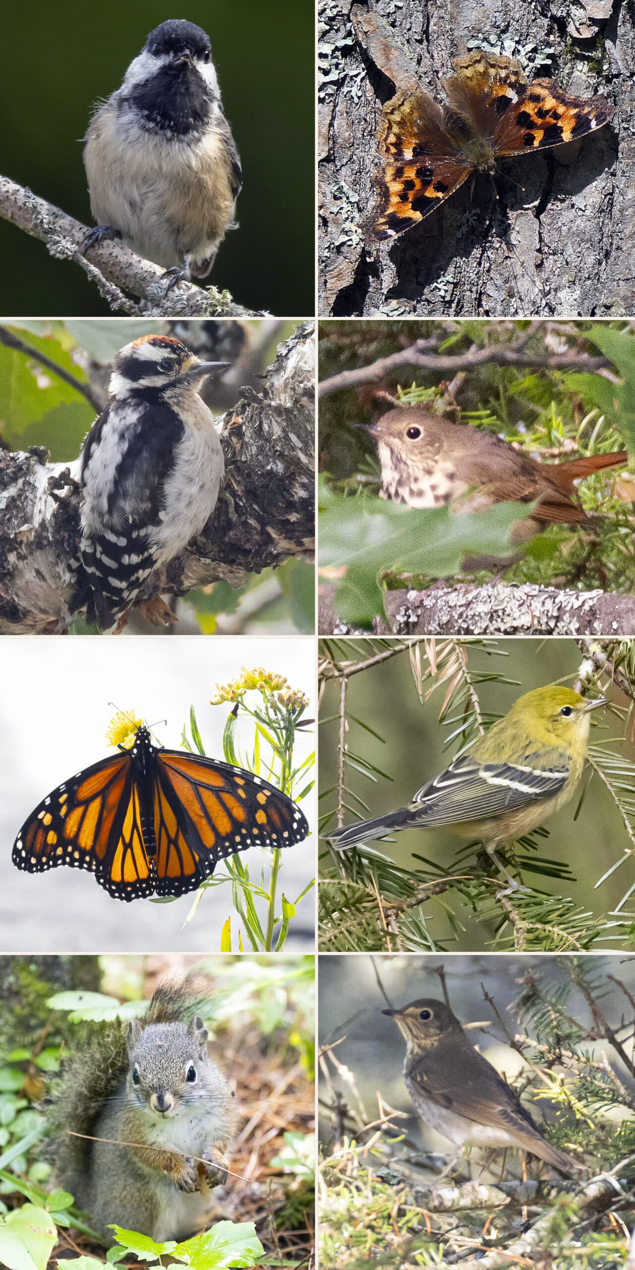
Row 2: Downy Woodpecker, Hermit Thrush
Row 3: Monarch Butterfly, Pine Warbler
Row 4: Red Squirrel, Swainson's Thrush
Birding, Wildlife, and Nature
Misery Bay Provincial Park is known for having unique plants and wildlife, on account of it’s varied - and also unique! - habitats.
When originally researching for our trip, the fact that Northern Parulas nest in the park was a big draw - we hadn’t seen any yet, at that time.
Our wildlife viewing actually began on the way to Misery Bay Provincial Park, with Sandhill Cranes on the side of the road. We’d only seen them once before, and that was two or 3 of them WAY off in the distance.
On the way to Misery Bay, we were thrilled to see 5 of them in one field... but then we came to a field with more than 100! We’d never seen anything like it, so we were pretty excited for that!
Anyway, at the park - in terms of birds - we didn’t see or hear anything “weird”, which was a little disappointing.
We’re guessing that was a function of the time of year - nothing that had been reported on the Audubon app lately had been anything we hadn’t seen before.
Overall, we heard and/or saw:
American Crow, American Redstart, Black-Capped Chickadee, Black-Throated Blue Warbler, Blue Jay, Brown Creeper, Common Raven, Downy Woodpecker, Northern Flicker, Pine Warbler, Red-Breasted Nuthatch, Semipalmated Plover, Swainson’s Thrush, White-Crowned Sparrow, White-Throated Sparrow, and Yellow Warbler.
We didn’t see any other wildlife, beyond some chipmunks. Given where we were at the time, Porter felt compelled to make an “Alvar and the Chipmunks” crack, LOL.
All of the potential for seeing orchids was long gone, after all!
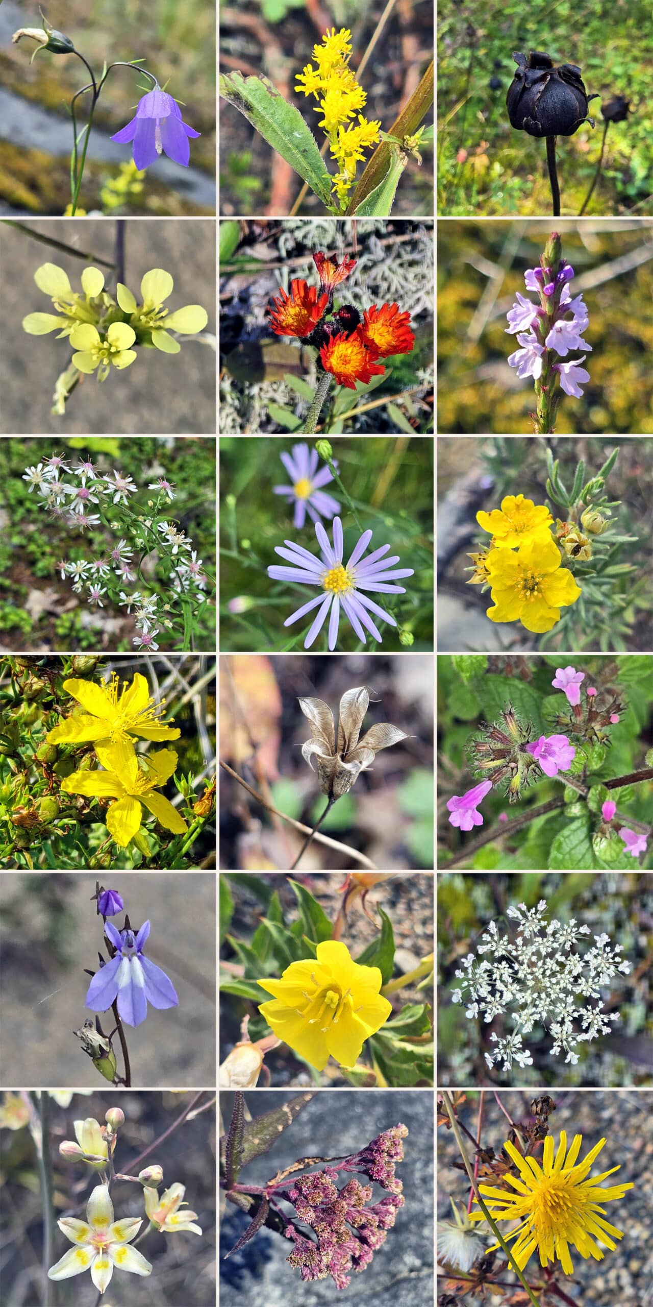
We were honestly surprised at the variety of flowers and plants we saw, that we’d NEVER seen before.
I couldn’t have told you what any of it was, at the time - we’ve since Googled some of it! - but there was a whole lot of “Come LOOK! What is THAT?!” going on during our walk.
Based on what all we saw in mid September, we’re DEFINITELY going to have to go back in late spring!
Discovery Program
The Friends of Misery Bay offers Natural Heritage Education programming - over 50 programs - during the summer months.
These are held at the Visitor Centre, and teach visitors about the different environments in the park, the different species at risk that live in the park, and more.
As we visited during the off season, we didn’t have access to any of that.
That said, there were plenty of educational opportunities throughout the park.
As I’d mentioned earlier, the signage under the deck area at the Visitor Center was really cool and informative.
Then - along the trails - there were a bunch of interpretive signs, explaining the history of the area, or what you might be looking at.
At one point, I came to a sign about fossils. I stopped reading and shouted out to Porter that there were fossils, and we started looking.
I was excited to see something that looked like a long spine... and there was a photo of it, right on that sign. As it turns out, it wasn’t a spine - it was “chatter marks” - a series of grooves carved into the rock, as the glaciers moved over it.
All around, a great learning experience - even without access to the Visitor Centre or programming.
Niantic Games
We first loaded Pokemon Go in the parking lot, mostly as a test of cellular reception. It loaded just fine, and there were a few Pokestops nearby.
We came across a few more, throughout the park.
The big thing to note about Pokemon Go was that the trails as shown on the Pokemap were VERY accurate. There were a few places where the signage wasn’t super clear, and we could always tell where we were by following the app’s map.
Final Thoughts
We didn’t go into Misery Bay Provincial Park with a lot of expectations, just because we’ve never heard ANYONE talking about it.
I don’t think I’d ever seen it mentioned in any of the camping or Provincial Park groups online, so it was a big mystery to us, waiting to be “discovered”.
... and we LOVED it.
I mean, almost every last thing about this park, we adored.
The washroom situation was pretty heinous - seriously, it’s not a “see the park in 30 minutes” kind of stop! Let us have somewhere to pee! - but everything else was AMAZING.
We loved seeing all kinds of different plants we’d never seen before, walking over the Alvar pavements, and learning more about glacier retreat, rock formations, and more.
It was also amazing to have an entire Provincial Park ALL to ourselves for a few hours - something that I doubt happens during the main season!
Anyway, we’re definitely going to be back, and we’re seriously looking forward to seeing more of the trails, more new-to-us forms of life, etc!
Next time, we’ll bring leave the car at the campsite, and drive the whole RV to Misery Bay. Then we can come and go as we need, have access to our own facilities, and not have to worry about driving across an entire island to feed our cats on time!
More Near-North Ontario Provincial Parks & Places to See
Want to read some more about the parks we've camped and at places we've seen in Near-Northern Ontario? Here are some more posts!
Near-Northern Ontario Campground Reviews:
Arrowhead Provincial Park
Chutes Provincial Park
Driftwood Provincial Park
Fairbank Provincial Park
Finlayson Point Provincial Park
Grundy Lake Provincial Park
Kap-Kig-Iwan Provincial Park
Marten River Provincial Park
Mikisew Provincial Park
Killbear Provincial Park
Oastler Lake Provincial Park
Six Mile Lake Provincial Park
Sturgeon Bay Provincial Park
Near-Northern Ontario Places to See:
Big Chute Marine Railway
Bridal Veil Falls, Manitoulin Island
Cup and Saucer Trail, Manitoulin Island
Fielding Bird Sanctuary
French River Provincial Park
Hardy Lake Provincial Park
Onaping Falls
Oxtongue River-Ragged Falls Provincial Park
Screaming Heads
Want to explore beyond Near-Northern Ontario? Check out our full list of Campground Reviews, Ontario Waterfalls, and other Places to See.
We also have a ton of Camping Recipes to cook up, while on your adventures!

Thanks for Reading!If you loved this post - or have any questions about it - please leave a comment below! We'd also love it if you would consider sharing the link on social media! |


Leave a Reply